Embed Size (px)
Citation preview
Gulf of Mexico Basin, Alabama
Ayobami .T. Folaranmi* and Jack Pashin. Boone Pickens School of Geology, Oklahoma State University, Stillwater Oklahoma *[email protected]
The purpose of this study was to characterize a saline formation that is actively being used to store CO2 as part of the SECARB III
Anthropogenic test in Alabama. The study is aimed at understanding the potential of Lower Cretaceous redbeds to store commer-
cial quantities of anthropogenic CO2. Citronelle Dome is a simple salt-cored anticline that lacks faults and contains abundant reser -
voir sandstone bodies and mudstone, evaporite, and carbonate seals.
The Paluxy Formation has an average thickness of about 1,100 feet in Citronelle Dome. Core analysis indicates that the Paluxy
Formation is a coarsening-upward, succession composed of numerous stacked, aggradational sandstone-mudstone packages. In-
Three wells were drilled for injection, monitoring, and reservoir characterization. Cores from the Paluxy were retrieved, and a
full suite of open-hole geophysical logs was acquired. Detailed petrologic and well log analysis was performed to analyze frame-
work sandstone composition, sandstone diagenesis, and reservoir architecture. High porosity and permeability in the sandstone
units facilitate high CO2 capacity and injectivity, and multiple reservoir seals ensure safe permanent storage in Citronelle dome.
Sandstone body geometry is complex, and understanding reservoir heterogeneity is an essential component of reservoir manage-
ment in Citronelle Dome.
CHOCTAW
CLARKE
WASHINGTON
MOBILE
BALDWIN
CitronelleDome
Wiggins Arch
Hatchetigbee
anticline
Mo
bil
e G
rab
en
West Bend Fault
Gilbertown Graben
ALA
BA
MA
MISSISSIP
PI
MISSISSIPPIINTERIOR
SALT BASIN
PLANTBARRY
CITRONELLEFIELD
Index Map
0 im 0201 10
EXPLANATION
Citronelle Field
C red power plant(~14 MMst CO2/yr)
Normal fault;bar on downthrown side
Fold; arrow points inplunge direction
010 20 30 km10
Research Supported by Advanced Resources International through grants from the U.S. Department of Energy and Southern Company
CONCLUSIONS
STUDY AREA
GEOPHYSICAL LOGS
PETROLOGY
MODERN BRAIDED FLUVIAL SYSTEM ANALOG
CORE PHOTOGRAPHS
Well D-9-8 #2
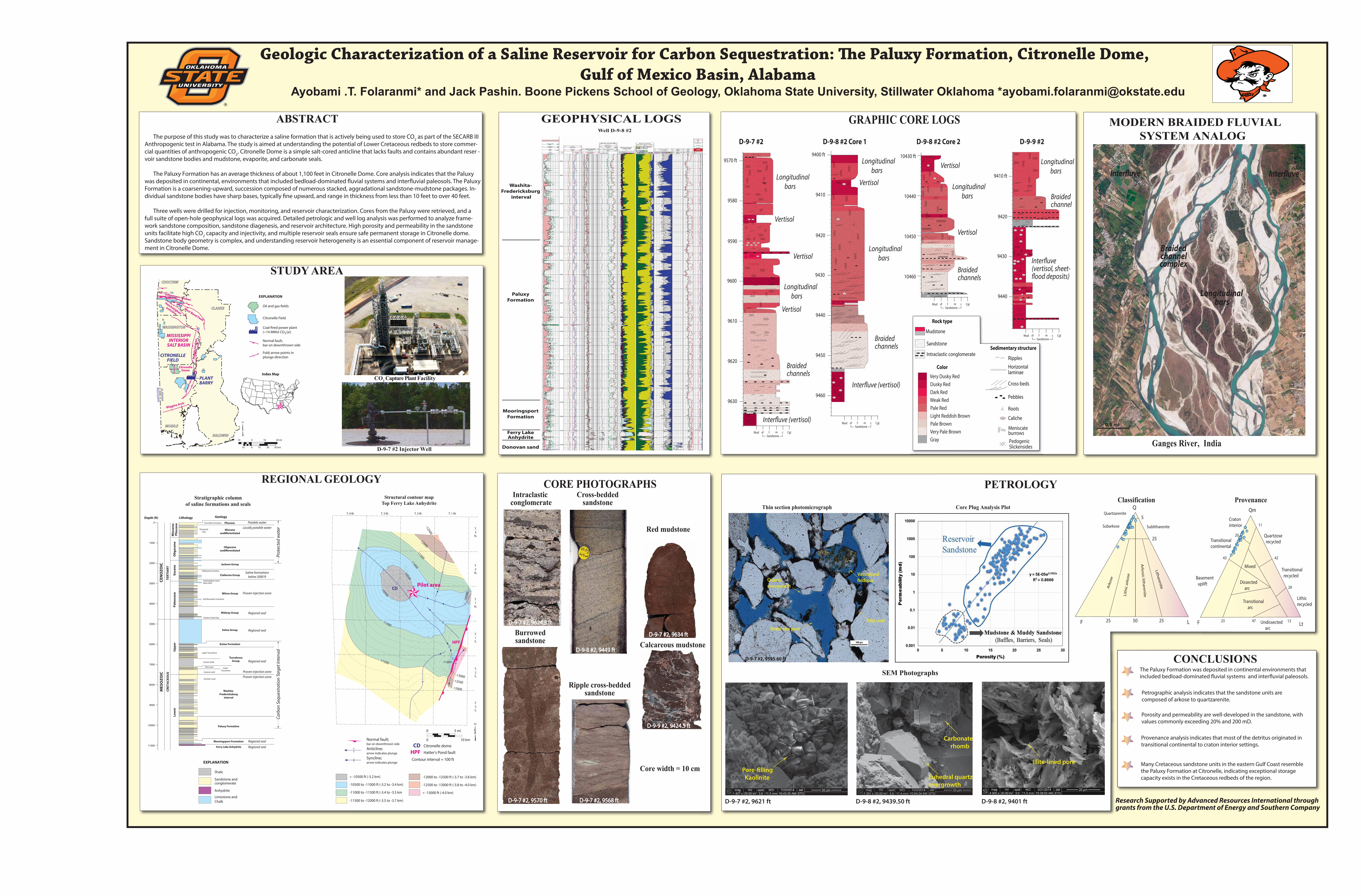
The Paluxy Formation was deposited in continental environments that
Petrographic analysis indicates that the sandstone units are
composed of arkose to quartzarenite.
Porosity and permeability are well-developed in the sandstone, with
values commonly exceeding 20% and 200 mD.
Provenance analysis indicates that most of the detritus originated in
transitional continental to craton interior settings.
Many Cretaceous sandstone units in the eastern Gulf Coast resemble
the Paluxy Formation at Citronelle, indicating exceptional storage
capacity exists in the Cretaceous redbeds of the region.
ABSTRACT
Quartzarenite
Subarkose Sublitharenite
Ark
ose
Ark
osic
litha
ren
iteLit
hic
ark
ose
Lith
are
nite
Q
F L25 50 25
25
5 Craton
interior
Basement
uplift
Quartzose
recycled
Transitional
recycled
Lithic
recycled
Mixed
Dissected
arc
Transitional
arc
Undissected
arc
23 47 13
11
42
29
20
43
Transitional
continental
Qm
F Lt
ClassificationThin section photomicrograph Core Plug Analysis Plot
SEM Photographs
ProvenanceIntraclastic
conglomerateCross-bedded
sandstone
Ripple cross-beddedsandstone
Burrowedsandstone
Red mudstone
Calcareous mudstone
Core width = 10 cm
Washita-
Fredericksburg
interval
Paluxy
Formation
Ferry LakeAnhydrite
Donovan sand
Mooringsport
Formation
GRAPHIC CORE LOGS
9620
9610
9580
9590
9600
9570 ft
9630
SandstoneMud vf f m c Cgl
SandstoneMud vf f m c Cgl
SandstoneMud vf f m c Cgl
SandstoneMud vf f m c Cgl
D-9-7 #2
9450
9440
9410
9420
9430
9400 ft
9460
D-9-8 #2 Core 1
10450
10440
10430 ft
10460
Braided channel
Braided channels
Braided channels
Longitudinal
bars
Longitudinal
bars
Longitudinal
bars
Longitudinal
bars
Longitudinal
bars
Longitudinal
bars
Braided channels
(vertisol, sheet-
Vertisol
Vertisol
Vertisol
Vertisol
Vertisol
Vertisol
D-9-8 #2 Core 2
Ganges River, India
9440
9410 ft
9420
9430
D-9-9 #2
Mudstone
Sandstone
Intraclastic conglomerate
Roots
Caliche
Horizontal laminae
Cross-beds
Pebbles
Ripples
Rock type
Color
Sedimentary structure
Meniscate burrows
Pedogenic Slickensides
Very Dusky Red
Dusky Red
Dark Red
Weak Red
Pale Red
Light Reddish Brown
Pale Brown
Very Pale Brown
Gray
Inter-
D-9-7 #2, 9624.5 ftD-9-7 #2, 9624.5 ft
D-9-7 #2, 9570 ftD-9-7 #2, 9570 ft D-9-7 #2, 9568 ftD-9-7 #2, 9568 ft
D-9-9 #2, 9424.5 ftD-9-9 #2, 9424.5 ft
D-9-8 #2, 9449 ftD-9-8 #2, 9449 ft
D-9-7 #2, 9634 ftD-9-7 #2, 9634 ft
Quartz overgrowth
Pore-filling Kaolinite Euhedral quartz
overgrowth
Carbonate rhomb
Illite-lined pore
Grain-size pore
Vacuolized feldspar
Illite coat
D-9-7 #2, 9595.60 ft
D-9-7 #2, 9621 ft D-9-8 #2, 9439.50 ft D-9-8 #2, 9401 ft
REGIONAL GEOLOGY
CO2 Capture Plant Facility
D-9-7 #2 Injector Well
Structural contour mapTop Ferry Lake Anhydrite
Stratigraphic columnof saline formations and seals
Shale
Limestone and
Chalk
Anhydrite
Sandstone and conglomerate
EXPLANATION
Bashi MarlHatchetigbee Sand
Selma Group
Wilcox Group
Midway Group
Salt Mountain Limestone
Porters Creek Clay
Claiborne Group
Jackson Group
Oligocene
Miocene
Pliocene Citronelle Formation
Pensacola
Clay
Eutaw Formation
upper Tuscaloosa
Lower
Tuscaloosa
marine shale
Paluxy Formation
Mooringsport Formation
Washita-
Fredericksburg
interval
Pilot sand
massive sand
Dantzler sand
Ferry Lake Anhydrite
Lo
we
r
CR
ET
AC
EO
US
Up
pe
rP
ale
oce
ne
Eo
cen
eO
lig
oce
ne
Mio
cen
e-
Pli
oce
ne
Lithology Geology
2000
Depth (ft)
11000
10000
9000
8000
7000
6000
5000
4000
3000
1000
0
Tuscaloosa
Group
Tallahatta Formation
TE
RT
IAR
Y
ME
SO
ZO
ICC
EN
OZ
OIC
Proven injection zone
Ca
rbo
n S
equ
estr
ati
on
Ta
rget
Inte
rva
lP
rote
cted
wa
ter
Proven injection zone
Potable water
Locally potable water
Saline formations
below 2000 ft
Regional seal
Regional seal
Regional seal
Regional seal
Regional seal
Proven injection zone
-10500
-10500
-10
50
0
-11000
-11000
-11000
-11500
-11500
-12000
-12500
-13000
-12000
-12500
T.
3
N.
T. 1 W.T. 2 W.T. 3 W.T. 4 W.
T.
2
N.
T.
1
N.
T.
1
S.
T.
2
S.
T.
3
S.
0 5 mi
0 10 km
> -10500 ft (-3.2 km)
-10500 to -11000 ft (-3.2 to -3.4 km)
-11000 to -11500 ft (-3.4 to -3.5 km
-11500 to -12000 ft (-3.5 to -3.7 km)
-12000 to -12500 ft (-3.7 to -3.8 km)
-12500 to -13000 ft (-3.8 to -4.0 km)
< -13000 ft (-4.0 km)
Normal fault; bar on downthrown side
Citronelle domeAnticline; arrow indicates plunge
Syncline; arrow indicates plunge
CD
CD
Hatter's Pond fault
Contour interval = 100 ft
HPF
HPF
Pilot area
Longitudinal
InterfluveInterfluve
Braided channel
0.5 mi
complex
bars