Embed Size (px)
Citation preview
GEOGRAPHY
OF THE
UNITED STATES
& CANADA
By Brett Lucas
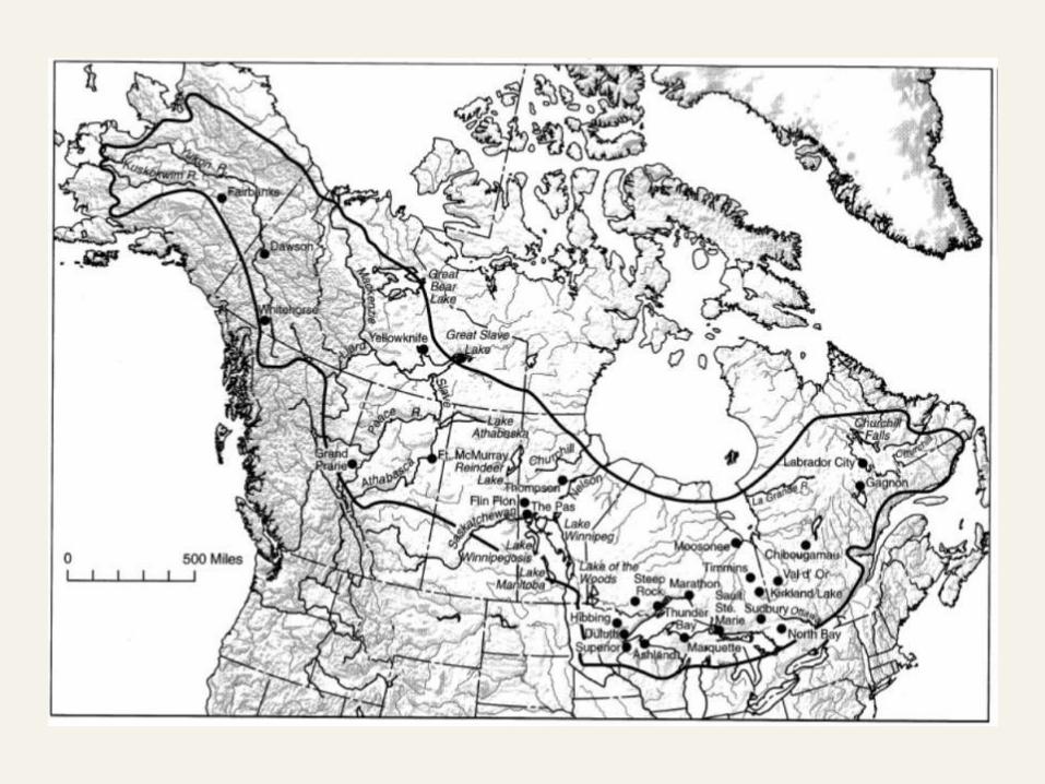
THE BOREAL FOREST
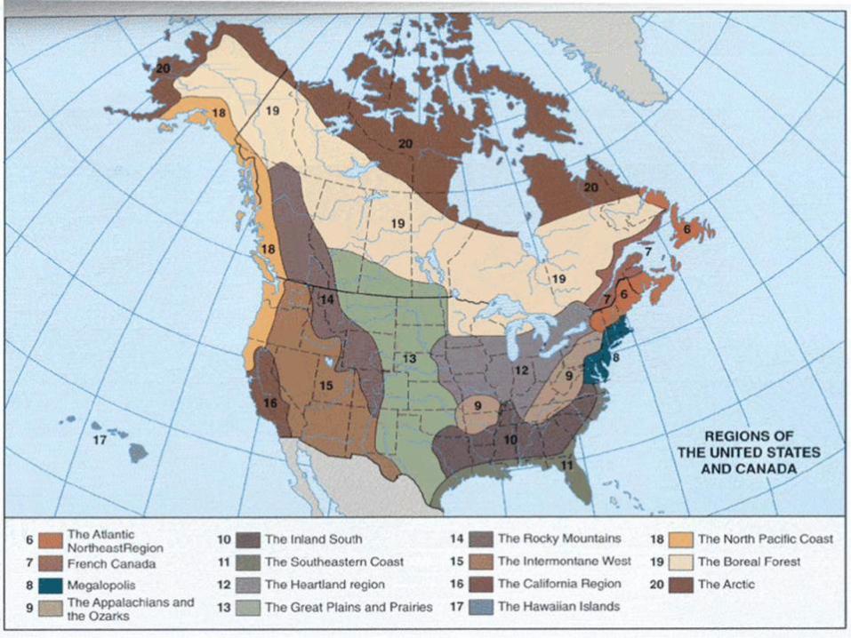
Setting the Boundaries
What states and provinces are part of the region?
Parts of AK, Yukon Territory, Northwest Territories,
British Columbia, Alberta, Saskatchewan, Manitoba,
Ontario, Québec, MN, WI, MI
What regions does it border?
North Pacific Coast, Rockies, Great Plains, Heartland,
French Canada, Atlantic Northeast, The Arctic
Overview
Forested
Small human presence, now or ever
Little agriculture
Coldest spots in North America
Physical Geography
Physical Setting
Difficult landscape
Little useable soil
Significantly altered by glaciers
Rocks and forests
Many lakes: deranged drainage
Difficult to cross
Frozen waterways much of the year
Voracious insects during brief summer
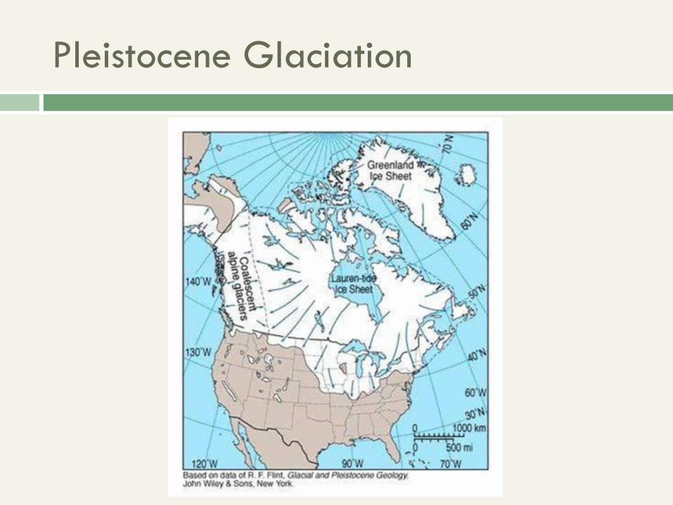
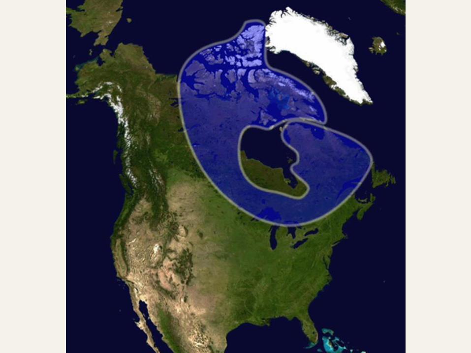
Pleistocene Glaciation
Canadian Shield
Hills in Labrador and Québec
Flat elsewhere
Many rivers, most drain into Hudson Bay
Forest interspersed with bare rock
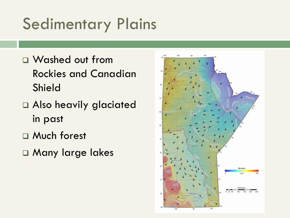
Sedimentary Plains
Washed out from
Rockies and Canadian
Shield
Also heavily glaciated
in past
Much forest
Many large lakes
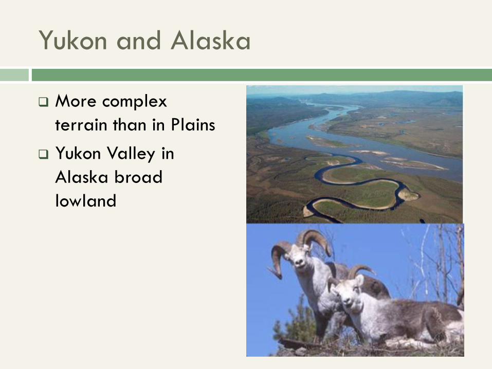
Yukon and Alaska
More complex
terrain than in Plains
Yukon Valley in
Alaska broad
lowland
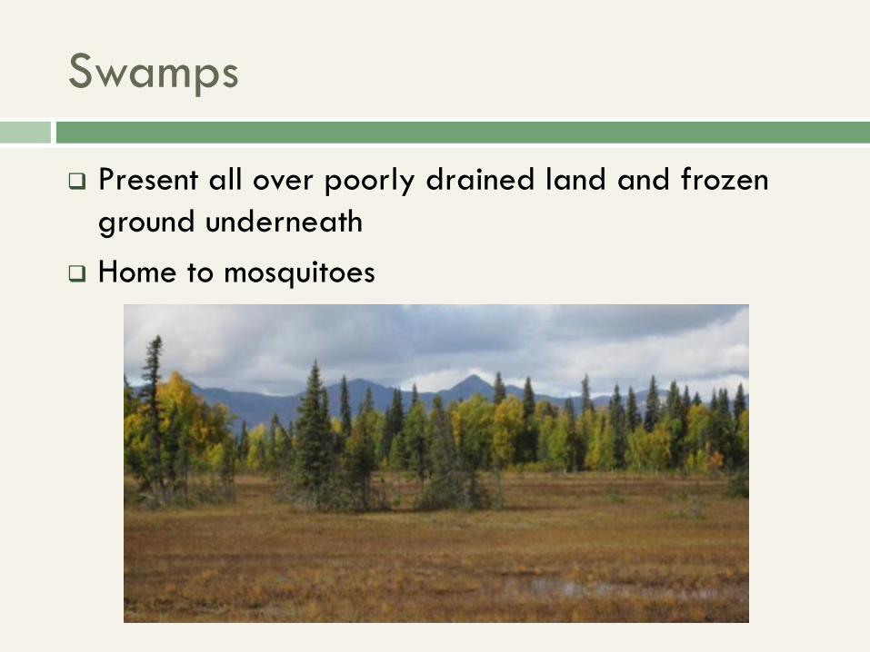
Swamps
Present all over poorly drained land and frozen
ground underneath
Home to mosquitoes
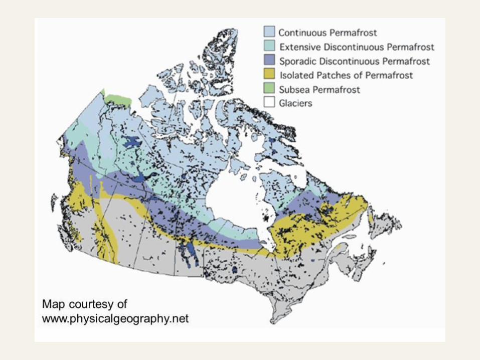
Permafrost
Permafrost is soil at or below the freezing point of
water (0 °C or 32 °F) for two or more years.
“Discontinuous” – ground frozen in places but not
others
“Active layer” – top part that thaws out in the
summer
Hazardous to construction
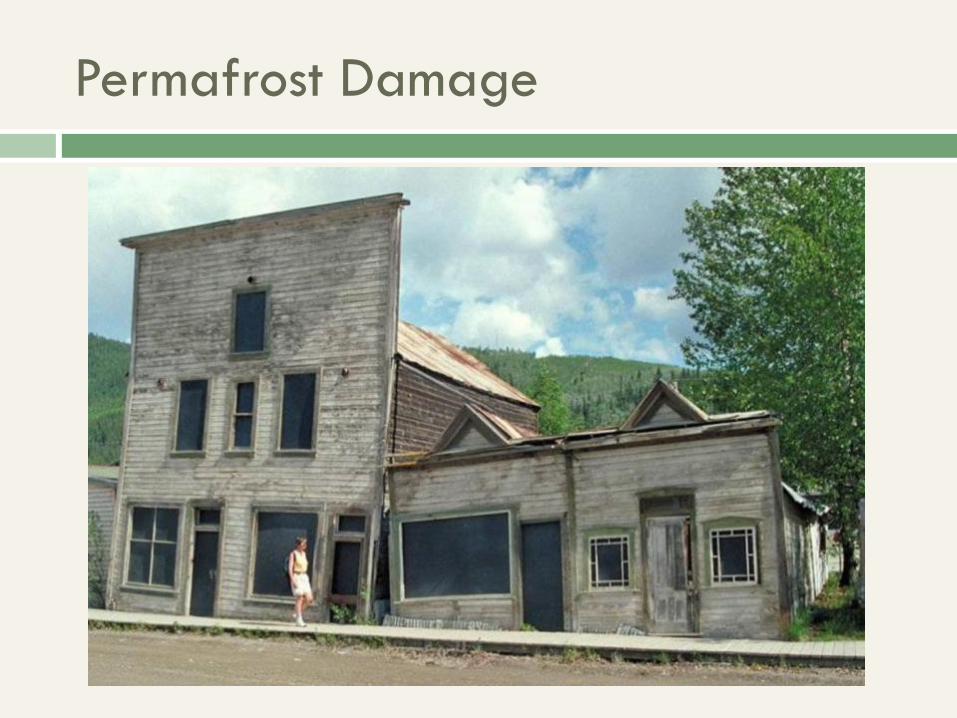
Permafrost Damage
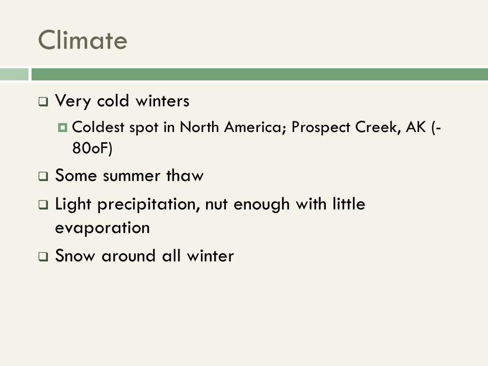
Climate
Very cold winters
Coldest spot in North America; Prospect Creek, AK (-
80oF)
Some summer thaw
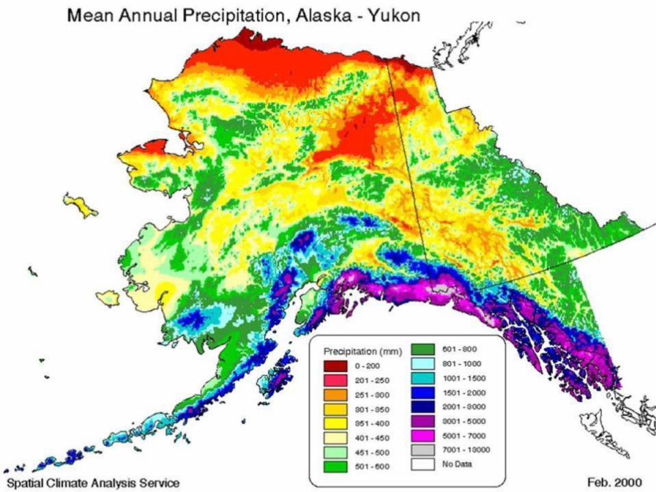
Light precipitation, nut enough with little
evaporation
Snow around all winter
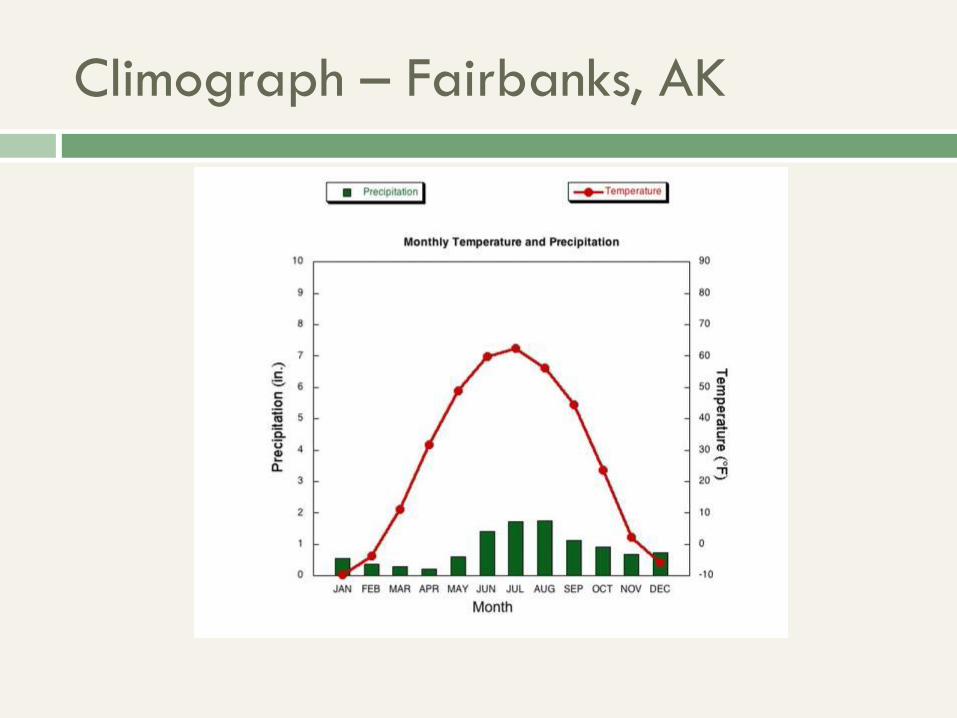
Climograph – Fairbanks, AK
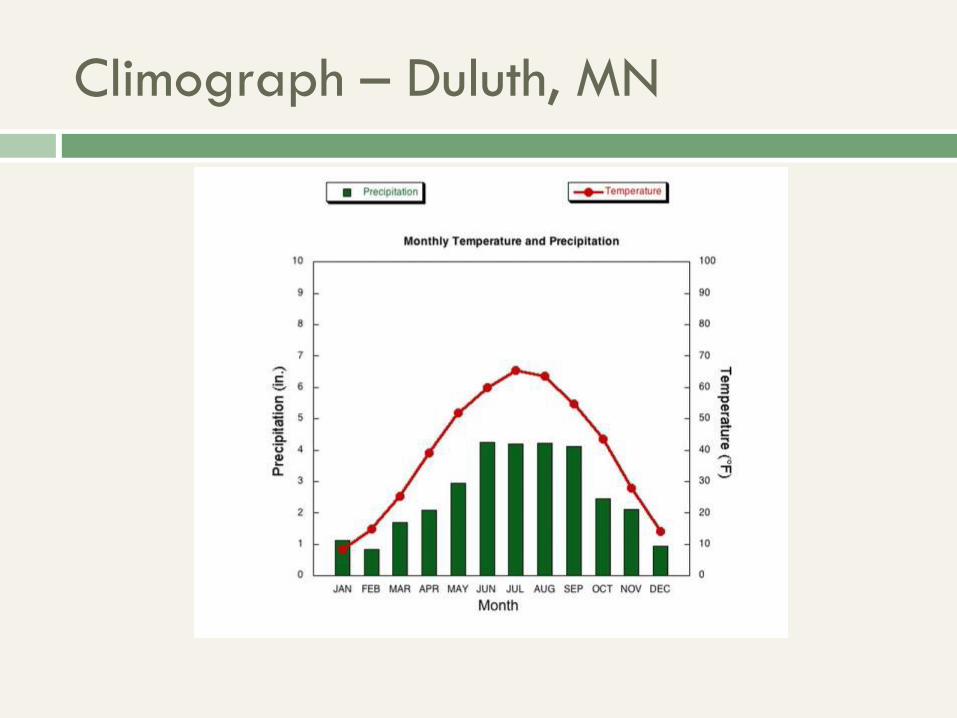
Climograph – Duluth, MN
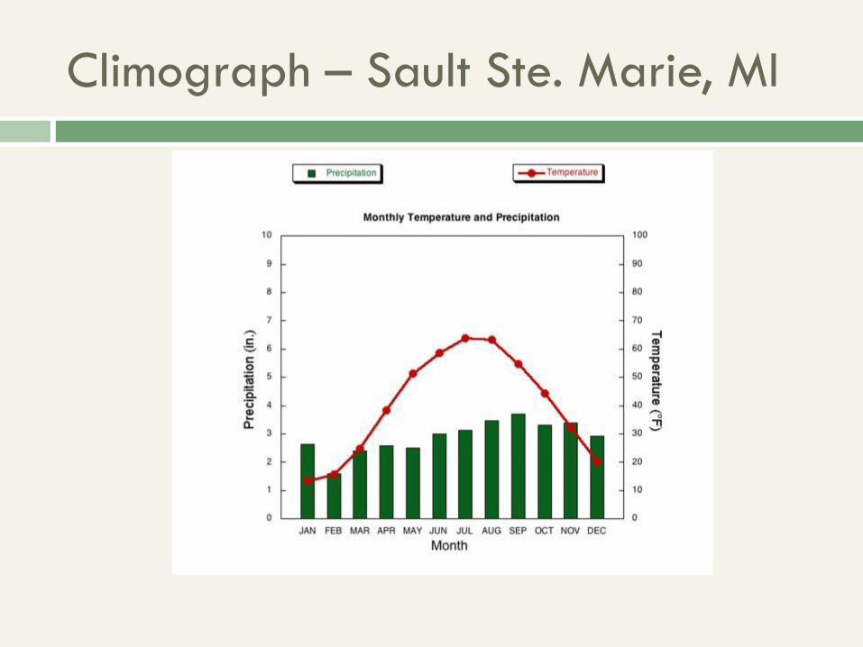
Climograph – Sault Ste. Marie, MI
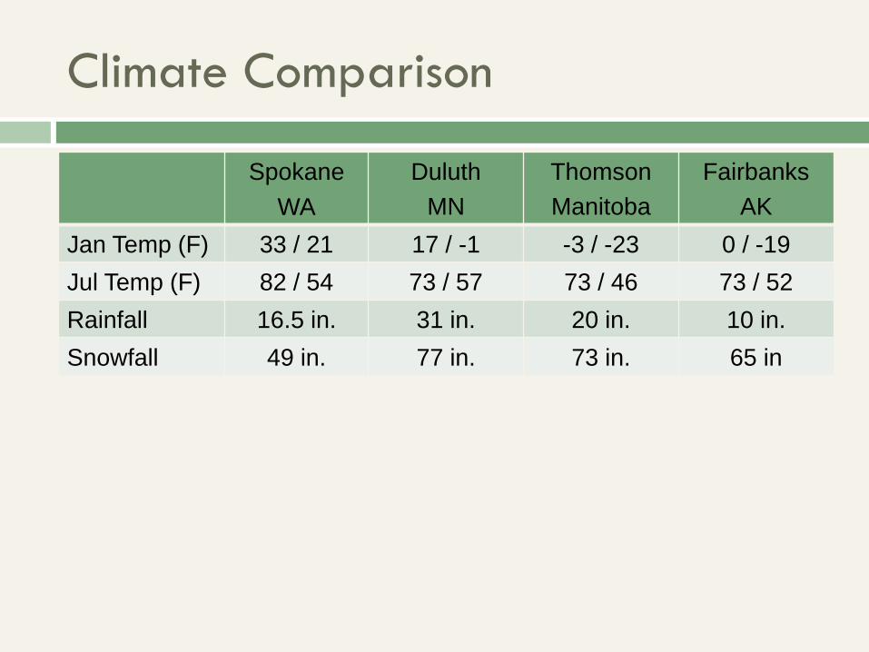
Climate Comparison
Spokane
WA
Duluth
MN
Thomson
Manitoba
Fairbanks
AK
Jan Temp (F) 33 / 21 17 / -1 -3 / -23 0 / -19
Jul Temp (F) 82 / 54 73 / 57 73 / 46 73 / 52
Rainfall 16.5 in. 31 in. 20 in. 10 in.
Snowfall 49 in. 77 in. 73 in. 65 in
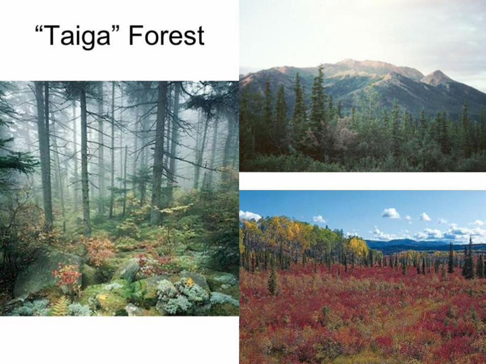
Natural vegetation: “Taiga” Forest
“World’s largest biome
Southern reaches: more permanent forest cover
(hardwoods and conifers)
Northern reaches: fewer trees, more open spaces,
more conifers
General grade: taller trees to south
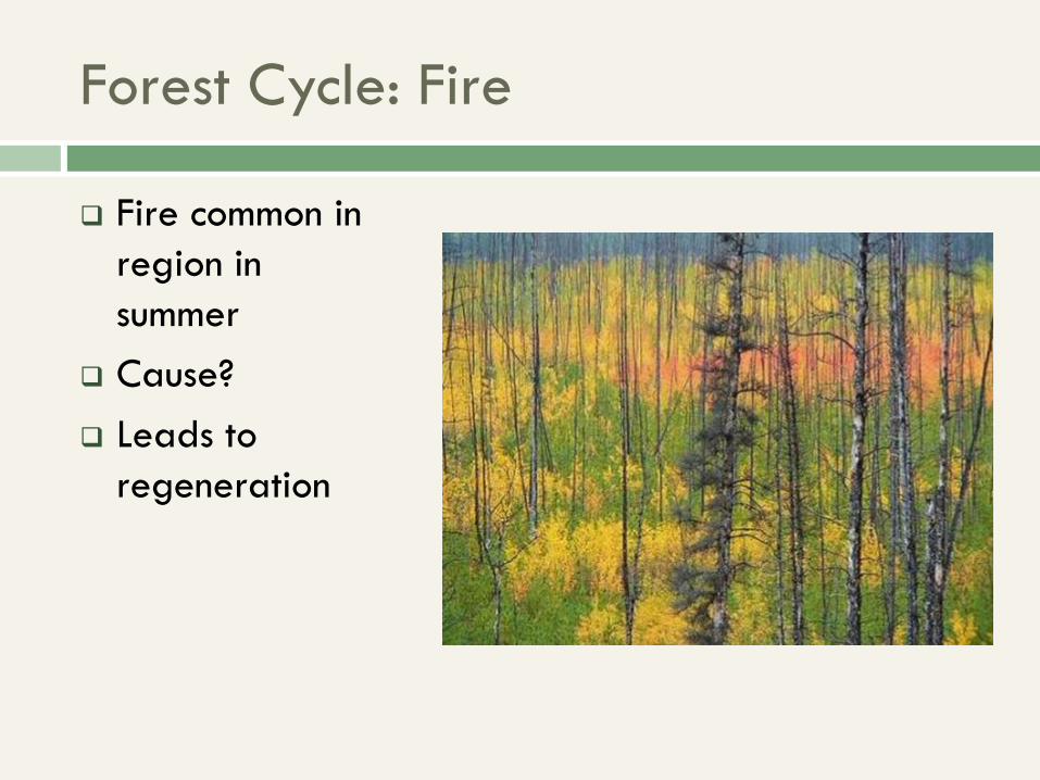
Forest Cycle: Fire
Fire common in
region in
summer
Cause?
Leads to
regeneration
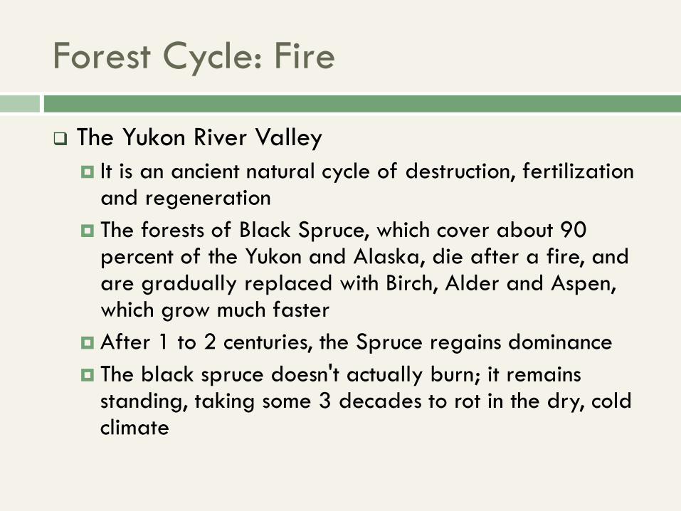
Forest Cycle: Fire
The Yukon River Valley
It is an ancient natural cycle of destruction, fertilization and regeneration
The forests of Black Spruce, which cover about 90 percent of the Yukon and Alaska, die after a fire, and are gradually replaced with Birch, Alder and Aspen, which grow much faster
After 1 to 2 centuries, the Spruce regains dominance
The black spruce doesn't actually burn; it remains standing, taking some 3 decades to rot in the dry, cold climate
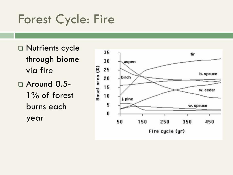
Forest Cycle: Fire
Nutrients cycle
through biome
via fire
Around 0.5-
1% of forest
burns each
year
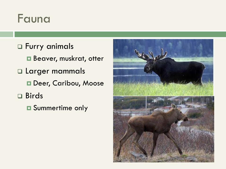
Fauna
Furry animals
Beaver, muskrat, otter
Larger mammals
Deer, Caribou, Moose
Birds
Summertime only
Population & Settlement
Native Settlement
Scattered around area
Greater concentration further south
Lived off caribou and fishing
Small numbers
Caucasian Settlement
Fur trappers: 1700’s-1800’s
Loggers and miners: 1800’s-1900’s
Never large numbers
Mostly settlement on southern fringes, gradually
moving north
Westward expansion as with rest of North America
Present Settlement
Small
Rural
Concentrations in few cities
Whitehorse has 80% of Yukon’s population
Little growth anywhere
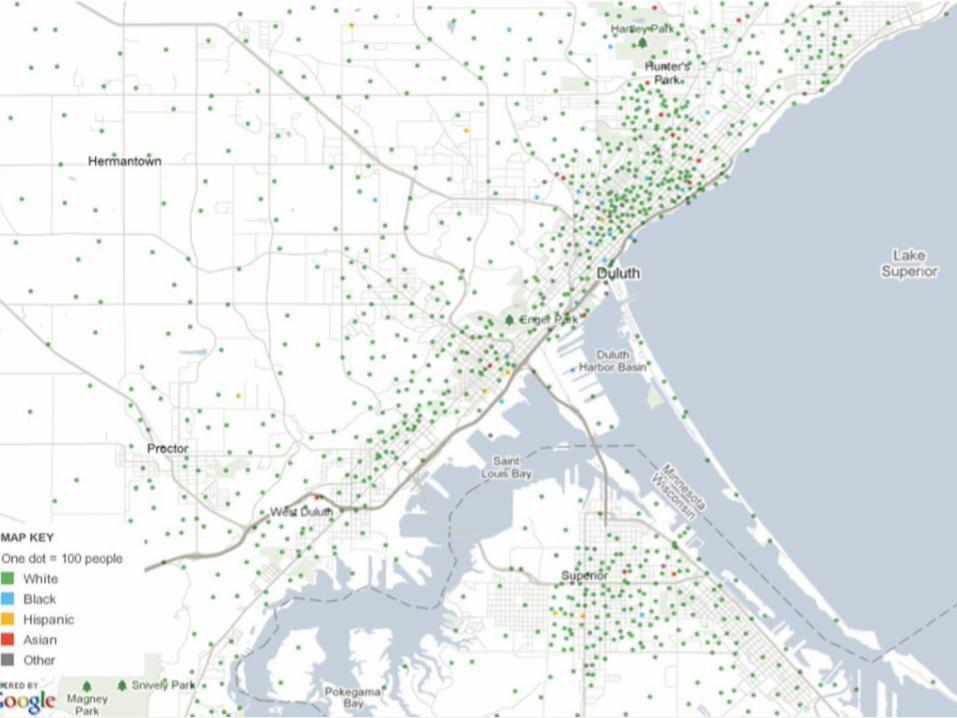
Almost all Caucasian, First Nations, or Métis
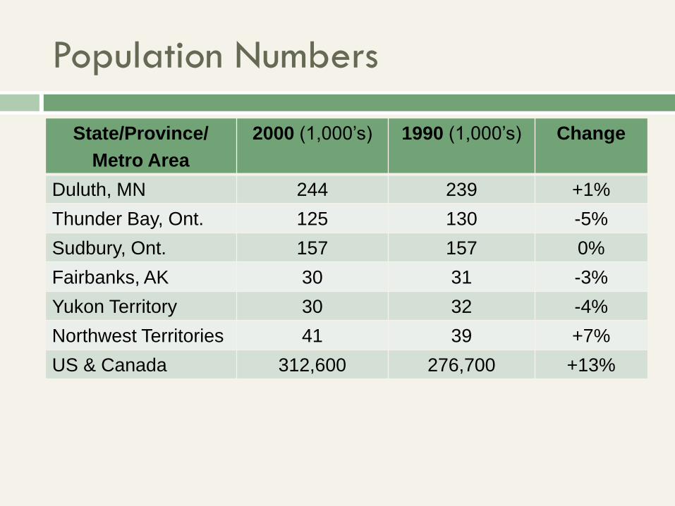
Population Numbers
State/Province/
Metro Area
2000 (1,000’s) 1990 (1,000’s) Change
Duluth, MN 244 239 +1%
Thunder Bay, Ont. 125 130 -5%
Sudbury, Ont. 157 157 0%
Fairbanks, AK 30 31 -3%
Yukon Territory 30 32 -4%
Northwest Territories 41 39 +7%
US & Canada 312,600 276,700 +13%
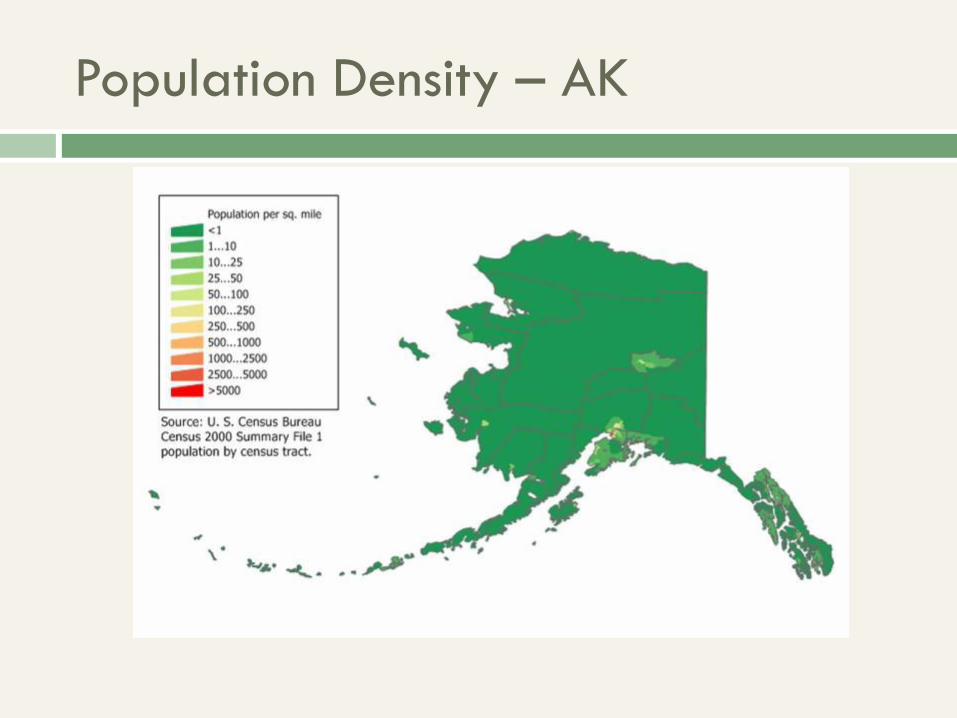
Population Density – AK
Human & Economic Geography
Mining
Many minerals in isolated areas
Nickel, Iron, Gold, Cobalt, Copper, Zinc, Silver, Lead
Strewn about other places
Towns boom and bust with mining
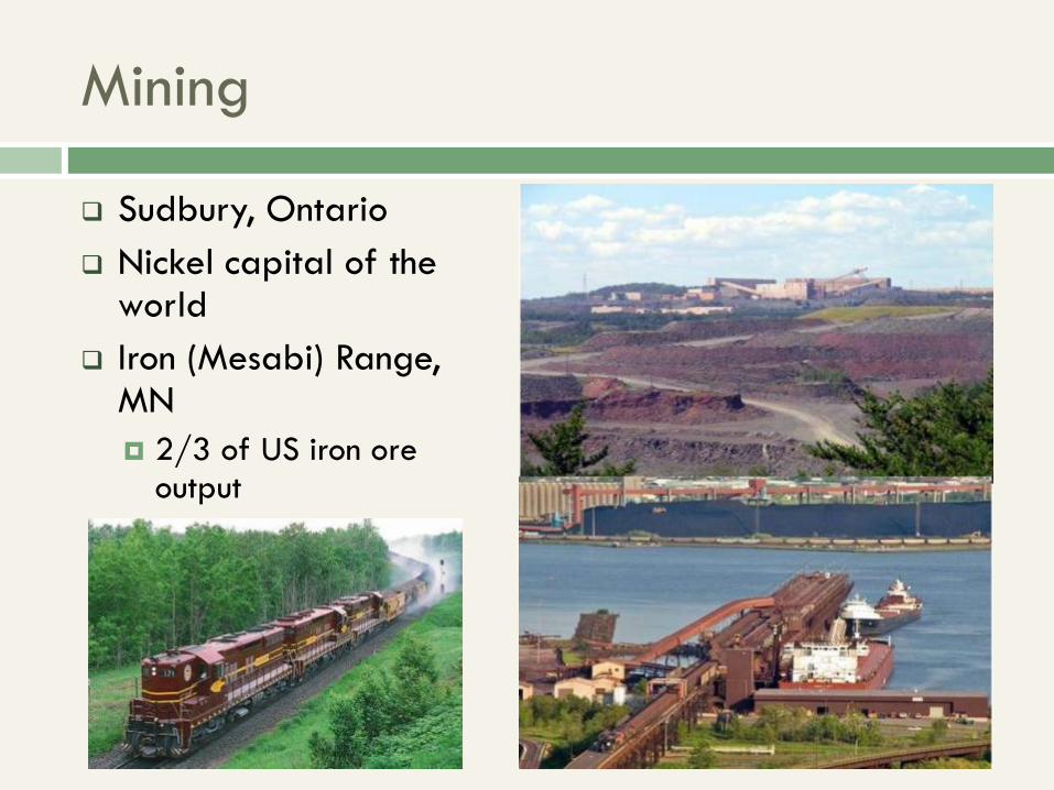
Mining
Sudbury, Ontario
Nickel capital of the world
Iron (Mesabi) Range, MN
2/3 of US iron ore output
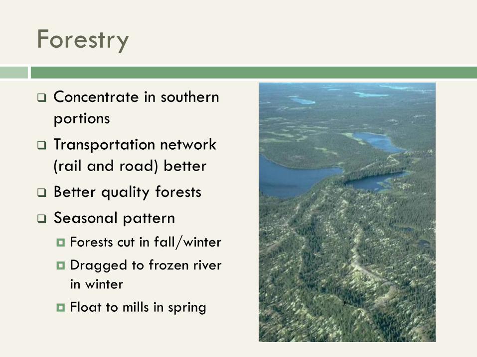
Forestry
Concentrate in southern
portions
Transportation network
(rail and road) better
Better quality forests
Seasonal pattern
Forests cut in fall/winter
Dragged to frozen river
in winter
Float to mills in spring
Fishing
Great Lakes
Michigan, Superior, Ontario, Huron, Erie
Great Slave Lake
Lake Winnipeg
Smaller lakes that can support industry
Fishing decreases somewhat in the north, where the
fish population is too low
Other Resources
Oil: Northern Alberta Tar Sands
Huge resource. Difficult to extract
Fur farming
Trapping in significant decline, fur farms on increase
Water resources
Hydroelectric dams (remember the James Bay Cree!)
Economic/Resource Outlook
Difficult economy
Mainstay of life is taking things from the land
Significant native presence and power
High birth rates
Net outflow of population
Transportation still difficult
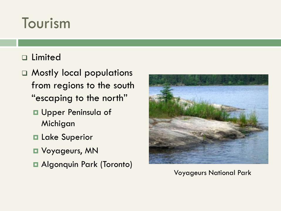
Tourism
Limited
Mostly local populations
from regions to the south
“escaping to the north”
Upper Peninsula of
Michigan
Lake Superior
Voyageurs, MN
Algonquin Park (Toronto)
Voyageurs National Park
Rural Canadian Employment
Difficult to get doctors, teachers and other service
employees to work in northern Canada
Local population doesn't have training
More urban dwellers don’t want to move there
Result, more areas with high poverty rates and poor
service quality
Native Land Claims
Natives have had better luck here than in the rest of
the continent
Land never developed
Populations never displaced
Non-natives really don’t want to live here
Resources discovered underneath
“Nunavut” discussed in the “Arctic” Region
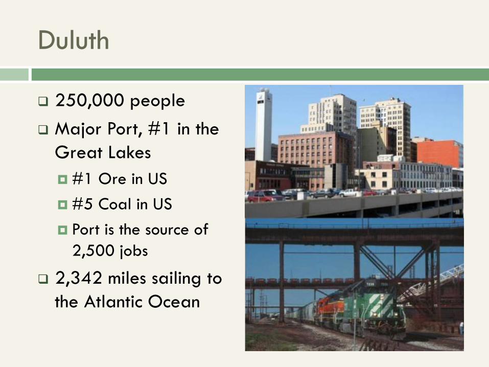
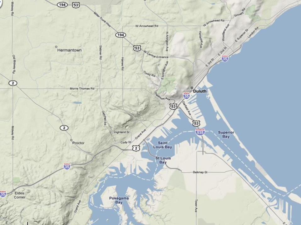
Duluth
250,000 people
Major Port, #1 in the
Great Lakes
#1 Ore in US
#5 Coal in US
Port is the source of
2,500 jobs
2,342 miles sailing to
the Atlantic Ocean
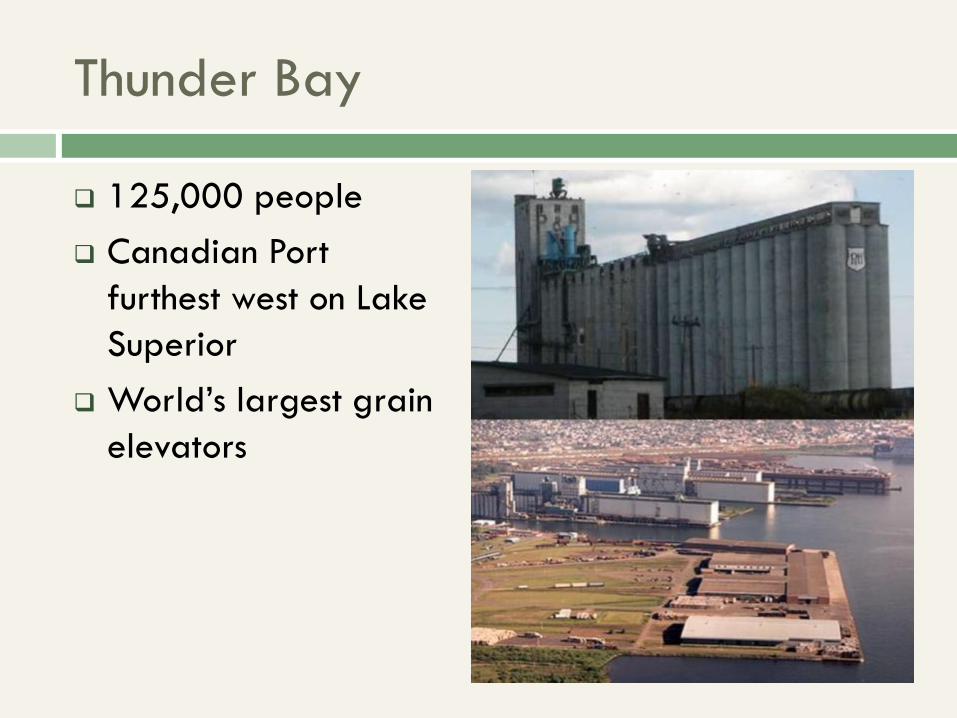
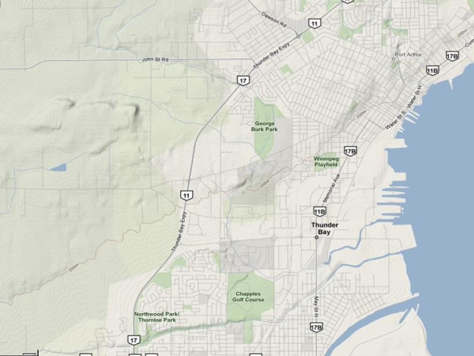
Thunder Bay
125,000 people
Canadian Port
furthest west on Lake
Superior
World’s largest grain
elevators
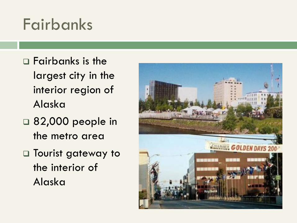
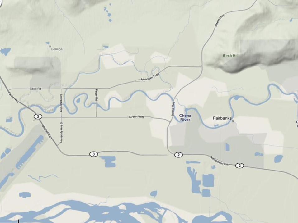
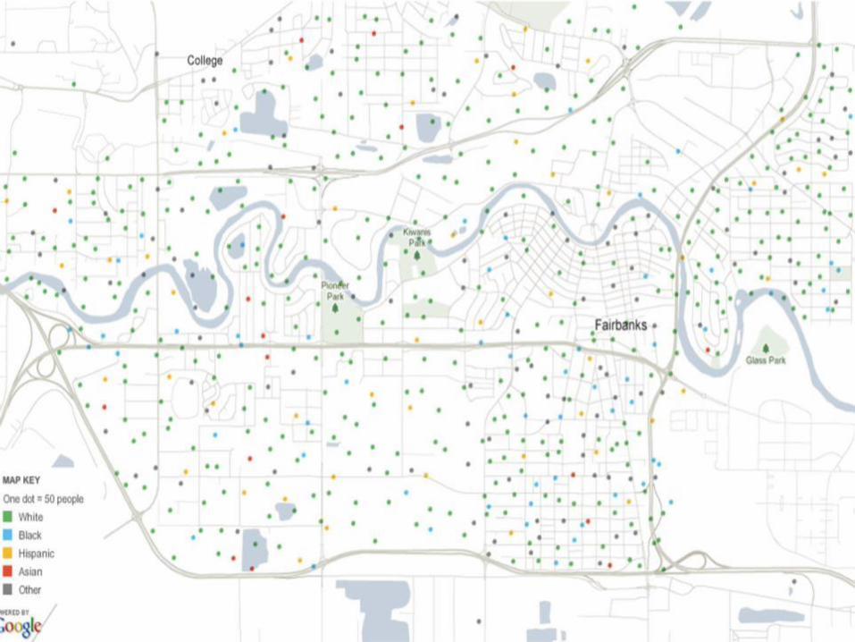
Fairbanks
Fairbanks is the
largest city in the
interior region of
Alaska
82,000 people in
the metro area
Tourist gateway to
the interior of
Alaska
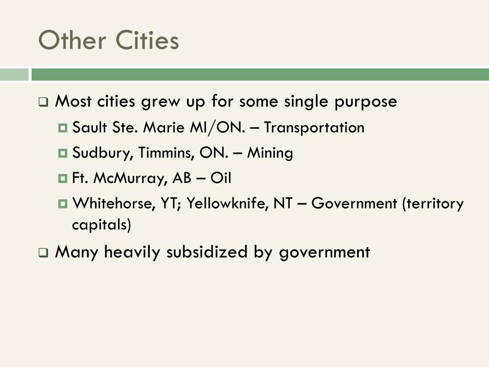
Other Cities
Most cities grew up for some single purpose
Sault Ste. Marie MI/ON. – Transportation
Sudbury, Timmins, ON. – Mining
Ft. McMurray, AB – Oil
Whitehorse, YT; Yellowknife, NT – Government (territory
capitals)
Many heavily subsidized by government