Embed Size (px)
Citation preview
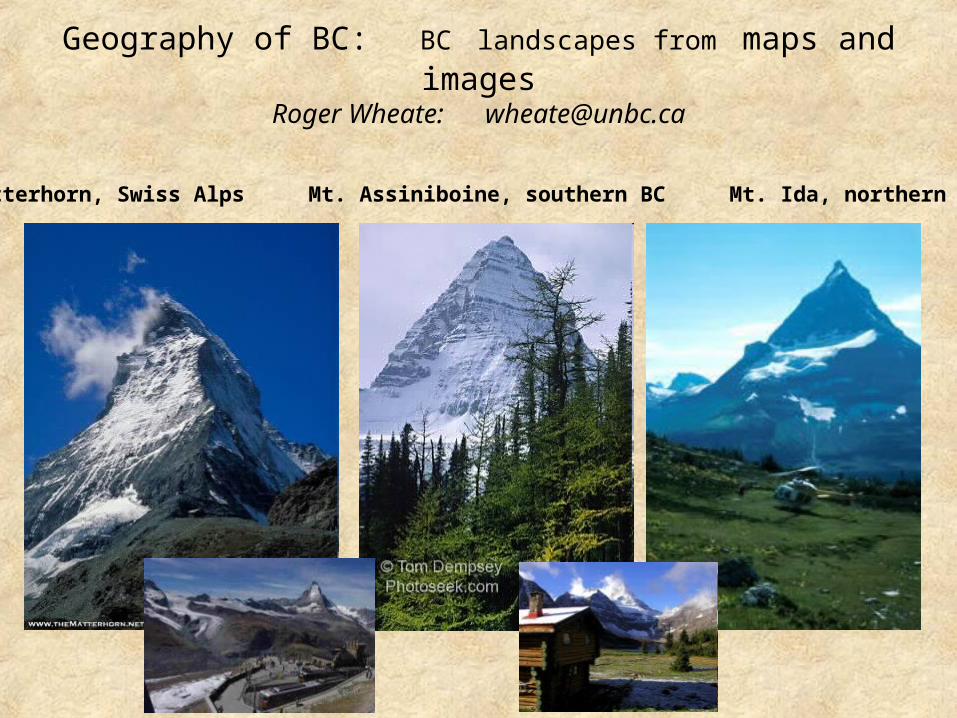
Geography of BC: BC landscapes from maps and images
Roger Wheate: [email protected]
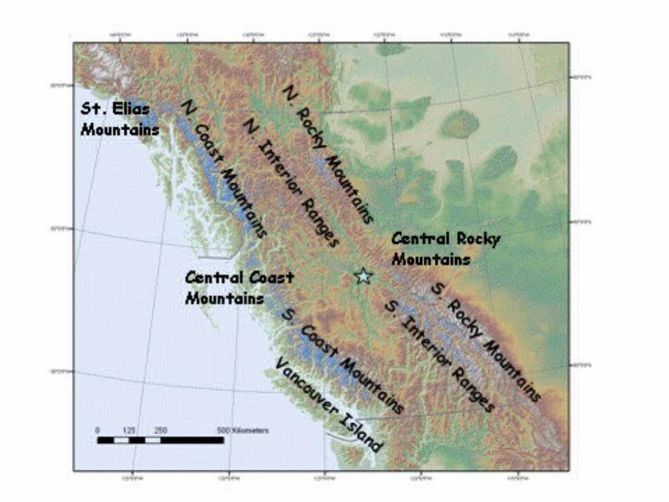
Matterhorn, Swiss Alps Mt. Assiniboine, southern BC Mt. Ida, northern BC
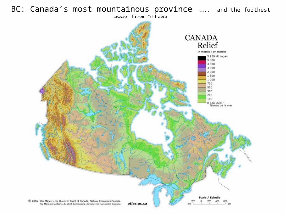
BC: Canada’s most mountainous province ….. and the furthest away from Ottawa
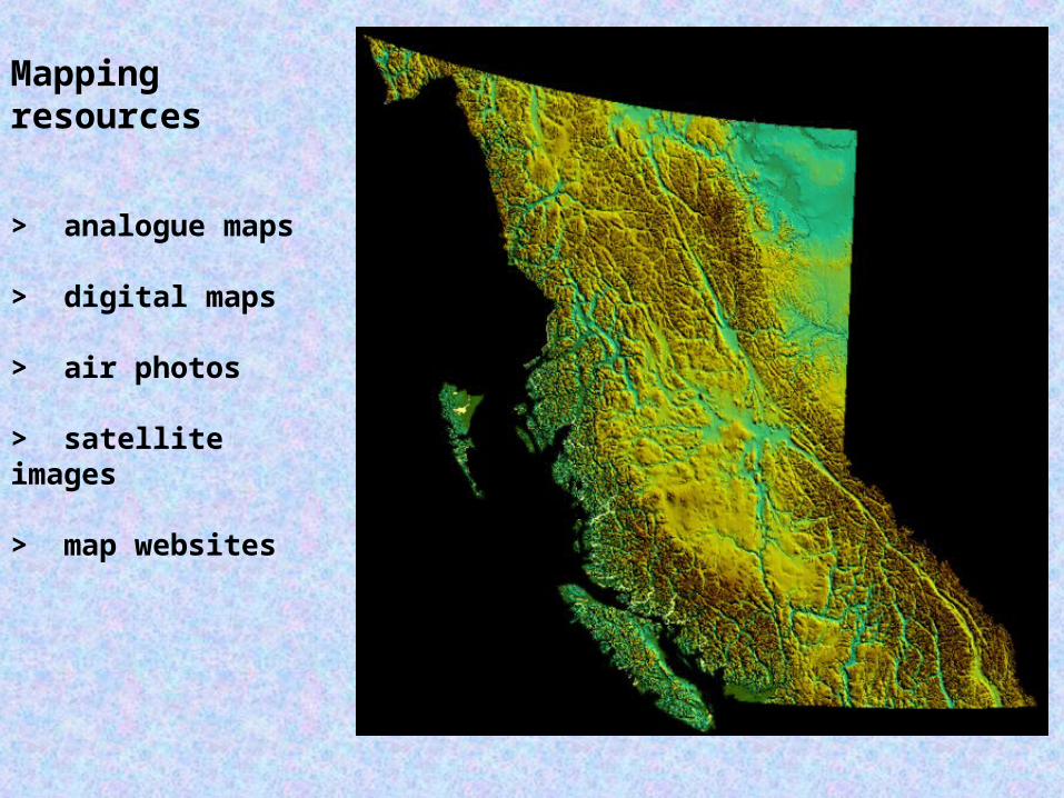
Mapping resources
> analogue maps
> digital maps
> air photos
> satellite images
> map websites
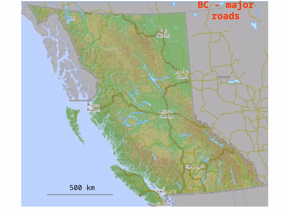
BC – major roads
500 km
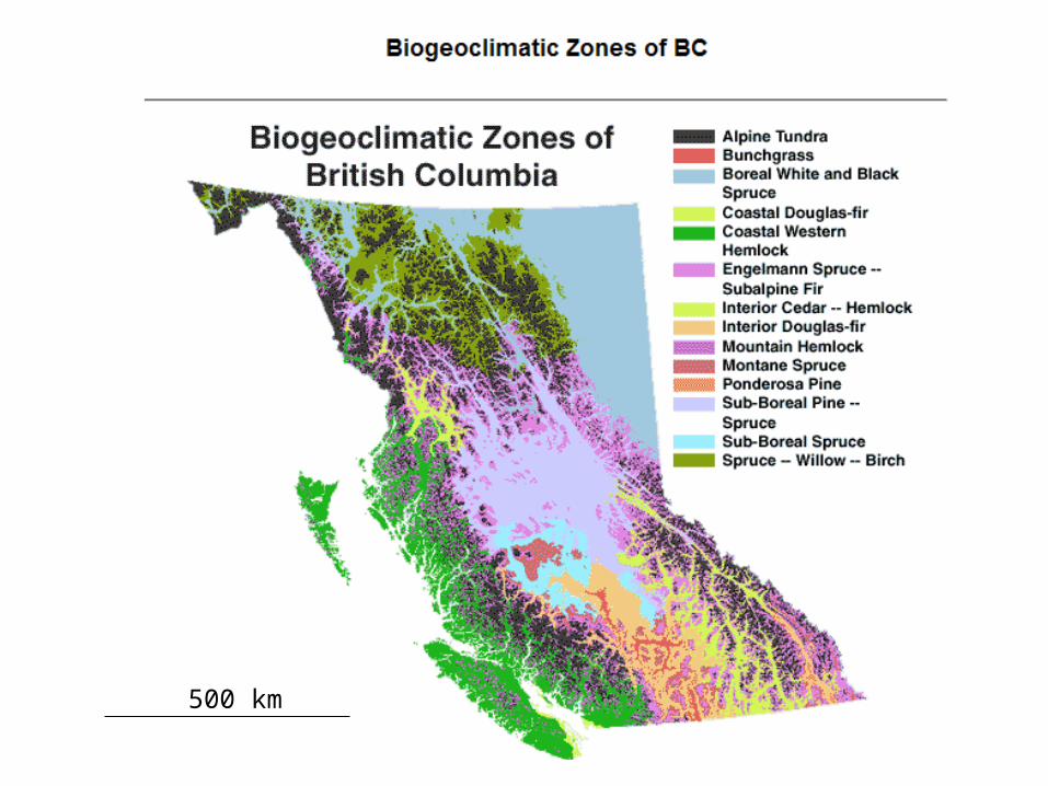
500 km
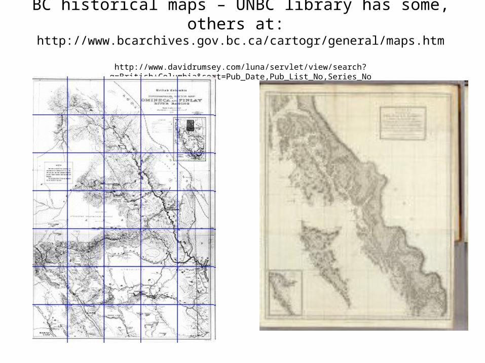
BC historical maps – UNBC library has some, others at: http://www.bcarchives.gov.bc.ca/cartogr/general/maps.htm
http://www.davidrumsey.com/luna/servlet/view/search?q=British+Columbia&sort=Pub_Date,Pub_List_No,Series_No
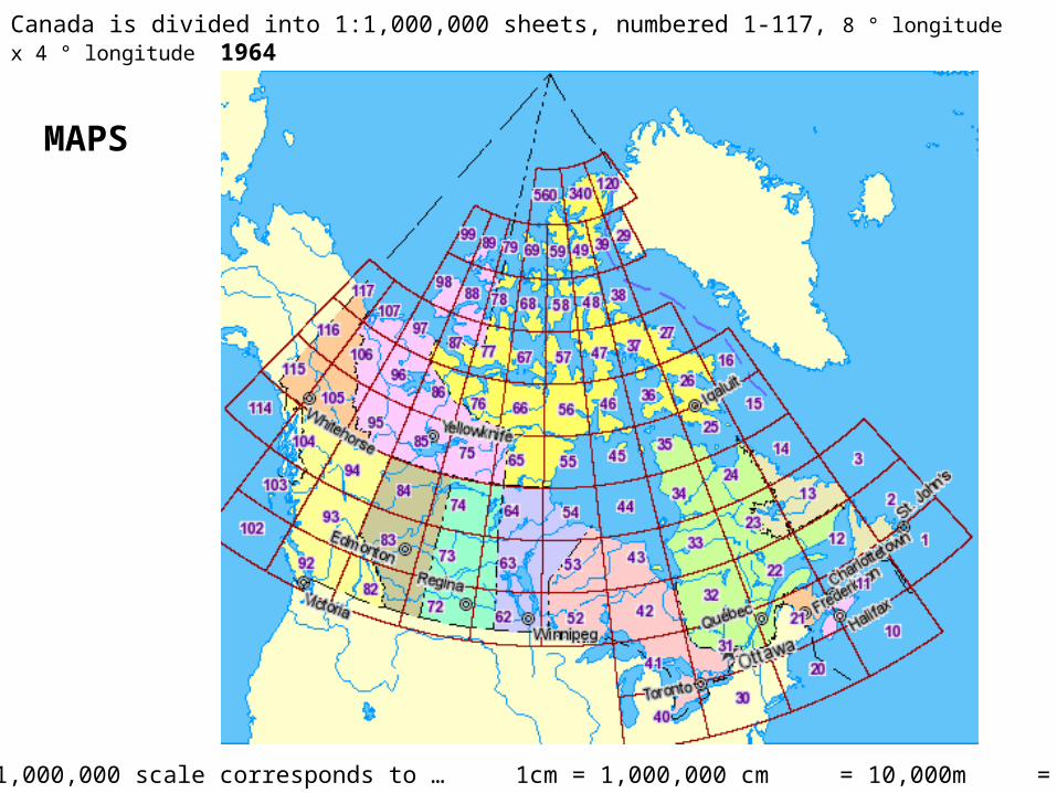
Canada is divided into 1:1,000,000 sheets, numbered 1-117, 8 ° longitude x 4 ° longitude 1964
1:1,000,000 scale corresponds to … 1cm = 1,000,000 cm = 10,000m = 10km
MAPS
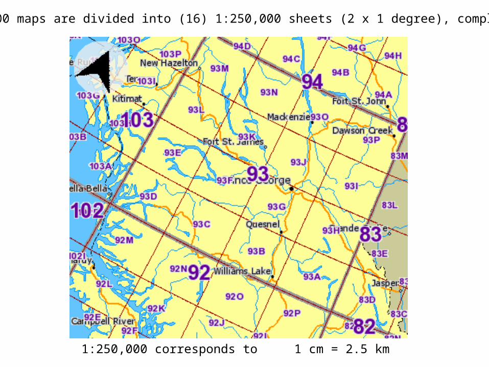
1:1,000,000 maps are divided into (16) 1:250,000 sheets (2 x 1 degree), completed 1970
1:250,000 corresponds to 1 cm = 2.5 km
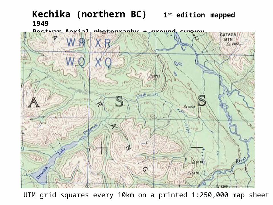
Kechika (northern BC) 1st edition mapped 1949Postwar Aerial photography + ground survey
UTM grid squares every 10km on a printed 1:250,000 map sheet
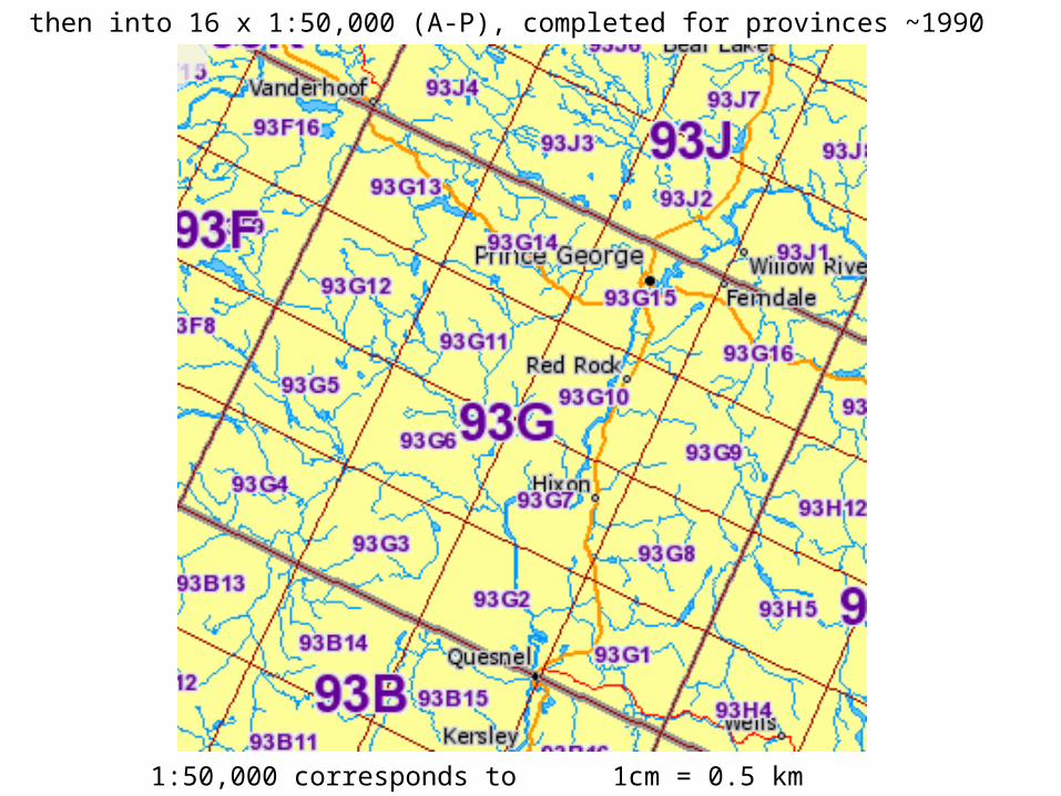
then into 16 x 1:50,000 (A-P), completed for provinces ~1990
1:50,000 corresponds to 1cm = 0.5 km
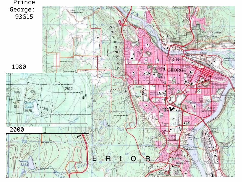
Prince George: 93G15
1980
2000
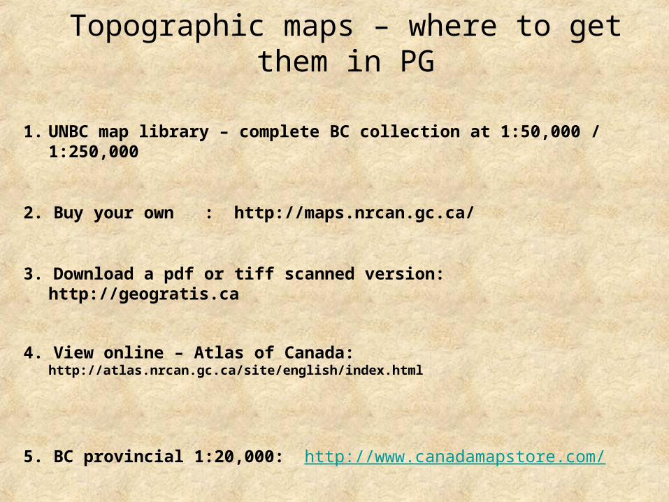
Topographic maps – where to get them in PG
1. UNBC map library – complete BC collection at 1:50,000 / 1:250,000
2. Buy your own : http://maps.nrcan.gc.ca/
3. Download a pdf or tiff scanned version: http://geogratis.ca
4. View online – Atlas of Canada: http://atlas.nrcan.gc.ca/site/english/index.html
5. BC provincial 1:20,000: http://www.canadamapstore.com/
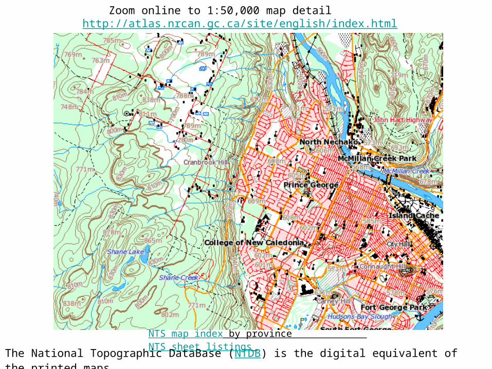
Zoom online to 1:50,000 map detail http://atlas.nrcan.gc.ca/site/english/index.html
NTS map index by province NTS sheet listings
The National Topographic DataBase (NTDB) is the digital equivalent of the printed maps
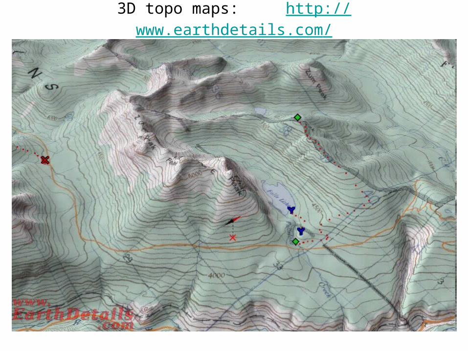
3D topo maps: http://www.earthdetails.com/
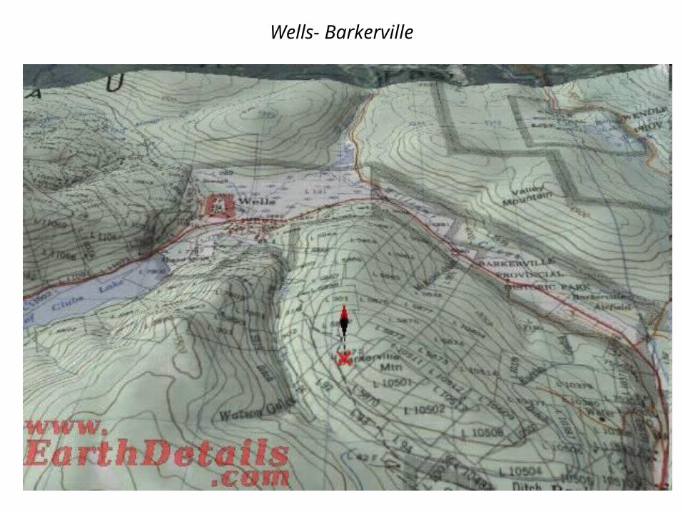
Wells- Barkerville
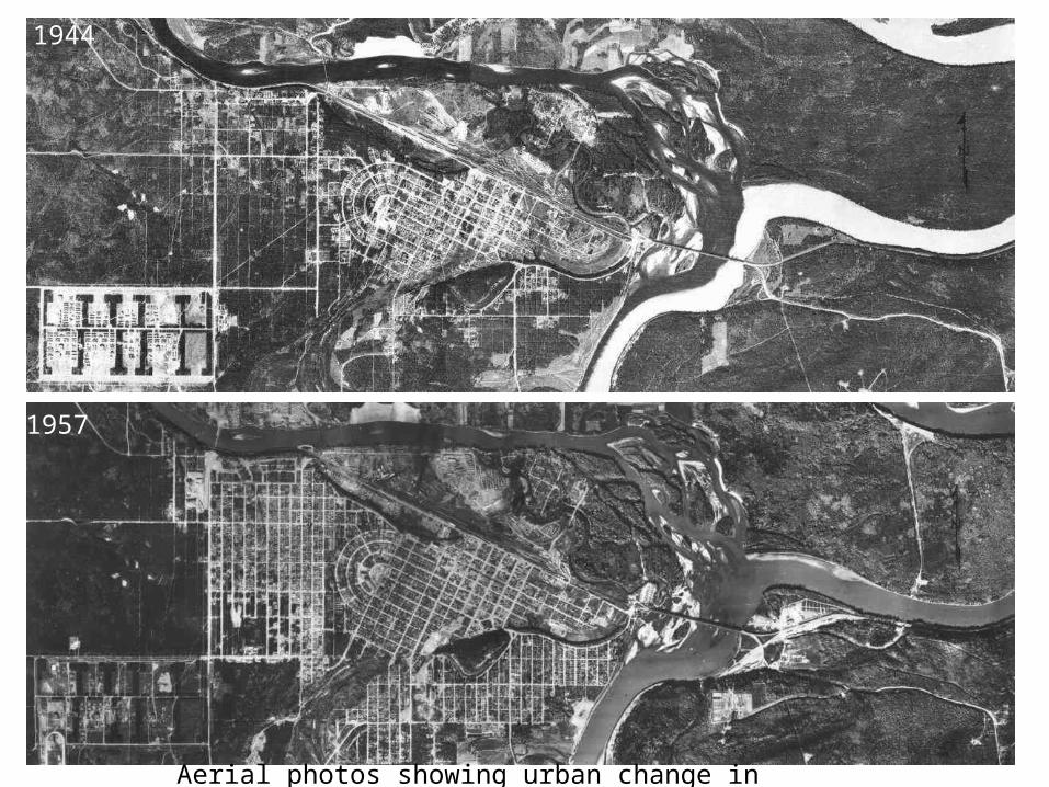
1944
1957
Aerial photos showing urban change in Prince George
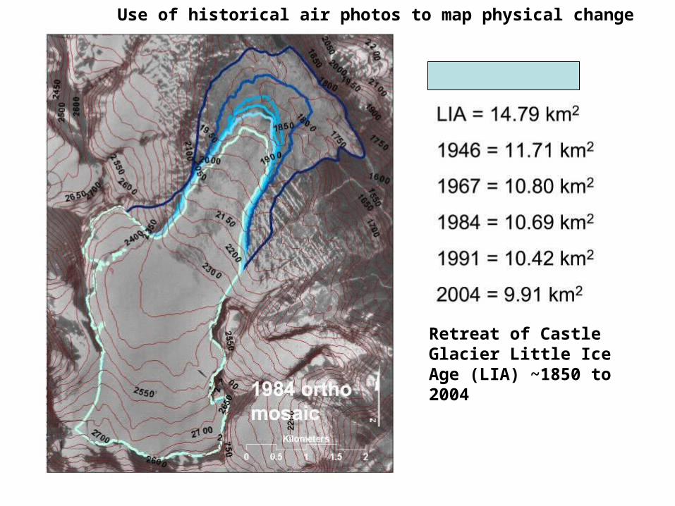
Retreat of Castle Glacier Little Ice Age (LIA) ~1850 to 2004
Use of historical air photos to map physical change
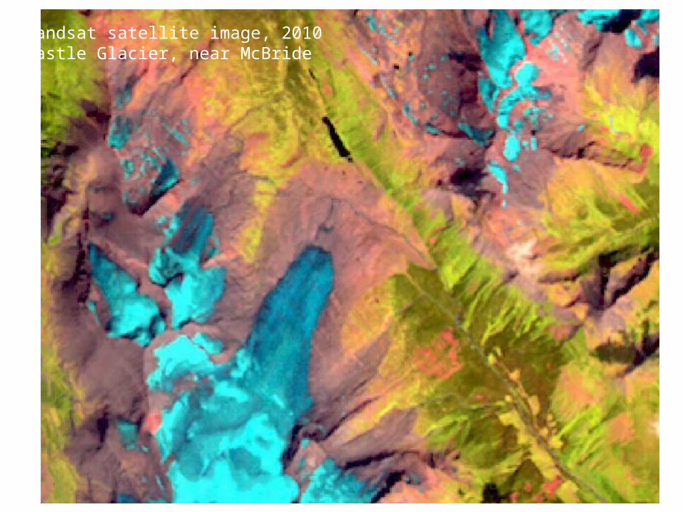
Landsat satellite image, 2010Castle Glacier, near McBride
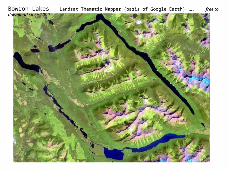
Bowron Lakes – Landsat Thematic Mapper (basis of Google Earth) …. free to download since 2009
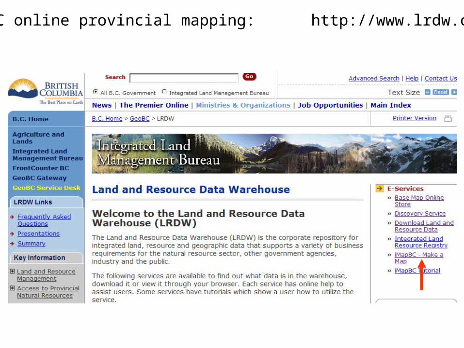
BC online provincial mapping: http://www.lrdw.ca/
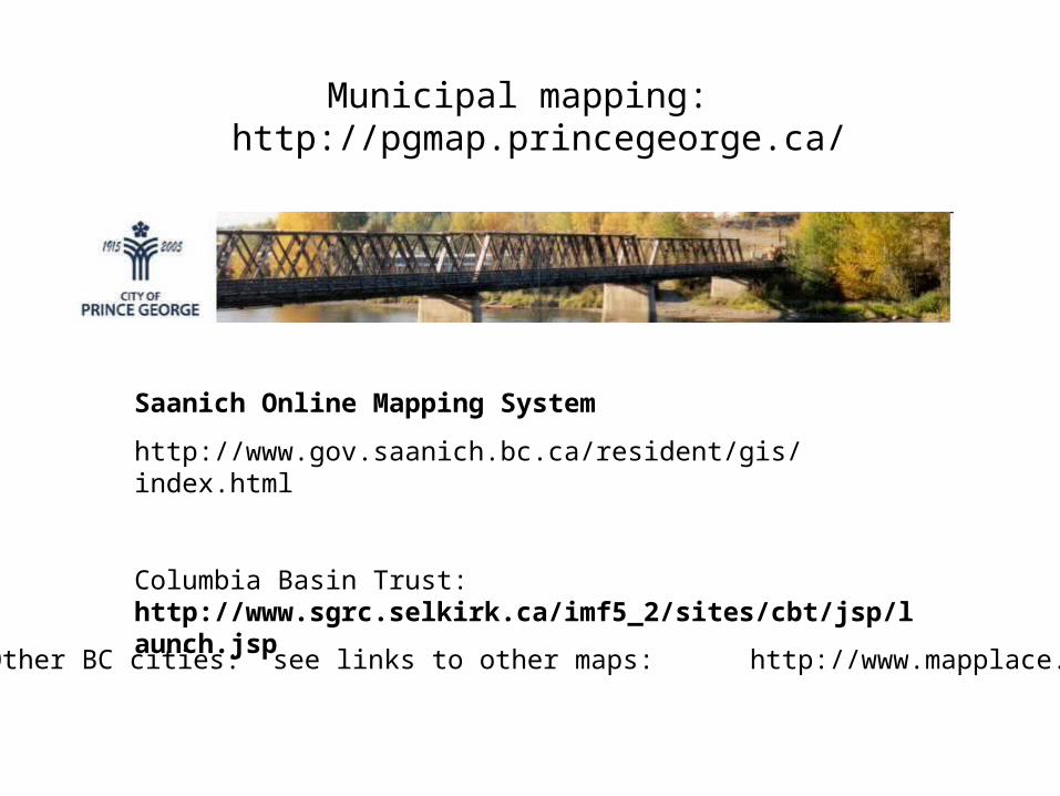
Municipal mapping: http://pgmap.princegeorge.ca/
Other BC cities: see links to other maps: http://www.mapplace.ca/
Saanich Online Mapping System
http://www.gov.saanich.bc.ca/resident/gis/index.html
Columbia Basin Trust: http://www.sgrc.selkirk.ca/imf5_2/sites/cbt/jsp/launch.jsp
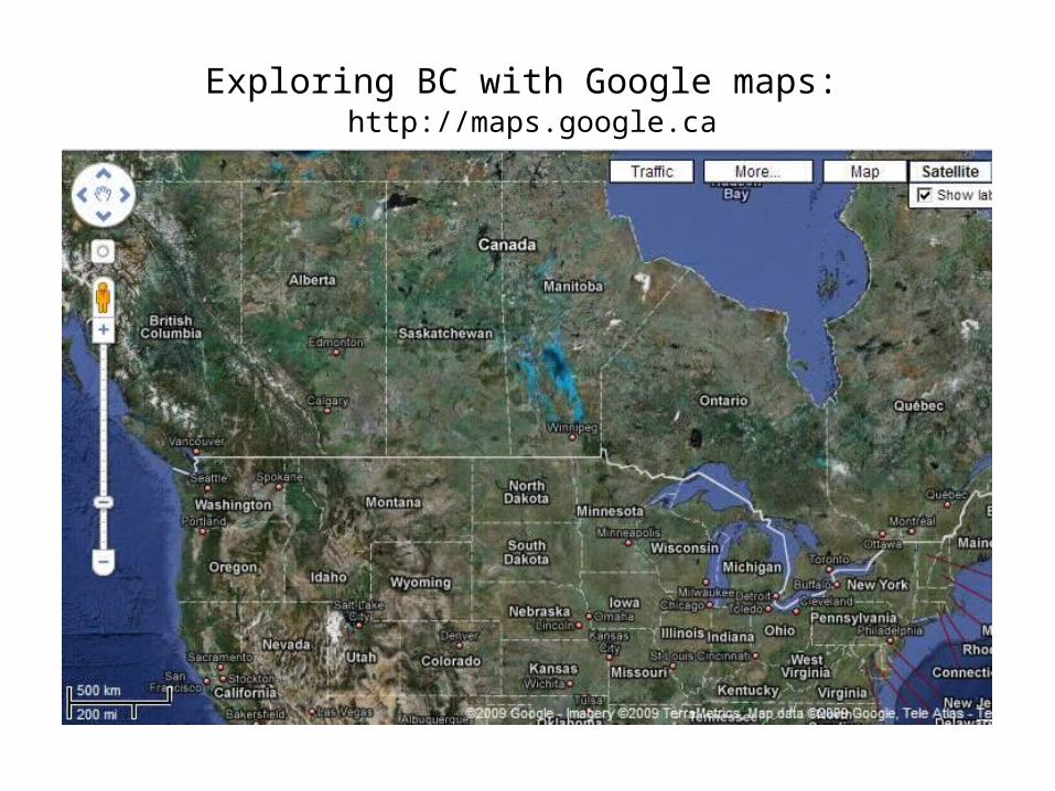
Exploring BC with Google maps: http://maps.google.ca
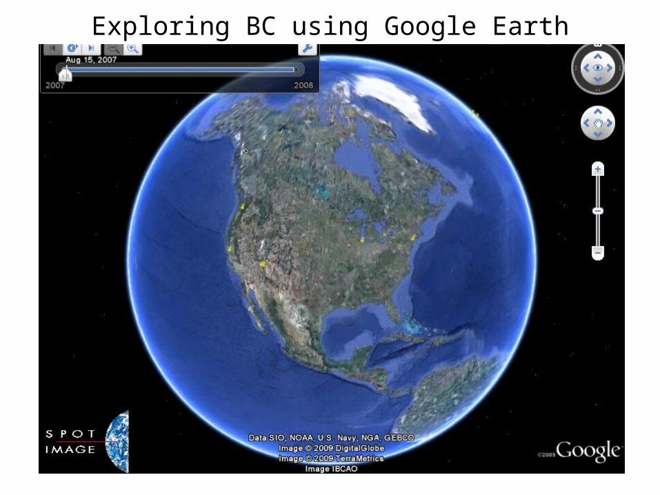
Exploring BC using Google Earth
Printed maps have some advantages – larger display, no equipment needed, finer details etc..
Advantages of digital mapping:
Seamless (no map edges)
Variable scale (zoom and pan)
Whole province / world available onscreen
(free)
Easier to update (imagery)
Integrated with associated technologies e.g. 3D
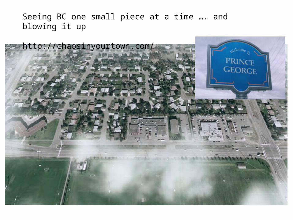
Seeing BC one small piece at a time …. and blowing it up
http://chaosinyourtown.com/