Embed Size (px)
Citation preview

GeographicalInforma1onSystem(GIS)indetec1onofrisk
zonestomentalhealth01/10/2015:15.00-16.00h.
ParallelSession3:Symposium299:
Detec1ngindividualsatmentalrisk.Speaker:Dr.ManuelEstebanLucas-BorjaEngineer.DepartmentofAgroforestryandGene5csScienceandTechnology.UniversityofCas5llaLaMancha.ManuelEsteban.Lucas@uclm.es

GeographicalInforma1onSystem(GIS)indetec1onofriskzonestomentalhealth
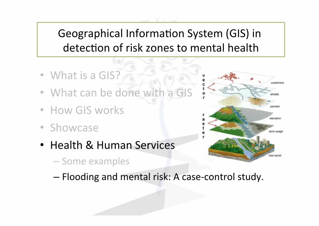
• WhatisaGIS?• WhatcanbedonewithaGIS• HowGISworks• Examples• Health&HumanServices
– Someexamples– Floodingandmentalrisk:Acase-controlstudy.

GeographicalInforma1onSystem(GIS)indetec1onofriskzonestomentalhealth
• WhatisaGIS?• WhatcanbedonewithaGIS• HowGISworks• Examples• Health&HumanServices
– Someexamples– Floodingandmentalrisk:Acase-controlstudy.

GeographicalInforma1onSystem(GIS)indetec1onofriskzonestomentalhealth
A geographic informaEon system (GIS) can be defined as a set ofhardware,soSware,data,methodsandpeople.Itsaimconsistsinthemanagement,analysisanddisplayofgeographicallyinforma1on.A GIS lets us visualize, analyze, and interpret data to understandrela1onships,paTerns,andtrends.

GeographicalInforma1onSystem(GIS)indetec1onofriskzonestomentalhealth
• WhatisaGIS?• WhatcanbedonewithaGIS• HowGISworks• Examples• Health&HumanServices
– Someexamples– Floodingandmentalrisk:Acase-controlstudy.

GeographicalInforma1onSystem(GIS)indetec1onofriskzonestomentalhealth
• Wecanvisualize,analyze,andinterpretdatausingmapsabout:
– Theposi1onofthings(i.e.coordinates)– Thequan11esofthings(i.e.popula1on)– Thedensi1esofthings(i.e.densityofpopula1on)– Whathappensinsideaspecificarea(i.e.riskordamage)– Whatisnearbywithinauserdefineddistance
– Theevolu1on/changeofphenomena…
Naturaldisasters

GeographicalInforma1onSystem(GIS)indetec1onofriskzonestomentalhealth
• WhatisaGIS?• WhatcanbedonewithaGIS• HowGISworks• Examples• Health&HumanServices
– Someexamples– Floodingandmentalrisk:Acase-controlstudy.

GISstoresgeographicinforma1oninseparatelayers
GeographicalInforma1onSystem(GIS)indetec1onofriskzonestomentalhealth

GeographicalInforma1onSystem(GIS)indetec1onofriskzonestomentalhealth
HEALTH

GeographicalInforma1onSystem(GIS)indetec1onofriskzonestomentalhealth
• WhatisaGIS?• WhatcanbedonewithaGIS• HowGISworks• Examples• Health&HumanServices
– Someexamples– Floodingandmentalrisk:Acase-controlstudy.

GeographicalInforma1onSystem(GIS)indetec1onofriskzonestomentalhealth
www.Esri.com

GeographicalInforma1onSystem(GIS)indetec1onofriskzonestomentalhealth
www.Esri.com

GeographicalInforma1onSystem(GIS)indetec1onofriskzonestomentalhealth
• WhatisaGIS?• WhatcanbedonewithaGIS• HowGISworks• Examples• Health&HumanServices
– Someexamples– Floodingandmentalrisk:Acase-controlstudy.

1.- Introducción Thefirstgeographicalanalysisofdiseasedata–plo[ngpointsonamapandlookingforrela1onships:Snow'smap(1854),demonstra1ngthespa1alclusteringofcholeradeathsaroundtheBroadStreetwell,providedstrongevidenceinsupportofhistheorythatcholerawasawater-bornedisease

GeographicalInforma1onSystem(GIS)indetec1onofriskzonestomentalhealth
www.Esri.com

GeographicalInforma1onSystem(GIS)indetec1onofriskzonestomentalhealth
OPEN ACCESS Review article
Emerging applications of GeographicInformation Systems (GIS) incommunity and local mentalhealth researchJames S. Brown*
INTRODUCTION
Medical geography or the use of geography to study disease traces back to ancient times 1. After thelate 17th-century, medical geography became more formalized with developments in cartography andthe introduction of maps of disease distribution.2 By the 20th-century, medical geographers developedsophisticated statistical methods of geographical epidemiology to create maps allowing the spatialanalysis of health-related issues.3 For example, in mental health research, spatial analysis ofgeographic patterns of mental disorders led to the correlation of urban environments with increasedrisk for severe mental disorders.4 During recent years, technological innovation in computer mappingreferred to as geographic information systems (GIS) significantly enhanced the analysis of healthquestions in small local areas such as census blocks and neighborhoods. GIS analyses have shownsuperiority to classical geographic techniques in these small areas that eluded accurate investigationin the past.A “geographic information system” (GIS) is defined as “an integrated collection of computer software
and data used to view and manage information about geographic places, analyze spatial relationships,and model spatial processes (pg. 90).5” Although the history of GIS is international, most GIS historianstrace its origins to the 1960’s in Canada and the United States (US).6 The first “true” GIS, the CanadaGeographic Information System,6 paralleled initial GIS developments in the US at the HarvardLaboratory for Computer Graphics and Spatial Analysis. These early versions of GIS in the US werefurther enhanced by major contributions by the US Bureau of the Census, the US Geological Survey andcertain commercial enterprises.6 With the aid of both commercial and open-source GIS software,researchers now routinely apply GIS to medical, scientific and environmental research, urban planning,land management, military intelligence, resource management, transportation, archaeology,cartography, criminology, marketing, and other research. In medicine, GIS users perform analyses inpublic health, epidemiology, health policy, hospital administration, emergency response, disastermanagement and medical research.7
Before GIS existed, mental health researchers used visual and manual cartographic methods(here on referred to as “classical” methods) combined with various degrees of statistical analysis toinvestigate the epidemiology of mental illness. Although the first such studies in the US were publishedin the 19th-century, the most important work began in the 20th-century with the classic work on mentaldisorders in urban areas by Faris and Dunham in 1939.8 Later milestone investigations in geographicpsychiatry examined the association of urban environments with schizophrenia.9 Studies usingclassical methods to describe the distribution of mental illness within urban and rural areas still appearin the literature10 but most research now focuses on the more narrowly defined “neighborhood-level”geography of mental illness best analyzed with GIS.
Cite this article as: Brown JS. Emerging applications of Geographic Information Systems (GIS) incommunity and local mental health research, Journal of Local and Global Health Perspectives2013:5 http://dx.doi.org/10.5339/jlghp.2013.5
http://dx.doi.org/10.5339/jlghp.2013.5
Submitted: 10 February 2013Accepted: 6 March 2013ª 2013 Brown, licensee BloomsburyQatar Foundation Journals. This isan open access article distributedunder the terms of the CreativeCommons Attribution license CC BY3.0, which permits unrestricted use,distribution and reproduction in anymedium, provided the original workis properly cited.
Associate Clinical Professor ofPsychiatry, Department of Psychiatry,VCU School of Medicine, Richmond,VA, USA
*Email: [email protected]
'D@KSG©!@RDC©&DNFQ@OGHB©(MENQL@SHNM©2XRSDLR©�&(2�©@MC©SGDHQ© OOKHB@SHNMR
1$5($6©�© "3 ©(-%.1,©,$# ©����©#$"©������©�������
402
Health Based Geographic Information Systems (GIS) and their ApplicationsEvangelos C. Fradelos1, Ioanna V. Papathanasiou2, Dimitra Mitsi�, Konstantinos Tsaras2, Christos F. Kleisiaris4, Lambrini *NTQJNTS@�
2S@SD©,DMS@K©'NROHS@K©NE© SSHB@©b#@OGMDh�©&QDDBD�
-TQRHMF©#DO@QSLDMS�©3DBGMNKNFHB@K©$CTB@SHNM@K©(MRSHSTSD©NE©3GDRR@KX�©&QDDBD2
&DMDQ@K©'NROHS@K©NE© SGDMR©b$KOHRh�©&QDDBD�
-TQRHMF©#DO@QSLDMS�©3DBGMNKNFHB@K©$CTB@SHNM@K©(MRSHSTSD©NE©"QDSD�©&QDDBD�
-TQRHMF©#DO@QSLDMS�© KDW@MCDQ©3DBGMNKNFHB@K©$CTB@SHNM@K©(MRSHSTSD©NE©3GDRR@KNMHJH�©&QDDBD�
Corresponding author: Ioanna V. Papathanasiou, RN, MSc, PhD. Assistant Professor . Nursing Department. Technological Educational Institute of Thessaly, Greece. Phone: +302410684446. E-mail: [email protected], [email protected]
1. INTRODUCTIONMedical researches as well as the study of the Earth’s sur-
face, better still, geography are interlinked with each other; their relationship dates from antiquity. Hippocrates was the first to describe the relationship between the geographical characteristics of a place and the inhabitants’ health. Hip-pocrates described all these in his treatise “On Air, Water and Places”. [1] As the time goes by, it has become increasingly apparent that the mapping and the geographic information might be both very useful and vital not only for research but also for understanding the processes of diseases. The study of the English Physician John Snow in 1854 was a milestone towards this direction. It led to the detection of the source of infection in a cholera epidemic that broke out in London. Having mapped the locations of those individuals who were affected, he concluded that contaminated water was the cause of the outbreak. [2] This research laid the foundations for both cartographic and geographic applications as a tool in medical science. Nowadays, the rapid development of technology has resulted, among other things, in the creation and deploy-ment of new disciplines that cooperate with both the science of medicine and medical research. The science of Geographic Information Systems and, by extension Geomatics belongs to a discipline which is constantly developing at a global level. This sector has many applications regarding medical / epide-miological research and generally, the social sciences.
2. PURPOSEThe purpose of this study is to highlight Geographic In-
formation Systems as technology and the various applications that they find in the field of medicine, either epidemiological or social research and health care, in general. Furthermore, this discipline may act as a decision making tool in health care and it might contribute to the formulation of policies re-garding the health sector.
3. MATERIAL AND METHODSThe method of literature review was used in this study. It
also included articles and publications that are related to the theme. What is more, this study has drawn information on re-searches and publications that are taken from databases such as HEAL-LINK, Google Scholar, Pub-med material. The Key words that were used in the search were: Geographic Infor-mation Systems, Applications, Medical research, and public health.
The literature review was conducted between March and August 2014. Finally, 32 articles and publications were chosen from the initial 187 articles and publications. That happened after sorting out the material which was mainly based on ab-stracts and their content.
4. DEFINITION OF GEOGRAPHIC INFORMATION SYSTEMS
The first maps were made due to the fact that people needed to classify the special elements of the earth’s surface. These elements relate to spatial distribution as well as the demand for specialized maps regarding the earth’s surface. The rapid development of information technology and the extension of
ABSTRACT,DCHB@K©QDRD@QBGDR©@R©VDKK©@R©SGD©RSTCX©NE©SGD©$@QSG�R©RTQE@BD�©ADSSDQ©RSHKK�©FDNFQ@OGX©@QD©HMSDQKHMJDC©VHSG©D@BG©NSGDQ�©SGDHQ©QDK@SHNMRGHO©C@SDR©EQNL©@MSHPTHSX ©The science of Geographic Information Systems and, by extension, Geomatics engineering belongs to a discipline which is constantly developing at a global level. This sector has many applications regarding medical / epidemiological research and generally, the social sciences. Furthermore, this discipline may @BS©@R©@©CDBHRHNM©L@JHMF©SNNK©HM©SGD©GD@KSGB@QD©RDBSNQ©@MC©HS©LHFGS©BNMSQHATSD©SN©SGD©ENQLTK@SHNM©NE©ONKHBHDR©HMSN©SGD©GD@KSGB@QD©RDBSNQ ©3GD©TRD©NE©&(2©RN©@R©SN©RNKUD©OTAKHB©GD@KSG©HRRTDR©G@R©@M©DWONMDMSH@K©HMBQD@RD©@MC©G@R©ADDM©UHS@K©SN©SGD©TMCDQRS@MCHMF©@MC©SQD@SLDMS©NE©GD@KSG©OQNAKDLR©HM©CHȮDQDMS©FDNFQ@OGHB©@QD@R ©(M©QDBDMS©XD@QR�©SGD©TRD©NE©U@QHNTR©HMENQL@SHNM©SDBGMNKNFX©RDQUHBDR©@MC©RNȳV@QD©G@R©KD@C©GD@KSG©OQNEDRRHNM@KR©SN©VNQJ©LNQD©DȮDBSHUDKX Key words: Geographic Information Systems, applications, medical research, public health.
doi: 10.5455/aim.2014.22.402-405 "3 ©(-%.1,©,$# ©����©#$"©������©�������1DBDHUDC�©��©2DOSDLADQ©����©g© BBDOSDC�©��©-NUDLADQ©����© AVICENA 2014
REVIEW
Published online: 19/12/2014Published print: 12/2014

GeographicalInforma1onSystem(GIS)indetec1onofriskzonestomentalhealth
Using Geographic Information Systems (GIS) to Understand Mental Health Needs, Utilization and Access within a Social Context in
California and in Three Selected Counties
A Project of the Center for Reducing Health Disparities UC Davis School of Medicine
Sponsored by the Mental Health Services Oversight and Accountability Commission
(MHSOAC)
Prepared by Marlene M. von Friederichs-Fitzwater, PhD., MPH
Assistant Professor of Hematology & Oncology UC Davis School of Medicine
Director, Outreach Research & Education Program UC Davis Cancer Center
Estella M. Geraghty, MD, MS, MPH Assistant Professor of Clinical Internal Medicine
UC Davis School of Medicine
Sergio Aguilar-Gaxiola, MD, PhD Professor of Clinical Internal Medicine
Director, Center for Reducing Health Disparities UC Davis School of Medicine
March 31, 2011
- 1 -
Report on GIS and public health spatial applications
“Disease ecology is inherently integrative and spatial, and GIS
provides the environment in which the biophysical, social, behavioural, and cultural worlds can be combined for
a systemic understanding of health and disease.”1
Public Health Services Branch Queensland Health

GeographicalInforma1onSystem(GIS)indetec1onofriskzonestomentalhealth
GeographicalInforma1onSystem(GIS)indetec1onofriskzonestomentalhealth
• WhatisaGIS?• WhatcanbedonewithaGIS• HowGISworks• Showcase• Health&HumanServices
– Someexamples– Floodingandmentalrisk:Acase-controlstudy.

GeographicalInforma1onSystem(GIS)indetec1onofriskzonestomentalhealth
!
!
2012(flooding)
Meanannualprecipita1on(1950-2012)
WorkdoneusingGIS:1ºDetec1nganaturaldisaster(flooding)loca1on2ºAnalysinganaffectedandacontrolpopula1on¿Rela1onbetweenfloodingandmentalhealthpopula1on?
Floodingandmentalrisk:Acase-controlstudy.
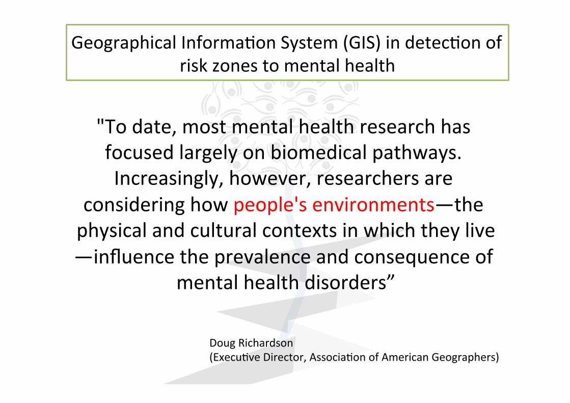
"Todate,mostmentalhealthresearchhasfocusedlargelyonbiomedicalpathways.Increasingly,however,researchersare
consideringhowpeople'senvironments—thephysicalandculturalcontextsinwhichtheylive—influencetheprevalenceandconsequenceof
mentalhealthdisorders”
DougRichardson(Execu1veDirector,Associa1onofAmericanGeographers)
GeographicalInforma1onSystem(GIS)indetec1onofriskzonestomentalhealth
GeographicalInforma1onSystem(GIS)indetec1onofriskzonestomentalhealth
• Manythankstothepeopleinvolvedinthiswork:
ThanksforyouraTen1on!
ProfesionalesÁreaGesEónSanitariaNorteAlmería:AndrésFontalbaNavas.PsiquiatraJuanFranciscoGarcíaMasegosa.MédicoAtenciónPrimariaMacarenaMarínOlalla.PsiquiatraPilarLucasBorja.Psiquiatra.JavierPastorHurtado.FarmaciaFranciscoAguileraManrique.UnidadCalidadyFormaciónVirginiaGilAguilar.MédicoAtenciónPrimariaMartaRuizSerrano.MédicoAtenciónPrimariaIvánPlazaNieto.MédicoAtenciónPrimariaAnaMaríaIranzoLuna.MédicoAtenciónPrimariaUniversidaddeMálagaDepartamentoPsiquiatríayFisioterapiaProf.JoséMiguelPenaAndreu
Collaborations:
Collaborations: