Embed Size (px)
Citation preview

Geographic Knowledge Engineering for Smart Planning
1 – Introduction
2 – Components of a GKB
3 – Knowledge-base planning Tuesday Afternoon
4 – Conclusions
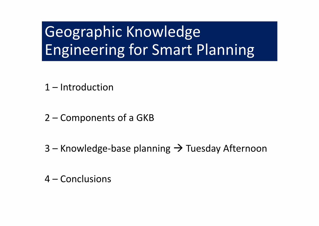
1 – Introduction
• Dataless urban planning
• Statistical analysis (Baxter, 76)
• Computer-Assisted Cartography
• Urban Data Bases (80s)
• Information• Geographic information systems (80s)
• Fundamentals of Spatial Information Systems (Laurini-Thompson, 91)
• “Information Systems for Urban Planning” (Laurini, 01)
• Now Knowledge• Business intelligence to Territorial Intelligence
• Knowledge society

Specific characteristics
• Space 2D, 3D, 3D+T coordinates
• Computational geometry, topology
• Cartography and geovisualization
• Spatial analysis
• Features and geographic objects
• Measurement accuracy
• Multiple representations
• Acquisition devices

Example of a street
Trafficengineer
Street
Street represented
by a graph
Street represented
by a surface
Street represented
by two polylines
Street represented
by a volume
Street
maintenance
engineer
Cadaster
officer
Technical
network
engineer
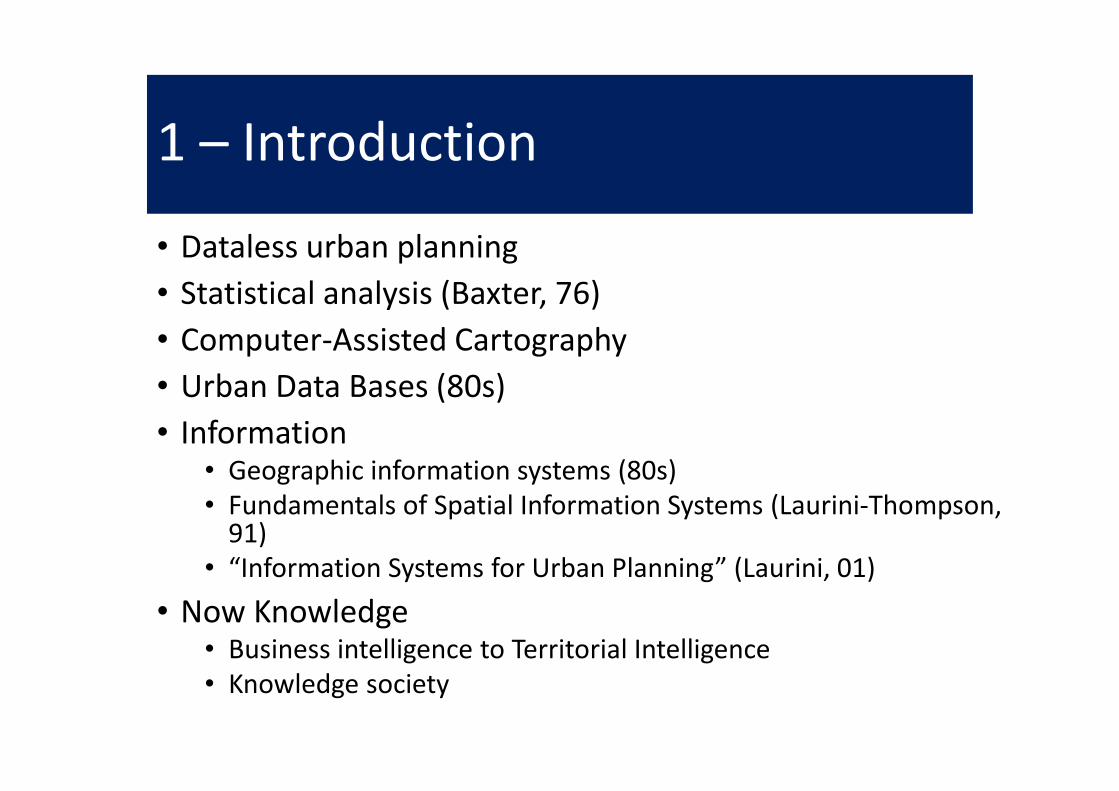
Infrastructure organization
Connections(Open)
Data
Sensors Physical Layers
Human
IntelligenceMachine
Processable
knowledge
Knowledge
Infrastructure
Governance, Regulations
Smart Territory

Geometric Homology
AB
A
B
(a) (b)
Geom(A) =Geom (B)Reflexive, associative
But non-transitive

Generic and Applicative Knowledge
• Generic knowledge
• valid everywhere and
• linked to acquisition devices
• and linguistics aspects
• Applicative knowledge linked to applicative domains such as
• urban planning,
• environmental planning,
• transportation, etc.

Geographic Projects
• Where to put a new airport, a new hospital, a new stadium, etc.?
• Is this new construction project compliant with planning rules?
• What is the best mode or the best way to get from Ato B?
• How to organize a plan for green spaces in a city?
• How to reorganize common transportation?
• etc.

Usage
Geographic
Knowledge
Base
Geographic
inference
engine
Geographic
project
- Feasibility report
- Spreadsheets
- Ranking alternatives
- Maps
- 3D models
- Chorems
- etc.
Output:

Origin of Geographic Knowledge
Geographic
Knowledge
Base
Geographic
Database
Geographic
Document
Base
Geographic
Data Mining
Geographic
Information
Retrieval

2 – GKB components
Geographic
Objects
Geographic
Relations
Geographic
Ontology
Geographic
Rules
Physico-
mathematical
Models
Gazetteer
Geographic Geographic Geographic Geographic KnowledgeKnowledgeKnowledgeKnowledge BaseBaseBaseBase
Geographic
Structures
External
Knowledge

GKB Formalization
• GKB ≡ (Terr, λ,Ω, GO,Γ,REL, Σ,RULES, PROJECTS)• Terr defines a territory, which is a part of Earth,
• λ a language,
• GO is the set of all geographic objects stored in GKB,
• Γ a gazetteer,
• Ω an ontology,
• REL a set of relationships between geographic objects,
• Σ a set of structures linking some geographic objects,
• RULES a set of rules and
• PROJECTS a set of old and ongoing projects.
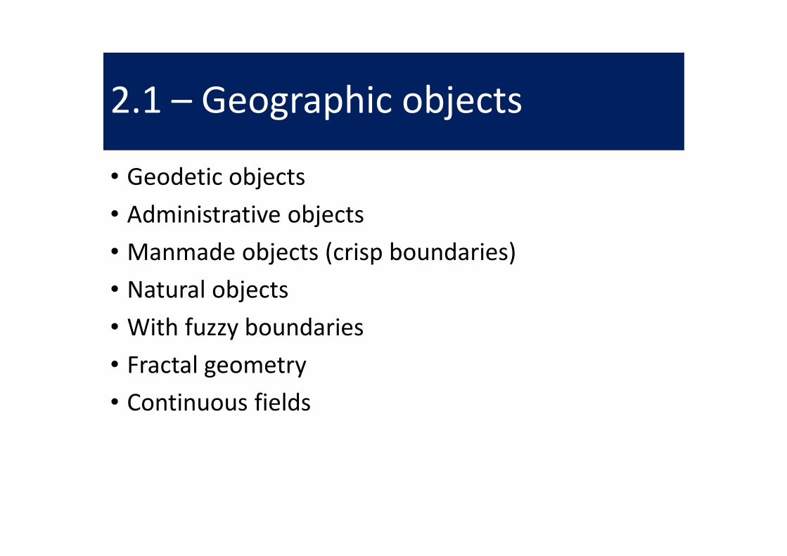
2.1 – Geographic objects
• Geodetic objects
• Administrative objects
• Manmade objects (crisp boundaries)
• Natural objects
• With fuzzy boundaries
• Fractal geometry
• Continuous fields

Geodetic Objects
• Theoretical objects on the globe
– Equator
– North and south poles
– Meridians
– Parallels
• Modeled with points, lines and circles
• Basis for definition of coordinates
• Cannot disappear

Administrative objects
• Without considering disputes at borders
• Non-connected polygons
• Often organized in hierarchical tessellations
• Countries, regions, provinces, municipalities
• Parks
• Total coverage of the Earth
• A some scales, they can disappear

Manmade Objects
• Manmade
• Buildings, bridges, streets, etc.
• Usually Euclidean objects
• Modeled as non-connected polygons
• At some scales
• Roads can become linear
• They can disappear
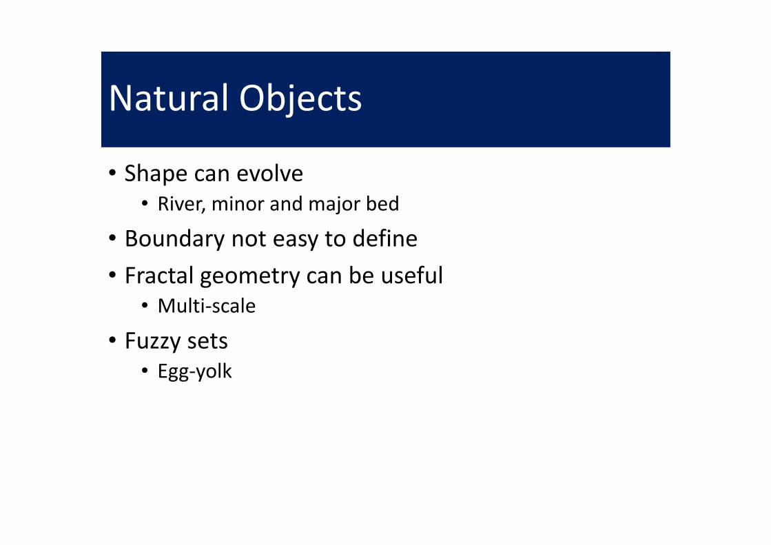
Natural Objects
• Shape can evolve
• River, minor and major bed
• Boundary not easy to define
• Fractal geometry can be useful
• Multi-scale
• Fuzzy sets
• Egg-yolk

Characteristics of Geo Objects
Semantic Identification Geometry
Geographic
Object
Geographic
features
Computer
Level

What is it?
(a) A car park? No, the roof of
a small used as a car park.
(b) A meadow? No, a water
catchment area
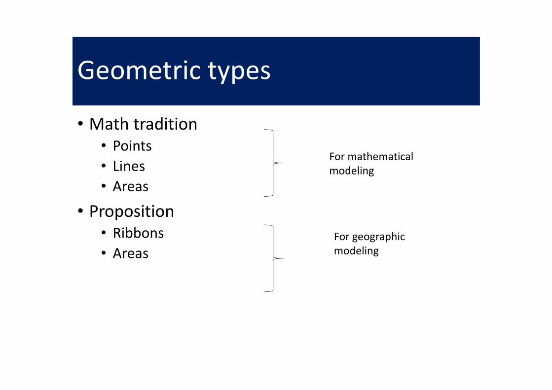
Geometric types
• Math tradition
• Points
• Lines
• Areas
• Proposition
• Ribbons
• Areas
For mathematical
modeling
For geographic
modeling

From Lines to Ribbons
• Ribbon = line with a width
• Rectangular Ribbons
• Loose Ribbons
(a) (b) (c)

Construction of a ribbon
• Line as a starting skeleton
x, y
x1, y1
h
α
Skeleton
Derivative
Perpendicular to derivative
Curve C1
Curve C1
Curve C2
h
h
Skeletonof the ribbon
(a) (b)
U2
U1
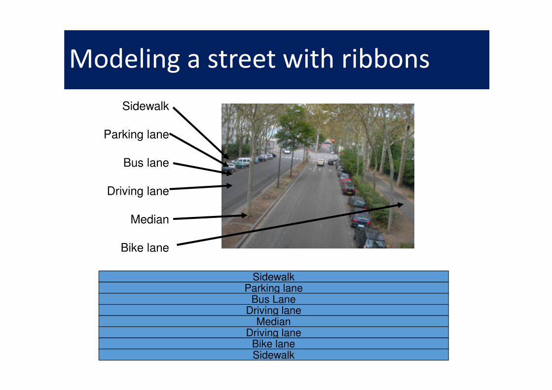
Sidewalk
Parking lane
Bus lane
Driving lane
Median
Bike lane
Modeling a street with ribbons
SidewalkParking lane
Bus LaneDriving lane
MedianDriving lane
Bike laneSidewalk

General Process
Smaller
and smaller
scale
Smaller
scale
Some
scale
Area
Point
Void
Ribbon
Line
Void

Final Remarks Concerning Geographic Objects
• GO ≡ O1, O2,… On: n ∈N.
• Oi ≡ (GeoIDi, G-Typei, Topoi, Geomi, Ω-Type, (Attribute, Value)*)
• G-Type ∈ Point, Line, Area, Ribbon, Void, Null.
• Modifiers
• Crisp and Fuzzy for points, lines, ribbons and areas
• Oriented or Not_Oriented for lines and ribbons.

2.2 – Geographic relations
• Not only spatial relations (Egenhofer)
• Geographic relations can vary according to scale
• Ribbon relations

Egenhofer Relations
A B
Disjoint (A, B)
A B
Contains (A, B)
A
B
Inside (A, B)
A B
Overlaps (A, B)
A B
Touches (A, B)
A B
Equals (A, B)
A B
Covers (A, B)
B A
~Covers (A, B)

Ribbon relations
Side-to-side Edge-to-edge Merging

Examples
River
Barge lane
Pedestrian lane
Bike lane
Vegetation lane
(b) Along a river(a) A street decomposed into ribbons
Median
Car lanes
Emergency
lane
Verge/
Shoulder
SIDE_BY_SIDE (Platform, railways)SIDE_BY_SIDE (Bus_stop, Bus_lane)SIDE_BY_SIDE (Levee, River)SIDE_BY_SIDE (Towpath, River).
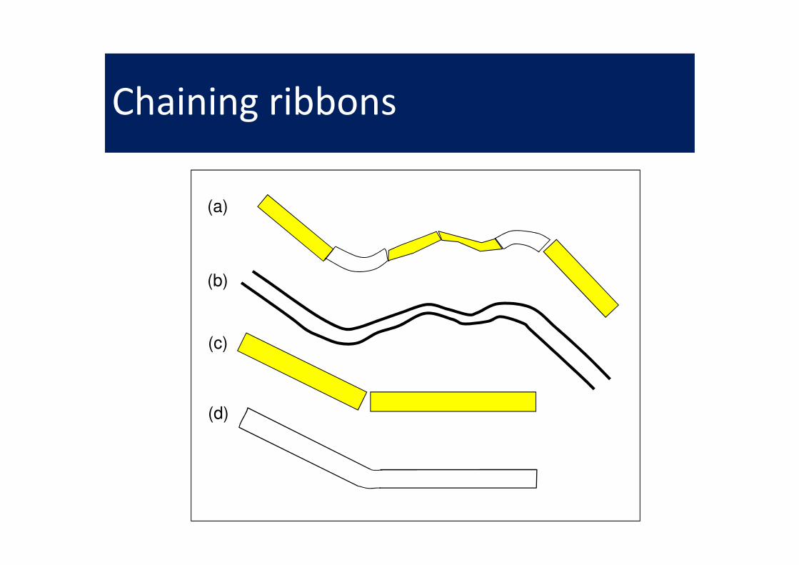
Chaining ribbons
(a)
(b)
(c)
(d)
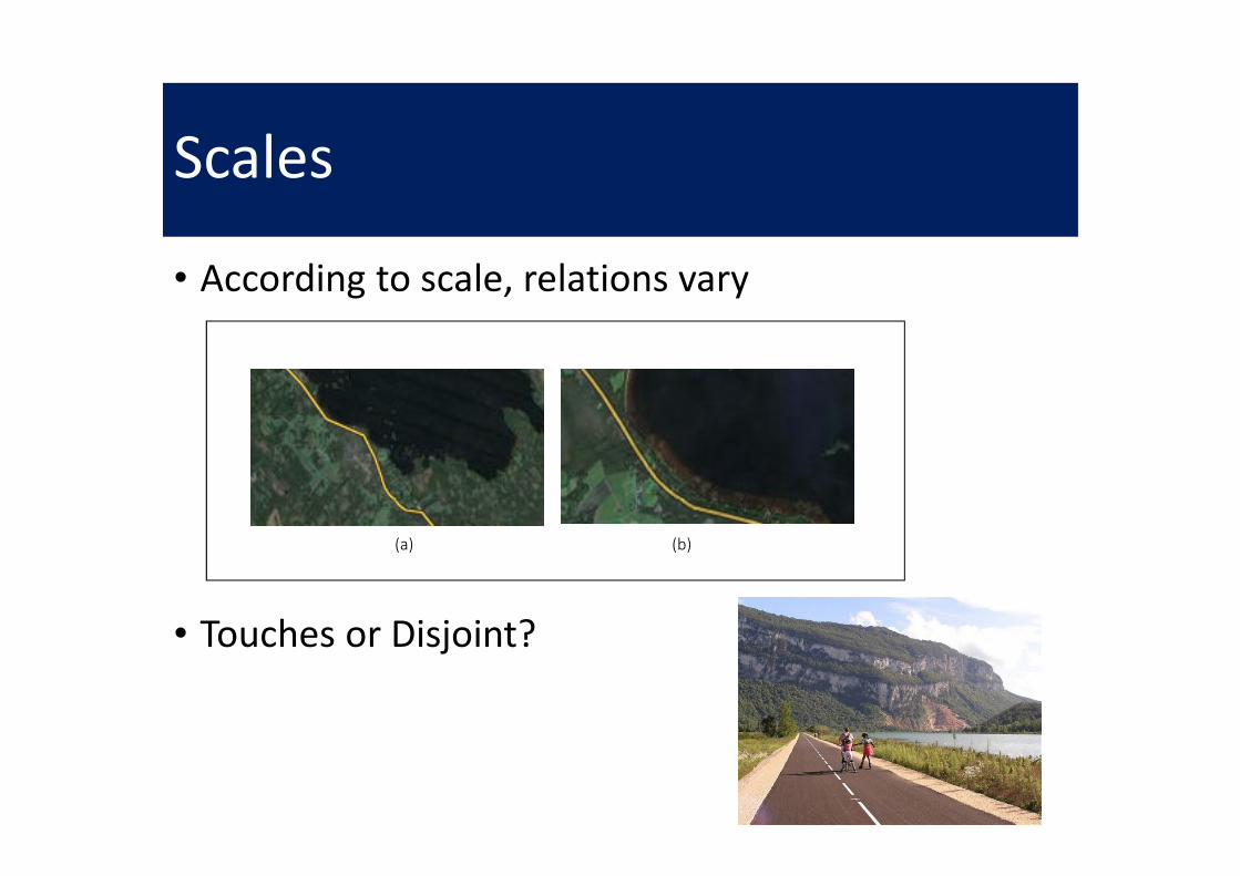
Scales
• According to scale, relations vary
• Touches or Disjoint?
(a) (b)
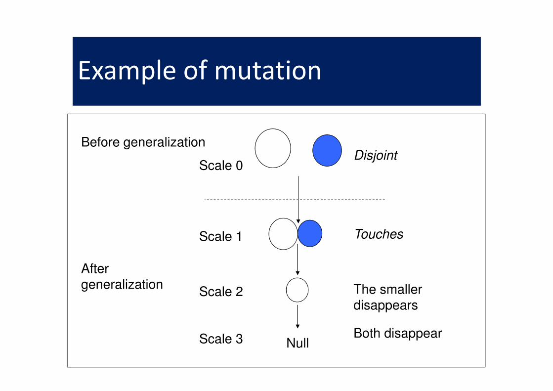
Example of mutation
Before generalizationDisjoint
Scale 0
After generalization
Null
Touches
The smallerdisappears
Scale 1
Scale 2
Scale 3 Both disappear

Disjoint-to-touches Rule
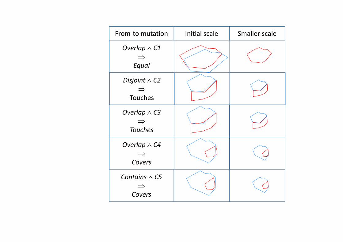
From-to mutation Initial scale Smaller scale
Overlap ∧ C1
⇒
Equal
Disjoint ∧ C2
⇒
Touches
Overlap ∧ C3
⇒
Touches
Overlap ∧ C4
⇒
Covers
Contains ∧ C5
⇒
Covers
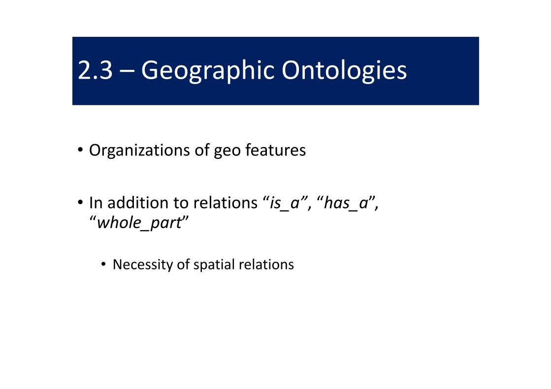
2.3 – Geographic Ontologies
• Organizations of geo features
• In addition to relations “is_a”, “has_a”, “whole_part”
• Necessity of spatial relations

Example of ambiguities

Geographic
Feature
Ecosystem
Landform
Coral Reef
Desert
Forest
Ocean
Shrubland
Tundra
Wetland
Bay
Beach
Cave
Channel
Cliff
Coastline
Fault
Glacier
Gorge
Icefield
Island
Lagoon
Lake
Mountain
Ford

Planet
Ocean
Sea
Continent
Lake
BayGulf
River
Contains Contains
Contains
Covers
Covers
Covers
Covers
Touches
Touches
Touches
Touches

2.4 – Gazetteers
• Placenames / toponyms
• Can change over time
• Multiple translations
• Different places can have same name
• Not only cities, but also streets and landmarks
Toponyms PlacesMany-to-many

Some problems regarding toponyms
• “Mississippi” can be the name of a river or of a state.
• The city, “Venice”, Italy, is also known as “Venezia”, “Venise”, “Venedig”, respectively, in Italian, French and German.
• The local name of the Greek city of “Athens” is “Αθήνα”; read [a’θina].
• “Istanbul” was known as “Byzantium” and “Constantinople” in the past.
• The modern city of Rome is much bigger than in Romulus’s time.
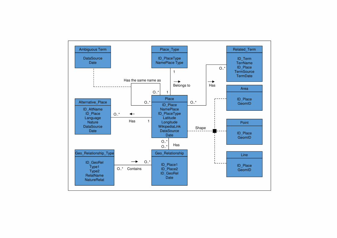
Ambiguous Term
DataSource
Date
Place_Type
ID_PlaceType
NamePlace Type
Related_Term
ID_Term
TerrName
ID_Place
TermSource
TermDate
Alternative_Place
ID_AltName
ID_Place
Language
Nature
DataSource
Date
Geo_Relationship_Type
ID_GeoRel
Type1
Type2
RelatName
NatureRelat
Geo_Relationship
ID_Place1
ID_Place2
ID_GeoRel
Date
Line
ID_Place
GeomID
Point
ID_Place
GeomID
ID_Place
GeomID
Area
Has
O..*
1
Contains
O..*
O..*
O..*
O..*Has
1
1
Belongs to Has
O..*
O..*
Shape
ID_Place
NamePlace
ID_PlaceType
Latitude
Longitude
WikipediaLink
DataSource
Date
Place
Has the same name as
O..*
O..*

2.5 – Geographic Rules
• in the United Kingdom, we drive on the left;
• in Canada, the majority of the population lives along the border with the United States;
• each capital city has an international airport nearby;
• between the two capital cities, in general, there are direct flights;
• in the Northern Hemisphere, the more you are going to the north, the colder (but locally this is not always true).
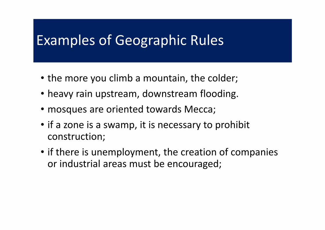
Examples of Geographic Rules
• the more you climb a mountain, the colder;
• heavy rain upstream, downstream flooding.
• mosques are oriented towards Mecca;
• if a zone is a swamp, it is necessary to prohibit construction;
• if there is unemployment, the creation of companies or industrial areas must be encouraged;

Decision trees, tables and maps
http://wikitravel.org/en/Electrical_systems

Different Types of Geographic Rules
• Applicative rules
• Urban and Environmental Planning
• Transportation
• Tourism, etc
• Generic rules (to ensure reasoning robustness)
• Quality control
• Independence from data acquisition devices
• Taking human languages and reasoning into account
• Variation according scales (mutation of shapes, relations, etc.)

Tobacco shop rule in France
Tobacconist
Where it is forbidden
to open a new
tobacco shop
Where it is authorized

Zone Determination

Urban Planning Rules
• Rule 1: If a zone is a marsh or floodplain then prohibit construction.
• Rule 2: If there is unemployment then support the creation of businesses and/or create industrial zones.
• Rule 3: If a plot is adjacent to an airport then limit the height of the building.
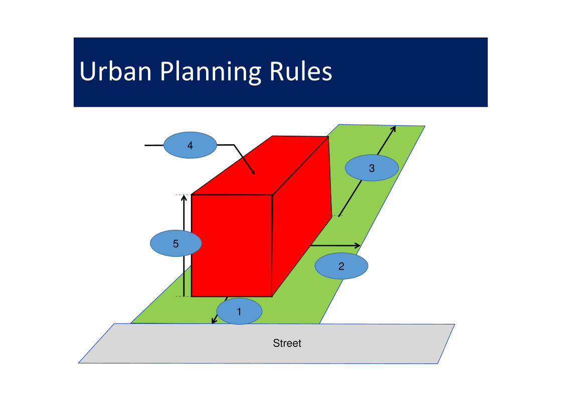
Urban Planning Rules
Street
1
5
3
4
2

Encoding

Naïve relation between places and rules
Rules Places
Many-to-many
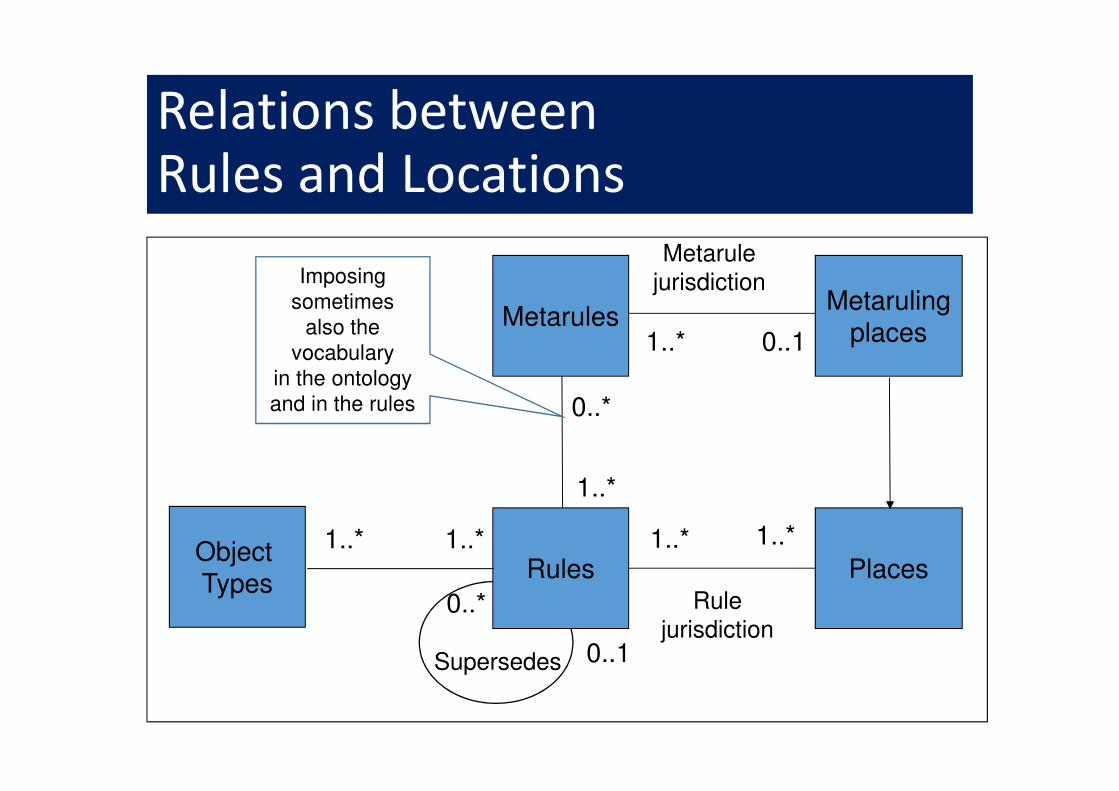
Relations between Rules and Locations
Rules Places1..*
Supersedes
1..*
0..1
0..*
Metarules
0..*
1..*
Metarulingplaces
Imposing
sometimes
also the
vocabulary
in the ontology
and in the rules
Rule
jurisdiction
Metarule
jurisdiction
1..* 0..1
Object Types
1..* 1..*
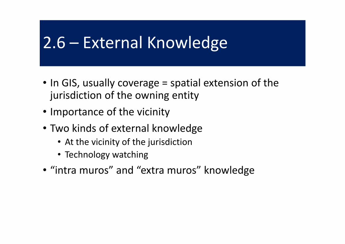
2.6 – External Knowledge
• In GIS, usually coverage = spatial extension of the jurisdiction of the owning entity
• Importance of the vicinity
• Two kinds of external knowledge
• At the vicinity of the jurisdiction
• Technology watching
• “intra muros” and “extra muros” knowledge

External Knowledge
KK
K
K K
K K
KK
K
K K
K
K
KK
K
A CityInternal
Knowledge
External
Neighboring
Knowledge
External
Outside
Knowledge

3 – Conclusions (1/2)
• 80 % of data in the world have some geographic base
• Only a rapid presentation of geographic knowledge in urban planning
• Territorial intelligence more complex than business intelligence
• Many additional aspects must be developed