Embed Size (px)
Citation preview
Geographic Information Geographic Information Systems (GIS)Systems (GIS)
Nick HankersonNick Hankerson
Danielle WittDanielle Witt
Amy YardleyAmy Yardley
April 18, 2007April 18, 2007

What is GIS?What is GIS?
A system for capturing, storing, A system for capturing, storing, analyzing and managing data and analyzing and managing data and associated attributes which are associated attributes which are spatially referenced to the earth. spatially referenced to the earth. (wikipedia.com)(wikipedia.com)
Spatial DataSpatial Data
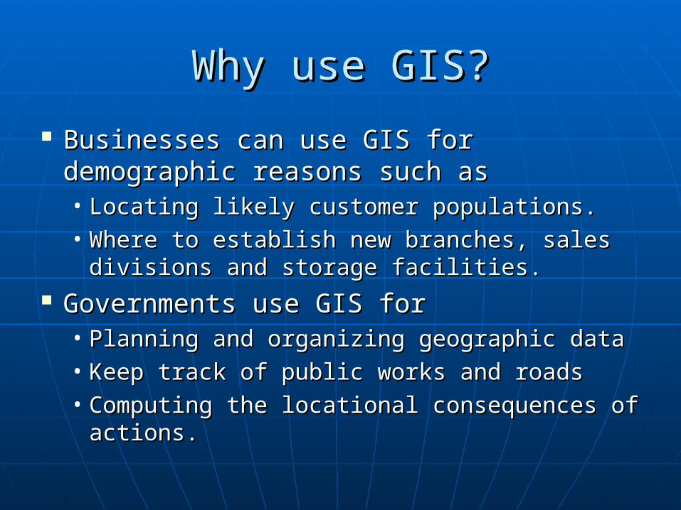
Why use GIS?Why use GIS?
Businesses can use GIS for demographic Businesses can use GIS for demographic reasons such asreasons such as• Locating likely customer populations.Locating likely customer populations.• Where to establish new branches, sales Where to establish new branches, sales
divisions and storage facilities.divisions and storage facilities. Governments use GIS forGovernments use GIS for
• Planning and organizing geographic dataPlanning and organizing geographic data• Keep track of public works and roadsKeep track of public works and roads• Computing the locational consequences of Computing the locational consequences of
actions.actions.
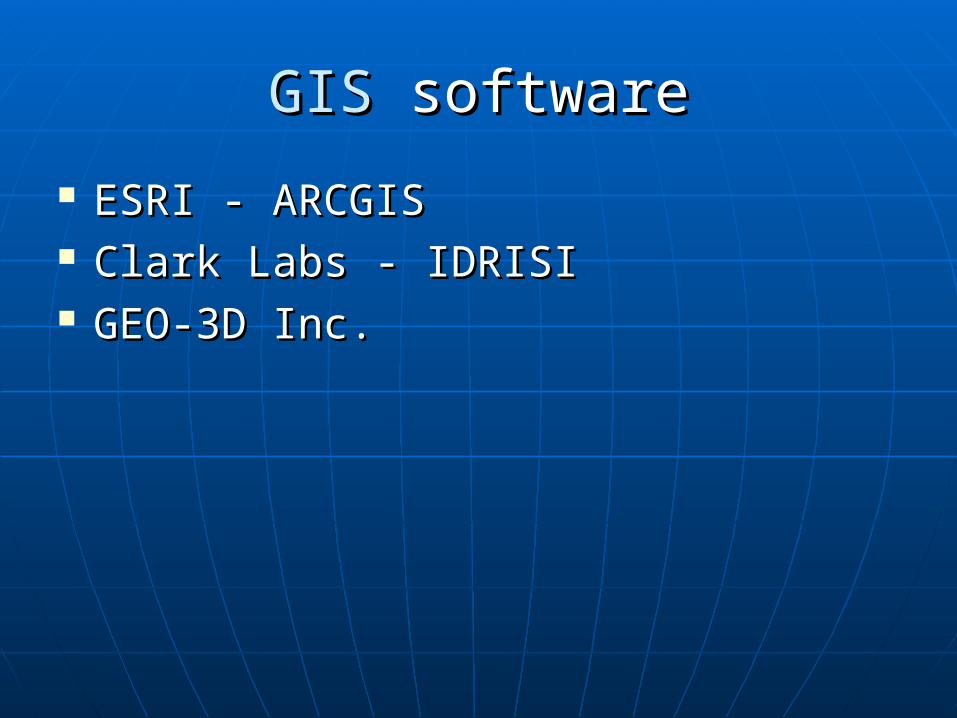
GIS GIS softwaresoftware
ESRI - ARCGISESRI - ARCGIS Clark Labs - IDRISIClark Labs - IDRISI GEO-3D Inc.GEO-3D Inc.
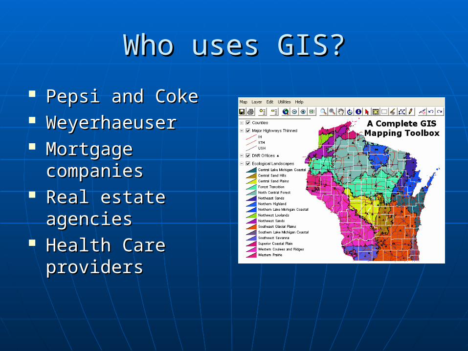
Who uses GIS?Who uses GIS?
Pepsi and CokePepsi and Coke WeyerhaeuserWeyerhaeuser Mortgage Mortgage
companiescompanies Real estate Real estate
agenciesagencies Health Care Health Care
providersproviders

The Technology Behind GISThe Technology Behind GIS
2D images2D images Vector – GIS application that uses Vector – GIS application that uses
points to store and plot lines and points to store and plot lines and polygons for infinite precision of polygons for infinite precision of geographic areas.geographic areas.
Raster – GIS application that uses Raster – GIS application that uses pixels to store andpixels to store and plot geographic plot geographic areas. areas.
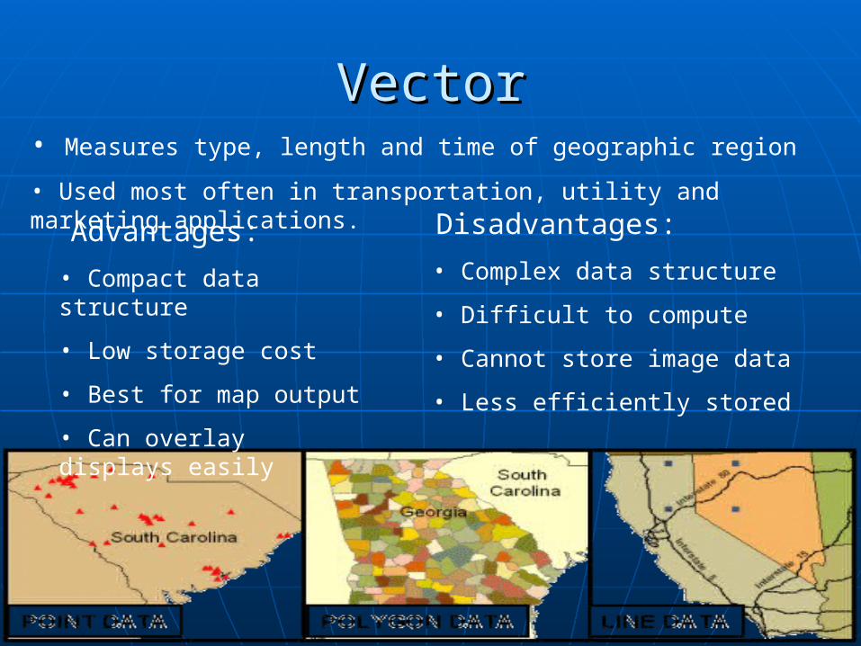
VectorVector
Advantages:
• Compact data structure
• Low storage cost
• Best for map output
• Can overlay displays easily
Disadvantages:
• Complex data structure
• Difficult to compute
• Cannot store image data
• Less efficiently stored
• Measures type, length and time of geographic region
• Used most often in transportation, utility and marketing applications.
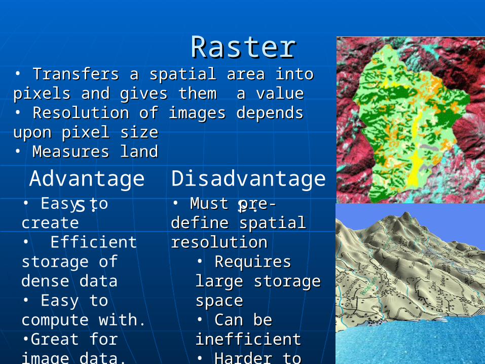
RasterRaster• Transfers a spatial area into pixels and Transfers a spatial area into pixels and gives them a valuegives them a value• Resolution of images depends upon pixel Resolution of images depends upon pixel sizesize• Measures landMeasures land
Advantages: Disadvantages:• Easy to create• Efficient storage of dense data• Easy to compute with.•Great for image data.
• Must pre-define Must pre-define spatial resolutionspatial resolution
• Requires large Requires large storage spacestorage space• Can be inefficientCan be inefficient• Harder to overlay Harder to overlay •Poor with linear Poor with linear featuresfeatures
Some ExamplesSome Examples
Most GIS systemsMost GIS systems support both support both vector and raster systems but not vector and raster systems but not simultaneously.simultaneously.
Market leadersMarket leaders• ArcGIS ArcGIS • IDRISIIDRISI• 3D Intergraph3D Intergraph
SourcesSources http://rwsmaps.griffel.se/Guadeloupe3D(RasterMahttp://rwsmaps.griffel.se/Guadeloupe3D(RasterMa
p).jpgp).jpg http://http://www.esri.com/index.htmlwww.esri.com/index.html http://http://www.forestpal.com/fgis.htmlwww.forestpal.com/fgis.html http://www.gisjobs.com/resources.htmlhttp://www.gisjobs.com/resources.html http://www.knowledgebank.irri.org/sam/SAM/http://www.knowledgebank.irri.org/sam/SAM/
images/SAM2_a12/Raster%20map.jpgimages/SAM2_a12/Raster%20map.jpg http://www.vcrlter.virginia.edu/~jhp7e/advgis/http://www.vcrlter.virginia.edu/~jhp7e/advgis/
local/lectures/rastervsvector05.pdf?meid=51 local/lectures/rastervsvector05.pdf?meid=51 www.GIS.comwww.GIS.com www.Idrisi.cawww.Idrisi.ca// www.wikipedia.comwww.wikipedia.com