Embed Size (px)
Citation preview
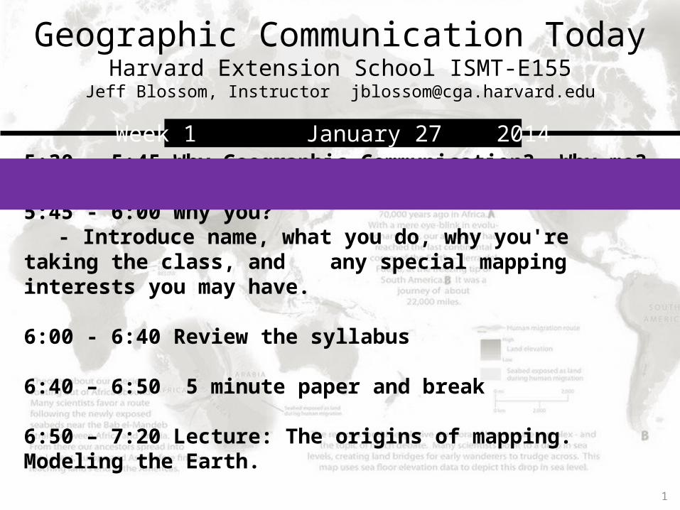
Geographic Communication TodayHarvard Extension School ISMT-E155
Jeff Blossom, Instructor [email protected]
5:30 - 5:45 Why Geographic Communication? Why me?
5:45 - 6:00 Why you?- Introduce name, what you do, why you're taking the class, and any special mapping interests you may have.
6:00 - 6:40 Review the syllabus
6:40 – 6:50 5 minute paper and break
6:50 – 7:20 Lecture: The origins of mapping. Modeling the Earth.
1
Week 1 January 27 2014

Geographic:geo – “the earth”graphos – “to write”
Geography – To describe or write about the Earth.
Communication – a process whereby meaning is shared between two living organisms.
2
Why “Geographic Communication”?
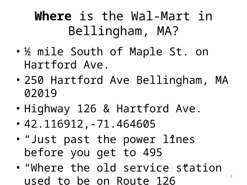
Where is the Wal-Mart in Bellingham, MA?
• ½ mile South of Maple St. on Hartford Ave.• 250 Hartford Ave Bellingham, MA 02019• Highway 126 & Hartford Ave.• 42.116912,-71.464605• “Just past the power lines before you get to
495”• “Where the old service station used to be on
Route 126”
3

Where is the Wal-Mart in Bellingham, MA?
4
Maps are the means by which geographic information is communicated visually.
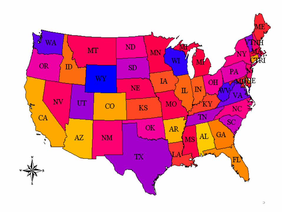
5

6
Montevideo, Uruguay-34.86,-56.17
7

8

9

Map of India (general reference map) Population density map (thematic map)darker color = higher population density
10

11
12

13

14
15
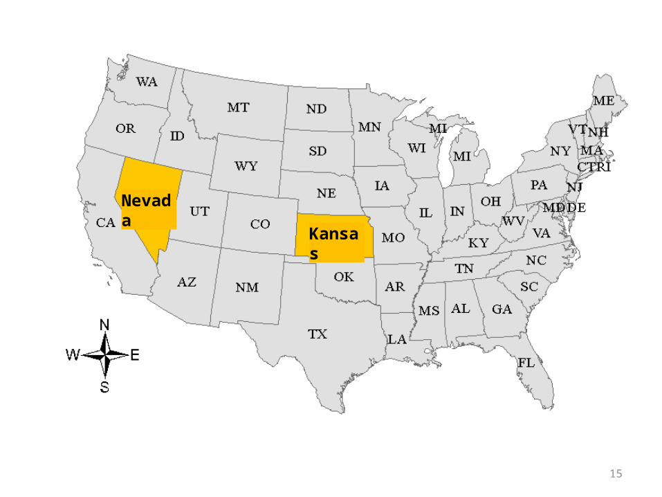
Nevada
Kansas

16
Knowing WHERE is important

Geographic Communication TodayHarvard Extension School ISMT-E155
Jeff Blossom, Instructor [email protected]
5:30 - 5:45 Why Geographic Communication? Why me?
5:45 - 6:00 Why you?- Introduce name, what you do, why you're taking the class, and
any special mapping interests you may have.
6:00 - 6:40 Review the syllabus
6:40 – 6:50 5 minute paper and break
6:50 – 7:20 Lecture: The origins of mapping. Modeling the Earth.
17
Week 1 January 27 2014
18
Introductions
Teaching assistant: Stacy Bogan [email protected]
Why you?- Introduce name- what you do- why you're taking the class- special mapping interests you may have

Geographic Communication TodayHarvard Extension School ISMT-E155
Jeff Blossom, Instructor [email protected]
5:30 - 5:45 Why Geographic Communication? Why me?
5:45 - 6:00 Why you?- Introduce name, what you do, why you're taking the class, and
any special mapping interests you may have.
6:00 - 6:40 Review the syllabus (handout)
6:40 – 6:50 5 minute paper and break
6:50 – 7:20 Lecture: The origins of mapping. Modeling the Earth.
19
Week 1 January 27 2014

Lab assignment requirements• Answer questions in a Word or text file.• Export maps in PDF or PNG format.• Map data into KML format.• Upload the Word, PDF, and KML files to the course
website drop box• If having problems with the Dropbox, submitting labs
via email is fine.• Labe are due 9 days after assignment (the following
Friday at midnight)• Need clarification or having trouble? Email anytime,
come to office hours before and after class.

21
What you will need for this class• An 8 GB USB flash drive • Access to a PC with internet connection and installation privileges
• At least 5 hours a week commitment
Lecture slides will be available on the class
website, prior to class.

Geographic Communication TodayHarvard Extension School ISMT-E155
Jeff Blossom, Instructor [email protected]
5:30 - 5:45 Why Geographic Communication? Why me?
5:45 - 6:00 Why you?- Introduce name, what you do, why you're taking the class, and
any special mapping interests you may have.
6:00 - 6:40 Review the syllabus (handout)
6:40 – 6:50 5 minute paper and break
6:50 – 7:20 Lecture: The origins of mapping. Modeling the Earth.
22
Week 1 January 27 2014
Week 1 five minute paper<handout>

Geographic Communication TodayHarvard Extension School ISMT-E155
Jeff Blossom, Instructor [email protected]
5:30 - 5:45 Why Geographic Communication? Why me?
5:45 - 6:00 Why you?- Introduce name, what you do, why you're taking the class, and
any special mapping interests you may have.
6:00 - 6:40 Review the syllabus (handout)
6:40 – 6:50 5 minute paper and break
6:50 – 7:20 Lecture: The origins of mapping. Modeling the Earth.
24
Week 1 January 27 2014

The origins of mapping and modeling the Earth
A map is a visual representation of an area.
Nearly all maps depict something on Earth, and are thus geographic in nature.
25

3d map of space matter
26
Map of the human brain

16,500 BC - Star maps on cave walls (France)
~12,000 BC -Map engraved on a mammoth tusk (Ukraine)
27
The first map

The first maps - Babalonians
Babylonian world map preserved on a clay tablet.
~2300 BC
28

Mapping advancements – Ancient Greece
Aristotle (384-322 B.C.E.)Proved the Earth is round, evidenced by:• The lunar eclipse is always circular• Ships seem to sink as they move away from view and pass
the horizon• Some stars can be seen only from certain parts of the Earth.
These observations led to modeling the Earth as a sphere 29
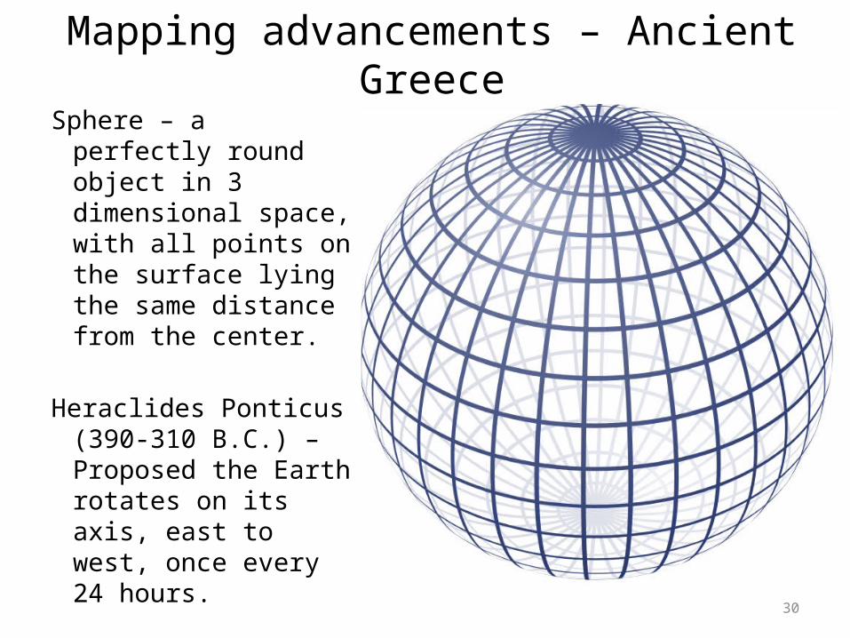
Sphere – a perfectly round object in 3 dimensional space, with all points on the surface lying the same distance from the center.
Heraclides Ponticus (390-310 B.C.) – Proposed the Earth rotates on its axis, east to west, once every 24 hours. 30
Mapping advancements – Ancient Greece

Spherical geometry: Great circles, hemisphere
31
Great circle - the circular intersection of a sphere and a plane which passes through the center point of the sphere.
• All lines of longitude and the Equator are great circles• Two hemisphere’s (half of a sphere) are created on either
side of the plane

Spherical geometry: Small circles
32
Small circle - the intersection of the sphere and a plane which does not pass through the center point of the sphere. All lines of latitude except for the Equator are small circles.
great circle (Equator)Lines of latitude
(small circles)

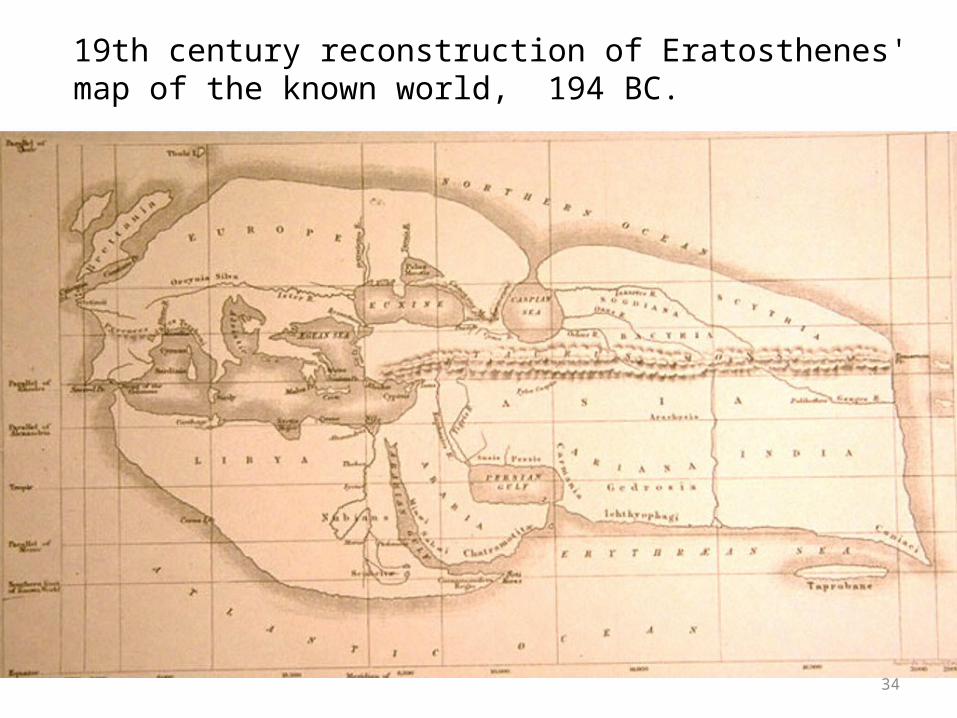
Eratosthenes (275–195 B.C.E.)• First used the word “Geography”• Approximated the circumference of the Earth.• Wrote “On the Measurement of the Earth”• Put forth that accurate mapping depends on
accurate linear measurement.• Proposed using meridians and parallels to
base accurate measurements on.
33
Mapping advancements – Ancient Greece
34
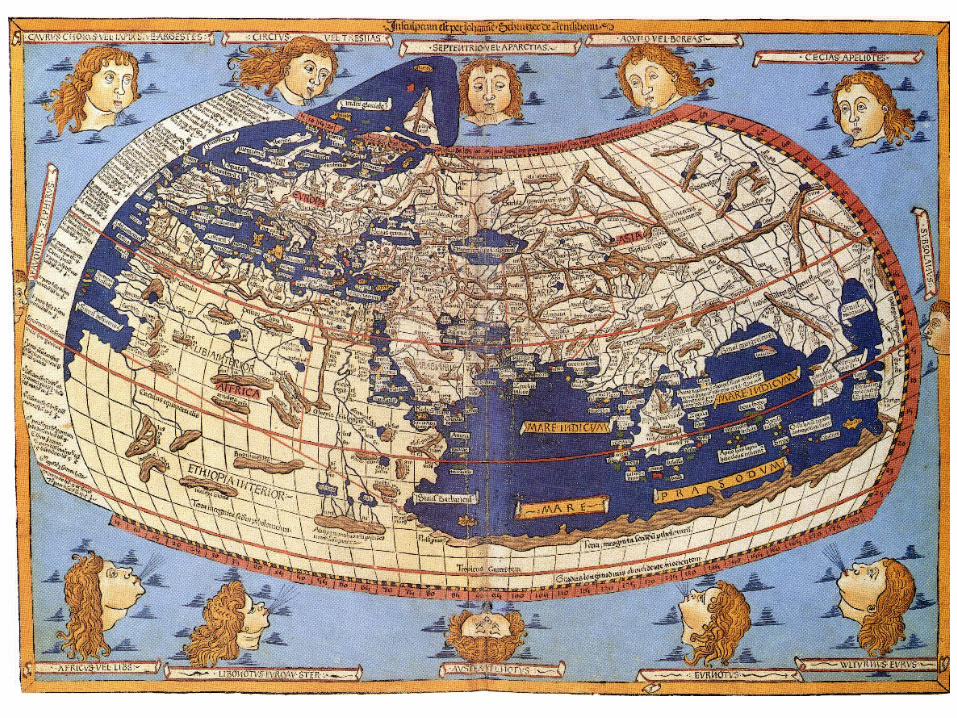
19th century reconstruction of Eratosthenes' map of the known world, 194 BC.

35
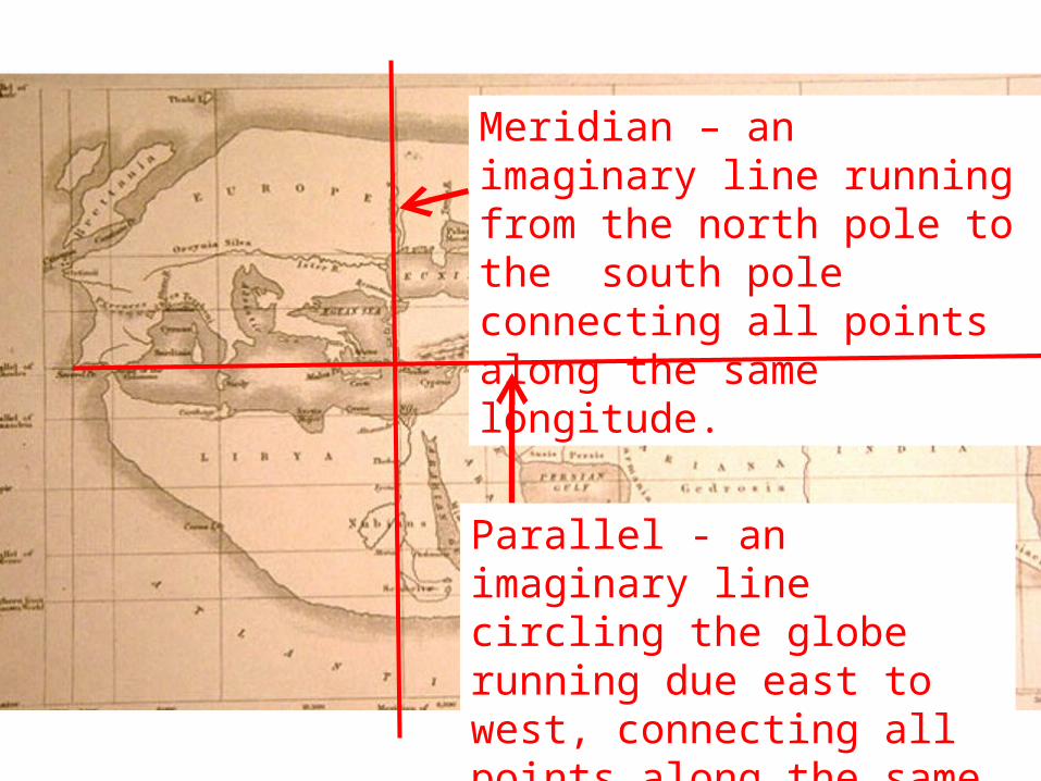
Meridian – an imaginary line running north to south.
Parallel - an imaginary line running east to west.
Allowed for the description of places on Earth in as referenced to parallels and meridians
36
Meridian – an imaginary line running from the north pole to the south pole connecting all points along the same longitude.
Parallel - an imaginary line circling the globe running due east to west, connecting all points along the same latitude angle.

Coordinate systems• Coordinate system – a system which uses one
or more numbers to uniquely determine the position of a point.
37
• Two axes (X and Y) on a horizontal plane
• Equally spaced linear units

38
0,0 (origin)
X axis
Y axis

Geographic coordinate system
• A geographic coordinate system is a coordinate system that enables every location on the Earth to be specified by a pair of numbers.
• Commonly uses values of longitude and latitude to represent horizontal positions on Earth.
For example -71.10, 42.37 (longitude, latitude) represents a point in Cambridge, MA.
39
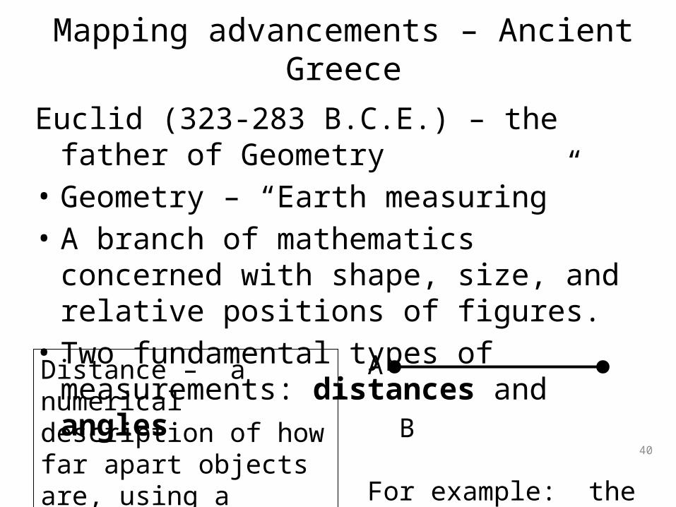
Euclid (323-283 B.C.E.) – the father of Geometry• Geometry – “Earth measuring”• A branch of mathematics concerned with
shape, size, and relative positions of figures.• Two fundamental types of measurements:
distances and angles
40
A B
For example: the distance from A to B equals 1 stadia
Distance – a numerical description of how far apart objects are, using a common reference unit.
Mapping advancements – Ancient Greece

Euclidian Geometry - Angle
41
ray 1
Angle – a figure formed by two rays sharing a common end point:
Ray – a line that is finite in one direction, but infinite in the other.
ray
2
endpoint
Euclidian Geometry - angle
42
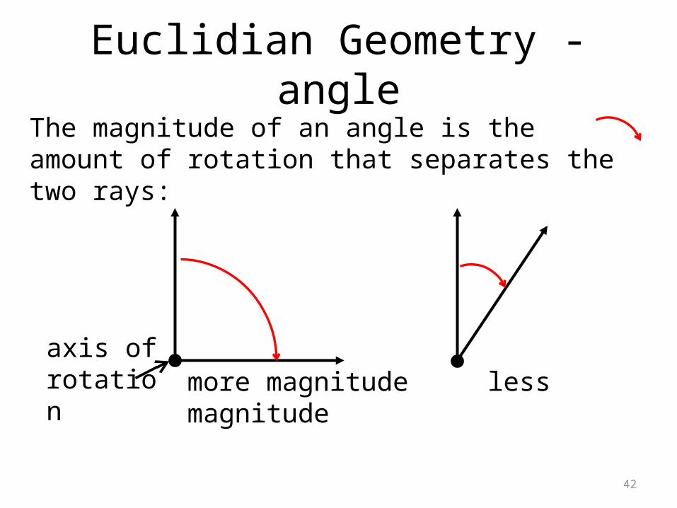
The magnitude of an angle is the amount of rotation that separates the two rays:
axis of rotation more magnitude less magnitude

Euclidian Geometry - degree
43
A degree, denoted by a small superscript circle (°), is 1/360 of a full circle. One full circle is 360°
90°
180°
270°
360°0°
90° angle
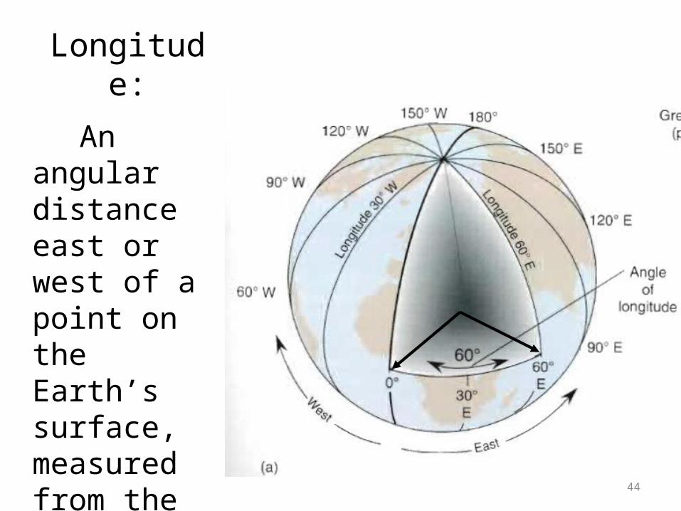
Longitude:
44
An angular distance east or west of a point on the Earth’s surface, measured from the center of the Earth.

Meridians of longitude
45

Measuring longitude
• Prime Meridian—The meridian of longitude 0 degrees, used as the origin for the measurement of longitude.
• Longitude at a point may be determined by calculating the time difference between that at its location and the time at the prime meridian.
• Since there are 24 hours in a day and 360 degrees in a circle, the sun moves across the sky at a rate of 15 degrees per hour (360°/24 hours = 15° per hour).
• So if local time (where a person is) is four hours ahead of time at the prime meridian, then that person is at 60° longitude (4 hours × 15° per hour = 60°).
46

Latitude:
An angular distance north or south of the Equator measured from the center of the Earth.
47

Latitudinal references• The north pole and south
pole mark the opposite positions on the axis around which the earth rotates.
• The Equator is a great circle located halfway between the poles, and is used as the origin reference for latitude.
• Polaris (the north star) is a located directly above the north pole, and is visible as a fixed position in the sky about which the Earth rotates.
48
Polaris
Equator
axis

Measuring latitude
49
Polaris
Horizon
Measure the angle from the horizon to Polaris (or Sigma Octantis in the Southern Hemisphere) using an astrolabe, cross staff, sextant, or other tool. This is your latitude.
•
45°
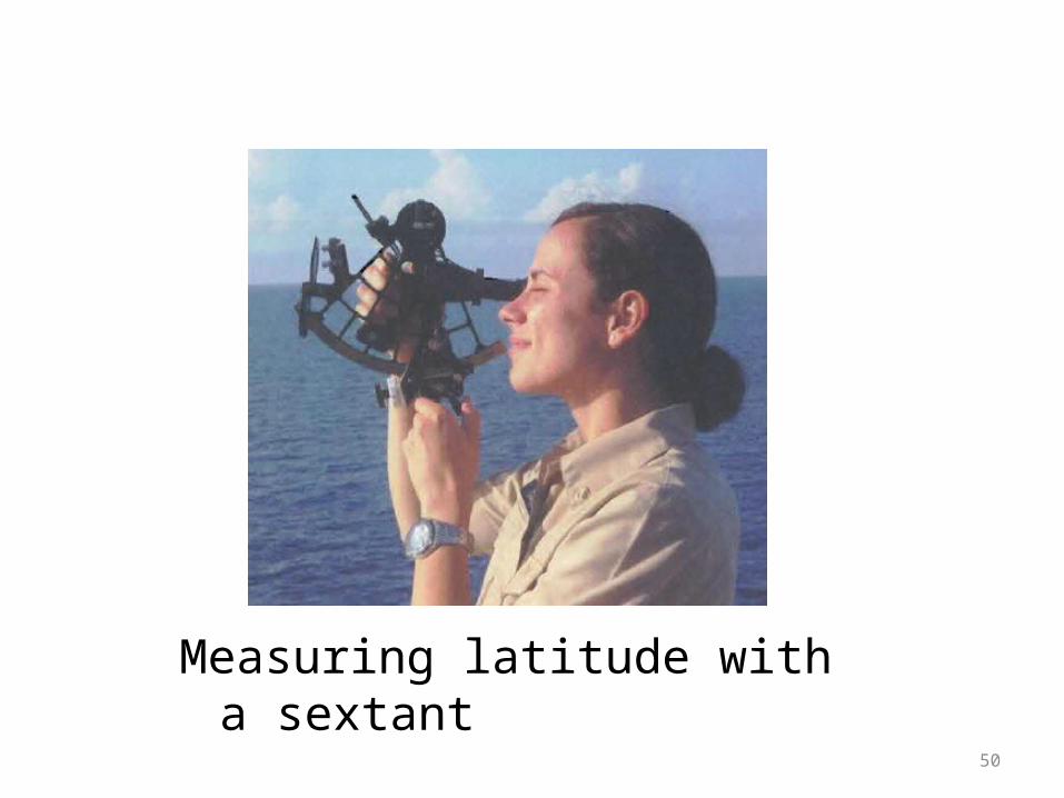
Measuring latitude with a sextant
50

Lines of Latitude
51
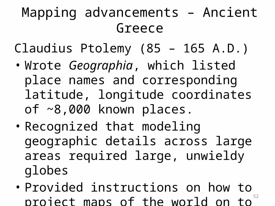
Claudius Ptolemy (85 – 165 A.D.)• Wrote Geographia, which listed place names
and corresponding latitude, longitude coordinates of ~8,000 known places.
• Recognized that modeling geographic details across large areas required large, unwieldy globes
• Provided instructions on how to project maps of the world on to paper.
52
Mapping advancements – Ancient Greece
53

• Gazetteer – “a geographical index, or dictionary….usually accompanied by maps”
Let’s look at one of the many modern day electronic gazetteers: maps.google.com
54
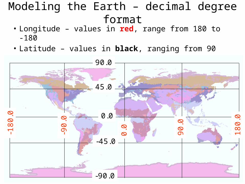
Modeling the Earth – decimal degree format• Longitude – values in red, range from 180 to -180• Latitude – values in black, ranging from 90 to -90
55
0.0
45.0
90.0
-90.0
-45.0
0.0 90.0
180.0
-90.0
-180.0

• 5th century BC – Geographic descriptions and placements of rivers, lakes, provincial characteristics.
• 4th century BC – Local maps in ink on wooden blocks
• 2nd century BC – Local maps on silk• Detailed descriptions of place-names and
administrative changes from the 1st century AD and onwards.
• Pei Xiu (224-271) – Outlines mapping principles, and pinpoints many locations with more precision.56
Mapping advancements – The Chinese

Surveying – the systematic collection of positional locations using distances and angles
from a known reference.
• Distance measured with a survey chain, ropes, rods – anything with a fixed distance that can be laid on the earth.
• Angles measured with astrolabe, compass, theodolite.
57Survey chain Greek astrolabe modern compass

Surveying
• Objects located using distance and angles are plotted on paper according to a known reference.
Mason-Dixon line – Important reference line for the United States, established in 1767.
58
End of lecture 1
Through mathematics we can model our earth
59
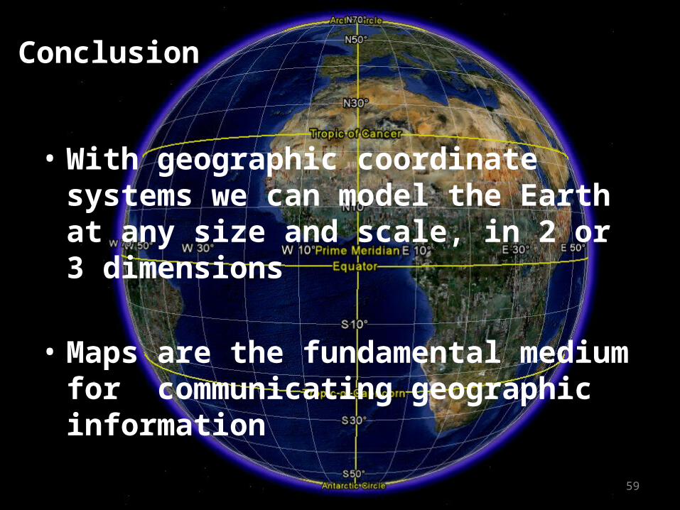
Conclusion
• With geographic coordinate systems we can model the Earth at any size and scale, in 2 or 3 dimensions
• Maps are the fundamental medium for communicating geographic information

And finally….• Assignment: Lab 1 “Using Online Maps”– Currently available on the class website, Week 1 page
• Download both GeoComm_Lab_1.pdf and GeoComm_Lab_1_AnswerSheet.docx
– Due on Wednesday, February 5th
• Next week: – Lecture: Georeferencing, geocoding, geography– Discussion: Map critique– Demo – QuantumGIS software