Embed Size (px)
Citation preview

GeoEvent Server: An IntroductionJosh Joyner
RJ Sunderman
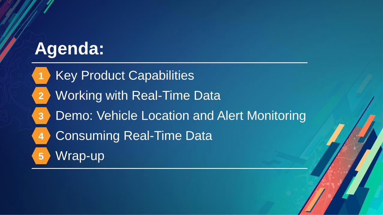
Agenda:
Key Product Capabilities
Working with Real-Time Data
Demo: Vehicle Location and Alert Monitoring
Consuming Real-Time Data
Wrap-up
1
2
3
4
5
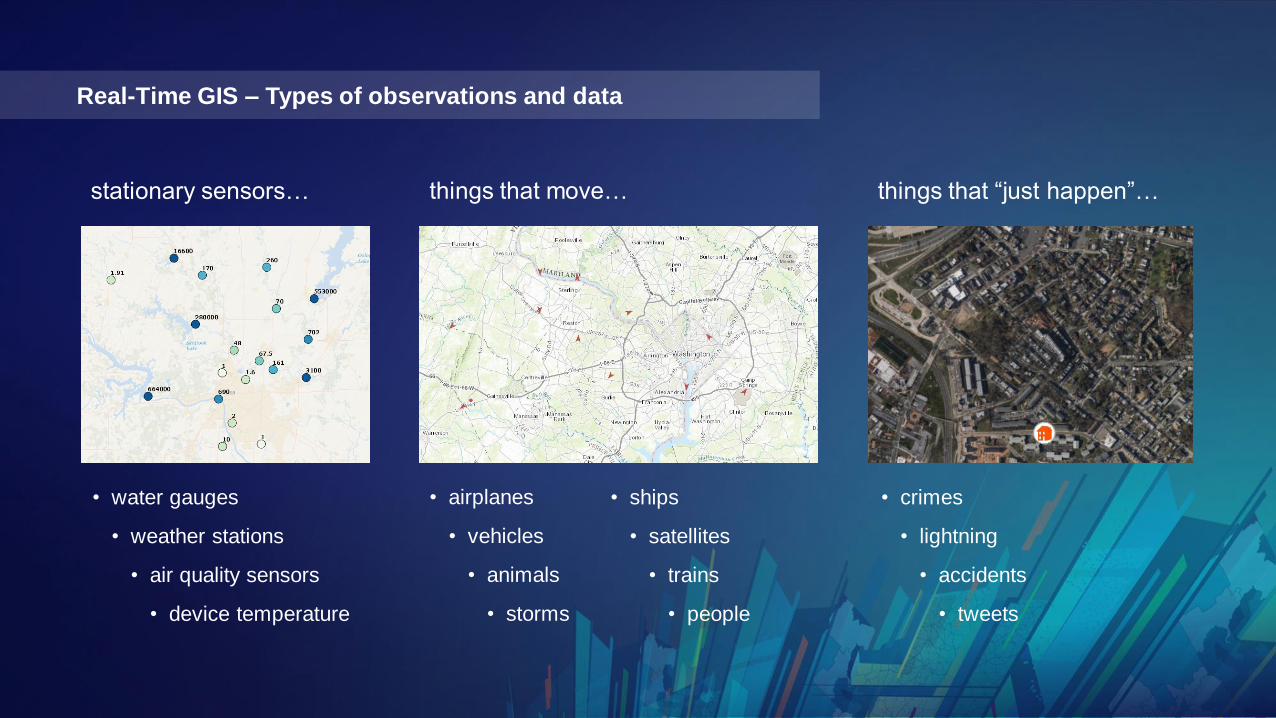
things that move… things that “just happen”…
• airplanes
• vehicles
• animals
• storms
• crimes
• lightning
• accidents
• tweets
Real-Time GIS – Types of observations and data
stationary sensors…
• water gauges
• weather stations
• air quality sensors
• device temperature
• ships
• satellites
• trains
• people

Bringing real-time and big data capabilities to your ArcGIS Enterprise
GeoEvent Server
server role
spatiotemporal big
data store
Vehicle Location❖ Ingest Data:
GeoEvent Server – Key Capability #1

Bringing real-time and big data capabilities to your ArcGIS Enterprise
GeoEvent Server
server role
spatiotemporal big
data store
Sensors and Instruments❖ Ingest Data:
GeoEvent Server – Key Capability #1
Bringing real-time and big data capabilities to your ArcGIS Enterprise
GeoEvent Server
server role
spatiotemporal big
data store
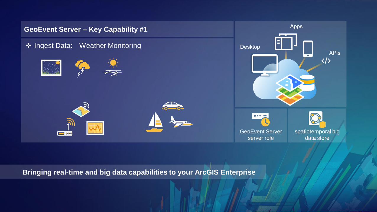
Weather Monitoring❖ Ingest Data:
GeoEvent Server – Key Capability #1

Bringing real-time and big data capabilities to your ArcGIS Enterprise
GeoEvent Server
server role
spatiotemporal big
data store
Public Safety Data Feeds❖ Ingest Data:
GeoEvent Server – Key Capability #1

Bringing real-time and big data capabilities to your ArcGIS Enterprise
GeoEvent Server
server role
spatiotemporal big
data store
Commercial, Industrial, Utilities❖ Ingest Data:
GeoEvent Server – Key Capability #1
Bringing real-time and big data capabilities to your ArcGIS Enterprise
GeoEvent Server
server role
spatiotemporal big
data store
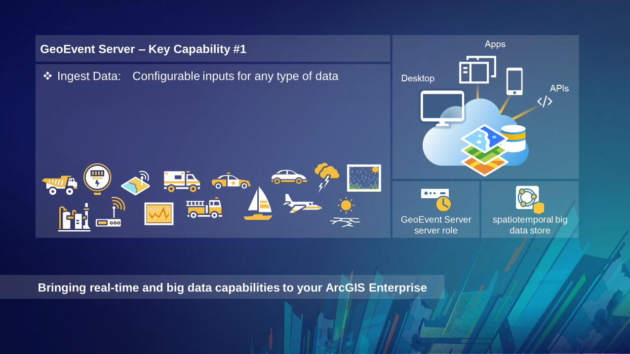
Configurable inputs for any type of data❖ Ingest Data:
GeoEvent Server – Key Capability #1

Bringing real-time and big data capabilities to your ArcGIS Enterprise
Filter:
Blue / Orange
▪ Identify event records with specified attribute values
❖ Apply real-time analytics: Filtering
GeoEvent Server – Key Capability #2
GeoEvent Server
server role
spatiotemporal big
data store

Bringing real-time and big data capabilities to your ArcGIS Enterprise
▪ Identify event records with specified attribute values
▪ Determine spatial relationships with established geofences
❖ Apply real-time analytics: Filtering
GeoEvent Server – Key Capability #2
geofence
outside
inside
outside
geofence
disjoint crosses
GeoEvent Server
server role
spatiotemporal big
data store

Bringing real-time and big data capabilities to your ArcGIS Enterprise
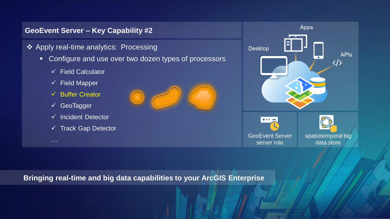
✓ Field Calculator
✓ Field Mapper
✓ Buffer Creator
✓ GeoTagger
✓ Incident Detector
✓ Track Gap Detector
…
GeoEvent Server – Key Capability #2
▪ Configure and use over two dozen types of processors
❖ Apply real-time analytics: Processing
GeoEvent Server
server role
spatiotemporal big
data store
Bringing real-time and big data capabilities to your ArcGIS Enterprise
GeoEvent Server – Key Capability #2
▪ Configure and use over two dozen types of processors
❖ Apply real-time analytics: Processing
GeoEvent Server
server role
spatiotemporal big
data store
✓ Field Calculator
✓ Field Mapper
✓ Buffer Creator
✓ GeoTagger
✓ Incident Detector
✓ Track Gap Detector
…

Bringing real-time and big data capabilities to your ArcGIS Enterprise
▪ Configurable outputs enable processed events to bestored in a traditional relational geodatabase
▪ When data is received at a high volume, high velocity,or is accumulated over time, a spatiotemporal big datastore is an available noSQL option for enterprise storage
❖ Store data as feature records in a geodatabase
GeoEvent Server – Key Capability #3
GeoEvent Server
server role
spatiotemporal big
data store

Bringing real-time and big data capabilities to your ArcGIS Enterprise
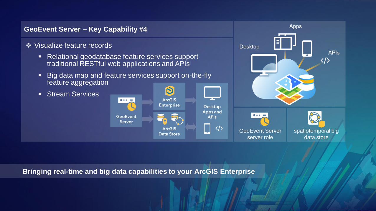
▪ Relational geodatabase feature services supporttraditional RESTful web applications and APIs
▪ Big data map and feature services support on-the-flyfeature aggregation
❖ Visualize feature records
GeoEvent Server – Key Capability #4
GeoEvent Server
server role
spatiotemporal big
data store
Bringing real-time and big data capabilities to your ArcGIS Enterprise
▪ Relational geodatabase feature services supporttraditional RESTful web applications and APIs
▪ Big data map and feature services support on-the-flyfeature aggregation
▪ Stream Services
❖ Visualize feature records
DesktopApps and
APIs
ArcGISData Store
ArcGISEnterprise
GeoEventServer
GeoEvent Server – Key Capability #4
GeoEvent Server
server role
spatiotemporal big
data store
Bringing real-time and big data capabilities to your ArcGIS Enterprise
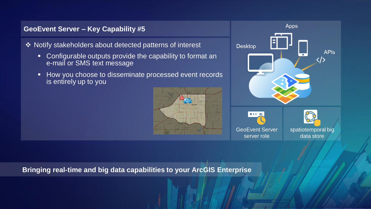
▪ Configurable outputs provide the capability to format ane-mail or SMS text message
▪ How you choose to disseminate processed event recordsis entirely up to you
❖ Notify stakeholders about detected patterns of interest
GeoEvent Server – Key Capability #5
!
GeoEvent Server
server role
spatiotemporal big
data store

Bringing real-time and big data capabilities to your ArcGIS Enterprise
GeoEvent Server – Key Capability #5
❖ Adjust the behavior of things in our environmentthrough actuation
IoT
Amazon Azure
GeoEvent Server
server role
spatiotemporal big
data store

GeoEvent Server
server role
spatiotemporal big
data store

GeoEvent Serverserver role
spatiotemporal bigdata store
GeoEvent Serverserver role
spatiotemporal bigdata store
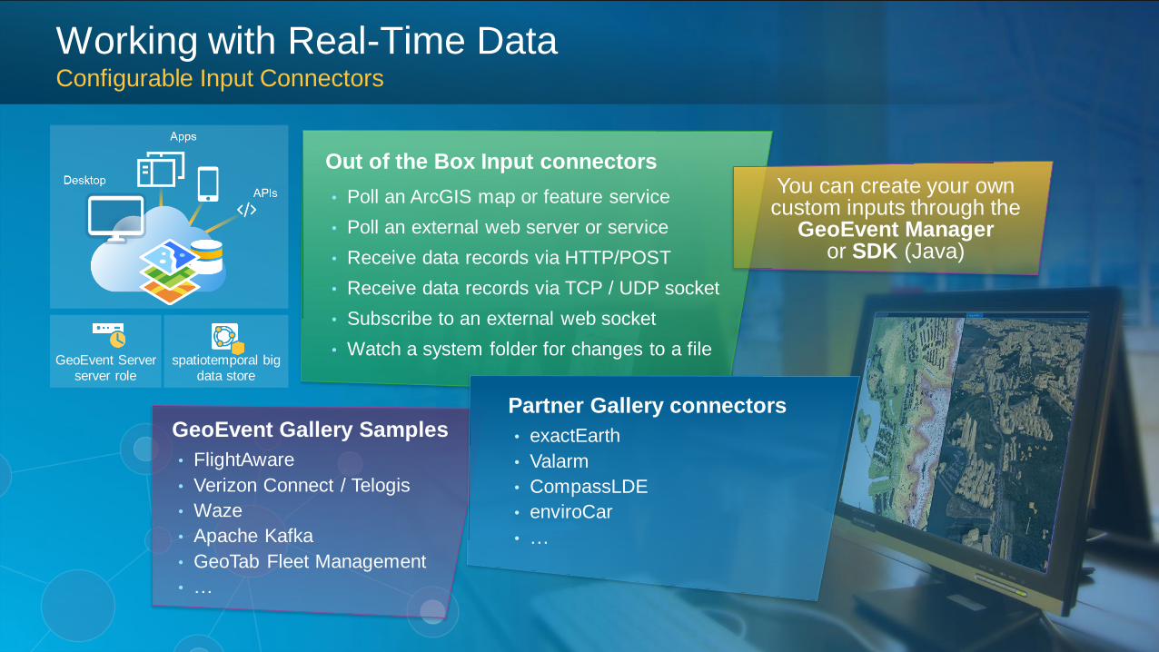
Out of the Box Input connectors
• Poll an ArcGIS map or feature service
• Poll an external web server or service
• Receive data records via HTTP/POST
• Receive data records via TCP / UDP socket
• Subscribe to an external web socket
• Watch a system folder for changes to a file
GeoEvent Gallery Samples
• FlightAware
• Verizon Connect / Telogis
• Waze
• Apache Kafka
• GeoTab Fleet Management
• …
Partner Gallery connectors
• exactEarth
• Valarm
• CompassLDE
• enviroCar
• …
spatiotemporal bigdata store
GeoEvent Serverserver role
You can create your owncustom inputs through the
GeoEvent Manageror SDK (Java)
Working with Real-Time DataConfigurable Input Connectors

Out of the Box Output Connectors
• Add or Update a feature
• Add or Update a spatiotemporal big data store
• Send Features to a Stream Service
• Push data records to an external website
• Push data records to an external websocket
• Send data records via TCP/UDP socket
• Send a text, email, or instant message
• Write a local file (CSV, JSON, GeoJSON)You can create your owncustom outputs through the GeoEvent Manager
or SDK (Java)
spatiotemporal bigdata store
GeoEvent Serverserver role
Gallery Components
• Amazon & Azure IoT
• Hadoop
• Kafka
• MQTT
• ActiveMQ
• RabbitMQ
• MongoDB
• …
Working with Real-Time DataConfigurable Output Connectors

spatiotemporal bigdata store
GeoEvent Serverserver role
Out of the Box Output Geoprocessing
• Attribute & Spatial Filtering
• Buffer Creator
• Convex Hull Creator
• Difference Creator
• Envelope Creator
• Field Calculator
• Field Enricher
• Field Mapper
• Field Reducer
• Geotagger
• Incident Detector
• Intersector
• Projector
• Simplifier
• Symmetric Difference
• Track Gap Detector
• Union Creator
Sample Add-on Processors
• Add XYZ
• Event Volume Control
• Motion Calculator
• Range Fan
• Reverse Geocoder
• Service Area Creator
• Track Idle Detector
• …You can create your owncustom processors through
the GeoEvent Manageror SDK (Java)
Working with Real-Time DataConfigurable Filters & Processors

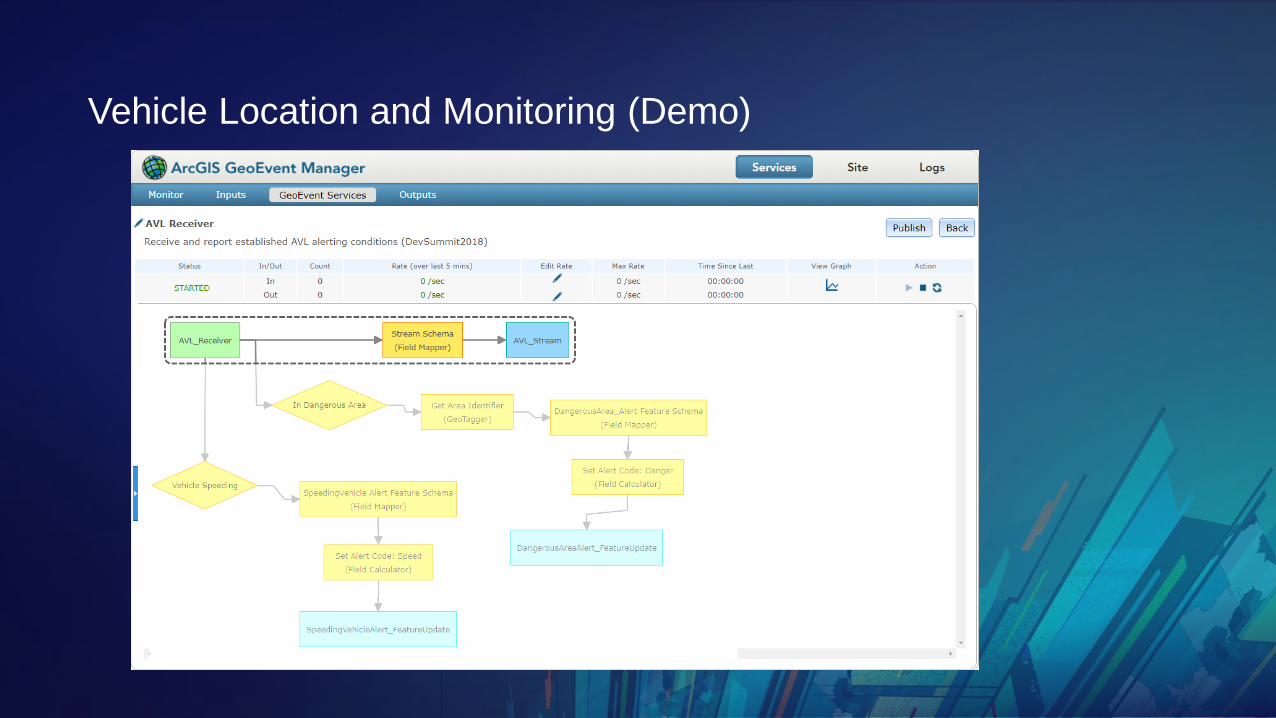
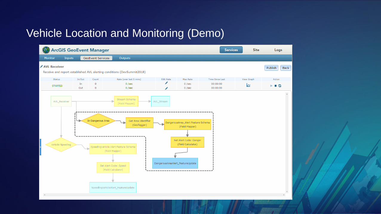
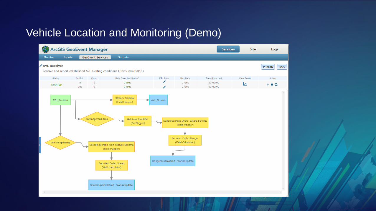
Using GeoEvent Server to build a
common operational display
Vehicle Location and
Alert Monitoring

Vehicle Location and Monitoring (Demo)Vehicle Location and Monitoring (Demo)
Vehicle Location and Monitoring (Demo)Vehicle Location and Monitoring (Demo)
Vehicle Location and Monitoring (Demo)Vehicle Location and Monitoring (Demo)

Vehicle Location and Monitoring (Demo)Vehicle Location and Monitoring (Demo)
Vehicle Location and Monitoring (Demo)Vehicle Location and Monitoring (Demo)
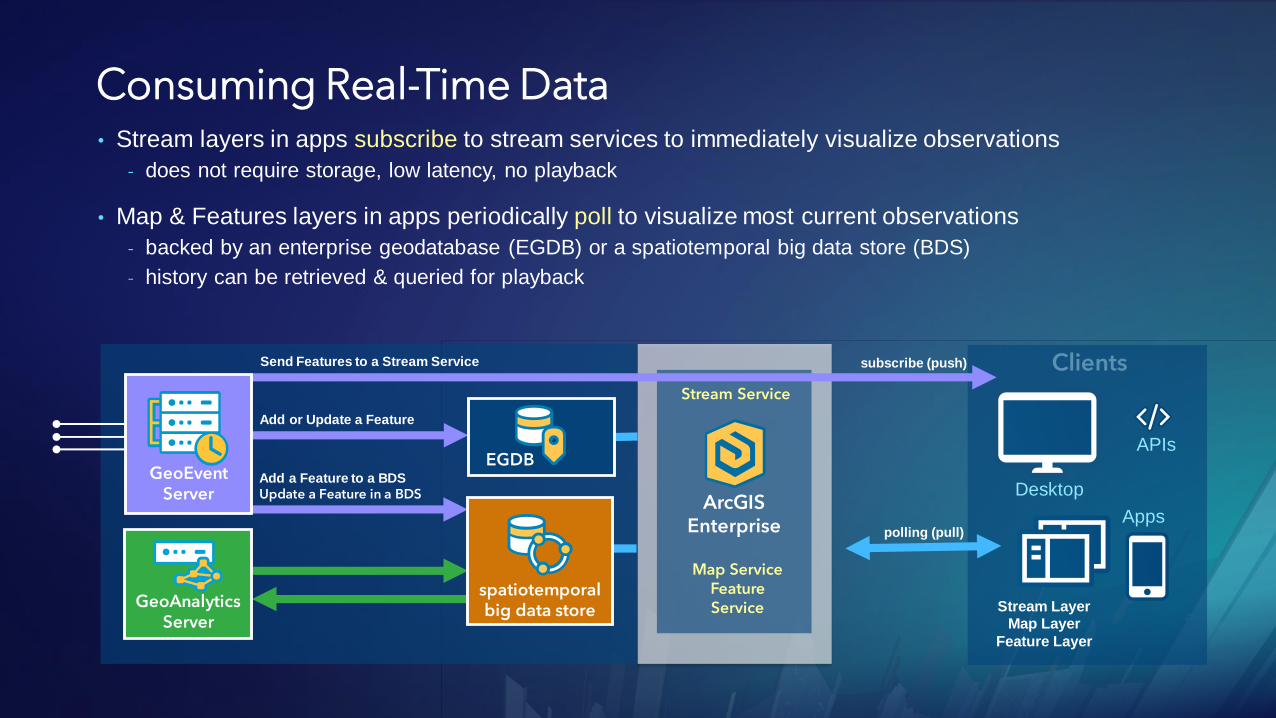
Consuming Real-Time Data
Stream LayerMap Layer
Feature Layer
• Stream layers in apps subscribe to stream services to immediately visualize observations
- does not require storage, low latency, no playback
• Map & Features layers in apps periodically poll to visualize most current observations
- backed by an enterprise geodatabase (EGDB) or a spatiotemporal big data store (BDS)
- history can be retrieved & queried for playback
ArcGISEnterprise
Stream Service
Send Features to a Stream Service subscribe (push)
polling (pull)
Map ServiceFeature ServiceGeoAnalytics
Server
Add a Feature to a BDS
Update a Feature in a BDS
spatiotemporalbig data store
Add or Update a Feature
EGDBGeoEvent
Server
Apps
Desktop
APIs

Apps
Desktop
APIs
ArcGISEnterprise
ArcGIS GeoEventServer
spatiotemporalbig data store
analytics storage
visualization
live & historic
aggregates & features
live features
stream services
ArcGIS GeoEvent Serversummary
ingestion
actuation
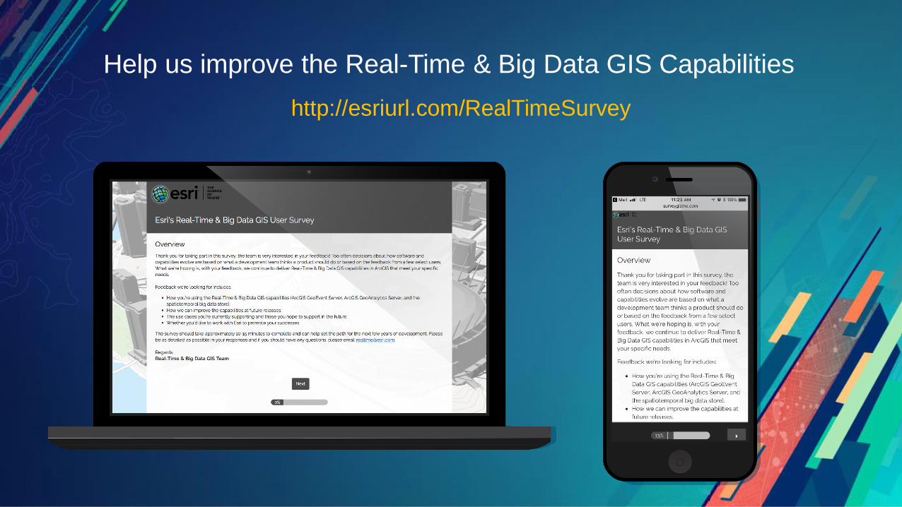
Help us improve the Real-Time & Big Data GIS Capabilities
http://esriurl.com/RealTimeSurvey
Questions / Feedback?
RJ Sunderman
ArcGIS GeoEvent ServerProduct Engineer, Esri
Josh Joyner
ArcGIS GeoEvent ServerProduct Manager