Embed Size (px)
Citation preview
Geodetics RTD Software
April 2004www.geodetics.com
Reference Station Networks using Geodetics' RTD Software

Geodetics, Inc. is a software company based in La Jolla, California. It specializes in high-precision,
real-time position and navigation solutions based on its proprietary Epoch-by-Epoch™ technology.
Geodetics and Thales Navigation have partnered to offer a network RTK solution.
About Geodetics
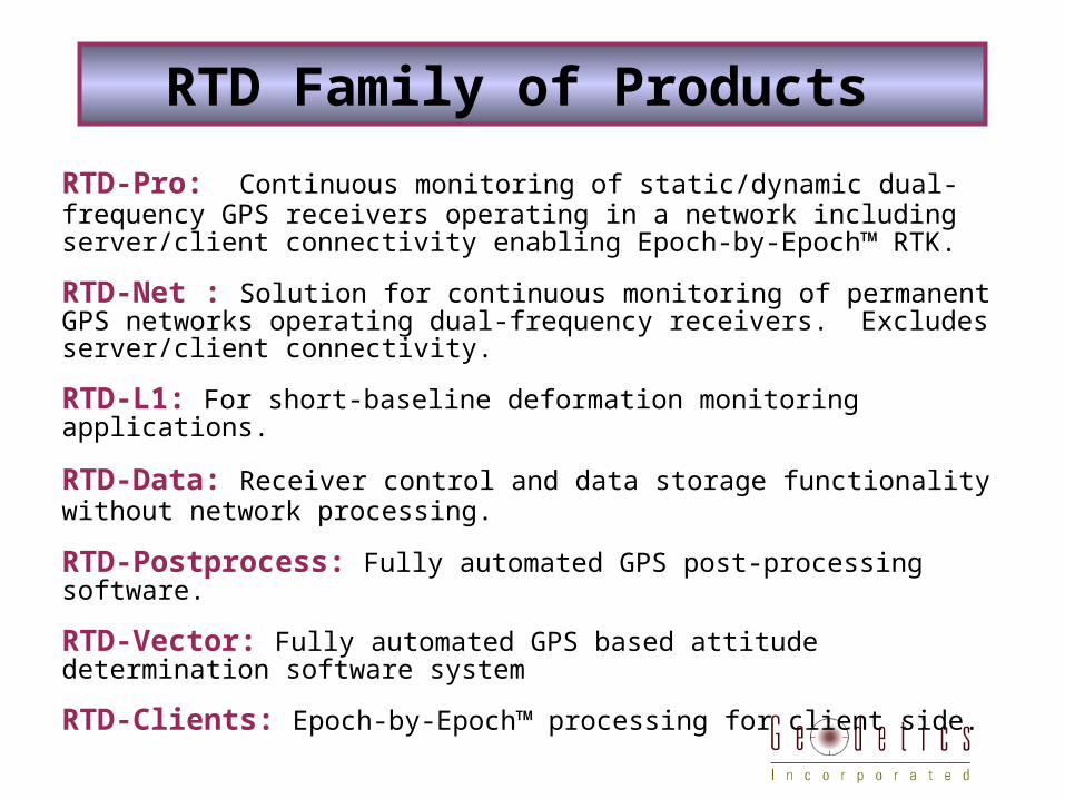
RTD Family of Products
RTD-Pro: Continuous monitoring of static/dynamic dual-frequency GPS receivers operating in a network including server/client connectivity enabling Epoch-by-Epoch™ RTK.
RTD-Net : Solution for continuous monitoring of permanent GPS networks operating dual-frequency receivers. Excludes server/client connectivity.
RTD-L1: For short-baseline deformation monitoring applications.
RTD-Data: Receiver control and data storage functionality without network processing.
RTD-Postprocess: Fully automated GPS post-processing software.
RTD-Vector: Fully automated GPS based attitude determination software system
RTD-Clients: Epoch-by-Epoch™ processing for client side.
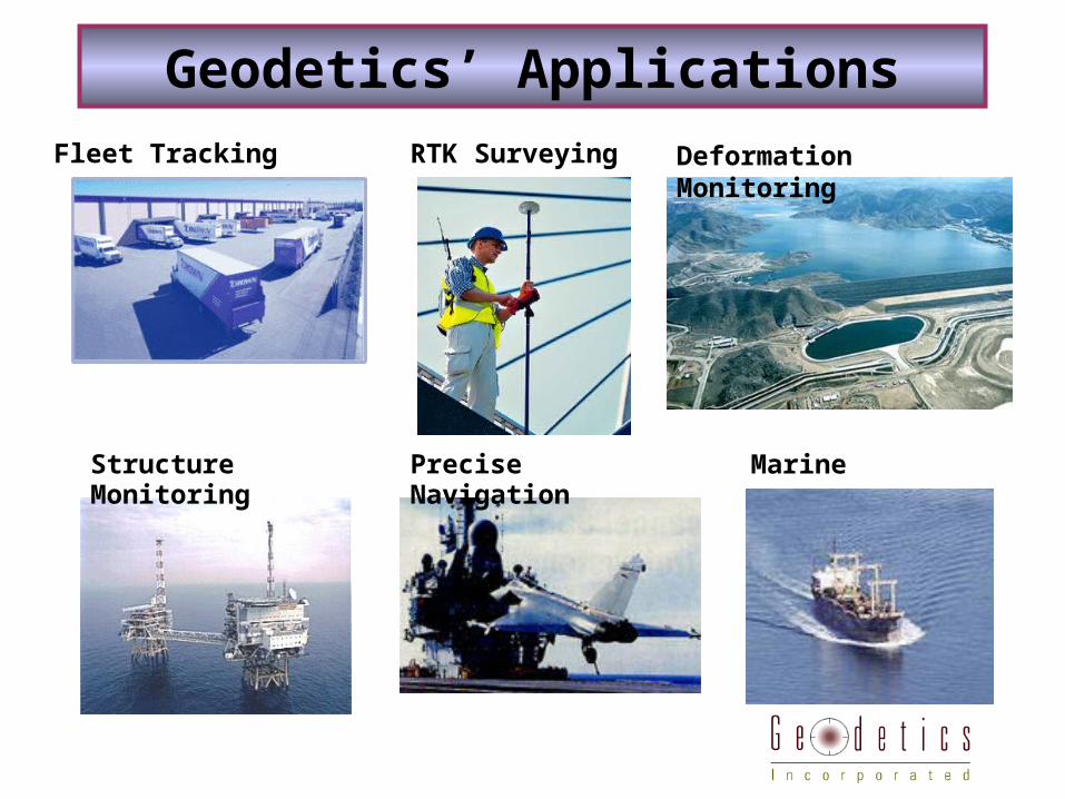
Fleet Tracking
Structure Monitoring
MarinePrecise Navigation
RTK Surveying Deformation Monitoring
Geodetics’ Applications
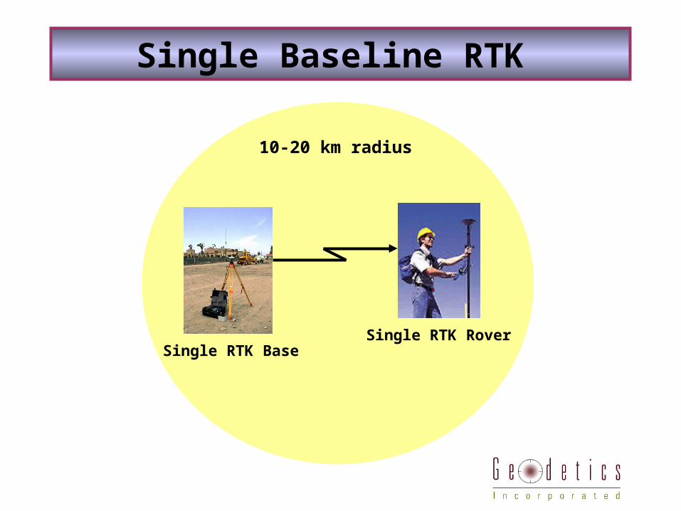
Single Baseline RTK
10-20 km radius
Single RTK BaseSingle RTK Rover
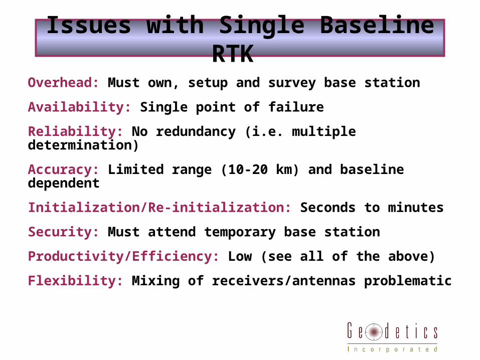
Issues with Single Baseline RTK
Overhead: Must own, setup and survey base station
Availability: Single point of failure
Reliability: No redundancy (i.e. multiple determination)
Accuracy: Limited range (10-20 km) and baseline dependent
Initialization/Re-initialization: Seconds to minutes
Security: Must attend temporary base station
Productivity/Efficiency: Low (see all of the above)
Flexibility: Mixing of receivers/antennas problematic
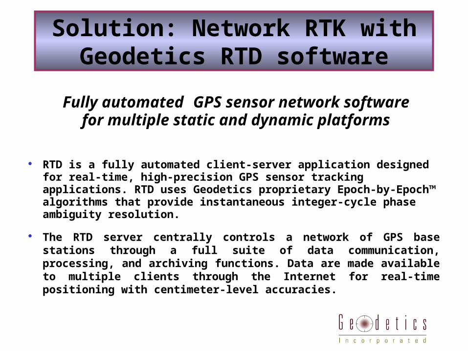
Fully automated GPS sensor network softwarefor multiple static and dynamic platforms
RTD is a fully automated client-server application designed for real-
time, high-precision GPS sensor tracking applications. RTD uses Geodetics proprietary Epoch-by-Epoch™ algorithms that provide instantaneous integer-cycle phase ambiguity resolution.
The RTD server centrally controls a network of GPS base stations through a full suite of data communication, processing, and archiving functions. Data are made available to multiple clients through the Internet for real-time positioning with centimeter-level accuracies.
Solution: Network RTK with Geodetics RTD software
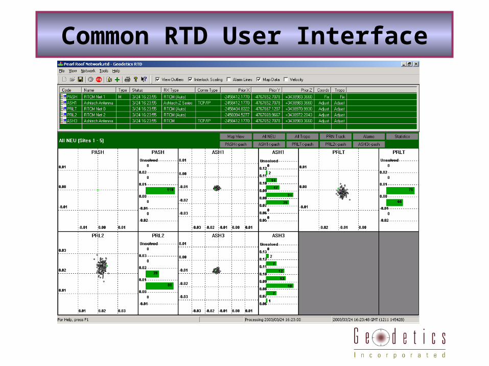
Common RTD User Interface
RTD
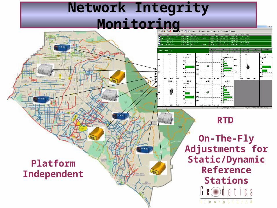
Network Integrity Monitoring
Platform Independent
On-The-Fly Adjustments for Static/Dynamic
Reference Stations
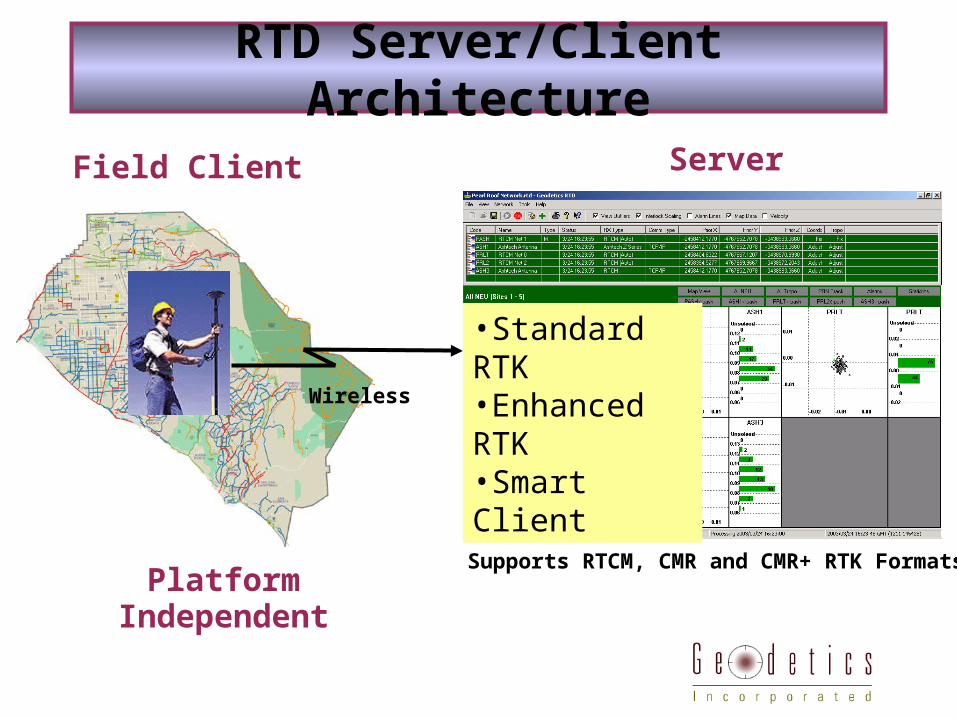
Field Client
•Standard RTK•Enhanced RTK•Smart Client
Server
RTD Server/Client Architecture
Platform Independent
Wireless
Supports RTCM, CMR and CMR+ RTK Formats
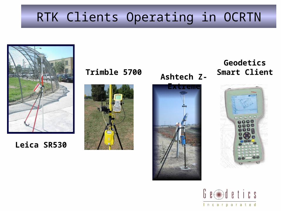
Geodetics Smart ClientTrimble 5700
Leica SR530
RTK Clients Operating in OCRTN
Ashtech Z-Extreme
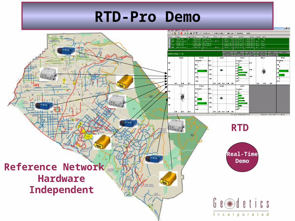
Reference Network
RTD
RTD-Pro Demo
Hardware Independent
Real-TimeDemo
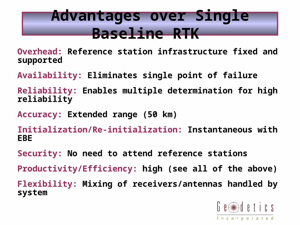
Advantages over Single Baseline RTK
Overhead: Reference station infrastructure fixed and supported
Availability: Eliminates single point of failure
Reliability: Enables multiple determination for high reliability
Accuracy: Extended range (50 km)
Initialization/Re-initialization: Instantaneous with EBE
Security: No need to attend reference stations
Productivity/Efficiency: high (see all of the above)
Flexibility: Mixing of receivers/antennas handled by system
Network RTK Benefits
• Multiple Beneficiaries (for example)• Surveyors
• GIS Data Collectors
• City Services (Fleet Management/Asset Tracking)
• Get More Work Done With Same Crew Size
• Autonomous Field Crews
• Reference Coordinates are Known/Controlled by System Operator
• Potential Revenue Generator
• The System could pay for itself within one or two years through increased efficiency, reduced labor, and savings related to hardware purchases
Advantages over Single Baseline RTK
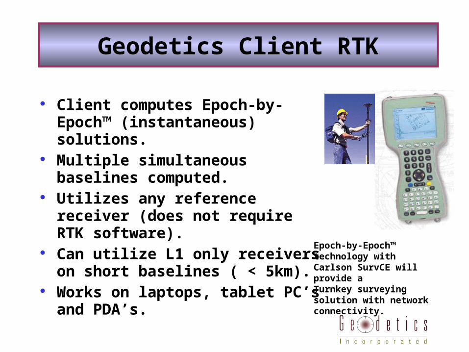
Client computes Epoch-by-Epoch™ (instantaneous) solutions.
Multiple simultaneous baselines computed.
Utilizes any reference receiver (does not require RTK software).
Can utilize L1 only receivers on short baselines ( < 5km).
Works on laptops, tablet PC’s and PDA’s.
Geodetics Client RTK
Epoch-by-Epoch™ technology withCarlson SurvCE will provide aTurnkey surveying solution with network connectivity.
Integer-cycle phase ambiguities are resolved independently at each epoch for a network of GPS receivers.
Relative site positions estimated to cm-precision with only a single epoch of GPS data from 5 or more satellites, providing “true” RTK.
Special treatment of atmospheric effects on client allows extended range several times the maximum distance achieved by RTK systems. Uses “real” reference stations. Nothing “virtual” about it.
Solution: Network RTK with Geodetics RTD software
Designed specifically for real-time wireless networked environments.
Works with geodetic-quality GPS receivers (dual and single frequency).
Accuracy gracefully degraded based on GPS data availability at each epoch.
Precise relative positioning of moving platforms (no base station required).
Other Features
Immediate (one-epoch) initialization and re- initialization vs. 15 seconds to several minutes, for ambiguity fixing.
Unaffected by cycle-slips and constellation changes. Easier to detect and reject erroneous data points Multiple vs. single base receiver operations Extended range
Epoch-by-Epoch™ vs Traditional RTK
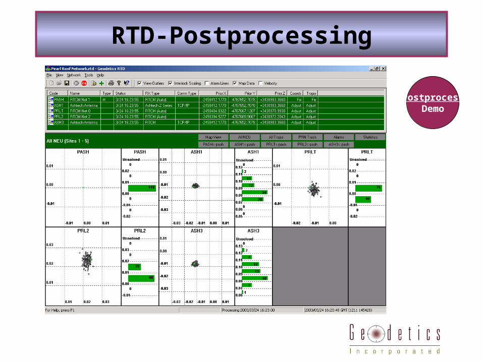
RTD-Postprocessing
PostprocessDemo
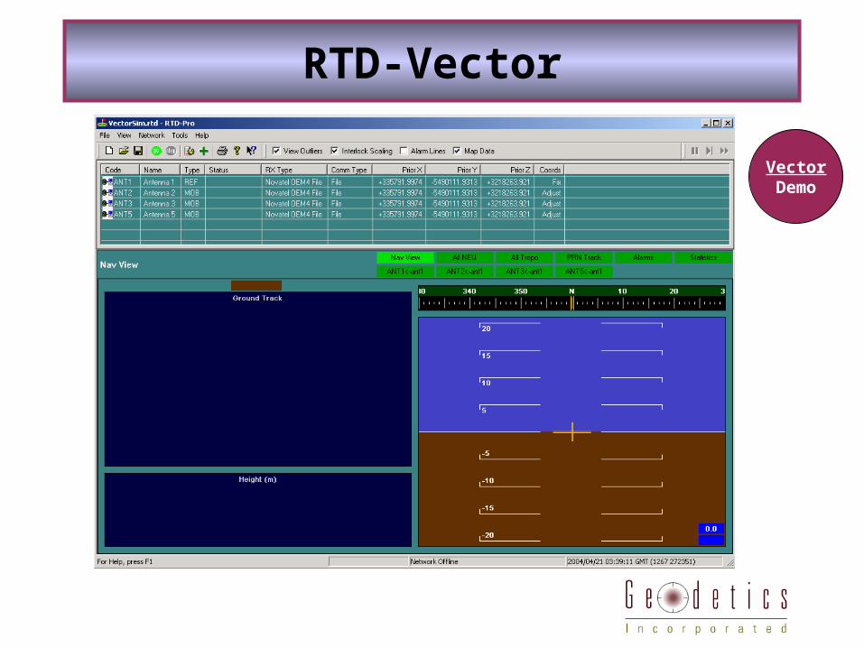
RTD-Vector
VectorDemo
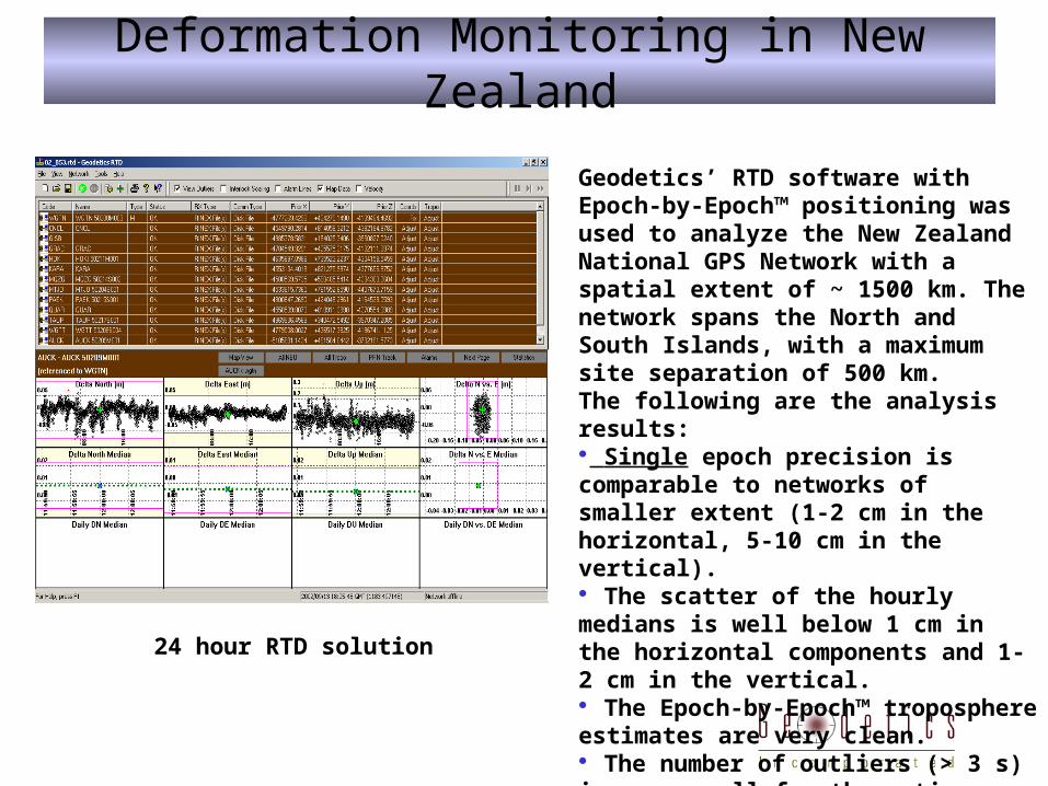
Geodetics’ RTD software with Epoch-by-Epoch™ positioning was used to analyze the New Zealand National GPS Network with a spatial extent of ~ 1500 km. The network spans the North and South Islands, with a maximum site separation of 500 km. The following are the analysis results: Single epoch precision is comparable to networks of smaller extent (1-2 cm in the horizontal, 5-10 cm in the vertical). The scatter of the hourly medians is well below 1 cm in the horizontal components and 1-2 cm in the vertical. The Epoch-by-Epoch™ troposphere estimates are very clean. The number of outliers (> 3 s) is very small for the entire data set (about 0.1%).
24 hour RTD solution
Deformation Monitoring in New Zealand
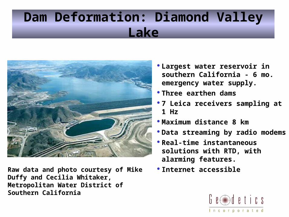
Dam Deformation: Diamond Valley Lake
Largest water reservoir in southern California - 6 mo. emergency water supply.
Three earthen dams 7 Leica receivers sampling at 1 Hz Maximum distance 8 km Data streaming by radio modems Real-time instantaneous solutions
with RTD, with alarming features. Internet accessible Raw data and photo courtesy of Mike Duffy and
Cecilia Whitaker, Metropolitan Water District of Southern California
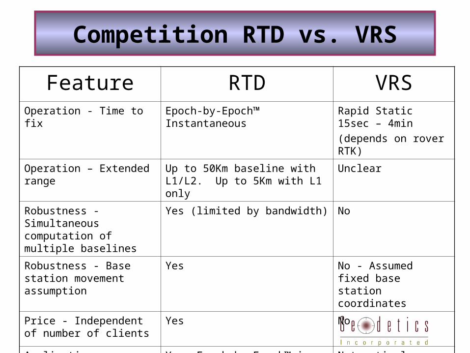
Feature RTD VRSOperation - Time to fix Epoch-by-Epoch™ Instantaneous Rapid Static 15sec – 4min
(depends on rover RTK)
Operation – Extended range Up to 50Km baseline with L1/L2. Up to 5Km with L1 only
Unclear
Robustness - Simultaneous computation of multiple baselines
Yes (limited by bandwidth) No
Robustness - Base station movement assumption
Yes No - Assumed fixed base station coordinates
Price - Independent of number of clients
Yes No
Applications - Suitable for dynamic applications (UPS, trash collection, AVL etc…)
Yes. Epoch-by-Epoch™ is ideally suited to dynamic applications
Not optimal.
Competition RTD vs. VRS
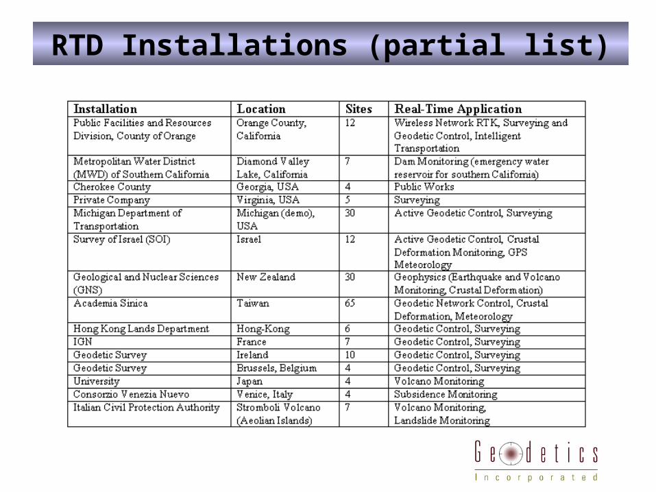
RTD Installations (partial list)
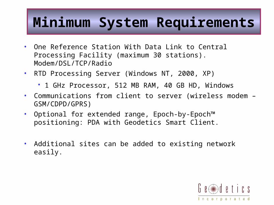
• One Reference Station With Data Link to Central Processing Facility (maximum 30 stations). Modem/DSL/TCP/Radio
• RTD Processing Server (Windows NT, 2000, XP)
• 1 GHz Processor, 512 MB RAM, 40 GB HD, Windows • Communications from client to server (wireless modem –
GSM/CDPD/GPRS)
• Optional for extended range, Epoch-by-Epoch™ positioning: PDA with Geodetics Smart Client.
• Additional sites can be added to existing network easily.
Minimum System Requirements

Geodetics, Inc. provides Epoch-by-Epoch™ positioning and navigation products for
extended range, high-precision, real-time applications
www.geodetics.com
Tel: (858) 729-0872