Embed Size (px)
Citation preview
Geo-enabling Digital India Rakesh Raina
Sr. Vice President – India Business, Esri India
What is Digital India?
• Digital India is a Programme to prepare India for a knowledge future.
• The focus is on being transformative – to realize IT + IT = IT
• The focus is on making technology central to enabling change.
• It is an Umbrella Programme – covering many departments.
- It weaves together a large number of ideas and thoughts into a single, comprehensive
vision so that each of them is seen as part of a larger goal.
- Each individual element stands on its own. But is also part of the larger picture.
- It is coordinated by DeitY, implemented by the entire government.
- The weaving together makes the Mission transformative in totality
• The Programme:
- Pulls together many existing schemes.
- These schemes will be restructured and re-focused.
- They will be implemented in a synchronized manner.
- Many elements are only process improvements with minimal cost.
• The common branding of programmes as Digital India highlights their
transformative impact.
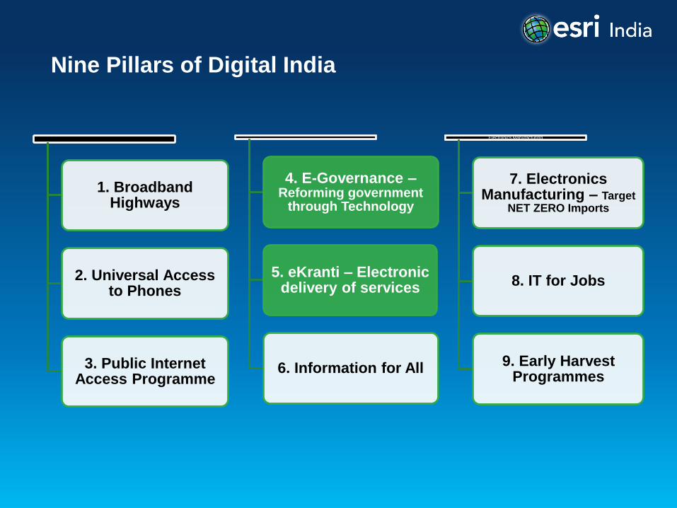
Nine Pillars of Digital India
1. Broadband Highways
2. Universal Access to Phones
3. Public Internet Access Programme
4. E-Governance – Reforming government
through Technology
5. eKranti – Electronic delivery of services
6. Information for All
Electronics Manufacturing
7. Electronics Manufacturing – Target
NET ZERO Imports
8. IT for Jobs
9. Early Harvest Programmes
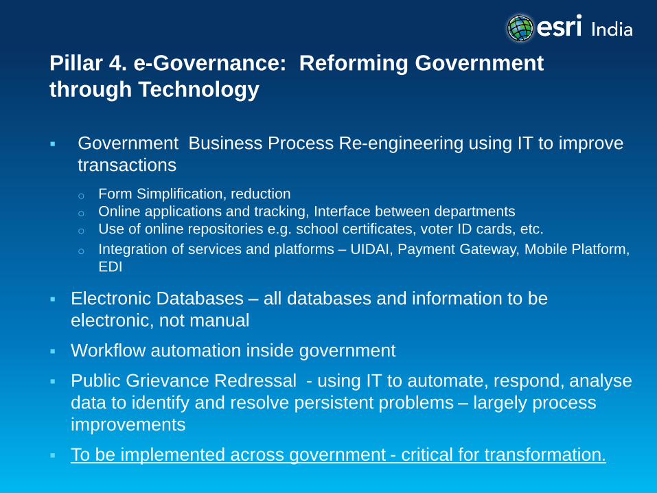
Pillar 4. e-Governance: Reforming Government
through Technology
Government Business Process Re-engineering using IT to improve
transactions
o Form Simplification, reduction
o Online applications and tracking, Interface between departments
o Use of online repositories e.g. school certificates, voter ID cards, etc.
o Integration of services and platforms – UIDAI, Payment Gateway, Mobile Platform,
EDI
Electronic Databases – all databases and information to be
electronic, not manual
Workflow automation inside government
Public Grievance Redressal - using IT to automate, respond, analyse
data to identify and resolve persistent problems – largely process
improvements
To be implemented across government - critical for transformation.
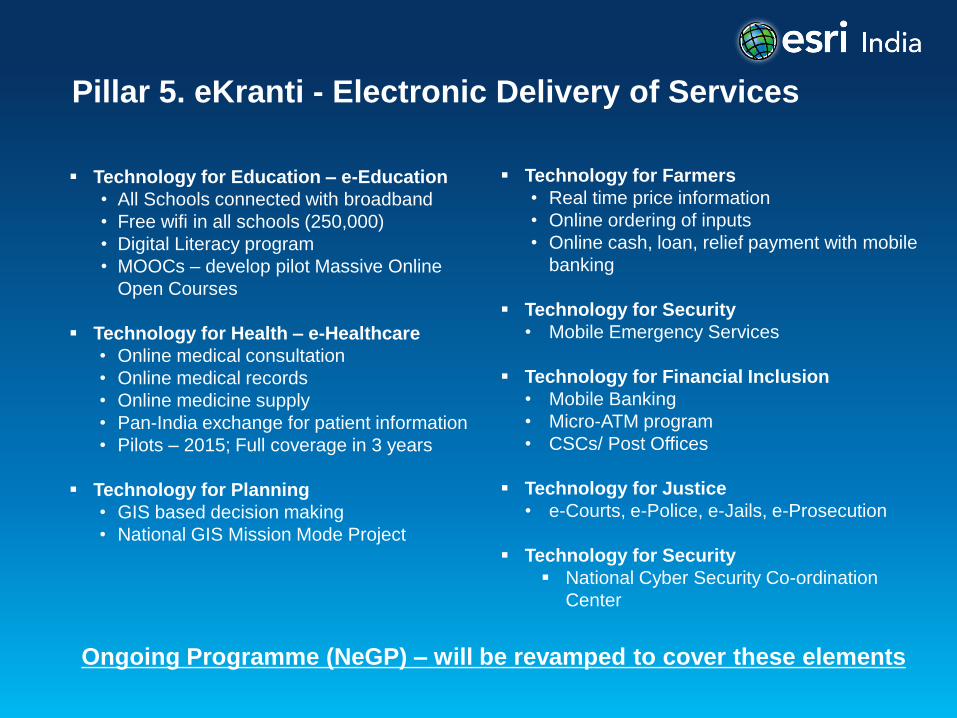
Pillar 5. eKranti - Electronic Delivery of Services
Technology for Education – e-Education
• All Schools connected with broadband
• Free wifi in all schools (250,000)
• Digital Literacy program
• MOOCs – develop pilot Massive Online
Open Courses
Technology for Health – e-Healthcare
• Online medical consultation
• Online medical records
• Online medicine supply
• Pan-India exchange for patient information
• Pilots – 2015; Full coverage in 3 years
Technology for Planning
• GIS based decision making
• National GIS Mission Mode Project
Technology for Farmers
• Real time price information
• Online ordering of inputs
• Online cash, loan, relief payment with mobile
banking
Technology for Security
• Mobile Emergency Services
Technology for Financial Inclusion
• Mobile Banking
• Micro-ATM program
• CSCs/ Post Offices
Technology for Justice
• e-Courts, e-Police, e-Jails, e-Prosecution
Technology for Security
National Cyber Security Co-ordination
Center
Ongoing Programme (NeGP) – will be revamped to cover these elements
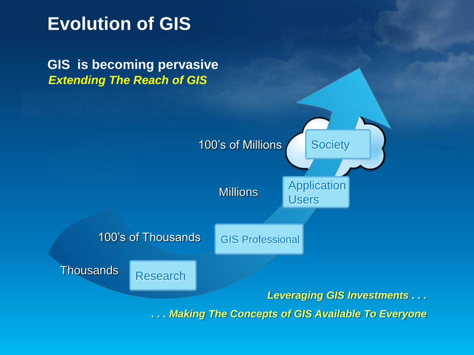
Evolution of GIS
GIS is becoming pervasive Extending The Reach of GIS
Leveraging GIS Investments . . .
. . . Making The Concepts of GIS Available To Everyone
Thousands
100’s of Thousands
Millions
100’s of Millions Society
Application
Users
GIS Professional
Research
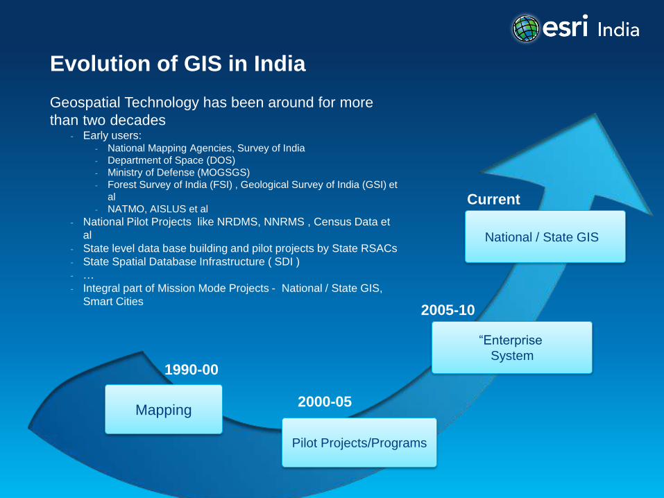
Evolution of GIS in India
Geospatial Technology has been around for more
than two decades - Early users:
- National Mapping Agencies, Survey of India
- Department of Space (DOS)
- Ministry of Defense (MOGSGS)
- Forest Survey of India (FSI) , Geological Survey of India (GSI) et
al
- NATMO, AISLUS et al
- National Pilot Projects like NRDMS, NNRMS , Census Data et
al
- State level data base building and pilot projects by State RSACs
- State Spatial Database Infrastructure ( SDI )
- …
- Integral part of Mission Mode Projects - National / State GIS,
Smart Cities 2005-10
2000-05
1990-00
“Enterprise
System
Pilot Projects/Programs
Mapping
Current
National / State GIS
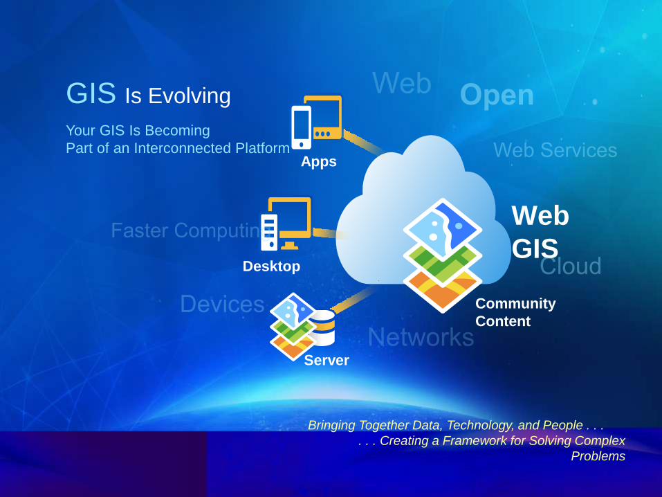
GIS Is Evolving
Your GIS Is Becoming
Part of an Interconnected Platform
Bringing Together Data, Technology, and People . . .
. . . Creating a Framework for Solving Complex
Problems
Apps
Desktop
Web
GIS
Community
Content
Server
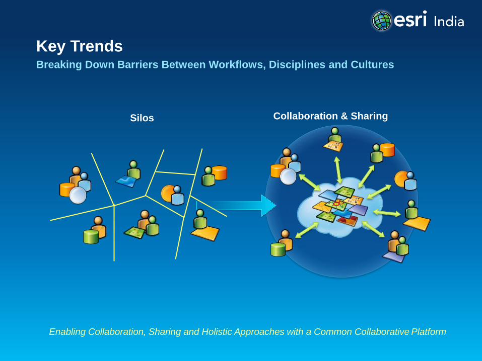
Key Trends Breaking Down Barriers Between Workflows, Disciplines and Cultures
Enabling Collaboration, Sharing and Holistic Approaches with a Common Collaborative Platform
Collaboration & Sharing Silos
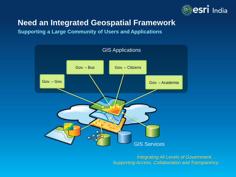
Need an Integrated Geospatial Framework Supporting a Large Community of Users and Applications
Integrating All Levels of Government . . .
Supporting Access, Collaboration and Transparency
GIS Services
Gov. – Bus
Gov. – Gov. Gov. – Academia
Gov. – Citizens
GIS Applications
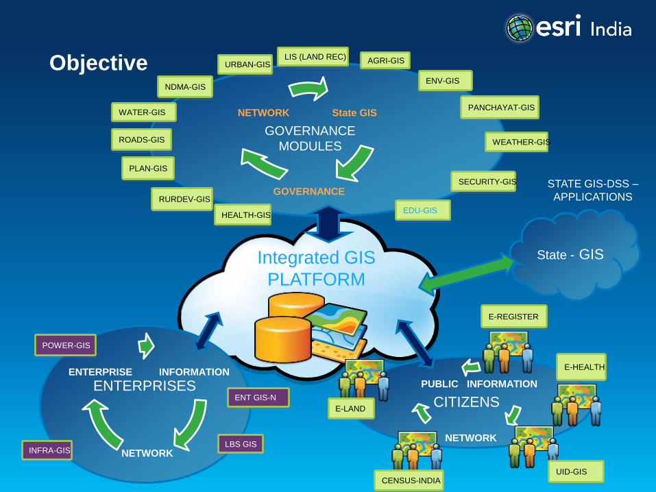
Objective
Integrated GIS
PLATFORM
State GIS
GOVERNANCE
NETWORK
SECURITY-GIS
LIS (LAND REC)
ENV-GIS NDMA-GIS
ROADS-GIS
PLAN-GIS
HEALTH-GIS
RURDEV-GIS
URBAN-GIS AGRI-GIS
WATER-GIS
GOVERNANCE
MODULES
INFORMATION
NETWORK
PUBLIC
CITIZENS
E-REGISTER
E-HEALTH
E-LAND
UID-GIS CENSUS-INDIA
POWER-GIS
INFRA-GIS LBS GIS
INFORMATION
NETWORK
ENTERPRISE
ENTERPRISES ENT GIS-N
STATE GIS-DSS –
APPLICATIONS
PANCHAYAT-GIS
WEATHER-GIS
EDU-GIS
State - GIS
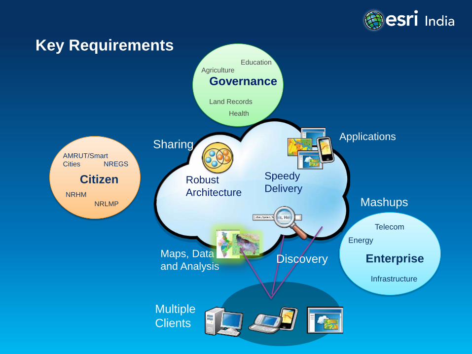
Key Requirements
Agriculture
Health
Land Records
Education
Governance
Sharing
Mashups
Applications
Maps, Data
and Analysis
Speedy
Delivery Robust
Architecture
NREGS
NRHM
AMRUT/Smart
Cities
Citizen
Energy
Infrastructure
Telecom
Enterprise
Multiple
Clients
NRLMP
Discovery
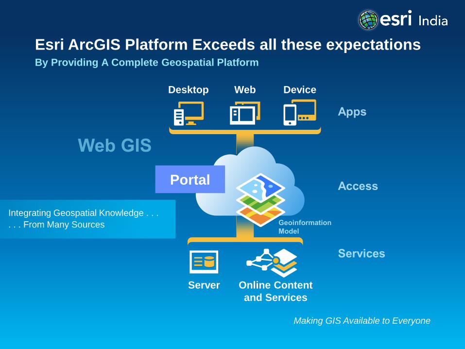
Esri ArcGIS Platform Exceeds all these expectations By Providing A Complete Geospatial Platform
Making GIS Available to Everyone
Desktop Web Device
Server Online Content
and Services
Portal
Integrating Geospatial Knowledge . . .
. . . From Many Sources
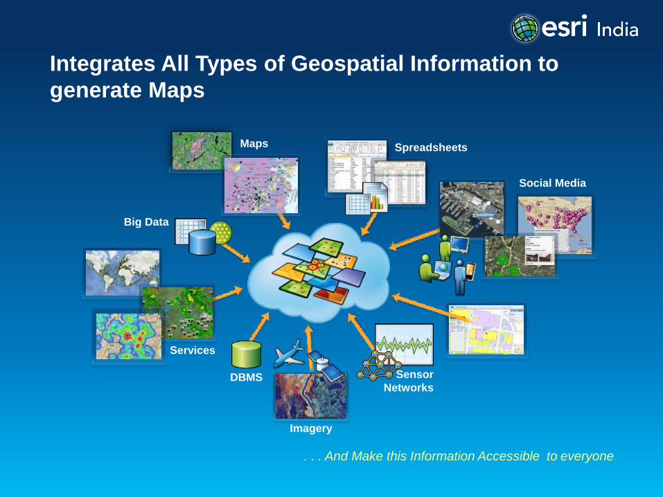
Integrates All Types of Geospatial Information to
generate Maps
. . . And Make this Information Accessible to everyone
Imagery
DBMS
Services
Sensor
Networks
Big Data
Spreadsheets Maps
Social Media
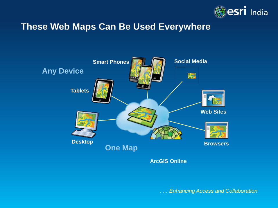
These Web Maps Can Be Used Everywhere
. . . Enhancing Access and Collaboration
One Map Desktop
Tablets
Smart Phones
Web Sites
ArcGIS Online
Any Device
Browsers
Social Media
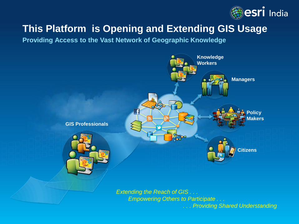
This Platform is Opening and Extending GIS Usage Providing Access to the Vast Network of Geographic Knowledge
Extending the Reach of GIS . . .
Empowering Others to Participate . . .
. . . Providing Shared Understanding
GIS Professionals
Knowledge
Workers
Managers
Policy
Makers
Citizens
Case Studies
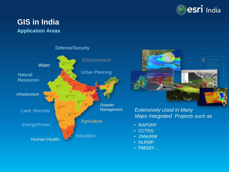
GIS in India Application Areas
Human Health Education
Defense/Security
Agriculture
Urban Planning
Water
Land Records
Disaster
Management
Energy/Power
Natural
Resources
Environment
Infrastructure
• RAPDRP
• CCTNS
• JNNURM
• NLRMP
• PMGSY…
Extensively Used in Many
Major Integrated Projects such as
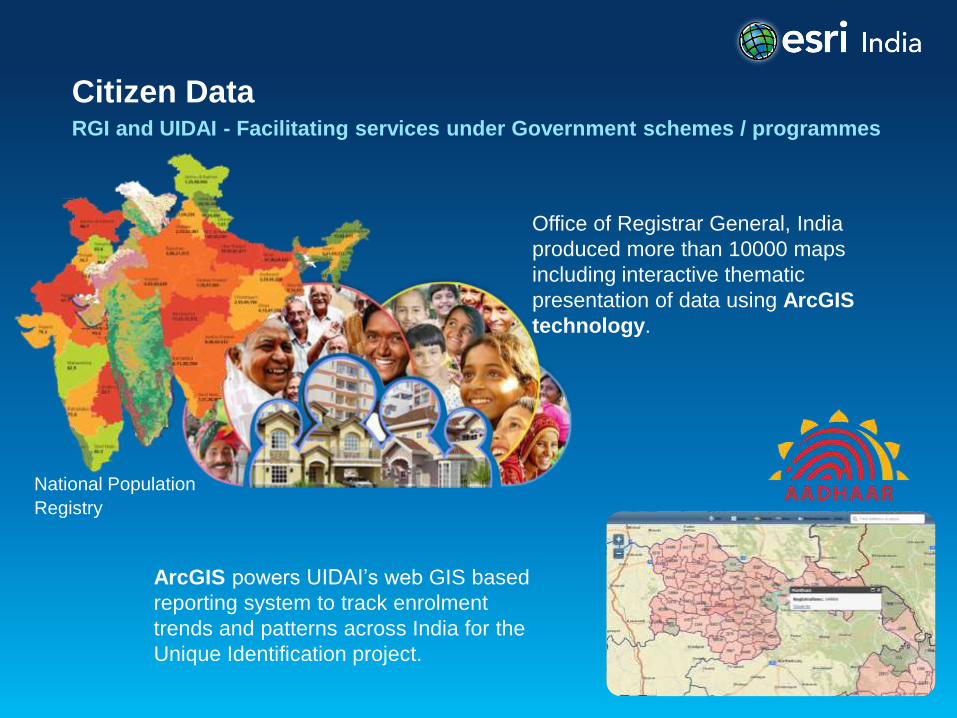
Citizen Data RGI and UIDAI - Facilitating services under Government schemes / programmes
Office of Registrar General, India
produced more than 10000 maps
including interactive thematic
presentation of data using ArcGIS
technology.
ArcGIS powers UIDAI’s web GIS based
reporting system to track enrolment
trends and patterns across India for the
Unique Identification project.
National Population
Registry
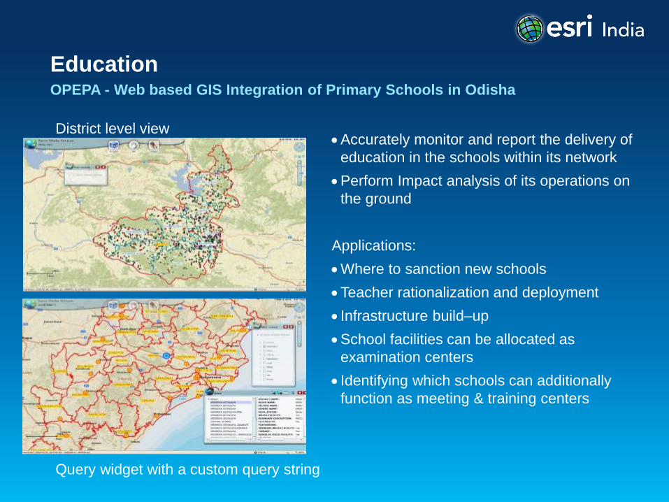
Education OPEPA - Web based GIS Integration of Primary Schools in Odisha
District level view
Query widget with a custom query string
Accurately monitor and report the delivery of
education in the schools within its network
Perform Impact analysis of its operations on
the ground
Applications:
Where to sanction new schools
Teacher rationalization and deployment
Infrastructure build–up
School facilities can be allocated as
examination centers
Identifying which schools can additionally
function as meeting & training centers
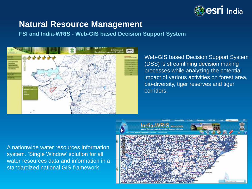
Natural Resource Management FSI and India-WRIS - Web-GIS based Decision Support System
Web-GIS based Decision Support System
(DSS) is streamlining decision making
processes while analyzing the potential
impact of various activities on forest area,
bio-diversity, tiger reserves and tiger
corridors.
A nationwide water resources information
system. ‘Single Window’ solution for all
water resources data and information in a
standardized national GIS framework
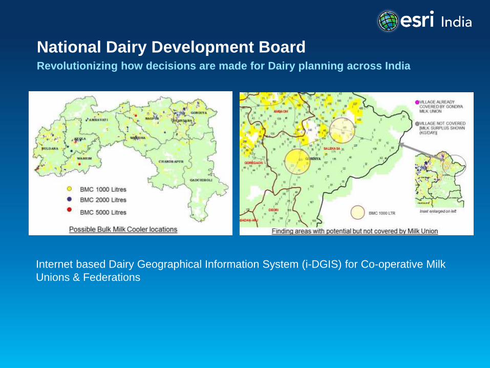
National Dairy Development Board Revolutionizing how decisions are made for Dairy planning across India
Internet based Dairy Geographical Information System (i-DGIS) for Co-operative Milk
Unions & Federations
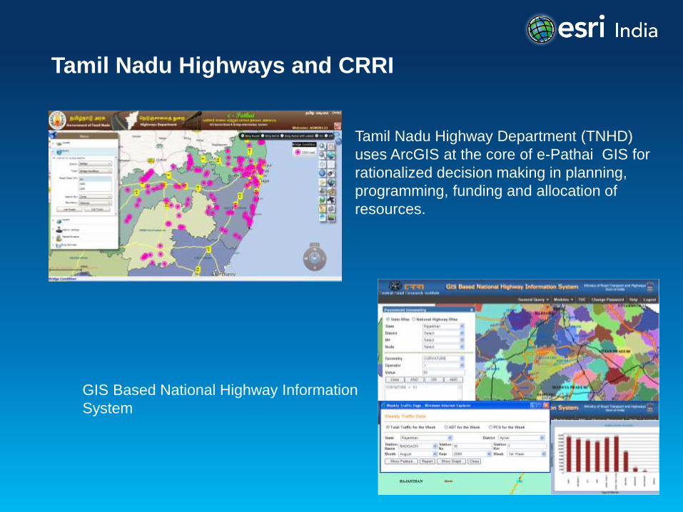
Tamil Nadu Highways and CRRI
Tamil Nadu Highway Department (TNHD)
uses ArcGIS at the core of e-Pathai GIS for
rationalized decision making in planning,
programming, funding and allocation of
resources.
GIS Based National Highway Information
System
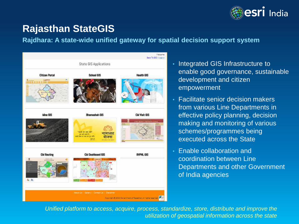
Rajasthan StateGIS Rajdhara: A state-wide unified gateway for spatial decision support system
Unified platform to access, acquire, process, standardize, store, distribute and improve the
utilization of geospatial information across the state
• Integrated GIS Infrastructure to
enable good governance, sustainable
development and citizen
empowerment
• Facilitate senior decision makers
from various Line Departments in
effective policy planning, decision
making and monitoring of various
schemes/programmes being
executed across the State
• Enable collaboration and
coordination between Line
Departments and other Government
of India agencies
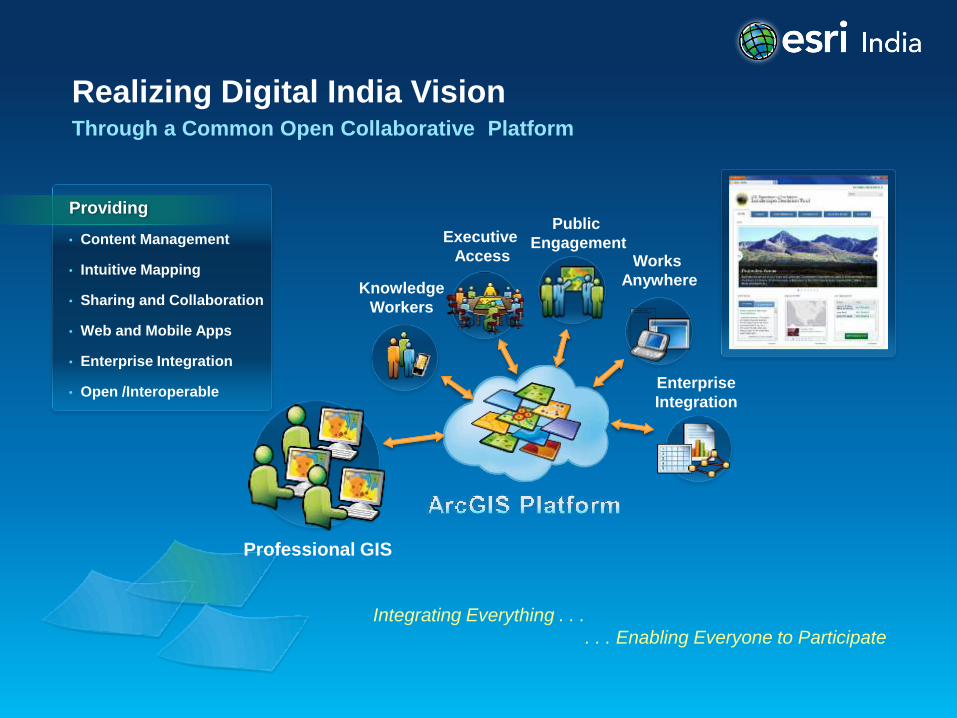
Realizing Digital India Vision Through a Common Open Collaborative Platform
Integrating Everything . . .
. . . Enabling Everyone to Participate
• Content Management
• Intuitive Mapping
• Sharing and Collaboration
• Web and Mobile Apps
• Enterprise Integration
• Open /Interoperable
Providing Public
Engagement Executive
Access
Knowledge
Workers
Professional GIS
Enterprise
Integration
Works
Anywhere

To know more visit us at:
http://www.esriindia.com