Embed Size (px)
Citation preview
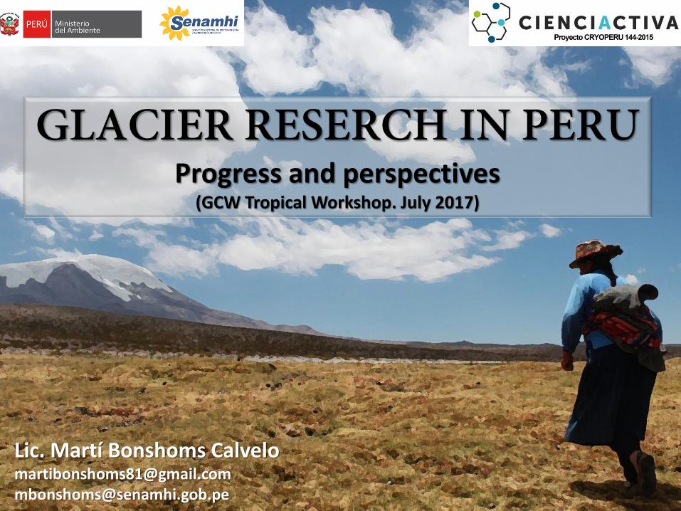
Progress and perspectives (GCW Tropical Workshop. July 2017)
Lic. Martí Bonshoms Calvelo [email protected] [email protected]
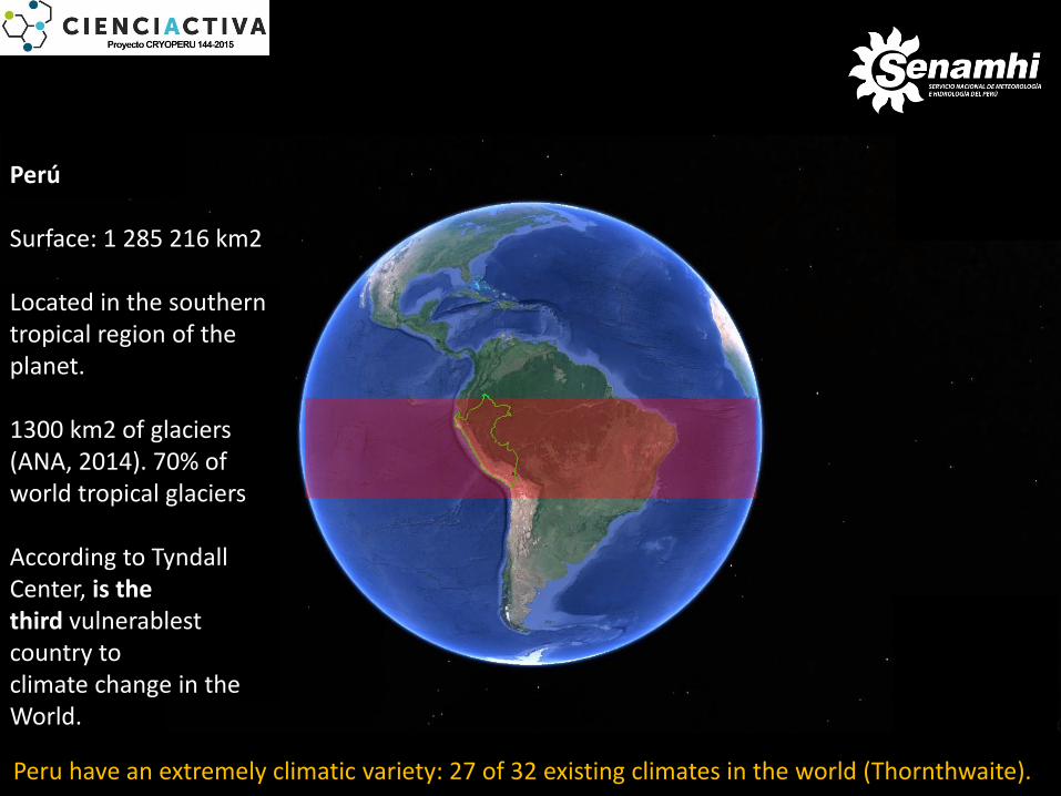
Peru have an extremely climatic variety: 27 of 32 existing climates in the world (Thornthwaite).
Perú Surface: 1 285 216 km2 Located in the southern tropical region of the planet. 1300 km2 of glaciers (ANA, 2014). 70% of world tropical glaciers According to Tyndall Center, is the third vulnerablest country to climate change in the World.
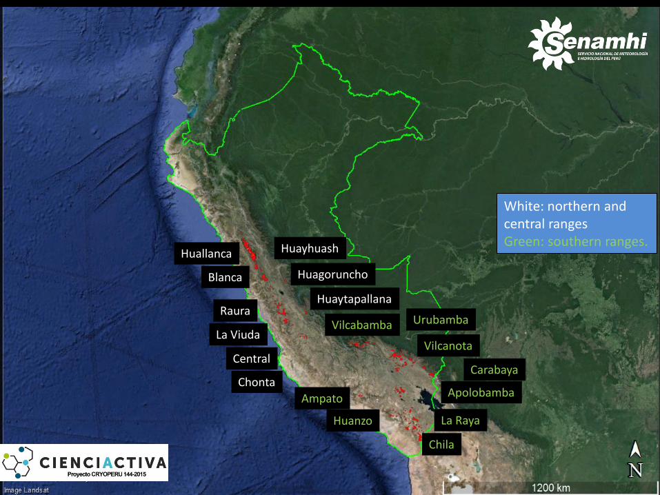
Huanzo
Blanca
La Viuda
Huagoruncho
Raura
Huallanca Huayhuash
Central
Ampato Apolobamba
Carabaya
Vilcanota
Urubamba Vilcabamba
Chila
La Raya
Huaytapallana
Chonta
White: northern and central ranges Green: southern ranges.
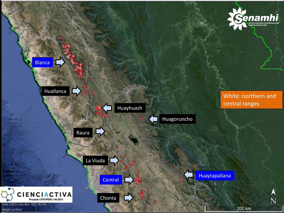
Blanca
La Viuda
Huagoruncho
Raura
Huallanca
Huayhuash
Central Huaytapallana
Chonta
Huaytapallana Central
White: northern and central ranges
Blanca
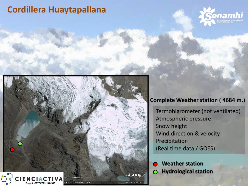
Weather station
Hydrological station
Cordillera Huaytapallana
Complete Weather station ( 4684 m.)
Termohigrometer (not ventilated) Atmospheric pressure Snow height Wind direction & velocity Precipitation (Real time data / GOES)
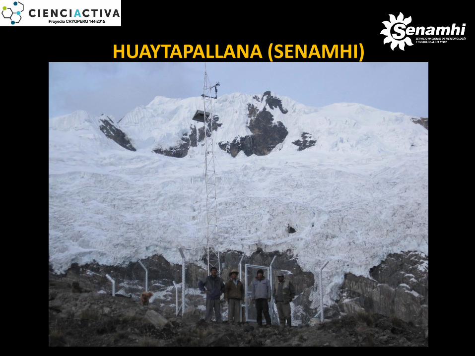
HUAYTAPALLANA (SENAMHI)
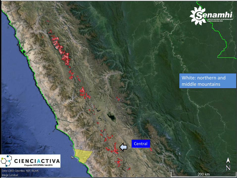
Central
White: northern and middle mountains
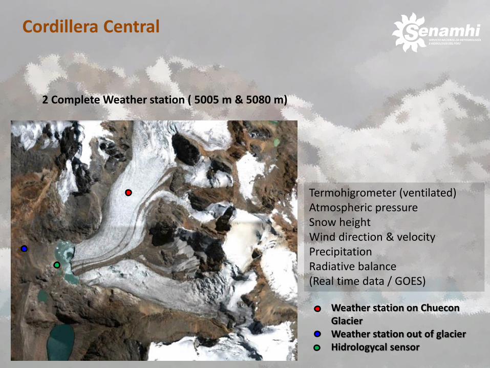
Cordillera Central
• Weather station on Chuecon Glacier
• Weather station out of glacier • Hidrologycal sensor
2 Complete Weather station ( 5005 m & 5080 m)
Termohigrometer (ventilated) Atmospheric pressure Snow height Wind direction & velocity Precipitation Radiative balance (Real time data / GOES)
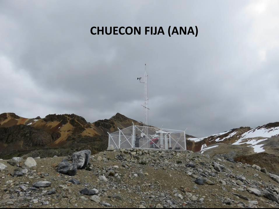
CHUECON FIJA (ANA)
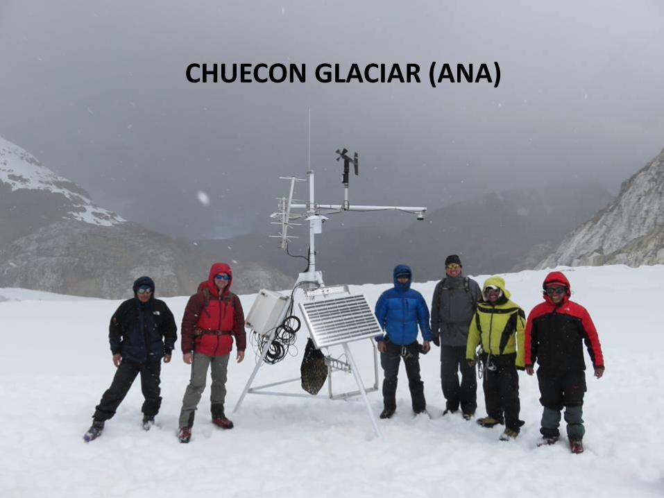
CHUECON GLACIAR (ANA)
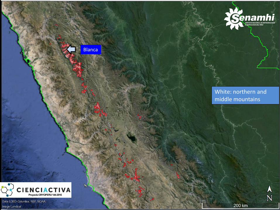
Blanca
White: northern and middle mountains
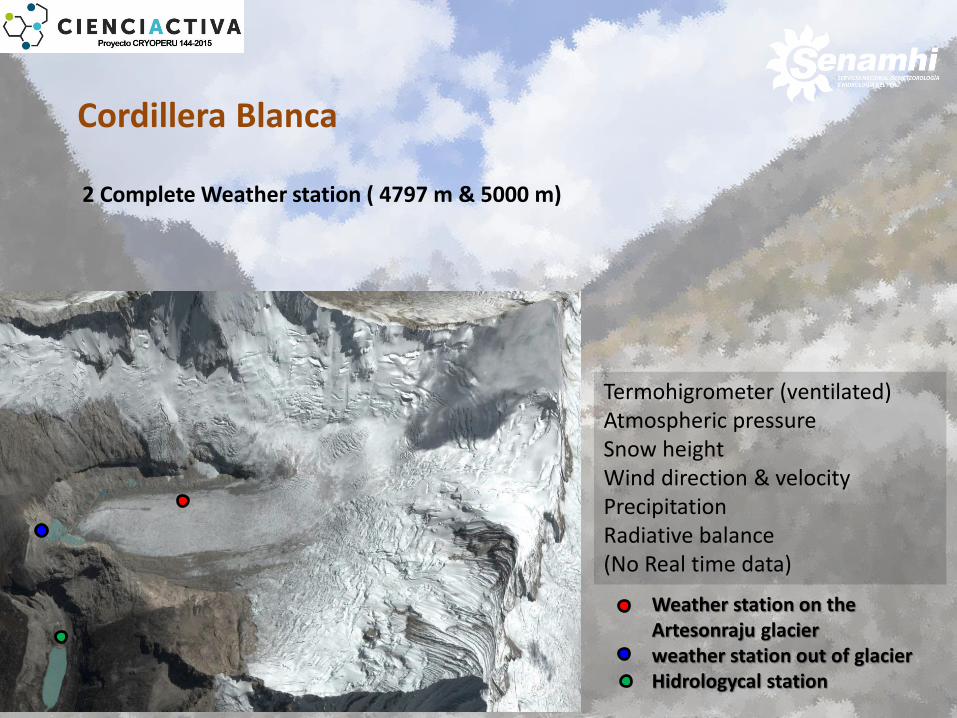
Cordillera Blanca
• Weather station on the Artesonraju glacier
• weather station out of glacier • Hidrologycal station
Termohigrometer (ventilated) Atmospheric pressure Snow height Wind direction & velocity Precipitation Radiative balance (No Real time data)
2 Complete Weather station ( 4797 m & 5000 m)
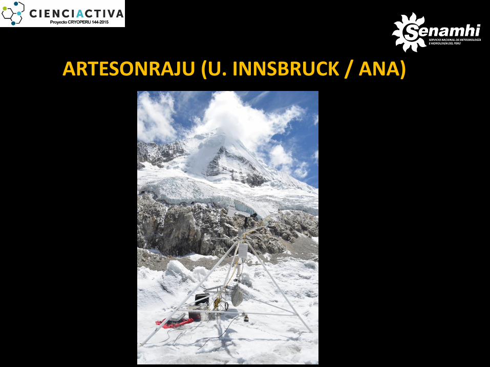
ARTESONRAJU (U. INNSBRUCK / ANA)
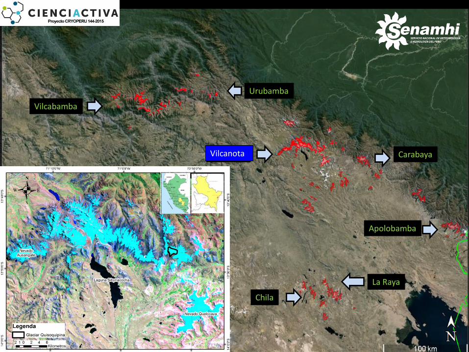
Huanzo
Ampato
Apolobamba
Carabaya Vilcanota
Urubamba
Vilcabamba
Chila
La Raya
Ampato
Vilcanota
Green: southern ranges
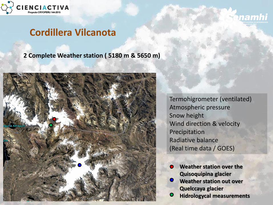
Cordillera Vilcanota
• Weather station over the Quisoquipina glacier
• Weather station out over Quelccaya glacier
• Hidrologycal measurements
Termohigrometer (ventilated) Atmospheric pressure Snow height Wind direction & velocity Precipitation Radiative balance (Real time data / GOES)
2 Complete Weather station ( 5180 m & 5650 m)
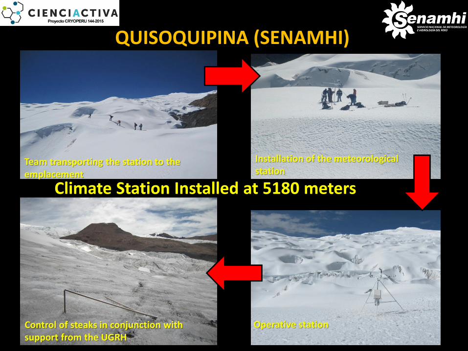
Team transporting the station to the emplacement
Installation of the meteorological station
Operative station Control of steaks in conjunction with support from the UGRH
Climate Station Installed at 5180 meters
QUISOQUIPINA (SENAMHI)
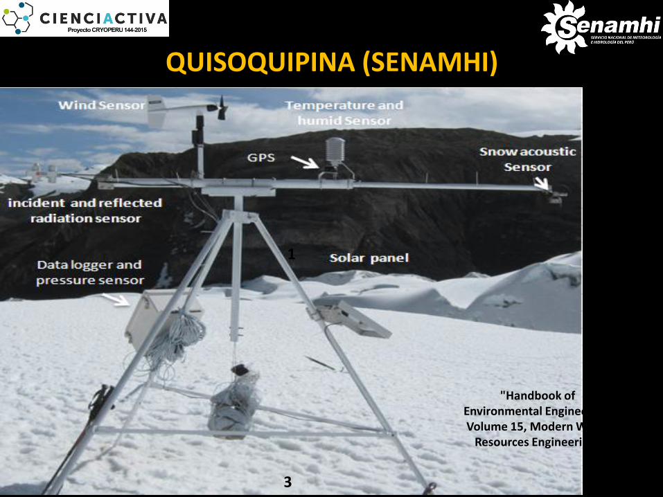
1
3
2
"Handbook of Environmental Engineering, Volume 15, Modern Water
Resources Engineering"
QUISOQUIPINA (SENAMHI)
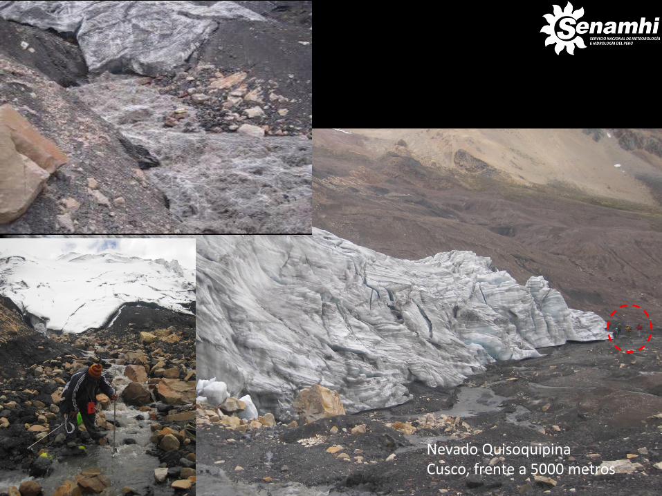
Nevado Quisoquipina Cusco, frente a 5000 metros
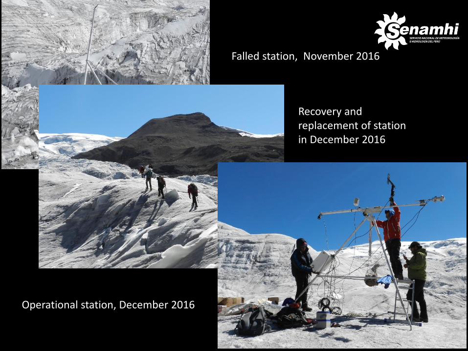
Falled station, November 2016
Recovery and replacement of station in December 2016
Operational station, December 2016
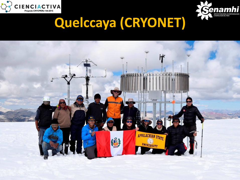
Quelccaya (CRYONET)
• Weather station over the glacier
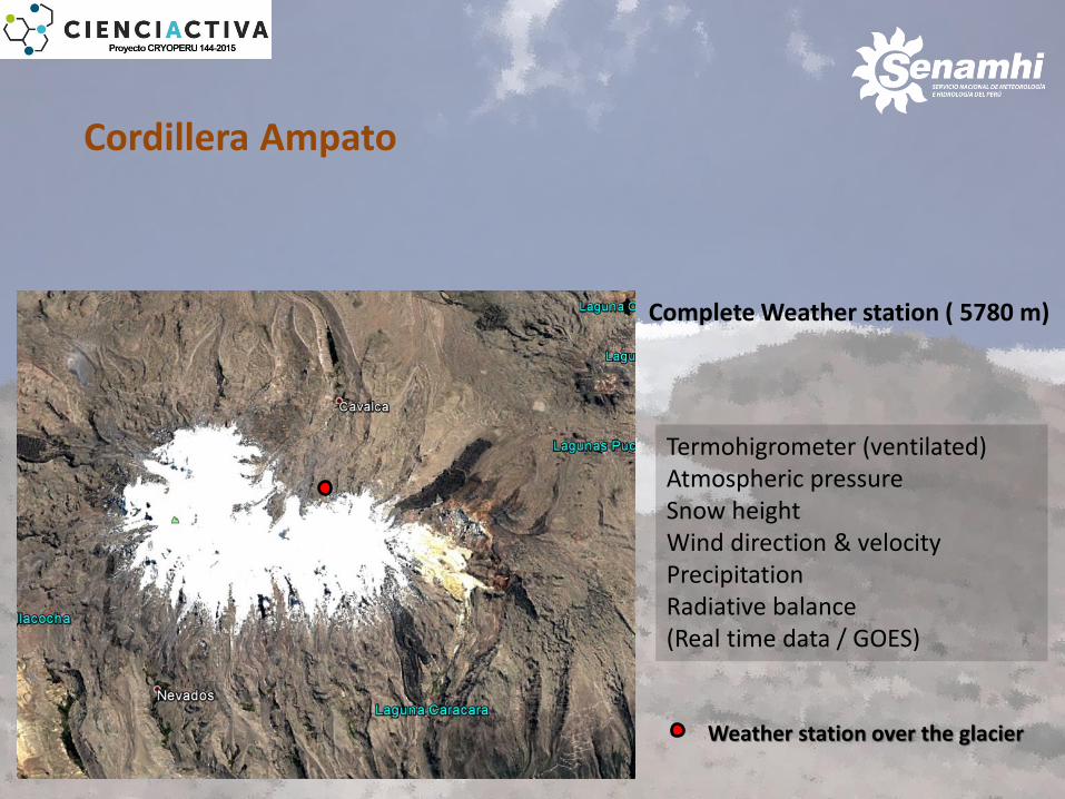
Cordillera Ampato
Termohigrometer (ventilated) Atmospheric pressure Snow height Wind direction & velocity Precipitation Radiative balance (Real time data / GOES)
Complete Weather station ( 5780 m)
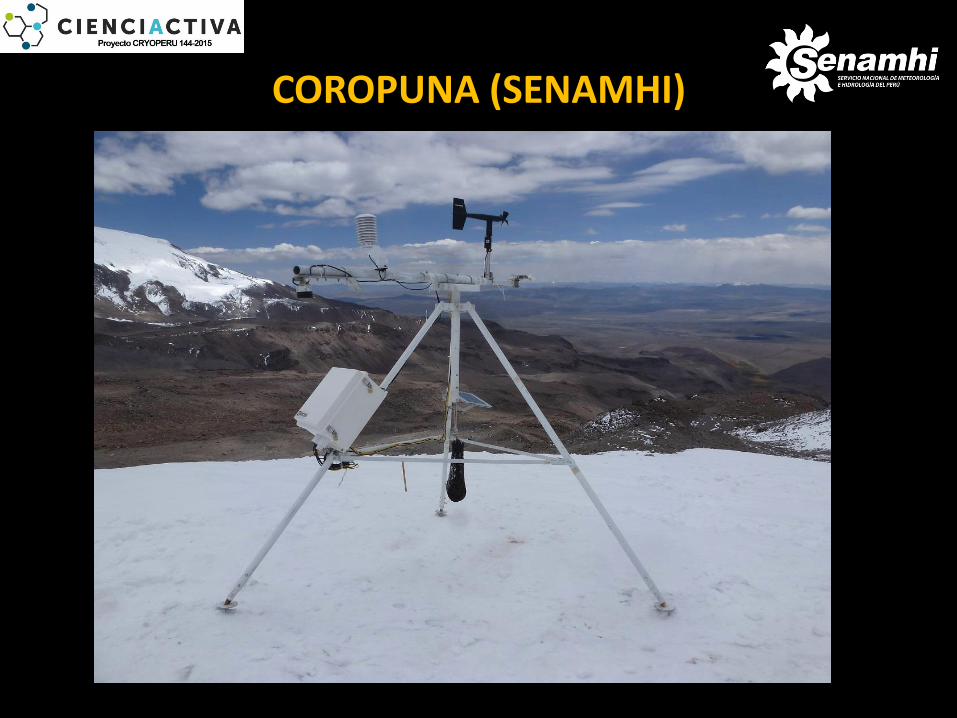
COROPUNA (SENAMHI)
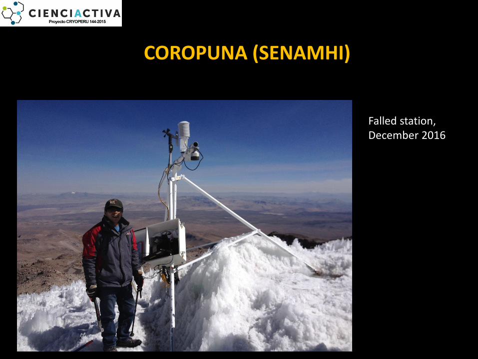
Falled station, December 2016
COROPUNA (SENAMHI)

Opertional station, December 2016
COROPUNA (SENAMHI)
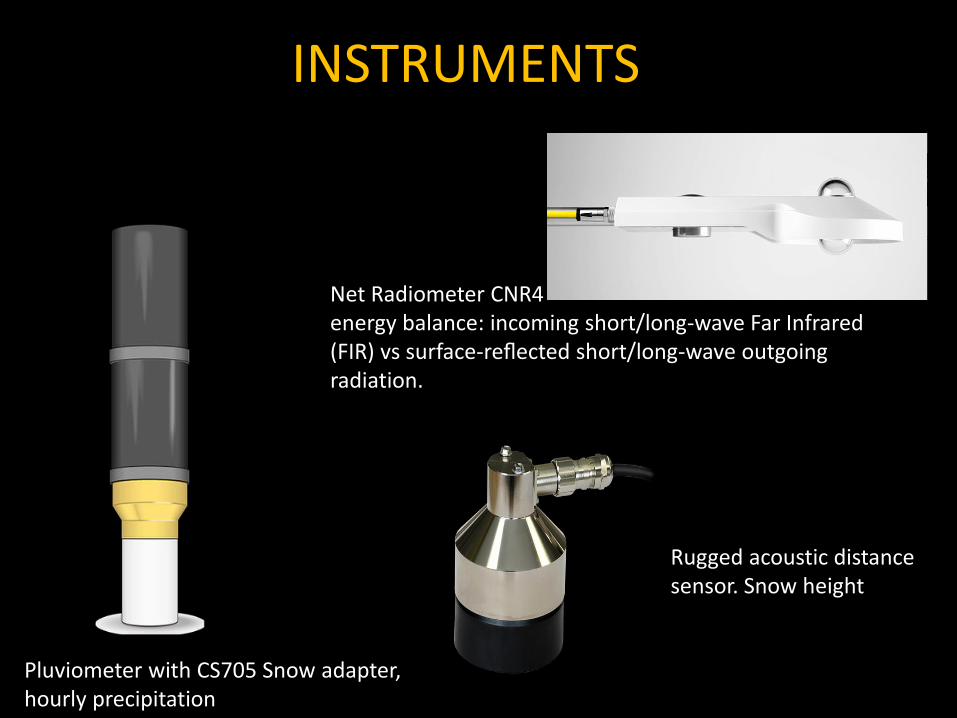
INSTRUMENTS
Pluviometer with CS705 Snow adapter, hourly precipitation
Net Radiometer CNR4 energy balance: incoming short/long-wave Far Infrared (FIR) vs surface-reflected short/long-wave outgoing radiation.
Rugged acoustic distance sensor. Snow height
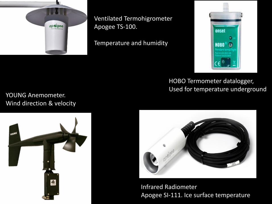
Ventilated Termohigrometer Apogee TS-100. Temperature and humidity
HOBO Termometer datalogger, Used for temperature underground
YOUNG Anemometer. Wind direction & velocity
Infrared Radiometer Apogee SI-111. Ice surface temperature
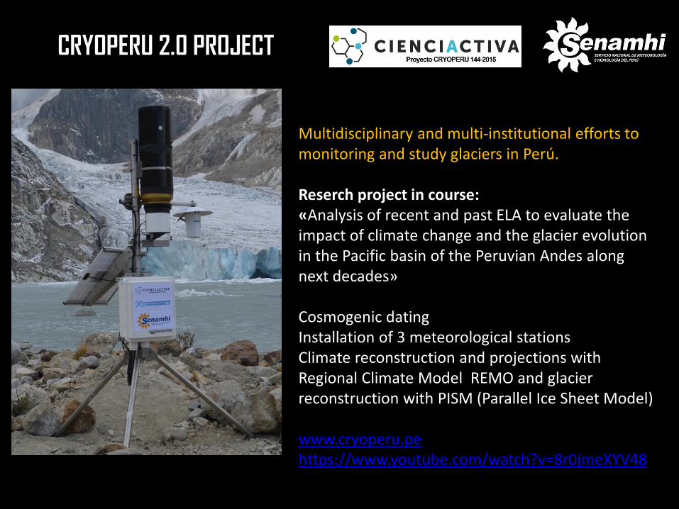
CRYOPERU 2.0 PROJECT
Multidisciplinary and multi-institutional efforts to monitoring and study glaciers in Perú. Reserch project in course: «Analysis of recent and past ELA to evaluate the impact of climate change and the glacier evolution in the Pacific basin of the Peruvian Andes along next decades» Cosmogenic dating Installation of 3 meteorological stations Climate reconstruction and projections with Regional Climate Model REMO and glacier reconstruction with PISM (Parallel Ice Sheet Model) www.cryoperu.pe https://www.youtube.com/watch?v=8r0jmeXYV48
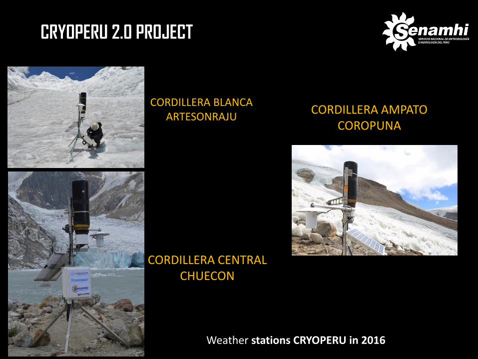
CRYOPERU 2.0 PROJECT
CORDILLERA BLANCA ARTESONRAJU
CORDILLERA CENTRAL CHUECON
CORDILLERA AMPATO COROPUNA
Weather stations CRYOPERU in 2016
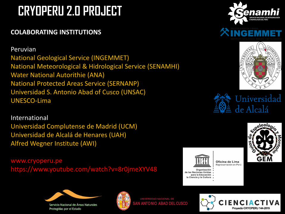
CRYOPERU 2.0 PROJECT
COLABORATING INSTITUTIONS Peruvian National Geological Service (INGEMMET) National Meteorological & Hidrological Service (SENAMHI) Water National Autorithie (ANA) National Protected Areas Service (SERNANP) Universidad S. Antonio Abad of Cusco (UNSAC) UNESCO-Lima International Universidad Complutense de Madrid (UCM) Universidad de Alcalá de Henares (UAH) Alfred Wegner Institute (AWI) www.cryoperu.pe https://www.youtube.com/watch?v=8r0jmeXYV48
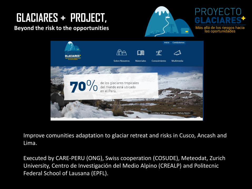
GLACIARES + PROJECT, Beyond the risk to the opportunities
Improve comunities adaptation to glaciar retreat and risks in Cusco, Ancash and Lima. Executed by CARE-PERU (ONG), Swiss cooperation (COSUDE), Meteodat, Zurich University, Centro de Investigación del Medio Alpino (CREALP) and Politecnic Federal School of Lausana (EPFL).
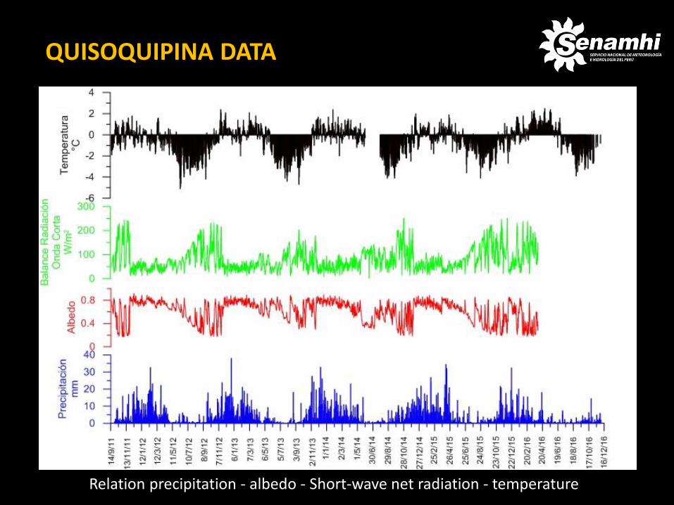
Relation precipitation - albedo - Short-wave net radiation - temperature
QUISOQUIPINA DATA

Relation precipitation - albedo - Short-wave net radiation - temperature
COROPUNA DATA
ANTARTIDA
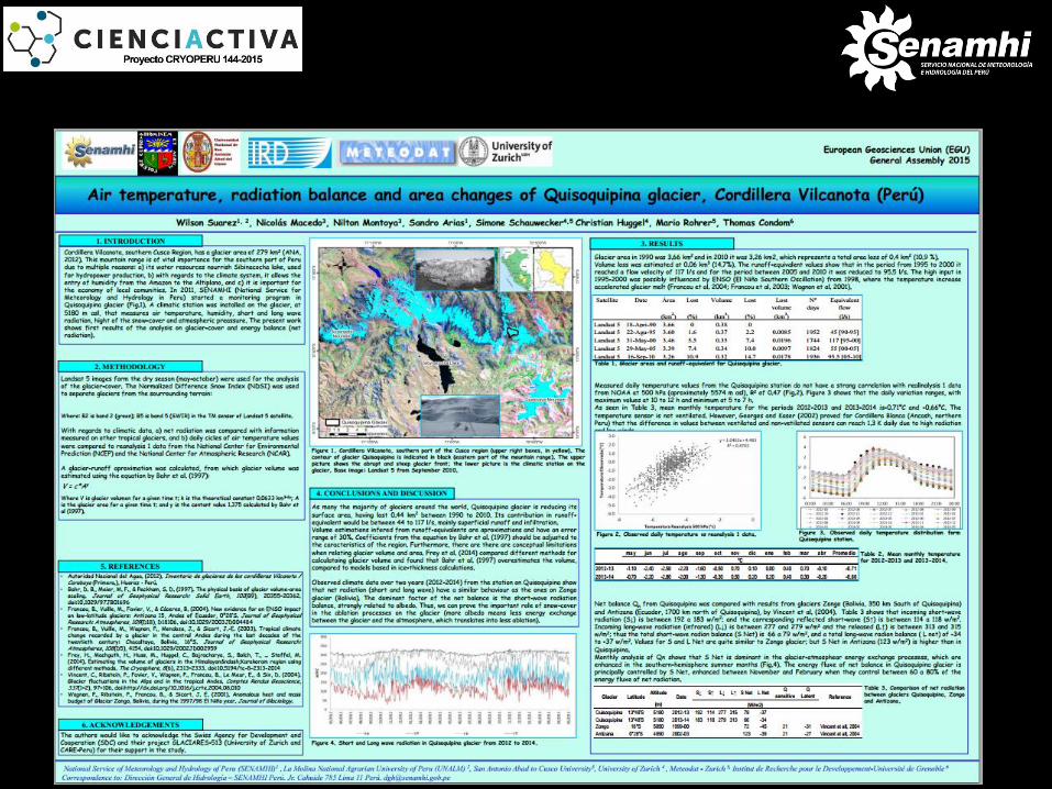
Scientific Publications Perry, L.B., A. Seimon, M. Andrade-Flores, J.L. Endries, S.E. Yuter, F. Velarde, S. Arias, M. Bonshoms, E.J. Burton, R. Winkelmann, C.M. Cooper, G. Mamani, M. Rado, N. Montoya, N. Quispe. 2017. Characteristics of precipitating storms in glacierized tropical Andean cordilleras of Peru and Bolivia. Annals of the American Association of Geographers, 107: 309–322. Suarez,W., Macedo, N., Montoya, N. Arias, S., Schauwecker, S., Huggel, C., Rohrer, M., & Condom, T. (2015). Net energy balance (2012-2014) and temporal evolution of the Quisoquipina snow peak in Cusco Region (1990-2010). Revista Peruana Geo-Atmosferica (RPGA), 4, 82 – 92.
ANTARTIDA
Condom, T;Escobar, M; Purkey, D;Pouget, J; Suarez, w; Ramos, C; Apaestegui, J; Zapata, M; Gomez, J and Vergara, W. (2012) . Modelling the hydrologic role of glaciers within a Water Evaluation and Planning System (WEAP): a case study in the Rio Santa watershed (Peru). Hydrol. Earth Syst. 8, 869–916 pp. Chevallier,P; Pouyaud, B; Suarez, W and Condom,T. (2010) . Climate change threats to environment in the tropical Andes: glaciers and water resources. Environ Change, 9pp. Suarez, W; Condom, T and Apastegui, J. (2010). Determinación del cambio climático sobre la hidrología de las cuencas Rímac y Mantaro (Perú). Cambio climático en la cuenca del rio Mantaro-Instituto Geofísico del Perú. 68-78pp. Suarez, W; Chevallier, P; Pouyaud, B, Lopez, P. (2008) “Hydrological and hydraulic balance of Parón lake (white cordillera, Perú)”. Hydrological sciences journal , 266-277 pp. Rabatel, A., B. Francou, A. Soruco, J. Gomez, B. C_aceres, J.L. Ceballos, R. Basantes, M. Vuille, J.E. Sicart, C. Huggel, M. Scheel, Y. Lejeune, Y. Arnaud, M. Collet, T. Condom, G. Consoli, V. Favier, V. Jomelli, R. Galarraga, P. Ginot, L. Maisincho, J. Mendoza, M. M_en_egoz, E. Ramirez, P. Ribstein, W. Suarez, M. Villacis and P. Wagnon, (2013). Current state of glaciers in the tropical Andes: a multi-century perspective on glacier evolution and climate change, The Cryosphere, 7, 81-102.
ANTARTIDA
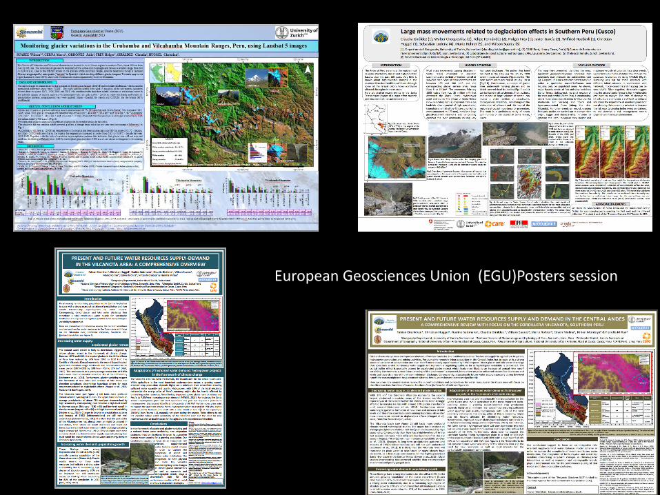
European Geosciences Union (EGU)Posters session
ANTARTIDA
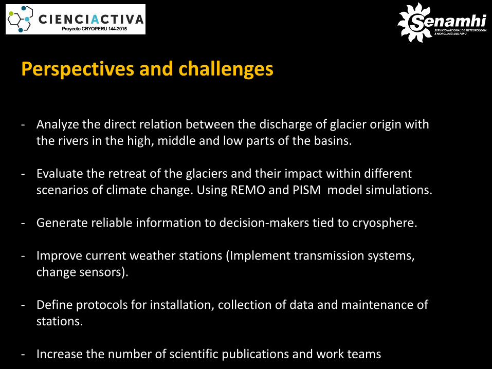
ANTARTIDA Perspectives and challenges
- Analyze the direct relation between the discharge of glacier origin with the rivers in the high, middle and low parts of the basins.
- Evaluate the retreat of the glaciers and their impact within different scenarios of climate change. Using REMO and PISM model simulations.
- Generate reliable information to decision-makers tied to cryosphere.
- Improve current weather stations (Implement transmission systems, change sensors).
- Define protocols for installation, collection of data and maintenance of stations.
- Increase the number of scientific publications and work teams
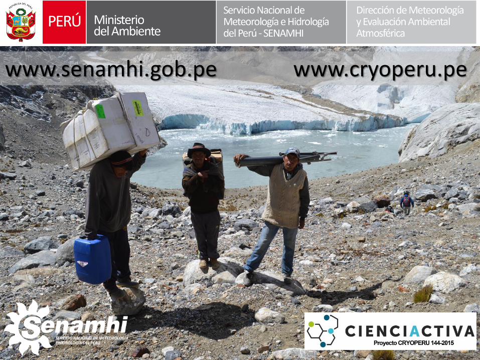
www.senamhi.gob.pe www.cryoperu.pe