Embed Size (px)
Citation preview
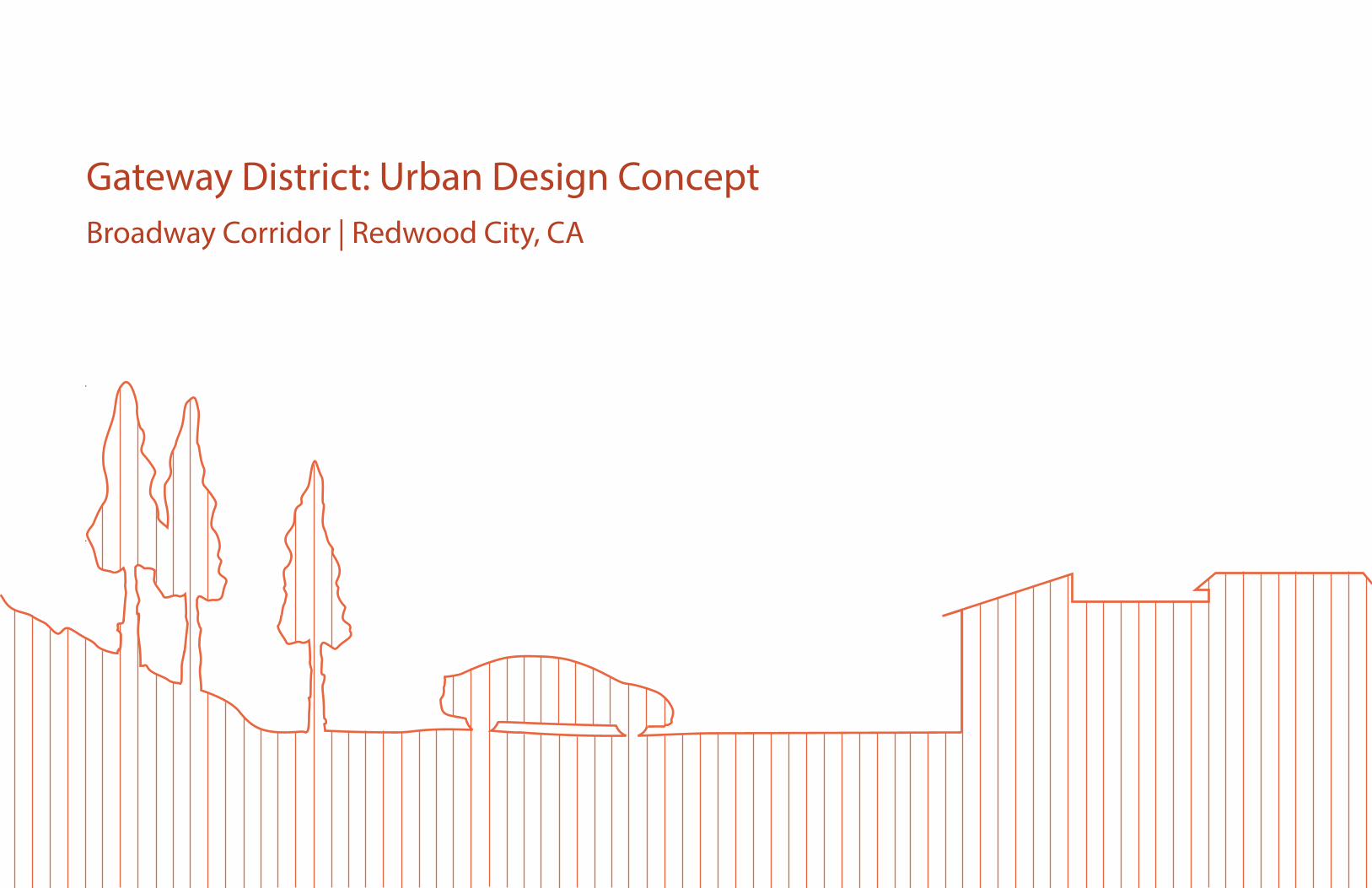
Gateway District: Urban Design ConceptBroadway Corridor | Redwood City, CA


3
Table of Contents
Introduction
Section 1: Background Research Section 3: Design Development
ReferencesSection 2: Concept Creation
5
Methodology 7
Literature Review 9Case Studies 13Existing Conditions 19
Opportunities and Challenges 23Vision Statement 25Conceptual Diagram 26
Site Plan 27Development Table 30Sketchup Rendering 34Section/Elevation 34Conclusion 35
37

5
Introduction
The Gateway District: Urban Design Concept proposes land uses and urban form for the Gateway District in Redwood City. The plan will serve as a basis for future development within the district
and help reinforce existing surrounding uses. As the project is an expansion of the Broadway Corridor Study prepared by the Senior Class Community Planning Laboratory of Cal Poly in Winter
2014, data and analysis gathered within the study guided the design decisions that are incorporated into the concept plan.

7
Methodology
The design concept has been carefully crafted through a dynamic process. Much of the information used to create this proposal was found within the Broadway Corridor Study and as such,
analytics of land use and community outreach surveys done in the study are translated and used in the Gateway District: Urban Design Concept. However, this background information is merely a
small portion of what is necessary to construct a proposal. By reviewing literature and researching case studies about gateways and different development types, more information about the project
becomes available. Once the amassed data, surveys, and literature had been thoroughly analyzed, a conceptual diagram highlighting key features, proposed roads and land uses was created in
Adobe Illustrator, utilizing the knowledge gained from background research. A site plan illustrating building and road placement is drawn next with calculations for building height, acreage of land
uses, and projected population increase. Finally a massing model has been generated via Google Sketch-up to exhibit the height and placement of buildings.


9
Literature Review
In order to create a successful gateway, it is important to review and analyze past literature of gateway planning in order to fully grasp the concept of the term and envision improvements to the
site accordingly. Likewise, there must be literature review of any unique or interesting uses that one might propose to decipher the appropriateness of such developments within the district.
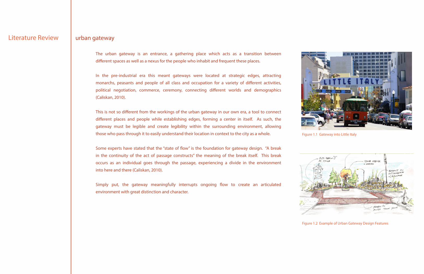
The urban gateway is an entrance, a gathering place which acts as a transition between
different spaces as well as a nexus for the people who inhabit and frequent these places.
In the pre-industrial era this meant gateways were located at strategic edges, attracting
monarchs, peasants and people of all class and occupation for a variety of different activities,
political negotiation, commerce, ceremony, connecting different worlds and demographics
(Caliskan, 2010).
This is not so different from the workings of the urban gateway in our own era, a tool to connect
different places and people while establishing edges, forming a center in itself. As such, the
gateway must be legible and create legibility within the surrounding environment, allowing
those who pass through it to easily understand their location in context to the city as a whole.
Some experts have stated that the “state of flow” is the foundation for gateway design. “A break
in the continuity of the act of passage constructs” the meaning of the break itself. This break
occurs as an individual goes through the passage, experiencing a divide in the environment
into here and there (Caliskan, 2010).
Simply put, the gateway meaningfully interrupts ongoing flow to create an articulated
environment with great distinction and character.
Literature Review urban gateway
Figure 1.1 Gateway into Little Italy
Figure 1.2 Example of Urban Gateway Design Features
11
Recent trends in hospitality indicate that a number of travelers are seeking boutique hotels.
The growth of this sector is brought on by an increasing population of people who enjoy the
more accommodating atmosphere and sustainable design of most boutiques.
While the Downtown remains the number one choice for hotel guests, proximity to traffic
interchanges, business centres, shopping centres, and tourist destinations are often attractive
to patrons of boutique hotels.
According to the Boutique Hotel Budapest, a boutique hotel is one with an upper limit of
100-rooms. Because of this smaller number, the personal connection one guest feels with the
staff is increased.
Additionally, the design of boutique hotels are non-traditional and as such, a variety of styles
define the most successful of them (Boutique Hotel Budapest). Four main design themes
are widely prevalent within the hospitality industry: ascetic modernism, nostalgic opulence,
extravagant fantasy, and exotic exclusivity. Boutique and chain hotels alike use these few
themes as a basis for their design strategies.
Additional trends have recently emerged to complement these design themes. Some hotels
have begun to participate in urban regeneration, refurbishing old housing in prime locales,
while others incorporate the ethno-cultural diversity of their environment, complimenting local
cultures and blending into the local environment.
Literature Reviewboutique hotel
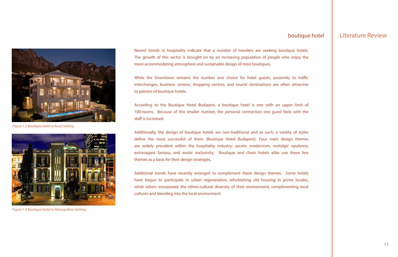
Figure 1.3 Boutique Hotel in Rural Setting
Figure 1.4 Boutique Hotel in Metropolitan Setting

13
Case Studies
The following case studies have been reviewed and analyzed due to their locational similarity to the Broadway Corridor. As such, proximity to multiple nexuses and adjacency to a key transportation
artery have been observed in each case study. Information gathered from the study analyses will be used as a basis for design decisions within the Gateway District.
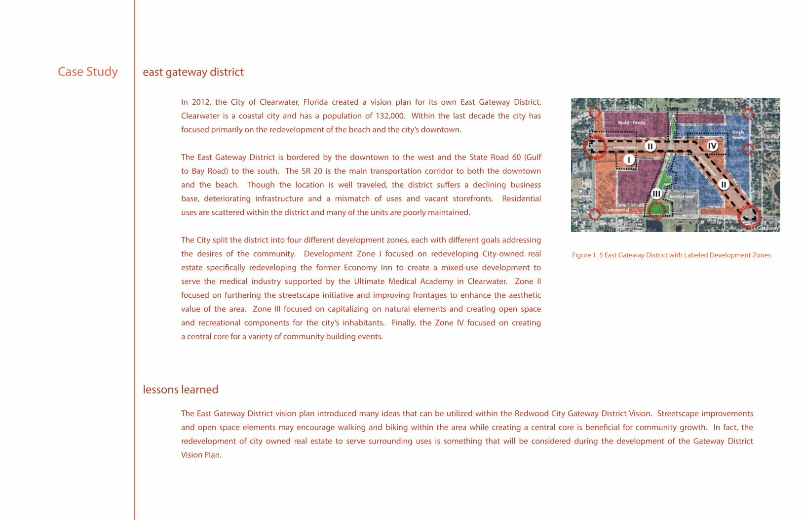
In 2012, the City of Clearwater, Florida created a vision plan for its own East Gateway District.
Clearwater is a coastal city and has a population of 132,000. Within the last decade the city has
focused primarily on the redevelopment of the beach and the city’s downtown.
The East Gateway District is bordered by the downtown to the west and the State Road 60 (Gulf
to Bay Road) to the south. The SR 20 is the main transportation corridor to both the downtown
and the beach. Though the location is well traveled, the district suffers a declining business
base, deteriorating infrastructure and a mismatch of uses and vacant storefronts. Residential
uses are scattered within the district and many of the units are poorly maintained.
The City split the district into four different development zones, each with different goals addressing
the desires of the community. Development Zone I focused on redeveloping City-owned real
estate specifically redeveloping the former Economy Inn to create a mixed-use development to
serve the medical industry supported by the Ultimate Medical Academy in Clearwater. Zone II
focused on furthering the streetscape initiative and improving frontages to enhance the aesthetic
value of the area. Zone III focused on capitalizing on natural elements and creating open space
and recreational components for the city’s inhabitants. Finally, the Zone IV focused on creating
a central core for a variety of community building events.
The East Gateway District vision plan introduced many ideas that can be utilized within the Redwood City Gateway District Vision. Streetscape improvements
and open space elements may encourage walking and biking within the area while creating a central core is beneficial for community growth. In fact, the
redevelopment of city owned real estate to serve surrounding uses is something that will be considered during the development of the Gateway District
Vision Plan.
Case Study
Figure 1. 5 East Gateway District with Labeled Development Zones
east gateway district
lessons learned
15
The South State Street Corridor Plan highlighted the importance of updating infrastructure and improving aesthetics to create new places for people to
enjoy. The plan identifies a few interesting ideas to attract consumers, proposing integration of possible public arts and assessing the feasibility of creating
a public trail within the corridor. The plan also explains the importance of developing a simple and easy to read wayfinding system to direct visitors to
major destinations.
The South State Street Corridor project created a vision for the future of one of Ann Arbor’s major
thoroughfares. Ann Arbor is a city in the state of Michigan with a population of approximately
113,934 people. The South State Street Corridor is mainly an employment and retail destination
and has office, retail, residential, research, and industrial uses.
The corridor is frequently traveled by commuters as it connects the Interstate 94 to downtown
Ann Arbor and an adjacent city, the Pittsfield Township. While proximity to the interstate, the
downtown, and the University of Michigan south athletic campus encourages growth within the
area, portions of the corridor lack the aesthetic quality and legibility that are so present in other
parts of the street.
Therefore the City has developed five goals for the corridor: interconnection, diversity,
sustainability, attractiveness, and invigoration. The corridor must enable users to travel safely,
comfortably, and seamlessly by all modes of transportation and connect people to the downtown,
the University, and to important places within the City and region. The City must also provide
a mix of services, housing, and amenities to accommodate the diverse demographic of Ann
Arbor and use the land, energy and resources wisely, in a way that promotes healthy lifestyles
and decisions. Furthermore, the South State Street Corridor must remain an attractive and
desirable location with public spaces, landscapes, and architecture that provide places for
people to work, live and play.
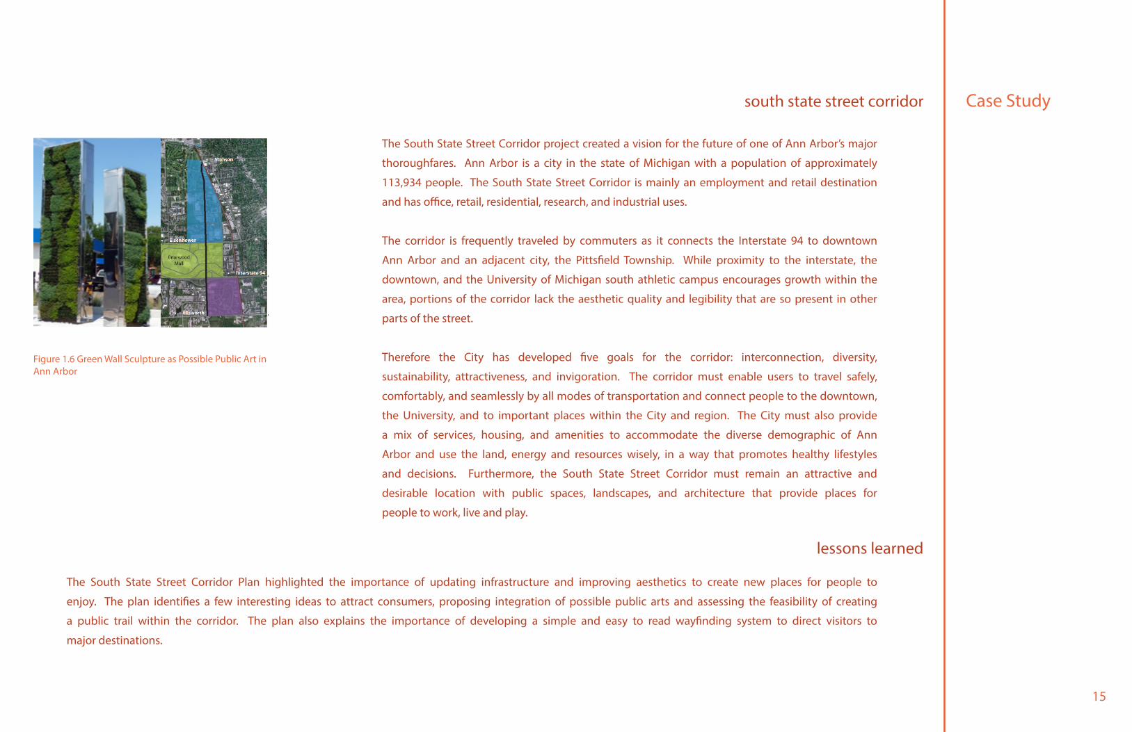
Figure 1.6 Green Wall Sculpture as Possible Public Art in Ann Arbor
Case Studysouth state street corridor
lessons learned
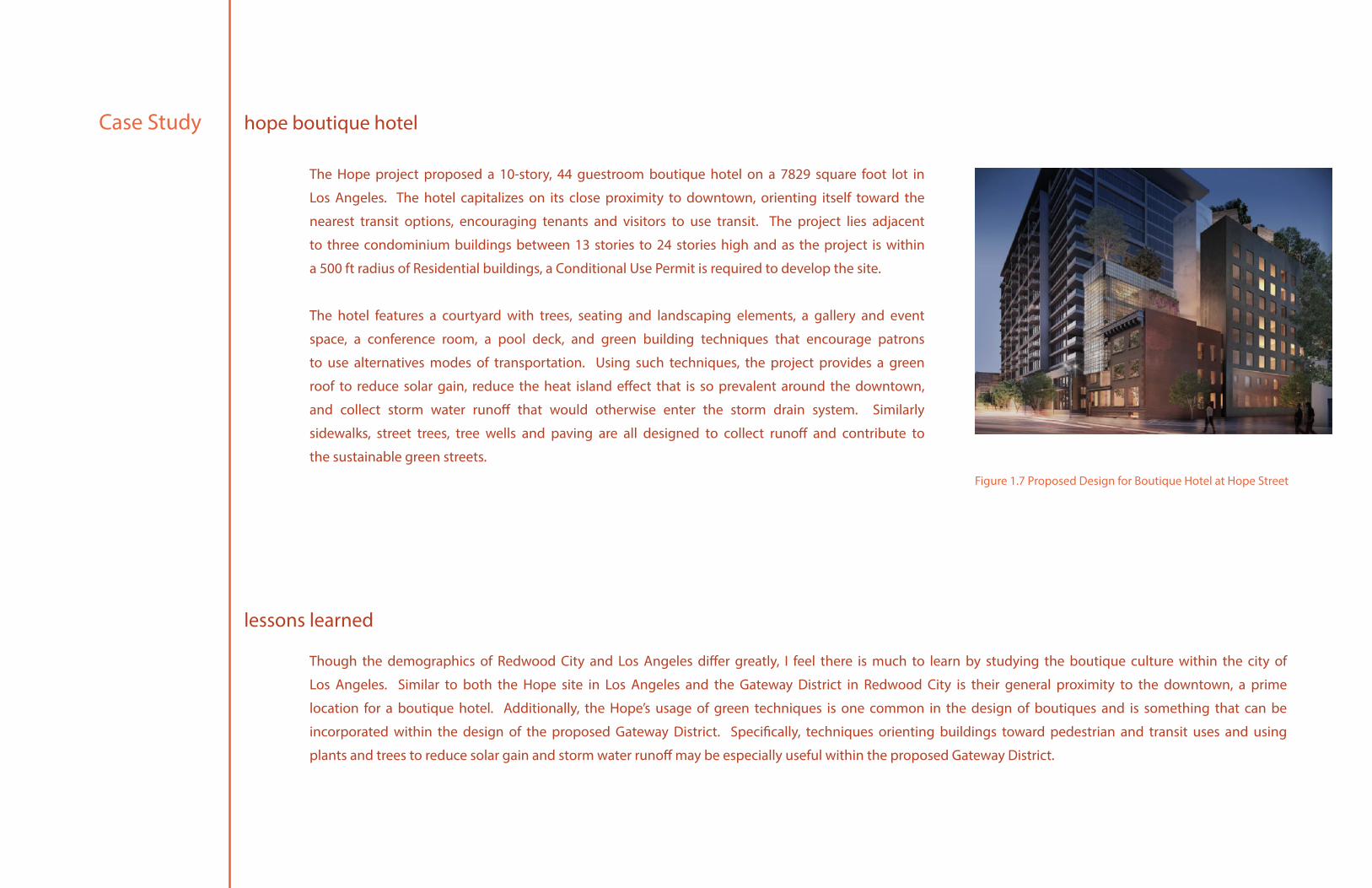
The Hope project proposed a 10-story, 44 guestroom boutique hotel on a 7829 square foot lot in
Los Angeles. The hotel capitalizes on its close proximity to downtown, orienting itself toward the
nearest transit options, encouraging tenants and visitors to use transit. The project lies adjacent
to three condominium buildings between 13 stories to 24 stories high and as the project is within
a 500 ft radius of Residential buildings, a Conditional Use Permit is required to develop the site.
The hotel features a courtyard with trees, seating and landscaping elements, a gallery and event
space, a conference room, a pool deck, and green building techniques that encourage patrons
to use alternatives modes of transportation. Using such techniques, the project provides a green
roof to reduce solar gain, reduce the heat island effect that is so prevalent around the downtown,
and collect storm water runoff that would otherwise enter the storm drain system. Similarly
sidewalks, street trees, tree wells and paving are all designed to collect runoff and contribute to
the sustainable green streets.
Though the demographics of Redwood City and Los Angeles differ greatly, I feel there is much to learn by studying the boutique culture within the city of
Los Angeles. Similar to both the Hope site in Los Angeles and the Gateway District in Redwood City is their general proximity to the downtown, a prime
location for a boutique hotel. Additionally, the Hope’s usage of green techniques is one common in the design of boutiques and is something that can be
incorporated within the design of the proposed Gateway District. Specifically, techniques orienting buildings toward pedestrian and transit uses and using
plants and trees to reduce solar gain and storm water runoff may be especially useful within the proposed Gateway District.
Case Study hope boutique hotel
lessons learned
Figure 1.7 Proposed Design for Boutique Hotel at Hope Street
17
The site for Carnegie Science Center is similar to that of the Gateway District in its prime location between two heavily traveled destinations and its
visibility from the freeway. A science center may be a good fit for the City of Redwood as it plans to expand its light industrial district (adjacent to the
Gateway District) and encourage new technologies and companies. As such it is important to address the needs of these future companies and create an
atmosphere fitting for such uses. Using sustainable design practices and integrating science into the landscape design are fascinating ideas used in the
Carnegie plan that may be essential to the creation of the Gateway District’s own design as it both brings sustainability to the site as well as incorporates
innovative design principles, supporting Redwood City’s mission to encourage new technologies. Furthermore the science center’s expansion of the Three
River’s Park and integration of public art into its design helps strengthen community growth and enhances the walkability of the site. While the scale and
scope of the Carnegie Science Center does match nor fit within the scope of the Gateway District Project, the design guidelines and principles used to
design the center are applicable to the Gateway District Project.
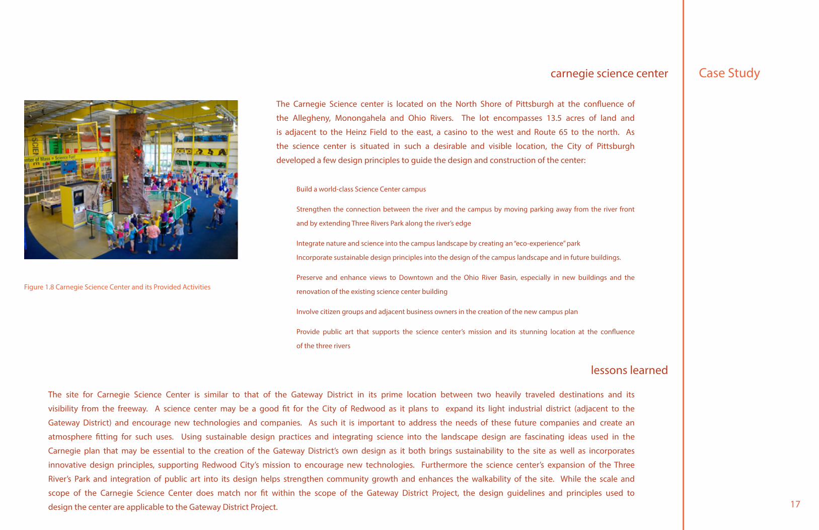
The Carnegie Science center is located on the North Shore of Pittsburgh at the confluence of
the Allegheny, Monongahela and Ohio Rivers. The lot encompasses 13.5 acres of land and
is adjacent to the Heinz Field to the east, a casino to the west and Route 65 to the north. As
the science center is situated in such a desirable and visible location, the City of Pittsburgh
developed a few design principles to guide the design and construction of the center:
Build a world-class Science Center campus
Strengthen the connection between the river and the campus by moving parking away from the river front
and by extending Three Rivers Park along the river’s edge
Integrate nature and science into the campus landscape by creating an “eco-experience” park
Incorporate sustainable design principles into the design of the campus landscape and in future buildings.
Preserve and enhance views to Downtown and the Ohio River Basin, especially in new buildings and the
renovation of the existing science center building
Involve citizen groups and adjacent business owners in the creation of the new campus plan
Provide public art that supports the science center’s mission and its stunning location at the confluence
of the three rivers
Case Studycarnegie science center
lessons learned
Figure 1.8 Carnegie Science Center and its Provided Activities

19
Existing Conditions
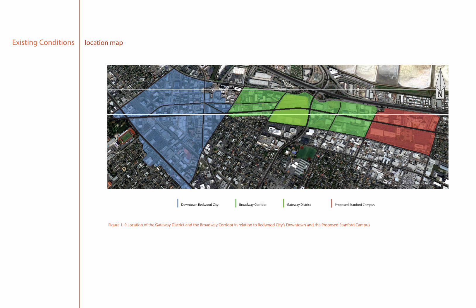
The Redwood City Gateway District is located within the Broadway Corridor at the intersection of Woodside Road and Broadway Street. Because of its proximity to both the City’s downtown and
the proposed Stanford campus as well as its adjacency to the Highway 101, the district is very well traveled, receiving large amounts of vehicular traffic daily. However, the Broadway Corridor Study
Area does not adequately support seamless multi-modal transportation options. Pedestrian amenities in the Corridor currently consist merely of sidewalks and crosswalks of poor condition while
signalized crosswalks only exist on major intersections. It is necessary that the Gateway District improves pedestrian mobility, reinforcing existing infrastructure to increase safety and walkability
within the district as the urban gateway must serve as an entrance, a public gathering place and needs to provide pedestrians adequate protection from vehicular traffic. Furthermore, as the
gateway must be a nexus, uses proposed must encourage community growth and provide public spaces for people to gather. Currently the Gateway District is mainly made up of commercial
and public uses. The north half of the district, divided by the Broadway Street, is the current location of the Redwood City Corporation Yard while the south portion is home to Redwood Plaza, a
regional commercial center with stores such as CVS, Foods Co, and Jack in the Box. Both lots are highly underutilized and the uses that occupy them must change in order to revitalize the area
and create a robust and noticeable gateway for Redwood City.
This thinking is consistent with survey analysis done earlier within the project. Findings state that majority surveyed concluded that the land that held the Corporation Yard was indeed underutilized
and while residents and patrons of Redwood City enjoyed the ability to shop in the Gateway District, many felt that parking was far too abundant and the space could be used to support some
other use.
Existing Conditions location map
Downtown Redwood City Broadway Corridor Gateway District Proposed Stanford Campus
n
Figure 1. 9 Location of the Gateway District and the Broadway Corridor in relation to Redwood City’s Downtown and the Proposed Stanford Campus

21
Existing Conditionsexisting land use map
Industrial-Light Mixed Use-Residential Public Public-Church Residential-Apartment Retail/Commercial-General Retail/Commercial-Office/Technology
Retail/Commercial-Small/Local Vacant with Improvements
800 ft
n
Figure 1. 10 Existing Land Uses in the Broadway Corridor

23
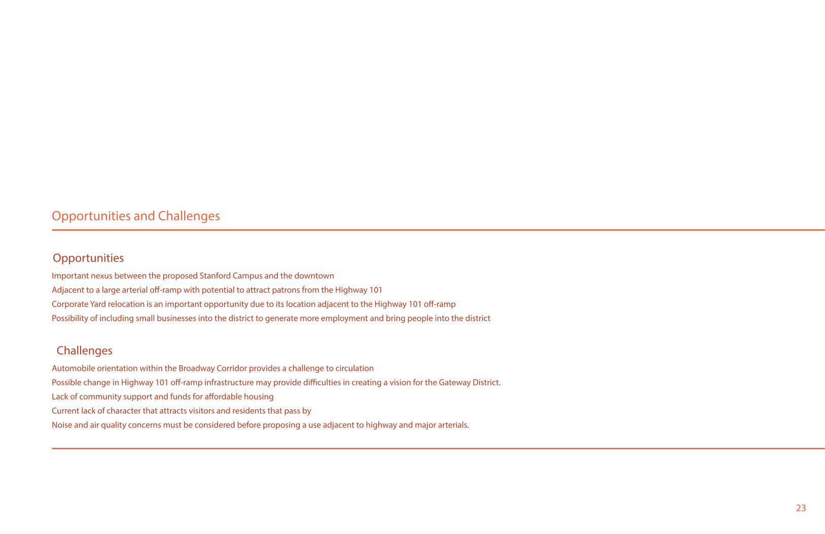
Opportunities and Challenges
Important nexus between the proposed Stanford Campus and the downtown
Adjacent to a large arterial off-ramp with potential to attract patrons from the Highway 101
Corporate Yard relocation is an important opportunity due to its location adjacent to the Highway 101 off-ramp
Possibility of including small businesses into the district to generate more employment and bring people into the district
Automobile orientation within the Broadway Corridor provides a challenge to circulation
Possible change in Highway 101 off-ramp infrastructure may provide difficulties in creating a vision for the Gateway District.
Lack of community support and funds for affordable housing
Current lack of character that attracts visitors and residents that pass by
Noise and air quality concerns must be considered before proposing a use adjacent to highway and major arterials.
Opportunities
Challenges

25
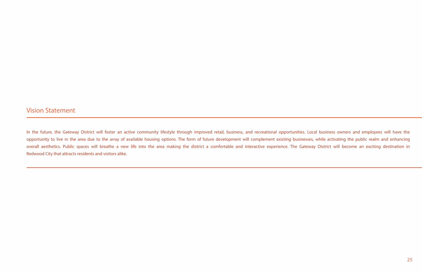
Vision Statement
In the future, the Gateway District will foster an active community lifestyle through improved retail, business, and recreational opportunities. Local business owners and employees will have the
opportunity to live in the area due to the array of available housing options. The form of future development will complement existing businesses, while activating the public realm and enhancing
overall aesthetics. Public spaces will breathe a new life into the area making the district a comfortable and interactive experience. The Gateway District will become an exciting destination in
Redwood City that attracts residents and visitors alike.
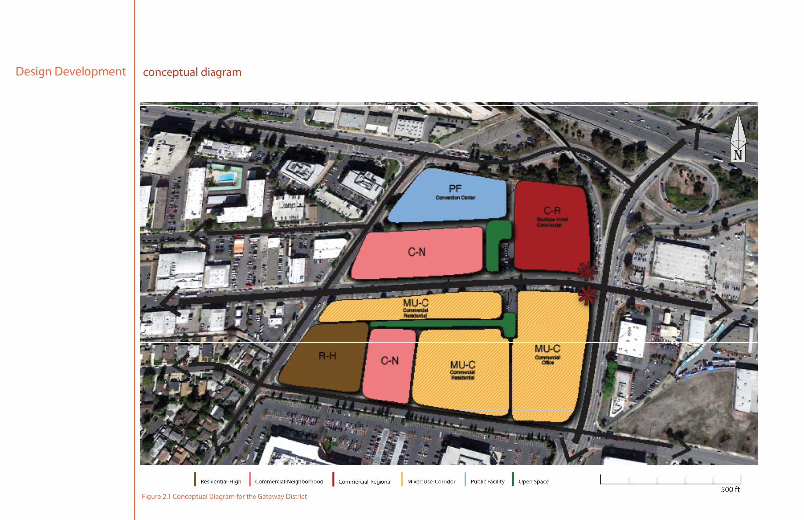
Design Development conceptual diagram
500 ft
n
Public Facility Open SpaceResidential-High Mixed Use-CorridorCommercial-RegionalCommercial-Neighborhood
Figure 2.1 Conceptual Diagram for the Gateway District
27
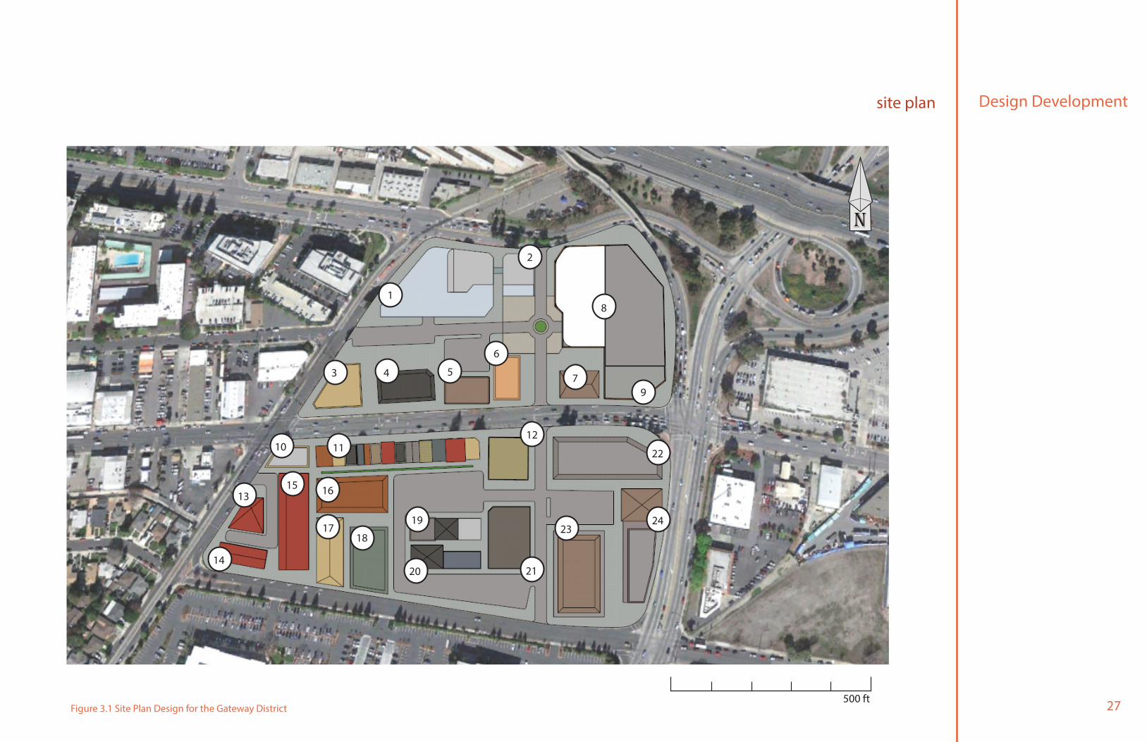
Design Developmentsite plan
500 ft
n
1
2
3 4 5
6
79
8
10
1315 16
11
1718
19
20 21
12
2324
22
14
Figure 3.1 Site Plan Design for the Gateway District
Design Development
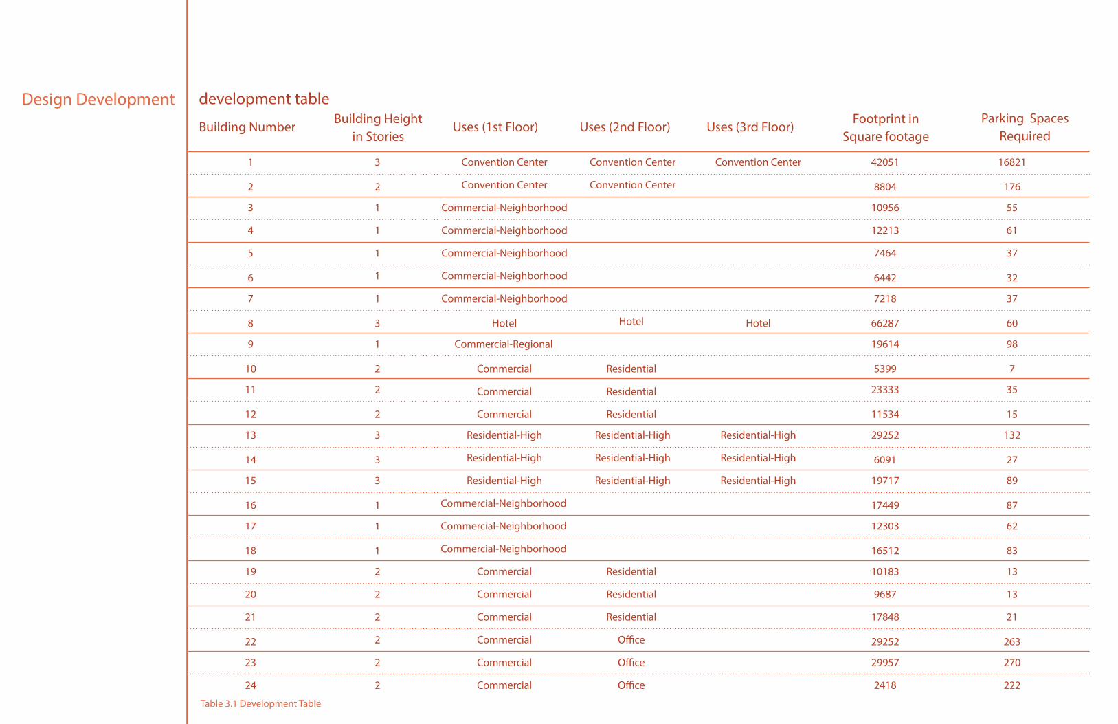
Building Number
1 Convention Center
Convention Center
Convention Center
Convention Center
Convention Center 42051 168213
21 17848 21
9 Commercial-Regional 19614 981
19 Commercial
Commercial
Commercial
Commercial
Commercial
Commercial
Residential
Residential
Residential
Office
Office
Office
10183 132
2
2
2
2
2
20 9687 13
5 7464 37
13 Residential-High
Residential-High
Residential-High
Residential-High
Residential-High
Residential-High
Residential-High
Residential-High
Residential-High
29252 1323
3 Commercial-Neighborhood
Commercial-Neighborhood
Commercial-Neighborhood
Commercial-Neighborhood
Commercial-Neighborhood
10956 551
1
1
1
1
23 29957 270
11 23333 352
7 7218 37
17 12303 621
15 19717 893
2 8804 1762
22 29252 263
10 Commercial
Commercial
Commercial
Residential
Residential
Residential
5399 72
6 6442 32
14 6091 273
4 12213 61
24 2418 222
12 11534 152
8 Hotel Hotel Hotel 66287 603
18 16512 831
16 Commercial-Neighborhood
Commercial-Neighborhood
Commercial-Neighborhood
17449 871
Building Height in Stories
Uses (1st Floor) Uses (2nd Floor) Uses (3rd Floor)Parking Spaces
RequiredFootprint in
Square footage
development table
Table 3.1 Development Table
29
Design Developmentproposal for parking requirement
The number of parking provided within the Gateway District: Urban Design Concept Proposal is less than what is required by the Redwood City Zoning
Ordinance. However, the land area required by the Zoning Ordinance for the proposed plan exceeds 40% of the total area of the site. It is crucial to consider
the value of land before proposing developments. With its adjacency to the highway off-ramp and main arterials and its proximity to both the proposed
Stanford Campus and the City’s Downtown, the Gateway District is perhaps among the most valuable and desirable locations in the city. Consequently,
in the interest of utilizing land most efficiently, it is important to reduce the total amount of parking spaces required within the Gateway District.
Redwood City has begun to expand their bike-share program and has recently proposed a light-rail system to increase public transportation options. A
reduction in vehicular parking will provide incentives for people to use alternative transportation options, increasing ridership of transit, and promoting a
healthier lifestyle through exercise and reduced air pollution. Specifically, a 20 percent reduction to the parking requirement for mixed-use buildings is will
be appropriate in utilizing land more efficiently. This minimization will reduce a significant quantity of unused space as it is expected that occupants and
patrons of mixed-use buildings will be able to share parking spaces. Such policy is feasible because residential, office, and commercial uses are projected
to have staggered peak parking demands.
Design Development
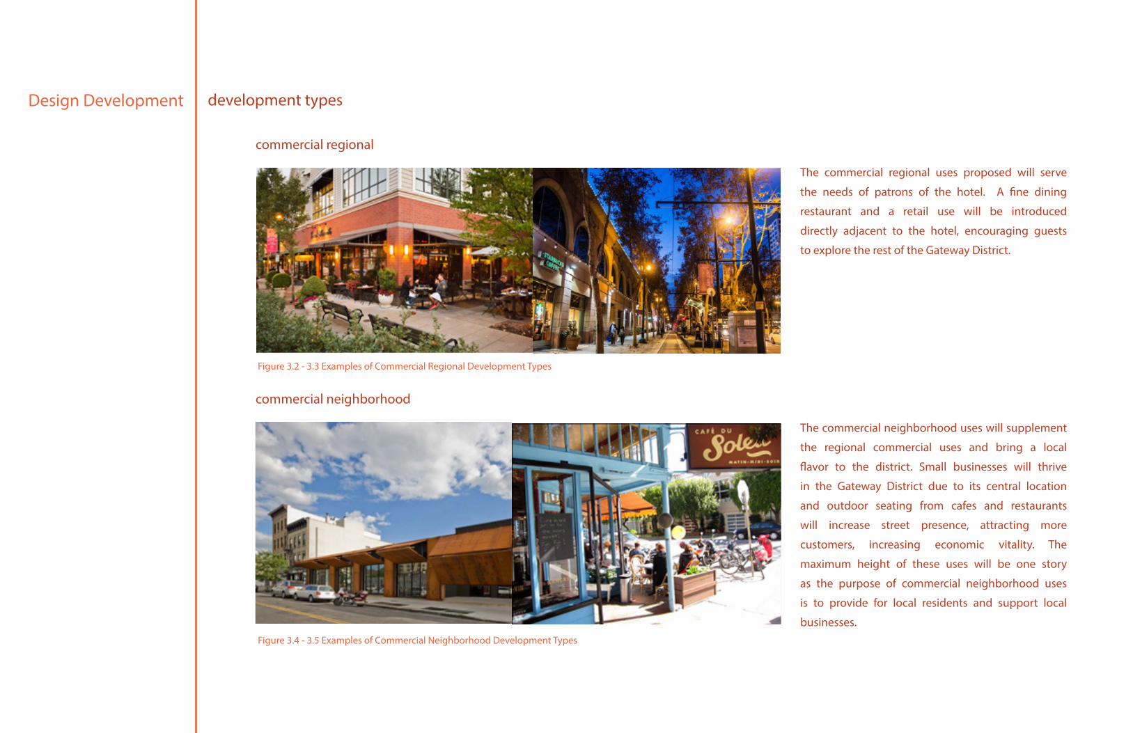
The commercial regional uses proposed will serve
the needs of patrons of the hotel. A fine dining
restaurant and a retail use will be introduced
directly adjacent to the hotel, encouraging guests
to explore the rest of the Gateway District.
The commercial neighborhood uses will supplement
the regional commercial uses and bring a local
flavor to the district. Small businesses will thrive
in the Gateway District due to its central location
and outdoor seating from cafes and restaurants
will increase street presence, attracting more
customers, increasing economic vitality. The
maximum height of these uses will be one story
as the purpose of commercial neighborhood uses
is to provide for local residents and support local
businesses.
development types
commercial regional
commercial neighborhood
Figure 3.2 - 3.3 Examples of Commercial Regional Development Types
Figure 3.4 - 3.5 Examples of Commercial Neighborhood Development Types
31
Design Developmentdevelopment types
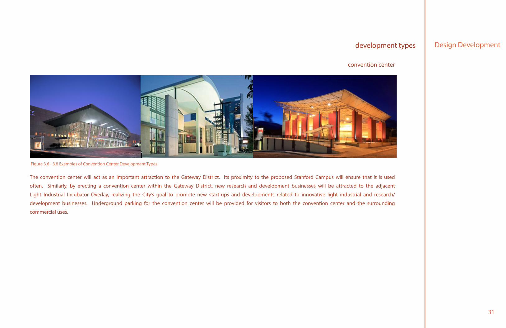
The convention center will act as an important attraction to the Gateway District. Its proximity to the proposed Stanford Campus will ensure that it is used
often. Similarly, by erecting a convention center within the Gateway District, new research and development businesses will be attracted to the adjacent
Light Industrial Incubator Overlay, realizing the City’s goal to promote new start-ups and developments related to innovative light industrial and research/
development businesses. Underground parking for the convention center will be provided for visitors to both the convention center and the surrounding
commercial uses.
convention center
Figure 3.6 - 3.8 Examples of Convention Center Development Types
Design Development
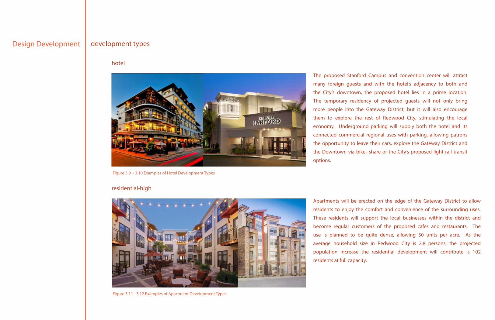
Apartments will be erected on the edge of the Gateway District to allow
residents to enjoy the comfort and convenience of the surrounding uses.
These residents will support the local businesses within the district and
become regular customers of the proposed cafes and restaurants. The
use is planned to be quite dense, allowing 50 units per acre. As the
average household size in Redwood City is 2.8 persons, the projected
population increase the residential development will contribute is 102
residents at full capacity.
development types
hotel
residential-high
commercial regional
The proposed Stanford Campus and convention center will attract
many foreign guests and with the hotel’s adjacency to both and
the City’s downtown, the proposed hotel lies in a prime location.
The temporary residency of projected guests will not only bring
more people into the Gateway District, but it will also encourage
them to explore the rest of Redwood City, stimulating the local
economy. Underground parking will supply both the hotel and its
connected commercial regional uses with parking, allowing patrons
the opportunity to leave their cars, explore the Gateway District and
the Downtown via bike- share or the City’s proposed light rail transit
options.
Figure 3.9 - 3.10 Examples of Hotel Development Types
Figure 3.11 - 3.12 Examples of Apartment Development Types
33
Design Developmentdevelopment types
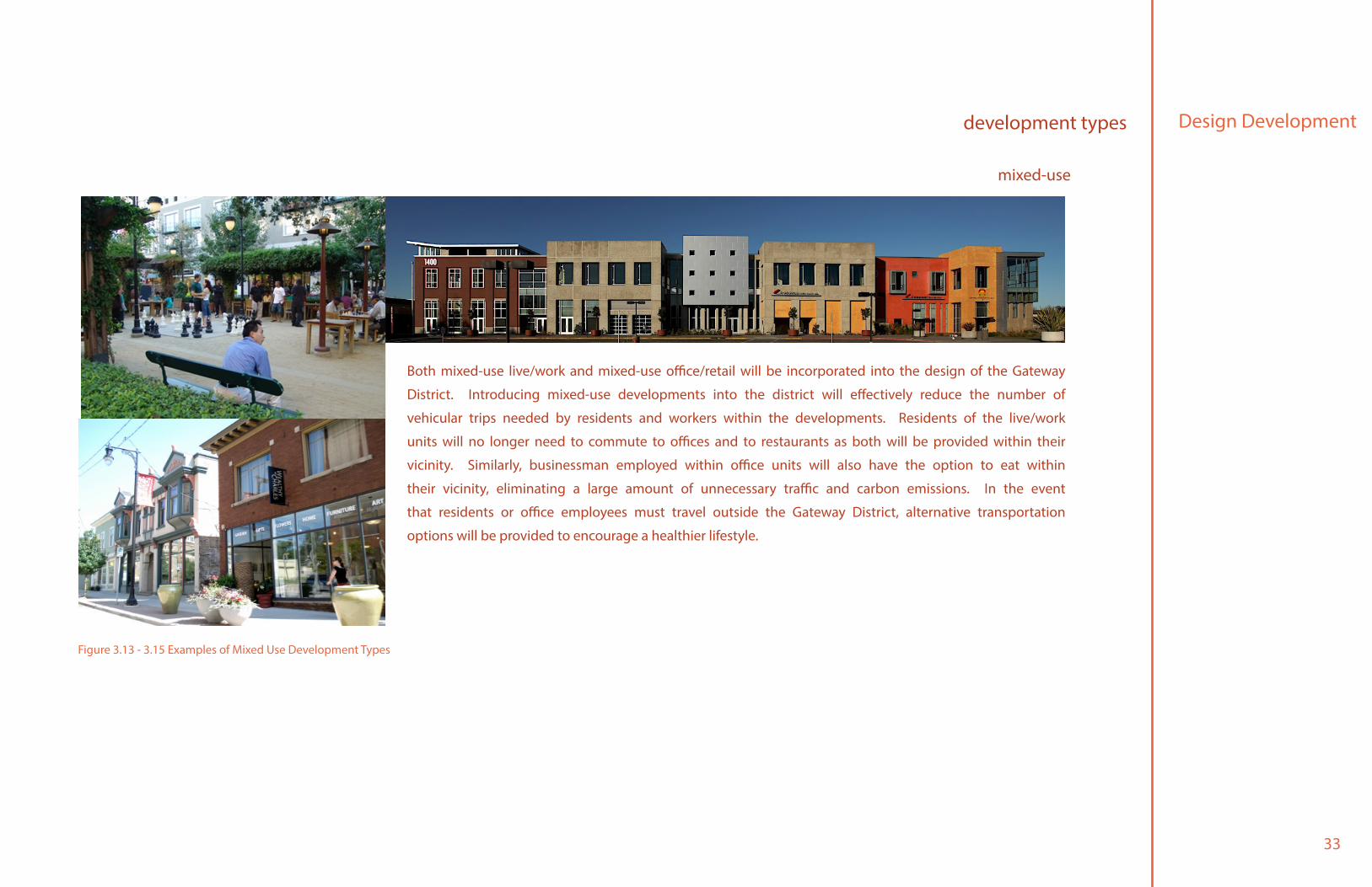
Both mixed-use live/work and mixed-use office/retail will be incorporated into the design of the Gateway
District. Introducing mixed-use developments into the district will effectively reduce the number of
vehicular trips needed by residents and workers within the developments. Residents of the live/work
units will no longer need to commute to offices and to restaurants as both will be provided within their
vicinity. Similarly, businessman employed within office units will also have the option to eat within
their vicinity, eliminating a large amount of unnecessary traffic and carbon emissions. In the event
that residents or office employees must travel outside the Gateway District, alternative transportation
options will be provided to encourage a healthier lifestyle.
mixed-use
Figure 3.13 - 3.15 Examples of Mixed Use Development Types
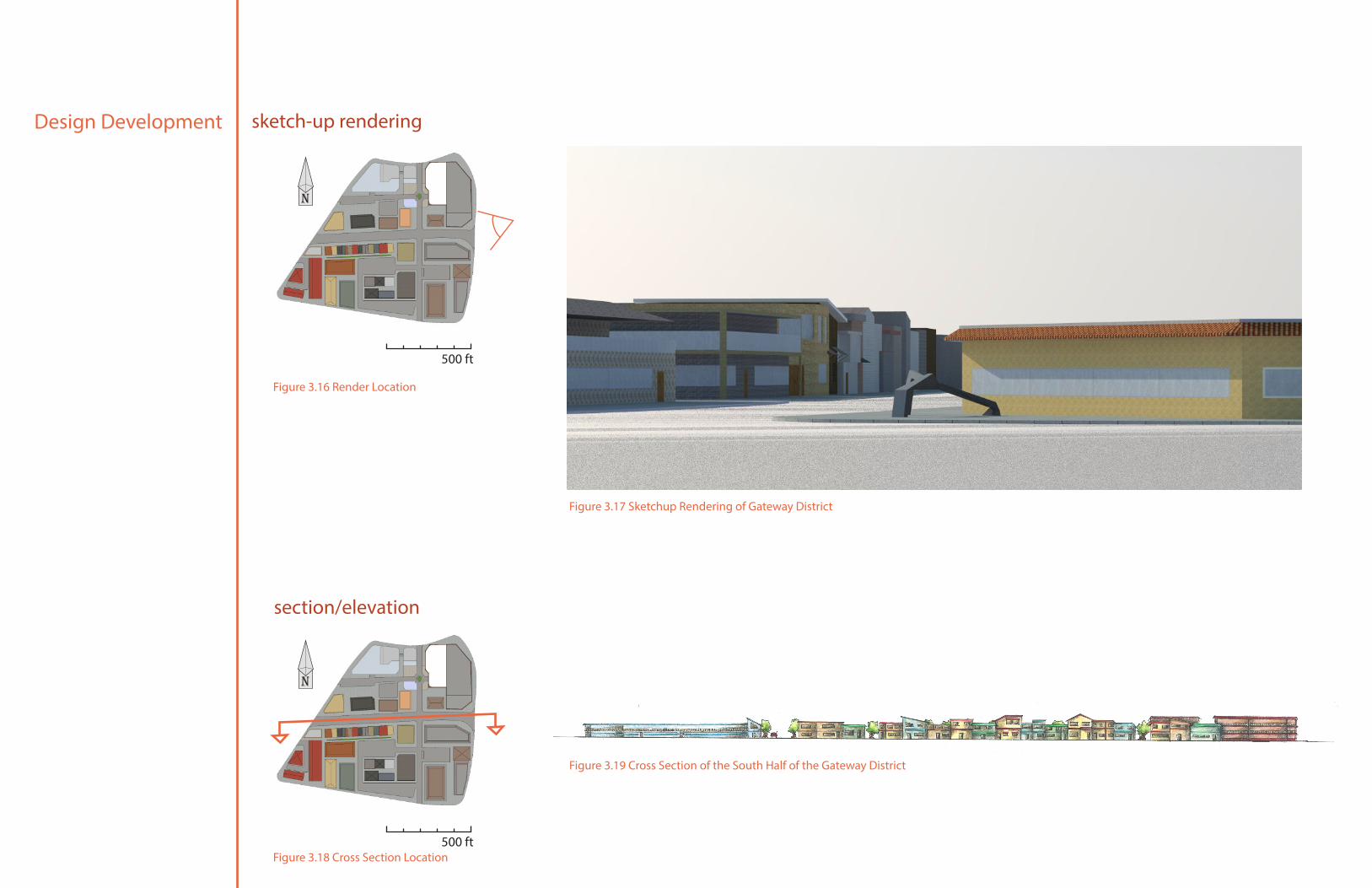
Design Development sketch-up rendering
section/elevation
500 ft
500 ft
n
n
Figure 3.17 Sketchup Rendering of Gateway District
Figure 3.19 Cross Section of the South Half of the Gateway District
Figure 3.16 Render Location
Figure 3.18 Cross Section Location
35
Conclusion
The exposure of the intersection at Woodside Road and Broadway Street to commuters, visitors and residents makes the Gateway District an ideal location for development. The opportunities for
the area are outstanding due to the availability of land, its visibility from the freeway, and its proximity to both Redwood City’s Downtown and the Stanford Campus. Such factors make the Gateway
District one of the most desirable places for development in Redwood City. As an urban gateway, the proposed district will support surrounding uses by providing shops for consumers, restaurants
for commuters, and housing for local residents. Additionally, the hotel and convention center will help promote both the Stanford Campus and the emerging businesses from the adjacent Light
Industrial Incubator. With the help of locals of Redwood City, these potential prospects of the Gateway District can be maximized and realized.

37
References
Çalışkan, O. (). Urban Gateway: Just a Symbol, or More? (Reappraising an Old Idea in the Case of Ankara). Journal of Urban Design, 15, 91-122.
The Concept. (n.d.). Boutique Hotel Budapest. Retrieved , from http://www.boutiquehotelbudapest.com/en/home/the-concept/
Joseph, B. P., & Wu, J. The Effects of the New Trend in Hotel Design. International Hospitality Research Centre Switzerland.
Gensler, Social Impact. (Jan 2012) Clearwater East Gateway Vision Plan.
City of Ann Arbor. (2013) South State Street Corridor Plan
Urban Design Center. (2013) Boutique Hotel 1130 Hope Street.
Urban Design Associates. (Sept 2008) Carnegie Science Center Master Development Plan.

Approval
Title: Gateway District: Urban Design Concept
Author: Jonathan Chiu
Date Submitted: 6/11/14
Zeljka P. Howard | Senior Project Advisor
Signature
Signature
Date
Date
Hemalata C. Dandekar | Department Head

Approval
Title: Gateway District: Urban Design Concept
Author: Jonathan Chiu
Date Submitted: 6/11/14
Grade Assigned
Zeljka P. Howard | Senior Project Advisor
Signature
Signature
Date
Date
Hemalata C. Dandekar | Department Head