Embed Size (px)
Citation preview
21BACKGROUND
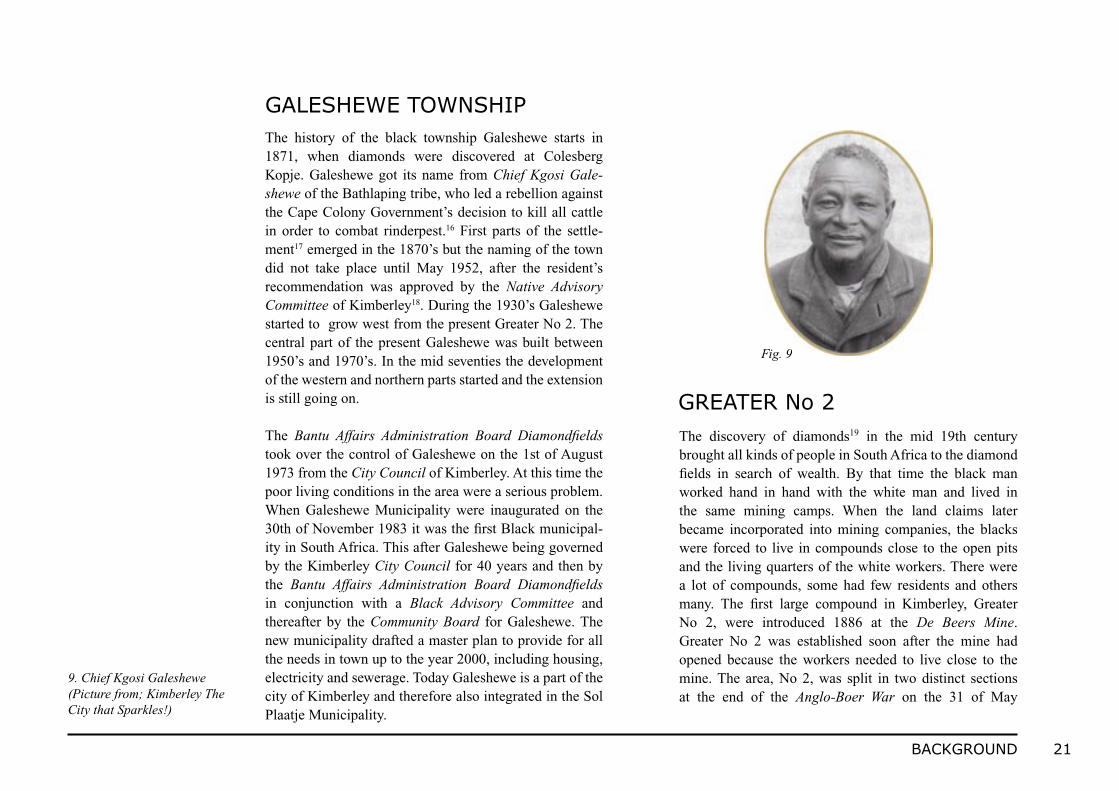
The history of the black township Galeshewe starts in 1871, when diamonds were discovered at Colesberg Kopje. Galeshewe got its name from Chief Kgosi Gale-shewe of the Bathlaping tribe, who led a rebellion against the Cape Colony Government’s decision to kill all cattle in order to combat rinderpest.16 First parts of the settle-ment17 emerged in the 1870’s but the naming of the town did not take place until May 1952, after the resident’s recommendation was approved by the Native Advisory Committee of Kimberley18. During the 1930’s Galeshewe started to grow west from the present Greater No 2. The central part of the present Galeshewe was built between 1950’s and 1970’s. In the mid seventies the development of the western and northern parts started and the extension is still going on.
The Bantu Affairs Administration Board Diamondfields took over the control of Galeshewe on the 1st of August 1973 from the City Council of Kimberley. At this time the poor living conditions in the area were a serious problem. When Galeshewe Municipality were inaugurated on the 30th of November 1983 it was the first Black municipal-ity in South Africa. This after Galeshewe being governed by the Kimberley City Council for 40 years and then by the Bantu Affairs Administration Board Diamondfields in conjunction with a Black Advisory Committee and thereafter by the Community Board for Galeshewe. The new municipality drafted a master plan to provide for all the needs in town up to the year 2000, including housing, electricity and sewerage. Today Galeshewe is a part of the city of Kimberley and therefore also integrated in the Sol Plaatje Municipality.
GALESHEWE TOWNSHIP
The discovery of diamonds19 in the mid 19th century brought all kinds of people in South Africa to the diamond fields in search of wealth. By that time the black man worked hand in hand with the white man and lived in the same mining camps. When the land claims later became incorporated into mining companies, the blacks were forced to live in compounds close to the open pits and the living quarters of the white workers. There were a lot of compounds, some had few residents and others many. The first large compound in Kimberley, Greater No 2, were introduced 1886 at the De Beers Mine. Greater No 2 was established soon after the mine had opened because the workers needed to live close to the mine. The area, No 2, was split in two distinct sections at the end of the Anglo-Boer War on the 31 of May
GREATER No 2
9. Chief Kgosi Galeshewe (Picture from; Kimberley The City that Sparkles!)
Fig. 9
22 BACKGROUND
During the former apartheid period many protests against the system took place in Greater No 2. It is one of the reasons why the area used to be known as the most violent part of Galeshewe. The people in Greater No 2 were always the target when there were grumblings and com-plaints. It was often pointed out as one of the slum areas in Kimberley.23
Many houses in Greater No 2 are today in bad condition. The reason why there are few houses to preserve is that they were built in traditional, less durable materials such as mud.24 To improve the living conditions the municipal-ity today helps inhabitants to build new, so called RDP-houses. These houses are built under the relatively new Reconstruction and Development Program initiated by the new government in 1994. Roads in contrast, are much better than the houses. The road surface of the narrow streets were paved with concrete stones in 1998. At the same time the area was provided with a municipal water reticulation and sewerage system. The water system was extended to the plot boundaries and every house got a tap outside.
1902. At that time the total population in the area was 6 000-7 000, and about 800 huts were available for ac-commodation. The streets were about 60 feet in width (18 meters).
From the beginning, black people established themselves almost spontaneously in the No 2 area. After a while the area expanded to accommodate the natural increase of the No 2 area residents and also families from other areas in Kimberley.20
The main street running through the area, Royal Street, was built 1915. As late as 1982 there were no street lighting in Greater No 2. However, high mast lights have been in use since the 1970’s as a result of the apartheid government. Water was supplied for free to the inhabit-ants and in 1943 the first Kindergarten for black people in the whole of South Africa were opened in Greater No 221. One of the two first state controlled beerhalls in Kimberley were located in Greater No 2. In this beerhall alcoholic beverages were served to the inhabitants, but women and men had separate areas. In 1952 the Bantu Hall, the com-munity hall, and the Beerhall were burned down, but they were quickly rebuilt.22 Besides these social services there was also a law practice along Royal Street. Mr Robert Sobukwe, the first president for the Pan African Congress, PAC, owned the practice. He managed the law-practice for many years in the still existing house. Today it is turned into a small shop.

23BACKGROUND
The former political system has resulted in very inequi-table, inefficient, unsustainable and expensive cities to manage and maintain and to exacerbating poverty and un-employment. Both the country’s history and a number of trends, which are evidence all over the world, are reflected in current urban structure. Evidence for this new trend is the new scale of today´s cities, their extended spread or reach and there multi-centred form.25
The IDP points out that planning in South Africa has been characterised by a bureaucratic process, which predomi-nantly concentrated on the regulation and control of land use aimed at entrenching racial segregation. This means that planning mainly served the needs of a relatively small privileged group. Historically planning gave little or no at-tention to the questions of maximising the development of the country in the interest of the whole population. Ques-tions like poverty alleviation and economic development was given little consideration and environmental sustain-ability was ignored. Planning was instead concentrated on legalistic and bureaucratic approaches that discouraged community participation. Both planning and implementa-tion tended towards a sectoral approach, which failed to integrate and make the important developmental linkages between different sectors. Instead of focus on integrated development it tended towards planning for segregation.
White urban centres and their economies were inrended to be supported by the development of black townships, labour ”reservoirs”.26 Very little consideration to preserve the dignity of people and maintaining a reasonable standard of living was considered in these townships.
They were planned in a way that no economic activity could take place, which was the way to plan under the apartheid system. Almost no social amenities existed in the townships since recreation often was synonymous with beerhalls and health care facilities and health programmes. To deal with the population growth there was gross under-provisioning of infrastructure development. Galeshewe is an example of the national strategy of planning with the intention to control and manipulate black South Africans. One example of this is that water reticulation in Galesh-ewe was completed as late as 1995. Some residents are still relying on the bucket system for their sanitation and many families in Galeshewe can still feel the devastating impact and effect from the apartheid planning.
Sol Plaatje Municipality´s IDP from 2002 points out that there has been a significant shift towards a different approach to planning and delivery since South Africa became a democratic nation in 1994. The new planning seeks community involvement to identify key priorities and to ensure that maximised resources are directed at delivering these priorities. This ended up in important planning principles and concepts that were refined and named Integrated Development Planning.
Governments at all levels have since the dismantling of the apartheid in 1994 been working on removing the in-equalities of the old system. Priorities are now orientated towards low-income households in the formerly black townships to provide them with infrastructure. This has placed particular pressure on municipalities.27
PLANNING
24 BACKGROUND
In a report by MacFarlane and Daniels, Professor Manual Castell says that cities are the home for more than 50 % of the world’s population. An even a higher percentage is projected by 2020. The area of sub-Saharan Africa has the fastest rate of urbanisation in the world. A crisis of poverty and social disintegration is the result of globalisation in cities around the world. Metropolitan sprawls have over-taken the traditional cities as coherent spaces of communal intersection. Because of this trend it is an urgent world-wide priority to reconstruct cities. Spatial concentration of jobs, human development possibilities and services such as finance, law, health and education partly drive the trend toward urbanisation. At least three elements is needed to reconstruct a city; accountable and democratic metropoli-tan governments, new ideas of strategic planning, restore ways of balancing individual freedoms and communal interactions for example by recreate public spaces since it is there that the communal cohesiveness can occur. Castell says that; ”public spaces are the signs of bridges among us. We need to build bridges among different communica-tion channels. Links must be restored between power and experience, culture and technology”28.
According to the CUP, Draft 1998, it is due to the former political system in South Africa that municipalities have not worked to improve the environments in the townships. Since the political system changed in 1994 municipali-ties have started to work with these former disadvantaged areas. South Africa is at present planning for spatial and social integration of their multi-centred cities through a process of densification, aiming at enhancing the effec-
CHALLENGES FOR TODAYtiveness of public transport. This process has to incorpo-rate city cores and peripheries as well as the social and economic activities in all areas of the city. In Kimberley this selective intensification is seen to occur mainly along already existing public transportation corridors, on large tracts of under-utilised or vacant land and on suitable mining land and at various existing new and emerging nodal points in the urban system.
The CUP points out access to urban land as the most critical element for overcoming poverty in the city. The problem is that land can not be identified and allocated in sufficient quantities and in appropriate locations for the poor, due to the fact that they in the past has been denied urban land ownership.
”The work with undoing the Apartheid City will focus on:· linking the component parts of the city through high-density activity corridors;· township upgrading;· urban in-fill;· development and integration of apartheid devel- oped ”buffer zones”;· inner city redevelopment;· development and provision of adequate open spaces for recreational purposes; and· land reform programmes (restitution, redistribution and tenure reform).”29
25BACKGROUND
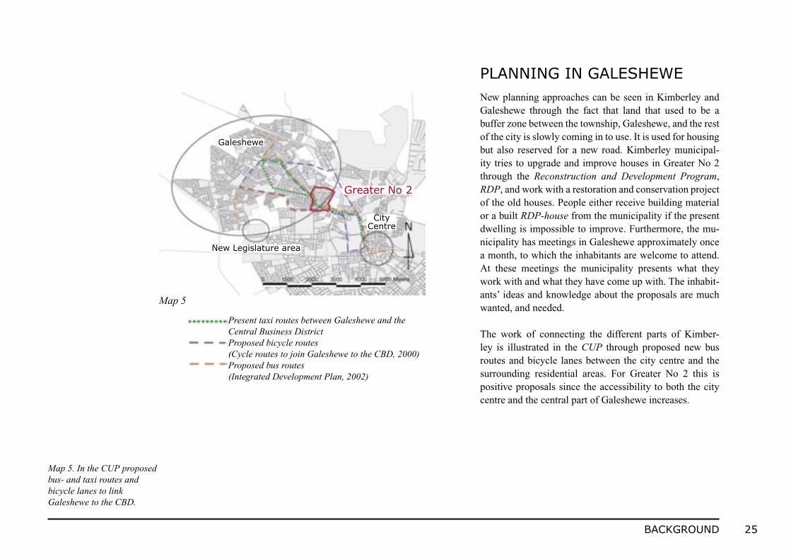
Map 5. In the CUP proposed bus- and taxi routes and bicycle lanes to link Galeshewe to the CBD.
PLANNING IN GALESHEWENew planning approaches can be seen in Kimberley and Galeshewe through the fact that land that used to be a buffer zone between the township, Galeshewe, and the rest of the city is slowly coming in to use. It is used for housing but also reserved for a new road. Kimberley municipal-ity tries to upgrade and improve houses in Greater No 2 through the Reconstruction and Development Program, RDP, and work with a restoration and conservation project of the old houses. People either receive building material or a built RDP-house from the municipality if the present dwelling is impossible to improve. Furthermore, the mu-nicipality has meetings in Galeshewe approximately once a month, to which the inhabitants are welcome to attend. At these meetings the municipality presents what they work with and what they have come up with. The inhabit-ants’ ideas and knowledge about the proposals are much wanted, and needed.
The work of connecting the different parts of Kimber-ley is illustrated in the CUP through proposed new bus routes and bicycle lanes between the city centre and the surrounding residential areas. For Greater No 2 this is positive proposals since the accessibility to both the city centre and the central part of Galeshewe increases.
Map 5
Greater No 2
Galeshewe
CityCentre
New Legislature area
Present taxi routes between Galeshewe and the Central Business DistrictProposed bicycle routes(Cycle routes to join Galeshewe to the CBD, 2000)Proposed bus routes(Integrated Development Plan, 2002)
26 INVENTORY
FACTS GREATER No 2 Average household size 5; several generations often living togetherArea 57,76 haEstimated population 7555Population per ha 131
FACTS KIMBERLEYAverage household size 4,5Area 5576,5 haEstimated population 212.257Population per ha 38
I N V E N TO R Y
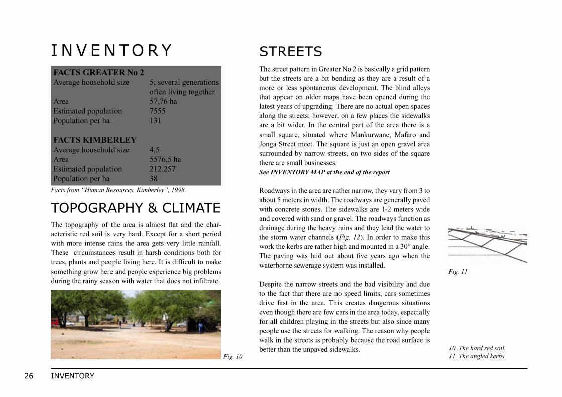
The topography of the area is almost flat and the char-acteristic red soil is very hard. Except for a short period with more intense rains the area gets very little rainfall. These circumstances result in harsh conditions both for trees, plants and people living here. It is difficult to make something grow here and people experience big problems during the rainy season with water that does not infiltrate.
Facts from “Human Resources, Kimberley”, 1998.
TOPOGRAPHY & CLIMATE
STREETSThe street pattern in Greater No 2 is basically a grid pattern but the streets are a bit bending as they are a result of a more or less spontaneous development. The blind alleys that appear on older maps have been opened during the latest years of upgrading. There are no actual open spaces along the streets; however, on a few places the sidewalks are a bit wider. In the central part of the area there is a small square, situated where Mankurwane, Mafaro and Jonga Street meet. The square is just an open gravel area surrounded by narrow streets, on two sides of the square there are small businesses. See INVENTORY MAP at the end of the report
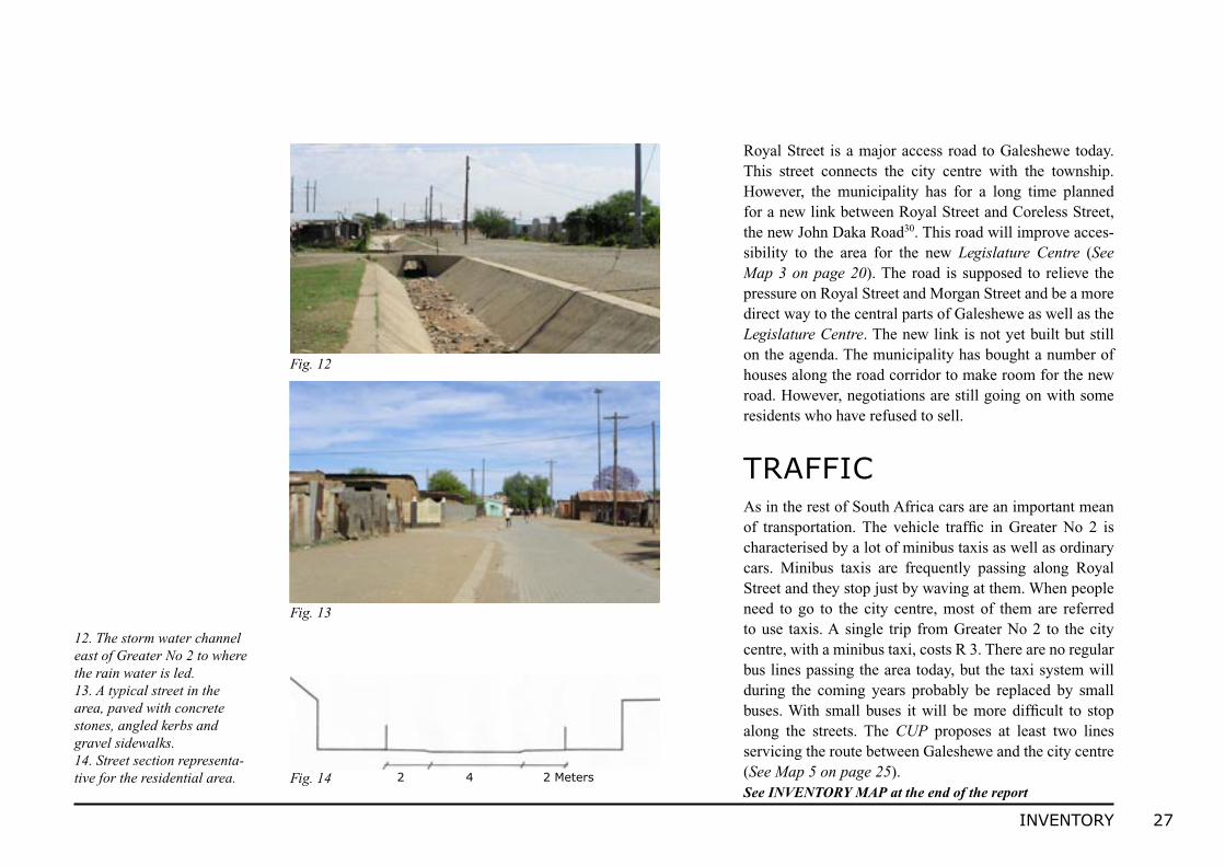
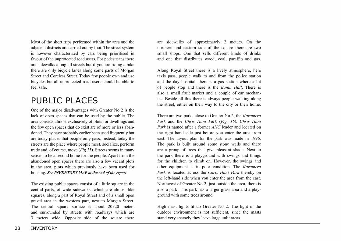
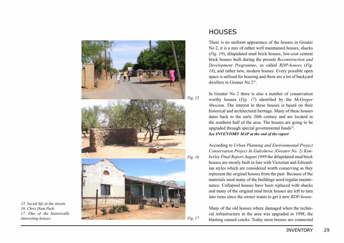
Roadways in the area are rather narrow, they vary from 3 to about 5 meters in width. The roadways are generally paved with concrete stones. The sidewalks are 1-2 meters wide and covered with sand or gravel. The roadways function as drainage during the heavy rains and they lead the water to the storm water channels (Fig. 12). In order to make this work the kerbs are rather high and mounted in a 30° angle. The paving was laid out about five years ago when the waterborne sewerage system was installed.
Despite the narrow streets and the bad visibility and due to the fact that there are no speed limits, cars sometimes drive fast in the area. This creates dangerous situations even though there are few cars in the area today, especially for all children playing in the streets but also since many people use the streets for walking. The reason why people walk in the streets is probably because the road surface is better than the unpaved sidewalks.
Fig. 1010. The hard red soil.11. The angled kerbs.
Fig. 11
27INVENTORY
Royal Street is a major access road to Galeshewe today. This street connects the city centre with the township. However, the municipality has for a long time planned for a new link between Royal Street and Coreless Street, the new John Daka Road30. This road will improve acces-sibility to the area for the new Legislature Centre (See Map 3 on page 20). The road is supposed to relieve the pressure on Royal Street and Morgan Street and be a more direct way to the central parts of Galeshewe as well as the Legislature Centre. The new link is not yet built but still on the agenda. The municipality has bought a number of houses along the road corridor to make room for the new road. However, negotiations are still going on with some residents who have refused to sell.
TRAFFICAs in the rest of South Africa cars are an important mean of transportation. The vehicle traffic in Greater No 2 is characterised by a lot of minibus taxis as well as ordinary cars. Minibus taxis are frequently passing along Royal Street and they stop just by waving at them. When people need to go to the city centre, most of them are referred to use taxis. A single trip from Greater No 2 to the city centre, with a minibus taxi, costs R 3. There are no regular bus lines passing the area today, but the taxi system will during the coming years probably be replaced by small buses. With small buses it will be more difficult to stop along the streets. The CUP proposes at least two lines servicing the route between Galeshewe and the city centre (See Map 5 on page 25). See INVENTORY MAP at the end of the report
Fig. 12
Fig. 13
12. The storm water channel east of Greater No 2 to where the rain water is led.13. A typical street in the area, paved with concrete stones, angled kerbs and gravel sidewalks.14. Street section representa-tive for the residential area. Fig. 14 2 4 2 Meters
28 INVENTORY
Most of the short trips performed within the area and the adjacent districts are carried out by foot. The street system is however characterized by cars being prioritised in favour of the unprotected road users. For pedestrians there are sidewalks along all streets but if you are riding a bike there are only bicycle lanes along some parts of Morgan Street and Coreless Street. Today few people own and use bicycles but all unprotected road users should be able to feel safe.
PUBLIC PLACESOne of the major disadvantages with Greater No 2 is the lack of open spaces that can be used by the public. The area consists almost exclusively of plots for dwellings and the few open spaces that do exist are of more or less aban-doned. They have probably earlier been used frequently but are today places that people only pass. Instead, today the streets are the place where people meet, socialize, perform trade and, of course, move (Fig 15). Streets seems in many senses to be a second home for the people. Apart from the abandoned open spaces there are also a few vacant plots in the area, plots which previously have been used for housing. See INVENTORY MAP at the end of the report
The existing public spaces consist of a little square in the central parts, of wide sidewalks, which are almost like squares, along a part of Royal Street and of a small open gravel area in the western part, next to Morgan Street. The central square surface is about 20x20 meters and surrounded by streets with roadways which are 3 meters wide. Opposite side of the square there
are sidewalks of approximately 2 meters. On the northern and eastern side of the square there are two small shops. One that sells different kinds of drinks and one that distributes wood, coal, paraffin and gas.
Along Royal Street there is a lively atmosphere, here taxis pass, people walk to and from the police station and the day hospital, there is a gas station where a lot of people stop and there is the Bantu Hall. There is also a small fruit market and a couple of car mechan-ics. Beside all this there is always people walking along the street, either on their way to the city or their home.
There are two parks close to Greater No 2, the Karamera Park and the Chris Hani Park (Fig. 16). Chris Hani Park is named after a former ANC leader and located on the right hand side just before you enter the area from east. The layout plan for the park was made in 1996. The park is built around some stone walls and there are a group of trees that give pleasant shade. Next to the park there is a playground with swings and things for the children to climb on. However, the swings and other equipment is in poor condition. The Karamera Park is located across the Chris Hani Park thereby on the left-hand side when you enter the area from the east. Northwest of Greater No 2, just outside the area, there is also a park. This park has a larger grass area and a play-ground with some trees around.
High mast lights lit up Greater No 2. The light in the outdoor environment is not sufficient, since the masts stand very sparsely they leave large unlit areas.
29INVENTORY
There is no uniform appearance of the houses in Greater No 2, it is a mix of rather well maintained houses, shacks (Fig. 19), dilapidated mud brick houses, low-cost cement brick houses built during the present Reconstruction and Development Programme, so called RDP-houses (Fig. 18), and rather new, modern houses. Every possible open space is utilised for housing and there are a lot of backyard dwellers in Greater No 231.
In Greater No 2 there is also a number of conservation worthy houses (Fig. 17) identified by the McGregor Museum. The interest in these houses is based on their historical and architectural heritage. Many of these houses dates back to the early 20th century and are located in the southern half of the area. The houses are going to be upgraded through special governmental funds32. See INVENTORY MAP at the end of the report
According to Urban Planning and Environmental Project Conservation Project In Galeshewe (Greater No. 2) Kim-berley Final Report August 1999 the dilapidated mud brick houses are mostly built in line with Victorian and Edward-ian styles which are considered worth conserving as they represent the original houses from the past. Because of the materials used many of the buildings need regular mainte-nance. Collapsed houses have been replaced with shacks and many of the original mud brick houses are left to turn into ruins since the owner wants to get a new RDP-house.
Many of the old houses where damaged when the techni-cal infrastructure in the area was upgraded in 1998, the blasting caused cracks. Today most houses are connected
HOUSES
Fig. 15
Fig. 16
Fig. 17
15. Social life in the streets.16. Chris Hani Park.17. One of the historically interesting houses.
30 INVENTORY
to municipal water and electricity systems. The fresh water taps are placed outside, on the plots, and if people want it inside the house they have to pay for it themselves. The distance between the house and the street are often not more than 5 meters. Although difficult, it is possible to restore the old mud brick houses33, first the structure has to be restored and then it is possible to cover the facade with a special kind of plaster. This is a method that can help preserving the houses for many more years.
According to local inhabitants there are a lot of old people living in Greater No 2. There are also a lot of children and young people but not quite as many middle-aged. The un-employment rate is rather high and most of the inhabitants live under simple conditions. A big problem for the people living here is the lack of occupation. Our impression is that a lot of people suffer because there are few things to do, few job opportunities and a lack of social and recreational activities contribute to a negative attitude. However, the area used to be much poorer than it is today, nowadays more people have jobs and therefore also opportunities to upgrade their houses and gardens34. Most inhabitants we have interviewed appreciate people coming and visiting the area and the attitude concerning future tourism is positive.
LIVING CONDITIONS
Fig. 18
Fig. 19
Fig. 20
18. A RDP-house.19. Schacks and ordinary houses are often located on the same plot.20. Three or four generations often live together.
31INVENTORY
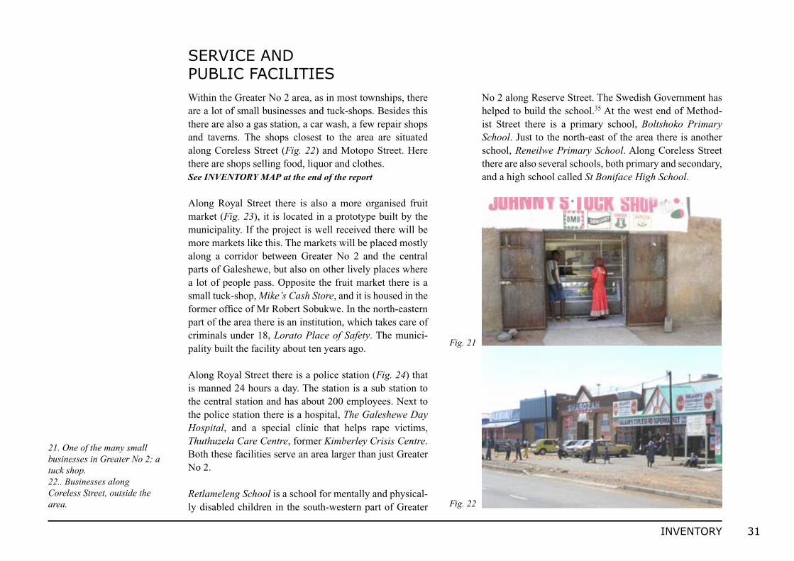
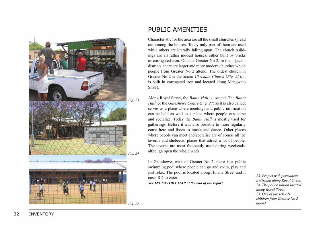
Within the Greater No 2 area, as in most townships, there are a lot of small businesses and tuck-shops. Besides this there are also a gas station, a car wash, a few repair shops and taverns. The shops closest to the area are situated along Coreless Street (Fig. 22) and Motopo Street. Here there are shops selling food, liquor and clothes.See INVENTORY MAP at the end of the report
Along Royal Street there is also a more organised fruit market (Fig. 23), it is located in a prototype built by the municipality. If the project is well received there will be more markets like this. The markets will be placed mostly along a corridor between Greater No 2 and the central parts of Galeshewe, but also on other lively places where a lot of people pass. Opposite the fruit market there is a small tuck-shop, Mike’s Cash Store, and it is housed in the former office of Mr Robert Sobukwe. In the north-eastern part of the area there is an institution, which takes care of criminals under 18, Lorato Place of Safety. The munici-pality built the facility about ten years ago.
Along Royal Street there is a police station (Fig. 24) that is manned 24 hours a day. The station is a sub station to the central station and has about 200 employees. Next to the police station there is a hospital, The Galeshewe Day Hospital, and a special clinic that helps rape victims, Thuthuzela Care Centre, former Kimberley Crisis Centre. Both these facilities serve an area larger than just Greater No 2.
Retlameleng School is a school for mentally and physical-ly disabled children in the south-western part of Greater
No 2 along Reserve Street. The Swedish Government has helped to build the school.35 At the west end of Method-ist Street there is a primary school, Boltshoko Primary School. Just to the north-east of the area there is another school, Reneilwe Primary School. Along Coreless Street there are also several schools, both primary and secondary, and a high school called St Boniface High School.
SERVICE AND PUBLIC FACILITIES
Fig. 21
Fig. 22
21. One of the many small businesses in Greater No 2; a tuck shop.22.. Businesses along Coreless Street, outside the area.
32 INVENTORY
Characteristic for the area are all the small churches spread out among the houses. Today only part of them are used while others are literally falling apart. The church build-ings are all rather modest houses, either built by bricks or corrugated iron. Outside Greater No 2, in the adjacent districts, there are larger and more modern churches which people from Greater No 2 attend. The oldest church in Greater No 2 is the Scient Christian Church (Fig. 26), it is built in corrugated iron and located along Mangwato Street.
Along Royal Street, the Bantu Hall is located. The Bantu Hall, or the Galeshewe Centre (Fig. 27) as it is also called, serves as a place where meetings and public information can be held as well as a place where people can come and socialize. Today the Bantu Hall is mostly used for gatherings. Before it was also possible to more regularly come here and listen to music and dance. Other places where people can meet and socialise are of course all the taverns and shebeens, places that attract a lot of people. The taverns are most frequently used during weekends, although open the whole week.
In Galeshewe, west of Greater No 2, there is a public swimming pool where people can go and swim, play and just relax. The pool is located along Hulana Street and it costs R 2 to enter.See INVENTORY MAP at the end of the report
PUBLIC AMENITIES
Fig. 23
Fig. 24
Fig. 25
23. Project with permanent fruitstand along Royal Street.24. The police station located along Royal Street.25. One of the schools children from Greater No 2 attend.
33INVENTORY
To the northwest of Greater No 2 there is a large sports ground. It is a stadium with a stand where people play cricket and soccer. There are also running tracks for athlet-ics, but they are presently not used.
There used to be other places for people to socialise in, for example the Native Barlow Bantu Hall where Mhlanga Street meets Mzimba Street. Today the house is a church but previously this was a popular place when people wanted to sing and dance. Another important place in Greater No 2 was the old beerhall (Fig. 28), a place that was built in 1947 and demolished about five years ago. It was the first beer hall in Galeshewe and was during many years the only place where people legally could buy alco-holic beverages. The South African Breweries today own the plot.
Fig. 26
Fig. 27
Fig. 28
26. The Scient Christian Church, the oldest church in Greater No 2.27. The Bantu Hall, Galeshewe Centre.28. The rests of the old Beer Hall.

34 INTERVIEWS
During our visits in Greater No 2 we have performed about 15 interviews. The intention was to understand the area better and to realise what is important to people. Through these interviews we have gained knowledge about people’s thoughts and minds about the environment, the everyday life and future changes in Greater No 2. We interviewed teenagers, middle-aged people and senior citizens. Below is a compilation of what people living in the area have told us during the interviews. The information has been an im-portant aspect when developing the proposals for Greater No 2.
P E O P L E ’ S P E R C E P T I O N S
COMPILATIONAccording to people we have talked to in Greater No 2 one of the most important and positive characteristics of Greater No 2 are the strong social connections. Despite simple and sometimes poor living conditions people like living here. This is shown by the fact that most residents live in the area their whole lives. They are proud of their area and even if they have had the opportunity to move somewhere else most would stay. However, a high degree of unemployment, lack of activities and useful public places are instead their worries. The variation of shops and other service facilities are low. Today they mostly consist of shebeens, taverns and informal businesses. Many residents mean that the lack of activities, high rate of unemployment and the many shebeens and taverns are the source to crime, violence and alcohol abuse.Concerning the physical environment the residents find the
narrow paved streets to be a resource. There are few cars in the residents area today due to the fact that car ownership is low. The problem, however, is that some cars drive too fast and become a danger to people walking and children playing in the streets. When residents perform longer trips, taxis are used while shorter distances are carried out by foot.
The high lighting masts are considered good and effective, but need to be complemented by ordinary street lights to cover the whole area and avoid dark areas. The safety in the outdoor environment must be improved and the poor houses renovated. By doing this both the living condi-tions and the appearance of the area would be improved. The residents are positive to and welcome visitors from outside, to see their area.See APPENDIX for a full compilation of the interviews
35ANALYSIS
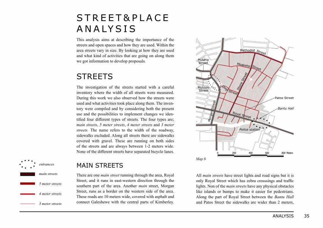
This analysis aims at describing the importance of the streets and open spaces and how they are used. Within the area streets vary in size. By looking at how they are used and what kind of activities that are going on along them we got information to develop proposals.
S T R E E T & P L A C E A N A LY S I S
STREETSThe investigation of the streets started with a careful inventory where the width of all streets were measured. During this work we also observed how the streets were used and what activities took place along them. The inven-tory were compiled and by considering both the present use and the possibilities to implement changes we iden-tified four different types of streets. The four types are; main streets, 5 meter streets, 4 meter streets and 3 meter streets. The name refers to the width of the roadway, sidewalks excluded. Along all streets there are sidewalks covered with gravel. These are running on both sides of the streets and are always between 1-2 meters wide. None of the different streets have separated bicycle lanes.
MAIN STREETSThere are one main street running through the area, Royal Street, and it runs in east-western direction through the southern part of the area. Another main street, Morgan Street, runs as a border on the western side of the area. These roads are 10 meters wide, covered with asphalt and connect Galeshewe with the central parts of Kimberley.
All main streets have street lights and road signs but it is only Royal Street which has zebra crosssings and traffic lights. Non of the main streets have any physical obstacles like islands or bumps to make it easier for pedestrians. Along the part of Royal Street between the Bantu Hall and Patos Street the sidewalks are wider than 2 meters,
main streets
5 meter streets
4 meter streets
3 meter streets
entrancesMap 6
Royal Street
Street
Sto
ne S
tree
t
Moaketsi
Street
Street
Methodist
Oogi
Mor
gan S
tree
t
Bantu Hall
Patos Street
Police station
Motopo Street
Hulana Street

36 ANALYSIS
Inside the area there are two 5 meter streets, Stone Street which runs north-south in the central parts of the area and Methodist Street, which works as a border towards the adjacent areas north of Greater No 2. The two wider streets are linked together with a grid of narrow streets. These narrow streets are 3 or 4 meters wide. There are no informal paths or shortcuts running through the blocks except for some paths leading out to the previous buffer zone, located on the eastern side of the area.
Both the 5, 4 and 3 meter streets have roadways paved with concrete stones and serve as local streets for the people living in the area. Along the streets there are no street lights, street signs or other traffic signs. Neither are there any zebra crossings or any physical obstacles like islands or bumps in the streets. The only permanent physical objects in the street are electrical poles placed along property boarders. The sidewalks border directly on the private plots and therefore the possibilities to widen the
streets are limited. Along some parts of Moaketsi Street and Oogi Street the sidewalks are wider, 3-4 meters, than in the rest of the area. However, when walking, people tend to use the paved road surface instead of the sidewalks. The reason for this is probably the more convenient surface and few cars using the streets. Since most of the movements are performed by foot a lot of people also meet and social-ise there. The children also use the streets for playing.
The traffic is limited due to low car ownership in the area, but sometimes taxis and private cars pass through at high speed. There are no separate bicycle lanes within the area so the few people that do ride bicycles are referred to the streets. We have not noticed any difference considering how pedestrians and cars use the different streets. Despite this, we find Stone Street and Moaketsi Street to have a higher degree of integration in the residential area than the other streets. This since they are located central in the area and runs through it without interruptions.
forming small open areas without any specified use (See Fig. 29). These areas are, primarily on the southern side outside the police station, spontaneously used for parking. Between the sidewalks and plots high electrical poles are placed. The main streets are frequently used by cars but the side-walks along them are not that busy. Instead people tend to walk through the residential area.
5, 4 AND 3 METER STREETS Fig. 29
29. The wide sidewalk on the southern side of Royal Street, outside the police station.
37ANALYSIS
Fig. 30
Fig. 31
30. Royal street.31. A 3 meter street within the dwelling area.32. Section of a main street, Royal Street.33. Section of a typical street within the dwelling area.
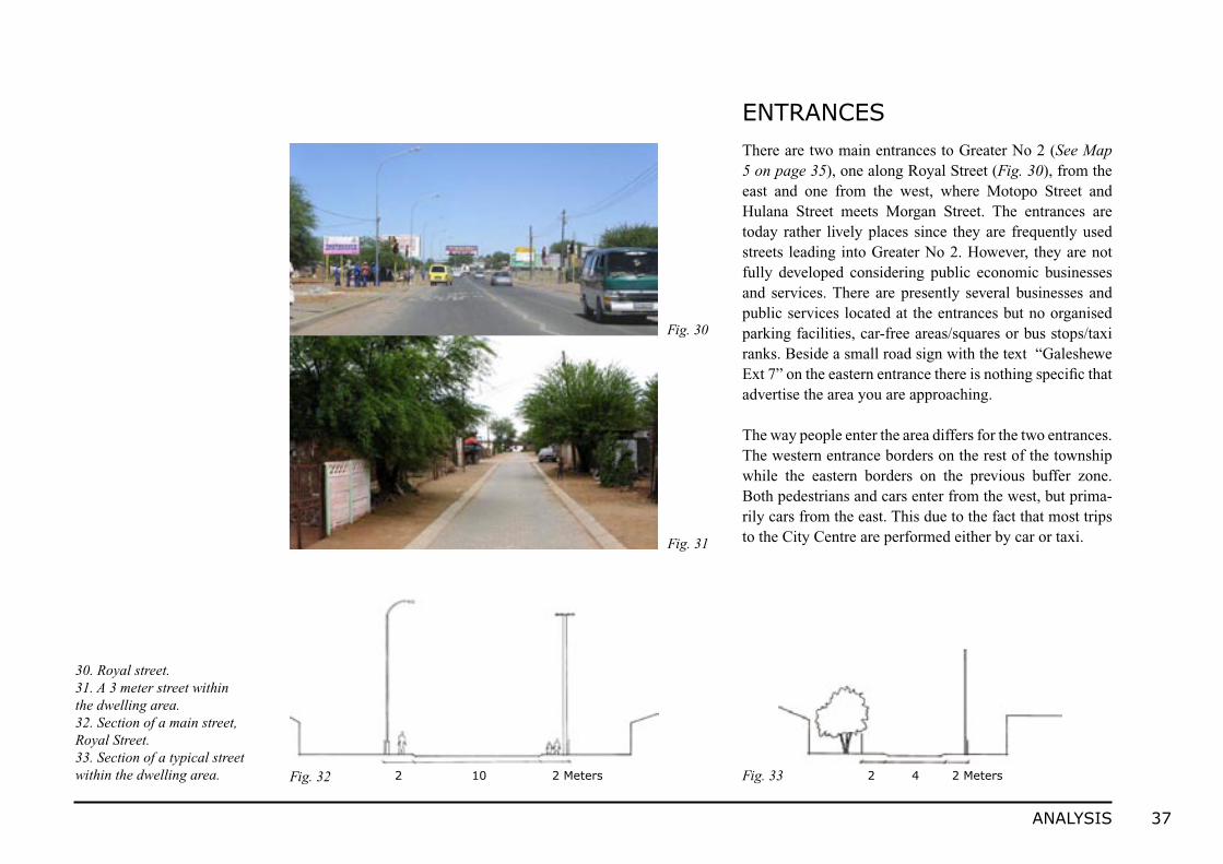
ENTRANCESThere are two main entrances to Greater No 2 (See Map 5 on page 35), one along Royal Street (Fig. 30), from the east and one from the west, where Motopo Street and Hulana Street meets Morgan Street. The entrances are today rather lively places since they are frequently used streets leading into Greater No 2. However, they are not fully developed considering public economic businesses and services. There are presently several businesses and public services located at the entrances but no organised parking facilities, car-free areas/squares or bus stops/taxi ranks. Beside a small road sign with the text “Galeshewe Ext 7” on the eastern entrance there is nothing specific that advertise the area you are approaching.
The way people enter the area differs for the two entrances. The western entrance borders on the rest of the township while the eastern borders on the previous buffer zone. Both pedestrians and cars enter from the west, but prima-rily cars from the east. This due to the fact that most trips to the City Centre are performed either by car or taxi.
2 10 2 Meters 2 4 2 MetersFig. 32 Fig. 33
38 ANALYSIS
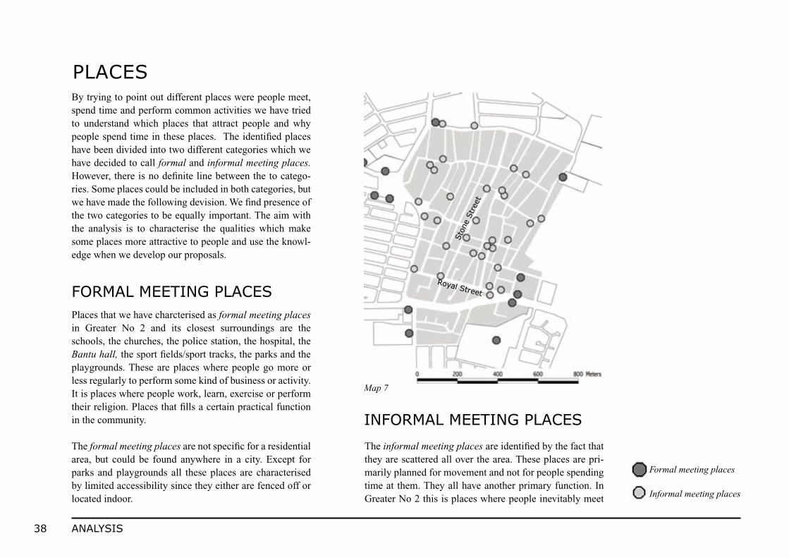
By trying to point out different places were people meet, spend time and perform common activities we have tried to understand which places that attract people and why people spend time in these places. The identified places have been divided into two different categories which we have decided to call formal and informal meeting places. However, there is no definite line between the to catego-ries. Some places could be included in both categories, but we have made the following devision. We find presence of the two categories to be equally important. The aim with the analysis is to characterise the qualities which make some places more attractive to people and use the knowl-edge when we develop our proposals.
PLACES
Formal meeting places
Informal meeting places
FORMAL MEETING PLACES
INFORMAL MEETING PLACES
Places that we have charcterised as formal meeting places in Greater No 2 and its closest surroundings are the schools, the churches, the police station, the hospital, the Bantu hall, the sport fields/sport tracks, the parks and the playgrounds. These are places where people go more or less regularly to perform some kind of business or activity. It is places where people work, learn, exercise or perform their religion. Places that fills a certain practical function in the community.
The formal meeting places are not specific for a residential area, but could be found anywhere in a city. Except for parks and playgrounds all these places are characterised by limited accessibility since they either are fenced off or located indoor.
The informal meeting places are identified by the fact that they are scattered all over the area. These places are pri-marily planned for movement and not for people spending time at them. They all have another primary function. In Greater No 2 this is places where people inevitably meet
Map 7
Royal Street
Sto
ne S
tree
t
39ANALYSIS
Fig. 34
Fig. 35
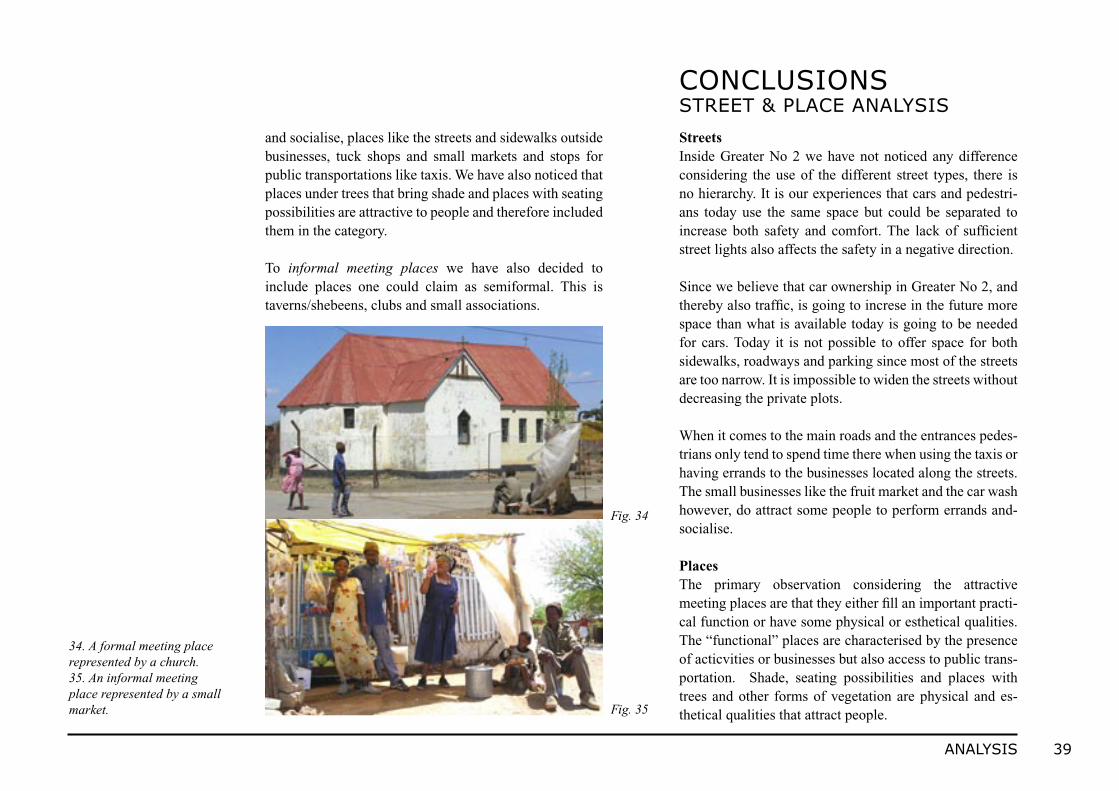
34. A formal meeting place represented by a church.35. An informal meeting place represented by a small market.
and socialise, places like the streets and sidewalks outside businesses, tuck shops and small markets and stops for public transportations like taxis. We have also noticed that places under trees that bring shade and places with seating possibilities are attractive to people and therefore included them in the category. To informal meeting places we have also decided to include places one could claim as semiformal. This is taverns/shebeens, clubs and small associations.
StreetsInside Greater No 2 we have not noticed any difference considering the use of the different street types, there is no hierarchy. It is our experiences that cars and pedestri-ans today use the same space but could be separated to increase both safety and comfort. The lack of sufficient street lights also affects the safety in a negative direction.
Since we believe that car ownership in Greater No 2, and thereby also traffic, is going to increse in the future more space than what is available today is going to be needed for cars. Today it is not possible to offer space for both sidewalks, roadways and parking since most of the streets are too narrow. It is impossible to widen the streets without decreasing the private plots. When it comes to the main roads and the entrances pedes-trians only tend to spend time there when using the taxis or having errands to the businesses located along the streets. The small businesses like the fruit market and the car wash however, do attract some people to perform errands and-socialise.
PlacesThe primary observation considering the attractive meeting places are that they either fill an important practi-cal function or have some physical or esthetical qualities. The “functional” places are characterised by the presence of acticvities or businesses but also access to public trans-portation. Shade, seating possibilities and places with trees and other forms of vegetation are physical and es-thetical qualities that attract people.
CONCLUSIONS STREET & PLACE ANALYSIS
40 ANALYSIS
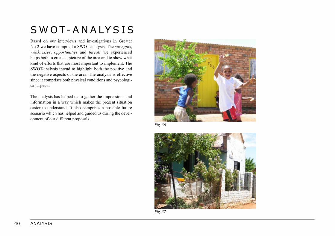
Based on our interviews and investigations in Greater No 2 we have compiled a SWOT-analysis. The strengths, weaknesses, opportunities and threats we experienced helps both to create a picture of the area and to show what kind of efforts that are most important to implement. The SWOT-analysis intend to highlight both the positive and the negative aspects of the area. The analysis is effective since it comprises both physical conditions and psycologi-cal aspects.
The analysis has helped us to gather the impressions and information in a way which makes the present situation easier to understand. It also comprises a possible future scenario which has helped and guided us during the devel-opment of our different proposals.
S W OT-A N A LY S I S
Fig. 36
Fig. 37