Embed Size (px)
Citation preview
CLOUDS & THUNDERSTORMS Basic Climatology Oklahoma Climatological Survey
Funding provided by NOAA Sectoral Applications Research Project
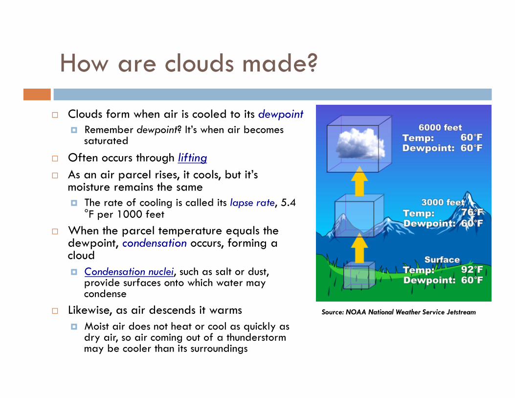
How are clouds made?
Clouds form when air is cooled to its dewpoint Remember dewpoint? It’s when air becomes
saturated Often occurs through lifting As an air parcel rises, it cools, but it’s
moisture remains the same The rate of cooling is called its lapse rate, 5.4
°F per 1000 feet When the parcel temperature equals the
dewpoint, condensation occurs, forming a cloud Condensation nuclei, such as salt or dust,
provide surfaces onto which water may condense
Likewise, as air descends it warms Moist air does not heat or cool as quickly as
dry air, so air coming out of a thunderstorm may be cooler than its surroundings
Source: NOAA National Weather Service Jetstream
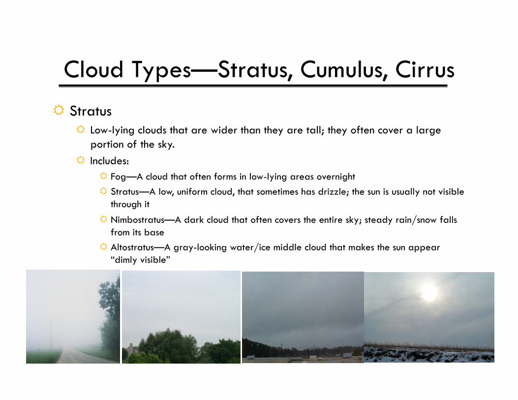
Cloud Types—Stratus, Cumulus, Cirrus Stratus
Low-lying clouds that are wider than they are tall; they often cover a large portion of the sky.
Includes: Fog—A cloud that often forms in low-lying areas overnight Stratus—A low, uniform cloud, that sometimes has drizzle; the sun is usually not visible
through it Nimbostratus—A dark cloud that often covers the entire sky; steady rain/snow falls
from its base Altostratus—A gray-looking water/ice middle cloud that makes the sun appear
“dimly visible”
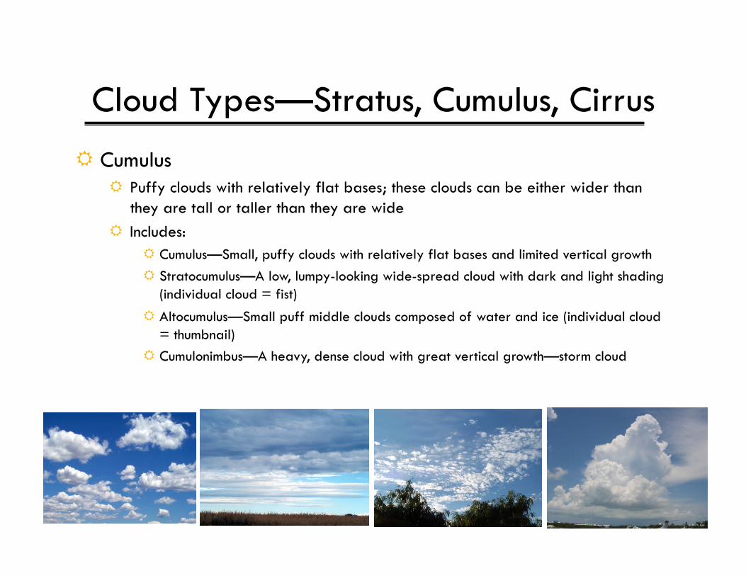
Cloud Types—Stratus, Cumulus, Cirrus Cumulus
Puffy clouds with relatively flat bases; these clouds can be either wider than they are tall or taller than they are wide
Includes: Cumulus—Small, puffy clouds with relatively flat bases and limited vertical growth Stratocumulus—A low, lumpy-looking wide-spread cloud with dark and light shading
(individual cloud = fist) Altocumulus—Small puff middle clouds composed of water and ice (individual cloud
= thumbnail) Cumulonimbus—A heavy, dense cloud with great vertical growth—storm cloud
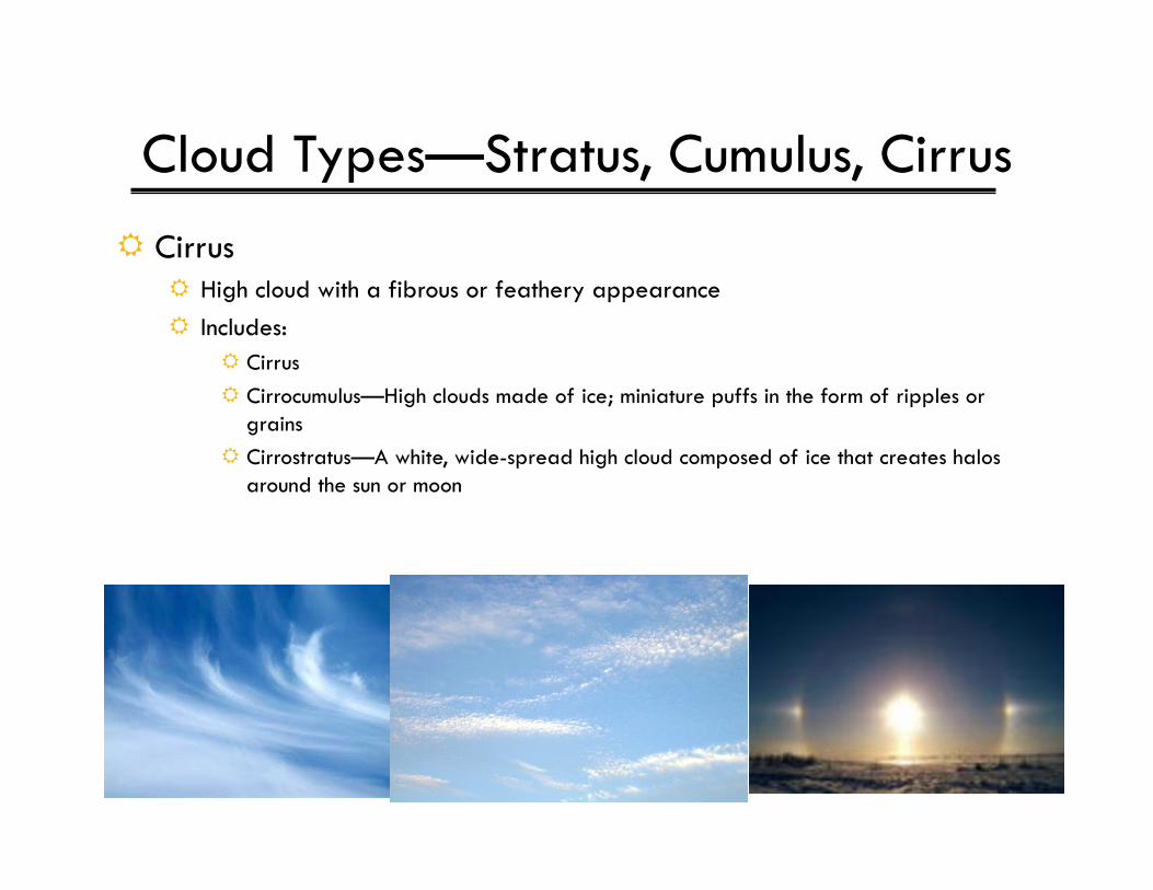
Cloud Types—Stratus, Cumulus, Cirrus Cirrus
High cloud with a fibrous or feathery appearance Includes:
Cirrus Cirrocumulus—High clouds made of ice; miniature puffs in the form of ripples or
grains Cirrostratus—A white, wide-spread high cloud composed of ice that creates halos
around the sun or moon
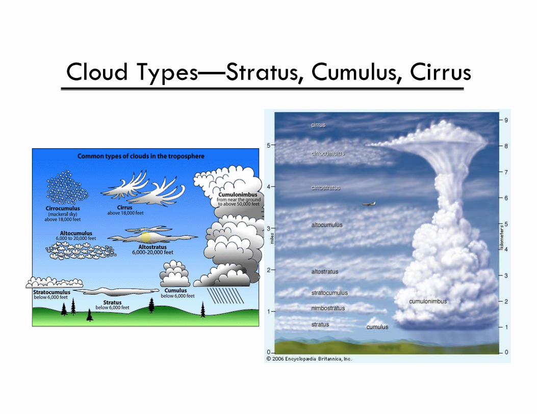
Cloud Types—Stratus, Cumulus, Cirrus
THUNDERSTORMS
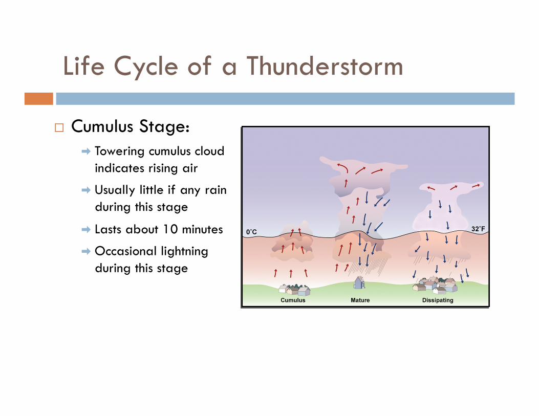
Life Cycle of a Thunderstorm
Cumulus Stage: ➡ Towering cumulus cloud
indicates rising air
➡ Usually little if any rain during this stage
➡ Lasts about 10 minutes
➡ Occasional lightning during this stage
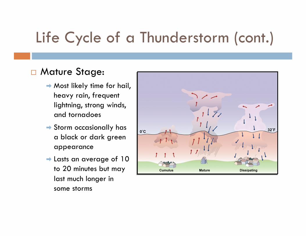
Life Cycle of a Thunderstorm (cont.)
Mature Stage: ➡ Most likely time for hail,
heavy rain, frequent lightning, strong winds, and tornadoes
➡ Storm occasionally has a black or dark green appearance
➡ Lasts an average of 10 to 20 minutes but may last much longer in some storms
Life Cycle of a Thunderstorm (cont.)
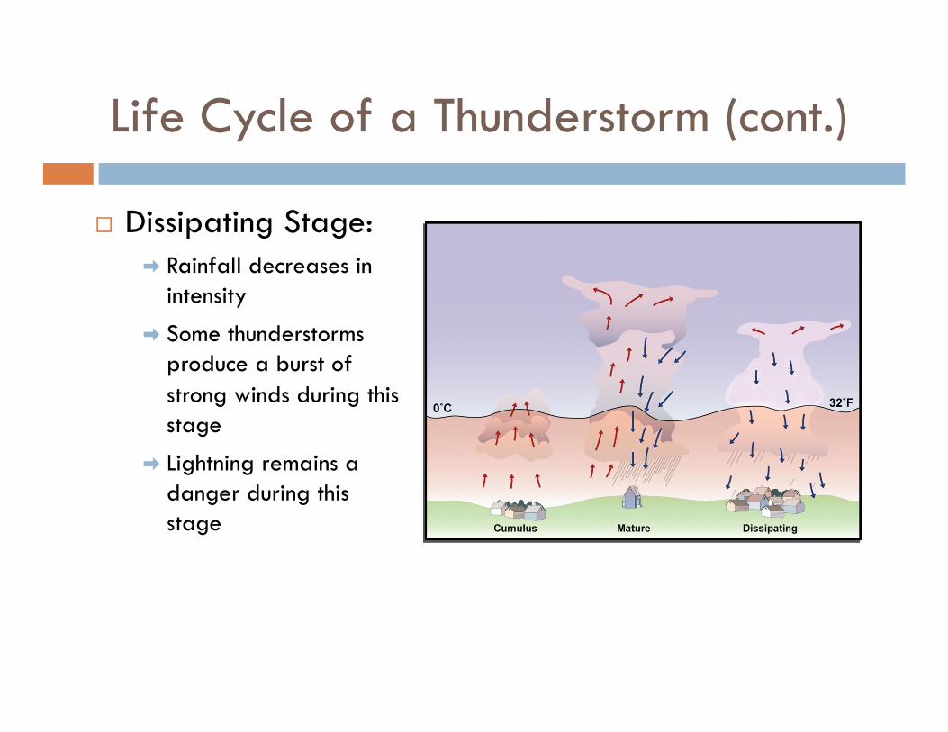
Dissipating Stage: ➡ Rainfall decreases in
intensity
➡ Some thunderstorms produce a burst of strong winds during this stage
➡ Lightning remains a danger during this stage
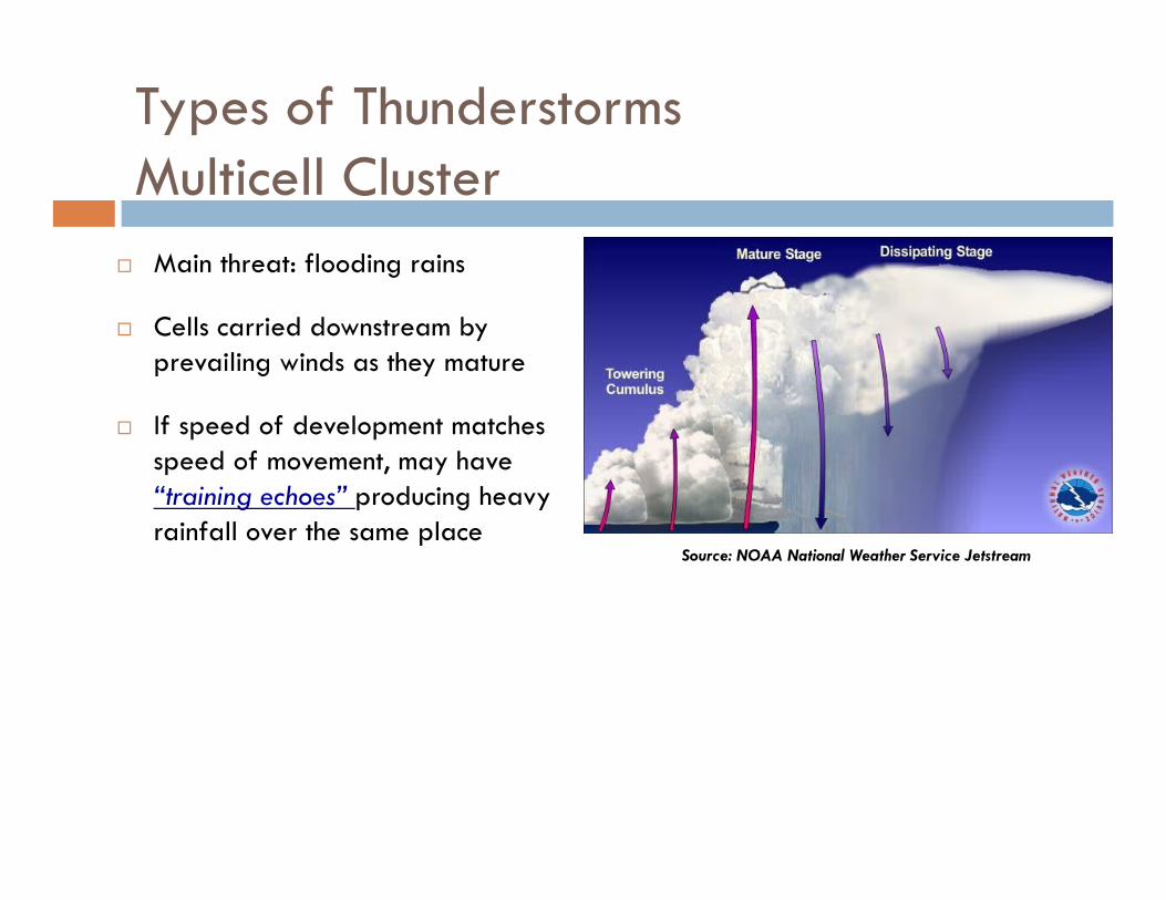
Types of Thunderstorms Multicell Cluster
Main threat: flooding rains
Cells carried downstream by prevailing winds as they mature
If speed of development matches speed of movement, may have “training echoes” producing heavy rainfall over the same place
Source: NOAA National Weather Service Jetstream
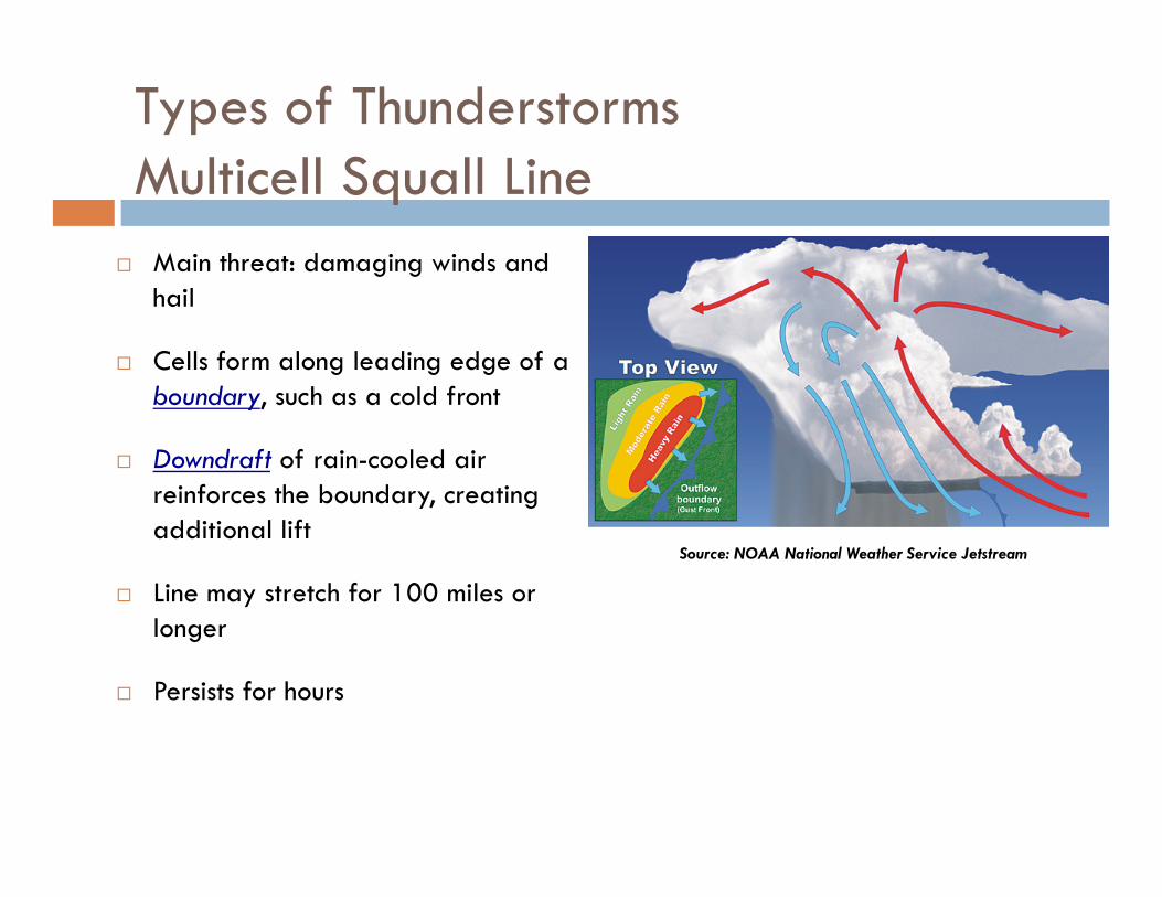
Types of Thunderstorms Multicell Squall Line
Main threat: damaging winds and hail
Cells form along leading edge of a boundary, such as a cold front
Downdraft of rain-cooled air reinforces the boundary, creating additional lift
Line may stretch for 100 miles or longer
Persists for hours
Source: NOAA National Weather Service Jetstream
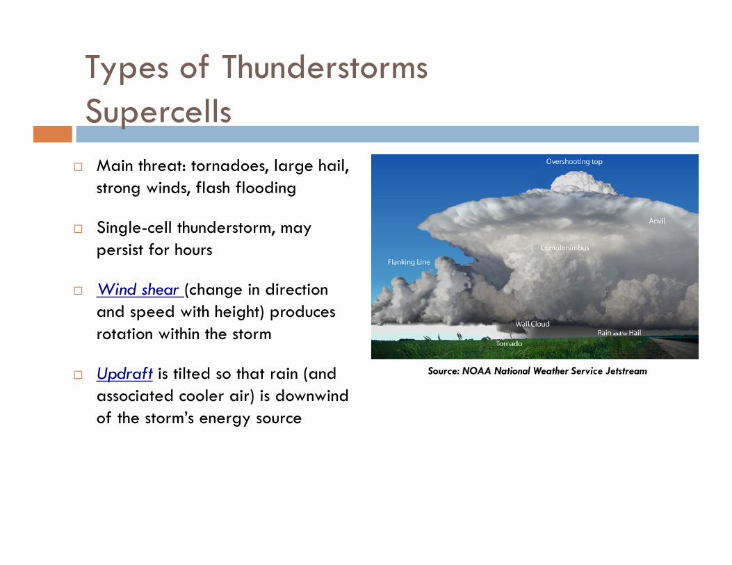
Types of Thunderstorms Supercells
Main threat: tornadoes, large hail, strong winds, flash flooding
Single-cell thunderstorm, may persist for hours
Wind shear (change in direction and speed with height) produces rotation within the storm
Updraft is tilted so that rain (and associated cooler air) is downwind of the storm’s energy source
Source: NOAA National Weather Service Jetstream
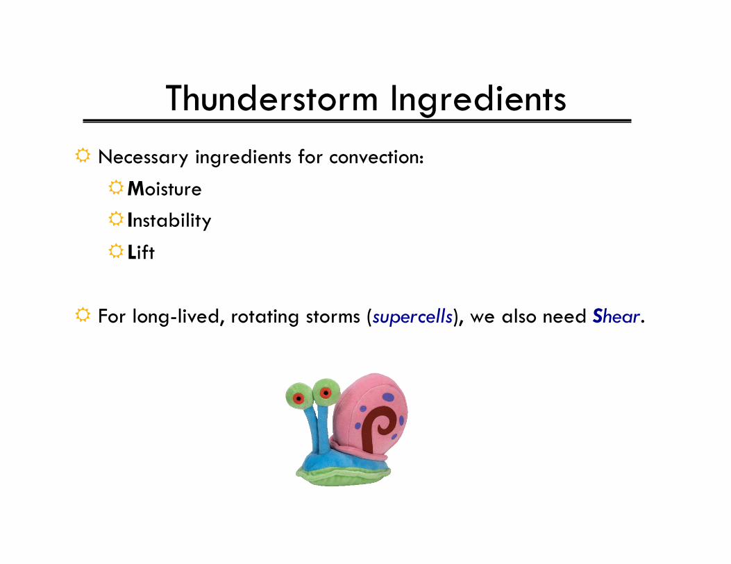
Thunderstorm Ingredients Necessary ingredients for convection:
Moisture Instability Lift
For long-lived, rotating storms (supercells), we also need Shear.
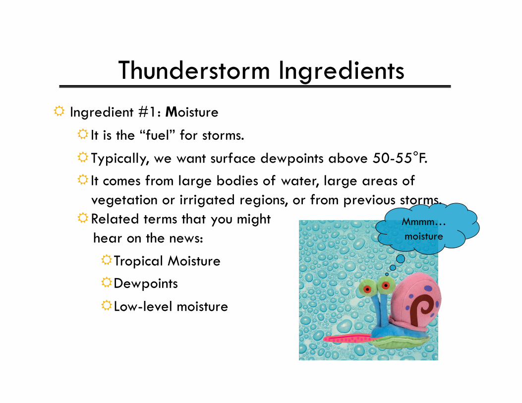
Thunderstorm Ingredients Ingredient #1: Moisture
It is the “fuel” for storms. Typically, we want surface dewpoints above 50-55°F. It comes from large bodies of water, large areas of
vegetation or irrigated regions, or from previous storms. Related terms that you might hear on the news:
Tropical Moisture Dewpoints Low-level moisture
Mmmm…moisture
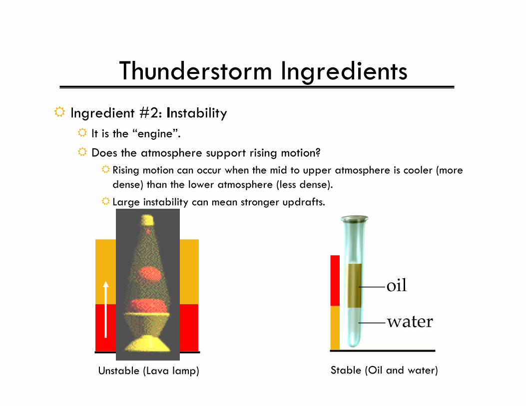
Thunderstorm Ingredients Ingredient #2: Instability
It is the “engine”. Does the atmosphere support rising motion?
Rising motion can occur when the mid to upper atmosphere is cooler (more dense) than the lower atmosphere (less dense).
Large instability can mean stronger updrafts.
Unstable (Lava lamp) Stable (Oil and water)
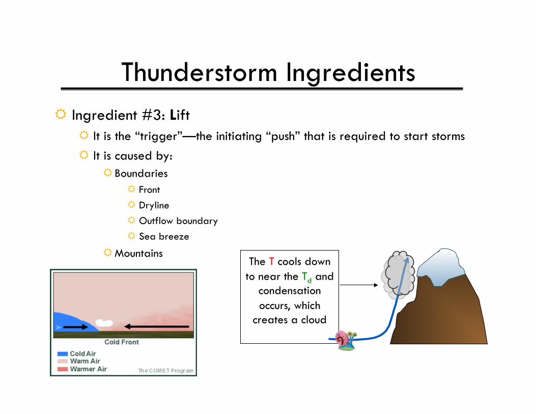
Thunderstorm Ingredients Ingredient #3: Lift
It is the “trigger”—the initiating “push” that is required to start storms It is caused by:
Boundaries Front Dryline Outflow boundary Sea breeze
Mountains The T cools down to near the Td and
condensation occurs, which
creates a cloud
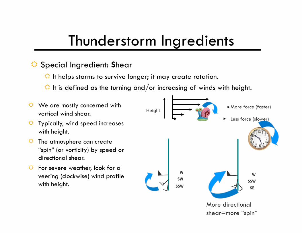
Thunderstorm Ingredients Special Ingredient: Shear
It helps storms to survive longer; it may create rotation. It is defined as the turning and/or increasing of winds with height.
We are mostly concerned with vertical wind shear.
Typically, wind speed increases with height.
The atmosphere can create “spin” (or vorticity) by speed or directional shear.
For severe weather, look for a veering (clockwise) wind profile with height.
Height
SSW
SW W
SE
SSW W
More directional shear=more “spin”
More force (faster)
Less force (slower)
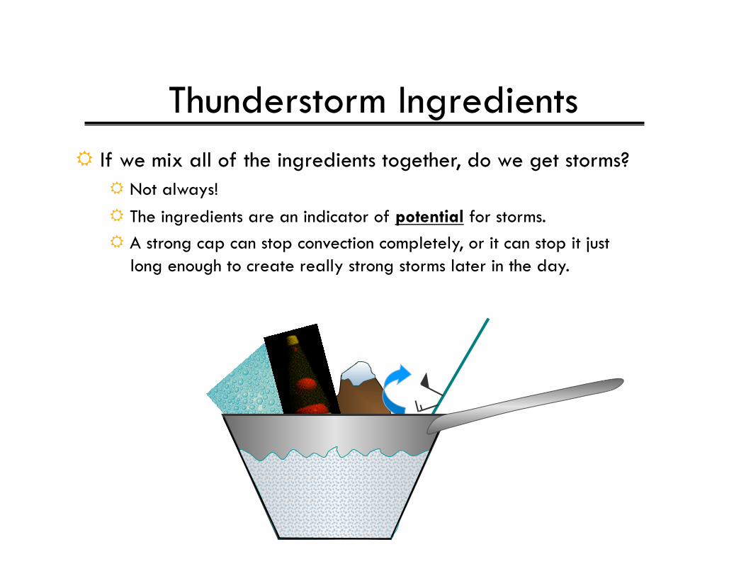
Thunderstorm Ingredients If we mix all of the ingredients together, do we get storms?
Not always! The ingredients are an indicator of potential for storms. A strong cap can stop convection completely, or it can stop it just
long enough to create really strong storms later in the day.