Embed Size (px)
Citation preview
2009 Indiana GIS ConferenceFebruary 17-18, 2009
Bloomington Monroe County Convention Center
Fundamentals of ArcGIS Server Map
Caching
Tom Brenneman
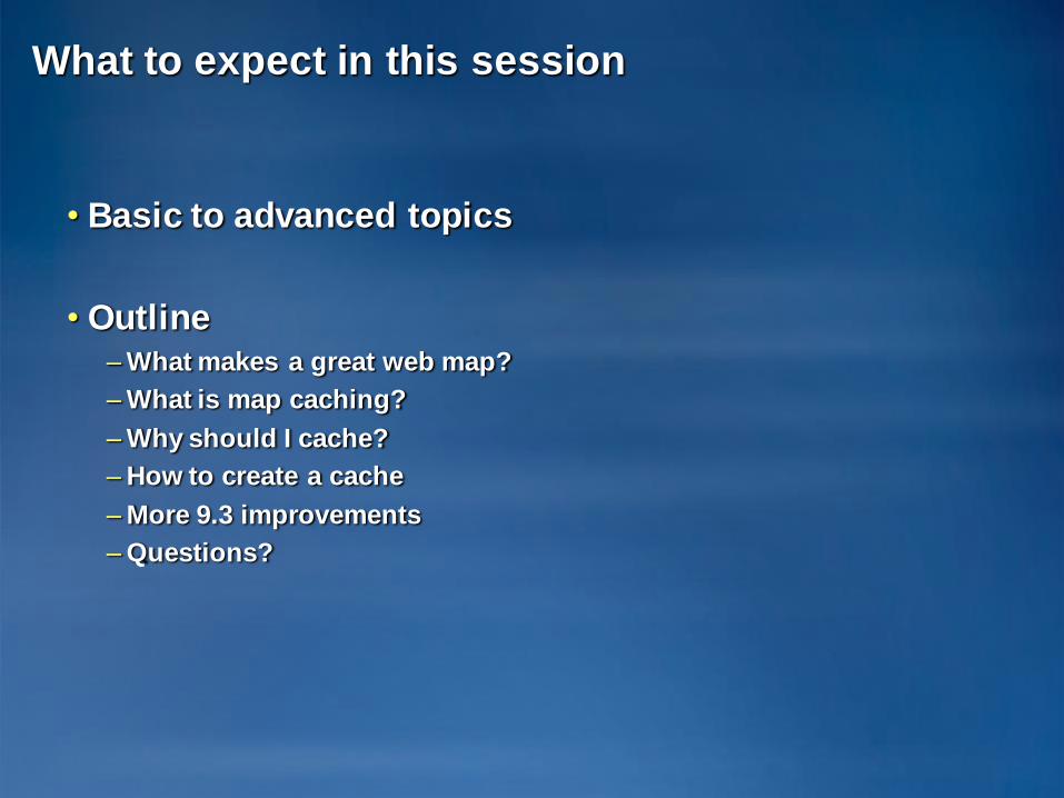
What to expect in this session
• Basic to advanced topics
• Outline– What makes a great web map?
– What is map caching?
– Why should I cache?
– How to create a cache
– More 9.3 improvements
– Questions?
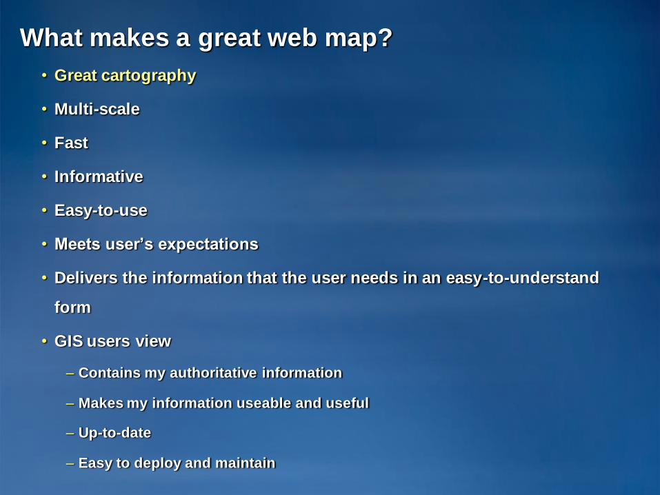
What makes a great web map?
• Great cartography
• Multi-scale
• Fast
• Informative
• Easy-to-use
• Meets user’s expectations
• Delivers the information that the user needs in an easy-to-understand
form
• GIS users view
– Contains my authoritative information
– Makes my information useable and useful
– Up-to-date
– Easy to deploy and maintain
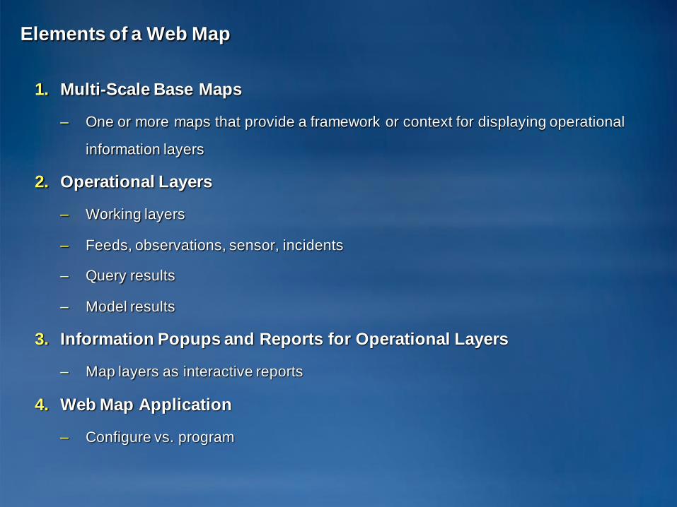
Elements of a Web Map
1. Multi-Scale Base Maps
– One or more maps that provide a framework or context for displaying operational
information layers
2. Operational Layers
– Working layers
– Feeds, observations, sensor, incidents
– Query results
– Model results
3. Information Popups and Reports for Operational Layers
– Map layers as interactive reports
4. Web Map Application
– Configure vs. program
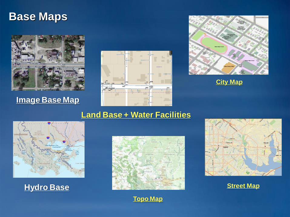
Base Maps
Land Base + Water Facilities
Image Base Map
Hydro Base Street Map
City Map
Topo Map
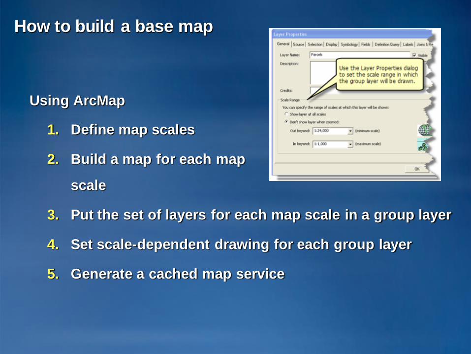
How to build a base map
Using ArcMap
1. Define map scales
2. Build a map for each map
scale
3. Put the set of layers for each map scale in a group layer
4. Set scale-dependent drawing for each group layer
5. Generate a cached map service
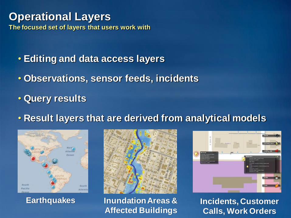
Operational LayersThe focused set of layers that users work with
• Editing and data access layers
• Observations, sensor feeds, incidents
• Query results
• Result layers that are derived from analytical models
Earthquakes Inundation Areas &
Affected BuildingsIncidents, Customer
Calls, Work Orders
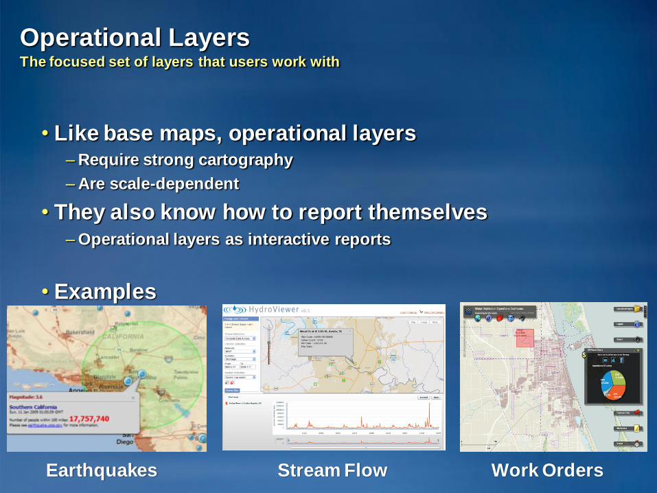
Operational LayersThe focused set of layers that users work with
• Like base maps, operational layers– Require strong cartography
– Are scale-dependent
• They also know how to report themselves– Operational layers as interactive reports
• Examples
Earthquakes Stream Flow Work Orders

What is map caching?
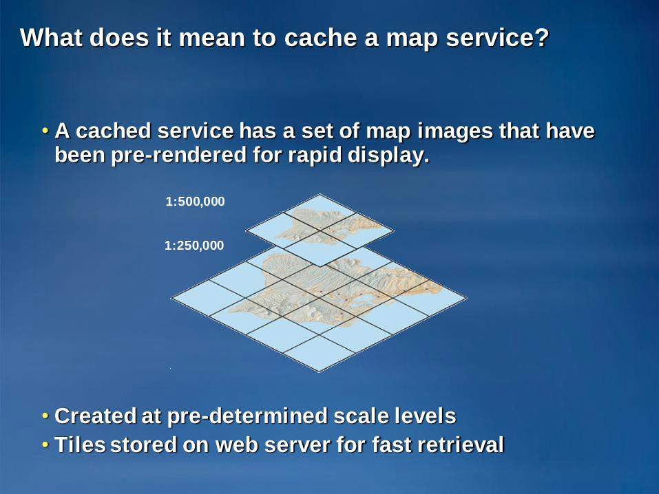
What does it mean to cache a map service?
• A cached service has a set of map images that have been pre-rendered for rapid display.
• Created at pre-determined scale levels
• Tiles stored on web server for fast retrieval
1:500,000
1:250,000
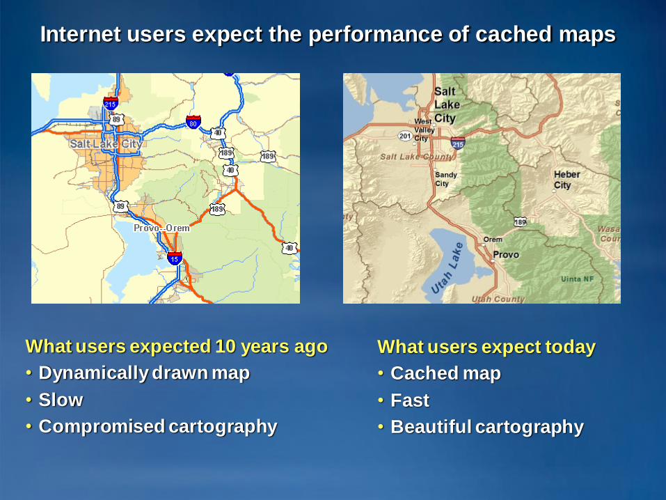
What users expect today
• Cached map
• Fast
• Beautiful cartography
What users expected 10 years ago
• Dynamically drawn map
• Slow
• Compromised cartography
Internet users expect the performance of cached maps
Demo
• Viewing a high-quality cached map service
– Hamilton county and state of Indiana
How to create a cache
• Cache creation tools
• Properties of a cache
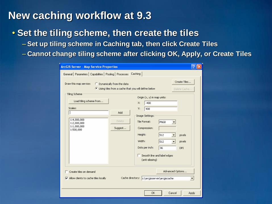
New caching workflow at 9.3
• Set the tiling scheme, then create the tiles– Set up tiling scheme in Caching tab, then click Create Tiles
– Cannot change tiling scheme after clicking OK, Apply, or Create Tiles
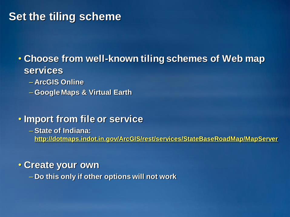
Set the tiling scheme
• Choose from well-known tiling schemes of Web map
services– ArcGIS Online
– Google Maps & Virtual Earth
• Import from file or service– State of Indiana:
http://dotmaps.indot.in.gov/ArcGIS/rest/services/StateBaseRoadMap/MapServer
• Create your own– Do this only if other options will not work
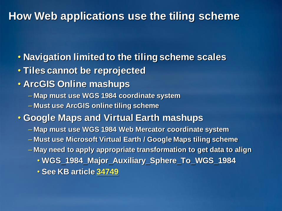
How Web applications use the tiling scheme
• Navigation limited to the tiling scheme scales
• Tiles cannot be reprojected
• ArcGIS Online mashups– Map must use WGS 1984 coordinate system
– Must use ArcGIS online tiling scheme
• Google Maps and Virtual Earth mashups– Map must use WGS 1984 Web Mercator coordinate system
– Must use Microsoft Virtual Earth / Google Maps tiling scheme
– May need to apply appropriate transformation to get data to align
• WGS_1984_Major_Auxiliary_Sphere_To_WGS_1984
• See KB article 34749
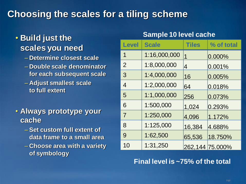
Choosing the scales for a tiling scheme
• Build just the
scales you need– Determine closest scale
– Double scale denominator
for each subsequent scale
– Adjust smallest scale
to full extent
• Always prototype your
cache
– Set custom full extent of
data frame to a small area
– Choose area with a variety
of symbology
7-17
Level Scale Tiles % of total
1 1:16,000,000 1 0.000%
2 1:8,000,000 4 0.001%
3 1:4,000,000 16 0.005%
4 1:2,000,000 64 0.018%
5 1:1,000,000 256 0.073%
6 1:500,000 1,024 0.293%
7 1:250,000 4,096 1.172%
8 1:125,000 16,384 4.688%
9 1:62,500 65,536 18.750%
10 1:31,250 262,144 75.000%
Sample 10 level cache
Final level is ~75% of the total
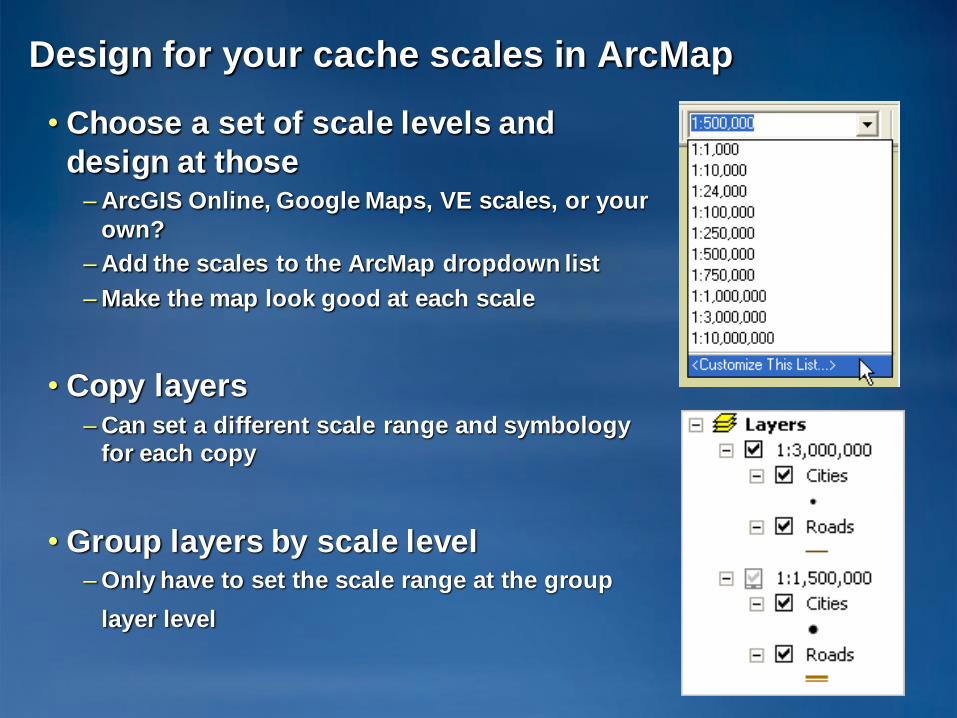
Design for your cache scales in ArcMap
• Choose a set of scale levels and
design at those– ArcGIS Online, Google Maps, VE scales, or your
own?
– Add the scales to the ArcMap dropdown list
– Make the map look good at each scale
• Copy layers – Can set a different scale range and symbology
for each copy
• Group layers by scale level– Only have to set the scale range at the group
layer level
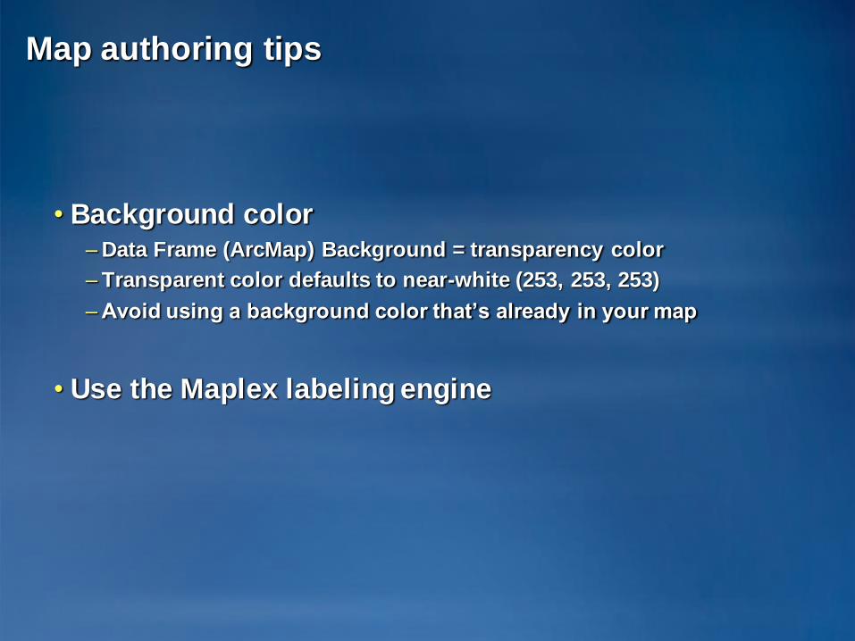
Map authoring tips
• Background color– Data Frame (ArcMap) Background = transparency color
– Transparent color defaults to near-white (253, 253, 253)
– Avoid using a background color that’s already in your map
• Use the Maplex labeling engine
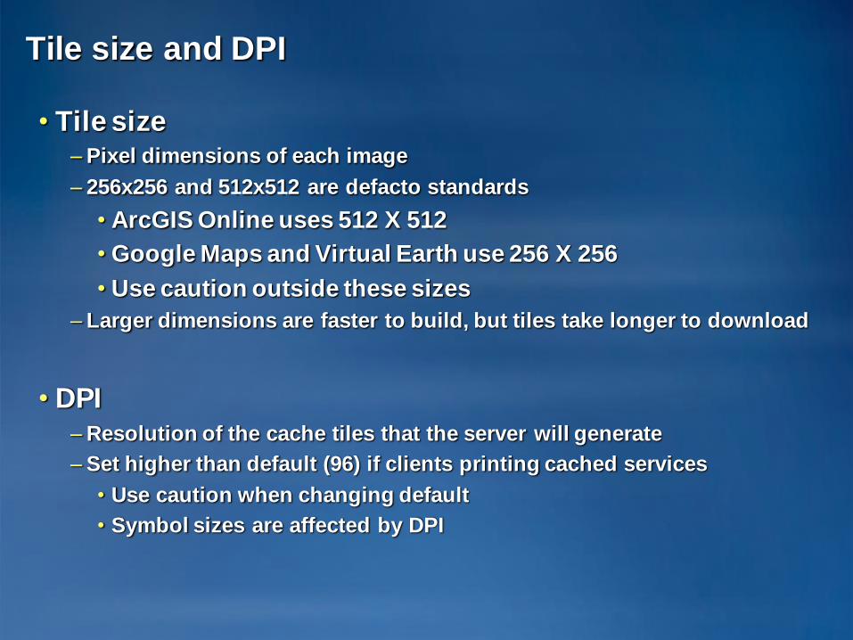
Tile size and DPI
• Tile size– Pixel dimensions of each image
– 256x256 and 512x512 are defacto standards
• ArcGIS Online uses 512 X 512
• Google Maps and Virtual Earth use 256 X 256
• Use caution outside these sizes
– Larger dimensions are faster to build, but tiles take longer to download
• DPI– Resolution of the cache tiles that the server will generate
– Set higher than default (96) if clients printing cached services
• Use caution when changing default
• Symbol sizes are affected by DPI
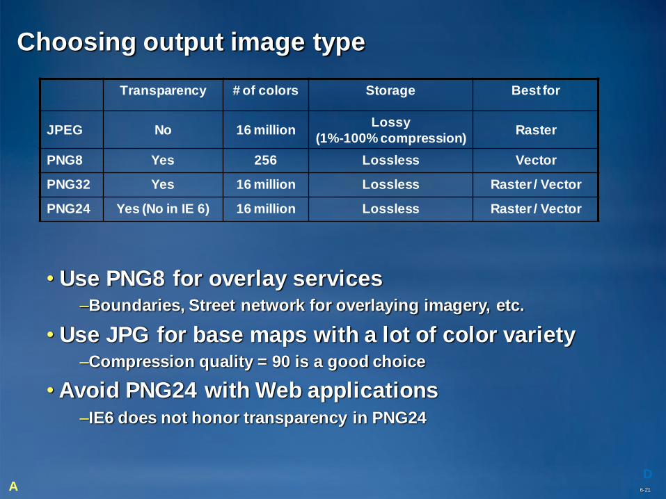
Transparency # of colors Storage Best for
JPEG No 16 millionLossy
(1%-100% compression)Raster
PNG8 Yes 256 Lossless Vector
PNG32 Yes 16 million Lossless Raster / Vector
PNG24 Yes (No in IE 6) 16 million Lossless Raster / Vector
Choosing output image type
D6-21A
• Use PNG8 for overlay services –Boundaries, Street network for overlaying imagery, etc.
• Use JPG for base maps with a lot of color variety–Compression quality = 90 is a good choice
• Avoid PNG24 with Web applications–IE6 does not honor transparency in PNG24
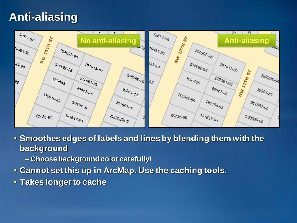
Anti-aliasing
• Smoothes edges of labels and lines by blending them with the
background
– Choose background color carefully!
• Cannot set this up in ArcMap. Use the caching tools.
• Takes longer to cache
Anti-aliasingNo anti-aliasing
Fused or Multi-layer
• Fused– Single image tiles for all map layers
at each scale level
– Best performance
– No control over individual layer visibility
• Multi-layer– Image tile for each map layer at each scale level
– Only practical with ArcMap clients
– Avoid with web applications
• Blending on web tier reduces scalability and performance
• Internet users expect the performance of fused cached maps
6-23
Create tiles
• Manage Map Server Cache Tiles– New tool at 9.3
– Similar to Update Map Server Cache Tiles at 9.2
– Allows fine-grained control over scales that are cached
• Launch this tool from:– ArcCatalog by clicking “Create tiles” or “Update tiles” in the Caching
tab of Service Properties
– ArcToolbox
– Command line
– Scripting environment such as Python
• Service must be started to create tiles
• Use N+1 instances where N = the number of sockets on server
Updated documentation
• Caching help section greatly expanded between 9.2
and 9.3
• Web help is constantly updated– http://webhelp.esri.com
• ArcGIS Server Development Blog addresses specific
problems. Content is later moved to the web help
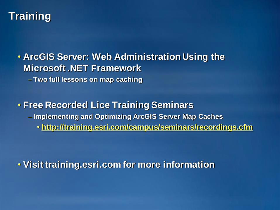
Training
• ArcGIS Server: Web Administration Using the
Microsoft .NET Framework– Two full lessons on map caching
• Free Recorded Lice Training Seminars– Implementing and Optimizing ArcGIS Server Map Caches
• http://training.esri.com/campus/seminars/recordings.cfm
• Visit training.esri.com for more information

Related sessions
• Advanced ArcGIS Server Map Caching topics and
Workflows
• Wednesday 9:15 – 10:00 AM

Questions?
ESRI Developer Summit 2008 28


![Python and ArcGIS Enterprise - static.packt-cdn.com€¦ · Python and ArcGIS Enterprise [ 2 ] ArcGIS enterprise Starting with ArcGIS 10.5, ArcGIS Server is now called ArcGIS Enterprise](https://img.pdfslide.us/doc/110x75/5ecf20757db43a10014313b7/python-and-arcgis-enterprise-python-and-arcgis-enterprise-2-arcgis-enterprise.jpg)


![[Arcgis] Riset ArcGIS JS & Flex](https://img.pdfslide.us/doc/110x75/55cf96d7550346d0338e2017/arcgis-riset-arcgis-js-flex.jpg)