Embed Size (px)
Citation preview
Kansas State University Libraries Kansas State University Libraries
New Prairie Press New Prairie Press
Symphony in the Flint Hills Field Journal 2011 – Freedom’s Frontier in the Flint Hills (Laurie J. Hamilton, Editor)
Freedom’s Frontier National Heritage Area Freedom’s Frontier National Heritage Area
Follow this and additional works at: https://newprairiepress.org/sfh
Recommended Citation Recommended Citation (2011). "Freedom’s Frontier National Heritage Area," Symphony in the Flint Hills Field Journal. https://newprairiepress.org/sfh/2011/flinthills/2
To order hard copies of the Field Journals, go to shop.symphonyintheflinthills.org.
The Field Journals are made possible in part with funding from the Fred C. and Mary R. Koch Foundation.
This is brought to you for free and open access by the Conferences at New Prairie Press. It has been accepted for inclusion in Symphony in the Flint Hills Field Journal by an authorized administrator of New Prairie Press. For more information, please contact [email protected].
21
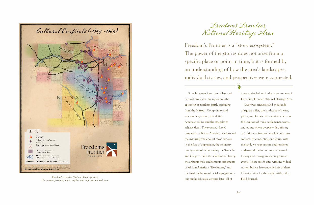
Stretching over four river valleys and
parts of two states, the region was the
epicenter of conflicts, partly stemming
from the Missouri Compromise and
westward expansion, that defined
American values and the struggles to
achieve them. The repeated, forced
movement of Native American nations and
the inspiring resilience of those nations
in the face of oppression, the voluntary
immigration of settlers along the Santa Fe
and Oregon Trails, the abolition of slavery,
the arduous treks and tenuous settlements
of African-American “Exodusters,” and
the final resolution of racial segregation in
our public schools a century later—all of
these stories belong in the larger context of
Freedom’s Frontier National Heritage Area.
Over two centuries and thousands
of square miles, the landscape of rivers,
plains, and forests had a critical effect on
the location of trails, settlements, towns,
and points where people with differing
definitions of freedom would come into
contact. By connecting our stories with
the land, we help visitors and residents
understand the importance of natural
history and ecology in shaping human
events. There are 55 sites with individual
stories, but we have provided six of these
historical sites for the reader within this
Field Journal.
Freedom’s Frontier is a “story ecosystem.”
The power of the stories does not arise from a
specific place or point in time, but is formed by
an understanding of how the area’s landscapes,
individual stories, and perspectives were connected.
Freedom’s FrontierNational Heritage Area
Freedom’s Frontier National Heritage AreaGo to www.freedomsfrontier.org for more information and sites.
232322
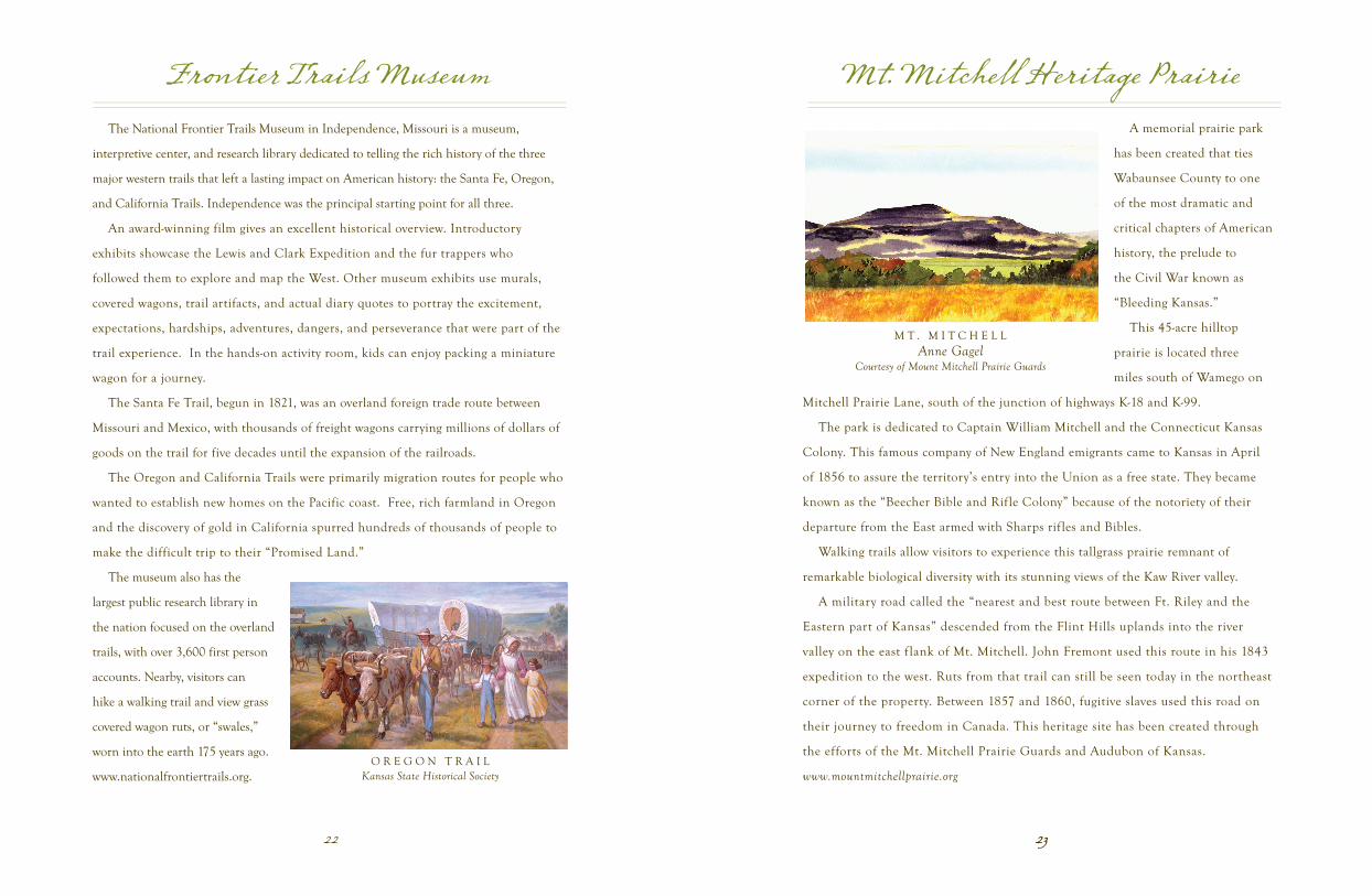
Frontier Trails Museum
The National Frontier Trails Museum in Independence, Missouri is a museum,
interpretive center, and research library dedicated to telling the rich history of the three
major western trails that left a lasting impact on American history: the Santa Fe, Oregon,
and California Trails. Independence was the principal starting point for all three.
An award-winning film gives an excellent historical overview. Introductory
exhibits showcase the Lewis and Clark Expedition and the fur trappers who
followed them to explore and map the West. Other museum exhibits use murals,
covered wagons, trail artifacts, and actual diary quotes to portray the excitement,
expectations, hardships, adventures, dangers, and perseverance that were part of the
trail experience. In the hands-on activity room, kids can enjoy packing a miniature
wagon for a journey.
The Santa Fe Trail, begun in 1821, was an overland foreign trade route between
Missouri and Mexico, with thousands of freight wagons carrying millions of dollars of
goods on the trail for five decades until the expansion of the railroads.
The Oregon and California Trails were primarily migration routes for people who
wanted to establish new homes on the Pacific coast. Free, rich farmland in Oregon
and the discovery of gold in California spurred hundreds of thousands of people to
make the difficult trip to their “Promised Land.”
The museum also has the
largest public research library in
the nation focused on the overland
trails, with over 3,600 first person
accounts. Nearby, visitors can
hike a walking trail and view grass
covered wagon ruts, or “swales,”
worn into the earth 175 years ago.
www.nationalfrontiertrails.org.O R E G O N T R A I L
Kansas State Historical Society
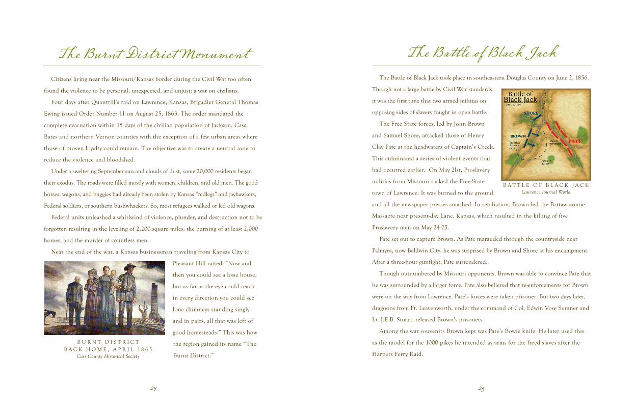
Mt. Mitchell Heritage Prairie
A memorial prairie park
has been created that ties
Wabaunsee County to one
of the most dramatic and
critical chapters of American
history, the prelude to
the Civil War known as
“Bleeding Kansas.”
This 45-acre hilltop
prairie is located three
miles south of Wamego on
Mitchell Prairie Lane, south of the junction of highways K-18 and K-99.
The park is dedicated to Captain William Mitchell and the Connecticut Kansas
Colony. This famous company of New England emigrants came to Kansas in April
of 1856 to assure the territory’s entry into the Union as a free state. They became
known as the “Beecher Bible and Rifle Colony” because of the notoriety of their
departure from the East armed with Sharps rif les and Bibles.
Walking trails allow visitors to experience this tallgrass prairie remnant of
remarkable biological diversity with its stunning views of the Kaw River valley.
A military road called the “nearest and best route between Ft. Riley and the
Eastern part of Kansas” descended from the Flint Hills uplands into the river
valley on the east f lank of Mt. Mitchell. John Fremont used this route in his 1843
expedition to the west. Ruts from that trail can still be seen today in the northeast
corner of the property. Between 1857 and 1860, fugitive slaves used this road on
their journey to freedom in Canada. This heritage site has been created through
the efforts of the Mt. Mitchell Prairie Guards and Audubon of Kansas.
www.mountmitchellprairie.org
M T . M I T C H E L LAnne Gagel
Courtesy of Mount Mitchell Prairie Guards
2524
The Burnt District Monument
Citizens living near the Missouri/Kansas border during the Civil War too often
found the violence to be personal, unexpected, and unjust: a war on civilians.
Four days after Quantrill’s raid on Lawrence, Kansas, Brigadier General Thomas
Ewing issued Order Number 11 on August 25, 1863. The order mandated the
complete evacuation within 15 days of the civilian population of Jackson, Cass,
Bates and northern Vernon counties with the exception of a few urban areas where
those of proven loyalty could remain. The objective was to create a neutral zone to
reduce the violence and bloodshed.
Under a sweltering September sun and clouds of dust, some 20,000 residents began
their exodus. The roads were filled mostly with women, children, and old men. The good
horses, wagons, and buggies had already been stolen by Kansas “redlegs” and jayhawkers,
Federal soldiers, or southern bushwhackers. So, most refugees walked or led old wagons.
Federal units unleashed a whirlwind of violence, plunder, and destruction not to be
forgotten resulting in the leveling of 2,200 square miles, the burning of at least 2,000
homes, and the murder of countless men.
Near the end of the war, a Kansas businessman traveling from Kansas City to
Pleasant Hill noted: “Now and
then you could see a lone house,
but as far as the eye could reach
in every direction you could see
lone chimneys standing singly
and in pairs, all that was left of
good homesteads.” This was how
the region gained its name “The
Burnt District.”
B U R N T D I S T R I C TB A C K H O M E , A P R I L 1 8 6 5
Cass County Historical Society
The Battle of Black Jack
The Battle of Black Jack took place in southeastern Douglas County on June 2, 1856.
Though not a large battle by Civil War standards,
it was the first time that two armed militias on
opposing sides of slavery fought in open battle.
The Free State forces, led by John Brown
and Samuel Shore, attacked those of Henry
Clay Pate at the headwaters of Captain’s Creek.
This culminated a series of violent events that
had occurred earlier. On May 2lst, Proslavery
militias from Missouri sacked the Free-State
town of Lawrence. It was burned to the ground
and all the newspaper presses smashed. In retaliation, Brown led the Pottawatomie
Massacre near present-day Lane, Kansas, which resulted in the killing of five
Proslavery men on May 24-25.
Pate set out to capture Brown. As Pate marauded through the countryside near
Palmyra, now Baldwin City, he was surprised by Brown and Shore at his encampment.
After a three-hour gunfight, Pate surrendered.
Though outnumbered by Missouri opponents, Brown was able to convince Pate that
he was surrounded by a larger force. Pate also believed that re-enforcements for Brown
were on the way from Lawrence. Pate’s forces were taken prisoner. But two days later,
dragoons from Ft. Leavenworth, under the command of Col. Edwin Vose Sumner and
Lt. J.E.B. Stuart, released Brown’s prisoners.
Among the war souvenirs Brown kept was Pate’s Bowie knife. He later used this
as the model for the 1000 pikes he intended as arms for the freed slaves after the
Harpers Ferry Raid.
B A T T L E O F B L A C K J A C KLawrence Journal World
272726
Constitution Hall-Topeka
Just a year after the passage of the Kansas-Nebraska Act, 40 Free-staters met for three
weeks beginning Oct. 23, 1855. Topeka was barely a year old with a population of 350. These
delegates wrote the Topeka Constitution in hopes of Congressional approval. The result would
be immediate Kansas statehood which would overrule the proslavery territorial legislature.
The Topeka Constitution’s line, “There shall be no slavery in this state,” was a bold
statement considering that the proslavery movement 17 miles away in Lecompton had made it
illegal to write or to say anything opposing slavery.
Two of the most influential delegates to the Topeka Constitutional Convention were
Charles Robinson, who would become the first Kansas governor, and James Lane, who would
become the first U.S. senator. Cyrus K. Holliday, Topeka’s founder, was another delegate.
When the Topeka Constitution was submitted to Congress, it was passed in the House
of Representatives. However, proslavery members of the Senate attempted to block voting to
prevent passage. The Topeka Constitution with subsequent national press sent a powerful
message that the Free-State cause would eventually triumph. It did on January 29, 1861. Kansas
entered the Union as a free state.
Topeka’s Constitution Hall, originally a free-standing building, was added onto and
became known as State Row, housing
government offices until a move to the east
wing of the Kansas Statehouse.
Efforts are underway to restore
Constitution Hall in Topeka. It is listed
on the National Register of Historic Places
and is recognized as a site important to the
Underground Railroad by the National Park
Service Network to Freedom program.
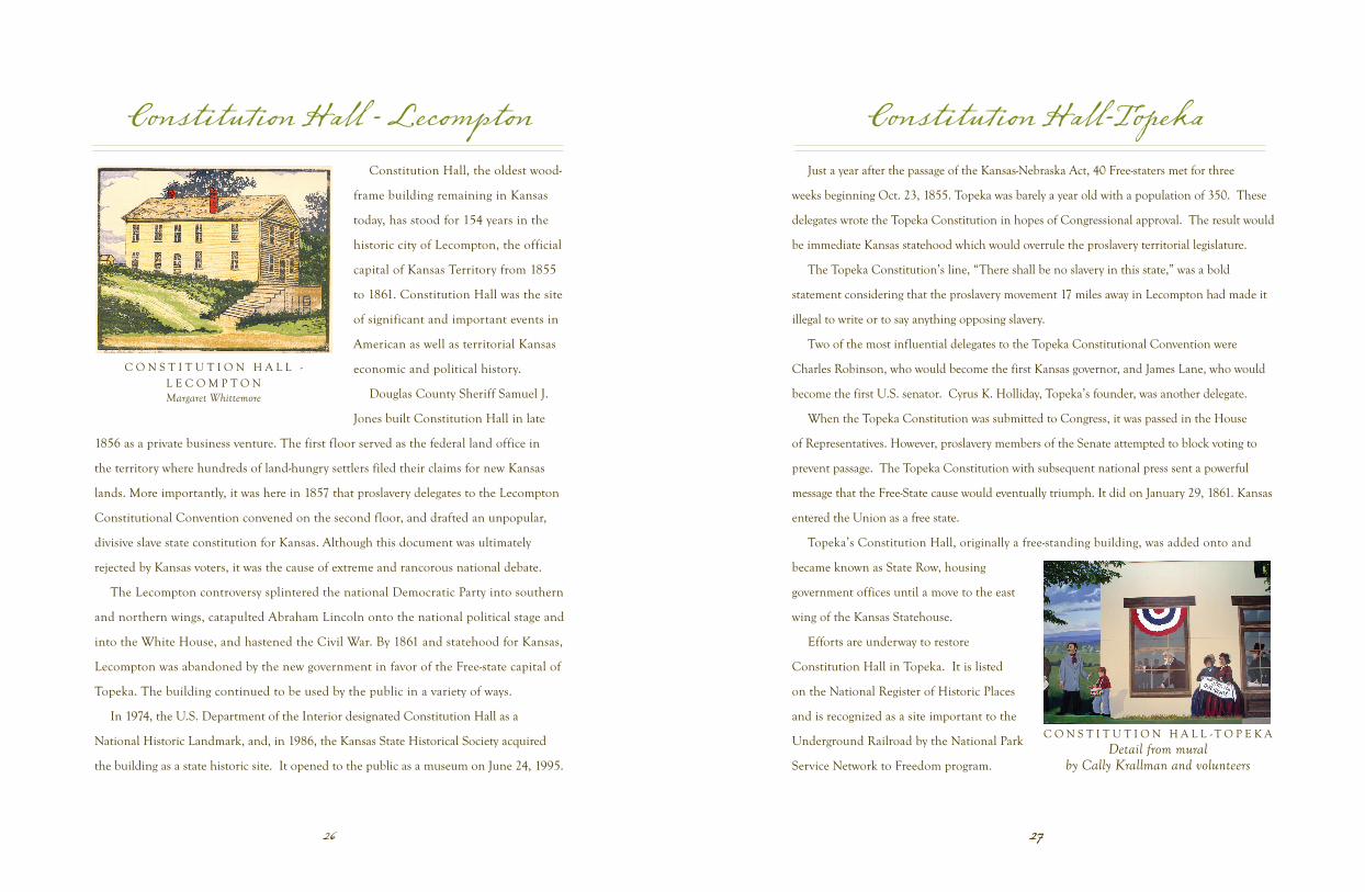
Constitution Hall - Lecompton
Constitution Hall, the oldest wood-
frame building remaining in Kansas
today, has stood for 154 years in the
historic city of Lecompton, the official
capital of Kansas Territory from 1855
to 1861. Constitution Hall was the site
of significant and important events in
American as well as territorial Kansas
economic and political history.
Douglas County Sheriff Samuel J.
Jones built Constitution Hall in late
1856 as a private business venture. The first floor served as the federal land office in
the territory where hundreds of land-hungry settlers filed their claims for new Kansas
lands. More importantly, it was here in 1857 that proslavery delegates to the Lecompton
Constitutional Convention convened on the second floor, and drafted an unpopular,
divisive slave state constitution for Kansas. Although this document was ultimately
rejected by Kansas voters, it was the cause of extreme and rancorous national debate.
The Lecompton controversy splintered the national Democratic Party into southern
and northern wings, catapulted Abraham Lincoln onto the national political stage and
into the White House, and hastened the Civil War. By 1861 and statehood for Kansas,
Lecompton was abandoned by the new government in favor of the Free-state capital of
Topeka. The building continued to be used by the public in a variety of ways.
In 1974, the U.S. Department of the Interior designated Constitution Hall as a
National Historic Landmark, and, in 1986, the Kansas State Historical Society acquired
the building as a state historic site. It opened to the public as a museum on June 24, 1995.
C O N S T I T U T I O N H A L L - L E C O M P T O NMargaret Whittemore
C O N S T I T U T I O N H A L L - T O P E K ADetail from mural
by Cally Krallman and volunteers