Embed Size (px)
Citation preview
FIELD RECONNAISSANCE REPORT Cooper Island
British Virgin Islands 15 August 2014
Prepared for the BVI Environmental Profile Programme
by Island Resources Foundation (IRF)
IRF Profile Team Investigators: Kevel C. Lindsay and Jean-Pierre Bacle
Summary
On 15 August 2014, Island Resources Foundation (IRF) biodiversity investigators, Jean-Pierre Bacle and Kevel Lindsay, undertook field reconnaissance investi-gation of Cooper Island as part of the BVI Environmental Profile Programme. This Field Trip Report summarizes activities that took place, while also highlight-ing important findings and issues. A more detailed description of the island’s natural history will be made available in April 2015 as part of the publication of the Tortola Environmental Profile. The reconnaissance trip was made possible thanks to a number of generous contributions from donors who are listed at the end of this report.
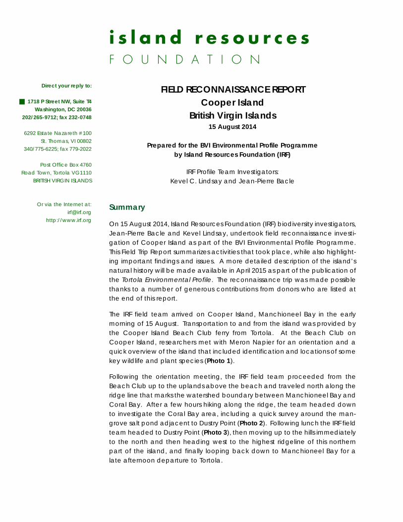
The IRF field team arrived on Cooper Island, Manchioneel Bay in the early morning of 15 August. Transportation to and from the island was provided by the Cooper Island Beach Club ferry from Tortola. At the Beach Club on Cooper Island, researchers met with Meron Napier for an orientation and a quick overview of the island that included identification and locations of some key wildlife and plant species (Photo 1).
Following the orientation meeting, the IRF field team proceeded from the Beach Club up to the uplands above the beach and traveled north along the ridge line that marks the watershed boundary between Manchioneel Bay and Coral Bay. After a few hours hiking along the ridge, the team headed down to investigate the Coral Bay area, including a quick survey around the man-grove salt pond adjacent to Dustry Point (Photo 2). Following lunch the IRF field team headed to Dustry Point (Photo 3), then moving up to the hills immediately to the north and then heading west to the highest ridgeline of this northern part of the island, and finally looping back down to Manchioneel Bay for a late afternoon departure to Tortola.
i s l a n d r e s o u r c e s F O U N D A T I O N
Direct your reply to:
1718 P Street NW, Suite T4 Washington, DC 20036 202/265-9712; fax 232-0748
6292 Estate Nazareth #100 St. Thomas, VI 00802 340/775-6225; fax 779-2022
Post Office Box 4760 Road Town, Tortola VG1110 BRITISH VIRGIN ISLANDS
Or via the Internet at: irf@ irf.org http://www.irf.org
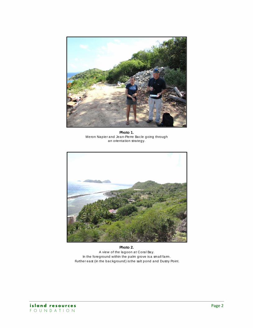
Photo 1. Meron Napier and Jean-Pierre Bacle going through
an orientation strategy.
Photo 2. A view of the lagoon at Coral Bay.
In the foreground within the palm grove is a small farm. Further east (in the background) is the salt pond and Dustry Point.
i s l a n d r e s o u r c e s Page 2 F O U N D A T I O N
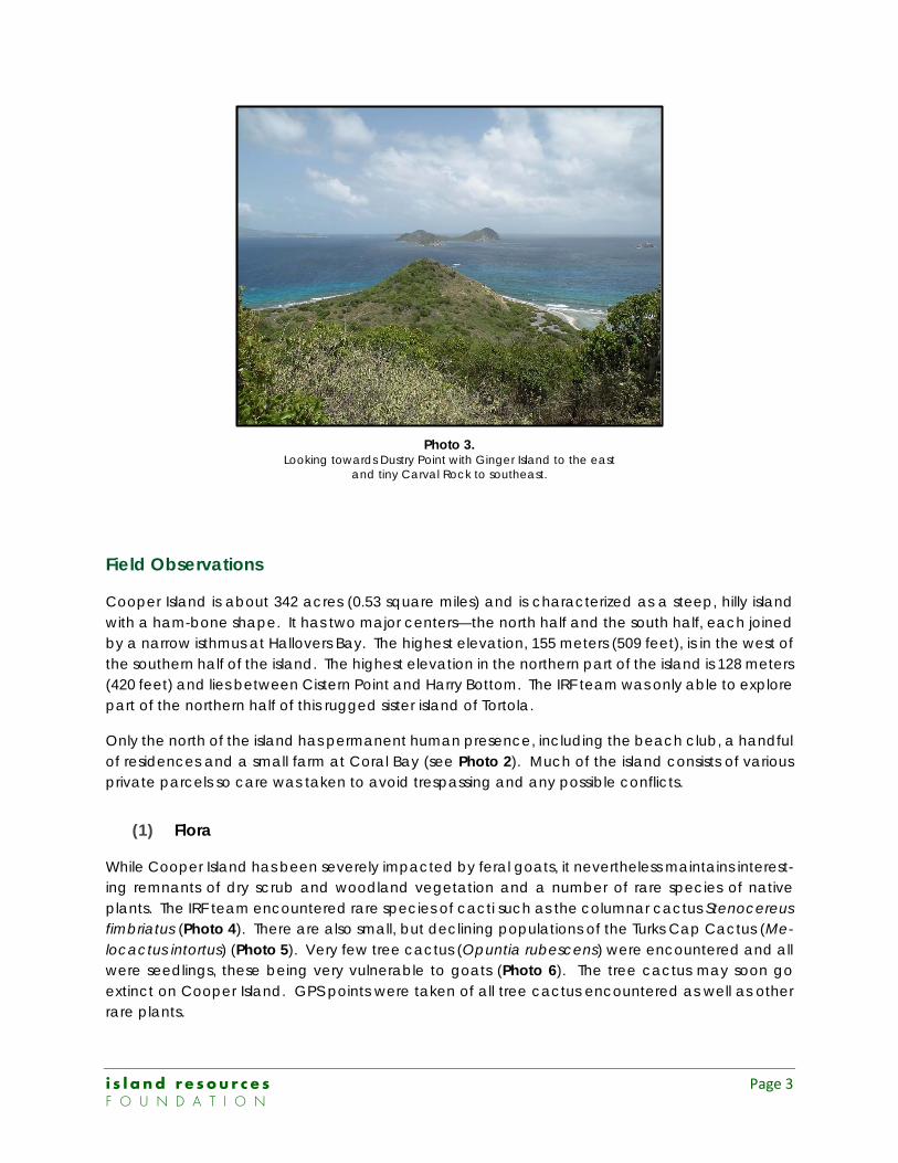
Photo 3. Looking towards Dustry Point with Ginger Island to the east
and tiny Carval Rock to southeast.
Field Observations
Cooper Island is about 342 acres (0.53 square miles) and is characterized as a steep, hilly island with a ham-bone shape. It has two major centers—the north half and the south half, each joined by a narrow isthmus at Hallovers Bay. The highest elevation, 155 meters (509 feet), is in the west of the southern half of the island. The highest elevation in the northern part of the island is 128 meters (420 feet) and lies between Cistern Point and Harry Bottom. The IRF team was only able to explore part of the northern half of this rugged sister island of Tortola.
Only the north of the island has permanent human presence, including the beach club, a handful of residences and a small farm at Coral Bay (see Photo 2). Much of the island consists of various private parcels so care was taken to avoid trespassing and any possible conflicts.
(1) Flora
While Cooper Island has been severely impacted by feral goats, it nevertheless maintains interest-ing remnants of dry scrub and woodland vegetation and a number of rare species of native plants. The IRF team encountered rare species of cacti such as the columnar cactus Stenocereus fimbriatus (Photo 4). There are also small, but declining populations of the Turks Cap Cactus (Me-locactus intortus) (Photo 5). Very few tree cactus (Opuntia rubescens) were encountered and all were seedlings, these being very vulnerable to goats (Photo 6). The tree cactus may soon go extinct on Cooper Island. GPS points were taken of all tree cactus encountered as well as other rare plants.
i s l a n d r e s o u r c e s Page 3 F O U N D A T I O N
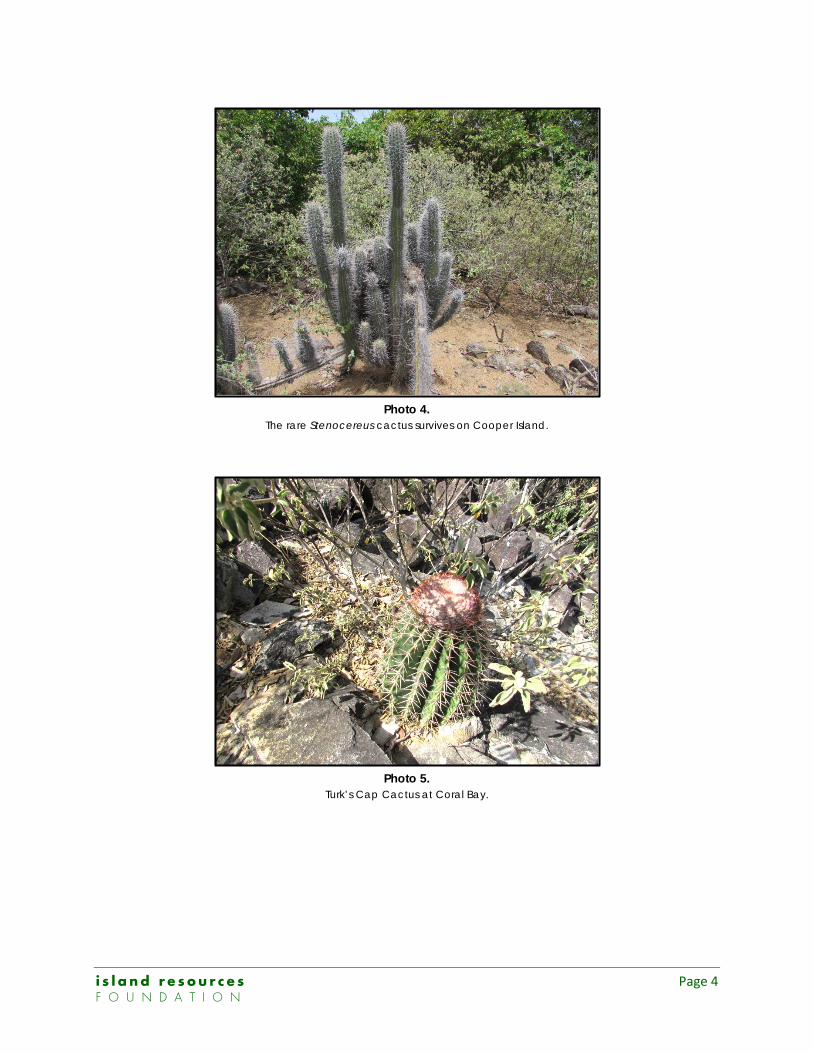
Photo 4. The rare Stenocereus cactus survives on Cooper Island.
Photo 5. Turk’s Cap Cactus at Coral Bay.
i s l a n d r e s o u r c e s Page 4 F O U N D A T I O N
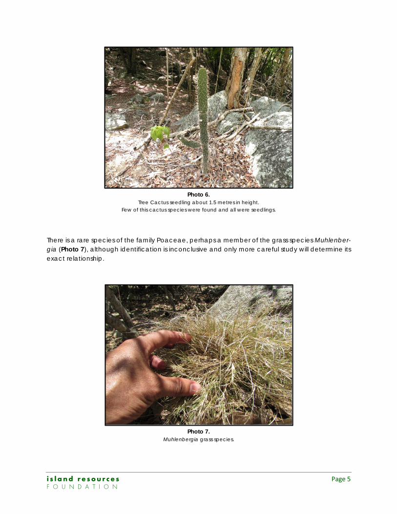
Photo 6. Tree Cactus seedling about 1.5 metres in height.
Few of this cactus species were found and all were seedlings.
There is a rare species of the family Poaceae, perhaps a member of the grass species Muhlenber-gia (Photo 7), although identification is inconclusive and only more careful study will determine its exact relationship.
Photo 7. Muhlenbergia grass species.
i s l a n d r e s o u r c e s Page 5 F O U N D A T I O N
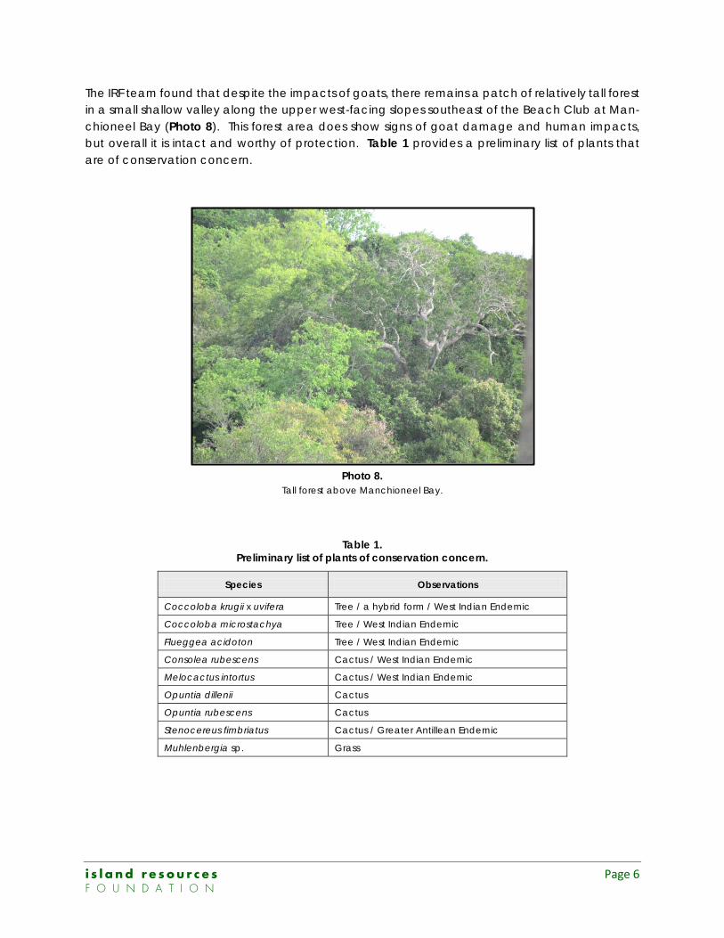
The IRF team found that despite the impacts of goats, there remains a patch of relatively tall forest in a small shallow valley along the upper west-facing slopes southeast of the Beach Club at Man-chioneel Bay (Photo 8). This forest area does show signs of goat damage and human impacts, but overall it is intact and worthy of protection. Table 1 provides a preliminary list of plants that are of conservation concern.
Photo 8. Tall forest above Manchioneel Bay.
Table 1. Preliminary list of plants of conservation concern.
Species Observations
Coccoloba krugii x uvifera Tree / a hybrid form / West Indian Endemic
Coccoloba microstachya Tree / West Indian Endemic
Flueggea acidoton Tree / West Indian Endemic
Consolea rubescens Cactus / West Indian Endemic
Melocactus intortus Cactus / West Indian Endemic
Opuntia dillenii Cactus
Opuntia rubescens Cactus
Stenocereus fimbriatus Cactus / Greater Antillean Endemic
Muhlenbergia sp. Grass
i s l a n d r e s o u r c e s Page 6 F O U N D A T I O N
(2) Fauna
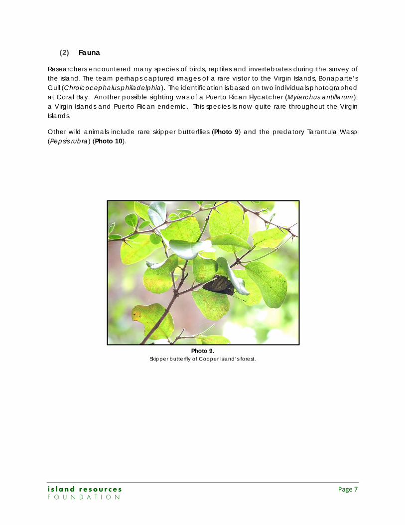
Researchers encountered many species of birds, reptiles and invertebrates during the survey of the island. The team perhaps captured images of a rare visitor to the Virgin Islands, Bonaparte’s Gull (Chroicocephalus philadelphia). The identification is based on two individuals photographed at Coral Bay. Another possible sighting was of a Puerto Rican Flycatcher (Myiarchus antillarum), a Virgin Islands and Puerto Rican endemic. This species is now quite rare throughout the Virgin Islands.
Other wild animals include rare skipper butterflies (Photo 9) and the predatory Tarantula Wasp (Pepsis rubra) (Photo 10).
Photo 9. Skipper butterfly of Cooper Island’s forest.
i s l a n d r e s o u r c e s Page 7 F O U N D A T I O N
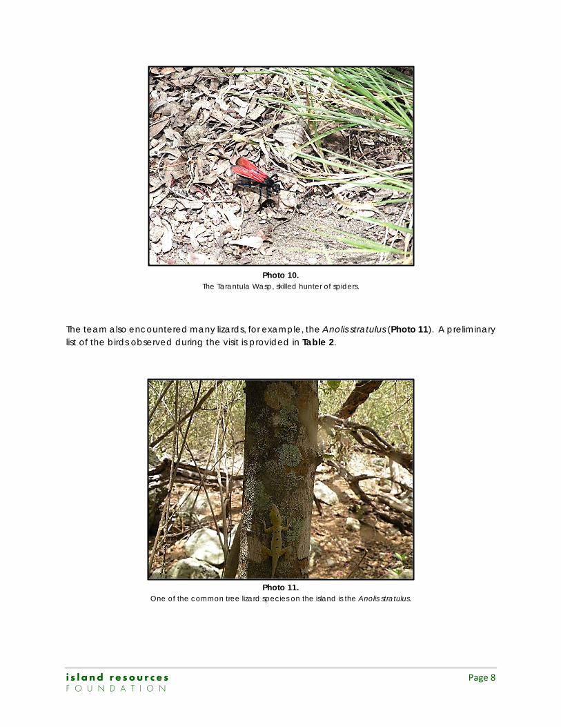
Photo 10. The Tarantula Wasp, skilled hunter of spiders.
The team also encountered many lizards, for example, the Anolis stratulus (Photo 11). A preliminary list of the birds observed during the visit is provided in Table 2.
Photo 11. One of the common tree lizard species on the island is the Anolis stratulus.
i s l a n d r e s o u r c e s Page 8 F O U N D A T I O N
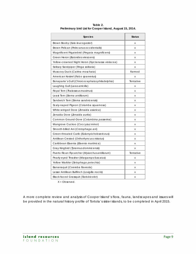
Table 2. Preliminary bird List for Cooper Island, August 15, 2014.
Species Status
Brown Booby (Sula leucogaster) x
Brown Pelican (Pelecanus occidentalis) x
Magnificent Frigatebird (Fregata magnificens) x
Green Heron (Butorides virescens) x
Yellow-crowned Night Heron (Nyctanassa violacea) x
Solitary Sandpiper (Tringa solitaria) x
Muscovy Duck (Cairina moschata) Farmed
American Kestrel (Falco sparverius) x
Bonaparte’s Gull (Chroicocephalus philadelphia) Tentative
Laughing Gull (Larus atricilla) x
Royal Tern (Thalasseus maximus) x
Least Tern (Sterna antillarum) x
Sandwich Tern (Sterna sandvicensis) x
Scaly-naped Pigeon (Columba squamosa) x
White-winged Dove (Zenaida asiatica) x
Zenaida Dove (Zenaida aurita) x
Common Ground-Dove (Columbina passerina) x
Mangrove Cuckoo (Coccyzuz minor) x
Smooth-billed Ani (Crotophaga ani) x
Green-throated Carib (Eulampis holosericeus) x
Antillean Crested (Orthorhyncus cristatus) x
Caribbean Elaenia (Elaenia martinica) x
Gray Kingbird (Tyrannus dominicensis) x
Puerto Rican Flycatcher (Myiarchus antillarum) Tentative
Pearly-eyed Thrasher (Margarops fuscatus) x
Yellow Warbler (Setophaga petechia) x
Bananaquit (Coereba flaveola) x
Lesser Antillean Bullfinch (Loxigilla noctis) x
Black-faced Grassquit (Tiaris bicolor) x
X = Observed.
A more complete review and analysis of Cooper Island’s flora, fauna, landscapes and issues will be provided in the natural history profile of Tortola’s sister islands, to be completed in April 2015.
i s l a n d r e s o u r c e s Page 9 F O U N D A T I O N
Acknowledgements
The IRF research team acknowledges the contribution and generosity of the following persons and organizations:
- The Cooper Island Beach Club, Ltd.
- Charlotte Fuller
- Sail Caribbean Ltd.
- James and Donna Weber
- Fred and Candia Kruse
- Susie and Richard Coles (Sheet Anchor Ltd.)
We also offer our gratitude to Andy Murrant and Meron Napier of the Cooper Island Beach Club for their support and making this field trip possible. Our appreciation to Edward Childs of Smiths Gore for his assistance, particularly with fund raising for the Sister Islands Natural History Project.
i s l a n d r e s o u r c e s Page 10 F O U N D A T I O N