Embed Size (px)
Citation preview
FORT ORD REUSE AUTHORITY
HIGHWAY 1 DESIGN CORRIDORDESIGN GUIDELINES
Revised
March 29, 2005
1HIGHWAY 1 DESIGN CORRIDOR DESIGN GUIDELINES
Fort Ord Reuse Authority
1.0 Introduction
1.1 Purpose
This document provides a set of design guidelines for the creation of design standards and zoning ordinances by jurisdictions with authority along the 3-mile California Highway 1 stretch of the former Fort Ord. These guidelines will also serve as the basis for future Fort Ord Reuse Authority ("FORA") consistency determination review of legislative, land use, and project approvals submitted by affected jurisdictions, as required by state law. FORA, as obligated by the provisions of the 1997 adopted Fort Ord Base Reuse Plan (“Base Reuse Plan”) and the accompanying Environmental Impact Report, has prepared these Highway 1 Design Corridor Design Guidelines (“Design Guidelines”).
Consistency determination, notwithstanding any other provision of the FORA Design Guidelines, should ensure compliance with the minimum standards of the Caltrans Guidelines for the Official Designation of Scenic Highways, as promulgated under the California Streets and Highway Code, Division, Chapter 2, Article 2.5.
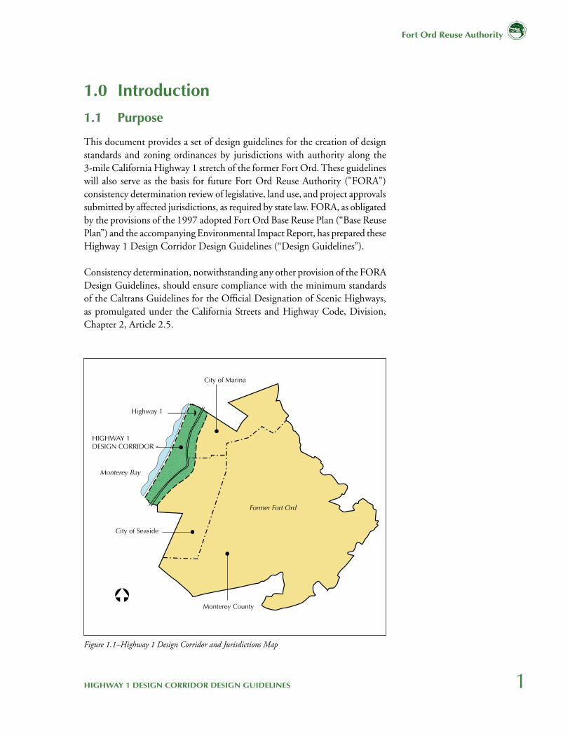
Figure 1.1–Highway 1 Design Corridor and Jurisdictions Map
Monterey Bay
Highway 1
City of Marina
City of Seaside
Monterey County
Former Fort Ord
HIGHWAY 1DESIGN CORRIDOR
2
Fort Ord Reuse Authority
1.2 Process
FORA, acting as a clearinghouse, convened a Highway 1 Design Corridor Working Group, comprised of agencies with jurisdiction over or property adjacent to the Highway 1 Design Corridor (“Corridor”), as generally defined in Figure 1.1. Among the purposes of these Design Guidelines is to highlight commitments included in the Base Reuse Plan, which identifies a range of policy statements relevant to the Highway One Corridor. These statements communicate the vision for the Base Reuse Plan and a starting point to reconcile conflicts among the jurisdictions in the design planning process. These major policy statements pertinent to the Highway 1 Design Corridor from the Base Reuse Plan are provided in Section 4.0–Reuse Plan Policies, at the end of this report.
In addition to providing direction to jurisdictions, outlining Base Reuse Plan requirements, and forming the basis of consistency determinations, these Design Guidelines serve: 1) to define a common look and feel for the Highway 1 Corridor as generally defined by the Base Reuse Plan, and 2) to provide guidelines to protect and enhance the Corridor character in the deployment of the sovereign responsibilities of the underlying individual jurisdictions. The Design Guidelines are consistent with the development levels and land uses included in the Base Reuse Plan, and protect the design goals included in that document.
Also, local and regional planning documents, including the Big Sur Coast Highway Management Plan and the California Department of Transportation Scenic Highway Program, were reviewed for reference to the protection and preservation of the Design Corridor Landscape.
Design guidelines can be
policy statements as well as
site specific requirements
to consistently provide
information to developers
and decision makers of
desired design character.
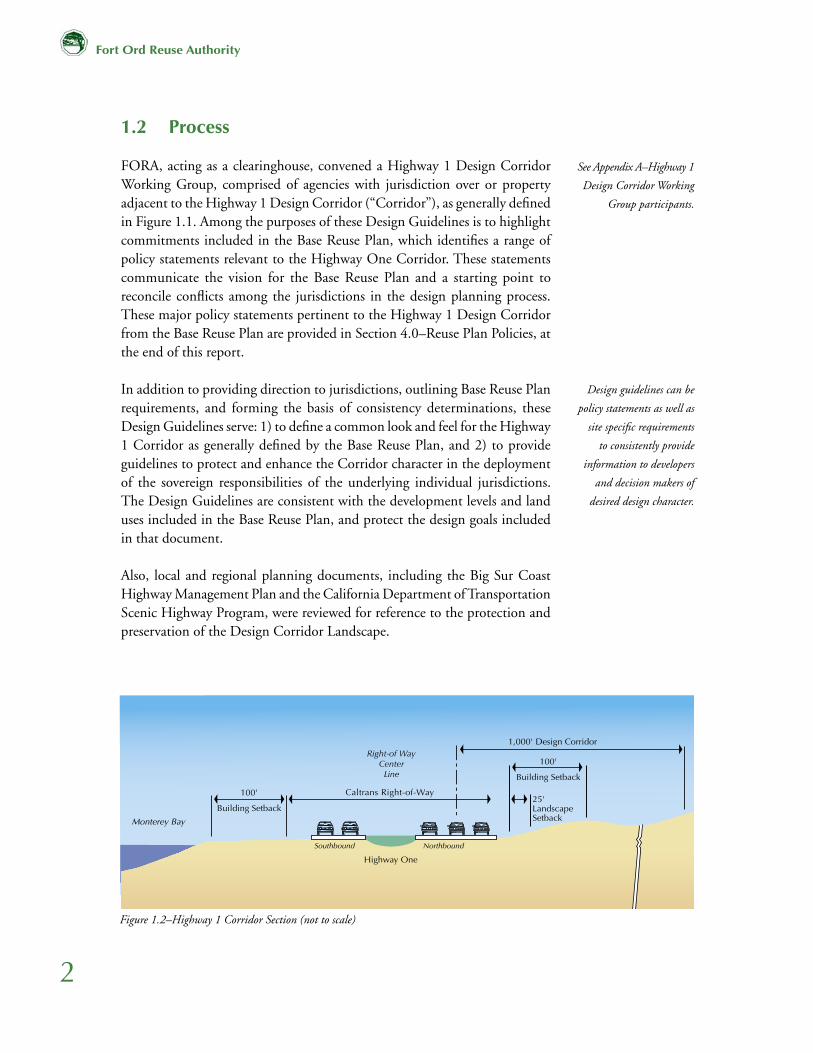
Figure 1.2–Highway 1 Corridor Section (not to scale)
����������������������
���������������������
���������� ����������
�����������
����������������������
����
����������������
�������������������������������
����
����������������
See Appendix A–Highway 1
Design Corridor Working
Group participants.
3HIGHWAY 1 DESIGN CORRIDOR DESIGN GUIDELINES
Fort Ord Reuse Authority
1.3 Content of Report
This report is divided into three sections: Section 1.0 provides a precise definition of the design corridor and an outline of the Design Guidelines.
Section 2.0 is a Design Guidelines list which describes general site planning and design recommendations for building heights and setbacks, tree protection/preservation, open space and bikeways development, landscape planting character, and accommodation of public facility needs.
Section 3.0 of the report is devoted to specific signage standards for the corridor. This section is divided into two parts:
1. For areas controlled by the California Department of Transportation ("Caltrans"), where FORA and adjacent jurisdictions can make requests for signage. However, the final text, graphics, or symbols will be determined by Caltrans according to current state laws.
2. Within the 1,000-foot design corridor (Figure 1.2), signage will be defined by the individual jurisdictions' sign ordinances. Project and local area signage will be the purview of the individual jurisdictional City Councils, Planning Commissions and Design Review entities, once sign ordinances are found consistent by FORA with the Base Reuse Plan and these Guidelines.
Finally, Section 4.0 summarizes relevant statements from the Base Reuse Plan regarding protecting and enhancing design character that guided the development of the Highway 1 Design Corridor Guidelines. Other attachments and graphics clarifying various aspects of the material included are either in the body or appendix to the report.
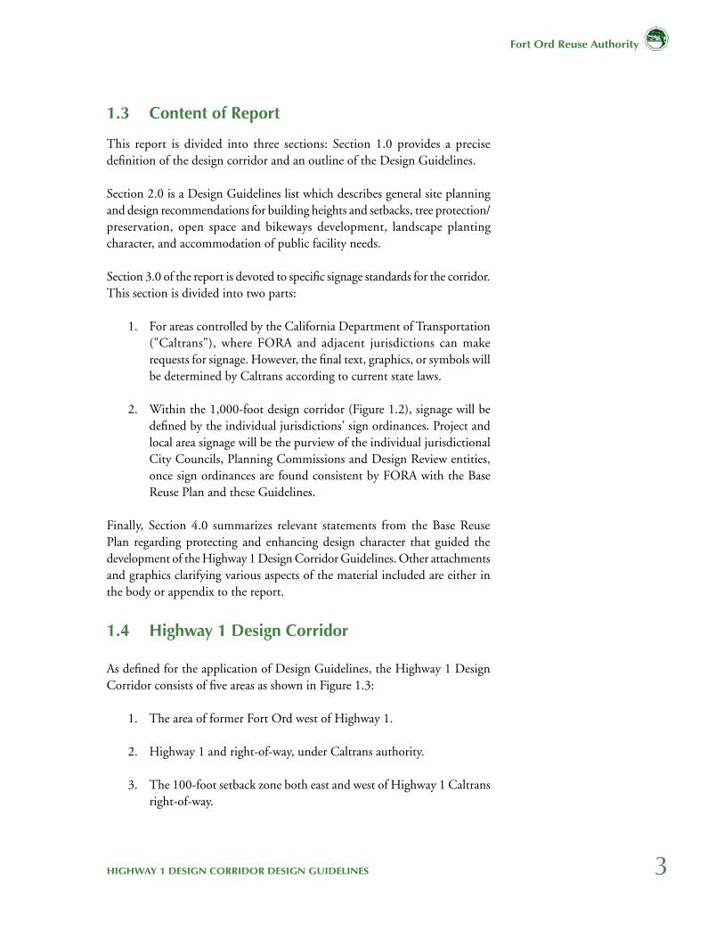
1.4 Highway 1 Design Corridor
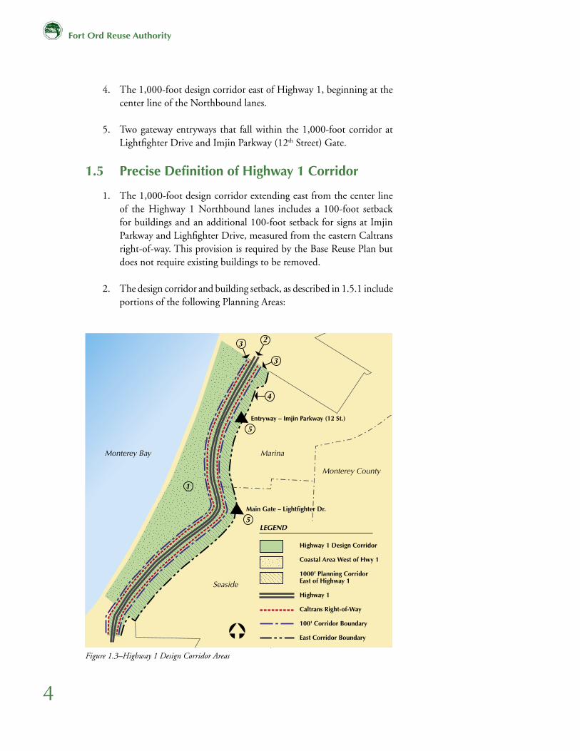
As defined for the application of Design Guidelines, the Highway 1 Design Corridor consists of five areas as shown in Figure 1.3:
1. The area of former Fort Ord west of Highway 1.
2. Highway 1 and right-of-way, under Caltrans authority.
3. The 100-foot setback zone both east and west of Highway 1 Caltrans right-of-way.
4
Fort Ord Reuse Authority
4. The 1,000-foot design corridor east of Highway 1, beginning at the center line of the Northbound lanes.
5. Two gateway entryways that fall within the 1,000-foot corridor at Lightfighter Drive and Imjin Parkway (12th Street) Gate.
1.5 Precise Definition of Highway 1 Corridor
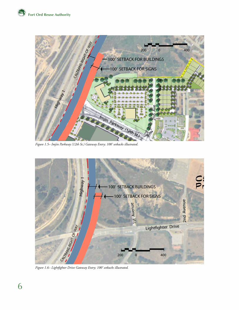
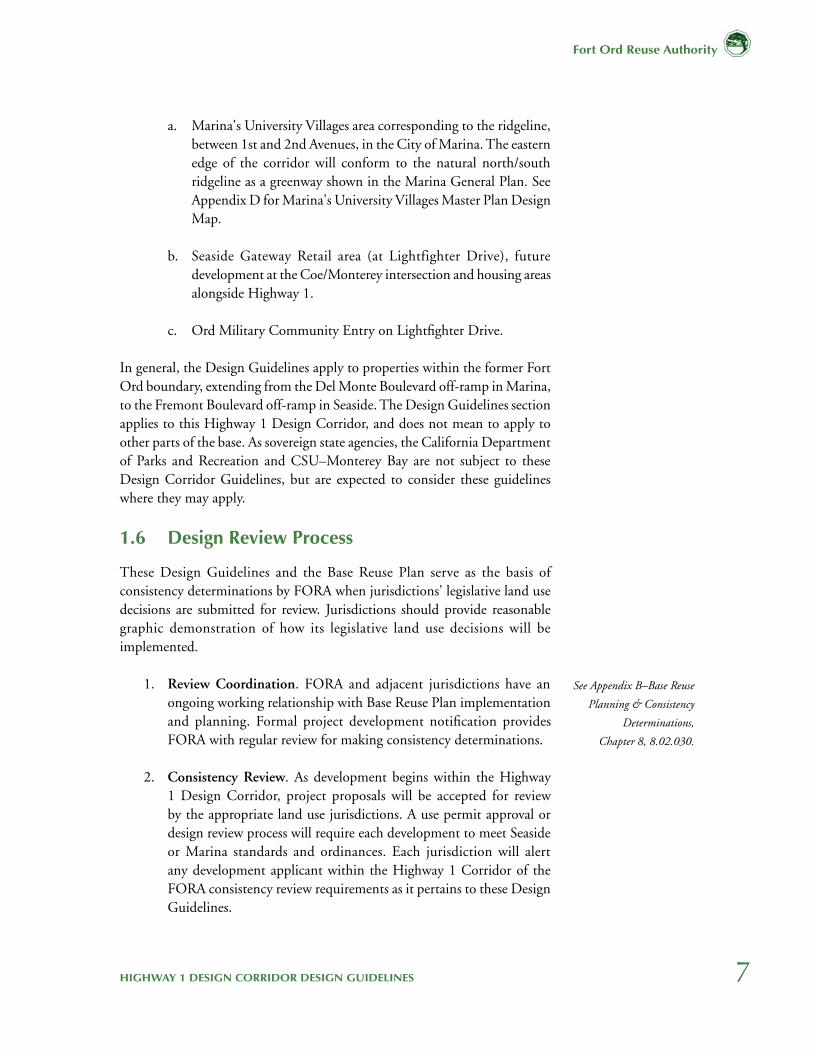
1. The 1,000-foot design corridor extending east from the center line of the Highway 1 Northbound lanes includes a 100-foot setback for buildings and an additional 100-foot setback for signs at Imjin Parkway and Lighfighter Drive, measured from the eastern Caltrans right-of-way. This provision is required by the Base Reuse Plan but does not require existing buildings to be removed.
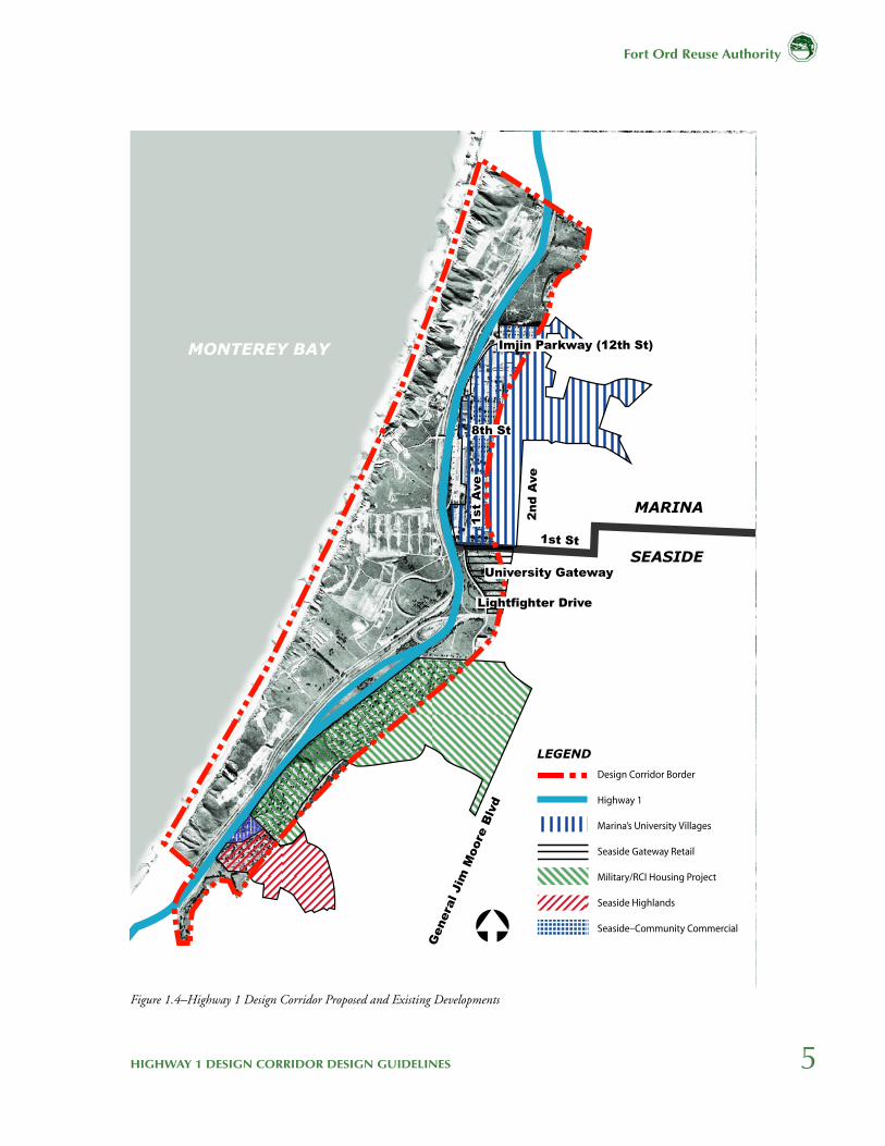
2. The design corridor and building setback, as described in 1.5.1 include portions of the following Planning Areas:
Figure 1.3–Highway 1 Design Corridor Areas
������������
���������������������������������
�����������������������������
���������������
�������
������
�������������������������
��������������������������
����������������������������������������
���������
���������������������
����������������������
����������������������
�������
�
�
�
�
�
�
5HIGHWAY 1 DESIGN CORRIDOR DESIGN GUIDELINES
Fort Ord Reuse Authority
MONTEREY BAY
MARINA
SEASIDE
Genera
l Jim
Moore
Blv
d
2n
d A
ve
1st
Ave
8th St
Imjin Parkway (12th St)
Lightfighter Drive
University Gateway
1st St
LEGEND
����������������������
���������
����������������������������
����������������������
����������������������������
�����������������
����������������������������
Figure 1.4–Highway 1 Design Corridor Proposed and Existing Developments
6
Fort Ord Reuse Authority
Figure 1.5– Imjin Parkway (12th St.) Gateway Entry; 100' setbacks illustrated.
Figure 1.6– Lightfighter Drive Gateway Entry; 100' setbacks illustrated.
����������������������������������������������������
����������������������������������������������������
�����������������������
����
���
����
��
���
���
��
��������������������������
���������������������������
��������������������
�����
���
��
�
���
�����
��
�
���
�����
������
���
���
���
���
���
�
���
����
��
���
��
����
�����������������������
�����������������������
����������������������������������������������������
����������������������������������������������������
�����������������������
����
���
����
��
���
���
��
��������������������������
���������������������������
��������������������
�����
���
��
�
���
�����
��
�
���
�����
������
���
���
���
���
���
�
���
����
��
���
��
����
�����������������������
�����������������������
7HIGHWAY 1 DESIGN CORRIDOR DESIGN GUIDELINES
Fort Ord Reuse Authority
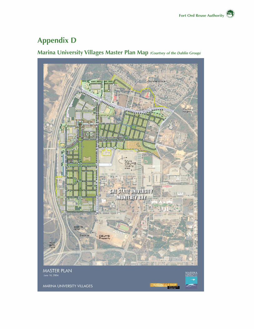
a. Marina's University Villages area corresponding to the ridgeline, between 1st and 2nd Avenues, in the City of Marina. The eastern edge of the corridor will conform to the natural north/south ridgeline as a greenway shown in the Marina General Plan. See Appendix D for Marina's University Villages Master Plan Design Map.
b. Seaside Gateway Retail area (at Lightfighter Drive), future development at the Coe/Monterey intersection and housing areas alongside Highway 1.
c. Ord Military Community Entry on Lightfighter Drive.
In general, the Design Guidelines apply to properties within the former Fort Ord boundary, extending from the Del Monte Boulevard off-ramp in Marina, to the Fremont Boulevard off-ramp in Seaside. The Design Guidelines section applies to this Highway 1 Design Corridor, and does not mean to apply to other parts of the base. As sovereign state agencies, the California Department of Parks and Recreation and CSU–Monterey Bay are not subject to these Design Corridor Guidelines, but are expected to consider these guidelines where they may apply.
1.6 Design Review Process
These Design Guidelines and the Base Reuse Plan serve as the basis of consistency determinations by FORA when jurisdictions' legislative land use decisions are submitted for review. Jurisdictions should provide reasonable graphic demonstration of how its legislative land use decisions will be implemented.
1. Review Coordination. FORA and adjacent jurisdictions have an ongoing working relationship with Base Reuse Plan implementation and planning. Formal project development notification provides FORA with regular review for making consistency determinations.
2. Consistency Review. As development begins within the Highway 1 Design Corridor, project proposals will be accepted for review by the appropriate land use jurisdictions. A use permit approval or design review process will require each development to meet Seaside or Marina standards and ordinances. Each jurisdiction will alert any development applicant within the Highway 1 Corridor of the FORA consistency review requirements as it pertains to these Design Guidelines.
See Appendix B–Base Reuse
Planning & Consistency
Determinations,
Chapter 8, 8.02.030.
8
Fort Ord Reuse Authority
See Fort Ord Reuse Plan
Volume 1–Procedure
for Appeals & Review of
Development Entitlements,
Page 207-209.
3. FORA Consistency Review. FORA Design Review will be an Administrative evaluation of development proposals on a project by project basis for consistency to the FORA Base Reuse Plan in general and these Design Guidelines specifically:
a. Building heights and setbacksb. Tree protection/preservationc. Open space and bikeways developmentd. Lighting and signagee. Landscape planting characterf. Accommodation for public facility needs
FORA will regularly review and comment to local jurisdictions on project consistency with the Design Guidelines.
If a local jurisdiction's proposal is determined inconsistent by FORA staff, the jurisdiction or applicant may decide to file a formal appeal to the FORA Board per adopted policies.
See Fort Ord Reuse Plan
Volume 1–Procedure
for Appeals & Review of
Development Entitlements,
Page 207-209.
9HIGHWAY 1 DESIGN CORRIDOR DESIGN GUIDELINES
Fort Ord Reuse Authority
2.0 Design GuidelinesThese Highway 1 Design Guidelines are provided to all jurisdictions who are developing standards regarding the protection of scenic character and views along the Highway 1 corridor.
2.1 Highway 1
1. The FORA Planners Working Group will serve as a liaison to Caltrans to provide continuing input regarding fencing, signage, and support for appropriate planting and irrigation. The Design Guidelines assume Caltrans support for the highway beautification program and the use of native plants and lighting for safety.
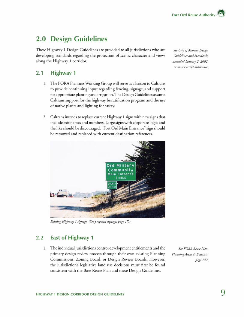
2. Caltrans intends to replace current Highway 1 signs with new signs that include exit names and numbers. Large signs with corporate logos and the like should be discouraged. “Fort Ord Main Entrance” sign should be removed and replaced with current destination references.
2.2 East of Highway 1
1. The individual jurisdictions control development entitlements and the primary design review process through their own existing Planning Commissions, Zoning Board, or Design Review Boards. However, the jurisdiction’s legislative land use decisions must first be found consistent with the Base Reuse Plan and these Design Guidelines.
See City of Marina Design
Guidelines and Standards,
amended January 2, 2002,
or most current ordinance.
Existing Highway 1 signage. (See proposed signage, page 17.)
See FORA Reuse Plan:
Planning Areas & Districts,
page 142.
10
Fort Ord Reuse Authority
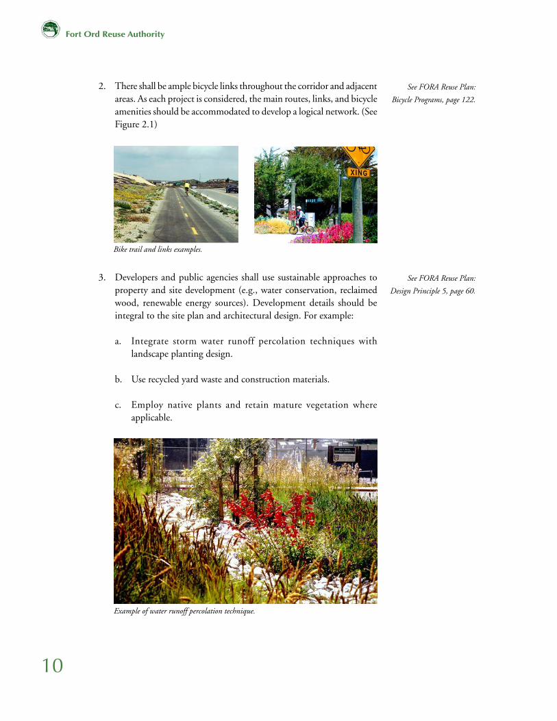
2. There shall be ample bicycle links throughout the corridor and adjacent areas. As each project is considered, the main routes, links, and bicycle amenities should be accommodated to develop a logical network. (See Figure 2.1)
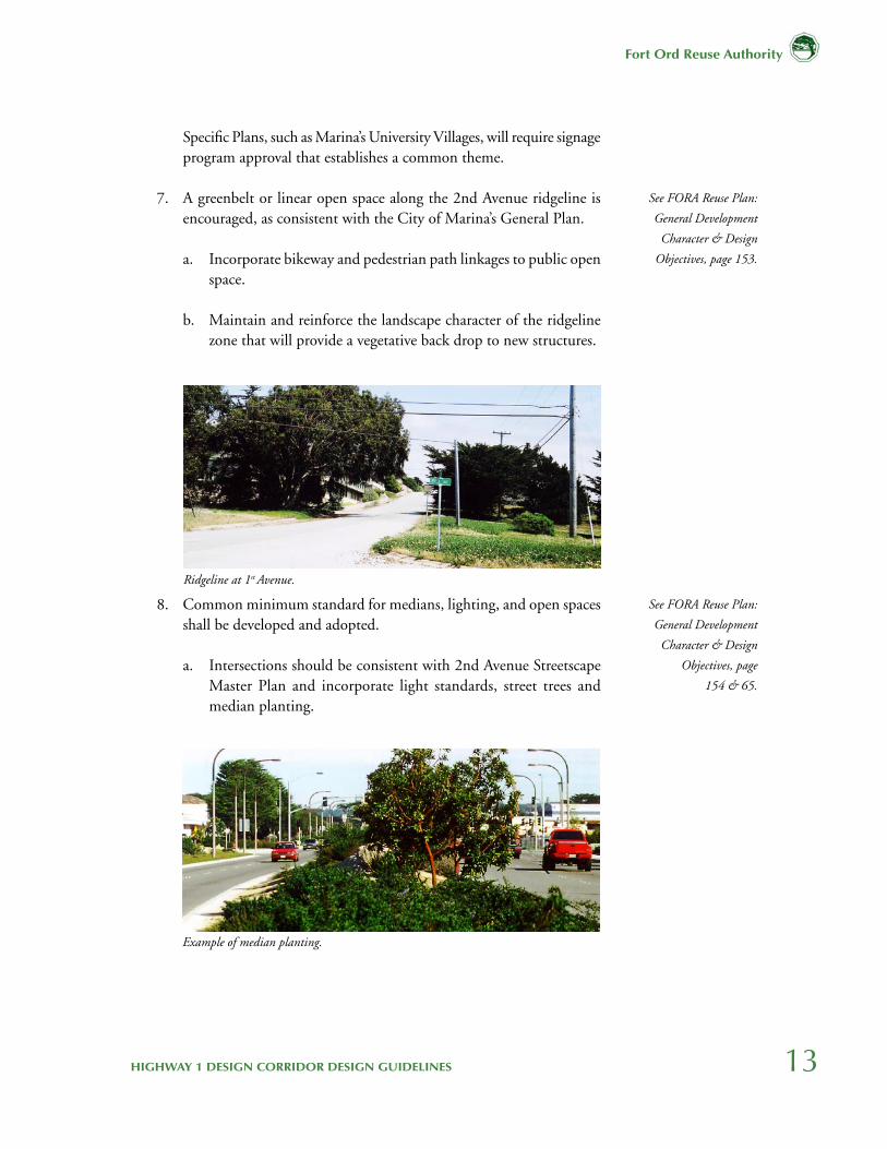
3. Developers and public agencies shall use sustainable approaches to property and site development (e.g., water conservation, reclaimed wood, renewable energy sources). Development details should be integral to the site plan and architectural design. For example:
a. Integrate storm water runoff percolation techniques with landscape planting design.
b. Use recycled yard waste and construction materials.
c. Employ native plants and retain mature vegetation where applicable.
See FORA Reuse Plan:
Bicycle Programs, page 122.
See FORA Reuse Plan:
Design Principle 5, page 60.
Bike trail and links examples.
Example of water runoff percolation technique.

11HIGHWAY 1 DESIGN CORRIDOR DESIGN GUIDELINES
Fort Ord Reuse Authority
MONTEREY BAY
MARINA
SEASIDE
Genera
l Jim
Moore
Blv
d
Mon
tere
y Rd
2n
d A
ve
1st
Ave
8th St
5th St
Imjin Parkway (12th St)
Lightfighter Dr
1st St
Gigling Rd
LEGEND
Design Corridor Border
Proposed Bicycle Routes
Highway 1
Pacific Coast TrailClass I Bike Route
Trail Connections
Figure 2.1–Proposed Bicycle Network and Trail Connections

12
Fort Ord Reuse Authority
4. Developers and public agencies, to the maximum extent possible, should fill in gaps between trees with trees native to the Monterey Coastal region or other vegetation consistent with the dune setting. Planting specimen trees and large native shrubs are also encouraged where appropriate.
a. Trees (6” trunk diameter or greater) in reasonable condition, within 25-feet of Caltrans right-of-way and at gateways, to the maximum extent possible, should be preserved and integrated into the site plan.
5. Setbacks required by the Base Reuse Plan shall be respected. Appropriate vegetative and architectural screening techniques should be incorporated into projects to sustain or enhance scenic vistas. Note that existing buildings need not be removed in order to comply with this provision, but may be renovated to meet current codes.
a. A 25-foot landscape setback (average) along Highway 1 should be provided to accommodate and protect mature trees.
6. Jurisdictions shall encourage compatible signage and common themes so that the look and feel of the corridor retains a connected quality.
See FORA Reuse Plan:
Landscape & Open Space,
page 71.
See FORA Reuse Plan:
Landscape & Open Space,
page 71.
See FORA Reuse Plan:
Design Principle 6, page 61.
Stand of Cypress trees in 25-foot setback.
Foliage gaps along Highway 1. Path through oak mature oaks.
13HIGHWAY 1 DESIGN CORRIDOR DESIGN GUIDELINES
Fort Ord Reuse Authority
Specific Plans, such as Marina’s University Villages, will require signage program approval that establishes a common theme.
7. A greenbelt or linear open space along the 2nd Avenue ridgeline is encouraged, as consistent with the City of Marina’s General Plan.
a. Incorporate bikeway and pedestrian path linkages to public open space.
b. Maintain and reinforce the landscape character of the ridgeline zone that will provide a vegetative back drop to new structures.
8. Common minimum standard for medians, lighting, and open spaces shall be developed and adopted.
a. Intersections should be consistent with 2nd Avenue Streetscape Master Plan and incorporate light standards, street trees and median planting.
See FORA Reuse Plan:
General Development
Character & Design
Objectives, page 153.
See FORA Reuse Plan:
General Development
Character & Design
Objectives, page
154 & 65.
Ridgeline at 1st Avenue.
Example of median planting.
14
Fort Ord Reuse Authority
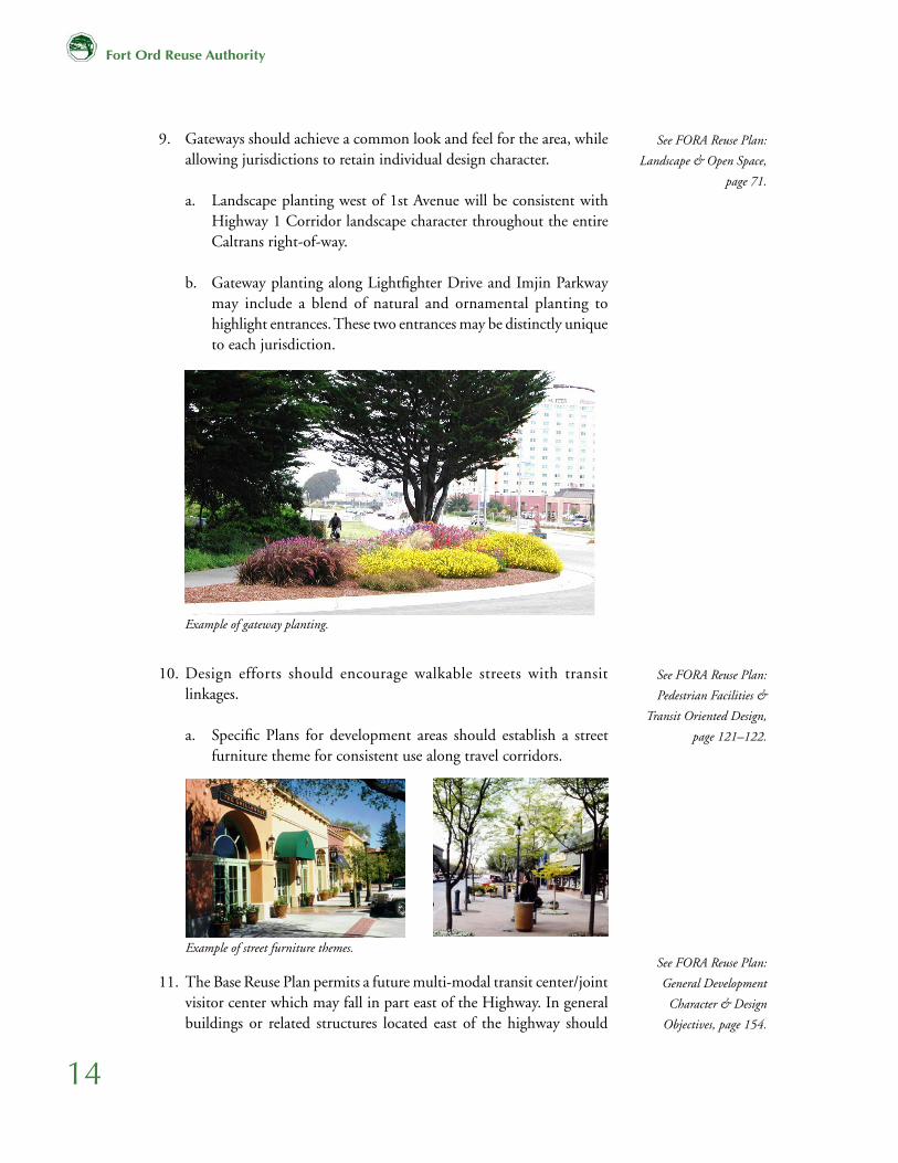
9. Gateways should achieve a common look and feel for the area, while allowing jurisdictions to retain individual design character.
a. Landscape planting west of 1st Avenue will be consistent with Highway 1 Corridor landscape character throughout the entire Caltrans right-of-way.
b. Gateway planting along Lightfighter Drive and Imjin Parkway
may include a blend of natural and ornamental planting to highlight entrances. These two entrances may be distinctly unique to each jurisdiction.
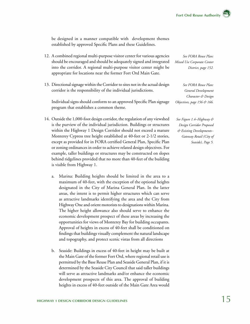
10. Design efforts should encourage walkable streets with transit linkages.
a. Specific Plans for development areas should establish a street furniture theme for consistent use along travel corridors.
11. The Base Reuse Plan permits a future multi-modal transit center/joint visitor center which may fall in part east of the Highway. In general buildings or related structures located east of the highway should
See FORA Reuse Plan:
Landscape & Open Space,
page 71.
See FORA Reuse Plan:
Pedestrian Facilities &
Transit Oriented Design,
page 121–122.
See FORA Reuse Plan:
General Development
Character & Design
Objectives, page 154.
Example of gateway planting.
Example of street furniture themes.
15HIGHWAY 1 DESIGN CORRIDOR DESIGN GUIDELINES
Fort Ord Reuse Authority
be designed in a manner compatible with development themes established by approved Specific Plans and these Guidelines.
12. A combined regional multi-purpose visitor center for various agencies should be encouraged and should be adequately signed and integrated into the corridor. A regional multi-purpose visitor center might be appropriate for locations near the former Fort Ord Main Gate.
13. Directional signage within the Corridor to sites not in the actual design corridor is the responsibility of the individual jurisdictions.
Individual signs should conform to an approved Specific Plan signage program that establishes a common theme.
14. Outside the 1,000-foot design corridor, the regulation of any viewshed is the purview of the individual jurisdiction. Buildings or structures within the Highway 1 Design Corridor should not exceed a mature Monterey Cypress tree height established at 40-feet or 2-1/2 stories, except as provided for in FORA certified General Plan, Specific Plan or zoning ordinances in order to achieve related design objectives. For example, taller buildings or structures may be constructed on slopes behind ridgelines provided that no more than 40-feet of the building is visible from Highway 1.
a. Marina: Building heights should be limited in the area to a maximum of 40-feet, with the exception of the optional heights designated in the City of Marina General Plan. In the latter areas, the intent is to permit higher structures which can serve as attractive landmarks identifying the area and the City from Highway One and orient motorists to designations within Marina. The higher height allowance also should serve to enhance the economic development prospect of these areas by increasing the opportunities for views of Monterey Bay for building occupants. Approval of heights in excess of 40-feet shall be conditioned on findings that buildings visually complement the natural landscape and topography, and protect scenic vistas from all directions
b. Seaside: Buildings in excess of 40-feet in height may be built at the Main Gate of the former Fort Ord, where regional retail use is permitted by the Base Reuse Plan and Seaside General Plan, if it is determined by the Seaside City Council that said taller buildings will serve as attractive landmarks and/or enhance the economic development prospects of this area. The approval of building heights in excess of 40-feet outside of the Main Gate Area would
See FORA Reuse Plan:
Mixed Use Corporate Center
District, page 152.
See FORA Reuse Plan:
General Development
Character & Design
Objectives, page 156 & 166.
See Figure 1.4–Highway &
Design Corridor Proposed
& Existing Developments–
Gateway Retail (City of
Seaside), Page 5.
16
Fort Ord Reuse Authority
be conditioned on findings that the proposed buildings will not damage the natural landscape and topography or obstruct scenic vistas.
2.3 West of Highway 1
1. There should be ample bicycle links to the State Park on the west side of the Highway and adjacent areas. As each project is considered, the main routes, links, and bicycle amenities should be accommodated to develop a logical network. (See Figure 1.4)
2. Setbacks: The minimum 100-foot setback from the west edge of the Caltrans right-of-way required by the Base Reuse Plan shall be respected, and screening techniques should be included to enhance views. Except transportation-related facilities, new buildings should not be sited in the 100-foot setback although existing structures need not be removed.
3. The Base Reuse Plan permits future public facilities such as a desalination plant and a multi-modal transit center or joint visitor center in the Highway 1 Corridor west of the Highway. The Working Group would like to see that any buildings west of the highway be designed in a manner compatible with the other values espoused by the Base Reuse Plan and the design guidelines included in this report.
See FORA Reuse Plan:
Pedestrian & Bicycles, page
306–308.
See FORA Reuse Plan:
Projected Land Uses, page
172.
See FORA Reuse Plan:
General Development
Character & Design
Objectives, page 152–154.
17HIGHWAY 1 DESIGN CORRIDOR DESIGN GUIDELINES
Fort Ord Reuse Authority
3.0 Signage Guidelines
3.1 Overview/Vision
Signage along the Design Corridor may be directed toward viewers on three different levels: within the Caltrans right-of-way, within the 1,000-foot corridor on private property directed to the highway traveler, and on private property directed to a visitor within the development neighborhood.
The visual character of this coastal dune environment remains largely intact and this stretch of the highway serves as an important coastal open space setting for all the cities of the Monterey Peninsula.
This section constitutes a basis for consistency findings by FORA. More detailed guidelines on specific topics are covered in the remainder of this document. To be found consistent with these design guidelines, sign ordinances of local jurisdictions must preserve the open space character of the Highway 1 Corridor and achieve the following objectives:
1. Views of the sky, ocean, dunes and ridgelines will be preserved. Signs and their support structures will not block view of the sky. Signs mounted on buildings must be below the eave or parapet line and below 40-feet.
2. Sign support structures for all freestanding signs located within the Design Corridor cannot be located within 100-feet of the Caltrans right-of-way. An additional 100-foot setback is included from off-ramp to on-ramp at Lightfighter Drive and Imjin Parkway for a total of 200-foot setback from the right-of-way at these locations. The signage base will be designed to blend with the coastal dune character (for example, by using earth-tone colors: tan, brown, forest green, gray or dark blue).
3.2 Highway 1 Right-of-Way
The dominant signage will be along the highway providing direction, information, and destinations for the highway traveler. In order to reduce duplication and eliminate irrelevant signage, Caltrans has proposed the following actions:
1. Eliminate all median signs.
See Appendix E–Sign
Definitions
18
Fort Ord Reuse Authority
2. Update and consolidate destination references to former Fort Ord military properties.
3. Reduce size of signs where possible.
CSU Monterey Bay and local communities will continue to jointly plan and potentially fund sign removal and replacement. Sign information is restricted by Caltrans to exclude any advertising or reference to specific businesses.
3.3 Private Property Signage
The Base Reuse Plan anticipated commercial signage, on private property, would accompany the major retail centers. These will be located within the 1,000-foot Design Corridor and outside the Highway 1 right-of-way on private land but viewed from multiple locations (as noted in 3.1), to identify destinations. These signs will be positioned and sized to direct motorists to commercial destinations. Signs are not allowed within the 100-foot building setback.
This signage will be regulated by the cities of Marina and Seaside. The Specific Plan for Marina’s University Villages will include signage guidelines for review and adoption by Marina. The Seaside Gateway Retail and future development near the Coe/Monterey intersection will likewise be required to include a detailed signage plan. Both project proposals, including signage will be reviewed for consistency with the Base Reuse Plan and these Guidelines by FORA.
Specific project submittals to the individual jurisdictions should provide a detailed visual presentation of sign size and mass related to existing trees to remain as well as the proposed building sizes and locations. Signage proposals should address the following issues:
See FORA Reuse Plan:
Community Design Vision,
3.1.2 Design Objectives,
page 62.
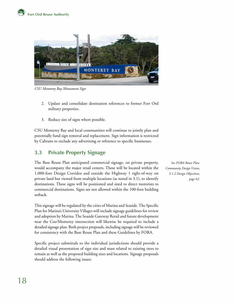
CSU Monterey Bay Monument Sign

19HIGHWAY 1 DESIGN CORRIDOR DESIGN GUIDELINES
Fort Ord Reuse Authority
1. Signage should be stationary and not changing, flashing or animated.
2. Building signs should not extend above the eaves or parapet wall.
3. Sign illumination and glare should be kept to a minimum. Downlighting is preferred.
4. Use of portable signs and mobile signs are discouraged in all Highway 1 Corridor areas.
5. Billboards, as defined in Appendix E attached hereto, are to be prohibited by the jurisdictions in finalizing the land use design standard for the Highway 1 Corridor. Limit the number, spacing, and size of signs. Use of single multiple identification low profile signs is encouraged.
3.4 Specific Signage Standards
1. Once FORA has found a local jurisdiction’s sign ordinance consistent with the Base Reuse Plan and these guidelines, individual jurisdictions will permit and enforce signs in their own jurisdictions. To achieve a similar look and feel of the former Fort Ord Area (common themes), consistent use of materials and style in public information and directional signage is recommended.
a. Retain military names and themes (note: City of Marina has renamed 12th St. as Imjin Parkway).
b. Collegiate names and themes for universities, clearly demarking the transitions onto campuses are encouraged.
2. Appropriately mark major entrances to destinations in relation to Caltrans controlled rights-of-way and individual jurisdiction controlled rights-of-way. In some cases, a destination may have signs in both Caltrans and jurisdiction-controlled rights-of-way.
3. Administrative rules regarding signage will correspond with FORA approved (as consistent with these Guidelines) jurisdictional sign ordinances or the rules of sovereign entities.
a. CSUMB (Caltrans and local jurisdiction (e.g. directional signs to CSUMB))
20
Fort Ord Reuse Authority
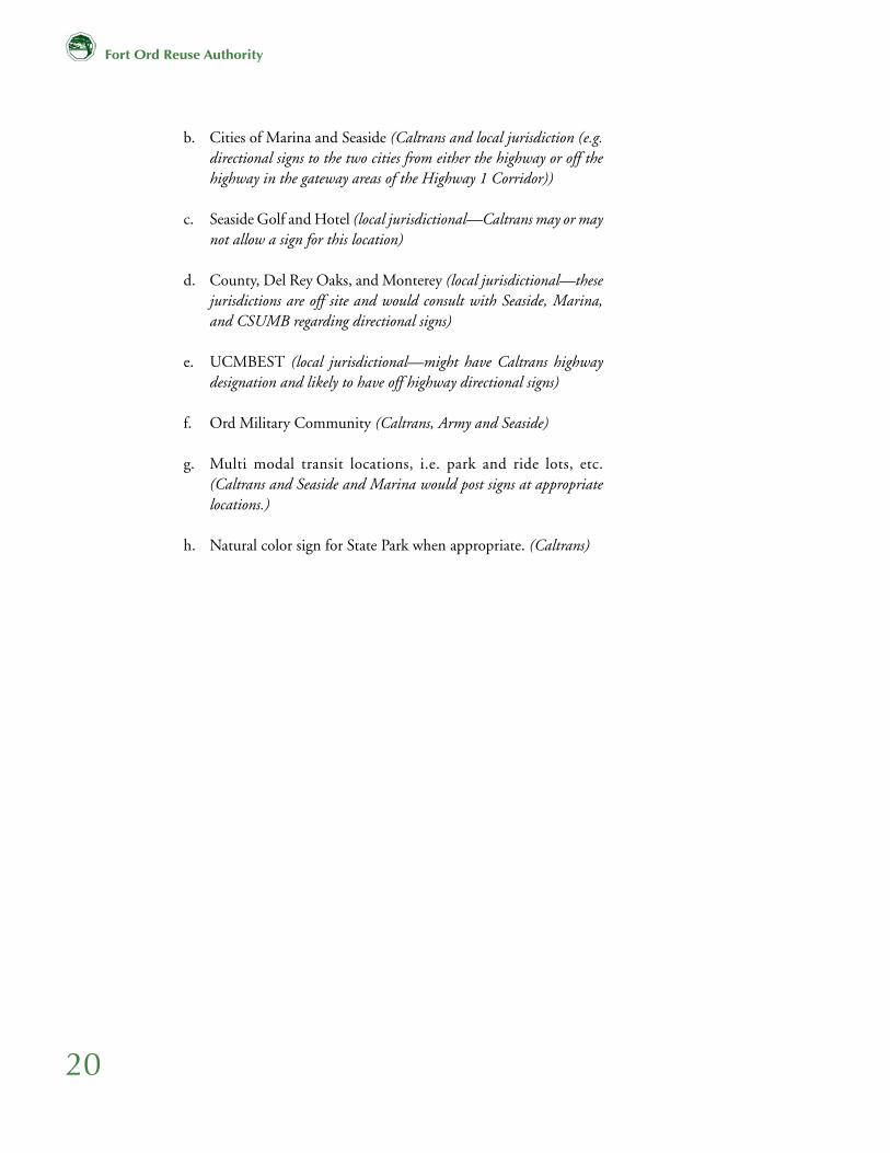
b. Cities of Marina and Seaside (Caltrans and local jurisdiction (e.g. directional signs to the two cities from either the highway or off the highway in the gateway areas of the Highway 1 Corridor))
c. Seaside Golf and Hotel (local jurisdictional—Caltrans may or may not allow a sign for this location)
d. County, Del Rey Oaks, and Monterey (local jurisdictional—these jurisdictions are off site and would consult with Seaside, Marina, and CSUMB regarding directional signs)
e. UCMBEST (local jurisdictional—might have Caltrans highway designation and likely to have off highway directional signs)
f. Ord Military Community (Caltrans, Army and Seaside)
g. Multi modal transit locations, i.e. park and ride lots, etc. (Caltrans and Seaside and Marina would post signs at appropriate locations.)
h. Natural color sign for State Park when appropriate. (Caltrans)
21HIGHWAY 1 DESIGN CORRIDOR DESIGN GUIDELINES
Fort Ord Reuse Authority
4.0 Reuse Plan PoliciesThe following are selected FORA Base Reuse Plan policy statements approved by the FORA Board in June 1997. Each policy has a direct or indirect implication to the Highway 1 Design Corridor. The bolded statements and its main point briefly explained are taken directly from the Reuse Plan. The margin page references are provided for more background information.
4.1 General
1. Adopt Regional Urban Design Guidelines. The Base Reuse Plan requires the adoption of Urban Design Guidelines that cover the entire base.
2. Specific Design and Signage Standards. Specific Plans for proposed Mixed Use Areas are required to provide Design and Signage Standards.
4.2 East of Highway 1
1. Landscape Character/Landscape Buffers. The landscape character of the Highway 1 Design Corridor should be preserved as a buffer between the Highway 1 right-of-way and development.
2. Scenic Corridor. The Highway 1 Design Corridor serves to support its attractiveness to the former Fort Ord and as a visual gateway to the region.
3. Maximum Building Heights. Except as noted herein, establish a maximum building height related to an identified mature landscape height to accommodate higher intensity land uses appropriate to this location without detracting from the regional landscape character of the State Highway 1 Scenic Corridor.
4. Maintain a Minimum 100-foot Development Setback. New buildings shall not directly abut the highway to allow for a continuous landscape character.
5. Unique Identity: Education. A major theme of the corridor should be that of a center of education.
6. Mixed-Use Developments. The Base Reuse Plan encourages mixed-use neighborhoods and developments to reduce auto trips and segregation of land uses.
See FORA Reuse Plan:
Design Principle 6, page 9.
See FORA Reuse Plan:
Design Objectives, page 62.
See FORA Reuse Plan:
Landscape Character of Fort
Ord, page 125.
See FORA Reuse Plan:
Design Principle 6, page 9.
See FORA Reuse Plan:
General Development
Character & Design
Objectives 2, page 154 & 165.
See FORA Reuse Plan:
General Development
Character & Design, page
153 & 165.
See FORA Reuse Plan:
Design Principle 1, page 9.
See FORA Reuse Plan:
Design Principle 3, page 9.
22
Fort Ord Reuse Authority
7. Diverse Neighborhoods. Neighborhoods should include housing affordable to an array of income groups and households.
8. Sustainable Development. The Base Reuse Plan promotes a broad series of practices designed to protect natural and human resources.
9. Discernible Edges/Link Neighborhoods and Cities (“Connectivity.”) The existing communities on and adjacent to the base should be linked and connected but should also retain their own discernible character.
10. Compact/Higher Densities at Core. To avoid sprawl, the already built up inner areas of the base should have higher densities.
11. Transit and Pedestrian Friendly. Development on the former Fort Ord shall promote alternatives to auto travel.
12. Village Environment. A village-like environment should be achieved.
13. High Quality Research and Development Center to anchor Town Center. Another central theme to the former Fort Ord region should be the presence of high quality Research and Development facilities.
14. Design Guidelines to Address Architectural Qualities, Building Massing and Orientation, Parking, Fencing and Lighting. These design features shall be addressed prior to development by the individual jurisdictions through Specific Plan and Design Review approval processes.
15. Incorporate Visitor/Cultural Center. A Visitor Center (or Centers) should be incorporated into the plans for reuse of the base, to enhance understanding and interpretation of the history and potential of the region.
16. Eighth Street Bridge as a Gateway to State Park. The existing Eighth Street Bridge shall connect the developable areas east of Highway 1, to the State Park on the west side of the highway.
4.3 West of Highway 1
1. Undeveloped Character West of Highway 1. The area west of Highway 1, with the exception of an appropriately sited transit/ visitor center,
See FORA Reuse Plan:
Design Principle 4, page 9.
See FORA Reuse Plan:
Design Principle 5, page 9.
See FORA Reuse Plan:
Community Form, page 62.
See FORA Reuse Plan:
Mixed Use Development/
Increased Density, page 121.
See FORA Reuse Plan:
Design Principle 3, page 59.
See FORA Reuse Plan:
Design Principle 3, page 59.
See FORA Reuse Plan:
Innovative Opportunities for
Collaborative Education and
Research, page 24.
See FORA Reuse Plan:
General Development
Character & Design
Objectives, page 154 & 165.
See FORA Reuse Plan:
Mixed-Use Corporate Center
District, page 152.
See FORA Reuse Plan:
Mixed-Use Corporate Center
District, page 152.
See FORA Reuse Plan: Fort
Ord Dunes State Park,
page 88.
23HIGHWAY 1 DESIGN CORRIDOR DESIGN GUIDELINES
Fort Ord Reuse Authority
See FORA Reuse Plan:
Design Principle 3, page 59.
See FORA Reuse Plan:
Design Principle 6, page 9.
See FORA Reuse Plan:
General Development
Character, page 154 & 165.
See FORA Reuse Plan: Town
Center Planning Area, page
152.
See FORA Reuse Plan: Town
Center Planning Area, page
152.
See FORA Reuse Plan:
Design Principle 5, page 9.
or other appropriate public use, shall retain a minimally developed character, primarily as a park and recreational area.
2. Transit and Pedestrian Friendly. Development on the former Fort Ord shall promote alternatives to auto travel.
3. Landscape Character/ Landscape Buffers. The landscape character of the Highway 1 Design Corridor shall be preserved, and buffers provided between Highway 1 right-of-way and development.
4. Maximum Building Heights. Establish a maximum building height related to an identified mature landscape height to accommodate higher intensity land uses appropriate to this location without detracting from the regional landscape character of the State Highway 1 Scenic Corridor.
5. 8th Street Bridge as a Gateway to State Park. Establish a maximum building height related to an identified mature landscape height to accommodate higher intensity land uses appropriate to this location without detracting from the regional landscape character of the State Highway 1 Scenic Corridor.
6. Incorporate Visitor/Cultural Center. A Visitors Center should be incorporated into the plans for reuse of the base, to enhance understanding and interpretation of the history and potential of the region.
7. Sustainable Development. The Base Reuse Plan promotes development practices designed to protect natural and human resources.

24
Fort Ord Reuse Authority
This page intentionally left blank.
Fort Ord Reuse Authority
City of MarinaJeff Dack
City of CarmelElizabeth CarakerChristine Di Iorio, Planning Director
City of MontereyBill Fell
City of Pacific GroveJudy MacClelland
Marina Coast Water DistrictDave Meza
California Department of Parks & RecreationKen Gray
California State University Monterey Bay (CSUMB)Forrest Ebbs, Melissa Gutheil, Judith Steinkamp, Kathleen Ventimiglia and Beverly Wood
City of Seaside Mary Orrison
County of MontereyNick Chiulos and George Devine
Sand CitySteve Matarazzo
U.S. ArmyRob Robinson, Michael Kelly and Bill Salmon
Transportation Agency for Monterey County (TAMC)Lee Yarborough, Walt Allen and Christina Watson
California Department of Transportation (Caltrans)Mark McCumsey, Scott Dowlin and Dave Murray
FORA Staff:Michael Houlemard, Executive OfficerSteve Endsley, Director of Planning and FinanceCarrie Mann, ConsultantMarta Montoro, InternAndrew Miller, Intern
Report/Graphics Support:Bellinger Foster Steinmetz Landscape Architcture
Appendix A
Highway 1 Design Corridor Plan Working Group
The Fort Ord Reuse Authority Highway 1 Design Corridor Working Group (Working Group) consisted of the following individuals, representing the effected jurisdictions or interested agencies.

Fort Ord Reuse Authority

Fort Ord Reuse Authority
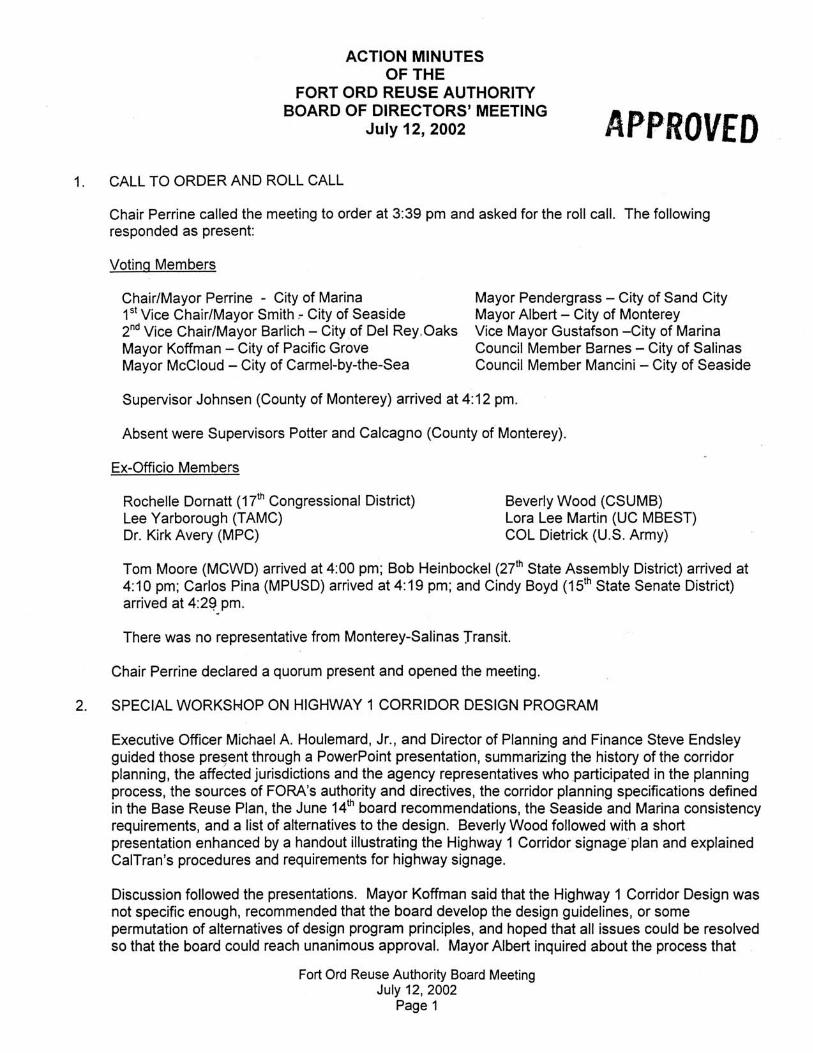
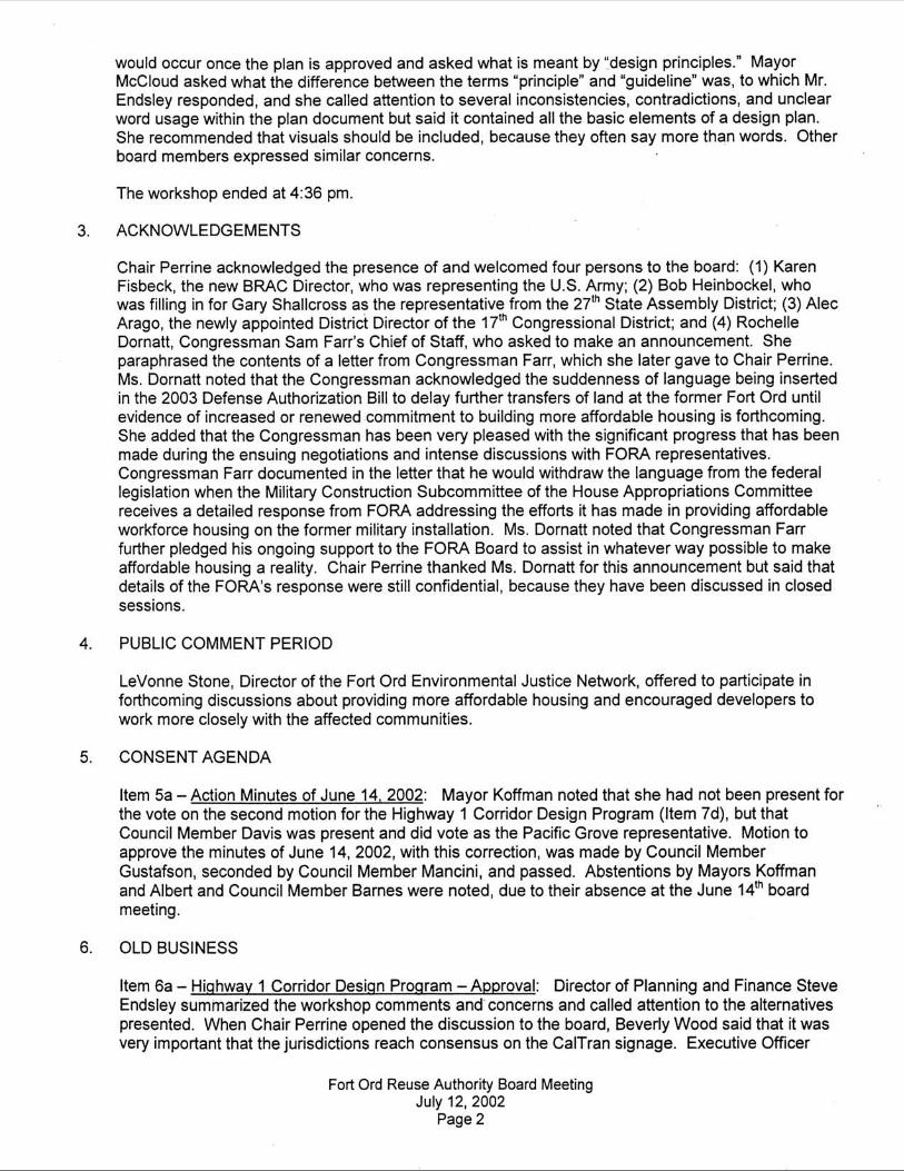
Appendix B
FORA Board of Directors’ Meeting Action Minutes, 7/12/2002


Fort Ord Reuse Authority

Fort Ord Reuse Authority
Appendix C
FORA Master Resolution, Chapter 8–Base Reuse Planning and Consistency Determinations
(Provided as a reference to FORA development review authority.)
Page 1
CHAPTER 8.BASE REUSE PLANNING AND CONSISTENCY DETERMINATIONS.
8.01. GENERAL PROVISIONS.
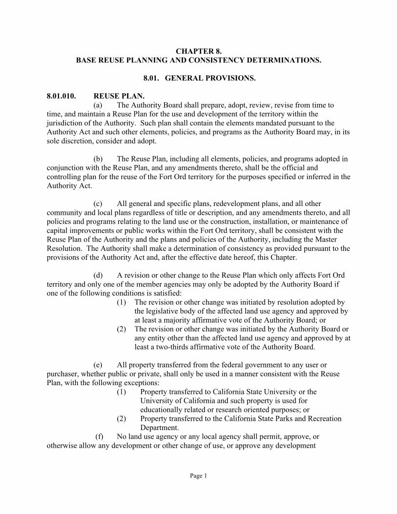
8.01.010. REUSE PLAN.(a) The Authority Board shall prepare, adopt, review, revise from time to
time, and maintain a Reuse Plan for the use and development of the territory within thejurisdiction of the Authority. Such plan shall contain the elements mandated pursuant to theAuthority Act and such other elements, policies, and programs as the Authority Board may, in itssole discretion, consider and adopt.
(b) The Reuse Plan, including all elements, policies, and programs adopted inconjunction with the Reuse Plan, and any amendments thereto, shall be the official andcontrolling plan for the reuse of the Fort Ord territory for the purposes specified or inferred in theAuthority Act.
(c) All general and specific plans, redevelopment plans, and all othercommunity and local plans regardless of title or description, and any amendments thereto, and allpolicies and programs relating to the land use or the construction, installation, or maintenance ofcapital improvements or public works within the Fort Ord territory, shall be consistent with theReuse Plan of the Authority and the plans and policies of the Authority, including the MasterResolution. The Authority shall make a determination of consistency as provided pursuant to theprovisions of the Authority Act and, after the effective date hereof, this Chapter.
(d) A revision or other change to the Reuse Plan which only affects Fort Ordterritory and only one of the member agencies may only be adopted by the Authority Board ifone of the following conditions is satisfied:
(1) The revision or other change was initiated by resolution adopted bythe legislative body of the affected land use agency and approved byat least a majority affirmative vote of the Authority Board; or
(2) The revision or other change was initiated by the Authority Board orany entity other than the affected land use agency and approved by atleast a two-thirds affirmative vote of the Authority Board.
(e) All property transferred from the federal government to any user orpurchaser, whether public or private, shall only be used in a manner consistent with the ReusePlan, with the following exceptions:
(1) Property transferred to California State University or theUniversity of California and such property is used foreducationally related or research oriented purposes; or
(2) Property transferred to the California State Parks and Recreation Department.
(f) No land use agency or any local agency shall permit, approve, orotherwise allow any development or other change of use, or approve any development
Page 2
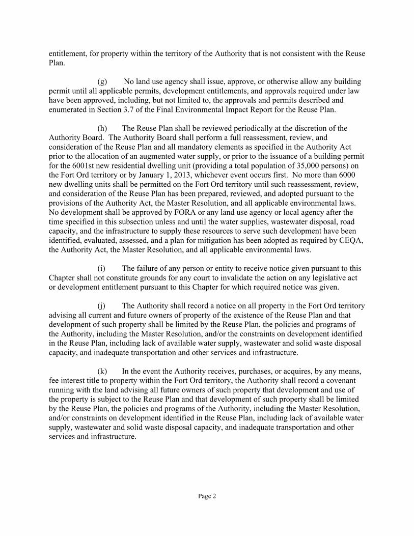
entitlement, for property within the territory of the Authority that is not consistent with the ReusePlan.
(g) No land use agency shall issue, approve, or otherwise allow any buildingpermit until all applicable permits, development entitlements, and approvals required under lawhave been approved, including, but not limited to, the approvals and permits described andenumerated in Section 3.7 of the Final Environmental Impact Report for the Reuse Plan.
(h) The Reuse Plan shall be reviewed periodically at the discretion of theAuthority Board. The Authority Board shall perform a full reassessment, review, andconsideration of the Reuse Plan and all mandatory elements as specified in the Authority Actprior to the allocation of an augmented water supply, or prior to the issuance of a building permitfor the 6001st new residential dwelling unit (providing a total population of 35,000 persons) onthe Fort Ord territory or by January 1, 2013, whichever event occurs first. No more than 6000new dwelling units shall be permitted on the Fort Ord territory until such reassessment, review,and consideration of the Reuse Plan has been prepared, reviewed, and adopted pursuant to theprovisions of the Authority Act, the Master Resolution, and all applicable environmental laws.No development shall be approved by FORA or any land use agency or local agency after thetime specified in this subsection unless and until the water supplies, wastewater disposal, roadcapacity, and the infrastructure to supply these resources to serve such development have beenidentified, evaluated, assessed, and a plan for mitigation has been adopted as required by CEQA,the Authority Act, the Master Resolution, and all applicable environmental laws.
(i) The failure of any person or entity to receive notice given pursuant to thisChapter shall not constitute grounds for any court to invalidate the action on any legislative actor development entitlement pursuant to this Chapter for which required notice was given.
(j) The Authority shall record a notice on all property in the Fort Ord territoryadvising all current and future owners of property of the existence of the Reuse Plan and thatdevelopment of such property shall be limited by the Reuse Plan, the policies and programs ofthe Authority, including the Master Resolution, and/or the constraints on development identifiedin the Reuse Plan, including lack of available water supply, wastewater and solid waste disposalcapacity, and inadequate transportation and other services and infrastructure.
(k) In the event the Authority receives, purchases, or acquires, by any means,fee interest title to property within the Fort Ord territory, the Authority shall record a covenantrunning with the land advising all future owners of such property that development and use ofthe property is subject to the Reuse Plan and that development of such property shall be limitedby the Reuse Plan, the policies and programs of the Authority, including the Master Resolution,and/or constraints on development identified in the Reuse Plan, including lack of available watersupply, wastewater and solid waste disposal capacity, and inadequate transportation and otherservices and infrastructure.
Page 3
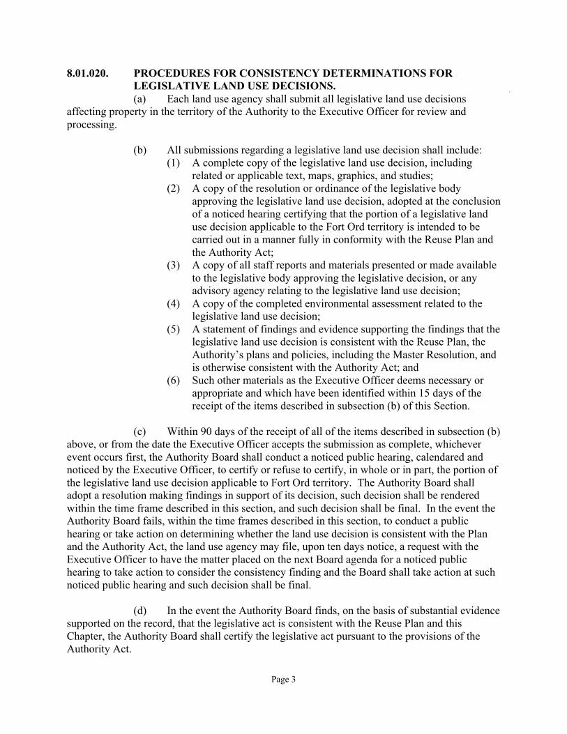
8.01.020. PROCEDURES FOR CONSISTENCY DETERMINATIONS FORLEGISLATIVE LAND USE DECISIONS.(a) Each land use agency shall submit all legislative land use decisions
affecting property in the territory of the Authority to the Executive Officer for review andprocessing.
(b) All submissions regarding a legislative land use decision shall include:(1) A complete copy of the legislative land use decision, including
related or applicable text, maps, graphics, and studies;(2) A copy of the resolution or ordinance of the legislative body
approving the legislative land use decision, adopted at the conclusionof a noticed hearing certifying that the portion of a legislative landuse decision applicable to the Fort Ord territory is intended to becarried out in a manner fully in conformity with the Reuse Plan andthe Authority Act;
(3) A copy of all staff reports and materials presented or made availableto the legislative body approving the legislative decision, or anyadvisory agency relating to the legislative land use decision;
(4) A copy of the completed environmental assessment related to thelegislative land use decision;
(5) A statement of findings and evidence supporting the findings that thelegislative land use decision is consistent with the Reuse Plan, theAuthority’s plans and policies, including the Master Resolution, andis otherwise consistent with the Authority Act; and
(6) Such other materials as the Executive Officer deems necessary orappropriate and which have been identified within 15 days of thereceipt of the items described in subsection (b) of this Section.
(c) Within 90 days of the receipt of all of the items described in subsection (b)above, or from the date the Executive Officer accepts the submission as complete, whicheverevent occurs first, the Authority Board shall conduct a noticed public hearing, calendared andnoticed by the Executive Officer, to certify or refuse to certify, in whole or in part, the portion ofthe legislative land use decision applicable to Fort Ord territory. The Authority Board shalladopt a resolution making findings in support of its decision, such decision shall be renderedwithin the time frame described in this section, and such decision shall be final. In the event theAuthority Board fails, within the time frames described in this section, to conduct a publichearing or take action on determining whether the land use decision is consistent with the Planand the Authority Act, the land use agency may file, upon ten days notice, a request with theExecutive Officer to have the matter placed on the next Board agenda for a noticed publichearing to take action to consider the consistency finding and the Board shall take action at suchnoticed public hearing and such decision shall be final.
(d) In the event the Authority Board finds, on the basis of substantial evidencesupported on the record, that the legislative act is consistent with the Reuse Plan and thisChapter, the Authority Board shall certify the legislative act pursuant to the provisions of theAuthority Act.
Page 4
(e) In the event the Authority Board refuses to certify the legislative land usedecision in whole or in part, the Authority Board’s resolution making findings shall includesuggested modifications which, if adopted and transmitted to the Authority Board by the affectedland use agency, will allow the legislative land use decision to be certified. If such modificationsare adopted by the affected land use agency as suggested, and the Executive Officer confirmssuch modifications have been made, the legislative land use decision shall be deemed certified.In the event the affected land use agency elects to meet the Authority Board’s refusal ofcertification in a manner other than as suggested by the Authority Board, the legislative body ofthe affected land use agency shall resubmit its legislative land use decision to the ExecutiveOfficer and follow the procedures contained in this Section.
(f) No legislative land use decision shall be deemed final and complete, norshall any land use entitlement be issued for property affected otherwise permitted by suchlegislative land use decision unless it has been certified pursuant to the procedures described inthis Section.
(g) The Authority Board may only refuse to certify zoning ordinances, zoningdistrict maps, or other legislative land use decision on the grounds that such actions do notconform with, or are inadequate to carry out, the provisions of the general plan, certified asconsistent with the Reuse Plan pursuant to the provisions of this Section, applicable to theaffected property.
(h) Nothing in this Section or in this Chapter shall apply to or be construed asadversely affecting any consistency determination previously obtained by a land use agency andcertified by the Authority Board pursuant to the Authority Act.
8.01.030. REVIEW OF DEVELOPMENT ENTITLEMENTS.(a) After the portion of a general plan applicable to Fort Ord territory has
become effective, development review authority within such portion of territory shall beexercised by the land use agency with jurisdiction lying within the area to which the general planapplies. Each land use agency may issue or deny, or conditionally issue, developmententitlements within their respective jurisdictions so long as the land use agency has a generalplan certified pursuant to Section 8.01.020 and the decisions issuing, denying, or conditionallyissuing development entitlements are consistent with the adopted and certified general plan, theReuse Plan, and is in compliance with CEQA and all other applicable laws.
(b) All decisions on development entitlements of a land use agency affectingproperty within the territory of the Authority may be reviewed by the Authority Board on its owninitiative, or may be appealed to the Authority Board, subject to the procedures specified in thisSection. No development entitlement shall be deemed final and complete until the appeal andreview procedures specified in this Section and Sections 8.01.040 and 8.01.050 of this Chapterhave been exhausted.
(c) The land use agency approving a development entitlement within thejurisdiction of the Authority shall provide notice of approval or conditional approval to the
Page 5
Executive Officer. Notice of approval or conditional approval of a development entitlementshall include:
(1) A complete copy of the approved development entitlement,including related or applicable text, maps, graphics, and studies.
(2) A copy of all staff reports and materials presented or made availableto any hearing body that reviewed the development entitlement.
(3) A copy of the completed environmental assessment related to thedevelopment entitlement.
8.01.040. REVIEW OF DEVELOPMENT ENTITLEMENTS BY INITIATIVE OFTHE AUTHORITY BOARD.Within 35 days of the receipt of all of the notice materials described in subsection
(d) of Section 8.01.030, the Authority Board, on its own initiative, may consider a resolutionsetting a hearing on a development entitlement affecting Fort Ord territory. The Authority Boardmay continue the matter of setting a hearing once for any reason. In the event the AuthorityBoard does not act to set the matter for hearing within the 35 day time period or at the continuedmeeting, whichever event is last, the decision of the land use agency approving the developmententitlement shall be deemed final and shall not be subject to review by the Authority Boardpursuant to this Section. Nothing in this section shall be construed as abrogating any rights thatany person may have to appeal development entitlements to the Authority Board pursuant toSection 8.01.050. In the event the Authority Board sets the matter for hearing, such hearing shallcommence at the first regular meeting of the Authority Board following the date the AuthorityBoard passed its resolution setting the matter for hearing or at a special hearing date prior to suchregular meeting. The Authority Board may continue the matter once. In the event the AuthorityBoard fails to take action on the development entitlement within such time period, thedevelopment entitlement shall be deemed approved.
8.01.050. REVIEW OF DEVELOPMENT ENTITLEMENTS BY APPEAL TOAUTHORITY BOARD.
(a) Within 10 days of a land use agency approving a development entitlement,any person aggrieved by that approval and who participated either orally or in writing, in thatagency’s hearing on the matter, may file a written appeal of such approval with the ExecutiveOfficer, specifically setting forth the grounds for the appeal, which shall be limited to issuesraised at the hearing before the land use agency. The person filing the appeal shall pay a filingfee in an amount equal to the fee for appeal of combined development permits as established bythe Monterey County Board of Supervisors for the cost of processing the appeal. The ExecutiveOfficer shall set, schedule, and notice a public hearing before the Authority Board. In the eventthe Authority Board fails to act on the development entitlement within the time periods specifiedin this Section to conduct a public hearing and take action within 60 days on determiningwhether the development entitlement is consistent with the Reuse Plan and the Authority Act, theland use agency may file, upon ten days notice, a request with the Authority Board to have thematter placed on the next Board agenda for a noticed public hearing to take action to consider thedevelopment entitlement.
Page 6
(b) At the time and place noticed by the Executive Officer, the AuthorityBoard will conduct a hearing on the development entitlement. The Authority Board maycontinue the matter once for any reason.
(c) Said continued hearing must be rescheduled to a date that is not later than35 days from the date of the initial hearing date. In the event the Authority Board determines thedevelopment entitlement is not consistent with the Reuse Plan, the development shall be deniedand the Authority Board’s decision shall be final. In the event the Authority Board determinesthe development entitlement is consistent with the Reuse Plan, the Authority Board shall approvethe development entitlement.
8.01.060. SUPERCESSION.In the event of a conflict or inconsistency between this Chapter of the Master
Resolution and the Reuse Plan, the Development and Resource Plan, and other adopted FORApolicies and procedures in regards to legislative land use decisions and/or developmententitlements affecting lands within the affected territory, the provisions of this Chapter shallgovern.
8.01.070. FORA AS RESPONSIBLE AGENCY UNDER CEQA. In taking action on all legislative land decisions and for review of all
development entitlements, the Authority Board shall act as a responsible agency under CEQA.
8.01.080. ADMINISTRATIVE APPEALS.Any administrative decision made by the Executive Officer may be appealed to
the Authority Board within 15 days by completing and filing a notice of appeal at the Office ofthe Executive Officer.
Article 8.02. CONSISTENCY DETERMINATION CRITERIA.
8.02.010. LEGISLATIVE LAND USE DECISION CONSISTENCY.(a) In the review, evaluation, and determination of consistency regarding
legislative land use decisions, the Authority Board shall disapprove any legislative land usedecision for which there is substantial evidence supported by the record, that
(1) Provides a land use designation that allows more intense land usesthan the uses permitted in the Reuse Plan for the affected territory;
(2) Provides a development more dense than the density of usepermitted in the Reuse Plan for the affected territory;
(3) Is not in substantial conformance with applicable programs specifiedin the Reuse Plan and Section 8.02.020 of this Master Resolution.
(4) Provides uses which conflict or are incompatible with uses permittedor allowed in the Reuse Plan for the affected property or whichconflict or are incompatible with open space, recreational, or habitatmanagement areas within the jurisdiction of the Authority;
(5) Does not require or otherwise provide for the financing and/orinstallation, construction, and maintenance of all infrastructure
Page 7
necessary to provide adequate public services to the propertycovered by the legislative land use decision; and
(6) Does not require or otherwise provide for implementation of the FortOrd Habitat Management Plan.
(b) FORA shall not preclude the transfer of intensity of land uses and/ordensity of development involving properties within the affected territory as long as the land usedecision meets the overall intensity and density criteria of Sections 8.02.010(a)(1) and (2) aboveas long as the cumulative net density or intensity of the Fort Ord Territory is not increased.
(c) The Authority Board, in its discretion, may find a legislative land usedecision is in substantial compliance with the Reuse Plan when the Authority Board finds thatthe applicant land use agency has demonstrated compliance with the provisions specified inthis section and Section 8.02.020 of this Master Resolution.
8.02.020. SPECIFIC PROGRAMS AND MITIGATION MEASURES FORINCLUSION IN LEGISLATIVE LAND USE DECISIONS.(a–t) Details of programs and mitigation measures. (See original document for
detail.)
8.02.030. DEVELOPMENT ENTITLEMENT CONSISTENCY.(a) In the review, evaluation, and determination of consistency regarding any
development entitlement presented to the Authority Board pursuant to Section 8.01.030 of thisResolution, the Authority Board shall withhold a finding of consistency for any developmententitlement that:
(1–6) (See original document for detail.)
(7) Is not consistent with the Highway 1 Scenic Corridor designstandards as such standards may be developed and approved by theAuthority Board.
(8) (See original document for detail.)
i:\winword g\resolutions\master resolution\chapter 8.0804doc.doc
Fort Ord Reuse Authority
Appendix D
Marina University Villages Master Plan Map (Courtsey of the Dahlin Group)

Fort Ord Reuse Authority
Fort Ord Reuse Authority
Appendix E
Sign Definitions
“Animated sign” means any sign which includes action or motion or the optical illusion of action or motion, or color changes of all or any part of the sign facing, requiring electrical energy, or set in motion by movement of the atmosphere. Excluded from the definition are public service message center signs and flags.
“Billboard sign” means any sign that directs attention to a business, service, product, or entertainment not sold or offered on the premises on which the sign is located, including but not limited to outdoor advertising and other signs.
“Building-mounted sign” means a sign affixed to a building, painted directly on a wall or erected against the wall of a building.
“Directional sign” means any sign which is designed and erected solely for the purpose of traffic or pedestrian direction and which is placed on the property to which or on which the public is directed. Such a sign contains no advertising copy. (Examples are: “one-way,” “entrance,” “exit,” “parking in rear,” “15 miles per hour,” “no left turn.”)
“Flashing sign” means any sign which contains an intermittent or flashing light source or which includes the illusion of intermittent or flashing light by means of animation or an externally mounted intermittent light source.
“Freestanding sign” means any sign not attached to or on a building.
“Illumination” means the method by which a sign is lighted so as to be readable at night. The following types of illumination are provided for in this chapter:
1. “Direct illumination” means the lighting of the sign face from behind so that the light shines through translucent sign copy or lighting via neon or other gases within translucent tubing incorporated onto or into the sign face.
2. “Indirect illumination” means the lighting of an opaque sign face from a light source mounted in front of the face, or the lighting of opaque sign copy (on an opaque sign face) via lights mounted into the copy and shining rearward onto the face to form a lighted “halo” around the copy (e.g., “reverse channel” letters).
“Monument sign” means a freestanding sign mounted on a low-profile solid base, a fence, or a wall, as distinguished from support by poles (see page 18).
“Parapet wall” means a wall extending above the roof plane of the building.
Fort Ord Reuse Authority
“Portable sign” or “mobile sign” means a sign made of any material, which, by its design, is readily movable and is equipped with wheels, casters or rollers or which is not permanently affixed to the ground, structure or building, or a sign upon a vehicle or trailer used as a stationary advertising display, the primary purpose of which is to serve as a base or platform for the sign. (Also includes sidewalk or sandwich board signs.)
“Sign” means any medium for visual communication, including but not limited to words, symbols and illustrations, together with all parts, materials, frame and background, which is used or intended to be used to attract attention to, identify or advertise an establishment, product, service, activity or location, or to provide information.
“Sign height,” “height of sign,” or “height” means the following:
1. For building-mounted signs, the distance from the average finish grade directly beneath the sign to the top of the sign.
2. For freestanding signs, the distance from top of curb of the nearest street or parking lot (or the edge of pavement of such street where there is no curb) to the top of the sign or any vertical projection thereof, including supporting columns and/or design elements.
“Support structure” means base, supports, uprights and bracing for a sign.