Embed Size (px)
Citation preview
ASIA-PACIFICFORESTRY WEEK 2016GROWING OUR FUTURE!
Gewa Gamoga
a/REDD & Climate Change Manager
PNG Forest Authority
Papua New Guinea
Forest & Land Use in Papua New Guinea -2013
ASIA-PACIFIC FORESTRY WEEK 2016GROWING OUR FUTURE!
Presentation Outline
1. Papua New Guinea in Brief2. Methodology3. Findings4. Next steps5. Key Message
ASIA-PACIFIC FORESTRY WEEK 2016GROWING OUR FUTURE!
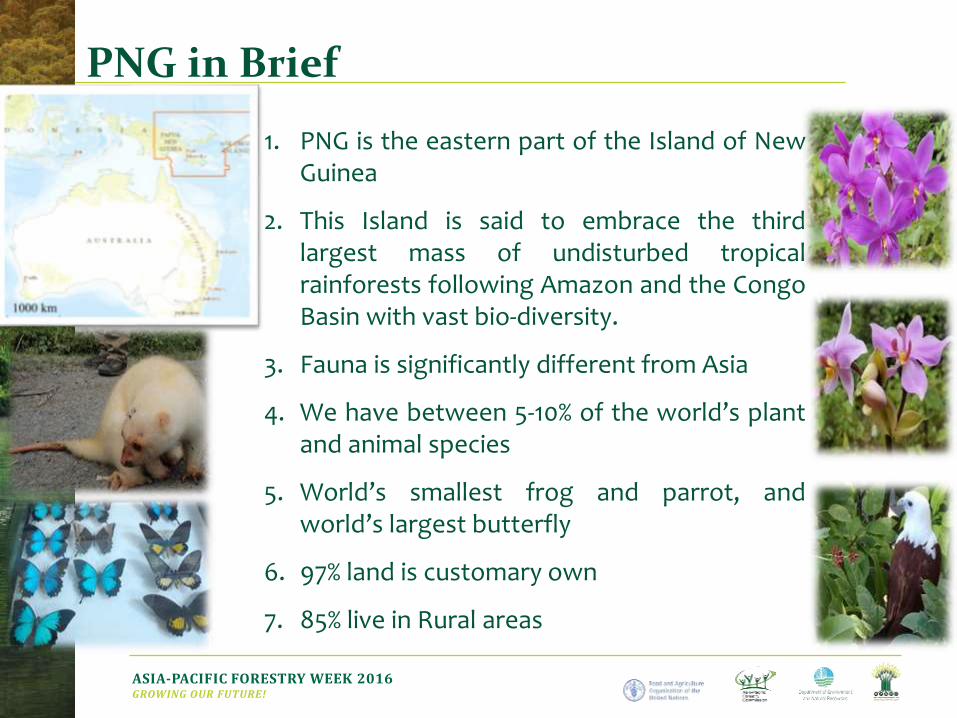
PNG in Brief
1. PNG is the eastern part of the Island of NewGuinea
2. This Island is said to embrace the thirdlargest mass of undisturbed tropicalrainforests following Amazon and the CongoBasin with vast bio-diversity.
3. Fauna is significantly different from Asia
4. We have between 5-10% of the world’s plantand animal species
5. World’s smallest frog and parrot, andworld’s largest butterfly
6. 97% land is customary own
7. 85% live in Rural areas
ASIA-PACIFIC FORESTRY WEEK 2016GROWING OUR FUTURE!
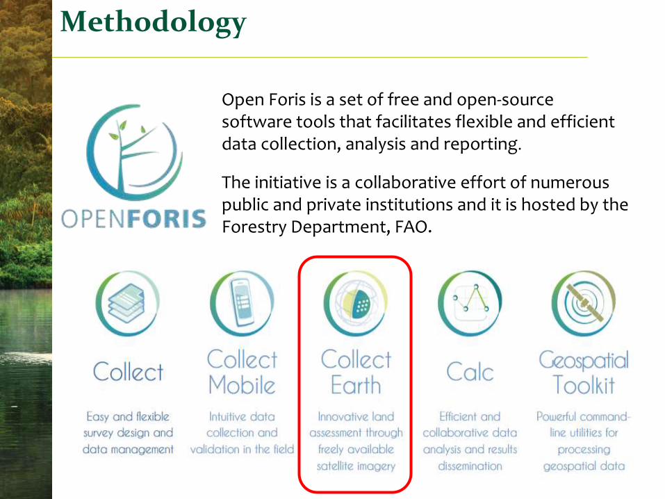
Methodology
Open Foris is a set of free and open-source software tools that facilitates flexible and efficient data collection, analysis and reporting.
The initiative is a collaborative effort of numerous public and private institutions and it is hosted by the Forestry Department, FAO.
ASIA-PACIFIC FORESTRY WEEK 2016GROWING OUR FUTURE! 5
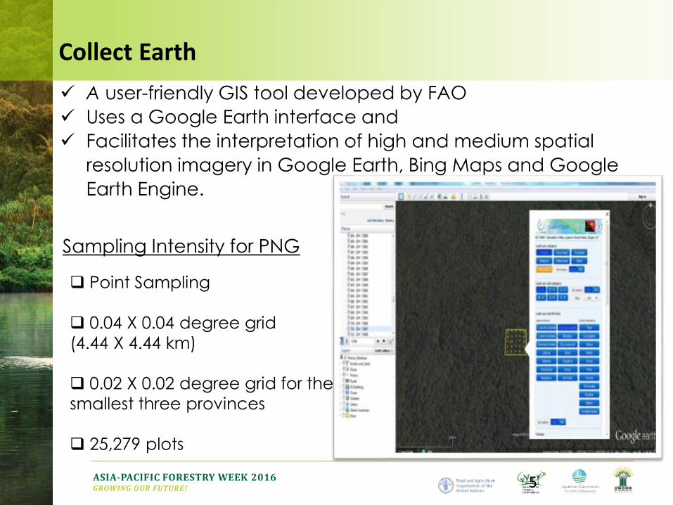
Sampling Intensity for PNG
Point Sampling
0.04 X 0.04 degree grid
(4.44 X 4.44 km)
0.02 X 0.02 degree grid for the
smallest three provinces
25,279 plots
A user-friendly GIS tool developed by FAO
Uses a Google Earth interface and
Facilitates the interpretation of high and medium spatial
resolution imagery in Google Earth, Bing Maps and Google
Earth Engine.
Collect Earth
ASIA-PACIFIC FORESTRY WEEK 2016GROWING OUR FUTURE! 8
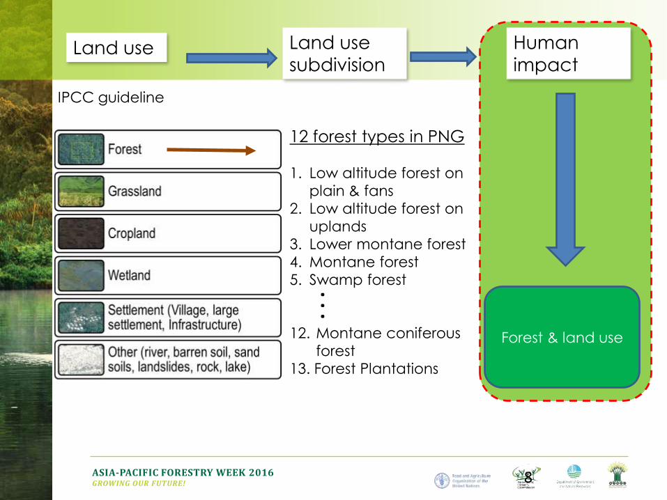
Land use Land use
subdivision
12 forest types in PNG
1. Low altitude forest on
plain & fans
2. Low altitude forest on
uplands
3. Lower montane forest
4. Montane forest
5. Swamp forest
12. Montane coniferous
forest
13. Forest Plantations
Human
impact
. . .
IPCC guideline
Forest & land use
ASIA-PACIFIC FORESTRY WEEK 2016GROWING OUR FUTURE!
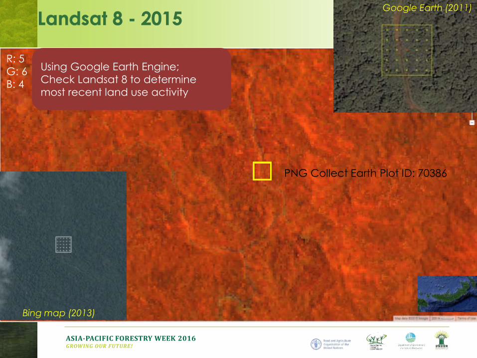
Google Earth (2011)
Bing map (2013)
R: 5
G: 6
B: 4
PNG Collect Earth Plot ID: 70386
Using Google Earth Engine;
Check Landsat 8 to determine
most recent land use activity
ASIA-PACIFIC FORESTRY WEEK 2016GROWING OUR FUTURE!
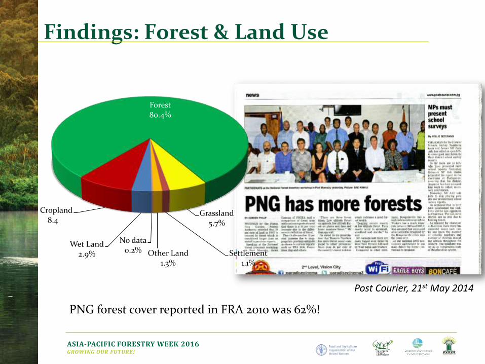
Findings: Forest & Land Use
Post Courier, 21st May 2014
Forest80.4%
Grassland5.7%
Settlement1.1%
Other Land1.3%
No data0.2%
Wet Land2.9%
Cropland8.4%
PNG forest cover reported in FRA 2010 was 62%!
ASIA-PACIFIC FORESTRY WEEK 2016GROWING OUR FUTURE!
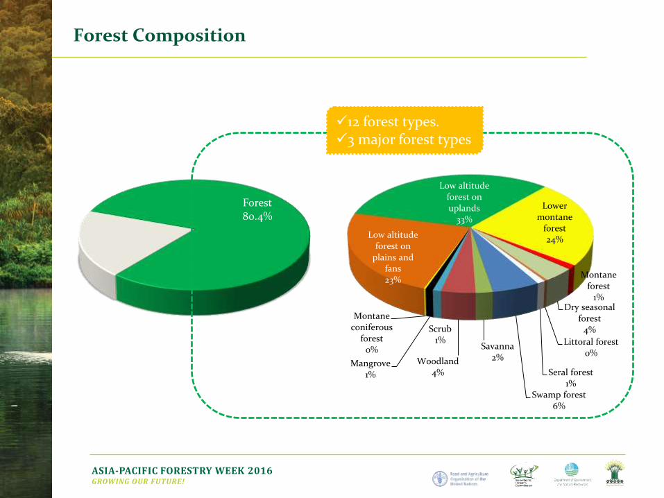
Forest Composition
Forest80.4%
Low altitude forest on
plains and fans23%
Low altitude forest on uplands
33%
Lower montane
forest24%
Montane forest
1%Dry seasonal
forest4%
Littoral forest0%
Seral forest1%
Swamp forest6%
Savanna2%Woodland
4%
Scrub1%
Mangrove1%
Montane coniferous
forest0%
12 forest types.3 major forest types
ASIA-PACIFIC FORESTRY WEEK 2016GROWING OUR FUTURE!
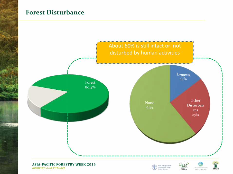
Forest Disturbance
Forest80.4%
Logging14%
Other Disturban
ces25%
None61%
About 60% is still intact or not disturbed by human activities
ASIA-PACIFIC FORESTRY WEEK 2016GROWING OUR FUTURE!
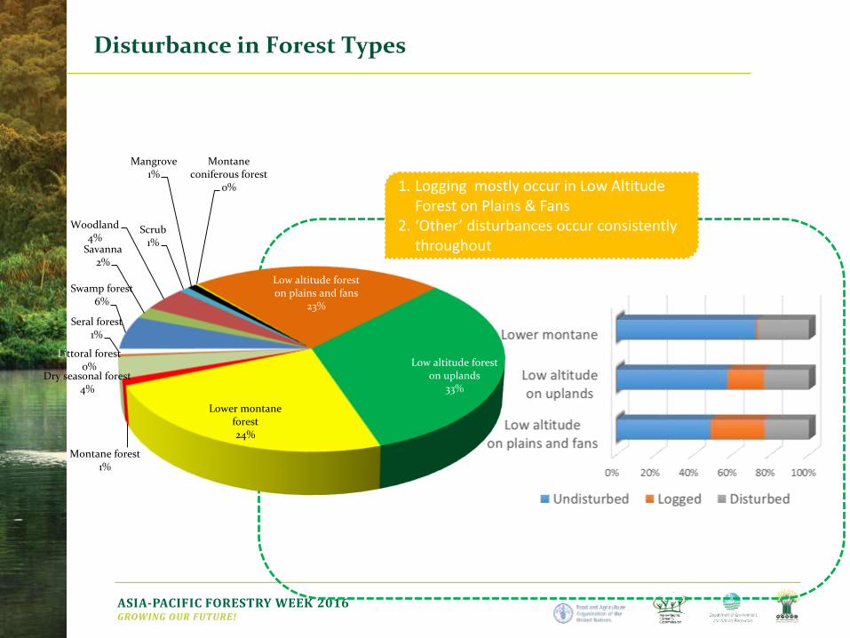
Disturbance in Forest Types
Low altitude forest on plains and fans
23%
Low altitude forest on uplands
33%
Lower montane forest24%
Montane forest1%
Dry seasonal forest4%
Littoral forest0%
Seral forest1%
Swamp forest6%
Savanna2%
Woodland4%
Scrub1%
Mangrove1%
Montane coniferous forest
0% 1. Logging mostly occur in Low Altitude Forest on Plains & Fans
2. ‘Other’ disturbances occur consistently throughout
ASIA-PACIFIC FORESTRY WEEK 2016GROWING OUR FUTURE!
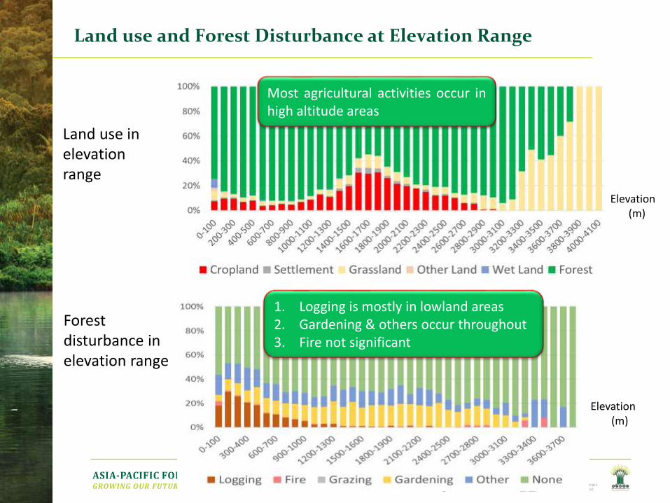
Land use and Forest Disturbance at Elevation Range
Land use in elevation range
Forest disturbance in elevation range
Elevation(m)
Elevation(m)
Most agricultural activities occur inhigh altitude areas
1. Logging is mostly in lowland areas2. Gardening & others occur throughout3. Fire not significant
ASIA-PACIFIC FORESTRY WEEK 2016GROWING OUR FUTURE!
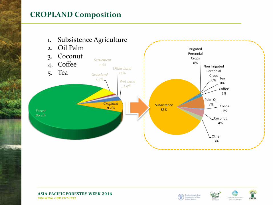
CROPLAND Composition
Forest80.4%
Grassland5.7%
Settlement1.1%
Other Land1.3%
Wet Land2.9%
Cropland8.4%
Subsistence83%
Irrigated Perennial
Crops0%
Non Irrigated Perennial
Crops0%
Tea0%
Coffee2%
Palm Oil7% Cocoa
1%
Coconut4%
Other3%
1. Subsistence Agriculture2. Oil Palm3. Coconut4. Coffee5. Tea
ASIA-PACIFIC FORESTRY WEEK 2016GROWING OUR FUTURE!
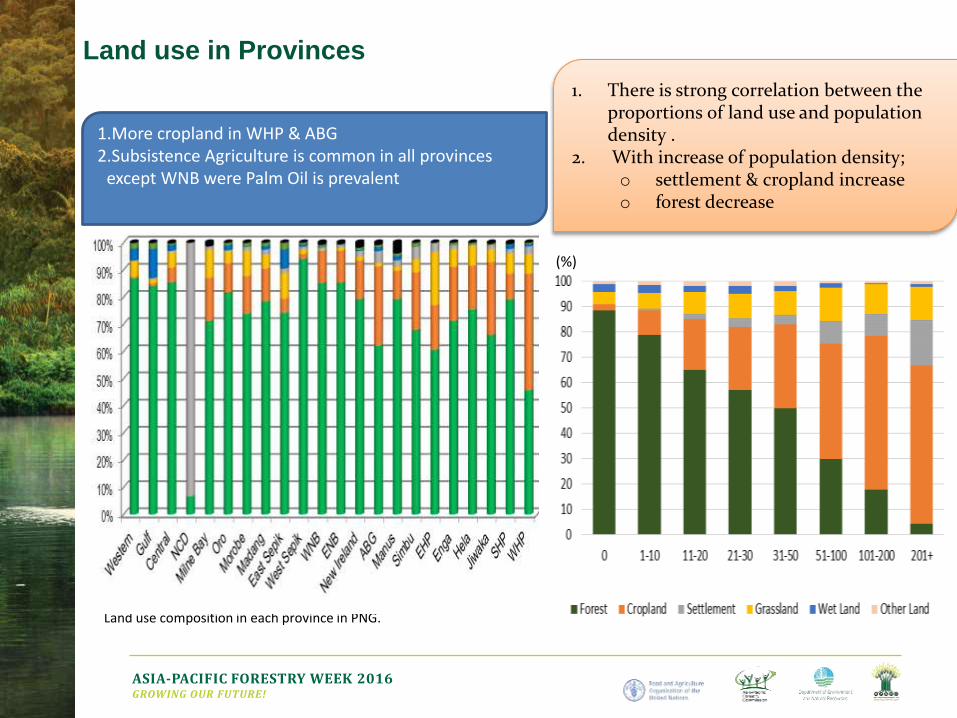
Land use in Provinces
Land use composition in each province in PNG.
1. There is strong correlation between the proportions of land use and population density .
2. With increase of population density;o settlement & cropland increaseo forest decrease
1.More cropland in WHP & ABG2.Subsistence Agriculture is common in all provinces
except WNB were Palm Oil is prevalent
(%)
ASIA-PACIFIC FORESTRY WEEK 2016GROWING OUR FUTURE!
Assess Forest & Land Use Change between year
2000 – 2015
to identify the drivers of
o Forest change (deforestation/degradation)
o Other land use changes
ASIA-PACIFIC FORESTRY WEEK 2016GROWING OUR FUTURE!
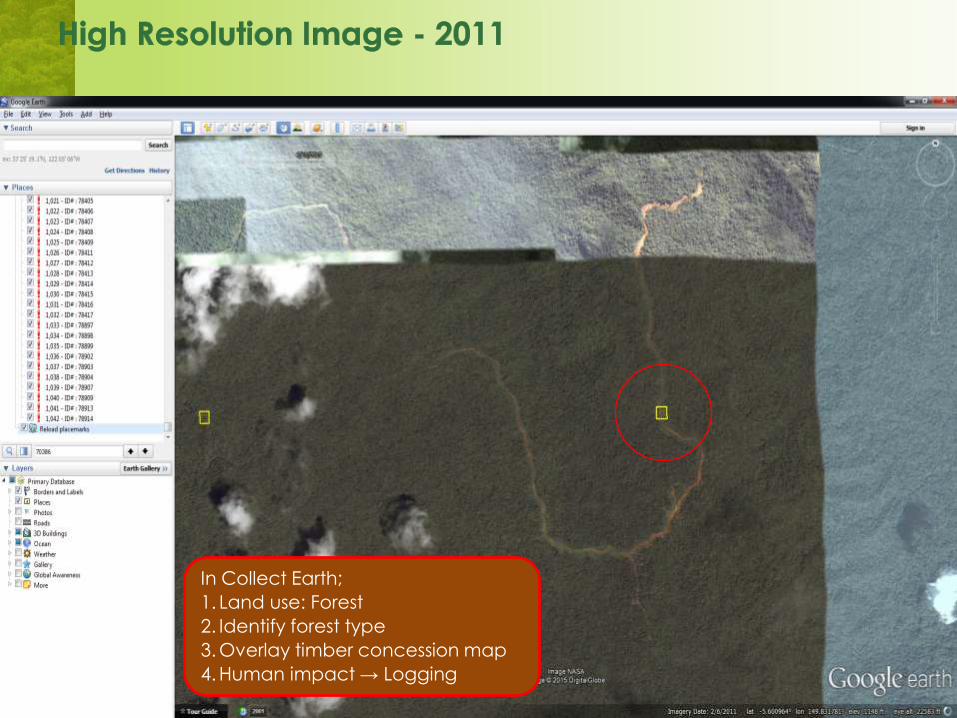
In Collect Earth;
1. Land use: Forest
2. Identify forest type
3. Overlay timber concession map
4. Human impact → Logging
ASIA-PACIFIC FORESTRY WEEK 2016GROWING OUR FUTURE!
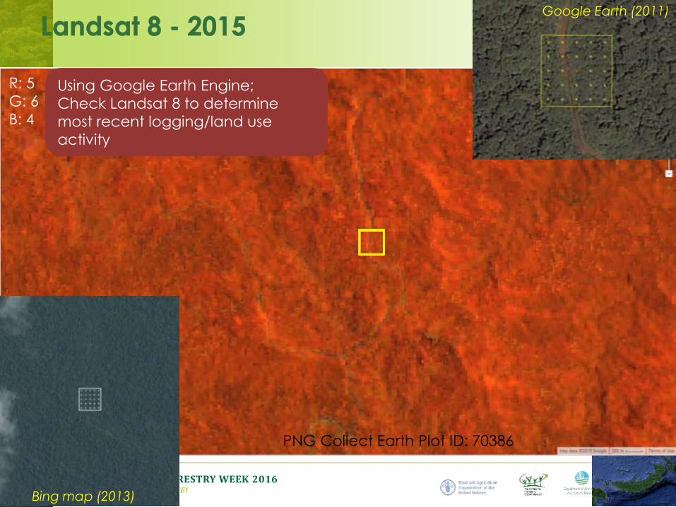
Google Earth (2011)
Bing map (2013)
R: 5
G: 6
B: 4
PNG Collect Earth Plot ID: 70386
Using Google Earth Engine;
Check Landsat 8 to determine
most recent logging/land use
activity
ASIA-PACIFIC FORESTRY WEEK 2016GROWING OUR FUTURE!
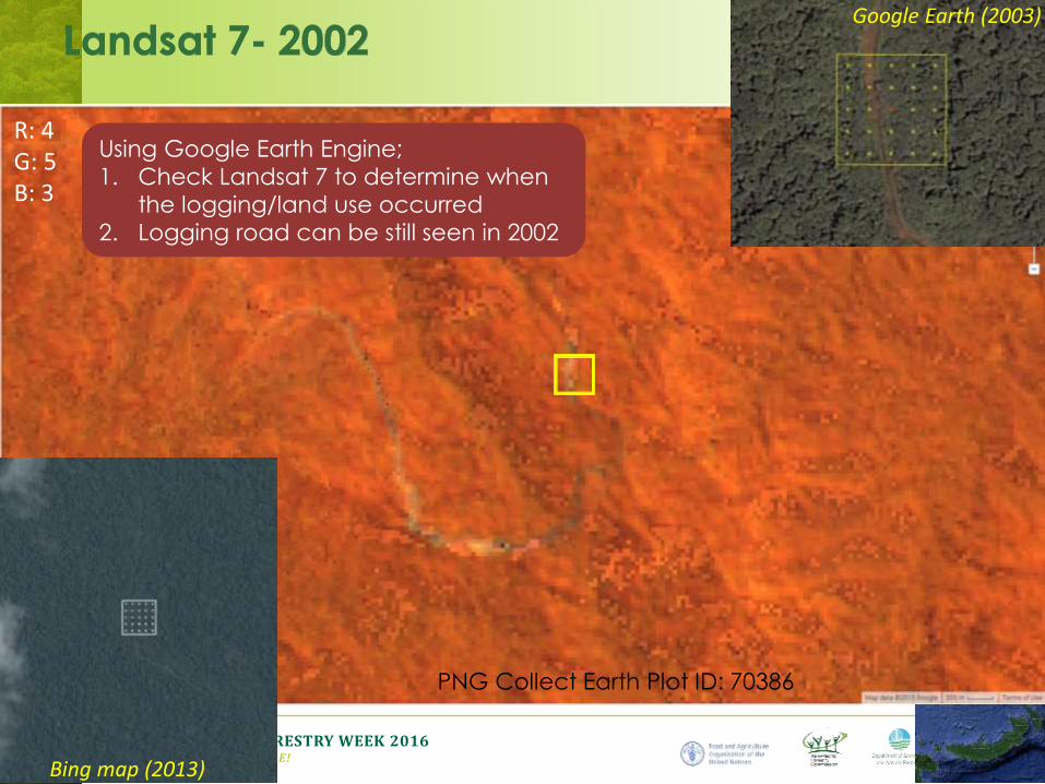
Google Earth (2003)
Bing map (2013)
R: 4G: 5B: 3
Using Google Earth Engine;
1. Check Landsat 7 to determine when
the logging/land use occurred
2. Logging road can be still seen in 2002
PNG Collect Earth Plot ID: 70386
ASIA-PACIFIC FORESTRY WEEK 2016GROWING OUR FUTURE!
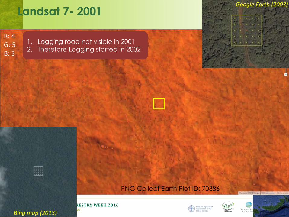
Google Earth (2003)
Bing map (2013)
R: 4G: 5B: 3
1. Logging road not visible in 2001
2. Therefore Logging started in 2002
PNG Collect Earth Plot ID: 70386
ASIA-PACIFIC FORESTRY WEEK 2016GROWING OUR FUTURE!
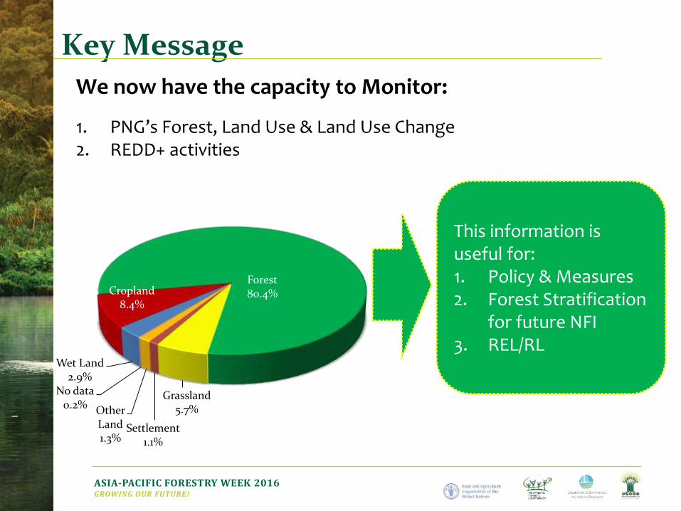
Key Message
1. PNG’s Forest, Land Use & Land Use Change2. REDD+ activities
Forest80.4%
Grassland5.7%
Settlement1.1%
Other Land1.3%
No data0.2%
Wet Land2.9%
Cropland8.4%
This information is useful for:1. Policy & Measures2. Forest Stratification
for future NFI3. REL/RL
We now have the capacity to Monitor:
Thank You!
Vertical bar photo by Ricky Martin, CIFOR