Embed Size (px)
Citation preview
Forest Survey of India, DehradunMinistry of Environment, Forest & Climate Change,
Government of India
FOREST FIRE RELATED INTERVENTIONS OF FSI
Major Work Areas
1. Near Real Time Forest Fire Alert System
2. Pre Warning Alerts
3. Burned Area Studies
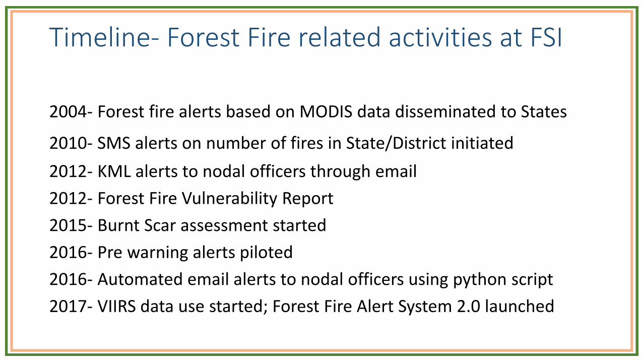
Timeline- Forest Fire related activities at FSI
2004- Forest fire alerts based on MODIS data disseminated to States
2010- SMS alerts on number of fires in State/District initiated
2012- KML alerts to nodal officers through email
2012- Forest Fire Vulnerability Report
2015- Burnt Scar assessment started
2016- Pre warning alerts piloted
2016- Automated email alerts to nodal officers using python script
2017- VIIRS data use started; Forest Fire Alert System 2.0 launched
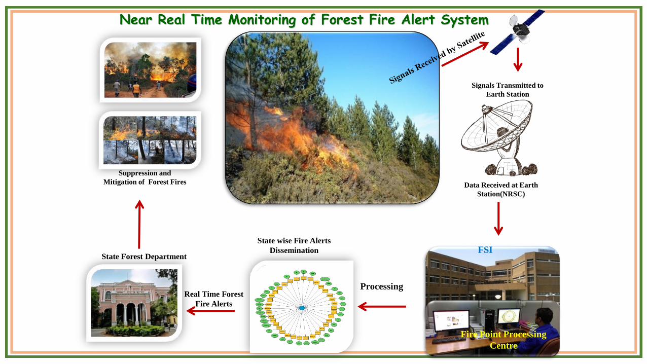
Signals Transmitted to
Earth Station
Suppression and
Mitigation of Forest Fires
Real Time Forest
Fire Alerts
State Forest Department
Data Received at Earth
Station(NRSC)
Near Real Time Monitoring of Forest Fire Alert System
Fire Point Processing
Centre
FSIState wise Fire Alerts
Dissemination
Processing
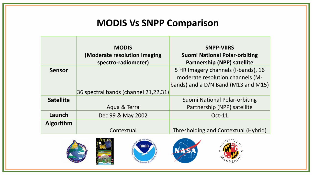
MODIS Vs SNPP Comparison
MODIS(Moderate resolution Imaging
spectro-radiometer)
SNPP-VIIRSSuomi National Polar-orbiting
Partnership (NPP) satellite
Sensor
36 spectral bands (channel 21,22,31)
5 HR Imagery channels (I-bands), 16 moderate resolution channels (M-
bands) and a D/N Band (M13 and M15)
SatelliteAqua & Terra
Suomi National Polar-orbiting Partnership (NPP) satellite
Launch Dec 99 & May 2002 Oct-11
AlgorithmContextual Thresholding and Contextual (Hybrid)
MODIS(Moderate resolution Imaging
spectro-radiometer)
SNPP-VIIRSSuomi National Polar-orbiting
Partnership (NPP) satellite
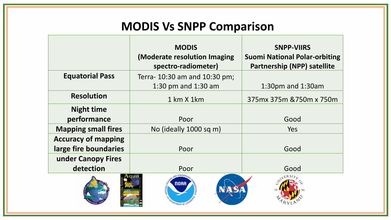
Equatorial Pass Terra- 10:30 am and 10:30 pm;1:30 pm and 1:30 am 1:30pm and 1:30am
Resolution 1 km X 1km 375mx 375m &750m x 750m
Night time performance Poor Good
Mapping small fires No (ideally 1000 sq m) Yes
Accuracy of mapping large fire boundaries Poor Good
under Canopy Fires detection Poor Good
MODIS Vs SNPP Comparison
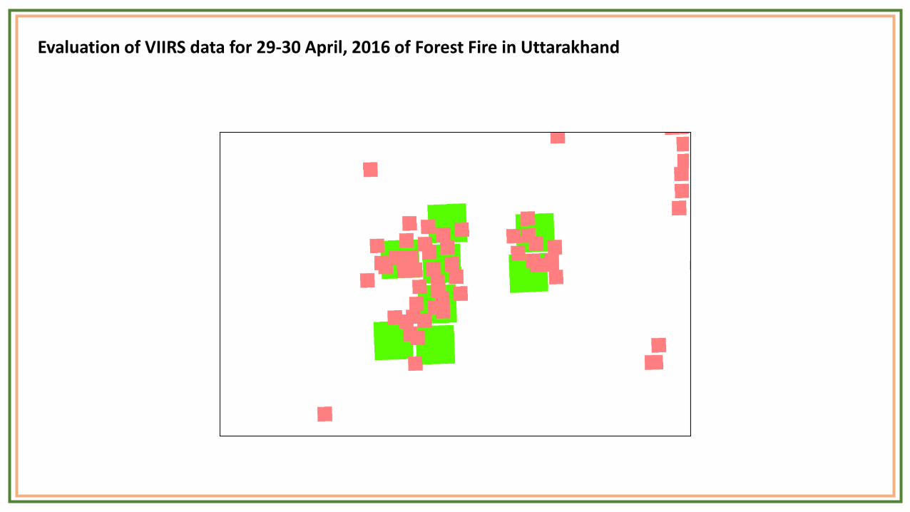
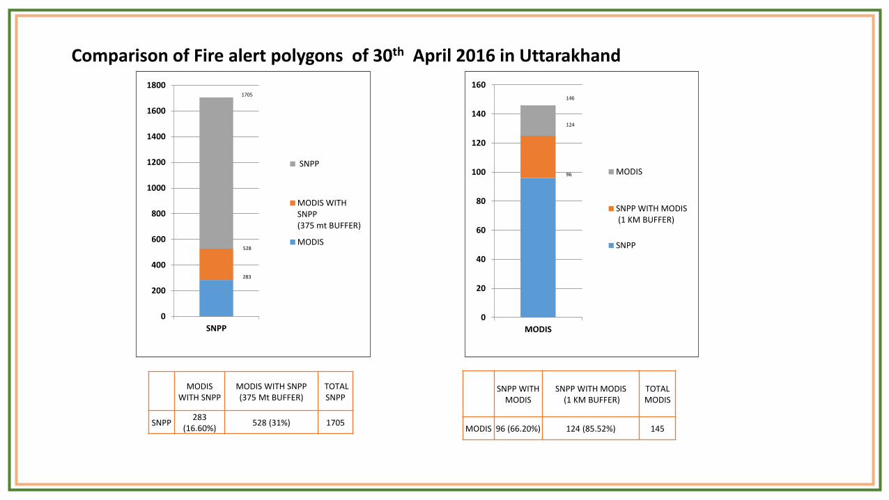
Evaluation of VIIRS data for 29-30 April, 2016 of Forest Fire in Uttarakhand
0
20
40
60
80
100
120
140
160
MODIS
MODIS
SNPP WITH MODIS (1 KM BUFFER)
SNPP528
146
124
96
0
200
400
600
800
1000
1200
1400
1600
1800
SNPP
SNPP
MODIS WITHSNPP(375 mt BUFFER)
MODIS
1705
283
MODIS WITH SNPP
MODIS WITH SNPP (375 Mt BUFFER)
TOTAL SNPP
SNPP283
(16.60%)528 (31%) 1705
SNPP WITH MODIS
SNPP WITH MODIS(1 KM BUFFER)
TOTAL MODIS
MODIS 96 (66.20%) 124 (85.52%) 145
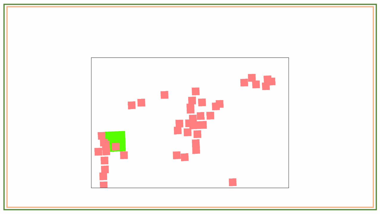
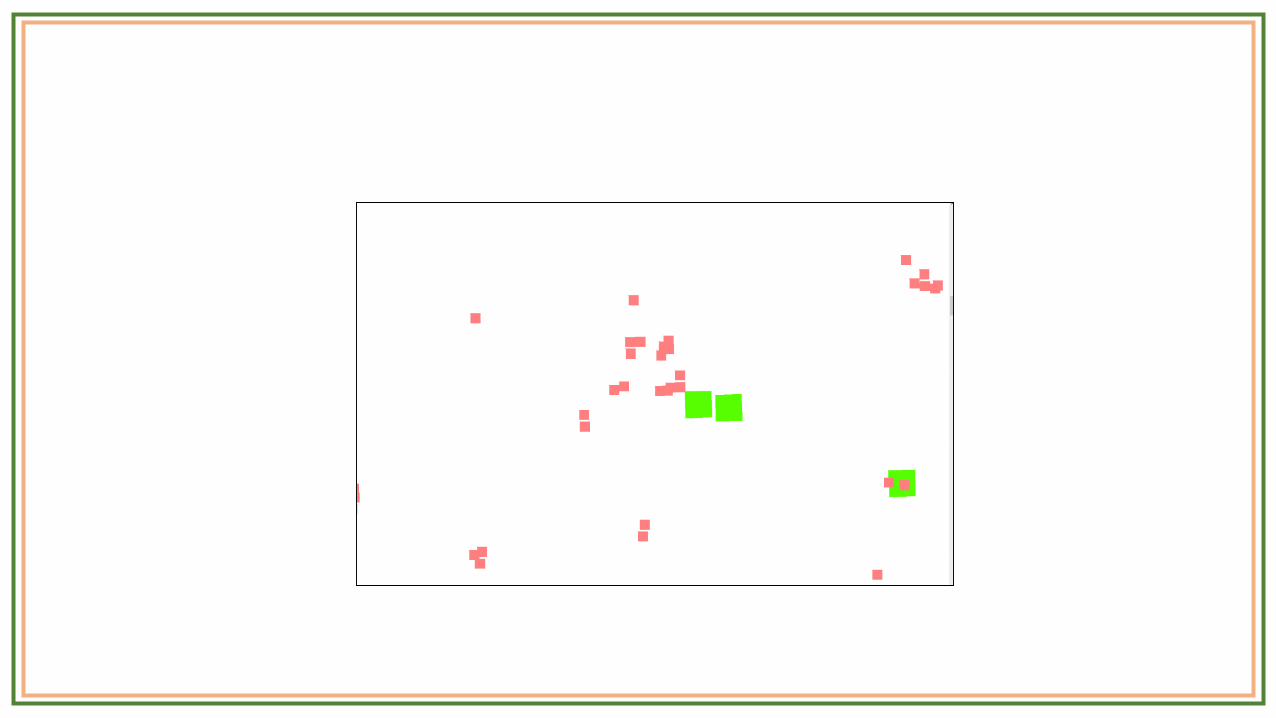
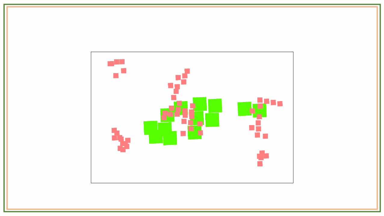
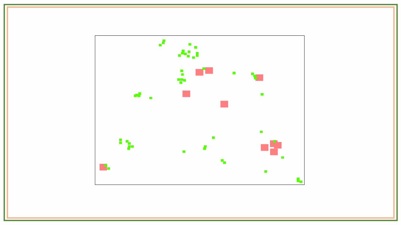
Comparison of Fire alert polygons of 30th April 2016 in Uttarakhand
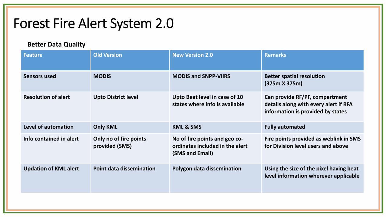
Forest Fire Alert System 2.0
Feature Old Version New Version 2.0 Remarks
Sensors used MODIS MODIS and SNPP-VIIRS Better spatial resolution (375m X 375m)
Resolution of alert Upto District level Upto Beat level in case of 10 states where info is available
Can provide RF/PF, compartment details along with every alert if RFA information is provided by states
Level of automation Only KML KML & SMS Fully automated
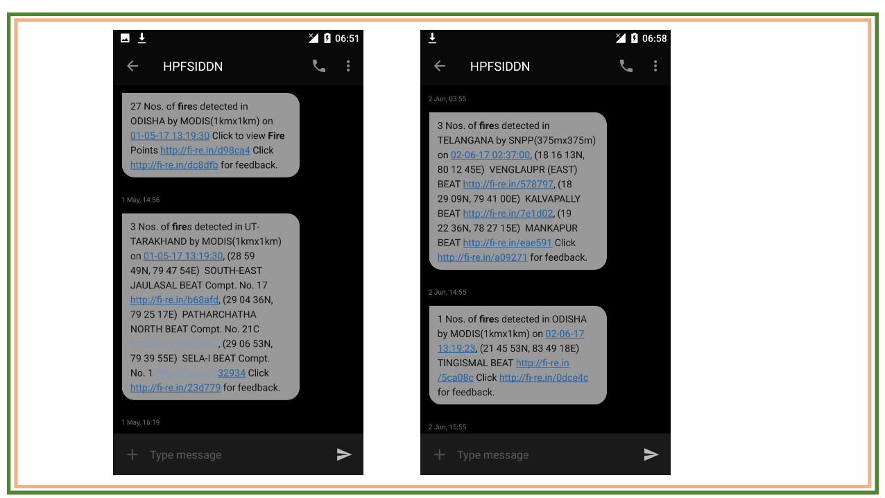
Info contained in alert Only no of fire points provided (SMS)
No of fire points and geo co-ordinates included in the alert (SMS and Email)
Fire points provided as weblink in SMS for Division level users and above
Updation of KML alert Point data dissemination Polygon data dissemination Using the size of the pixel having beat level information wherever applicable
Better Data Quality
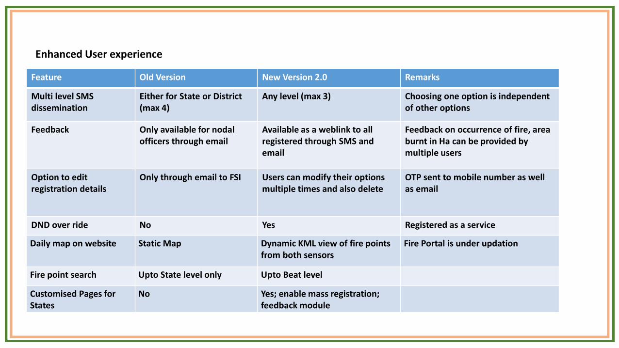
Feature Old Version New Version 2.0 Remarks
Multi level SMS dissemination
Either for State or District (max 4)
Any level (max 3) Choosing one option is independent of other options
Feedback Only available for nodal officers through email
Available as a weblink to all registered through SMS and email
Feedback on occurrence of fire, area burnt in Ha can be provided by multiple users
Option to edit registration details
Only through email to FSI Users can modify their options multiple times and also delete
OTP sent to mobile number as wellas email
DND over ride No Yes Registered as a service
Daily map on website Static Map Dynamic KML view of fire points from both sensors
Fire Portal is under updation
Fire point search Upto State level only Upto Beat level
Customised Pages for States
No Yes; enable mass registration; feedback module
Enhanced User experience
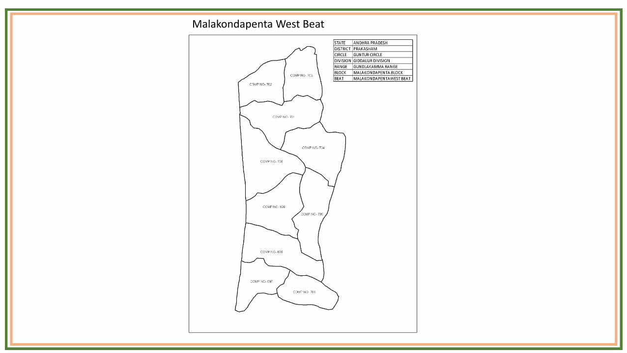
Malakondapenta West Beat
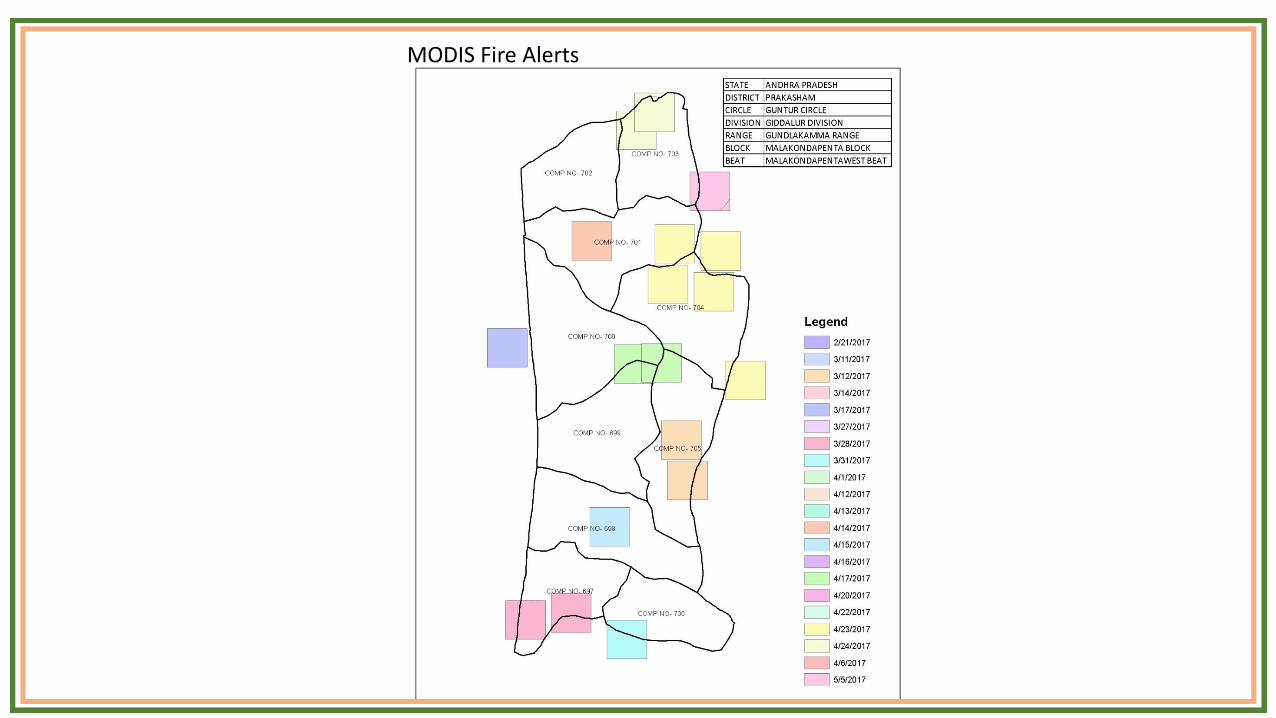
MODIS Fire Alerts
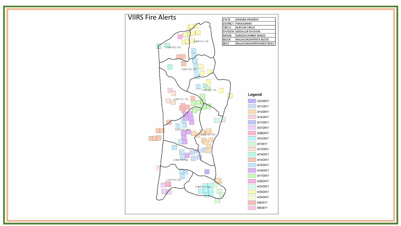
VIIRS Fire Alerts
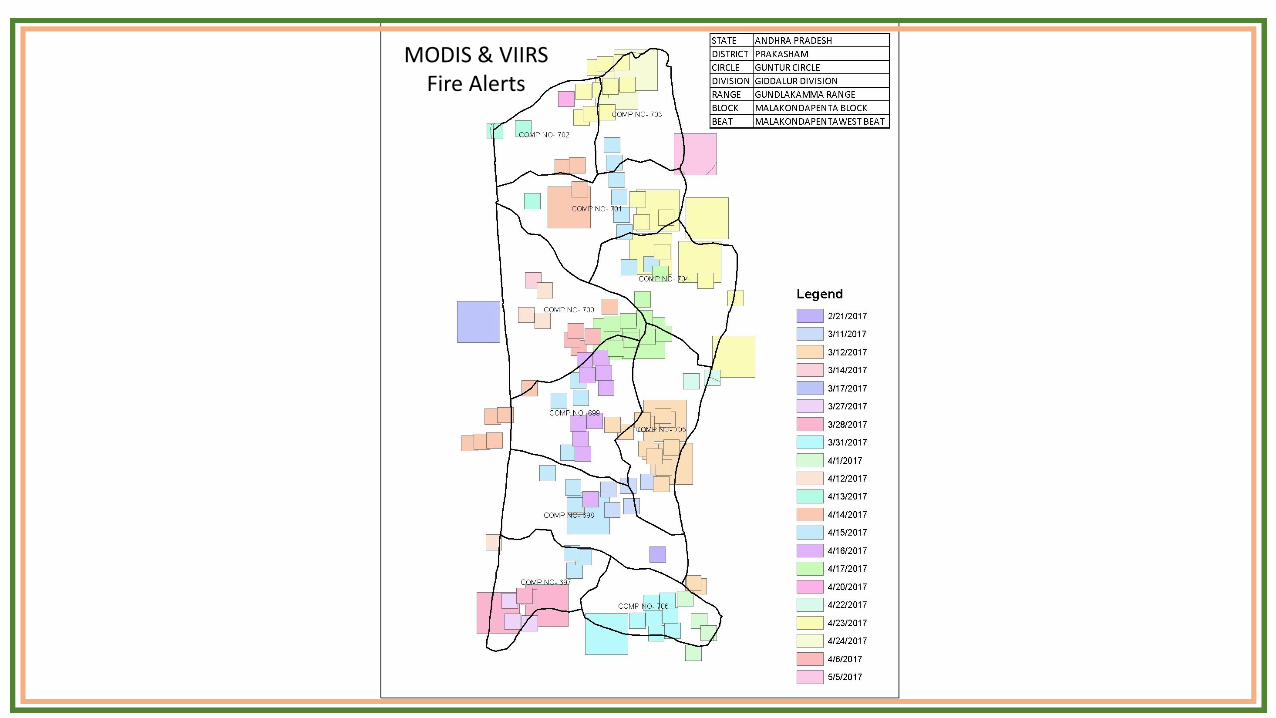
MODIS & VIIRSFire Alerts
0
500
1,000
1,500
2,000
2,500
3,000
3,500
4,000
4,500
5,000
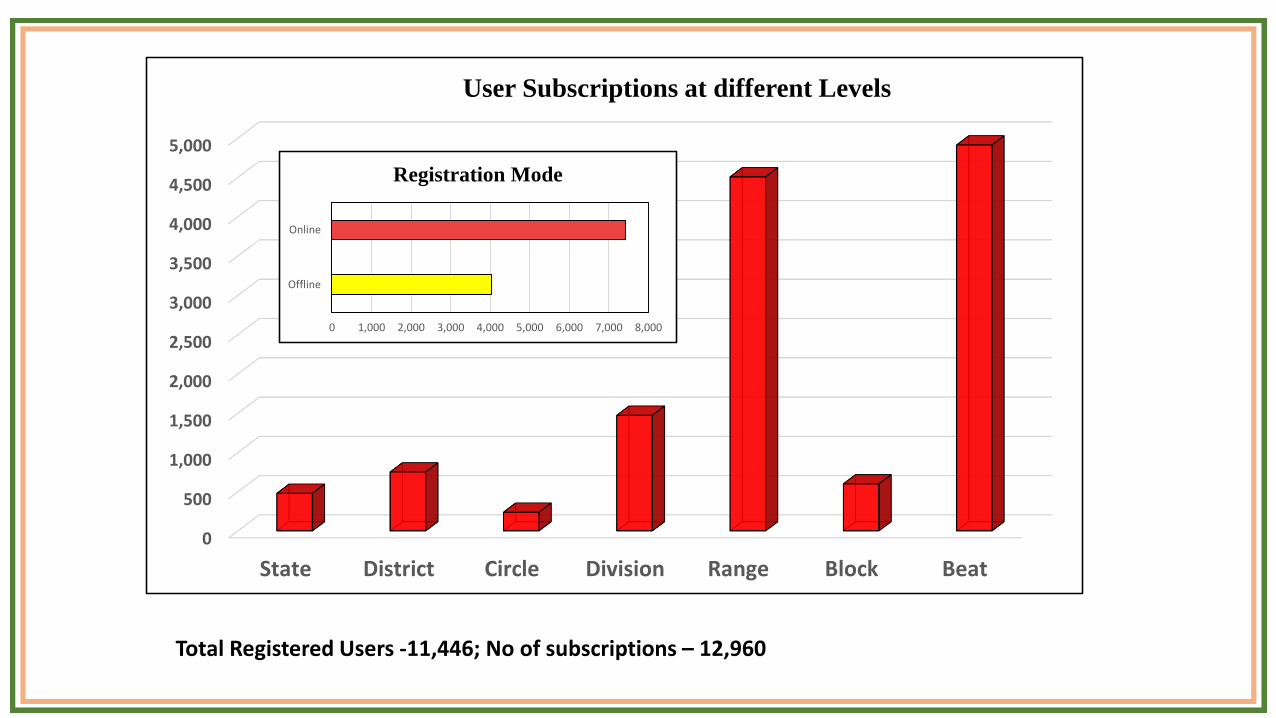
State District Circle Division Range Block Beat
User Subscriptions at different Levels
Total Registered Users -11,446; No of subscriptions – 12,960
0 1,000 2,000 3,000 4,000 5,000 6,000 7,000 8,000
Offline
Online
Registration Mode
0
1,000
2,000
3,000
4,000
5,000
6,000
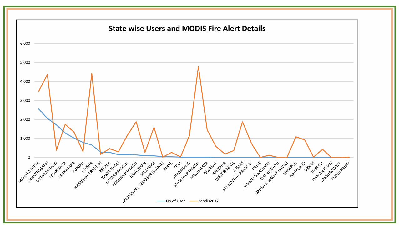
State wise Users and MODIS Fire Alert Details
No of User Modis2017
Limitations
• Technological limitations of resolution, detection thresholds
• Low Temporal frequency (Although its improving)
• Highly dependent on mobile network coverage
• Technology intensive (but not cost intensive! Open source options!)
Focus Areas for future
• Use of Direct Readout data (Both the platform and algorithm are free for Government users)
• Use of Geostationary data (currently evaluating INSAT 3D and 3DR; Himawari is another option)
• Reach to more users ; improve user awareness
• Encourage digitization and geo referencing of forest boundaries
• Long term characterization of fires using science quality MODIS data
• Establish national forest fire database
II. BURNT AREA MAPPING
• Country wide burned area mapping carried out since 2015
• IRS – P6- AWiFS data used (56 m resolution)
• Results communicated to SFDs
• Methodology to be validated before mainstreaming
• Use of MODIS MCD64A1 product for generation of data for previous years
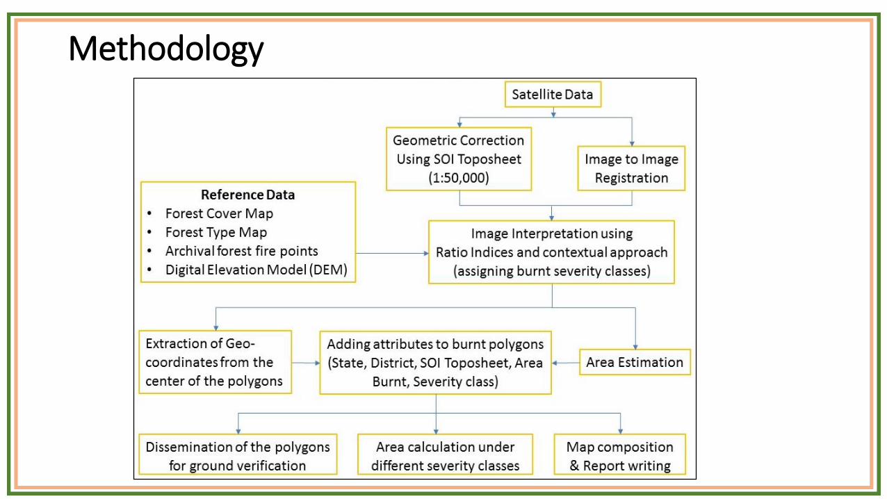
Methodology
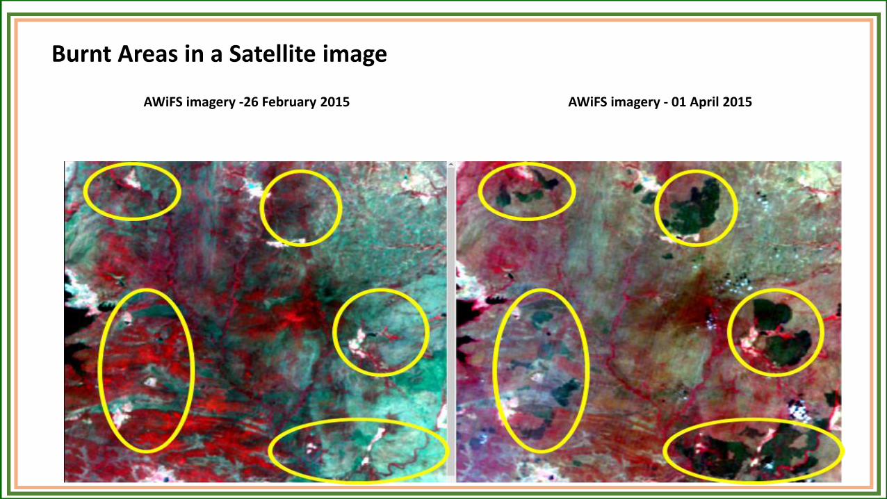
AWiFS imagery -26 February 2015 AWiFS imagery - 01 April 2015
Burnt Areas in a Satellite image
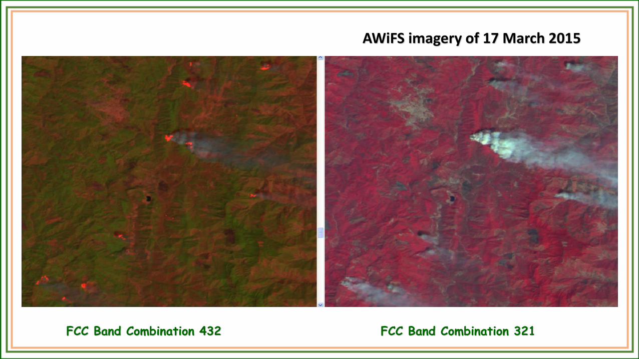
AWiFS imagery of 17 March 2015
FCC Band Combination 432 FCC Band Combination 321
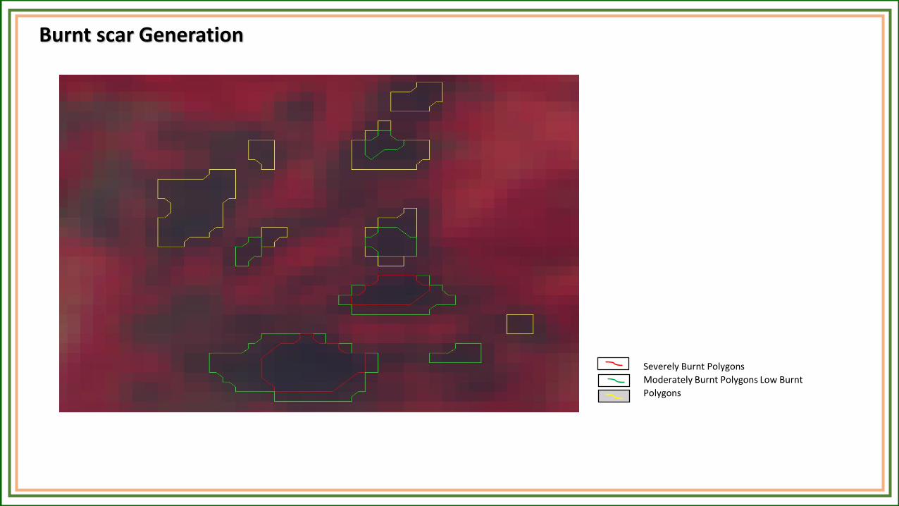
Severely Burnt Polygons
Moderately Burnt Polygons Low Burnt
Polygons
Burnt scar Generation
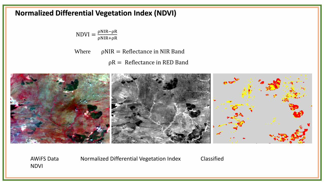
Normalized Differential Vegetation Index (NDVI)
NDVI =ρNIR−ρR
ρNIR+ρR
Where ρNIR = Reflectance in NIR Band
ρR = Reflectance in RED Band
AWiFS Data Normalized Differential Vegetation Index Classified NDVI
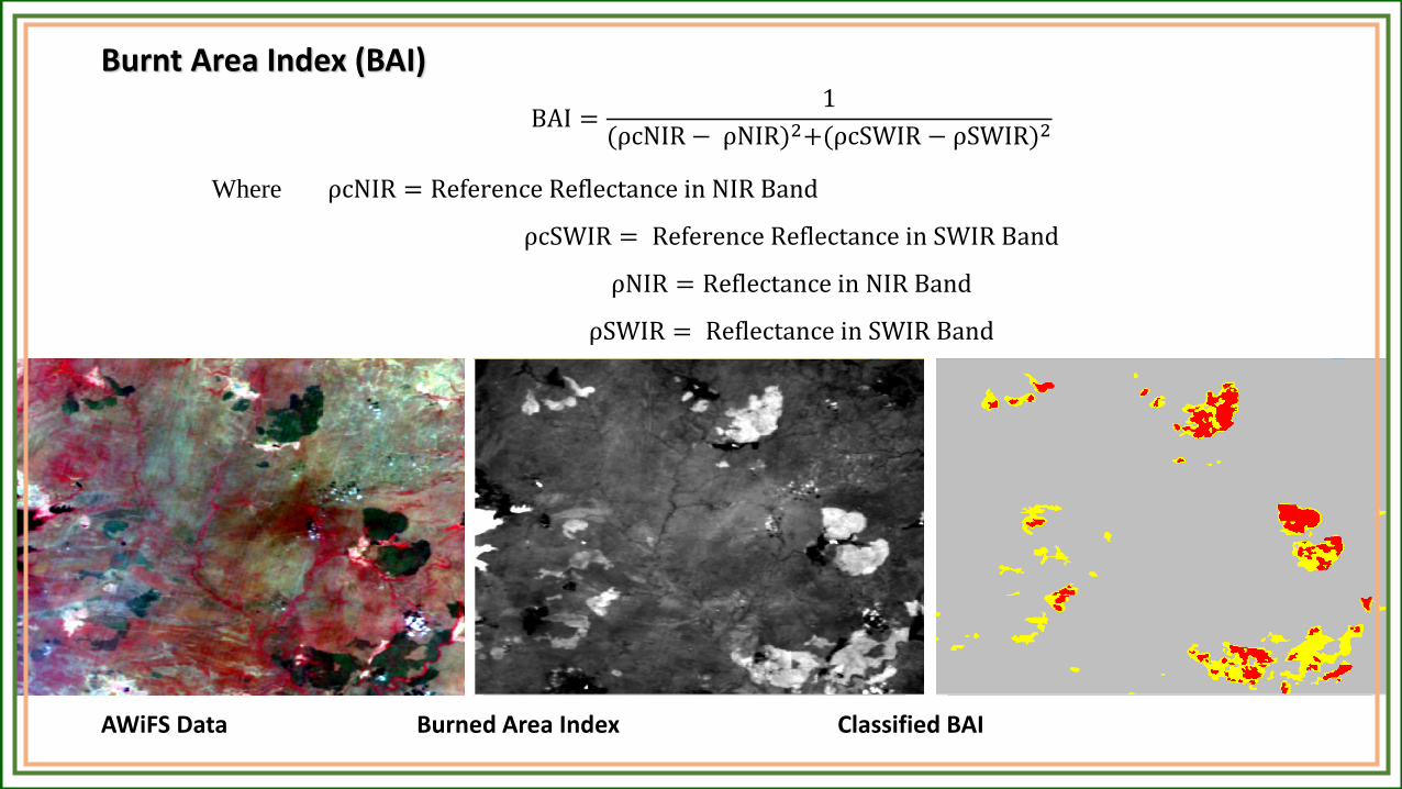
Burnt Area Index (BAI)
BAI =1
(ρcNIR − ρNIR)2+(ρcSWIR − ρSWIR)2
Where ρcNIR = Reference Reflectance in NIR Band
ρcSWIR = Reference Reflectance in SWIR Band
ρNIR = Reflectance in NIR Band
ρSWIR = Reflectance in SWIR Band
AWiFS Data Burned Area Index Classified BAI
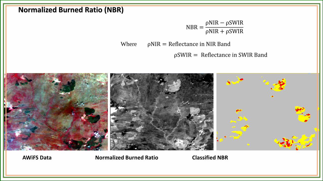
Normalized Burned Ratio (NBR)
NBR =ρNIR − ρSWIR
ρNIR + ρSWIR
Where ρNIR = Reflectance in NIR Band
ρSWIR = Reflectance in SWIR Band
AWiFS Data Normalized Burned Ratio Classified NBR
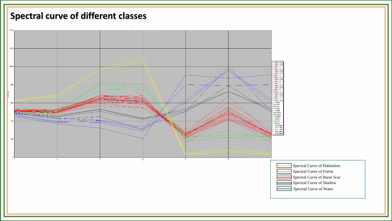
Spectral Curve of Forest
Spectral Curve of Shadow
Spectral Curve of Habitation
Spectral Curve of Burnt Scar
Spectral Curve of Water
Spectral curve of different classes
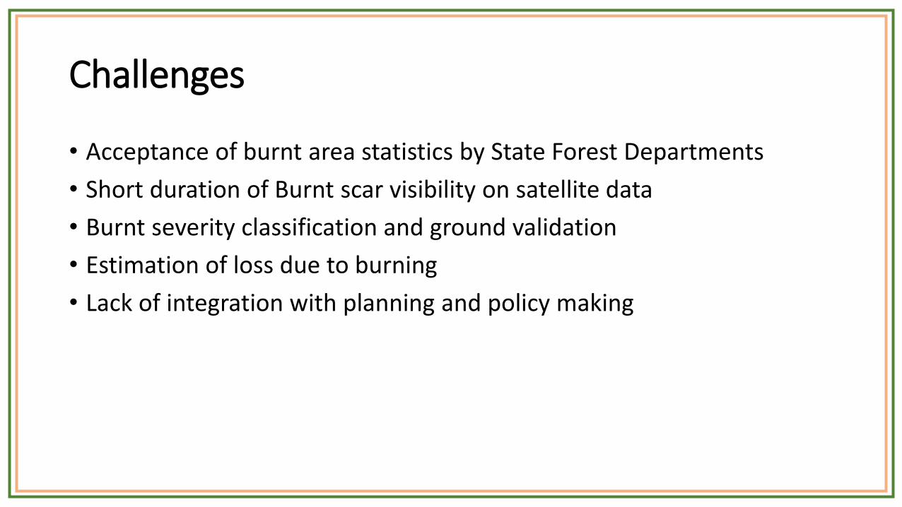
Challenges
• Acceptance of burnt area statistics by State Forest Departments
• Short duration of Burnt scar visibility on satellite data
• Burnt severity classification and ground validation
• Estimation of loss due to burning
• Lack of integration with planning and policy making
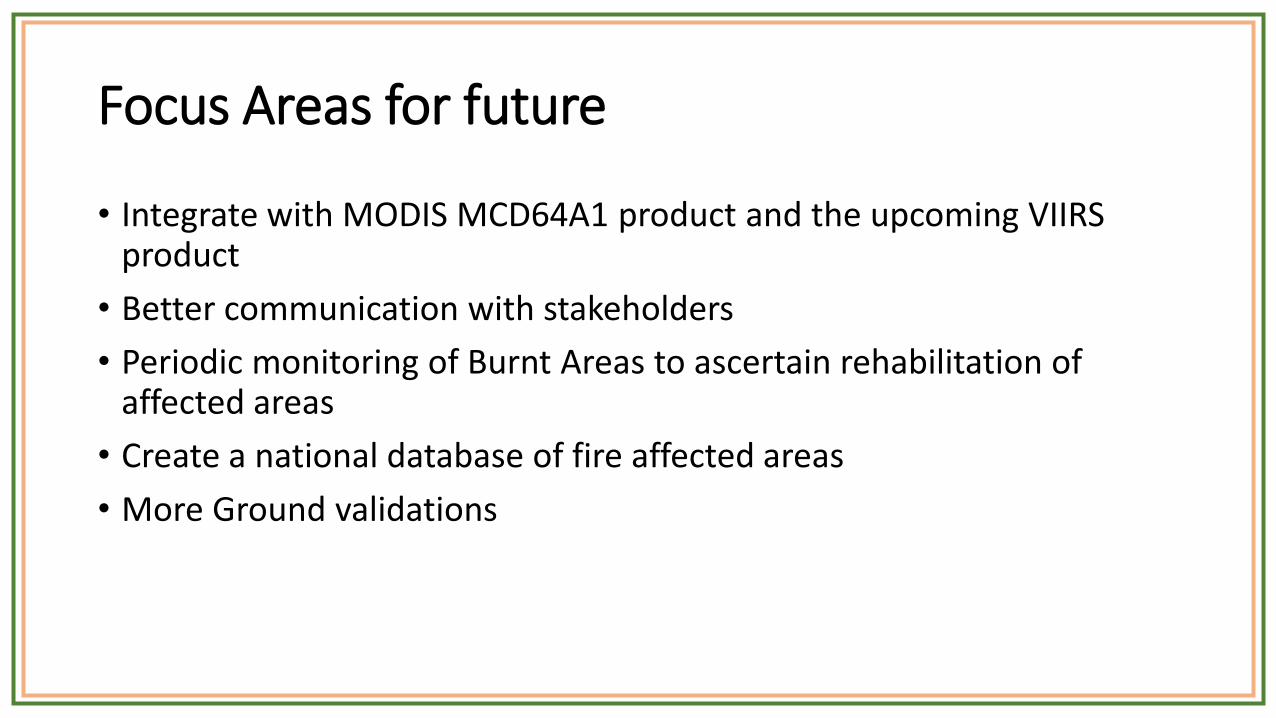
Focus Areas for future
• Integrate with MODIS MCD64A1 product and the upcoming VIIRS product
• Better communication with stakeholders
• Periodic monitoring of Burnt Areas to ascertain rehabilitation of affected areas
• Create a national database of fire affected areas
• More Ground validations

Pre-warning Alert System
❖Identify vulnerable areas to alert forest field staff to enable
- Risk reduction
- Resource allocation, Co-ordination
- Risk mitigation
- Input for future planning (CMP)
Objective is not to predict forest fires but to identify areas which are more
vulnerable to severe forest fires
Early Warning Basic FDRS Comprehensive FDRS

Pre-warning Alert System – parameters used
❖ Forest Type & Cover (fuel load)
❖ Temperature, Relative Humidity, Rainfall, wind speed (Drought/Weather)
❖ Social factors ?? (population density, analyse past forest fire trends)
❖ Topography ?? (slope, aspect)
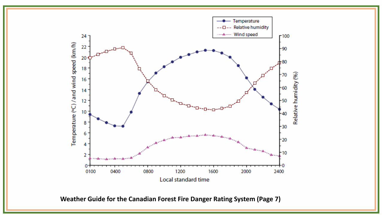
Weather Guide for the Canadian Forest Fire Danger Rating System (Page 7)
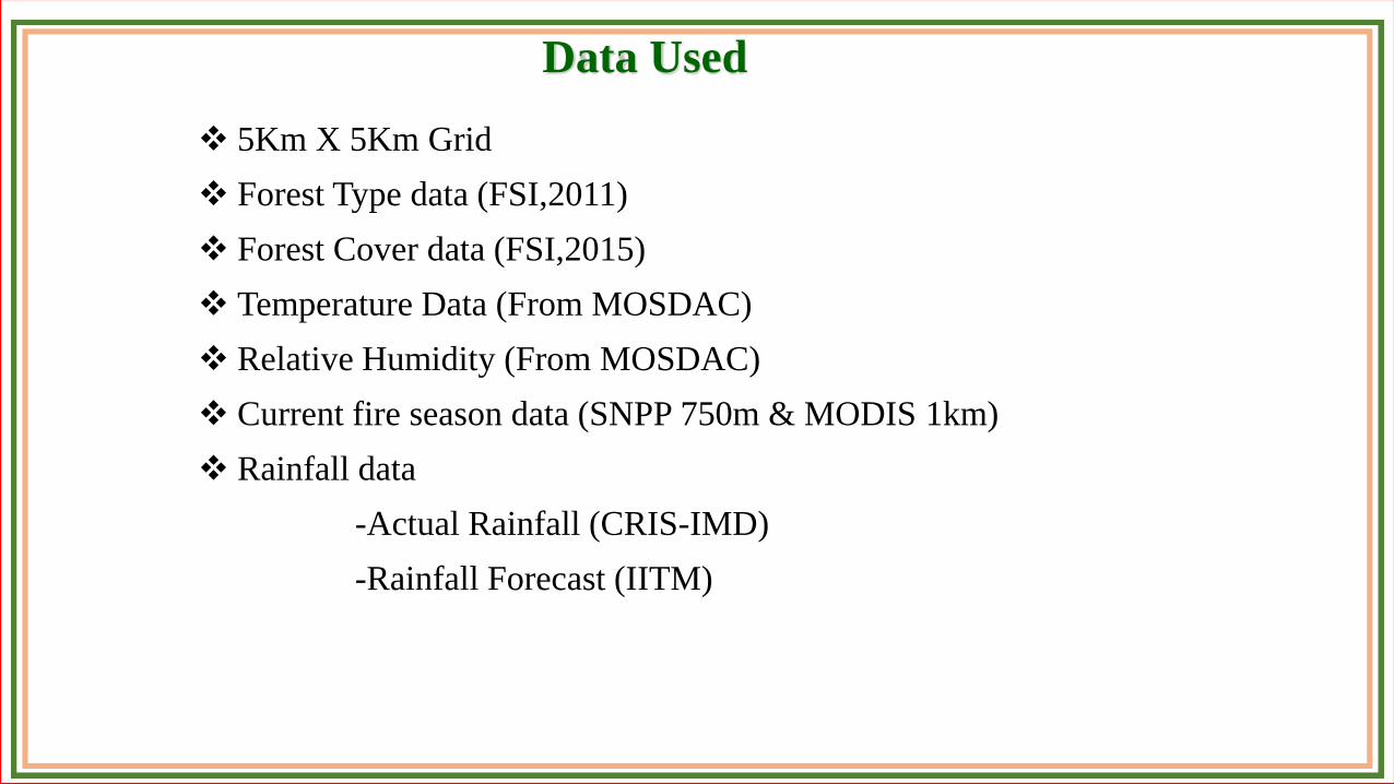
Data Used
❖ 5Km X 5Km Grid
❖ Forest Type data (FSI,2011)
❖ Forest Cover data (FSI,2015)
❖ Temperature Data (From MOSDAC)
❖ Relative Humidity (From MOSDAC)
❖ Current fire season data (SNPP 750m & MODIS 1km)
❖ Rainfall data
-Actual Rainfall (CRIS-IMD)
-Rainfall Forecast (IITM)
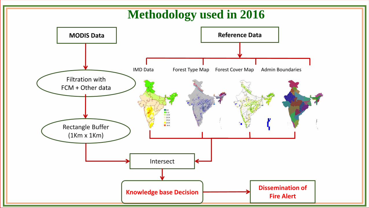
Filtration withFCM + Other data
Knowledge base Decision
Intersect
MODIS Data
Dissemination of Fire Alert
Reference Data
IMD Data Forest Type Map Forest Cover Map Admin Boundaries
Rectangle Buffer (1Km x 1Km)
Methodology used in 2016
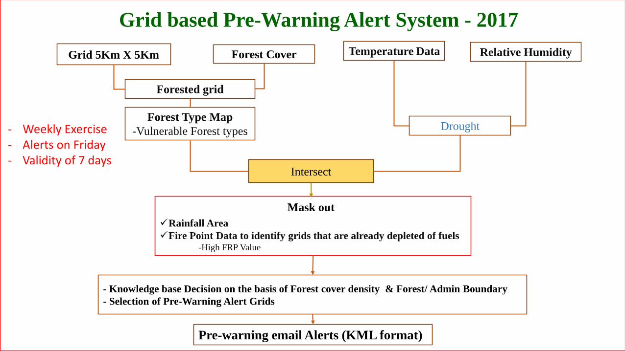
Grid based Pre-Warning Alert System - 2017
Forest Type Map
-Vulnerable Forest types
✓Rainfall Area
✓Fire Point Data to identify grids that are already depleted of fuels-High FRP Value
Temperature Data
Drought
Relative Humidity
Intersect
- Knowledge base Decision on the basis of Forest cover density & Forest/ Admin Boundary
- Selection of Pre-Warning Alert Grids
Pre-warning email Alerts (KML format)
- Weekly Exercise- Alerts on Friday- Validity of 7 days
Grid 5Km X 5Km
Mask out
Forest Cover
Forested grid
Drought Determination (Application of KBDI)
Keetch Byram Drought Index is a popular drought index for forest fire control - Lookup tables published in 1968- Forecasts daily drought conditions based on daily rainfall and max
temperature- Good indicator of drought buildup- Useful for early warning
0
100
200
300
400
500
600
700
800
900
0
5
10
15
20
25
30
35
40
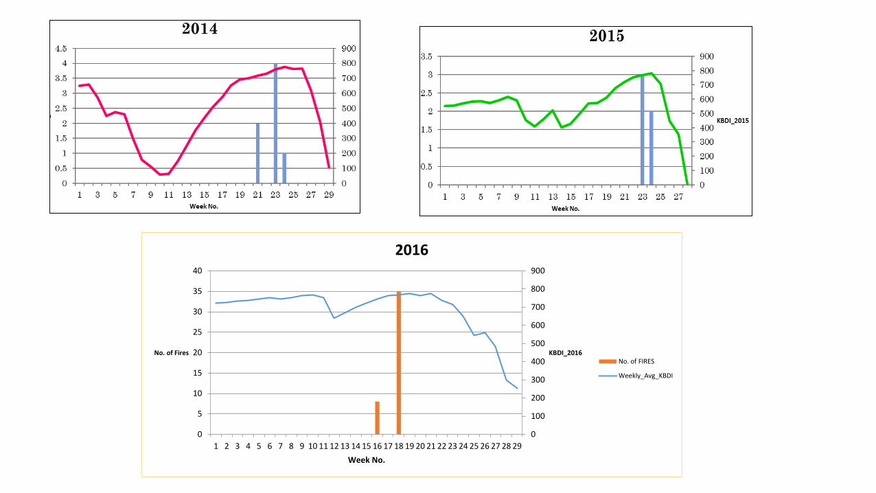
1 2 3 4 5 6 7 8 9 10 11 12 13 14 15 16 17 18 19 20 21 22 23 24 25 26 27 28 29
KBDI_2016No. of Fires
Week No.
2016
No. of FIRES
Weekly_Avg_KBDI
1 1 1 2 3 1 0 1 3
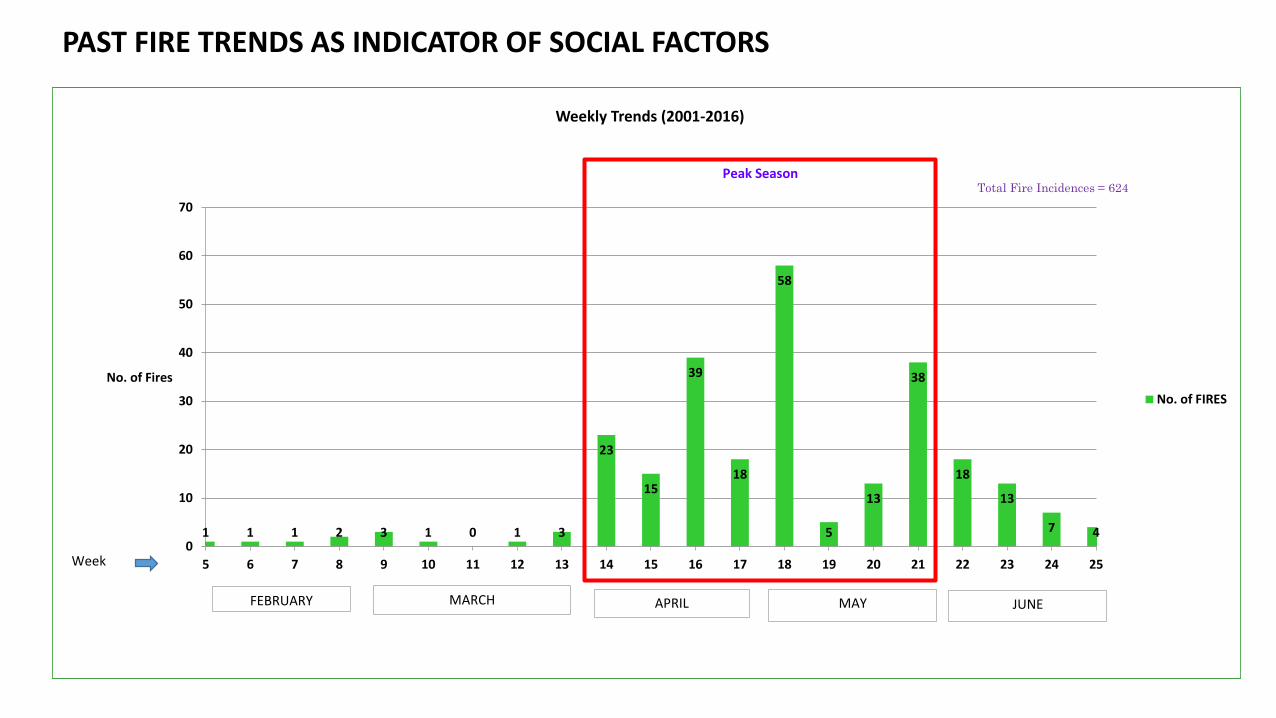
23
15
39
18
58
5
13
38
18
13
7 40
10
20
30
40
50
60
70
5 6 7 8 9 10 11 12 13 14 15 16 17 18 19 20 21 22 23 24 25
No. of Fires
Weekly Trends (2001-2016)
No. of FIRES
MARCH APRIL MAY JUNE
Week
Peak Season
FEBRUARY
Total Fire Incidences = 624
PAST FIRE TRENDS AS INDICATOR OF SOCIAL FACTORS
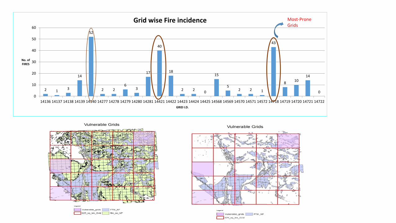
2 13
14
52
2 26
3
17
40
18
2 20
15
52 2 1
43
810
14
00
10
20
30
40
50
60
14136 14137 14138 14139 14140 14277 14278 14279 14280 14281 14421 14422 14423 14424 14425 14568 14569 14570 14571 14572 14718 14719 14720 14721 14722
No. of FIRES
GRID I.D.
Grid wise Fire incidence Most-Prone Grids
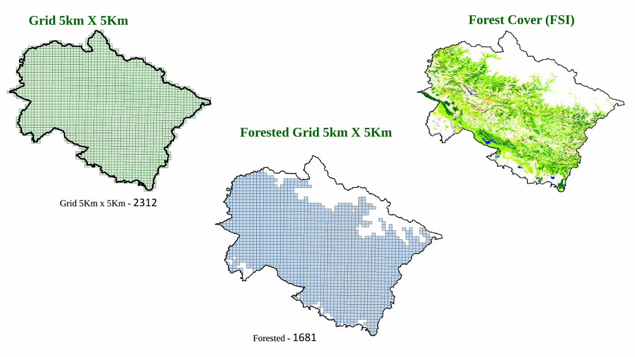
Grid 5km X 5Km
Forested Grid 5km X 5Km
Forest Cover (FSI)
Forested - 1681
Grid 5Km x 5Km - 2312
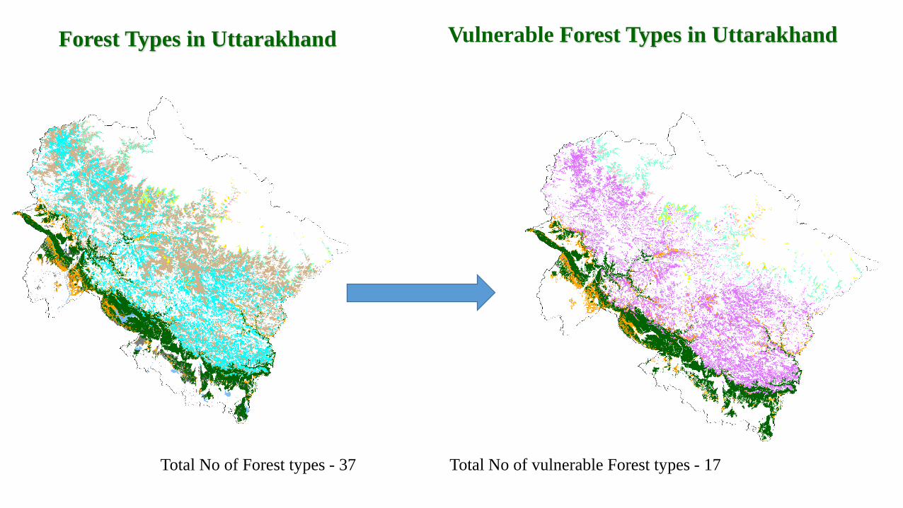
Vulnerable Forest Types in Uttarakhand Forest Types in Uttarakhand
Total No of Forest types - 37 Total No of vulnerable Forest types - 17
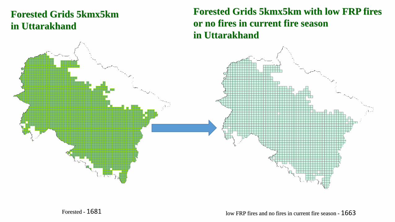
Forested Grids 5kmx5km
in Uttarakhand
Forested Grids 5kmx5km with low FRP fires
or no fires in current fire season
in Uttarakhand
low FRP fires and no fires in current fire season - 1663Forested - 1681
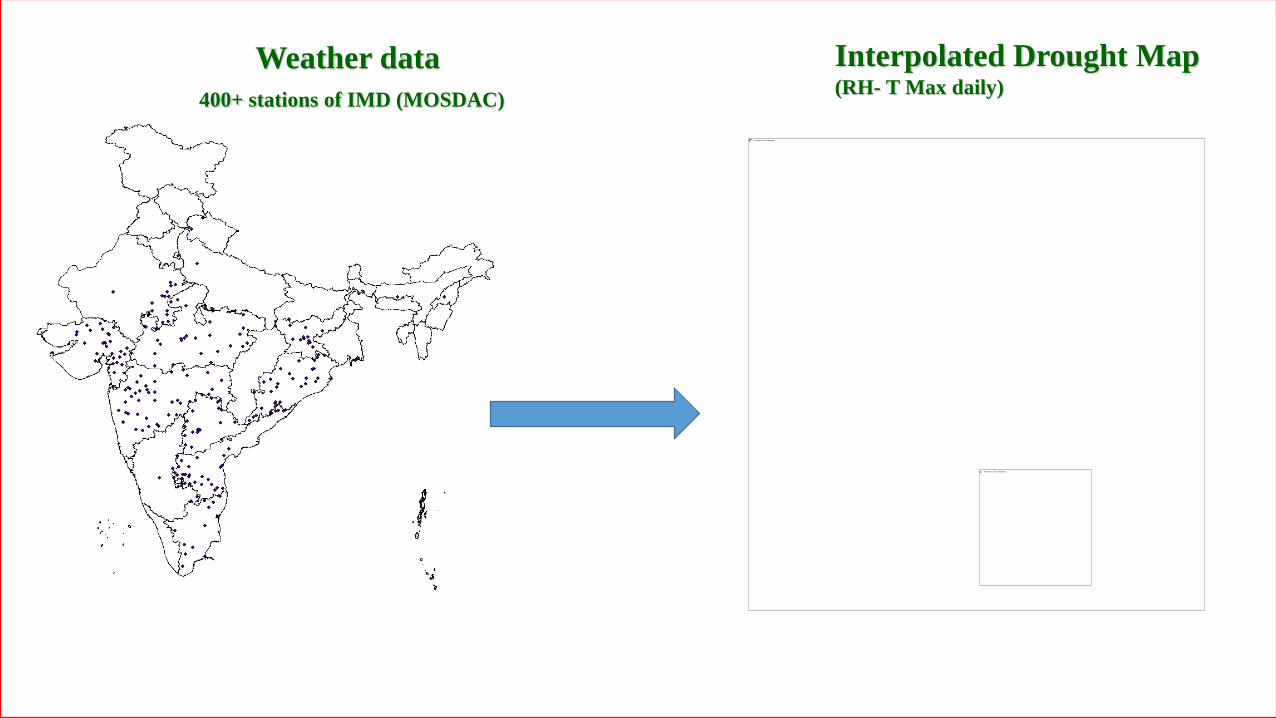
Weather data
400+ stations of IMD (MOSDAC)
Interpolated Drought Map(RH- T Max daily)
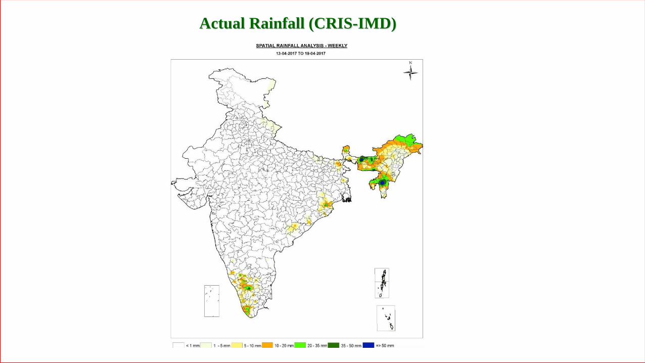
Actual Rainfall (CRIS-IMD)
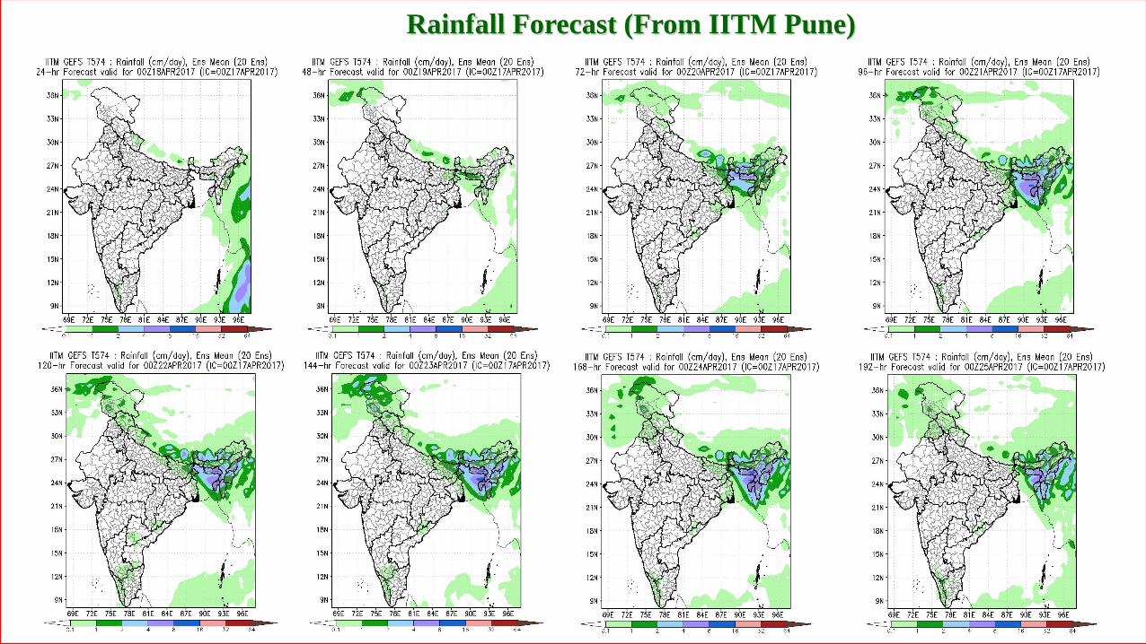
Rainfall Forecast (From IITM Pune)
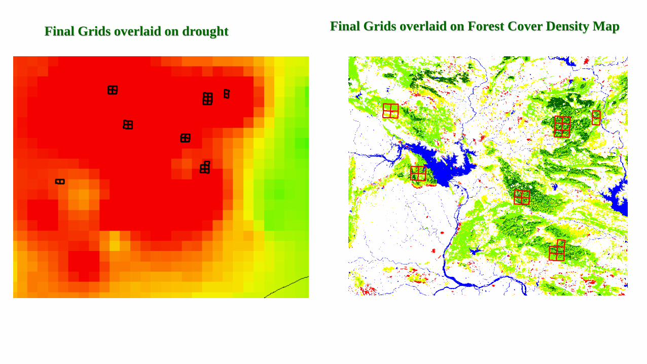
Final Grids overlaid on drought Final Grids overlaid on Forest Cover Density Map
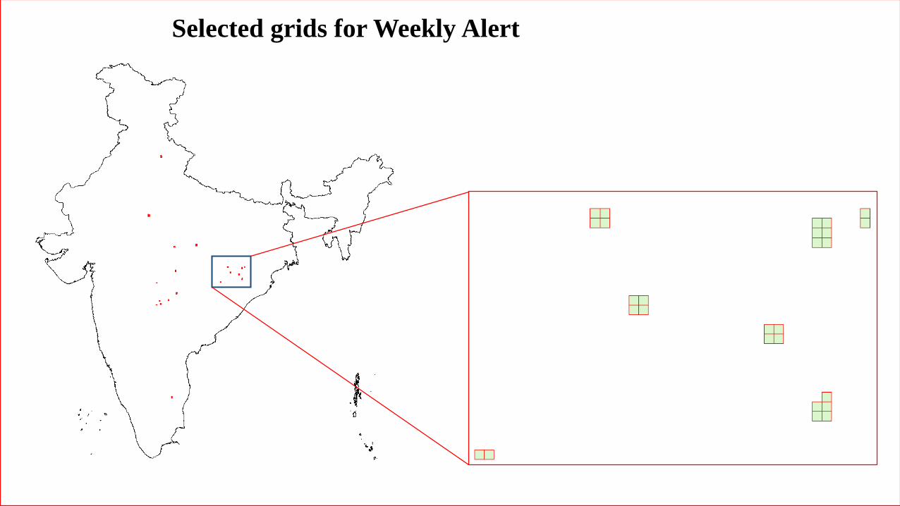
Selected grids for Weekly Alert

KML disseminated to nodal officer through e-mail
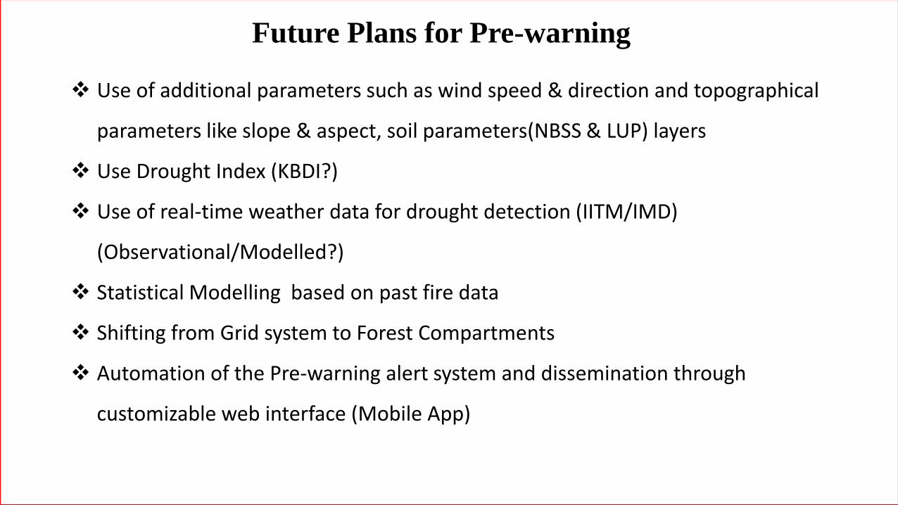
❖ Use of additional parameters such as wind speed & direction and topographical
parameters like slope & aspect, soil parameters(NBSS & LUP) layers
❖ Use Drought Index (KBDI?)
❖ Use of real-time weather data for drought detection (IITM/IMD)
(Observational/Modelled?)
❖ Statistical Modelling based on past fire data
❖ Shifting from Grid system to Forest Compartments
❖ Automation of the Pre-warning alert system and dissemination through
customizable web interface (Mobile App)
Future Plans for Pre-warning