Embed Size (px)
Citation preview
1
Fire Weather Services
For
South Carolina
Operating Plan
NWS Charleston, SC
NWS Columbia, SC
NWS Greenville-Spartanburg, SC
NWS Wilmington, NC
March, 2019 This operating plan will be a semi-permanent document, specifying services provided by National Weather Service in South Carolina. The plan incorporates procedures detailed
in the Interagency Agreement for Meteorological Services.

2
Table of Contents Introduction.................................................................................................................... …..4 Purpose of AOP............................................................................................................. …..4 Explanation of relationship between AOP and MOU.................................................... ..…4 Service Area and Organizational Directory………......................................................... …..5 Service Area.................................................................................................................. …..5 National Weather Service Headquarters…………......................................................... …..6 National Weather Service Regional Headquarters………............................................. …..6 Weather Forecast Offices (WFO)…….…………........................................................... …..6 Meteorologists-in-Charge (MIC)……….………….......................................................... …..7 Program Leaders (or Focal Points)…….…………......................................................... …..7 Participating Agencies……………………………………………………………………….. Services Provided by the National Weather Service.....................................................
…..8…..9
Basic Services………………………………………......................................................... …..9 Fire Weather Planning Forecast (FWF).…………......................................................... …..9 Suggested Update Criteria for the Fire Weather Planning Forecast............................. …..9 Parameter Definitions………………………………......................................................... …10 Atmospheric Dispersion Index (ADI)…..…………......................................................... …12 Low Visibility Occurrence Risk Index (LVORI)..…......................................................... …13 Fire Weather Point Forecast Matrix (PFW)………......................................................... …15 Fire Weather Area Forecast Matrix (AFW)………......................................................... …15 Site Specific Wildland Fire Spot Forecasts (FWS)........................................................ …16 Spot Forecast Content..……...………….…………......................................................... …16 National Fire Danger Rating System (NFDRS) Forecasts……..................................... …17 NFDRS Issuance……………..………….…………......................................................... …17 NFDRS Contents……………..………….…………......................................................... …17 NFDRS Procedures…………..………….…………......................................................... …17 Fire Weather Watch and Red Flag Warning (RFW) Program....................................... …18 RFW Criteria…………………..………….…………......................................................... …18 NWS Columbia Specific RFW Criteria……………......................................................... …20 RFW Content………………….………….…………......................................................... …21 SC Red Flag Fire Alert……….………….…………......................................................... …21 SC Burn Ban…………………..………….…………......................................................... …21 Fire Danger Statements……..………….…………......................................................... …21 Participation in Interagency Groups…...…………......................................................... …22 Special Services..…………….………….…………......................................................... …22 AMRS Services....…………….………….…………......................................................... …23 Fire Weather Training.……….………….…………......................................................... …24 Other Special Services...…….………….…………......................................................... …24 Communications..…………….………….…………......................................................... …25 Wildland Fire Agency Responsibilities...…………......................................................... …26 Operational Support and Predictive Services……......................................................... …26 Program Management……….………….…………......................................................... …26 Feedback, Monitoring and Improvement…………......................................................... …26 Technology Transfer…...…….………….…………......................................................... …26 Agency Computer Resources.………….…………......................................................... …26 Fire Weather Observations….………….…………......................................................... …26 On-Site Support...…………….………….…………......................................................... …27 Training……….....…………….………….…………......................................................... …28 Joint Responsibilities..……….………….…………......................................................... …28
3
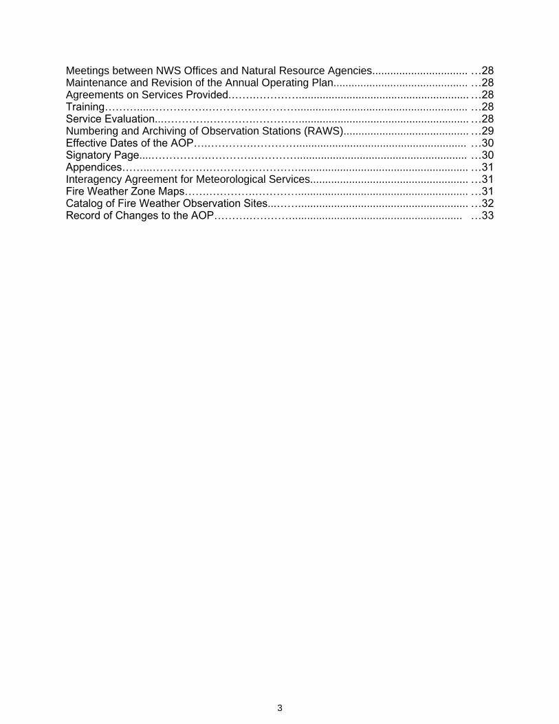
Meetings between NWS Offices and Natural Resource Agencies................................ …28 Maintenance and Revision of the Annual Operating Plan............................................. …28 Agreements on Services Provided.…….…………......................................................... …28 Training……….....…………….………….…………......................................................... …28 Service Evaluation...………….………….…………......................................................... …28 Numbering and Archiving of Observation Stations (RAWS).......................................... …29 Effective Dates of the AOP….………….…………......................................................... …30 Signatory Page....…………….………….…………......................................................... …30 Appendices……...…………….………….…………......................................................... …31 Interagency Agreement for Meteorological Services..................................................... …31 Fire Weather Zone Maps…….………….…………......................................................... …31 Catalog of Fire Weather Observation Sites...……......................................................... …32 Record of Changes to the AOP……….…………......................................................... …33
4
Introduction
Purpose of AOP.
This Operating Plan serves as the official document governing the interaction and
relationships between the National Weather Service offices that serve South Carolina,
and the federal, state and local land management agencies in the state of South
Carolina.
Explanation of relationship between AOP and MOU.
This State Operating Plan is issued in lieu of a formal Memorandum of Understanding
(MOU) between the National Weather Service, US Forest Service, SC Forestry
Commission, and other land management agencies that rely on fire weather support. The plan will also outline forecast operations and services available to users. This
includes products and formats, dissemination and coordination, and the responsibilities
of the customers.
This Operating Plan will be the governing document for fire weather procedures and
cooperation among the following agencies:
• National Weather Service
• US Forest Service
• National Park Service
• South Carolina Forestry Commission
• US Army, Department of Defense
• US Forest Service Savannah River • US Fish and Wildlife Service
• The Nature Conservancy
This Operating Plan for Fire Weather Services conforms to the Interagency Agreement
for Meteorological Services , valid from 2012 through 2019.
The Southern Area Mobilization Guide and the National Mobilization Guide
further define the relationship between the wildland fire agencies and the NWS
Incident Meteorologist.
Partners, Customers and Users
Partners, customers and users shall be defined as any person, group, agency or body
which uses the products and services provided by the NWS in support of fire
operations.
5
Service Area
and
Organizational Directory
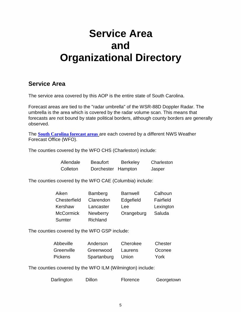
Service Area
The service area covered by this AOP is the entire state of South Carolina.
Forecast areas are tied to the "radar umbrella" of the WSR-88D Doppler Radar. The
umbrella is the area which is covered by the radar volume scan. This means that
forecasts are not bound by state political borders, although county borders are generally
observed.
The South Carolina forecast areas are each covered by a different NWS Weather Forecast Office (WFO).
The counties covered by the WFO CHS (Charleston) include:
Allendale Beaufort Berkeley Charleston
Colleton Dorchester Hampton Jasper
The counties covered by the WFO CAE (Columbia) include:
Aiken Bamberg Barnwell Calhoun
Chesterfield Clarendon Edgefield Fairfield
Kershaw Lancaster Lee Lexington
McCormick Newberry Orangeburg Saluda
Sumter Richland
The counties covered by the WFO GSP include:
Abbeville Anderson Cherokee Chester
Greenville Greenwood Laurens Oconee
Pickens Spartanburg Union York
The counties covered by the WFO ILM (Wilmington) include:
Darlington Dillon Florence Georgetown
6
Horry Marion Marlboro Williamsburg
National Weather Service Headquarters
NWS Headquarters, located in Silver Spring, Maryland, establishes policies and
coordinates the national fire weather program. The national program manager coordinates the program with the regional program managers. The national program
manager also works with the national headquarters of the Federal forestry and land management agencies and the Association of State Foresters in determining overall forestry and land management requirements for meteorological support. The national
program manager coordinates national training in forestry and fire weather for NWS forecasters.
National Weather Service Regional Headquarters
Regional Headquarters manage the technical operational aspects of the fire weather program within each region. They also provide guidance and assistance to meteorologists-in-charge (MIC) on program operations and problems through Supplements to the National Directives System (NDS) and conferences. Regional
Headquarters advise National Headquarters on matters pertaining to technical planning
and operations. The regional program managers coordinate the regions' fire weather
programs and advise the Regional Directors on the operational and administrative
aspects of the regions' programs.
Weather Forecast Offices (WFO)
Weather Forecast Offices prepare and disseminate forecast products for all sectors of
the population, including those for the Fire Weather program. These offices are
responsible for providing forecasts for user agencies within their County Warning and
Forecast Area (CWFA). Most offices have a designated fire weather focal point or fire
weather program leader.
The National Weather Service Weather Forecast Offices serving South Carolina
will provide 24-hour, 365 days a year service. WFO's can be reached at:
Charleston National Weather Service 5777 South Aviation Avenue North Charleston, South Carolina 29406
Columbia National Weather Service 2909 Aviation Way Columbia, South Carolina 29170
7
Greenville-Spartanburg National Weather Service 1549 GSP Drive Greer, South Carolina 29651
Wilmington National Weather Service 2015 Gardner Drive Wilmington, North Carolina 28405
NOTE: Unlisted telephone numbers used for coordination cannot be listed here. All
user agencies have been or will be provided voice and fax numbers to be used for
official purposes only.
Meteorologists-in-Charge (MIC)
The Meteorologists-in-Charge are responsible for the provision of adequate forestry and
fire weather services for the offices' assigned areas of program responsibility. The MIC's
will ensure that the focal points or program leaders are provided adequate time for user
liaison and assistance activities.
Rich Okulski, Columbia, SC
Mark Willis, Wilmington, NC
Michael Emlaw, Charleston, SC
Stephen Wilkinson, Greenville-Spartanburg, SC
Program Leaders (or Focal Points)
Fire weather focal points and program leaders are the "customer service representatives" for the program. The focal points or program leaders, as representatives of the MIC's, are in regular contact with land management agencies, helping them assess their meteorological needs, informing them of NWS products and services available to meet these needs, and educating them in the most effective use of the various NWS products and resources, including NOAA Weather Radio (NWR). Focal points and program leaders will work with users to utilize existing NWS products
and services produced for other programs that could meet the requirements of wildland
management. The focal points and program leaders are also tasked with ensuring staff
meteorologists are trained and remain proficient in preparing forecast products for
support of the fire weather program.
Mike Proud, Columbia, SC
Terry Lebo, Wilmington, NC
Scott Krentz, Greenville-Spartanburg, SC
8
Bob Bright, Charleston, SC
Participating Agencies
The following agencies are participants of this operating plan:
National Weather Service.
National Park Service.
Savannah River Site.
South Carolina Forestry Commission.
The Nature Conservancy.
United States Fish and Wildlife Service.
United States Forest Service.
U.S. Army, Department of Defense.

9
Services Provided by the
National Weather Service
Basic Services
Routine Fire Weather Planning Forecasts (FWF)
NWS Charleston, SC
NWS Columbia, SC
NWS Greenville-Spartanburg, SC
NWS Wilmington, NC
Background
Routine Fire Weather Planning Forecasts are issued twice per day, every day of the year, by 0700 LT in the morning, and preferably by 1500 LT in the afternoon (no later than 1600L). An updated FWF will be issued by 11 AM if the forecaster feels the forecast has become unrepresentative based on the criteria listed below. Customers should note that updates to the FWF will not be issued at any other time of the day. The FWF will be available from each NWS office's website. In the event of an internet
outage, the customers may call the NWS offices, and have the forecast faxed to them.
Suggested FWF Update Criteria
Standard Air Temperature: +/- 5 degrees F.
Relative Humidity: +/- 5%.
Wind Speed and Direction at 20 ft AGL: +/- 5 mph and/or 45 degrees.
Precipitation POP, duration and amount: same as for public zones. Note: duration
guideline for NFDRS is +/- 2 hours.
Inversions: +/- 100 m or 328 ft.
Freezing Level: +/- 100 m or 328 ft.
Transports Winds: +/- 5 mph and/or 45 degrees.
10
Mixing Height: +/- 100 m or 328 ft.
Stability: Must be in correct category 90% of time.
Burn Category: One category of change.
Dispersion: One category of change.
Note: Forecasters should examine regional morning upper air soundings to assist
with forecast update decisions.
Content
The format of the Fire Weather Forecast is specified in National Weather Service
Directive 10-401. The forecast will start with a headline of Red Flag Warnings or Fire
Weather Watches (or of meteorological trends), followed by a meteorological
discussion. The forecast will then be broken down by zone groupings of counties
expecting similar weather in the early forecast period (days one and two).
The morning forecast will include three periods; today, tonight, and tomorrow. The
afternoon forecast will include four periods; tonight, tomorrow, tomorrow night, and the
next day.
Fire Weather Forecast (FWF) Parameter Definitions
CLOUD COVER or CLOUD AMOUNT: Represents the average sky condition over the specified area during the specified period. For example, “Clear” or “Sunny” indicates cloud cover < 10%; “Mostly Clear” or “Mostly Sunny” are used when cloud cover is ≥10% and <30%; “Partly Cloudy” or “Partly Sunny” are used when cloud cover is ≥30%
and <60%; “Mostly Cloudy” is used when cloud cover is ≥60% and <80%; and “Cloudy”
is used when cloud cover is ≥80%.
CHANCE PRECIP: Represents the chance (rounded to the nearest 10%) of measurable (≥ 0.01 inches) precipitation over the specified area during the specified period. Note: Drizzle and snow flurries are not considered measurable precipitation and thus will not
be given a probability.
PRECIP TYPE: Represents the predominant precipitation type over the specified
area during the specified period. Note: The only exception is when showers and
thunderstorms are expected, as only thunderstorms will be designated as the
precipitation type.
MAX/MIN TEMP: Represents the expected maximum (during the daytime period) and
minimum (during the nighttime period) temperatures over the specified area.
11
MAX/MIN RH: Represents the expected maximum (during the nighttime period) and
minimum (during the daytime period) relative humidity (%) over the specified area.
WND20FT/EARLY and WND20FT/LATE : Represents the 2-minute average wind speed (MPH) and direction 20 feet above the ground or vegetative cover. Wind direction is the direction the wind blows from. “Early” refers to the morning hours (before noon) during daytime period and also the evening hours (before midnight) during nighttime periods. “Late” refers to the afternoon hours during the daytime period and the pre-dawn (after midnight) hours during the nighttime period. Wind gusts, which are rapid fluctuations in wind speed of usually less than 30 seconds in duration, are indicated if expected. The highest probable wind gust will be preceded by a “G” and will usually only be included if they are 10 MPH or greater than the sustained wind speed.
PRECIP AMOUNT: Represents the precipitation amount (hundredths of an
inch) whenever the chance of precipitation is ≥20%.
PRECIP DURATION: Represents the duration of measurable precipitation (hours)
when the chance of precipitation is ≥20%.
PRECIP BEGIN: Represents the begin time (to the nearest hour) of
measurable precipitation when the chance of precipitation is ≥20%.
NOTE: Used by WFO’s CAE, CHS and GSP.
PRECIP END: Represents the end time (to the nearest hour) of
measurable precipitation when the chance of precipitation is ≥20%.
NOTE: Used by WFO’s CAE, CHS and GSP.
LAL: Represents the Lightning Activity Level, as defined below.
1: No thunderstorms. 2: Cumulus clouds are common, but only a few reach towering cumulus stage. A single thunderstorm must be confirmed in the rating area. The clouds mostly produce virga, but light rain will occasionally reach the ground. 3: Cumulus clouds are common. Swelling and towering cumulus cover less than 2/10 of the sky. Thunderstorms are few, but two or three must occur in the observation area. Light to moderate rain will reach the ground and lightning is infrequent. 4: Swelling cumulus and towering cumulus cover 2/10-3/10 of the sky. Thunderstorms are scattered, but more than 3 must occur in the observation area. Moderate rain is commonly produced and lightning is frequent. 5: Towering cumulus and thunderstorms are numerous covering more than 3/10 of the sky and occasionally obscure it. Rain is moderate to heavy and lightning is frequent and intense. 6: Same as #3, but dry (little to no rain reaching the ground).
NOTE: Used by WFO’s ILM and GSP.

12
HAINES INDEX: Represents the Haines Index, which is used to describe the stability of the atmosphere, with values ranging from 2 to 6. In the South Carolina Coastal Plain, Piedmont, and Foothills, "low elevation" is assumed for the calculation of the Haines Index. It utilizes the atmospheric temperature at 950 mb and 850 mb as well as taking
into account the moisture levels (dew point depression) at 850 mb. In the South
Carolina mountains, the "mid level" Haines Index is calculated using the temperatures
at 850 and 700 mb, and the dew point depression at 850 mb.
NOTE: Used by WFO’s ILM and GSP.
DSI: Represents the Davis Stability Index, which is the maximum surface temperature (in deg C) minus the 850 mb temperature (in deg C). If the difference is <10 deg C, it is considered a Category 1 (stable); between 10 deg C and 14 deg C, it is considered a Category 2 (conditionally unstable); between 15 deg C and 17 deg C, it is considered a Category 3 (unstable); and >17 deg C, it is considered a Category 4
(absolutely unstable). Note: DSI is only computed for the daytime period.
MIXING HGT: Represents the mixing height, or the height (in feet above the ground) to
which vigorous vertical mixing takes place. The Miller-Holzworth (dry adiabatic)
method is used for determining mixing heights at all WFO’s but CAE, where the
vertical dew point profile is used. Offices serving South Carolina have agreed to
attempt to keep mixing heights within 1000 feet of those of neighboring offices.
DISPERSION: Represents the begin and end times of the low-level (usually surface-
based) inversion as well as the category of dispersion during this period based on the
surface wind speed. The dispersion category gives a general indication of the state of the atmosphere with respect to its ability to disperse smoke. The categories are as
follows: Very Poor (VP) or Poor (PO): 0-4 MPH winds, Fair (FA): 5-7 MPH winds, Good
(GD): 8-9 MPH winds, Excellent (EX): ≥10 MPH winds. It is assumed that at least fair
mixing is occurring in the evening prior to the onset of the nighttime inversion.
ATMOSPHERIC DISPERSION INDEX (ADI): A numerical index developed by Lavdas
that incorporates stability and mixing height to determine dispersion. Stability class is
determined using solar angle, ceiling and wind. The categories are as follows:
Very Poor (ADI 1-6): very frequent at night; represents the majority of nights in many
locations.
Poor (ADI 7-12): stagnant at day, but near or above average at night.
Generally Poor (ADI 13-20): stagnation, if persistent, although better than average for a
night value.
Fair (ADI 21-40): stagnation may be indicated if accompanied by persistent low wind
speeds.
13
Generally Good (ADI 41-60): climatological afternoon values in most inland
forested areas of the US fall within this range.
Good (ADI 61-100): typical case burning weather values are in this range.
Very Good (ADI > 100): but may indirectly indicate hazardous conditions.
NOTE: Early and late in each period, both day and night.
LOW VISIBILITY OCCURRENCE RISK INDEX (LVORI): A numerical index derived
from ADI and relative humidity. It indicates the probability of visibility restriction
caused by smoke and or fog, and is based on a study of traffic accidents in Florida.
The categories are as follows:
1: Lowest proportion of accidents with smoke and/or fog reported (130 of
127,604 accidents, or just over 0.0010 accidents).
2. Physical or statistical reasons for not including in category 1, but proportion of
accidents not significantly higher. 3. Higher proportion of accidents than category 1, by about 30 to 50 percent, marginal
significance (between 1 and 5 percent). 4. Significantly higher than category 1, by a factor of 2. 5. Significantly higher than category 1, by a factor of 3 to 10. 6. Significantly higher than category 1, by a factor of 10 to 20. 7. Significantly higher than category 1, by a factor of 20 to 40. 8. Significantly higher than category 1, by a factor of 40 to 75. 9. Significantly higher than category 1, by a factor of 75 to 125. 10. Significantly higher than category 1, by a factor of 150.
NOTE: Early and late in each period, both day and night.
MINIMUM SURFACE VISIBILITY AND OBSTRUCTION (MIN VSBY): The minimum
visibility at the surface, and the type of obstruction reducing it, if reduced. Only visibility
values below 7 statute miles will be accompanied by an obstruction. Visibility of 7 to 10
miles is considered unrestricted.
NOTE: Only used by GSP, first two periods, early and late.
14
INVERSION: BEGIN/END & BURNOFF TEMPERATURE: Represents the temperature and time at which the morning inversion will burn off as well as the time it will set up in the evening. If the inversion is not surface-based (yet still at low levels, e.g. below 1000 ft.), meteorological factors other than nighttime radiational cooling may be taking place and as such, inversion information may not be given ("Inversion" remains in the forecast through the day, which would be reflected by a low mixing height). Conversely, there will be situations when a low-level inversion does not develop at night and thus "NONE" will be noted. Other inversion notation includes CONT (for continued inversion), and TEMP/HHMM (when an inversion mixes out at local time HHMM).
NOTE: Used by WFO's GSP.
INVERSION: For daytime periods, this represents the time (in military time) at which the inversion (below 1000 feet) is expected to dissipate and for nighttime periods it represents when the inversion is expected to set up. Users should keep in mind that the inversion may not always be surface-based, but can still be below 1000 feet, especially during the morning burnoff and evening setup periods. Also, there will be situations when a low-level inversion does not develop at night, and thus "NONE" will be noted. This typically occurs when low-level winds are strong and the atmosphere is well-mixed
such as during cold frontal passages. When an inversion is expected to continue
through an entire period, the inversion will be noted as "CONT". This is most likely to
occur in the winter when strong high pressure is in place.
NOTE: Used by WFO’s CAE, ILM and CHS.
TRANSPORT WND: Represents the transport wind, or the average wind direction and
speed (MPH) from the surface to the top of the mixed layer (mixing height). Direction
indicates where the wind is blowing from.
VENT RATE: Represents the ventilation rate (FT MPH), or the potential for the
atmosphere to disperse smoke. It is computed by multiplying the mixing height by
the transport wind. Ventilation rates are used to determine Burn Categories.
WPA (Wind Profile Analysis): Offices serving counties in North Carolina (GSP and ILM)
may also include a wind profile analysis (March through May at GSP, year round at ILM), but will not include dispersion or burn category, since the values defining
these elements differ from North Carolina to South Carolina.
At the bottom of the forecast for each forecast area (zone grouping), an extended
forecast for days three through seven will be appended. This will include a forecast
of winds and minimum relative humidity.
15
Fire Weather Point Forecast Matrix (PFW)
NWS Greenville-Spartanburg, SC
The Fire Weather Point Forecast Matrix (PFW) is a tabular-type product used by natural
resource management personnel for decision support related to pre-suppression and
other planning or resource management activities at or near a specific point. These
points are predetermined by the customers, and are semi-permanent in nature,
meaning they can be changed from time to time, but not on a daily basis.
Product Overview and Issuance Criteria
The PFW provides a detailed prediction of elements for three days out at 3-hour
intervals, including smoke management parameters through day 2, and a more general
3 to 7 day forecast without smoke management parameters. The winds given in this
forecast are not terrain corrected winds. The PFW is issued twice daily, once during the morning (between 3:00 and 6:30 AM), and the other during the afternoon (between 2:00
and 4:00 PM). For an example and information on decoding the product, click on PFW
Guide.
Note: Only issued by GSP and ILM.
Fire Weather Area Forecast Matrix (AFW)
NWS Greenville-Spartanburg, SC
The Fire Weather Point Forecast Matrix (AFW) is a tabular-type product used by natural resource management personnel for decision support related to pre-suppression and other planning or resource management activities in a specific fire weather zone. These forecasts are produced for each individual fire weather zone, usually one county (example: Greenwood County), but in some cases a part of a county (example: Pickens Mountains), or parts of several counties (example: Great Smoky Mountains National Park, which is in Swain and Haywood Counties).
Product Overview and Issuance Criteria
The AFW provides a detailed prediction of elements for three days out at 3-hour intervals, including smoke management parameters through day 2, and a more general 3 to 7 day forecast without smoke management parameters. The winds given in this
forecast are not terrain corrected winds. The AFW is issued twice daily, once during the
morning (between 3:00 and 6:30 AM), and the other during the afternoon (between 2:00
and 4:00 PM). For an example and information on decoding the product, click on AFW
Guide.
Note: Only issued by GSP.
16
Site Specific Wildland Fire Forecasts (Spot Forecasts) (FWS)
Background
Spot forecasts will be issued on request in support of wildfire and natural resource
management. The forecasts are usually issued with a turn-around time of 30 to 60 minutes, unless the request is for the next day, in which case the fulfillment may be delayed until the date of ignition, depending on forecast workload and duty priorities.
Requests can be submitted days in advance of the specified ignition time by utilizing the "NWS Spot" webpage available from each NWS office's website. Spot forecasts will
be produced and posted to the same webpage by the requested delivery time as well as sent to the email address provided.
The spot forecast request page is nationally standardized, and prompts the customer for information about the location, elevation and size of the fire, as well as for observations and a contact phone number and email. Local, current observations are of critical importance, and allow the forecaster to modify the forecast based on elements such as wind speed and direction, temperature, and dew point. The customer can customize their request by selecting which elements they need and for which forecast periods. A "Remarks" section allows the customer to ask for additional forecast elements or time periods, and highlight to the forecaster the most important element(s). There is also an option to request a NOAA Hysplit Model trajectory forecast, which will automatically be emailed. In case of an internet outage, the customer may fax in a request, using form D-
1.
Content/Format
Spot forecasts typically cover three 12 hours periods (e.g., Today, Tonight, Tomorrow),
but may cover fewer or more periods as the customer requests. Any forecast beyond
day two will typically be an outlook.
The FWS format is specified in National Weather Service Directive 10-401. There are
essentially two FWS formats available: (1) narrative, and (2) tabular. The narrative
format is generally in 12 hours blocks out to around 36 hours. The tabular format can
provide detailed information on the individual parameters in 1, 2 or 3 hour increments. Due to a nationwide agreement between the NWS and various state and federal
forestry agencies, the narrative format must be used to satisfy spot forecast requests for
wildfires.
FWS's will be headlined for Red Flag Warnings or Fire Weather Watches. The forecast will then begin with a meteorological discussion, and will include any of the following information as designated by the requesting customer: sky/weather, temperature, relative humidity, wind direction and speed (20 ft., 2min), mixing height and transport wind. Additional elements such as inversion times, Atmospheric Dispersion Index (ADI) and Low Visibility Occurrence Risk Index (LVORI) may also
be requested.
17
National Fire Danger Rating System (NFDRS) Forecasts (FWM)
Issuance
NFDRS forecasts will be issued for any predetermined site from which an NFDRS
observation is received provided the observation is received on time, is complete, and is
deemed accurate. The land management agencies will determine which observation
sites (normally RAWS sites) will be NFDRS sites. Initiation of NFDRS forecasts for a
new site will be coordinated with the NWS, and the agency requesting new NFDRS
service will provide the NWS with information about the site location.
Contents
The format of the NFDRS Forecast is specified in National Weather Service Directive 10-
401. The NFDRS forecast will be a forecast of the next day observation at 1300 LST.
The forecast will include expected state of weather, temperature, relative humidity, wind
speed and direction (to 16 points) at 1300 LST. The forecast also includes the expected
lightning activity level for the next day and a half, the 24 hour maximum and minimum temperature and relative humidity, the 24 hour precipitation duration, and whether fuels
will be wet (wet flag) at 1300 LST.
Procedures
The land management agencies are responsible for taking, quality controlling, transmitting and archiving the NFDRS observations. Observation must be received at the NWS in a timely manner. Forecasts will only be prepared for predetermined sites,
and only from those sites for which an observation has been received. The NWS will prepare and transmit the NFDRS forecasts no later than 4 PM. Although the data
cutoff time for ingest into the NFDRS software is 7 PM, preliminary calculations based on the forecast are used by the land managers to make staffing decisions at shift briefing time (4 PM).
18
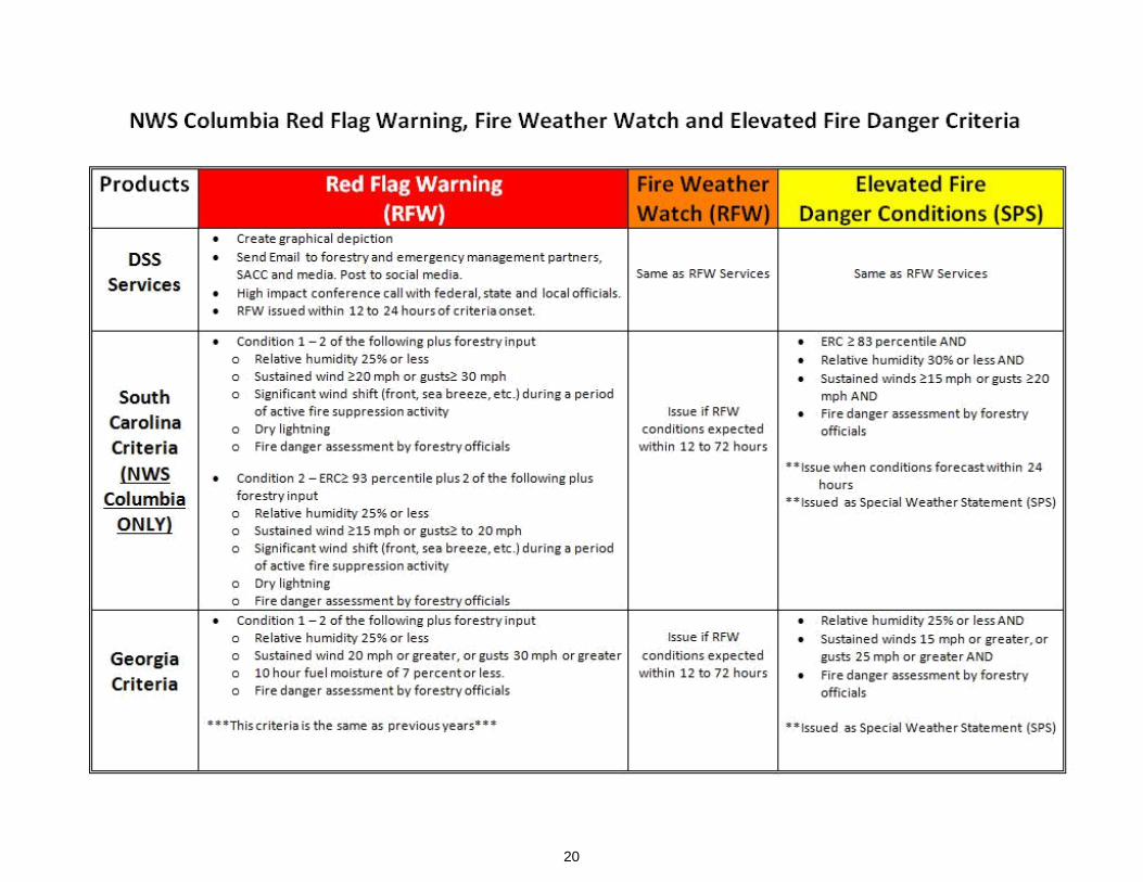
Fire Weather Watch and Red Flag Warning Program (RFW)
Criteria
A Red Flag event is defined as a combination of high (or greater) fire danger and critical
weather elements.
For WFO CAE the following criteria will be used. Wind criteria are for 10 meter, 2
minute average wind. A 10% reduction must be applied to the criteria when comparing
against the FWF wind, which is a 20 ft. 2 minute average wind.
Condition #1: At least two parameters of 1 - 5 must be occurring or forecast
to occur, with number 6 being mandatory.
1. Minimum relative humidity of 25 percent or lower. 2. Sustained surface wind (20-foot) of 20 mph or greater, or gusts to 30
mph or greater, for a significant duration (roughly one hour or more). 3. Significant wind shift (front, sea breeze, etc.) during a period of active
fire suppression activity. 4. Strong potential for lightning, especially after an especially hot and dry
(little or no precipitation) period or when dry lightning (little or no precipitation) is expected.
5. Consultation with Fire Weather Partners (to determine fuel moisture;
fire danger rating, etc.).
OR
Condition #2: Energy Release Component (ERC) Percentile greater than or
equal to 93% and two of the parameters below must be occurring, or forecast
to occur, with number 5 being mandatory.
1. Minimum relative humidity of 25 percent or lower. 2. Sustained wind 15 mph or greater, or gusts to 20 mph 3. Significant wind shift (front, sea breeze, etc.) during a period of active
fire suppression activity. 4. Dry lightning 5. Consultation with Fire Weather Partners (to determine fuel moisture;
fire danger rating, etc.).
For WFO’s GSP, ILM and CHS the following criteria will be used. Two or more of the
following weather criteria must be occurring or expected, in addition to high (or greater)
fire danger. Wind criteria are for 10 meter, 2 minute average wind. A 10% reduction
must be applied to the criteria when comparing against the FWF wind, which is a 20 ft. 2
minute average wind.
19
1. Minimum relative humidity of 25 percent or lower. 2. Sustained wind of 20 mph or greater, or gusts to 30 mph or greater. 3. Dry lightning. 4. A significant wind shift during times of active fire suppression. 5. Fire danger will be assessed by the land management agencies, and will
be obtained from them by the National Weather Service.
If Red Flag criteria are occurring, or expected within 12 hours, a Red Flag Warning must
be issued. A Fire Weather Watch will not be issued within 12 hours of an expected
event, nor will it be used in lieu of a Fire Danger Statement for sub Red Flag criteria.
If Red Flag criteria are expected, between 12 hours and 24 hours, either a Red Flag Warning or Fire Weather Watch will be issued. The Red Flag Warning will remain in
effect until the conditions abate or are no longer expected. The Fire Weather Watch will
be upgraded to a Red Flag Warning within 12 hours of criteria being met, or will be
cancelled.
If Red Flag criteria are expected within 24 to 72 hours, a Fire Weather Watch will be
issued, and will remain in effect until the watch is upgraded to a Red Flag Warning, or
conditions are no longer expected to develop.
Collaboration between the NWS and the land managers the day before an expected or
possible event is critical. Normally, WFO CAE will lead the coordination with the SCFC
and USFS anytime there are any concerns within the state, but individual WFO’s need
to make CAE aware of problems in their area.
20
21
Content
The format of the Red Flag Warning and Fire Weather Watch is specified in National
Weather Service Directive 10-401. A Red Flag Warning or Fire Weather Watch will begin
with a headline stating which product is in effect, the area the product covers, and the
meteorological reason why the product was issued.
Procedures
Whenever the meteorological criteria for a Red Flag event are occurring or expected to occur within 72 hours, the NWS office will contact the land management agencies to obtain a determination of fire danger. If the combined fire danger rating and meteorological criteria warrant a Red Flag product, the NWS and land management agencies will reach a consensus on whether to issue the product and for which areas at which times. Fire Weather Watches and Red Flag Warnings will be aired on NOAA Weather Radio.
SC Red Flag Fire Alert
A Red Flag Fire Alert will be issued by the South Carolina Forestry Commission (SCFC)
with the meteorological input from the NWS Forecast Office in Columbia. The Alert will
be issued when conditions that support potentially destructive forest fires are worsening.
It will continue in effect until the SCFC cancels it.
The NWS office in Columbia, South Carolina, will transmit Red Flag Fire Alerts for all of South Carolina, as a cooperative service to the SCFC. These will be delivered under the
product header, Rangeland Fire Danger Statement. The text will be preformatted, with
the body of the alert written by the SCFC. The SC Red Flag Fire Alert will be aired on
NOAA Weather Radio.
SC Burn Ban
A SC Burn Ban will be issued by the South Carolina Forestry Commission (SCFC). The
Ban will continue in effect until the SCFC cancels it.
The NWS office in Columbia, South Carolina, will transmit the Burn Ban for all of South
Carolina, as a cooperative service to the SCFC. This will be delivered under the product
header, Rangeland Fire Danger Statement. The text will be preformatted, with the body
of the alert written by the SCFC. The SC Burn Ban will be aired on NOAA Weather
Radio.
Fire Danger Statements
The NWS will issue a Fire Danger Statement when fire danger and/or fire occurrence is
high, and weather conditions are near critical levels. Under these circumstances, land
22
management agencies may request that the NWS issue a Fire Danger Statement or Blow-Up Alert. These statements will be issued in coordination with the requesting agency and will only be issued with their approval. The NWS will use the Special Weather Statement (SPS) for these issuances, with the headline "...Fire Danger
Statement ...", and the following call to action statement: "Please refer to your local burn
permitting authorities on whether you can burn today. If you do burn... you are advised
to use extreme caution." Fire Danger Statements will be aired on NOAA Weather Radio.
WFO CAE will use the following criteria for Fire Danger Statements: 1. ERC ≥ 83% AND 2. Relative humidity 30% or less AND 3. Sustained winds 15 mph or greater, or guts 20 mph or greater AND 4. Fire danger assessment by forestry officials
WFO’s GSP, ILM and CHS will use the following criteria for Fire Danger Statements:
1. RH within 5% of Red Flag Criteria (30% or lower) AND 2. ASOS wind speeds or gusts within 5 MPH of Red Flag Criteria (sustained
15 MPH or gusts to 25 MPH) AND 3. Low fuel moisture as determined by land managers.
These criteria may be waived at the request of the land managers, typically for unusual
or dangerous situations.
Participation in Interagency Groups
The NWS and its customers will meet from time to time, for the purpose of reviewing the
operational relationships agreed to in this plan, and as partners in other interagency
meetings.
Meetings may be between one NWS office and all of its customers from several states,
a state meeting of all NWS offices and fire weather customers within South Carolina,
or a meeting conducted by a customer group with the NWS offices invited either
individually or collectively.
Customers may at times invite NWS representatives to serve on an interagency group
at either the state or national level. These groups may serve a variety of purposes, such
as program review, service evaluation, scientific advisory or joint decision making.
Special Services
Special fire weather services are those services that are uniquely required by land management agencies and go beyond the normal forecast operations of the NWS. Special services include Incident Meteorologist (IMET) deployment using the All Hazards Meteorological Response System (AMRS), station visits, weather observer
23
training, participation in user agency personnel training, outreach and other
pertinent meteorological services.
There are a variety of ways that NWS personnel can be requested by land management
agencies. Most requests can be made through the Fire Weather Program Leader or
Meteorologist-in-Charge at the appropriate NWS Forecast Office. IMET support, for
large wildfires, major all hazards incidents or other significant weather sensitive events
(such as those with a Presidential or FEMA Declaration) should be placed through the
South Carolina Interagency Coordination Center.
Typically, special services require NWS personnel to be away from the Forecast Office
and will require user agencies to reimburse the NWS for expenses such as overtime,
travel and per diem. For IMET support, reimbursable expenses include overtime, travel,
per diem, equipment maintenance and transportation of the IMET and equipment.
For short term incidents or events, NWS personnel will provide temporary on-scene
services when possible until either the short term incident or event ends, or the formal
request for an IMET has been approved and the IMET arrives on-scene. Costs
associated with NWS personnel on short term incidents will generally be covered by the
personnel’s home office with no reimbursement required by the land management
agency.
Reimbursement of costs for special services will be as outlined in the Interagency Agreement for Meteorological Services
All Hazards Meteorological Response System (AMRS)
The AMRS contains a laptop computer, a printer, a smartphone, and an upper air
radiosonde system, as well as other tools to aid the forecaster in providing the most
accurate on-site weather forecasts. These modules are national resources, but are
located at the National Weather Service offices that have an IMET (Incident
Meteorologist) on station. There is one AMRS unit in South Carolina, located at the
Columbia WFO, which can be used by any of the three IMETs on station. North
Carolina has two offices with AMRS kits, one of which is Wilmington, NC with one
IMET on station.
Requests for the AMRS and IMET should be made through the local Interagency State Coordination Center. Typically, the IMET nearest the incident will be deployed. However, during times of limited resources, IMETs from other areas of the country may
be called. This decision will be made by the National Fire Weather Operations
Coordinator (NFWOC) in conjunction with the MIC and IMET from the affected offices.
The mobilization of the AMRS and the IMET is coordinated through the local State
Interagency Coordination Center, the Southern Area Interagency Fire Cache, and the
Southern Area Coordination Center (SACC). Demobilization is initiated at the
incident, and coordinated through the Coordination Centers previously mentioned.
For more

24

25
specific information, reference the Southern Area and the National Interagency Mobilization Guides.
The requesting agency is responsible for any storage of the unit while in transit and
shelter for the IMET and unit at the site. A sheltered work area, of at least 50 square
feet with a table and chair, must be protected from excessive dust, free of standing
water or condensation, and must be heated and/or cooled sufficiently to allow efficient
operation of equipment. Power (120V AC) must be provided for the AMRS's electrical
equipment and priority telephone access during certain short periods each day must
be made available. Upon arrival at the incident and after going through the appropriate check-
in procedures, the IMET will:
1. Brief the Fire Behavior Analyst (FBAN), Planning Section Chief (PSC), and the Incident Commander (IC) on current and expected weather as it affects the fire.
2. Establish a schedule with the IC and the FBAN for written forecasts and formal briefings.
3. Request a briefing of the fire situation and potential behavior problems from the FBAN. As time and resources permit, incident management should arrange for an aerial inspection trip for the meteorologist and should provide the forecaster with current fireline maps. If possible, the IMET should be assigned a radio with the fireline frequency.
4. Arrange for a schedule of observations from key points around the fire and from
nearby lookouts and fire danger stations, in cooperation with the FBAN and
PSC. On large fires, some personnel (at least two) should be permanently
assigned to this duty. On smaller fires, this information can be provided by
Division Supervisors equipped with belt weather kits.
Fire Weather Training
NWS meteorologists will be available to assist in user-oriented training, such as at fire
behavior schools (e.g. S-290 and S-390), and weather related courses. Requests
should be made through the Meteorologist-in-Charge as early as possible after dates for
such training have been determined.
Other Special Services
Other special services include weather station visits by user agency personnel,
weather observer training, and course development work. These activities would
typically be at the full expense of the requesting agency unless other arrangements
have been made.
26
Communications
The primary means of communication used by the NWS is Advanced Weather Interactive Processing System (AWIPS). Products transmitted through AWIPS include:
pre-suppression forecasts, Fire Weather Watches, Red Flag Warnings, Fire Danger
statements, and NFDRS station forecasts.
Spot forecasts will be disseminated to the requesting agency by means of the internet,
with telefax (FAX) as a backup. Anytime a request for a spot forecast is made by fax,
the requesting agency must include a FAX number. A voice number should also be
included in the event problems or questions arise with the request, the forecast, or the
transmission.
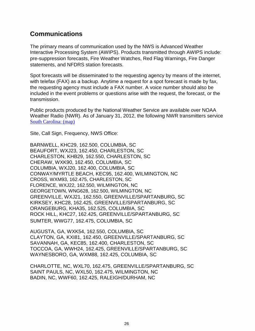
Public products produced by the National Weather Service are available over NOAA Weather Radio (NWR). As of January 31, 2012, the following NWR transmitters service South Carolina: (map)
Site, Call Sign, Frequency, NWS Office:
BARNWELL, KHC29, 162.500, COLUMBIA, SC BEAUFORT, WXJ23, 162.450, CHARLESTON, SC CHARLESTON, KHB29, 162.550, CHARLESTON, SC CHERAW, WXK90, 162.450, COLUMBIA, SC COLUMBIA, WXJ20, 162.400, COLUMBIA, SC CONWAY/MYRTLE BEACH, KEC95, 162.400, WILMINGTON, NC CROSS, WXM93, 162.475, CHARLESTON, SC
FLORENCE, WXJ22, 162.550, WILMINGTON, NC
GEORGETOWN, WNG628, 162.500, WILMINGTON, NC GREENVILLE, WXJ21, 162.550, GREENVILLE/SPARTANBURG, SC KIRKSEY, KHC28, 162.425, GREENVILLE/SPARTANBURG, SC ORANGEBURG, KHA35, 162.525, COLUMBIA, SC ROCK HILL, KHC27, 162.425, GREENVILLE/SPARTANBURG, SC
SUMTER, WWG77, 162.475, COLUMBIA, SC
AUGUSTA, GA, WXK54, 162.550, COLUMBIA, SC CLAYTON, GA, KXI81, 162.450, GREENVILLE/SPARTANBURG, SC SAVANNAH, GA, KEC85, 162.400, CHARLESTON, SC TOCCOA, GA, WWH24, 162.425, GREENVILLE/SPARTANBURG, SC WAYNESBORO, GA, WXM88, 162.425, COLUMBIA, SC
CHARLOTTE, NC, WXL70, 162.475, GREENVILLE/SPARTANBURG, SC SAINT PAULS, NC, WXL50, 162.475, WILMINGTON, NC BADIN, NC, WWF60, 162.425, RALEIGH/DURHAM, NC

27
Other means of communications may be utilized upon mutual agreement with user
agencies.
Wildland Fire Agency
Responsibilities
Operational Support and Predictive Services
Program Management
The wildland fire agencies will oversee the fire weather observation program,
including the siting and maintenance of the observing equipment, fire weather training
of their personnel, and the proficiency of their personnel in the use of the NWS Spot
software.
Monitoring, Feedback and Improvement
Land management agencies will monitor the quality and timeliness of NWS fire weather
products, and provide feedback the NWS in order to improve services to the agencies.
Technology Transfer
The wildland fire agencies may, from time to time, advise the NWS of new technologies
being implemented to monitor meteorological or fuel parameters, or to improve
communication, coordination, training, or reference. Wildland fire agency personnel
may, with prior arrangement, visit an NWS office to acquire knowledge of NWS
technologies used in the monitoring of weather, or the preparation of products.
Agency Computer Resources
Internet will be the primary method of obtaining the Fire Weather Forecast, Red Flag
Warning, Fire Weather Watch, and for both requesting and receiving a Spot Forecast.
As a backup method, a request can be made to the weather service for a product to be
faxed to the customer agency. NFDRS observations will be entered into WIMS, and
forecasts and calculations based on these observations will be received by WIMS, or by
internet via a WIMS website.
Fire Weather Observations
Fire weather observation stations provide the specialized weather observations for fire
weather forecasts, wildfire control and suppression, and various other land
management operations. These stations were selected very carefully in each state and
federal district. Sites were chosen to represent homogeneous weather conditions

28
across a district. Stations may either be manned sites operated by land management
agencies, or unmanned Remote Automatic Weather Stations (RAWS) maintained by
any of the federal or state land management agencies in the area.
All observation stations are assigned a 6-digit identification/location number. The first
two digits indicate the state, the second two digits indicated the county, and the last two
digits indicated the consecutively-assigned station number for that county. Land
managers who wish to have a number assigned to a station should contact the GACC
meteorologist at SACC in Atlanta.
RAWS stations are also assigned an 8 character alphanumeric identifier based on satellite transmission time (the DCP number, issued by the National Environmental Satellite Service (NESS)).
Observations from a satellite telemetered RAWS will automatically flow into WIMS via
the NESDIS ID. The RAWS owner may enter WIMS and manually change a recorded
observation (a type R ob) to an observed observation (a type O ob), to enter the state
of the weather. Otherwise, software will automatically employ the Nelson Algorithm to
determine the state of the weather, and the observation will remain a type R. Any
observation for which no 1300 LST data is available will use the 1200 LST data, and
will remain a type R observation, with no state of the weather encoded.
Even with automated state of the weather in observations, the responsibility still rests with the RAWS owner to ensure that observations are being transmitted, recorded, and archived properly in WIMS. Automation has greatly simplified the daily process; however there is still the need for observations to be checked for integrity and consistency. Managing the NFDRS model parameters will still be manual process in WIMS. Automation of state of the weather has helped streamline the WIMS collective
that is distributed to the NWS via AWIPS. NFDRS forecasts are based on RAWS
observations that appear on the daily collective.
Sensor failure will often result in erroneous or (at best) suspicious values. If the NWS
becomes aware of such a situation, it is prudent to contact the station owner. Similarly,
if a station owner becomes aware of sensor failure, he should relay that information to
the appropriate NWS office. It is that stations owner's responsibility to make sure that
their station is and remains in good working order and that repairs are made in a
timely manner. Owners of NFDRS stations can still (and should) correct any errors in
their respective observations.
On - Site Support
The user agencies are also responsible for maintaining observation site equipment. NWS personnel may accompany the user on maintenance trips or for annual
inspection visits, which could also serve as liaison with the users.

29
Training
The responsibility of training land management agency employees will be that of the
agencies themselves. However, the NWS will be available to assist when requested to
do so. Any expenses incurred by the NWS will normally be charged to the user agency,
unless other arrangements have been made.
Joint Responsibilities
Joint responsibilities include the following:
Meetings between the NWS Offices and the Land
Management Agencies
At least one statewide meeting should be attempted each year, usually coordinated by
the NWS State Liaison Office in Columbia. Individual NWS offices normally conduct a
meeting with all of their customers, from all affected states, either each year or every
other year.
Maintenance and Revision of the SC Annual Operating Plan
The AOP should be revised each year by the end of January, with cooperation and
participation from each NWS office and land management agency.
Agreements on Services Provided
Agreements are normally reached at statewide meetings, but may be achieved by a
series of local meetings or by other means such as telephone or e-mail. NWS offices
and land managers should be aware of the ripple effect an agreement might have on
other NWS offices or customers.
Training
Land management agencies and the NWS collaborate on training of personnel in each
other’s fields of expertise, operations, and equipment. Visits to offices and work centers,
as well as field job sites can meet part of these training requirements.
Service Evaluation
Services provided by the NWS, and delivery of observations and information from
the land management agencies to the NWS in support of these services, shall be
under constant evaluation by both parties.
30
Numbering and Archiving of Observation Stations
The GACC, when requested to do so by a land management agency, shall assign a
station ID number for fire weather observation platforms.
The land management agency will provide the station name, location (county,
latitude, and longitude), and elevation to the GACC meteorologist.
The GACC meteorologist will assign the number and assist the station owner in
establishing a station catalog in WIMS.
The numbering convention uses a six digit number, starting with 38 (for SC). The
following two digit number designates the county, and the counties are numbered
from 01 in the northwest, to 46 in the southeast. Due to a past mistake made in numbering,
the far southeastern portion of the state does not follow the convention to the letter, but
the traditional number have been preserved in the master map.
The GACC meteorologist is responsible for maintaining a database of RAWS stations in
his area. This information can be provided to the NWS regional program manager upon
request.
The master list for the state will be the list included in the appendix of this operating
plan, which will be updated at least annually with any new or changed stations. A copy
of the county numbering map for the state of SC will be kept on file at the GACC and
each NWS office serving SC.
31
Effective Dates on the AOP
The effective dates of this South Carolina Annual Operating Plan will be from January 1
through December 31 of the current calendar year. This plan will be subject to review
and revision by all signatory parties each year, or more frequently as operations
warrant.
The plan will be available on the fire weather homepage of each NWS office in SC. A
copy will be forwarded to NWS Eastern Region Headquarters by Jan 31 of the current
year. NWS Eastern Region will forward a copy to NIFC and NWS Headquarters.
Signature Page
The following signatories have accepted this Annual
Operating Plan for South Carolina, dated January 31, 2019.
Terms and conditions in this plan are subject to review by the
National Weather Service and the land management agency
customers on at least an annual basis, or more frequently as
operations require.
Mike Proud, Fire Weather Team, NWS Columbia, SC
32
Appendices
Interagency Agreement for the Meteorological Services
in Support of Agencies with Land and Fire Management
Responsibilities (Click Here)
Fire Weather Zone Maps
Fire weather zones in South Carolina will consist of individual counties or groups of
counties. These groupings will be dictated by meteorological conditions, may change
with each forecast issuance, and may contain counties in adjacent states served by
the forecast office. Normally, zone groupings are associated with climatologically
homogeneous areas, even with current meteorological reasoning taken into account.
For a map of the SC fire weather zones, click here.
For a map of the NWS offices serving SC, and the counties they serve, click here.
33
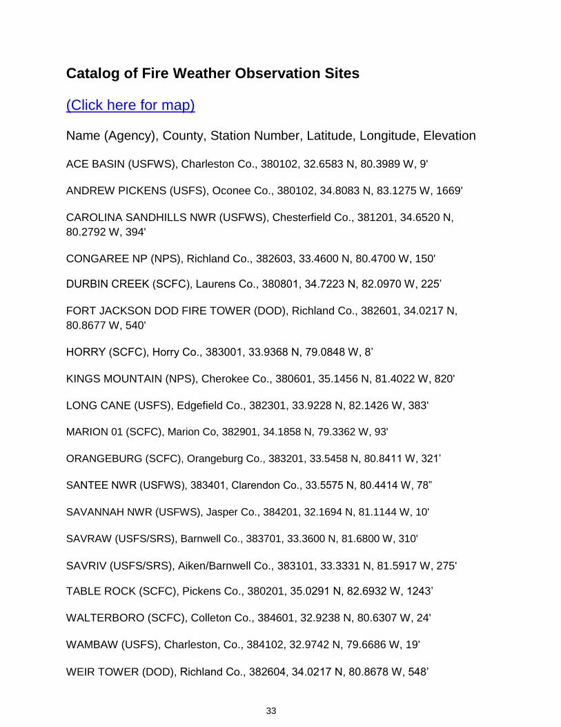
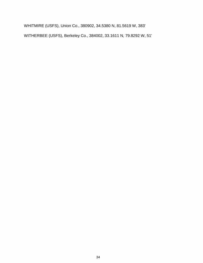
Catalog of Fire Weather Observation Sites
(Click here for map)
Name (Agency), County, Station Number, Latitude, Longitude, Elevation
ACE BASIN (USFWS), Charleston Co., 380102, 32.6583 N, 80.3989 W, 9'
ANDREW PICKENS (USFS), Oconee Co., 380102, 34.8083 N, 83.1275 W, 1669'
CAROLINA SANDHILLS NWR (USFWS), Chesterfield Co., 381201, 34.6520 N,
80.2792 W, 394'
CONGAREE NP (NPS), Richland Co., 382603, 33.4600 N, 80.4700 W, 150' DURBIN CREEK (SCFC), Laurens Co., 380801, 34.7223 N, 82.0970 W, 225’
FORT JACKSON DOD FIRE TOWER (DOD), Richland Co., 382601, 34.0217 N,
80.8677 W, 540'
HORRY (SCFC), Horry Co., 383001, 33.9368 N, 79.0848 W, 8’
KINGS MOUNTAIN (NPS), Cherokee Co., 380601, 35.1456 N, 81.4022 W, 820'
LONG CANE (USFS), Edgefield Co., 382301, 33.9228 N, 82.1426 W, 383'
MARION 01 (SCFC), Marion Co, 382901, 34.1858 N, 79.3362 W, 93'
ORANGEBURG (SCFC), Orangeburg Co., 383201, 33.5458 N, 80.8411 W, 321’
SANTEE NWR (USFWS), 383401, Clarendon Co., 33.5575 N, 80.4414 W, 78”
SAVANNAH NWR (USFWS), Jasper Co., 384201, 32.1694 N, 81.1144 W, 10'
SAVRAW (USFS/SRS), Barnwell Co., 383701, 33.3600 N, 81.6800 W, 310'
SAVRIV (USFS/SRS), Aiken/Barnwell Co., 383101, 33.3331 N, 81.5917 W, 275' TABLE ROCK (SCFC), Pickens Co., 380201, 35.0291 N, 82.6932 W, 1243’
WALTERBORO (SCFC), Colleton Co., 384601, 32.9238 N, 80.6307 W, 24'
WAMBAW (USFS), Charleston, Co., 384102, 32.9742 N, 79.6686 W, 19'
WEIR TOWER (DOD), Richland Co., 382604, 34.0217 N, 80.8678 W, 548’
34
WHITMIRE (USFS), Union Co., 380902, 34.5380 N, 81.5619 W, 383'
WITHERBEE (USFS), Berkeley Co., 384002, 33.1611 N, 79.8292 W, 51'

35
Record of Changes to the AOP
October 2006:
Noted in Services that the spot forecast format may be tabular.
January 2007:
Noted in Wildland Fire Agency Responsibilities the upcoming automation of R to O type
NFDRS observations.
Made detailed descriptions of forecast parameters in Services Provided by the National
Weather Service, and made active links to each NWS office.
February 2008:
Added a call to action statement for the Fire Danger Statement.
January 2009:
Changed dispersion information for CHS, and added information about ADI and LVORI, under Service Provided by the National Weather Service.
January 2010:
Updated the National Interagency Agreement for Meteorological Services to the 2008 - 2012 version. Added a map of RAWS Stations. Corrected the location of some RAWS sites. Added information on the Fire Weather Point Forecast Matrix (PFW).
January 2011:
Added ACE BASIN RAWS, and corrected locations and elevations of several RAWS sites in Appendix. Added Minimum Visibility and expanded definition of mixing height in
Planning Forecast section of Services.
January 2012:
Added section on the experimental AFW produced by WFO GSP, with a link to the AFW guide. Changed Wilmington, NC FPL from Ron Steve to Josh Weiss.
January 2013:
Change the Interagency Agreement link to the latest version. Made the 2013 AOP CMS compatible. Reviewed locations of RAWS sites, and added updated RAWS map.
January 2014:

36
Reorganized Red Flag Warning and Fire Weather Watch time criteria for easier comprehension. Added WFO ILM to list of offices issuing the PFW. Clarified criteria for
Fire Danger Statements.
January 2015:
Made changes to dates of AOP. Updated links to NWR sites and maps. Added information on importance of weather observations for spot forecasts.
January 2016:
Made changes to list of Meteorologists in Charge due to recent retirements. Added state agreement on Mixing Height discrepancies.
January 2017:
Made changes to list of Meteorologists in Charge and WFO fire weather focal points.
Changed Red Flag and Fire Danger Statement criteria for WFO Columbia. Changed ATMU Services to AMRS; IMETs no longer use satellite dishes or theodolites, which have been replaced by upper air radiosonde systems. January 2018:
Changes to list of Meteorologists in Charge. February 2019: Annual meeting and AOP delayed due to partial government shutdown. Updated Meteorologist in Charge, Program Leaders and Catalog of Fire Weather Observation Sites. Updated All Hazards Meteorological Response System (AMRS) to include AMRS at Wilmington, NC. Added 3 new RAWS locations, Durbin Creek, Orangeburg and Table Rock.