Embed Size (px)
Citation preview
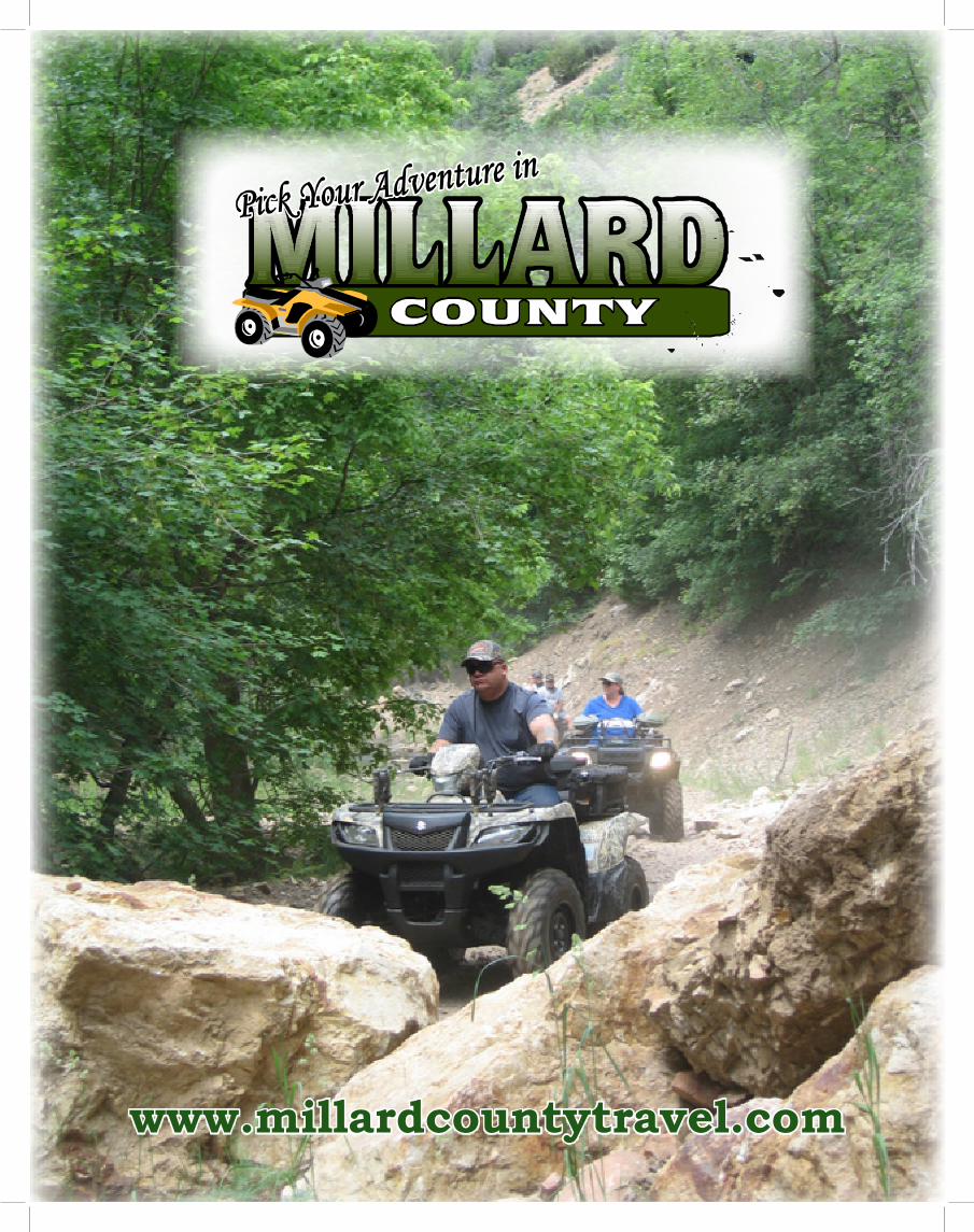
www.millardcountytravel.com
County Administration
50 South MainFillmore, Utah 84631
435-743-5227
Tourism Offices Director
71 South 200 WestPO Box 854
Delta, Utah 84624435-864-1400888-463-8627
County OfficesDelta
71 South 200 WestPO Box 854
Delta, Utah 84624435-864-1400
Delta Chamber of Commerce
76 North 200 WestDelta, Utah 84624
435-864-4316
North Park Tourism Office
460 North MainFillmore, Utah 84631
435-743-7803
Economic Development
71 South 200 WestPO Box 854
Delta, Utah 84624435-864-1407
Millard County Sheriff
765 So Highway 99, Ste. 1Fillmore, Utah 84631
435-743-5302
Fillmore City Offices75 West Center
Fillmore, Utah 84631435-743-5233
Delta City Offices76 North 200 WestDelta, Utah 84624
435-864-2759
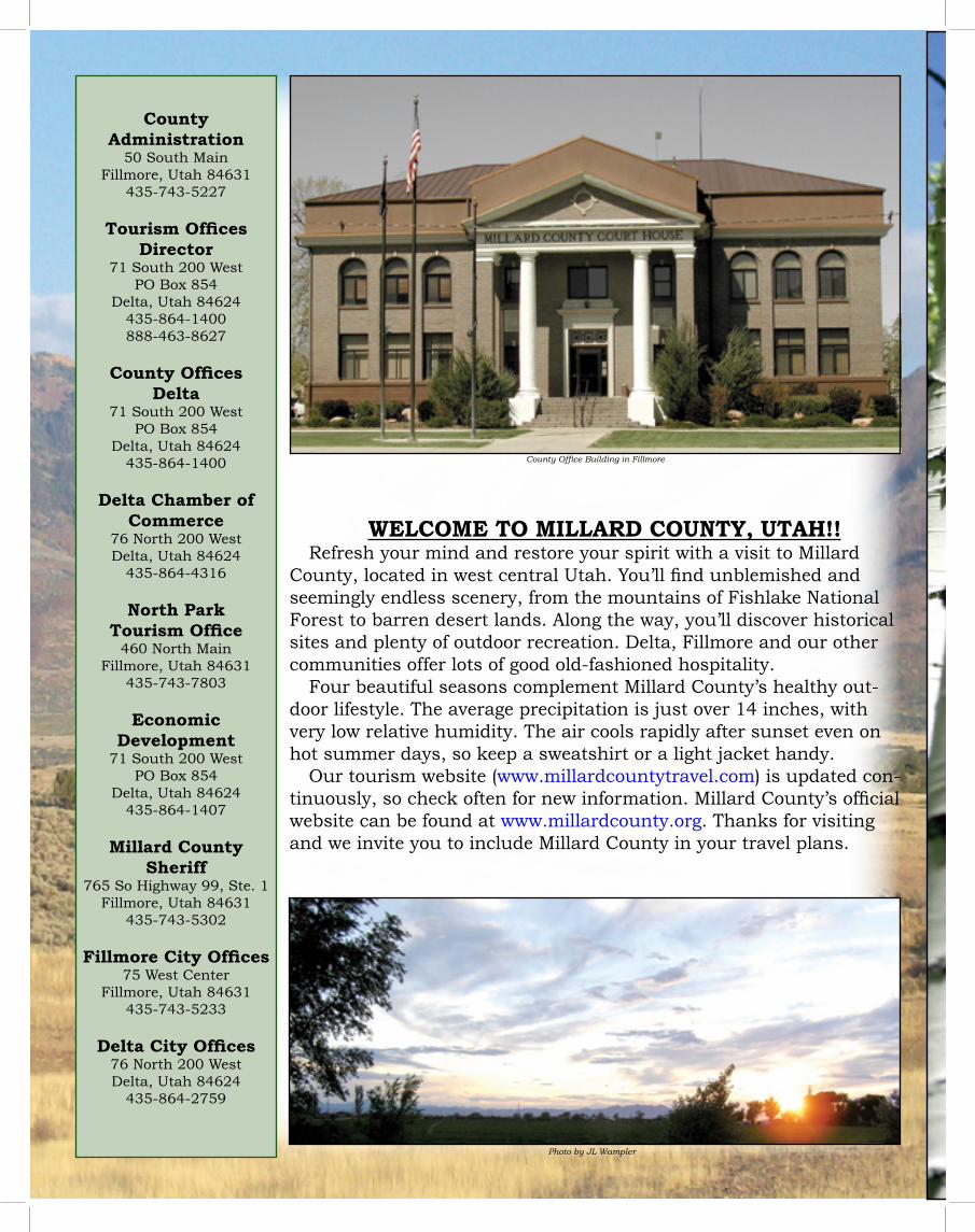
WELCOME TO MILLARD COUNTY, UTAH!!Refresh your mind and restore your spirit with a visit to Millard
County, located in west central Utah. You’ll find unblemished and seemingly endless scenery, from the mountains of Fishlake National Forest to barren desert lands. Along the way, you’ll discover historical sites and plenty of outdoor recreation. Delta, Fillmore and our other communities offer lots of good old-fashioned hospitality.
Four beautiful seasons complement Millard County’s healthy out-door lifestyle. The average precipitation is just over 14 inches, with very low relative humidity. The air cools rapidly after sunset even on hot summer days, so keep a sweatshirt or a light jacket handy.
Our tourism website (www.millardcountytravel.com) is updated con-tinuously, so check often for new information. Millard County’s official website can be found at www.millardcounty.org. Thanks for visiting and we invite you to include Millard County in your travel plans.
Photo by JL Wampler
County Office Building in Fillmore
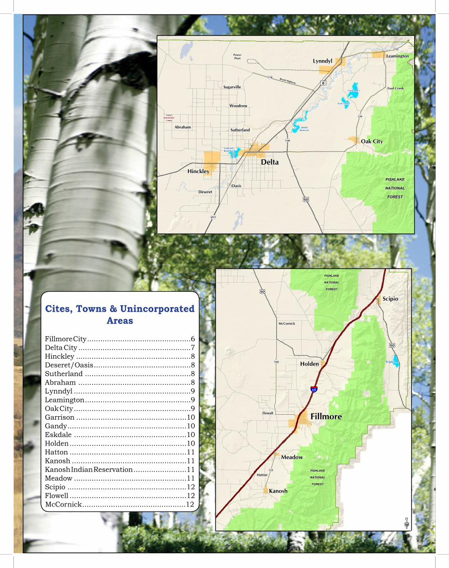
Cites, Towns & Unincorporated Areas
Fillmore City ...............................................6Delta City ...................................................7Hinckley ....................................................8Deseret/Oasis ............................................8Sutherland ................................................8Abraham ...................................................8Lynndyl .....................................................9Leamington ................................................9Oak City .....................................................9Garrison ..................................................10Gandy ......................................................10Eskdale ...................................................10Holden .....................................................10Hatton .....................................................11Kanosh ....................................................11Kanosh Indian Reservation ........................11Meadow ...................................................11Scipio ......................................................12Flowell .....................................................12McCornick ...............................................12
136
257
£¤6
132
125
174
£¤50
FISHLAKE
NATIONAL
FOREST
DeltaHinckley
AbrahamSutherland
Woodrow
Sugarville
OasisDeseret
Oak City
LynndylLeamington
Brush Highway
PowerPlant
Fool Creek
DMADReservoir
Fool Creek 2
Fool Creek 1
GunnisonBend Res.
TopazInternment
Camp
Millard County, Utah
100
£¤50
£¤50
133
§̈¦15
FISHLAKE
NATIONAL
FOREST
FISHLAKE
NATIONAL
FOREST
Delta
Fillmore
Oasis
Holden
Scipio
Meadow
Kanosh
Hatton
Flowell
McCornick
Scipio L.
·
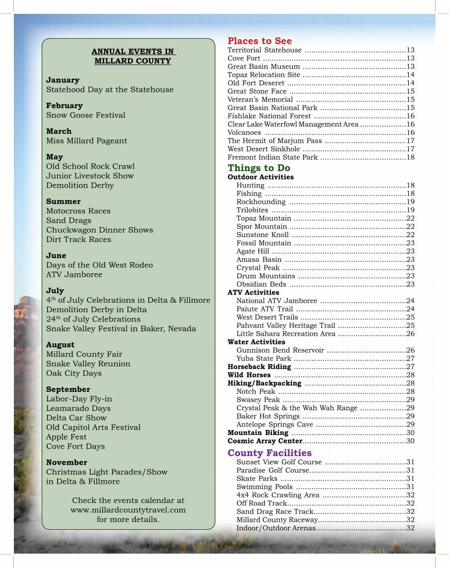
ANNUAL EVENTS IN MILLARD COUNTY
January Statehood Day at the Statehouse
February Snow Goose Festival
March Miss Millard Pageant
May Old School Rock CrawlJunior Livestock ShowDemolition Derby
Summer Motocross RacesSand DragsChuckwagon Dinner ShowsDirt Track Races
June Days of the Old West RodeoATV Jamboree
July 4th of July Celebrations in Delta & FillmoreDemolition Derby in Delta24th of July CelebrationsSnake Valley Festival in Baker, Nevada
AugustMillard County FairSnake Valley ReunionOak City Days
September Labor-Day Fly-inLeamarado DaysDelta Car ShowOld Capitol Arts FestivalApple FestCove Fort Days
November Christmas Light Parades/Show in Delta & Fillmore
Check the events calendar at www.millardcountytravel.com
for more details.
Places to SeeTerritorial Statehouse ..............................................13Cove Fort .................................................................13Great Basin Museum ...............................................13Topaz Relocation Site ...............................................14Old Fort Deseret ......................................................14Great Stone Face .....................................................15Veteran’s Memorial ..................................................15Great Basin National Park .......................................15Fishlake National Forest ..........................................16Clear Lake Waterfowl Management Area .....................16Volcanoes ................................................................16The Hermit of Marjum Pass .....................................17West Desert Sinkhole ...............................................17Fremont Indian State Park .......................................18
Things to DoOutdoor Activities
Hunting ...............................................................18Fishing ................................................................18Rockhounding .....................................................19Trilobites .............................................................19Topaz Mountain ...................................................22Spor Mountain .....................................................22Sunstone Knoll ....................................................22Fossil Mountain ...................................................23Agate Hill .............................................................23Amasa Basin .......................................................23Crystal Peak ........................................................23Drum Mountains .................................................23Obsidian Beds .....................................................23
ATV ActivitiesNational ATV Jamboree .......................................24Paiute ATV Trail ..................................................24West Desert Trails ................................................25Pahvant Valley Heritage Trail ...............................25Little Sahara Recreation Area ...............................26
Water ActivitiesGunnison Bend Reservoir ....................................26Yuba State Park ...................................................27
Horseback Riding ...................................................27Wild Horses ............................................................28Hiking/Backpacking ..............................................28
Notch Peak ..........................................................28Swasey Peak ........................................................29Crystal Peak & the Wah Wah Range .....................29Baker Hot Springs ...............................................29Antelope Springs Cave .........................................29
Mountain Biking ....................................................30Cosmic Array Center...............................................30
County FacilitiesSunset View Golf Course .....................................31Paradise Golf Course............................................31Skate Parks .........................................................31Swimming Pools ..................................................314x4 Rock Crawling Area ......................................32Off Road Track......................................................32Sand Drag Race Track..........................................32Millard County Raceway........................................32Indoor/Outdoor Arenas.........................................32
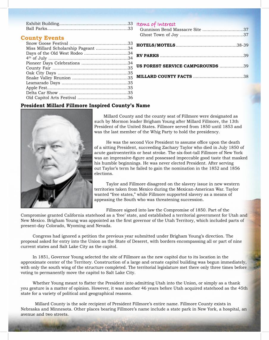
Exhibit Building....................................................33Ball Parks.............................................................33
County EventsSnow Goose Festival ............................................33Miss Millard Scholarship Pageant ........................34Days of the Old West Rodeo .................................344th of July ............................................................34Pioneer Days Celebrations ...................................34County Fair .........................................................35Oak City Days .....................................................35Snake Valley Reunion ..........................................35Leamarado Days ..................................................35Apple Fest.............................................................35Delta Car Show ....................................................35Old Capitol Arts Festival ......................................36
President Millard Fillmore Inspired County’s Name
Millard County and the county seat of Fillmore were designated as such by Mormon leader Brigham Young after Millard Fillmore, the 13th President of the United States. Fillmore served from 1850 until 1853 and was the last member of the Whig Party to hold the presidency.
He was the second Vice President to assume office upon the death of a sitting President, succeeding Zachary Taylor who died in July 1850 of acute gastroenteritis or heat stroke. The six-foot-tall Fillmore of New York was an impressive-figure and possessed impeccable good taste that masked his humble beginnings. He was never elected President. After serving out Taylor’s term he failed to gain the nomination in the 1852 and 1856 elections.
Taylor and Fillmore disagreed on the slavery issue in new western territories taken from Mexico during the Mexican-American War. Taylor wanted “free states,” while Fillmore supported slavery as a means of appeasing the South who was threatening succession.
Fillmore signed into law the Compromise of 1850. Part of the Compromise granted California statehood as a ‘free’ state, and established a territorial government for Utah and New Mexico. Brigham Young was appointed as the first governor of the Utah Territory, which included parts of present-day Colorado, Wyoming and Nevada.
Congress had ignored a petition the previous year submitted under Brigham Young’s direction. The proposal asked for entry into the Union as the State of Deseret, with borders encompassing all or part of nine current states and Salt Lake City as the capitol.
In 1851, Governor Young selected the site of Fillmore as the new capitol due to its location in the approximate center of the Territory. Construction of a large and ornate capitol building was begun immediately, with only the south wing of the structure completed. The territorial legislature met there only three times before voting to permanently move the capitol to Salt Lake City.
Whether Young meant to flatter the President into admitting Utah into the Union, or simply as a thank you gesture is a matter of opinion. However, it was another 46 years before Utah acquired statehood as the 45th state for a variety of political and geographical reasons.
Millard County is the sole recipient of President Fillmore’s entire name. Fillmore County exists in Nebraska and Minnesota. Other places bearing Fillmore’s name include a state park in New York, a hospital, an avenue and two streets.
Items of InterestGunnison Bend Massacre Site ...............................37Ghost Town of Joy ................................................37
HOTELS/MOTELS ..............................................38-39
RV PARKS ...............................................................39
US FOREST SERVICE CAMPGROUNDS ..................39
MILLARD COUNTY FACTS ......................................38
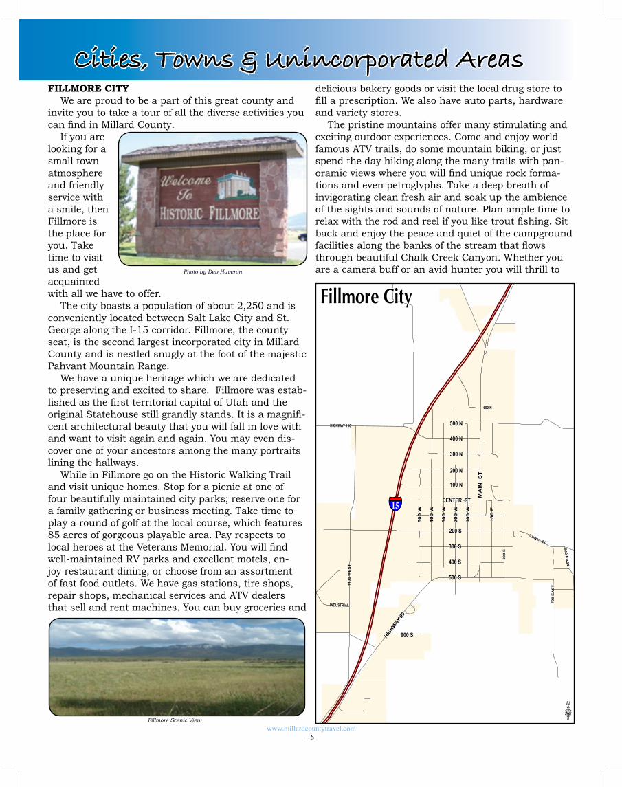
FILLMORE CITYWe are proud to be a part of this great county and
invite you to take a tour of all the diverse activities you can find in Millard County.
If you are looking for a small town atmosphere and friendly service with a smile, then Fillmore is the place for you. Take time to visit us and get acquainted with all we have to offer.
The city boasts a population of about 2,250 and is conveniently located between Salt Lake City and St. George along the I-15 corridor. Fillmore, the county seat, is the second largest incorporated city in Millard County and is nestled snugly at the foot of the majestic Pahvant Mountain Range.
We have a unique heritage which we are dedicated to preserving and excited to share. Fillmore was estab-lished as the first territorial capital of Utah and the original Statehouse still grandly stands. It is a magnifi-cent architectural beauty that you will fall in love with and want to visit again and again. You may even dis-cover one of your ancestors among the many portraits lining the hallways.
While in Fillmore go on the Historic Walking Trail and visit unique homes. Stop for a picnic at one of four beautifully maintained city parks; reserve one for a family gathering or business meeting. Take time to play a round of golf at the local course, which features 85 acres of gorgeous playable area. Pay respects to local heroes at the Veterans Memorial. You will find well-maintained RV parks and excellent motels, en-joy restaurant dining, or choose from an assortment of fast food outlets. We have gas stations, tire shops, repair shops, mechanical services and ATV dealers that sell and rent machines. You can buy groceries and
delicious bakery goods or visit the local drug store to fill a prescription. We also have auto parts, hardware and variety stores.
The pristine mountains offer many stimulating and exciting outdoor experiences. Come and enjoy world famous ATV trails, do some mountain biking, or just spend the day hiking along the many trails with pan-oramic views where you will find unique rock forma-tions and even petroglyphs. Take a deep breath of invigorating clean fresh air and soak up the ambience of the sights and sounds of nature. Plan ample time to relax with the rod and reel if you like trout fishing. Sit back and enjoy the peace and quiet of the campground facilities along the banks of the stream that flows through beautiful Chalk Creek Canyon. Whether you are a camera buff or an avid hunter you will thrill to Photo by Deb Haveron
Fillmore Scenic View
www.millardcountytravel.com - 6 -
Cities, Towns & Unincorporated Areas
§̈¦15200 S
Canyon Rd
MA
IN
ST
110
0 W
ES
T
40
0 W
30
0 W
10
0 W
AIRWAY
CENTER ST
400 S
300 S
100 N
20
0 W
500 N
1000 SOUTH
HIGHWAY 100
10
0 E
HIGHW
AY 99
300 N
200
E
700
EA
ST
850 NORTH
50
0 W
200 N
400 N
800 E
AS
T
900 S
INDUSTRIAL
600 N
500 S
·
Fillmore City
the sights of deer, elk, cougar, and wild turkeys.To the west of Fillmore, the Pahvant Valley is dotted
with volcanic remains, sand hills, and miles and miles of great adventure. Lat 38.968861 Lon -112.323692
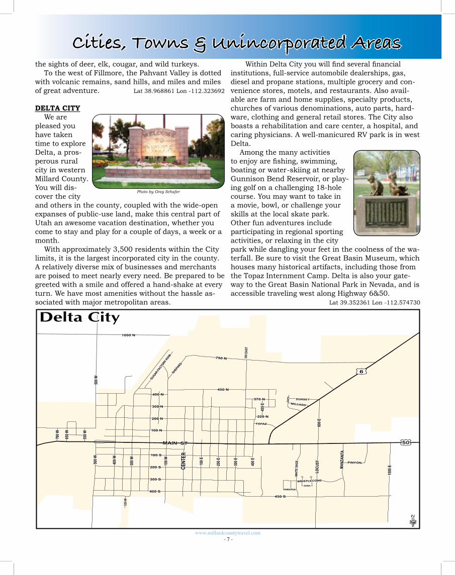
DELTA CITYWe are
pleased you have taken time to explore Delta, a pros-perous rural city in western Millard County. You will dis-cover the city and others in the county, coupled with the wide-open expanses of public-use land, make this central part of Utah an awesome vacation destination, whether you come to stay and play for a couple of days, a week or a month.
With approximately 3,500 residents within the City limits, it is the largest incorporated city in the county. A relatively diverse mix of businesses and merchants are poised to meet nearly every need. Be prepared to be greeted with a smile and offered a hand-shake at every turn. We have most amenities without the hassle as-sociated with major metropolitan areas.
Within Delta City you will find several financial institutions, full-service automobile dealerships, gas, diesel and propane stations, multiple grocery and con-venience stores, motels, and restaurants. Also avail-able are farm and home supplies, specialty products, churches of various denominations, auto parts, hard-ware, clothing and general retail stores. The City also boasts a rehabilitation and care center, a hospital, and caring physicians. A well-manicured RV park is in west Delta.
Among the many activities to enjoy are fishing, swimming, boating or water-skiing at nearby Gunnison Bend Reservoir, or play-ing golf on a challenging 18-hole course. You may want to take in a movie, bowl, or challenge your skills at the local skate park. Other fun adventures include participating in regional sporting activities, or relaxing in the city park while dangling your feet in the coolness of the wa-terfall. Be sure to visit the Great Basin Museum, which houses many historical artifacts, including those from the Topaz Internment Camp. Delta is also your gate-way to the Great Basin National Park in Nevada, and is accessible traveling west along Highway 6&50.
Lat 39.352361 Lon -112.574730
Photo by Greg Schafer
www.millardcountytravel.com - 7 -
Cities, Towns & Unincorporated Areas
200 N
100 N
100 S
200 S
300 S
400 S
400 W
300 W
100 W
100 E
200 E
300 E
400 E
700 W
550 W
650 W
500 W
400 N
450 S
370 N
220 N
£¤6
£¤50
1000 N
MAIN ST
750 N
CENT
ER
300 N
450 N
LOCU
ST
1500
E
800 E
MANZ
ANITA
WHI
TE S
AGE
BRISTLECONE
DAYS
SHEPARD
TOPAZ
SUNSET
PINYON
SUGAR FA
CTORY R
OW
455 E
OAK
MILLARD
TAMARIX
320 W
350 E
AST
500 W
·
Delta City
HINCKLEY TOWNSettled in1876 by Mormon pioneers, the town was
first called Deseret #3, as part of the Deseret LDS Ward, then Bloomington, and finally Hinckley. The name was given in honor of Ira Hinckley, who was then the Millard Stake President.
During the settlement of Hinckley, rattlesnakes were a major problem. Through the hard work of the towns-people, it soon became a thriving community with rich farmland. Hinckley is the last town in Millard County before embarking on Highway 6&50 going west, which was named “America’s Loneliest Highway.” Lat 39.323431 Lon -112.671240
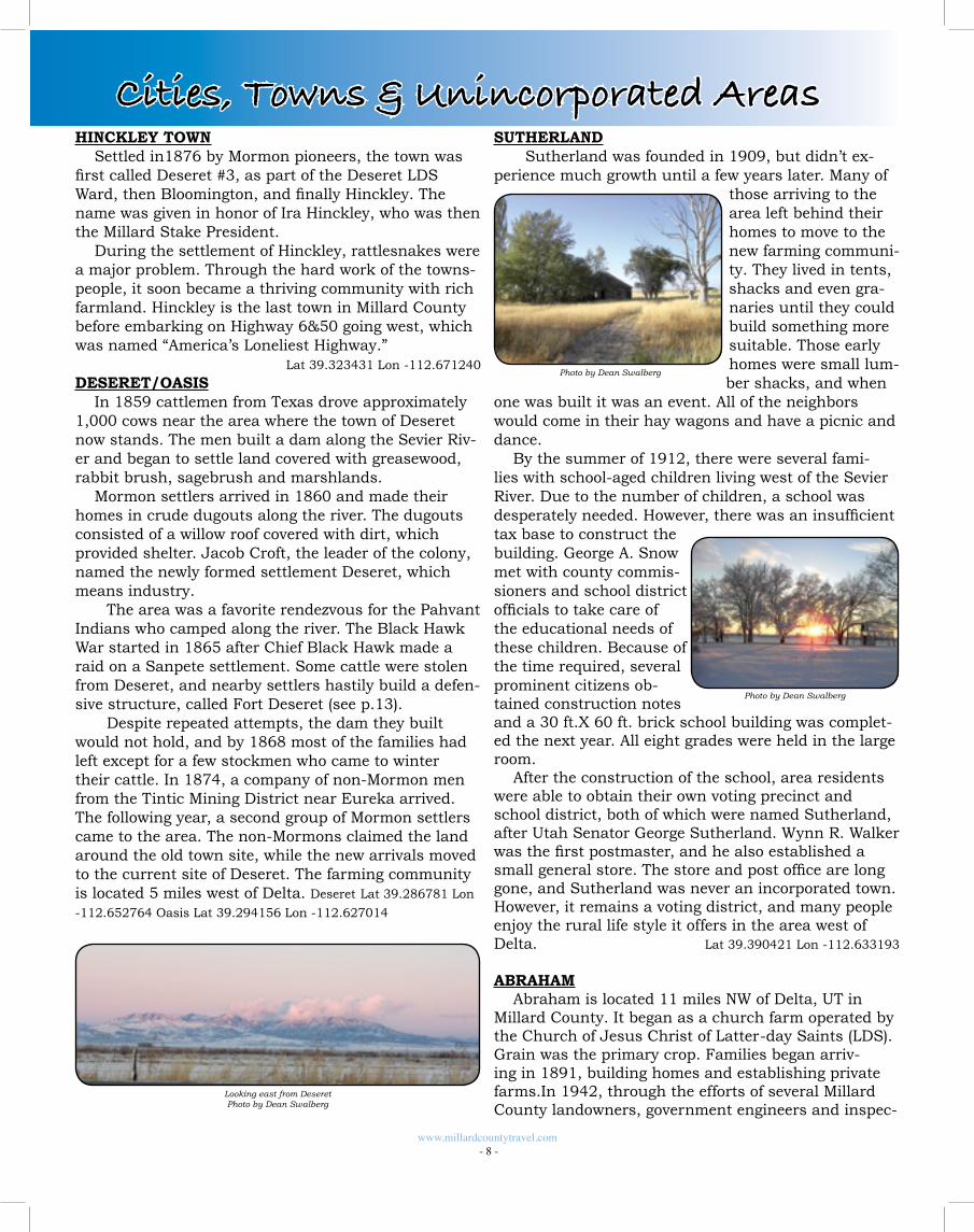
DESERET/OASISIn 1859 cattlemen from Texas drove approximately
1,000 cows near the area where the town of Deseret now stands. The men built a dam along the Sevier Riv-er and began to settle land covered with greasewood, rabbit brush, sagebrush and marshlands.
Mormon settlers arrived in 1860 and made their homes in crude dugouts along the river. The dugouts consisted of a willow roof covered with dirt, which provided shelter. Jacob Croft, the leader of the colony, named the newly formed settlement Deseret, which means industry.
The area was a favorite rendezvous for the Pahvant Indians who camped along the river. The Black Hawk War started in 1865 after Chief Black Hawk made a raid on a Sanpete settlement. Some cattle were stolen from Deseret, and nearby settlers hastily build a defen-sive structure, called Fort Deseret (see p.13).
Despite repeated attempts, the dam they built would not hold, and by 1868 most of the families had left except for a few stockmen who came to winter their cattle. In 1874, a company of non-Mormon men from the Tintic Mining District near Eureka arrived. The following year, a second group of Mormon settlers came to the area. The non-Mormons claimed the land around the old town site, while the new arrivals moved to the current site of Deseret. The farming community is located 5 miles west of Delta. Deseret Lat 39.286781 Lon
-112.652764 Oasis Lat 39.294156 Lon -112.627014
SUTHERLAND Sutherland was founded in 1909, but didn’t ex-
perience much growth until a few years later. Many of those arriving to the area left behind their homes to move to the new farming communi-ty. They lived in tents, shacks and even gra-naries until they could build something more suitable. Those early homes were small lum-ber shacks, and when
one was built it was an event. All of the neighbors would come in their hay wagons and have a picnic and dance.
By the summer of 1912, there were several fami-lies with school-aged children living west of the Sevier River. Due to the number of children, a school was desperately needed. However, there was an insufficient tax base to construct the building. George A. Snow met with county commis-sioners and school district officials to take care of the educational needs of these children. Because of the time required, several prominent citizens ob-tained construction notes and a 30 ft.X 60 ft. brick school building was complet-ed the next year. All eight grades were held in the large room.
After the construction of the school, area residents were able to obtain their own voting precinct and school district, both of which were named Sutherland, after Utah Senator George Sutherland. Wynn R. Walker was the first postmaster, and he also established a small general store. The store and post office are long gone, and Sutherland was never an incorporated town. However, it remains a voting district, and many people enjoy the rural life style it offers in the area west of Delta. Lat 39.390421 Lon -112.633193
ABRAHAMAbraham is located 11 miles NW of Delta, UT in
Millard County. It began as a church farm operated by the Church of Jesus Christ of Latter-day Saints (LDS). Grain was the primary crop. Families began arriv-ing in 1891, building homes and establishing private farms.In 1942, through the efforts of several Millard County landowners, government engineers and inspec-
www.millardcountytravel.com - 8 -
Cities, Towns & Unincorporated Areas
Looking east from DeseretPhoto by Dean Swalberg
Photo by Dean Swalberg
Photo by Dean Swalberg
tors, a large area of land was purchased from several Abraham landowners to become part of the Topaz Relocation Center. Most of those who sold their lands then moved to nearby towns, leaving behind only 50 residents. After World War II, the government notified these farmers that they could buy back their land.Many of them did purchase their land back and re-established homes and farms in the area.
The area was settled in 1870 primarily as a farm-ing district and was named after Abraham Cannon, who was a prominent member of the Church of Jesus Christ of Latter-day Saints (LDS). The growth of Abra-ham peaked in 1927 with approximately 400 people.In 1942, the Topaz Relocation Center housed 5,000 Japa-nese. As of 2011 there are approximately 50 families residing in the Abraham area.
LiquaDry, Inc. is the major industrial entity in the community and employs approximately 60-70 people.There is also opportunity for employment on farms and ranches in the area as well as some of the local dairies. The Intermountain Power Plant (IPP) and Graymont Limestone also provide employment for some members of the community.
Farming and ranching make up the primary eco-nomic activities for the Abraham area.Alfalfa for hay and seed is the primary crop. Small grains such as barley, wheat and oats, as well as silage corn and corn for grain are also becoming more popular. Beef cattle comprise the majority of livestock operations in the area. There are also several dairies in the Abraham community.
There are many different recreational activities that can be enjoyed by individuals and families in the area surrounding Abraham. Traveling on the deserts nearby provides opportunities to view wildlife such as prong-horn antelope and wild mustangs and also provides exciting opportunities for the professional and amateur photographer. Camping can be enjoyed in the ample open spaces. A visit to the Topaz Relocation Center remains provides a look into the past and the history of our country. Perhaps most satisfying of all are the many opportunities to just get away from the conges-tion of the city. Lat 39.396532 Lon -112.718192
LYNNDYL TOWN Lynndyl is located 17 miles northeast of Delta on
Highway 6. The main line of the Union Pacific Railroad from Salt Lake City to Los Angeles goes through the western edge of town.
The town began in 1907 and was the first railroad terminal south of Salt Lake City. At Lynndyl’s peak, there was a railroad shop, railroad station, land office for railroad officials and a large hotel. In 1911, set-tlers came to farm the area and the town was given the
name Lynn, which was later changed by the post office to Lynndyl. Lat 39.519254 Lon -112.375460
LEAMINGTON TOWNLeamington was settled in 1871 by a small group
of people that came from Oak City to acquire farm ground. It was one of the few communities not au-thorized by the Mormon Church. The first permanent homes were built in 1873. The town was named by Frank Young, who was a nephew of Brigham Young and among the first settlers. He selected the name from Leamington, England.
One of the first projects in settling the town was to build ditches to irrigate the ground. The water was taken from the Sevier River. Several attempts to dam the river failed. As a result, the settlers had to remove water several miles upstream. This meant digging ditches several miles further than anticipated. Most of the settlers were farm-ers, but by 1879 the railroad came through town, which provided employment for some people. Two stores and a hotel were built, as well as a church and a school.
The current population of Leamington is approximately 200, many of which are descendants of some of the first settlers.
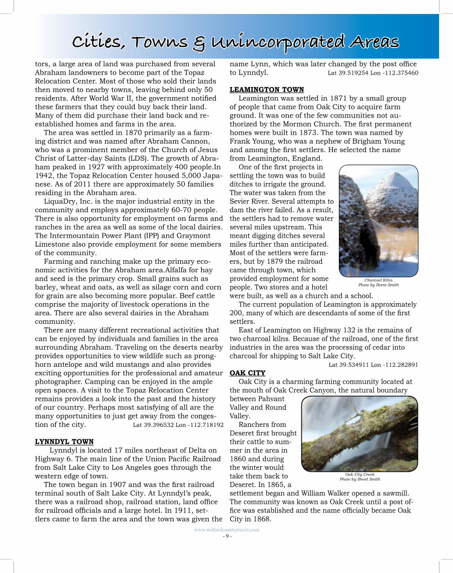
East of Leamington on Highway 132 is the remains of two charcoal kilns. Because of the railroad, one of the first industries in the area was the processing of cedar into charcoal for shipping to Salt Lake City.
Lat 39.534911 Lon -112.282891
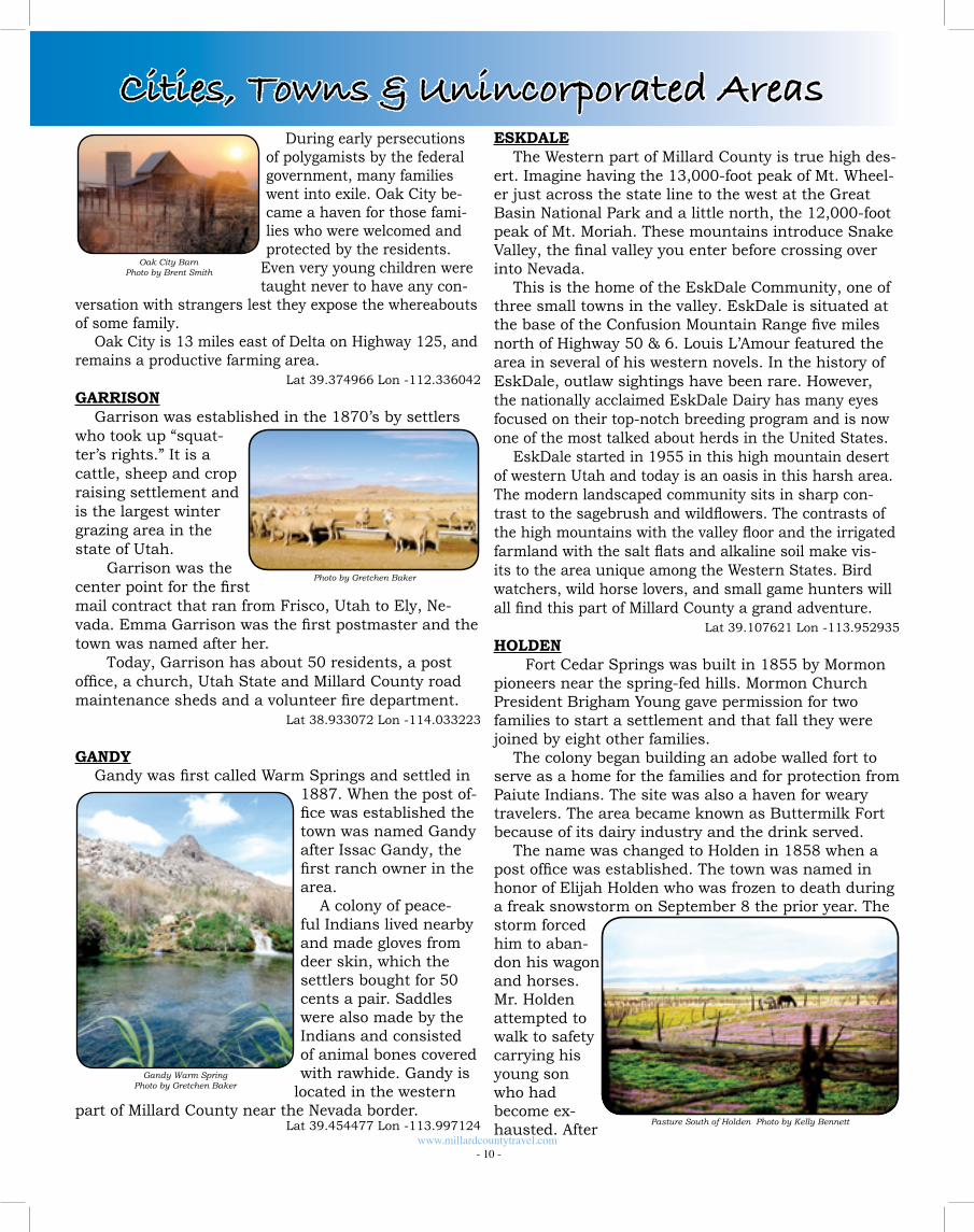
OAK CITYOak City is a charming farming community located at
the mouth of Oak Creek Canyon, the natural boundary between Pahvant Valley and Round Valley.
Ranchers from Deseret first brought their cattle to sum-mer in the area in 1860 and during the winter would take them back to Deseret. In 1865, a settlement began and William Walker opened a sawmill. The community was known as Oak Creek until a post of-fice was established and the name officially became Oak City in 1868.
Charcoal KilnsPhoto by Brent Smith
Oak City CreekPhoto by Brent Smith
www.millardcountytravel.com - 9 -
Cities, Towns & Unincorporated Areas
During early persecutions of polygamists by the federal government, many families went into exile. Oak City be-came a haven for those fami-lies who were welcomed and protected by the residents.
Even very young children were taught never to have any con-
versation with strangers lest they expose the whereabouts of some family.
Oak City is 13 miles east of Delta on Highway 125, and remains a productive farming area.
Lat 39.374966 Lon -112.336042
GARRISONGarrison was established in the 1870’s by settlers
who took up “squat-ter’s rights.” It is a cattle, sheep and crop raising settlement and is the largest winter grazing area in the state of Utah. Garrison was the center point for the first mail contract that ran from Frisco, Utah to Ely, Ne-vada. Emma Garrison was the first postmaster and the town was named after her. Today, Garrison has about 50 residents, a post office, a church, Utah State and Millard County road maintenance sheds and a volunteer fire department. Lat 38.933072 Lon -114.033223
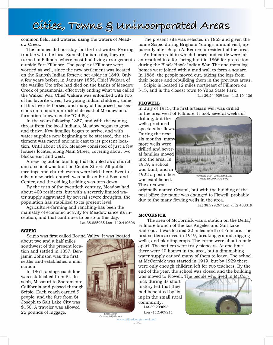
GANDYGandy was first called Warm Springs and settled in
1887. When the post of-fice was established the town was named Gandy after Issac Gandy, the first ranch owner in the area.
A colony of peace-ful Indians lived nearby and made gloves from deer skin, which the settlers bought for 50 cents a pair. Saddles were also made by the Indians and consisted of animal bones covered with rawhide. Gandy is
located in the western part of Millard County near the Nevada border.
Lat 39.454477 Lon -113.997124
ESKDALEThe Western part of Millard County is true high des-
ert. Imagine having the 13,000-foot peak of Mt. Wheel-er just across the state line to the west at the Great Basin National Park and a little north, the 12,000-foot peak of Mt. Moriah. These mountains introduce Snake Valley, the final valley you enter before crossing over into Nevada.
This is the home of the EskDale Community, one of three small towns in the valley. EskDale is situated at the base of the Confusion Mountain Range five miles north of Highway 50 & 6. Louis L’Amour featured the area in several of his western novels. In the history of EskDale, outlaw sightings have been rare. However, the nationally acclaimed EskDale Dairy has many eyes focused on their top-notch breeding program and is now one of the most talked about herds in the United States.
EskDale started in 1955 in this high mountain desert of western Utah and today is an oasis in this harsh area. The modern landscaped community sits in sharp con-trast to the sagebrush and wildflowers. The contrasts of the high mountains with the valley floor and the irrigated farmland with the salt flats and alkaline soil make vis-its to the area unique among the Western States. Bird watchers, wild horse lovers, and small game hunters will all find this part of Millard County a grand adventure.
Lat 39.107621 Lon -113.952935
HOLDEN Fort Cedar Springs was built in 1855 by Mormon
pioneers near the spring-fed hills. Mormon Church President Brigham Young gave permission for two families to start a settlement and that fall they were joined by eight other families.
The colony began building an adobe walled fort to serve as a home for the families and for protection from Paiute Indians. The site was also a haven for weary travelers. The area became known as Buttermilk Fort because of its dairy industry and the drink served.
The name was changed to Holden in 1858 when a post office was established. The town was named in honor of Elijah Holden who was frozen to death during a freak snowstorm on September 8 the prior year. The storm forced him to aban-don his wagon and horses. Mr. Holden attempted to walk to safety carrying his young son who had become ex-hausted. After
www.millardcountytravel.com - 10 -
Cities, Towns & Unincorporated Areas
Pasture South of Holden Photo by Kelly Bennett
Oak City BarnPhoto by Brent Smith
Gandy Warm SpringPhoto by Gretchen Baker
Photo by Gretchen Baker
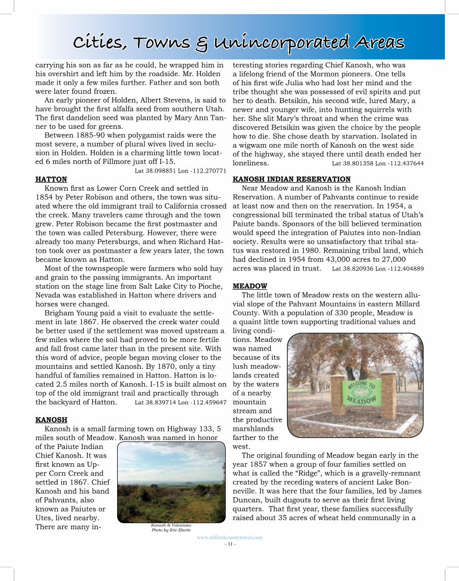
carrying his son as far as he could, he wrapped him in his overshirt and left him by the roadside. Mr. Holden made it only a few miles further. Father and son both were later found frozen.
An early pioneer of Holden, Albert Stevens, is said to have brought the first alfalfa seed from southern Utah. The first dandelion seed was planted by Mary Ann Tan-ner to be used for greens.
Between 1885-90 when polygamist raids were the most severe, a number of plural wives lived in seclu-sion in Holden. Holden is a charming little town locat-ed 6 miles north of Fillmore just off I-15.
Lat 38.098851 Lon -112.270771
HATTONKnown first as Lower Corn Creek and settled in
1854 by Peter Robison and others, the town was situ-ated where the old immigrant trail to California crossed the creek. Many travelers came through and the town grew. Peter Robison became the first postmaster and the town was called Petersburg. However, there were already too many Petersburgs, and when Richard Hat-ton took over as postmaster a few years later, the town became known as Hatton.
Most of the townspeople were farmers who sold hay and grain to the passing immigrants. An important station on the stage line from Salt Lake City to Pioche, Nevada was established in Hatton where drivers and horses were changed.
Brigham Young paid a visit to evaluate the settle-ment in late 1867. He observed the creek water could be better used if the settlement was moved upstream a few miles where the soil had proved to be more fertile and fall frost came later than in the present site. With this word of advice, people began moving closer to the mountains and settled Kanosh. By 1870, only a tiny handful of families remained in Hatton. Hatton is lo-cated 2.5 miles north of Kanosh. I-15 is built almost on top of the old immigrant trail and practically through the backyard of Hatton. Lat 38.839714 Lon -112.459647
KANOSHKanosh is a small farming town on Highway 133, 5
miles south of Meadow. Kanosh was named in honor of the Paiute Indian Chief Kanosh. It was first known as Up-per Corn Creek and settled in 1867. Chief Kanosh and his band of Pahvants, also known as Paiutes or Utes, lived nearby. There are many in-
teresting stories regarding Chief Kanosh, who was a lifelong friend of the Mormon pioneers. One tells of his first wife Julia who had lost her mind and the tribe thought she was possessed of evil spirits and put her to death. Betsikin, his second wife, lured Mary, a newer and younger wife, into hunting squirrels with her. She slit Mary’s throat and when the crime was discovered Betsikin was given the choice by the people how to die. She chose death by starvation. Isolated in a wigwam one mile north of Kanosh on the west side of the highway, she stayed there until death ended her loneliness. Lat 38.801358 Lon -112.437644
KANOSH INDIAN RESERVATIONNear Meadow and Kanosh is the Kanosh Indian
Reservation. A number of Pahvants continue to reside at least now and then on the reservation. In 1954, a congressional bill terminated the tribal status of Utah’s Paiute bands. Sponsors of the bill believed termination would speed the integration of Paiutes into non-Indian society. Results were so unsatisfactory that tribal sta-tus was restored in 1980. Remaining tribal land, which had declined in 1954 from 43,000 acres to 27,000 acres was placed in trust. Lat 38.820936 Lon -112.404889
MEADOWThe little town of Meadow rests on the western allu-
vial slope of the Pahvant Mountains in eastern Millard County. With a population of 330 people, Meadow is a quaint little town supporting traditional values and living condi-tions. Meadow was named because of its lush meadow-lands created by the waters of a nearby mountain stream and the productive marshlands farther to the west.
The original founding of Meadow began early in the year 1857 when a group of four families settled on what is called the “Ridge”, which is a gravelly-remnant created by the receding waters of ancient Lake Bon-neville. It was here that the four families, led by James Duncan, built dugouts to serve as their first living quarters. That first year, these families successfully raised about 35 acres of wheat held communally in a
www.millardcountytravel.com - 11 -
Kanosh & VolcanoesPhoto by Eric Eberle
Cities, Towns & Unincorporated Areas
The present site was selected in 1863 and given the name Scipio during Brigham Young’s annual visit, ap-parently after Scipio A. Kenner, a resident of the area.
An Indian raid in which horses and cattle were tak-en resulted in a fort being built in 1866 for protection during the Black Hawk Indian War. The one room log homes were joined with a mud wall to form a square. In 1886, the people moved out, taking the logs from their homes and rebuilding them in the previous areas.
Scipio is located 12 miles northeast of Fillmore on I-15, and is the closest town to Yuba State Park.
Lat 39.244909 Lon -112.104136
FLOWELLIn July of 1915, the first artesian well was drilled in the area west of Fillmore. It took several weeks of drilling, but the wells produced spectacular flows. During the next six months, many more wells were drilled and sever-al families moved into the area. In 1919, a school was built, and in 1922 a post office was established. The area was originally named Crystal, but with the building of the post office the name was changed to Flowell, probably due to the many flowing wells in the area. Lat 38.979267 Lon -112.433319
McCORNICK The area of McCornick was a station on the Delta/
Fillmore branch of the Los Angeles and Salt Lake Railroad. It was located 22 miles north of Fillmore. The first settlers arrived in 1919, breaking ground, digging wells, and planting crops. The farms were about a mile apart. The settlers were truly pioneers. At one time there were 40 homes in the area, but a diminishing water supply caused many of them to leave. The school at McCornick was started in 1919, but by 1929 there were only enough children left for two teachers. By the end of the year, the school was closed and the building was moved to Flowell. The people who lived in McCor-nick during its short history felt that they had benefitted by liv-ing in the small rural community.
Lat 39.209693
Lon -112.409211
common field, and watered using the waters of Mead-ow Creek.
The families did not stay for the first winter. Fearing trouble with the local Kanosh Indian tribe, they re-turned to Fillmore where most had living arrangements outside Fort Fillmore. The people of Fillmore were worried as well, since the new settlement was located on the Kanosh Indian Reserve set aside in 1849. Only a few years before, in January 1855, Chief Wakara of the warlike Ute tribe had died on the banks of Meadow Creek of pneumonia, effectively ending what was called the Walker War. Chief Wakara was entombed with two of his favorite wives, two young Indian children, some of this favorite horses, and many of his prized posses-sions on a mountain rock slide east of Meadow on a formation known as the “Old Pig”.
In the years following 1857, and with the waning threat from the local Indians, Meadow began to grow and thrive. New families began to arrive, and with water supplies now beginning to be stressed, the set-tlement was moved one mile east to its present loca-tion. Until about 1865, Meadow consisted of just a few houses located along Main Street, covering about two blocks east and west.
A new log public building that doubled as a church and a school was built on Center Street. All public meetings and church events were held there. Eventu-ally, a new brick church was built on First East and Center, and the old log building was torn down.
By the turn of the twentieth century, Meadow had about 400 residents, but with a severely limited wa-ter supply aggravated by several severe droughts, the population has stabilized to its present level.
Agriculture-farming and ranching-has been the mainstay of economic activity for Meadow since its in-ception, and that continues to be so to this day.
Lat 38.885935 Lon -112.410606
SCIPIOScipio was first called Round Valley. It was located
about two and a half miles southwest of the present loca-tion and settled in 1857. Ben-jamin Johnson was the first settler and established a mail station.
In 1861, a stagecoach line was established from St. Jo-seph, Missouri to Sacramento, California and passed through Scipio. Each coach carried 9 people, and the fare from St. Joseph to Salt Lake City was $150. A traveler was allowed 25 pounds of luggage.
www.millardcountytravel.com - 12 -
Highway 100 - Cool Spring DayPhoto by Dean Swalberg
Cities, Towns & Unincorporated Areas
Scipio StationPhoto by Kelly Bennett
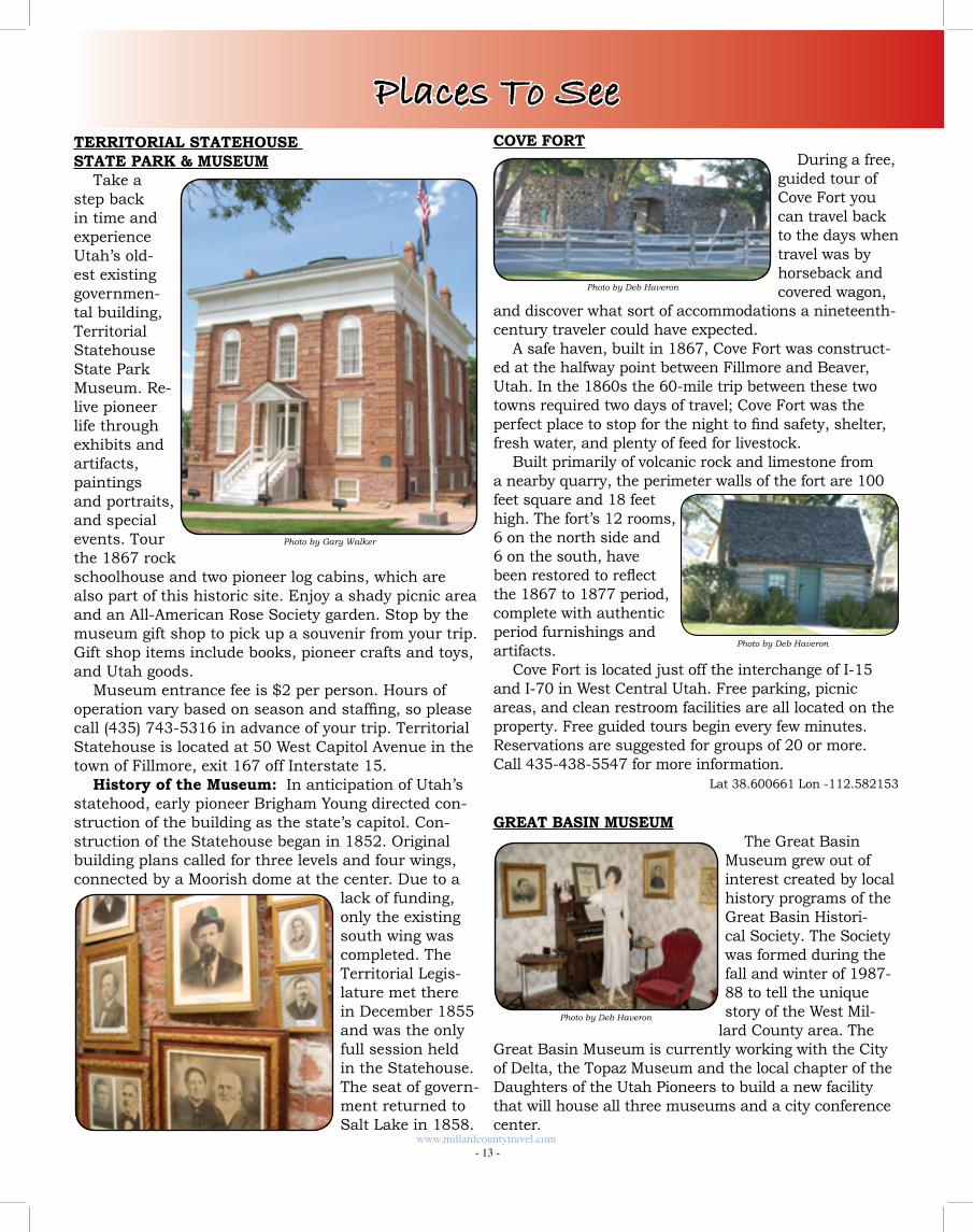
TERRITORIAL STATEHOUSE STATE PARK & MUSEUM
Take a step back in time and experience Utah’s old-est existing governmen-tal building, Territorial Statehouse State Park Museum. Re-live pioneer life through exhibits and artifacts, paintings and portraits, and special events. Tour the 1867 rock schoolhouse and two pioneer log cabins, which are also part of this historic site. Enjoy a shady picnic area and an All-American Rose Society garden. Stop by the museum gift shop to pick up a souvenir from your trip. Gift shop items include books, pioneer crafts and toys, and Utah goods.
Museum entrance fee is $2 per person. Hours of operation vary based on season and staffing, so please call (435) 743-5316 in advance of your trip. Territorial Statehouse is located at 50 West Capitol Avenue in the town of Fillmore, exit 167 off Interstate 15.
History of the Museum: In anticipation of Utah’s statehood, early pioneer Brigham Young directed con-struction of the building as the state’s capitol. Con-struction of the Statehouse began in 1852. Original building plans called for three levels and four wings, connected by a Moorish dome at the center. Due to a
lack of funding, only the existing south wing was completed. The Territorial Legis-lature met there in December 1855 and was the only full session held in the Statehouse. The seat of govern-ment returned to Salt Lake in 1858.
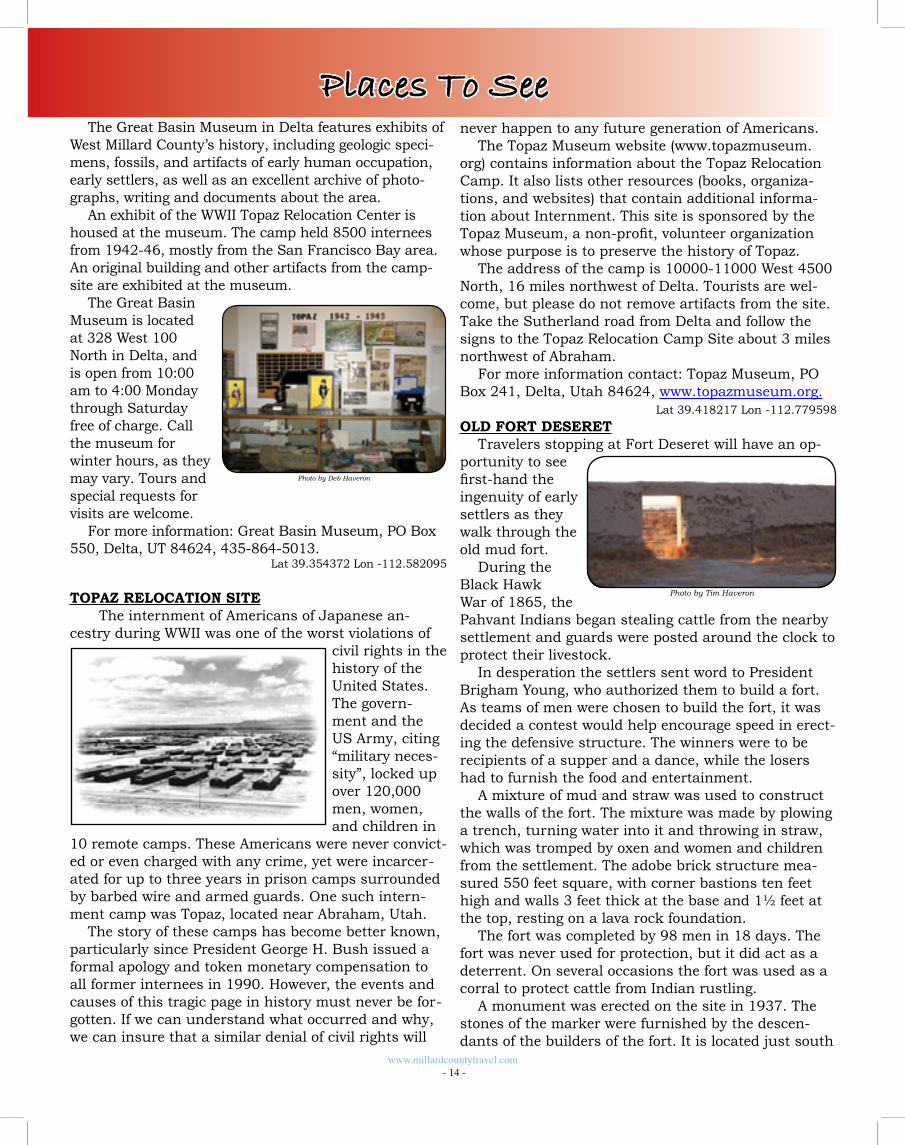
COVE FORTDuring a free,
guided tour of Cove Fort you can travel back to the days when travel was by horseback and covered wagon,
and discover what sort of accommodations a nineteenth-century traveler could have expected.
A safe haven, built in 1867, Cove Fort was construct-ed at the halfway point between Fillmore and Beaver, Utah. In the 1860s the 60-mile trip between these two towns required two days of travel; Cove Fort was the perfect place to stop for the night to find safety, shelter, fresh water, and plenty of feed for livestock.
Built primarily of volcanic rock and limestone from a nearby quarry, the perimeter walls of the fort are 100 feet square and 18 feet high. The fort’s 12 rooms, 6 on the north side and 6 on the south, have been restored to reflect the 1867 to 1877 period, complete with authentic period furnishings and artifacts.
Cove Fort is located just off the interchange of I-15 and I-70 in West Central Utah. Free parking, picnic areas, and clean restroom facilities are all located on the property. Free guided tours begin every few minutes. Reservations are suggested for groups of 20 or more. Call 435-438-5547 for more information.
Lat 38.600661 Lon -112.582153
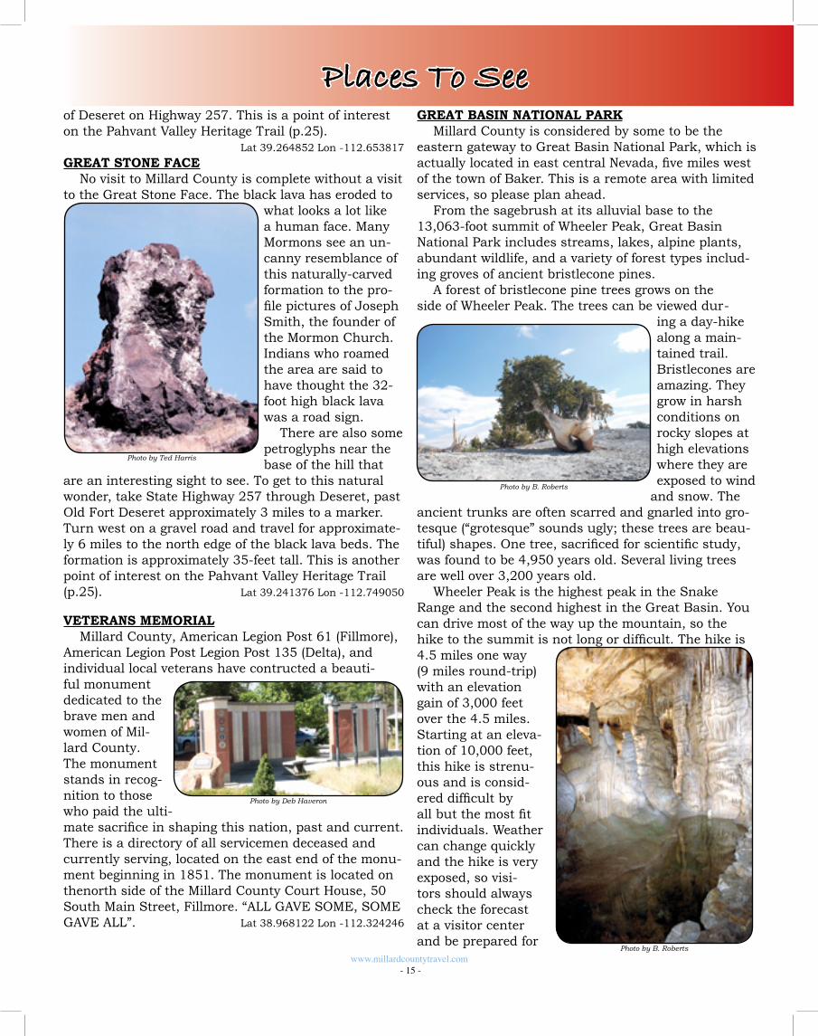
GREAT BASIN MUSEUMThe Great Basin
Museum grew out of interest created by local history programs of the Great Basin Histori-cal Society. The Society was formed during the fall and winter of 1987-88 to tell the unique story of the West Mil-
lard County area. The Great Basin Museum is currently working with the City of Delta, the Topaz Museum and the local chapter of the Daughters of the Utah Pioneers to build a new facility that will house all three museums and a city conference center.
Photo by Deb Haveron
Photo by Deb Haveron
Photo by Deb Haveron
www.millardcountytravel.com - 13 -
Photo by Gary Walker
Places To See
The Great Basin Museum in Delta features exhibits of West Millard County’s history, including geologic speci-mens, fossils, and artifacts of early human occupation, early settlers, as well as an excellent archive of photo-graphs, writing and documents about the area.
An exhibit of the WWII Topaz Relocation Center is housed at the museum. The camp held 8500 internees from 1942-46, mostly from the San Francisco Bay area. An original building and other artifacts from the camp-site are exhibited at the museum.
The Great Basin Museum is located at 328 West 100 North in Delta, and is open from 10:00 am to 4:00 Monday through Saturday free of charge. Call the museum for winter hours, as they may vary. Tours and special requests for visits are welcome.
For more information: Great Basin Museum, PO Box 550, Delta, UT 84624, 435-864-5013.
Lat 39.354372 Lon -112.582095
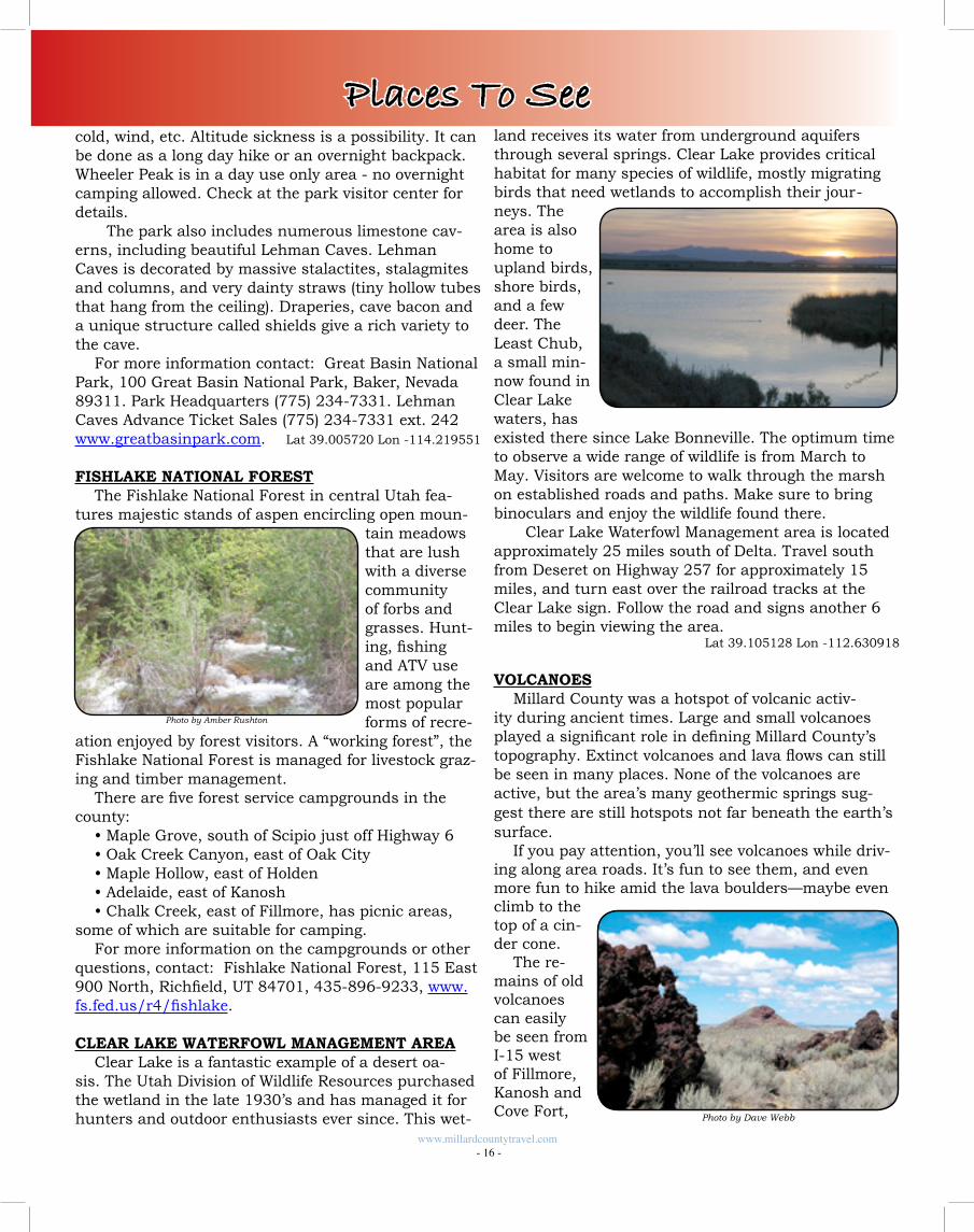
TOPAZ RELOCATION SITE The internment of Americans of Japanese an-
cestry during WWII was one of the worst violations of civil rights in the history of the United States. The govern-ment and the US Army, citing “military neces-sity”, locked up over 120,000 men, women, and children in
10 remote camps. These Americans were never convict-ed or even charged with any crime, yet were incarcer-ated for up to three years in prison camps surrounded by barbed wire and armed guards. One such intern-ment camp was Topaz, located near Abraham, Utah.
The story of these camps has become better known, particularly since President George H. Bush issued a formal apology and token monetary compensation to all former internees in 1990. However, the events and causes of this tragic page in history must never be for-gotten. If we can understand what occurred and why, we can insure that a similar denial of civil rights will
www.millardcountytravel.com - 14 -
Places To See
Photo by Tim Haveron
Photo by Deb Haveron
never happen to any future generation of Americans. The Topaz Museum website (www.topazmuseum.
org) contains information about the Topaz Relocation Camp. It also lists other resources (books, organiza-tions, and websites) that contain additional informa-tion about Internment. This site is sponsored by the Topaz Museum, a non-profit, volunteer organization whose purpose is to preserve the history of Topaz.
The address of the camp is 10000-11000 West 4500 North, 16 miles northwest of Delta. Tourists are wel-come, but please do not remove artifacts from the site. Take the Sutherland road from Delta and follow the signs to the Topaz Relocation Camp Site about 3 miles northwest of Abraham.
For more information contact: Topaz Museum, PO Box 241, Delta, Utah 84624, www.topazmuseum.org.
Lat 39.418217 Lon -112.779598
OLD FORT DESERETTravelers stopping at Fort Deseret will have an op-
portunity to see first-hand the ingenuity of early settlers as they walk through the old mud fort.
During the Black Hawk War of 1865, the Pahvant Indians began stealing cattle from the nearby settlement and guards were posted around the clock to protect their livestock.
In desperation the settlers sent word to President Brigham Young, who authorized them to build a fort. As teams of men were chosen to build the fort, it was decided a contest would help encourage speed in erect-ing the defensive structure. The winners were to be recipients of a supper and a dance, while the losers had to furnish the food and entertainment.
A mixture of mud and straw was used to construct the walls of the fort. The mixture was made by plowing a trench, turning water into it and throwing in straw, which was tromped by oxen and women and children from the settlement. The adobe brick structure mea-sured 550 feet square, with corner bastions ten feet high and walls 3 feet thick at the base and 1½ feet at the top, resting on a lava rock foundation.
The fort was completed by 98 men in 18 days. The fort was never used for protection, but it did act as a deterrent. On several occasions the fort was used as a corral to protect cattle from Indian rustling.
A monument was erected on the site in 1937. The stones of the marker were furnished by the descen-dants of the builders of the fort. It is located just south
GREAT BASIN NATIONAL PARKMillard County is considered by some to be the
eastern gateway to Great Basin National Park, which is actually located in east central Nevada, five miles west of the town of Baker. This is a remote area with limited services, so please plan ahead.
From the sagebrush at its alluvial base to the 13,063-foot summit of Wheeler Peak, Great Basin National Park includes streams, lakes, alpine plants, abundant wildlife, and a variety of forest types includ-ing groves of ancient bristlecone pines.
A forest of bristlecone pine trees grows on the side of Wheeler Peak. The trees can be viewed dur-
ing a day-hike along a main-tained trail. Bristlecones are amazing. They grow in harsh conditions on rocky slopes at high elevations where they are exposed to wind
and snow. The ancient trunks are often scarred and gnarled into gro-tesque (“grotesque” sounds ugly; these trees are beau-tiful) shapes. One tree, sacrificed for scientific study, was found to be 4,950 years old. Several living trees are well over 3,200 years old.
Wheeler Peak is the highest peak in the Snake Range and the second highest in the Great Basin. You can drive most of the way up the mountain, so the hike to the summit is not long or difficult. The hike is 4.5 miles one way (9 miles round-trip) with an elevation gain of 3,000 feet over the 4.5 miles. Starting at an eleva-tion of 10,000 feet, this hike is strenu-ous and is consid-ered difficult by all but the most fit individuals. Weather can change quickly and the hike is very exposed, so visi-tors should always check the forecast at a visitor center and be prepared for
Photo by B. Roberts
Photo by B. Roberts
www.millardcountytravel.com - 15 -
Photo by Deb Haveron
Photo by Ted Harris
Places To Seeof Deseret on Highway 257. This is a point of interest on the Pahvant Valley Heritage Trail (p.25).
Lat 39.264852 Lon -112.653817
GREAT STONE FACENo visit to Millard County is complete without a visit
to the Great Stone Face. The black lava has eroded to what looks a lot like a human face. Many Mormons see an un-canny resemblance of this naturally-carved formation to the pro-file pictures of Joseph Smith, the founder of the Mormon Church. Indians who roamed the area are said to have thought the 32-foot high black lava was a road sign.
There are also some petroglyphs near the base of the hill that
are an interesting sight to see. To get to this natural wonder, take State Highway 257 through Deseret, past Old Fort Deseret approximately 3 miles to a marker. Turn west on a gravel road and travel for approximate-ly 6 miles to the north edge of the black lava beds. The formation is approximately 35-feet tall. This is another point of interest on the Pahvant Valley Heritage Trail (p.25). Lat 39.241376 Lon -112.749050
VETERANS MEMORIALMillard County, American Legion Post 61 (Fillmore),
American Legion Post Legion Post 135 (Delta), and individual local veterans have contructed a beauti-ful monument dedicated to the brave men and women of Mil-lard County. The monument stands in recog-nition to those who paid the ulti-mate sacrifice in shaping this nation, past and current. There is a directory of all servicemen deceased and currently serving, located on the east end of the monu-ment beginning in 1851. The monument is located on thenorth side of the Millard County Court House, 50 South Main Street, Fillmore. “ALL GAVE SOME, SOME GAVE ALL”. Lat 38.968122 Lon -112.324246
www.millardcountytravel.com - 16 -
Places To Seecold, wind, etc. Altitude sickness is a possibility. It can be done as a long day hike or an overnight backpack. Wheeler Peak is in a day use only area - no overnight camping allowed. Check at the park visitor center for details.
The park also includes numerous limestone cav-erns, including beautiful Lehman Caves. Lehman Caves is decorated by massive stalactites, stalagmites and columns, and very dainty straws (tiny hollow tubes that hang from the ceiling). Draperies, cave bacon and a unique structure called shields give a rich variety to the cave.
For more information contact: Great Basin National Park, 100 Great Basin National Park, Baker, Nevada 89311. Park Headquarters (775) 234-7331. Lehman Caves Advance Ticket Sales (775) 234-7331 ext. 242 www.greatbasinpark.com. Lat 39.005720 Lon -114.219551
FISHLAKE NATIONAL FORESTThe Fishlake National Forest in central Utah fea-
tures majestic stands of aspen encircling open moun-tain meadows that are lush with a diverse community of forbs and grasses. Hunt-ing, fishing and ATV use are among the most popular forms of recre-
ation enjoyed by forest visitors. A “working forest”, the Fishlake National Forest is managed for livestock graz-ing and timber management.
There are five forest service campgrounds in the county:
• Maple Grove, south of Scipio just off Highway 6• Oak Creek Canyon, east of Oak City• Maple Hollow, east of Holden• Adelaide, east of Kanosh• Chalk Creek, east of Fillmore, has picnic areas,
some of which are suitable for camping.For more information on the campgrounds or other
questions, contact: Fishlake National Forest, 115 East 900 North, Richfield, UT 84701, 435-896-9233, www.fs.fed.us/r4/fishlake.
CLEAR LAKE WATERFOWL MANAGEMENT AREAClear Lake is a fantastic example of a desert oa-
sis. The Utah Division of Wildlife Resources purchased the wetland in the late 1930’s and has managed it for hunters and outdoor enthusiasts ever since. This wet-
Photo by Amber Rushton
land receives its water from underground aquifers through several springs. Clear Lake provides critical habitat for many species of wildlife, mostly migrating birds that need wetlands to accomplish their jour-neys. The area is also home to upland birds, shore birds, and a few deer. The Least Chub, a small min-now found in Clear Lake waters, has existed there since Lake Bonneville. The optimum time to observe a wide range of wildlife is from March to May. Visitors are welcome to walk through the marsh on established roads and paths. Make sure to bring binoculars and enjoy the wildlife found there.
Clear Lake Waterfowl Management area is located approximately 25 miles south of Delta. Travel south from Deseret on Highway 257 for approximately 15 miles, and turn east over the railroad tracks at the Clear Lake sign. Follow the road and signs another 6 miles to begin viewing the area.
Lat 39.105128 Lon -112.630918
VOLCANOESMillard County was a hotspot of volcanic activ-
ity during ancient times. Large and small volcanoes played a significant role in defining Millard County’s topography. Extinct volcanoes and lava flows can still be seen in many places. None of the volcanoes are active, but the area’s many geothermic springs sug-gest there are still hotspots not far beneath the earth’s surface.
If you pay attention, you’ll see volcanoes while driv-ing along area roads. It’s fun to see them, and even more fun to hike amid the lava boulders—maybe even climb to the top of a cin-der cone.
The re-mains of old volcanoes can easily be seen from I-15 west of Fillmore, Kanosh and Cove Fort, Photo by Dave Webb
ened rock indicates where his stove once stood. Ce-ment dams were constructed above his cave to capture water, and Stinson hauled barrels of water from Cow Pond, Skunk Springs or Painter Springs.
Although living in isolation, Stinson had quite a few visitors. They were county residents or travelers with car problems, and many often enjoyed his home brew. The brew was made with sugar, yeast and water, and then placed in large crocks set behind his wood stove. Sugar was added regularly and the mixture was al-lowed to ferment. Stinson bottled the potent results and shared it with guests - if he enjoyed their com-pany. A visitor who didn’t leave a few coins on the table before departing would not be offered the drink next time.
He met his minimal needs by trapping and selling the pelts of bobcats and coyotes. He also cleared rock and debris from the highway and received a small wage from the government. He gathered a few stray sheep and planted a vegetable garden. He built a pen for his pet badgers.
In 1951, a new highway was built to the south and Stinson lost his road job. He reluctantly moved into Delta and left his serene environment. At the age of 80, Stinson died of natural causes. At his request, his ashes were scattered around the base of his Marjum Pass home. Lat 39.247166 Lon -113.402867
WEST DESERT SINKHOLE
It is said that Joseph Niel-son discovered this amazing sink hole in 1927. He was heading back to his camp at night when he strayed into the area. His horse stopped and ab-solutely refused to go another step. He got off the horse and started walking, when suddenly he was hanging on to the reins of his horse with nothing below his feet. Fortunately, Nielson was able to coax his horse to back up while he was holding the reins and get out of the mysterious hole he found himself in. The next day, Nielson went back to see in the daylight what had tried to swallow him. As he neared the sinkhole, once again his horse refused to move close.
Lat 39.204615 Lon -113.270345
and from Highway 257 in the Black Rock area, about 52 miles south of Delta. In the distance you can see several mountains that have dramatic volcano shape.
There are no formally designated “volcano” tours, drives, or hikes, but plenty of opportunity to see and hike on volcanoes as you explore the back roads. The newly designated Pahvant Valley Heritage Trail high-lights many of the volcanic formations in the area.
The photos on this page were taken at a small cin-der cone located between Kanosh and I-15. From the center of Kanosh, just follow the graveled road west and you’ll skirt along the northern edge of the volcano. Views are impressive from the road, and even better if you get out and hike.
Lava rocks in all shapes and sizes can be found here, ranging from tiny cinders to huge crystals. Some are black, some red. Many have sharp edges so take care as you hike.
Lat 38.964458 Lon -112.484830
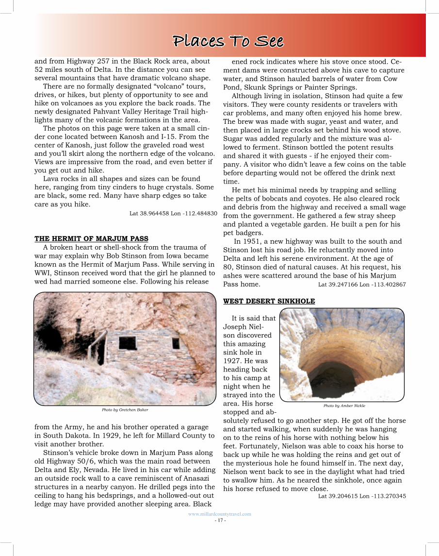
THE HERMIT OF MARJUM PASSA broken heart or shell-shock from the trauma of
war may explain why Bob Stinson from Iowa became known as the Hermit of Marjum Pass. While serving in WWI, Stinson received word that the girl he planned to wed had married someone else. Following his release
from the Army, he and his brother operated a garage in South Dakota. In 1929, he left for Millard County to visit another brother.
Stinson’s vehicle broke down in Marjum Pass along old Highway 50/6, which was the main road between Delta and Ely, Nevada. He lived in his car while adding an outside rock wall to a cave reminiscent of Anasazi structures in a nearby canyon. He drilled pegs into the ceiling to hang his bedsprings, and a hollowed-out out ledge may have provided another sleeping area. Black
Photo by Amber Nickle
www.millardcountytravel.com - 17 -
Places To See
Photo by Gretchen Baker
OUTDOOR ACTIVITIESMillard County offers
a wide variety of ter-rain ranging from high, forested mountains to desert lowlands. The area includes a surpris-ing number of lakes and streams, with diverse ecosystems supporting mule deer, elk, prong-horn, cougars, coyotes, waterfowl, swans, ea-gles, falcons and many other birds, mammals and reptiles.
Much of this land is public, managed by the US Forest Service or Bureau of Land Management, and is open to outdoor recreation. Millard County offers wide open spaces and rugged backcountry, with virtually unlimited opportunity for recreation. You can find solitude here. There is space to pursue your interests… space to enjoy yourself. Come and pick your adventure!HUNTING
Hunting is very popular among residents and visi-tors to Millard County. Some of Utah’s best big game hunting units are found in this area, offering the oppor-tunity for trophy hunts. There are also plenty of oppor-tunities for casual hunters and family groups.
Mule deer and elk are common in the Fish Lake Na-tional Forest, in the areas east of I-15 and around Oak
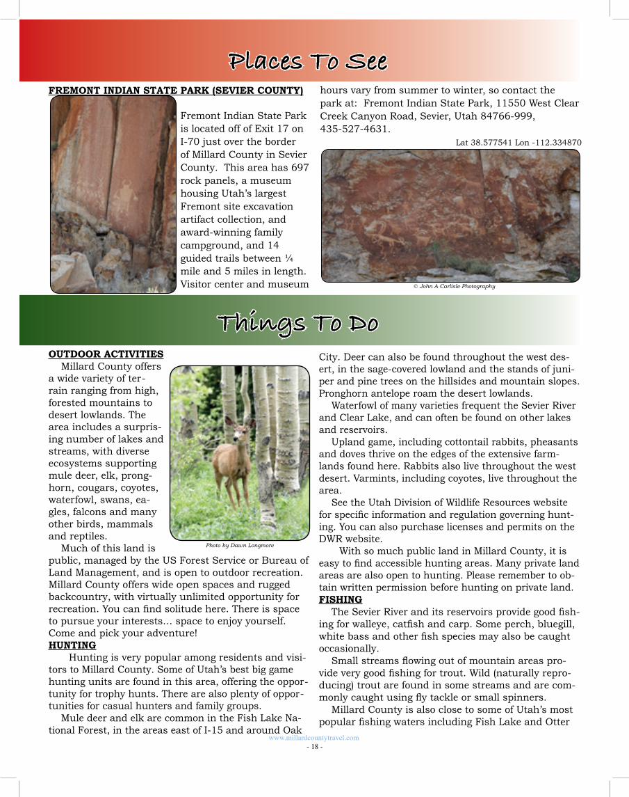
hours vary from summer to winter, so contact the park at: Fremont Indian State Park, 11550 West Clear Creek Canyon Road, Sevier, Utah 84766-999, 435-527-4631. Lat 38.577541 Lon -112.334870
City. Deer can also be found throughout the west des-ert, in the sage-covered lowland and the stands of juni-per and pine trees on the hillsides and mountain slopes. Pronghorn antelope roam the desert lowlands.
Waterfowl of many varieties frequent the Sevier River and Clear Lake, and can often be found on other lakes and reservoirs.
Upland game, including cottontail rabbits, pheasants and doves thrive on the edges of the extensive farm-lands found here. Rabbits also live throughout the west desert. Varmints, including coyotes, live throughout the area.
See the Utah Division of Wildlife Resources website for specific information and regulation governing hunt-ing. You can also purchase licenses and permits on the DWR website.
With so much public land in Millard County, it is easy to find accessible hunting areas. Many private land areas are also open to hunting. Please remember to ob-tain written permission before hunting on private land. FISHING
The Sevier River and its reservoirs provide good fish-ing for walleye, catfish and carp. Some perch, bluegill, white bass and other fish species may also be caught occasionally.
Small streams flowing out of mountain areas pro-vide very good fishing for trout. Wild (naturally repro-ducing) trout are found in some streams and are com-monly caught using fly tackle or small spinners.
Millard County is also close to some of Utah’s most popular fishing waters including Fish Lake and Otter
Photo by Dawn Longmore
FREMONT INDIAN STATE PARK (SEVIER COUNTY) Fremont Indian State Park
is located off of Exit 17 on I-70 just over the border of Millard County in Sevier County. This area has 697 rock panels, a museum housing Utah’s largest Fremont site excavation artifact collection, and award-winning family campground, and 14 guided trails between ¼ mile and 5 miles in length.
Visitor center and museum
Places To See
© John A Carlisle Photography
Things To Do
www.millardcountytravel.com - 18 -

Things To DoCreek Reservoir.
Chalk Creek is located directly east of the town of Fillmore. The south fork is accessible by gravel road and contains mostly rainbow trout. Some cutthroat trout are found in the higher elevation areas and a few brown trout are found in the lower end of the stream. Hatch-ery trout are stocked near the campground, about 4 miles up the canyon. The north fork is accessible only by hiking. A trail provides access to the upper end of the north fork where wild cutthroat and rainbow cut-throat hybrids are plentiful. Most of Chalk Creek is located in the Fishlake National Forest.
Corn Creek is accessible by dirt road going east from the town of Kanosh. The stream contains predom-inantly brown trout. A few rainbow trout are stocked near the campground, about 3 miles up the canyon. The upper 3 miles of stream are accessible by foot trail. Most of the stream is located in the Fishlake National Forest. Lat 39.394560 Lon -112.479867DMAD Reservoir is located off US 6 northeast of Delta.
It contains walleye, catfish, bass and carp. Lat 39.394560 Lon -112.479867Gunnison Bend Reservoir is located on the west edge of Delta. It contains catfish, carp, bass, yel-low perch, bluegill and walleye. Lat 39.349940 Lon -112.631920Oak Creek flows out of the can-yon just east of Oak City. It is accessible from the gravel road
extending up the canyon to a public campground in the Fishlake National Forest. The stream supports a population of small wild brown trout.
The Sevier River flows through the central portion of Millard County and contains catfish, carp, walleye, bass and other fish species.
ROCK HOUNDING ADVENTURESThe rugged desert mountains in Millard County at-
tract rock hounders from around the world. The Ante-lope Springs area is one of the best places in the world to find trilobites. Gem-quality topaz comes from Topaz Mountain, just over the county line in Juab County. Sunstone Knoll is the place to find interesting sun-stone. Countless other sites yield rare and interesting rocks, fossils and minerals.
Please note that it is illegal to collect Indian or his-torical artifacts on public lands without a permit. This
Photo by Amber Rushton
Photo by Tashelle Dutson
includes arrowheads, pottery, rock art, old bottles, etc. Metal de-tectors can be used anywhere except historical sites.
You can collect common inverte-brates (without skeletal structures; hard or soft bodied animals such as insects or trilobites) in reasonable quanti-ties, but it is illegal to sell those finds. Dinosaur and other vertebrate fossils may not be collected on any federal or state lands except by permits issued to accredited institutions.
Many of the roads to the rockhounding areas are ac-cessible on maintained gravel roads. However, because much of this area is remote and rugged, it is recom-mended that you drive a truck or 4-wheel drive vehicle.
For additional information, please contact: Bureau of Land Management, 95 East 500 North, Fillmore, Utah 84631, 435-743-3100, www.ut.blm.gov/fillmore/index/html.
An excellent source of information on rockhound-ing and fossil collecting is A Collector’s Guide to Rock, Mineral, & Fossil Localities of Utah by James R. Wilson. This book is available from the Utah Geological Survey.
TRILOBITESTrilobite fossils are extremely popular
with collectors. They are from an extinct group of arthropods that lived from the early Cambrian Period until near the end of the Permian Period. These hard-shelled prehistoric animals lived on the sea floors and reefs for millions of years. They devel-oped into complex and beautiful animals,
resulting in a variety of fossil-types. The Antelope Springs area in Mil-
lard County is one of the best places on earth to find trilobite fossils. There are both public and private quarries, so make sure you know where you are. The private quar-ries are well marked. These private areas charge a fee to dig in their quarries, but can almost guarantee that you will find trilobites.
Lat 39.353120 Lon -113.279585
Elrathia KingiPhoto by Tim Haveron
Photo by Deb Haveron
Olenoides SuperbusPhoto by Jake Skabelund
www.millardcountytravel.com - 19 -
21
100
136
257
£¤50£¤6
£¤6
132
125
174
£¤50
£¤50
133
§̈¦15
§̈¦15
§̈¦15
§̈¦70
FISHLAKE
NATIONAL
FOREST
FISHLAKE
NATIONAL
FOREST
FISHLAKE
NATIONAL
FOREST
Delta
Fillmore
Hinckley
Abraham Sutherland
Woodrow
Sugarville
OasisDeseret
Holden
Scipio
Oak City
LynndylLeamington
Meadow
Kanosh
Hatton
Flowell
McCornick
Brush Highway
PowerPlant
Scipio L.
Fool Creek
Garrison
£¤50 £¤6
21
Eskdale
Robinson'sRanch
Gandy
Sevier
Dry
Lake
DesertRange
ExperimentalArea
COVE FORT
TERRITORIALSTATEHOUSE
GREAT STONE FACE
FORT DESERET
TOPAZ RELOCATIONCAMP
CLEAR LAKEBIRD REFUGE
GREAT BASIN MUSEUM
Border Inn
#
PIUTE
ATV
TRA
ILCRICKET MOUNTAINSATV TRAIL
AMASA BASINATV TRAIL
CONGER MOUNTAINATV TRAIL
ANTELOPE SPRINGSROCKHOUNDING SITE
AMASA BASINROCKHOUNDING SITE
FOSSIL MOUNTAINROCKHOUNDING SITE
CRYSTAL PEAKROCKHOUNDING SITE
OBSIDIAN BEDSROCKHOUNDING SITE
SUNSTONE KNOLLROCKHOUNDING SITE
·ATV Trail
Millard County
21
100
136
257
£¤50£¤6
£¤6
132
125
174
£¤50
£¤50
133
§̈¦15
§̈¦15
§̈¦15
§̈¦70
FISHLAKE
NATIONAL
FOREST
FISHLAKE
NATIONAL
FOREST
FISHLAKE
NATIONAL
FOREST
Delta
Fillmore
Hinckley
Abraham Sutherland
Woodrow
Sugarville
OasisDeseret
Holden
Scipio
Oak City
LynndylLeamington
Meadow
Kanosh
Hatton
Flowell
McCornick
Brush Highway
PowerPlant
Scipio L.
Fool Creek
Garrison
£¤50 £¤6
21
Eskdale
Robinson'sRanch
Gandy
Sevier
Dry
Lake
DesertRange
ExperimentalArea
COVE FORT
TERRITORIALSTATEHOUSE
GREAT STONE FACE
FORT DESERET
TOPAZ RELOCATIONCAMP
CLEAR LAKEBIRD REFUGE
GREAT BASIN MUSEUM
Border Inn
#
PIUTE
ATV
TRA
ILCRICKET MOUNTAINSATV TRAIL
AMASA BASINATV TRAIL
CONGER MOUNTAINATV TRAIL
ANTELOPE SPRINGSROCKHOUNDING SITE
AMASA BASINROCKHOUNDING SITE
FOSSIL MOUNTAINROCKHOUNDING SITE
CRYSTAL PEAKROCKHOUNDING SITE
OBSIDIAN BEDSROCKHOUNDING SITE
SUNSTONE KNOLLROCKHOUNDING SITE
·ATV Trail
Millard County

For more information on the private quarries, con-tact information is listed below:
U-Dig FossilsPO Box 1113350 East 300 SouthDelta, Utah 84624435-864-3638435-864-4294 FAXE-mail: [email protected]://www.u-digfossils.com
A New Dig, Inc.PO Box 122Hinckley, UT 84635435-864-3691E-mail: [email protected]
TOPAZ MOUNTAIN (Juab County) Topaz, Utah’s state
gem, is a semi-precious gemstone that occurs as very hard, trans-parent crystals in a variety of colors. The topaz crystals at Topaz Mountain are natu-rally amber colored but become colorless after extensive exposure to sunlight. The crystals formed within cavities of the Topaz Mountain rhyolite, a volcanic rock which erupted approximately six to seven million years ago from volcanic vents along faults in the area.
Topaz Mountain is one of the world’s great places to find topaz. If you search the washes and slopes on the south side of the mountain you will find small topaz crystals glimmering in the sunlight. If you search seams in the rhyolite, you may find gem-quality crys-tals.
Topaz Mountain is located in a remote area where there is no water and no services are provided. You should always carry food, plenty of water, tools and emergency equipment. To dig the topaz, helpful tools include a rock hammer or regular hammer, screw driv-er, bags for your gems, hiking boots, hat, sun screen, bug repellant and once again don’t forget the water! Jeans are a wise choice since while you are digging you are often on your knees on the rough and jagged rocks.
There is plenty of “dry” camping in the area for tents, trailers and motorhomes. There are also hun-dreds of miles of roads and trails that can be driven
Photo by Tim Haveron
www.millardcountytravel.com - 22 -
Modocia TypicalisPhoto by Jake Skabelund
Things To Doaround the Topaz Mountain area.
From Nephi, travel southwest from Nephi on Hwy 132 for about 34 miles to the town of Lynndyl and the junction with Hwy 6. Continue south on U.S. Highway 6 for about 5 miles and then turn west onto Highway 174 (Brush Wellman Road). This intersection is well marked. Drive northwest on the paved Brush Wellman Road for about 37 miles, to the signed dirt road lead-ing up to Topaz Mountain. The mountain will be clearly visible at this point. The most popular rockhounding spots are along the mountain’s southern slope.
For more detailed information on looking for topaz, an excellent resource is A Field Guide to Topaz and As-sociated Minerals of the Thomas Range, Utah by John Holfert, Walter Mroch & Jeremy Fuller.
Lat 39.712721 Lon -113.107856
SPOR MOUNTAIN (Juab County)Near Spor Mountain you can find apache tears,
which are a type of obsidian. Black is the most common color, but it can range from black to red to brown. They appear to be opaque, but if you hold it to the light, it looks more translucent. Follow Highway 174 (Brush Wellman Highway) to the end of the pave-
ment. Turn right on a dirt road and follow it up about 400 yards to a bluff. Apache tears can be found on the ground around the top of this bluff.
Across the road to the east of Spor Mountain is a source of purple fluorspar (also called fluorite).
Lat 39.741846 Lon -113179189
SUNSTONE KNOLLHunting and collecting sunstones glittering in the
sun atop Sunstone Knoll is a great way to spend an afternoon, especially with kids. Some of the sunstones (golden labradorite) are the size of small fingernails. Others are larger and yellow in color.
Golden labradorite is believed to increase inner strength, vitality, courage, mental clarity, endurance and spiritual focus. The sunstones are easy to find on sunny days. Otherwise, dig where others have and look for rocks holding the crystals within hollow cavities by crack-ing them open.
Sunstone Knoll is about 11 miles south of Deseret, just east of Hwy 257. Turn left over the railroad track at the sign, then follow the road about one-quarter mile onto the knoll. Lat 39.147770 Lon -112.713437
Apache TearsPhoto by Tim Haveron
FluorsparPhoto by Tim Haveron
Photo by Tim Haveron
www.millardcountytravel.com - 23 -
Things To DoFOSSIL MOUNTAIN
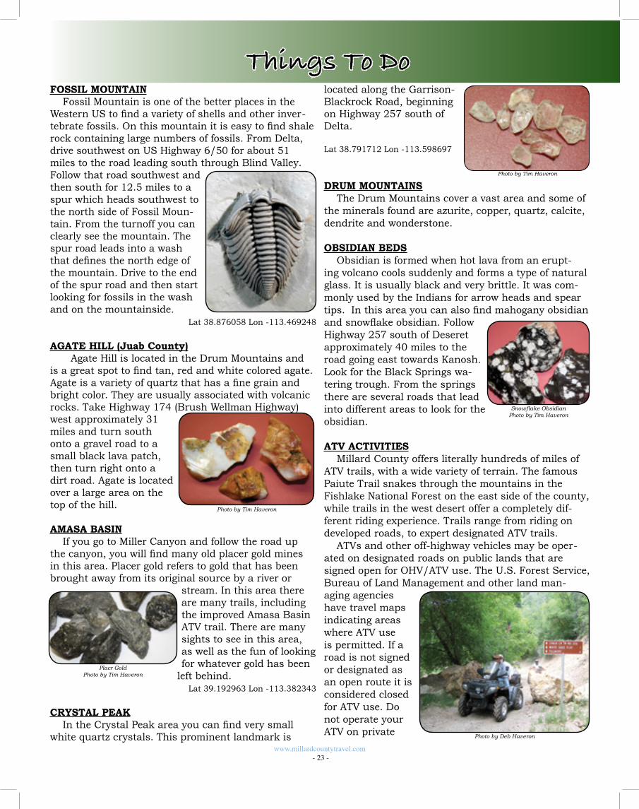
Fossil Mountain is one of the better places in the Western US to find a variety of shells and other inver-tebrate fossils. On this mountain it is easy to find shale rock containing large numbers of fossils. From Delta, drive southwest on US Highway 6/50 for about 51 miles to the road leading south through Blind Valley. Follow that road southwest and then south for 12.5 miles to a spur which heads southwest to the north side of Fossil Moun-tain. From the turnoff you can clearly see the mountain. The spur road leads into a wash that defines the north edge of the mountain. Drive to the end of the spur road and then start looking for fossils in the wash and on the mountainside.
Lat 38.876058 Lon -113.469248
AGATE HILL (Juab County) Agate Hill is located in the Drum Mountains and
is a great spot to find tan, red and white colored agate. Agate is a variety of quartz that has a fine grain and bright color. They are usually associated with volcanic rocks. Take Highway 174 (Brush Wellman Highway) west approximately 31 miles and turn south onto a gravel road to a small black lava patch, then turn right onto a dirt road. Agate is located over a large area on the top of the hill.
AMASA BASINIf you go to Miller Canyon and follow the road up
the canyon, you will find many old placer gold mines in this area. Placer gold refers to gold that has been brought away from its original source by a river or
stream. In this area there are many trails, including the improved Amasa Basin ATV trail. There are many sights to see in this area, as well as the fun of looking for whatever gold has been
left behind. Lat 39.192963 Lon -113.382343
CRYSTAL PEAKIn the Crystal Peak area you can find very small
white quartz crystals. This prominent landmark is
Photo by Tim Haveron
Placr GoldPhoto by Tim Haveron
located along the Garrison-Blackrock Road, beginning on Highway 257 south of Delta. Lat 38.791712 Lon -113.598697
DRUM MOUNTAINSThe Drum Mountains cover a vast area and some of
the minerals found are azurite, copper, quartz, calcite, dendrite and wonderstone.
OBSIDIAN BEDSObsidian is formed when hot lava from an erupt-
ing volcano cools suddenly and forms a type of natural glass. It is usually black and very brittle. It was com-monly used by the Indians for arrow heads and spear tips. In this area you can also find mahogany obsidian and snowflake obsidian. Follow Highway 257 south of Deseret approximately 40 miles to the road going east towards Kanosh. Look for the Black Springs wa-tering trough. From the springs there are several roads that lead into different areas to look for the obsidian.
ATV ACTIVITIESMillard County offers literally hundreds of miles of
ATV trails, with a wide variety of terrain. The famous Paiute Trail snakes through the mountains in the Fishlake National Forest on the east side of the county, while trails in the west desert offer a completely dif-ferent riding experience. Trails range from riding on developed roads, to expert designated ATV trails.
ATVs and other off-highway vehicles may be oper-ated on designated roads on public lands that are signed open for OHV/ATV use. The U.S. Forest Service, Bureau of Land Management and other land man-aging agencies have travel maps indicating areas where ATV use is permitted. If a road is not signed or designated as an open route it is considered closed for ATV use. Do not operate your ATV on private
Photo by Tim Haveron
Snowflake ObsidianPhoto by Tim Haveron
Photo by Deb Haveron
land without the owner’s permission. For more detailed information please contact:
Bureau of Land Management, Fillmore Field Office, 35 East 500 North, Fillmore, Utah 84631, 435-743-3100.
NATIONAL ATV JAMBOREEThe National ATV Jamboree located in Fillmore,
Utah is a major event among ATV enthusiasts and also one of the major trail heads to access the famous
Paiute ATV Trail. The Jamboree is a week-long event held the last full week of June. The Jamboree offers approximately 30 rides with varying degrees of difficulty. We
can challenge your machine and riding ability or give you an easy winding trail with breathtaking views. The Jamboree offers a number of trails that accommodate Side-By-Side machines as well. Your ATV riding experience will offer scenery ranging from pines and aspen forests to spectacular desert views and sunsets.
Local guides describe the geology, history and sto-ries that enhance your riding experience. Participants will enjoy seeing a variety of wildlife including deer, elk and wild turkeys.
While at the Jamboree you can participate in special dinners during the evenings such as a pizza party, pot-luck dinner, barbecues, a progressive dinner up Chalk Creek and others. We tailor a ride just for the “ladies” and also an overnight ride for those who want to expe-rience the great outdoors at its best.
PAIUTE ATV TRAILCentral Utah’s 900-plus mile Paiute ATV Trail Sys-
tem, part of which falls in Millard County, is a loop trail with no beginning and no end! It passes through several towns and has side trails leading to others. Dirt Wheels magazine rates the Paiute ATV Trail as one of the 15 best trails in the country. It has been rated as one of the top five trails in the country by ATV Illus-trated magazine. Many riders consider the Paiute Trail to be the top in the United States.
Exploring the Paiute ATV Trail: The trail is designed to provide an enjoyable recreational ride through fantastic scenery. The trail was formed by connecting old roads and trails through Fishlake Na-tional Forest and BLM managed land. Several narrow
Photo by Dawn Longmore
www.millardcountytravel.com - 24 -
Things To Dosections of trail were eventu-ally constructed to complete the loop. The main trail is 238 miles long, with over 800 miles of marked side trails and over 1900-plus estimated miles of side forest roads and trails. Due to its vast size, the Paiute ATV Trail is best explored in segments.
The Paiute ATV Trail caters to relaxing and family type riding. Many riders along the four-foot wide trails enjoy the scenery and atmosphere of a deeply dense forest, as well as popular activities such as fishing or camping near the path. Panoramic scenes along ridges allow riders to see over 100 miles in the distance (and 11,000 below!), which makes the ATV trail a popular photographic destination. Wildlife is commonly spotted close by, including occasional glimpses of free-roaming herds of deer and elk.
The main loop of the trail takes approximately 25 riding hours to complete, but that doesn’t leave much time for stopping or taking pictures. For comfort and full enjoyment of the trail, the time should be spread
Photo by Dawn Longmore
Out of State ATV Registration Information
The State of Utah has a reciprocity agreement with the states listed below. This agreement allows residents of those states to ride their currently registered ATVs in the State of Utah without having to purchase our “non-resident permit”. If you reside in the following states, and your ATV is currently registered, you DO NOT NEED to purchase a non-resident permit.
ArizonaArkansas CaliforniaDelawareIdahoIndianaKansasLouisianaMinnesotaMississippiMissouri
MontanaNebraskaNew MexicoNew YorkNorth DakotaOklahomaOregonPennsylvaniaVermontWashingtonWisconsin
*ATV Jamboree participants are not required to have the non-resident permit DURING the Jamboree.
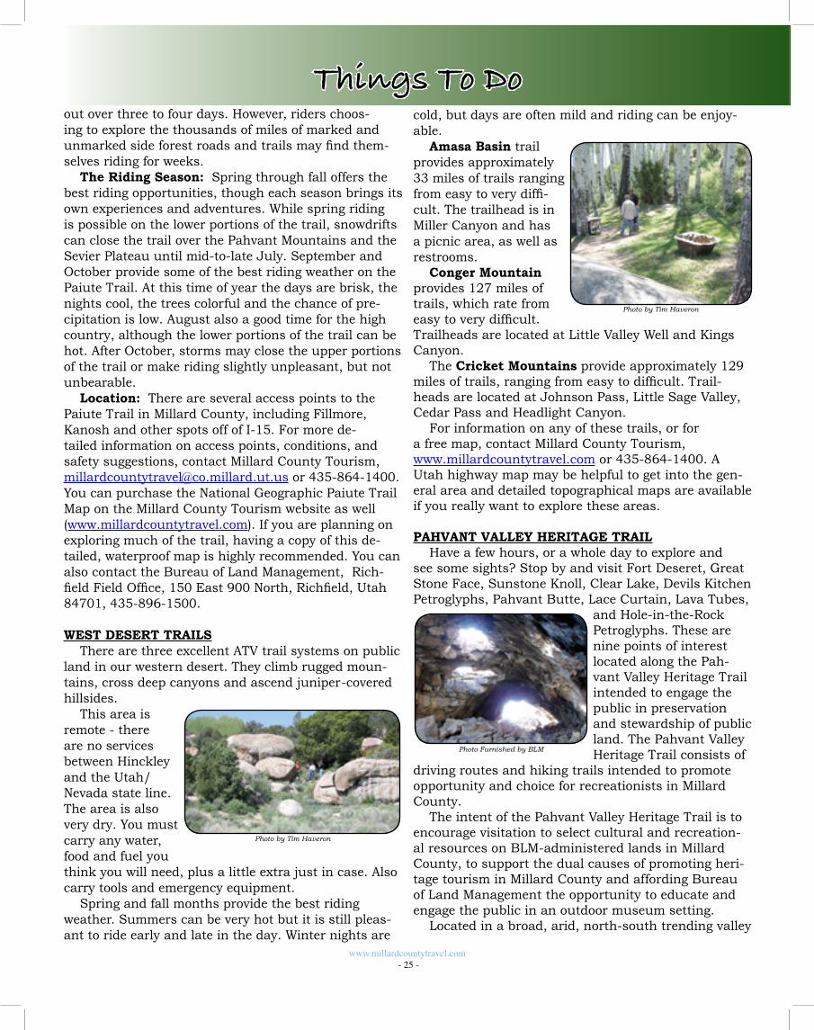
www.millardcountytravel.com - 25 -
Things To Doout over three to four days. However, riders choos-ing to explore the thousands of miles of marked and unmarked side forest roads and trails may find them-selves riding for weeks.
The Riding Season: Spring through fall offers the best riding opportunities, though each season brings its own experiences and adventures. While spring riding is possible on the lower portions of the trail, snowdrifts can close the trail over the Pahvant Mountains and the Sevier Plateau until mid-to-late July. September and October provide some of the best riding weather on the Paiute Trail. At this time of year the days are brisk, the nights cool, the trees colorful and the chance of pre-cipitation is low. August also a good time for the high country, although the lower portions of the trail can be hot. After October, storms may close the upper portions of the trail or make riding slightly unpleasant, but not unbearable.
Location: There are several access points to the Paiute Trail in Millard County, including Fillmore, Kanosh and other spots off of I-15. For more de-tailed information on access points, conditions, and safety suggestions, contact Millard County Tourism, [email protected] or 435-864-1400. You can purchase the National Geographic Paiute Trail Map on the Millard County Tourism website as well (www.millardcountytravel.com). If you are planning on exploring much of the trail, having a copy of this de-tailed, waterproof map is highly recommended. You can also contact the Bureau of Land Management, Rich-field Field Office, 150 East 900 North, Richfield, Utah 84701, 435-896-1500.
WEST DESERT TRAILSThere are three excellent ATV trail systems on public
land in our western desert. They climb rugged moun-tains, cross deep canyons and ascend juniper-covered hillsides.
This area is remote - there are no services between Hinckley and the Utah/Nevada state line. The area is also very dry. You must carry any water, food and fuel you think you will need, plus a little extra just in case. Also carry tools and emergency equipment.
Spring and fall months provide the best riding weather. Summers can be very hot but it is still pleas-ant to ride early and late in the day. Winter nights are
Photo by Tim Haveron
cold, but days are often mild and riding can be enjoy-able.
Amasa Basin trail provides approximately 33 miles of trails ranging from easy to very diffi-cult. The trailhead is in Miller Canyon and has a picnic area, as well as restrooms.
Conger Mountain provides 127 miles of trails, which rate from easy to very difficult. Trailheads are located at Little Valley Well and Kings Canyon.
The Cricket Mountains provide approximately 129 miles of trails, ranging from easy to difficult. Trail-heads are located at Johnson Pass, Little Sage Valley, Cedar Pass and Headlight Canyon.
For information on any of these trails, or for a free map, contact Millard County Tourism, www.millardcountytravel.com or 435-864-1400. A Utah highway map may be helpful to get into the gen-eral area and detailed topographical maps are available if you really want to explore these areas.
PAHVANT VALLEY HERITAGE TRAILHave a few hours, or a whole day to explore and
see some sights? Stop by and visit Fort Deseret, Great Stone Face, Sunstone Knoll, Clear Lake, Devils Kitchen Petroglyphs, Pahvant Butte, Lace Curtain, Lava Tubes,
and Hole-in-the-Rock Petroglyphs. These are nine points of interest located along the Pah-vant Valley Heritage Trail intended to engage the public in preservation and stewardship of public land. The Pahvant Valley Heritage Trail consists of
driving routes and hiking trails intended to promote opportunity and choice for recreationists in Millard County.
The intent of the Pahvant Valley Heritage Trail is to encourage visitation to select cultural and recreation-al resources on BLM-administered lands in Millard County, to support the dual causes of promoting heri-tage tourism in Millard County and affording Bureau of Land Management the opportunity to educate and engage the public in an outdoor museum setting.
Located in a broad, arid, north-south trending valley
Photo by Tim Haveron
Photo Furnished by BLM
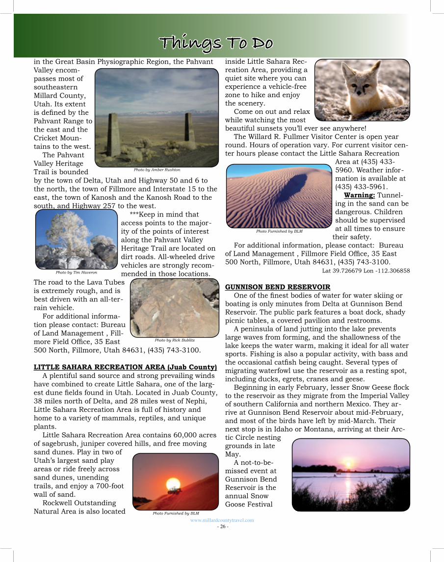
inside Little Sahara Rec-reation Area, providing a quiet site where you can experience a vehicle-free zone to hike and enjoy the scenery.
Come on out and relax while watching the most beautiful sunsets you’ll ever see anywhere!
The Willard R. Fullmer Visitor Center is open year round. Hours of operation vary. For current visitor cen-ter hours please contact the Little Sahara Recreation
Area at (435) 433-5960. Weather infor-mation is available at (435) 433-5961.
Warning: Tunnel-ing in the sand can be dangerous. Children should be supervised at all times to ensure
their safety.For additional information, please contact: Bureau
of Land Management , Fillmore Field Office, 35 East 500 North, Fillmore, Utah 84631, (435) 743-3100.
Lat 39.726679 Lon -112.306858
GUNNISON BEND RESERVOIROne of the finest bodies of water for water skiing or
boating is only minutes from Delta at Gunnison Bend Reservoir. The public park features a boat dock, shady picnic tables, a covered pavilion and restrooms.
A peninsula of land jutting into the lake prevents large waves from forming, and the shallowness of the lake keeps the water warm, making it ideal for all water sports. Fishing is also a popular activity, with bass and the occasional catfish being caught. Several types of migrating waterfowl use the reservoir as a resting spot, including ducks, egrets, cranes and geese.
Beginning in early February, lesser Snow Geese flock to the reservoir as they migrate from the Imperial Valley of southern California and northern Mexico. They ar-rive at Gunnison Bend Reservoir about mid-February, and most of the birds have left by mid-March. Their next stop is in Idaho or Montana, arriving at their Arc-tic Circle nesting grounds in late May.
A not-to-be-missed event at Gunnison Bend Reservoir is the annual Snow Goose Festival
in the Great Basin Physiographic Region, the Pahvant Valley encom-passes most of southeastern Millard County, Utah. Its extent is defined by the Pahvant Range to the east and the Cricket Moun-tains to the west.
The Pahvant Valley Heritage Trail is bounded by the town of Delta, Utah and Highway 50 and 6 to the north, the town of Fillmore and Interstate 15 to the east, the town of Kanosh and the Kanosh Road to the south, and Highway 257 to the west.
***Keep in mind that access points to the major-ity of the points of interest along the Pahvant Valley Heritage Trail are located on dirt roads. All-wheeled drive vehicles are strongly recom-mended in those locations.
The road to the Lava Tubes is extremely rough, and is best driven with an all-ter-rain vehicle.
For additional informa-tion please contact: Bureau of Land Management , Fill-more Field Office, 35 East 500 North, Fillmore, Utah 84631, (435) 743-3100.
LITTLE SAHARA RECREATION AREA (Juab County)A plentiful sand source and strong prevailing winds
have combined to create Little Sahara, one of the larg-est dune fields found in Utah. Located in Juab County, 38 miles north of Delta, and 28 miles west of Nephi, Little Sahara Recreation Area is full of history and home to a variety of mammals, reptiles, and unique plants.
Little Sahara Recreation Area contains 60,000 acres of sagebrush, juniper covered hills, and free moving sand dunes. Play in two of Utah’s largest sand play areas or ride freely across sand dunes, unending trails, and enjoy a 700-foot wall of sand.
Rockwell Outstanding Natural Area is also located
Photo Furnished by BLM
www.millardcountytravel.com - 26 -
Photo by Tim Haveron
Photo by Amber Rushton
Photo Furnished by BLM
Photo by Rick Bublitz
Things To Do
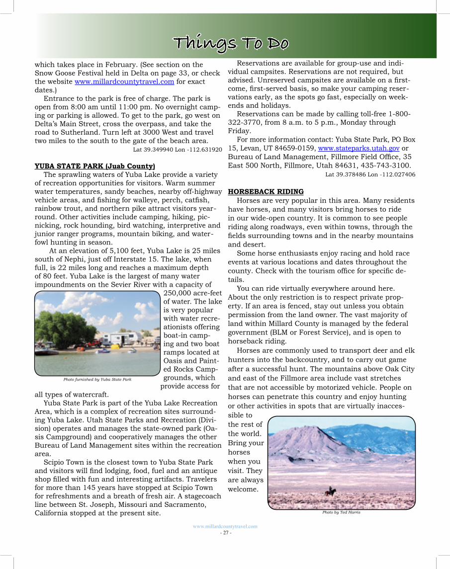
www.millardcountytravel.com - 27 -
Things To Dowhich takes place in February. (See section on the Snow Goose Festival held in Delta on page 33, or check the website www.millardcountytravel.com for exact dates.)
Entrance to the park is free of charge. The park is open from 8:00 am until 11:00 pm. No overnight camp-ing or parking is allowed. To get to the park, go west on Delta’s Main Street, cross the overpass, and take the road to Sutherland. Turn left at 3000 West and travel two miles to the south to the gate of the beach area. Lat 39.349940 Lon -112.631920
YUBA STATE PARK (Juab County)The sprawling waters of Yuba Lake provide a variety
of recreation opportunities for visitors. Warm summer water temperatures, sandy beaches, nearby off-highway vehicle areas, and fishing for walleye, perch, catfish, rainbow trout, and northern pike attract visitors year-round. Other activities include camping, hiking, pic-nicking, rock hounding, bird watching, interpretive and junior ranger programs, mountain biking, and water-fowl hunting in season.
At an elevation of 5,100 feet, Yuba Lake is 25 miles south of Nephi, just off Interstate 15. The lake, when full, is 22 miles long and reaches a maximum depth of 80 feet. Yuba Lake is the largest of many water impoundments on the Sevier River with a capacity of
250,000 acre-feet of water. The lake is very popular with water recre-ationists offering boat-in camp-ing and two boat ramps located at Oasis and Paint-ed Rocks Camp-grounds, which
provide access for all types of watercraft.
Yuba State Park is part of the Yuba Lake Recreation Area, which is a complex of recreation sites surround-ing Yuba Lake. Utah State Parks and Recreation (Divi-sion) operates and manages the state-owned park (Oa-sis Campground) and cooperatively manages the other Bureau of Land Management sites within the recreation area.
Scipio Town is the closest town to Yuba State Park and visitors will find lodging, food, fuel and an antique shop filled with fun and interesting artifacts. Travelers for more than 145 years have stopped at Scipio Town for refreshments and a breath of fresh air. A stagecoach line between St. Joseph, Missouri and Sacramento, California stopped at the present site.
Photo furnished by Yuba State Park
Reservations are available for group-use and indi-vidual campsites. Reservations are not required, but advised. Unreserved campsites are available on a first-come, first-served basis, so make your camping reser-vations early, as the spots go fast, especially on week-ends and holidays.
Reservations can be made by calling toll-free 1-800-322-3770, from 8 a.m. to 5 p.m., Monday through Friday.
For more information contact: Yuba State Park, PO Box 15, Levan, UT 84659-0159, www.stateparks.utah.gov or Bureau of Land Management, Fillmore Field Office, 35 East 500 North, Fillmore, Utah 84631, 435-743-3100. Lat 39.378486 Lon -112.027406
HORSEBACK RIDINGHorses are very popular in this area. Many residents
have horses, and many visitors bring horses to ride in our wide-open country. It is common to see people riding along roadways, even within towns, through the fields surrounding towns and in the nearby mountains and desert.
Some horse enthusiasts enjoy racing and hold race events at various locations and dates throughout the county. Check with the tourism office for specific de-tails.
You can ride virtually everywhere around here. About the only restriction is to respect private prop-erty. If an area is fenced, stay out unless you obtain permission from the land owner. The vast majority of land within Millard County is managed by the federal government (BLM or Forest Service), and is open to horseback riding.
Horses are commonly used to transport deer and elk hunters into the backcountry, and to carry out game after a successful hunt. The mountains above Oak City and east of the Fillmore area include vast stretches that are not accessible by motorized vehicle. People on horses can penetrate this country and enjoy hunting or other activities in spots that are virtually inacces-sible to the rest of the world. Bring your horses when you visit. They are always welcome.
Photo by Ted Harris
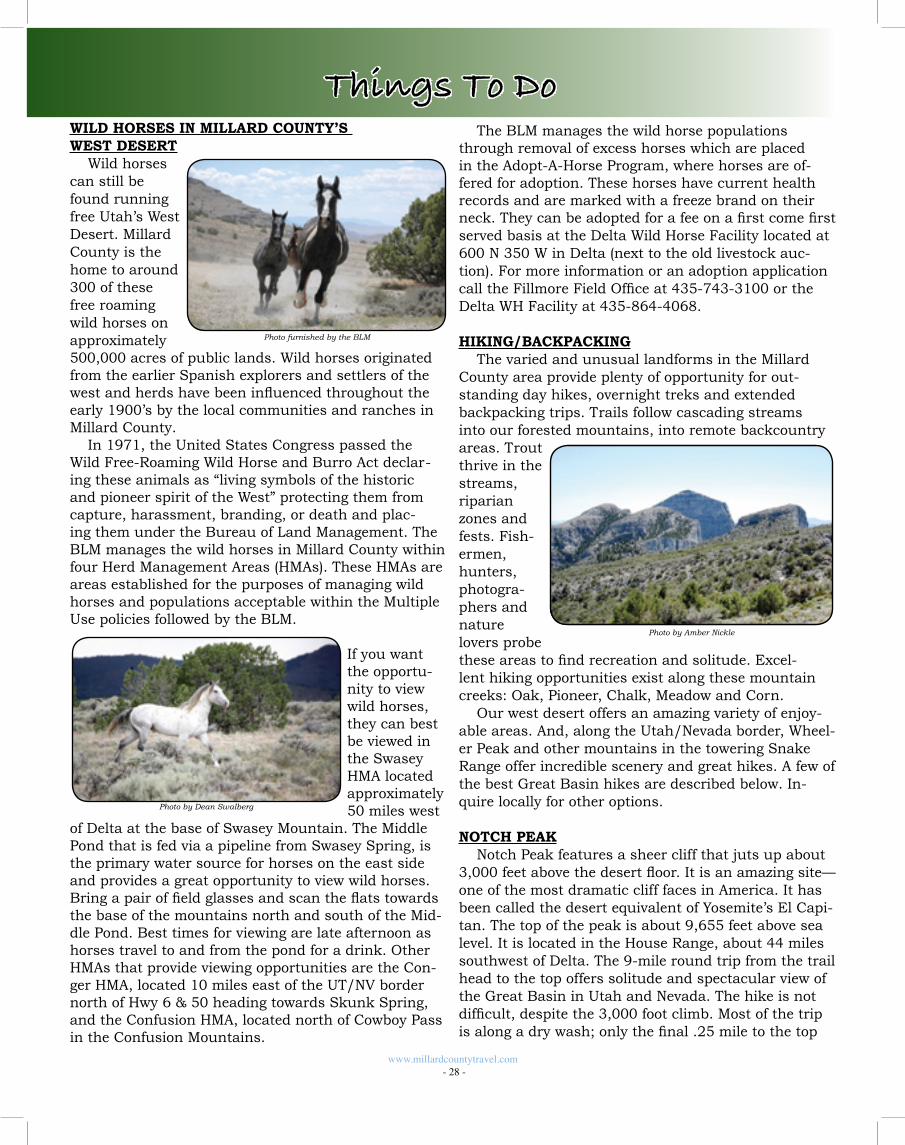
WILD HORSES IN MILLARD COUNTY’S WEST DESERT
Wild horses can still be found running free Utah’s West Desert. Millard County is the home to around 300 of these free roaming wild horses on approximately 500,000 acres of public lands. Wild horses originated from the earlier Spanish explorers and settlers of the west and herds have been influenced throughout the early 1900’s by the local communities and ranches in Millard County.
In 1971, the United States Congress passed the Wild Free-Roaming Wild Horse and Burro Act declar-ing these animals as “living symbols of the historic and pioneer spirit of the West” protecting them from capture, harassment, branding, or death and plac-ing them under the Bureau of Land Management. The BLM manages the wild horses in Millard County within four Herd Management Areas (HMAs). These HMAs are areas established for the purposes of managing wild horses and populations acceptable within the Multiple Use policies followed by the BLM.
If you want the opportu-nity to view wild horses, they can best be viewed in the Swasey HMA located approximately 50 miles west
of Delta at the base of Swasey Mountain. The Middle Pond that is fed via a pipeline from Swasey Spring, is the primary water source for horses on the east side and provides a great opportunity to view wild horses. Bring a pair of field glasses and scan the flats towards the base of the mountains north and south of the Mid-dle Pond. Best times for viewing are late afternoon as horses travel to and from the pond for a drink. Other HMAs that provide viewing opportunities are the Con-ger HMA, located 10 miles east of the UT/NV border north of Hwy 6 & 50 heading towards Skunk Spring, and the Confusion HMA, located north of Cowboy Pass in the Confusion Mountains.
www.millardcountytravel.com - 28 -
Photo by Dean Swalberg
Photo furnished by the BLM
Things To DoThe BLM manages the wild horse populations
through removal of excess horses which are placed in the Adopt-A-Horse Program, where horses are of-fered for adoption. These horses have current health records and are marked with a freeze brand on their neck. They can be adopted for a fee on a first come first served basis at the Delta Wild Horse Facility located at 600 N 350 W in Delta (next to the old livestock auc-tion). For more information or an adoption application call the Fillmore Field Office at 435-743-3100 or the Delta WH Facility at 435-864-4068.
HIKING/BACKPACKINGThe varied and unusual landforms in the Millard
County area provide plenty of opportunity for out-standing day hikes, overnight treks and extended backpacking trips. Trails follow cascading streams into our forested mountains, into remote backcountry areas. Trout thrive in the streams, riparian zones and fests. Fish-ermen, hunters, photogra-phers and nature lovers probe these areas to find recreation and solitude. Excel-lent hiking opportunities exist along these mountain creeks: Oak, Pioneer, Chalk, Meadow and Corn.
Our west desert offers an amazing variety of enjoy-able areas. And, along the Utah/Nevada border, Wheel-er Peak and other mountains in the towering Snake Range offer incredible scenery and great hikes. A few of the best Great Basin hikes are described below. In-quire locally for other options.
NOTCH PEAKNotch Peak features a sheer cliff that juts up about
3,000 feet above the desert floor. It is an amazing site—one of the most dramatic cliff faces in America. It has been called the desert equivalent of Yosemite’s El Capi-tan. The top of the peak is about 9,655 feet above sea level. It is located in the House Range, about 44 miles southwest of Delta. The 9-mile round trip from the trail head to the top offers solitude and spectacular view of the Great Basin in Utah and Nevada. The hike is not difficult, despite the 3,000 foot climb. Most of the trip is along a dry wash; only the final .25 mile to the top
Photo by Amber Nickle
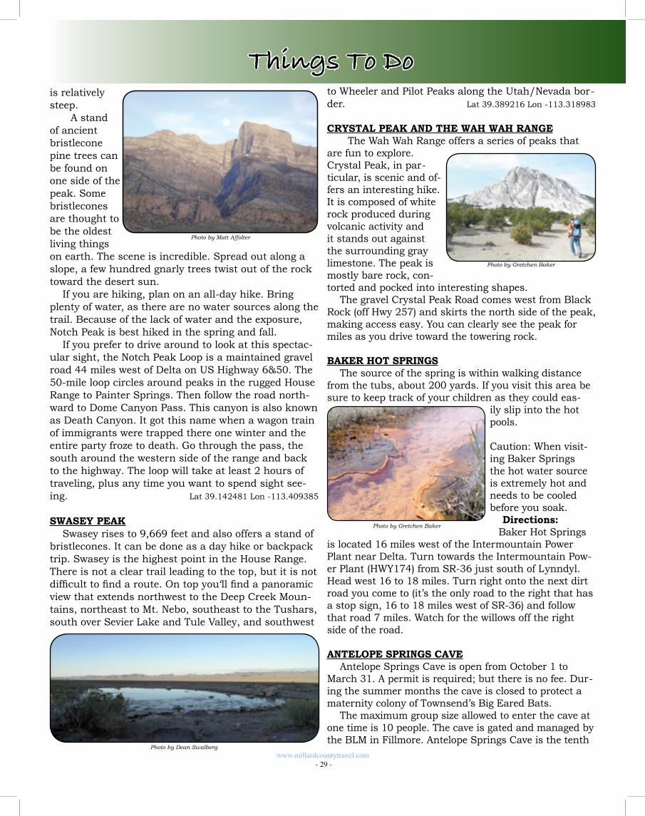
www.millardcountytravel.com - 29 -
Things To Dois relatively steep.
A stand of ancient bristlecone pine trees can be found on one side of the peak. Some bristlecones are thought to be the oldest living things on earth. The scene is incredible. Spread out along a slope, a few hundred gnarly trees twist out of the rock toward the desert sun.
If you are hiking, plan on an all-day hike. Bring plenty of water, as there are no water sources along the trail. Because of the lack of water and the exposure, Notch Peak is best hiked in the spring and fall.
If you prefer to drive around to look at this spectac-ular sight, the Notch Peak Loop is a maintained gravel road 44 miles west of Delta on US Highway 6&50. The 50-mile loop circles around peaks in the rugged House Range to Painter Springs. Then follow the road north-ward to Dome Canyon Pass. This canyon is also known as Death Canyon. It got this name when a wagon train of immigrants were trapped there one winter and the entire party froze to death. Go through the pass, the south around the western side of the range and back to the highway. The loop will take at least 2 hours of traveling, plus any time you want to spend sight see-ing. Lat 39.142481 Lon -113.409385
SWASEY PEAKSwasey rises to 9,669 feet and also offers a stand of
bristlecones. It can be done as a day hike or backpack trip. Swasey is the highest point in the House Range. There is not a clear trail leading to the top, but it is not difficult to find a route. On top you‘ll find a panoramic view that extends northwest to the Deep Creek Moun-tains, northeast to Mt. Nebo, southeast to the Tushars, south over Sevier Lake and Tule Valley, and southwest
Photo by Matt Affolter
Photo by Dean Swalberg
to Wheeler and Pilot Peaks along the Utah/Nevada bor-der. Lat 39.389216 Lon -113.318983
CRYSTAL PEAK AND THE WAH WAH RANGE The Wah Wah Range offers a series of peaks that
are fun to explore. Crystal Peak, in par-ticular, is scenic and of-fers an interesting hike. It is composed of white rock produced during volcanic activity and it stands out against the surrounding gray limestone. The peak is mostly bare rock, con-torted and pocked into interesting shapes.
The gravel Crystal Peak Road comes west from Black Rock (off Hwy 257) and skirts the north side of the peak, making access easy. You can clearly see the peak for miles as you drive toward the towering rock.
BAKER HOT SPRINGSThe source of the spring is within walking distance
from the tubs, about 200 yards. If you visit this area be sure to keep track of your children as they could eas-
ily slip into the hot pools.
Caution: When visit-ing Baker Springs the hot water source is extremely hot and needs to be cooled before you soak.
Directions: Baker Hot Springs
is located 16 miles west of the Intermountain Power Plant near Delta. Turn towards the Intermountain Pow-er Plant (HWY174) from SR-36 just south of Lynndyl. Head west 16 to 18 miles. Turn right onto the next dirt road you come to (it’s the only road to the right that has a stop sign, 16 to 18 miles west of SR-36) and follow that road 7 miles. Watch for the willows off the right side of the road.
ANTELOPE SPRINGS CAVEAntelope Springs Cave is open from October 1 to
March 31. A permit is required; but there is no fee. Dur-ing the summer months the cave is closed to protect a maternity colony of Townsend’s Big Eared Bats.
The maximum group size allowed to enter the cave at one time is 10 people. The cave is gated and managed by the BLM in Fillmore. Antelope Springs Cave is the tenth
Photo by Gretchen Baker
Photo by Gretchen Baker
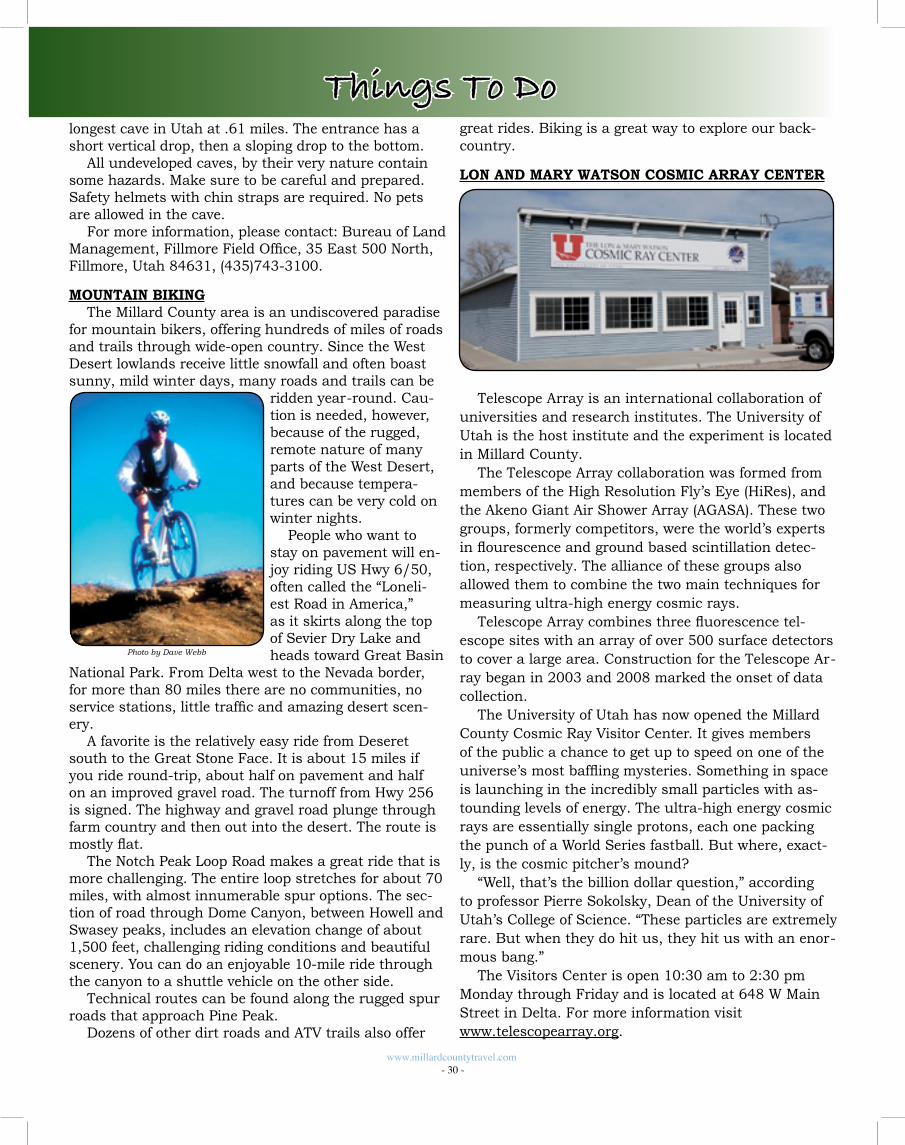
longest cave in Utah at .61 miles. The entrance has a short vertical drop, then a sloping drop to the bottom.
All undeveloped caves, by their very nature contain some hazards. Make sure to be careful and prepared. Safety helmets with chin straps are required. No pets are allowed in the cave.
For more information, please contact: Bureau of Land Management, Fillmore Field Office, 35 East 500 North, Fillmore, Utah 84631, (435)743-3100.
MOUNTAIN BIKINGThe Millard County area is an undiscovered paradise
for mountain bikers, offering hundreds of miles of roads and trails through wide-open country. Since the West Desert lowlands receive little snowfall and often boast sunny, mild winter days, many roads and trails can be
ridden year-round. Cau-tion is needed, however, because of the rugged, remote nature of many parts of the West Desert, and because tempera-tures can be very cold on winter nights.
People who want to stay on pavement will en-joy riding US Hwy 6/50, often called the “Loneli-est Road in America,” as it skirts along the top of Sevier Dry Lake and heads toward Great Basin
National Park. From Delta west to the Nevada border, for more than 80 miles there are no communities, no service stations, little traffic and amazing desert scen-ery.
A favorite is the relatively easy ride from Deseret south to the Great Stone Face. It is about 15 miles if you ride round-trip, about half on pavement and half on an improved gravel road. The turnoff from Hwy 256 is signed. The highway and gravel road plunge through farm country and then out into the desert. The route is mostly flat.
The Notch Peak Loop Road makes a great ride that is more challenging. The entire loop stretches for about 70 miles, with almost innumerable spur options. The sec-tion of road through Dome Canyon, between Howell and Swasey peaks, includes an elevation change of about 1,500 feet, challenging riding conditions and beautiful scenery. You can do an enjoyable 10-mile ride through the canyon to a shuttle vehicle on the other side.
Technical routes can be found along the rugged spur roads that approach Pine Peak.
Dozens of other dirt roads and ATV trails also offer
www.millardcountytravel.com - 30 -
Photo by Dave Webb
Things To Dogreat rides. Biking is a great way to explore our back-country.
LON AND MARY WATSON COSMIC ARRAY CENTER
Telescope Array is an international collaboration of universities and research institutes. The University of Utah is the host institute and the experiment is located in Millard County.
The Telescope Array collaboration was formed from members of the High Resolution Fly’s Eye (HiRes), and the Akeno Giant Air Shower Array (AGASA). These two groups, formerly competitors, were the world’s experts in flourescence and ground based scintillation detec-tion, respectively. The alliance of these groups also allowed them to combine the two main techniques for measuring ultra-high energy cosmic rays.
Telescope Array combines three fluorescence tel-escope sites with an array of over 500 surface detectors to cover a large area. Construction for the Telescope Ar-ray began in 2003 and 2008 marked the onset of data collection.
The University of Utah has now opened the Millard County Cosmic Ray Visitor Center. It gives members of the public a chance to get up to speed on one of the universe’s most baffling mysteries. Something in space is launching in the incredibly small particles with as-tounding levels of energy. The ultra-high energy cosmic rays are essentially single protons, each one packing the punch of a World Series fastball. But where, exact-ly, is the cosmic pitcher’s mound?
“Well, that’s the billion dollar question,” according to professor Pierre Sokolsky, Dean of the University of Utah’s College of Science. “These particles are extremely rare. But when they do hit us, they hit us with an enor-mous bang.”
The Visitors Center is open 10:30 am to 2:30 pm Monday through Friday and is located at 648 W Main Street in Delta. For more information visit www.telescopearray.org.
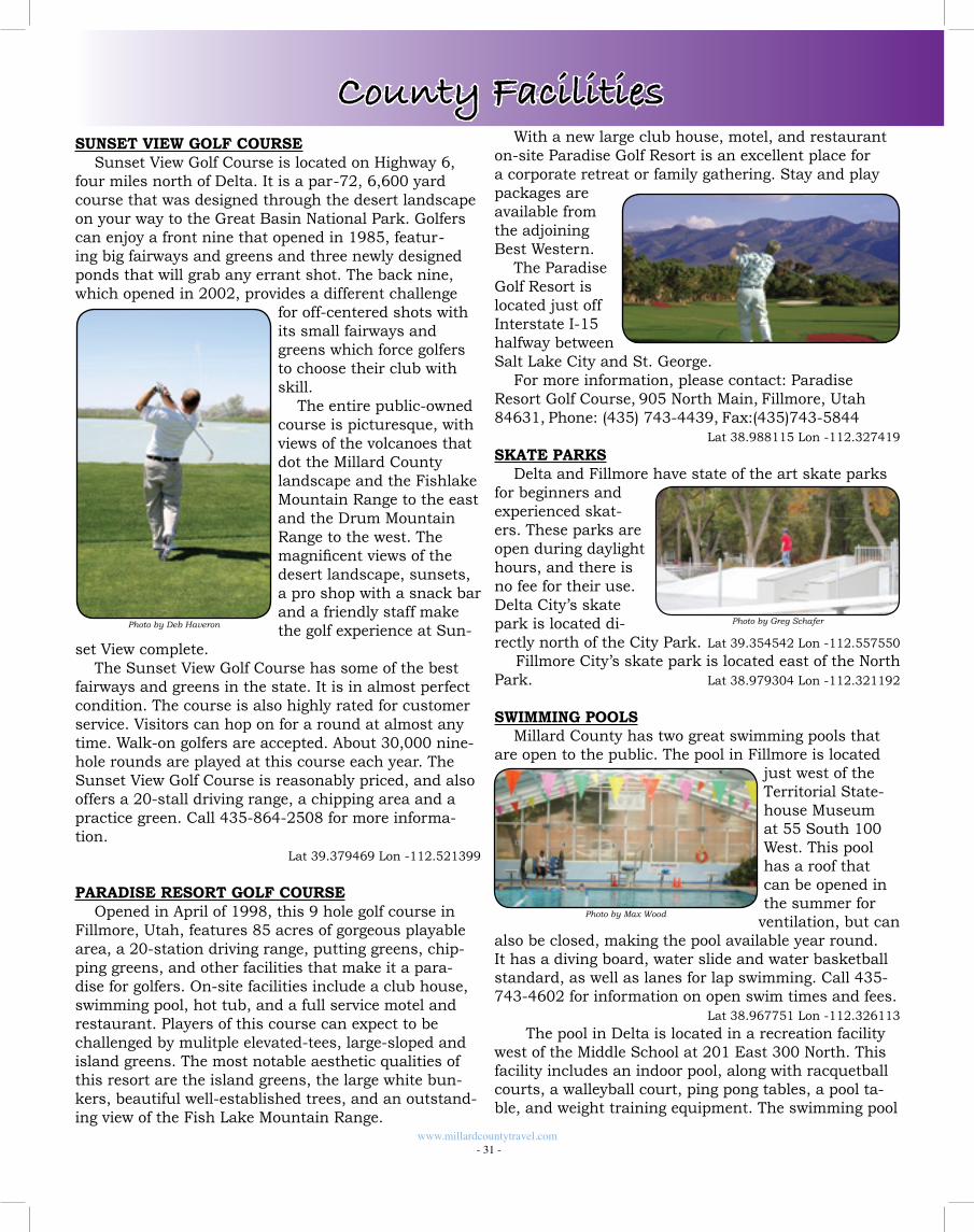
www.millardcountytravel.com - 31 -
County FacilitiesSUNSET VIEW GOLF COURSE
Sunset View Golf Course is located on Highway 6, four miles north of Delta. It is a par-72, 6,600 yard course that was designed through the desert landscape on your way to the Great Basin National Park. Golfers can enjoy a front nine that opened in 1985, featur-ing big fairways and greens and three newly designed ponds that will grab any errant shot. The back nine, which opened in 2002, provides a different challenge
for off-centered shots with its small fairways and greens which force golfers to choose their club with skill.
The entire public-owned course is picturesque, with views of the volcanoes that dot the Millard County landscape and the Fishlake Mountain Range to the east and the Drum Mountain Range to the west. The magnificent views of the desert landscape, sunsets, a pro shop with a snack bar and a friendly staff make the golf experience at Sun-
set View complete. The Sunset View Golf Course has some of the best
fairways and greens in the state. It is in almost perfect condition. The course is also highly rated for customer service. Visitors can hop on for a round at almost any time. Walk-on golfers are accepted. About 30,000 nine-hole rounds are played at this course each year. The Sunset View Golf Course is reasonably priced, and also offers a 20-stall driving range, a chipping area and a practice green. Call 435-864-2508 for more informa-tion.
Lat 39.379469 Lon -112.521399
PARADISE RESORT GOLF COURSEOpened in April of 1998, this 9 hole golf course in
Fillmore, Utah, features 85 acres of gorgeous playable area, a 20-station driving range, putting greens, chip-ping greens, and other facilities that make it a para-dise for golfers. On-site facilities include a club house, swimming pool, hot tub, and a full service motel and restaurant. Players of this course can expect to be challenged by mulitple elevated-tees, large-sloped and island greens. The most notable aesthetic qualities of this resort are the island greens, the large white bun-kers, beautiful well-established trees, and an outstand-ing view of the Fish Lake Mountain Range.
Photo by Deb Haveron
With a new large club house, motel, and restaurant on-site Paradise Golf Resort is an excellent place for a corporate retreat or family gathering. Stay and play packages are available from the adjoining Best Western.
The Paradise Golf Resort is located just off Interstate I-15 halfway between Salt Lake City and St. George.
For more information, please contact: Paradise Resort Golf Course‚ 905 North Main‚ Fillmore, Utah 84631‚ Phone: (435) 743-4439‚ Fax:(435)743-5844
Lat 38.988115 Lon -112.327419
SKATE PARKSDelta and Fillmore have state of the art skate parks
for beginners and experienced skat-ers. These parks are open during daylight hours, and there is no fee for their use. Delta City’s skate park is located di-rectly north of the City Park. Lat 39.354542 Lon -112.557550
Fillmore City’s skate park is located east of the North Park. Lat 38.979304 Lon -112.321192
SWIMMING POOLSMillard County has two great swimming pools that
are open to the public. The pool in Fillmore is located just west of the Territorial State-house Museum at 55 South 100 West. This pool has a roof that can be opened in the summer for
ventilation, but can also be closed, making the pool available year round. It has a diving board, water slide and water basketball standard, as well as lanes for lap swimming. Call 435-743-4602 for information on open swim times and fees.
Lat 38.967751 Lon -112.326113
The pool in Delta is located in a recreation facility west of the Middle School at 201 East 300 North. This facility includes an indoor pool, along with racquetball courts, a walleyball court, ping pong tables, a pool ta-ble, and weight training equipment. The swimming pool
Photo by Greg Schafer
Photo by Max Wood
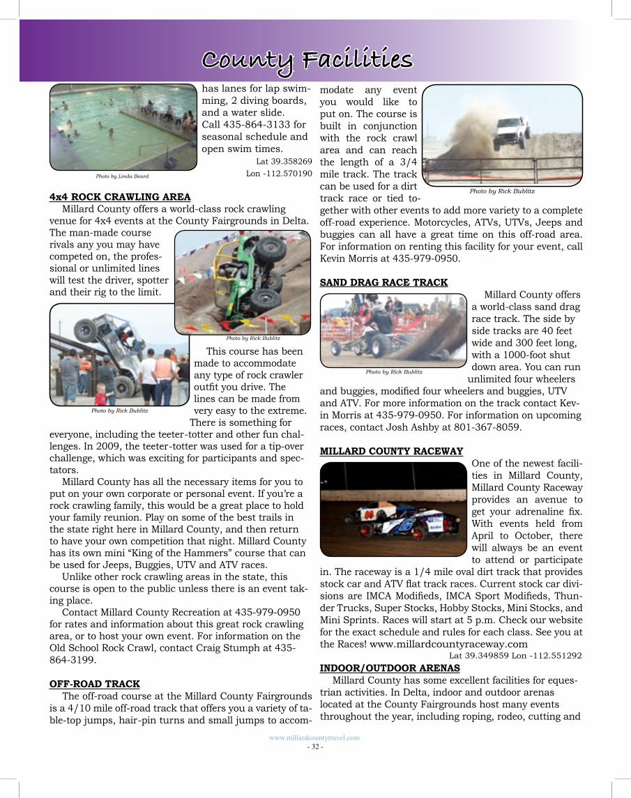
modate any event you would like to put on. The course is built in conjunction with the rock crawl area and can reach the length of a 3/4 mile track. The track can be used for a dirt track race or tied to-gether with other events to add more variety to a complete off-road experience. Motorcycles, ATVs, UTVs, Jeeps and buggies can all have a great time on this off-road area. For information on renting this facility for your event, call Kevin Morris at 435-979-0950.
SAND DRAG RACE TRACKMillard County offers
a world-class sand drag race track. The side by side tracks are 40 feet wide and 300 feet long, with a 1000-foot shut down area. You can run
unlimited four wheelers and buggies, modified four wheelers and buggies, UTV and ATV. For more information on the track contact Kev-in Morris at 435-979-0950. For information on upcoming races, contact Josh Ashby at 801-367-8059.
MILLARD COUNTY RACEWAYOne of the newest facili-ties in Millard County, Millard County Raceway provides an avenue to get your adrenaline fix. With events held from April to October, there will always be an event to attend or participate
in. The raceway is a 1/4 mile oval dirt track that provides stock car and ATV flat track races. Current stock car divi-sions are IMCA Modifieds, IMCA Sport Modifieds, Thun-der Trucks, Super Stocks, Hobby Stocks, Mini Stocks, and Mini Sprints. Races will start at 5 p.m. Check our website for the exact schedule and rules for each class. See you at the Races! www.millardcountyraceway.com
INDOOR/OUTDOOR ARENASMillard County has some excellent facilities for eques-
trian activities. In Delta, indoor and outdoor arenas located at the County Fairgrounds host many events throughout the year, including roping, rodeo, cutting and
has lanes for lap swim-ming, 2 diving boards, and a water slide. Call 435-864-3133 for seasonal schedule and open swim times.
Lat 39.358269
Lon -112.570190
4x4 ROCK CRAWLING AREAMillard County offers a world-class rock crawling
venue for 4x4 events at the County Fairgrounds in Delta. The man-made course rivals any you may have competed on, the profes-sional or unlimited lines will test the driver, spotter and their rig to the limit.
This course has been made to accommodate any type of rock crawler outfit you drive. The lines can be made from very easy to the extreme.
There is something for everyone, including the teeter-totter and other fun chal-lenges. In 2009, the teeter-totter was used for a tip-over challenge, which was exciting for participants and spec-tators.
Millard County has all the necessary items for you to put on your own corporate or personal event. If you’re a rock crawling family, this would be a great place to hold your family reunion. Play on some of the best trails in the state right here in Millard County, and then return to have your own competition that night. Millard County has its own mini “King of the Hammers” course that can be used for Jeeps, Buggies, UTV and ATV races.
Unlike other rock crawling areas in the state, this course is open to the public unless there is an event tak-ing place.
Contact Millard County Recreation at 435-979-0950 for rates and information about this great rock crawling area, or to host your own event. For information on the Old School Rock Crawl, contact Craig Stumph at 435-864-3199.
OFF-ROAD TRACK The off-road course at the Millard County Fairgrounds is a 4/10 mile off-road track that offers you a variety of ta-ble-top jumps, hair-pin turns and small jumps to accom-
www.millardcountytravel.com - 32 -
Photo by Rick Bublitz
Photo by Rick Bublitz
Photo by Rick Bublitz
Photo by Linda Beard
County Facilities
Photo by Rick Bublitz
Lat 39.349859 Lon -112.551292
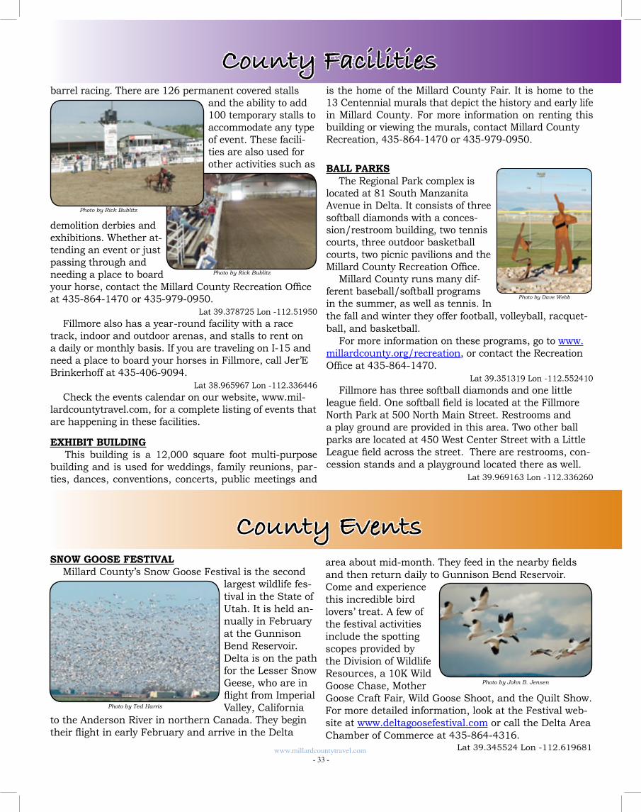
is the home of the Millard County Fair. It is home to the 13 Centennial murals that depict the history and early life in Millard County. For more information on renting this building or viewing the murals, contact Millard CountyRecreation, 435-864-1470 or 435-979-0950.
BALL PARKSThe Regional Park complex is
located at 81 South Manzanita Avenue in Delta. It consists of three softball diamonds with a conces-sion/restroom building, two tennis courts, three outdoor basketball courts, two picnic pavilions and the Millard County Recreation Office.
Millard County runs many dif-ferent baseball/softball programs in the summer, as well as tennis. In the fall and winter they offer football, volleyball, racquet-ball, and basketball.
For more information on these programs, go to www.millardcounty.org/recreation, or contact the Recreation Office at 435-864-1470.
Lat 39.351319 Lon -112.552410
Fillmore has three softball diamonds and one little league field. One softball field is located at the Fillmore North Park at 500 North Main Street. Restrooms and a play ground are provided in this area. Two other ball parks are located at 450 West Center Street with a Little League field across the street. There are restrooms, con-cession stands and a playground located there as well. Lat 39.969163 Lon -112.336260
barrel racing. There are 126 permanent covered stalls and the ability to add 100 temporary stalls to accommodate any type of event. These facili-ties are also used for other activities such as
demolition derbies and exhibitions. Whether at-tending an event or just passing through and needing a place to board your horse, contact the Millard County Recreation Office at 435-864-1470 or 435-979-0950.
Lat 39.378725 Lon -112.51950
Fillmore also has a year-round facility with a race track, indoor and outdoor arenas, and stalls to rent on a daily or monthly basis. If you are traveling on I-15 and need a place to board your horses in Fillmore, call Jer’E Brinkerhoff at 435-406-9094.
Lat 38.965967 Lon -112.336446
Check the events calendar on our website, www.mil-lardcountytravel.com, for a complete listing of events that are happening in these facilities.
EXHIBIT BUILDING This building is a 12,000 square foot multi-purpose building and is used for weddings, family reunions, par-ties, dances, conventions, concerts, public meetings and
www.millardcountytravel.com - 33 -
County Facilities
Photo by Rick Bublitz
Photo by Rick Bublitz
Photo by Dave Webb
County EventsSNOW GOOSE FESTIVAL
Millard County’s Snow Goose Festival is the second largest wildlife fes-tival in the State of Utah. It is held an-nually in February at the Gunnison Bend Reservoir. Delta is on the path for the Lesser Snow Geese, who are in flight from Imperial Valley, California
to the Anderson River in northern Canada. They begin their flight in early February and arrive in the Delta
area about mid-month. They feed in the nearby fields and then return daily to Gunnison Bend Reservoir. Come and experience this incredible bird lovers’ treat. A few of the festival activities include the spotting scopes provided by the Division of Wildlife Resources, a 10K Wild Goose Chase, Mother Goose Craft Fair, Wild Goose Shoot, and the Quilt Show. For more detailed information, look at the Festival web-site at www.deltagoosefestival.com or call the Delta Area Chamber of Commerce at 435-864-4316.
Photo by Ted Harris
Photo by John B. Jensen
Lat 39.345524 Lon -112.619681
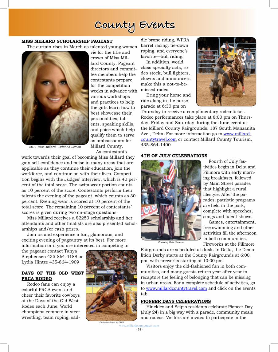
dle bronc riding, WPRA barrel racing, tie-down roping, and everyone’s favorite—bull riding.
In addition, world class specialty acts, ro-deo stock, bull fighters, clowns and announcers make this a not-to-be-missed rodeo.
Bring your horse and ride along in the horse parade at 6:30 pm on Thursday to receive a complimentary rodeo ticket. Rodeo performances take place at 8:00 pm on Thurs-day, Friday and Saturday during the June event at the Millard County Fairgrounds, 187 South Manzanita Ave., Delta. For more information go to www.millard-countytravel.com or contact Millard County Tourism, 435-864-1400.
4TH OF JULY CELEBRATIONSFourth of July fes-
tivities begin in Delta and Fillmore with early morn-ing breakfasts, followed by Main Street parades that highlight a rural lifestyle. After the pa-rades, patriotic programs are held in the park, complete with speeches, songs and talent shows.
Games, entertainment, free swimming and other activities fill the afternoon in both communities. Fireworks at the Fillmore
Fairgrounds are scheduled at dusk. In Delta, the Demo-lition Derby starts at the County Fairgrounds at 6:00 pm, with fireworks starting at 10:00 pm.
Visitors enjoy the old-fashioned fun in both com-munities, and many guests return year after year to recapture the feeling of belonging that can be missing in urban areas. For a complete schedule of activities, go to www.millardcountytravel.com and click on the events tab.
PIONEER DAYS CELEBRATIONSHinckley and Scipio residents celebrate Pioneer Day
(July 24) in a big way with a parade, community meals and rodeos. Visitors are invited to participate in the
MISS MILLARD SCHOLARSHIP PAGEANTThe curtain rises in March as talented young women
vie for the title and crown of Miss Mil-lard County. Pageant directors and commit-tee members help the contestants prepare for the competition weeks in advance with various workshops and practices to help the girls learn how to best showcase their personalities, tal-ents, speaking skills, and poise which help qualify them to serve as ambassadors for Millard County.
As contestants work towards their goal of becoming Miss Millard they gain self-confidence and poise in many areas that are applicable as they continue their education, join the workforce, and continue on with their lives. Competi-tion begins with the Judges’ Interview, which is 40 per-cent of the total score. The swim wear portion counts as 10 percent of the score. Contestants perform their talents the evening of the pageant, which counts as 30 percent. Evening wear is scored at 10 percent of the total score. The remaining 10 percent of contestants’ scores is given during two on-stage questions.
Miss Millard receives a $2250 scholarship and her attendants and other finalists are also presented schol-arships and/or cash prizes.
Join us and experience a fun, glamorous, and exciting evening of pageantry at its best. For more information or if you are interested in competing in the pageant contact Tanya Stephensen 435-864-4188 or Lydia Hintze 435-864-1909
DAYS OF THE OLD WEST PRCA RODEO
Rodeo fans can enjoy a colorful PRCA event and cheer their favorite cowboys at the Days of the Old West Rodeo each June. World champions compete in steer wrestling, team roping, sad-
www.millardcountytravel.com - 34 -
Photos furnished by PRCA
Photo by Deb Haveron
2011 Miss Millard - Brianna Lemon
County Events
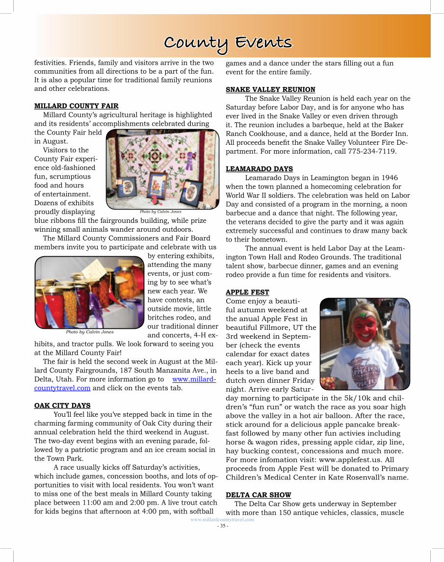
festivities. Friends, family and visitors arrive in the two communities from all directions to be a part of the fun. It is also a popular time for traditional family reunions and other celebrations.
MILLARD COUNTY FAIRMillard County’s agricultural heritage is highlighted
and its residents’ accomplishments celebrated during the County Fair held in August.
Visitors to the County Fair experi-ence old-fashioned fun, scrumptious food and hours of entertainment. Dozens of exhibits proudly displaying blue ribbons fill the fairgrounds building, while prize winning small animals wander around outdoors.
The Millard County Commissioners and Fair Board members invite you to participate and celebrate with us
by entering exhibits, attending the many events, or just com-ing by to see what’s new each year. We have contests, an outside movie, little britches rodeo, and our traditional dinner and concerts, 4-H ex-
hibits, and tractor pulls. We look forward to seeing you at the Millard County Fair!
The fair is held the second week in August at the Mil-lard County Fairgrounds, 187 South Manzanita Ave., in Delta, Utah. For more information go to www.millard-countytravel.com and click on the events tab.
OAK CITY DAYS You’ll feel like you’ve stepped back in time in the
charming farming community of Oak City during their annual celebration held the third weekend in August. The two-day event begins with an evening parade, fol-lowed by a patriotic program and an ice cream social in the Town Park.
A race usually kicks off Saturday’s activities, which include games, concession booths, and lots of op-portunities to visit with local residents. You won’t want to miss one of the best meals in Millard County taking place between 11:00 am and 2:00 pm. A live trout catch for kids begins that afternoon at 4:00 pm, with softball
www.millardcountytravel.com - 35 -
County Eventsgames and a dance under the stars filling out a fun event for the entire family.
SNAKE VALLEY REUNION The Snake Valley Reunion is held each year on the
Saturday before Labor Day, and is for anyone who has ever lived in the Snake Valley or even driven through it. The reunion includes a barbeque, held at the Baker Ranch Cookhouse, and a dance, held at the Border Inn. All proceeds benefit the Snake Valley Volunteer Fire De-partment. For more information, call 775-234-7119.
LEAMARADO DAYS Leamarado Days in Leamington began in 1946
when the town planned a homecoming celebration for World War II soldiers. The celebration was held on Labor Day and consisted of a program in the morning, a noon barbecue and a dance that night. The following year, the veterans decided to give the party and it was again extremely successful and continues to draw many back to their hometown.
The annual event is held Labor Day at the Leam-ington Town Hall and Rodeo Grounds. The traditional talent show, barbecue dinner, games and an evening rodeo provide a fun time for residents and visitors.
APPLE FESTCome enjoy a beauti-ful autumn weekend at the anual Apple Fest in beautiful Fillmore, UT the 3rd weekend in Septem-ber (check the events calendar for exact dates each year). Kick up your heels to a live band and dutch oven dinner Friday night. Arrive early Satur-day morning to participate in the 5k/10k and chil-dren’s “fun run” or watch the race as you soar high above the valley in a hot air balloon. After the race, stick around for a delicious apple pancake break-fast followed by many other fun activies including horse & wagon rides, pressing apple cidar, zip line, hay bucking contest, concessions and much more. For more infomation visit: www.applefest.us. All proceeds from Apple Fest will be donated to Primary Children’s Medical Center in Kate Rosenvall’s name.
DELTA CAR SHOWThe Delta Car Show gets underway in September
with more than 150 antique vehicles, classics, muscle
Photo by Calvin Jones
Photo by Calvin Jones
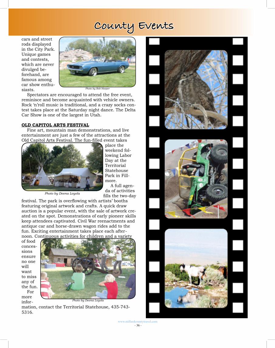
cars and street rods displayed in the City Park. Unique games and contests, which are never divulged be-forehand, are famous among car show enthu-siasts.
Spectators are encouraged to attend the free event, reminisce and become acquainted with vehicle owners. Rock ‘n’roll music is traditional, and a crazy socks con-test takes place at the Saturday night dance. The Delta Car Show is one of the largest in Utah.
OLD CAPITOL ARTS FESTIVALFine art, mountain man demonstrations, and live
entertainment are just a few of the attractions at the Old Capitol Arts Festival. The fun-filled event takes
place the weekend fol-lowing Labor Day at the Territorial Statehouse Park in Fill-more.
A full agen-da of activities
fills the two-day festival. The park is overflowing with artists’ booths featuring original artwork and crafts. A quick draw auction is a popular event, with the sale of artwork cre-ated on the spot. Demonstrations of early pioneer skills keep attendees captivated. Civil War reenactments and antique car and horse-drawn wagon rides add to the fun. Exciting entertainment takes place each after-noon. Continuous activities for children and a variety of food conces-sions ensure no one will want to miss any of the fun.
For more infor-mation, contact the Territorial Statehouse, 435-743-5316.
www.millardcountytravel.com - 36 -
Photo by Deena Loyola
Photo by Deena Loyola
County Events
Photo by Bob Harper
a dozen guns volleyed in unison at the startled survey-ors. Captain Gunnison, who was washing down by the river, drew his revolver and fired upon his assailants in a vain attempt to protect himself. Eight of Gunnison’s men were killed in 20 minutes; none of the Indians were killed.
It was 12 days before a burial party for Gunnison’s men, which included Chief Kanosh, arrived at the death scene. By then the coyotes and other animals had left only mutilated skeletons glistening in the sun. Captain Gunnison was recognized by grey hair that clung to his temples. Captain Gunnison and William Potter were wrapped in blankets and taken back with the group. The other men were buried at the site of the massacre.
Some of the Indians were tried in court during 1855. They were found guilty and given jail sentences for the massacre. A stone monument marks the site where the massacre occurred. Approximately 5 miles west of Hinckley look for the historical marker sign, turn south and travel approximately 2 miles on a gravel road to the site. Due to vandalism, the plaque describing what hap-pened has been removed from the marker and is now located in the Great Basin Museum located in Delta.
Lat 39.280815 Lon -112.778005
GHOST TOWN OF JOYFew things capture the imagination like a ghost
town. Stand at the end of Main Street and listen for echoes from the past in the town of Joy. In 1879 min-ing operations and a copper smelter was established in and named in honor of Harry Joy, a mining engineer from Detroit, Michigan. The town was a supply point for miners and ranchers. A hotel, café, store, bunk hous-es and other buildings once stood against the desert skyline. The Drum Mining District straddled the Juab/Millard County line and mined gold, silver, copper and other minerals. The excessive cost of hauling fuel to the smelter caused an early closure. The mine continued to operate for many years after the town of Joy was aban-doned, mostly taking manganese. All that remains are a few shacks, crumbled foun-dations, a double headed mine frame and a lone grave at the cross-roads. Travel west on the Brush Highway about 31 miles. Turn left on a gravel road and travel about 6.5 miles to where the town of Joy once stood.
Lat 39.572364 Lon -113.061257
GUNNISON MASSACRE SITEIn the history of Mil-
lard County, there was sometimes needless trouble with the Indians. The Gunnison Massacre is an example of that type of tragedy. Briefly told, the incident had its beginning in Kanosh. The Hudspeth Emigrant train, on its way to Cali-
fornia, had stopped at the Corn Creek Camp site. The wagon train had been previously warned in Fillmore that they may encounter Indians along the way, but were friendly, if left alone.
Hudspeth shouldered his rifle and went out hunting while members of the train rested at the campsite. While he was gone, some Indian braves came into the circle of wagons. As they usually did, the braves had bows and arrows with them, but were hoping to trade buckskin moccasins and gloves for supplies. One member of the train perceived the weapons as a threat and snatched a bow from the hands of an old Indian brave. The Indian responded by drawing an arrow from his quiver, prod-ding the traveler in the chest. A struggle occurred and two other Indians were hurt, while the old brave was shot twice and died the next night. Unfortunately, the older Indian was the father of a war chief, Moshoquope, who was known to be hot-tempered. The Chief wanted vengeance. Chief Kanosh advised peace and explained that the odds were against them. However, Mosho-quope was intent on revenge for his father.
When Hudspeth returned to camp and heard what had happened, he hurriedly broke camp and had his company head south for fear of what might happen. Moshoquope wanted to follow them, but Chief Kanosh would not allow it, and had the power to enforce his decision. Chief Moshoquope took his braves and went on the war path heading west toward the Se-vier River.
About two weeks later, another party lead by Captain John W. Gunnison was traveling through the area look-ing for a railroad route. He was warned of the trouble with Moshoquope and told to watch for his war party. When Gunnison arrived at the Sevier River and hadn’t seen any sign of Indians, he sent half of his men north. He and the rest of his party headed south and were spot-ted by Moshoquope’s war party. During the night, the warriors planned their attack.
On the morning of October 2, 1853, the attack began with the cook being shot and arrows flying. More than
www.millardcountytravel.com - 37 -
Photo by Tim Haveron
Photo by Tim Haveron
Photo by Tim Haveron
Items of Interest
HOTELS/MOTELS
• County Seat: Fillmore • Largest City: Delta • Population: Approx. 12,000 • Area: 6,561 Square Miles • Primary Industry: Agriculture
• Average Max Temperature 66° F• Average Low Temperature: 38°F• Average Precipitation: 14”• Low Humidity• 3rd Largest County in the State
Millard County Facts
FILLMORE HOTELS/MOTELS
Best Western Paradise Inn901 North Main 435-743-6895http://book.bestwestern.com 76 rooms
Capital Motel30 East Center435-743-841540 rooms
Country Garden Bed & Breakfast190 South Main435-743-76083 rooms
Fillmore Motel61 North Main435-743-545410 rooms
JKS Travel Plaza 885 South Park Ave.435-743-444018 rooms
Spinning Wheel65 South Main435-743-6260http://spinningwheelmotel.net/16 rooms
Comfort Inn & Suites940 South Highway 99435-743-433456 rooms
Photo by Dave Webb
Frequently Asked Questions
What opportunities are there for shopping in Millard County? Fillmore and Delta are our largest towns, both offer retail services that can provide you with any item you are seeking, from Groceries, to fine gifts, to camping gear, to Sun-dries. Just ask a local and they will point you to the nearest retailer. Our small communities also offer some quaint shopping opportunities that should not be missed.
Where can I eat? You can get everthing from Mexican, Chinese, Steaks, Burgers, Pizza and American food at our locally owned and oper-ated restaurants. Ask for details wherever you are staying or go to www.millardcounty.com and click on “Services”: Restaurants.
Can I rent ATV’s in Millard County? Yes, there are a few companies that provide these services. Go to www.millardcounty.com and click on “Services”: ATV Rentals.
What health care services are available? There is full service hospital and medical clinics located in both Fillmore and Delta.
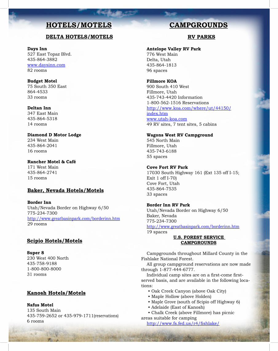
Scipio Hotels/Motels
Super 8230 West 400 North435-758-91881-800-800-800031 rooms
Kanosh Hotels/Motels
Nafus Motel135 South Main435-759-2652 or 435-979-1711(reservations)6 rooms
CAMPGROUNDS
DELTA HOTELS/MOTELS
Days Inn527 East Topaz Blvd.435-864-3882www.daysinn.com 82 rooms
Budget Motel75 South 350 East864-453333 rooms
Deltan Inn347 East Main435-864-531814 rooms
Diamond D Motor Lodge234 West Main435-864-204116 rooms
Rancher Motel & Café171 West Main435-864-274115 rooms
Baker, Nevada Hotels/Motels
Border InnUtah/Nevada Border on Highway 6/50775-234-7300http://www.greatbasinpark.com/borderinn.htm 29 rooms
RV PARKS
Antelope Valley RV Park776 West MainDelta, Utah 435-864-181396 spaces
Fillmore KOA900 South 410 WestFillmore, Utah435-743-4420 Information1-800-562-1516 Reservationshttp://www.koa.com/where/ut/44150/index.htm www.utah-koa.com 49 RV sites, 7 tent sites, 5 cabins
Wagons West RV Campground545 North MainFillmore, Utah 435-743-618855 spaces
Cove Fort RV Park17030 South Highway 161 (Ext 135 off I-15; Exit 1 off I-70)Cove Fort, Utah435-864-753533 spaces
Border Inn RV ParkUtah/Nevada Border on Highway 6/50Baker, Nevada775-234-7300http://www.greatbasinpark.com/borderinn.htm 19 spaces
U.S. FOREST SERVICE CAMPGROUNDS
Campgrounds throughout Millard County in the Fishlake National Forest.
All group campground reservations are now made through 1-877-444-6777.
Individual camp sites are on a first-come first-served basis, and are available in the following loca-tions:
• Oak Creek Canyon (above Oak City) • Maple Hollow (above Holden) • Maple Grove (south of Scipio off Highway 6) • Adelaide (East of Kanosh) • Chalk Creek (above Fillmore) has picnic
areas suitable for campinghttp://www.fs.fed.us/r4/fishlake/
HOTELS/MOTELS