Embed Size (px)
Citation preview

3/17/2010
1
Flood plain managementmanagement
Non-structural intervention to
b t fl dicombat flooding
Contents of the presentation
•Floodplain morphology, geomorphologic processd hi tand geomorphic agents
•Flood plain types and river actions
•Non structural measures; Planning & Communityparticipation and managementparticipation and managementadministrative issues
3/17/2010
2
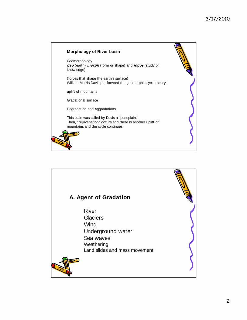
Morphology of River basin
Geomorphology geo (earth) morph (form or shape) and logos (study or knowledge).
(forces that shape the earth's surface)(forces that shape the earth s surface) William Morris Davis put forward the geomorphic cycle theory
uplift of mountains
Gradational surface
Degradation and Aggradations
This plain was called by Davis a "peneplain,“Then, "rejuvenation" occurs and there is another uplift of mountains and the cycle continues
A. Agent of Gradation
RiverGlaciersWindUnderground waterSea waves Weathering Land slides and mass movement

3/17/2010
3
1. RiverRivers show a remarkable diversity of character and behavior in any catchments.
Three stages of River
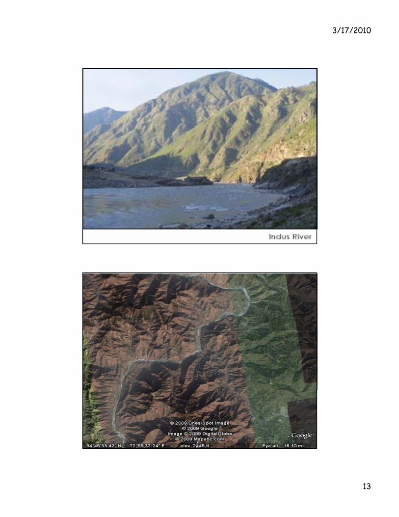
Youth stage: Degrading Streams Create V-Shape valley and erosioneg River Indus in Himalayas Mountains
Middle/ Maturity stage Streams in Equilibrium Deposition and erosion equal/balance Streams are able to carve wider
eg, Upper Indus (Punjab below Kalabagh)
Maturity ("old age") Streams and DeltasMaturity ( old age ) Streams and Deltasmeandering, deposition, choking of the river flood plain, overspill of water and floods, ultimately entering into delta, eg the indus delta in Sindh

3/17/2010
4
2.Climatic change:
Three glaciations periodsCold climate: Glaciers advancement Worm climate: Rivers/ Rise in the sea level/melting of ice & glaciers, floodsand erosion (no population or few)
Climate change the current scenario Extreme weather event/too many rains or drought
3. Geological or tectonic uplift also cause the erosion and depositions

3/17/2010
5
B.. Anthropogenic /Human activities
Profoundly effect of:
Building of Dam/ Barrage/Canalsg f D m gPorts, Mining, Human settlement/Road net worksFarming/Deforestation,
Improper land use practices, eg overgrazing, l i icultivation
Over exploitation of the resources etc. with out doing EIA/SIA/SEA community participation
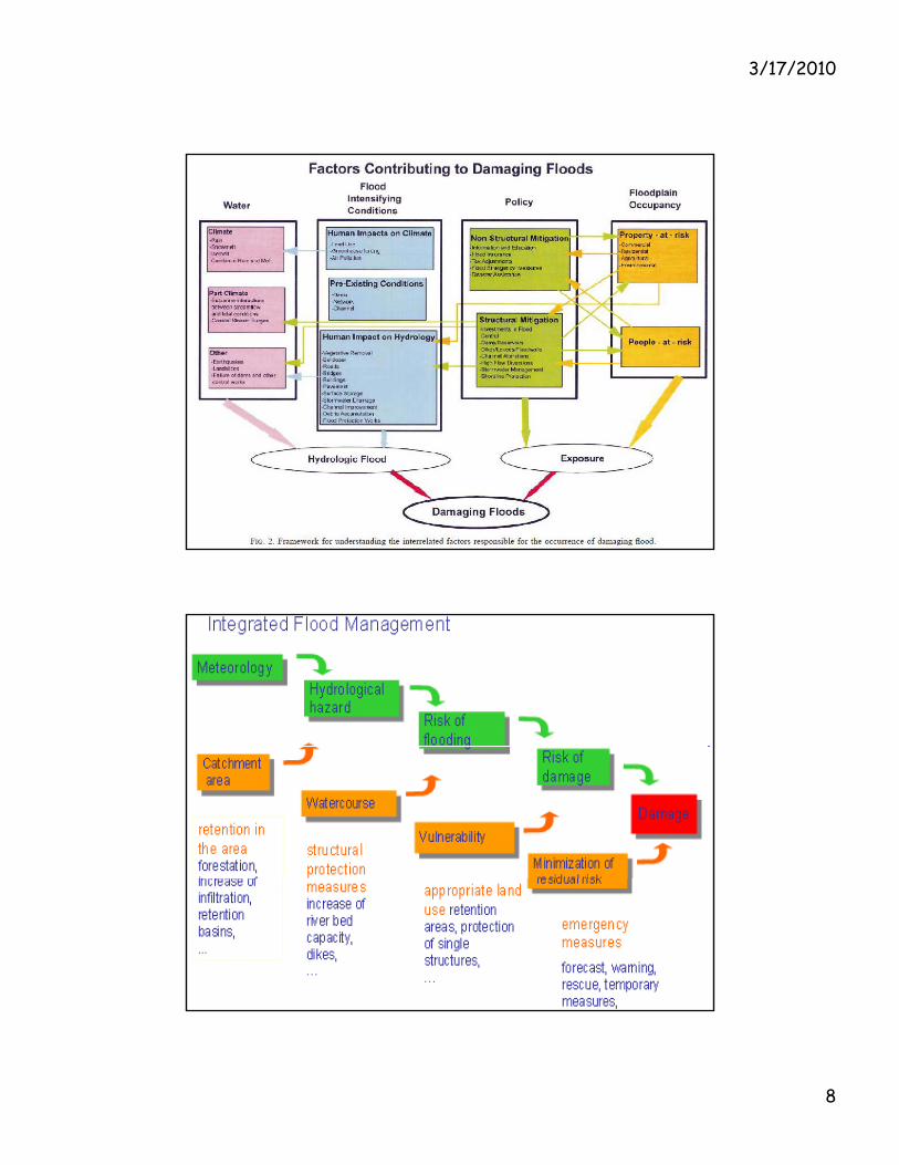
1. River management programs:Must respect the inherent diversity and behavioral regime of aquatic ecosystems.
Each catchment should be managed in its own right, Patterns/ and forms and processes upstream and down streamGeomorphic information that provides a physical template for Geomorphic information that provides a physical template for river rehabilitation activities.
For effective water shed management/cross boundaries issueNeed to consider the activities in the whole water shedBoth ecosystem: the mountain and the plain
Need integrated development planning to reduce the hazards, multi sector, multi year development planningRegional planning approach like TVA in USA or TDA in ThalCurrently no such arrangement in Pakistan
3/17/2010
6
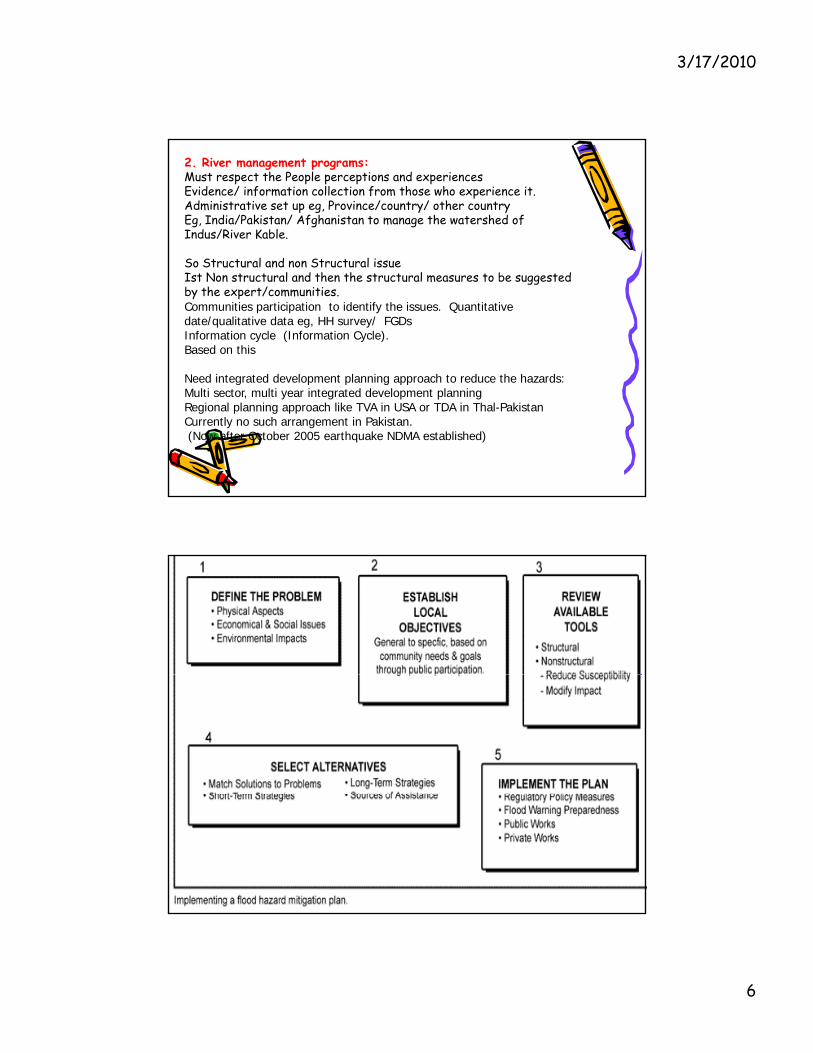
2. River management programs:Must respect the People perceptions and experiencesEvidence/ information collection from those who experience it.Administrative set up eg, Province/country/ other countryEg, India/Pakistan/ Afghanistan to manage the watershed of Indus/River Kable.
l d l So Structural and non Structural issueIst Non structural and then the structural measures to be suggested by the expert/communities.Communities participation to identify the issues. Quantitative date/qualitative data eg, HH survey/ FGDsInformation cycle (Information Cycle).Based on this
Need integrated development planning approach to reduce the hazards:Need integrated development planning approach to reduce the hazards: Multi sector, multi year integrated development planningRegional planning approach like TVA in USA or TDA in Thal-PakistanCurrently no such arrangement in Pakistan.(Now after October 2005 earthquake NDMA established)
3/17/2010
7
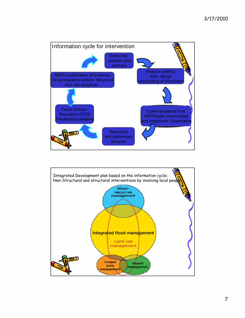
Define the problem and
partnersAnalyse existing
data, designSEPA socialization of Evidence
Information cycle for intervention
, gand piloting of instrument
Collect evidence from
for participatory Actions: StructuralAnd non-structural
Focus Groups Discussion (FGD) HH/People/ communities
and institutions: Quantitative
Data entryand preliminary
analysis
Discussion (FGD) Feedback/Qualitative
Integrated Development plan based on the information cycle:Non-Structural and structural interventions by involving local people
3/17/2010
8

3/17/2010
9
3/17/2010
10

3/17/2010
11
3/17/2010
12
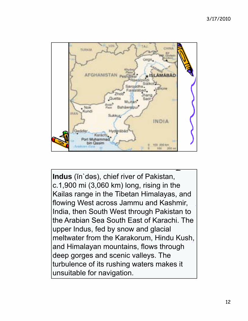
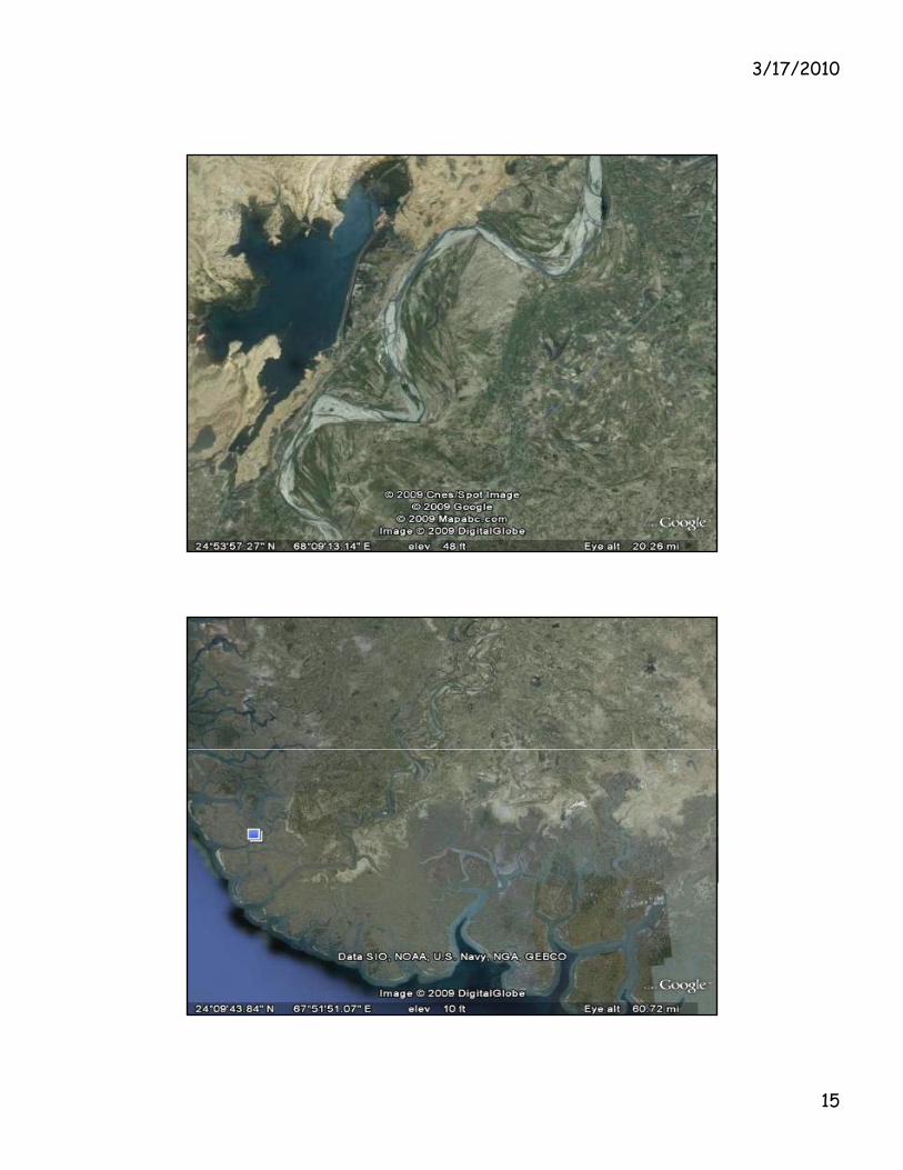
Indus (ĭn`dəs), chief river of Pakistan, c.1,900 mi (3,060 km) long, rising in the Kailas range in the Tibetan Himalayas, and flowing West across Jammu and Kashmir, g ,India, then South West through Pakistan to the Arabian Sea South East of Karachi. The upper Indus, fed by snow and glacial meltwater from the Karakorum, Hindu Kush, and Himalayan mountains, flows through deep gorges and scenic valleys. The turbulence of its rushing waters makes it unsuitable for navigation.
3/17/2010
13

3/17/2010
14
3/17/2010
15
3/17/2010
16
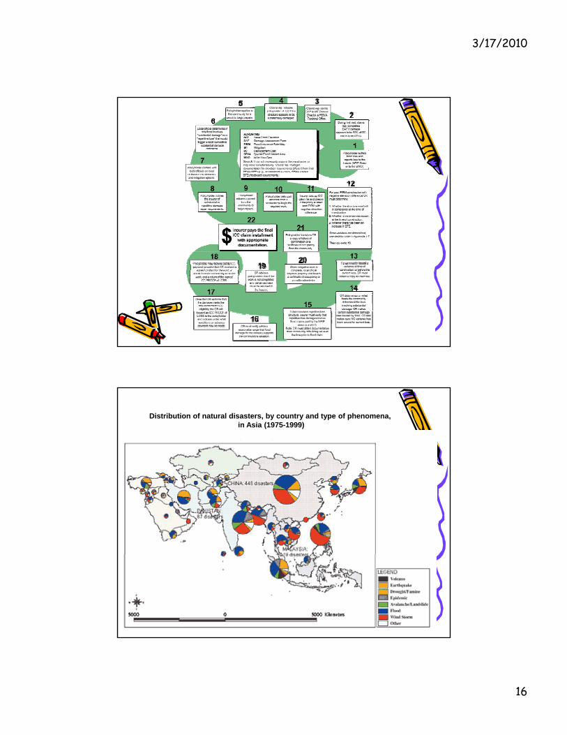
Distribution of natural disasters, by country and type of phenomena, in Asia (1975-1999)
3/17/2010
17
The Agno River Basin Development Commission is mandated to oversee and coordinate all development along this river and to ensure a holistic approach towards its water resources planning and management. Its functions are to:
Develop a comprehensive master plan for the river basin, I t t thi l ith l l d i l l d i t tIntegrate this plan with local and regional plans and investment programmes, Implement development projects related to the basin, Initiate, receive and recommend project proposals for the basin's development, Formulate, review and propose improvements in existing policies governing the basin's development, Commission, coordinate, monitor all planning studies and research and development in the basin; Coordinate preventive measures and other projects among concerned government agenciesagencies, Establish a functional information and database system including computer generated planning tools such as GIS.
Implementation of the Red River Basin VisionThe March 2000 Hanoi Round Table on Water Vision made the following proposals:
Clean water, green land and a prosperous people, establish a Red River Basin Commission as agencies presently responsible for management of river basin water resources are fragmented among many bodies, provincial authorities g g y , pand civic groups, consolidate all plans (sector and local) into an integrated basin plan for sustainable development, disseminate it to all stakeholders, and mobilize and encourage their participation in its implementation, and take priority actions to create an integrated master plan, establish a management body for the basin's water resources within a suitable legal and institutional framework, popularise this plan, promote better control and mitigation of water-related disasters, particularly floods, enhance management role of government agencies to improve interaction betweenmanagement role of government agencies to improve interaction between sectors and with the people, and increase public awareness of the "clean water and green land" concept and seek their involvement.
3/17/2010
18
The following solutions at different levels and in different sectors were identified:survey and monitor flood prone areas to effectively mitigate floods, classify their depth and frequency and prepare for emergency measures to reduce or overcome damage caused by exceptional ones, forecast and monitor on a regional basis, institute proper reservoir management to optimise storage and energy production, invest in control works, e.g.,30 flood gates and protection dikes and make local and national investment studies to assess effectiveness of such measures taken, and provide a basis to prioritise essential investments to rehabilitate and construct flood control and water management infrastructure, build local awareness and preparedness at district and village levels, encourage cooperation in implementing self-help projects and making use of traditional technologies to find the most cost effective and sustainable technologies, diversify agricultural production and extend production basis of irrigated crops during dry season to compensate for recurrent losses due to floods, implement appropriate and adequate national and local mechanisms and capacityimplement appropriate and adequate national and local mechanisms and capacity to cope with emergences and plan for long-term solutions, and establish a national flood management unit to consolidate strategies that include assessment, classification, monitoring, planning, etc. to contain flood damage.
Flood Mitigation Surveys:
•integrate approach to data collection and management takinginto account ground and satellite based technology,
•evaluate alternative procedures using remote sensingp g gtechnologies, incorporating the hydrometric network andhydrodynamic studies,
•institute joint plan of action among regional pilot projects,
•practice real time reception of meteorological satellite data,
t ti l iti f i d f fl d d t•promote national capacities for processing and use of flood data,and
•encourage further regional cooperation..
3/17/2010
19
Flood Forecasting and River Modelling:
Modernize present flood forecasting system with new components such as pattern recognition techniques to process rainfall forecasts, distributed hydrological modelling, hydrodynamic and flow modelling etc.,
Exchange information and data transfer between regional and national centres, reinforce centres, and
adopt a consistent and harmonized line of software for database management, simulation modelling and water resources planning.
study flood phenomena, operate reservoirs on a multipurpose basis, implement flood protection schemes based on typographic data
and time dependent hydrologic simulation, and use differential GPS for topographic mapping
Flood Control Works:make additional studies to assess potential and feasibility of flood protection works, taking into account increased agricultural production from flood protection measures and irrigation safety of human lives and possible impact onirrigation, safety of human lives and possible impact on environment,
strengthen local capacity in planning and implementation, including training of national and local technical staff for feasibility studies on flood control work and provision of support to local communities, and ,develop a national framework for integrated water resources management, with adequate attention on a national water sector profile, including important potential flood control works, to ensure adequate investment and resources in this sector.

3/17/2010
20
Local Preparedness in Flood Control:
develop awareness and preparedness in cooperation with local communities, plan community involvement to increase awareness and willingness to participate, furnish adequate technical and financial support, train provincial and district staff, and i l t i l l t i i tiimplement simple, low-cost irrigation technologies.
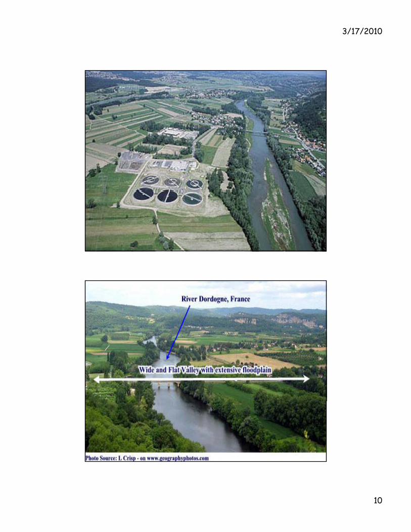
Floodplain level land along the course of a river formed by the deposition of sediment during periodic floods.
Floodplains contain such features as levees, delta plains, and oxbow lakes.
Floodplains may be extensive, such as below the conflux of the Ohio and the Mississippi, where they have a width up to 80 mi (130 km).
River Indus below Kalabagh
Rivers with extensive floodplains are the Indus, Nile, Ganges, Danube, and Po.
Floodplains are generally very fertile thus making them richFloodplains are generally very fertile, thus making them rich agricultural lands.
The disadvantage of farming on a floodplain is the natural hazard of floods . In the United States there has been extensive house construction on floodplains in recent years, necessitating the construction of new dams to control small, annual floods.

3/17/2010
21
Conclusion
• Effective flood plain management • Need intervention and control• Building Institutions• Capacity building
U f d t h l RS/GIS• Use of modern technology RS/GIS• Legislation• Land use planning and control• Clear administrative boundary and control through the local
institutions• Community/CBOs/NGOs participation for action eg, Plantation of
tress• and grasses on shamalat/commons to control erosion and minimizeand grasses on shamalat/commons to control erosion and minimize
flood hazards • Awareness raising programme• Allocation of resources