Embed Size (px)
Citation preview

Fleetbroadband from Stratos
AWT Worldwide
June 23rd, 2010
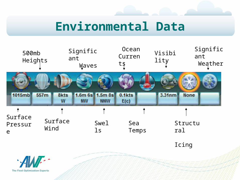
Environmental Data
Surface Pressure
500mb Heights
Surface Wind
Significant Waves
Swells
Ocean Currents
Sea Temps
Visibility
Structural Icing
Significant Weather
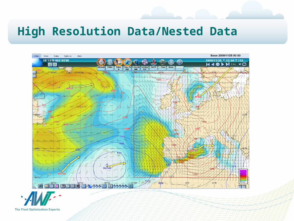
High Resolution Data/Nested Data
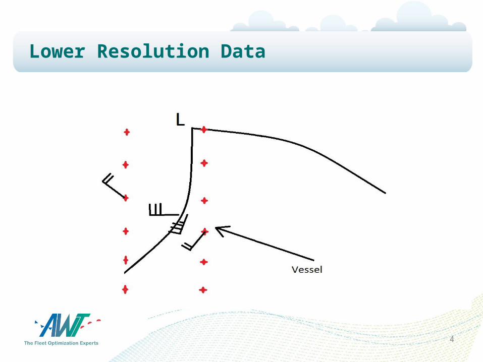
Lower Resolution Data
4
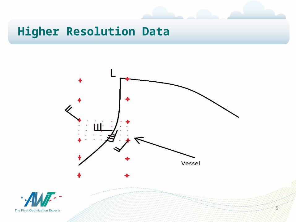
Higher Resolution Data
5
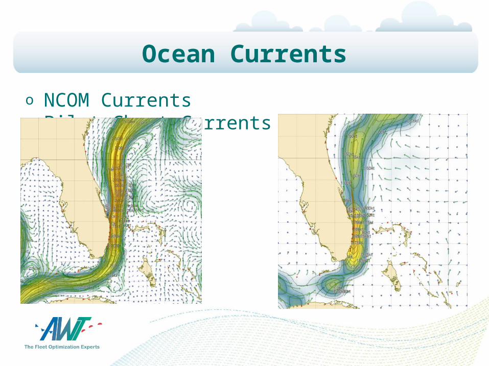
Ocean Currents
o NCOM Currents Pilot Chart Currents
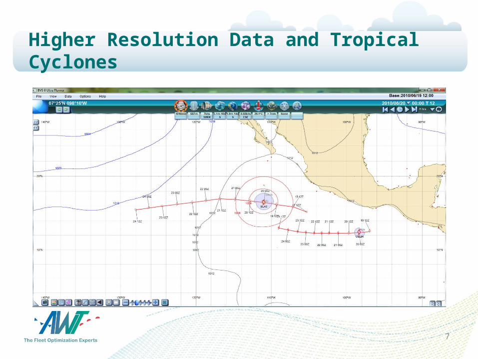
Higher Resolution Data and Tropical Cyclones
7
8
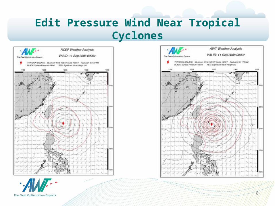
Edit Pressure Wind Near Tropical Cyclones
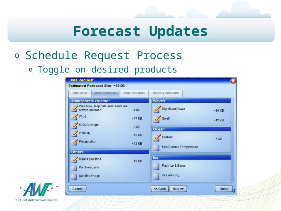
Forecast Updates
o Schedule Request Processo Toggle on desired products
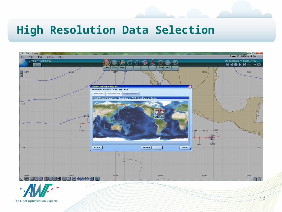
High Resolution Data Selection
10
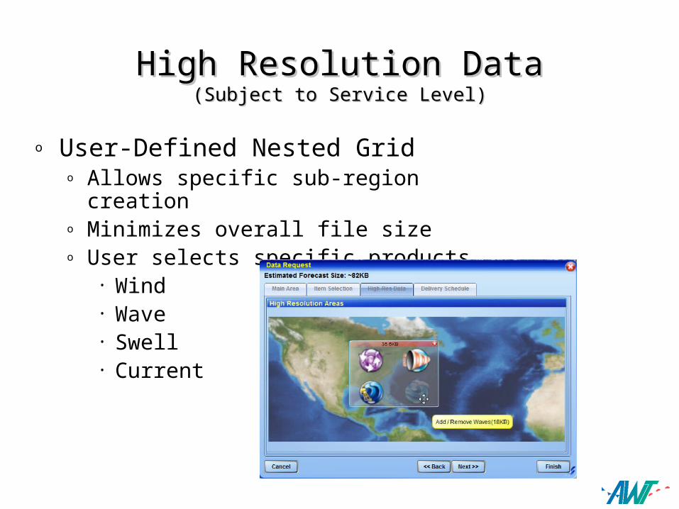
High Resolution DataHigh Resolution Data(Subject to Service Level)(Subject to Service Level)
o User-Defined Nested Grid o Allows specific sub-region creationo Minimizes overall file sizeo User selects specific products
• Wind• Wave• Swell• Current
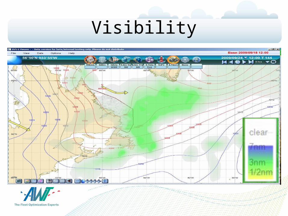
Visibility
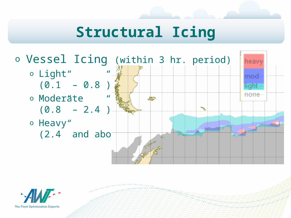
Structural Icing
o Vessel Icing (within 3 hr. period)o Light
(0.1” – 0.8”)o Moderate
(0.8” – 2.4”)o Heavy
(2.4” and above)
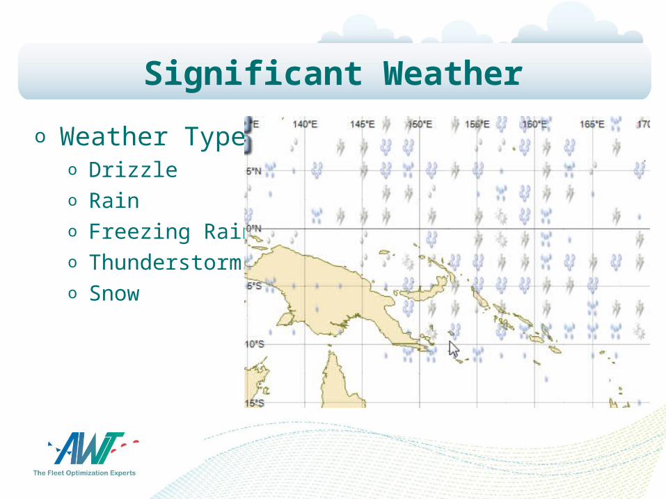
Significant Weather
o Weather Typeo Drizzleo Raino Freezing Raino Thunderstormso Snow

Government Data
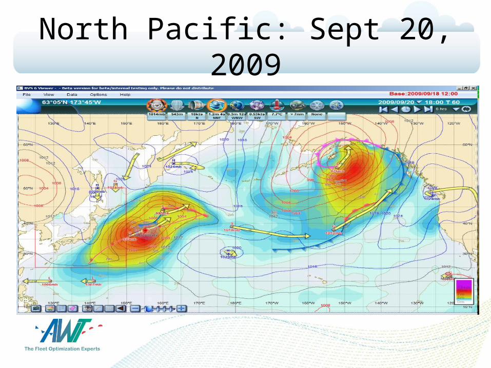
North Pacific: Sept 20, 2009

Vessel Motion Alarms
o BVS customized to vessel typeo Voyage specific information entered
• Graph displays motion risk
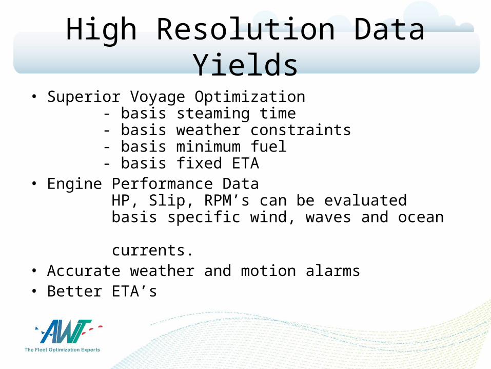
High Resolution Data Yields
• Superior Voyage Optimization - basis steaming time - basis weather constraints - basis minimum fuel - basis fixed ETA
• Engine Performance Data HP, Slip, RPM’s can be evaluated basis specific wind, waves and ocean currents.
• Accurate weather and motion alarms• Better ETA’s
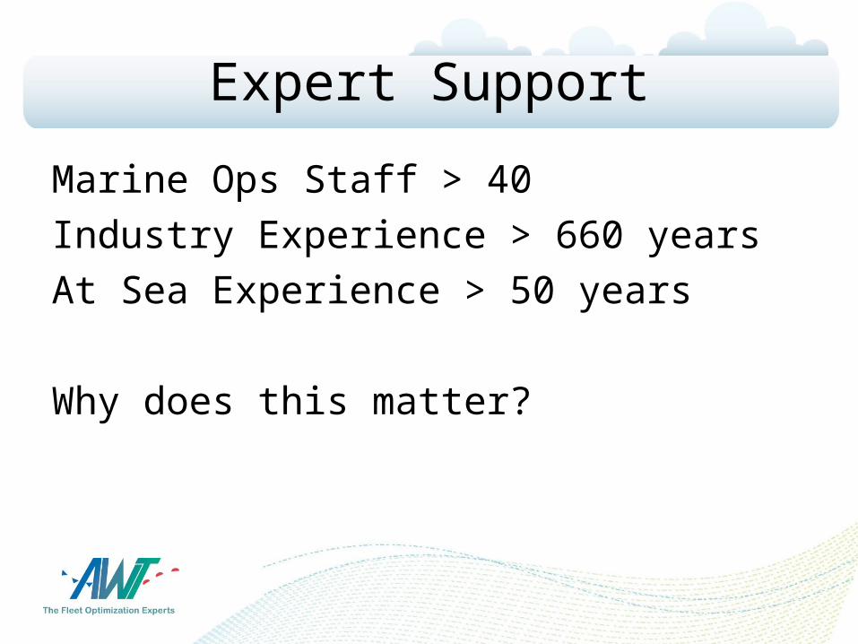
Expert Support
Marine Ops Staff > 40
Industry Experience > 660 years
At Sea Experience > 50 years
Why does this matter?
Thank You