Embed Size (px)
Citation preview
Simpsons Track
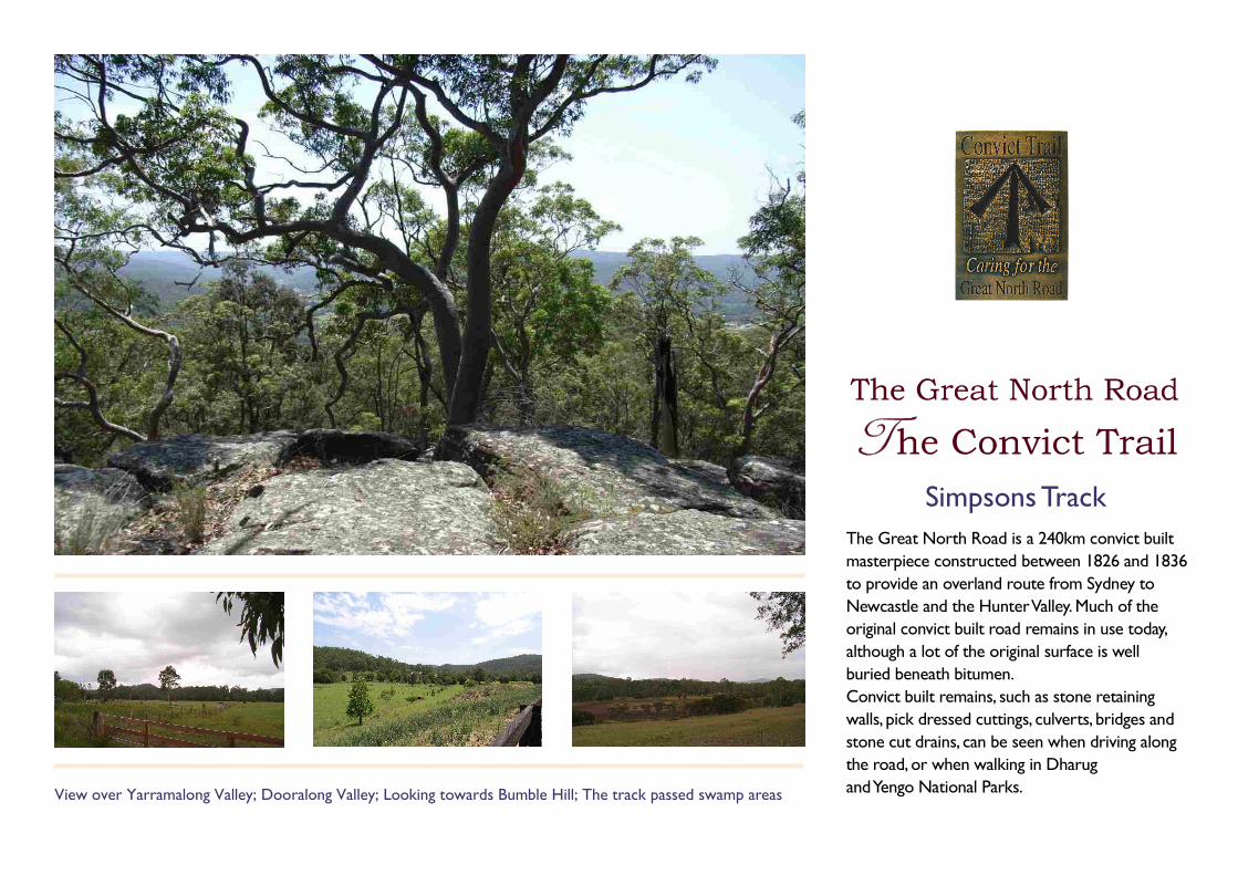
View over Yarramalong Valley; Dooralong Valley; Looking towards Bumble Hill; The track passed swamp areas
The Great North Road is a 240km convict built
masterpiece constructed between 1826 and 1836
to provide an overland route from Sydney to
Newcastle and the Hunter Valley. Much of the
original convict built road remains in use today,
although a lot of the original surface is well
buried beneath bitumen.
Convict built remains, such as stone retaining
walls, pick dressed cuttings, culverts, bridges and
stone cut drains, can be seen when driving along
the road, or when walking in Dharug
and Yengo National Parks.
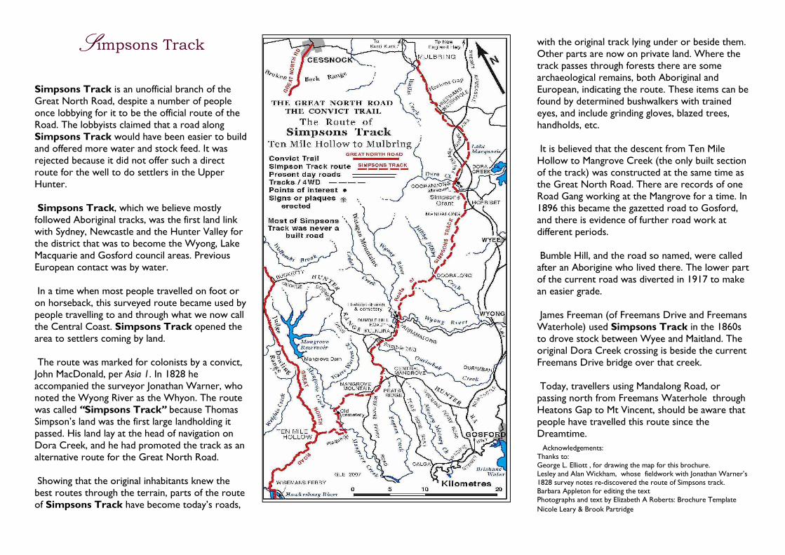
Simpsons Track is an unofficial branch of the Great North Road, despite a number of people once lobbying for it to be the official route of the Road. The lobbyists claimed that a road along Simpsons Track would have been easier to build and offered more water and stock feed. It was rejected because it did not offer such a direct route for the well to do settlers in the Upper Hunter. Simpsons Track, which we believe mostly followed Aboriginal tracks, was the first land link with Sydney, Newcastle and the Hunter Valley for the district that was to become the Wyong, Lake Macquarie and Gosford council areas. Previous European contact was by water. In a time when most people travelled on foot or on horseback, this surveyed route became used by people travelling to and through what we now call the Central Coast. Simpsons Track opened the area to settlers coming by land. The route was marked for colonists by a convict, John MacDonald, per Asia 1. In 1828 he accompanied the surveyor Jonathan Warner, who noted the Wyong River as the Whyon. The route was called “Simpsons Track” because Thomas Simpson’s land was the first large landholding it passed. His land lay at the head of navigation on Dora Creek, and he had promoted the track as an alternative route for the Great North Road. Showing that the original inhabitants knew the best routes through the terrain, parts of the route of Simpsons Track have become today’s roads,
with the original track lying under or beside them. Other parts are now on private land. Where the track passes through forests there are some archaeological remains, both Aboriginal and European, indicating the route. These items can be found by determined bushwalkers with trained eyes, and include grinding gloves, blazed trees, handholds, etc. It is believed that the descent from Ten Mile Hollow to Mangrove Creek (the only built section of the track) was constructed at the same time as the Great North Road. There are records of one Road Gang working at the Mangrove for a time. In 1896 this became the gazetted road to Gosford, and there is evidence of further road work at different periods. Bumble Hill, and the road so named, were called after an Aborigine who lived there. The lower part of the current road was diverted in 1917 to make an easier grade. James Freeman (of Freemans Drive and Freemans Waterhole) used Simpsons Track in the 1860s to drove stock between Wyee and Maitland. The original Dora Creek crossing is beside the current Freemans Drive bridge over that creek. Today, travellers using Mandalong Road, or passing north from Freemans Waterhole through Heatons Gap to Mt Vincent, should be aware that people have travelled this route since the Dreamtime.
Acknowledgements: Thanks to: George L. Elliott , for drawing the map for this brochure. Lesley and Alan Wickham, whose fieldwork with Jonathan Warner’s 1828 survey notes re-discovered the route of Simpsons track. Barbara Appleton for editing the text Photographs and text by Elizabeth A Roberts: Brochure Template
Nicole Leary & Brook Partridge
SSSSimpsons Track
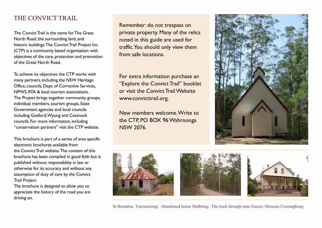
St Barnabas, Yarramalong; Abandoned house Mulbring; The track through state forests; Museum Coorangbong
Remember: do not trespass on
private property. Many of the relics
noted in this guide are used for
traffic. You should only view them
from safe locations.
For extra information purchase an
“Explore the Convict Trail” booklet
or visit the Convict Trail Website
www.convicttrail.org.
New members welcome. Write to
the CTP, PO BOX 96 Wahroonga
NSW 2076.
THE CONVICT TRAIL
The Convict Trail is the name for The Great
North Road, the surrounding land, and
historic buildings. The Convict Trail Project Inc.
(CTP) is a community based organisation with
objectives of the care, protection and promotion
of the Great North Road.
To achieve its objectives the CTP works with
many partners, including the NSW Heritage
Office, councils, Dept. of Corrective Services,
NPWS, RTA & local tourism associations.
The Project brings together community groups,
individual members, tourism groups, State
Government agencies and local councils
including Gosford, Wyong and Cessnock
councils. For more information, including
“conservation partners” visit the CTP website.
This brochure is part of a series of area specific
electronic brochures available from
the Convict Trail website. The content of this
brochure has been compiled in good faith but is
published without responsibility in law or
otherwise for its accuracy and without any
assumption of duty of care by the Convict
Trail Project.
The brochure is designed to allow you to
appreciate the history of the road you are
driving on.