Embed Size (px)
Citation preview
1© 2016
Making Complex Data Usable
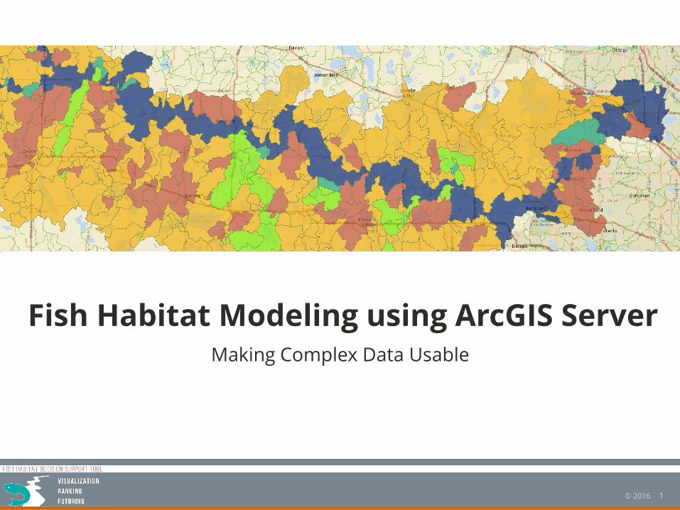
Fish Habitat Modeling using ArcGIS Server
2© 2016
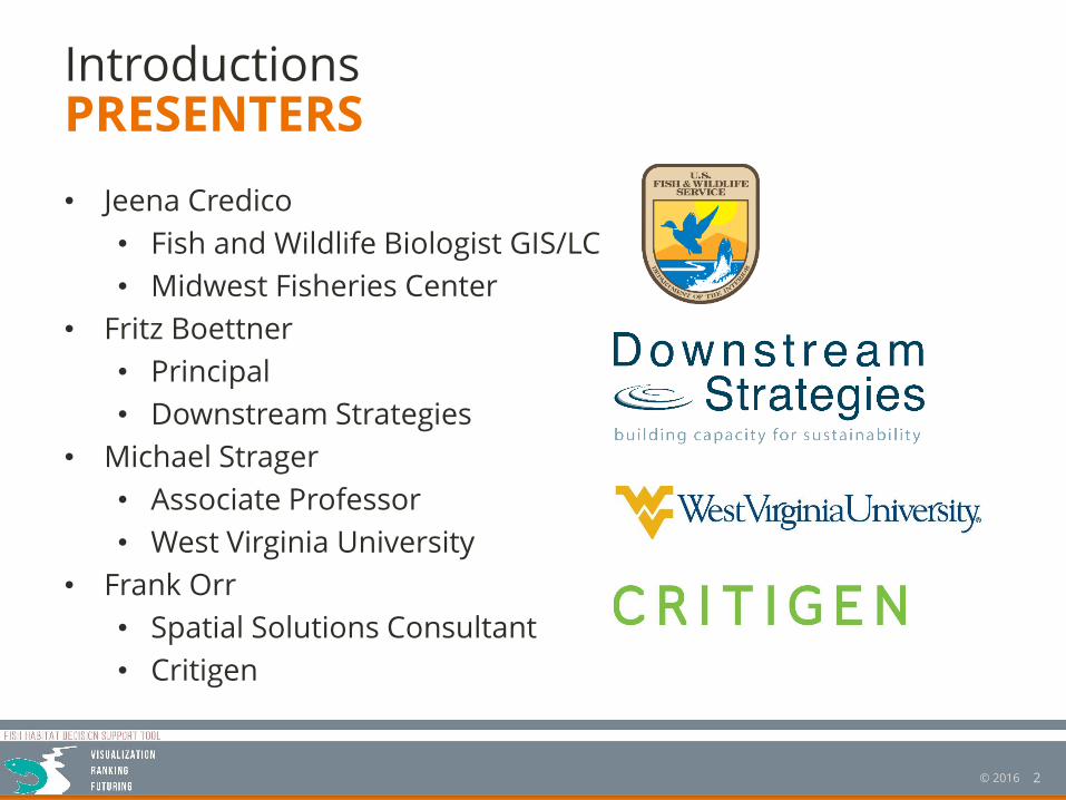
Introductions
• Jeena Credico
• Fish and Wildlife Biologist GIS/LC
• Midwest Fisheries Center
• Fritz Boettner
• Principal
• Downstream Strategies
• Michael Strager
• Associate Professor
• West Virginia University
• Frank Orr
• Spatial Solutions Consultant
• Critigen
PRESENTERS
3© 2016
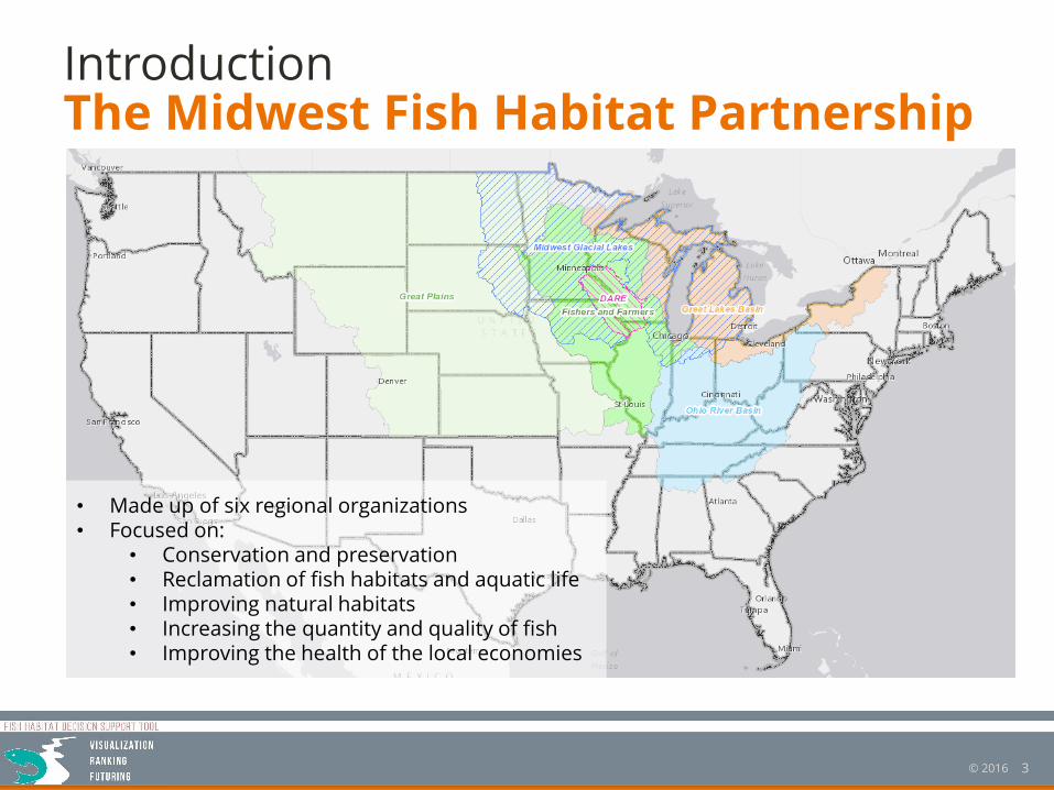
IntroductionThe Midwest Fish Habitat Partnership
• Made up of six regional organizations• Focused on:
• Conservation and preservation• Reclamation of fish habitats and aquatic life• Improving natural habitats• Increasing the quantity and quality of fish• Improving the health of the local economies
4© 2016
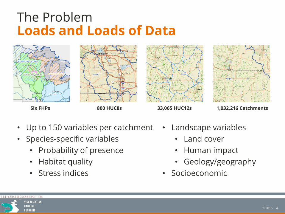
The ProblemLoads and Loads of Data
Six FHPs 33,065 HUC12s800 HUC8s 1,032,216 Catchments
• Up to 150 variables per catchment
• Species-specific variables
• Probability of presence
• Habitat quality
• Stress indices
• Landscape variables
• Land cover
• Human impact
• Geology/geography
• Socioeconomic
5© 2016
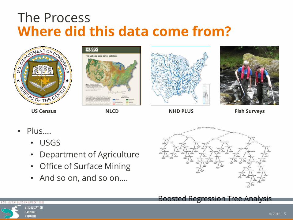
The ProcessWhere did this data come from?
US Census NHD PLUSNLCD Fish Surveys
• Plus….
• USGS
• Department of Agriculture
• Office of Surface Mining
• And so on, and so on….
Boosted Regression Tree Analysis
6© 2016
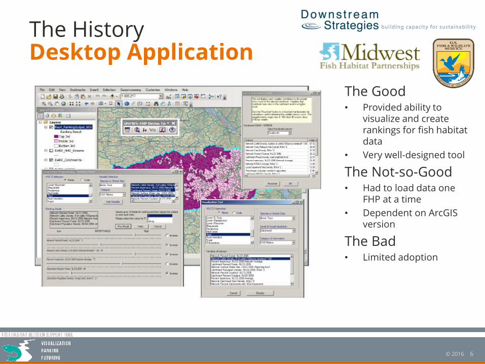
The HistoryDesktop Application
The Good• Provided ability to
visualize and create rankings for fish habitat data
• Very well-designed tool
The Not-so-Good• Had to load data one
FHP at a time
• Dependent on ArcGIS version
The Bad• Limited adoption
7© 2016
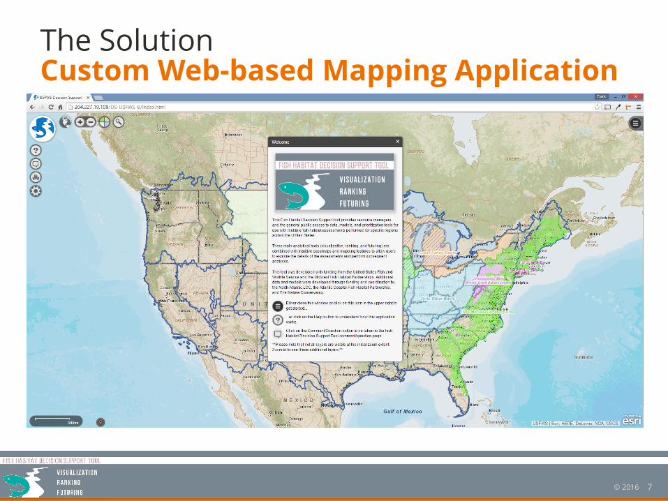
The SolutionCustom Web-based Mapping Application
8© 2016
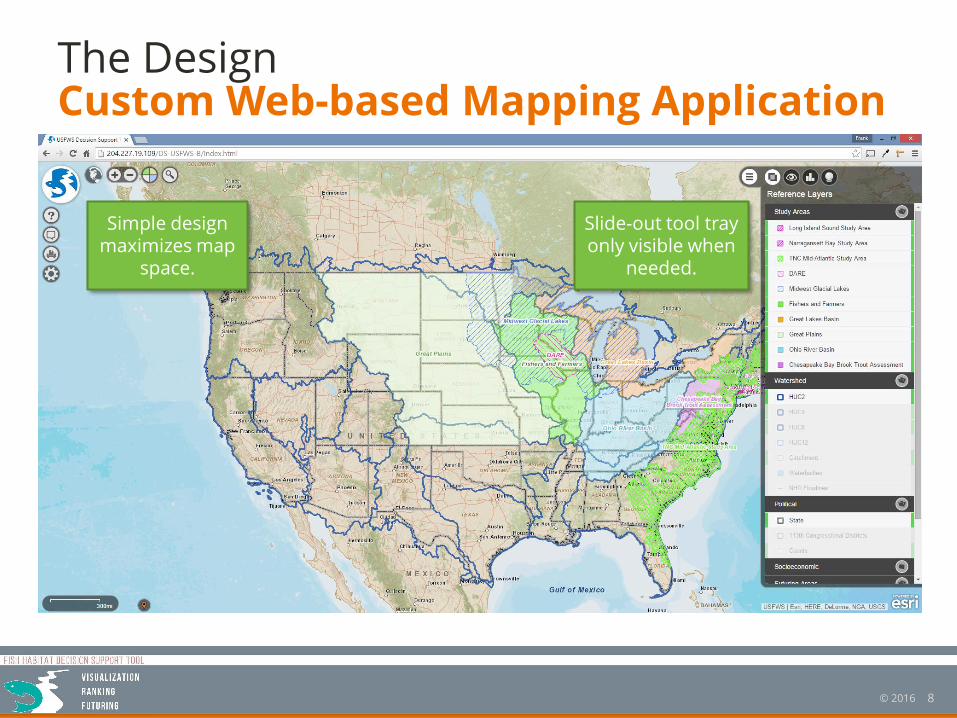
The DesignCustom Web-based Mapping Application
Simple design maximizes map
space.
Slide-out tool tray only visible when
needed.
9© 2016
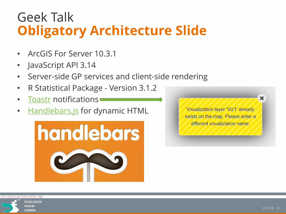
Geek Talk
• ArcGIS For Server 10.3.1
• JavaScript API 3.14
• Server-side GP services and client-side rendering
• R Statistical Package - Version 3.1.2
• Toastr notifications
• Handlebars.js for dynamic HTML
Obligatory Architecture Slide
10© 2016
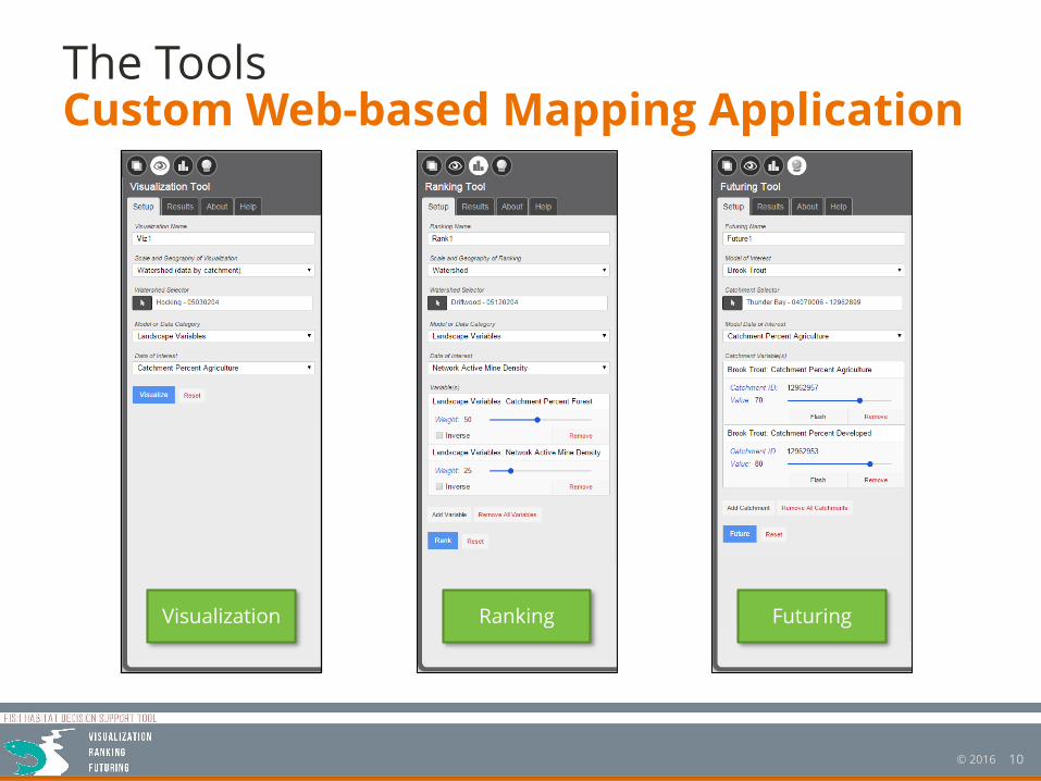
The ToolsCustom Web-based Mapping Application
Visualization Ranking Futuring
11© 2016
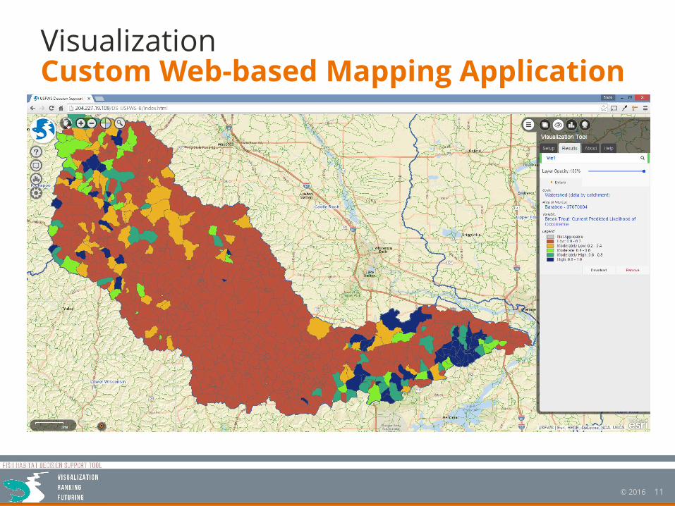
VisualizationCustom Web-based Mapping Application
12© 2016
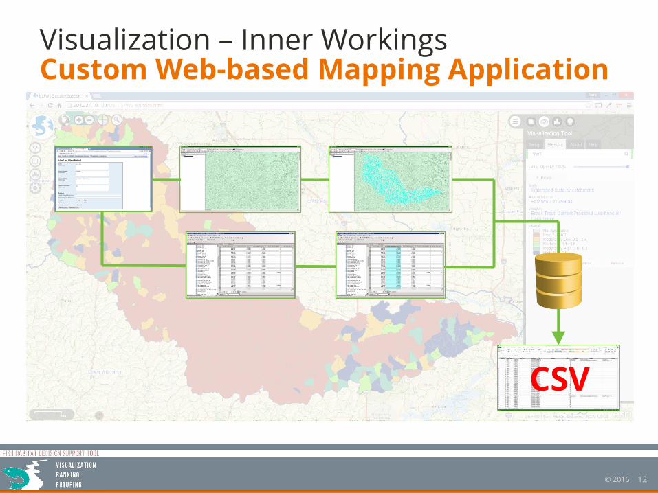
Visualization – Inner WorkingsCustom Web-based Mapping Application
CSV
13© 2016
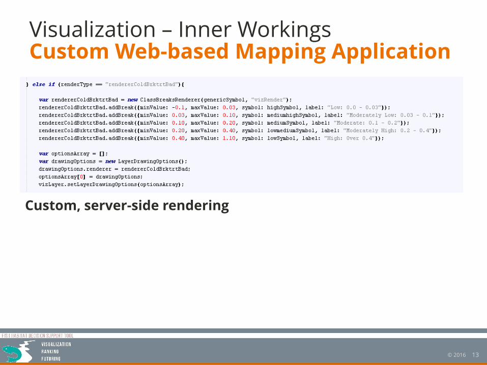
Visualization – Inner WorkingsCustom Web-based Mapping Application
Custom, server-side rendering
14© 2016
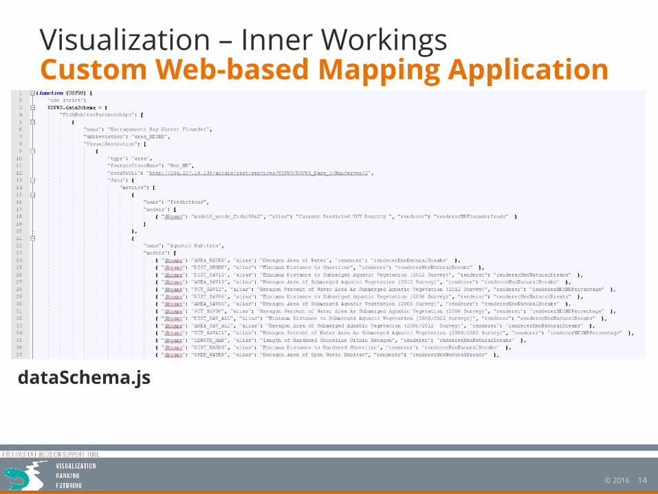
Visualization – Inner WorkingsCustom Web-based Mapping Application
dataSchema.js
15© 2016
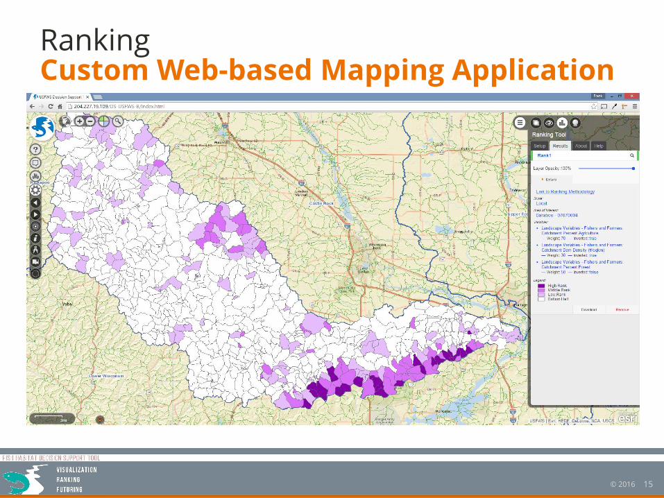
RankingCustom Web-based Mapping Application
16© 2016
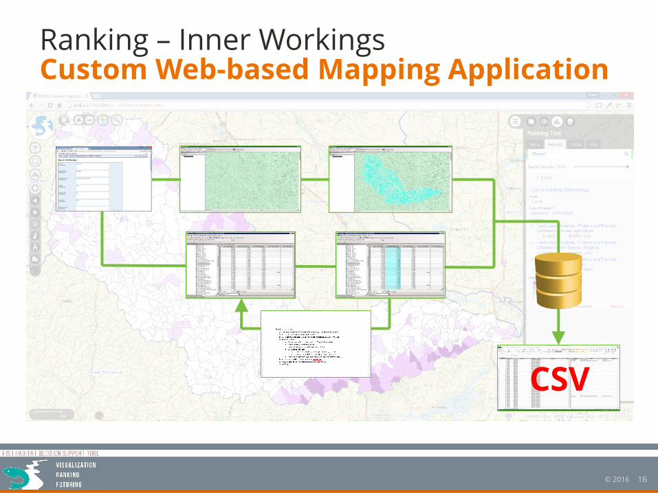
Ranking – Inner WorkingsCustom Web-based Mapping Application
CSV
17© 2016
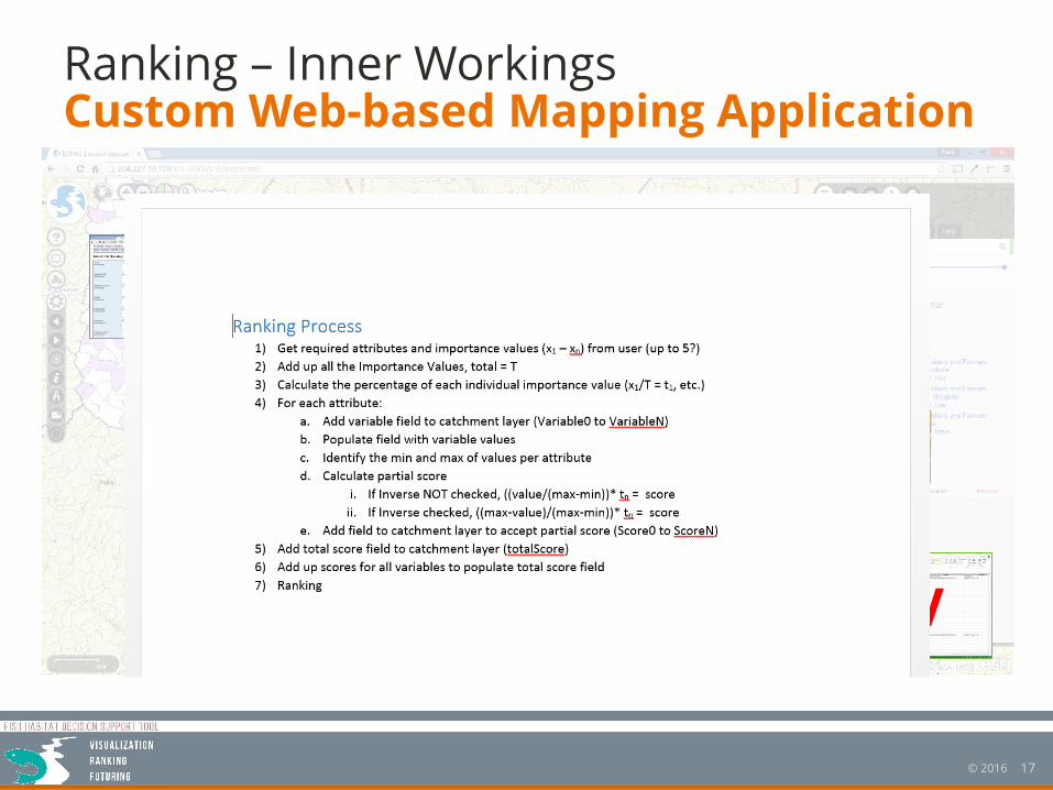
Ranking – Inner WorkingsCustom Web-based Mapping Application
CSV
18© 2016
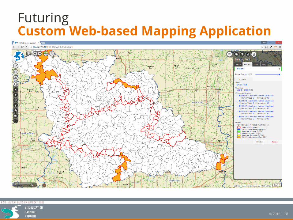
FuturingCustom Web-based Mapping Application
19© 2016
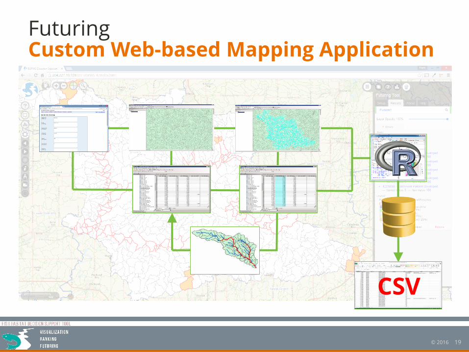
FuturingCustom Web-based Mapping Application
CSV

20© 2016
QuestionsANSWERS