Embed Size (px)
Citation preview

Dimitris ANASTASIOU, Danae GAIFILLIA, Afroditi KATSADOUROU, Eirini KOLYVAKI, Xanthos
PAPANIKOLAOU, Michail GIANNIOU, Georgios S. VERGOS and Vassilios PAGOUNIS
First Validation of the Hellenic Vertical Datum as a Prerequisite for the Efficient Disaster and Resource
Management: The “ELEVATION” Project.
FIG Commission 3 Workshop 2012
Spatial Information, Informal Development, Property and Housing
Athens, Greece, 10-14 December 2012
First Validation of the Hellenic Vertical Datum as a Prerequisite for the
Efficient Disaster and Resource Management: The “ELEVATION” Project.
Dimitris ANASTASIOU, Danae GAIFILLIA, Afroditi KATSADOUROU, Eirini
KOLYVAKI, Xanthos PAPANIKOLAOU, Michail GIANNIOU, Georgios S. VERGOS and
Vassilios PAGOUNIS, Greece
Key words: Vertical Network evaluation, geoid, GNSS, leveling, Mean Sea Level
SUMMARY
The entity of technical works at national scales is based on well established horizontal and
vertical reference networks. The knowledge of the location where an event took place (e.g.,
natural disaster, crustal deformations and small distortions of a construction) is crucial to
crisis management. Additionally, precise knowledge of an incidents’ place is possible to lead
to more equitable confrontation from the authorities.
With the applications of modern technology, horizontal position determination is feasible with
particularly high precision. With respect to vertical control networks their confrontation is
different: the effect of the earth's gravity field, due to the inherent connection of the height
information with the natural environment, complicates both the measurement and the
utilization of leveling data. The importance of height information is extremely high; it is
enough if one thinks of the human activities that dependent on its precise and rigorous
determination. The exploitation of surface water resources, as well as underground ones, the
construction of large technical infrastructures (dams, bridges), as well as decision-making on
environmental issues require, as much as possible, precise and henceforth reliable height
information. In combination, therefore, with the horizontal position elevation data complete
our knowledge for the three-dimensional location of an incident within the natural
environment where we live and act.
In the frame of the action “Archimedes III – Funding of research groups in T.E.I.”, which is
co-financed by the E.U. (European Social Fund) and national funds under the Operational
Program “Education and Lifelong Learning 2007-2013”, a project for the validation and
quality control of the Hellenic vertical network is currently in progress. Two investigation
areas, one in Attika and another in Thessaloniki have been chosen. The areas include several
height benchmarks of the national trigonometric and leveling networks. Static GPS
observations as well as classical spirit leveling in combination with special trigonometric
leveling are performed to assess the internal accuracy of the two networks. Some initial
numerical tests based on GPS and leveling measurements are presented and the goals of the
project are analyzed.

Dimitris ANASTASIOU, Danae GAIFILLIA, Afroditi KATSADOUROU, Eirini KOLYVAKI, Xanthos
PAPANIKOLAOU, Michail GIANNIOU, Georgios S. VERGOS and Vassilios PAGOUNIS
First Validation of the Hellenic Vertical Datum as a Prerequisite for the Efficient Disaster and Resource
Management: The “ELEVATION” Project.
FIG Commission 3 Workshop 2012
Spatial Information, Informal Development, Property and Housing
Athens, Greece, 10-14 December 2012
First Validation of the Hellenic Vertical Datum as a Prerequisite for the
Efficient Disaster and Resource Management: The “ELEVATION” Project.
Dimitris ANASTASIOU, Danae GAIFILLIA, Afroditi KATSADOUROU, Eirini
KOLYVAKI, Xanthos PAPANIKOLAOU, Michail GIANNIOU, Georgios S. VERGOS and
Vassilios PAGOUNIS, Greece
1. INTRODUCTION
The total of the technical work of a country is based on well established horizontal reference
networks as well as vertical ones. The knowledge of the location where an event took place
(e.g., natural disaster, crustal deformations, and small distortions of a construction) is crucial
to a crisis management. On the other hand, the precise knowledge of an incident place is
possible to lead to more equitable confrontation from the authorities. With the applications of
modern technology such as GNSS/GPS, the horizontal determination is feasible with
particularly high precision. The horizontal control networks are measured and validated
continuously and their accuracy is particularly high. With respect to the vertical control
networks their confrontation is different: the effect of the earth's gravity field, due to the
inherent connection of the height information with the direct natural environment,
complicates the processes of measurement and utilization of leveling data (Vergos et al. 2006,
Vergos 2011). The importance of height information is extremely high; it is enough one to
think the human activities dependent on this. The exploitation of surface water resources as
well as underground ones, the construction of large technical infrastructures (dams, bridges),
as well as the decision-making on environmental issues require as much as possible precise
and henceforth reliable hypsometric information. In combination, therefore, with the
horizontal position the height data complete our knowledge for the location of an incident in
the natural environment where we live and act.
The evaluation of the Hellenic vertical network is the main objective of this work. Height
information of high accuracy and reliability in a common reference system is essential.
Especially today, with the pan-European effort for the establishment of a common European
Vertical Network, the validation of the Hellenic vertical network seems a one-way road
decision. In order to underline the importance of the reference systems unification, we
mention that the International Association of Geodesy (IAG) established several sub-
Commissions that are responsible for the definition and realization of continent-wide geodetic
reference systems. For Europe the corresponding sub-Commission is EUREF, which has
introduced the European Terrestrial Reference System of 1989 (ETRS89) and the European
Vertical Reference System (EVRS). The realization of ETRS89 in Greece has been
established through the Hellenic Positioning System (HEPOS) (Katsampalos et al., 2009).
During the next years the connection of the vertical datum with Europe has to be done; this is
also a European Community directive under the name “INSPIRE”. Before the connection, the
validation of the vertical network has to be carried out.

Dimitris ANASTASIOU, Danae GAIFILLIA, Afroditi KATSADOUROU, Eirini KOLYVAKI, Xanthos
PAPANIKOLAOU, Michail GIANNIOU, Georgios S. VERGOS and Vassilios PAGOUNIS
First Validation of the Hellenic Vertical Datum as a Prerequisite for the Efficient Disaster and Resource
Management: The “ELEVATION” Project.
FIG Commission 3 Workshop 2012
Spatial Information, Informal Development, Property and Housing
Athens, Greece, 10-14 December 2012
2. THEORETICAL BACKGROUND
The first-order vertical control network of Greece was established and measured by the
Hellenic Military Geographic Service from 1963 to 1986. On the other hand, the points of the
Hellenic trigonometric network have some height information, which was obtained by means
of trigonometric leveling. This vertical information has not been systematically validated
since its creation, although relevant efforts have been made during the evaluation of
EGM2008 (Kotsakis et al. 2008a, 2008b). Thus, the validation of the vertical reference
network before the establishment of the European interconnection is essential. In particular,
Greece has not been connected yet with any of the unified vertical control systems, resulted a
major difficulty in dealing with cross-border problems, relating to transmission of raw
materials as well as with road and rail transportations. A prerequisite for the Hellenic vertical
datum integration is its evaluation and the use of new technologies for its continuous update.
The validation of the height data must be based on the interpretation of inner accuracy
solution and the external control using heterogeneous data. The leveling problem in modern
times has been transferred from classical terrestrial solutions to the introduction of new
methods based on the dipole of high accuracy and fast evaluation. This dipole can lead to
continuously updating information for reference point variations and introduce the necessity
of decision models through a GIS application.
The need for separation between horizontal and vertical positioning derives from the different
accuracy provided by the terrestrial observations. Horizontal directions are measured with
increased accuracy with respect to the vertical ones. This is due to the atmospheric refraction
effect. The abovementioned event introduces greater uncertainty to the vertical positioning.
This is why classical geodetic observations are divided into horizontal directions and
distances for horizontal positioning and spirit leveling measurements for vertical positioning.
Hypsometric data are referenced to suitable level surfaces. These surfaces represent
characteristic elements of the observation environment (see also Figure 1). A characteristic
level surface is the MSL. This surface represents the traditional connection of all human
activities with the natural environment. Practically, it is the common knowledge that the MSL
is a zero-height surface. Theoretically speaking, MSL in a global scale constitutes a balance
surface of waters, i.e., an equipotential surface of Earth’s gravity field. In this manner, the
concept of geoid as a height reference surface is introduced. The geoid is an equipotential
surface of the Earth’s gravity field that is approached by the MSL in global scale, provided
that the effects of tides and marine currents are removed. In well-defined national vertical
control network, heights are referenced in a datum point of zero altitude. Usually, the zero-
height point is defined by local MSL observations from tide gauges records. In reality, the
sea-level change is measured from a conventionally elected level, which is considered
constant: the tide gauge zero. Another reference surface used is the ellipsoid of revolution.
The ellipsoid is not a physical surface and is used only as a model of the Earth’s surface for
the horizontal positioning, due to the simplicity of its mathematical relations. The ellipsoid is
the reference surface utilized by the geodetic satellite missions. The data of such missions will
be used for the validation of the current vertical network. The main height reference surfaces
used in the proposed act as well as the measurements (satellite or terrestrial) applied is
depicted in Figure 1, where the triplet of heights under investigation are outlined as: a) the
Dimitris ANASTASIOU, Danae GAIFILLIA, Afroditi KATSADOUROU, Eirini KOLYVAKI, Xanthos
PAPANIKOLAOU, Michail GIANNIOU, Georgios S. VERGOS and Vassilios PAGOUNIS
First Validation of the Hellenic Vertical Datum as a Prerequisite for the Efficient Disaster and Resource
Management: The “ELEVATION” Project.
FIG Commission 3 Workshop 2012
Spatial Information, Informal Development, Property and Housing
Athens, Greece, 10-14 December 2012
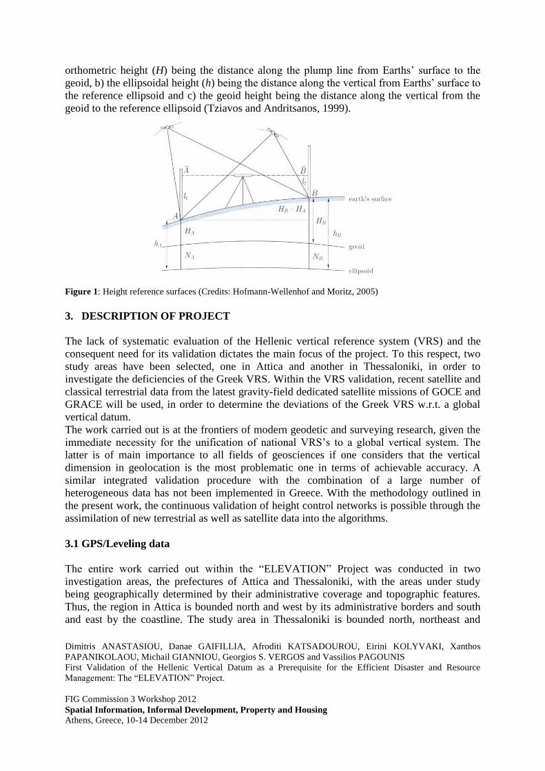
orthometric height (H) being the distance along the plump line from Earths’ surface to the
geoid, b) the ellipsoidal height (h) being the distance along the vertical from Earths’ surface to
the reference ellipsoid and c) the geoid height being the distance along the vertical from the
geoid to the reference ellipsoid (Tziavos and Andritsanos, 1999).
Figure 1: Height reference surfaces (Credits: Hofmann-Wellenhof and Moritz, 2005)
3. DESCRIPTION OF PROJECT
The lack of systematic evaluation of the Hellenic vertical reference system (VRS) and the
consequent need for its validation dictates the main focus of the project. To this respect, two
study areas have been selected, one in Attica and another in Thessaloniki, in order to
investigate the deficiencies of the Greek VRS. Within the VRS validation, recent satellite and
classical terrestrial data from the latest gravity-field dedicated satellite missions of GOCE and
GRACE will be used, in order to determine the deviations of the Greek VRS w.r.t. a global
vertical datum.
The work carried out is at the frontiers of modern geodetic and surveying research, given the
immediate necessity for the unification of national VRS’s to a global vertical system. The
latter is of main importance to all fields of geosciences if one considers that the vertical
dimension in geolocation is the most problematic one in terms of achievable accuracy. A
similar integrated validation procedure with the combination of a large number of
heterogeneous data has not been implemented in Greece. With the methodology outlined in
the present work, the continuous validation of height control networks is possible through the
assimilation of new terrestrial as well as satellite data into the algorithms.
3.1 GPS/Leveling data
The entire work carried out within the “ELEVATION” Project was conducted in two
investigation areas, the prefectures of Attica and Thessaloniki, with the areas under study
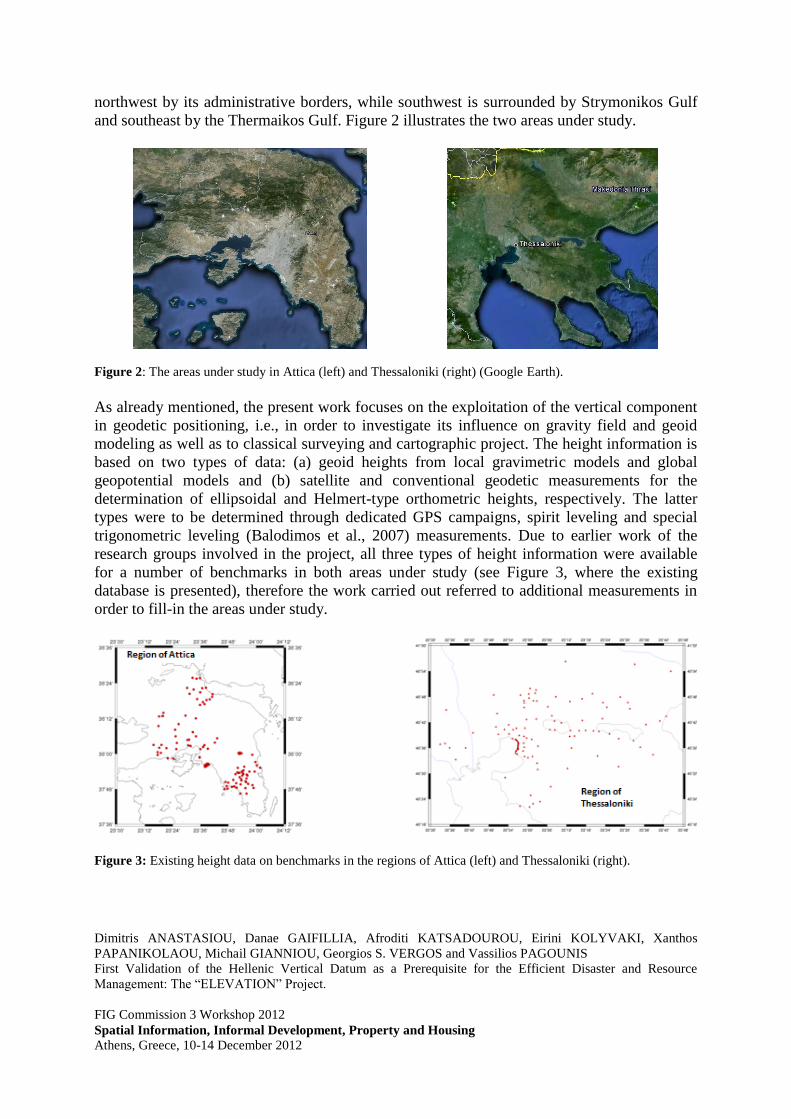
being geographically determined by their administrative coverage and topographic features.
Thus, the region in Attica is bounded north and west by its administrative borders and south
and east by the coastline. The study area in Thessaloniki is bounded north, northeast and
Dimitris ANASTASIOU, Danae GAIFILLIA, Afroditi KATSADOUROU, Eirini KOLYVAKI, Xanthos
PAPANIKOLAOU, Michail GIANNIOU, Georgios S. VERGOS and Vassilios PAGOUNIS
First Validation of the Hellenic Vertical Datum as a Prerequisite for the Efficient Disaster and Resource
Management: The “ELEVATION” Project.
FIG Commission 3 Workshop 2012
Spatial Information, Informal Development, Property and Housing
Athens, Greece, 10-14 December 2012
northwest by its administrative borders, while southwest is surrounded by Strymonikos Gulf
and southeast by the Thermaikos Gulf. Figure 2 illustrates the two areas under study.
Figure 2: The areas under study in Attica (left) and Thessaloniki (right) (Google Earth).
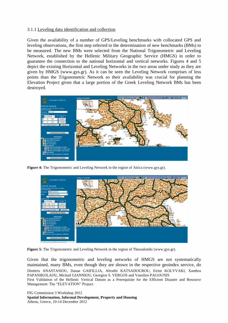
As already mentioned, the present work focuses on the exploitation of the vertical component
in geodetic positioning, i.e., in order to investigate its influence on gravity field and geoid
modeling as well as to classical surveying and cartographic project. The height information is
based on two types of data: (a) geoid heights from local gravimetric models and global
geopotential models and (b) satellite and conventional geodetic measurements for the
determination of ellipsoidal and Helmert-type orthometric heights, respectively. The latter
types were to be determined through dedicated GPS campaigns, spirit leveling and special
trigonometric leveling (Balodimos et al., 2007) measurements. Due to earlier work of the
research groups involved in the project, all three types of height information were available
for a number of benchmarks in both areas under study (see Figure 3, where the existing
database is presented), therefore the work carried out referred to additional measurements in
order to fill-in the areas under study.
Figure 3: Existing height data on benchmarks in the regions of Attica (left) and Thessaloniki (right).
Dimitris ANASTASIOU, Danae GAIFILLIA, Afroditi KATSADOUROU, Eirini KOLYVAKI, Xanthos
PAPANIKOLAOU, Michail GIANNIOU, Georgios S. VERGOS and Vassilios PAGOUNIS
First Validation of the Hellenic Vertical Datum as a Prerequisite for the Efficient Disaster and Resource
Management: The “ELEVATION” Project.
FIG Commission 3 Workshop 2012
Spatial Information, Informal Development, Property and Housing
Athens, Greece, 10-14 December 2012
3.1.1 Leveling data identification and collection
Given the availability of a number of GPS/Leveling benchmarks with collocated GPS and
leveling observations, the first step referred to the determination of new benchmarks (BMs) to
be measured. The new BMs were selected from the National Trigonometric and Leveling
Network, established by the Hellenic Military Geographic Service (HMGS) in order to
guarantee the connection to the national horizontal and vertical networks. Figures 4 and 5
depict the existing Horizontal and Leveling Networks in the two areas under study as they are
given by HMGS (www.gys.gr). As it can be seen the Leveling Network comprises of less
points than the Trigonometric Network so their availability was crucial for planning the
Elevation Project given that a large portion of the Greek Leveling Network BMs has been
destroyed.
Figure 4: The Trigonometric and Leveling Network in the region of Attica (www.gys.gr).
Figure 5: The Trigonometric and Leveling Network in the region of Thessaloniki (www.gys.gr).
Given that the trigonometric and leveling networks of HMGS are not systematically
maintained, many BMs, even though they are shown in the respective geoindex service, do

Dimitris ANASTASIOU, Danae GAIFILLIA, Afroditi KATSADOUROU, Eirini KOLYVAKI, Xanthos
PAPANIKOLAOU, Michail GIANNIOU, Georgios S. VERGOS and Vassilios PAGOUNIS
First Validation of the Hellenic Vertical Datum as a Prerequisite for the Efficient Disaster and Resource
Management: The “ELEVATION” Project.
FIG Commission 3 Workshop 2012
Spatial Information, Informal Development, Property and Housing
Athens, Greece, 10-14 December 2012
not exist anymore. Therefore, the first step referred to a reconnaissance campaign in order to
identify BMs that still exist and verify that they are in good condition to be measured
(monument not destroyed or relocated, etc.). The height BMs reconnaissance was based on
descriptions of their location provided by HMGS along with an approximate estimation of
their geodetic coordinates. Overall six tracks, comprising of a total number of 157 height
BMs, were followed so as to identify height benchmarks in Attica. From these, only the 27
were found including three points that were inappropriate to use. In the region of Thessaloniki
overall five tracks, comprising of a total number of 28 height BMs, were followed in order to
indentify the height benchmarks. From these, 10 points were found; all of them being
adequate for measurements. Figure 6 depicts the 27 height BMs which were found in the
region of Attica and the 10 height BMs in the region of Thessaloniki.
Figure 6: The height BMs that were found in the region of Attica (left) and Thessaloniki (right)
Of the total number of height benchmarks that were found after the research in the two
investigation areas only a part of them were chosen for conducting the leveling
measurements. The two methods that were used in order to determine the orthometric heights
are classic spirit leveling and special trigonometric leveling. The plan of leveling
measurements is based on the prevailing conditions of each investigation area, so that Table 1
summarizes the leveling measurements in the regions of Attica and Thessaloniki. It should be
noted, that for most leveling BMs, since GPS measurements cannot be performed directly on
them, collocated BMs were established at short distances in order to measure both orthometric
as well as ellipsoidal heights for all of them.
In order to reassess the leveling network in the investigation areas of Attica and Thessaloniki
a combination of satellite and ground based techniques were used for the determination of
orthometric height differences. Specifically, the height differences that were selected and
measured in Attica were ten and in Thessaloniki twelve. As already have mentioned, the two
types of techniques that were applied are the classical spirit leveling and the special
trigonometric leveling. The two techniques were applied not only between height benchmarks
but also between benchmarks and height benchmarks. Table 1 presents in detail the regions,

Dimitris ANASTASIOU, Danae GAIFILLIA, Afroditi KATSADOUROU, Eirini KOLYVAKI, Xanthos
PAPANIKOLAOU, Michail GIANNIOU, Georgios S. VERGOS and Vassilios PAGOUNIS
First Validation of the Hellenic Vertical Datum as a Prerequisite for the Efficient Disaster and Resource
Management: The “ELEVATION” Project.
FIG Commission 3 Workshop 2012
Spatial Information, Informal Development, Property and Housing
Athens, Greece, 10-14 December 2012
the techniques and the equipment of the leveling measurements which were used in the areas
under study in Attica and Thessaloniki.
Table 1: The regions, the techniques and the equipment of the leveling measurements in Attica and Thessaloniki.
Leveling
Process
No
Date Region Starting
Point ID Ending Point ID
Technique
* Equipment
ATHENS
1 09/10 Ano Souli 5161020148 5161020147 CSL Topcon DL-101C
2 09/10 Rafina 5161020130 161017 CSL Topcon DL-101C
3 13/10 Rafina 5161020130 5161020131 STL Leica TCR 1202
4 13/10 Nea Makri 5161020135 5161020136 STL Leica TCR 1202
5 16/10 Grammatiko 5161020152 161105 STL Leica TCR 1202
6 16/10 Kapandriti 5161020163 5161020161 STL Leica TCR 1202
THESSALONIKI
1 11/09 Peristera 8063220022 63067 CSL Leica Spr. 150
2 11/09 Epanomi 8116220021 8116220021_101gg CSL Leica Spr. 150
3 11/09 Peristera 8063220023 8063220023_103gg CSL Leica Spr. 150
4 11/09 Peristera 8063220022 8063220022 _102gg CSL Leica Spr. 150
5 11/09 Kardia 8103160009 8103160009_100gg CSL Leica Spr. 150
6 11/09 Agios
Athanasios 8118040011 8118040011_106gg CSL
Leica Spr. 150
7 11/09 Gefira 8303030021 8303030021_107gg CSL Leica Spr. 150
8 12/09 Proxoma 8176030029 8176030029_109gg CSL Leica Spr. 150
9 12/09 Proxoma 8176030029 176021 CSL Leica Spr. 150
10 12/09 Dorkada 8187110022 8187110022 _105gg CSL Leica Spr. 150
11 12/09 Koufalia 8176200040 8176200040 _108gg CSL Leica Spr. 150
12 12/09 Kartere 8187110298 8187110298_104gg CSL Leica Spr. 150
13 11/09 Peristera 8063220022 63067 STL Topcon GTS212
14 11/09 Epanomi 8116220021 8116220021_101gg STL Topcon GTS212
15 11/09 Peristera 8063220023 8063220023_103gg STL Topcon GTS212
16 11/09 Peristera 8063220022 8063220022 _102gg STL Topcon GTS212
17 12/09 Kardia 8103160009 8103160009_100gg STL Topcon GTS212
18 12/09 Agios
Athanasios 8118040011 8118040011_106gg STL
Topcon GTS212
19 12/09 Gefira 8303030021 8303030021_107gg STL Topcon GTS212
20 12/09 Proxoma 8176030029 8176030029_109gg STL Topcon GTS212
21 12/09 Proxoma 8176030029 176021 STL Topcon GTS212
22 12/09 Dorkada 8187110022 8187110022 _105gg STL Topcon GTS212
23 12/09 Koufalia 8176200040 8176200040 _108gg STL Topcon GTS212
24 11/09 Kartere 8187110298 8187110298_104gg STL Topcon GTS212
* CSL : Classical Spirit Leveling STL: Special Trigonometric Leveling

Dimitris ANASTASIOU, Danae GAIFILLIA, Afroditi KATSADOUROU, Eirini KOLYVAKI, Xanthos
PAPANIKOLAOU, Michail GIANNIOU, Georgios S. VERGOS and Vassilios PAGOUNIS
First Validation of the Hellenic Vertical Datum as a Prerequisite for the Efficient Disaster and Resource
Management: The “ELEVATION” Project.
FIG Commission 3 Workshop 2012
Spatial Information, Informal Development, Property and Housing
Athens, Greece, 10-14 December 2012
3.1.2 GPS data identification and collection
The GPS data to be collected refer to ellipsoidal heights over the previously outlined network
of identified trigonometric and leveling BMs as well as over the newly established reference
points close to the leveling BMs. The latter were located in a short distance from the height
benchmarks of the national leveling network for validation and quality control. From the 27
vertical benchmarks which were found in Attica, 9 were selected to be measured.
Furthermore, in Thessaloniki all the available vertical benchmarks were suitable for GPS and
leveling observations. After the selection of the appropriate height benchmarks, the selection
of the benchmarks of the national trigonometric network took place. In order to guarantee the
redundancy of the measurements, alternative benchmarks were selected, within some eligible
areas for each point. Figures 7 and 8 depict the location of the benchmarks along with the
confidence regions where alternative BMs would be sought.
Figure 7: Map of the Attica test area, with the location of the groups of alternative benchmarks (red ellipsoids),
the existing height benchmarks (red circles) and the already available benchmarks of the national trigonometric
network (green triangles).
All GPS measurements have been collected in static mode and have been connected to the
HEPOS stations. The HEPOS stations near Attica and Thessaloniki were used as reference
stations for the GPS measurements in order to calculate the coordinates of the benchmarks in
the HTRS07 datum, providing high accuracy and homogeneity. Besides, HEPOS stations
provide several other advantages. First of all, they ensure smaller baseline lengths compared
with the EPN (EUREF Permanent Network) stations, as there is a dense network all over
Greece and especially in Attica and Thessaloniki. In the case of EPN, the only available
stations would be AUT1 in Thessaloniki and NOA1 in Attica, leading to baseline lengths
greater than 50 km. On the contrary, the HEPOS network ensures smaller baselines, in the

Dimitris ANASTASIOU, Danae GAIFILLIA, Afroditi KATSADOUROU, Eirini KOLYVAKI, Xanthos
PAPANIKOLAOU, Michail GIANNIOU, Georgios S. VERGOS and Vassilios PAGOUNIS
First Validation of the Hellenic Vertical Datum as a Prerequisite for the Efficient Disaster and Resource
Management: The “ELEVATION” Project.
FIG Commission 3 Workshop 2012
Spatial Information, Informal Development, Property and Housing
Athens, Greece, 10-14 December 2012
order of 25 km, which allow the determination of highly accurate geometric heights.
Moreover, HEPOS data are available in any observation rate unlike the EPN data which are
provided at an observation rate of 30 sec. Figure 9 depicts the HEPOS stations that were used
in this work.
Figure 8: Map of the Thessaloniki test area, with the location of the groups of alternative benchmarks (red
ellipsoids), the existing height benchmarks (red circles) and the already available benchmarks of the national
trigonometric network (green triangles).
For each area under study, dual frequency receivers were used as it is mandatory for baselines
longer than 10 Km, in order to reduce the influence of the ionosphere. For the GPS
measurements in Attica the appropriate equipment of the Geodesy-Surveying Laboratory of
the Technological Educational Institute of Athens was used. Regarding the area of
Thessaloniki, the Department of Geodesy and Surveying of the School of Rural and
Surveying Engineering of the Aristotle University of Thessaloniki provided the necessary
equipment.
Figure 9: The HEPOS stations which cover the investigation areas of Attica (left) and Thessaloniki (right).
Dimitris ANASTASIOU, Danae GAIFILLIA, Afroditi KATSADOUROU, Eirini KOLYVAKI, Xanthos
PAPANIKOLAOU, Michail GIANNIOU, Georgios S. VERGOS and Vassilios PAGOUNIS
First Validation of the Hellenic Vertical Datum as a Prerequisite for the Efficient Disaster and Resource
Management: The “ELEVATION” Project.
FIG Commission 3 Workshop 2012
Spatial Information, Informal Development, Property and Housing
Athens, Greece, 10-14 December 2012
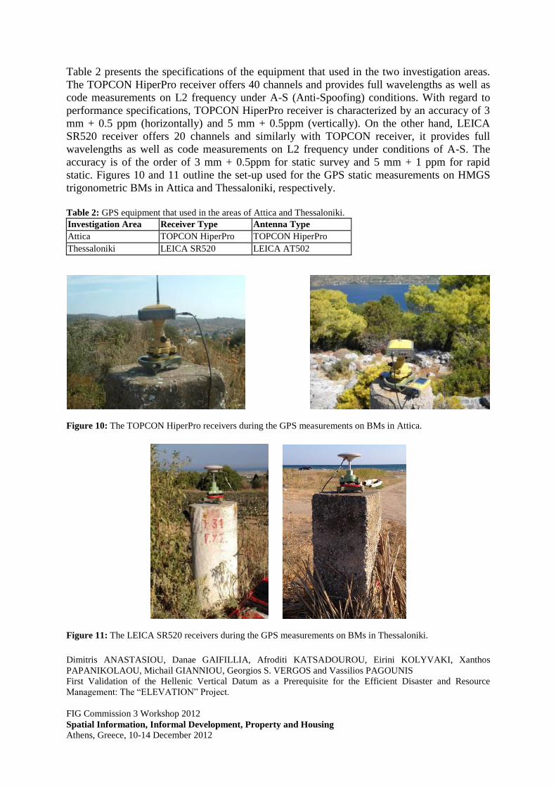
Table 2 presents the specifications of the equipment that used in the two investigation areas.
The TOPCON HiperPro receiver offers 40 channels and provides full wavelengths as well as
code measurements on L2 frequency under A-S (Anti-Spoofing) conditions. With regard to
performance specifications, TOPCON HiperPro receiver is characterized by an accuracy of 3
mm + 0.5 ppm (horizontally) and 5 mm + 0.5ppm (vertically). On the other hand, LEICA
SR520 receiver offers 20 channels and similarly with TOPCON receiver, it provides full
wavelengths as well as code measurements on L2 frequency under conditions of A-S. The
accuracy is of the order of 3 mm + 0.5ppm for static survey and 5 mm + 1 ppm for rapid
static. Figures 10 and 11 outline the set-up used for the GPS static measurements on HMGS
trigonometric BMs in Attica and Thessaloniki, respectively.
Table 2: GPS equipment that used in the areas of Attica and Thessaloniki.
Investigation Area Receiver Type Antenna Type
Attica TOPCON HiperPro TOPCON HiperPro
Thessaloniki LEICA SR520 LEICA AT502
Figure 10: The TOPCON HiperPro receivers during the GPS measurements on BMs in Attica.
Figure 11: The LEICA SR520 receivers during the GPS measurements on BMs in Thessaloniki.

Dimitris ANASTASIOU, Danae GAIFILLIA, Afroditi KATSADOUROU, Eirini KOLYVAKI, Xanthos
PAPANIKOLAOU, Michail GIANNIOU, Georgios S. VERGOS and Vassilios PAGOUNIS
First Validation of the Hellenic Vertical Datum as a Prerequisite for the Efficient Disaster and Resource
Management: The “ELEVATION” Project.
FIG Commission 3 Workshop 2012
Spatial Information, Informal Development, Property and Housing
Athens, Greece, 10-14 December 2012
The GPS measurements in both investigation areas have been conducted following commonly
defined parameters, i.e. occupation time of at least 60 minutes, logging rate 15 sec and
elevation mask 10o. The antenna height measurements are characterized by an accuracy of ±1
mm, while the reference point was at the top of the benchmark. The uniform equipment and
procedure for the antenna height measurements provide homogeneity and high accuracy, with
variations of the order of 2-3 cm.. Considering the above, the errors in reading or typing the
antenna height, which are a common source of errors in GPS measurements, can be avoided.
The next section outlines the results from the two leveling methods employed to determine
orthometric heights as well as the analysis of the GPS processing for the determination of
geodetic coordinates.
4. NUMERICAL ANALYSIS
4.1 Leveling results and analysis
As far leveling is concerned, traditional spirit and special trigonometric leveling have been
employed. Tables 3 and 4 summarize the results acquired over the leveling baselines w.r.t. the
determination of the height difference between a reference and a measuring point. Given the
superiority of spirit leveling, it is interesting to notice that the differences between spirit and
trigonometric leveling achieved range from a few mm up to ±3.2cm for the longer distances.
These data will be used in height combination schemes for the adjustment between
orthometric, ellipsoidal and geoid heights towards the unification of the Greek Vertical
Reference System (VRS) (Tziavos et al. 2012a, b; Vergos and Sideris 2002, Vergos et al.
2007). Therefore the inherent consistency of the height information as well as proper error
modeling, which can be achieved from spirit leveling through the baseline length, are vital.
Table 3: Leveling results for the investigation area of Attica.
Leveling
Process
No
Region Starting
Point ID
Ending
Point ID
S*
(km) Technique*
Orthometric
Height
Difference*
1 Ano Souli 5161020148 5161020147 1.13 CSL -48.752
2 Rafina 5161020130 161017 0.60 CSL 3.754
3 Rafina 5161020130 5161020131 0.95 STL -22.105
4 Nea Makri 5161020135 5161020136 1.23 STL -22.638
5 Grammatiko 5161020152 161105 0.40 STL 8.206
6 Kapandriti 5161020163 5161020161 3.47 STL 27.751
*S: Distance CSL : Classical Spirit Leveling STL: Special Trigonometric Leveling
Table 4: Leveling results for the investigation area of Thessaloniki.
Leveling
Process
No
Region Starting
Point ID Ending Point ID
S*
(km)
DHCSL
(m)
DHSTL
(m)
DHCSL-
DHSTL
(m)
1 Peristera 63067 8063220022 0.32 4.817 4.785 0.032
2 Epanomi 8116220021 8116220021_101gg 0.06 0.399 0.395 0.004
3 Peristera 8063220023 8063220023_103gg 0.106 0.796 0.806 -0.010
4 Peristera 8063220022 8063220022 _102gg 0.032 0.123 0.125 -0.002
5 Kardia 8103160009 8103160009_100gg 0.04 0.233 0.231 0.002
6 Ag. Athan. 8118040011 8118040011_106gg 0.077 -0.562 -0.562 -0.000

Dimitris ANASTASIOU, Danae GAIFILLIA, Afroditi KATSADOUROU, Eirini KOLYVAKI, Xanthos
PAPANIKOLAOU, Michail GIANNIOU, Georgios S. VERGOS and Vassilios PAGOUNIS
First Validation of the Hellenic Vertical Datum as a Prerequisite for the Efficient Disaster and Resource
Management: The “ELEVATION” Project.
FIG Commission 3 Workshop 2012
Spatial Information, Informal Development, Property and Housing
Athens, Greece, 10-14 December 2012
7 Gefira 8303030021 8303030021_107gg 0.055 -0.447 -0.446 -0.001
8 Proxoma 8176030029 8176030029_109gg 0.071 -2.064 -2.066 0.002
9 Proxoma 8176030029 176021 0.3 10.536 10.548 -0.012
10 Dorkada 8187110022 8187110022 _105gg 0.091 -2.222 -2.201 -0.021
11 Koufalia 8176200040 8176200040 _108gg 0.02 0.556 0.549 0.007
12 Kartere 8187110298 8187110298_104gg 0.028 0.728 0.737 -0.009
* CSL : Classical Spirit Leveling STL: Special Trigonometric Leveling
4.2 GPS results and analysis
In order to determine the geodetic coordinates of all the GPS BMs in HTRS07, HEPOS
reference stations have been used for each investigation area. Each point has been connected
to two HEPOS stations. During GPS processing three different approaches have been
followed. First, the benchmarks and the newly established points were solved from the nearest
HEPOS reference station. Afterwards, the measured benchmarks and points were solved from
the next nearest HEPOS reference station. Finally, a least squares adjustment has been
computed for each point using the two baselines connecting the point to the HEPOS stations.
Different GPS processing software packages have been used for the baseline reduction, with
the results presented herein coming from the Leica Geo Office (LGO) program. Figures 12
and 13 depict the processed baselines for both areas. So that in each station the geodetic
coordinates are determined as an adjusted solution from both the nearest and next nearest
HEPOS station.
Figure 12: Baselines (short and long) in Attica and processing results (LGO).
Tables 5 and 6 present the geodetic coordinates (X, Y, Z) in HTRS07 as well as the standard
deviations (std) of all the measured benchmarks and points in Attica and Thessaloniki,
including both the nearest and the furthest HEPOS reference station. In these tables, both the

Dimitris ANASTASIOU, Danae GAIFILLIA, Afroditi KATSADOUROU, Eirini KOLYVAKI, Xanthos
PAPANIKOLAOU, Michail GIANNIOU, Georgios S. VERGOS and Vassilios PAGOUNIS
First Validation of the Hellenic Vertical Datum as a Prerequisite for the Efficient Disaster and Resource
Management: The “ELEVATION” Project.
FIG Commission 3 Workshop 2012
Spatial Information, Informal Development, Property and Housing
Athens, Greece, 10-14 December 2012
coordinates and the standard deviations of the final solutions are provided. It is of worth
mentioning that some points were not solved from both stations because the averaging limit
was exceeded. For these points in both areas (outlined with red in the Tables) the problem in
solving simultaneously form both HEPOS stations can be attributed to limited satellite
visibility due to obstacles like trees and disrupted L2 measurements due to electromagnetic
interferences in the areas of the BMs.
Figure 13: Baselines (short and long) in Thessaloniki and processing results (LGO).
Table 5: Leica Geo Office results for both the shortest and the longest baselines in Attica.
Point Id X (m) Y (m) Z (m) std(X)
(m)
std(Y)
(m)
std(Z)
(m)
17064 0 0 0 0.0000 0.0000 0.0000 019010E 4613547.0539 2029159.6199 3895771.1204 0.0190 0.0086 0.0163
19053 4607522.5128 2027123.8561 3904262.2811 0.0114 0.0051 0.0105
137014 4624209.4675 1981217.3049 3908357.9147 0.0163 0.0074 0.0180 137030 (014A) 4622964.6992 1976765.5018 3911403.3561 0.0016 0.0007 0.0014
137041 4616154.9471 1979488.8528 3918081.4371 0.0127 0.0109 0.0118 161002E 4604412.8482 2031604.7214 3905583.0883 0.0020 0.0034 0.0013
161017 (008A) 4595913.4895 2044840.0840 3908391.8324 0.0008 0.0005 0.0009
161064 4597228.7009 2025478.8403 3917234.4837 0.0237 0.0115 0.0203 161105 4586413.9092 2038335.9746 3923156.6757 0.0085 0.0071 0.0069
161125 4590576.0486 2021108.4579 3927088.1604 0.0071 0.0109 0.0060 161126 4587973.3529 2027855.3390 3927308.2137 0.0113 0.0054 0.0097
186002 (006A) 4618223.0634 2058827.9960 3874789.1905 0.0006 0.0003 0.0004 186022 4615211.4360 2055422.3103 3880355.0791 0.0075 0.0034 0.0095
236021 4581915.2099 2033374.5249 3930571.9198 0.0246 0.0148 0.0225
236030 (008A) 4585143.1414 2019476.6059 3933839.0248 0.0022 0.0014 0.0021 301004 4609355.4433 2057853.8783 3885916.1798 0.0171 0.0076 0.0197
301013 (006A) 4605929.0987 2056182.1690 3890738.5004 0.0013 0.0007 0.0009 346090 (007A) 4628184.1549 1983816.4342 3901654.3515 0.0016 0.0009 0.0013

Dimitris ANASTASIOU, Danae GAIFILLIA, Afroditi KATSADOUROU, Eirini KOLYVAKI, Xanthos
PAPANIKOLAOU, Michail GIANNIOU, Georgios S. VERGOS and Vassilios PAGOUNIS
First Validation of the Hellenic Vertical Datum as a Prerequisite for the Efficient Disaster and Resource
Management: The “ELEVATION” Project.
FIG Commission 3 Workshop 2012
Spatial Information, Informal Development, Property and Housing
Athens, Greece, 10-14 December 2012
379009 (014A) 4591750.5756 2012634.0687 3929840.4948 0.0015 0.0007 0.0011
5018020020E 4615857.6783 2032320.5692 3891353.1940 0.0204 0.0108 0.0171 5161020121E 4601281.1458 2037784.4608 3905935.6226 0.0165 0.0077 0.0141
5161020136E 4593049.6215 2043003.0354 3912569.4115 0.0095 0.0042 0.0083 5161020145E 4588934.6792 2039212.7396 3919371.4087 0.0213 0.0098 0.0183
5161020163E 4588360.5715 2032567.5184 3923889.1101 0.0164 0.0100 0.0158
5161360009E 4603436.9788 2026684.6893 3909049.5178 0.0042 0.0045 0.0049 5186020046E 4617943.1065 2047301.4261 3881105.3377 0.0228 0.0116 0.0200
5186020050E 4616939.0250 2050325.4874 3880683.3359 0.0125 0.0073 0.0173
Table 6: Leica Geo Office results for both the shortest and the longest baselines in Thessaloniki.
Point Id X (m) Y (m) Z (m) std(X)
(m)
std(Y)
(m)
std(Z)
(m)
103005 4480666.0949 1895782.9751 4110619.2829 0.0062 0.0089 0.0051 103007 4478991.1303 1895435.8957 4112635.9879 0.0072 0.0168 0.0011
103014 4479612.5713 1889120.4670 4114772.6982 0.0105 0.0227 0.0047
103017 4476709.8245 1893380.9070 4116115.5248 0.0060 0.0045 0.0055 103019 4474196.8246 1897206.0092 4117252.7451 0.0053 0.0035 0.0056
103025 4477908.8600 1885456.4768 4118343.8225 0.0080 0.0070 0.0087 103031 4472091.0924 1896051.6572 4119857.2543 0.0088 0.0040 0.0107
103032 4475930.0026 1886301.1065 4120124.2848 0.0150 0.0181 0.0137
112008 4459560.7816 1919082.2449 4123644.9935 0.0186 0.0167 0.0168 112061 (033A) 4452624.1769 1920013.1342 4130364.2539 0.0031 0.0016 0.0022
116031 4459072.8908 1909753.7084 4128127.1158 0.0219 0.0103 0.0244 116841 4462126.5674 1904951.1834 4128207.4375 0.0093 0.0127 0.0081
118006 4469107.6152 1896050.6803 4122971.3521 0.0167 0.0095 0.0158 118022 4470682.3808 1879348.7361 4128840.1563 0.0184 0.0082 0.0204
118045 4464238.6666 1875971.6023 4137321.9046 0.0102 0.0125 0.0110
162015 4459475.8444 1871330.0809 4144860.2808 0.0075 0.0053 0.0091 176021 4462120.7138 1863710.4955 4145221.6803 0.0066 0.0049 0.0061
176026 (031A) 4464363.8174 1856104.3600 4146148.7320 0.0010 0.0006 0.0011 187042 4441500.8104 1904100.2864 4149974.3977 0.0041 0.0041 0.0046
187060 (033A) 4442363.9366 1893855.9793 4153530.6041 0.0023 0.0010 0.0013
187070 (033A) 4437527.7375 1902564.9604 4154731.9948 0.0008 0.0006 0.0009 187074 4442289.2703 1887645.5560 4156175.6318 0.0194 0.0118 0.0238
187091 (041A) 4437706.7257 1892654.8102 4159146.9497 0.0017 0.0008 0.0019 303067 4473122.9709 1860044.5646 4134906.4635 0.0057 0.0026 0.0068
303090 4465346.0160 1868379.1500 4139556.9686 0.0158 0.0069 0.0148 303091 4464374.2639 1870519.5410 4139676.3865 0.0094 0.0042 0.0102
63060 4469475.5286 1906438.7224 4117985.9686 0.0211 0.0090 0.0241
63065 (032A) 4471702.9712 1899377.8031 4118859.6266 0.0008 0.0005 0.0007 63067 4467325.5952 1906701.8451 4120072.9194 0.0041 0.0019 0.0039
8063220022 4467482.2391 1906730.4750 4119885.3973 0.0122 0.0073 0.0113 8063220023 4467579.9136 1907762.5726 4119308.8459 0.0084 0.0066 0.0080
8103160009 4472994.6822 1897932.8837 4118155.5474 0.0237 0.0107 0.0256
8116220021 4467440.3278 1905593.2258 4120443.9714 0.0027 0.0030 0.0030 8118040011 (031A) 4465679.9842 1869758.4022 4138544.4068 0.0009 0.0006 0.0008
8176030029 4462231.6043 1863678.7380 4145105.9953 0.0089 0.0047 0.0093 8176200040 (031A) 4466585.2522 1857132.3179 4143241.2579 0.0014 0.0007 0.0009
8187110022 4442217.1203 1894721.8215 4153140.3566 0.0147 0.0100 0.0137
8187110298 4443353.2857 1892754.9310 4152810.5781 0.0188 0.0080 0.0220 8303030021 4465695.1732 1867417.3088 4139579.6800 0.0051 0.0031 0.0059

Dimitris ANASTASIOU, Danae GAIFILLIA, Afroditi KATSADOUROU, Eirini KOLYVAKI, Xanthos
PAPANIKOLAOU, Michail GIANNIOU, Georgios S. VERGOS and Vassilios PAGOUNIS
First Validation of the Hellenic Vertical Datum as a Prerequisite for the Efficient Disaster and Resource
Management: The “ELEVATION” Project.
FIG Commission 3 Workshop 2012
Spatial Information, Informal Development, Property and Housing
Athens, Greece, 10-14 December 2012
Given the solution with all possible baselines between the measured points and the HEPOS
stations, closing error of the loops that are created separately for each investigation area have
been computed, along with the relative errors. Tables 7 and 8 present, for Attica and
Thessaloniki respectively, the closing and relative errors for all BMs measured. It is
interesting to notice that the relative error ranges from 0.04 ppm up to 3.71 ppm, indicating
the quality of the GPS measurements.
Table 7: Loops results in the investigation area of Attica (LGO).
Loop Closing error (cm) Length (km) Relative error (ppm)
019010E-007A-098A 0.34 62.03 0.0548 019053-007A-098A 9.03 48.08 1.8781 137014-007A-014A 0.75 95.75 0.0783
137030-014A-043A 3.99 133.50 0.2989
137041-014A-007A 6.48 85.03 0.7621 161002-098A-008A 1.39 40.18 0.3459
161064-098A-008A 2.62 51.49 0.5088 161105-008A-098A 0.41 54.90 0.0747
161125-008A-098A 7.09 70.36 1.0077 161126-098A-008A 0.28 65.12 0.0430
161017-098A-008A 0.54 44.63 0.1210
186022-098A-006A 6.82 86.11 0.7920 236021-008A-024A 22.63 101.16 2.2371
236030-008A-024A 24.28 98.62 2.4620 301004-006A-098A 0.18 88.77 0.0203
301013-006A-098A 33.6 90.43 3.7156
346090-007A-043A 24.97 138.98 1.7967 379009-014A-024A 1.34 76.45 0.1753
5018020020E-098A-007A 2.56 72.23 0.3544 5161020136E-008A-098A 0.86 40.52 0.2122
5161020145E-098A-008A 1.71 46.61 0.3669 5161020163E-008A-098A 4.08 56.34 0.7242
5161360009E-098A-007A 1.19 47.82 0.2488
5186020046E-098A-006A 17.52 89.41 1.9595 5186020050E-098A-006A 1.36 87.87 0.1548
Table 8: Loops results in the investigation area of Thessaloniki (LGO).
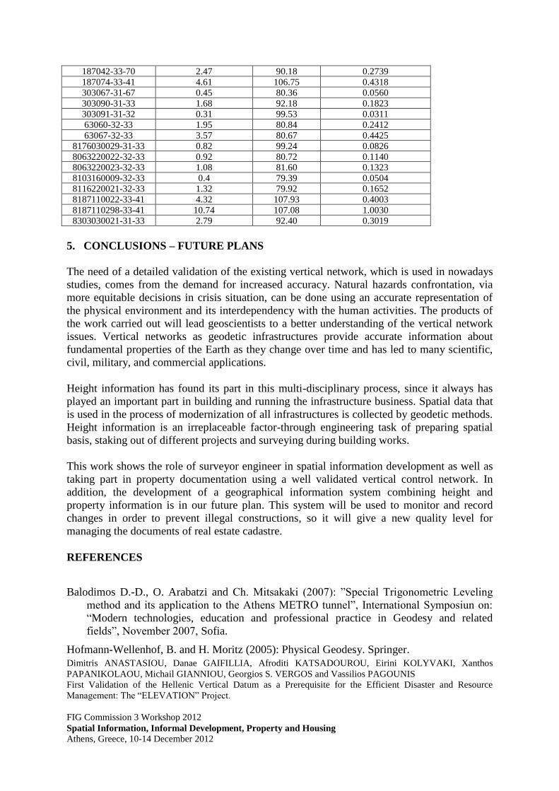
Loop Closing error (cm) Length (km) Relative error (ppm)
103005-32-67 3.51 83.39 0.4209 103007-32-67 21.81 83.24 2.6203
103014-32-67 3.02 84.67 0.3567
103017-32-67 21.55 85.71 2.5143 103019-32-33 14.44 80.17 1.8011
103025-32-67 0.88 88.53 0.0994 103031-32-33 1.56 80.38 0.1941
103032-31-32 1.22 89.85 0.1358
112008-32-33 3.38 93.76 0.3605 116031-32-33 2.12 82.67 0.2565
116841-32-33 1.9 79.31 0.2396 118006-32-33 0.44 79.93 0.0551
118022-31-32 0.42 90.66 0.0463 118045-31-33 2.59 91.08 0.2844
162015-31-41 9.16 117.89 0.7770
176021-31-33 2.63 99.35 0.2647
Dimitris ANASTASIOU, Danae GAIFILLIA, Afroditi KATSADOUROU, Eirini KOLYVAKI, Xanthos
PAPANIKOLAOU, Michail GIANNIOU, Georgios S. VERGOS and Vassilios PAGOUNIS
First Validation of the Hellenic Vertical Datum as a Prerequisite for the Efficient Disaster and Resource
Management: The “ELEVATION” Project.
FIG Commission 3 Workshop 2012
Spatial Information, Informal Development, Property and Housing
Athens, Greece, 10-14 December 2012
187042-33-70 2.47 90.18 0.2739
187074-33-41 4.61 106.75 0.4318 303067-31-67 0.45 80.36 0.0560
303090-31-33 1.68 92.18 0.1823 303091-31-32 0.31 99.53 0.0311
63060-32-33 1.95 80.84 0.2412
63067-32-33 3.57 80.67 0.4425 8176030029-31-33 0.82 99.24 0.0826
8063220022-32-33 0.92 80.72 0.1140 8063220023-32-33 1.08 81.60 0.1323
8103160009-32-33 0.4 79.39 0.0504 8116220021-32-33 1.32 79.92 0.1652
8187110022-33-41 4.32 107.93 0.4003
8187110298-33-41 10.74 107.08 1.0030 8303030021-31-33 2.79 92.40 0.3019
5. CONCLUSIONS – FUTURE PLANS
The need of a detailed validation of the existing vertical network, which is used in nowadays
studies, comes from the demand for increased accuracy. Natural hazards confrontation, via
more equitable decisions in crisis situation, can be done using an accurate representation of
the physical environment and its interdependency with the human activities. The products of
the work carried out will lead geoscientists to a better understanding of the vertical network
issues. Vertical networks as geodetic infrastructures provide accurate information about
fundamental properties of the Earth as they change over time and has led to many scientific,
civil, military, and commercial applications.
Height information has found its part in this multi-disciplinary process, since it always has
played an important part in building and running the infrastructure business. Spatial data that
is used in the process of modernization of all infrastructures is collected by geodetic methods.
Height information is an irreplaceable factor-through engineering task of preparing spatial
basis, staking out of different projects and surveying during building works.
This work shows the role of surveyor engineer in spatial information development as well as
taking part in property documentation using a well validated vertical control network. In
addition, the development of a geographical information system combining height and
property information is in our future plan. This system will be used to monitor and record
changes in order to prevent illegal constructions, so it will give a new quality level for
managing the documents of real estate cadastre.
REFERENCES
Balodimos D.-D., O. Arabatzi and Ch. Mitsakaki (2007): ”Special Trigonometric Leveling
method and its application to the Athens METRO tunnel”, International Symposiun on:
“Modern technologies, education and professional practice in Geodesy and related
fields”, November 2007, Sofia.
Hofmann-Wellenhof, B. and H. Moritz (2005): Physical Geodesy. Springer.

Dimitris ANASTASIOU, Danae GAIFILLIA, Afroditi KATSADOUROU, Eirini KOLYVAKI, Xanthos
PAPANIKOLAOU, Michail GIANNIOU, Georgios S. VERGOS and Vassilios PAGOUNIS
First Validation of the Hellenic Vertical Datum as a Prerequisite for the Efficient Disaster and Resource
Management: The “ELEVATION” Project.
FIG Commission 3 Workshop 2012
Spatial Information, Informal Development, Property and Housing
Athens, Greece, 10-14 December 2012
Kotsakis, C., K. Katsambalos, D. Ampatzidis, M. Gianniou (2008a): “Evaluation of EGM08
using GPS and leveling heights in Greece”, Proceedings of the International Symposium
on Gravity, Geoid and Earth Observation GGEO 2008, June 2008, Chania, Greece.
Kotsakis, C., K. Katsambalos, M. Gianniou (2008b): “Evaluation of EGM08 based on GPS
and Orthometric Heights over the Hellenic Mainland”, Special Issue of the Newton 's
Bulletin (joint journal of the BGI and the IGFS) with reports from the IAG/IGFS Joint
Working Group on the 'Evaluation of Global Earth Gravity Models.
Katsampalos, K., C. Kotsakis, M. Gianniou (2010): “Hellenic Terrestrial Reference System
2007 (HTRS07): a regional densification of ETRS89 over Greece in support of HEPOS”,
Bollettino di Geodesia e Scienze Affini, Vol. LXIX , N. 2-3, 2010, pp. 329-347.
Tziavos IN, Vergos GS, Grigoriadis VN, Andritsanos VD (2012) Adjustment of collocated
GPS, geoid and orthometric height observations in Greece. Geoid or orthometric height
improvement? In: Kenyon S, Pacino C, Marti U (eds) Geodesy for Planet Earth,
International Association of Geodesy Symposia Vol. 136, Springer Berlin Heidelberg
New York, pp. 481-488.
Tziavos I.N. and V.D. Andritsanos (1999): Recent Geoid Computations for the Hellenic Area.
Phys. Chem. Earth (A), Vol. 24, No. 1, pp. 91—96.
Tziavos IN, Vergos GS, Mertikas SP, Daskalakis A, Grigoriadis VN, Tripolitsiotis A (2012)
The contribution of local gravimetric geoid models to the calibration of satellite altimetry
data and an outlook of the latest GOCE GGM performance in GAVDOS. Accepted for
publication to Advances in Space Research, doi: 10.1016/j.asr.2012.06.013.
Vergos GS (2011) The recent gravity-field dedicated satellite missions and applications to
geosciences. CHOROgrafies, “Spatial Approaches”, 2(1)1-11. ISSN: 1792-3913.
Vergos GS, Grigoriadis V, Tziavos IN, Sideris MG (2007) Combination of multi-satellite
altimetry data with CHAMP and GRACE EGMs for geoid and sea surface topography
determination. In: Tregoning P, Rizos C (eds) Dynamic Planet 2005 - Monitoring and
Understanding a Dynamic Planet with Geodetic and Oceanographic Tools, International
Association of Geodesy Symposia, vol.130 Springer – Verlag Berlin Heidelberg, pp. 244-
250.
Vergos GS, Sideris MG (2002) Evaluation of Geoid Models and Validation of Geoid and
GPS/Leveling Undulations in Canada. IGeS Bulletin, Vol. 12, pp. 3 - 17.
Vergos GS, Tziavos IN, Sideris MG (2006) On the validation of CHAMP- and GRACE-type
EGMs and the construction of a combined model. Geodesy and Cartography 55(3): 115-
131.
BIOGRAPHICAL NOTES
Mr. Dimitris Anastasiou holds a Dipl. Eng. (RSE) from School of Rural and Surveying
Engineering (SRSE) of the National Technical University of Athens (NTUA). He is currently
a PhD candidate at SRSE/NTUA.

Dimitris ANASTASIOU, Danae GAIFILLIA, Afroditi KATSADOUROU, Eirini KOLYVAKI, Xanthos
PAPANIKOLAOU, Michail GIANNIOU, Georgios S. VERGOS and Vassilios PAGOUNIS
First Validation of the Hellenic Vertical Datum as a Prerequisite for the Efficient Disaster and Resource
Management: The “ELEVATION” Project.
FIG Commission 3 Workshop 2012
Spatial Information, Informal Development, Property and Housing
Athens, Greece, 10-14 December 2012
Ms. Danae Gaifillia holds a Dipl. Eng (SE) of the Department of Surveying Engineering of
the Technological Educational Institute of Athens (TEI Athens). She is currently a
postgraduate student at Applied Geography and Spatial Planning – Geoinformatics at HUA.
Ms. Afroditi Katsadourou holds a Dipl. Eng (RSE) and a M.Sc. from the Department of
Geodesy and Surveying (DGS) of the Aristotle University of Thessaloniki (AUTh). She is
currently a research assistant at DGS/AUTh.
Ms. Eirini Kolyvaki holds a Dipl. Eng (RSE) and a M.Sc. from the Department of Geodesy
and Surveying (DGS) of the Aristotle University of Thessaloniki (AUTh). She is currently a
research assistant at DGS/AUTh.
Mr. Xanthos Papanikolaou holds a Dipl. Eng. (RSE) from School of Rural and Surveying
Engineering (SRSE) of the National Technical University of Athens (NTUA). He is currently
a PhD candidate at SRSE/NTUA.
Dr. Michail Gianniou is Assistant Professor at the Department of Surveying Engineering of
the Technological Educational Institute of Athens (TEI Athens). He holds a Ph.D. from the
Technical University of Darmstadt, Germany and a Dipl. Eng (RSE) from DGS/AUTh.
Dr. Georgios S. Vergos is a Lecturer at the Department of Geodesy and Surveying (DGS) of
the Aristotle University of Thessaloniki (AUTh). He holds a Ph.D. and Dipl. Eng (RSE) from
DGS/AUTh and a M.Sc. from the Department of Geomatics Engineering of the University of
Calgary.
Dr. Vassilios Pagounis is an Associate Professor at the Department of Surveying
Engineering of the Technological Educational Institute of Athens (TEI Athens). He holds a
Ph.D. from the National Technical University of Athens (NTUA) and a Dipl. Eng (RSE) from
DGS/AUTh.
CONTACTS
Associate Professor Vassilios Pagounis
Technological Educational Institute of Athens
Agiou Spyridonos Str.
Aigaleo, Athens
GREECE
Tel. + 30-210-5385820
Fax + 30-210-5385886
Email: [email protected]
Web site: www.teiath.gr