Embed Size (px)
Citation preview
Historic Roads of Virginia
FincastleCounty Road Orders
1773 - 1776
Ann Brush MillerSenior Research Scientist
Virginia Transportation Research Council
Virginia Transportation Research Council
by
Betty E. Spillman and Shirley P. Thomas
New River Historical Society
and
for the
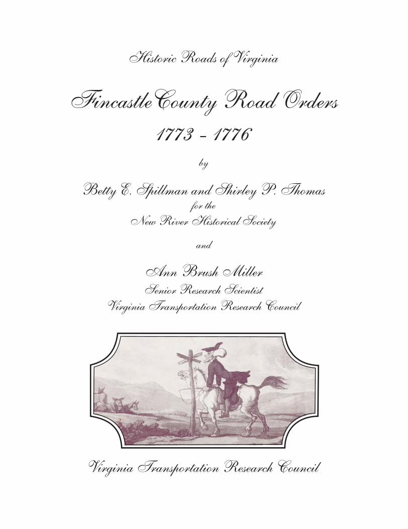
Standard Title Page - Report on State Project Report No.
Report Date
No. Pages
Type Report: Final
Project No.: 84657
VTRC 07-R32 May 2007 Period Covered: February 2007 to May 2007
Contract No.
Title: Fincastle County Road Orders 1773-1776
Key Words: Virginia Early Roads Fincastle County Southwest Virginia
Authors: Betty E. Spillman, Shirley P. Thomas, and Ann Brush Miller
Performing Organization Name and Address: Virginia Transportation Research Council 530 Edgemont Road Charlottesville, VA 22903
Sponsoring Agencies’ Name and Address Virginia Department of Transportation 1401 E. Broad Street Richmond, VA 23219
Supplementary Notes
Abstract The road history projects undertaken by the Virginia Transportation Research Council establish the feasibility of studies of early road networks and their use in the environmental review process. These projects, by gathering and publishing the early road orders of the vast parent counties, also lay the foundation for additional research by local groups over a broad area of Virginia. This volume marks the twenty-fifth entry in the Historic Roads of Virginia series, first initiated by the Virginia Transportation Research Council (then the Virginia Highway & Transportation Research Council) in 1973. Fincastle County Road Orders 1773-1776 is a cooperative effort of the Virginia Transportation Research Council and the New River Historical Society. This volume furthers the coverage of early western Virginia transportation records begun in the previously published Orange County Road Orders 1734-1749, Augusta County Road Orders 1745-1769, and Botetourt County Road Orders 1770-1778. This project covers the entire period of Fincastle County’s existence, during which time the county covered much of present day southwest Virginia. This information will eliminate the need for further research into the Fincastle County road order records. If questions arise about early roads once a Virginia Department of Transportation road improvement project is already underway (or nearly underway), primary historical research of this nature can take 6 to 12 months to complete. Therefore, this study can be a source of potentially significant cost savings for VDOT, including the avoided costs of project delays and consultant costs for cultural resource studies should questions arise.
FINCASTLE COUNTY ROAD ORDERS 1773-1776
by
Betty E. Spillman and Shirley P. Thomas for the
New River Historical Society
and
Ann Brush Miller Senior Research Scientist
Virginia Transportation Research Council
Virginia Transportation Research Council (A partnership of the Virginia Department of Transportation
and the University of Virginia since 1948)
Charlottesville, Virginia
May 2007 VTRC 07-R32
ii
DISCLAIMER
The contents of this report reflect the views of the authors, who are responsible for the facts and the accuracy of the data presented herein. The contents do not necessarily reflect the official views or policies of the Virginia Department of Transportation, the Commonwealth Transportation Board, or the Federal Highway Administration. This report does not constitute a standard, specification, or regulation.
Copyright 2007 by the Commonwealth of Virginia.
iii
HISTORIC ROADS OF VIRGINIA Louisa County Road Orders 1742-1748, by Nathaniel Mason Pawlett Goochland County Road Orders 1728-1744, by Nathaniel Mason Pawlett Albemarle County Road Orders 1744-1748, by Nathaniel Mason Pawlett The Route of the Three Notch’d Road, by Nathaniel Mason Pawlett and Howard Newlon An Index to Roads in the Albemarle County Surveyor’s Books 1744-1853, by Nathaniel Mason
Pawlett A Brief History of the Staunton and James River Turnpike, by Douglas Young Albemarle County Road Orders 1783-1816, by Nathaniel Mason Pawlett A Brief History of Roads in Virginia 1607-1840, by Nathaniel Mason Pawlett A Guide to the Preparation of County Road Histories, by Nathaniel Mason Pawlett Early Road Location: Key to Discovering Historic Resources? by Nathaniel Mason Pawlett and
K. Edward Lay Albemarle County Roads 1725-1816, by Nathaniel Mason Pawlett “Backsights,” A Bibliography, by Nathaniel Mason Pawlett Orange County Road Orders 1734-1749, by Ann Brush Miller Spotsylvania County Road Orders 1722-1734, by Nathaniel Mason Pawlett Brunswick County Road Orders 1732-1749, by Nathaniel Mason Pawlett Orange County Road Orders 1750-1800, by Ann Brush Miller Lunenburg County Road Orders 1746-1764, by Nathaniel Mason Pawlett and Tyler Jefferson
Boyd Culpeper County Road Orders 1763-1764, by Ann Brush Miller Augusta County Road Orders 1745-1769, by Nathaniel Mason Pawlett, Ann Brush Miller,
Kenneth Madison Clark and Thomas Llewellyn Samuel, Jr.
iv
Amelia County Road Orders 1735-1753, by Nathaniel Mason Pawlett, Ann Brush Miller, and Kenneth Madison Clark
Fairfax County Road Orders 1749-1800, by Beth Mitchell New Kent County and Hanover County Road Orders 1706-1743, Transcribed from the Vestry
Book of St. Paul’s Parish, by Ann Brush Miller Frederick County Road Orders 1743-1772, by Gene Luckman and Ann Brush Miller Botetourt County Road Orders 1770-1778, by Ann Brush Miller
v
FOREWORD
by
Ann Brush Miller Virginia Transportation Research Council
Fincastle County Road Orders 1773-1776 is a cooperative project between the New
River Historical Society and the Virginia Transportation Research Council. It is the sixth volume of road orders produced cooperatively between a private group and the Virginia Transportation Research Council, following similar projects with the Orange County Historical Society (which sponsored the production of Orange County Road Orders 1734-1749 and Orange County Road Orders 1750-1800), the Culpeper County Historical Society (which sponsored Culpeper County Road Orders 1763-1764), the Fairfax County History Commission (which sponsored Fairfax County Road Orders 1749-1800), and Shenandoah University (which sponsored Frederick County Road Orders 1743-1772).
The location, transcription, and checking of the county road orders was undertaken by
Betty E. Spillman and Shirley P. Thomas for the New River Historical Society. Indexing was undertaken at the Virginia Transportation Research Council by Ann Brush Miller. A companion volume, Montgomery County Road Orders 1777-1800, is currently in preparation by Ms. Spillman and Ms. Thomas.
Particular appreciation is due to Mr. William T. Buchanan of Salem for his interest and
assistance in the preparation of this volume. Additional assistance, so to speak, was rendered by an earlier researcher: Lewis Preston Summers, in Annals of Southwest Virginia (Abingdon, Va., 1929). Summers’ work cites road orders for which the entries are now partly torn or deteriorated. In a number of cases, torn words in the original record have been determined from Summers’ text.
Fincastle County Road Orders 1773-1776 covers early transportation records for this
now-extinct Virginia county, which contained nearly all of present-day southwestern Virginia. At its creation from Botetourt County in 1772, Fincastle County included within its territory a portion of modern Craig County and the counties of Giles, Montgomery, Floyd, Pulaski, Carroll, Wythe, Bland, Tazewell, Smyth, Grayson, Buchanan, Russell, Washington, Dickenson, Wise, Scott, and Lee. In addition, the territory of the present-day state of Kentucky and the southern portion of what is now West Virginia were within the boundaries of Fincastle County. In 1777, the entire territory of Fincastle County was divided into the counties of Montgomery, Washington, and Kentucky, and Fincastle County ceased to exist. The Fincastle County court order records were incorporated into the order books of Montgomery County.
This volume is the twenty-fifth entry in the Historic Roads of Virginia series, initiated by
the Virginia Transportation Research Council (then the Virginia Highway & Transportation Research Council) in 1973. Fincastle County Road Orders 1773-1776 is the fifth volume of published road orders to be concerned with the early transportation records of western and

vi
southwestern Virginia. It follows Botetourt County Road Orders 1770-1778, Frederick County Road Orders 1743-1772, Augusta County Road Orders 1745-1769, and Orange County Road Orders 1734-1749 (which included the period during which the territory west of the Blue Ridge was part of Orange County, prior to 1745).
vii
A NOTE ON THE METHODS, EDITING, AND DATING SYSTEM
by
Nathaniel Mason Pawlett (Faculty Research Historian, Virginia Transportation Research Council, 1973-1995)
The road and bridge orders contained in the order books of an early Virginia county are
the primary source of information for the study of its roads. When extracted, indexed, and published by the Virginia Transportation Research Council, they greatly facilitate this. All of the early county court order books are in manuscript, sometimes so damaged and faded as to be almost indecipherable. Usually rendered in the rather ornate script of the time, the phonetic spellings of this period often serve to complicate matters further for the researcher and recorder.
With these road orders available in an indexed and cross-indexed published form, it will be possible to produce chronological chains of road orders illustrating the development of many of the early roads of a vast area from the threshold of settlement through much of the eighteenth century. Immediate corroboration for these chains of road orders will usually be provided by other evidence such as deeds, plats, and the Confederate Engineers maps. Often, in fact, the principal roads will be found to survive in place under their early names.
With regard to the general editorial principles of the project, it has been our perception over the years as the road orders of Louisa, Hanover, Goochland, Albemarle, and other counties have been examined and recorded that road orders themselves are really a variety of “notes,” often cryptic, incomplete, or based on assumptions concerning the level of knowledge of the reader. As such, any further abstracting or compression of them would tend to produce “notes” taken from “notes,” making them even less comprehensible. The tendency has, therefore, been in the direction of restraint in editing, leaving any conclusions with regard to meaning up to the individual reader or researcher using these publications. In pursuing this course, we have attempted to present the reader with a typescript text that is as near a type facsimile of the manuscript itself as we can come.
Our objective is to produce a text that conveys as near the precise form of the original as we can, reproducing all the peculiarities of the eighteenth-century orthography. While some compromises have had to be made because of the modern keyboard, this was really not that difficult a task. Most of their symbols can be accommodated by modern typography, and most abbreviations are fairly clear as to meaning.
Punctuations may appear misleading at times, with unnecessary commas or commas
placed where periods should be located; appropriate terminal punctuation is often missing or else takes the form of a symbol such as a long dash, etc. The original capitalization has been retained insofar as it was possible to determine from the original manuscript whether capitals were intended. No capitals have been inserted in place of those originally omitted. The original spelling and syntax have been retained throughout, even including the obvious errors in various

viii
places, such as repetitions of words and simple clerical errors. Ampersands have been retained throughout to include such forms as “&c” for “etc.” Superscript letters have also been retained where used in ye, yt, sd. The thorn symbol (y), pronounced as “th,” has been retained in the aforesaid “ye,” pronounced “the,” and “yt” (that). The tailed “p” (resembling a capital “p” with the tail extended into a loop) has also been retained. This symbol has no counterpart in modern typography; given the limits of the modern keyboard, we have rendered it as a capital “p” (P). This should be taken to mean either “per” (by), “pre,” or “pro” (sometimes “par” as in “Pish” for parish) as the context by the order may demand. For damaged and missing portions of the manuscripts we have used square brackets to denote the [missing], [torn] or [illegible] portions. Because of the large number of ancient forms of spelling, grammar, and syntax, it has been deemed impracticable to insert the form [sic] after each one to indicate a literal rendering. Therefore, the reader must assume that apparent errors are merely the result of our literal transcription of the road orders, barring the introduction of typographical errors, of course. If, in any case, this appears to present insuperable problems, resort should be made to the original records.
As to dating, most historians and genealogists who have worked with early Virginian records will be aware of the English dating system in use down to 1752. Although there was an eleven-day difference from our calendar in the day of the month, the principal difference lay in the fact that the beginning of the year was dated from March 25 rather than January 1, as was the case from 1752 onward to the present. Thus, January, February, and March (to the 25th) were the last three months in a given year, and the new year came in only on March 25.
Early Virginian records usually follow this practice, though in some cases dates during these three months will be shown in the form 1732/3, showing both the English date and that in use on the Continent, where the year began January 1. For researchers using material with dates in the English style, it is important to remember that under this system (for instance) a man might die in January 1734 yet convey property or serve in public office in June 1734, since June came before January in a given year under this system.
ix
INTRODUCTION
by
Ann Brush Miller
The roads are under the government of the county courts, subject to be controuled by the general court. They order whenever they think them necessary. The inhabitants of the county are by them laid off into precincts, to each of which they allot a convenient portion of the public roads to be kept in repair. Such bridges as may be built without the assistance of artificers, they are to be built. If the stream be such as to require a bridge of regular workmanship, the court employs workmen to build it, at the expense of the whole county. If it be too great for the county, application is made to the general assembly, who authorize individuals to build it, and to take a fixed toll from all passengers, or give sanction to such other proposition as to them appears reasonable.
—Thomas Jefferson, Notes on the State of Virginia, 1781
The establishment and maintenance of public roads were among the most important functions of the county court during the colonial period in Virginia. Each road was opened and maintained by an Overseer of the Highways appointed by the Gentlemen Justices yearly. He was usually assigned all the “Labouring Male Titheables” living on or near the road for this purpose. These individuals then furnished all their own tools, wagons, and teams and were required to labor for six days each year on the roads.
Major projects, such as bridges over rivers, demanding considerable expenditure were executed by commissioners appointed by the court to select the site and to contract with workmen for the construction. Where bridges connected two counties, a commission was appointed by each and they cooperated in executing the work.
At its creation from Botetourt County in 1772, Fincastle County extended from the
vicinity of present-day Blacksburg southwest and west through Virginia and into what is now Kentucky and West Virginia. Its territory included a part of modern Craig County, Virginia, and the entirety of the modern Virginia counties of Montgomery, Floyd, Giles, Pulaski, Carroll, Wythe, Bland, Tazewell, Smyth, Grayson, Buchanan, Russell, Washington, Dickenson, Wise, Scott, and Lee. The southern portion of what is now West Virginia, as well as the entire state of Kentucky, was within the original boundaries of Fincastle County.
This vast, thinly settled frontier county proved a difficult one to administer, and various inhabitants, living far from the county seat, petitioned for the creation of new administrative units. The final result—an unusual one for Virginia—was not division of the county’s territory, but extinction of the entire county. An Act of the Virginia Assembly in October 1776 provided that after the last day of December 1776, the entire territory of Fincastle County would be divided into the new counties of Montgomery, Washington, and Kentucky (the latter including the territory of the modern state of Kentucky) and Fincastle County would cease to exist.

x
The road orders contained in this volume cover the period from January 1773, when Fincastle’s county government became operational, to the final dissolution of the county (and the county’s government) at the end of 1776 in preparation for the establishment of the counties of Montgomery, Washington, and Kentucky. These road orders comprise the principal extant evidence concerning the early development of roads over a large area of western and southwestern Virginia, and adjoining regions, during the period of expanding settlement in the immediate pre-Revolutionary era and the early years of the American Revolution.
1
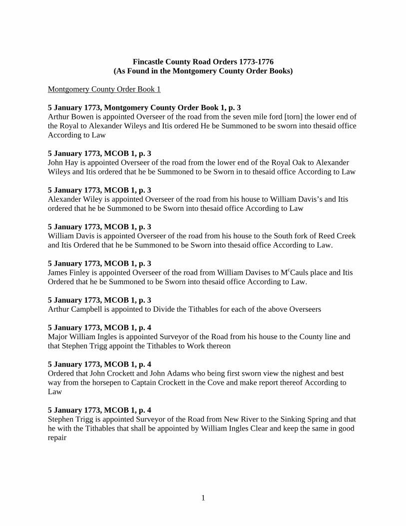
Fincastle County Road Orders 1773-1776
(As Found in the Montgomery County Order Books) Montgomery County Order Book 1 5 January 1773, Montgomery County Order Book 1, p. 3 Arthur Bowen is appointed Overseer of the road from the seven mile ford [torn] the lower end of the Royal to Alexander Wileys and Itis ordered He be Summoned to be sworn into thesaid office According to Law 5 January 1773, MCOB 1, p. 3 John Hay is appointed Overseer of the road from the lower end of the Royal Oak to Alexander Wileys and Itis ordered that he be Summoned to be Sworn in to thesaid office According to Law 5 January 1773, MCOB 1, p. 3 Alexander Wiley is appointed Overseer of the road from his house to William Davis’s and Itis ordered that he be Summoned to be Sworn into thesaid office According to Law 5 January 1773, MCOB 1, p. 3 William Davis is appointed Overseer of the road from his house to the South fork of Reed Creek and Itis Ordered that he be Summoned to be Sworn into thesaid office According to Law. 5 January 1773, MCOB 1, p. 3 James Finley is appointed Overseer of the road from William Davises to McCauls place and Itis Ordered that he be Summoned to be Sworn into thesaid office According to Law. 5 January 1773, MCOB 1, p. 3 Arthur Campbell is appointed to Divide the Tithables for each of the above Overseers 5 January 1773, MCOB 1, p. 4 Major William Ingles is appointed Surveyor of the Road from his house to the County line and that Stephen Trigg appoint the Tithables to Work thereon 5 January 1773, MCOB 1, p. 4 Ordered that John Crockett and John Adams who being first sworn view the nighest and best way from the horsepen to Captain Crockett in the Cove and make report thereof According to Law 5 January 1773, MCOB 1, p. 4 Stephen Trigg is appointed Surveyor of the Road from New River to the Sinking Spring and that he with the Tithables that shall be appointed by William Ingles Clear and keep the same in good repair
2
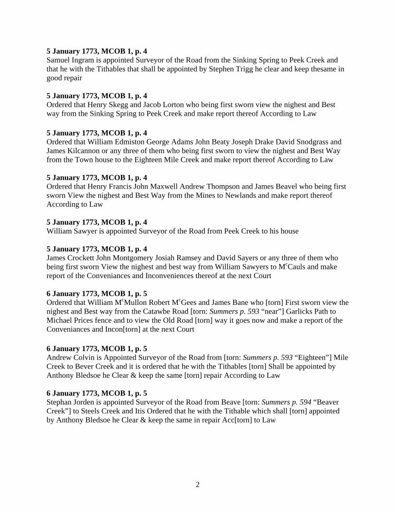
5 January 1773, MCOB 1, p. 4 Samuel Ingram is appointed Surveyor of the Road from the Sinking Spring to Peek Creek and that he with the Tithables that shall be appointed by Stephen Trigg he clear and keep thesame in good repair 5 January 1773, MCOB 1, p. 4 Ordered that Henry Skegg and Jacob Lorton who being first sworn view the nighest and Best way from the Sinking Spring to Peek Creek and make report thereof According to Law 5 January 1773, MCOB 1, p. 4 Ordered that William Edmiston George Adams John Beaty Joseph Drake David Snodgrass and James Kilcannon or any three of them who being first sworn to view the nighest and Best Way from the Town house to the Eighteen Mile Creek and make report thereof According to Law 5 January 1773, MCOB 1, p. 4 Ordered that Henry Francis John Maxwell Andrew Thompson and James Beavel who being first sworn View the nighest and Best Way from the Mines to Newlands and make report thereof According to Law 5 January 1773, MCOB 1, p. 4 William Sawyer is appointed Surveyor of the Road from Peek Creek to his house 5 January 1773, MCOB 1, p. 4 James Crockett John Montgomery Josiah Ramsey and David Sayers or any three of them who being first sworn View the nighest and best way from William Sawyers to McCauls and make report of the Conveniances and Inconveniences thereof at the next Court 6 January 1773, MCOB 1, p. 5 Ordered that William McMullon Robert McGees and James Bane who [torn] First sworn view the nighest and Best way from the Catawbe Road [torn: Summers p. 593 “near”] Garlicks Path to Michael Prices fence and to view the Old Road [torn] way it goes now and make a report of the Conveniances and Incon[torn] at the next Court 6 January 1773, MCOB 1, p. 5 Andrew Colvin is Appointed Surveyor of the Road from [torn: Summers p. 593 “Eighteen”] Mile Creek to Bever Creek and it is ordered that he with the Tithables [torn] Shall be appointed by Anthony Bledsoe he Clear & keep the same [torn] repair According to Law 6 January 1773, MCOB 1, p. 5 Stephan Jorden is appointed Surveyor of the Road from Beave [torn: Summers p. 594 “Beaver Creek”] to Steels Creek and Itis Ordered that he with the Tithable which shall [torn] appointed by Anthony Bledsoe he Clear & keep the same in repair Acc[torn] to Law
3
6 January 1773, MCOB 1, p. 5 David Steel is appointed Surveyor of the Road from Steels Creek [torn: Summers p. 594 “to”] Muddy Creek & Itis ordered that he with the Tithables which shall be app[torn] by Anthony Bledsoe he Clear & keep the same in repair Accor[torn] to Law [Note: The following original order is badly torn. This entire entry is from Lewis Preston Summers’ Annals of Southwest Virginia (1929), p. 594.] 6 January 1773, MCOB 1, p. 5 Moses Looney is appointed Surveyor of the Road from Muddy Creek to the County line and It is ordered that he with the Tithable which shall be appointed by Anthony Bledsoe he Clear & keep the same in repair According to Law 6 January 1773, MCOB 1, p. 6 Ordered that Anthony Bledsoe do appoint the Tithables to work under the above mentioned Surveyor [Note: Pages 7 and 8 are in reverse order.] 6 January 1773, MCOB 1, p. 7 This Court doth recommend to his Excellency the Governor that he will be pleased to Establish the Court house for this County at a piece of Land Commonly called McCalls place now the property of Ross and Company and the Lands of Samuel Crockett in lieu of the Lead Mines for the several reasons Following That the said McCauls place and Crocketts lies on the Great Road that passes thro the County and that it is well watered Timbered & Levell that it is much more Centrical than the Mines & that it is in the neighborhood of a Great deal of Good Land & Meadows That the Lead Mines is near the South Line of the County that there is no Spring Conveniant very scarce of Timber and in a Neighbour[torn] where there is very little pasture and entirely off the leading Road To which Order Arthur Campbell dissents [Note: The following pages, MCOB 1, pp. 8-33, are apparently misdated. Although the date on the entries is March 1774, several of these entries continue orders from the January 1773 court, and another order is continued in the May 1773 entry. Lewis Preston Summers in Annals of Southwest Virginia (1929), pp. 597-602, also places these orders in the 1773 chronology.] 2 March 1774 [1773], MCOB 1, p. 8 The Order for viewing a road from the Town House to the Eighteen Mile Creek made at Last Court is set aside and Itis Ordered that John Hays Benjamin Logan William Campbell Arthur Bowen Thomas Ramsey [torn] any four of them who being first Sworn View the Several ways Hays purposed for said Road and make a report of the Conveniances and Inconveniances Attending the same respectively and the distances to the next Court
4
2 March 1774 [1773], MCOB 1, p. 8 A report made pursuant to and Order of Court for viewing the Road from the horsepen to Captain Crocketts returned and the road Established therefore Itis ordered that Samuel Montgomery be appointed Surveyor thereof 2 March 1774 [1773], MCOB 1, p. 8 Ordered that Robert Davis Alexander Wiley Robert Buchanan and Hugh Gullion or any three of them who being first sworn View the Nighest and best way from James Davises to Jacob Ketterines & make Report thereof at the next Court 2 March 1774 [1773], MCOB 1, p. 10 A report Pursuant toan Order of the Court for Viewing a Road from William Sawyerses to McCauls being returned Itis ordered that a Road be Established from William Sawyerses plantation up by his mill dam and past James Crocketts house into the Old Road Betwixt that and Reed Creek 2 March 1774 [1773], MCOB 1, p. 10 David Sawyers is appointed Surveyor of thesaid Road litle Pine Run to the ford of Reed Creek and Itis ordered that he with the Tithables that usually worked with him over the river and else where he Clear and keep the same in good repair 2 March 1774 [1773], MCOB 1, p. 11 Ordered that James McCarty Mathias Mounts John Smith Thomas Byrd Nathan Richardson and Peter Lee or any three of them who being first Sworn do View the nighest and Best Way from the Town House on Holston to Castlewood on Clinch and make report of the Conveniances and Inconveniances at the next Court 2 March 1774 [1773], MCOB 1, p. 12 Ordered that Thomas Berry and Andrew Miller who being first Sworn View the nighest and Best Way from Thomas Berrys past William Kennadys Mill onto the Great Road and make report of the Conveniances and Inconveniances there of at the next Court 2 March 1774 [1773], MCOB 1, p. 13 Ordered that John Maxwell William Leitch Robert Allison Robert Camp[torn] or any three of them who being first Sworn do view the nighest and Best way from Catharines Mill to Charles Allisons and so on to Sinclars Bottom and Make report of the Conveniances and Inconveniances there of at next Court 2 March 1774 [1773], MCOB 1, p 13 Michael Greegar is appointed Surveyor of the Road in the room of Jacob Catharine from the south fork of Reed Creek to the Crossing below Catharines and that he with the Tithables that usually Worked under Katharine he Clear and keep thesame in repair According to Law
5
3 March 1774 [1773], MCOB 1, p. 33 Ordered that the persons formerly appointed to view the way up Cripple Creek do view the same and Make report of the Conveniances and Inconveniances at the next Court [Note: End of misdated March court section.] 4 May 1773, MCOB 1, p. 34 On the petion of a number of Inhabitants Itis Ordered that William Thompson Absalom Mounts and William Lockart who being first Sworn do View the Nighest and best way from the foot of the Mountain by Joseph Cloyds to William Lockarts on Walkers Creek and Make a report of the Conveniances and Inconveniances thereof at the next Court. 4 May 1773, MCOB 1, p. 34 The order for viewing the way from James Davises to Jacob Katharines being returned the old way is reported be the most Conveniant Itis ordered that the same be Established 4 May 1773, MCOB 1, p. 35 Ordered that James Hais John Hais Archibald Buchanan and Robert Davis or any three of them who being first Sworn View the nighest and Best way from the rich Valley over the Mountain by Robert Davises onto the Leading Road from Holston and make a report of the Conveniances and Inconveniances thereof at the next Court 5 May 1773, MCOB 1, p. 36 (Grand Jury Presentment) James McGavock for Stopping the Kings highway by Information of John Newell 5 May 1773, MCOB 1, p. 39 Ordered that Isaac Ridde Westley White James Young and James Montgomery who being first Sworn View the Nighest and best Way from the Eleven Mile Creek on Holston by Joneses place at the Crossing place to Watago and make a report of the Conveniances and Inconveniances thereof at the next Court 5 May 1773, MCOB 1, p. 39 Ordered that John Duncan Alexander Montgomery and James Smith who first being Sworn be added to the Order made Last Court for viewing the nighest and Best way from the Town house to Castles Wood and that the whole or any three of them make a Report of the Conveniance and the Inconveniances thereof at the next Court 5 May 1773, MCOB 1, p. 70 James McGavock and John Montgomery to appoint the hands that is to work on the Road whereof Samuel Montgomery is overseer 5 May 1773, MCOB 1, p. 70 Ordered that William Sawyers John Adams John Alcorn John Miller Jno Montgomery James Crockett David Sawyers and Josiah Ramsey or any Six of them being first Sworn do view
6
the Several ways proposed from the ford of Reed Creek next Sawyers to the Fork of Robert Montgomerys road and make report of the Conveniences and Ill Conveniences thereof Respecting as well the Distance -- 6 July 1773, MCOB 1, p. 73 Ordered that David Sayars. Andrew Crockett. James Newell & Samuel Drake or any three of them being first Sworn according to law do View the way from Hans Meadows to Herbert’s Ferry and make report thereof to the next Court. 6 July 1773, MCOB 1, p. 73 Ordered that James Smith & David Cowan be appointed overseer of the Road from Castle Woods to Elk Garden and that the Divide the Road betwixt them. 6 July 1773, MCOB 1, p. 75 The report returned for Viewing the way from the Ford of Reed Creek next Sawyer’s to the Fork of Robt Montgomery’s road returned & said road Established by way of James McGavock’s Mill dam and James McGavock appointed Surveyor from the first Foard of Reed Creek below McGavocks to McCalls & John Montgomery to lay off the hands to work on said Road -- 6 July 1773, MCOB 1, p. 75 The Report for viewing the way from John Dunkan’s in Elk Garden to the Town house returned & Established agreeable to said report. Viz -- Beginning at said Duncan’s and along the up Road a mile thence over the Mountain into the Poor Valley about Five miles to the Westward of the old path from thence by the bigg Lick through Lyon’s Gap to the Town house & William Crabtree appointed overseer of said road from the Town house to the North Fork beyond the Bigg Lick and Peter Lee appointed overseer of said Road from the North Fork to the Foot of Clinch Mountain. Capt Thompson Capt Campbell & Capt Russell to allott the hands to work on Each road & for to make the said road a good horse Way 6 July 1773, MCOB 1, p. 75 The report for Viewing the way from the Town house to the Eighteen Mile Creek returned and the lower Road Established and William Campbell Gent appointed overseer from the Seven Mile Foard to the bigg Spring below Captain Thompson’s on the old Way and William Edmiston appointed overseer from thence to James Kinkcannons and James Bryan appointed overseer from the said James Kinkannons to the Eighteen mile Creek & Captain Thompson to allott the hands to Work on Each Road. 6 July 1773, MCOB 1, p. 75 Frederick Edwards appointed overseer of the road from Peek Creek to Little Pine Run and the usual hands to keep the Same in Repair according to Law. & William Sawyers is appointed overseer of the road from thence to Reed Creek in the Room of David Sawyers & that he with the usual hands to work on said road & keep the same in Repair according to Law
7
6 July 1773, MCOB 1, p. 75 A Road appointed from the mines to John Newlands George Ewen appointed overseer from the mines to Henry Francis & Henry Francis appointed overseer from his own house to John Newlands and that the said overseers do take the said Road the Nearest & best way. 6 July 1773, MCOB 1, p. 75 The report of the road from Eleven Mile Creek to the Ford of Holston as you go to Wattauga returned & Road Established agreeable to said report & James Montgomery appointed overseer of said road from the Eleven Mile Creek to his house. Jas Young appointed overseer from thence to Isacc Riddells & Isaac Riddell from thence to Foard [torn: Summers p. 609 “of”] Holston & Capt. Bledsoe to allott the bounds of the hands for Each overseer 6 July 1773, MCOB 1, p. 77 A Road Established from Catharine’s Mill to Charles Allisons house on condition that the people on the South Fork do cutt the same themselves or any others on said Road who think it usefull -- 6 July 1773, MCOB 1, p. 77 Ordered that Robert Edmiston. William Edmiston. Alexander McNutt. Robert Buchanan & John Edmiston being first sworn do View the way from Charles Allison’s down the South Fork to Robt Edmiston’s & make report thereof to the next Court. 6 July 1773, MCOB 1, p. 77 On the complaint of William Kavannagh it is ordered that James Adair do move his Fence or leave a path by him or otherwise that he appear at the next court to answer for stopping up said path -- 7 September 1773, MCOB 1, p, 107 William Preston. James Adams. John Adams. James Montgomery. Joseph Montgomery. John Draper and Federick Edwards or any three of them being First sworn are appointed to view the way by John Taylor’s foard, Samuel Peppers, the Horse Shoe &by Brown’s bottom from the glades by Draper’s Meadows into the Landing road Betwixt Majr Ingles Ferry & Read Creek and make report of the convenience & Inconveniency that attends the same to the next Court. 7 September 1773, MCOB 1, p. 107 John Craig. Peter Stevens & Philip Barrier being first sworn are appointed to view the highest & best way from the Glades near Draper’s Meadows to the Markett road at Jno Craig & make report thereof to the next Court -- 7 September 1773, MCOB 1, p. 110 John Reed is appointed overseer of the road from the Eighteen mile Creek to McKenner’s and James Bryant, from thence up where he Begun & that he keep the Same in repair agreeable to Law.
8
7 September 1773, MCOB 1, p. 113 William Herbert is appointed overseer of the road from his Ferry to the head of Poplar Camp Creek and Thomas Foster from the Ferry to the Forks of the Road beyond the Boiling Spring -- and Filby Vanhouver to be overseer from the head of Poplar Camp Creek to the Pittsylvania Line & that Capt Herbert lay of the hand Between Francis & George Erven. 7 September 1773, MCOB 1, p. 113 Order that James McGavock be appointed overseer of the Landing Road as formerly as to the length but that his hands shall not be called more than Five miles from each side of his Road to be Judged by Jno Montgomery Senr & that he with said hands keepthe same in repair according to Law 8 September 1773, MCOB 1, p, 122 Ordered that Joseph Black. Ande Colvin. Saml Erven. Wm Blackburn. George Blackburn. Saml
Briggs. David Galwood Jno Berri [or Brown]. Christn Aklin. Jno Kerick. Jno Vance & Benjn Logan do clear the nearest & best way from Saml Briggs’s on The Eighteen mile Creek to James Bryant’s on the Eleven mile Creek -- 8 September 1773, MCOB 1, p. 123 Roger Topp appointed Surveyor of the Road in the Room of Stephen Jordan.
2 November 1773, MCOB 1, p. 143 (Grand Jury Presentment) Likewise we present James McGavock for not keeping the Road in Sufficient repair 2 November 1773, MCOB 1, p. 144 Ordered that George Parish. Jno Howe & W. Howe and Jno Nicholas or any two of them Being first sworn do veiw the way from the bigg Crossing of Walkers Creek to the mouth of Wolf Creek and make report thereof to the next Court 2 November 1773, MCOB 1, p. 144 Ordered that the road by Capt. Bledsoe’s plantation be altered at the overseer’s Discretion 2 November 1773, MCOB 1, p. 144 On the Petition of a Number of Inhabitants It is ordered that William Priest, Henry Willis, Joseph Martin, William Bowen, Joseph Cravens or any three of them being first sworn do view the best way from the Maiden Spring Settlement into the great road & make report of the Conveniency and Inconveniency Thereof to the next Court. 2 November 1773, MCOB 1, p. 144 The report for Veiwing the way from the Glades near Drapers Meadows to the Market Road at Jno Craigs returned and the road Established agreeable thereto. And ordered that Peter Stevens be appointed overseer of the same & that Jno Craig work thereon & tell others that Settle within the bounds.
9
2 November 1773, MCOB 1, p. 145 It is Ordered that Jno Adams be appointed Overseer of the road in the room of James McGavock 3 November 1773, MCOB 1, p. 148 Ordered that the petitioners do clear a way for a Bridle road from Wm Doak’s Mill to James Maxwells mill and that the Overseer be appointed to Said road agreeable to the petition [Note: Last Fincastle County road order in MCOB 1; pages 150-324 of MCOB 1 are Montgomery County court records 1785-1788. Road orders found on pages 150-324 appear in Montgomery County Road Orders 1777-1800.] Montgomery County Order Book 2
3 May 1774, MCOB 2, p. 2 John Maxwell is appointed Surveyor of the Road from William Davis’s to the South fork of Reed Creek in the room of the said Davis and Its Ordered that with the Tithables that usually worked under the said Davis he clear and keep the same in Repair according to Law.
3 May 1774, MCOB 2, p. 3 On the petitions of the Inhabitants of Bever Creek. Its ordered that Benjamin Logan open a Road from James Fulkorsons to the Waggon Road at James Blacks the Best and most Convenient Way and sd Benjamin Logan is Appointed Overseer thereof. Its Ordered that he with the Tithables thereof keep the same in good repair according to Law
3 May 1774, MCOB 2, p. 7 This Court doth appoint William Ingles and Stephen Trigg Trustees for this County to get together with David Robinson and William Madison the Trustees for Botetourt County to the Lowest Bidder the Repairing of the Road as they shall direct from this County agrees to bear one half of the Expenses should it not amount to more than fifteen pounds each County
2 August 1774, MCOB 2, p. 109 Ordered that William Thompson Henry Patton and Adam Waggoner view a Road from the Fork of Taylors road and Peppers into the Great Road leading by Major Ingles ferry up to fort Chiswell and make a report thereof at the next Court to be held 2 August 1774, MCOB 2, p. 109 Ordered that John Burk Andrew Hatfield and Paulur Lybrook view the Nighest and Best way from the foot of Rich Creek Mountain to Tom’s Creek and that Burk be Appointed Overseer thereof and that he with the Tithables in that District Clear & keep the same in repair According to Law 2 August 1774, MCOB 2, p. 109 Ordered that Philip Barrier Robert Magee and William McMullen who being first Sworn veiw the nighest and Best Way from Toms Creek to the Glades and make a report thereof at the next Court
10
6 December 1774, MCOB 2, p. 112 Ordered that a Road be cutt from Arthur Campbells Mill to Blue Spring at the head of Criple Creek by the way of the Rye Bottom and that William Campbell Gent appoint the Tithables to work thereon and that Charles Allison be Overseer of thesame 6 December 1774, MCOB 2, p. 112 Ordered that a Road be cutt from Arthur Campbells Mill to Archibald Buchanans on the north fork of Holston and that William Campbell Gent appoint the Tithables to work thereon and that thesaid Archibald Buchanan be Overseer of thesame. 6 December 1774, MCOB 2, p. 112 Ordered that John Shelby be appointed Surveyor of the Road none by the name of the Watago Road in the Room of Isaac Riddle and that he withthe Tithables that usually Worked on thesame be Clear and keep thesame in repair According to Law 7 February 1775, MCOB 2, p. 114 William Love is Appointed Surveyor of the road from the Lower ford of reed Creek to McCauls in the room of John Adams and Itis Ordered that he with the Tithables that usually worked there on he Clear and keep the same in good repair 7 February 1775, MCOB 2, p. 116 Joseph Buchanan is appointed Surveyor of the road from the ford of reed Creek at McCauls to the foard of thesaid Creek this side of Katharins Mill in the room of John Finley and it is ordered that he with the Tithables that usually worked thereon Clear and keep the same in repair According to Law 7 March 1775, MCOB 2, p. 137 The report of William McMullen James Bane & Robert McGee the persons appointed to view the way from Michael Prices field to where Greshams path goes into the Catawbo road being returned on Consideration whereof it is the opinion of the Court that the new road be opened as marked by the viewers & that Philip Barriger, with Robert Greyson, William McMullen, Robert McGee, Robert Ritche, John Crinor, Michl Larke, George Feilder, John Ramy, Harmon Cook, Joseph McDonald, Jacob Seiler, James Bane, Wm Preston, Michael Price & Jacob Smith, and their Tithables or any others who may settle within his Bounds do open and keep the same in Repair According to Law 7 March 1775, MCOB 2, p. 137 John Hill is appointed Surveyor of the road from Strouples Creek to the uper Corner of Michael Prices field and it is ordered that George Taylor, Ludawick Switcher, William Bowles, Joseph Puppecroser, Henry Bingaman, Jacob Shell, Jacob Shell Junior, Casper Garlick, John Haven, Francis Munsey, Obediah Muncey, William Bennett, Phillip Harless, Emanuel Harless, David Harless, James Crow, George Williams, Jacob Delanorrick and John Hill and their Tithables work and keep the same in repair according to Law
11
7 March 1775, MCOB 2, p. 138 Robert McGee William McMullen and Phillip Barriger the persons appointed to view the road from Toms Creek to the glades being returned it is Ordered that Wm McMullen be Surveyor thereof, and that he with the Tithables to be appointed by Colonel William Preston, Clear and keep the same in repair according to Law 2 May 1775, MCOB 2, p. 139 Ordered that Henry Thompson Nathaniel Morgan and Saul Cecil, who being first sworn, view and mark the nighest and best way from William Thompsons mill on back Creek to the Corner of Samuel Pepper up land Field and make report of the Conveniances & Inconveniances to the next Court 7 November 1775, MCOB 2, p. 147 Ordered that Thomas Burk be appointed overseer of the road from the Mouth of Sinking Creek to Toms Creek and that he with the usual hands keep the same in repair according to Law 3 September 1776, MCOB 2, p. 149 Henry Hafford is appointed overseer of the road from Seven mile Tree to Colo Ingliss Ferry & that he with the usual hands to work thereon of which Colo Inglis will give a list of keep the same in repair according to Law -- 3 September 1776, MCOB 2, p. 149 Alexander Robertson is appointed overseer of the road from Colo William Ingliss Ferry to the Sinking Spring and that he with the usual hands keep the same in repair according to Law 3 September 1776, MCOB 2, p. 149 Samuel Ingram is appointed overseer of the road from the Sinking Spring to Peek Creek and that he with the usual hands keep the same in repair according to Law. 3 September 1776, MCOB 2, p. 149 Robert Carr is appointed overseer of the road from Peek Creek to Little Pine run & that he with the usual hands keep the same in repair according to Law 3 September 1776, MCOB 2, p. 149 Andrew Boyd is appointed overseer of the road from Little Pine Run to Reed Creek & that he with the usual hands of which W. Sawyer will give him a List keep the same in repair according to Law -- 3 September 1776, MCOB 2, p. 149 James Simpson is appointed overseer of the road from the Ford of Reed Creek to Potters and that Mr John Montgomery & Mr McGavock Do allott the hands & that he keep the same in repair according to Law.
12
3 September 1776, MCOB 2, p. 149 John Wood is appointed overseer of the road from the Potters to the Ford of Reed Creek at McCauls & John Montgomery & W. McGavock Do allott the hands to work thereon & that he keep the Same in repair according to Law 3 September 1776, MCOB 2, p. 149 Joseph White is appointed overseer of the road from the Ford of Reed Creek at McCauls to Jacob Pattersons mill & that he with the usual hands keep the same in repair according to Law. 3 September 1776, MCOB 2, p. 149 Michael Craiger is appointed overseer of the road from Jacob Pattersons to the Ford of the South Fork of Reed Creek and that he with the usual hands keep the same in repair according to Law 3 September 1776, MCOB 2, p. 150 John Maxwell is appointed overseer of the road from the Ford of the South Fork of Reed Creek to a Branch below William Davises Field and the hands from Michael Weavers across by Jacob Toblars and below to Craigers bounds to work thereon & keep the same in repair 3 September 1776, MCOB 2, p. 150 Alexander Wiley is appointed overseer of the road from the Branch below William Davises Field to the ford of the Creek at his own house and the hands from Michael Weavers across to Jacob Toblars with the usual hands keep the same in repair according to Law 3 September 1776, MCOB 2, p. 150 William Calhoon is appointed overseer of the road from the Ford of the River at Alexander Wyley’s to the Fording of the Mill Creek at the Royal Oak with the usual hands in John Hayes bounds do keep the same in repair according to Law 3 September 1776, MCOB 2, p. 150 Andrew Bowen is appointed overseer of the road from the Mill Ford at the Royal Oak to the Seven Mile Ford & that he with the usual hands keep the same in Repair according to Law. 3 September 1776, MCOB 2, p. 150 William Story is appointed overseer of the road from the Seven Mile Ford of Holston to Grayston springs & the hands that work under Capt Campbell to work thereon & keep the Same in repair according to Law 3 September 1776, MCOB 2, p. 150 George Adams is appointed overseer of the road from Grayston Spring to James Kincannons house and that he with the usual hands keep the same in repair according to Law
13
3 September 1776, MCOB 2, p. 150 David Beaty Gent is appointed overseer of the road from James Kincannons house to Bryants Fort and that he with the hands that worked under the former overseer keep the Same in repair according to Law 3 September 1776, MCOB 2, p. 150 James Bryant is appointed overseer of the road from his Fort to Blacks Fort and that he with the usual hands keep the Same in Repair according to Law 3 September 1776, MCOB 2, p. 150 Andrew Colvin is appointed overseer of the road from Blacks Fort to the ford of Beaver Creek & that he with the usual hands keep the Same in repair according to Law 3 September 1776, MCOB 2, p. 150 John Carmack is appointed overseer of the road from the Ford of Beaver Creek to Majr Bledsoe’s and that he with the usual hands keep the same in repair according to Law. 3 September 1776, MCOB 2, p. 150 David Steel is appointed overseer of the road from Majr Bledsoe’s to the meeting house and that he with the usual hands keep the same in repair according to Law. 3 September 1776, MCOB 2, p. 150 John Adair is appointed overseer of the road from the meeting house to Amos Heatons & that with the usual hands he keep the same in repair according to law. 3 September 1776, MCOB 2, p. 150 Charles Deverix is appointed overseer of the road from the lead mines into the big road below Michael Daugherty’s & W. Montgomery & W. McGavock to allot the hands to work thereon & c [Note: Last road order before the end of Fincastle County’s existence.]

14
15
INDEX
This index is arranged by subject: Ferries and Fords; Land Features; Meeting Houses, Chapels, Churches and Glebes; Mills and Mill Dams; Miscellaneous Subjects; Personal Names; Rivers, Runs, Springs, Creeks, and other Water Features; and Roads. Ferries and Fords the ford of Beaver Creek, 13(2) the crossing below Catharine’s [Katharine’s], 4 Herbert’s/William Herbert’s ferry, 6, 8 Maj. Ingles’s/Col. Ingles’s [Inglis] ferry, 7, 9, 11(2) the crossing place at Jones’s place [on Holston?] to Watago (the ford of Holston as you
go to Wattauga), 5, 7 the fording of the Mill Creek at the Royal Oak (the Mill ford at the Royal Oak), 12(2) the ford of Reed Creek, 4, 11 the lower ford of Reed Creek, 10 the ford of the South Fork of Reed Creek, 12(2) the ford of Reed Creek near Katharin’s mill, 10 the ford of Reed Creek at McCaul’s, 10, 12(2) the first ford of Reed Creek below McGavock’s, 6 the ford of Reed Creek next Sawyer’s, 6(2) the Seven Mile ford (of Holston), 1, 6, 12(2) John Taylor’s ford, 7 the Big Crossing of Walkers Creek, 8 the ford of the Creek/ford of the River at Alexander Wiley’s/Wyley’s house, 12(2) Land Features the foot of Clinch Mountain, 6 Lyon’s Gap, 6 the Mountain, 5 the Mountain (near the Poor Valley), 6 the foot of the Mountain, 5 the Poor Valley, 6 the foot of Rich Creek Mountain, 9 Rich Valley, 5 Meeting Houses, Chapels, Churches and Glebes the meeting house, 13(2) Mills and Mill Dams Arthur Campbell’s mill, 10(2) Catharine’s/Katharine’s/ Katharin’s mill, 4, 7, 10
16
Wm. Doak’s mill, 9 William Kennady’s mill, 4 James McGavock’s mill dam, 6 James Maxwell’s mill, 9 Jacob Patterson’s mill, 12 Jacob Patterson’s [probably mill], 12 William Sawyers’s mill dam, 4 William Thompson’s mill on Back Creek, 11 Miscellaneous Subjects James Adair’s fence, 7 Charles Allison’s/Charles Allison’s house, 4, 7(2) Thomas Berry’s, 4 the Inhabitants of Bever Creek, 9 the Big Lick, 6 Black’s Fort, 13(2) James Black’s, 9 Capt. Bledsoe’s plantation, 8 Maj. Bledsoe’s, 13(2) Botetourt County, 9 Saml. Briggs’s on the Eighteen Mile Creek, 8 Brown’s bottom, 7 James Bryant’s on the Eleven Mile Creek, 8 (James) Bryant’s Fort, 13(2) Archibald Buchanan’s on the North Fork of Holston, 10 Castlewood on Clinch River/Castle Woods/Castles Wood, 4, 5, 6 Catharine’s [Katharine’s], 4 [Note: See also Jacob Katharine’s/Ketterine’s.] Joseph Cloyd’s, 5 the County line, 1, 3 the south line of the County, 3 the Court house for Fincastle County, 3 the Cove, 1 Jno. Craig’s, 7, 8 Capt. Crockett’s/Capt. Crockett’s in the Cove, 1, 4 James Crockett’s house, 4 the lands of Samuel Crockett (on the Great road), 3 Michael Daugherty’s, 13 James Davis’s, 4, 5 Robert Davis’s, 5 William Davis’s/William Davis’s house, 1(3), 9 William Davis’s field, 12(2) (the Glades by/near) Draper’s Meadows, 7(2), 8 [Note: See also the Glades.] John Duncan’s/Dunkan’s in Elk Garden, 6 Robt. Edmiston’s, 7 Elk Garden, 6(2)
17
Forts: • Black’s Fort, 13(2) • (James) Bryant’s Fort, 13(2) • Fort Chiswell, 9
Henry Francis’s house, 7 James Fulkorson’s, 9 the Glades/ the Glades by/near Draper’s Meadows, 7(2), 8, 9, 11 Hans Meadows, 6 Amos Heaton’s, 13 the Horsepen, 1, 4 the Horse Shoe, 7 Maj. William Ingles’s house, 1 Jones’s place at the crossing place [on Holston?] to Watago, 5 Jacob Katharine’s/Jacob Ketterine’s, 4, 5 James Kinkcannon’s/James Kincannon’s house, 6, 12, 13 the Lead Mines (near the south line of the County), 3, 13 [Note: See also the Mines.] William Lockart’s on Walkers Creek, 5 McCall’s/McCaul’s/McCaul’s place, 1, 2, 4, 6, 10(2), 12(2)
• McCaul’s/McCall’s place (on the Great road), 3 McGavock’s, 6 McKenner’s, 7 the Maiden Spring Settlement, 8 the Mines, 2, 7 [Note: See also the Lead Mines.] James Montgomery’s house, 7 (John) Newland’s, 2, 7 Pepper’s, 8 Samuel Pepper’s, 7 Samuel Pepper’s upland field, 11 Pittsylvania [County] line, 8 Potter’s/the Potter’s, 11, 12 Michael Price’s fence, 2 Michael Price’s field, 10(2) Isaac Riddell’s, 7 Ross and Company, 3 the Royal Oak, 12(2) the lower end of the Royal [Oak], 1(2) the Rye Bottom, 10 Sawyer’s, 6(2) William Sawyer’s/William Sawyer’s house, 2(2) William Sawyers’s plantation, 4 Seven Mile Tree, 11 Sinclars Bottom, 4 the people on the South Fork, 7 Capt. Thompson’s, 6 Jacob Toblar’s, 12(2) the Town house/ the Town House on Holston River, 2, 3, 4, 5, 6(2)
18
Watago/Wattauga, 5, 7, 10 Michael Weaver’s, 12(2) Alexander Wiley’s/Alexander Wiley’s house/Alexander Wyley’s house, 1(3), 12(2) Personal Names Adair, James, 7 Adair, John, 13 Adams, George, 2 Adams, James, 7 Adams, John/Jno., 1, 5, 7, 9, 10 Aklin, Christn., 8 Alcorn, John, 5 Allison, Charles, 4, 7(2), 10 Allison, Robert, 4 Bane, James, 2, 10(2) Barrier, Philip, 7, 9 [Note: See also Barriger.] Barriger, Philip/Phillip, 10, 11 [Note: See also Barrier.] Beaty, David, Gent., 13 Beaty, John, 2 Beavel, James, 2 Bennett, William, 10 Berri [or Brown], Jno., 8 Berry, Thomas, 4 Bingaman, Henry, 10 Black, 13(2) Black, James, 9 Black, Joseph, 8 Blackburn, George, 8 Blackburn, Wm., 8 Bledsoe, Anthony, 2(2), 3(3) Bledsoe, Capt., 7, 8 Bledsoe, Maj., 13(2) Bowen, Andrew, 12 Bowen, Arthur, 1, 3 Bowen, William, 8 Bowles, William, 10 Boyd, Andrew, 11 Briggs, Saml., 8 Brown, 7 Brown [or Berri], Jno., 8 Bryan, James, 6 Bryant, 13 Bryant, James, 7, 8, 13 Buchanan, Archibald, 5, 10 Buchanan, Joseph, 10
19
Buchanan, Robert, 4, 7 Burk, John, 9 Burk, Thomas, 11 Byrd, Thomas, 4 Calhoon, William, 12 Camp[torn], Robert, 4 Campbell, Arthur, 1, 3, 10(2) Campbell, Capt., 6, 12 Campbell, William (and Gent.), 3, 6, 10(2) Carmack, John, 13 Carr, Robert, 11 Catharine, 4, 7 [Note: See also Katharin, Ketterine, etc.] Catharine, Jacob, 4 [Note: See also Katharin, Ketterine, etc.] Cecil, Saul, 11 Cloyd, Joseph, 5 Colvin, Andrew/Ande., 2, 8, 13 Cook, Harmon, 10 Cowan, David, 6 Crabtree, William, 6 Craig, John/Jno., 7, 8 Craiger, 12 Craiger, Michael, 12 Cravens, Joseph, 8 Crinor, John, 10 Crockett, Andrew, 6 Crockett, Capt., 1, 4 Crockett, James, 2, 4, 5 Crockett, John, 1 Crockett, Samuel, 3 Crow, James, 10 Daugherty, Michael, 13 Davis, James, 4, 5 Davis, Robert, 4, 5 Davis, William, 1(3), 9, 12(2) Delanorrick, Jacob, 10 Deverix, Charles, 13 Doak, Wm, 9 Drake, Joseph, 2 Drake, Samuel, 6 Draper, 7 Draper, John, 7 Duncan, John, 5, 6 [Note: See also Dunkan.] Dunkan, John, 6 [Note: See also Duncan.] Edmiston, John, 7 Edmiston, Robert/Robt., 7 Edmiston, William, 2, 6, 7
20
Edward, Frederick/Federick, 6, 7 Erven, Francis, 8 Erven, George, 8 Erven, Saml., 8 Ewen, George, 7 Feilder, George, 10 Finley, James, 1 Finley, John, 10 Foster, Thomas, 8 Francis, Henry, 2, 7 Fulkorson, James, 9 Galwood, David, 8 Garlick, 2 Garlick, Casper, 10 His Excellency the Governor, 3 Greegar, Michael, 4 Gresham, 10 Greyson, Robert, 10 Gullion, Hugh, 4 Hafford, Henry, 11 Hais, James, 5 Hais, John, 5 Han, 6 Harless, David, 10 Harless, Emanuel, 10 Harless, Phillip, 10 Hatfield, Andrew, 9 Haven, John, 10 Hay, John, 1 Hays, John, 3, 12 Heaton, Amos, 13 Herbert, 6 Herbert, Capt., 8 Herbert, William, 8 Hill, John, 10 Howe, Jno., 8 Howe, W., 8 Ingles, Maj., 7, 9 Ingles, William (and Maj.), 1(2), 9 Inglis, Col., 11 Ingliss, Col. William, 11 Ingram, Samuel, 2, 11 Jones, 5 Jordan, Stephen, 8 Jorden, Stephan, 2 Katharin, 10 [Note: See also Catharine, Ketterine, etc.]
21
Katharine, Jacob, 4, 5 [Note: See also Catharine, Ketterine, etc.] Kavannagh, William, 7 Kennady, William, 4 Kerick, Jno., 8 Ketterine, Jacob, 4 [Note: See also Catharine, Katharin, etc.] Kilcannon, James, 2 Kincannon, James, 12, 13 Kinkcannon, James, 6 Larke, Michl., 10 Lee, Peter, 4, 6 Leitch, William, 4 Lockart, William, 5 Logan, Benjamin/Benjn., 3, 8, 9 Looney, Moses, 3 Lorton, Jacob, 2 Love, William, 10 Lybrook, Paulur, 9 McCall, 3, 6 [Note: See also McCaul.] McCarty, James, 4 McCaul 1, 2, 3, 4, 10(2), 12(2) [Note: See also McCall.] McDonald, Joseph, 10 McGavock, 6 McGavock, James, 5(2), 6, 8(2), 9 McGavock, Mr., 11 McGavock, W., 12, 13 McGee, Robert, 10, 11 McGees, Robert, 2 McKenner, 7 McMullen, William/Wm, 9, 10, 11 McMullon, William, 2 McNutt, Alexander, 7 Madison, William, 9 Magee, Robert, 9 Martin, Joseph, 8 Maxwell, James, 9 Maxwell, John, 2, 4, 9, 12 Miller, Andrew, 4 Miller, John, 5 Montgomery, Alexander, 5 Montgomery, James, 5, 7(2) Montgomery, John/Jno. (and Mr.), 2, 5(2), 6, 11, 12 Montgomery, Jno., Sr., 8 Montgomery, Joseph, 7 Montgomery, Robert, 6(2) Montgomery, Samuel, 4, 5 Montgomery, W., 13
22
Morgan, Nathaniel, 11 Mounts, Absalom, 5 Mounts, Mathias, 4 Muncey, Obediah, 10 Munsey, Francis, 10 Newell, James, 6 Newell, John, 5 Newland, 2 Newland, John, 7 Nicholas, Jno., 8 Parish, George, 8 Paterson, Jacob, 12(2) Patton, Henry, 9 Pepper, 9 Pepper, Samuel, 7, 11 Potter 11, 12 [Note: “the Potter” on p. 12.], Preston, William/Wm. (and Col.), 7, 10, 11 Price, Michael, 2, 10(2) Priest, William, 8 Puppecroser, Joseph, 10 Ramey, John, 10 Ramsey, Josiah, 2, 5 Ramsey, Thomas, 3 Reed, John, 7 Richardson, Nathan, 4 Ridde, Isaac, 5 Riddell, Isaac/Isacc, 7 Riddle, Isaac, 10 Ritche, Robert, 10 Robertson, Alexander, 11 Robinson, David, 9 Ross (and Company), 3 Russell, Capt., 6 Sawyer[s], 6(2) Sawyers, David, 4, 5, 6 Sawyer, W., 11 Sawyer[s], William, 2(2), 4, 5, 6 Sayars, David, 6 Sayers, David, 2 Seiler, Jacob, 10 Shelby, John, 10 Shell, Jacob, 10 Shell, Jacob, Jr., 10 Simpson, James, 11 Sinclar, 4 Skegg, Henry, 2
23
Smith, Jacob, 10 Smith, James, 5, 6 Smith, John, 4 Snodgrass, David, 2 Steel, David, 3, 13 Stevens, Peter, 7, 8 Story, William, 12 Switcher, Ludawick, 10 Taylor, 9 Taylor, George, 10 Taylor, John, 7 Trigg, Stephen, 1(2), 2, 9 Thompson, Andrew, 2 Thompson, Capt., 6(2) Thompson, Henry, 11 Thompson, William, 5, 9, 11 Toblar, Jacob, 12(2) Topp, Roger, 8 Vance, Jno., 8 Vanhouver, Filby, 8 Waggoner, Adam, 9 Weaver, Michael, 12(2) White, Joseph, 12 White, Westley, 5 Wiley, Alexander, 1(3), 4, 12 Williams, George, 10 Willis, Henry, 8 Wood, John, 12 Wyley, Alexander, 12 Young, James/Jas., 5, 7 Rivers, Runs, Springs, Creeks, and other Water Features Back Creek, 11 Beaver/Bever Creek, 2(2), 9, 13(2) Blue Spring at the head of Crip[p]le Creek, 10 the Boiling Spring, 8 Catawbe/Catawbo, 2, 10 Clinch River, 4 Cripple Creek, 5, 10 Branch below William Davis’s field, 12(2) the Eighteen Mile Creek, 2(2), 3, 6, 7, 8 the Eleven Mile Creek, 5, 7, 8 Grayston Spring/Grayston Springs, 12(2) Holston River/Holston, 4, 5(2), 7, 12 the North Fork of Holston, 10
24
Little Pine Run, 4, 6, 11(2) Maiden Spring, 8 the Mill Creek at the Royal Oak, 12 Muddy Creek, 3(2) New River, 1 the North Fork, 6 Peek Creek, 2(3), 6, 11(2) Poplar Camp Creek, 8 Read/Reed Creek, 4(2), 6(3), 7, 10(2), 11(2), 12(2) South Fork of Reed Creek, 1, 4, 9, 12(2) the mouth of Sinking Creek, 11 the Sinking Spring, 1, 2(2), 11(2) the South Fork, 7(2) Steels Creek, 2, 3 Strouples Creek, 10 the Big Spring below Capt. Thompson’s, 6 Tom’s Creek, 9(2), 11(2) Walkers Creek, 5, 8 the Creek/the River at Alexander Wiley’s/Wyley’s house, 12(2) the mouth of Wolf Creek, 8
25
Roads Roads are cross-indexed to all locations and persons mentioned. Descriptions have been standardized to simplify the preparation of this index. Path at James Adair’s, 7 Road from Catharine’s mill to Charles Allison’s and so on to Sinclars Bottom (road from Catharine’s mill to Charles Allison’s house), 4, 7 Road from Charles Allison’s down the South Fork to Robt. Edmiston’s, 7 Road from William Thompson’s mill on Back Creek to the corner of Samuel Pepper’s upland field, 11 Road from Eighteen Mile Creek to Be[a]ver Creek, 2 Road from Beaver Creek to Steels Creek, 2 Road from Black’s Fort to the ford of Beaver Creek, 13 Road from the ford of Beaver Creek to Maj. Bledsoe’s, 13 Road from Thomas Berry’s past William Kennady’s mill onto the Great Road, 4 Road [horse way] from John Duncan’s/Dunkan’s in Elk Garden to the Town house (beginning at Duncan’s and along the up road a mile, thence over the Mountain into the Poor Valley about five miles to the westward of the old path, from thence by the Big Lick through Lyon’s Gap to the Town house), 6 Sections:
• from the Town house to the North Fork beyond the Big Lick, 6 • from the North Fork to the foot of Clinch Mountain, 6
Road from the lead mines into the Big road below Michael Daugherty’s, 13 [Note: The Big road is apparently the same as the Great road.] Road from the Town house to the Eighteen Mile Creek, 2, 3
• previous order to view set aside, 3 • several ways proposed by John Hays, 3 • the lower road established, 6
Sections: • from the Seven Mile ford to the Big Spring below Capt. Thompson’s on the old way, 6 • from the Big Spring to James Kinkcannon’s, 6 • from James Kinkannon’s to the Eighteen Mile Creek, 6
Probable sections: • Road from the Eighteen Mile Creek to McKenner’s, 7
26
• From McKenner’s to where James Bryant formerly begun, 7 [Note: This is probably a further division of the section from James Kincannon’s to Eighteen Mile Creek, 6.]
Road from James Fulkorson’s to the Wagon road at James Black’s, 9 Road from James Bryant’s Fort to Black’s Fort, 13 Road from Black’s Fort to the ford of Beaver Creek, 13 Road by Capt. Bledsoe’s plantation, 8 Road from the ford of Beaver Creek to Maj. Bledsoe’s, 13 Road from Maj. Bledsoe’s to the meeting house, 13 Road from Arthur Campbell’s mill to Blue Spring at the head of Cripple Creek by the way of the Rye Bottom, 10 Road from William Herbert’s ferry to the head of Poplar Camp Creek, 8 Related roads: Road from William Herbert’s ferry to the forks of the road beyond the Boiling Spring, 8 and Road from the head of Poplar Camp Creek to the Pittsylvania line, 8 Road from Fincastle County to Botetourt County, 9 Road from Saml. Briggs’s on the Eighteen Mile Creek to James Bryant’s on the Eleven Mile Creek, 8 Road from John Taylor’s ford via Samuel Pepper’s, the Horse Shoe and Brown’s bottom from the glades by Draper’s Meadows into the Landing road between Maj. Ingles’s ferry and Read Creek, 7 Road from the Town house to the Eighteen Mile Creek, 2, 3
• previous order to view set aside, 3 • several ways proposed by John Hays, 3 • the lower road established, 6
Sections: • from the Seven Mile ford to the Big Spring below Capt. Thompson’s on the old way, 6 • from the Big Spring to James Kinkcannon’s, 6 • from James Kinkannon’s to the Eighteen Mile Creek, 6
Probable sections: • Road from the Eighteen Mile Creek to McKenner’s, 7 • From McKenner’s to where James Bryant formerly begun, 7 [Note: This is probably a
further division of the section from James Kincannon’s to Eighteen Mile Creek, 6.]
27
Road from Saml. Briggs’s on the Eighteen Mile Creek to James Bryant’s on the Eleven Mile Creek, 8 Road from James Kincannon’s house to Bryant’s Fort, 13 Road from James Bryant’s Fort to Black’s Fort, 13 Road from Arthur Campbell’s mill to Archibald Buchanan’s on the North Fork of Holston, 10 Road from Arthur Campbell’s mill to Blue Spring at the head of Cripple Creek by the way of the Rye Bottom, 10 Road from Arthur Campbell’s mill to Archibald Buchanan’s on the North Fork of Holston, 10 Road from the Town House on Holston to Castlewood on Clinch (road from the Town house to Castles Wood), 4, 5 Road from Castle Woods to Elk Garden, 6
• Road to be divided in two sections, 6 Road from the Catawbe road near Garlick’s path to Michael Price’s fence, 2 Related road:
• the old road as it goes now, 2 Note: This road is possibly the same or related to: Road from Michael Price’s field to where Gresham’s path goes into the Catawbo road, 10 [Note: In addition to Catharine, see also Katharin, Ketterine, etc.] Road from Catharine’s mill to Charles Allison’s and so on to Sinclars Bottom (road from Catharine’s mill to Charles Allison’s house), 4, 7 Road from the South Fork of Reed Creek to the crossing below Catharine’s [Katharine’s], 4 Road from the fork of Taylor’s road and Pepper’s into the Great road leading by Maj. Ingles’s ferry up to Fort Chiswell, 9 Road from the Town House on Holston to Castlewood on Clinch (road from the Town house to Castles Wood), 4, 5 Road [horse way] from John Duncan’s/Dunkan’s in Elk Garden to the Town house (beginning at Duncan’s and along the up road a mile, thence over the Mountain into the Poor Valley about five miles to the westward of the old path, from thence by the Big Lick through Lyon’s Gap to the Town house), 6 Sections:
• from the Town house to the North Fork beyond the Big Lick, 6 • from the North Fork to the foot of Clinch Mountain, 6
28
Road from the foot of the Mountain by Joseph Cloyd’s to William Lockart’s on Walkers Creek, 5 Road from Maj. William Ingles’s house to the County line, 1 Road from Muddy Creek to the County line, 3 Road from the Horsepen to Capt. Crockett’s/Capt. Crockett’s in the Cove, 1, 4 Road from the Glades near Draper’s Meadows to the Market road at John Craig’s, 7, 8 Road from Arthur Campbell’s mill to Blue Spring at the head of Cripple Creek by the way of the Rye Bottom, 10 Road up Cripple Creek, 5 Road from the Horsepen to Capt. Crockett’s/Capt. Crockett’s in the Cove, 1, 4 Road from William Sawyer’s/Sawyers’s to McCaul’s, (to be established from William Sawyer’s plantation up by his mill dam and past James Crockett’s house into the old road between that and Reed Creek), 2, 4 Road from the lead mines into the Big road below Michael Daugherty’s, 13 [Note: The Big road is apparently the same as the Great road.] Road from James Davis’s to Jacob Katharine’s/Ketterine’s, 4, 5
• the old way to be established, 5 Road from the Rich Valley over the Mountain by Robert Davis’s onto the leading road from Holston, 5 Road from Alexander Wiley’s house to William Davis’s (road from the Branch below William Davis’s field to the ford of the Creek at Alexander Wiley’s house), 1, 12 Road from William Davis’s house to the South Fork of Reed Creek (road from the ford of the South Fork of Reed Creek to a Branch below William Davis’s field), 1, 9, 12 Road from William Davis’s to McCaul’s place, 1 Bridle road from Wm. Doak’s mill to James Maxwell’s mill, 9 Road from John Taylor’s ford via Samuel Pepper’s, the Horse Shoe and Brown’s bottom from the glades by Draper’s Meadows into the Landing road between Maj. Ingles’s ferry and Read Creek, 7 Road from the Glades near Draper’s Meadows to the Market road at John Craig’s, 7, 8
29
Road [horse way] from John Duncan’s/Dunkan’s in Elk Garden to the Town house (beginning at Duncan’s and along the up road a mile, thence over the Mountain into the Poor Valley about five miles to the westward of the old path, from thence by the Big Lick through Lyon’s Gap to the Town house), 6 Sections:
• from the Town house to the North Fork beyond the Big Lick, 6 • from the North Fork to the foot of Clinch Mountain, 6
Road from Charles Allison’s down the South Fork to Robt. Edmiston’s, 7 Road from the Town house to the Eighteen Mile Creek, 2, 3
• previous order to view set aside, 3 • several ways proposed by John Hays, 3 • the lower road established, 6
Sections: • from the Seven Mile ford to the Big Spring below Capt. Thompson’s on the old way, 6 • from the Big Spring to James Kinkcannon’s, 6 • from James Kinkannon’s to the Eighteen Mile Creek, 6
Probable sections: • Road from the Eighteen Mile Creek to McKenner’s, 7 • From McKenner’s to where James Bryant formerly begun, 7 [Note: This is probably a
further division of the section from James Kincannon’s to Eighteen Mile Creek, 6.] Road from Eighteen Mile Creek to Be[a]ver Creek, 2 Road from Saml. Briggs’s on the Eighteen Mile Creek to James Bryant’s on the Eleven Mile Creek, 8 Road from the Eleven Mile Creek on Holston by Jones’s place at the crossing place to Watago (road from Eleven Mile Creek to the ford of Holston as you go to Wattauga), 5, 7 Sections:
• from the Eleven Mile Creek to James Montgomery’s house, 7 • from James Montgomery’s house to Isaac Riddell’s, 7 • from Isaac Riddell’s to the ford of Holston, 7
Road from Saml. Briggs’s on the Eighteen Mile Creek to James Bryant’s on the Eleven Mile Creek, 8 Road from Castle Woods to Elk Garden, 6
• Road to be divided in two sections, 6 Road [horse way] from John Duncan’s/Dunkan’s in Elk Garden to the Town house (beginning at Duncan’s and along the up road a mile, thence over the Mountain into the Poor Valley about five miles to the westward of the old path, from thence by the Big Lick through Lyon’s Gap to the Town house), 6
30
Sections: • from the Town house to the North Fork beyond the Big Lick, 6 • from the North Fork to the foot of Clinch Mountain, 6
Road from Fincastle County to Botetourt County, 9 Roads to/from forts
• Road from the fork of Taylor’s road and Pepper’s into the Great road leading by Maj. Ingles’ ferry up to Fort Chiswell, 9
• Road from Black’s Fort to the ford of Beaver Creek, 13 • Road from James Bryant’s Fort to Black’s Fort, 13 • Road from James Kincannon’s house to Bryant’s Fort, 13 • Road from James Bryant’s Fort to Black’s Fort, 13
Road from the mines to (John) Newland’s, 2, 7 Sections:
• from the mines to Henry Francis’s house, 7 • from Henry Francis’s house to John Newland’s, 7
Road from James Fulkorson’s to the Wagon road at James Black’s, 9 Road from the Catawbe road near Garlick’s path to Michael Price’s fence, 2 Related road:
• the old road as it goes now, 2 Note: This road is possibly the same or related to: Road from Michael Price’s field to where Gresham’s path goes into the Catawbo road, 10 Road from John Taylor’s ford via Samuel Pepper’s, the Horse Shoe and Brown’s bottom from the glades by Draper’s Meadows into the Landing road between Maj. Ingles’s ferry and Read Creek, 7 Road from the Glades near Draper’s Meadows to the Market road at John Craig’s, 7, 8 Road from Toms Creek to the Glades, 9, 11 Road from the Seven Mile ford of Holston to Grayston Springs, 12 Road from Grayston Spring to James Kincannon’s house, 12 the Great road, 3 Road from Thomas Berry’s past William Kennady’s mill onto the Great road, 4 Road from the Maiden Spring Settlement into the Great road, 8 Road from the fork of Taylor’s road and Pepper’s into the Great road leading by Maj. Ingles’s ferry up to Fort Chiswell, 9
31
Road from the lead mines into the Big road below Michael Daugherty’s, 13 [Note: The Big road is apparently the same as the Great road.] Road from the Catawbe road near Garlick’s path to Michael Price’s fence, 2 Related road:
• the old road as it goes now, 2 Note: This road is possibly the same or related to: Road from Michael Price’s field to where Gresham’s path goes into the Catawbo road, 10 Road from Hans Meadows to Herbert’s ferry, 6 Road from the Town house to the Eighteen Mile Creek, 2, 3
• previous order to view set aside, 3 • several ways proposed by John Hays, 3 • the lower road established, 6
Sections: • from the Seven Mile ford to the Big Spring below Capt. Thompson’s on the old way, 6 • from the Big Spring to James Kinkcannon’s, 6 • from James Kinkannon’s to the Eighteen Mile Creek, 6
Probable sections: • Road from the Eighteen Mile Creek to McKenner’s, 7 • From McKenner’s to where James Bryant formerly begun, 7 [Note: This is probably a
further division of the section from James Kincannon’s to Eighteen Mile Creek, 6.] Road from the meeting house to Amos Heaton’s, 13 Road from Hans Meadows to Herbert’s ferry, 6 Road from William Herbert’s ferry to the head of Poplar Camp Creek, 8 Related roads: Road from William Herbert’s ferry to the forks of the road beyond the Boiling Spring, 8 and Road from the head of Poplar Camp Creek to the Pittsylvania line, 8 Road from the Town House on Holston to Castlewood on Clinch (road from the Town house to Castles Wood), 4, 5 Road from the Rich Valley over the Mountain by Robert Davis’s onto the leading road from Holston, 5 Road from the Eleven Mile Creek on Holston by Jones’s place at the crossing place to Watago (road from Eleven Mile Creek to the ford of Holston as you go to Wattauga), 5, 7 Sections:
• from the Eleven Mile Creek to James Montgomery’s house, 7 • from James Montgomery’s house to Isaac Riddell’s, 7 • from Isaac Riddell’s to the ford of Holston, 7
32
Road from Arthur Campbell’s mill to Archibald Buchanan’s on the North Fork of Holston, 10 Road from the Seven Mile ford of Holston to Grayston Springs, 12 Road from the Horsepen to Capt. Crockett’s/Capt. Crockett’s in the Cove, 1, 4 Road from John Taylor’s ford via Samuel Pepper’s, the Horse Shoe and Brown’s bottom from the glades by Draper’s Meadows into the Landing road between Maj. Ingles’s ferry and Read Creek, 7 [Note: Entries for Ingles and Ingliss are combined.] Road from Maj. William Ingles’s house to the County line, 1 Road from John Taylor’s ford via Samuel Pepper’s, the Horse Shoe and Brown’s bottom from the glades by Draper’s Meadows into the Landing road between Maj. Ingles’s ferry and Read Creek, 7 Road from the fork of Taylor’s road and Pepper’s into the Great road leading by Maj. Ingles’s ferry up to Fort Chiswell, 9 Road from Seven Mile Tree to Col. Ingliss [Ingles’s] ferry, 11 Road from Col. William Ingliss [Ingles’s] ferry to the Sinking Spring, 11 Road from the Eleven Mile Creek on Holston by Jones’s place at the crossing place to Watago (road from Eleven Mile Creek to the ford of Holston as you go to Wattauga), 5, 7 Sections:
• from the Eleven Mile Creek to James Montgomery’s house, 7 • from James Montgomery’s house to Isaac Riddell’s, 7 • from Isaac Riddell’s to the ford of Holston, 7
[Note: In addition to Katharin, Ketterine, etc., see also Catharine.] Road from James Davis’s to Jacob Katharine’s/Ketterine’s, 4, 5
• the old way to be established, 5 Road from the South Fork of Reed Creek to the crossing below Catharine’s [Katharine’s], 4 Road from the ford of Reed Creek at McCaul’s to the ford of the said [Reed] Creek this side of Katharin’s mill, 10 Road from Thomas Berry’s past William Kennady’s mill onto the Great Road, 4 Road from the Town house to the Eighteen Mile Creek, 2, 3
• previous order to view set aside, 3
33
• several ways proposed by John Hays, 3 • the lower road established, 6
Sections: • from the Seven Mile ford to the Big Spring below Capt. Thompson’s on the old way, 6 • from the Big Spring to James Kinkcannon’s, 6 • from James Kinkannon’s to the Eighteen Mile Creek, 6
Probable sections: • Road from the Eighteen Mile Creek to McKenner’s, 7 • From McKenner’s to where James Bryant formerly begun, 7 [Note: This is probably a
further division of the section from James Kincannon’s to Eighteen Mile Creek, 6.] Road from Grayston Spring to James Kincannon’s house, 12 Road from James Kincannon’s house to Bryant’s Fort, 13 The King’s Highway, 5 Road from John Taylor’s ford via Samuel Pepper’s, the Horse Shoe and Brown’s bottom from the glades by Draper’s Meadows into the Landing road between Maj. Ingles’s ferry and Read Creek, 7 the Landing road, 8 Road from the lead mines into the Big road below Michael Daugherty’s, 13 [Note: The Big road is apparently the same as the Great road.] Road from Peek Creek to William Sawyer’s house, 2 Note: This appears to be the same road as: Road from Peek Creek to Little Pine Run, 6, 11 Associated road: Road from Little Pine Run to Reed Creek/the ford of Reed Creek, 4, 6, 11 Road from the foot of the Mountain by Joseph Cloyd’s to William Lockart’s on Walkers Creek, 5 Road [horse way] from John Duncan’s/Dunkan’s in Elk Garden to the Town house (beginning at Duncan’s and along the up road a mile, thence over the Mountain into the Poor Valley about five miles to the westward of the old path, from thence by the Big Lick through Lyon’s Gap to the Town house), 6 Sections:
• from the Town house to the North Fork beyond the Big Lick, 6 • from the North Fork to the foot of Clinch Mountain, 6
[Note: Entries for McCall and McCaul are combined.] Road from William Davis’s to McCaul’s place, 1
34
Road from William Sawyer’s/Sawyers’s to McCaul’s, (to be established from William Sawyer’s plantation up by his mill dam and past James Crockett’s house into the old road between that and Reed Creek), 2, 4 Road from the ford of Reed Creek next Sawyer’s to the fork of Robert Montgomery’s road (several ways proposed; road established to go by James McGavock’s mill dam), 6(2) Section:
• from the first ford of Reed Creek below McGavock’s to McCall’s, 6 Road from the lower ford of Reed Creek to McCaul’s, 10 Road from the ford of Reed Creek at McCaul’s to the ford of the said [Reed] Creek this side of Katharin’s mill, 10 Road from the ford of Reed Creek to Potters, 11 Note: This is apparently a different road than: Road from the Potter’s to the ford of Reed Creek at McCauls, 12 Road from the ford of Reed Creek at McCaul’s to Jacob Patterson’s mill, 12 Note: This is apparently a different road than: Road from Jacob Patterson’s [mill?] to the ford of the South Fork of Reed Creek, 12 Road from the ford of Reed Creek next Sawyer’s to the fork of Robert Montgomery’s road (several ways proposed; road established to go by James McGavock’s mill dam), 6(2) Section:
• from the first ford of Reed Creek below McGavock’s to McCall’s, 6 Road from the Town house to the Eighteen Mile Creek, 2, 3
• previous order to view set aside, 3 • several ways proposed by John Hays, 3 • the lower road established, 6
Sections: • from the Seven Mile ford to the Big Spring below Capt. Thompson’s on the old way, 6 • from the Big Spring to James Kinkcannon’s, 6 • from James Kinkannon’s to the Eighteen Mile Creek, 6
Probable sections: • Road from the Eighteen Mile Creek to McKenner’s, 7 • From McKenner’s to where James Bryant formerly begun, 7 [Note: This is probably a
further division of the section from James Kincannon’s to Eighteen Mile Creek, 6.] Road from the Maiden Spring Settlement into the Great road, 8 Road from the Glades near Draper’s Meadows to the Market road at John Craig’s, 7, 8 Bridle road from Wm. Doak’s mill to James Maxwell’s mill, 9
35
Road from Maj. Bledsoe’s to the meeting house, 13 Road from the meeting house to Amos Heaton’s, 13 Roads to/from/at the Royal Oak
• Road from the Seven Mile ford [torn] the lower end of the Royal [Oak] to Alexander Wiley’s, 1
• Road from the lower end of the Royal Oak to Alexander Wiley’s, 1 • Road from the ford of the River at Alexander Wyley’s to the fording of the Mill Creek at
the Royal Oak, 12 • Road from the Mill ford at the Royal Oak to the Seven Mile ford, 12
Road from the mines to (John) Newland’s, 2, 7 Sections:
• from the mines to Henry Francis’s house, 7 • from Henry Francis’s house to John Newland’s, 7
Road from the lead mines into the Big road below Michael Daugherty’s, 13 [Note: The Big road is apparently the same as the Great road.] Road from the Eleven Mile Creek on Holston by Jones’s place at the crossing place to Watago (road from Eleven Mile Creek to the ford of Holston as you go to Wattauga), 5, 7 Sections:
• from the Eleven Mile Creek to James Montgomery’s house, 7 • from James Montgomery’s house to Isaac Riddell’s, 7 • from Isaac Riddell’s to the ford of Holston, 7
Road from the ford of Reed Creek next Sawyer’s to the fork of Robert Montgomery’s road (several ways proposed; road established to go by James McGavock’s mill dam), 6(2) Section:
• from the first ford of Reed Creek below McGavock’s to McCall’s, 6 Road from the foot of the Mountain by Joseph Cloyd’s to William Lockart’s on Walkers Creek, 5 Road from the Rich Valley over the Mountain by Robert Davis’s onto the leading road from Holston, 5 Road [horse way] from John Duncan’s/Dunkan’s in Elk Garden to the Town house (beginning at Duncan’s and along the up road a mile, thence over the Mountain into the Poor Valley about five miles to the westward of the old path, from thence by the Big Lick through Lyon’s Gap to the Town house), 6 Sections:
• from the Town house to the North Fork beyond the Big Lick, 6 • from the North Fork to the foot of Clinch Mountain, 6
36
Road from Steels Creek [to?] Muddy Creek, 3 Road from Muddy Creek to the County line, 3 Road from New River to the Sinking Spring, 1 Road from the Mines to (John) Newland’s, 2, 7 Sections:
• from the mines to Henry Francis’s house, 7 • from Henry Francis’s house to John Newland’s, 7
Road [horse way] from John Duncan’s/Dunkan’s in Elk Garden to the Town house (beginning at Duncan’s and along the up road a mile, thence over the Mountain into the Poor Valley about five miles to the westward of the old path, from thence by the Big Lick through Lyon’s Gap to the Town house), 6 Sections:
• from the Town house to the North Fork beyond the Big Lick, 6 • from the North Fork to the foot of Clinch Mountain, 6
Road from the ford of Reed Creek at McCaul’s to Jacob Patterson’s mill, 12 Note: This is apparently a different road than: Road from Jacob Patterson’s [mill?] to the ford of the South Fork of Reed Creek, 12 Road from the Sinking Spring to Peek Creek, 2(2), 11
• alternate (or different?) route to be viewed, 2 Road from Peek Creek to William Sawyer’s house, 2 Note: This appears to be the same road as: Road from Peek Creek to Little Pine Run, 6, 11 Associated road: Road from Little Pine Run to Reed Creek/the ford of Reed Creek, 4, 6, 11 Road from the fork of Taylor’s road and Pepper’s into the Great road leading by Maj. Ingles’s ferry up to Fort Chiswell, 9 Road from John Taylor’s ford via Samuel Pepper’s, the Horse Shoe and Brown’s bottom from the glades by Draper’s Meadows into the Landing road between Maj. Ingles’s ferry and Read Creek, 7 Road from William Thompson’s mill on Back Creek to the corner of Samuel Pepper’s upland field, 11 Road from William Herbert’s ferry to the head of Poplar Camp Creek, 8 Related roads: Road from William Herbert’s ferry to the forks of the road beyond the Boiling Spring, 8 and
37
Road from the head of Poplar Camp Creek to the Pittsylvania line, 8 Road [horse way] from John Duncan’s/Dunkan’s in Elk Garden to the Town house (beginning at Duncan’s and along the up road a mile, thence over the Mountain into the Poor Valley about five miles to the westward of the old path, from thence by the Big Lick through Lyon’s Gap to the Town house), 6 Sections:
• from the Town house to the North Fork beyond the Big Lick, 6 • from the North Fork to the foot of Clinch Mountain, 6
Road from William Herbert’s ferry to the head of Poplar Camp Creek, 8 Related roads: Road from William Herbert’s ferry to the forks of the road beyond the Boiling Spring, 8 and Road from the head of Poplar Camp Creek to the Pittsylvania line, 8 Road from the ford of Reed Creek to Potters, 11 Note: This is apparently a different road than: Road from the Potter’s to the ford of Reed Creek at McCauls, 12 Road from the Catawbe road near Garlick’s path to Michael Price’s fence, 2 Related road:
• the old road as it goes now, 2 Note: This road is possibly the same or related to: Road from Michael Price’s field to where Gresham’s path goes into the Catawbo road, 10 Road from Strouples Creek to the upper corner of Michael Price’s field, 10 Note: Entries for Read Creek and Reed Creek are combined. Road from William Davis’s house to the South Fork of Reed Creek (road from the ford of the South Fork of Reed Creek to a Branch below William Davis’s field), 1, 9, 12 Road from Peek Creek to William Sawyer’s house, 2 Note: This appears to be the same road as: Road from Peek Creek to Little Pine Run, 6, 11 Associated road: Road from Little Pine Run to Reed Creek/the ford of Reed Creek, 4, 6, 11 Road from William Sawyer’s/Sawyers’s to McCaul’s, (to be established from William Sawyer’s plantation up by his mill dam and past James Crockett’s house into the old road between that and Reed Creek), 2, 4 Road from the South Fork of Reed Creek to the crossing below Catharine’s [Katharine’s], 4 Road from the ford of Reed Creek next Sawyer’s to the fork of Robert Montgomery’s road (several ways proposed; road established to go by James McGavock’s mill dam), 6(2)
38
Section: • from the first ford of Reed Creek below McGavock’s to McCall’s, 6
Road from John Taylor’s ford via Samuel Pepper’s, the Horse Shoe and Brown’s bottom from the glades by Draper’s Meadows into the Landing road between Maj. Ingles’s ferry and Read Creek, 7 Road from the lower ford of Reed Creek to McCaul’s, 10 Road from the ford of Reed Creek at McCaul’s to the ford of the said [Reed] Creek this side of Katharin’s mill, 10 Road from the ford of Reed Creek to Potters, 11 Note: This is apparently a different road than: Road from the Potter’s to the ford of Reed Creek at McCauls, 12 Road from the ford of Reed Creek at McCaul’s to Jacob Patterson’s mill, 12 Note: This is apparently a different road than: Road from Jacob Patterson’s [mill?] to the ford of the South Fork of Reed Creek, 12 Road from the foot of Rich Creek Mountain to Tom’s Creek, 9 Road from the Rich Valley over the Mountain by Robert Davis’s onto the leading road from Holston, 5 Road from the Eleven Mile Creek on Holston by Jones’s place at the crossing place to Watago (road from Eleven Mile Creek to the ford of Holston as you go to Wattauga), 5, 7 Sections:
• from the Eleven Mile Creek to James Montgomery’s house, 7 • from James Montgomery’s house to Isaac Riddell’s, 7 • from Isaac Riddell’s to the ford of Holston, 7
Roads to/from/at the Royal Oak
• Road from the Seven Mile ford [torn] the lower end of the Royal [Oak] to Alexander Wiley’s, 1
• Road from the lower end of the Royal Oak to Alexander Wiley’s, 1 • Road from the ford of the River at Alexander Wyley’s to the fording of the Mill Creek at
the Royal Oak, 12 • Road from the Mill ford at the Royal Oak to the Seven Mile ford, 12
Road from Arthur Campbell’s mill to Blue Spring at the head of Cripple Creek by the way of the Rye Bottom, 10 Road from Peek Creek to William Sawyer’s house, 2 Note: This appears to be the same road as: Road from Peek Creek to Little Pine Run, 6, 11 Associated road:
39
Road from Little Pine Run to Reed Creek/the ford of Reed Creek, 4, 6, 11 Road from William Sawyer’s/Sawyers’s to McCaul’s, (to be established from William Sawyer’s plantation up by his mill dam and past James Crockett’s house into the old road between that and Reed Creek), 2, 4 Road from the ford of Reed Creek next Sawyer’s to the fork of Robert Montgomery’s road (several ways proposed; road established to go by James McGavock’s mill dam), 6(2) Section:
• from the first ford of Reed Creek below McGavock’s to McCall’s, 6 Roads to/from/at the Royal Oak
• Road from the Seven Mile ford [torn] the lower end of the Royal [Oak] to Alexander Wiley’s, 1
• Road from the lower end of the Royal Oak to Alexander Wiley’s, 1 • Road from the ford of the River at Alexander Wyley’s to the fording of the Mill Creek at
the Royal Oak, 12 • Road from the Mill ford at the Royal Oak to the Seven Mile ford, 12
Road from the Town house to the Eighteen Mile Creek, 2, 3
• previous order to view set aside, 3 • several ways proposed by John Hays, 3 • the lower road established, 6
Sections: • from the Seven Mile ford to the Big Spring below Capt. Thompson’s on the old way, 6 • from the Big Spring to James Kinkcannon’s, 6 • from James Kinkannon’s to the Eighteen Mile Creek, 6
Probable sections: • Road from the Eighteen Mile Creek to McKenner’s, 7 • From McKenner’s to where James Bryant formerly begun, 7 [Note: This is probably a
further division of the section from James Kincannon’s to Eighteen Mile Creek, 6.] Road from the Seven Mile ford of Holston to Grayston Springs, 12 Road from Seven Mile Tree to Col. Ingliss [Ingles’s] ferry, 11 Road from Catharine’s mill to Charles Allison’s and so on to Sinclars Bottom (road from Catharine’s mill to Charles Allison’s house), 4, 7 Road from the mouth of Sinking Creek to Toms Creek, 11 Road from New River to the Sinking Spring, 1 Road from the Sinking Spring to Peek Creek, 2(2), 11
• alternate (or different?) route to be viewed, 2
40
Road from Col. William Ingliss [Ingles’s] ferry to the Sinking Spring, 11 Road from Beaver Creek to Steels Creek, 2 Road from Steels Creek [to?] Muddy Creek, 3 Road from Strouples Creek to the upper corner of Michael Price’s field, 10 Road from John Taylor’s ford via Samuel Pepper’s, the Horse Shoe and Brown’s bottom from the glades by Draper’s Meadows into the Landing road between Maj. Ingles’s ferry and Read Creek, 7 Road from the fork of Taylor’s road and Pepper’s into the Great road leading by Maj. Ingles’s ferry up to Fort Chiswell, 9 Road from the Town house to the Eighteen Mile Creek, 2, 3
• previous order to view set aside, 3 • several ways proposed by John Hays, 3 • the lower road established, 6
Sections: • from the Seven Mile ford to the Big Spring below Capt. Thompson’s on the old way, 6 • from the Big Spring to James Kinkcannon’s, 6 • from James Kinkannon’s to the Eighteen Mile Creek, 6
Probable sections: • Road from the Eighteen Mile Creek to McKenner’s, 7 • From McKenner’s to where James Bryant formerly begun, 7 [Note: This is probably a
further division of the section from James Kincannon’s to Eighteen Mile Creek, 6.] Road from William Thompson’s mill on Back Creek to the corner of Samuel Pepper’s upland field, 11 Road from the foot of Rich Creek Mountain to Toms Creek, 9 Road from Toms Creek to the Glades, 9, 11 Road from the mouth of Sinking Creek to Toms Creek, 11 Road from the Town house to the Eighteen Mile Creek, 2, 3
• previous order to view set aside, 3 • several ways proposed by John Hays, 3 • the lower road established, 6
Sections: • from the Seven Mile ford to the Big Spring below Capt. Thompson’s on the old way, 6 • from the Big Spring to James Kinkcannon’s, 6 • from James Kinkannon’s to the Eighteen Mile Creek, 6
41
Probable sections: • Road from the Eighteen Mile Creek to McKenner’s, 7 • From McKenner’s to where James Bryant formerly begun, 7 [Note: This is probably a
further division of the section from James Kincannon’s to Eighteen Mile Creek, 6.] Road from the Town House on Holston to Castlewood on Clinch (road from the Town house to Castles Wood), 4, 5 Road [horse way] from John Duncan’s/Dunkan’s in Elk Garden to the Town house (beginning at Duncan’s and along the up road a mile, thence over the Mountain into the Poor Valley about five miles to the westward of the old path, from thence by the Big Lick through Lyon’s Gap to the Town house), 6 Sections:
• from the Town house to the North Fork beyond the Big Lick, 6 • from the North Fork to the foot of Clinch Mountain, 6
Road from James Fulkorson’s to the Wagon road at James Black’s, 9 Road from the foot of the Mountain by Joseph Cloyd’s to William Lockart’s on Walkers Creek, 5 Road from the Big Crossing of Walkers Creek to the mouth of Wolf Creek, 8 Road from the Eleven Mile Creek on Holston by Jones’s place at the crossing place to Watago (road from Eleven Mile Creek to the ford of Holston as you go to Wattauga), 5, 7 Sections:
• from the Eleven Mile Creek to James Montgomery’s house, 7 • from James Montgomery’s house to Isaac Riddell’s, 7 • from Isaac Riddell’s to the ford of Holston, 7
the Watago road, 10 Note: Entries for Wiley and Wyley are combined. Roads to/from/at the Royal Oak
• Road from the Seven Mile ford [torn] the lower end of the Royal [Oak] to Alexander Wiley’s, 1
• Road from the lower end of the Royal Oak to Alexander Wiley’s, 1 • Road from the ford of the River at Alexander Wyley’s to the fording of the Mill Creek at
the Royal Oak, 12 • Road from the Mill ford at the Royal Oak to the Seven Mile ford, 12
Road from Alexander Wiley’s house to William Davis’s (road from the Branch below William Davis’s field to the ford of the Creek at Alexander Wiley’s house), 1, 12 Road from the Big Crossing of Walkers Creek to the mouth of Wolf Creek, 8


![[1776] Common Sense](https://img.pdfslide.us/doc/110x75/577cd59e1a28ab9e789b4238/1776-common-sense.jpg)