Embed Size (px)
Citation preview
CENTRAL CORRIDOR LRT STATE CAPITOL MALL HISTORIC FINAL MITIGATION PLAN February 2010
FINAL MITIGATION PLAN to address
Adverse Effects of the Central Corridor LRT Project
on the State Capitol Mall Historic District
February 25, 2010
CENTRAL CORRIDOR LRT STATE CAPITOL MALL HISTORIC DISTRICT FINAL MITIGATION PLAN February 2010
Page 2 of 6
INTRODUCTION This Mitigation Plan has been developed pursuant to stipulations in the Central Corridor Light Rail Transit (LRT) project Programmatic Agreement, executed by the Federal Transit Administration (FTA), the Advisory Council on Historic Preservation (ACHP), the Minnesota State Historic Preservation Office (MnSHPO) and the Metropolitan Council (Council) in June 2009. The Central Corridor LRT project is an approximately 11-mile LRT line that will serve the Minneapolis and St. Paul downtown areas, as well as the University of Minnesota (U of M) and the State Capitol complex. In downtown Minneapolis, it will integrate with the Hiawatha LRT line. There will be 20 stations along the line, including five shared with the existing Hiawatha LRT. Below-grade infrastructure to allow for later construction of three future infill stations will be provided and an operations and maintenance facility will be constructed as part of the project. The Central Corridor LRT project will be constructed by the Metropolitan Council. The Federal Transit Administration (FTA) is the lead federal agency in this undertaking. This Mitigation Plan has been developed to address adverse effects findings made by the Minnesota State Historic Preservation Office (MnSHPO) regarding the Central Corridor LRT project’s effects on the State Capitol Mall Historic District.
ADVERSE EFFECTS NOTED Specifically, MnSHPO found, in a letter dated May 14, 2009 and addressed to the Federal Transit Administration, that:
“Two lawn panels, contributing elements of the historic district, will be removed for the project. In addition, we believe that the placement of the Rice Street Station along the edge of Leif Erickson Park, a contributing element of the historic district, introduces a structural mass that is out of character with the open nature of this landscape. To be sure, we are working with project designers and the Capitol Area Architectural Planning Board in an effort to reduce that effect through an appropriate station design. However, because the effect is based on placement of the mass of the station immediately adjacent to and over a portion of the open landscape space, the adverse effect can only be reduced, not eliminated. Mitigation for this effect will need to be developed pursuant to Stipulation IV of the [Programmatic] agreement.”
PROPERTY SETTING AND ASSOCIATION As summarized in “Supplemental Historic Properties Investigations and Evaluations for the Central Corridor Light Rail Transit Project,” the State Capitol Mall was first evaluated in 1995 as part of the Central Corridor project. At that time, it was recommended for National Register listing under Criterion A for its significance in community planning and development. The State Capitol Mall was characterized as originating from a plan by Cass Gilbert, modified by Clarence Johnston, Jr. and Arthur Nichols (see photos in Attachment A). In the supplemental investigations completed as part of the early stages
CENTRAL CORRIDOR LRT STATE CAPITOL MALL HISTORIC DISTRICT FINAL MITIGATION PLAN February 2010
Page 3 of 6
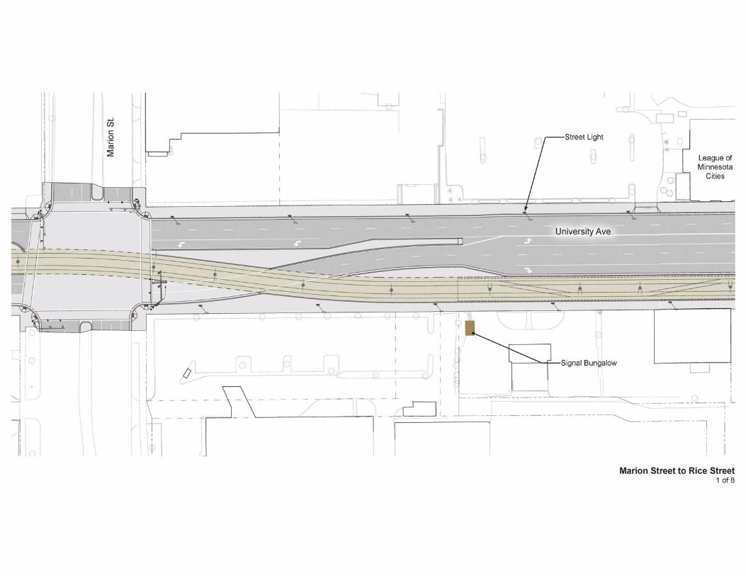
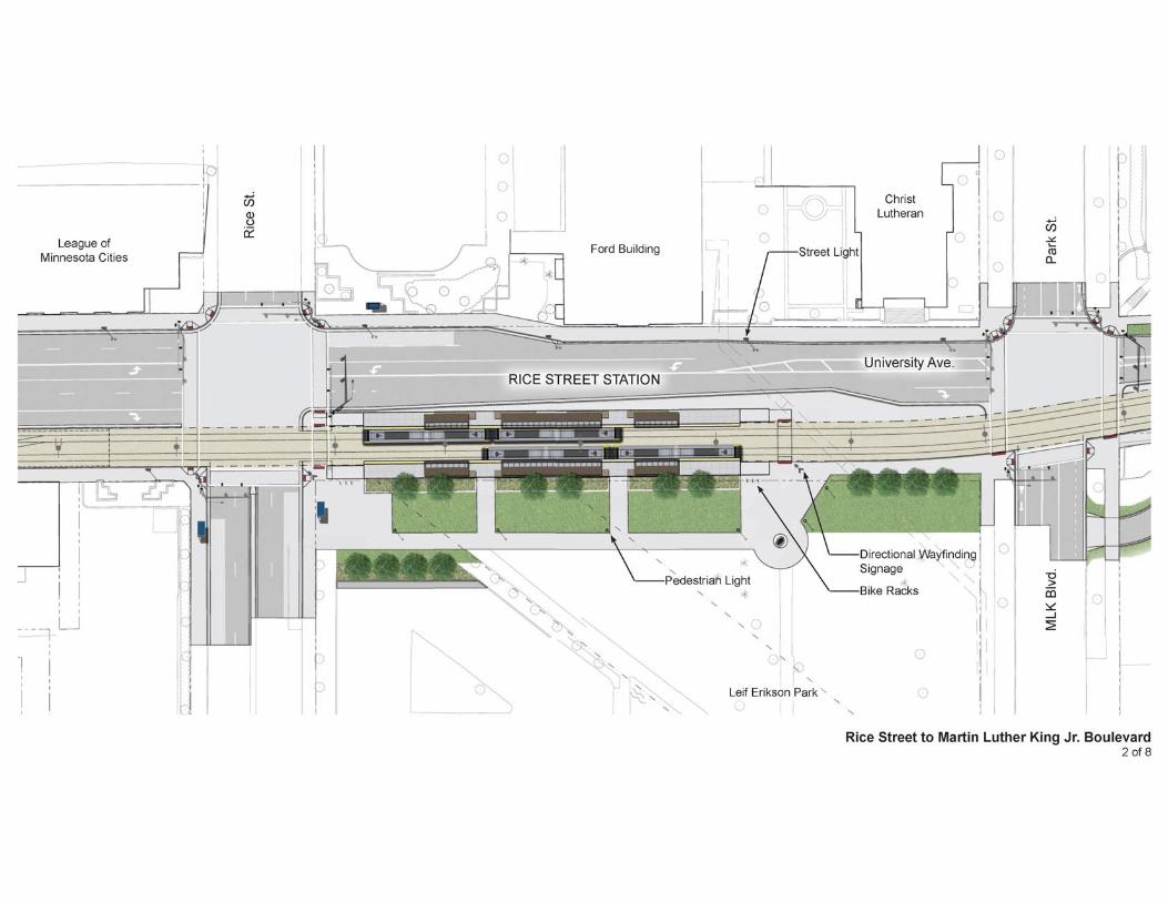
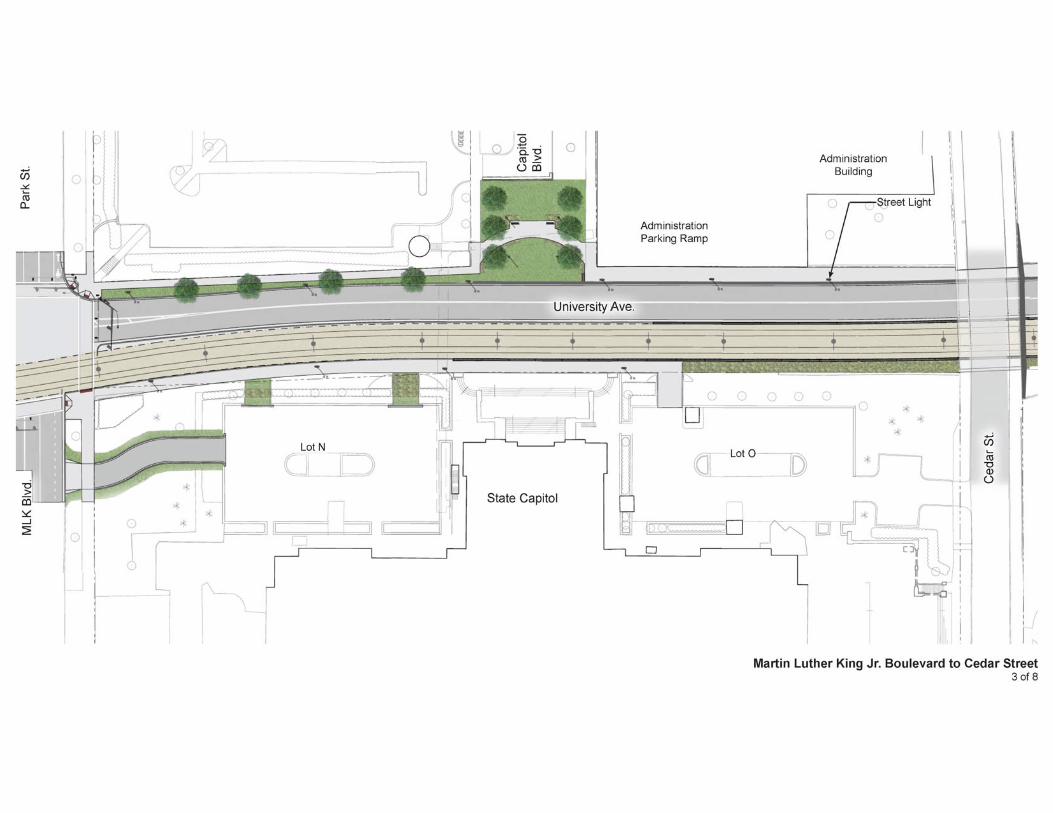
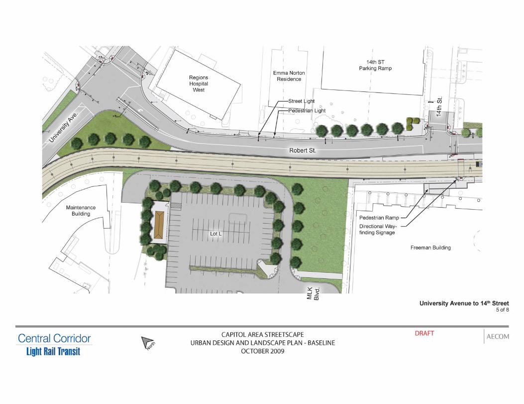
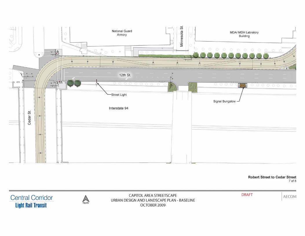
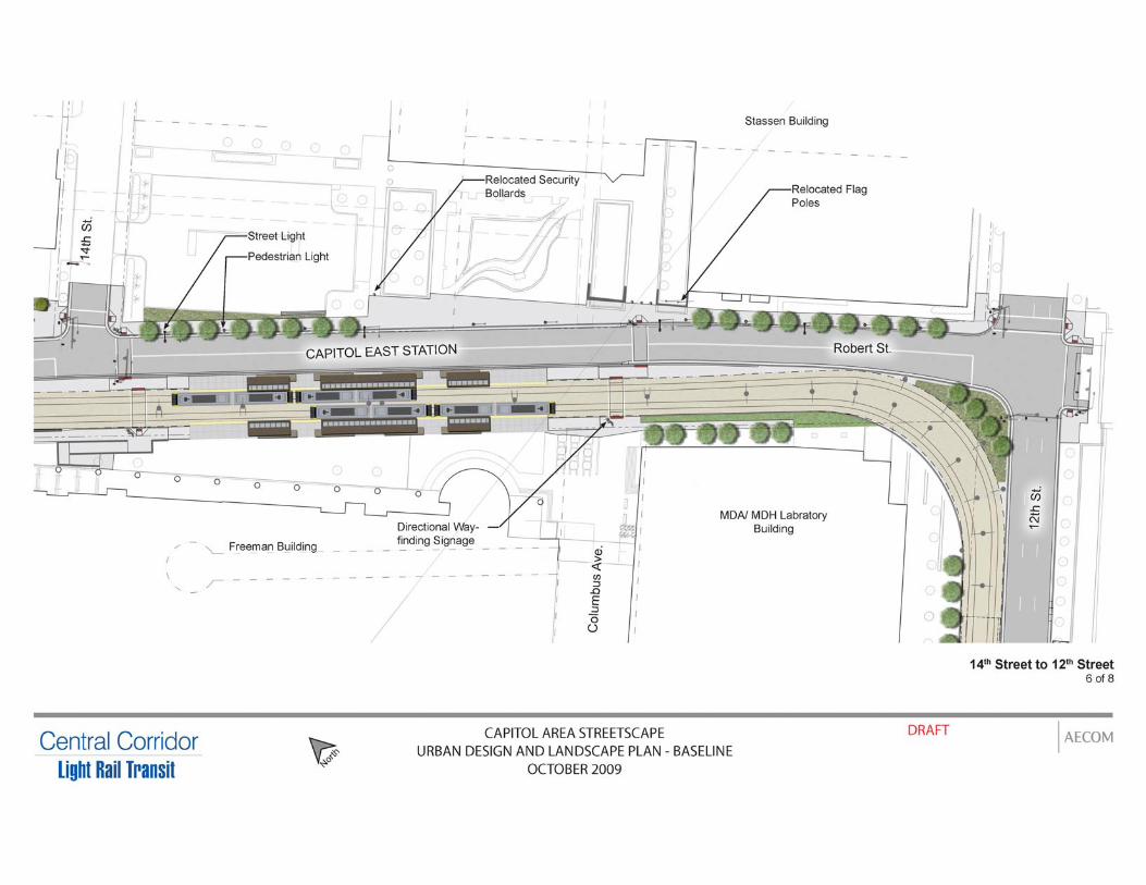
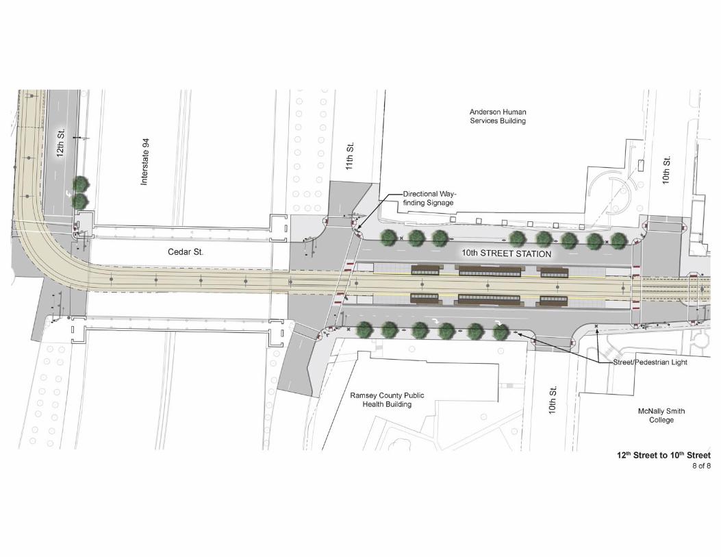
of Central Corridor LRT preliminary engineering, and as published in the above-referenced document, it was concluded that it would also be appropriate to recommend listing of the State Capitol Mall under Criterion C in the area of landscape architecture. Such a listing would include the area generally associated with the Mall, as well as the formal approaches, with their grassy medians and flanking boulevards. This recommendation recognizes that vision of Cass Gilbert in designing the State Capitol, of providing a setting inspired by the City Beautiful movement with plazas and axial and radial avenues that would culminate at the Capitol building. A separate investigation of Leif Erikson Lawn in the State Capitol Mall Historic District was also completed in early states of Central Corridor LRT preliminary engineering. As summarized in “Supplemental Historic Properties Investigations and Evaluations for the Central Corridor Light Rail Transit Project,” Leif Erikson Lawn sits on the state capitol grounds at the corner of University Avenue and Park Street North/Reverend Dr. Martin Luther King, Jr. Boulevard immediately west of the State Capitol building. From about 1890 to 1950, at least four streetcar lines (and probably earlier horsecars) traveled a diagonal route along Wabasha Street, which extended in front of the capitol and bordered the park site on the south. At the turn of the century, several buildings occupied the parcels north of Wabasha Street. These buildings were razed in the mid-1920s and this portion of the site was designated as part of the State Capitol grounds at that time. The angled section of Wabasha bordering the site was removed around 1940, when the capitol approach was redeveloped and the area’s streets realigned. The Leif Erikson monument was installed in 1949. Photographs taken during the dedication ceremony show only deciduous trees on the site. Currently, several mature conifers – which appear to be Norway Pine and Norway spruce – frame the monument on three sides and are clustered closely together on the north. These trees partially, or completely (depending on the angle) obscure the monument from view (see photos in Attachment A). DESCRIPTION OF CENTRAL CORRIDOR LRT AS IT AFFECTS PROPERTY SETTING AND ASSOCIATION The Central Corridor LRT alignment will pass along various boundaries of the State Capitol Mall Historic District within publicly-owned rights-of-way. To the north, it will be constructed on University Avenue. A portion of Leif Erikson lawn adjacent to University Avenue will be occupied by the eastbound Rice Street LRT station platform and by the LRT tracks. The Central Corridor LRT will depart University Avenue, traveling south along Robert Street. The LRT continues south on Robert Street (outside the district boundary) from the eastern terminus of Reverend Dr. Martin Luther King, Jr. Boulevard to 12th Street. At 12th Street, the Central Corridor LRT continues west, again along the district boundary. The Central Corridor LRT will head south on Cedar Street, operating in the center of Cedar Street (within the historic district from 12th Street to 10th Street) necessitating removal of the landscaped medians to install LRT tracks and the 10th Street LRT station. The design of the Rice Street station, pedestrian approaches to the station, landscaping, and the relationship of landscape elements to the statue of Leif Erikson and to the State Capitol was the focus of consultation discussions with MnSHPO and other parties,
CENTRAL CORRIDOR LRT STATE CAPITOL MALL HISTORIC DISTRICT FINAL MITIGATION PLAN February 2010
Page 4 of 6
including the Capitol Area Architectural and Planning Board (CAAPB). Another key area for focus of design consultation discussions was the placement of LRT catenary poles, pedestrian paths, safety fencing and other project infrastructure. Project design plans have been developed in response to issues raised at various consultation meetings, specifically:
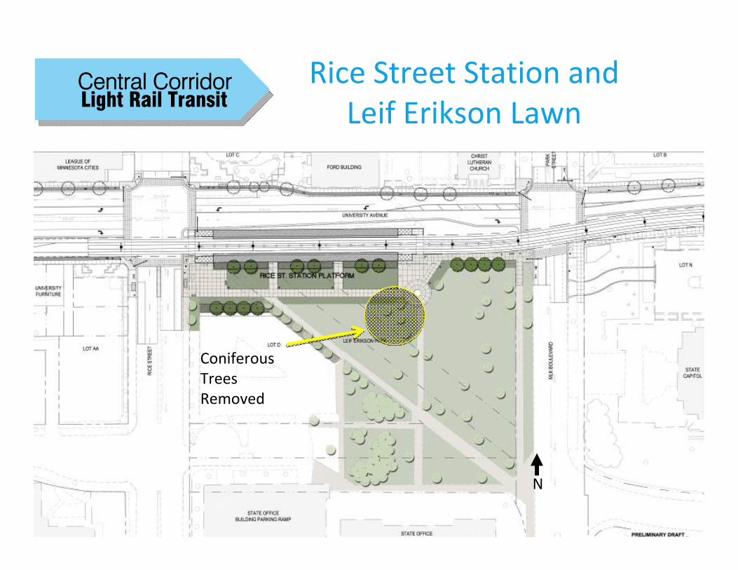
• Softening the effects of the southern edge of the Rice Street station platform as it affects the landscape of Leif Erikson lawn. This was accomplished by creating three symmetrical lawn panels just south of the eastbound station platform, planting Honey Locust trees within the panels, and moving the sidewalk to follow the edge of the lawn panels;
• Creating other pedestrian amenities (as illustrated in the figure that follows) that restore pedestrian connections to the statue of Leif Erikson and the State Capitol;
• Altering the standard LRT station design for the Rice Street station by creating two entry points on the eastbound station platform for more seamless access into the Leif Erikson Lawn;
• Minimizing any adverse viewshed impacts to the north face of the State Capitol from Capitol Boulevard by altering the east-west sidewalk north of University Avenue to guide pedestrians through landscaped materials away from the terminus of Capitol Boulevard thereby avoiding the need for a safety railing at this location; and,
• Shifting the LRT tracks at the back of the Capitol to save the relocation of a western granite pier and circular staircase.
MITIGATION OF ADVERSE EFFECTS IDENTIFIED This proposed mitigation plan response to adverse effects noted to the historic State Capitol Mall landscape and is comprised of two elements.
1. Historic Landscape Documentation The historic landscape of the State Capitol Mall Historic District will be documented by development of a scholarly article providing an in-depth examination of the history of the development, implementation and evolution of the historic landscape of the State Capitol Mall Historic District. This article is intended to document the significant historic elements of the landscape in this district and provide information for use by historians and contemporary landscape architects and planners working within this historic district.
• The article will be written by a historian or architectural historian meeting the Secretary of the Interior’s Standards Professional Qualification Standards and will be written to the publication standards for a scholarly journal. The Met Council will consult with MnSHPO in making the selection of a historian to write the article.
CENTRAL CORRIDOR LRT STATE CAPITOL MALL HISTORIC DISTRICT FINAL MITIGATION PLAN February 2010
Page 5 of 6
• Upon completion, the article will be submitted by the Met Council for consideration of publication to an appropriate journal or journals (such as Preservation, APT Bulletin, Minnesota History, and/or the Minnesota Preservationist).
• A copy of the article will be submitted to MnSHPO and the Capitol Area Architectural and Planning Board (CAAPB).
2. Landscaping Improvements As noted in several consultation meetings with MnSHPO and the CAAPB, the mature conifers that surround the statue of Leif Erikson have the effect of substantially screening the statue from public view. The follow figure illustrates the proposed removal of several of the mature conifers surrounding the statue of Leif Erikson, thereby improving sight lines to the statue from both the Minnesota State Capitol Building and to the Norwegian Evangelical Lutheran Church (Christ Lutheran Church).
SUMMARY AND CONCLUSIONS The actions summarized above and illustrated in the figure that follows are intended to respond to adverse effects of the Central Corridor LRT project on the State Capitol Mall Historic District. This mitigation plan, as accepted and approved by the FTA and MnSHPO pursuant to obligations stipulated in the Central Corridor LRT Programmatic Agreement will be implemented coincident with construction of the Central Corridor LRT project.
1
Light Rail TransitCentral Corridor Rice Street Station and
Leif Erikson Lawn
N
Coniferous Trees Removed
Attachment A Historic Photos, Maps, and Other Source Data
Supplemental Historic Property Investigations and Evaluations for CCLRT Project: Minnesota State Capitol Mall Historic District: Evaluation of Approaches and Boundary Delineation
Hess, Roise and Company—Page 79
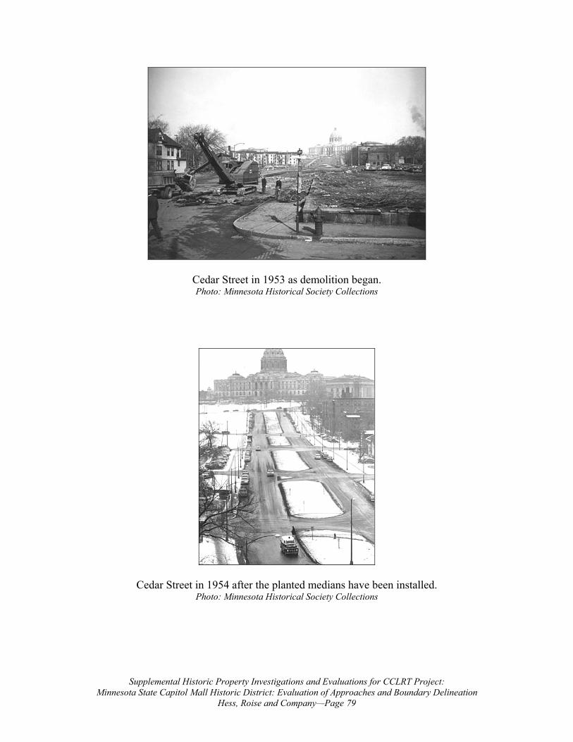
Cedar Street in 1953 as demolition began. Photo: Minnesota Historical Society Collections
Cedar Street in 1954 after the planted medians have been installed. Photo: Minnesota Historical Society Collections
Supplemental Historic Property Investigations and Evaluations for CCLRT Project: Minnesota State Capitol Mall Historic District: Evaluation of Approaches and Boundary Delineation
Hess, Roise and Company—Page 80
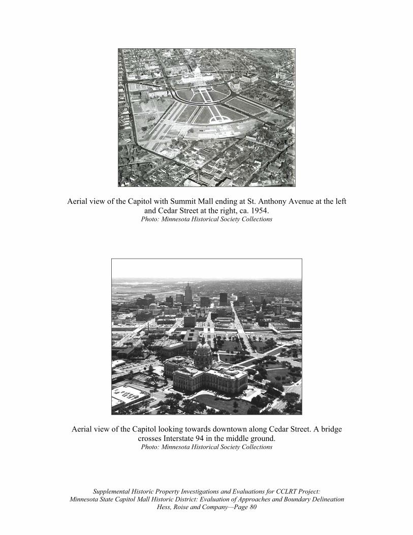
Aerial view of the Capitol with Summit Mall ending at St. Anthony Avenue at the left and Cedar Street at the right, ca. 1954.
Photo: Minnesota Historical Society Collections
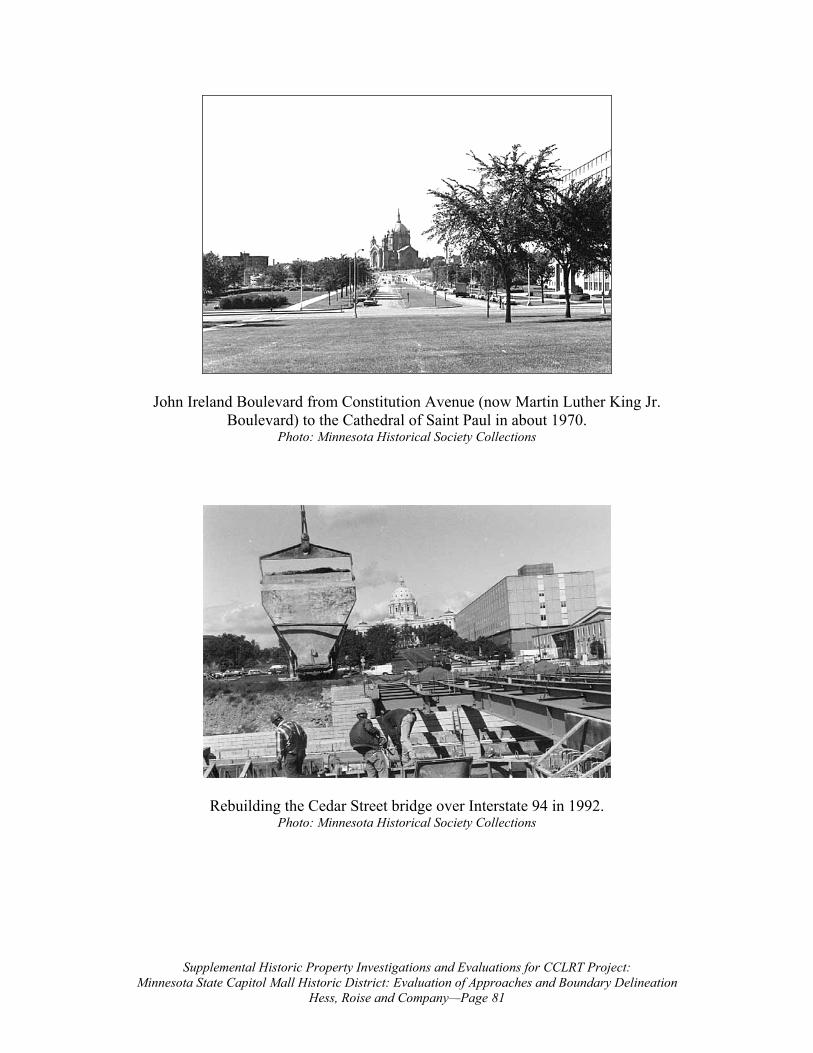
Aerial view of the Capitol looking towards downtown along Cedar Street. A bridge crosses Interstate 94 in the middle ground. Photo: Minnesota Historical Society Collections
Supplemental Historic Property Investigations and Evaluations for CCLRT Project: Minnesota State Capitol Mall Historic District: Evaluation of Approaches and Boundary Delineation
Hess, Roise and Company—Page 81
John Ireland Boulevard from Constitution Avenue (now Martin Luther King Jr. Boulevard) to the Cathedral of Saint Paul in about 1970.
Photo: Minnesota Historical Society Collections
Rebuilding the Cedar Street bridge over Interstate 94 in 1992. Photo: Minnesota Historical Society Collections
Supplemental Historic Property Investigations and Evaluations for CCLRT Project: Minnesota State Capitol Mall Historic District: Evaluation of Approaches and Boundary Delineation
Hess, Roise and Company—Page 82
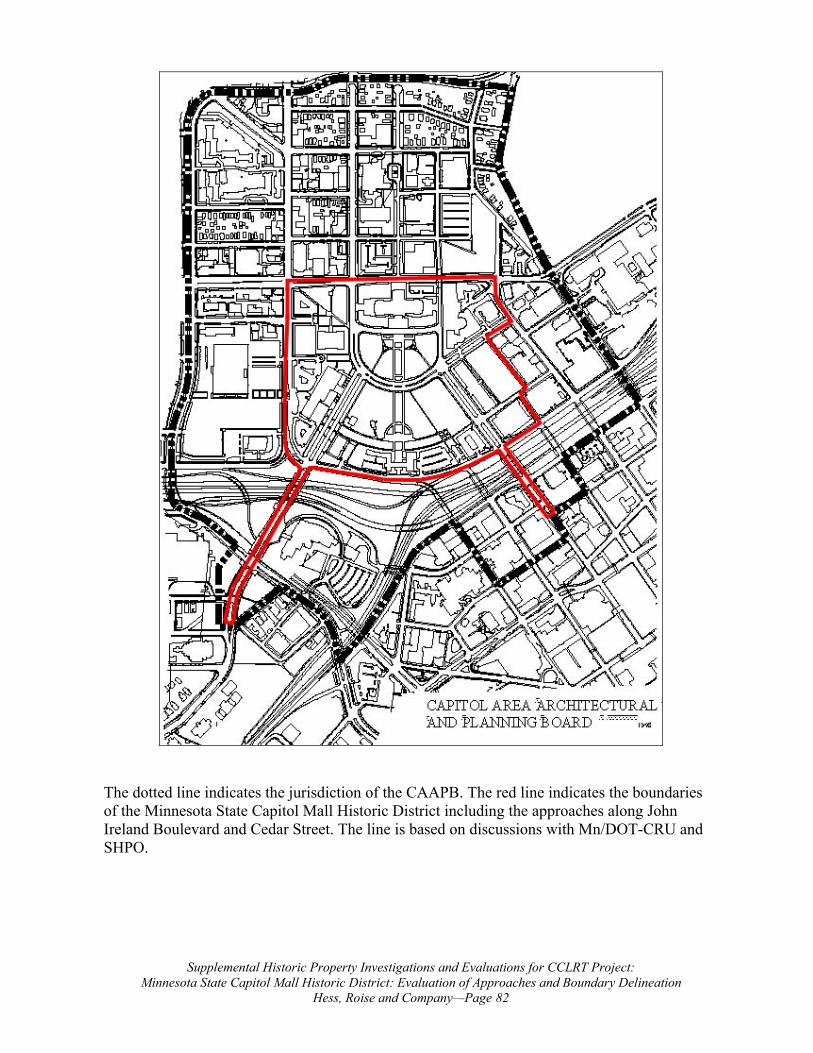
The dotted line indicates the jurisdiction of the CAAPB. The red line indicates the boundaries of the Minnesota State Capitol Mall Historic District including the approaches along John Ireland Boulevard and Cedar Street. The line is based on discussions with Mn/DOT-CRU and SHPO.
Supplemental Historic Property Investigations and Evaluations for CCLRT Project: Leif Erikson Lawn in the State Capitol Mall Historic District: A Historical Study
Hess, Roise and Company—Page 88
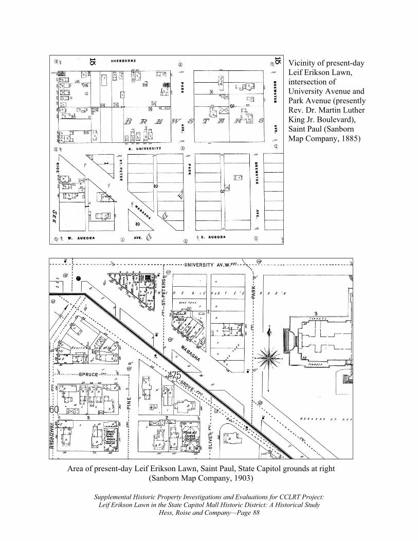
Area of present-day Leif Erikson Lawn, Saint Paul, State Capitol grounds at right (Sanborn Map Company, 1903)
Vicinity of present-day Leif Erikson Lawn, intersection of University Avenue and Park Avenue (presently Rev. Dr. Martin Luther King Jr. Boulevard), Saint Paul (Sanborn Map Company, 1885)
Supplemental Historic Property Investigations and Evaluations for CCLRT Project: Leif Erikson Lawn in the State Capitol Mall Historic District: A Historical Study
Hess, Roise and Company—Page 89
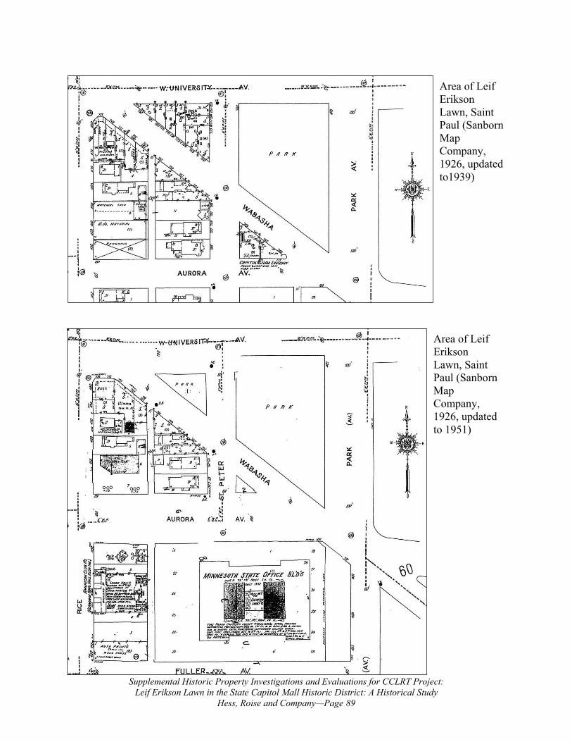
Area of Leif Erikson Lawn, Saint Paul (Sanborn Map Company, 1926, updated to 1951)
Area of Leif Erikson Lawn, Saint Paul (Sanborn Map Company, 1926, updated to1939)
Supplemental Historic Property Investigations and Evaluations for CCLRT Project: Leif Erikson Lawn in the State Capitol Mall Historic District: A Historical Study
Hess, Roise and Company—Page 90
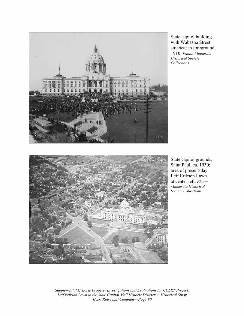
State capitol grounds, Saint Paul, ca. 1930; area of present-day Leif Erikson Lawn at center left. Photo: Minnesota Historical Society Collections
State capitol building with Wabasha Street streetcar in foreground, 1910. Photo: Minnesota Historical Society Collections
Supplemental Historic Property Investigations and Evaluations for CCLRT Project: Leif Erikson Lawn in the State Capitol Mall Historic District: A Historical Study
Hess, Roise and Company—Page 91
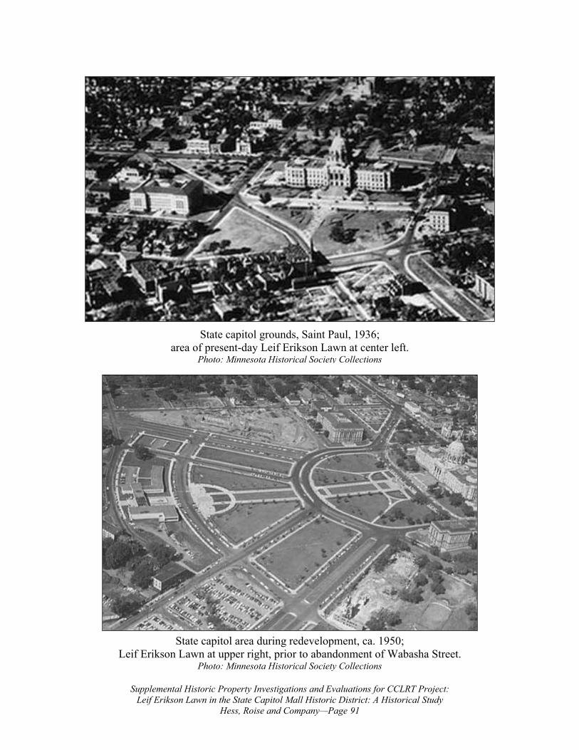
State capitol area during redevelopment, ca. 1950; Leif Erikson Lawn at upper right, prior to abandonment of Wabasha Street.
Photo: Minnesota Historical Society Collections
State capitol grounds, Saint Paul, 1936; area of present-day Leif Erikson Lawn at center left.
Photo: Minnesota Historical Society Collections
Supplemental Historic Property Investigations and Evaluations for CCLRT Project: Leif Erikson Lawn in the State Capitol Mall Historic District: A Historical Study
Hess, Roise and Company—Page 92
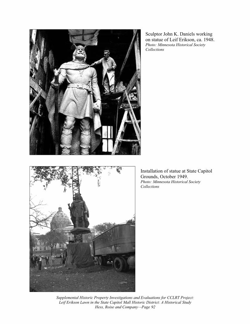
Installation of statue at State Capitol Grounds, October 1949. Photo: Minnesota Historical Society Collections
Sculptor John K. Daniels working on statue of Leif Erikson, ca. 1948. Photo: Minnesota Historical Society Collections
Supplemental Historic Property Investigations and Evaluations for CCLRT Project: Leif Erikson Lawn in the State Capitol Mall Historic District: A Historical Study
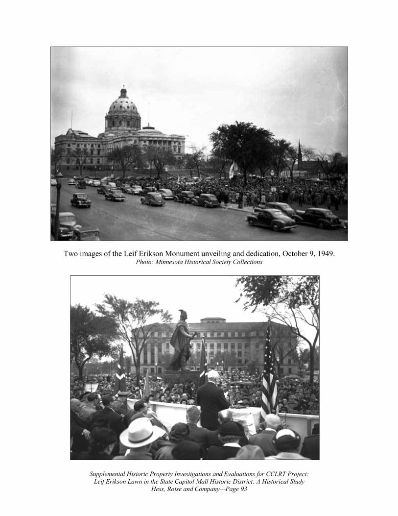
Hess, Roise and Company—Page 93
Two images of the Leif Erikson Monument unveiling and dedication, October 9, 1949. Photo: Minnesota Historical Society Collections
Supplemental Historic Property Investigations and Evaluations for CCLRT Project: Leif Erikson Lawn in the State Capitol Mall Historic District: A Historical Study
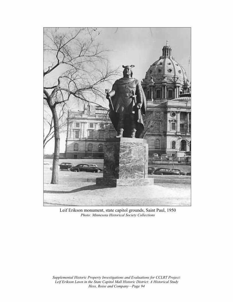
Hess, Roise and Company—Page 94
Leif Erikson monument, state capitol grounds, Saint Paul, 1950 Photo: Minnesota Historical Society Collections
Supplemental Historic Property Investigations and Evaluations for CCLRT Project: Leif Erikson Lawn in the State Capitol Mall Historic District: A Historical Study
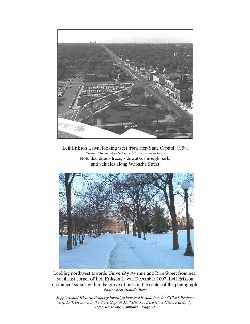
Hess, Roise and Company—Page 95
Leif Erikson Lawn, looking west from atop State Capitol, 1959. Photo: Minnesota Historical Society Collections
Note deciduous trees, sidewalks through park, and vehicles along Wabasha Street.
Looking northwest towards University Avenue and Rice Street from near southeast corner of Leif Erikson Lawn, December 2007. Leif Erikson
monument stands within the grove of trees in the center of the photograph. Photo: Erin Hanafin Berg
Supplemental Historic Property Investigations and Evaluations for CCLRT Project: Leif Erikson Lawn in the State Capitol Mall Historic District: A Historical Study
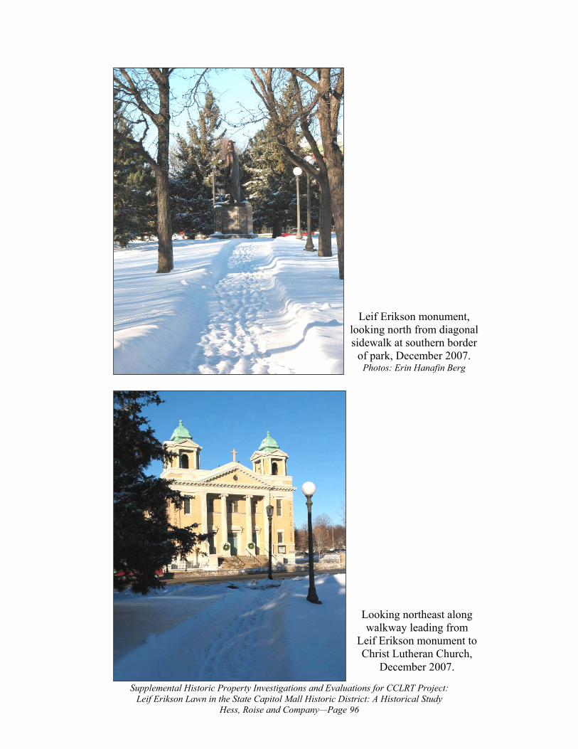
Hess, Roise and Company—Page 96
Looking northeast along walkway leading from
Leif Erikson monument to Christ Lutheran Church,
December 2007.
Leif Erikson monument, looking north from diagonal sidewalk at southern border
of park, December 2007. Photos: Erin Hanafin Berg
Supplemental Historic Property Investigations and Evaluations for CCLRT Project: Leif Erikson Lawn in the State Capitol Mall Historic District: A Historical Study
Hess, Roise and Company—Page 97
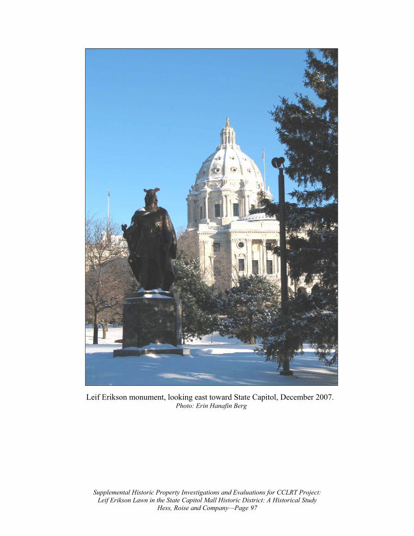
Leif Erikson monument, looking east toward State Capitol, December 2007. Photo: Erin Hanafin Berg
Attachment B Central Corridor LRT
Updated 60 Percent Design Sheets