Embed Size (px)
Citation preview

1
BASIC ASSESSMENT REPORT
(AUGUST 2010)
Basic Assessment Report in terms of the NEMA Environmental Impact Assessment Regulations, 2010
AUGUST 2010
Kindly note that:
1. This Basic Assessment Report is the standard report required by DEA&DP in terms of the EIA Regulations, 2010 and
must be completed for all Basic Assessment applications. 2. This report must be used in all instances for Basic Assessment applications for an environmental authorisation in
terms of the National Environmental Management Act, 1998 (Act No. 107 of 1998) (NEMA), as amended, and the Environmental Impact Assessment Regulations, 2010, and/or a waste management licence in terms of the National Environmental Management: Waste Act, 2008 (Act 59 of 2008) (NEM: WA), and/or an atmospheric emission licence in terms of the National Environmental Management: Air Quality Act, 2004 (Act No. 39 of 2004) (NEM: AQA).
3. This report is current as of 2 August 2010. It is the responsibility of the Applicant / EAP to ascertain whether
subsequent versions of the report have been published or produced by the competent authority.
4. The required information must be typed within the spaces provided in the report. The sizes of the spaces provided are not necessarily indicative of the amount of information to be provided. It is in the form of a table that will expand as each space is filled with typing.
5. Incomplete reports will be rejected. A rejected report may be amended and resubmitted. 6. The use of “not applicable” in the report must be done with circumspection. Where it is used in respect of material
information that is required by the Department for assessing the application, this may result in the rejection of the report as provided for in the regulations.
7. While the different sections of the report only provide space for provision of information related to one
alternative, if more than one feasible and reasonable alternative is considered, the relevant section must be copied and completed for each alternative.
8. Unless protected by law all information contained in, and attached to this report, will become public information on
receipt by the competent authority. If information is not submitted with this report due to such information being protected by law, the applicant and/or EAP must declare such non-disclosure and provide the reasons for the belief that the information is protected.
9. This report must be submitted to the Department at the postal address given below or by delivery thereof to the
Registry Office of the Department. No faxed or e-mailed reports will be accepted. Please note that for waste management licence applications, this report must be submitted for the attention of the Department’s Waste Management Directorate (tel: 021-483-2756 and fax: 021-483-4425) at the same postal address as the Cape Town Office Region A.
10. Unless indicated otherwise, two electronic copies (CD/DVD) and three hard copies of this report must be submitted to
the Department.
DEPARTMENTAL DETAILS
CAPE TOWN OFFICE REGION A (Cape Winelands, City of Cape Town: Tygerberg and Oostenberg Administrations)
CAPE TOWN OFFICE REGION B (West Coast, Overberg, City of Cape Town: Helderberg, South Peninsula, Cape Townand Blaauwberg Administrations
GEORGE OFFICE (Eden and Central Karoo)
Department of Environmental Affairs and Development Planning Attention: Directorate: Integrated Environmental Management (Region A2) Private Bag X 9086 Cape Town, 8000 Registry Office 1
st Floor Utilitas Building
1 Dorp Street, Cape Town Queries should be directed to the Directorate: Integrated Environmental Management (Region A2) at: Tel: (021) 483-4793 Fax: (021) 483-3633
Department of Environmental Affairs and Development Planning Attention: Directorate: Integrated Environmental Management (Region B) Private Bag X 9086 Cape Town, 8000 Registry Office 1
st Floor Utilitas Building
1 Dorp Street, Cape Town Queries should be directed to the Directorate: Integrated Environmental Management (Region B) at: Tel: (021) 483-4094 Fax: (021) 483-4372
Department of Environmental Affairs and Development Planning Attention: Directorate: Integrated Environmental Management (Region A1) Private Bag X 6509 George, 6530 Registry Office 4
th Floor, York Park Building
93 York Street George Queries should be directed to the Directorate: Integrated Environmental Management (Region A1) at: Tel: (044) 805 8600 Fax: (044) 874-2423

2
View the Department’s website at http://www.capegateway.gov.za/eadp for the latest version of this document.
DEPARTMENTAL REFERENCE NUMBER(S)
File reference number (EIA):
Olifantsberg Landbouvereniging
Jan du Toitsrivier E12/2/4/1-B2/33-1045/10
Brandwacht Irrigation Board
Hartebeesrivier E12/2/4/1-B2/33-1047/10
Worcester East Water Users Association
Nuy & Nonnarivier E12/2/4/1-B2/33-1046/10
Noree Water Users Association
Vinkrivier E12/2/4/1-B1/11-1044/10
Cogmanskloof Irrigation Board
Keisierivier E12/2/4/1-B1/7-1049/10
File reference number (Waste): N/A
File reference number
(Exemptions):
Olifantsberg Landbouvereniging E12/2/4/5-B2/33-1004/10
Brandwacht Irrigation Board E12/2/4/5-B2/33-1006/10
Worcester East Water Users Association E12/2/4/5-B2/33-1005/10
Noree Water Users Association E12/2/4/5-B1/11-1003/10
Cogmanskloof Irrigation Board E12/2/4/5-B1/7-1001/10
PROJECT TITLE
Cape Winelands November 2008 Flood repair work
DETAILS OF THE ENVIRONMENTAL ASSESSMENT PRACTITIONER (EAP)
Environmental Assessment
Practitioner (EAP): Charl de Villiers Environmental Consulting cc
Contact person: Charl de Villiers
Postal address: 14 Bradwell Road, Vredehoek
Cape Town Postal code: 8001
Telephone: (021) 461 2477 Cell: 083 785 0776
E-mail: [email protected] Fax: 086 553 9256
EAP Qualifications M.Phil Environmental Management (University of Cape Town)
EAP Registrations/Associations Certified Environmental Assessment Practitioner (EAPSA)
Details of the EAP’s expertise to carry out Basic Assessment procedures
Charl de Villiers is a Certified Environmental Assessment Practitioner (EAPSA). He practices as Charl de Villiers
Environmental Consulting cc.
He has worked as an EAP for nine years, specialising in the alignment of environmental assessment with biodiversity
priorities, pre-application biodiversity screening, and developing strategic, ecosystem-based planning approaches to
agri-environmental land use planning, impact assessment and management. He managed the Botanical Society of SA’s
‘Biodiversity in EIA’ project from 2004 to 2009, served as the Special Land-use Adviser to the C.A.P.E. programme in
2009 and 2010, and co-ordinated the drafting of the national agricultural mainstreaming strategy for SANBI’s Grasslands
Programme.
Mr De Villiers holds an MPhil in environmental management from the University of Cape Town which was awarded with
distinction. He is a recipient of the IAIA’s President’s Bursary (2008) and is a co-representative of the IAIAsa on the
Western Cape Planning and Development Forum. He became a Certified Environmental Assessment Practitioner in
November 2010.

3
EXECUTIVE SUMMARY OF THE CONTENT OF THE BASIC ASSESSMENT REPORT:
This Basic Assessment Report (BAR) forms the hub of a combined application, by five different applicants, to construct
soil conservation works (primarily gabion weirs and groynes) in six rivers that experienced flood damage in November
2008 and for which disaster relief funding has been awarded by the national Department of Agriculture, Forestry and
Fisheries.
Applicants and affected rivers
The applicants, and the respective rivers to which the applications apply (nearest towns or railway stations in brackets),
are the:
− Olifantsberg Landbouvereniging – Jan du Toits River (Goudiniweg siding)
− Brandwacht Irrigation Board – Hartebees River (Worcester)
− Worcester-Oos Waterverbruikersvereniging – Nonna River ( Nuy)
− Worcester-Oos Waterverbruikersvereniging – Nuy River (Nuy)
− Noree Besproeiingsraad – Vink River (Langvlei siding)
− Cogmanskloof Besproeiingsraad – Keisie River (Montagu)
The rivers in question are all located in the Breede Water Management Area (WMA). Responsibility for managing water
resources in the Breede WMA vests with the Breede-Overberg Catchment Management Agency (BOCMA).
All the projects will take place within the Cape Winelands District Municipality and, specifically, the Witzenberg, Breede
Valley and Langeberg municipalities.
Structure of BAR
The BAR is structured as follows:
− Information that is generic to all five applications (e.g. the types of activities for which authorisation is being
sought, shared characteristics of affected instream and riparian ecosystems, the legal and policy context, the
impact assessment methodology and assumptions, and the need for and desirability of the proposed
structures); and
− Project-specific information which is dealt with on a case-by-case basis (e.g. location-specific descriptions of
the receiving environment and potential environmental vulnerabilities, the assessment and evaluation of
impacts associated with each of the proposed structures, and project- and location-specific mitigation
measures) (see annexures D1, D2, H and J).
Reasons for applications
The BAR summarises the main reasons why the applicants, supported by the Western Cape Department of Agriculture,
want to construct soil conservation works at various flood-damaged sites in six rivers in the Cape Winelands District
Municipality.
The proposed projects are all a sequel to floods in November 2008 which caused extensive damage to farm land and
infrastructure in the Cape Winelands District Municipalities. Altogether 341 farms were affected, with damage totalling
an estimated R980-million.i
The over-arching, common objectives of all the applications are to:
− Protect agricultural resources by controlling erosion to river banks;
− Promote the recovery of degraded riparian ecosystems; and
− Facilitate sound environmental management practices at the farming-river interface.
In some instances, the proposed soil conservation works will contribute to the protection of road bridges against flood
damage. The projects will also have the combined goal of contributing to local economic development by providing
labour intensive work opportunities in areas characterised by considerable unemployment and a high degree of
seasonal fluctuation for many people with jobs in agriculture.
The affected environment
All the works would be conducted in highly seasonal cobbled foothill rivers located within intensively cultivated alluvial
floodplains or arid valley bottom wetlands at the base of various west- and south-facing mountain ranges between the
Jan du Toits River in the west and the Keisie River to its east in the winter rainfall region of the Western Cape.

4
The affected terrestrial ecosystems would potentially be associated with alluvium fynbos, alluvium renosterveld or Little
Karoo vegetation types. Mean annual precipation generally decreases with lower altitudes, and towards the north-east
and inland of the Hex River and Langeberg mountains. Thunderstorms may occur more frequently in the east, in early
summer. Some of the locations for the proposed projects are depicted as ‘Critical Biodiversity Areas’ by the biodiversity
plans for the Witzenberg, Breede Valley and Langeberg municipalities. The majority of these areas are, however,
intensively farmed and most of the rivers traversing farmland have undergone pronounced modification as a result of
inter alia encroachment of vineyards and farm roads into the riparian zone, bank erosion, bulldozed levees, transervse
excavations of channels and banks and invasion by woody alien plants.
Although most of the affected systems have CBA status, they would currently appear to have very limited value to the
achievement of biodiversity targets and thresholds. One of the objectives for the proposed projects would be to prevent
further erosion and siltation and to contribute to the restoration of riparian habitat, which would be consistent with the
objectives for managing CBAs.
Because the rivers have very similar hydrological, geomorphological and ecological characteristics, their management
requirements are virtually identical.
Alternatives and impact assessment
The BAR presents the technical alternatives that were considered for achieving the related objectives of soil
conservation and river rehabiliation, and explains why groynes (actually combinations of groynes placed in so-called
‘groyne fields’) are considered to be the preferred option for achieving these objectives. Location alternatives are not
applicable due to the need to introduce remedial and preventive measures to sites where flood damage has occurred.
The BAR identifies potential impacts that may result from the design, construction or long term operational phases of
the project, and relates their significance to inter alia the Critical Biodiversity Area status of the respective rivers and
their immediate terrestrial margins. It concludes that notwithstanding limited unavoidable residual impacts on the
biophysical environment, the net effect of the various projects would be overwheliming positive in that they would:
− Protect valuable agricultural land and infrastructure against erosion;
− Prevent further degradation of the rivers and riparian habitat as a result of erosion and down-cutting of banks,
and the ensuing increase in sedimentation and reduction in water quality;
− Protect bridges against the risk of future flood damage which is also indirectly driven by the artificial raising of
water levels because of sedimentation of channels and result colonisation of these areas by sediment-trapping
reeds and invasive alien plants;
− Actively contribute to the restoration of the affected rivers as regionally important agro-ecological systems;
and
− Promote job creation and skills’ transfers among contract workers drawn from historically marginalised
communities.
Need and desirability
Overall, the BAR concludes that the agri-environmental benefits of the projects are considered to outweigh their
negative effects. Furthermore, failure to act effectively and timeously would result in further loss of agricultural soils,
further damage to instream and riparian habitats along ecologically important river systems, and general degradation of
the biodiversity and productivity of the agroecosystems in question. The projects are viewed as being demonstrably
consistent with the ‘Duty of Care’ doctrine, the sustainabilty mandate of the Western Cape Department of Agriculture,
as well as the conservation management objectives of Critical Biodiversity Areas.

5
SECTION A: ACTIVITY INFORMATION
1. PROJECT DESCRIPTION
(a) Is the project a new development? YES NO
(b) Provide a detailed description of the development project and associated infrastructure.
Background to projects
The background set out here is applicable to all the applications and proposed projects and their respective agri-
environmental contexts which, in most significant respects, reflect a high degree of similarity.
Soils for agriculture in the Western Cape are generally shallow and irrigation water is limited. The deepest and best soils
are commonly found in alluvial floodplains. Historically, these soils often were the first to be developed for high
investment, long-term crops such as wine and table grapes and they continue to support a multi-billion rand industry
and are a major driver of rural economic development.
In practice, the expansion of vineyards and orchards into riparian zones has left very little undeveloped space between
the agricultural land and the low-flow boundary of the stream. As a result of this encroachment, these hemmed-in rivers
have limited latitude to meander without the banks being eroded. Riparian habitat and floodplain dynamics have also
been further degraded by the bulldozing of levees or ‘keerwalle’ to prevent flooding to cultivated areas. In most cases,
the transition between vineyards and the edge of channel is abrupt, and devoid of any indigenous vegetation.
In the case of foothill rivers in the Breede Water Management Area (WMA), untransformed streambeds would have
been dynamic systems consisted of loosely sorted boulders that would shift during floods, resulting in several channels,
each flowing at different flood levels, that could change from flood to flood. The natural shifting, braided structure of
these rivers has largely been displaced by single-channel systems, often with bulldozed banks, and very little intact
riparian vegetation. This has resulted in a significant loss of instream habitat diversity, which is probably associated with
a loss of instream faunal diversity.
The popular belief of land-users is that the position of the river must be forced to remain constant. Historically farmers
have bulldozed sediment out of rivers to “open” them and used the material to create levees along the sides of the
rivers to prevent the river from breaking into orchards and vineyards, thus effectively channelizing the river systems.
Natural floodplain or valley bottom habitat has, in turn, been destroyed by monoculture – mostly vineyards in the case
of these applications – which has been accompanied by the widespread transformation of particularly alluvial fynbos
and renosterveld vegetation types. In comparison, veld against steeper, rockier slopes is generally less suitable for
cultivation and is therefore much more intact then lower-lying vegetation types associated with rivers and their
floodplains
Disturbances to the riparian area have also been conducive to the spread of invasive alien plants, which further
exacerbates the artificial narrowing of watercourses, contributes to the instability of river banks, and causes
degradation of floodplain habitat. These processes have dramatically increased the instability of many rivers in
cultivated landscapes in the Western Cape.
Purpose of applications
The purpose of these applications is to obtain environmental authorisation to construct, depending on the type of
damage and underlying hydrological dynamics, gabion weirs and/or groyne fields that would:
− Protect agricultural resources by controlling erosion to river banks;
− Promote the recovery of degraded riparian ecosystems; and
− Facilitate sound long-term environmental management practices at the farming-river interface through
implementation of appropriate environmental management plans.
Please note that, due to close technical and environmental similarities, these applications are closely modelled on the
basic assessment for the proposed rehabilitation of the Hex River on erf 199 and others at De Doorns (DEADP ref:
E12/2/4/1-B2/33-1050/10).
6
The projects
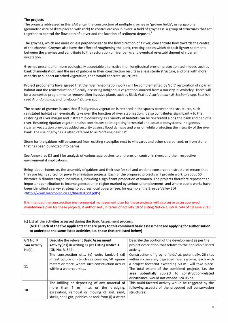
The projects addressed in this BAR entail the construction of multiple groynes or ‘groyne fields’, using gabions
(geometric wire baskets packed with rock) to control erosion in rivers. A field of groynes is a group of structures that act
together to control the flow path of a river and the location of sediment deposits.ii
The groynes, which are more or less perpendicular to the flow direction of a river, concentrate flow towards the centre
of the channel. Groynes also have the effect of roughening the bank, creating eddies which deposit lighter sediments
between the groynes and contribute to the restoration of river banks and eventual re-establishment of riparian
vegetation.
Groynes present a far more ecologically acceptable alternative than longitudinal erosion protection techniques such as
bank channelisation, and the use of gabions in their construction results in a less sterile structure, and one with more
capacity to support attached vegetation, than would concrete structures.
Project proponents have agreed that the river rehabiltation works will be complemented by ‘soft’ restoration of riparian
habitat and the reintroduction of locally-occurring indigenous vegetation sourced from a nursery in Wolseley. There will
be a concerted programme to remove alien invasive plants such as Black Wattle Acacia mearnsii, Sesbania spp, Spanish
reed Arundo donax, and ‘olieboom’ Datura spp.
The nature of groynes is such that if indigenous vegetation is restored in the spaces between the structures, such
reinstated habitat can eventually take over the function of river stabilisation. It also contributes significantly to the
restoring of river margin and instream biodiversity as a variety of habitats can be re-created along the bank and bed of a
river. Restoring riparian vegetation also contributes to integrating terrestrial and aquatic ecosystems. Indigenous
riparian vegetation provides added security against flood damage and erosion while protecting the integrity of the river
bank. The use of groynes is often referred to as “soft engineering”.
Stone for the gabions will be sourced from existing stockpiles next to vineyards and other cleared land, or from stone
that has been bulldozed into berms.
See Annexures D2 and I for analysis of various approaches to anti-erosion control in rivers and their respective
environmental implications.
Being labour-intensive, the assembly of gabions and their use for soil and wetland conservation structures means that
they are highly suited for poverty alleviation projects. Each of the proposed projects will provide work to about 60
historically disadvantaged individuals, including a significant proportion of women. The projects therefore represent an
important contribution to income generation in region marked by serious unemployment and where public works have
been identified as a key strategy to address local poverty (see, for example, the Breede Valley SDF,
<http://www.macroplan.co.za/final%20sdf.pdf>)
It is intended the construction environmental management plan for these projects will also serve as an approved
maintenance plan for these projects, if authorised , in terms of Activity 18 of Listing Notice 1, GN R. 544 of 18 June 2010.
(c) List all the activities assessed during the Basic Assessment process:
[NOTE: Each of the five applicants that are party to this combined basic assessment are applying for authorisation
to undertake the same listed activities, i.e. those that are listed below]
GN No. R.
544 Activity
No(s):
Describe the relevant Basic Assessment
Activity(ies) in writing as per Listing Notice 1
(GN No. R. 544)
Describe the portion of the development as per the
project description that relates to the applicable listed
activity.
11
The construction of…. (v) weirs (and/or) (xi)
infrastructure or structures covering 50 square
meters or more, where such construction occurs
within a watercourse….
Construction of ‘groyne fields’ at, potentially, 26 sites
within six severely degraded river systems, each with
a project footprint exceeding 50 m2,
will take place.
The total extent of the combined projects, i.e. the
area potentially subject to construction-related
disturbance, would not exceed 124.05 ha.
18
The infilling or depositing of any material of
more than 5 m3 into, or the dredging,
excavation, removal or moving of soil, sand,
shells, shell grit, pebbles or rock from (i) a water
This multi-faceted activity would be triggered by the
following aspects of the proposed soil conservation
structures:
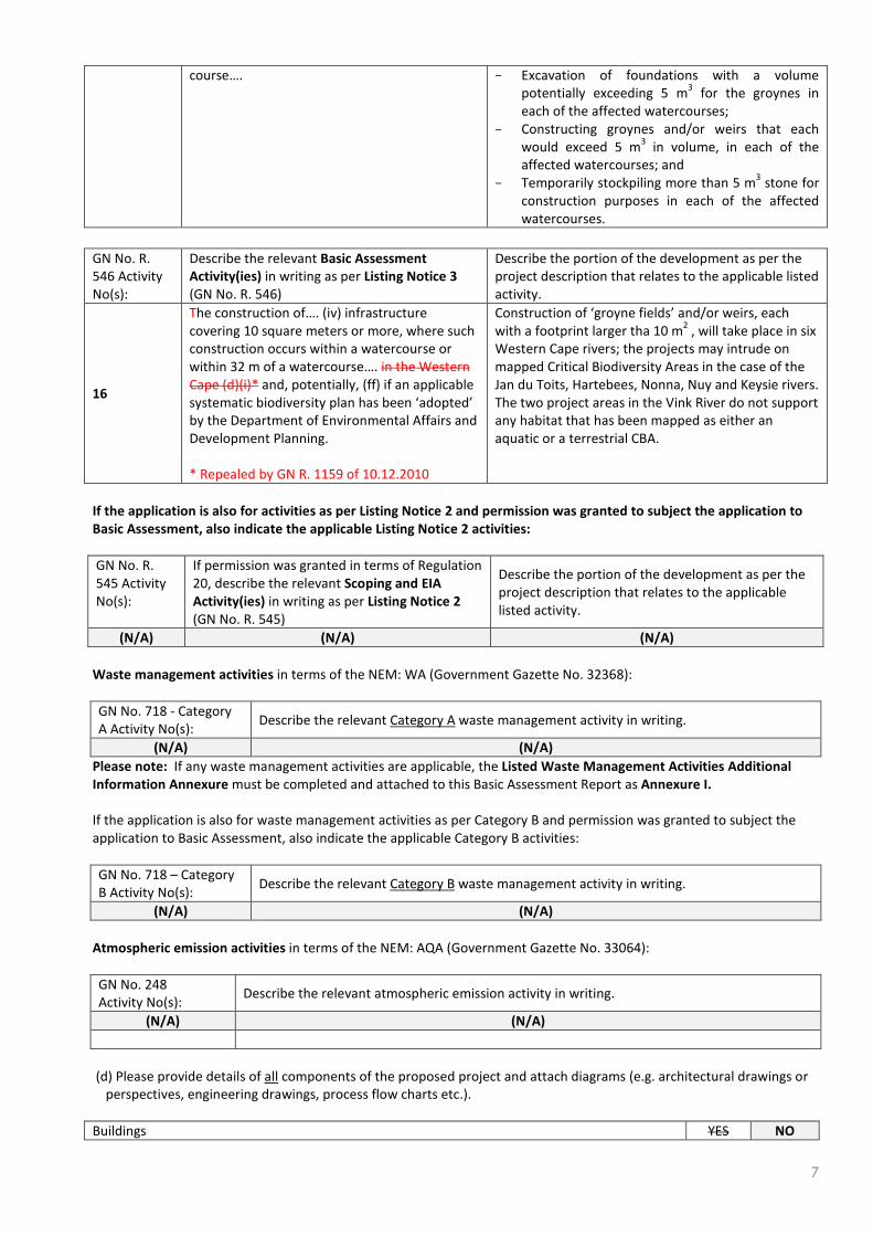
7
course…. − Excavation of foundations with a volume
potentially exceeding 5 m3 for the groynes in
each of the affected watercourses;
− Constructing groynes and/or weirs that each
would exceed 5 m3 in volume, in each of the
affected watercourses; and
− Temporarily stockpiling more than 5 m3 stone for
construction purposes in each of the affected
watercourses.
GN No. R.
546 Activity
No(s):
Describe the relevant Basic Assessment
Activity(ies) in writing as per Listing Notice 3
(GN No. R. 546)
Describe the portion of the development as per the
project description that relates to the applicable listed
activity.
16
The construction of…. (iv) infrastructure
covering 10 square meters or more, where such
construction occurs within a watercourse or
within 32 m of a watercourse…. in the Western
Cape (d)(i)* and, potentially, (ff) if an applicable
systematic biodiversity plan has been ‘adopted’
by the Department of Environmental Affairs and
Development Planning.
* Repealed by GN R. 1159 of 10.12.2010
Construction of ‘groyne fields’ and/or weirs, each
with a footprint larger tha 10 m2 , will take place in six
Western Cape rivers; the projects may intrude on
mapped Critical Biodiversity Areas in the case of the
Jan du Toits, Hartebees, Nonna, Nuy and Keysie rivers.
The two project areas in the Vink River do not support
any habitat that has been mapped as either an
aquatic or a terrestrial CBA.
If the application is also for activities as per Listing Notice 2 and permission was granted to subject the application to
Basic Assessment, also indicate the applicable Listing Notice 2 activities:
GN No. R.
545 Activity
No(s):
If permission was granted in terms of Regulation
20, describe the relevant Scoping and EIA
Activity(ies) in writing as per Listing Notice 2
(GN No. R. 545)
Describe the portion of the development as per the
project description that relates to the applicable
listed activity.
(N/A) (N/A) (N/A)
Waste management activities in terms of the NEM: WA (Government Gazette No. 32368):
GN No. 718 - Category
A Activity No(s): Describe the relevant Category A waste management activity in writing.
(N/A) (N/A)
Please note: If any waste management activities are applicable, the Listed Waste Management Activities Additional
Information Annexure must be completed and attached to this Basic Assessment Report as Annexure I.
If the application is also for waste management activities as per Category B and permission was granted to subject the
application to Basic Assessment, also indicate the applicable Category B activities:
GN No. 718 – Category
B Activity No(s): Describe the relevant Category B waste management activity in writing.
(N/A) (N/A)
Atmospheric emission activities in terms of the NEM: AQA (Government Gazette No. 33064):
GN No. 248
Activity No(s): Describe the relevant atmospheric emission activity in writing.
(N/A) (N/A)
(d) Please provide details of all components of the proposed project and attach diagrams (e.g. architectural drawings or
perspectives, engineering drawings, process flow charts etc.).
Buildings YES NO

8
Provide brief description:
Infrastructure (e.g. roads, power and water supply/ storage) YES NO
Provide brief description: Each of the projects for which environmental authorisation is being sought by virtue of this
basic assessment process entails the construction of soil conservation works by means of groynes built with gabions. No
other infrastructure is involved. The objectives of the projects are to protect agricultural resources by controlling
erosion to river banks, promote the recovery of degraded riparian ecosystems, and to facilitate sound environmental
management practices at the farming-river interface through implementation of appropriate environmental
management plans
Processing activities (e.g. manufacturing, storage, distribution) YES NO
Provide brief description: Not applicable
Storage facilities for raw materials and products (e.g. volume and substances to be stored)
Provide brief description: Not applicable YES NO
Storage and treatment facilities for solid waste and effluent generated by the project YES NO
Provide brief description: The project will not generate any effluent or waste other than during the construction phase,
when human waste will be disposed of via chemical or other toilets that will be temporarily located for this purpose at
the respective construction sites.
Other activities (e.g. water abstraction activities, crop planting activities) YES NO
Provide brief description: No other activities will be undertaken
2. PHYSICAL SIZE OF THE ACTIVITY (REFER TO TABLE INSERTED BELOW 4(c) FOR DETAILS OF PROPERTY SIZES,
AND THE EXTENT OF EACH PROJECT FOOTPRINT DURING CONSTRUCTION.)
Size of the property:
(a) Indicate the size of the property (cadastral unit) on which the activity is to be
undertaken. Combined totals per river (ha)
Jan du Toits River 524.74
Hartebees River 304.03
Nonna River 132.66
Nuy River 1279.98
Vink River 4352.04
Keisie River 3371.61
TOTAL for all properties 9965.06
Size of the facility:
(b) Indicate the size of the facility (development area) on which the activity is to be
undertaken. See below at 2(d)
Jan du Toits River
Hartebees River
Nonna River
Nuy River
Vink River
Keisie River
Size of the activity:
(c) Indicate the physical size (footprint) of the activity together with its associated
infrastructure:
Jan du Toits River
N/A
Hartebees River
Nonna River
Nuy River
Vink River
Keisie River
(d) Indicate the physical size (footprint) of the activity:
NOTE that this refers to the total area that may be disturbed during construction; (ha)

9
the groyne fields would have a considerably smaller physical footprint.
Jan du Toits River 15.0
Hartebees River 17.14
Nonna River 6.76
Nuy River 28.39
Vink River 24.28
Keisie River 32.48
TOTAL footprint for all projects 124.05
(e) Indicate the physical size (footprint) of the associated infrastructure: m
2
Jan du Toits River
N/A
Hartebees River
Nonna River
Nuy River
Vink River
Keisie River
and, for linear activities:
Length of the activity:
(f) Indicate the length of the activity: N/A
3. SITE ACCESS
(a) Is there an existing access road? YES NO
Jan du Toits River YES
Hartebees River YES
Nonna River YES
Nuy River YES
Vink River YES
Keisie River YES
(b) If no, what is the distance over which a new access road will be built? N/A
(c) Describe the type of access road planned: N/A
Please Note: indicate the position of the proposed access road on the site plan. N/A
4. DESCRIPTION OF THE PROPERTY ON WHICH THE ACTIVITY IS TO BE UNDERTAKEN AND THE LOCATION OF THE
ACTIVITY ON THE PROPERTY
(a) Provide a description of the property on which the activity is to be undertaken and the location of the activity on the
property.
River Description of property Location of activity on the property
Jan du Toits Wine farms, railway siding, rail and road bridge.
See sections A(4)(c) for the co-ordinates of site,
and B(2)(b) for descriptions of the sites and the
surrounding properties.
Hartebees Wine farms
Nonna Wine farms
Nuy Wine farms
Vink (Noree) Wine farms
Keisie Wine and fruit farms
(b) Please provide a location map (see below) as Annexure A to this report which shows the location of the property and
the location of the activity on the property; as well as a site map (see below) as Annexure B to this report; and if
applicable all alternative properties and locations.

10
Locality
map:
( Refer to Annexure A.
Site Plan:
(Refer to
annexure (B)
Detailed site plan(s) must be prepared for each alternative site or alternative activity. The site plan
must contain or conform to the following:
• The detailed site plan must be at a scale preferably at a scale of 1:500 or at an appropriate scale.
The scale must be indicated on the plan. (Annexure B)
• The property boundaries and numbers of all the properties within 50m of the site must be
indicated on the site plan. (Annexure B)
• The current land use (not zoning) as well as the land use zoning of each of the adjoining properties
must be indicated on the site plan. (Annexure B)
• The position of each element of the application as well as any other structures on the site must be
indicated on the site plan. (Annexure B)
• Services, including electricity supply cables (indicate above or underground), water supply
pipelines, boreholes, sewage pipelines, storm water infrastructure and access roads that will form
part of the development must be indicated on the site plan. (N/A)
• Servitudes indicating the purpose of the servitude must be indicated on the site plan. (N/A)
• Sensitive environmental elements within 100m of the site must be included on the site plan,
including (but not limited to):
o Rivers.
o Flood lines (i.e. 1:10, 1:50, year and 32 meter set back line from the banks of a river/stream).
o Ridges.
o Cultural and historical features.
o Areas with indigenous vegetation (even if it is degraded or infested with alien species).
• Whenever the slope of the site exceeds 1:10, then a contour map of the site must be submitted.
(c) For a linear activity, please also provide a description of the route.
N/A
Indicate the position of the activity using the latitude and longitude of the centre point of the site. The co-ordinates
must be in degrees, minutes and seconds. The minutes should be given to at least three decimals to ensure adequate
accuracy. The projection that must be used in all cases is the WGS84 spheroid in a national or local projection.
PLEASE SEE NEXT PAGE FOR THE CO-ORDINATES FOR EACH SITE

11
River Site Site ((ha) Farm (ha) Upstream Mid-point Downstream
Jan du Toits 1 4.42 298.6 33°34'24.456 33°34'31.841 33°34'39.401 S
19°20'8.036 19°20'8.036 19°20'4.344 E
2 4.88 96.49 33°34'43.797 33°34'51.533 33°34'2.083 S
19°20'1.706 19°20'58.19 19°19'55.552 E
3 2.22 89.34 33°35'13.511 33°35'19.665 33°35'25.644 S
19°19'55.552 19°19'49.398 19°19'46.585 E
4 3.48 40.31 33°36'23.643 33°36'31.348 33°36'37.475 S
19°19'8.516 19°19'7.483 19°19'8.514 E
Hartebees 1 5.6 102.63 33°35'1.418 33°35'10.418 33°35'22.029 S
19°25'20.183 19°25'14.467 19°25'6.847 E
2 5.71 68.73 33°35'42.12 33°35'35.031 33°36'2.73 S
19°24'55.589 19°24'50.046 19°24'45.716 E
3 2.64 37.08 33°36'8.619 33°36'16.24 33°36'24.9 S
19°24'45.197 19°21'40.694 19°24'40.347 E
4 3.19 95.59 33°36'27.151 33°36'34.425 33°36'41.353 S
19°21'40.694 19°20'1.706 19°20'1.706 E
Nonna 1 3.92 30.25 33°37'8.201 33°37'14.069 33°37'21.285 S
19°35'35.469 19°35'27.459 19°35'18.816 E
2 2.84 102.41 33°37'35.559 33°37'45.551 33°37'56.416 S
19°35'3.748 19°34'53.122 19°34'45.192 E
Nuy 1 7.29 155.61 33°38'314.891 33°38'15.042 33°38'19.72 S
19°39'35.103 19°39'10.505 19°38'48.926 E
2 1.7 283.31 33°38'23.643 33°38'25.756 33°38'29.83 S
19°38'41.532 19°38'37.608 19°38'35.647 E
3 2.03 283.31 33°38'36.621 33°38'40.997 33°38'44.015 S
19°38'33.836 19°38'32.025 19°38'28.102 E
4 7.23 283.31 33°38'44.468 33°38'50.202 33°38'58.653 S
19°38'24.178 19°38'18.896 19°38'13.162 E
5 6.64 221.34 33°39'4.689 33°38'18.421 33°38'25.514 S
19°38'10.597 19°38'2.901 19°38'51.432 E
6 3.5 53.1 33°39'35.172 33°39'38.642 33°39'37.284 S
19°37'28.042 19°37'21.553 19°37'13.253 E
Vink 1 4.27 33.72
33°44'37.855 33°44'35.94 33°44'37.561 S
19°47'59.792 19°47'48.743 19°47'37.252 E
2 5.6 1013.66
33°44'40.654 33°44'44.337 33°44'49.641 S
19°47'24.877 19°47'13.976 19°47'3.956 E
3 6.31 800.01
33°44'53.324 33°45'1.132 33°45'11.002 S
19°46'56.784 19°46'48.784 19°46'35.083 E
4 8.1 305.0
33°45'22.051 33°45'37.667 33°45'0.06 S
19°46'28.748 19°46'19.614 19°46'14.458 E
Keisie 1 4.92 1233.55 33°41'42.866 33°41'45.382 33°41'53.386 S
20°5'44.325 20°6'0.104 20°6'11.424 E
2 3.98 173.73 33°41'55.445 33°41'59.218 33°41'1.734 S
20°6'13.025 20°6'17.942 20°6'21.231 E
3 2.54 1407.28 33°42'4.821 33°42'9.738 33°42'16.484 S
20°6'28.919 20°6'32.693 20°6'35.208 E
4 13.22 227.9 33°43'2.68 33°43'19.146 33°43'33.896 S
20°6'40.354 20°6'44.127 20°6'33.319 E
5 4.19 92.75 33°44'20.321 33°44'30.841 33°44'40.217 S
20°6'27.319 20°6'27.547 20°6'26.289 E
6 3.63 236.4 33°44'43.876 33°44'53.024 33°44'58.741 S
20°6'26.404 20°6'27.89 20°6'34.751 E

12
(d) or:
For linear activities: Latitude (S): Longitude (E):
• Starting point of the activity N/A N/A N/A N/A N/A N/A
• Middle point of the activity N/A N/A N/A N/A N/A N/A
• End point of the activity N/A N/A N/A N/A N/A N/A
Please Note: For linear activities that are longer than 500m, please provide and addendum with co-ordinates taken every
100 meters along the route.
5. SITE PHOTOGRAPHS
Colour photographs of the site and its surroundings (taken of the site and from the site) with a description of each
photograph. The vantage points from which the photographs were taken must be indicated on the site plan, or locality
plan as applicable. If available, please also provide a recent aerial photograph. Photographs must be attached as
Annexure C to this report. It should be supplemented with additional photographs of relevant features on the site. Date
of photographs must be included. Please note that the above requirements must be duplicated for all alternative sites.
All the potential project locations applied for were formally visited on the 12th
August 2010 by all relevant officials
including representatives from CapeNature, DEA&DP, DEAT, BOCMA, Dept. of Agriculture and Cape Winelands District
Municipality. This was followed by a second site visit by the WCDA and the EAP on 13 December 2010. The Keisie site was
revisited on 12 January 2011.
Attached (Annexure B) is the latest 2009 aerial photography of these rivers indicating the position of each site. Site
specific photographs will be taken as required by the approved EMP and as per specialist report provided by the Western
Cape Department of Agriculture.

13
SECTION B: DESCRIPTION OF RECEIVING ENVIRONMENT
Site/Area Description
For linear activities (pipelines, etc.) as well as activities that cover very large sites, it may be necessary to complete copies
of this section for each part of the site that has a significantly different environment. In such cases please complete
copies of Section B and indicate the area which is covered by each copy No. on the Site Plan.
1. GRADIENT OF THE SITE
Indicate the general gradient of the sites (highlight the appropriate box).
Flat Flatter than 1:10 1:10 – 1:4 Steeper than 1:4
Jan du Toits x
Hartebees x
Nonna x
Nuy x
Vink x
Keisie x
2. LOCATION IN LANDSCAPE
(a) Indicate the landform(s) that best describes the site (highlight the appropriate box(es).
Ridgeline Plateau
Side slope of
hill/
mountain
Closed
valley
Open
valley Plain
Undulating
plain/low
hills
Dune Sea-front
Jan du
Toits x x
Hartebees x
Nonna x
Nuy x x
Vink x
Keisie x
(b) Please provide a description of the location in the landscape.
Jan du Toits
The four Jan du Toits River sites are located in the piedmont between the Hex River mountains
(Fonteintjiesberg = 1 989.3 MSL) and the Breede River, which is about 7 km to the south of the
nearest mountain. The topography slopes evenly to the south towards the Breede River. The
Badsberg and adjacent peaks dominate the western aspect of the Upper Breede River Valley.
Sites 1 – 3 are located in a prominently eroded reach of the Hex River, more than 2 km in length. The
right bank is dominated by vineyards. There is a sizeable patch of indigenous vegetation on the left
bank which is otherwise predominantly under vines.
Site 4 is located downstream of a minor road that leads to the Olof Bergh distillery just south of the
railway bridge over the Hex River at the Goudiniweg station. Both banks here are heavily infested by
invasive alien plants downstream of the road bridge. Large deposits of alluvial material have formed
a prominent ridge parallel to the stream about 300 m downstream of the latter road bridge.

14
Hartebees
Topographically, the landscape is similar to that of the Hex River sites, except that the Hartebees
River sites are located in an open basin between the surrounding mountains. The Olifantsberg (632.9
MSL to the west), Brandwachtberg (1 812.2 MSL) to the NNW, and an unnamed peak (549 MSL) to
the east define the cirque through which the Hartebees River flows towards the Breede River, about
6 km to the south of the lower site.
Sites 1 and 2 are located directly upstream of a road bridge at ‘Normandie’. The river is practically
straight at this point. There are vineyards on both banks; a wind break delineates the left bank. There
is a house, about 30 to 40 m from the river’s edge, and 80 m from the road bridge, on the right bank.
Sites 3 and 4 are located about 750 m north of the Worcester-Wes neighbouhood, just above the
road bridge at ‘Barclay’s Farm’. These sites are flanked by vineyards to the west and a highly
disturbed alluvial terrace to the east. There is a weir about 130 m upstream from the road bridge. It is
substantially outflanked by erosion.
Nonna
The Nonna sites are about 8 km due east of the point where the N1 national road enters a poort near
De Wet and swings north towards Glen Heatlie. The Nonna River flows in south-westerly direction
from the Rabiesberg (1 663.8 MSL), through ‘Bellevue’ farm, towards the R60 road and the Breede
River.
Conditions at Sites 1 and 2 are very similar. The Nonna River is notably degraded where it flows
through ‘Bellevue’. Alien shrubs and trees occupy much of its lower reaches here (i.e. at Site 2). The
right (western bank) of the river and its floodplain are defined by vineyards transected by an Eskom
powerline. The left bank, besides for erosion directly adjacent to the channel, is clad in indigenous
renosterveld vegetation that appears to be mostly natural.
A koppie dominates the left bank; the angle of slope here exceeds a rise of 1:2. Boulder and cobble
deposits have markedly raised the bed of the channel which in places appears to be virtually level
with the base of the adjacent vineyards. Berms have been bulldozed longitudinally in an apparent bid
to protect vineyards against further flood damage. A furrow is located about 20 m above the Nonna
river on its left bank.
Nuy
The Nuy River is located about 5 km east of the Nonna River, at the base of the Rabiesberg (. It is
located in a much wider valley than its neighbour (about 1.5 km at the farm ‘Leipzig’, compared to
about 500 m at ‘Bellevue’), although the general topography and land-uses are virtually identical.
Sites 1 – 4 are located in an eroded section of river that flows in a westerly direction before swining
to the south-west. The southern flank of the valley is defined by a koppie (510 MSL) comprising
shales that potentially support Breede Shale Renosterveld. The floodplain between the river and the
lower slopes of the Rabiesberg supports vineyards. There is an irrigation furrow on the lower slopes
of the koppie in question. The right bank supports vineyards. The left bank abuts shale ‘koppies’.
Sites 5 and 6 are downstream of the road. Site 5 is located adjacent to a drift. The channel has been
scoured to a width of about 60 m at its widest. Both banks are under vineyards, except where wattles
have become established on the left bank. Phragmites spp (‘fluitjiesruit’) occur in the wettest parts of
the channel. This site is virtually flat and isolated from the more broken topography to the north. Site
6 is downstream, at a guest house. Vineyards constitute the dominant land use.
Vink (aka
‘Noree’ River)
There are potentially four candidate sites for soil conservation works on the Vink River. The upper
site (1) is at a drift just south of the Peerboom Dam, and the lowest one (4) is located about 3.5 km to
the south. Site 2 is just below the Kruispad Dam. The floodplain is extensively cultivated by vineyards.
There are dense stands of bluegum on the right bank of both sites, although the upper site supports
riverine thicket, including Acacia karoo on the right (north) bank. At Site 2, deposits of alluvial stone
have also raised the bed of the river to a height which is almost level with the soil surface in the
vineyards on the northern bank.

15
Keisie
(Pietersfontein)
The six ‘Keisie’ sites are located on the Pietersfontein River, upstream of its confluence with the
Keisie River. They are strung out on outer bends over a distance of about 6.5 km.
This area is located near the base of the Koo valley in the semi-arid Succulent Karoo Biome. It is
defined by the Waboomsberge to the north (Klipsringerberg, 1 427 MSL) and the Langeberge
(Bloupunt, 1 266 MSL) to the south. Montagu is the closest town, about 3 km to the south.
Site 1 is located in the Pietersfontein River, about 100 m above the confluence with a tributary that
flows in from the north. There are orchards on the left (outer) bank. The uncultivated right bank is
located several meters below a gravel road. A bulldozed levee separates the orchards from the main
channel of the Baden River.
Site 2 is about 300 m downstream. The left (inner) bend is dominated by a stand of mature bluegums
and three or four labourers’ cottages. Vineyards and orchards define the main landcover on right
(outer) bend. There are also a shed, a small dam and the foundations of a house that was washed
away in the November 2008 floods on the right bank.
Site 3 is about 500 m downstream from site 2. The river can be crossed by an informal drift. The
channel and banks are massively disturbed by bulldozing. There are vineyards and the right (outer)
bank, whereas the raised portion of the left bank appears to be a former cultivated area, about 1 ha
in extent.
Site 4 is about 1.5 km downstream. Both banks are cultivated, orchards on the left and vineyards on
the right. There are isolated clumps of vegetation in the channel, chiefly Phragmites sp and Acacia
spp. Rock revetments buffer the left (inner) bank, which fronts orchards. The right (outer) bank and
bend appear to have been bulldozed to protect the adjacent vineyards.
Site 5 is another 1 700 m downstream. There is a distinctive hooked-shaped indentation on the right
(western) bank which abuts extensive vineyards. Fields on the opposite side of the river consists of
cleared lands and orchards. The channel shares most of the characteristics of the upstream sites, i.e.
it is heavily modified by bulldozing and clumps of reeds and woody invasives.
Site 6 is just upstream from the bridge where the R318 crosses the Keisie and Pietersfontein rivers. Its
condition is virtually identical to the other sties.
3. GROUNDWATER, SOIL AND GEOLOGICAL STABILITY OF THE SITE
(a) Is the site(s) located on or near any of the following (highlight the appropriate boxes)?
Water
table
<1.5 m
Season-
ally wet
soils
Unstable
rocky
slopes or
steep
slopes
with
loose soil
Dispers-
ive soils
Soils with
high clay
content
Other
unstable
soil or
geo-
logical
feature
Area
sensitive
to
erosion
Area
adjacent
to or
above an
aquifer
(water
table ≤
1.5 m)
An area
within
100 m of
the
source of
surface
water
Jan du
Toits yes yes No no no no yes yes yes
Hartebees
yes yes No no no no yes yes yes
Nonna
yes yes Yes no yes no yes yes yes
Nuy
yes yes Yes no yes no yes yes yes
Vink
yes yes No no no no yes yes yes
Keisie
yes yes No no no no yes yes yes

16
(b) If any of the answers to the above are “YES” or “unsure”, specialist input may be requested by the Department.
(Information in respect of the above will often be available at the planning sections of local authorities. Where it
exists, the 1:50 000 scale Regional Geotechnical Maps prepared by Geological Survey may also be used).
(c) Please indicate the type of geological formation underlying and approximate to the site.
Granite Shale
Sand-
stone
Quartz-
ite
Dolo-
mite
Dolo-
rite Other (describe)
Jan du Toits x Soils vary from quaternary alluvial deposits
consisting of round cobbles embedded in
fine loamy sand (Jan du Toits, Hartebees) to
fine loamy sand with high gravel and cobble
contents (Nonna, Nuy, Vink) to clays and
loams (Nonna, Nuy, Vink) to deep
loamy/sandy soils (Keisie)
Hartebees x
Nonna x x
Nuy x x
Vink x x
Keisie x x
4. SURFACE WATER
(a) Indicate the surface water present on and or adjacent to the site and alternative sites (highlight the appropriate
boxes)?
Perennial River Non-Perennial
River
Permanent
Wetland
Seasonal
Wetland
Artificial
Wetland
Estuarine /
Lagoonal
wetland
Jan du Toits
Yes No No Yes No No
Hartebees
No Yes No Yes No No
Nonna
No Yes No Yes No No
Nuy
No Yes No Yes No No
Vink
No Yes No Yes No No
Keisie
No Yes No Yes No No
(b) Please provide a description.

17
River types and climate
All of the proposed works will take place within braided, cobble or boulder-bed rivers and their respective riparian zones
where severe erosion took place during the November 2008 floods.
When the sites were visited in mid-December (i.e. early summer) 2010, all but the Jan du Toits River and Nuy River were
dry. The classification of the affected rivers as ‘perennial’ or ‘non-perennial’ must be treated with caution as surface
flows may significantly vary depending on the amount of precipitation that occurred in the preceeding period.
Generally, it is assumed that the rivers east of Worcester demonstrate a high degree of seasonality with winter spates
and high flows succeeded by limited or no base flow in the summer, drier, periods. There may also be an increase in
thunderstorm activity in early summer in the east.
In all cases, the affected rivers would be classified as foothill rivers embedded in floodplain or valley bottom wetlands by
the C.A.P.E fine-scale planning freshwater ecosystem guidelines, and the CBA maps for the Witzenberg, Breede Valley
and Langeberg municipalities (also see the new Western Cape Biodiversity Framework, Kirkwood et al. 2010). All the
sites barring those in the Vinkrivier coincide with mapped aquatic CBAs and the riparian zones with terrestrial CBAs.
However, none of the proposed works would have a direct impact on untransformed habitats (aquatic and terrestrial);
see Annexure D(1) for a summary of the mapped biodiversity characteristics and habitat condition of the sites.
Condition of receiving environment
The receiving environment in all cases is characterised by severe erosion of the river channel and banks and massive
deposition of alluvial material in places. In most of the rivers, attempts have been made to alter the direction of flow by
means of bulldozed berms and in systems such as the Nuy and Vink, the banks have been ‘smoothened’ by transverse
bulldozing in a bid to prevent erosion and facilitate rapid run-off during floods. Most of the systems have well-
established stands of invasive alien plants, or new infestations within areas of flood and post-flood disturbance. All of
the affected floodplains are extensively transformed as a result of viticulture and none is in a natural or near natural
condition.
Where seeps may have occurred, or are mapped as being present (e.g. the Keisie River), these features have either been
obliterated by vineyards or physical evidence of their potential presence has been destroyed by flood action. Seeps are,
however, most likely to function relatively naturally against shale slopes which have largely escaped transformation.
It is speculated that artificial drainage associated with viticulture has probably had a deleterious effect over many
decades on the natural functioning of local drainage patterns, especially sub-surface ones that may have been
associated with the former presence of alluvium fynbos and renosterveld.
Site characterisation
CapeNature undertook a site characterisation analysis of the respective rivers using the River Health Programme’s
Index of Habitat Integrity (IHI) (Annexure D5). The integrity categories are:
A Unmodified, natural
B Largely natural with few modifications
C Moderately modified
D Largely modified
E Seriously modified
F Critically/extremely modified
The IHI classes for the instream habitat integrity of all the catchments of the six rivers considered for flood repairs,
CapeNature (15 February 2011) were:
− Jan du Toits (E); Hartebees (E); Nonna (D); Nuy (E); Vink (D) and Keisie (Baden) (D).
The IHI classes for the riparian zone integrity of all the catchments of the six rivers considered for flood repairs,
CapeNature (15 February 2011) were:
− Jan du Toits (F); Hartebees (F); Nonna (F); Nuy (F); Vink (F) and Keisie (Baden) (E).
All the rivers and riparian zones in question are therefore in a ‘largely modified’ to ‘critically modified condition’.

18
5. BIODIVERSITY
Please note: The Department may request specialist input/studies depending on the nature of the biodiversity occurring
on the site and potential impact(s) of the proposed activity/ies. To assist with the identification of the biodiversity
occurring on site and the ecosystem status consult http://bgis.sanbi.org or [email protected]. Information is also
available on compact disc (cd) from the Biodiversity-GIS Unit, Ph (021) 799 8698. This information may be updated from
time to time and it is the applicant/ EAP’s responsibility to ensure that the latest version is used. A map of the relevant
biodiversity information (including an indication of the habitat conditions as per (b) below) and must be provided as an
overlay map to the property/site plan as Annexure D to this report.
(a) Highlight the applicable biodiversity planning categories of all areas on site and indicate the reason(s) provided in the
biodiversity plan for the selection of the specific area as part of the specific category). See Annexure D3:
Biodiversity overlay maps, Annexure D1: CBAs and habitat quality,and Annexure D4: Site characterisation
River
& IHI
classes
(instream;
riparian)
Systematic Biodiversity Planning Category
If CBA or ESA, indicate the reason(s) for its selection in
biodiversity plan CBA ESA ONA NNR
Jan du
Toits
(E, F)
Yes No No Yes
CBA (Aq): Foothill rivers, alluvial floodplains
CBA (Terr): Wetland type threshold; Priority sub-
catchment; Vegetation type threshold
Hartebees
(E, F) Yes Yes Yes Yes
CBA (Aq): Foothill river; Cape alluvial floodplain
CBA (Terr): Wetland type threshold; Focal animal
species occur in wetlands that will not be affected by
the structures in the river; Significant wetland cluster
Nonna
(D, F) Yes Yes Yes Yes CBA (Terr): Vegetation type threshold
Nuy
(E, F) Yes Yes Yes Yes CBA (Aq): Foothill river; Floodplain wetland
CBA (Terr): Vegetation type threshold.
Vink
(D, F) No Yes Yes Yes
No CBAs
Mainstem of Vink a designated ESA
Keisie
(D, E) Yes Yes Yes Yes
CBA (Aq): Foothill river; Seeps
CBA (Terr): Priority sub-catchment
(b) Highlight and describe the habitat condition on site. See Annexure C for photographs depicting the condition of the
various sites.
Jan du Toits River
Habitat Condition
Percentage of
habitat
condition class
(adding up to
100%)
Description and additional Comments and Observations
(including additional insight into condition, e.g. poor land management
practises, presence of quarries, grazing/harvesting regimes etc).
Natural 5
Two fairly sizeable patches of indigenous vegetation occur on the left
(eastern) bank of the river. They have a shared extent of about 23 ha and
a river frontage of about 800 m. They will not be affected by the
proposed soil conservation works.
Near Natural
(includes areas with low
to moderate level of
alien invasive plants)
10
There is some indigenous vegetation in a ‘near natural’ condition on the
left (E) bank of the river, opposite Site 1.
Degraded
(includes areas heavily
invaded by alien plants)
70
Most of the construction effort will be in the channel and along the banks
of the river. The system has been massively degraded by erosion and
bulldozing of alluvial material.
Transformed
(includes cultivation, 15
The areas in the floodplain where groynes are to be placed are either
under vinyeyards or heavily infested by invasive alien plants.

19
dams, urban, plantation,
roads, etc)
Hartebees River
Habitat Condition
Percentage of
habitat
condition class
(adding up to
100%)
Description and additional Comments and Observations
(including additional insight into condition, e.g. poor land management
practises, presence of quarries, grazing/harvesting regimes etc).
Natural 0 There is no habitat in the vicinity of any of the Hex River sites which is
designed ‘natural’ by the Western Cape biodiversity framework .
Near Natural
(includes areas with low
to moderate level of
alien invasive plants)
5
The left bank at the weir site supports <1.2 ha of very degraded, grass and
wattle-dominated veld. The area appears to have been subject to
sustained disturbances such as trampling and sporadic cultivation, and is
viewed as having negligible biodiversity value.
Degraded
(includes areas heavily
invaded by alien plants)
80
The channel of the river where most of the construction will take place is
severely degraded and virtually devoid of any vegetation besides
opportunistic weedy species, especially wattles. Upstream of ‘Normandie’
farm the river has eroded right up to the roads flanking the vineyards
either side of the channel.
Transformed
(includes cultivation,
dams, urban, plantation,
roads, etc)
15
The floodplain supports vineyards, which overwhelmingly dominate the
landscape on either bank of the Hartebees River.
Nonna River
Habitat Condition
Percentage of
habitat
condition class
(adding up to
100%)
Description and additional Comments and Observations
(including additional insight into condition, e.g. poor land management
practises, presence of quarries, grazing/harvesting regimes etc).
Natural 10
The Western Cape biodiversity framework (2010) depicts about half of the
Nonna River above the road bridge as being ‘Natural’ (i.e. where it
traverses ‘Bellevue’ farm). This would accurately depict the condition of
habitat on the left, west-facing bank, but the remainder of the system is
grossly degraded. The soil conservations work would be established on
eroded banks abutting vineyards, i.e. they will not affect untransformed
veld.
Near Natural
(includes areas with low
to moderate level of
alien invasive plants)
0
No ‘Near natural’ areas are depicted for the area by the Western Cape
biodiversity framework (2010). Clumps of vegetation on raised benches in
the channel of the river may qualify as ‘near natural’, but have not been
depicted as thus by the biodiversity framework.
Degraded
(includes areas heavily
invaded by alien plants)
75
The river channel and banks have been massively damaged and
restructured by erosion, there has been extensive bulldozing in the
channel, and the lower reaches of the Nonna River and its uncultivated
floodplain on the ‘Bellevue’ farm are heavily infested with invasive alien
plants. In contrast, the Western Cape biodiversity framework (2010) does
not depict any ‘degraded’ habitat in the vicinity.
Transformed
(includes cultivation,
dams, urban, plantation,
roads, etc)
15
Vineyards occupy most of the floodplain of the Nonna River on the
‘Bellevue’ farm. The river has incised so deeply into vineyards on the right
bank that there is scarcely room for a vehicle to pass between the
vineyards and channel edge.
Nuy River
Habitat Condition
Percentage of
habitat
condition class
(adding up to
100%)
Description and additional Comments and Observations
(including additional insight into condition, e.g. poor land management
practises, presence of quarries, grazing/harvesting regimes etc).

20
Natural 15
About 60% of the steeper left bank of the Nuy River above the road bridge
appears to be largely natural renosterveld, and is depicted as ‘Natural’ by
the Western Cape biodiveristy framework (2010). The remainder of the
‘Natural’ areas either side of the road bridge appear have been destroyed
by the November 2008 floods. Areas of untransformed veld will not be
affected by the proposed soil conservation works.
Near Natural
(includes areas with low
to moderate level of
alien invasive plants)
0
There is no ‘Near natural’ habitat in the areas in question.
Degraded
(includes areas heavily
invaded by alien plants)
70
No habitat is depicted locally as ‘Degraded’ by the Western Cape
biodiversity framework (2010), but the Nuy River directly above the road
bridge has been invaded by various wattle species and pine on the left
bank.
Transformed
(includes cultivation,
dams, urban, plantation,
roads, etc)
15
Vineyards have massively displaced natural habitat in the floodplain of the
Nuy river.
Vink River
Habitat Condition
Percentage of
habitat
condition class
(adding up to
100%)
Description and additional Comments and Observations
(including additional insight into condition, e.g. poor land management
practises, presence of quarries, grazing/harvesting regimes etc).
Natural 5
The most intact natural habitat in the Vink River was found on the right
bank of the river at the upper drift. This karroid-like thicket occupies an
area of about 6 ha. A similar type of vegetation also occurs in a c. 3.5 ha
patch on the opposite bank. This at least partly reflects the distributon of
‘Natural’ habitat in this area by the Western Cape biodiversity framework
(2010). It may be more accurate to describe this vegetation as ‘Near-
natural’ to ‘Natural’.
Near Natural
(includes areas with low
to moderate level of
alien invasive plants)
0
No habitat depicted as ‘Near natural’ occurs in the direct vicinity of the
Vink River sites.
Degraded
(includes areas heavily
invaded by alien plants)
70
The channel and banks that would be affected by the proposed soil
conservation works are heavily degraded as a result of erosion, bulldozing
and alien encroachment (these features are depicted as ‘Natural’ by the
Western Cape biodiversity framework (2010)).
Transformed
(includes cultivation,
dams, urban, plantation,
roads, etc)
25
All the areas in the areas in the floodplain where groynes may be
‘anchored’ are under vines.
Keisie River
Habitat Condition
Percentage of
habitat
condition class
(adding up to
100%)
Description and additional Comments and Observations
(including additional insight into condition, e.g. poor land management
practises, presence of quarries, grazing/harvesting regimes etc).
Natural 5
The least transformed habitats that are found in the affected environment
are probably the shale slopes that determine the course of the Keisie
River. These areas will not, however, be directly affected by the proposed
soil conservation works.
Near Natural
(includes areas with low
to moderate level of
alien invasive plants)
0
The Western Cape biodiversity framework (2010) does not indicate the
occurrence of ‘Near natural’ habitat in the vicinity of the proposed soil
conservation works.

21
Degraded
(includes areas heavily
invaded by alien plants)
70
As with all the other rivers subject to this basic assessment, the Keisie
River has undergone major transformation as a result of floods and
inappopriate management practices such as bulldozing of the channel and
banks. The riparian zone is intensively cultivated. This is a naturally
braided system, as are the other rivers, so a degree of disturbance is to be
expected that would not necessarily be adduced to human interventions
or mismanagement.
Transformed
(includes cultivation,
dams, urban, plantation,
roads, etc)
25
The floodplain of the Keisie River is extensively cultivated and fragmented
by roads, stands of alien plants and agricutural infrastructure.
(c) Complete the table to indicate:
(i) the type of vegetation, including its ecosystem status, present on the site; and
(ii) whether an aquatic ecosystem is present on site.
(d) Please provide a description of the vegetation type and/or aquatic ecosystem present on site, including any
important biodiversity features/information identified on site (e.g. threatened species and special habitats)
Terrestrial Ecosystems Aquatic Ecosystems
River Vegetation type Ecosystem status
Draft national list of
threatened
ecosystems, DEA
(2009)
River and wetland types
C.A.P.E. fine-scale planning project: Aquatic
ecosystems of the upper Breede River valley
planning domainiii
Floodplain wetland, valley bottom wetland,
seeps, depressional wetlands, mountain
streams, foothill rivers, lowland rivers
Ecosystem
present YES NO
UN-
SURE
Jan du Toits Breede Alluvium
Fynbos
EN Foothill river
Cape alluvial
floodplain
X
Hartebees
Breede Alluvium
Fynbos
EN Foothill river
Cape alluvial
floodplain
wetlands
X
Nonna Breede Alluvium
Renosterveld
Breede Shale
Renosterveld
VU
LT
Foothill river
Cape alluvial
floodplain X
Nuy Breede Alluvium
Renosterveld
Breede Shale
Renosterveld
VU
LT
Foothill river
Floodplain
wetland X
Vink Breede Alluvium
Renosterveld
Breede Shale
Renosterveld
VU
LT
Foothill river
Alluvial
floodplain
X
Keisie Western Little
Karoo
LT Foothill river
Floodplain
Seeps
X
22
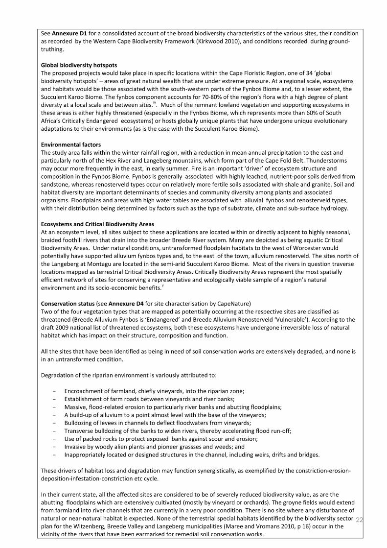
See Annexure D1 for a consolidated account of the broad biodiversity characteristics of the various sites, their condition
as recorded by the Western Cape Biodiversity Framework (Kirkwood 2010), and conditions recorded during ground-
truthing.
Global biodiversity hotspots
The proposed projects would take place in specific locations within the Cape Floristic Region, one of 34 ‘global
biodiversity hotspots’ – areas of great natural wealth that are under extreme pressure. At a regional scale, ecosystems
and habitats would be those associated with the south-western parts of the Fynbos Biome and, to a lesser extent, the
Succulent Karoo Biome. The fynbos component accounts for 70-80% of the region’s flora with a high degree of plant
diversty at a local scale and between sites.iv. Much of the remnant lowland vegetation and supporting ecosystems in
these areas is either highly threatened (especially in the Fynbos Biome, which represents more than 60% of South
Africa’s Critically Endangered ecosystems) or hosts globally unique plants that have undergone unique evolutionary
adaptations to their environments (as is the case with the Succulent Karoo Biome).
Environmental factors
The study area falls within the winter rainfall region, with a reduction in mean annual precipitation to the east and
particularly north of the Hex River and Langeberg mountains, which form part of the Cape Fold Belt. Thunderstorms
may occur more frequently in the east, in early summer. Fire is an important ‘driver’ of ecosystem structure and
composition in the Fynbos Biome. Fynbos is generally associated with highly leached, nutrient-poor soils derived from
sandstone, whereas renosterveld types occur on relatively more fertile soils associated with shale and granite. Soil and
habitat diversity are important determinants of species and community diversity among plants and associated
organisms. Floodplains and areas with high water tables are associated with alluvial fynbos and renosterveld types,
with their distribution being determined by factors such as the type of substrate, climate and sub-surface hydrology.
Ecosystems and Critical Biodiversity Areas
At an ecosystem level, all sites subject to these applications are located within or directly adjacent to highly seasonal,
braided foothill rivers that drain into the broader Breede River system. Many are depicted as being aquatic Critical
Biodiversity Areas. Under natural conditions, untransformed floodplain habitats to the west of Worcester would
potentially have supported alluvium fynbos types and, to the east of the town, alluvium renosterveld. The sites north of
the Langeberg at Montagu are located in the semi-arid Succulent Karoo Biome. Most of the rivers in question traverse
locations mapped as terrestrial Critical Biodiversity Areas. Critically Biodiversity Areas represent the most spatially
efficient network of sites for conserving a representative and ecologically viable sample of a region’s natural
environment and its socio-economic benefits.v
Conservation status (see Annexure D4 for site characterisation by CapeNature)
Two of the four vegetation types that are mapped as potentially occurring at the respective sites are classified as
threatened (Breede Alluvium Fynbos is ‘Endangered’ and Breede Alluvium Renosterveld ‘Vulnerable’). According to the
draft 2009 national list of threatened ecosystems, both these ecosystems have undergone irreversible loss of natural
habitat which has impact on their structure, composition and function.
All the sites that have been identified as being in need of soil conservation works are extensively degraded, and none is
in an untransformed condition.
Degradation of the riparian environment is variously attributed to:
− Encroachment of farmland, chiefly vineyards, into the riparian zone;
− Establishment of farm roads between vineyards and river banks;
− Massive, flood-related erosion to particularly river banks and abutting floodplains;
− A build-up of alluvium to a point almost level with the base of the vineyards;
− Bulldozing of levees in channels to deflect floodwaters from vineyards;
− Transverse bulldozing of the banks to widen rivers, thereby accelerating flood run-off;
− Use of packed rocks to protect exposed banks against scour and erosion;
− Invasive by woody alien plants and pioneer grassses and weeds; and
− Inappropriately located or designed structures in the channel, including weirs, drifts and bridges.
These drivers of habitat loss and degradation may function synergistically, as exemplified by the constriction-erosion-
deposition-infestation-constriction etc cycle.
In their current state, all the affected sites are considered to be of severely reduced biodiversity value, as are the
abutting floodplains which are extensively cultivated (mostly by vineyard or orchards). The groyne fields would extend
from farmland into river channels that are currently in a very poor condition. There is no site where any disturbance of
natural or near-natural habitat is expected. None of the terrestrial special habitats identified by the biodiversity sector
plan for the Witzenberg, Breede Valley and Langeberg municipalities (Maree and Vromans 2010, p 16) occur in the
vicinity of the rivers that have been earmarked for remedial soil conservation works.

23
6. LAND USE OF THE SITE
Please note: The Department may request specialist input/studies depending on the nature of the land use character of
the area and potential impact(s) of the proposed activity/ies.
NB: The land-use types highlighted below do not necessarily occur at all the sites. See the detailed table underneath.
Untransformed area Low density
residential
Medium density
residential
High density
residential
Informal
residential
Retail Commercial &
warehousing Light industrial Medium industrial Heavy industrial
Power station Office/consulting
room
Military or police
base/station/compound
Casino/entertainment
complex
Tourism &
Hospitality
facility
Open cast mine Underground
mine
Spoil heap or slimes
dam
Quarry, sand or
borrow pit Dam or reservoir
Hospital/medical center School Tertiary education
facility Church Old age home
Sewage treatment plant Train station or
shunting yard Railway line
Major road (4 lanes
or more) Airport
Harbour Sport facilities Golf course Polo fields Filling station
Landfill or waste treatment
site Plantation Agriculture
River, stream or
wetland
Nature
conservation
area
Mountain, koppie or ridge Museum Historical building Graveyard Archeological
site
Other land uses (describe):
River Land uses character at sites
Jan du Toits River in agricultural area with mountain backdrop
Hartebees River in agricultural area with mountain backdrop
Nonna River in agricultural area abutting untransformed ‘koppies’ with mountain backdrop
Nuy River in agricultural area abutting untransformed ‘koppies’ with mountain backdrop
Vink River in agricultural area abutting untransformed ‘koppies’ with mountain backdrop
Keisie (Baden) River in agricultural area abutting untransformed ‘koppies’ with mountain backdrop
(a) Please provide a description.
All of the proposed work at the various sites will take place within the river channel and the abutting riparian zone
where severe erosion took place during the November 2008 floods. Viticulture represents the predominant land-use. All
the sites are locate at the base of mountain ranges or within hilly areas. There are no settlement or public institutions
(schools, hospitals, places of worship, etc) at any of the sites.

24
7. LAND USE CHARACTER OF SURROUNDING AREA
(a) Highlight the current land uses and/or prominent features that occur within +/- 500 m radius of the site and
neighbouring properties if these are located beyond 500 m of the site.
Please note: The Department may request specialist input/studies depending on the nature of the land use character of
the area and potential impact(s) of the proposed activity/ies.
NB: The land-use types highlighted below do not necessarily occur at all the sites. See the detailed table underneath.
Untransformed area Low density
residential
Medium density
residential
High density
residential
Informal
residential
Retail Commercial &
warehousing Light industrial Medium industrial Heavy industrial
Power station Office/consulting
room
Military or police
base/station/compound
Casino/entertainment
complex
Tourism &
Hospitality
facility
Open cast mine Underground
mine
Spoil heap or slimes
dam
Quarry, sand or
borrow pit
Dam or
reservoir
Hospital/medical center School Tertiary education
facility Church Old age home
Sewage treatment plant Train station or
shunting yard Railway line
Major road (4 lanes
or more) Airport
Harbour Sport facilities Golf course Polo fields Filling station
Landfill or waste treatment
site Plantation Agriculture
River, stream or
wetland
(Drainage ditches)
Nature
conservation
area
Mountain, koppie or ridge Museum Historical building Graveyard Archeological
site
Other land uses (describe):
River Land uses character within 500 m of the sites
Jan du Toits North of the R43, the landscape dominated by vineyards and farm buildings. South of the R43, the
most evident land uses are the Goudiniweg railway siding, roads, two bridges, a distillery, scattered
farm housing and vineyards. The Hex River Mountains are directly to the North.
Hartebees The four Hartebees sites are located in an agricultural area with sheds, scattererd farm
accommodation, powerlines and roads. The suburb ‘Worcester-Wes’ is about 500 m to the South.
The Hex River Mountains are directly to the North.
Nonna The Nonna sites are located on farmland (predominantly vineyards) at the base of the Rabiesberg.
Habitation includes scattered farm houses and worker accommodation. Infrastructure includes
roads, farm dams, an irrigation canal and a powerline. Low-lying shale ‘koppies’ define the eastern
boundary of the Nonna floodplain.
Nuy Largely similar to conditions that characterise land-uses around the Nonna sites.
Vink As for the Nonna and Nuy surrounds. Limestone quarries are visible in the hills to the South. The R60
route between Worcester and Robertson is about 4 km southwards of the Vink River sites.
Keisie
(Pietersfontein)
The Keisie (Pietersfontein) sites are located on farmland characterised by a mixture of orchards,
vineyards and cleared but unplanted lands. Site 6 is about 250 m downstream from the R318, which
connects Montagu to the N1 via the Koo valley. Conditions are otherwise very similar to all the other
sites in more rural settings. The Keisie (Pietersfontein) sites are about 4 km north of Montagu, inland
of the Koo valley.

25
(b) Please provide a description, including the distance and direction to the nearest residential area and industrial area.
See above for a description of the sites and their surrounds and, where applicable, the distance to the nearest
settlements.
8. SOCIO-ECONOMIC ASPECTS
Describe the existing social and economic characteristics of the community in order to provide baseline information.
All the sites fall within the winter rainfall region, with wine and fruit farming being the predominant economic
activities. The production of these crops is labour-intensive, particularly during the annual grape harvest (January-
March) when there is an influx of seasonal workers to farms and cellars. Employment is highly cyclical and periods
between harvests are associated with increased levels of unemployment. Except for the Hartebees River, which is
relatively close to an outlying suburb of Worcester, all the other sites are located in farming areas with scattered
employee accommodation and homesteads.
9. HISTORICAL AND CULTURAL ASPECTS (a) Please be advised that if section 38 of the National Heritage Resources Act, 1999 (Act No. 25 of 1999), is applicable to
your proposed development, then you are requested to furnish this Department with written comment from Heritage Western Cape as part of your public participation process. Section 38 of the Act states as follows: “38. (1) Subject to the provisions of subsections (7), (8) and (9), any person who intends to undertake a development categorised as-
(a) the construction of a road, wall, power line, pipeline, canal or other similar form of linear development or barrier exceeding 300m in length;
(b) the construction of a bridge or similar structure exceeding 50m in length; I any development or other activity which will change the character of a site- (i) exceeding 5 000 m2 in extent; or (ii) involving three or more existing erven or subdivisions thereof; or (iii) involving three or more erven or divisions thereof which have been consolidated within the past five years; or (iv) the costs of which will exceed a sum set in terms of regulations by SAHRA or a provincial heritage resources
authority; (d) the re-zoning of a site exceeding 10 000 m
2 in extent; or
(e) any other category of development provided for in regulations by SAHRA or a provincial heritage resources authority,
must at the very earliest stages of initiating such a development, notify the responsible heritage resources authority and furnish it with details regarding the location, nature and extent of the proposed development.”
(b) The impact on any national estate referred to in section 3(2), excluding the national estate contemplated in section
3(2)(i)(vi) and (vii), of the National Heritage Resources Act, 1999 (Act No. 25 of 1999), must also be investigated, assessed and evaluated. Section 3(2) states as follows: “3(2) Without limiting the generality of subsection (1), the national estate may include—
(a) places, buildings, structures and equipment of cultural significance; (b) places to which oral traditions are attached or which are associated with living heritage; (c) historical settlements and townscapes; (d) landscapes and natural features of cultural significance; (e) geological sites of scientific or cultural importance; (f) archaeological and palaeontological sites; (g) graves and burial grounds, including— (i) ancestral graves; (ii) royal graves and graves of traditional leaders; (iii) graves of victims of conflict; (iv) graves of individuals designated by the Minister by notice in the Gazette; (v) historical graves and cemeteries; and (vi) other human remains which are not covered in terms of the Human Tissue Act, 1983 (Act No. 65 of 1983); (h) sites of significance relating to the history of slavery in South Africa; (i) movable objects, including— (i) objects recovered from the soil or waters of South Africa, including archaeological and palaeontological objects and material, meteorites and rare geological specimens; (ii) objects to which oral traditions are attached or which are associated with living heritage; (iii) ethnographic art and objects; (iv) military objects; (v) objects of decorative or fine art;
26
(vi) objects of scientific or technological interest; and (vii) books, records, documents, photographic positives and negatives, graphic, film or video material or sound recordings, excluding those that are public records as defined in section 1(xiv) of the National Archives of South Africa Act, 1996 (Act No. 43 of 1996).”
Is section 38 of the National Heritage Resources Act, 1999, applicable to the development? YES NO
UNCERTAIN
If YES, explain:
Will the development impact on any national estate referred to in section 3(2) of the
National Heritage Resources Act, 1999?
YES NO
UNCERTAIN
If YES, explain:
Will any building or structure older than 60 years be affected in any way? YES NO UNCERTAIN
If YES, explain:
Please Note: If uncertain, the Department may request that specialist input be provided.
10. APPLICABLE LEGISLATION, POLICIES AND/OR GUIDELINES
(a) Please list all legislation, policies and/or guidelines that have been considered in the preparation of this Basic
Assessment Report.
LEGISLATION ADMINISTERING AUTHORITY
TYPE
Permit/ license/
authorisation/comment /
relevant consideration (e.g.
rezoning or consent use, building
plan approval)
DATE
(if already
obtained):
The National Water Act 36 of
1998 Department of Water Affairs
Section 21 license w.r.t. ‘Water
use’ – not required in terms of
General Authorisation issued
under s 39 of NWA “(in) terms of s
21[c] and 21[i] for the purpose of
rehabilitating a wetland for
conservation purposes’ (GN R.
1198, 18 December 2009).
N/A
POLICY/ GUIDELINES ADMINISTERING AUTHORITY
Exemption applications (DEADP 2010) and EMPs (Lochner 2005) DEADP
Western Cape PSDF and Draft Rural Land-use Guideline (2009) DEADP
DEADP guideline on need and desiraiblity (2010) DEADP
Biodiversity sector plans for the Witzenberg, Breede Valley and
Langeberg Municipalities DEADP-CapeNature
(b) Please describe how the legislation, policies and/or guidelines were taken into account in the preparation of this
Basic Assessment Report.
LEGISLATION / POLICY /
GUIDELINE
DESCRIBE HOW THE LEGISLATION / POLICY / GUIDELINE WERE TAKEN INTO
ACCOUNT
(e.g. describe the extent to which it was adhered to, or deviated from, etc).
General Authorisation issued by
the Minister of Water Affairs and
Forestry, 18 Dec 2009
This General Authorisation authorises water use for the purpose of wetland
rehabilitation, thereby relieving a water user of the requirement to obtain a licence
in terms of section 21 of the National Water Act 36 of 1998. The General
Authorisation defines ‘rehabilitation’ as “the process of reinstating natural

27
ecological driving forces within part or the whole of a degraded watercourse to
recover former or desired ecosystem structure, function, biotic composition and
associated ecosystem services...” The objectives of the proposed soil conservation
works are to prevent erosion and degradation of the riparian environment and to
initiate habitat restoration and the reinstatement of ecological functionality in river
systems that include aquatic Critical Biodiversity Areas. The EMP prepared for
these applications gives effect to the Breede-Overberg Catchment Management
Agency’s (BOCMA) request for information on control, monitoring and
management programmes. CapeNature’s requirements with respect to ecological
monitoring are also incorporated in the EMP.
Guideline on exemption
applications (Aug 2010)
Exemption authorisation issued in favour of all applicants (see above,
‘Department’s Reference Numbers’).
DEADP guideline on EMPs
(Lochner 2005)
Draft EMP for this application compiled with reference to DEADP guideline on
EMPs and s 24N of Act 107 of 1998 as amended.
Western Cape PSDF and rural
land-use guidelines
Objective 8 of the PSDF promotes the protection of biodiversity and agricultural
resources, including soil. Objective 9 calls for consumption of scarce environmental
resources to be minimised and for the combating of alien invasive species. The
Western Cape draft Rural Land-use Planning and Management Guidelines (DEADP
2009) assign Core 1 SPC status to CBAs. These are areas that are needed to meet
biodiversity targets and thresholds. They must be restored to a natural state in
order to sustain biodiversity pattern and process. All of the projects aim to
reinstate near-natural fluvial processes and habitat in highly degraded aquatic CBAs
by preventing further degradation to the riparian environment and setting in place
restorative measures. Combating soil erosion, conservation of agricultural
resources and biodiversity-inclusive land-use planning and development also
constitute important strategic objectives for the Cape Winelands District
Municipality’s Environmental Strategy and Strategic Environmental Management
Plan.
DEADP guideline on need and
desirability (Aug 2010)
‘Need and desirability’ are understood to mean that a project must be able to pass
two tests: will the project satisfy a demonstrable public interest, and is it beneficial
or to the public good? The first answer is a substantive one, whereas the second
one addresses normative considerations. The need for these projects is clear:
unmitigated soil erosion results in environmental degradation, disturbance to
ecosystems and loss of biodiversity, and the forfeiture of highly valuable and
irreplaceable agricultural resources. There is a clear need to prevent this from
occurring. Secondly, the projects are consistent with the normative standards set
by the PSDF in terms of the conservation of agricultural resources and biodiversity.
If the projects were not to go ahead, the result would be environmental harm and
the loss of agri-environmental amenities that would not be in the public interest.
The projects would also provide work to marginalised members of the community.
This is a clear social good.
Biodiversity sector plan for the
Witzenberg, Breede Valley and
Langeberg Municipalities
Biodiversity sector plans lay down biodiversity management objectives for CBAs
(maintain as natural, alternatively prevent further degradation and restore) and
recomimend guidelines that should be consulted for environmental assessment
(e,g the CAPE fine-scale planning guidelines to aquatic ecosystems and the Fynbos
Forum ecosystem guidelines – http://bgis.sanbi.org ). The latter have informed the
environmental assessment and the EMP.
Please note: Copies of any permit(s) or licences received from any other organ of state must be attached this report
as Annexure E.

28
SECTION C: PUBLIC PARTICIPATION
The public participation process must fulfil the requirements outlined in NEMA, the EIA Regulations, and if applicable the
NEM: WA and/or the NEM: AQA. This Department’s Guideline on Public Participation (August 2010) and Guideline on
Exemption Applications (August 2010), both of which are available on the Department’s website
(http://www.capegateway.gov.za/eadp), must also be taken into account.
Please highlight the appropriate box to indicate whether the specific requirement was undertaken or whether there
was a deviation that was agreed to by the Department.
1. Were all potential interested and affected parties notified of the application by –
(a) fixing a notice board at a place conspicuous to the public at the boundary or on the fence of -
(i) the site where the activity to which the application relates is to be undertaken; and YES DEVIATE1
(ii) any alternative site mentioned in the application; YES DEVIATE
(b) giving written notice to –
(i) the owner or person in control of that land if the applicant is not the owner or
person in control of the land; YES N/A
(ii) the occupiers of the site where the activity is to be undertaken and to any
alternative site where the activity is to be undertaken; YES DEVIATE
(iii) owners and occupiers of land adjacent to the site where the activity is to be
undertaken and to any alternative site where the activity is to be undertaken; YES DEVIATE
(iv) the municipal councillor of the ward in which the site and alternative site is
situated and any organisation of ratepayers that represent the community in the
area;
YES DEVIATE
(v) the municipality which has jurisdiction in the area; YES DEVIATE
(vi) any organ of state having jurisdiction in respect of any aspect of the activity; and YES DEVIATE
(vii) any other party as required by the competent authority; YES DEVIATE
I placing an advertisement in -
(i) one* local newspaper; and YES DEVIATE
(ii) any official Gazette that is published specifically for the purpose of providing
public notice of applications or other submissions made in terms of these
Regulations;
YES DEVIATE
(d) placing an advertisement in at least one* provincial newspaper or national
newspaper, if the activity has or may have an impact that extends beyond the
boundaries of the metropolitan or local municipality in which it is or will be
undertaken.
YES
DEVIATE
* Please note: In terms of the NEM: WA and NEM: AQA a notice must be placed in at least two newspapers circulating
in the area in which the activity applied for is to be carried out.
1 Deviation requests on DEA&DP’s advice. Exemptions have been issued for each of the five applications.

29
3. Please provide an overall summary of the Public Participation Process that was followed. (The detailed
outcomes of this process must be included in a comments and response report to be attached to the final Basic
Assessment Report (see note below) as Annexure F).
2. Provide a list of all the state departments that were consulted:
− Department of Agriculture (Prov. Dept. Western Cape)
− Department of Agriculture, Forestry & Fisheries (National Dept.)
2b. Parastatals that were consulted:
− Breede-Overberg Catchment management Agency
− CapeNature
2c. Municipalities that were consulted:
− Breede Valley Municipality
− Cape Winelands District Municipality
− Langeberg Municipality
− Witzenberg Municipality
2d. Civil society organisations that were consulted
− See attendance registers (Annexure F1)
NO OBJECTIONS WERE RECEIVED. All comment and the responses there to is summarised in Annexure F7
‘Comments and responses report’.

30
The Western Cape Department of Agriculture co-ordinating public participation during the pre-application,
planning, phases of the project, as well as during the basic assessment. The public participation process occurred
as follows:
1st
Community meeting – 4th
December 2008
2nd
Community meeting – November 2009
31 July 2010 – Information day (“Healthy river Ecosystems”) with community and department representatives
12th
August 2010 – Site visit and meetings at each river listed by all relevant departments (attended by inter alia
the Department of Environmental Affairs and Development Planning – EIA and biodiversitity directorates – the
Department of Environmental Affairs, DEA&DP, DEA, the Cape Winelands District Mun., CapeNature, the
provincial Department of Agriculture and BOCMA)
3rd
meeting - 31st
Aug. & 1st
Sept. 2010
For initial public participation in the planning phase, see:
Annexure F1 – Minutes of meetings with communities
Annexure F2 – Attendance register of these meetings
Annexure F3 – Notification to all landowners
Annexure F4 – Letters of support from Cape Nature, BOCMA, the Cogmanskloof Besproeiingsraad, the Noree
Besproeiingsraad, the Worcester-Oos Watergebruikersvereniging; the Hexvallei Watergebruikversvereniging,
the Brandwacht Besproeiingsraad, and the Olifantsberg Landbou-vereniging.
For public participation during the basic assessment phase, see:
Annexure F6: Notifications and comments on draft BAR and EMP
Annexure F7: Comments and responses report
The draft BAR and EMP were submitted to DEADP on 17 February 2010.
The draft BAR and EMP were placed on the Department of Agriculture’s ‘FTP’ site on 18 February 2010.
Interested and affected parties were notified by the WCDA of the availability of the draft documents on 18
February 2010. Stakeholders were requested to accept a shorter (i.e. less than 40-day) commenting period
owing to the urgency of the applications (cf. Section 4 of letters to I&APs of 17 February 2011).
All comment was received by 25 February 2011.
Please note:
Should any of the responses be “No” and no deviation or exemption from that requirement was requested and
agreed to /granted by the Department, the Basic Assessment Report will be rejected.
A list of all the potential interested and affected parties, including the organs of State, notified and a list of all
the register of interested and affected parties, must be submitted with the final Basic Assessment Report. The
list of registered interested and affected parties must be opened, maintained and made available to any person
requesting access to the register in writing.
The draft Basic Assessment Report must be submitted to the Department before it is made available to
interested and affected parties, including the relevant organs of State and State departments which have

31
jurisdiction with regard to any aspect of the activity, for a 40-day commenting period. With regard to State
departments, the 40-day period commences the day after the date on which the Department as the
competent/licensing authority requests such State department in writing to submit comment. The
applicant/EAP is therefore required to inform this Department in writing when the draft Basic Assessment
Report will be made available to the relevant State departments for comment. Upon receipt of the Draft Basic
Assessment Report and this confirmation, this Department will in accordance with Section 24O(2) and (3) of
the NEMA request the relevant State departments to comment on the draft report within 40 days.
All comments of interested and affected parties on the draft Basic Assessment Report must be recorded,
responded to and included in the Comments and Responses Report included as Annexure F to the final Basic
Assessment Report. If necessary, any amendments in response to comments received must be effected in the
Basic Assessment Report itself. The Comments and Responses Report must also include a description of the
public participation process followed.
The final Basic Assessment Report must be made available to registered interested and affected parties for
comment before submitting it to the Department for consideration. Unless otherwise indicated by the
Department, a final Basic Assessment Report must be made available to the registered interested and affected
parties for comment for a minimum of 21-days. Comments on the final Basic Assessment Report does not
have to be responded to, but the comments must be attached to the final Basic Assessment Report.
The minutes of any meetings held by the EAP with interested and affected parties and other role players which
record the views of the participants must also be submitted as part of the public participation information to be
attached to the final Basic Assessment Report as Annexure F (NB: Plse see Annexure F1).
Proof of all the notices given as indicated, as well as of notice to the interested and affected parties of the
availability of the draft Basic Assessment Report and final Basic Assessment Report must be submitted as part of
the public participation information to be attached to the final Basic Assessment Report as Annexure F (NB Plse
see Annexure F1).

32
SECTION D: NEED AND DESIRABILITY
Please Note: Before completing this section, first consult this Department’s Guideline on Need and Desirability (August
2010) available on the Department’s website (http://www.capegateway.gov.za/eadp).
1. Is the activity permitted in terms of the property’s existing land use rights? YES NO Please explain
All the affected properties are zoned agriculture. The activities involve rehabilitation of modified but ecologically
important rivers that have been degraded by agricultural development in floodplains, flooding and erosion. The NEMA s
28 ‘Duty of Care’ also places an onus on the state – in this case the provincial department of agriculture – to prevent
degradation to the environment and, where this unavoidable, to mitigate the effects of the damage, and where
degradation has occurred, to secure its remediation. This is also the general objective of CBA management and the
Western Cape draft Rural Land-use Management and Planning Guidelines.
2. Will the activity be in line with the following?
(a) Provincial Spatial Development Framework (PSDF) YES NO Please explain
Conservation of biodiversity and agricultural resources by means of erosion protection, flood repair and restoration of
the riparian zone. (cf. objectives 8 and 9 of the PSDF, and the draft W Cape rural land-use guidelines). See section 10(b)
above.
(b) Urban edge / Edge of Built environment for the area YES NO Please explain
All the projects are located in rural areas, outside the urban edge.
(c) Integrated Development Plan and Spatial Development Framework of the
Local Municipality (e.g. would the approval of this application compromise
the integrity of the existing approved and credible municipal IDP and SDF?).
YES NO Please explain
Erosion protection and flood repair: The Breede Valley SDF promotes the conservation of riparian areas and land within
the 1:50-year floodline, and calls for river EMPs for inter alia the Hex River. The Langeberg SDF promotes the
conservation of productive agricultural land and incorporates CBAs and their management objectives in its land-use
guidelines, which promote restoration of degraded eosystems. The SDF for the Cape Winelands DMA promotes the
development of appropriate management practices for rivers as well as their rehabilitation.
(d) Approved Structure Plan of the Municipality YES NO Please explain
Erosion protection and flood repair – As above
(e) An Environmental Management Framework (EMF) adopted by the
Department
(e.g. Would the approval of this application compromise the integrity of the
existing environmental management priorities for the area and if so, can it be
justified in terms of sustainability considerations?)
YES NO Please explain
Not applicable as there is no EMF for the areas in question. However, the objectives of the proposed projects and the
EMP that has been drafted for construction and maintenance of soil conservation works would be highly relevant to the
EMF that is being drafted for the Cape Winelands District Municipality.
(f) Any other Plans (e.g. Guide Plan) YES NO Please explain
The biodiversity sector plan for the Breede Valley, Witzenberg and Langeberg municipalities applies y to these
applications, and have been extensively consulted. The Western Cape Biodiversity Framework (2010) was also closely
consulted in the preparatation of this draft basic assessment report.

33
3. Is the land use (associated with the activity being applied for) considered
within the timeframe intended by the existing approved Spatial
Development Framework (SDF) agreed to by the relevant environmental
authority (i.e. is the proposed development in line with the projects and
programmes identified as priorities within the credible IDP)?
YES NO Please explain
All the applicable SDFs promote sustainable use and conservation of rivers through measures such as erosion protection
and flood repai. See comments above at D(2)(c).
4. Should development, or if applicable, expansion of the town/area
concerned in terms of this land use (associated with the activity being
applied for) occur here at this point in time?
YES NO Please explain
This is not applicable as all the rivers are outside the urban edge and on property zoned as agriculture
5. Does the community/area need the activity and the associated land use
concerned (is it a societal priority)? (This refers to the strategic as well as
local level (e.g. development is a national priority, but within a specific local
context it could be inappropriate.)
YES NO Please explain
All of these rivers were declared disaster areas by National Department of Agriculture, Forestry & Fisheries. Each of the
projects will provide about 60 jobs for historically disadvantaged persons for nearly four months. The projects will help
to reduce the risk of flood damage to particularly road infrastructure, which is in the public interest.
6. Are the necessary services with adequate capacity currently available (at
the time of application), or must additional capacity be created to cater for
the development? (Confirmation by the relevant Municipality in this
regard must be attached to the final Basic Assessment Report as Annexure
E.)
YES NO
The projects do
not require any
municipal services
Not applicable – no municipal services are required for this project
7. Is this development provided for in the infrastructure planning of the
municipality, and if not what will the implication be on the infrastructure
planning of the municipality (priority and placement of services and
opportunity costs)? (Comment by the relevant Municipality in this regard
must be attached to the final Basic Assessment Report as Annexure E.)
YES NO As above
These projects do not entail implementing or upgrading municipal infrastructure but would be of benefit to
municipalities.
,
8. Is this project part of a national programme to address an issue of national
concern or importance? YES NO Please explain
The rivers subject to this application were declared disaster areas by National Department of Agriculture, Forestry &
Fisheries and received financial assistance to repair and mitigate further losses because of extreme flooding in
November 2008. The funding received will also support the creation of jobs and skills development as is required by the
project and the Extended Public Works Program. Many of the rivers are depicted as aquatic CBAs, which indicates that
they are of national conservation importance. The projects will contribute to meeting national biodiversity conservation
priorities with respect to aquatic ecosystems and their rehabilitation.

34
9. Do location factors favour this land use (associated with the activity
applied for) at this place? (This relates to the contextualisation of the
proposed land use on this site within its broader context.)
YES NO Please explain
The purpose of constructing groynes – or, when they are combined, as ‘groyne fields’ – is to stabilise the riverbed and
riparian zone, thereby protecting valuable natural systems, preventing further degradation to important agri-
environmental resources, and promoting the recovery of severely degraded ecosystems.
10. How will the activity or the land use associated with the activity applied
for, impact on sensitive natural and cultural areas (built and rural/natural
environment)?
YES NO Please explain
There is no evident risk of the projects having any negative impact on habitat in a natural condition, or areas or items of
cultural or heritage importance.
11. How will the development impact on people’s health and wellbeing (e.g.
in terms of noise, odours, visual character and sense of place, etc)? YES NO Please explain
The projects will have a positive impact on human and ecological wellbeing as unsustainable loss of highly valuable
agricultural soil, infrastructure and produce will be significantly reduced. By contributing to the restoration of rivers
and riparian zones, the projects will help to regenerate the production of socially and economically useful ecosystem
goods and services such as improving water quality, reinstating the buffering function of healthy river banks and
creating conditions that are beneficial to maintaining aquatic and other biodiversity.
12. Will the proposed activity or the land use associated with the activity
applied for, result in unacceptable opportunity costs? YES NO Please explain
The projects will have the opposite effect: they will be socially, ecologically and economically beneficial as the purpose
of constructing groynes is to stabilise the riverbed and protect the riparian zone from further degradation. Failure to
take these measures will mean continued direct and indirect opportunity costs for landowners immediately affected by
erosion, as well as downstream land-users who will have to carry the costs of increased sedimentation, infestation by
alien plants, and ensuing adverse changes to the structure (e.g. erosion and down-cutting) and functioning of the rivers
where these cross their property.
13. What will the cumulative impacts (positive and negative) of the
proposed land use associated with the activity applied for, be? YES NO Please explain
A field of groynes is a group of structures that act together to control the flow path of a river and the location of
sediment deposits improving the conditions for natural revegetation. Groyne fields roughen the bank against which they
are constructed and in doing so, create a zone of lower flow velocity where the tendency for erosion is less and
deposition greater. Typically, eddy currents form in the pools between groynes where the water flows upstream along
the bank. The project will set in motion a process to prevent erosion of river banks, to restore hydrological and
ecological functionality, to facilitate the rehabiliation of indigenous riparian vegetation, and to generally promote the
recovery of severely degraded systems to societal benefit.
14. Is the development the best practicable environmental option for this
land/site? YES NO Please explain
(Refer to Annexure I - “THE USE OF GROYNES FOR RIVERBANK EROSION PROTECTION – H. King” )
The proposed projects represent the best practicable option for preventing further degradation of the river and loss of
valuable agricultural soil. They support the restoration of a degraded ecosystem with CBA status and are economically
and socially justifiable due their protection of agricultural resources and provision of work to historically disadvantaged
communities. The construction of groyne fields represent the least environmentally harmful method of securing socio-
economic benefits of the affected rivers while simultaneously holding environmental advantages, including promoting
the safeguarding of biodiversity.
15. What will the benefits be to society in general and to the local communities? Please explain
The excessive loss of highly valuable agricultural soil, infrastructure and produce will be significantly reduced, and
restoration of important biodiversity features will be initiated. The proposed works will prevent the need for further ad
hoc and reactive attempts to realign the rivers and secure their banks against erosion; such attempts, as evidenced by
damage to the riparian zone and channel in all the rivers in question, have not been successful or proven to be
sustainable. The groynes will also reduce downstream sediment transport, which should limit the build-up of flood-
borne materials at drifts and bridges, thereby reducing the risk of damage to these structures during floods.
16. Any other need and desirability considerations related to the proposed activity? Please explain
See above.

35
(17) Please describe how the general objectives of Integrated Environmental Management as set out in section 23 of
NEMA have been taken into account:
• Integration of the NEM principles into decision making – Key principles of relevance here are the requirement
that people’s needs and their wellbeing must be at the forefront of environmental concern, that the
disturbance to ecosystems must be avoided, mitigated and remedied, and that environmental management
must pay special attention to impacts in sensitive, dynamic or vulnerable ecosystems.
• Alternatives provide the basis for seeking the best practicable environmental option in impact assessment – the
design alternative that holds the most benefit for the environment and society, and which is supported by
demonstrated need and confirmed feasibility, has been selected for assessment and implementation.
• Effects of activities must be considered before implementation – the environmental implications and
desirability of the proposed projects – taking particularly agro-ecological, biodiversity and social considerations
into account – have been assessed with the view of ensuring an informed decision in support of the best
practicable environmental option.
• There has been an inclusive and and accountable process of public consultation in planning and environmental
assesment which has engaged with all key stakeholders and has responded positively to their comments.
• Environmental attributes, both substantive and strategic, have been taken into account in the planning of the
projects, their design, and the evaluation of potential impacts and benefits at a strategic and local scale.
• The projects have been specifically designed with the view of satisfying basically sustainability criteria as
enunciated in section 2 of NEMA and further elaborated through the Western Cape PSDF, SDFs, and
biodiversity sector plans for the Breede Valley, Witzenberg and Langeberg municipalities.
(18) Please describe how the principles of environmental management as set out in section 2 of NEMA have been taken
into account:
Key principles of relevance here are the requirement that peoples’ needs and their wellbeing must be at the forefront of
environmental concern, that the disturbance to ecosystems must be avoided, mitigated and remedied, and that
environmental management must pay special attention to impacts in sensitive, dynamic or vulnerable ecosystems.
These principles have been given effect as follows:
• It is recognsied that naturally functioning ecosystems underpin human wellbeing. The projects seek to secure
this goal by preventing further degradation and loss of soil and socio-economic and ecological amenity in the
various rivers. The projects also aim to set in place a process that will lead towards the restoration of riparian
habitat and biodiversity. Part of these restorative interventions entails creating job opportunities and
opportunities for skills’ acquisition for marginalised members of the community.
• The projects have been designed to avoid further disturbance to ecosystems, to mitigate unavoidable impacts
during construction, and to promote the remediying of residual impacts on biodiversity and the long-term
rehabilation of important riparian ecosystems.
• The design and construction process are clearly mindful of high contextual significance of the receiving
environment, its degraded state, and need to restore ecosystem functioning while securing agricultural
resources against further degradation. To this end, the design with the least environmental effect and greatest
ecological benefit has been selected as the preferred approach.
36
SECTION E: ALTERNATIVES
Please Note: Before completing this section, first consult this Department’s Guideline on Alternatives (August 2010)
available on the Department’s website (http://www.capegateway.gov.za/eadp).
“Alternatives”, in relation to a proposed activity, means different means of meeting the general purposes and
requirements of the activity, which may include alternatives to –
(a) the property on which, or location where, it is proposed to undertake the activity;
(b) the type of activity to be undertaken;
I the design or layout of the activity;
(d) the technology to be used in the activity;
(e) the operational aspects of the activity; and
(f) the option of not implementing the activity.
The NEMA prescribes that the procedures for the investigation, assessment and communication of the potential
consequences or impacts of activities on the environment must, inter alia, with respect to every application for
environmental authorisation –
• ensure that the general objectives of integrated environmental management laid down in NEMA and the National
Environmental Management Principles set out in NEMA are taken into account; and
• include an investigation of the potential consequences or impacts of the alternatives to the activity on the
environment and assessment of the significance of those potential consequences or impacts, including the option of
not implementing the activity.
The general objective of integrated environmental management is, inter alia, to “identify, predict and evaluate the actual
and potential impact on the environment, socio-economic conditions and cultural heritage, the risks and consequences
and alternatives and options for mitigation of activities, with a view to minimising negative impacts, maximising benefits,
and promoting compliance with the principles of environmental management” set out in NEMA.
1. In the sections below, please provide a description of any indentified and considered alternatives and alternatives
that were found to be feasible and reasonable.
Please note: Detailed written proof the investigation of alternatives must be provided and motivation if no
reasonable or feasible alternatives exist.
(a) Property and location/site alternatives to avoid negative impacts, mitigate unavoidable negative impacts and
maximise positive impacts, or detailed motivation if no reasonable or feasible alternatives exist:
There are no location or site alternatives – the purpose of the construction of groynes is to stabilize and rehabilitate
river beds and riparian zones and prevent any further degradation on specific sites where erosion took place during the
November 2008 floods. See Annexure B for site plans.
(b) Activity alternatives to avoid negative impacts, mitigate unavoidable negative impacts and maximise positive impacts,
or detailed motivation if no reasonable or feasible alternatives exist:
37
Annexure D(2) summarises the consistency of various soil conservation and river stabilisation options identified by
King (2010) in relation to the ecological management objectives for foothill rivers.
Potential activity alternatives are:-
1) Line the whole river with concrete or pre-fabricated concrete blocks (i,e, channelisation) so that sediment
(rock and stone) does not move – this would be stable although very costly, and highly undesirable from an
ecological perspective.
2) Secure the banks with rip-rap – this could be ecologically acceptable, but is more expensive than groynes and is
less effective than groynes built from gabions for re-esablishing riparian vegetetation;
3) Flatten slope of bank and reinstate indigenous vegetation cover – the most ecologically desirable option, but
not feasible where bends in the river are ‘tight’ and very vulnerable to erosion during floods.
4) Line bed and bank with gabion mattresses – relatively effective but has limited utility in terms of influencing
flood hydraulics to protect the river bank; from an enbvironmental perspective amounts to largescale loss of
instream habitat diversity and is not considered substantially better than lining with concrete.
5) Do nothing – this would perpetuate an unacceptable decline in the quality of the riparian environment, and
unmitigated erosion and sedimentation of the river. It would mean allowing the continued degradation of a
aquatic CBAs and irreplaceable agri-environmental resources.
6) Restore the natural flood plain and reinstate indigenous vegetation along the river banks and flood channels –
while ecologically an ideal scenario, this alternative is not feasible, as the floodplain has been highly
transformed and the financial cost of loss of agricultrural areas would be immense
7) Transverse groynes (stepped gabion structures with a protective ‘mattress) – this technique is viewed as the
best practicable environmental option in that groyne fields, by harnessing hydrological and geomorphological
principles, protect river banks from erosion by deflecting faster flowing currents away from the banks without
hindering the passage of large floods into the floodplain. So doing, they meet the objectives of securing the
bank and agricultural resources against further degradation while contributing to the rehabiliation of natural
riparian habitat. Groyne fields create wider and shallower river channels that slow down flow and carry less
sediment. They also provides space for the river to meander, increase the structural stability of the banks and
permit the re-establishment indigenous vegetation that helps to control sediment movement and to improve
integrity of riparian habitat.
(c) Design or layout alternatives to avoid negative impacts, mitigate unavoidable negative impacts and maximise
positive impacts, or detailed motivation if no reasonable or feasible alternatives exist:
See (b) above – based on these alternatives, it is concluded that the use of groynes to address the problem is the most
practical acologically desirable approach
Refer to Annexure D1 and Annexure D2.
(d) Technology alternatives (e.g. to reduce resource demand and resource use efficiency) to avoid negative impacts,
mitigate unavoidable negative impacts and maximise positive impacts, or detailed motivation if no reasonable or feasible
alternatives exist:
There is no other suitable alternative than to construct soft engineering structure like groynes. Refer to Annexure I.
(e) Operational alternatives to avoid negative impacts, mitigate unavoidable negative impacts and maximise positive
impacts, or detailed motivation if no reasonable or feasible alternatives exist:
There is no other suitable alternative than to construct soft engineering structure like groynes. Refer to Annexure I.
(f) The option of not implementing the activity (the No-Go Option):
Do nothing – Failure to act would be in contravention of the Duty of Care and the conservation and sustaianble use of
important agroecosystems. The ‘no go’ option would effectively condone the ongoing degradation of CBAs and the
ensuing loss of both ecological as well as agriculturally productive resources. Retention of the ‘status quo’ is not viewed
as a sustainable or practicable option. Refer to Annexure I, and Annexure J (impact assessment).
(g) Other alternatives to avoid negative impacts, mitigate unavoidable negative impacts and maximise positive impacts,
or detailed motivation if no reasonable or feasible alternatives exist:

38
There is no activity alternative to avoid negative impacts. To only do rehabilitation through alien clearing and re-
vegetation of indigenous plant material will not be sustainable as such areas would be extremely vulnerable to erosion
by floods. The extreme erosion because of the flooding has resulted in unstable riverbanks and unnatural islands of
sedimentation that have to be removed and stabilised through soft engineering structure like groynes.
(h) Please provide a summary of the alternatives investigated and the outcomes of such investigation:
Please note: If no feasible and reasonable alternatives exist, the description and proof of the investigation of alternatives,
together with motivation of why no feasible or reasonable alternatives exist, must be provided.
The purpose of these applications is to obtain environmental authorisation for structures that are designed to prevent
and mitigate further environmental damage to natural resources with both agricultural and biodiversity value.
The projects are intended to stabilise riverbanks through construction of groynes with gabions. They also involve the
clearing of alien plants and re-vegetation of the riverbanks after construction with indigenous plants, trees and typical
pioneer plants harvested in each river. The projects will also contribute to the protection of other public infrastructure,
such as bridges, against flood damage.
The November 2008 floods caused erosion at specific sites within seven river systems in the Cape Winelands District
Municipality. The extend of degradation was evaluated by several site visits and aerial photography taken after the
floods over the full length of each river. Based on professional opinion from specialists within the Western Cape
Department of Agriculture and inputs from each community, specific sites were identified as priorities for intervention.
Each damaged river was then surveyed a 20 m x 20 m topographical grid. The design of groyne structures is based on
these surveys and hydrological analyses. The rivers that were prioritised through this process are the subjects of these
applications.
Cf. CapeNature’s finding with respect to the desirability of rehabilitation of the affected rivers (Annexure D4): “(All)...
riparian habitats are in great need of rehabilitation.”
The environmental assessment process was initiated with an application for the authorisation of soil conservation work
in the Hex River at De Doorns. The latter project was authorised on 17-01-2011 (DEADP ref: E12/2/4/1-B2/33-1050/10).

39
SECTION F: IMPACT ASSESSMENT, MANAGEMENT, MITIGATION AND MONITORING MEASURES
Please note: The information in this section must be duplicated for all the feasible and reasonable alternatives (where
relevant).
1. PLEASE DESCRIBE THE MANNER IN WHICH THE DEVELOPMENT WILL IMPACT ON THE FOLLOWING ASPECTS:
(a) Geographical and physical aspects:
The projects will have a long-term impact on widely interspersed sections of river, chiefly in terms of local physical
modifications to the channel and banks of the affected rivers. These changes are specifically designed to have a long-
term, positive cumulative impacts in that they will contribute to the stabilisation of severely eroded river banks and the
re-establishment of indigenous riparian vegetation, thereby significantly reducing the potential impacts of floods on
agricultural resources and property. They will however result in permanent modifications at the footprint of each
structure, and limit natural processes such as the lateral migration of the river across its floodplain – such processes are
however already limited in an ad hoc fashion by the use of flood levees.
(b) Biological aspects:
Will the development have an impact on critical biodiversity areas (CBAs) or ecological support areas
(CSAs)? YES NO
If yes, please describe:
The projects will be implemented in agri-riparian environments with both aquatic and terrestrial CBA status. However,
these sites are currently highly degraded and make very little contribution to the achievement of biodiversity
conservation targets or objectives. The longer they are left to erode and degrade, the less chance there will be to secure
their rehabiliation as functionally, structurally and compositionally viable habitats. The presence of alien plants at most
sites means that there is an unmitigated risk of infestation downstream.
The projects are aimed at preventing further degradation to the riparian environment by curtailing further bank erosion,
removing invasive alien plants and re-establishing riparian habitat and vegetation. The projects are therefore consistent
with the management objectives of CBAs, i.e. to maintain land in a natural condition or, where there has been
disturbance, to prevent further degradation and to restore an area to a natural or near-natural condition.
A pre- and post-construction monitoring programme that focuses on macroinvertebrate (SASS) and habitat integrity
(IHAS) indices will be implemented with CapeNature’s assistance.
Will the development have on terrestrial vegetation, or aquatic ecosystems ( wetlands, estuaries or the
coastline)? YES NO
If yes, please describe:
See above. There will be relatively extensive disturbance during the construction phase, which is largely limited to the
driest period of the year (January to late April). All the sites where construction and rehabilitation are to take place are
degraded and in a very poor condition and there will therefore be no impact on undisturbed or near-natural aquatic
biotopes or terrestrial habitat. Active measures will be implemented to minimise construction-related impacts by means
of a construction phase environmental management programme. The projects are, in their own right, dedicated to
preventing erosion and rehabilitating badly degraded agri-riparian environments.
Will the development have an impact on any populations of threatened plant or animal species, and/or on
any habitat that may contain a unique signature of plant or animal species? YES NO
If yes, please describe:
At the Hartebees River, the CBA map for the Breede Valley Municipality refers to terrestrial habitat that is important for
(unidentified) “focal animal species”, and to the potential occurrence of one or more “significant wetland clusters.” The
species in question is associated with the mapped wetlands, which are all located outside the sites that have been
earmarked for protective works in the Hartebees River.
Please describe the manner in which any other biological aspects will be impacted:
The effects on the biotic environment are viewed as positive. Alien vegetation is to be removed and landowners will
have clear objectives and guidelines for managing the river systems through an authorised EMP. The project will also
have the long-term benefit of reinstating indigenous riparian habitat, promoting connectivity between the channel and
its buffer, and curtailing erosion and sedimentation.
(c) Socio-Economic aspects:
What is the expected capital value of the activity on completion? R28 million

40
What is the expected yearly income or contribution to the economy that will be generated by or as a
result of the activity?
R 0 (potential
savings are
discounted)
Will the activity contribute to service infrastructure? YES NO
How many new employment opportunities will be created in the construction phase of the activity? 58 000 person-
days (directly)
What is the expected value of the employment opportunities during the construction phase? R7-million
What percentage of this will accrue to previously disadvantaged individuals? 25%
How will this be ensured and monitored (please explain):
The Department of Agriculture Western Cape through its Natural Resource Management directorate will manage this
project according to the National guidelines for Extended Public Works Programme (EPWP) funding.
How many permanent new employment opportunities will be created during the operational phase of
the activity?
This project
would provide
temporary,
contract-based
employment
only. The
degree of
permanence
will depend on
the availability
of
opportunities
for similar
work
elsewhere
What is the expected current value of the employment opportunities during the first 10 years?
Not possible
to quantify
beyond the
ambit of this
project.
What percentage of this will accrue to previously disadvantaged individuals? For this
project, 98%
How will this be ensured and monitored (please explain):
Except for the small number of technical and supervisory personnel involved in the project (WCDA technicians will visit
the sites two or three times a week and there will be project managers appointed by each of the applicant
organisations), the workforce will exclusively represent historically disadvantaged persons. Payment is perfomance-
based and takes place every second week. Productivity is based on a two-weekly audit and formally signed off before
payment takes place. Record-keeping of spending on the project and its beneficiaries is therefore viewed as entirely
adequate.
Any other information related to the manner in which the socio-economic aspects will be impacted:
During the November 2008 flood a total claim for damages to the value of just over R900 million was received and
verified by the Western Cape Department of Agriculture. Of this total amount almost R420 million was non-insurable
losses. The loss of highly valuable agricultural land through erosion next to rivers and also to areas where the rivers
changed their flow paths because of obstructions in the main river flow path has a direct impact on the loss of
agricultural job opportunities and the ability to export produce. The projects therefore represent a direct intervention
to prevent further loss of irreplaceable agroecosystem ‘capital infrastructure’ and to maintain the biological and
economic productivity of agricultural land, as well as attendant livelihood benefits.
(d) Cultural and historic aspects:
All sites were visited and none was judged to be of either cultural or historical value as defined by the National Heritage
Resources Act.
41
2. WASTE AND EMISSIONS – THIS PROJECT WILL NOT PRODUCE ANY WASTE OR EMISSIONS
(a) Waste (including effluent) management
Will the activity produce waste (including rubble) during the construction phase? YES NO
If yes, indicate the types of waste (actual type of waste, e.g. oil, and whether hazardous or not) and
estimated quantity per type? N/A M
3
Will the activity produce waste during its operational phase? YES NO
If yes, indicate the types of waste (actual type of waste, e.g. oil, and whether hazardous or not) and
estimated quantity per type? The gabion structures are entirely inert. M
3
Where and how will the waste be treated / disposed of (describe)? N/A
If yes, indicate the types of waste (actual type of waste, e.g. oil, and whether hazardous or not) and estimated quantity
per type per phase of the development? N/A
Has the municipality or relevant authority confirmed that sufficient capacity exist for treating /
disposing of the waste to be generated by this activity(ies)? If yes, provide written confirmation from
Municipality or relevant authority ( Not Applicable )
YES NO
Will the activity produce waste that will be treated and/or disposed of at another facility other than
into a municipal waste stream? YES NO
If yes, has this facility confirmed that sufficient capacity exist for treating / disposing of the waste to be
generated by this activity(ies)? Provide written confirmation from the facility and provide the
following particulars of the facility: ( Not Applicable )
YES NO
Does the facility have an operating license? (If yes, please attach a copy of the license.)
( Not Applicable ) YES NO
Facility name:
Contact person:
Postal address:
Postal code:
Telephone: Cell:
E-mail: Fax:
Describe the measures that will be taken to reduce, reuse or recycle waste:
( Not Applicable )
(b) Emissions into the atmosphere
Will the activity produce emissions that will be disposed of into the atmosphere? YES NO
If yes, does it require approval in terms of relevant legislation? YES NO
Describe the emissions in terms of type and concentration and how it will be treated/mitigated:
Not applicable

42
3. WATER USE
Please indicate the source(s) of water for the activity by ticking the appropriate box(es)
Municipal Water board Groundwater River, Stream,
Dam or Lake Other The activity will not use water
If water is to be extracted from a groundwater source, river, stream, dam, lake or any other natural feature, please
indicate
the volume that will be extracted per month: ( Not Applicable ) m3
Please provide proof of assurance of water supply (eg. Letter of confirmation from municipality / water user
associations, yield of borehole) ( Not Applicable )
Does the activity require a water use permit / license from DWAF? YES NO
If yes, please submit the necessary application to Department of Water Affairs and attach proof thereof to this
application.
Describe the measures that will be taken to reduce water demand, and measures to reuse or recycle water:
N/A
4. POWER SUPPLY
Please indicate the source of power supply eg. Municipality / Eskom / Renewable energy source
( No electrical power will be used on site therefor not applicable )
If power supply is not available, where will power be sourced from?
N/A
5. ENERGY EFFICIENCY
Describe the design measures, if any, that have been taken to ensure that the activity is energy efficient:
( Not Applicable )
Describe how alternative energy sources have been taken into account or been built into the design of the activity, if
any:
( Not Applicable )

43
6. DESCRIPTION AND ASSESSMENT OF THE SIGNIFICANCE OF IMPACTS PRIOR TO AND AFTER MITIGATION
Please note: While sections are provided for impacts on certain aspects of the environment and certain impacts, the
sections should also be copied and completed for all other impacts.
(a) Impacts that may result from the planning, design and construction phase (briefly describe and compare the
potential impacts (as appropriate), significance rating of impacts, proposed mitigation and significance rating of
impacts after mitigation that are likely to occur as a result of the planning, design and construction phase.
Potential impacts on geographical and Biophysical aspects
Nature of impact:
Refer to Annexure J
Extent and duration of impact:
Probability of occurrence:
Degree to which the impact can be reversed:
Degree to which the impact may cause
irreplaceable loss of resources:
Cumulative impact prior to mitigation:
Significance rating of impact prior to mitigation
(Low, Medium, Medium-High, High, or Very-High)
Degree to which the impact can be mitigated:
Proposed mitigation:
Cumulative impact post mitigation:
Significance rating of impact after mitigation
(Low, Medium, Medium-High, High, or Very-High)
Potential impact on biological aspects:
Refer to Annexure J
Nature of impact:
Extent and duration of impact:
Probability of occurrence:
Degree to which the impact can be reversed:
Degree to which the impact may cause
irreplaceable loss of resources:
Cumulative impact prior to mitigation:
Significance rating of impact prior to mitigation
(Low, Medium, Medium-High, High, or Very-High)
Degree to which the impact can be mitigated:
Proposed mitigation:
Cumulative impact post mitigation:
Significance rating of impact after mitigation
(Low, Medium, Medium-High, High, or Very-High)
Potential impacts on socio-economic aspects:
Nature of impact:
The projects will result in savings by obviating the need for ad
hoc, reactive actions to address the effects of floods, and will
contribute to tthe protection of bridges and other infrastructure
against flood damage.
Extent and duration of impact: For the duration of the project; long-term, more than 20 years.
Probability of occurrence: Definite
Degree to which the impact can be reversed: Not desirable to reverse it.
Degree to which the impact may cause
irreplaceable loss of resources: Magnitude: zero
Cumulative impact prior to mitigation: Not relevant
Significance rating of impact prior to mitigation High positive significance

44
(Low, Medium, Medium-High, High, or Very-High)
Degree to which the impact can be mitigated: Not relevant
Proposed mitigation: Not relevant
Cumulative impact post mitigation: Major socio-economic benefits
Significance rating of impact after mitigation
(Low, Medium, Medium-High, High, or Very-High) As above: High positive significance
Potential impacts on cultural-historical aspects:
Nature of impact: There will be none.
Extent and duration of impact: N/A
Probability of occurrence: N/A
Degree to which the impact can be reversed: N/A
Degree to which the impact may cause
irreplaceable loss of resources: N/A
Cumulative impact prior to mitigation: N/A
Significance rating of impact prior to mitigation
(Low, Medium, Medium-High, High, or Very-High) N/A
Degree to which the impact can be mitigated: N/A
Proposed mitigation: N/A
Cumulative impact post mitigation: N/A
Significance rating of impact after mitigation
(Low, Medium, Medium-High, High, or Very-High) N/A
Potential noise impacts:
Nature of impact:
Refer to Annexure J
Extent and duration of impact:
Probability of occurrence:
Degree to which the impact can be reversed:
Degree to which the impact may cause
irreplaceable loss of resources:
Cumulative impact prior to mitigation:
Significance rating of impact prior to mitigation
(Low, Medium, Medium-High, High, or Very-High)
Degree to which the impact can be mitigated:
Proposed mitigation:
Cumulative impact post mitigation:
Significance rating of impact after mitigation
(Low, Medium, Medium-High, High, or Very-High)
Potential visual impacts:
Refer to Annexure J
Nature of impact:
Extent and duration of impact:
Probability of occurrence:
Degree to which the impact can be reversed:
Degree to which the impact may cause
irreplaceable loss of resources:
Cumulative impact prior to mitigation:
Significance rating of impact prior to mitigation
(Low, Medium, Medium-High, High, or Very-High)
Degree to which the impact can be mitigated:
Proposed mitigation:
Cumulative impact post mitigation:
Significance rating of impact after mitigation
(Low, Medium, Medium-High, High, or Very-High)

45
(b) Impacts that may result from the operational phase (briefly describe and compare the potential impacts (as
appropriate), significance rating of impacts, proposed mitigation and significance rating of impacts after mitigation
that are likely to occur as a result of the operational phase.
Potential impacts on the geographical and
physical aspects:
The objective of the projects, once finalised, it to have a net
positive effect on the receiving environment, although the
construction phase would be associated with short-term,
localised disturbance.
Nature of impact:
Extent and duration of impact:
Probability of occurrence:
Degree to which the impact can be reversed:
Degree to which the impact may cause
irreplaceable loss of resources:
Cumulative impact prior to mitigation:
Significance rating of impact prior to mitigation
(Low, Medium, Medium-High, High, or Very-High)
Degree to which the impact can be mitigated:
Proposed mitigation:
Cumulative impact post mitigation:
Significance rating of impact after mitigation
(Low, Medium, Medium-High, High, or Very-High)
Potential impact biological aspects:
See Annexure J w.r.t. habitat restoration, including alien
clearance, although the construction phase would be
associated with short-term, localised disturbance, including
water quality impacts.
Nature of impact:
Extent and duration of impact:
Probability of occurrence:
Degree to which the impact can be reversed:
Degree to which the impact may cause
irreplaceable loss of resources:
Cumulative impact prior to mitigation:
Significance rating of impact prior to mitigation
(Low, Medium, Medium-High, High, or Very-High)
Degree to which the impact can be mitigated:
Proposed mitigation:
Cumulative impact post mitigation:
Significance rating of impact after mitigation
(Low, Medium, Medium-High, High, or Very-High)
Potential impacts on the socio-economic aspects:
Socio-economic impacts are considered to be positive (see
F(1)(c) above for explanation)
Nature of impact:
Extent and duration of impact:
Probability of occurrence:
Degree to which the impact can be reversed:
Degree to which the impact may cause
irreplaceable loss of resources:
Cumulative impact prior to mitigation:
Significance rating of impact prior to mitigation
(Low, Medium, Medium-High, High, or Very-High)
Degree to which the impact can be mitigated:
Proposed mitigation:
Cumulative impact post mitigation:
Significance rating of impact after mitigation
(Low, Medium, Medium-High, High, or Very-High)
Potential impacts on the cultural-historical
aspects: Not applicable Nature of impact:
Extent and duration of impact:

46
Probability of occurrence:
Degree to which the impact can be reversed:
Degree to which the impact may cause
irreplaceable loss of resources:
Cumulative impact prior to mitigation:
Significance rating of impact prior to mitigation
(Low, Medium, Medium-High, High, or Very-High)
Degree to which the impact can be mitigated:
Proposed mitigation:
Cumulative impact post mitigation:
Significance rating of impact after mitigation
(Low, Medium, Medium-High, High, or Very-High)
Potential noise impacts:
Not applicable
Nature of impact:
Extent and duration of impact:
Probability of occurrence:
Degree to which the impact can be reversed:
Degree to which the impact may cause
irreplaceable loss of resources:
Cumulative impact prior to mitigation:
Significance rating of impact prior to mitigation
(Low, Medium, Medium-High, High, or Very-High)
Degree to which the impact can be mitigated:
Proposed mitigation:
Cumulative impact post mitigation:
Significance rating of impact after mitigation
(Low, Medium, Medium-High, High, or Very-High)
Potential visual impacts:
Nature of impact:
See visual impacts above
Extent and duration of impact:
Probability of occurrence:
Degree to which the impact can be reversed:
Degree to which the impact may cause
irreplaceable loss of resources:
Cumulative impact prior to mitigation:
Significance rating of impact prior to mitigation
(Low, Medium, Medium-High, High, or Very-High)
Degree to which the impact can be mitigated:
Proposed mitigation:
Cumulative impact post mitigation:
Significance rating of impact after mitigation
(Low, Medium, Medium-High, High, or Very-High)
(c) Impacts that may result from the decommissioning and closure phase (briefly describe and compare the potential
impacts (as appropriate), significance rating of impacts, proposed mitigation and significance rating of impacts
after mitigation that are likely to occur as a result of the decommissioning and closure phase.
Potential impacts on the geographical and
physical aspects:
Nature of impact:
Not applicable
Extent and duration of impact:
Probability of occurrence:
Degree to which the impact can be reversed:
Degree to which the impact may cause
irreplaceable loss of resources:
Cumulative impact prior to mitigation:
47
Significance rating of impact prior to mitigation
(Low, Medium, Medium-High, High, or Very-High)
Degree to which the impact can be mitigated:
Proposed mitigation:
Cumulative impact post mitigation:
Significance rating of impact after mitigation
(Low, Medium, Medium-High, High, or Very-High)
Potential impact biological aspects:
The objective of the project, once finalised, it to have a net
positive effect on the receiving environment.
See Annexure J
Nature of impact:
Extent and duration of impact:
Probability of occurrence:
Degree to which the impact can be reversed:
Degree to which the impact may cause
irreplaceable loss of resources:
Cumulative impact prior to mitigation:
Significance rating of impact prior to mitigation
(Low, Medium, Medium-High, High, or Very-High)
Degree to which the impact can be mitigated:
Proposed mitigation:
Cumulative impact post mitigation:
Significance rating of impact after mitigation
(Low, Medium, Medium-High, High, or Very-High)
Potential impacts on the socio-economic aspects:
See above and explanation at section F(1)(c) above
Nature of impact:
Extent and duration of impact:
Probability of occurrence:
Degree to which the impact can be reversed:
Degree to which the impact may cause
irreplaceable loss of resources:
Cumulative impact prior to mitigation:
Significance rating of impact prior to mitigation
(Low, Medium, Medium-High, High, or Very-High)
Degree to which the impact can be mitigated:
Proposed mitigation:
Cumulative impact post mitigation:
Significance rating of impact after mitigation
(Low, Medium, Medium-High, High, or Very-High)
Potential impacts on the cultural-historical
aspects:
Nature of impact:
Not applicable
Extent and duration of impact:
Probability of occurrence:
Degree to which the impact can be reversed:
Degree to which the impact may cause
irreplaceable loss of resources:
Cumulative impact prior to mitigation:
Significance rating of impact prior to mitigation
(Low, Medium, Medium-High, High, or Very-High)
Degree to which the impact can be mitigated:
Proposed mitigation:
Cumulative impact post mitigation:
Significance rating of impact after mitigation
48
(Low, Medium, Medium-High, High, or Very-High)
Potential noise impacts:
Nature of impact:
Not applicable
Extent and duration of impact:
Probability of occurrence:
Degree to which the impact can be reversed:
Degree to which the impact may cause
irreplaceable loss of resources:
Cumulative impact prior to mitigation:
Significance rating of impact prior to mitigation
(Low, Medium, Medium-High, High, or Very-High)
Degree to which the impact can be mitigated:
Proposed mitigation:
Cumulative impact post mitigation:
Significance rating of impact after mitigation
(Low, Medium, Medium-High, High, or Very-High)
Potential visual impacts:
SeeAnnexure J
Nature of impact:
Extent and duration of impact:
Probability of occurrence:
Degree to which the impact can be reversed:
Degree to which the impact may cause
irreplaceable loss of resources:
Cumulative impact prior to mitigation:
Significance rating of impact prior to mitigation
(Low, Medium, Medium-High, High, or Very-High)
Degree to which the impact can be mitigated:
Proposed mitigation:
Cumulative impact post mitigation:
Significance rating of impact after mitigation
(Low, Medium, Medium-High, High, or Very-High)
(d) Any other impacts:
Potential impact:
Not applicable
Nature of impact:
Extent and duration of impact:
Probability of occurrence:
Degree to which the impact can be reversed:
Degree to which the impact may cause irreplaceable loss
of resources:
Cumulative impact prior to mitigation:
Significance rating of impact prior to mitigation
(Low, Medium, Medium-High, High, or Very-High)
Degree to which the impact can be mitigated:
Proposed mitigation:
Cumulative impact post mitigation:
Significance rating of impact after mitigation
(Low, Medium, Medium-High, High, or Very-High)

49
7. SPECIALIST INPUTS/STUDIES AND RECOMMENDATIONS
Please note: Specialist inputs/studies must be attached to this report as Annexure G. Also take into account the
Department’s Guidelines on the Involvement of Specialists in EIA Processes available on the Department’s website
(http://www.capegateway.gov.za/eadp).
Specialist inputs/studies and recommendations:
Refer to Annexure D4 – Site characterisation by CapeNature
Refer to Annexure F4 – Letters of support for process from Cape Nature and BOCMA.
Refer to Annexure I – “River Erosion Protection Works: Design Report (H.E. King ,Pr. Eng.)
Refer to Annexure G – Independent specialist review on freshwater ecological aspects (Dr Liz Day, Pr.Sci.Nat.)
8. IMPACT SUMMARY
Please provide a summary of all the above impacts.
The option to build groynes will be the most suitable in terms of sustainability as well as environmental suitability for
the following reasons:
− The structures protect the bank from erosion by encouraging the faster flowing current to remain away from
the bank without obstructing the passage of large floods onto the adjacent flood plain;
− The structures create an environment suitable for re-establishment of indigenous vegetation, the
diversification of riparian habitats and reintegration of the bed and banks of the affected rivers
− The option has as its objective the long term protection of the bank by vegetation once the structure has
decayed.
− Groyne fields support creation of wider and shallower river channels that reduce flow velocity and therefore
sediment transport.
− The option is suitable for construction by semi- skilled workers in a job creation scheme.
− The option could arguably be more cost effective than other alternatives when long-term durability and
environmental sustainability are weighed up against short term savings
− The option promotes an environment where the need for clearing islands from the river will be less hence
promotes the chance for re-establishing a more natural river habitat.
− The structures will contribute to the protection of public infrastructure such as bridges and low water crossings
9. OTHER MANAGEMENT, MITIGATION AND MONITORING MEASURES
(a) Over and above the mitigation measures described in Section 6 above, please indicate any additional management,
mitigation and monitoring measures.
− CapeNature has undertaken a baseline, pre-construction, ecological assessment of all the subject rivers (site visits
for the IHAS and SASS surveys took place on 25-01-2011). These results are reflected in Annexure D4. The long-
term monitoring protocol will be developed with CapeNature’s assistance once the projects are completed. See the
EMP (Annexure H), CapeNature’s site characterisationreport (Annexure D4) for details.as well as CapeNature’s
comments to DEADP.
− No construction may take place in the Jan du Toits, Hartebees and Nonna rivers in winter, i.e. between April and
October.
− Construction may only commence if diversion of flows is not required.
− Where early groyne construction is shown to result in consistently higher levels of disturbance or in impacts that
were not foreseen by the Impact Assessment (Annexure J) or EMP,(Annexure H) the opportunity should be taken
to revise the EMP appropriately, for implementation in subsequent structures. Any such revision should include
input from the EAP and/or a freshwater ecologist
(b) Describe the ability of the applicant to implement the management, mitigation and monitoring measures.

50
Highly able and set according to agreements reach through a very extensive public participation program. (refer to
Annexure F1 – Minutes of meetings with communities and Annexure F4, letters of support). This project also have the
full support of the Western Cape Department of Agriculture and its expertise within the Directorate: Sustainable
Resource Management. Personnel from that directorate will assist with the management and monitoring of the
projects. Funding has been secured from National Department of Agriculture, Forestry and Fisheries.
Please note: A draft ENVIRONMENTAL MANAGEMENT PROGRAMME must be attached this report as Annexure H.

51
SECTION G: ASSESSMENT METHODOLOGIES AND CRITERIA, GAPS IN KNOWLEDGE, UNDERLAYING ASSUMPTIONS AND
UNCERTAINTIES
(a) Please describe adequacy of the assessment methods used.
Assesment was done according to:
− The set norms and criteria for “Assessment of River Protection work” as determined by the Western Cape
Department of Agriculture : Directorate Sustainable Resource Management. (Refer to Annexure I - “THE USE OF
GROYNES FOR RIVERBANK EROSION PROTECTION – H. King”);
− The CapeNature fine-scale guidelines for aquatic ecosystems (Job et al., 2008);
− Input and review by an independent aquatic ecologist (Annexure G – Reviewer’s report); and
− Standard impact assessment procedures in regular use in best practice environmental assessment. These have been
updated to reflect the CBA maps and guidelines for the three municipalities in question.
(b) Please describe the assessment criteria used.
Refer to Annexure I - “THE USE OF GROYNES FOR RIVERBANK EROSION PROTECTION – H. King” ; and
Annexure J – Impact Assessment
(c) Please describe the gaps in knowledge.
Rehabilitation – the re-vegetation of the areas in-between the groyne structures with seeds harvested from the rivers
and harvesting seedlings from the rivers is subject to potential unpredictable environmental conditions (e.g. floods and
drought) that can influence recruitment and viability of plants.
(d) Please describe the underlying assumptions.
This basic assessment has approached the proposed projects at a strategic, ecosystem-wide scale, with strict reliance on
the most recent and up to date biodiversity planning products, and reference to authoritative scientific literature and
land use management guidelines.
A specialist freshwater ecologist was appointed to review the environmental assessment and associated reports and
findings prior to their distribution for comment. CapeNature provided input w.r.t. an ecological monitoring protocol and
undertook the baseline habitat analysis for each site (the ‘SASS’ macroinvertrebrate testing could not be undertaken
due the absence of flowing water in the rivers). The technical, engineering, aspects of the projects have been addressed
by acknowledged experts in the field, with the appropriate qualifications and experience to ensure a high quality yet
sustainable product.
There has been close engagement with stakeholders with the interest and expertise to constructively criticise and
contribute to the projects and their long-term effectiveness and sustainability. On the basis of the foregoing, it is
assumed that:
− The selection of groynes represents the best practicable environmental option for achieving the objectives of these
applications, i.e. the prevention of erosion and promoting the recovery of degraded but ecologically important
rivers;
− The design and placement of individual groynes has taken into account the specific hydraulic and hydrological
conditions in each river and river segment
− The best available information about the projects has been provided by the Western Cape Department of
Agriculture;
− Contextual information about the respective sites is accurate unless found otherwise by ground-truthing;
− Independent specialist review of the freshwater ecological aspects of the applications would adequately counter any
observational or interpretive errors arising from environmental assessment undertaken by a ‘generalist’ EAP’;
− That significant impacts can be identified with sufficient confidence and that, after mitigtaion, residual negative
effects will be within socially, ecologically and economically acceptable bounds; and
− The applications are consistent with applicable legislation and policy, and pass the test of need and desirability.
(e) Please describe the uncertainties.

52
Uncertainty regarding the best practices regarding seed and seedling harvesting and which methods to use to improve
natural re-growth of river riparian zones.

53
SECTION H: RECOMMENDATION OF THE EAP PERSON WHO COMPLETED THE BA QUESTIONNAIRE
In my view (EAP), the information contained in this application form and the documentation attached
hereto is sufficient to make a decision in respect of the activities applied for. YES NO
If “NO”, list the aspects that should be further assessed through additional specialist input/assessment or whether this
application must be subjected to a Scoping & EIR process before a decision can be made:
(not applicable)
If “YES”, please indicate below whether in your opinion the activity should or should not be authorised:
Activities should be authorised: YES NO
Please provide reasons for your opinion
The applications should be authorised because:
− The long-term agri-environmental benefits of the proposed projects individually and cumulatively outweigh the
negative effects of groyne fields, which are localised and of limited negative significance given the highly degraded
condition of their locations in economically productive agricultural settings.
− Failure to act against erosion and the unmitigated degradation of important agro-ecosystems would be contrary to
the obligations imposed by the ‘Duty of Care’, the National Environmental Management Principles that pertain to
the conservation and sustainable use of ecosystems and biodiversity, the management objectives for Critical
Biodiversity Areas and policy commitments in the Western Cape to the sustainable use and conservation of rivers
and riparian areas.
− Overall, the projects would give effect to the state’s obligations to act public trustee and custodian of the
environment and, under the circumstances, represent the best practicable solution to environmental harm arising
from the interaction of agriculture and highly dynamic riparian ecosystems.
If you are of the opinion that the activity should be authorised, then please provide any conditions, including mitigation
measures that should in your view be considered for inclusion in an authorisation.
The attached Environmental Management Plan (Annexure H) must be implemented.
Duration and Validity:
Environmental authorisations are usually granted for a period of three years from the date of issue. Should a longer
period be required, the applicant/EAP is requested to provide a detailed motivation on what the period of validity
should be.
Records of Decision that provide for the maximum, three-year period of validity should allow sufficient time for all the
projects to be implemented.

54
SECTION I: APPENDICES
The following appendices must be attached to this report:
Annexure
Tick the box
if Annexure is
attached
Annexure A Locality map Yes
Annexure B Site plan(s) Yes
Annexure C Photographs Yes
Annexure D
D1: Critical Biodiversity Areas and habitat quality
D2: Groynes and freshwater management objectives
D3: Biodiversity overlay map
D4: Site characterisation (CapeNature)
Yes
Annexure E Permit(s) / license(s) from any other organ of state including service letters from
the municipality
See Annexure
F4
Annexure F
F1: Minutes of meetings with stakeholders
F2: Attendance registers for stakeholder meetings
F3: Notification of landowners (refer Annex F1)
F4: Letters of support
F5: Consultation with DEA&DP
F6: Notifications and comments on draft BAR and EMP
F7: Comments and responses report
Yes
Annexure G Reviewer’s report Yes
Annexure H Environmental Management Progamme Yes
Annexure I The use of groynes for riverbank erosion protection (King 2009) Yes
Annexure J Impact assessment Yes
Annexure K Terms of reference for EAP and specialist external reviewer Yes

55
DECLARATIONS
THE APPLICANT
I …………………………………., in my personal capacity or duly authorised (please circle the applicable
option) by ……………..................................………………… thereto hereby declare that I:
• regard the information contained in this report to be true and correct, and
• am fully aware of my responsibilities in terms of the National Environmental Management Act of 1998 (“NEMA”) (Act
No. 107 of 1998), the Environmental Impact Assessment Regulations (“EIA Regulations”) in terms of NEMA
(Government Notice No. R. 543 refers), and the relevant specific environmental management Act, and that failure to
comply with these requirements may constitute an offence in terms of the environmental legislation;
• appointed the environmental assessment practitioner as indicated above, which meet all the requirements in terms
of regulation 17 of GN No. R. 543, to act as the independent environmental assessment practitioner for this
application;
• have provided the environmental assessment practitioner and the competent authority with access to all
information at my disposal that is relevant to the application;
• will be responsible for the costs incurred in complying with the environmental legislation including but not limited to
–
o costs incurred in connection with the appointment of the environmental assessment practitioner or any person
contracted by the environmental assessment practitioner;
o costs incurred in respect of the undertaking of any process required in terms of the regulations;
o costs in respect of any fee prescribed by the Minister or MEC in respect of the regulations;
o costs in respect of specialist reviews, if the competent authority decides to recover costs; and
o the provision of security to ensure compliance with the applicable management and mitigation measures;
• am responsible for complying with the conditions that might be attached to any decision(s) issued by the competent
authority;
• have the ability to implement the applicable management, mitigation and monitoring measures;
• hereby indemnify, the government of the Republic, the competent authority and all its officers, agents and
employees, from any liability arising out of, inter alia, the content of any report, any procedure or any action for
which the applicant or environmental assessment practitioner is responsible; and
• am aware that a false declaration is an offence in terms of regulation 71 of GN No. R. 543.
Please Note: If acting in a representative capacity, a certified copy of the resolution or power of attorney must
be attached.
Signature of the applicant:
Name of company:
Date:

56
REFERENCES
i Departement Landbou Wes-Kaap (2009) Jaarverslag 2008 – 2009.
http://www.elsenburg.com/officialp/annreport/2008_09/ARAfr.pdf ii King H (2009) The use of groynes for riverbank erosion protection. Unpublished report, Western Cape Department of
Agriculture, Elsenburg. iii Job, Nancy, Kate Snaddon, Liz Day, Jeanne Nel, Lindie Smith-Adao (2008) C.A.P.E. fine-scale planning project: AQUATIC
ECOSYSTEMS OF THE UPPER BREEDE RIVER VALLEY PLANNING DOMAIN. Freshwater Consulting Group and Council for
Scientific and Industrial Research iv Manning J (2007) Field Guide to Fynbos. Struik Publishers, Cape Town
v Maree KS and Vromans DC (2010) The Biodiversity Sector Plan for the Witzenberg, Breede Valley and Langeberg
Municipalites: Supporting land-use planning and decision-making in Critical Biodiversity Areas and Ecological Support
Areas. Produced by CapeNature as part off the CAPE Fine-scale BIodiversity Planning Project, Kirstenbosch.