Embed Size (px)
Citation preview

Field Information and
Coordination Support Section
FICSS
Camp Mapping in
UNHCR’s ContextKarl Steinacker, Chief, FICSS/DOS
Luc St-Pierre, Senior GIS [email protected]

FICSS Responsibilities

FICSS 20
06
Responsibilities (1):Registration
• Management of the registration stockpile
• Support missions (assessment, planning, capacity building)
• Application Development (proGres, GIS)
• Provision of data for population analysis
• Support roll-out of “Project Profile”

Recording events
Refugee Status Determination
Assistance
Registration
Protection
Documentation
Physical file Local integration
Voluntary repatriation
Resettlement

Food Distribution Spreadsheet
Repatriation System
Urban Registration System
RSD Monitoring System
Assistance Monitoring System
Resettlement System Statistics Spreadsheet
Camp Registration System
Protection Monitoring System

PROFILE Realizes a Standard

Standards for RSD
Registration LevelsStandard data sets
3 months* 12 monthsImmediately
Level 3 Registration
Additionaldata
Reg
istr
at i
on
dat a
collecte
d a
nd
veri
fied
Time after arrival on territory of asylum
Level 1data
Level 2data
Level 3 data
Some
current
operationsLevel 1
Level 2 Registration
Standards set by the Unified Approach
WFP/UNHCR MOU

FICSS 20
06
Responsibilities (2):Statistics and Data Management
• Field support and capacity building
• Set and disseminate standards and best practices
• Develop common language and methodologies
• Create a network of people and data
• Compile, analyze, triangulate and disseminate/publish data
• Answering internal and external data requests
• Provide data analysis and interpretation advises
• Develop and improve of data collection instruments and other tools

Example Urban refugee database in SO Bukavu
• BEFORE- 4 different Excel spreadsheets; and- 1 Word document to monitor urban caseload (~300 persons)
- Much of the information duplicated in all documents - Same information has to be updated in all documents- Cumbersome to retrieve specific type of information
FICSS 20
06

SO Bukavu: Before consolidation
FICSS 20
06

Example Urban refugee database in SO Bukavu
• AFTER
1 consolidated Excel list; containing
- Entire bio-data
- Address
- Assistance-status
- Refugee children in school/not in school
- Type of school
FICSS 20
06
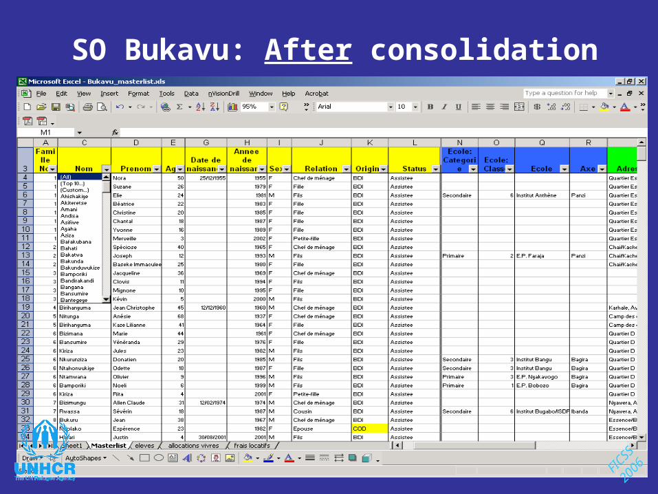
SO Bukavu: After consolidation
FICSS 20
06
FICSS 20
06

FICSS 20
06
Responsibilities (3): Geographic Information Systems (GIS)
• Support missions
• Develop tools in support of registration
• Facilitate Camp Coordination / Camp Management
• Disseminate specialist information
• Participate in publications
• Coordinate networks ofdata exchange


FICSS 20
06
Responsibilities (4):Camp Coordination / Management
• Refine concept
• Set and disseminate standards and best practices
• Develop common language
• Create a network of NGOs, people and data
• Support Operations
• Develop linkages with other IDP clusters
• Tool development

FICSS 20
06
Data Integration
UNHCR’sGeographic Information Systems
Registration
Statistics andData Management
•Setting standards
•Tools and guidelines •Field support / capacity building•Data compilation, verificationand analysis
Camp Coordinationand Management
•Provision of specialized services•Dissemination / Publication •Networking / Partnerships
Web-GIS
Inter-Agency Networks
CAMP MAPPING AT UNHCR

The case of Lugufu I and II, Tanzania
• Use Satellite imagery, GPS points, and information from our partners to map Lugufu
• Develop a set of best practices for using satellite imagery
• Link existing ProGres/registration data to GIS• Develop a capacity and system for continually
updating the maps and databases

Lugufu I and II
• Population 60 000 in Lugufu I;35 000 in Lugufu II.
• Refugees of Congolese nationality (DRC).
• Implementing partners- Tanzanian Red Cross- World Vision- Care International

Facts - Camp structure
The structure in Lugufu I is• Village (32) – admin 1• Block (768) – admin 2• Plot (approximately 18 250) – admin
3
The structure in Lugufu II is• Zone (7) – admin 1• Cluster (60) – admin 1*• Block (approximately 360) – admin 2• Plot (approximately 6 500) – admin 3
In total approximately 25 000 plots!

Available data
1. QuickBird satellite image from July 2003 (0.6 m resolution).

Available data
2. World Vision sketches of camp layout.
3. Well organized address system.

Available data
4. Sectoral Data:
• Water– Tanzanian Red Cross hand-
drawn water map.– GPS measurements of many
water points, not in standard system WGS 84.
• Education– Data about schools in Excel.

Mapping of Basic Structures
• Digitize the administrative structure of the camp.
+ =

Mapping of Basic Structures
• Digitize the road network of the camp.

Water Sector

Education, Health, Security, Environment, etc.
– Traveled in camp with the Implementing partner for each sector to identify each facility in their sector as well as collect attribute information.
– Facilities were digitized using the satellite image or with GPS points collected in the field.
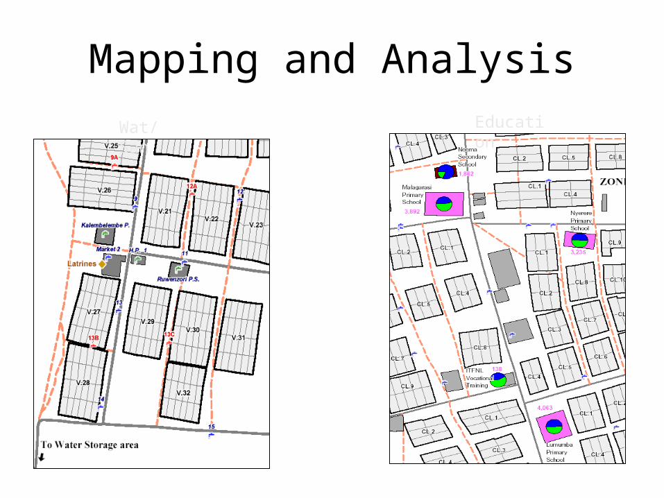
Mapping and Analysis
Wat/San
Education
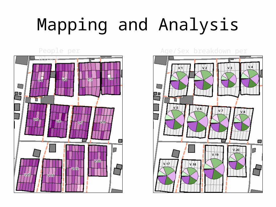
Mapping and AnalysisPeople per Block
Age/Sex breakdown per Village
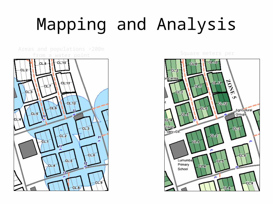
Mapping and AnalysisAreas and populations >200m
from a water point Square meters per person
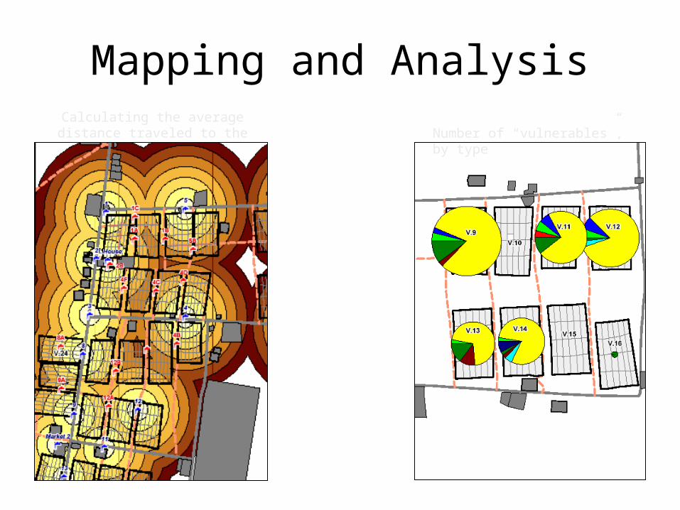
Mapping and AnalysisCalculating the average distance traveled to the nearest water tap Number of “vulnerables”, by
type

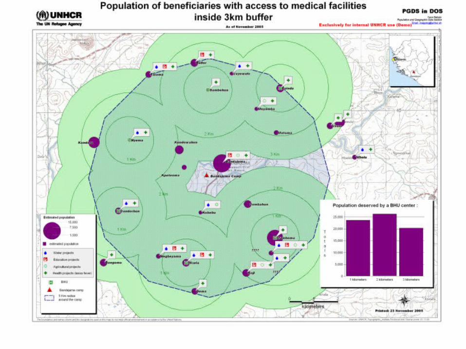
Broadening camp management to local environment: case of Sierrra Leone
• Local impacts of camp activities?
• Where are located the projects?
• What is the accuracy of the information?
• What is the level of achievement of projects?
• Who are the beneficiaries?
• Which area is the covered by the projects?
• Need for others actions?


FICSS 20
06
Opportunities for Partnerships• Tools and guidelines
• Camp mapping, remote sensing data interpretation, data management, camp coordination software
• Field support / capacity building• Telecommunication, regional GIS and Data Management Officers
(secondment or others)
• Provision of specialized services• Networking tools, site planning, urban locations mapping,
resources for durable solutions
• Dissemination / Publication• Translation of registration database, map atlas for decision-makers
• Networking / Partnerships• Infrastructure, capacity building, network support and
development costs