Embed Size (px)
Citation preview

Federal Oil and Gas Accessibility of the
United StatesPresented by Richard L. Watson
Senior Physical Scientist
USDI - BLM Washington Office
Division of Fluid Minerals
Presented to the 2008 ESRI International User Conference
San Diego, California
August 5, 2008

The EPCA Inventory
• What is the EPCA Inventory?• Phase III Inventory
– Study Area Delineation– Spatial Data Needs– GIS Methodology– Results– Additional GIS Analytical Techniques
• Lessons Learned• Conclusion

Legislative MandateEnergy Policy and Conservation Act (EPCA) of
2000, Sec. 604
As amended by the Energy Policy Act of 2005, Sec. 347
Requires Interior (lead delegated to BLM), to consult with Agriculture (USFS) and Energy, to conduct an inventory of onshore Federal lands identifying the USGS estimate of the oil and gas resources and any “restrictions or impediments” (constraints) to their development.
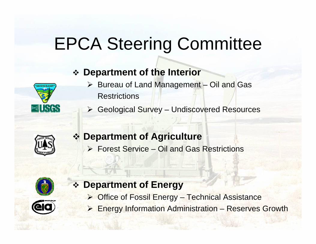
EPCA Steering CommitteeDepartment of the Interior
Bureau of Land Management – Oil and Gas Restrictions
Geological Survey – Undiscovered Resources
Department of AgricultureForest Service – Oil and Gas Restrictions
Department of EnergyOffice of Fossil Energy – Technical AssistanceEnergy Information Administration – Reserves Growth

Contractors
Advanced Resources International
(now Enegis, LLC)Arlington, VA
Premier Data ServicesEnglewood, CO
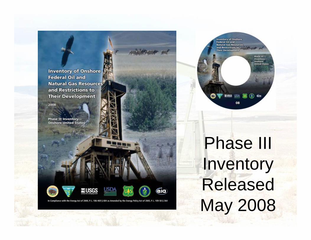
Phase III Inventory Released May 2008

EPCA Phase III Study Areas

Spatial Data Needs
• Layer
– Onshore Federal Mineral (Oil & Gas) Ownership
– Undiscovered Resources and Reserves Growth
– Oil & Gas Lease Stipulations
• Source
– BLM
– USGS/EIA
– BLM/USFS

Southwestern Wyoming Federal Lands

USGS Undiscovered Technically Recoverable Resources
Oil Natural Gas

Northern Alaska ResourcesOil: 25.5 BBbl Natural Gas: 79.6
Tcf
All Lands

Distribution of Total Federal Onshore Hydrocarbon Endowment by Type and
Resource Category

Stipulations (Constraints)
Complex Overlapping Polygons

Accessibility CategoriesDeveloped from Land Use Plans and NEPA Documents
{{
Inac
cess
ible
(No
Leas
ing)
Ava
ilabl
e w
ithR
estr
ictio
ns
Available »

Spatial Union
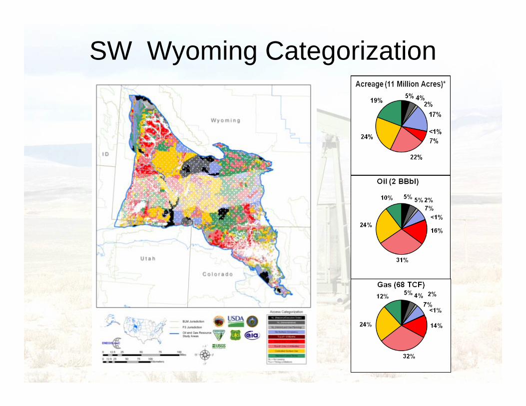
SW Wyoming Categorization

Phase III Aggregate Results
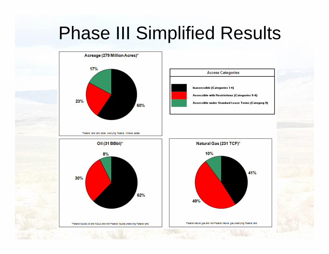
Phase III Simplified Results

Top Five Study Areas
NAK – Northern Alaska
PDX – Paradox Basin
UPB – Uinta-Piceance Basin
PDR – Powder River Basin
SWW – Southwestern Wyoming
EBG – Eastern Great Basin
SJB – San Juan Basin
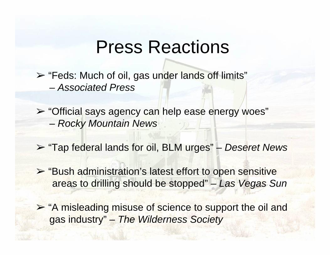
Press Reactions➢ “Feds: Much of oil, gas under lands off limits”
– Associated Press
➢ “Official says agency can help ease energy woes”– Rocky Mountain News
➢ “Tap federal lands for oil, BLM urges” – Deseret News
➢ “Bush administration’s latest effort to open sensitiveareas to drilling should be stopped” – Las Vegas Sun
➢ “A misleading misuse of science to support the oil andgas industry” – The Wilderness Society
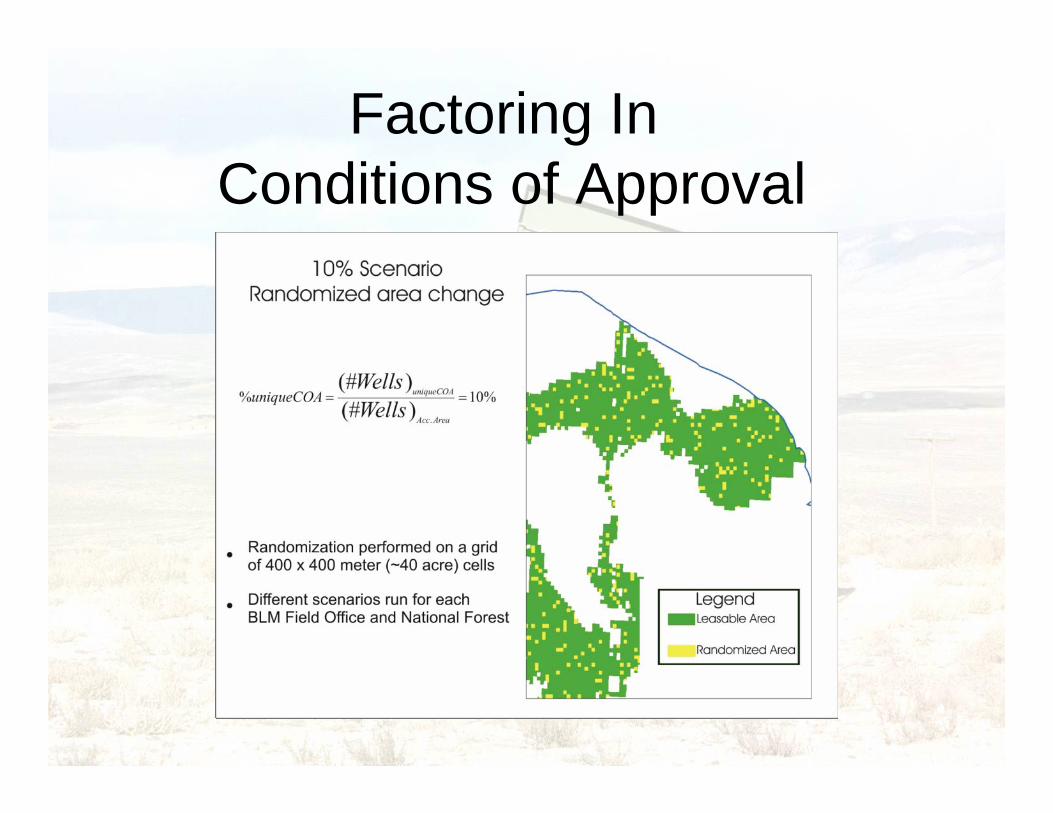
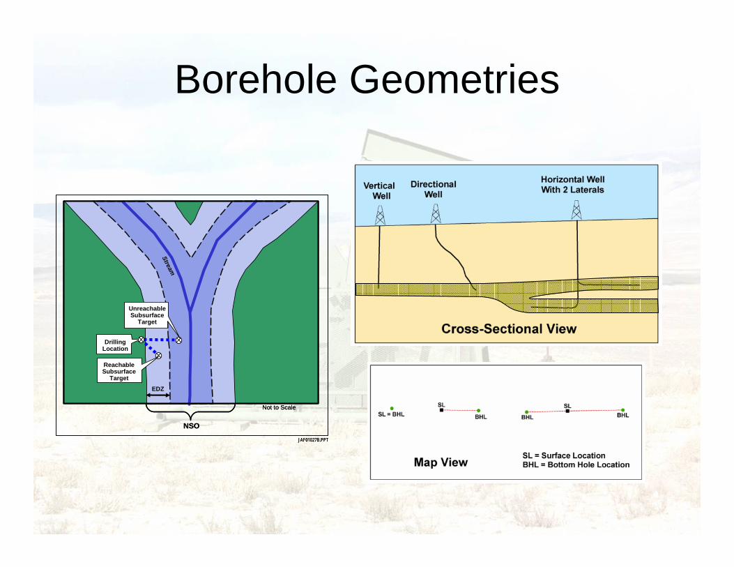
Factoring In Conditions of Approval

EDZ
DrillingLocation
UnreachableSubsurface
Target
Stream
NSO
ReachableSubsurface
Target
JAF01027B.PPT
Not to Scale
EDZ
DrillingLocation
UnreachableSubsurface
Target
Stream
NSO
ReachableSubsurface
Target
JAF01027B.PPT
Not to Scale
Factoring In the Extended Drilling Zone (EDZ)
EDZ
DrillingLocation
UnreachableSubsurface
Target
Stream
NSO
ReachableSubsurface
Target
JAF01027B.PPT
Not to Scale
EDZ
DrillingLocation
UnreachableSubsurface
Target
Stream
NSO
ReachableSubsurface
Target
JAF01027B.PPT
Not to Scale
Borehole Geometries

Buffer Technique for Three Borehole Geometries
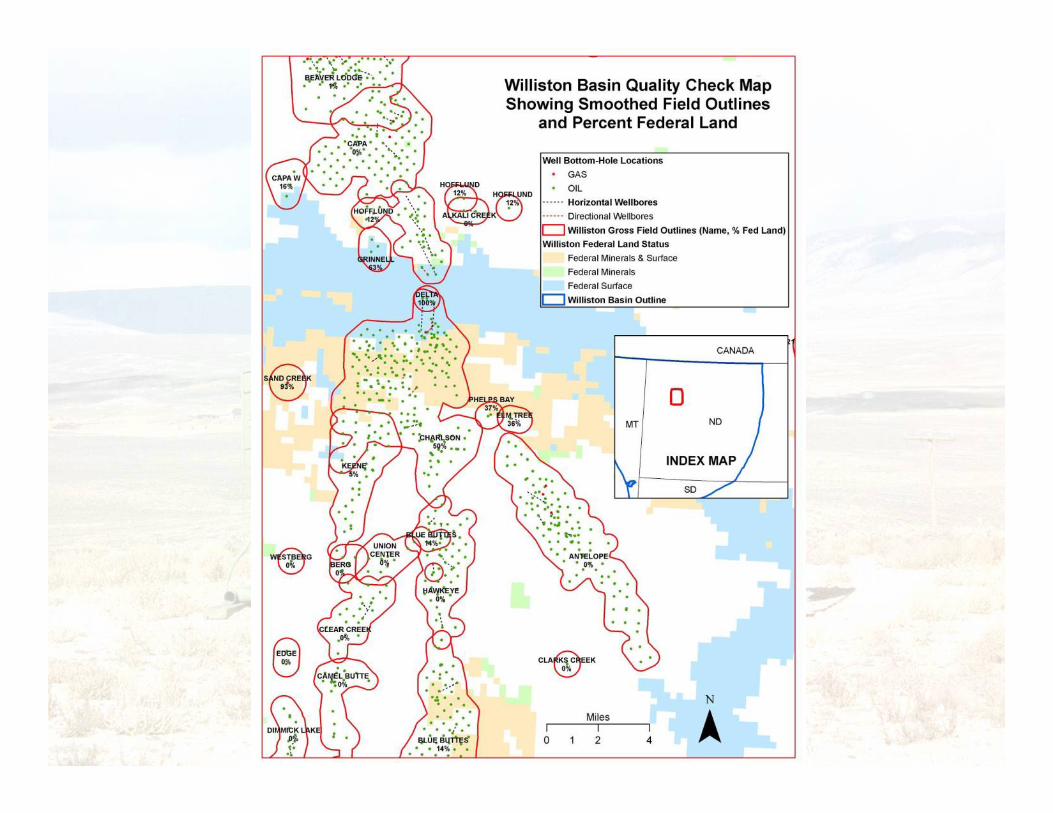
Oil and Gas Field Delineation


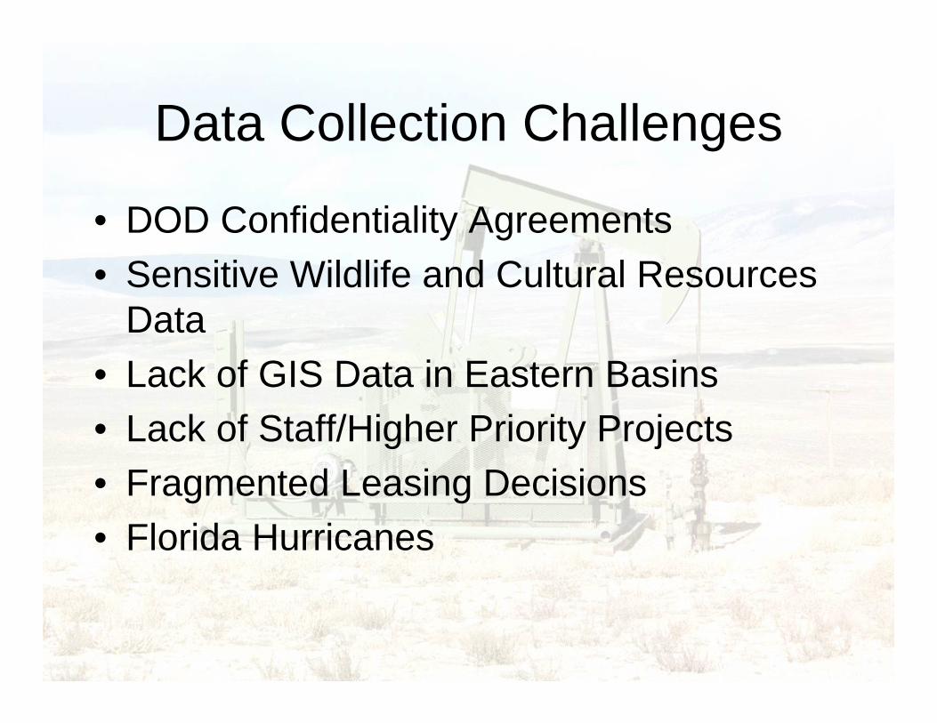
Data Collection Challenges
• DOD Confidentiality Agreements• Sensitive Wildlife and Cultural Resources
Data• Lack of GIS Data in Eastern Basins• Lack of Staff/Higher Priority Projects• Fragmented Leasing Decisions• Florida Hurricanes

Conclusion• EPCA Phase III inventoried 279 million acres of
Federal land
• 60 % of the oil resources are inaccessible
• 41% of the natural gas resources are inaccessible
• We couldn’t have done this without GIS!

EPCA on the Web
www.blm.gov
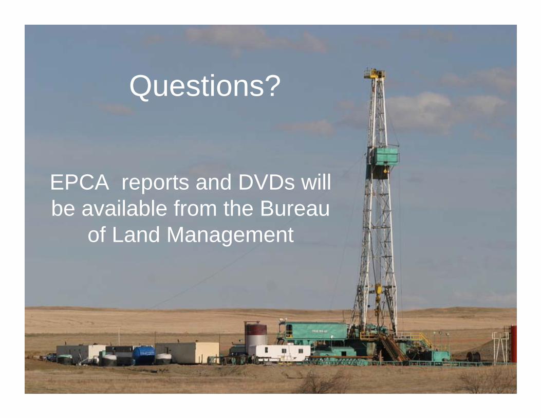
Questions?
EPCA reports and DVDs will be available from the Bureau
of Land Management

For more information contact:
Richard L. WatsonSenior Physical Scientist
USDI-Bureau of Land ManagementDivision of Fluid Minerals - WO-310
1620 L Street NWWashington, DC 20036
(202) 785-6595


![UNIFORM FEDERAL ACCESSIBILITY STANDARDS · 2013-03-11 · governing standards for Postal facility accessibility. Handbook RE-4 may be further amended.] 1. PURPOSE. This document sets](https://img.pdfslide.us/doc/110x75/5f870c217f0ee66e7217acb1/uniform-federal-accessibility-2013-03-11-governing-standards-for-postal-facility.jpg)