Embed Size (px)
Citation preview
On behalf of Aberdeen City Council
Project Ref: 45816/001 | Rev: AA | Date: January 2021
Registered Office: Buckingham Court Kingsmead Business Park, London Road, High Wycombe, Buckinghamshire, HP11 1JU Office Address: 3rd Floor, Randolph House, 4 Charlotte Lane, Edinburgh EH2 4QZ T: +44 (0)131 297 7010 E: [email protected]
External Transportation Links to Aberdeen South Harbour
STAG Detailed Options Appraisal Report
STAG Detailed Options Appraisal
External Transportation Links to Aberdeen South Harbour
ii
Document Control Sheet
Project Name: External Transportation Links to Aberdeen South Harbour
Project Ref: 45816
Report Title: STAG Detailed Options Appraisal Report
Doc Ref: Draft
Date: 20th January 2021
Name Position Signature Date
Prepared by: Emily Seaman
Emma Schneider
Associate Transport Planner
Principal Transport Economist
ES
ESch
Reviewed by: Emily Seaman
Scott Leitham
Associate Transport Planner
Director of Transport Planning
ES
SL
Approved by: Scott Leitham Director of Transport Planning SL
For and on behalf of Stantec UK Limited
Revision Date Description Prepared Reviewed Approved
1 02/11//20 Draft ES/ESch ES/SL SL
2 20/01/21 Revised Draft ES/ESch ES/SL SL
This report has been prepared by Stantec UK Limited (‘Stantec’) on behalf of its client to whom this report is addressed (‘Client’) in connection with the project described in this report and takes into account the Client's particular instructions and requirements. This report was prepared in accordance with the professional services appointment under which Stantec was appointed by its Client. This report is not intended for and should not be relied on by any third party (i.e. parties other than the Client). Stantec accepts no duty or responsibility (including in negligence) to any party other than the Client and disclaims all liability of any nature whatsoever to any such party in respect of this report.
STAG Detailed Options Appraisal
External Transportation Links to Aberdeen South Harbour
iii
Contents
Executive Summary .............................................................................................................................. 1
1 Introduction ............................................................................................................................. 22
1.2 An Evolution of the Focus: Energy Transition Zone .................................................... 23
1.3 Energy Transition Zone Background ........................................................................... 23
1.4 Wellington Road Multi-Modal Corridor Study .............................................................. 25
2 Smartening the Transport Planning Objectives .................................................................. 26
2.1 Introduction .................................................................................................................. 26
2.2 Smartening the Objectives .......................................................................................... 26
3 Revising the Options .............................................................................................................. 29
3.1 Options recommended from the Preliminary Options Appraisal ................................. 29
3.2 Revising the Options ................................................................................................... 32
3.3 Road Options ............................................................................................................... 32
3.4 Public Transport Options ............................................................................................. 32
3.5 Active Travel Options .................................................................................................. 22
3.6 Final Options for Detailed Options Appraisal .............................................................. 24
4 Detailed Options Appraisal: Geographical, Social and Economic Context ..................... 26
4.1 Geographical Context .................................................................................................. 26
4.2 Social Context ............................................................................................................. 26
4.3 Economic Context ....................................................................................................... 27
5 Detailed Options Appraisal: Aberdeen South Harbour and Energy Transition Zone - Scenario Development ........................................................................................................... 29
5.1 Introduction .................................................................................................................. 29
5.2 Aberdeen South Harbour – Traffic Generation ........................................................... 29
5.3 Energy Transition Zone - Traffic Generation ............................................................... 30
6 Detailed Options Appraisal: Traffic Modelling .................................................................... 33
6.1 Introduction .................................................................................................................. 33
6.2 Model Network ............................................................................................................. 33
6.3 Model Audit .................................................................................................................. 34
6.4 Further Base Model Development ............................................................................... 35
6.5 Do Minimum Model...................................................................................................... 35
6.6 Traffic Scenario Modelling ........................................................................................... 36
7 Detailed Options Appraisal: Appraisal against the Transport Planning Objectives ....... 37
7.1 Transport Planning Objectives .................................................................................... 37
7.2 Appraisal against the TPOs: Methodology .................................................................. 37
7.3 Appraisal Against the TPOs ........................................................................................ 39
8 Detailed Options Appraisal: Implementability ..................................................................... 57
8.1 Technical Feasibility .................................................................................................... 57
8.2 Operational Feasibility ................................................................................................. 62
STAG Detailed Options Appraisal
External Transportation Links to Aberdeen South Harbour
iv
9 Detailed Options Appraisal: STAG Criteria ......................................................................... 67
9.1 Introduction .................................................................................................................. 67
9.2 Environment Appraisal ................................................................................................ 67
9.3 Safety 81
9.4 Economy ...................................................................................................................... 84
9.5 Integration .................................................................................................................... 90
9.6 Accessibility and Social Inclusion ................................................................................ 95
10 Cost to Government ............................................................................................................. 101
10.1 Introduction ................................................................................................................ 101
10.2 Road Options ............................................................................................................. 101
10.3 Public Transport Operation Cost and Passenger Demand Estimates ...................... 104
10.4 Active Travel Cost Estimates .................................................................................... 108
11 Engagement .......................................................................................................................... 113
11.1 Overview .................................................................................................................... 113
11.2 All Option Overview ................................................................................................... 113
11.3 Option Summary ........................................................................................................ 114
12 Risk Register ......................................................................................................................... 117
13 Summary ............................................................................................................................... 127
Figures
Energy Transition Zone and Aberdeen South Harbour Locations .......................................................... 3 Road Option for Detailed Appraisal ......................................................................................................... 6 Public Transport Options for Detailed Appraisal ..................................................................................... 7 Active Travel Options for Detailed Appraisal ........................................................................................... 7 Figure 1:1: Approximate Energy Transition Zone and Aberdeen South Harbour Locations ................. 24 Figure 3:1: Road Options Recommended from Preliminary Options Appraisal .................................... 30 Figure 3:2: Public Transport Options Recommended from Preliminary Options Appraisal .................. 31 Figure 3:3: Active Travel Options Recommended from Preliminary Options Appraisal ....................... 31 Figure 3:4: Revised Public Transport Option B1 ................................................................................... 33 Figure 3:5: Public Transport Option B2 ................................................................................................. 20 Figure 3:6: Public Transport Option B4 ................................................................................................. 21 Figure 3:7: Public Transport Option B5 ................................................................................................. 22 Figure 3:8: Revised Active Travel Option C1 ........................................................................................ 23 Figure 3:9: New Active Travel Option C4 .............................................................................................. 24 Figure 4:1: SIMD 2020 .......................................................................................................................... 27 Figure 6:1: Base Traffic Model Network ................................................................................................ 34 Figure 10:1: Option C1 – Costed option route..................................................................................... 109 Figure 10:2: Option C1 – 5m segregated cycleway (3m) and pedestrian footway (2m) ..................... 109 Figure 10:3: Option C1 – 3m shared use path .................................................................................... 110 Figure 10:4: Option C4 – Tiered cycleway .......................................................................................... 111 Figure 11:1: Overview of the Responses from Public Engagement ................................................... 114 Figure A:1: Option A2a ........................................................................................................................ 136 Figure A:2: Option A2b ........................................................................................................................ 137 Figure A:3: Option A3a ........................................................................................................................ 138 Figure A:4: Option A3b ........................................................................................................................ 139 Figure A:5: Option A4 .......................................................................................................................... 140 Figure A:6: Option A5 .......................................................................................................................... 141
STAG Detailed Options Appraisal
External Transportation Links to Aberdeen South Harbour
v
Figure B:1: Tonnage by Quay Length at Comparator Ports ................................................................ 143 Figure C:1: Modelled ‘Ghost Links’ ..................................................................................................... 160 Figure C:2: Option A2a modelled network .......................................................................................... 162 Figure C:3: Option A2b modelled network .......................................................................................... 163 Figure C:4: Option A3a modelled network .......................................................................................... 165 Figure C:5: Option A3b modelled network .......................................................................................... 166 Figure C:6: Option A4 modelled network ............................................................................................ 167 Figure C:7: Option A5 modelled network ............................................................................................ 169 Figure F:1: Environmental Designations within the Study Area .......................................................... 201 Figure J:1: Option A2a – Percentage Split of Responses ................................................................... 222 Figure J:2: Option A2b – Percentage Split of Responses ................................................................... 223 Figure J:3: Option A3a – Percentage Split of Responses ................................................................... 224 Figure J:4: Option A3b – Percentage Split of Responses ................................................................... 225 Figure J:5: Option A4 – Percentage Split of Responses ..................................................................... 226 Figure J:6: Option A5 – Percentage Split of Responses ..................................................................... 227 Figure J:7: Option B1 – Percentage Split of Responses ..................................................................... 229 Figure J:8: Option B2 – Percentage Split of Responses ..................................................................... 230 Figure J:9: Option B4 – Percentage Split of Responses ..................................................................... 231 Figure J:10: Option B5 – Percentage Split of Responses ................................................................... 232 Figure J:11: Option C1 – Percentage Split of Responses ................................................................... 233 Figure J:12: Option C4 – Percentage Split of Responses ................................................................... 234 Figure K:1: Option A3a/b variant – Plan View ..................................................................................... 236 Figure K:2: Option A3a/b variant – Coast Road View ......................................................................... 237
Tables
Revised Transport Planning Objectives .................................................................................................. 5 Final options for Detailed Options Appraisal ........................................................................................... 5 Key Risks and Uncertainty .................................................................................................................... 20 Table 2:1: Revising the Transport Planning Objectives ........................................................................ 26 Table 2:2: Final Detailed Options Appraisal Transport Planning Objectives ........................................ 27 Table 3:1: Options recommended for further appraisal at Detailed Options Appraisal stage ............... 29 Table 3:2: Final options for Detailed Options Appraisal ........................................................................ 24 Table 5:1: Aberdeen South Harbour – Daily Trip Generation – Core Scenario .................................... 29 Table 5:2: Aberdeen South Harbour – Daily Trip Generation – High Scenario .................................... 30 Table 5:3: Energy Transition Zone – Daily Trip Generation – Core Scenario ....................................... 31 Table 5:4: Energy Transition Zone – Daily Trip Generation – High Scenario ....................................... 32 Table 7:1: Appraisal against the Transport Planning Objectives – Summary ....................................... 39 Table 7:2: Appraisal against the Transport Planning Objectives – Road Options ................................ 41 Table 7:3: Appraisal against the Transport Planning Objectives – Public Transport Options .............. 50 Table 7:4: Appraisal against the Transport Planning Objectives – Active Travel Options .................... 54 Table 8:1: Technical Feasibility ............................................................................................................. 57 Table 8:2: Operational Feasibility .......................................................................................................... 63 Table 9:1: Appraisal against the STAG Environmental Criteria – STAG Scoring ................................. 68 Table 9:2: Appraisal against the STAG Environmental Criteria ............................................................ 69 Table 9:3: Appraisal against the STAG Safety Criteria – STAG Scoring .............................................. 81 Table 9:4: Appraisal against the STAG Safety Criteria ......................................................................... 82 Table 9:5: Estimated Average Potential Journey Time Saving – Public Transport Options ................. 85 Table 9:6: Appraisal against the STAG Economy Criteria – STAG Scoring ......................................... 85 Table 9:7: Appraisal against the STAG Economy Criteria .................................................................... 86 Table 9:8: Appraisal against the STAG Integration Criteria – STAG Scoring ....................................... 90 Table 9:9: Appraisal against the STAG Integration Criteria .................................................................. 91 Table 9:10: Appraisal against the STAG Accessibility and Social Inclusion Criteria – STAG Scoring . 96 Table 9:11: Appraisal against the STAG Accessibility and Social Inclusion Criteria ............................ 96 Table 10:1 Construction Cost Estimates ............................................................................................. 101
STAG Detailed Options Appraisal
External Transportation Links to Aberdeen South Harbour
vi
Table 10:2: All Road Options – Monetised Economic Summary (includes TEE, carbon and accident benefits) 103 Table 10:3: Public Transport Options – Operating Cost ..................................................................... 105 Table 10:4: Public Transport Cost, Revenue and Subsidies ............................................................... 106 Table 10:5: Key Features of Regulatory Operating Models ................................................................ 106 Table 10:6: Indicative Annual Costs of Service Options ..................................................................... 107 Table 10:7: Break-even Analysis (Assumes Service is Registered as a Local Bus Service) ............. 108 Table 10:8: Option C1 Cost Estimate (to nearest £500) ..................................................................... 110 Table 10:9: Option C4 Cost Estimate (to nearest £500) ..................................................................... 111 Table 12:1: Risk and Uncertainty ........................................................................................................ 118 Table 13:1: Appraisal Summary .......................................................................................................... 128 Table 13:2: Option key Advantages and Disadvantages .................................................................... 130 Table B:1: Comparator Ports Cargo Tonnage..................................................................................... 142 Table B:2: Comparator Ports Quay Lengths ....................................................................................... 142 Table B:3: Estimated ASH Cargo Tonnage (Core Scenario) .............................................................. 144 Table B:4: Estimated Vehicle Capacities by Cargo Type .................................................................... 144 Table B:5: Aberdeen South Harbour – Daily Trip Generation ............................................................. 145 Table B:8: SGPH Staff Numbers and Shifts ........................................................................................ 147 Table B:9: SGPH Daily Trip Generation by Phase .............................................................................. 148 Table B:10: SGPH & proposed ETZ Daily Staff and Trip Volumes by Phase ..................................... 149 Table B:11: proposed ETZ Weekday Trip Generation – Opening Phase ........................................... 149 Table B:12: proposed ETZ Trip Distribution ........................................................................................ 150 Table C:1: Stationfields Trip Generation ............................................................................................. 155 Table C:2: Loirston Trip Generation .................................................................................................... 155 Table C:3: Altens East and Peterseat Trip Generation ....................................................................... 156 Table C:4: EfW Trip Generation .......................................................................................................... 157 Table C:5: EfW Trip Distribution .......................................................................................................... 158 Table C:6: 2041 High scenario with 10% background growth – AM Traffic Flows ............................. 171 Table C:7: 2041 High scenario with 10% background growth – IP Traffic Flows ............................... 172 Table C:8: 2041 High scenario with 10% background growth – PM Traffic Flows ............................. 173 Table D:1: HGV Journey Times – Charleston junction to/from Harbour / proposed ETZ site - 2026 - Core Scenario ...................................................................................................................................... 179 Table D:2: HGV Journey Times – Charleston junction to/from Harbour / proposed ETZ site - 2026 – High Scenario ...................................................................................................................................... 179 Table D:3: HGV Journey Times – Charleston junction to/from Harbour / proposed ETZ site - 2026 – High Scenario with 10% background growth....................................................................................... 180 Table D.4: HGV Journey Times – King George VI Bridge to/from Harbour / proposed ETZ site - 2026 – Core Scenario ...................................................................................................................................... 180 Table D:5: HGV Journey Times – King George VI Bridge to/from Harbour / proposed ETZ site - 2026 – High Scenario ...................................................................................................................................... 181 Table D:6: HGV Journey Times – King George VI Bridge to/from Harbour / proposed ETZ site - 2026 – High Scenario with 10% background growth....................................................................................... 181 Table D:7: HGV Journey Times – Charleston junction to/from Harbour / proposed ETZ site – 2041 - Core Scenario ...................................................................................................................................... 182 Table D:8: HGV Journey Times – Charleston junction to/from Harbour / proposed ETZ site – 2041 – High Scenario ...................................................................................................................................... 182 Table D:9: HGV Journey Times – Charleston junction to/from Harbour / proposed ETZ site – 2041 – High Scenario with 10% background growth....................................................................................... 183 Table D:10: HGV Journey Times – King George VI Bridge to/from Harbour / proposed ETZ site – 2041 – Core Scenario ................................................................................................................................... 183 Table D:11: HGV Journey Times – King George VI Bridge to/from Harbour / proposed ETZ site – 2041 – High Scenario ................................................................................................................................... 184 Table D:12: HGV Journey Times – King George VI Bridge to/from Harbour / proposed ETZ site – 2041 – High Scenario with 10% background growth.................................................................................... 184 Table D:13:Traffic Impact – 2041 – High Scenario +10% background growth – Overall Property Impact Indicator ........................................................................................................................................ 185 Table D:14: HGV Traffic Impact – 2041 – High Scenario +10% background growth –– AM .............. 187 Table D:15: HGV Traffic Impact – 2041 – High Scenario +10% background growth – IP .................. 188
STAG Detailed Options Appraisal
External Transportation Links to Aberdeen South Harbour
vii
Table D:16: HGV Traffic Impact – 2041 – High Scenario +10% background growth – PM ................ 189 Table D:17: Hansen Indicator – Road Options.................................................................................... 192 Table D:18: Hansen Indicator – Public Transport Options .................................................................. 193 Table E:1: Existing services operating in the Aberdeen South Harbour / proposed ETZ area ........... 195 Table E:2: Options for Existing Services to Serve proposed ETZ ....................................................... 195 Table E:3: Resource Requirements for Extending Existing Services to Harbour / proposed ETZ ..... 196 Table E:4: Cruise Ship Indicative Timetable ...................................................................................... 198 Table E:5: Option B4 Indicative Timetable ......................................................................................... 199 Table E:6: Option B5 Indicative Timetable ......................................................................................... 200 Table F:1: Burnbanks Village Noise Assessment – Traffic Flows on Coast Road (Do Minimum vs. Option A5) ........................................................................................................................................ 204 Table F:2: Monetised Carbon Emissions Benefits (positive figures indicate a saving) ....................... 205 Table G:1: COBALT Accident Analysis ............................................................................................... 209 Table H:1: Option A2a – Transport Economic Efficiency .................................................................... 212 Table H2: Option A2b – Transport Economic Efficiency ..................................................................... 213 Table H:3: Option A3a – Transport Economic Efficiency .................................................................... 214 Table H:4: Option A3b – Transport Economic Efficiency .................................................................... 215 Table H:5: Option A4 – Transport Economic Efficiency ...................................................................... 216 Table H:6: Option A5 – Transport Economic Efficiency ...................................................................... 217
Appendices
Appendix A Final Road Options for Detailed Options Appraisal
Appendix B Aberdeen South Harbour and Energy Transition Zone Scenario Development
Appendix C Traffic Modelling
Appendix D Transport Planning Objectives Appraisal
Appendix E Public Transport Operational Implementability Appraisal
Appendix F STAG Environmental Appraisal
Appendix G STAG Safety Appraisal
Appendix H STAG Economy Appraisal
Appendix I STAG Integration Appraisal
Appendix J Engagement
Appendix K Option A3a/b extension (East Tullos to Coast Road link)
STAG Detailed Options Appraisal
External Transportation Links to Aberdeen South Harbour
1
Executive Summary
Background
The External Transportation Links to Aberdeen South Harbour Study was originally commissioned in 2017 by Aberdeen City Council with the aim of examining transport connectivity to / from the new Aberdeen South Harbour at the Bay of Nigg, and to identify appropriate transport improvements which would then be taken forward for detailed appraisal. The study is an Aberdeen City Region Deal project, fully funded by the Scottish and United Kingdom Governments and has been undertaken in line with the Scottish Transport Appraisal Guidance (STAG).
The City Region Deal Agreement recognises the importance of the new harbour in accommodating existing and future demands on the port, noting that the project has national and regional significance. The City Region Deal Agreement states that ‘both the UK Government and the Scottish Government commit to maximising the impact of the harbour expansion on the wider regional economy’. The study therefore seeks to develop transport interventions which can maximise the wider regional economic benefits of the harbour development.
In 2018, after completion of the initial study which covered the ‘Initial Appraisal: Case for Change’ and ‘Preliminary Options Appraisal’ stages of STAG, Aberdeen City Council commissioned the subsequent stage of STAG, the ‘Detailed Options Appraisal’. Both the initial and subsequent stages of the study have been led by Stantec (formerly Peter Brett Associates).
While the initial study focus was on connectivity to the new harbour, this focus has widened as the study has progressed (as discussed below). Throughout the study, cognisance has been taken of the potential wider economic benefit the new harbour can bring to the region. The study fully recognises that improved connectivity to the harbour, and the industrial areas located nearby, can act as a key driver in improving the region’s attractiveness for international trade and investment, and can support businesses in the oil, gas, and renewable energy supply chain to internationalise in key global markets. This will help address the economic challenges facing the region and capitalise on available opportunities. Aberdeen South Harbour
Aberdeen South Harbour (ASH) is located at the Bay of Nigg, approximately 0.8km to the south east of Aberdeen city centre and the existing Aberdeen Harbour. The development is being taken forward in response to constraints at the existing harbour and is an expansion of activities aimed at capitalising on new and emerging markets as the harbour will be able to accommodate larger vessels. Once complete, the new harbour will provide:
1,400m of quay at water depths of up to 10.5m;
a turning circle of 300 metres;
a channel width of 165m;
a laydown area of 125,000 m2; and
heavy lift capacity.
The main access to the new harbour will be located close to the existing Coast Road / St. Fitticks Road / Greyhope Road junction. The site will include two single storey welfare / administration buildings, a car park, and a bus turning circle and it is anticipated that 20-25 harbour staff will be based at the site.
A Transport Assessment was produced in 2015. This concluded that the traffic generated by the harbour could be accommodated by existing transport infrastructure and therefore no junction
STAG Detailed Options Appraisal
External Transportation Links to Aberdeen South Harbour
2
improvements or significant additional road infrastructure were required upon opening. In 2016, Aberdeen City Council approved the Bay of Nigg Development Framework1. This covers the new harbour development site and the surrounding hinterland area, including Altens and East Tullos, and was developed with the aim of maximising the opportunities presented by the new harbour. The Development Framework identifies a series of infrastructure interventions or gateways where significant investment in external road infrastructure is required to realise the potential of the area. These included upgrading the road network in and around Altens and providing a direct link from the Bay of Nigg to East Tullos.
The Transport Assessment and the Bay of Nigg Development Framework formed an important starting point for this study and the analysis and outputs were used to inform both the baselining and subsequent option generation process.
Case for Change and Preliminary Options Appraisal
The initial stage of the study, the development of the Case for Change, considered the problems, opportunities, issues, and constraints for the study, set Transport Planning Objectives, and developed and sifted a list of multi-modal transport options which sought to improve connectivity to the new harbour. In the Preliminary Options Appraisal, these options were then appraised, against the objectives, the STAG appraisal criteria (Environment, Economy, Safety, Accessibility & Social Inclusion, and Integration), and against Implementability criteria (Feasibility, Affordability and Public Acceptability). Options were then rejected or selected for further development and more detailed appraisal in the Detailed Options Appraisal. This Detailed Options Appraisal is the focus of this report. Full details of the Case for Change and Preliminary Options Appraisal can be found in the report, External Transport Links to Nigg Bay - Pre and Part 1 Appraisal Report - v3.0, Peter Brett Associates (now part of Stantec), October 2018.
An Evolution of the Focus
As noted above, the initial scope of the study was to examine transport connectivity for the new Aberdeen South Harbour. As such, the options developed and appraised at the initial study stages, were developed with this aim in mind. However, in March 2020 Aberdeen City Council published their Proposed 2020 Local Development Plan (‘Proposed Plan’) which set out new proposed land use changes in the area in the immediate vicinity of the harbour.
Changes to the oil and gas sector in recent years means the energy industry is having to adapt and evolve and consider the potential for new sustainable and low/zero carbon energy resources. A 70-acre site (split between two areas) has been identified close to the new harbour, which includes green space and the existing East Tullos industrial estate. The area has been earmarked in the Proposed Plan and described as the city’s first ‘Energy Transition Zone’ (proposed ETZ). Under the proposals, the land would be set aside for the development of low or zero-carbon or renewable energy industries, with businesses focussing on wind, biomass, solar and tidal sectors. It would also see the creation of a hydrogen production plant and a shoreside energy hub.
The location identified for the proposed ETZ seeks to maximise development opportunities with the proximity of the harbour a key enabler in the development and success of the zone. Access to the harbour is key to encouraging and supporting the delivery of low carbon energy and technologies, and alternative fuel production at the site, to facilitate the transition from oil and gas to green energy production.
In June 2020, the Scottish Government announced £62m in funding to support the oil and gas sector, focussed on north-east Scotland, to help the industry deal with the dual economic impacts of the COVID-19 pandemic and the suppressed oil prices. The funding will go towards several projects, including the proposed ETZ.
1 https://www.gov.scot/binaries/content/documents/govscot/publications/factsheet/2018/06/aberdeen-city-council-planning-authority-core-documents/documents/bay-nigg-development-framework-pdf/bay-nigg-development-framework-pdf/govscot%3Adocument/Bay%2Bof%2BNigg%2BDevelopment%2BFramework.pdf
STAG Detailed Options Appraisal
External Transportation Links to Aberdeen South Harbour
3
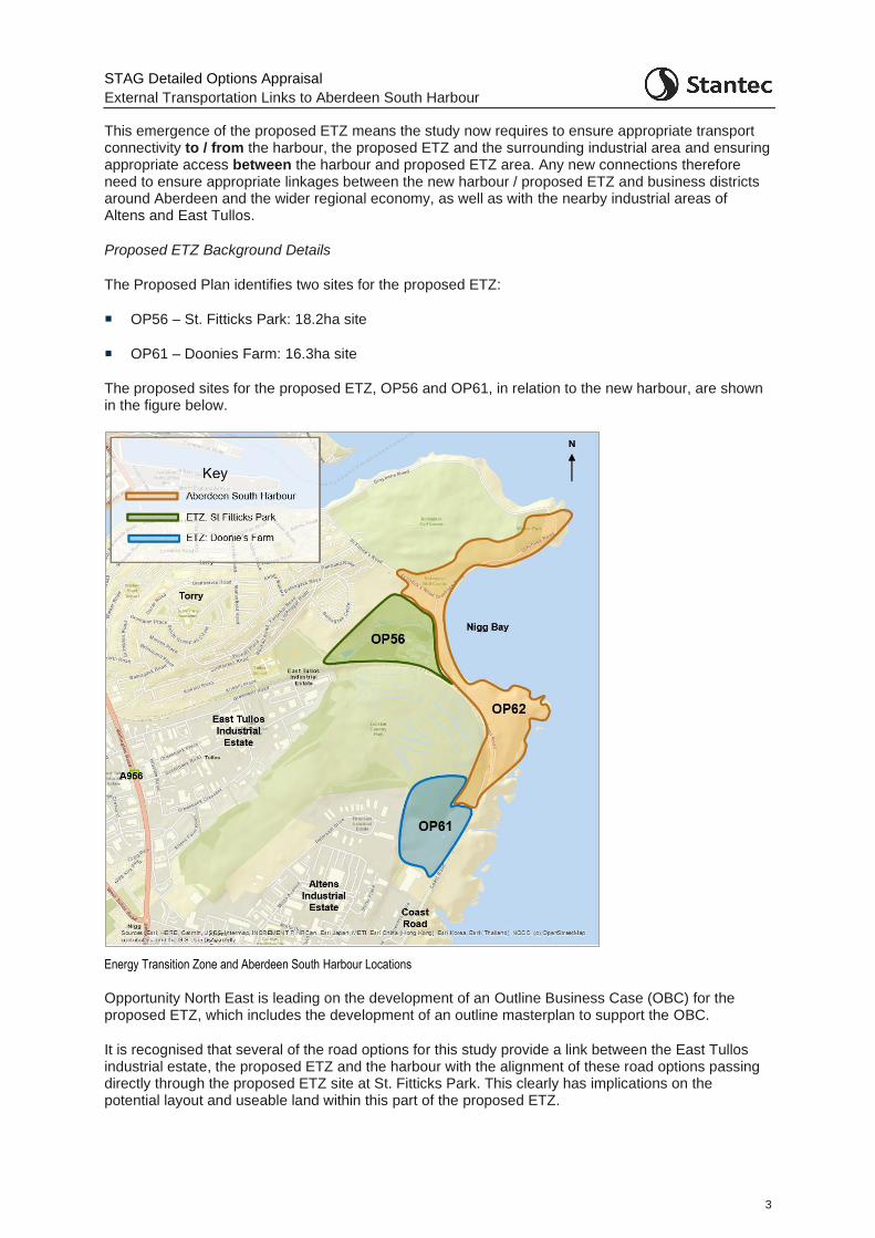
This emergence of the proposed ETZ means the study now requires to ensure appropriate transport connectivity to / from the harbour, the proposed ETZ and the surrounding industrial area and ensuring appropriate access between the harbour and proposed ETZ area. Any new connections therefore need to ensure appropriate linkages between the new harbour / proposed ETZ and business districts around Aberdeen and the wider regional economy, as well as with the nearby industrial areas of Altens and East Tullos.
Proposed ETZ Background Details
The Proposed Plan identifies two sites for the proposed ETZ:
OP56 – St. Fitticks Park: 18.2ha site
OP61 – Doonies Farm: 16.3ha site
The proposed sites for the proposed ETZ, OP56 and OP61, in relation to the new harbour, are shown in the figure below.
Energy Transition Zone and Aberdeen South Harbour Locations
Opportunity North East is leading on the development of an Outline Business Case (OBC) for the proposed ETZ, which includes the development of an outline masterplan to support the OBC.
It is recognised that several of the road options for this study provide a link between the East Tullos industrial estate, the proposed ETZ and the harbour with the alignment of these road options passing directly through the proposed ETZ site at St. Fitticks Park. This clearly has implications on the potential layout and useable land within this part of the proposed ETZ.
STAG Detailed Options Appraisal
External Transportation Links to Aberdeen South Harbour
4
While this study and the work being undertaken to develop the proposed ETZ are being undertaken separately, both studies are fully cognisant of the work being undertaken within the other study. Clearly the proposed ETZ site at St. Fitticks has the potential to benefit from improved connections to East Tullos but the scale of the benefit will be dependent on the activities being undertaken at the proposed ETZ site – which at this stage are not yet fully established. These activities will, in turn, dictate the availability of land for a new road within the proposed ETZ site. Given the proposed ETZ masterplanning work is ongoing, it is too early to determine whether the activities to be located at the proposed ETZ could accommodate space for a road, and if a road is deemed to provide benefit, then the exact alignment of such a road through the site. To this end, while engineering work has been undertaken as part of this study to consider a link through St. Fitticks Park (linking East Tullos and the Coast Road), the exact alignments presented should not be taken as fixed and would be subject to change, if taken forward, as development of the proposed ETZ site progresses.
Wellington Road Multi-modal Study
The work being undertaken for this study has also taken cognisance of the ongoing Wellington Road Multi-modal Corridor Study. The study is looking at ways of improving travel for people and goods along the Wellington Road corridor. Among the objectives are improving air quality, facilitating school travel, safer travel for pedestrians and cyclists, and improving bus and freight movements. The study area is from A90(T) / A956 Charleston Interchange to the Queen Elizabeth Bridge. It also incorporates the side roads in proximity to Wellington Road, and any interaction with A90(T).
Additional traffic generated by the new harbour and proposed ETZ, as well as the infrastructure proposed under the various options being considered, have the ability to affect traffic flows, patterns and routeing in the Wellington Road area. The need to collaborate to ensure that options are complementary has been important during the option development and appraisal process for both studies. Where options have the potential to constrain or support the proposals of the Wellington Road Multi-modal Corridor Study this is noted within the appraisal reporting.
Smartening the Objectives
The emergence of the proposed ETZ necessitated a review of both the Transport Planning Objectives (TPOs) for the study and the options themselves. The proposed ETZ and the activities likely to take place there are anticipated to generate additional traffic volumes to that envisaged for the new harbour and of a different traffic composition. The proposed ETZ has a transport impact in its own right and clearly has the potential to impact on the nature of the activities at the new harbour. This has implications not just on the likely benefits of any new road connection, but places additional weighting on public transport and active travel connections to ensure appropriate sustainable transport connections for those commuting to the sites.
Therefore, there are two main traffic variables:
The quantity and type of traffic associated with ASH: commercial vehicle traffic; car-based travel; public transport journeys; and active travel journeys.
The quantity and type of traffic associated with the proposed ETZ: commercial vehicle traffic; car-based travel; public transport journeys; and active travel journeys.
Given the widened focus of the study, the TPOs were revisited to ensure they are still relevant. This also provided an opportunity to rationalise the number of TPOs from the set of nine at the end of the Preliminary Options Appraisal stage. The final set of revised objectives agreed with the Client Group are shown in the table below.
STAG Detailed Options Appraisal
External Transportation Links to Aberdeen South Harbour
5
Revised Transport Planning Objectives
Revised TPO No.
Revised Objective
TPO1 Provide a designated Heavy Goods Vehicle (HGV) route to/from ASH / proposed ETZ sites which is more efficient than alternative routes to:
• minimise journey times to Aberdeen Western Peripheral Route (AWPR) / Charleston junction and King George VI Bridge; and
• help minimise inappropriate routeing and environmental and nuisance impacts
TPO2a Maximise connectivity by all modes (car, public transport, and active travel) between Aberdeen South Harbour / Energy Transition Zone and prospective workers at the sites
TPO2b Maximise connectivity between proposed ETZ and other energy-related businesses in the Aberdeen area (Business to Business)
TPO3 Futureproof access to the proposed ETZ / ASH for the widest range of abnormal loads possible and minimise the impact of abnormal loads travelling from and to the proposed ETZ / ASH
TPO4 Improve the resilience of transport connections to and from ASH /proposed ETZ
TPO5 Maximise the intermodal opportunities between the proposed ETZ and the existing rail network
Revising the Options
A review of all the options recommended for detailed appraisal was also undertaken. No changes were required for the road options, but the public transport and active travel options were revised to ensure improved connectivity to the new harbour and the proposed ETZ sites by all transport modes.
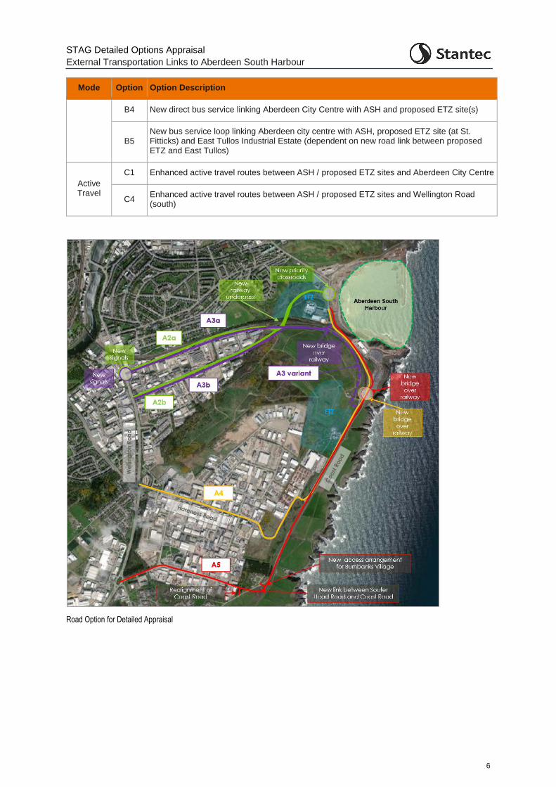
The final set of options that have been appraised at the Detailed Appraisal Stage, with their appraisal presented within this report, are shown below in the table and corresponding figures. This includes four road options (with two variants within two of these), four public transport options and two active travel options.
Final options for Detailed Options Appraisal
Mode Option Option Description
Road
A2a/b New road connection from Greenwell Road / Greenbank Road via St Fitticks Community Park to Coast Road with a new underbridge under the railway line
A3a/b
New road connection from Greenwell Road / Greenbank Road via the former Ness Landfill site and a new bridge over the railway. Instead of this new bridge, a variant of Option A3 includes an additional link around the perimeter of the landfill site to a location south of the existing bridge on Coast Road
A4 Improve the existing route via Hareness Road through the provision of a new bridge over the railway on Coast Road and capacity improvements.
A5 New road connection between Coast Road and Souter Head Road and a new bridge over the railway on Coast Road.
Public Transport
B1 Extend / enhance existing bus services between ASH / proposed ETZ sites (at both St. Fitticks and Doonies Farm) and Aberdeen City Centre.
B2 New bus service between ASH and Aberdeen City Centre for cruise passengers.
STAG Detailed Options Appraisal
External Transportation Links to Aberdeen South Harbour
6
Mode Option Option Description
B4 New direct bus service linking Aberdeen City Centre with ASH and proposed ETZ site(s)
B5 New bus service loop linking Aberdeen city centre with ASH, proposed ETZ site (at St. Fitticks) and East Tullos Industrial Estate (dependent on new road link between proposed ETZ and East Tullos)
Active Travel
C1 Enhanced active travel routes between ASH / proposed ETZ sites and Aberdeen City Centre
C4 Enhanced active travel routes between ASH / proposed ETZ sites and Wellington Road (south)
Road Option for Detailed Appraisal
STAG Detailed Options Appraisal
External Transportation Links to Aberdeen South Harbour
7
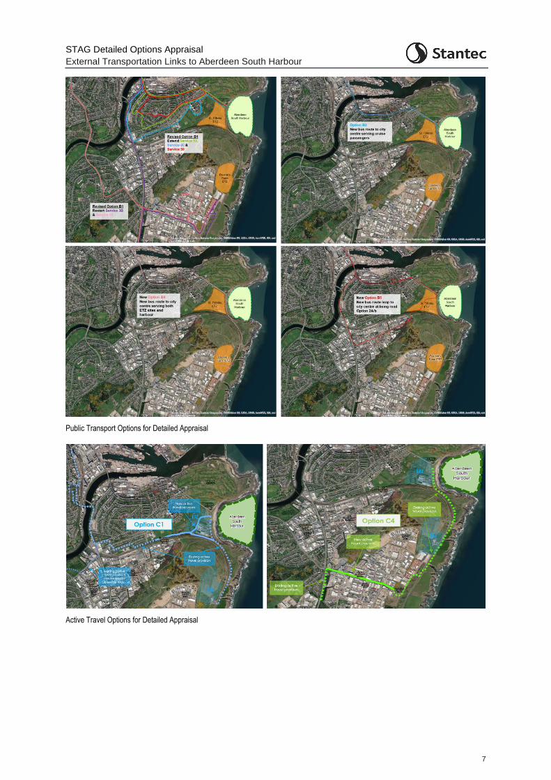
Public Transport Options for Detailed Appraisal
Active Travel Options for Detailed Appraisal
STAG Detailed Options Appraisal
External Transportation Links to Aberdeen South Harbour
8
Detailed Options Appraisal
The detailed appraisal of the options has covered:
Development of harbour and proposed ETZ anticipated traffic generation, geographical distribution, and profiling over the day
Traffic modelling to inform various appraisal elements
Assessment of the options against:
o Transport Planning Objectives
o STAG appraisal criteria
o Implementability considerations (technical and operational)
Cost to Government;
Risk and Uncertainty
Consultation and Engagement.
Aberdeen South Harbour and proposed ETZ traffic generation
Traffic generation estimates for ASH were derived by:
estimating annual cargo tonnage based on the relationship between quay length and cargo tonnage seen at comparator UK ports; and
estimating annual trip generation – influenced by the anticipated cargo to be handled by the port – with an understanding of this derived through discussion with the Aberdeen Harbour Board and consideration of broad freight types at the comparator ports; and profiling trips across an average day, based on the 2015 Transport Assessment.
In the absence of definitive information on the exact nature of development at the proposed ETZ, the Siemens Green Port Hull (SGPH) at Alexandra Dock in Hull was used as a ‘model’ of the type of activity which could emerge at the site. SGPH comprises a wind turbine manufacturing facility, offices, warehousing, and a marine installation/commissioning base. Information from the Traffic and Transportation Chapter of the Environmental Statement for the Hull site was used to inform estimates of trip generation at the proposed ETZ.
Traffic Modelling
To enable an economic assessment of the road options as well as feed into several further elements of the appraisal, the use of a traffic model was required. As well as providing traffic demand, trip distance and journey time data to feed into the assessment of the options, the traffic model provided visual representations of the operational performance of the options. A microsimulation traffic model developed by AECOM and being used in the Wellington Road Multi-modal Corridor Study was extended to allow the model to be effectively utilised for this study.
The 2019 ‘Base model’ simulates the behaviour of individual vehicles within the modelled road network and has formed the base platform for predicting the traffic patterns resulting from changes to traffic volumes and changes to the road network.
Future year traffic demands were generated for the future years of 2026 (the assumed opening year of any road option) and 2041 (15-years post opening). ‘Do Minimum’ models were developed to provide a representation of the future in 2026 and 2041 in the absence of any changes to the network. These
STAG Detailed Options Appraisal
External Transportation Links to Aberdeen South Harbour
9
and each of the equivalent future models with the options in place included additional traffic demand over and above the 2019 Base model. This additional demand represents underlying background growth, local committed developments and the traffic estimated for the new harbour and proposed ETZ sites.
Cost to Government
As the proposed road options are at the feasibility design stage, only high-level construction cost estimates have been developed. The estimates include optimism bias to reflect the uncertainties (at the 44% rate as per schemes at this stage of development). It is important to note that the cost estimates do not include allowances for the following:
Costs associated with land / property acquisition;
Statutory approvals / consents;
Adjustments to existing public utility apparatus;
Surveys and investigations;
Design and works supervision fees; or
Value Added Tax (VAT) and Inflation, as the date of construction is yet to be established.
At the next stage of preliminary and detailed design more detailed costs would be obtained. A high degree of cost uncertainty will remain until actual investigation and design work is undertaken.
Consultation and Engagement
Consultation was undertaken with a number of key stakeholders during the Detailed Options Appraisal. This included discussion with the ETZ masterplanning team, Aberdeen South Harbour, bus operators, and a potentially impacted local business.
To inform the public acceptability appraisal of the options, a public engagement exercise was undertaken in late 2020. Due to the COVID-19 pandemic, it was not possible to run face-to-face public events. As such, all engagement activity was online. The key points from this engagement have been incorporated in the appraisal with full details of the engagement outcomes in the main body of this report and an associated appendix. Key points to note are:
Of the road options (Options A2 – A5), Option A4 (a new bridge on Coast Road with Coast Road widening) was the only option where the overall engagement feedback highlighted net agreement with the option as opposed to net disagreement
There was particularly negative response towards Options A2a and A2b (proposing an underpass of the railway and road route through St. Fitticks Park). In particular, there was negative feedback from the Torry community given the route through the park.
There was also an overall net negative response towards Options A3a and A3b, although not as strong as towards Options A2a and A2b. Environmental concerns regarding the route through the landfill site were raised.
There was a mixed response towards Option A5, with negative feedback from the local Burnbanks Village community
There was a mixed response towards the bus options, Options B1, B2, B4 and B5
There was overall positive agreement with the active travel options, Options C1 and C4.

STAG Detailed Options Appraisal
External Transportation Links to Aberdeen South Harbour
10
Detailed Option Appraisal Summary
The key advantages and disadvantages associated with each option from the Detailed Options Appraisal are presented below.
STAG Detailed Options Appraisal
External Transportation Links to Aberdeen South Harbour
11
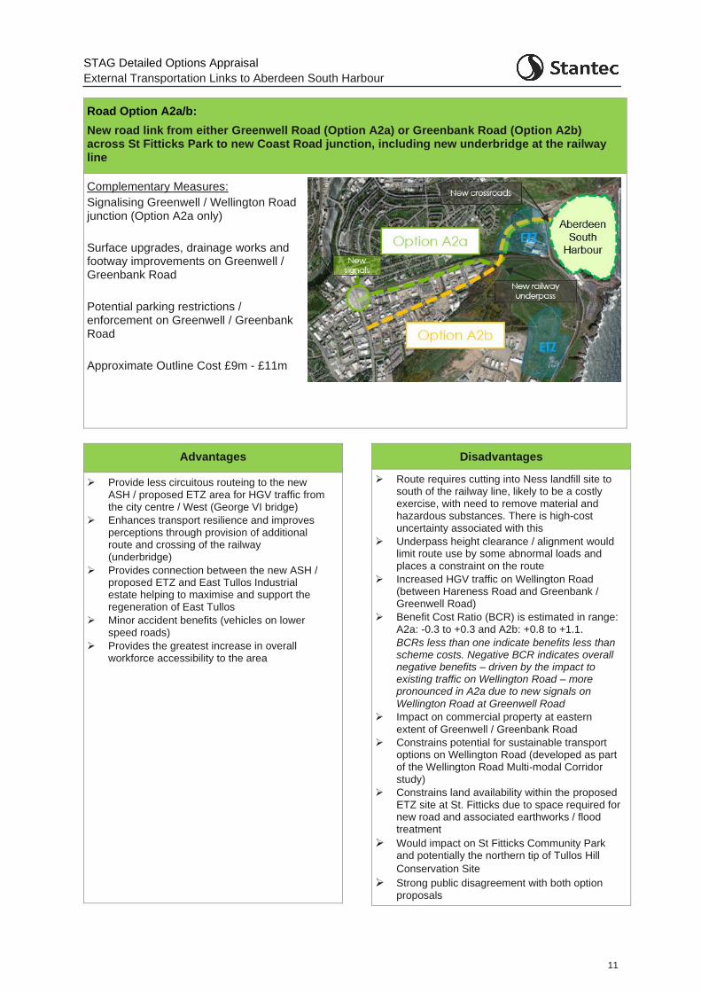
Road Option A2a/b:
New road link from either Greenwell Road (Option A2a) or Greenbank Road (Option A2b) across St Fitticks Park to new Coast Road junction, including new underbridge at the railway line
Complementary Measures:
Signalising Greenwell / Wellington Road junction (Option A2a only)
Surface upgrades, drainage works and footway improvements on Greenwell / Greenbank Road
Potential parking restrictions / enforcement on Greenwell / Greenbank Road
Approximate Outline Cost £9m - £11m
Advantages
➢ Provide less circuitous routeing to the new ASH / proposed ETZ area for HGV traffic from the city centre / West (George VI bridge)
➢ Enhances transport resilience and improves perceptions through provision of additional route and crossing of the railway (underbridge)
➢ Provides connection between the new ASH / proposed ETZ and East Tullos Industrial estate helping to maximise and support the regeneration of East Tullos
➢ Minor accident benefits (vehicles on lower speed roads)
➢ Provides the greatest increase in overall workforce accessibility to the area
Disadvantages
➢ Route requires cutting into Ness landfill site to south of the railway line, likely to be a costly exercise, with need to remove material and hazardous substances. There is high-cost uncertainty associated with this
➢ Underpass height clearance / alignment would limit route use by some abnormal loads and places a constraint on the route
➢ Increased HGV traffic on Wellington Road (between Hareness Road and Greenbank / Greenwell Road)
➢ Benefit Cost Ratio (BCR) is estimated in range: A2a: -0.3 to +0.3 and A2b: +0.8 to +1.1.
BCRs less than one indicate benefits less than scheme costs. Negative BCR indicates overall negative benefits – driven by the impact to existing traffic on Wellington Road – more pronounced in A2a due to new signals on
Wellington Road at Greenwell Road
➢ Impact on commercial property at eastern
extent of Greenwell / Greenbank Road
➢ Constrains potential for sustainable transport options on Wellington Road (developed as part of the Wellington Road Multi-modal Corridor study)
➢ Constrains land availability within the proposed ETZ site at St. Fitticks due to space required for new road and associated earthworks / flood treatment
➢ Would impact on St Fitticks Community Park and potentially the northern tip of Tullos Hill
Conservation Site
➢ Strong public disagreement with both option proposals
STAG Detailed Options Appraisal
External Transportation Links to Aberdeen South Harbour
11
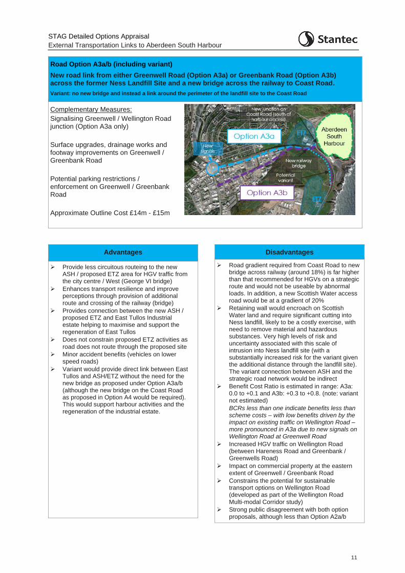
Road Option A3a/b (including variant)
New road link from either Greenwell Road (Option A3a) or Greenbank Road (Option A3b) across the former Ness Landfill Site and a new bridge across the railway to Coast Road.
Variant: no new bridge and instead a link around the perimeter of the landfill site to the Coast Road
Complementary Measures:
Signalising Greenwell / Wellington Road junction (Option A3a only)
Surface upgrades, drainage works and footway improvements on Greenwell / Greenbank Road
Potential parking restrictions / enforcement on Greenwell / Greenbank Road
Approximate Outline Cost £14m - £15m
Advantages
➢ Provide less circuitous routeing to the new ASH / proposed ETZ area for HGV traffic from the city centre / West (George VI bridge)
➢ Enhances transport resilience and improve perceptions through provision of additional route and crossing of the railway (bridge)
➢ Provides connection between the new ASH / proposed ETZ and East Tullos Industrial estate helping to maximise and support the
regeneration of East Tullos
➢ Does not constrain proposed ETZ activities as
road does not route through the proposed site
➢ Minor accident benefits (vehicles on lower speed roads)
➢ Variant would provide direct link between East Tullos and ASH/ETZ without the need for the new bridge as proposed under Option A3a/b (although the new bridge on the Coast Road as proposed in Option A4 would be required). This would support harbour activities and the regeneration of the industrial estate.
Disadvantages
➢ Road gradient required from Coast Road to new bridge across railway (around 18%) is far higher than that recommended for HGVs on a strategic route and would not be useable by abnormal loads. In addition, a new Scottish Water access road would be at a gradient of 20%
➢ Retaining wall would encroach on Scottish Water land and require significant cutting into Ness landfill, likely to be a costly exercise, with need to remove material and hazardous substances. Very high levels of risk and uncertainty associated with this scale of intrusion into Ness landfill site (with a substantially increased risk for the variant given the additional distance through the landfill site). The variant connection between ASH and the strategic road network would be indirect
➢ Benefit Cost Ratio is estimated in range: A3a: 0.0 to +0.1 and A3b: +0.3 to +0.8. (note: variant not estimated)
BCRs less than one indicate benefits less than scheme costs – with low benefits driven by the impact on existing traffic on Wellington Road – more pronounced in A3a due to new signals on Wellington Road at Greenwell Road
➢ Increased HGV traffic on Wellington Road (between Hareness Road and Greenbank / Greenwells Road)
➢ Impact on commercial property at the eastern extent of Greenwell / Greenbank Road
➢ Constrains the potential for sustainable transport options on Wellington Road (developed as part of the Wellington Road
Multi-modal Corridor study)
➢ Strong public disagreement with both option proposals, although less than Option A2a/b
STAG Detailed Options Appraisal
External Transportation Links to Aberdeen South Harbour
12
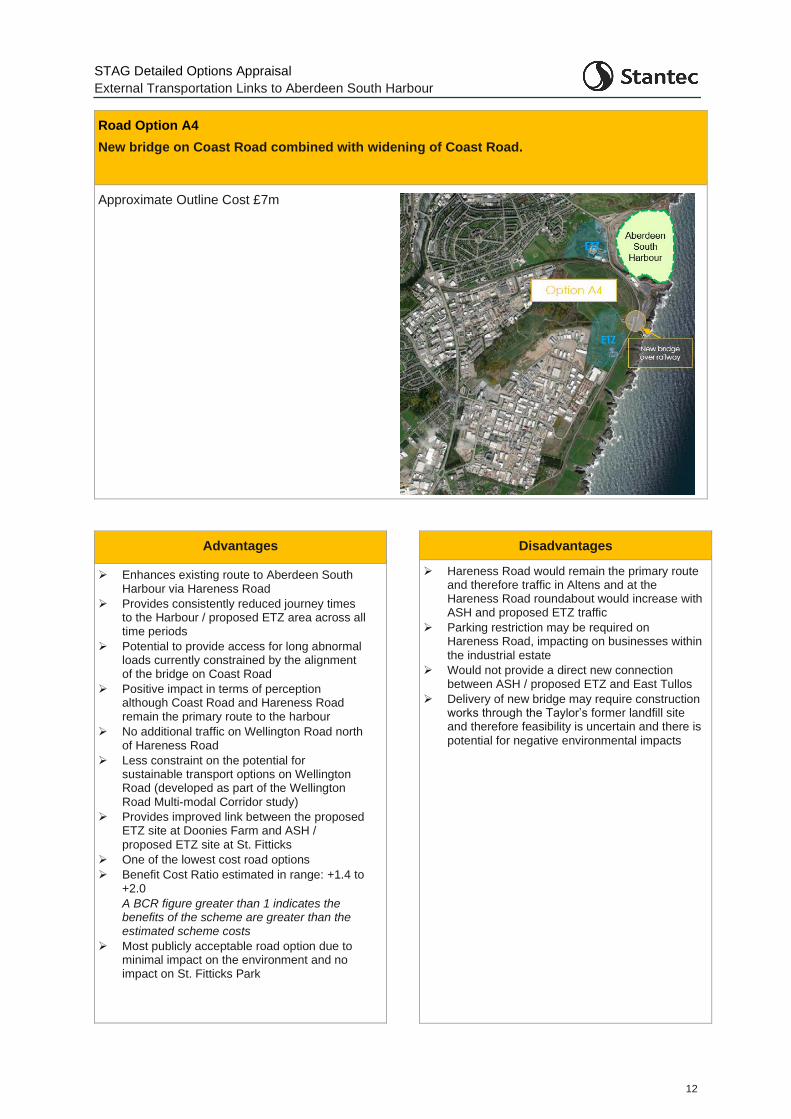
Road Option A4
New bridge on Coast Road combined with widening of Coast Road.
Approximate Outline Cost £7m
Advantages
➢ Enhances existing route to Aberdeen South Harbour via Hareness Road
➢ Provides consistently reduced journey times to the Harbour / proposed ETZ area across all time periods
➢ Potential to provide access for long abnormal loads currently constrained by the alignment of the bridge on Coast Road
➢ Positive impact in terms of perception although Coast Road and Hareness Road remain the primary route to the harbour
➢ No additional traffic on Wellington Road north of Hareness Road
➢ Less constraint on the potential for sustainable transport options on Wellington Road (developed as part of the Wellington
Road Multi-modal Corridor study)
➢ Provides improved link between the proposed ETZ site at Doonies Farm and ASH /
proposed ETZ site at St. Fitticks
➢ One of the lowest cost road options
➢ Benefit Cost Ratio estimated in range: +1.4 to +2.0
A BCR figure greater than 1 indicates the benefits of the scheme are greater than the estimated scheme costs
➢ Most publicly acceptable road option due to minimal impact on the environment and no impact on St. Fitticks Park
Disadvantages
➢ Hareness Road would remain the primary route and therefore traffic in Altens and at the Hareness Road roundabout would increase with ASH and proposed ETZ traffic
➢ Parking restriction may be required on Hareness Road, impacting on businesses within
the industrial estate
➢ Would not provide a direct new connection between ASH / proposed ETZ and East Tullos
➢ Delivery of new bridge may require construction works through the Taylor’s former landfill site and therefore feasibility is uncertain and there is
potential for negative environmental impacts
STAG Detailed Options Appraisal
External Transportation Links to Aberdeen South Harbour
13
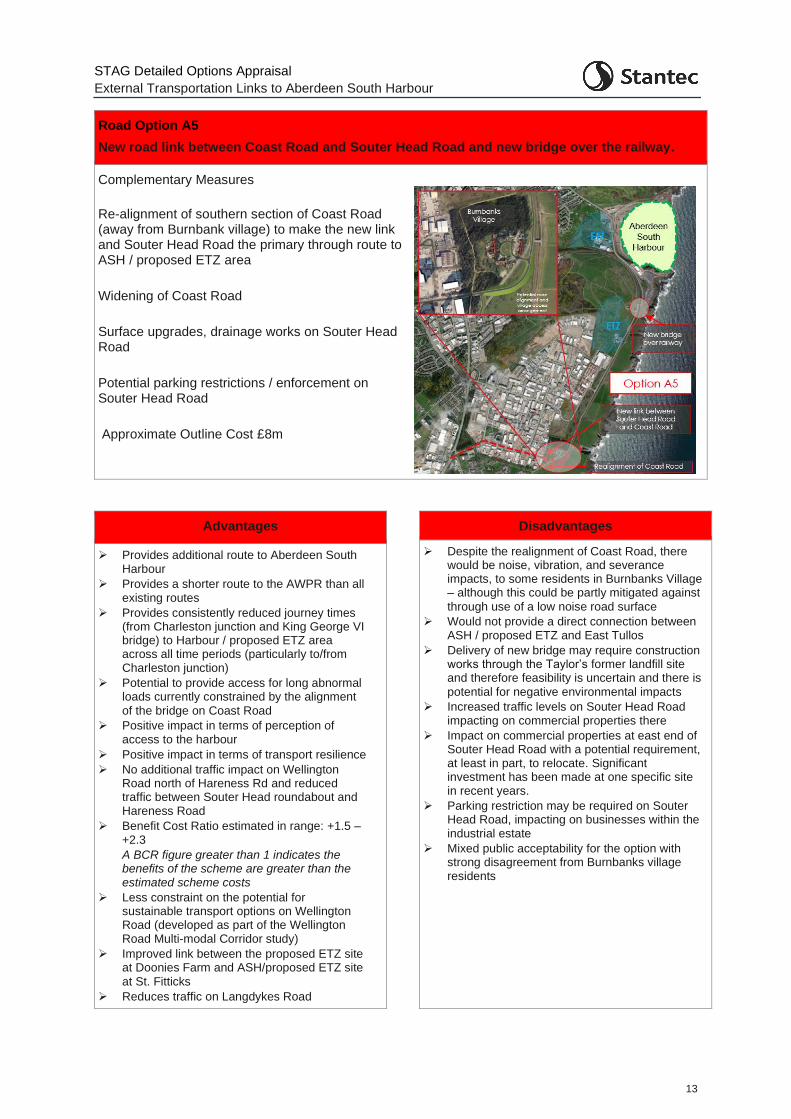
Road Option A5
New road link between Coast Road and Souter Head Road and new bridge over the railway.
Complementary Measures
Re-alignment of southern section of Coast Road (away from Burnbank village) to make the new link and Souter Head Road the primary through route to ASH / proposed ETZ area
Widening of Coast Road
Surface upgrades, drainage works on Souter Head Road
Potential parking restrictions / enforcement on Souter Head Road
Approximate Outline Cost £8m
Advantages
➢ Provides additional route to Aberdeen South Harbour
➢ Provides a shorter route to the AWPR than all existing routes
➢ Provides consistently reduced journey times (from Charleston junction and King George VI bridge) to Harbour / proposed ETZ area across all time periods (particularly to/from Charleston junction)
➢ Potential to provide access for long abnormal loads currently constrained by the alignment
of the bridge on Coast Road
➢ Positive impact in terms of perception of access to the harbour
➢ Positive impact in terms of transport resilience
➢ No additional traffic impact on Wellington Road north of Hareness Rd and reduced traffic between Souter Head roundabout and Hareness Road
➢ Benefit Cost Ratio estimated in range: +1.5 – +2.3
A BCR figure greater than 1 indicates the benefits of the scheme are greater than the estimated scheme costs
➢ Less constraint on the potential for sustainable transport options on Wellington Road (developed as part of the Wellington Road Multi-modal Corridor study)
➢ Improved link between the proposed ETZ site at Doonies Farm and ASH/proposed ETZ site
at St. Fitticks
➢ Reduces traffic on Langdykes Road
Disadvantages
➢ Despite the realignment of Coast Road, there would be noise, vibration, and severance impacts, to some residents in Burnbanks Village – although this could be partly mitigated against
through use of a low noise road surface
➢ Would not provide a direct connection between ASH / proposed ETZ and East Tullos
➢ Delivery of new bridge may require construction works through the Taylor’s former landfill site and therefore feasibility is uncertain and there is
potential for negative environmental impacts
➢ Increased traffic levels on Souter Head Road impacting on commercial properties there
➢ Impact on commercial properties at east end of Souter Head Road with a potential requirement, at least in part, to relocate. Significant investment has been made at one specific site in recent years.
➢ Parking restriction may be required on Souter Head Road, impacting on businesses within the industrial estate
➢ Mixed public acceptability for the option with strong disagreement from Burnbanks village residents
STAG Detailed Options Appraisal
External Transportation Links to Aberdeen South Harbour
14
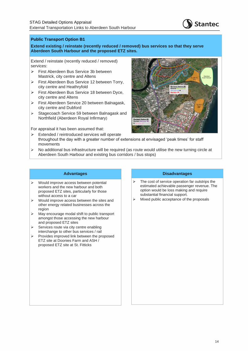
Public Transport Option B1
Extend existing / reinstate (recently reduced / removed) bus services so that they serve Aberdeen South Harbour and the proposed ETZ sites.
Extend / reinstate (recently reduced / removed) services:
➢ First Aberdeen Bus Service 3b between Mastrick, city centre and Altens
➢ First Aberdeen Bus Service 12 between Torry, city centre and Heathryfold
➢ First Aberdeen Bus Service 18 between Dyce, city centre and Altens
➢ First Aberdeen Service 20 between Balnagask, city centre and Dubford
➢ Stagecoach Service 59 between Balnagask and Northfield (Aberdeen Royal Infirmary)
For appraisal it has been assumed that:
➢ Extended / reintroduced services will operate throughout the day with a greater number of extensions at envisaged ‘peak times’ for staff movements
➢ No additional bus infrastructure will be required (as route would utilise the new turning circle at Aberdeen South Harbour and existing bus corridors / bus stops)
Advantages
➢ Would improve access between potential workers and the new harbour and both proposed ETZ sites, particularly for those without access to a car
➢ Would improve access between the sites and other energy related businesses across the region
➢ May encourage modal shift to public transport amongst those accessing the new harbour and proposed ETZ sites
➢ Services route via city centre enabling interchange to other bus services / rail
➢ Provides improved link between the proposed ETZ site at Doonies Farm and ASH / proposed ETZ site at St. Fitticks
Disadvantages
➢ The cost of service operation far outstrips the estimated achievable passenger revenue. The option would be loss making and require
substantial financial support.
➢ Mixed public acceptance of the proposals
STAG Detailed Options Appraisal
External Transportation Links to Aberdeen South Harbour
15
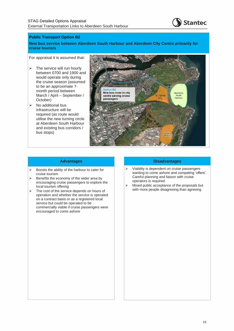
Public Transport Option B2
New bus service between Aberdeen South Harbour and Aberdeen City Centre primarily for cruise tourists
For appraisal it is assumed that:
➢ The service will run hourly between 0700 and 1900 and would operate only during the cruise season (assumed to be an approximate 7-month period between March / April – September / October)
➢ No additional bus infrastructure will be required (as route would utilise the new turning circle at Aberdeen South Harbour and existing bus corridors / bus stops)
Advantages
➢ Boosts the ability of the harbour to cater for cruise tourism
➢ Benefits the economy of the wider area by encouraging cruise passengers to explore the local tourism offering
➢ The cost of the service depends on hours of operation and whether the service is operated on a contract basis or as a registered local service but could be operated to be commercially viable if cruise passengers were
encouraged to come ashore
Disadvantages
➢ Viability is dependent on cruise passengers wanting to come ashore and competing ‘offers’. Careful planning and liaison with cruise operators is required.
➢ Mixed public acceptance of the proposals but with more people disagreeing than agreeing

STAG Detailed Options Appraisal
External Transportation Links to Aberdeen South Harbour
16
Public Transport Option B4
New bus service between the city centre and Aberdeen South Harbour / both proposed ETZ sites
For appraisal it is assumed that:
➢ Service would operate in line with envisaged ‘peak times’ / shift movements for staff
➢ Bus infrastructure would need to be incorporated into the Doonies Farm proposed ETZ site to provide a turning point for the service
Advantages
➢ Would improve access between potential workers and the new harbour and both proposed ETZ sites, particularly for those without access to a car (although of all public transport options this option has the lowest improved access)
➢ Would improve access between the proposed ETZ sites and other energy related businesses across the region (although of all public transport options this option has the lowest improved access)
➢ May encourage modal shift to public transport amongst those accessing the new harbour and proposed ETZ sites
➢ Sustainably connects both proposed ETZ
sites
➢ Service routes via city centre enabling
interchange to other bus services / rail
Disadvantages
➢ Only serves the city centre meaning likely interchange required for those accessing the new service from further afield
➢ The cost of service operation far outstrips the estimated achievable passenger revenue. The option would be loss making and require substantial financial support.
➢ There may be a transfer of passengers from existing services (those travelling between the city and Torry) to the new service which may erode the commercial viability of existing public transport provision
➢ Mixed public acceptance of the proposals
STAG Detailed Options Appraisal
External Transportation Links to Aberdeen South Harbour
17
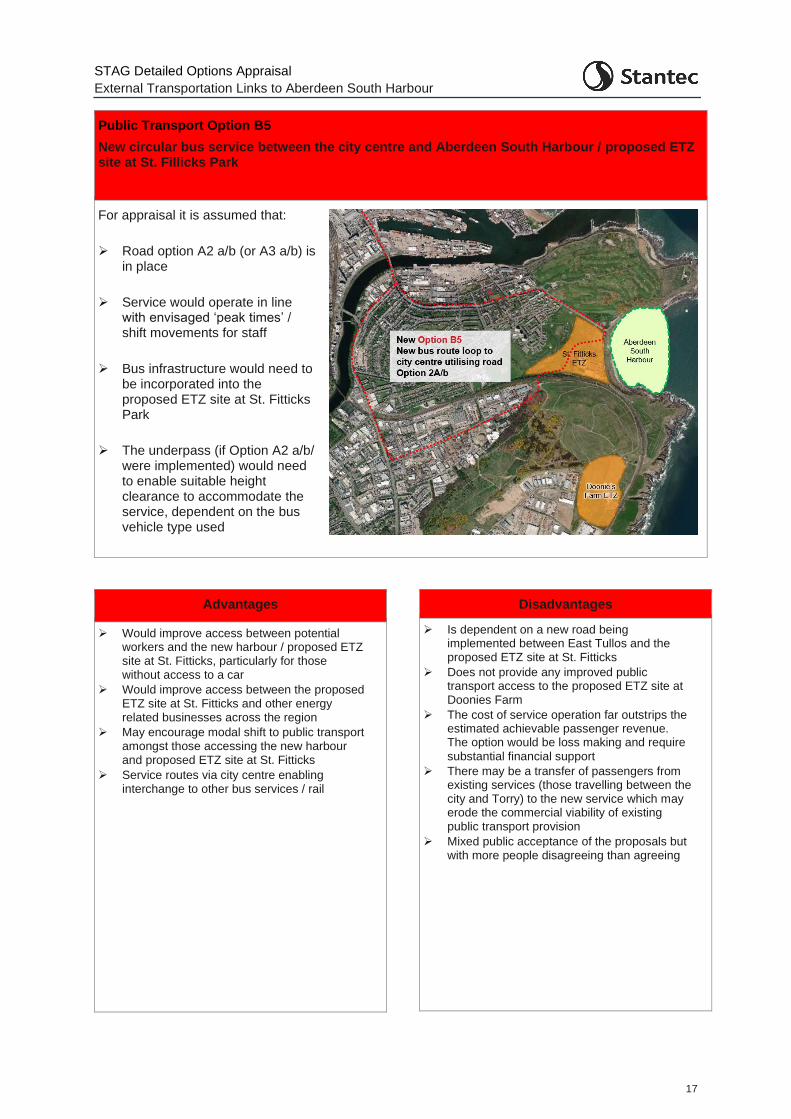
Public Transport Option B5
New circular bus service between the city centre and Aberdeen South Harbour / proposed ETZ site at St. Fillicks Park
For appraisal it is assumed that:
➢ Road option A2 a/b (or A3 a/b) is in place
➢ Service would operate in line with envisaged ‘peak times’ / shift movements for staff
➢ Bus infrastructure would need to be incorporated into the proposed ETZ site at St. Fitticks Park
➢ The underpass (if Option A2 a/b/ were implemented) would need to enable suitable height clearance to accommodate the service, dependent on the bus vehicle type used
Advantages
➢ Would improve access between potential workers and the new harbour / proposed ETZ site at St. Fitticks, particularly for those without access to a car
➢ Would improve access between the proposed ETZ site at St. Fitticks and other energy related businesses across the region
➢ May encourage modal shift to public transport amongst those accessing the new harbour and proposed ETZ site at St. Fitticks
➢ Service routes via city centre enabling interchange to other bus services / rail
Disadvantages
➢ Is dependent on a new road being implemented between East Tullos and the proposed ETZ site at St. Fitticks
➢ Does not provide any improved public transport access to the proposed ETZ site at Doonies Farm
➢ The cost of service operation far outstrips the estimated achievable passenger revenue. The option would be loss making and require
substantial financial support
➢ There may be a transfer of passengers from existing services (those travelling between the city and Torry) to the new service which may erode the commercial viability of existing public transport provision
➢ Mixed public acceptance of the proposals but with more people disagreeing than agreeing
STAG Detailed Options Appraisal
External Transportation Links to Aberdeen South Harbour
18
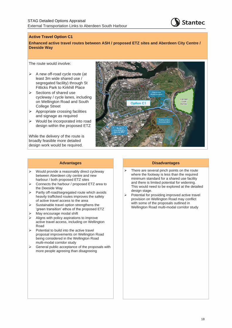
Active Travel Option C1
Enhanced active travel routes between ASH / proposed ETZ sites and Aberdeen City Centre / Deeside Way
The route would involve:
➢ A new off-road cycle route (at least 3m wide shared use / segregated facility) through St Fitticks Park to Kirkhill Place
➢ Sections of shared use cycleway / cycle lanes, including on Wellington Road and South College Street
➢ Appropriate crossing facilities and signage as required
➢ Would be incorporated into road design within the proposed ETZ
While the delivery of the route is broadly feasible more detailed design work would be required.
Advantages
➢ Would provide a reasonably direct cycleway between Aberdeen city centre and new harbour / both proposed ETZ sites
➢ Connects the harbour / proposed ETZ area to the Deeside Way
➢ Partly off-road/segregated route which avoids heavily trafficked routes improves the safety of active travel access to the area
➢ Sustainable travel option strengthens the
‘green transition’ ethos of the proposed ETZ
➢ May encourage modal shift
➢ Aligns with policy aspirations to improve active travel access, including on Wellington Road
➢ Potential to build into the active travel proposal improvements on Wellington Road being considered in the Wellington Road
multi-modal corridor study
➢ General public acceptance of the proposals with more people agreeing than disagreeing
Disadvantages
➢ There are several pinch points on the route where the footway is less than the required minimum standard for a shared use facility and there is limited potential for widening. This would need to be explored at the detailed design stage.
➢ Potential for providing improved active travel provision on Wellington Road may conflict with some of the proposals outlined in
Wellington Road multi-modal corridor study
STAG Detailed Options Appraisal
External Transportation Links to Aberdeen South Harbour
19
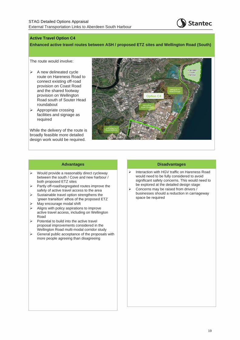
Active Travel Option C4
Enhanced active travel routes between ASH / proposed ETZ sites and Wellington Road (South)
The route would involve:
➢ A new delineated cycle route on Hareness Road to connect existing off-road provision on Coast Road and the shared footway provision on Wellington Road south of Souter Head roundabout
➢ Appropriate crossing facilities and signage as required
While the delivery of the route is broadly feasible more detailed design work would be required.
Advantages
➢ Would provide a reasonably direct cycleway between the south / Cove and new harbour / both proposed ETZ sites
➢ Partly off-road/segregated routes improve the
safety of active travel access to the area
➢ Sustainable travel option strengthens the
‘green transition’ ethos of the proposed ETZ
➢ May encourage modal shift
➢ Aligns with policy aspirations to improve active travel access, including on Wellington Road
➢ Potential to build into the active travel proposal improvements considered in the Wellington Road multi-modal corridor study
➢ General public acceptance of the proposals with more people agreeing than disagreeing
Disadvantages
➢ Interaction with HGV traffic on Hareness Road would need to be fully considered to avoid significant safety concerns. This would need to be explored at the detailed design stage
➢ Concerns may be raised from drivers / businesses should a reduction in carriageway space be required
STAG Detailed Options Appraisal
External Transportation Links to Aberdeen South Harbour
20
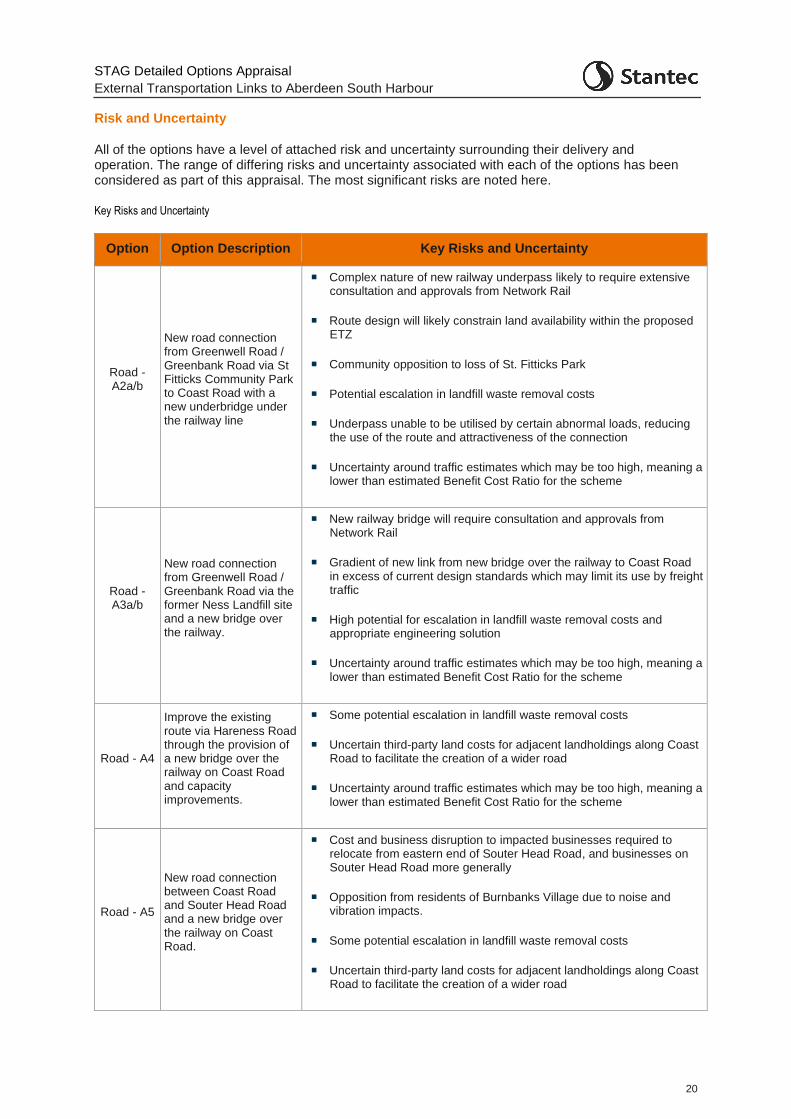
Risk and Uncertainty
All of the options have a level of attached risk and uncertainty surrounding their delivery and operation. The range of differing risks and uncertainty associated with each of the options has been considered as part of this appraisal. The most significant risks are noted here.
Key Risks and Uncertainty
Option Option Description Key Risks and Uncertainty
Road - A2a/b
New road connection from Greenwell Road / Greenbank Road via St Fitticks Community Park to Coast Road with a new underbridge under the railway line
Complex nature of new railway underpass likely to require extensive consultation and approvals from Network Rail
Route design will likely constrain land availability within the proposed ETZ
Community opposition to loss of St. Fitticks Park
Potential escalation in landfill waste removal costs
Underpass unable to be utilised by certain abnormal loads, reducing the use of the route and attractiveness of the connection
Uncertainty around traffic estimates which may be too high, meaning a lower than estimated Benefit Cost Ratio for the scheme
Road - A3a/b
New road connection from Greenwell Road / Greenbank Road via the former Ness Landfill site and a new bridge over the railway.
New railway bridge will require consultation and approvals from Network Rail
Gradient of new link from new bridge over the railway to Coast Road in excess of current design standards which may limit its use by freight traffic
High potential for escalation in landfill waste removal costs and appropriate engineering solution
Uncertainty around traffic estimates which may be too high, meaning a lower than estimated Benefit Cost Ratio for the scheme
Road - A4
Improve the existing route via Hareness Road through the provision of a new bridge over the railway on Coast Road and capacity improvements.
Some potential escalation in landfill waste removal costs
Uncertain third-party land costs for adjacent landholdings along Coast Road to facilitate the creation of a wider road
Uncertainty around traffic estimates which may be too high, meaning a lower than estimated Benefit Cost Ratio for the scheme
Road - A5
New road connection between Coast Road and Souter Head Road and a new bridge over the railway on Coast Road.
Cost and business disruption to impacted businesses required to relocate from eastern end of Souter Head Road, and businesses on Souter Head Road more generally
Opposition from residents of Burnbanks Village due to noise and vibration impacts.
Some potential escalation in landfill waste removal costs
Uncertain third-party land costs for adjacent landholdings along Coast Road to facilitate the creation of a wider road
STAG Detailed Options Appraisal
External Transportation Links to Aberdeen South Harbour
21
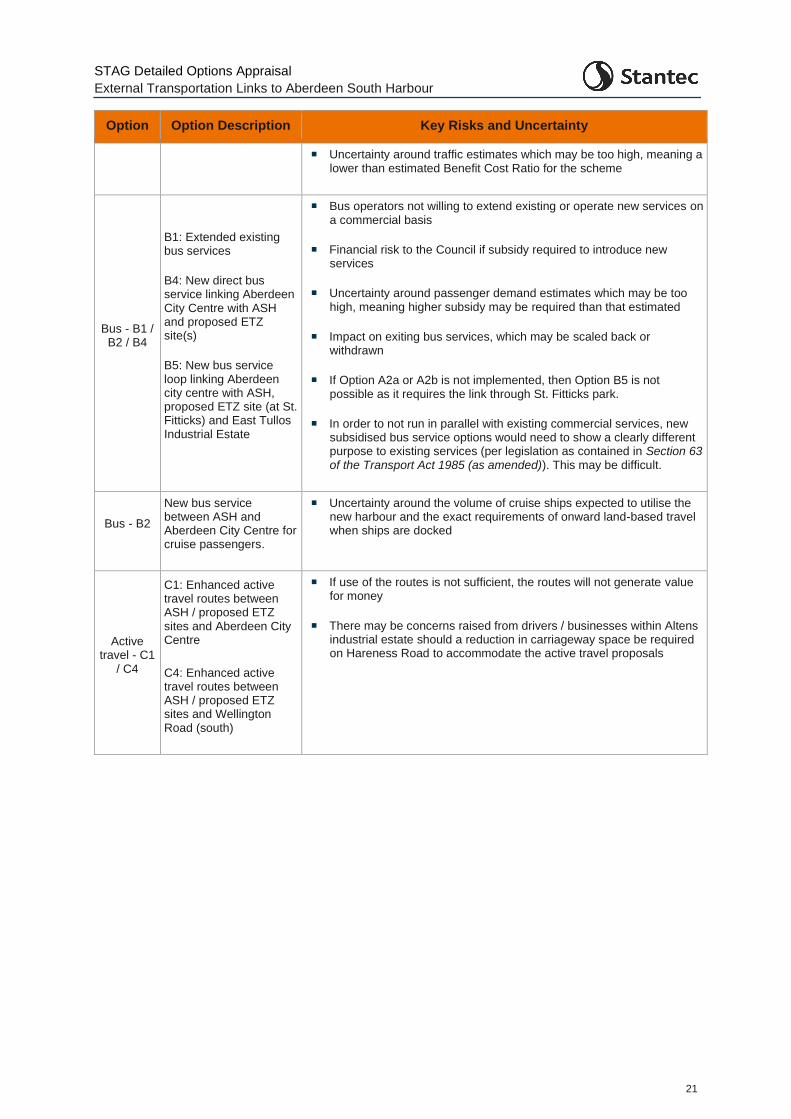
Option Option Description Key Risks and Uncertainty
Uncertainty around traffic estimates which may be too high, meaning a lower than estimated Benefit Cost Ratio for the scheme
Bus - B1 / B2 / B4
B1: Extended existing bus services
B4: New direct bus service linking Aberdeen City Centre with ASH and proposed ETZ site(s)
B5: New bus service loop linking Aberdeen city centre with ASH, proposed ETZ site (at St. Fitticks) and East Tullos Industrial Estate
Bus operators not willing to extend existing or operate new services on a commercial basis
Financial risk to the Council if subsidy required to introduce new services
Uncertainty around passenger demand estimates which may be too high, meaning higher subsidy may be required than that estimated
Impact on exiting bus services, which may be scaled back or withdrawn
If Option A2a or A2b is not implemented, then Option B5 is not possible as it requires the link through St. Fitticks park.
In order to not run in parallel with existing commercial services, new subsidised bus service options would need to show a clearly different purpose to existing services (per legislation as contained in Section 63 of the Transport Act 1985 (as amended)). This may be difficult.
Bus - B2
New bus service between ASH and Aberdeen City Centre for cruise passengers.
Uncertainty around the volume of cruise ships expected to utilise the new harbour and the exact requirements of onward land-based travel when ships are docked
Active travel - C1
/ C4
C1: Enhanced active travel routes between ASH / proposed ETZ sites and Aberdeen City Centre
C4: Enhanced active travel routes between ASH / proposed ETZ sites and Wellington Road (south)
If use of the routes is not sufficient, the routes will not generate value for money
There may be concerns raised from drivers / businesses within Altens industrial estate should a reduction in carriageway space be required on Hareness Road to accommodate the active travel proposals
STAG Detailed Options Appraisal
External Transportation Links to Aberdeen South Harbour
22
1 Introduction
1.1.1 Aberdeen City Council (ACC) commissioned Stantec (formerly Peter Brett Associates LLP) in October 2017 to undertake an appraisal of transport connections for the new Aberdeen South Harbour (ASH) located at the Bay of Nigg in Aberdeen. The aim of the study was to examine transport connectivity for the site and identify appropriate transport infrastructure and connectivity upgrades to be taken forward for detailed appraisal in the context of the Aberdeen City Region Deal.
1.1.2 The City Region Deal Agreement recognises the importance of the new harbour in accommodating existing and future demands on the port, noting that the project has national and regional significance. The City Region Deal Agreement states that ‘both the UK Government and the Scottish Government commit to maximising the impact of the harbour expansion on the wider regional economy’. The study therefore seeks to develop transport interventions which can maximise the wider regional economic benefits of the harbour development.
1.1.3 The study was undertaken in line with Scottish Transport Appraisal Guidance (STAG) and covered the Initial Appraisal: Case for Change (reported in June 2018) and Preliminary Options Appraisal (September 2018) stages. The Preliminary Options Appraisal presented an appraisal of the options generated against the:
Transport Planning Objectives (TPOs);
STAG criteria (Environment, Economy, Safety, Accessibility & Social Inclusion, and Integration); and
Implementability criteria (Feasibility, Affordability, and Public Acceptability).
1.1.4 The options were sifted into a more refined list with a final set of options recommended for further appraisal at the STAG Detailed Options Appraisal stage.
1.1.5 Subsequently, in March 2019, Stantec was further commissioned to undertake a Detailed Options Appraisal for the short-listed options. This report details the work undertaken to appraise the options and presents the findings of the appraisal.
1.1.6 The Detailed Options Appraisal covers:
Further option development;
Development of harbour market scenarios;
Traffic modelling and economic appraisal;
Assessment of the options against:
o Transport Planning Objectives;
o STAG appraisal criteria;
o Implementability considerations;
o Cost to Government; and Risk and Uncertainty; and
Consultation and Engagement.
STAG Detailed Options Appraisal
External Transportation Links to Aberdeen South Harbour
23
1.2 An Evolution of the Focus: Energy Transition Zone
1.2.1 The initial scope of the study was to examine transport connectivity for the new Aberdeen South Harbour. The options developed at the Initial Appraisal: Case for Change stage and appraised at the Preliminary Options Appraisal stage were developed with this aim in mind. However, in March 2020, Aberdeen City Council published their Proposed 2020 Local Development Plan (‘Proposed Plan’), which set out new proposed land use changes in the area in the immediate vicinity of the harbour.
1.2.2 Changes to the oil and gas sector in recent years means the industry is having to adapt and evolve and consider the potential for new more sustainable and lower/zero carbon energy resources. A 70-acre site (split between two areas) has been identified close to the new harbour which includes green space and the existing East Tullos industrial estates. The area has been earmarked in the Proposed 2020 Local Development Plan and described as the city’s first ‘Energy Transition Zone’ (proposed ETZ). Under the proposals, the land would be set aside for the development of low or zero-carbon or renewable energy industries, with businesses focussing on wind, biomass, solar and tidal sectors. It would also see the creation of a hydrogen production plant and a shoreside energy hub.
1.2.3 The location identified for the proposed ETZ seeks to maximise development opportunities, with the proximity of the harbour a key enabler in the development and success of the zone. Access to the harbour is key to encouraging and supporting the delivery of low carbon energy and technologies, and alternative fuel production at the site, all facilitating the transition from oil and gas to green energy production.
1.2.4 In June 2020, the Scottish Government announced £62m in funding to support the oil and gas sector, focussed on north-east Scotland, to help the industry deal with the dual economic impacts of the COVID-19 pandemic and the crash in oil prices. The funding will go towards several projects, including the proposed ETZ.
1.2.5 This altered situation means the study now has a wider remit. This widened remit focusses on ensuring appropriate and robust transport connectivity for the harbour, the proposed ETZ and the surrounding industrial area, ensuring appropriate access to the harbour, and proposed ETZ area. Any new connections need to ensure appropriate linkages between the harbour, proposed ETZ, the nearby industrial areas of Altens and East Tullos, as well as to the wider business districts around Aberdeen, and further afield.
1.2.6 The emergence of the proposed ETZ necessitated a review of both the Transport Planning Objectives for the study and the options themselves. The size of the proposed ETZ and the activities likely to take place there are anticipated to generate traffic volumes greater than those envisaged for the new harbour and of a different vehicle composition. This has implications not just on the likely benefits of any new road connection, but places additional weighting on public transport and active travel connections to ensure appropriate sustainable transport connections for those employed to the site.
1.3 Energy Transition Zone Background
1.3.1 The Proposed Plan identifies two sites for the proposed ETZ:
OP56 – St. FitticksPark: 18.2ha site
OP61 – Doonies Farm: 16.3ha site
1.3.2 It notes that “OP56, along with OP61, will support renewable energy transition related industries in association with Aberdeen South Harbour. Any development at this site must have a functional association with the South Harbour which precludes it being located elsewhere, such as the size of the infrastructure preventing transport from other locations or requiring ‘roll on / roll off’ level access to the South Harbour. Appropriate environmental assessments will be
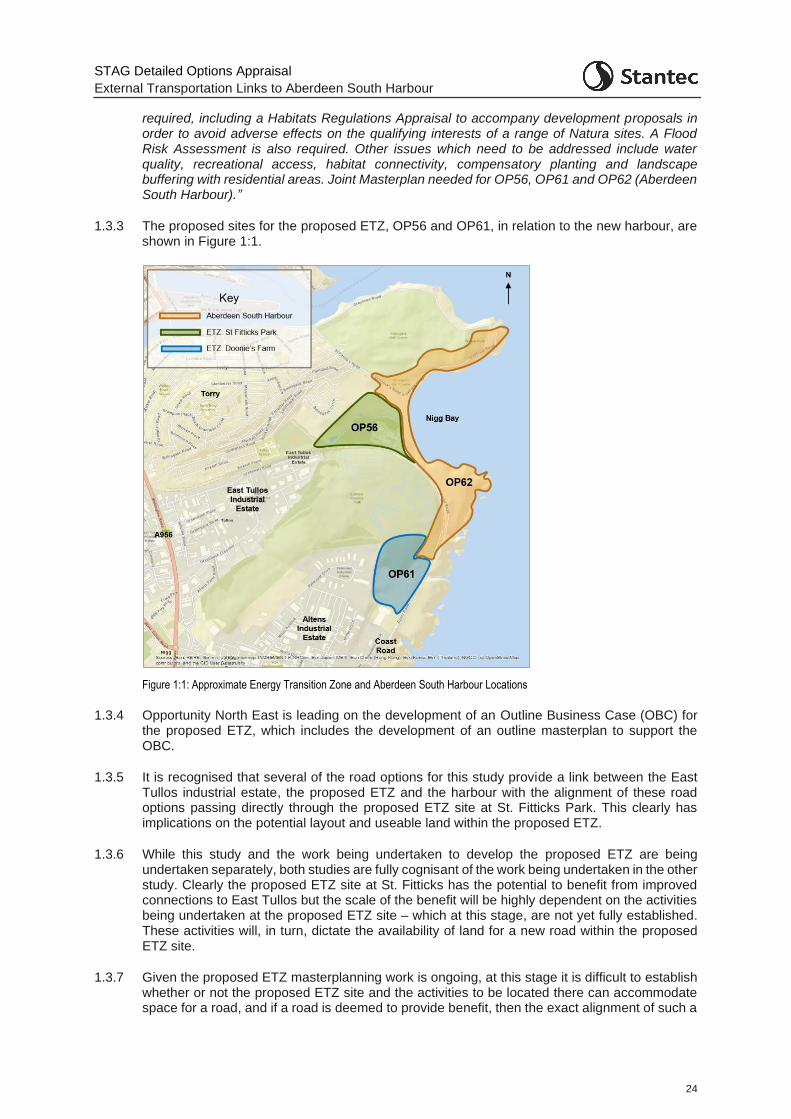
STAG Detailed Options Appraisal
External Transportation Links to Aberdeen South Harbour
24
required, including a Habitats Regulations Appraisal to accompany development proposals in order to avoid adverse effects on the qualifying interests of a range of Natura sites. A Flood Risk Assessment is also required. Other issues which need to be addressed include water quality, recreational access, habitat connectivity, compensatory planting and landscape buffering with residential areas. Joint Masterplan needed for OP56, OP61 and OP62 (Aberdeen South Harbour).”
1.3.3 The proposed sites for the proposed ETZ, OP56 and OP61, in relation to the new harbour, are shown in Figure 1:1.
Figure 1:1: Approximate Energy Transition Zone and Aberdeen South Harbour Locations
1.3.4 Opportunity North East is leading on the development of an Outline Business Case (OBC) for the proposed ETZ, which includes the development of an outline masterplan to support the OBC.
1.3.5 It is recognised that several of the road options for this study provide a link between the East Tullos industrial estate, the proposed ETZ and the harbour with the alignment of these road options passing directly through the proposed ETZ site at St. Fitticks Park. This clearly has implications on the potential layout and useable land within the proposed ETZ.
1.3.6 While this study and the work being undertaken to develop the proposed ETZ are being undertaken separately, both studies are fully cognisant of the work being undertaken in the other study. Clearly the proposed ETZ site at St. Fitticks has the potential to benefit from improved connections to East Tullos but the scale of the benefit will be highly dependent on the activities being undertaken at the proposed ETZ site – which at this stage, are not yet fully established. These activities will, in turn, dictate the availability of land for a new road within the proposed ETZ site.
1.3.7 Given the proposed ETZ masterplanning work is ongoing, at this stage it is difficult to establish whether or not the proposed ETZ site and the activities to be located there can accommodate space for a road, and if a road is deemed to provide benefit, then the exact alignment of such a
STAG Detailed Options Appraisal
External Transportation Links to Aberdeen South Harbour
25
road through the site and its purpose. To this end, while engineering work has been undertaken as part of this study to consider a link through St. Fitticks Park (linking East Tullos and the Coast Road), the exact alignments presented should not be taken as fixed and will be subject to change as development of the proposed ETZ site progresses.
1.4 Wellington Road Multi-Modal Corridor Study
1.4.1 The work being undertaken for this study has also taken cognisance of the ongoing Wellington Road Multi-modal Corridor Study. The study is looking at ways of improving travel for people and goods along the Wellington Road corridor. Among the objectives are improving air quality, facilitating school travel, safer travel for pedestrians and cyclists, and improving bus and freight movements. The study area is from A90(T) / A956 Charleston Interchange to the Queen Elizabeth Bridge. It also incorporates the side roads in proximity to Wellington Road, and any interaction with A90(T).
1.4.2 Additional traffic generated by the new harbour and proposed ETZ, as well as the infrastructure proposed under the various options being considered, have the ability to alter traffic flows, patterns, and routeing in the Wellington Road area. The need to collaborate to ensure that options are complementary has been important during the option development and appraisal process for both studies. Where options have the potential to constrain or support the proposals of the Wellington Road Multi-modal Corridor Study this is noted within the appraisal reporting.
STAG Detailed Options Appraisal
External Transportation Links to Aberdeen South Harbour
26
2 Smartening the Transport Planning Objectives
2.1 Introduction
2.1.1 The STAG states that at the start of any Detailed Options Appraisal the Transport Planning Objectives (TPOs) for the study should be revisited and ‘SMART-ened’ as much as possible. In this case there has been a material change in the form of new allocations from the Proposed Plan in the land neighbouring Aberdeen South Harbour (ASH). The allocation of the Energy Transition Zone (proposed ETZ) in the area would be expected to have a material effect on the volume and type of traffic moving to and from the ASH area.
2.1.2 The proposed ETZ is at the conceptual stage, albeit there are defined land packages in the LDP and the nature of the activity which would be permitted there has been very broadly defined as having a requirement to be in proximity to ASH. The proposed ETZ has a transport impact in its own right and clearly has the potential to impact on the nature of the activities at ASH.
2.1.3 There are therefore now two main variables:
The quantity and type of traffic associated with ASH: commercial vehicle traffic; car-based travel; public transport journeys; and active travel journeys.
The quantity and type of traffic associated with the proposed ETZ: commercial vehicle traffic; car-based travel; public transport journeys; and active travel journeys.
2.2 Smartening the Objectives
2.2.1 Given this widened focus of the study, the TPOs have been revisited to ensure they are still relevant. This has also provided an opportunity to rationalise the number of TPOs from the set of nine at the end of the Preliminary Appraisal.
2.2.2 Table 2:1 presents the original set of objectives on the left alongside their corresponding revised objectives on the right.
Table 2:1: Revising the Transport Planning Objectives
TPO No.
Preliminary Appraisal Objective
New TPO No.
Revised Objective
TPO1
Provide a designated Heavy Goods Vehicle (HGV) route to/from ASH which is more efficient than alternative routes to help minimise inappropriate routing, environmental and nuisance impacts
TPO1
Provide a designated Heavy Goods Vehicle (HGV) route to/from ASH / proposed ETZ sites which is more efficient than alternative routes to:
• minimise journey times to Aberdeen Western Peripheral Route (AWPR) / Charleston junction and King George VI Bridge; and
• help minimise inappropriate routeing and environmental and nuisance impacts
TPO2
Minimise the impacts of harbour traffic on Hareness Road, a key access route for proposed development
-
Wrapped up with TPO1.
TPO3 Maximise the landside opportunities for harbour related economic activity
TPO2a Maximise connectivity by all modes (car, public transport, and active travel) between Aberdeen
STAG Detailed Options Appraisal
External Transportation Links to Aberdeen South Harbour
27
TPO No.
Preliminary Appraisal Objective
New TPO No.
Revised Objective
South Harbour / Energy Transition Zone and prospective workers at the sites
TPO2b
Maximise connectivity between proposed ETZ and other energy-related businesses in the Aberdeen area (Business to Business)
TPO4
Minimise travel times by road between ASH and the Aberdeen Western Peripheral Route (AWPR) / Charleston junction and King George VI Bridge
-
Wrapped up with TPO1.
TPO5
Provide an access route to / from ASH for abnormal loads which avoids residential areas
TPO3
Futureproof access to the proposed ETZ / ASH for the widest range of abnormal loads possible and minimise the impact of abnormal loads travelling from and to the proposed ETZ / ASH
TPO6
Provide connections to / from ASH which help to tackle any perceptions of poor quality access to and from the harbour
-
-
TPO7
Provide appropriate public transport connections to / from ASH reflecting the type of activity at the harbour
-
Wrapped up in TPO2a
TPO8
Provide appropriate active travel connections to / from ASH reflecting the type of activity at the harbour
-
Wrapped up in TPO2a
TPO9
Improve the resilience of transport connections to and from ASH /proposed ETZ
TPO4
Improve the resilience of transport connections to and from ASH /proposed ETZ
(Retained as is)
-
-
TPO5
Maximise the intermodal opportunities between the proposed ETZ and the existing rail network
2.2.3 The final TPOs for the Detailed Options Appraisal are shown in Table 2:2.
Table 2:2: Final Detailed Options Appraisal Transport Planning Objectives
TPO No.
Detailed Options Appraisal Objective
TPO1 Provide a designated Heavy Goods Vehicle (HGV) route to/from ASH which is more efficient than alternative routes to:
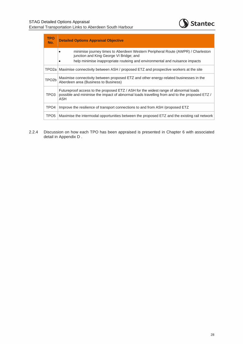
STAG Detailed Options Appraisal
External Transportation Links to Aberdeen South Harbour
28
TPO No.
Detailed Options Appraisal Objective
• minimise journey times to Aberdeen Western Peripheral Route (AWPR) / Charleston junction and King George VI Bridge; and
• help minimise inappropriate routeing and environmental and nuisance impacts
TPO2a Maximise connectivity between ASH / proposed ETZ and prospective workers at the site
TPO2b Maximise connectivity between proposed ETZ and other energy-related businesses in the Aberdeen area (Business to Business)
TPO3 Futureproof access to the proposed ETZ / ASH for the widest range of abnormal loads possible and minimise the impact of abnormal loads travelling from and to the proposed ETZ / ASH
TPO4 Improve the resilience of transport connections to and from ASH /proposed ETZ
TPO5 Maximise the intermodal opportunities between the proposed ETZ and the existing rail network
2.2.4 Discussion on how each TPO has been appraised is presented in Chapter 6 with associated detail in Appendix D .

STAG Detailed Options Appraisal
External Transportation Links to Aberdeen South Harbour
29
3 Revising the Options
3.1 Options recommended from the Preliminary Options Appraisal
3.1.1 At the end of the Preliminary Options Appraisal, several options were recommended for further appraisal. These included road, public transport, and active travel options. These options are described in Table 3:1, with the road, public transport and active travel options shown in Figure 3:1, Figure 3:2 and Figure 3:3 respectively.
Table 3:1: Options recommended for further appraisal at Detailed Options Appraisal stage
Mode Option ID Option Description
Road
A2a/b New road connection from Greenwell Road / Greenbank Road via St Fitticks Community Park to Coast Road with a new underbridge under the railway line
A3a/b New road connection from Greenwell Road / Greenbank Road via the former Ness Landfill site and a new bridge over the railway
In addition, a variant of Option A3 which instead of a new bridge comprises a link around the perimeter of the Ness landfill site to Coast Road has been explored.
A4 Improve the existing route via Hareness Road through the provision of a new bridge over the railway on Coast Road and capacity improvements.
A5 New road connection between Coast Road and Souter Head Road and a new bridge over the railway on Coast Road
Public Transport
B1 Extend / enhance existing bus services between ASH and Aberdeen City Centre.
B2 New bus service between ASH and Aberdeen City Centre for cruise passengers.
Active Travel
C1 Enhanced active travel routes between the Bay of Nigg and Aberdeen City Centre.
C3 Dedicated active travel route from Coast Road through Tullos Hill to the A956 with onward connections to the Deeside Way.
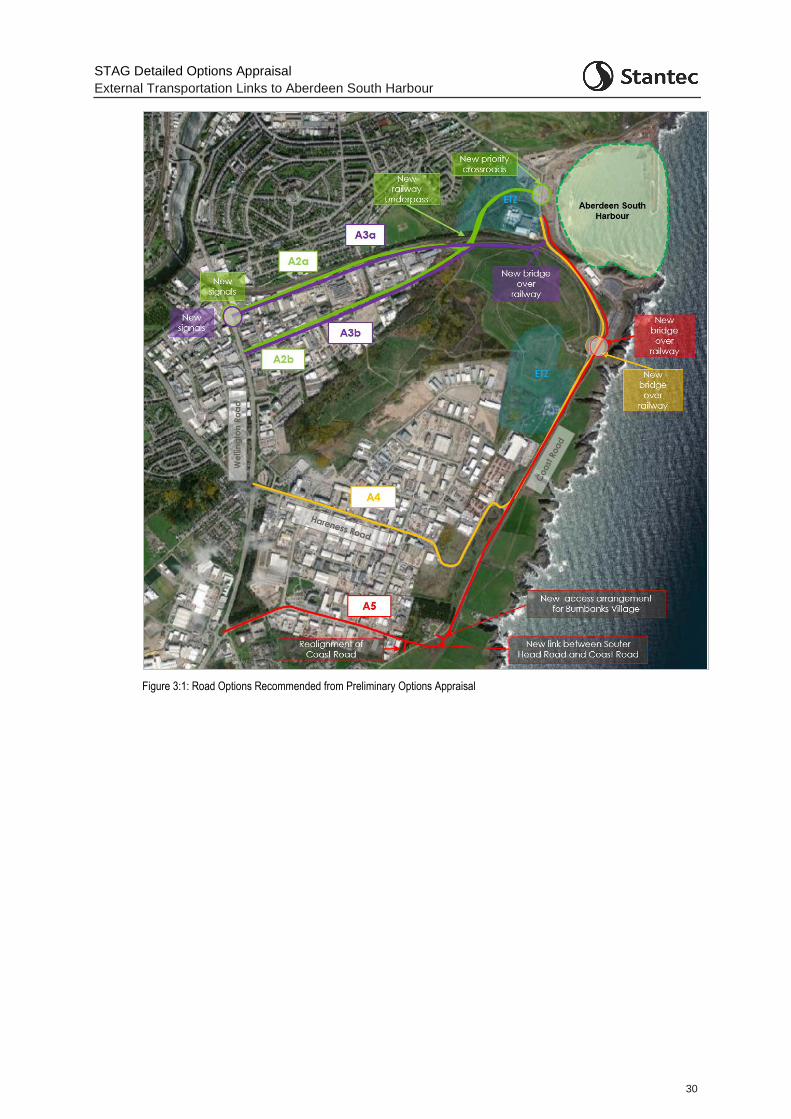
STAG Detailed Options Appraisal
External Transportation Links to Aberdeen South Harbour
30
Figure 3:1: Road Options Recommended from Preliminary Options Appraisal
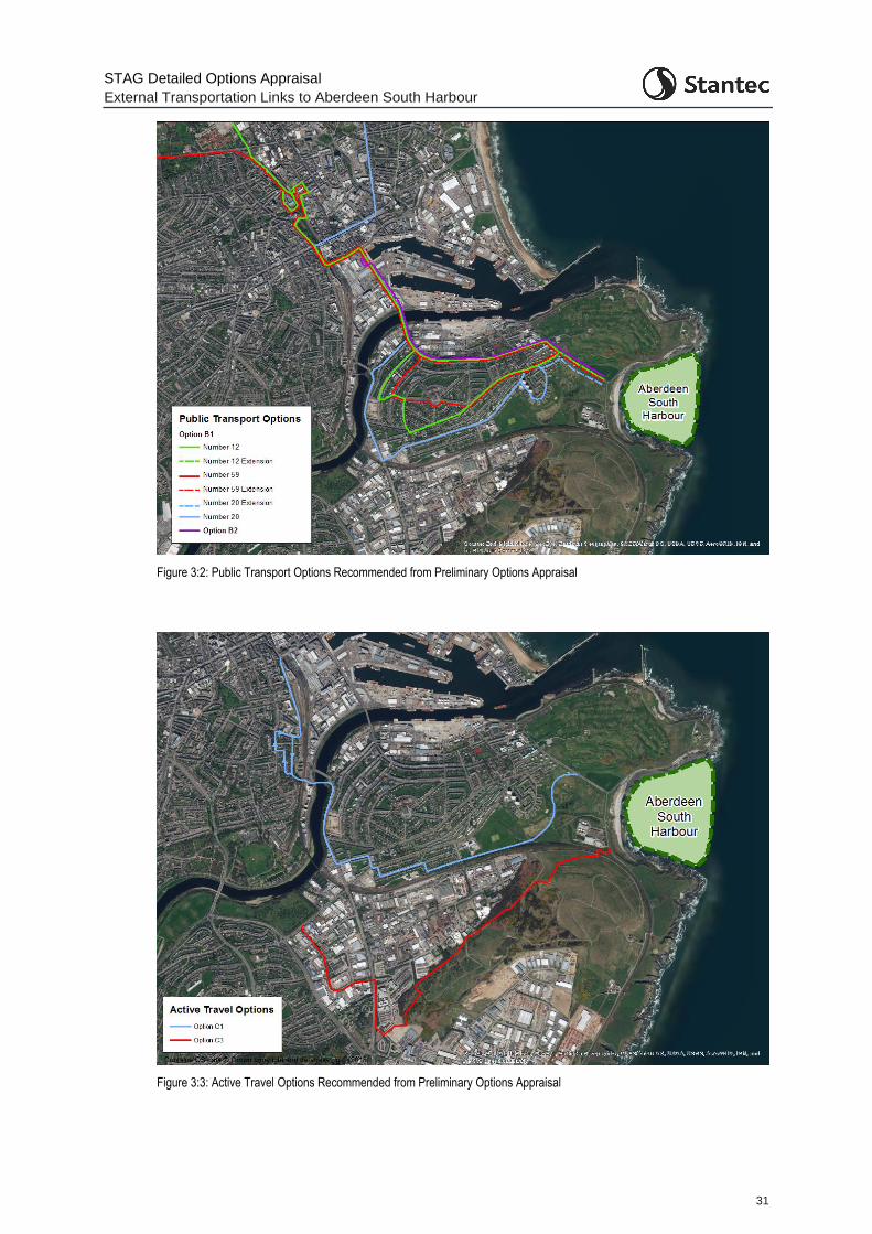
STAG Detailed Options Appraisal
External Transportation Links to Aberdeen South Harbour
31
Figure 3:2: Public Transport Options Recommended from Preliminary Options Appraisal
Figure 3:3: Active Travel Options Recommended from Preliminary Options Appraisal
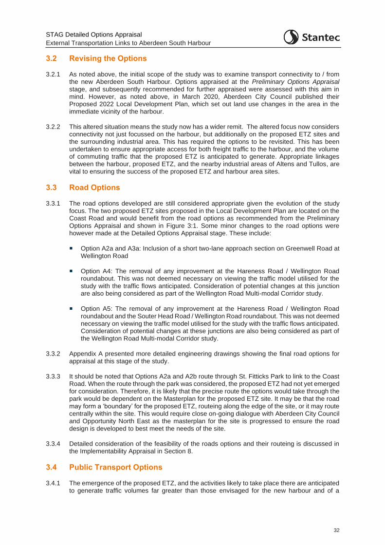
STAG Detailed Options Appraisal
External Transportation Links to Aberdeen South Harbour
32
3.2 Revising the Options
3.2.1 As noted above, the initial scope of the study was to examine transport connectivity to / from the new Aberdeen South Harbour. Options appraised at the Preliminary Options Appraisal stage, and subsequently recommended for further appraised were assessed with this aim in mind. However, as noted above, in March 2020, Aberdeen City Council published their Proposed 2022 Local Development Plan, which set out land use changes in the area in the immediate vicinity of the harbour.
3.2.2 This altered situation means the study now has a wider remit. The altered focus now considers connectivity not just focussed on the harbour, but additionally on the proposed ETZ sites and the surrounding industrial area. This has required the options to be revisited. This has been undertaken to ensure appropriate access for both freight traffic to the harbour, and the volume of commuting traffic that the proposed ETZ is anticipated to generate. Appropriate linkages between the harbour, proposed ETZ, and the nearby industrial areas of Altens and Tullos, are vital to ensuring the success of the proposed ETZ and harbour area sites.
3.3 Road Options
3.3.1 The road options developed are still considered appropriate given the evolution of the study focus. The two proposed ETZ sites proposed in the Local Development Plan are located on the Coast Road and would benefit from the road options as recommended from the Preliminary Options Appraisal and shown in Figure 3:1. Some minor changes to the road options were however made at the Detailed Options Appraisal stage. These include:
Option A2a and A3a: Inclusion of a short two-lane approach section on Greenwell Road at Wellington Road
Option A4: The removal of any improvement at the Hareness Road / Wellington Road roundabout. This was not deemed necessary on viewing the traffic model utilised for the study with the traffic flows anticipated. Consideration of potential changes at this junction are also being considered as part of the Wellington Road Multi-modal Corridor study.
Option A5: The removal of any improvement at the Hareness Road / Wellington Road roundabout and the Souter Head Road / Wellington Road roundabout. This was not deemed necessary on viewing the traffic model utilised for the study with the traffic flows anticipated. Consideration of potential changes at these junctions are also being considered as part of the Wellington Road Multi-modal Corridor study.
3.3.2 Appendix A presented more detailed engineering drawings showing the final road options for appraisal at this stage of the study.
3.3.3 It should be noted that Options A2a and A2b route through St. Fitticks Park to link to the Coast Road. When the route through the park was considered, the proposed ETZ had not yet emerged for consideration. Therefore, it is likely that the precise route the options would take through the park would be dependent on the Masterplan for the proposed ETZ site. It may be that the road may form a ‘boundary’ for the proposed ETZ, routeing along the edge of the site, or it may route centrally within the site. This would require close on-going dialogue with Aberdeen City Council and Opportunity North East as the masterplan for the site is progressed to ensure the road design is developed to best meet the needs of the site.
3.3.4 Detailed consideration of the feasibility of the roads options and their routeing is discussed in the Implementability Appraisal in Section 8.
3.4 Public Transport Options
3.4.1 The emergence of the proposed ETZ, and the activities likely to take place there are anticipated to generate traffic volumes far greater than those envisaged for the new harbour and of a
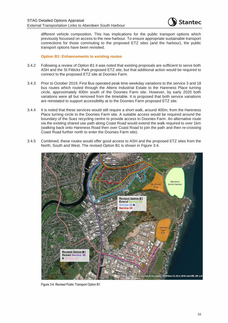
STAG Detailed Options Appraisal
External Transportation Links to Aberdeen South Harbour
33
different vehicle composition. This has implications for the public transport options which previously focussed on access to the new harbour. To ensure appropriate sustainable transport connections for those commuting to the proposed ETZ sites (and the harbour), the public transport options have been revisited.
Option B1: Enhancements to existing routes
3.4.2 Following a review of Option B1 it was noted that existing proposals are sufficient to serve both ASH and the St Fitticks Park proposed ETZ site, but that additional action would be required to connect to the proposed ETZ site at Doonies Farm.
3.4.3 Prior to October 2019, First Bus operated peak time weekday variations to the service 3 and 18 bus routes which routed through the Altens Industrial Estate to the Hareness Place turning circle, approximately 400m south of the Doonies Farm site. However, by early 2020 both variations were all but removed from the timetable. It is proposed that both service variations are reinstated to support accessibility at to the Doonies Farm proposed ETZ site.
3.4.4 It is noted that these services would still require a short walk, around 400m, from the Hareness Place turning circle to the Doonies Farm site. A suitable access would be required around the boundary of the Suez recycling centre to provide access to Doonies Farm. An alternative route via the existing shared use path along Coast Road would extend the walk required to over 1km (walking back onto Hareness Road then over Coast Road to join the path and then re-crossing Coast Road further north to enter the Doonies Farm site).
3.4.5 Combined, these routes would offer good access to ASH and the proposed ETZ sites from the North, South and West. The revised Option B1 is shown in Figure 3:4.
Figure 3:4: Revised Public Transport Option B1
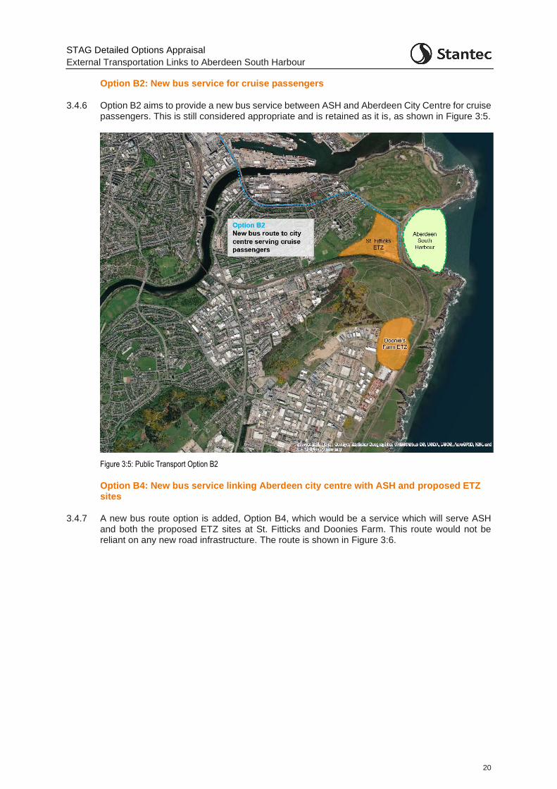
STAG Detailed Options Appraisal
External Transportation Links to Aberdeen South Harbour
20
Option B2: New bus service for cruise passengers
3.4.6 Option B2 aims to provide a new bus service between ASH and Aberdeen City Centre for cruise passengers. This is still considered appropriate and is retained as it is, as shown in Figure 3:5.
Figure 3:5: Public Transport Option B2
Option B4: New bus service linking Aberdeen city centre with ASH and proposed ETZ sites
3.4.7 A new bus route option is added, Option B4, which would be a service which will serve ASH and both the proposed ETZ sites at St. Fitticks and Doonies Farm. This route would not be reliant on any new road infrastructure. The route is shown in Figure 3:6.
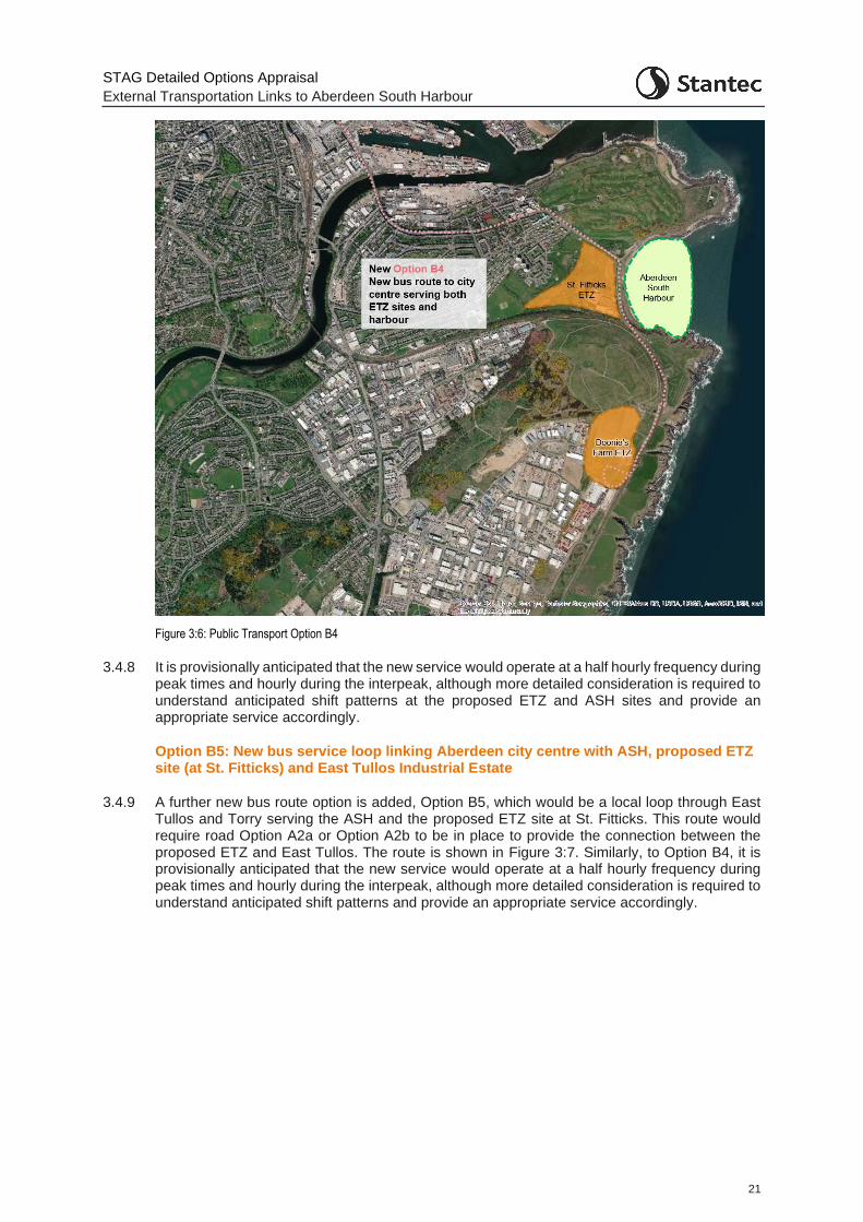
STAG Detailed Options Appraisal
External Transportation Links to Aberdeen South Harbour
21
Figure 3:6: Public Transport Option B4
3.4.8 It is provisionally anticipated that the new service would operate at a half hourly frequency during peak times and hourly during the interpeak, although more detailed consideration is required to understand anticipated shift patterns at the proposed ETZ and ASH sites and provide an appropriate service accordingly.
Option B5: New bus service loop linking Aberdeen city centre with ASH, proposed ETZ site (at St. Fitticks) and East Tullos Industrial Estate
3.4.9 A further new bus route option is added, Option B5, which would be a local loop through East Tullos and Torry serving the ASH and the proposed ETZ site at St. Fitticks. This route would require road Option A2a or Option A2b to be in place to provide the connection between the proposed ETZ and East Tullos. The route is shown in Figure 3:7. Similarly, to Option B4, it is provisionally anticipated that the new service would operate at a half hourly frequency during peak times and hourly during the interpeak, although more detailed consideration is required to understand anticipated shift patterns and provide an appropriate service accordingly.
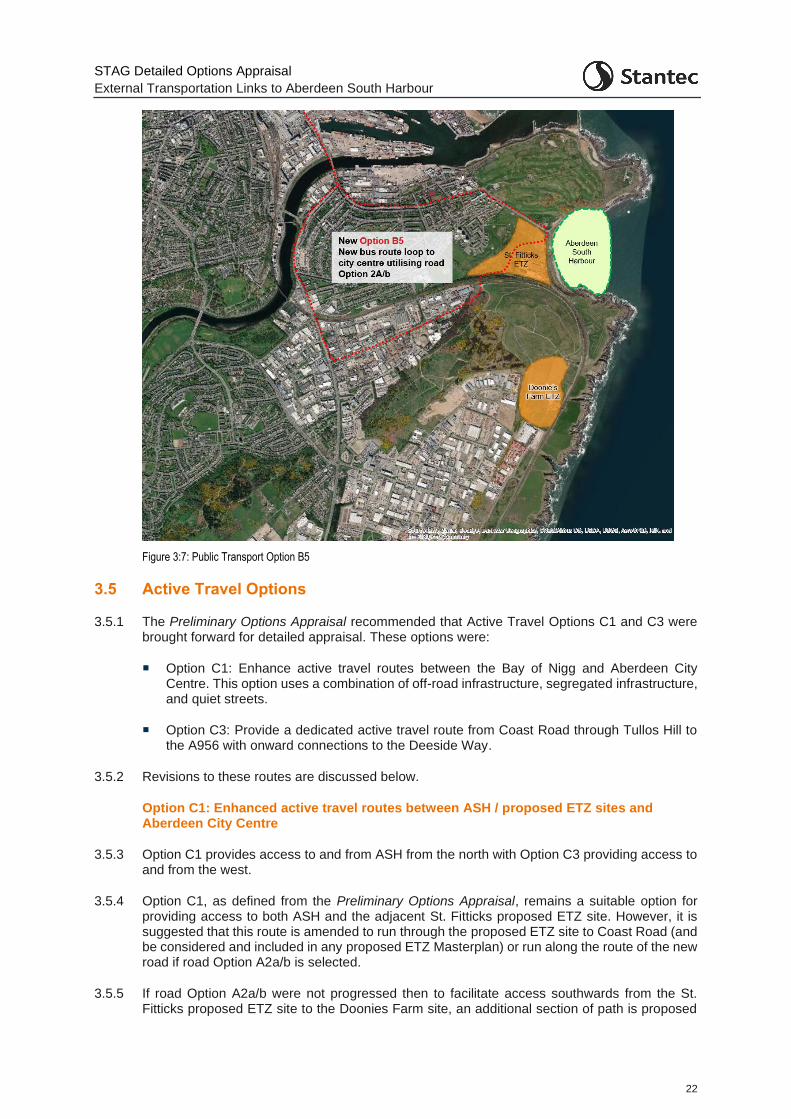
STAG Detailed Options Appraisal
External Transportation Links to Aberdeen South Harbour
22
Figure 3:7: Public Transport Option B5
3.5 Active Travel Options
3.5.1 The Preliminary Options Appraisal recommended that Active Travel Options C1 and C3 were brought forward for detailed appraisal. These options were:
Option C1: Enhance active travel routes between the Bay of Nigg and Aberdeen City Centre. This option uses a combination of off-road infrastructure, segregated infrastructure, and quiet streets.
Option C3: Provide a dedicated active travel route from Coast Road through Tullos Hill to the A956 with onward connections to the Deeside Way.
3.5.2 Revisions to these routes are discussed below.
Option C1: Enhanced active travel routes between ASH / proposed ETZ sites and Aberdeen City Centre
3.5.3 Option C1 provides access to and from ASH from the north with Option C3 providing access to and from the west.
3.5.4 Option C1, as defined from the Preliminary Options Appraisal, remains a suitable option for providing access to both ASH and the adjacent St. Fitticks proposed ETZ site. However, it is suggested that this route is amended to run through the proposed ETZ site to Coast Road (and be considered and included in any proposed ETZ Masterplan) or run along the route of the new road if road Option A2a/b is selected.
3.5.5 If road Option A2a/b were not progressed then to facilitate access southwards from the St. Fitticks proposed ETZ site to the Doonies Farm site, an additional section of path is proposed
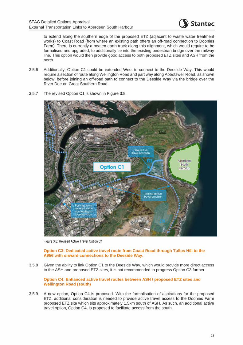
STAG Detailed Options Appraisal
External Transportation Links to Aberdeen South Harbour
23
to extend along the southern edge of the proposed ETZ (adjacent to waste water treatment works) to Coast Road (from where an existing path offers an off-road connection to Doonies Farm). There is currently a beaten earth track along this alignment, which would require to be formalised and upgraded, to additionally tie into the existing pedestrian bridge over the railway line. This option would then provide good access to both proposed ETZ sites and ASH from the north.
3.5.6 Additionally, Option C1 could be extended West to connect to the Deeside Way. This would require a section of route along Wellington Road and part way along Abbotswell Road, as shown below, before joining an off-road path to connect to the Deeside Way via the bridge over the River Dee on Great Southern Road.
3.5.7 The revised Option C1 is shown in Figure 3:8.
Figure 3:8: Revised Active Travel Option C1
Option C3: Dedicated active travel route from Coast Road through Tullos Hill to the A956 with onward connections to the Deeside Way.
3.5.8 Given the ability to link Option C1 to the Deeside Way, which would provide more direct access to the ASH and proposed ETZ sites, it is not recommended to progress Option C3 further.
Option C4: Enhanced active travel routes between ASH / proposed ETZ sites and Wellington Road (south)
3.5.9 A new option, Option C4 is proposed. With the formalisation of aspirations for the proposed ETZ, additional consideration is needed to provide active travel access to the Doonies Farm proposed ETZ site which sits approximately 1.5km south of ASH. As such, an additional active travel option, Option C4, is proposed to facilitate access from the south.
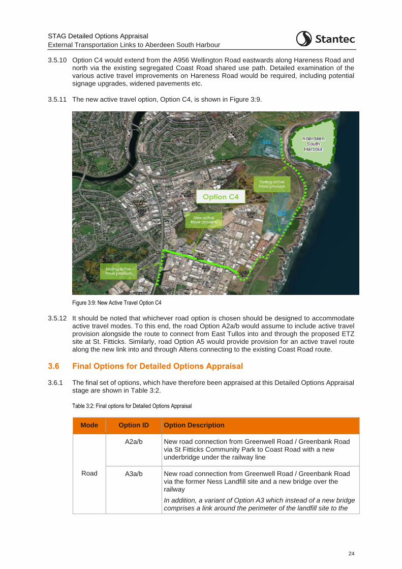
STAG Detailed Options Appraisal
External Transportation Links to Aberdeen South Harbour
24
3.5.10 Option C4 would extend from the A956 Wellington Road eastwards along Hareness Road and north via the existing segregated Coast Road shared use path. Detailed examination of the various active travel improvements on Hareness Road would be required, including potential signage upgrades, widened pavements etc.
3.5.11 The new active travel option, Option C4, is shown in Figure 3:9.
Figure 3:9: New Active Travel Option C4
3.5.12 It should be noted that whichever road option is chosen should be designed to accommodate active travel modes. To this end, the road Option A2a/b would assume to include active travel provision alongside the route to connect from East Tullos into and through the proposed ETZ site at St. Fitticks. Similarly, road Option A5 would provide provision for an active travel route along the new link into and through Altens connecting to the existing Coast Road route.
3.6 Final Options for Detailed Options Appraisal
3.6.1 The final set of options, which have therefore been appraised at this Detailed Options Appraisal stage are shown in Table 3:2.
Table 3:2: Final options for Detailed Options Appraisal
Mode Option ID Option Description
Road
A2a/b New road connection from Greenwell Road / Greenbank Road via St Fitticks Community Park to Coast Road with a new underbridge under the railway line
A3a/b New road connection from Greenwell Road / Greenbank Road via the former Ness Landfill site and a new bridge over the railway
In addition, a variant of Option A3 which instead of a new bridge comprises a link around the perimeter of the landfill site to the
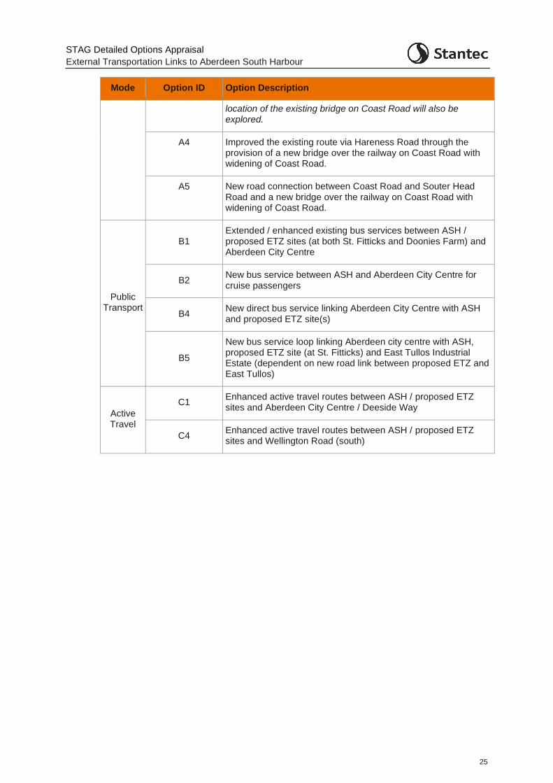
STAG Detailed Options Appraisal
External Transportation Links to Aberdeen South Harbour
25
Mode Option ID Option Description
location of the existing bridge on Coast Road will also be explored.
A4 Improved the existing route via Hareness Road through the provision of a new bridge over the railway on Coast Road with widening of Coast Road.
A5 New road connection between Coast Road and Souter Head Road and a new bridge over the railway on Coast Road with widening of Coast Road.
Public Transport
B1 Extended / enhanced existing bus services between ASH / proposed ETZ sites (at both St. Fitticks and Doonies Farm) and Aberdeen City Centre
B2 New bus service between ASH and Aberdeen City Centre for cruise passengers
B4 New direct bus service linking Aberdeen City Centre with ASH and proposed ETZ site(s)
B5
New bus service loop linking Aberdeen city centre with ASH, proposed ETZ site (at St. Fitticks) and East Tullos Industrial Estate (dependent on new road link between proposed ETZ and East Tullos)
Active Travel
C1 Enhanced active travel routes between ASH / proposed ETZ sites and Aberdeen City Centre / Deeside Way
C4 Enhanced active travel routes between ASH / proposed ETZ sites and Wellington Road (south)
STAG Detailed Options Appraisal
External Transportation Links to Aberdeen South Harbour
26
4 Detailed Options Appraisal: Geographical, Social and Economic Context
4.1 Geographical Context
4.1.1 ASH is located at the Bay of Nigg, approximately 0.8km to the south east of Aberdeen City Centre and the existing Aberdeen harbour. To the immediate north and west are the Nigg Bay Golf Club, Balnagask Golf Course and St. Fitticks Community Park, which form part of the broader Torry/Balnagask residential area. To the south west lies the Former Ness Landfill site and the Altens and East Tullos industrial estates.
4.1.2 The Proposed Plan proposed ETZ site, as shown in Figure 1:1, encompasses a site at St. Fitticks Park, due west of the new harbour and a site at Doonies Farm approximately 1.5km south of the new harbour. In addition, the overall strategy for the proposed ETZ encompasses the ongoing regeneration of East Tullos industrial estate.
4.1.3 Existing freight routes to the harbour permit HGV access to this area only from the south via the A956, Hareness Road and Coast Road/St. Fitticks Road, presenting a convoluted route for access from north or west Aberdeen. There is a general perception that access to and from the new harbour area is poor, with the Coast Road and Victoria Road viewed as unsuitable for large volumes of HGV and general traffic. In addition, the railway bridge on Coast Road is an issue for some abnormal loads, a particular issue for the renewables sector.
4.2 Social Context
4.2.1 The Torry residential area sits to the west of the proposed new harbour. Overall, Torry suffers from relatively high levels of unemployment, deprivation, and poor health.
4.2.2 SIMD 2020 shows five out of six datazones in Torry East are within the 10% most deprived in Scotland, and all six are within the 20% most deprived. In Torry West, three of the seven datazones fall within the 10% most deprived bracket, and six of seven are within the 20% most deprived, as shown in Figure 4:1. In general, these zones score poorly in all metrics except for geographic access.
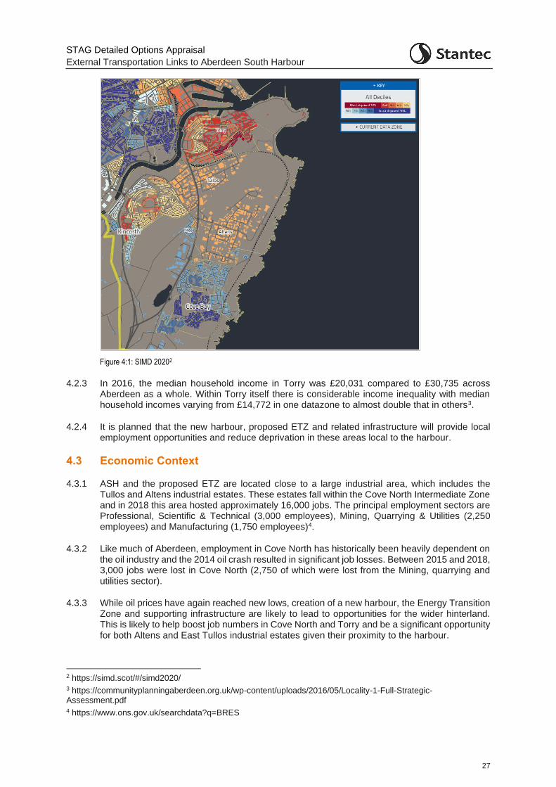
STAG Detailed Options Appraisal
External Transportation Links to Aberdeen South Harbour
27
Figure 4:1: SIMD 20202
4.2.3 In 2016, the median household income in Torry was £20,031 compared to £30,735 across Aberdeen as a whole. Within Torry itself there is considerable income inequality with median household incomes varying from £14,772 in one datazone to almost double that in others3.
4.2.4 It is planned that the new harbour, proposed ETZ and related infrastructure will provide local employment opportunities and reduce deprivation in these areas local to the harbour.
4.3 Economic Context
4.3.1 ASH and the proposed ETZ are located close to a large industrial area, which includes the Tullos and Altens industrial estates. These estates fall within the Cove North Intermediate Zone and in 2018 this area hosted approximately 16,000 jobs. The principal employment sectors are Professional, Scientific & Technical (3,000 employees), Mining, Quarrying & Utilities (2,250 employees) and Manufacturing (1,750 employees)4.
4.3.2 Like much of Aberdeen, employment in Cove North has historically been heavily dependent on the oil industry and the 2014 oil crash resulted in significant job losses. Between 2015 and 2018, 3,000 jobs were lost in Cove North (2,750 of which were lost from the Mining, quarrying and utilities sector).
4.3.3 While oil prices have again reached new lows, creation of a new harbour, the Energy Transition Zone and supporting infrastructure are likely to lead to opportunities for the wider hinterland. This is likely to help boost job numbers in Cove North and Torry and be a significant opportunity for both Altens and East Tullos industrial estates given their proximity to the harbour.
2 https://simd.scot/#/simd2020/ 3 https://communityplanningaberdeen.org.uk/wp-content/uploads/2016/05/Locality-1-Full-Strategic-Assessment.pdf 4 https://www.ons.gov.uk/searchdata?q=BRES

STAG Detailed Options Appraisal
External Transportation Links to Aberdeen South Harbour
28
4.3.4 The facilities at ASH have been designed to be flexible and adaptable to accommodate a range of industry sectors. There are several markets for the new harbour including oil and gas, decommissioning, subsea activities, renewables, cruise tourism and general and bulk cargo.
4.3.5 Altens is at present a much more prosperous location than East Tullos, with the standard of units much higher and the area home to several head offices, particularly within the oil and gas sector. In contrast, East Tullos is an older industrial estate (one of Aberdeen’s first) with poorer quality units, many of which were developed during the 1950s. As noted above, the plans for the development of the proposed ETZ encompass the regeneration of the East Tullos industrial estate area.
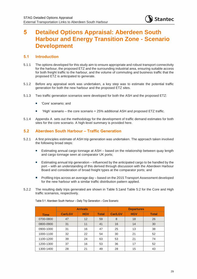
STAG Detailed Options Appraisal
External Transportation Links to Aberdeen South Harbour
29
5 Detailed Options Appraisal: Aberdeen South Harbour and Energy Transition Zone - Scenario Development
5.1 Introduction
5.1.1 The options developed for this study aim to ensure appropriate and robust transport connectivity for the harbour, the proposed ETZ and the surrounding industrial area, ensuring suitable access for both freight traffic to the harbour, and the volume of commuting and business traffic that the proposed ETZ is anticipated to generate.
5.1.2 Before any appraisal work was undertaken, a key step was to estimate the potential traffic generation for both the new harbour and the proposed ETZ sites.
5.1.3 Two traffic generation scenarios were developed for both the ASH and the proposed ETZ:
‘Core’ scenario; and
‘High’ scenario – the core scenario + 25% additional ASH and proposed ETZ traffic.
5.1.4 Appendix A sets out the methodology for the development of traffic demand estimates for both sites for the core scenario. A high-level summary is provided here.
5.2 Aberdeen South Harbour – Traffic Generation
5.2.1 A first principles estimate of ASH trip generation was undertaken. The approach taken involved the following broad steps:
Estimating annual cargo tonnage at ASH – based on the relationship between quay length and cargo tonnage seen at comparator UK ports;
Estimating annual trip generation – influenced by the anticipated cargo to be handled by the port – with an understanding of this derived through discussion with the Aberdeen Harbour Board and consideration of broad freight types at the comparator ports; and
Profiling trips across an average day – based on the 2015 Transport Assessment developed for the new harbour with a similar traffic distribution pattern applied.
5.2.2 The resulting daily trips generated are shown in Table 5:1and Table 5:2 for the Core and High traffic scenarios, respectively.
Table 5:1: Aberdeen South Harbour – Daily Trip Generation – Core Scenario
Time
Arrivals Departures
Car/LGV HGV Total Car/LGV HGV Total
0700-0800 47 12 59 8 18 26
0800-0900 31 11 41 16 14 30
0900-1000 31 16 47 25 13 38
1000-1100 32 22 54 30 21 52
1100-1200 39 24 63 53 21 74
1200-1300 37 16 53 36 17 52
1300-1400 28 21 49 28 15 43
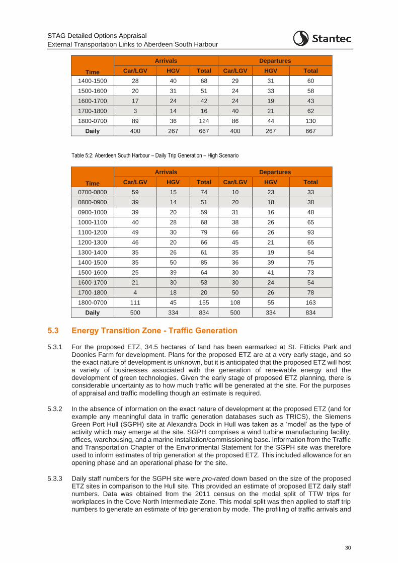
STAG Detailed Options Appraisal
External Transportation Links to Aberdeen South Harbour
30
Time
Arrivals Departures
Car/LGV HGV Total Car/LGV HGV Total
1400-1500 28 40 68 29 31 60
1500-1600 20 31 51 24 33 58
1600-1700 17 24 42 24 19 43
1700-1800 3 14 16 40 21 62
1800-0700 89 36 124 86 44 130
Daily 400 267 667 400 267 667
Table 5:2: Aberdeen South Harbour – Daily Trip Generation – High Scenario
Time
Arrivals Departures
Car/LGV HGV Total Car/LGV HGV Total
0700-0800 59 15 74 10 23 33
0800-0900 39 14 51 20 18 38
0900-1000 39 20 59 31 16 48
1000-1100 40 28 68 38 26 65
1100-1200 49 30 79 66 26 93
1200-1300 46 20 66 45 21 65
1300-1400 35 26 61 35 19 54
1400-1500 35 50 85 36 39 75
1500-1600 25 39 64 30 41 73
1600-1700 21 30 53 30 24 54
1700-1800 4 18 20 50 26 78
1800-0700 111 45 155 108 55 163
Daily 500 334 834 500 334 834
5.3 Energy Transition Zone - Traffic Generation
5.3.1 For the proposed ETZ, 34.5 hectares of land has been earmarked at St. Fitticks Park and Doonies Farm for development. Plans for the proposed ETZ are at a very early stage, and so the exact nature of development is unknown, but it is anticipated that the proposed ETZ will host a variety of businesses associated with the generation of renewable energy and the development of green technologies. Given the early stage of proposed ETZ planning, there is considerable uncertainty as to how much traffic will be generated at the site. For the purposes of appraisal and traffic modelling though an estimate is required.
5.3.2 In the absence of information on the exact nature of development at the proposed ETZ (and for example any meaningful data in traffic generation databases such as TRICS), the Siemens Green Port Hull (SGPH) site at Alexandra Dock in Hull was taken as a ‘model’ as the type of activity which may emerge at the site. SGPH comprises a wind turbine manufacturing facility, offices, warehousing, and a marine installation/commissioning base. Information from the Traffic and Transportation Chapter of the Environmental Statement for the SGPH site was therefore used to inform estimates of trip generation at the proposed ETZ. This included allowance for an opening phase and an operational phase for the site.
5.3.3 Daily staff numbers for the SGPH site were pro-rated down based on the size of the proposed ETZ sites in comparison to the Hull site. This provided an estimate of proposed ETZ daily staff numbers. Data was obtained from the 2011 census on the modal split of TTW trips for workplaces in the Cove North Intermediate Zone. This modal split was then applied to staff trip numbers to generate an estimate of trip generation by mode. The profiling of traffic arrivals and
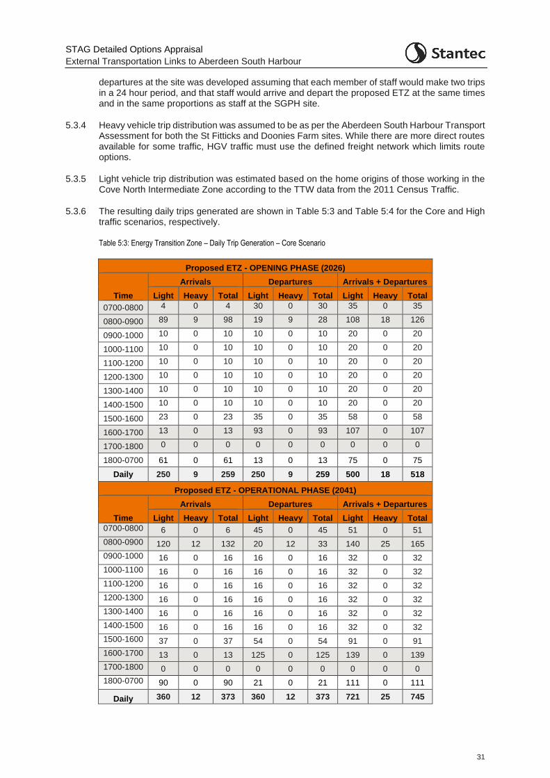
STAG Detailed Options Appraisal
External Transportation Links to Aberdeen South Harbour
31
departures at the site was developed assuming that each member of staff would make two trips in a 24 hour period, and that staff would arrive and depart the proposed ETZ at the same times and in the same proportions as staff at the SGPH site.
5.3.4 Heavy vehicle trip distribution was assumed to be as per the Aberdeen South Harbour Transport Assessment for both the St Fitticks and Doonies Farm sites. While there are more direct routes available for some traffic, HGV traffic must use the defined freight network which limits route options.
5.3.5 Light vehicle trip distribution was estimated based on the home origins of those working in the Cove North Intermediate Zone according to the TTW data from the 2011 Census Traffic.
5.3.6 The resulting daily trips generated are shown in Table 5:3 and Table 5:4 for the Core and High traffic scenarios, respectively.
Table 5:3: Energy Transition Zone – Daily Trip Generation – Core Scenario
Proposed ETZ - OPENING PHASE (2026)
Time
Arrivals Departures Arrivals + Departures
Light Heavy Total Light Heavy Total Light Heavy Total
0700-0800 4 0 4 30 0 30 35 0 35
0800-0900 89 9 98 19 9 28 108 18 126
0900-1000 10 0 10 10 0 10 20 0 20
1000-1100 10 0 10 10 0 10 20 0 20
1100-1200 10 0 10 10 0 10 20 0 20
1200-1300 10 0 10 10 0 10 20 0 20
1300-1400 10 0 10 10 0 10 20 0 20
1400-1500 10 0 10 10 0 10 20 0 20
1500-1600 23 0 23 35 0 35 58 0 58
1600-1700 13 0 13 93 0 93 107 0 107
1700-1800 0 0 0 0 0 0 0 0 0
1800-0700 61 0 61 13 0 13 75 0 75
Daily 250 9 259 250 9 259 500 18 518
Proposed ETZ - OPERATIONAL PHASE (2041)
Time
Arrivals Departures Arrivals + Departures
Light Heavy Total Light Heavy Total Light Heavy Total
0700-0800 6 0 6 45 0 45 51 0 51
0800-0900 120 12 132 20 12 33 140 25 165
0900-1000 16 0 16 16 0 16 32 0 32
1000-1100 16 0 16 16 0 16 32 0 32
1100-1200 16 0 16 16 0 16 32 0 32
1200-1300 16 0 16 16 0 16 32 0 32
1300-1400 16 0 16 16 0 16 32 0 32
1400-1500 16 0 16 16 0 16 32 0 32
1500-1600 37 0 37 54 0 54 91 0 91
1600-1700 13 0 13 125 0 125 139 0 139
1700-1800 0 0 0 0 0 0 0 0 0
1800-0700 90 0 90 21 0 21 111 0 111
Daily 360 12 373 360 12 373 721 25 745
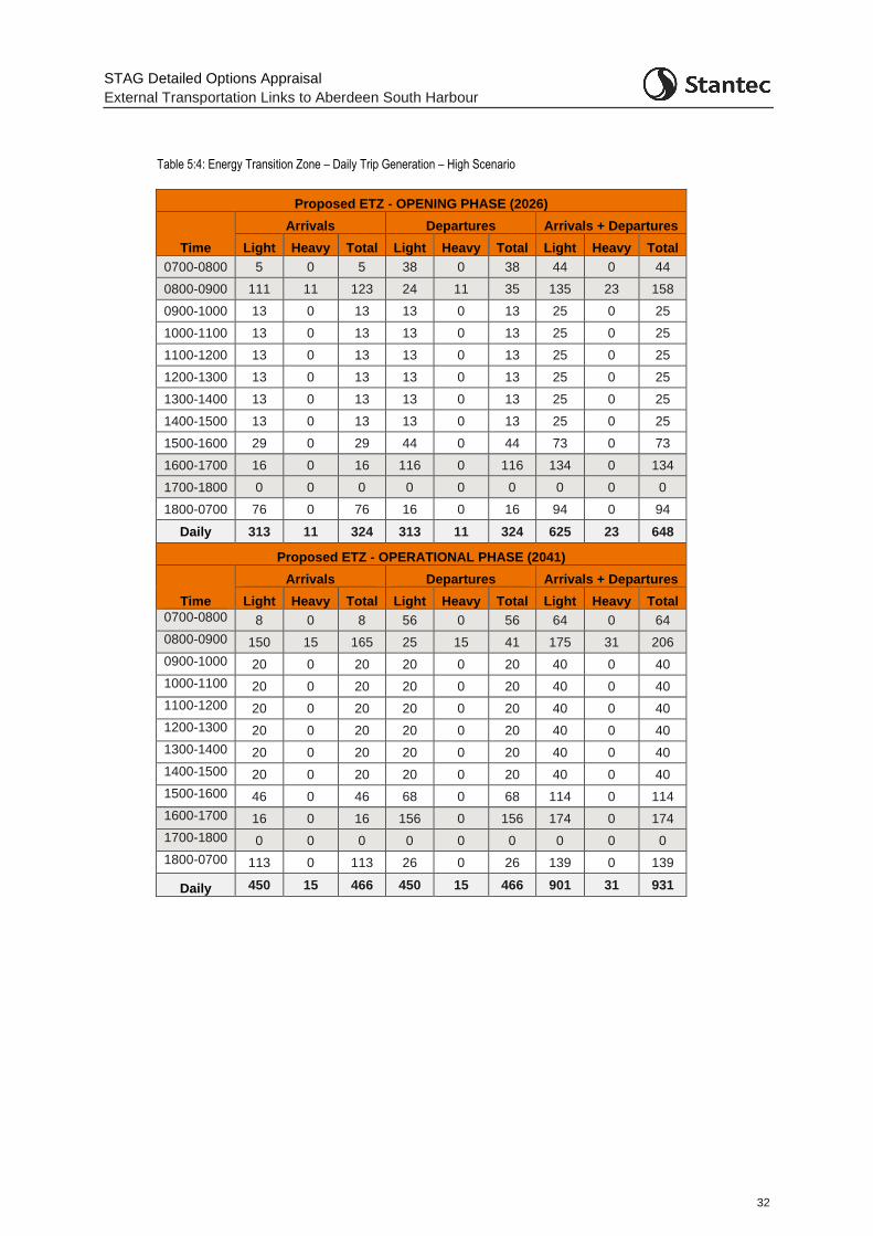
STAG Detailed Options Appraisal
External Transportation Links to Aberdeen South Harbour
32
Table 5:4: Energy Transition Zone – Daily Trip Generation – High Scenario
Proposed ETZ - OPENING PHASE (2026)
Time
Arrivals Departures Arrivals + Departures
Light Heavy Total Light Heavy Total Light Heavy Total
0700-0800 5 0 5 38 0 38 44 0 44
0800-0900 111 11 123 24 11 35 135 23 158
0900-1000 13 0 13 13 0 13 25 0 25
1000-1100 13 0 13 13 0 13 25 0 25
1100-1200 13 0 13 13 0 13 25 0 25
1200-1300 13 0 13 13 0 13 25 0 25
1300-1400 13 0 13 13 0 13 25 0 25
1400-1500 13 0 13 13 0 13 25 0 25
1500-1600 29 0 29 44 0 44 73 0 73
1600-1700 16 0 16 116 0 116 134 0 134
1700-1800 0 0 0 0 0 0 0 0 0
1800-0700 76 0 76 16 0 16 94 0 94
Daily 313 11 324 313 11 324 625 23 648
Proposed ETZ - OPERATIONAL PHASE (2041)
Time
Arrivals Departures Arrivals + Departures
Light Heavy Total Light Heavy Total Light Heavy Total
0700-0800 8 0 8 56 0 56 64 0 64
0800-0900 150 15 165 25 15 41 175 31 206
0900-1000 20 0 20 20 0 20 40 0 40
1000-1100 20 0 20 20 0 20 40 0 40
1100-1200 20 0 20 20 0 20 40 0 40
1200-1300 20 0 20 20 0 20 40 0 40
1300-1400 20 0 20 20 0 20 40 0 40
1400-1500 20 0 20 20 0 20 40 0 40
1500-1600 46 0 46 68 0 68 114 0 114
1600-1700 16 0 16 156 0 156 174 0 174
1700-1800 0 0 0 0 0 0 0 0 0
1800-0700 113 0 113 26 0 26 139 0 139
Daily 450 15 466 450 15 466 901 31 931
STAG Detailed Options Appraisal
External Transportation Links to Aberdeen South Harbour
33
6 Detailed Options Appraisal: Traffic Modelling
6.1 Introduction
6.1.1 To enable an economic assessment of the road options as well as feed into further elements of the appraisal, a traffic model was required. The model provided information on the operational performance of the options, and traffic demand and journey time data.
6.1.2 It was agreed that the Wellington Road microsimulation model (at the time being developed and used in the Wellington Road Multi-modal Corridor Study), would be the most appropriate model. The traffic model was extended such that it was more suitable to be used for the purpose of this study.
6.1.3 The microsimulation traffic model was developed in Paramics Discovery software. A traffic microsimulation model simulates the behaviour of individual vehicles within a modelled road network and is used to predict the likely impact of changes in traffic patterns resulting from changes to traffic flow or from changes to the transport network.
6.1.4 The model was extended by AECOM and audited by Stantec. Future year matrices in line with the opening year for the harbour, 2026, and a further future design year, 2041 were then developed as part of this study.
6.1.5 Appendix C presents full details of the work undertaken in auditing the model and developing future years forecasts, with a high-level summary provided below.
6.2 Model Network
6.2.1 The area / road network covered by the Base model is shown in Figure 6:1. To reflect the existing road network hierarchy, ‘major’ routes are coloured red, with ‘minor’ routes blue. Major routes are those which are signposted or are the preferred route. Minor routes are those routes which are un-signposted, a rat-run or local road etc.
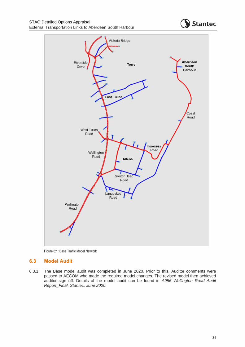
STAG Detailed Options Appraisal
External Transportation Links to Aberdeen South Harbour
34
Figure 6:1: Base Traffic Model Network
6.3 Model Audit
6.3.1 The Base model audit was completed in June 2020. Prior to this, Auditor comments were passed to AECOM who made the required model changes. The revised model then achieved auditor sign off. Details of the model audit can be found in A956 Wellington Road Audit Report_Final, Stantec, June 2020.
STAG Detailed Options Appraisal
External Transportation Links to Aberdeen South Harbour
35
6.4 Further Base Model Development
6.4.1 The Base Model development covered AM (07:00 – 09:00) and PM (16:00 – 18:00) time periods. For the purposes of economic assessment however, an inter-peak period model was also required.
6.4.2 During the Base Model development, observed traffic data was collected covering a 07:00 – 19:00 period. Therefore, while this data was not utilised in the development of the Base Model, it was available for developing a working IP period for inclusion in the model. An IP model was developed covering the period (09:00 – 16:00). The methodology for the development of the IP period demand matrices is set out in Appendix C .The extended Base Model used for the study therefore contains traffic demands for the 07:00 – 18:00 period.
6.5 Do Minimum Model
6.5.1 Future year Do Minimum models were required for an opening year of 2026 and a further future year of 2041. The Do Minimum model comprises assumptions around background traffic growth (including committed development in the area) and committed changes to the network.
6.5.2 The linking up of Palmerston Road to North Esplanade West at the northern extent of the model was therefore included. This enables vehicles travelling between North Esplanade Westand South College Street to route via Palmerston Place instead of the roundabout of North Esplanade West/ South College Street / Wellington Road / Riverside Drive.
6.5.3 In terms of underlying growth to be included, the following was assumed:
There would be low or nil growth associated with ‘local’ zones where no future development is allocated;
Future local development was included within the appropriate zones as allocated in the Local Development Plan and 2022 Proposed Plan; and
Two levels of growth were assumed for ‘through’ traffic (2.5% and up to 10% in 2041 (pro-rated for 2026). This was based on the knowledge that the network cannot handle much additional traffic and also the impact of the Aberdeen City Centre Masterplan and Sustainable Urban Mobility Plan which is seeking to reduce traffic in the city centre. The assumption here is that through traffic levels in the corridor would essentially reach a cap before re-routing to roads beyond the coverage of the modelled area.
6.5.4 The following planned local development areas were included in the Do Minimum demands:
Stationfields, Cove (150 homes, by 2026)
Loirston Development (500 homes by 2026, a further 1,000 home by 2041)
Altens East and Peterseat, Altens Industrial Estate (additional employment development assumed by 2026)
Energy from Waste Plant, East Tullos (operational by 2022).
6.5.5 Traffic generation for these sites was generated using TRICS or the relevant Transport Assessment if available. Appendix C presents the details of the trip generation for each site.
6.5.6 In addition to the four local sites above, the traffic demand scenarios associated with Aberdeen South Harbour and the Energy Transition Zone (as discussed in Section 5) were also included within the Do Minimum model.
STAG Detailed Options Appraisal
External Transportation Links to Aberdeen South Harbour
36
6.5.7 The Do Minimum 2026 and 2041 models were used as the platform from which to test the road schemes.
6.6 Traffic Scenario Modelling
6.6.1 For the purposes of the option testing within the traffic model, four scenarios were considered. The ‘+10%’ scenarios can be seen as ‘sensitivity’ test scenarios:
Core – Core scenario for both ASH and the proposed ETZ sites (with 2.5% background level traffic growth by 2041)
Core + 10% - Core scenario for both ASH and the proposed ETZ sites (with 10% background level traffic growth by 2041)
High – High scenario for both ASH and the proposed ETZ sites (with 2.5% background level traffic growth by 2041)
High + 10% – High scenario for both ASH and the proposed ETZ sites (with 10% background level traffic growth by 2041)
STAG Detailed Options Appraisal
External Transportation Links to Aberdeen South Harbour
37
7 Detailed Options Appraisal: Appraisal against the Transport Planning Objectives
7.1 Transport Planning Objectives
7.1.1 As noted in Chapter 2, the revised set of Transport Planning Objectives for the study are:
TPO1: Provide a designated Heavy Goods Vehicle (HGV) route to/from ASH which is more efficient than alternative routes to:
o minimise journey times to Aberdeen Western Peripheral Route (AWPR) / Charleston junction and King George VI Bridge; and
o help minimise inappropriate routeing and environmental and nuisance impacts
TPO2a: Maximise connectivity between ASH / proposed ETZ and prospective workers at the site
TPO2b: Maximise connectivity between proposed ETZ and other energy-related businesses in the Aberdeen area (Business to Business)
TPO3: Futureproof access to the proposed ETZ / ASH for the widest range of abnormal loads possible and minimise the impact of abnormal loads travelling from and to the proposed ETZ / ASH
TPO4: Improve the resilience of transport connections to and from ASH /proposed ETZ
TPO5: Maximise the intermodal opportunities between the proposed ETZ and the existing rail network
7.2 Appraisal against the TPOs: Methodology
TPO1: Provide a designated Heavy Goods Vehicle (HGV) route to/from ASH which is more efficient than alternative routes
Journey Time Analysis
7.2.1 Appraisal against TPO1 has been undertaken through the comparison of HGV journey times to and from the Aberdeen South Harbour / proposed ETZ (St. Fitticks park) access point on the Coast Road.
7.2.2 HGV journey times for the Do Minimum and Do Something (option) scenarios have been derived in part from the traffic model (up to the model extents) and then combined with journey times derived from Network Analyst software for the part of the route (to or from the origin / destination) located outwith the modelled area.
Environmental and Nuisance Routeing Analysis
7.2.3 HGV link flow analysis from the traffic model has been combined with information on the number of residential and business properties on each link to establish the number of properties immediately impacted by HGVs. A comparison has then been made between the Do Minimum and Do Something options to establish the difference in those impacted by increased / decreased noise and vibration effects. Analysis of the changes in terms of all vehicles has also been undertaken.
7.2.4 Appendix D presents full details of the analysis undertaken.
STAG Detailed Options Appraisal
External Transportation Links to Aberdeen South Harbour
38
TPO2a: Maximise connectivity between ASH / proposed ETZ and prospective workers at the site
7.2.5 To provide an indication of connectivity to the harbour and proposed ETZ sites, journey times by car and public transport from datazones within the region were compared between the Do Minimum and Do Something (option) scenarios. From this, ‘Hansen’ connectivity indicators were developed through considering the working age population within each datazone.
7.2.6 Hansen Indicators provide a measure of accessibility from an origin to a destination, weighted by a chosen ‘criterion’, with high scores indicating good accessibility and low scores suggesting there is poor accessibility according to the ‘criterion’. For appraisal against TPO2a, the ‘criterion’ used is working age population in each datazone to provide an indicator considering accessibility to employment.
7.2.7 Car travel times were developed in a similar way to those for TPO1, with the journey time from the relevant section within the model added to the journey time from the model extent to each datazone to establish the full journey time from each datazone to the Harbour / proposed ETZ site.
7.2.8 Public transport travel times, for both the Do Minimum and Do Something (option) situations were estimated from TRACC software, with each of the public transport options coded into TRACC. Note that no indicator has been developed for Option B2 as this relates to the ad-hoc provision of bus services to enable cruise ship passengers to access Aberdeen City directly from the new harbour.
7.2.9 Given the much lower likely impact of the active travel options, no quantitative analysis for these options has been undertaken.
7.2.10 The AM and PM indicator figures were averaged to represent an ‘Access to Workforce’ indicator.
7.2.11 Appendix D presents full details of the analysis undertaken.
TPO2b: Maximise connectivity between proposed ETZ and other energy-related businesses in the Aberdeen area (Business to Business)
7.2.12 The economic activity which will take place at the proposed ETZ is unlikely to take place in isolation. As well as an interaction with ASH, there is likely to be a local supply chain to serve the operations located at the proposed ETZ. This supply chain could involve the movement of goods and people into the proposed ETZ. Connectivity to the types of firms likely to form part of this supply chain is therefore also a key issue for the site.
7.2.13 TPO2b has been appraised through a comparison of car and public transport based Hansen Indicators (as per TPO2a) but considering connectivity between the harbour and proposed ETZ sites to and from BRES Energy sector workers (as a proxy for this type of business) only. In this instance, the ‘criterion’ used to weight the indicator is the number of energy sector workers in each datazone.
7.2.14 The IP indicator was used as a representation of accessibility during business hours and therefore as a ‘business to business’ indicator.
7.2.15 As per TPO2a, given the much lower likely impact of the active travel options, no quantitative analysis for these options has been undertaken.
7.2.16 Appendix D presents full details of the analysis undertaken.
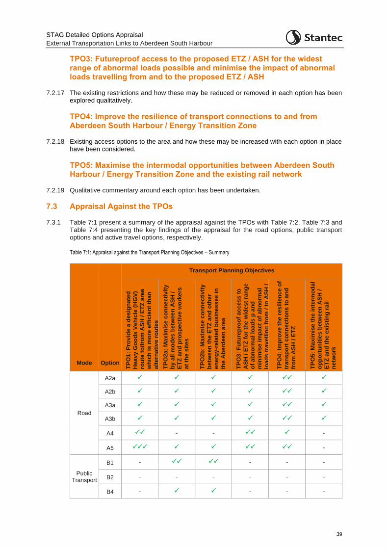
STAG Detailed Options Appraisal
External Transportation Links to Aberdeen South Harbour
39
TPO3: Futureproof access to the proposed ETZ / ASH for the widest range of abnormal loads possible and minimise the impact of abnormal loads travelling from and to the proposed ETZ / ASH
7.2.17 The existing restrictions and how these may be reduced or removed in each option has been explored qualitatively.
TPO4: Improve the resilience of transport connections to and from Aberdeen South Harbour / Energy Transition Zone
7.2.18 Existing access options to the area and how these may be increased with each option in place have been considered.
TPO5: Maximise the intermodal opportunities between Aberdeen South Harbour / Energy Transition Zone and the existing rail network
7.2.19 Qualitative commentary around each option has been undertaken.
7.3 Appraisal Against the TPOs
7.3.1 Table 7:1 present a summary of the appraisal against the TPOs with Table 7:2, Table 7:3 and Table 7:4 presenting the key findings of the appraisal for the road options, public transport options and active travel options, respectively.
Table 7:1: Appraisal against the Transport Planning Objectives – Summary
Mode Option
Transport Planning Objectives
TP
O1:
Pro
vid
e a
des
ign
ate
d
Hea
vy
Go
od
s V
eh
icle
(H
GV
)
rou
te t
o/f
rom
AS
H / E
TZ
are
a
wh
ich
is
mo
re e
ffic
ien
t th
an
alt
ern
ati
ve
ro
ute
s
TP
O2a
: M
ax
imis
e c
on
ne
cti
vit
y
by
all
mo
des
be
twee
n A
SH
/
ET
Z a
nd
pro
sp
ec
tiv
e w
ork
ers
at
the
sit
es
TP
O2b
: M
ax
imis
e c
on
ne
cti
vit
y
be
twe
en
th
e E
TZ
an
d o
the
r
en
erg
y-r
ela
ted
bu
sin
es
ses
in
the
Ab
erd
ee
n a
rea
TP
O3:
Fu
ture
pro
of
ac
ce
ss
to
AS
H /
ET
Z f
or
the
wid
es
t ra
ng
e
of
ab
no
rma
l lo
ad
s p
an
d
min
imis
e i
mp
ac
t o
f a
bn
orm
al
loa
ds
tra
ve
llin
g f
rom
/ t
o A
SH
/
ET
Z
TP
O4:
Imp
rov
e t
he
res
ilie
nce
of
tran
sp
ort
co
nn
ec
tio
ns
to
an
d
fro
m A
SH
/ E
TZ
TP
O5:
Ma
xim
ise
th
e in
term
od
al
op
po
rtu
nit
ies
betw
ee
n A
SH
/
ET
Z a
nd
th
e e
xis
tin
g r
ail
ne
two
rk
Road
A2a
A2b
A3a
A3b
A4 - - -
A5 -
Public Transport
B1 - - - -
B2 - - - - - -
B4 - - - -
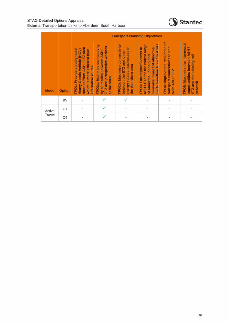
STAG Detailed Options Appraisal
External Transportation Links to Aberdeen South Harbour
40
Mode Option
Transport Planning Objectives
TP
O1
: P
rov
ide
a d
es
ign
ate
d
He
av
y G
oo
ds
Ve
hic
le (
HG
V)
rou
te t
o/f
rom
AS
H / E
TZ
are
a
wh
ich
is
mo
re e
ffic
ien
t th
an
alt
ern
ati
ve
ro
ute
s
TP
O2
a:
Ma
xim
ise
co
nn
ec
tiv
ity
by
all
mo
des
be
twee
n A
SH
/
ET
Z a
nd
pro
sp
ec
tiv
e w
ork
ers
at
the
sit
es
TP
O2
b:
Ma
xim
ise
co
nn
ec
tiv
ity
be
twe
en
th
e E
TZ
an
d o
the
r
en
erg
y-r
ela
ted
bu
sin
es
ses
in
the
Ab
erd
ee
n a
rea
TP
O3
: F
utu
rep
roo
f a
cce
ss
to
AS
H /
ET
Z f
or
the
wid
es
t ra
ng
e
of
ab
no
rma
l lo
ad
s p
an
d
min
imis
e i
mp
ac
t o
f a
bn
orm
al
loa
ds
tra
ve
llin
g f
rom
/ t
o A
SH
/
ET
Z
TP
O4
: Im
pro
ve t
he
res
ilie
nce
of
tra
ns
po
rt c
on
ne
cti
on
s t
o a
nd
fro
m A
SH
/ E
TZ
TP
O5
: M
ax
imis
e t
he
in
term
od
al
op
po
rtu
nit
ies
betw
ee
n A
SH
/
ET
Z a
nd
th
e e
xis
tin
g r
ail
ne
two
rk
B5 - - - -
Active Travel
C1 - - - - -
C4 - - - - -
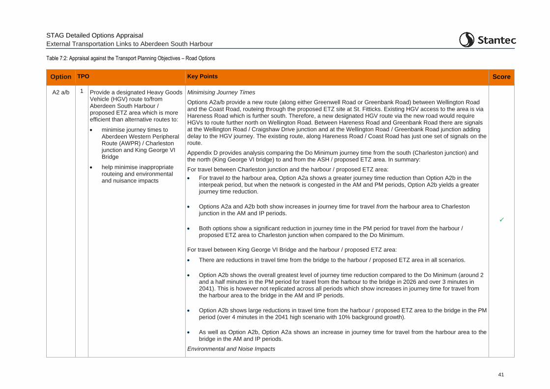
STAG Detailed Options Appraisal
External Transportation Links to Aberdeen South Harbour
41
Table 7:2: Appraisal against the Transport Planning Objectives – Road Options
Option TPO Key Points Score
A2 a/b 1 Provide a designated Heavy Goods Vehicle (HGV) route to/from Aberdeen South Harbour / proposed ETZ area which is more efficient than alternative routes to:
• minimise journey times to Aberdeen Western Peripheral Route (AWPR) / Charleston junction and King George VI Bridge
• help minimise inappropriate routeing and environmental and nuisance impacts
Minimising Journey Times
Options A2a/b provide a new route (along either Greenwell Road or Greenbank Road) between Wellington Road and the Coast Road, routeing through the proposed ETZ site at St. Fitticks. Existing HGV access to the area is via Hareness Road which is further south. Therefore, a new designated HGV route via the new road would require HGVs to route further north on Wellington Road. Between Hareness Road and Greenbank Road there are signals at the Wellington Road / Craigshaw Drive junction and at the Wellington Road / Greenbank Road junction adding delay to the HGV journey. The existing route, along Hareness Road / Coast Road has just one set of signals on the route.
Appendix D provides analysis comparing the Do Minimum journey time from the south (Charleston junction) and the north (King George VI bridge) to and from the ASH / proposed ETZ area. In summary:
For travel between Charleston junction and the harbour / proposed ETZ area:
• For travel to the harbour area, Option A2a shows a greater journey time reduction than Option A2b in the interpeak period, but when the network is congested in the AM and PM periods, Option A2b yields a greater journey time reduction.
• Options A2a and A2b both show increases in journey time for travel from the harbour area to Charleston junction in the AM and IP periods.
• Both options show a significant reduction in journey time in the PM period for travel from the harbour / proposed ETZ area to Charleston junction when compared to the Do Minimum.
For travel between King George VI Bridge and the harbour / proposed ETZ area:
• There are reductions in travel time from the bridge to the harbour / proposed ETZ area in all scenarios.
• Option A2b shows the overall greatest level of journey time reduction compared to the Do Minimum (around 2 and a half minutes in the PM period for travel from the harbour to the bridge in 2026 and over 3 minutes in 2041). This is however not replicated across all periods which show increases in journey time for travel from the harbour area to the bridge in the AM and IP periods.
• Option A2b shows large reductions in travel time from the harbour / proposed ETZ area to the bridge in the PM period (over 4 minutes in the 2041 high scenario with 10% background growth).
• As well as Option A2b, Option A2a shows an increase in journey time for travel from the harbour area to the bridge in the AM and IP periods.
Environmental and Noise Impacts
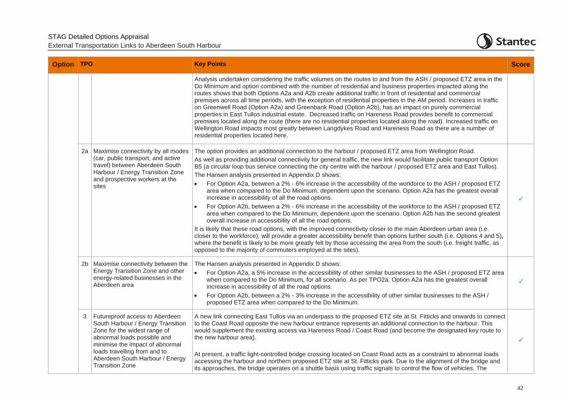
STAG Detailed Options Appraisal
External Transportation Links to Aberdeen South Harbour
42
Option TPO Key Points Score
Analysis undertaken considering the traffic volumes on the routes to and from the ASH / proposed ETZ area in the Do Minimum and option combined with the number of residential and business properties impacted along the routes shows that both Options A2a and A2b create additional traffic in front of residential and commercial premises across all time periods, with the exception of residential properties in the AM period. Increases in traffic on Greenwell Road (Option A2a) and Greenbank Road (Option A2b), has an impact on purely commercial properties in East Tullos industrial estate. Decreased traffic on Hareness Road provides benefit to commercial premises located along the route (there are no residential properties located along the road). Increased traffic on Wellington Road impacts most greatly between Langdykes Road and Hareness Road as there are a number of residential properties located here.
2a Maximise connectivity by all modes (car, public transport, and active travel) between Aberdeen South Harbour / Energy Transition Zone and prospective workers at the sites
The option provides an additional connection to the harbour / proposed ETZ area from Wellington Road.
As well as providing additional connectivity for general traffic, the new link would facilitate public transport Option B5 (a circular loop bus service connecting the city centre with the harbour / proposed ETZ area and East Tullos).
The Hansen analysis presented in Appendix D shows:
• For Option A2a, between a 2% - 6% increase in the accessibility of the workforce to the ASH / proposed ETZ area when compared to the Do Minimum, dependent upon the scenario. Option A2a has the greatest overall increase in accessibility of all the road options.
• For Option A2b, between a 2% - 6% increase in the accessibility of the workforce to the ASH / proposed ETZ area when compared to the Do Minimum, dependent upon the scenario. Option A2b has the second greatest overall increase in accessibility of all the road options.
It is likely that these road options, with the improved connectivity closer to the main Aberdeen urban area (i.e. closer to the workforce), will provide a greater accessibility benefit than options further south (i.e. Options 4 and 5), where the benefit is likely to be more greatly felt by those accessing the area from the south (i.e. freight traffic, as opposed to the majority of commuters employed at the sites).
2b Maximise connectivity between the Energy Transition Zone and other energy-related businesses in the Aberdeen area
The Hansen analysis presented in Appendix D shows:
• For Option A2a, a 5% increase in the accessibility of other similar businesses to the ASH / proposed ETZ area when compared to the Do Minimum, for all scenario. As per TPO2a, Option A2a has the greatest overall increase in accessibility of all the road options.
• For Option A2b, between a 2% - 3% increase in the accessibility of other similar businesses to the ASH / proposed ETZ area when compared to the Do Minimum.
3 Futureproof access to Aberdeen South Harbour / Energy Transition Zone for the widest range of abnormal loads possible and minimise the impact of abnormal loads travelling from and to Aberdeen South Harbour / Energy Transition Zone
A new link connecting East Tullos via an underpass to the proposed ETZ site at St. Fitticks and onwards to connect to the Coast Road opposite the new harbour entrance represents an additional connection to the harbour. This would supplement the existing access via Hareness Road / Coast Road (and become the designated key route to the new harbour area).
At present, a traffic light-controlled bridge crossing located on Coast Road acts as a constraint to abnormal loads accessing the harbour and northern proposed ETZ site at St. Fitticks park. Due to the alignment of the bridge and its approaches, the bridge operates on a shuttle basis using traffic signals to control the flow of vehicles. The
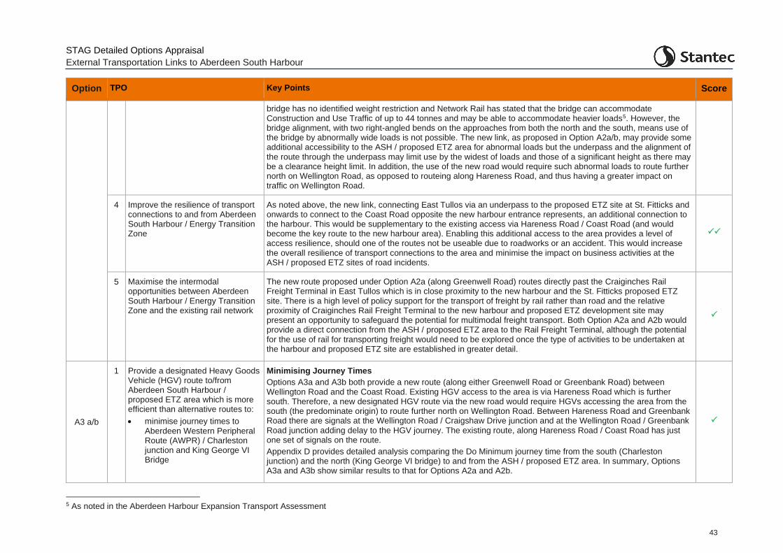
STAG Detailed Options Appraisal
External Transportation Links to Aberdeen South Harbour
43
Option TPO Key Points Score
bridge has no identified weight restriction and Network Rail has stated that the bridge can accommodate Construction and Use Traffic of up to 44 tonnes and may be able to accommodate heavier loads5. However, the bridge alignment, with two right-angled bends on the approaches from both the north and the south, means use of the bridge by abnormally wide loads is not possible. The new link, as proposed in Option A2a/b, may provide some additional accessibility to the ASH / proposed ETZ area for abnormal loads but the underpass and the alignment of the route through the underpass may limit use by the widest of loads and those of a significant height as there may be a clearance height limit. In addition, the use of the new road would require such abnormal loads to route further north on Wellington Road, as opposed to routeing along Hareness Road, and thus having a greater impact on traffic on Wellington Road.
4 Improve the resilience of transport connections to and from Aberdeen South Harbour / Energy Transition Zone
As noted above, the new link, connecting East Tullos via an underpass to the proposed ETZ site at St. Fitticks and onwards to connect to the Coast Road opposite the new harbour entrance represents, an additional connection to the harbour. This would be supplementary to the existing access via Hareness Road / Coast Road (and would become the key route to the new harbour area). Enabling this additional access to the area provides a level of access resilience, should one of the routes not be useable due to roadworks or an accident. This would increase the overall resilience of transport connections to the area and minimise the impact on business activities at the ASH / proposed ETZ sites of road incidents.
5 Maximise the intermodal opportunities between Aberdeen South Harbour / Energy Transition Zone and the existing rail network
The new route proposed under Option A2a (along Greenwell Road) routes directly past the Craiginches Rail Freight Terminal in East Tullos which is in close proximity to the new harbour and the St. Fitticks proposed ETZ site. There is a high level of policy support for the transport of freight by rail rather than road and the relative proximity of Craiginches Rail Freight Terminal to the new harbour and proposed ETZ development site may present an opportunity to safeguard the potential for multimodal freight transport. Both Option A2a and A2b would provide a direct connection from the ASH / proposed ETZ area to the Rail Freight Terminal, although the potential for the use of rail for transporting freight would need to be explored once the type of activities to be undertaken at the harbour and proposed ETZ site are established in greater detail.
A3 a/b
1 Provide a designated Heavy Goods Vehicle (HGV) route to/from Aberdeen South Harbour / proposed ETZ area which is more efficient than alternative routes to:
• minimise journey times to Aberdeen Western Peripheral Route (AWPR) / Charleston junction and King George VI Bridge
Minimising Journey Times
Options A3a and A3b both provide a new route (along either Greenwell Road or Greenbank Road) between Wellington Road and the Coast Road. Existing HGV access to the area is via Hareness Road which is further south. Therefore, a new designated HGV route via the new road would require HGVs accessing the area from the south (the predominate origin) to route further north on Wellington Road. Between Hareness Road and Greenbank Road there are signals at the Wellington Road / Craigshaw Drive junction and at the Wellington Road / Greenbank Road junction adding delay to the HGV journey. The existing route, along Hareness Road / Coast Road has just one set of signals on the route.
Appendix D provides detailed analysis comparing the Do Minimum journey time from the south (Charleston junction) and the north (King George VI bridge) to and from the ASH / proposed ETZ area. In summary, Options A3a and A3b show similar results to that for Options A2a and A2b.
5 As noted in the Aberdeen Harbour Expansion Transport Assessment
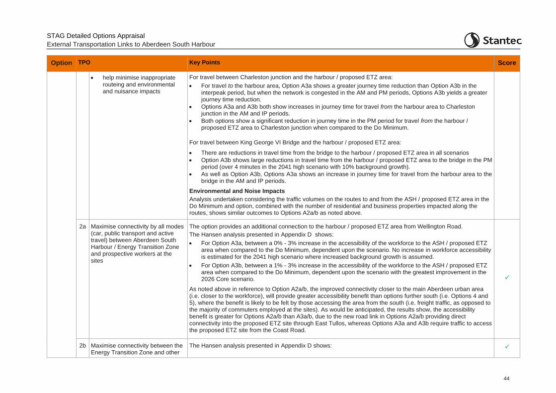
STAG Detailed Options Appraisal
External Transportation Links to Aberdeen South Harbour
44
Option TPO Key Points Score
• help minimise inappropriate routeing and environmental and nuisance impacts
For travel between Charleston junction and the harbour / proposed ETZ area:
• For travel to the harbour area, Option A3a shows a greater journey time reduction than Option A3b in the interpeak period, but when the network is congested in the AM and PM periods, Options A3b yields a greater journey time reduction.
• Options A3a and A3b both show increases in journey time for travel from the harbour area to Charleston junction in the AM and IP periods.
• Both options show a significant reduction in journey time in the PM period for travel from the harbour / proposed ETZ area to Charleston junction when compared to the Do Minimum.
For travel between King George VI Bridge and the harbour / proposed ETZ area:
• There are reductions in travel time from the bridge to the harbour / proposed ETZ area in all scenarios
• Option A3b shows large reductions in travel time from the harbour / proposed ETZ area to the bridge in the PM period (over 4 minutes in the 2041 high scenario with 10% background growth).
• As well as Option A3b, Options A3a shows an increase in journey time for travel from the harbour area to the bridge in the AM and IP periods.
Environmental and Noise Impacts
Analysis undertaken considering the traffic volumes on the routes to and from the ASH / proposed ETZ area in the Do Minimum and option, combined with the number of residential and business properties impacted along the routes, shows similar outcomes to Options A2a/b as noted above.
2a Maximise connectivity by all modes (car, public transport and active travel) between Aberdeen South Harbour / Energy Transition Zone and prospective workers at the sites
The option provides an additional connection to the harbour / proposed ETZ area from Wellington Road.
The Hansen analysis presented in Appendix D shows:
• For Option A3a, between a 0% - 3% increase in the accessibility of the workforce to the ASH / proposed ETZ area when compared to the Do Minimum, dependent upon the scenario. No increase in workforce accessibility is estimated for the 2041 high scenario where increased background growth is assumed.
• For Option A3b, between a 1% - 3% increase in the accessibility of the workforce to the ASH / proposed ETZ area when compared to the Do Minimum, dependent upon the scenario with the greatest improvement in the 2026 Core scenario.
As noted above in reference to Option A2a/b, the improved connectivity closer to the main Aberdeen urban area (i.e. closer to the workforce), will provide greater accessibility benefit than options further south (i.e. Options 4 and 5), where the benefit is likely to be felt by those accessing the area from the south (i.e. freight traffic, as opposed to the majority of commuters employed at the sites). As would be anticipated, the results show, the accessibility benefit is greater for Options A2a/b than A3a/b, due to the new road link in Options A2a/b providing direct connectivity into the proposed ETZ site through East Tullos, whereas Options A3a and A3b require traffic to access the proposed ETZ site from the Coast Road.
2b Maximise connectivity between the Energy Transition Zone and other
The Hansen analysis presented in Appendix D shows:
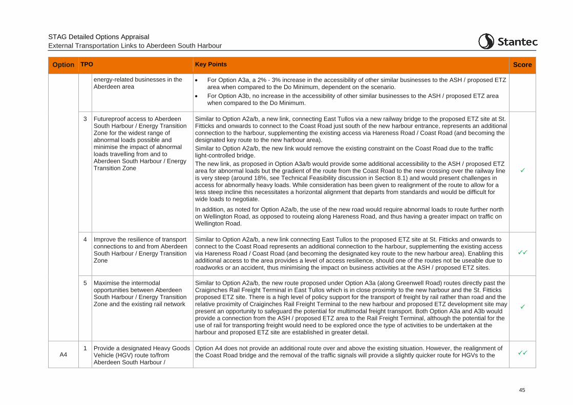
STAG Detailed Options Appraisal
External Transportation Links to Aberdeen South Harbour
45
Option TPO Key Points Score
energy-related businesses in the Aberdeen area
• For Option A3a, a 2% - 3% increase in the accessibility of other similar businesses to the ASH / proposed ETZ area when compared to the Do Minimum, dependent on the scenario.
• For Option A3b, no increase in the accessibility of other similar businesses to the ASH / proposed ETZ area when compared to the Do Minimum.
3 Futureproof access to Aberdeen South Harbour / Energy Transition Zone for the widest range of abnormal loads possible and minimise the impact of abnormal loads travelling from and to Aberdeen South Harbour / Energy Transition Zone
Similar to Option A2a/b, a new link, connecting East Tullos via a new railway bridge to the proposed ETZ site at St. Fitticks and onwards to connect to the Coast Road just south of the new harbour entrance, represents an additional connection to the harbour, supplementing the existing access via Hareness Road / Coast Road (and becoming the designated key route to the new harbour area).
Similar to Option A2a/b, the new link would remove the existing constraint on the Coast Road due to the traffic light-controlled bridge.
The new link, as proposed in Option A3a/b would provide some additional accessibility to the ASH / proposed ETZ area for abnormal loads but the gradient of the route from the Coast Road to the new crossing over the railway line is very steep (around 18%, see Technical Feasibility discussion in Section 8.1) and would present challenges in access for abnormally heavy loads. While consideration has been given to realignment of the route to allow for a less steep incline this necessitates a horizontal alignment that departs from standards and would be difficult for wide loads to negotiate.
In addition, as noted for Option A2a/b, the use of the new road would require abnormal loads to route further north on Wellington Road, as opposed to routeing along Hareness Road, and thus having a greater impact on traffic on Wellington Road.
4 Improve the resilience of transport connections to and from Aberdeen South Harbour / Energy Transition Zone
Similar to Option A2a/b, a new link connecting East Tullos to the proposed ETZ site at St. Fitticks and onwards to connect to the Coast Road represents an additional connection to the harbour, supplementing the existing access via Hareness Road / Coast Road (and becoming the designated key route to the new harbour area). Enabling this additional access to the area provides a level of access resilience, should one of the routes not be useable due to roadworks or an accident, thus minimising the impact on business activities at the ASH / proposed ETZ sites.
5 Maximise the intermodal opportunities between Aberdeen South Harbour / Energy Transition Zone and the existing rail network
Similar to Option A2a/b, the new route proposed under Option A3a (along Greenwell Road) routes directly past the Craiginches Rail Freight Terminal in East Tullos which is in close proximity to the new harbour and the St. Fitticks proposed ETZ site. There is a high level of policy support for the transport of freight by rail rather than road and the relative proximity of Craiginches Rail Freight Terminal to the new harbour and proposed ETZ development site may present an opportunity to safeguard the potential for multimodal freight transport. Both Option A3a and A3b would provide a connection from the ASH / proposed ETZ area to the Rail Freight Terminal, although the potential for the use of rail for transporting freight would need to be explored once the type of activities to be undertaken at the harbour and proposed ETZ site are established in greater detail.
A4 1 Provide a designated Heavy Goods
Vehicle (HGV) route to/from Aberdeen South Harbour /
Option A4 does not provide an additional route over and above the existing situation. However, the realignment of the Coast Road bridge and the removal of the traffic signals will provide a slightly quicker route for HGVs to the
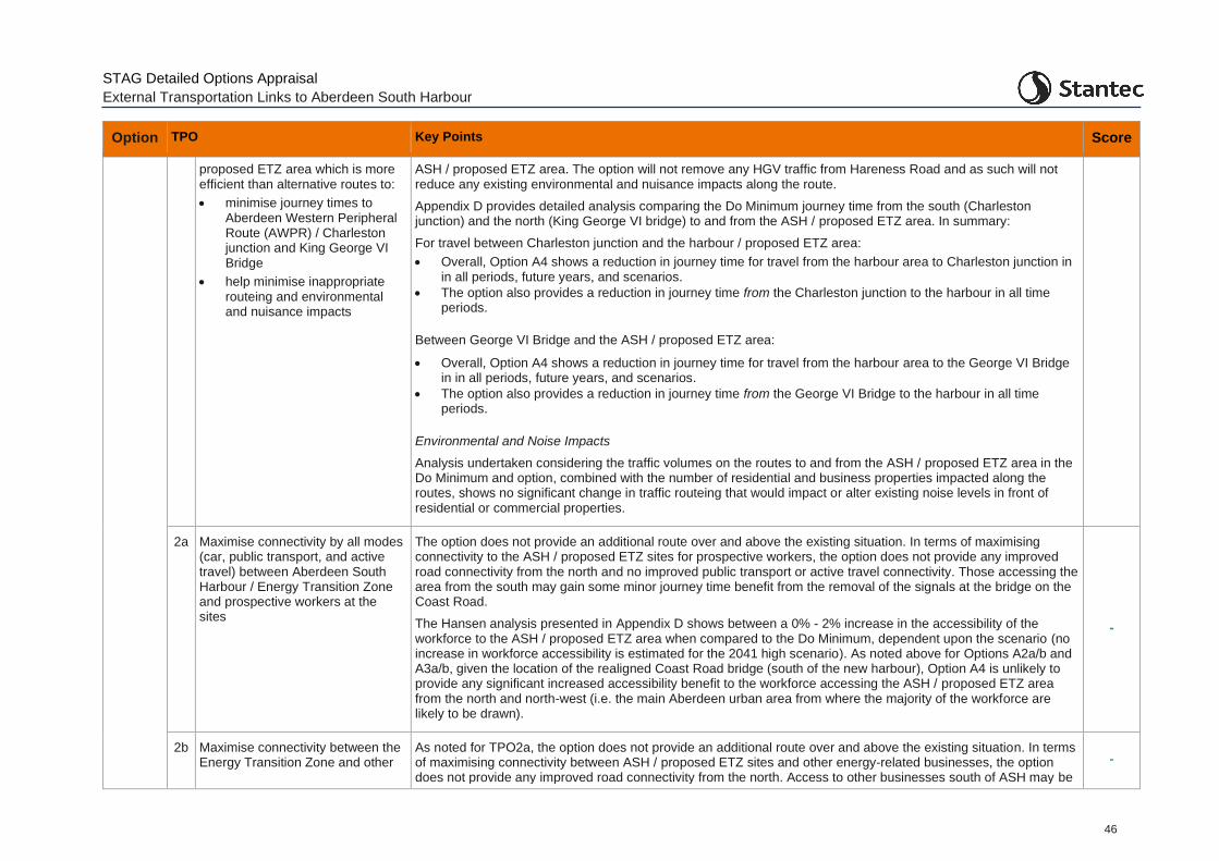
STAG Detailed Options Appraisal
External Transportation Links to Aberdeen South Harbour
46
Option TPO Key Points Score
proposed ETZ area which is more efficient than alternative routes to:
• minimise journey times to Aberdeen Western Peripheral Route (AWPR) / Charleston junction and King George VI Bridge
• help minimise inappropriate routeing and environmental and nuisance impacts
ASH / proposed ETZ area. The option will not remove any HGV traffic from Hareness Road and as such will not reduce any existing environmental and nuisance impacts along the route.
Appendix D provides detailed analysis comparing the Do Minimum journey time from the south (Charleston junction) and the north (King George VI bridge) to and from the ASH / proposed ETZ area. In summary:
For travel between Charleston junction and the harbour / proposed ETZ area:
• Overall, Option A4 shows a reduction in journey time for travel from the harbour area to Charleston junction in in all periods, future years, and scenarios.
• The option also provides a reduction in journey time from the Charleston junction to the harbour in all time periods.
Between George VI Bridge and the ASH / proposed ETZ area:
• Overall, Option A4 shows a reduction in journey time for travel from the harbour area to the George VI Bridge in in all periods, future years, and scenarios.
• The option also provides a reduction in journey time from the George VI Bridge to the harbour in all time periods.
Environmental and Noise Impacts
Analysis undertaken considering the traffic volumes on the routes to and from the ASH / proposed ETZ area in the Do Minimum and option, combined with the number of residential and business properties impacted along the routes, shows no significant change in traffic routeing that would impact or alter existing noise levels in front of residential or commercial properties.
2a Maximise connectivity by all modes (car, public transport, and active travel) between Aberdeen South Harbour / Energy Transition Zone and prospective workers at the sites
The option does not provide an additional route over and above the existing situation. In terms of maximising connectivity to the ASH / proposed ETZ sites for prospective workers, the option does not provide any improved road connectivity from the north and no improved public transport or active travel connectivity. Those accessing the area from the south may gain some minor journey time benefit from the removal of the signals at the bridge on the Coast Road.
The Hansen analysis presented in Appendix D shows between a 0% - 2% increase in the accessibility of the workforce to the ASH / proposed ETZ area when compared to the Do Minimum, dependent upon the scenario (no increase in workforce accessibility is estimated for the 2041 high scenario). As noted above for Options A2a/b and A3a/b, given the location of the realigned Coast Road bridge (south of the new harbour), Option A4 is unlikely to provide any significant increased accessibility benefit to the workforce accessing the ASH / proposed ETZ area from the north and north-west (i.e. the main Aberdeen urban area from where the majority of the workforce are likely to be drawn).
-
2b Maximise connectivity between the Energy Transition Zone and other
As noted for TPO2a, the option does not provide an additional route over and above the existing situation. In terms of maximising connectivity between ASH / proposed ETZ sites and other energy-related businesses, the option does not provide any improved road connectivity from the north. Access to other businesses south of ASH may be
-
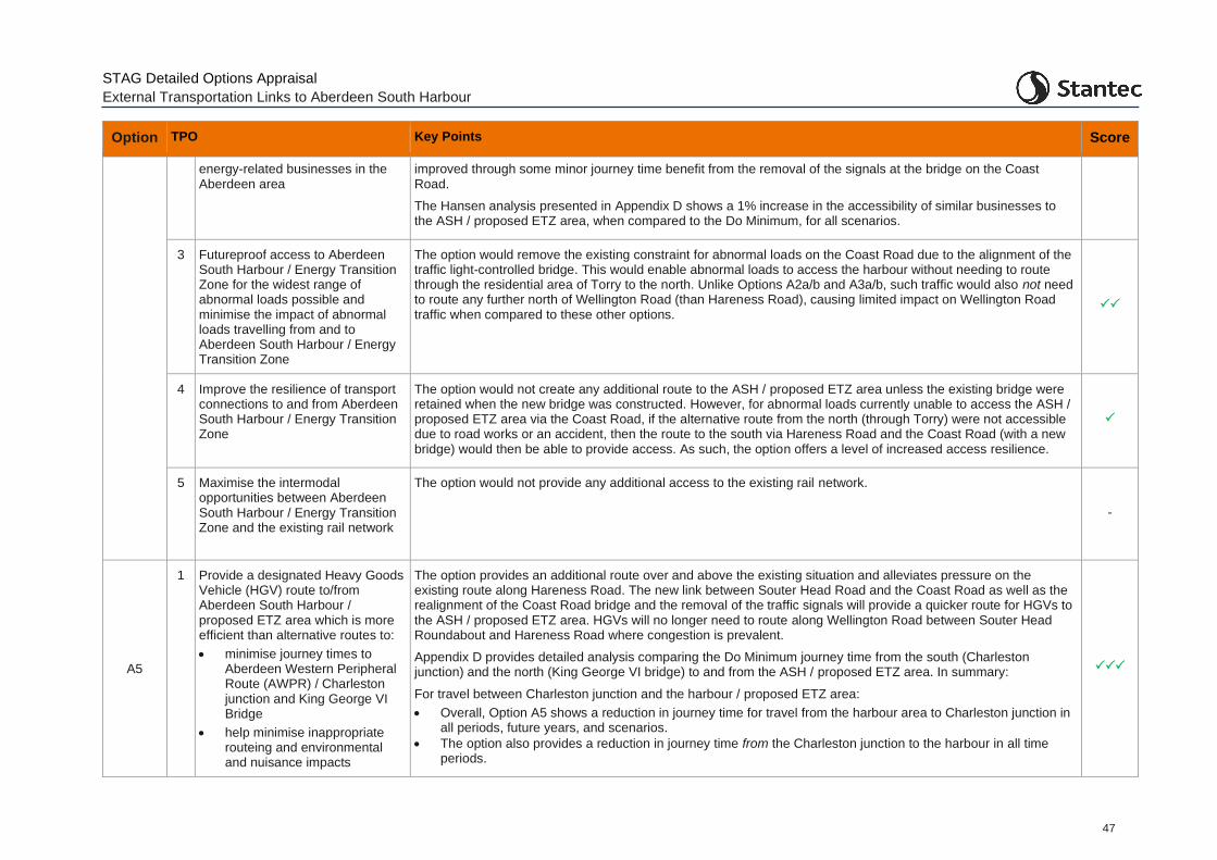
STAG Detailed Options Appraisal
External Transportation Links to Aberdeen South Harbour
47
Option TPO Key Points Score
energy-related businesses in the Aberdeen area
improved through some minor journey time benefit from the removal of the signals at the bridge on the Coast Road.
The Hansen analysis presented in Appendix D shows a 1% increase in the accessibility of similar businesses to the ASH / proposed ETZ area, when compared to the Do Minimum, for all scenarios.
3 Futureproof access to Aberdeen South Harbour / Energy Transition Zone for the widest range of abnormal loads possible and minimise the impact of abnormal loads travelling from and to Aberdeen South Harbour / Energy Transition Zone
The option would remove the existing constraint for abnormal loads on the Coast Road due to the alignment of the traffic light-controlled bridge. This would enable abnormal loads to access the harbour without needing to route through the residential area of Torry to the north. Unlike Options A2a/b and A3a/b, such traffic would also not need to route any further north of Wellington Road (than Hareness Road), causing limited impact on Wellington Road traffic when compared to these other options.
4 Improve the resilience of transport connections to and from Aberdeen South Harbour / Energy Transition Zone
The option would not create any additional route to the ASH / proposed ETZ area unless the existing bridge were retained when the new bridge was constructed. However, for abnormal loads currently unable to access the ASH / proposed ETZ area via the Coast Road, if the alternative route from the north (through Torry) were not accessible due to road works or an accident, then the route to the south via Hareness Road and the Coast Road (with a new bridge) would then be able to provide access. As such, the option offers a level of increased access resilience.
5 Maximise the intermodal opportunities between Aberdeen South Harbour / Energy Transition Zone and the existing rail network
The option would not provide any additional access to the existing rail network.
-
A5
1 Provide a designated Heavy Goods Vehicle (HGV) route to/from Aberdeen South Harbour / proposed ETZ area which is more efficient than alternative routes to:
• minimise journey times to Aberdeen Western Peripheral Route (AWPR) / Charleston junction and King George VI Bridge
• help minimise inappropriate routeing and environmental and nuisance impacts
The option provides an additional route over and above the existing situation and alleviates pressure on the existing route along Hareness Road. The new link between Souter Head Road and the Coast Road as well as the realignment of the Coast Road bridge and the removal of the traffic signals will provide a quicker route for HGVs to the ASH / proposed ETZ area. HGVs will no longer need to route along Wellington Road between Souter Head Roundabout and Hareness Road where congestion is prevalent.
Appendix D provides detailed analysis comparing the Do Minimum journey time from the south (Charleston junction) and the north (King George VI bridge) to and from the ASH / proposed ETZ area. In summary:
For travel between Charleston junction and the harbour / proposed ETZ area:
• Overall, Option A5 shows a reduction in journey time for travel from the harbour area to Charleston junction in all periods, future years, and scenarios.
• The option also provides a reduction in journey time from the Charleston junction to the harbour in all time periods.
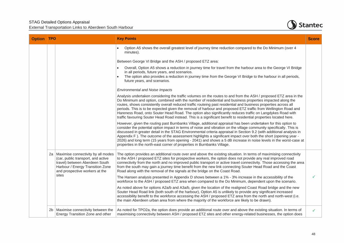
STAG Detailed Options Appraisal
External Transportation Links to Aberdeen South Harbour
48
Option TPO Key Points Score
• Option A5 shows the overall greatest level of journey time reduction compared to the Do Minimum (over 4 minutes).
Between George VI Bridge and the ASH / proposed ETZ area:
• Overall, Option A5 shows a reduction in journey time for travel from the harbour area to the George VI Bridge in all periods, future years, and scenarios.
• The option also provides a reduction in journey time from the George VI Bridge to the harbour in all periods, future years, and scenarios.
Environmental and Noise Impacts
Analysis undertaken considering the traffic volumes on the routes to and from the ASH / proposed ETZ area in the Do Minimum and option, combined with the number of residential and business properties impacted along the routes, shows consistently overall reduced traffic routeing past residential and business properties across all periods. This is to be expected given the removal of harbour and proposed ETZ traffic from Wellington Road and Hareness Road, onto Souter Head Road. The option also significantly reduces traffic on Langdykes Road with traffic favouring Souter Head Road instead. This is a significant benefit to residential properties located here.
However, given the routing past Burnbanks Village, additional appraisal has been undertaken for this option to consider the potential option impact in terms of noise and vibration on the village community specifically. This is discussed in greater detail in the STAG Environmental criteria appraisal in Section 9.2 (with additional analysis in Appendix F ). The outcome of the assessment highlights a significant impact over both the short (opening year - 2026) and long term (15 years from opening - 2041) and shows a 5 dB increase in noise levels in the worst-case at properties in the north-east corner of properties in Burnbanks Village.
2a Maximise connectivity by all modes (car, public transport, and active travel) between Aberdeen South Harbour / Energy Transition Zone and prospective workers at the sites
The option provides an additional route over and above the existing situation. In terms of maximising connectivity to the ASH / proposed ETZ sites for prospective workers, the option does not provide any real improved road connectivity from the north and no improved public transport or active travel connectivity. Those accessing the area from the south may gain a journey time benefit from the new link connecting Souter Head Road and the Coast Road along with the removal of the signals at the bridge on the Coast Road.
The Hansen analysis presented in Appendix D shows between a 1% - 3% increase in the accessibility of the workforce to the ASH / proposed ETZ area when compared to the Do Minimum, dependent upon the scenario.
As noted above for options A2a/b and A3a/b, given the location of the realigned Coast Road bridge and the new Souter Head Road link (both south of the harbour), Option A5 is unlikely to provide any significant increased accessibility benefit to the workforce accessing the ASH / proposed ETZ area from the north and north-west (i.e. the main Aberdeen urban area from where the majority of the workforce are likely to be drawn).
2b Maximise connectivity between the Energy Transition Zone and other
As noted for TPO2a, the option does provide an additional route over and above the existing situation. In terms of maximising connectivity between ASH / proposed ETZ sites and other energy-related businesses, the option does
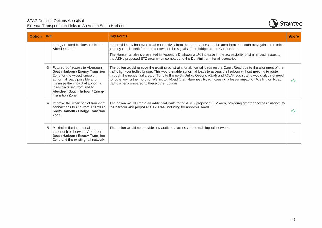
STAG Detailed Options Appraisal
External Transportation Links to Aberdeen South Harbour
49
Option TPO Key Points Score
energy-related businesses in the Aberdeen area
not provide any improved road connectivity from the north. Access to the area from the south may gain some minor journey time benefit from the removal of the signals at the bridge on the Coast Road.
The Hansen analysis presented in Appendix D shows a 1% increase in the accessibility of similar businesses to the ASH / proposed ETZ area when compared to the Do Minimum, for all scenarios.
3 Futureproof access to Aberdeen South Harbour / Energy Transition Zone for the widest range of abnormal loads possible and minimise the impact of abnormal loads travelling from and to Aberdeen South Harbour / Energy Transition Zone
The option would remove the existing constraint for abnormal loads on the Coast Road due to the alignment of the traffic light-controlled bridge. This would enable abnormal loads to access the harbour without needing to route through the residential area of Torry to the north. Unlike Options A2a/b and A3a/b, such traffic would also not need to route any further north of Wellington Road (than Hareness Road), causing a lesser impact on Wellington Road traffic when compared to these other options.
4 Improve the resilience of transport connections to and from Aberdeen South Harbour / Energy Transition Zone
The option would create an additional route to the ASH / proposed ETZ area, providing greater access resilience to the harbour and proposed ETZ area, including for abnormal loads.
5 Maximise the intermodal opportunities between Aberdeen South Harbour / Energy Transition Zone and the existing rail network
The option would not provide any additional access to the existing rail network.
-
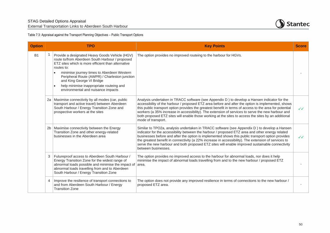
STAG Detailed Options Appraisal
External Transportation Links to Aberdeen South Harbour
50
Table 7:3: Appraisal against the Transport Planning Objectives – Public Transport Options
Option TPO Key Points Score
B1 1 Provide a designated Heavy Goods Vehicle (HGV) route to/from Aberdeen South Harbour / proposed ETZ sites which is more efficient than alternative routes to:
• minimise journey times to Aberdeen Western Peripheral Route (AWPR) / Charleston junction and King George VI Bridge
• help minimise inappropriate routeing and environmental and nuisance impacts
The option provides no improved routeing to the harbour for HGVs.
-
2a Maximise connectivity by all modes (car, public transport and active travel) between Aberdeen South Harbour / Energy Transition Zone and prospective workers at the sites
Analysis undertaken in TRACC software (see Appendix D ) to develop a Hansen indicator for the accessibility of the harbour / proposed ETZ area before and after the option is implemented, shows this public transport option provides the greatest benefit in terms of access to the area for potential workers (a 35% increase in accessibility). The extension of services to serve the new harbour and both proposed ETZ sites will enable those working at the sites to access the sites by an additional mode of transport.
2b Maximise connectivity between the Energy Transition Zone and other energy-related businesses in the Aberdeen area
Similar to TPO2a, analysis undertaken in TRACC software (see Appendix D ) to develop a Hansen indicator for the accessibility between the harbour / proposed ETZ area and other energy related businesses before and after the option is implemented shows this public transport option provides the greatest benefit in connectivity (a 22% increase in accessibility). The extension of services to serve the new harbour and both proposed ETZ sites will enable improved sustainable connectivity between businesses.
3 Futureproof access to Aberdeen South Harbour / Energy Transition Zone for the widest range of abnormal loads possible and minimise the impact of abnormal loads travelling from and to Aberdeen South Harbour / Energy Transition Zone
The option provides no improved access to the harbour for abnormal loads, nor does it help minimise the impact of abnormal loads travelling from and to the new harbour / proposed ETZ area. -
4 Improve the resilience of transport connections to and from Aberdeen South Harbour / Energy Transition Zone
The option does not provide any improved resilience in terms of connections to the new harbour / proposed ETZ area. -
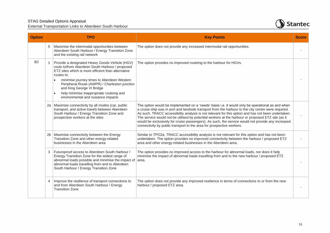
STAG Detailed Options Appraisal
External Transportation Links to Aberdeen South Harbour
51
Option TPO Key Points Score
5 Maximise the intermodal opportunities between Aberdeen South Harbour / Energy Transition Zone and the existing rail network
The option does not provide any increased intermodal rail opportunities. -
B2 1 Provide a designated Heavy Goods Vehicle (HGV) route to/from Aberdeen South Harbour / proposed ETZ sites which is more efficient than alternative routes to:
• minimise journey times to Aberdeen Western Peripheral Route (AWPR) / Charleston junction and King George VI Bridge
• help minimise inappropriate routeing and environmental and nuisance impacts
The option provides no improved routeing to the harbour for HGVs.
-
2a Maximise connectivity by all modes (car, public transport, and active travel) between Aberdeen South Harbour / Energy Transition Zone and prospective workers at the sites
The option would be implemented on a ‘needs’ basis i.e. it would only be operational as and when a cruise ship was in port and landside transport from the harbour to the city centre were required. As such, TRACC accessibility analysis is not relevant for this option and has not been undertaken. The service would not be utilised by potential workers at the harbour or proposed ETZ site (as it would be exclusively for cruise passengers). As such, the service would not provide any increased connectivity by public transport to the area for prospective workers.
-
2b Maximise connectivity between the Energy Transition Zone and other energy-related businesses in the Aberdeen area
Similar to TPO2a, TRACC accessibility analysis is not relevant for this option and has not been undertaken. The option provides no improved connectivity between the harbour / proposed ETZ area and other energy-related businesses in the Aberdeen area.
-
3 Futureproof access to Aberdeen South Harbour / Energy Transition Zone for the widest range of abnormal loads possible and minimise the impact of abnormal loads travelling from and to Aberdeen South Harbour / Energy Transition Zone
The option provides no improved access to the harbour for abnormal loads, nor does it help minimise the impact of abnormal loads travelling from and to the new harbour / proposed ETZ area.
-
4 Improve the resilience of transport connections to and from Aberdeen South Harbour / Energy Transition Zone
The option does not provide any improved resilience in terms of connections to or from the new harbour / proposed ETZ area.
-
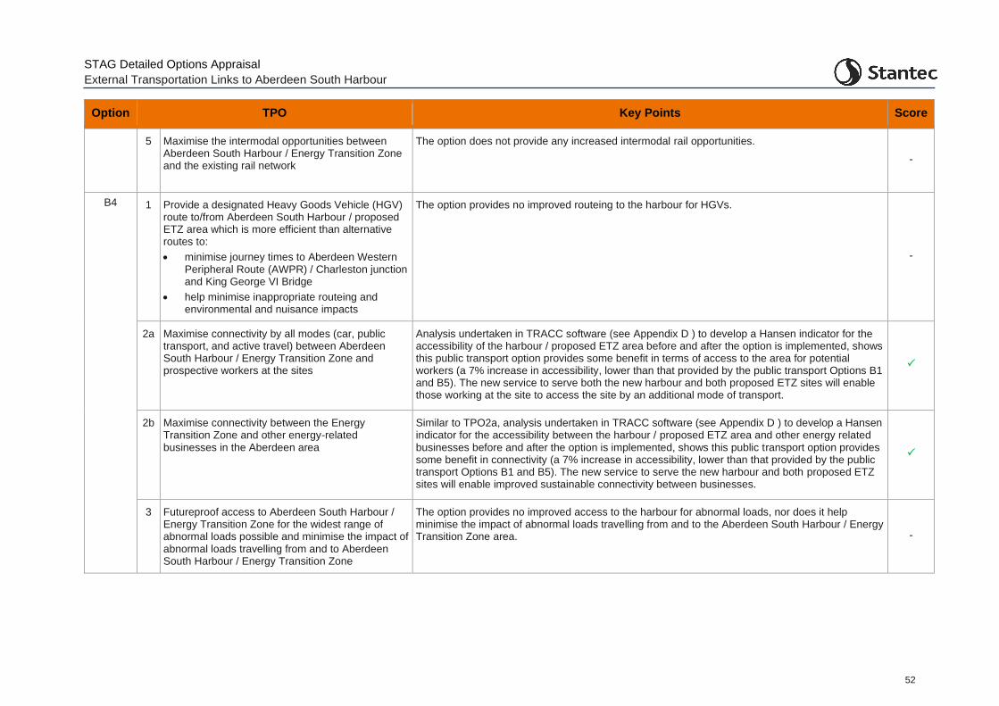
STAG Detailed Options Appraisal
External Transportation Links to Aberdeen South Harbour
52
Option TPO Key Points Score
5 Maximise the intermodal opportunities between Aberdeen South Harbour / Energy Transition Zone and the existing rail network
The option does not provide any increased intermodal rail opportunities.
-
B4 1 Provide a designated Heavy Goods Vehicle (HGV) route to/from Aberdeen South Harbour / proposed ETZ area which is more efficient than alternative routes to:
• minimise journey times to Aberdeen Western Peripheral Route (AWPR) / Charleston junction and King George VI Bridge
• help minimise inappropriate routeing and environmental and nuisance impacts
The option provides no improved routeing to the harbour for HGVs.
-
2a Maximise connectivity by all modes (car, public transport, and active travel) between Aberdeen South Harbour / Energy Transition Zone and prospective workers at the sites
Analysis undertaken in TRACC software (see Appendix D ) to develop a Hansen indicator for the accessibility of the harbour / proposed ETZ area before and after the option is implemented, shows this public transport option provides some benefit in terms of access to the area for potential workers (a 7% increase in accessibility, lower than that provided by the public transport Options B1 and B5). The new service to serve both the new harbour and both proposed ETZ sites will enable those working at the site to access the site by an additional mode of transport.
2b Maximise connectivity between the Energy Transition Zone and other energy-related businesses in the Aberdeen area
Similar to TPO2a, analysis undertaken in TRACC software (see Appendix D ) to develop a Hansen indicator for the accessibility between the harbour / proposed ETZ area and other energy related businesses before and after the option is implemented, shows this public transport option provides some benefit in connectivity (a 7% increase in accessibility, lower than that provided by the public transport Options B1 and B5). The new service to serve the new harbour and both proposed ETZ sites will enable improved sustainable connectivity between businesses.
3 Futureproof access to Aberdeen South Harbour / Energy Transition Zone for the widest range of abnormal loads possible and minimise the impact of abnormal loads travelling from and to Aberdeen South Harbour / Energy Transition Zone
The option provides no improved access to the harbour for abnormal loads, nor does it help minimise the impact of abnormal loads travelling from and to the Aberdeen South Harbour / Energy Transition Zone area. -
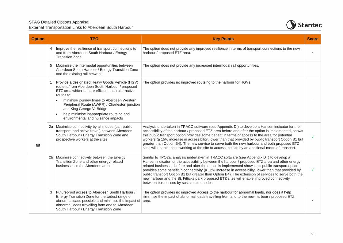
STAG Detailed Options Appraisal
External Transportation Links to Aberdeen South Harbour
53
Option TPO Key Points Score
4 Improve the resilience of transport connections to and from Aberdeen South Harbour / Energy Transition Zone
The option does not provide any improved resilience in terms of transport connections to the new harbour / proposed ETZ area. -
5 Maximise the intermodal opportunities between Aberdeen South Harbour / Energy Transition Zone and the existing rail network
The option does not provide any increased intermodal rail opportunities.
B5
1 Provide a designated Heavy Goods Vehicle (HGV) route to/from Aberdeen South Harbour / proposed ETZ area which is more efficient than alternative routes to:
• minimise journey times to Aberdeen Western Peripheral Route (AWPR) / Charleston junction and King George VI Bridge
• help minimise inappropriate routeing and environmental and nuisance impacts
The option provides no improved routeing to the harbour for HGVs.
-
2a Maximise connectivity by all modes (car, public transport, and active travel) between Aberdeen South Harbour / Energy Transition Zone and prospective workers at the sites
Analysis undertaken in TRACC software (see Appendix D ) to develop a Hansen indicator for the accessibility of the harbour / proposed ETZ area before and after the option is implemented, shows this public transport option provides some benefit in terms of access to the area for potential workers (a 15% increase in accessibility, lower than that provided by public transport Option B1 but greater than Option B4). The new service to serve both the new harbour and both proposed ETZ sites will enable those working at the site to access the site by an additional mode of transport.
2b Maximise connectivity between the Energy Transition Zone and other energy-related businesses in the Aberdeen area
Similar to TPO2a, analysis undertaken in TRACC software (see Appendix D ) to develop a Hansen indicator for the accessibility between the harbour / proposed ETZ area and other energy related businesses before and after the option is implemented shows this public transport option provides some benefit in connectivity (a 12% increase in accessibility, lower than that provided by public transport Option B1 but greater than Option B4). The extension of services to serve both the new harbour and the St. Fitticks park proposed ETZ sites will enable improved connectivity between businesses by sustainable modes.
3 Futureproof access to Aberdeen South Harbour / Energy Transition Zone for the widest range of abnormal loads possible and minimise the impact of abnormal loads travelling from and to Aberdeen South Harbour / Energy Transition Zone
The option provides no improved access to the harbour for abnormal loads, nor does it help minimise the impact of abnormal loads travelling from and to the new harbour / proposed ETZ area. -
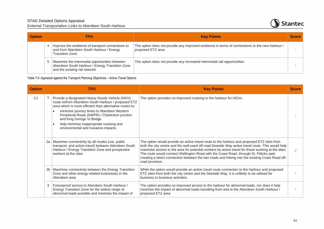
STAG Detailed Options Appraisal
External Transportation Links to Aberdeen South Harbour
54
Option TPO Key Points Score
4 Improve the resilience of transport connections to and from Aberdeen South Harbour / Energy Transition Zone
The option does not provide any improved resilience in terms of connections to the new harbour / proposed ETZ area -
5 Maximise the intermodal opportunities between Aberdeen South Harbour / Energy Transition Zone and the existing rail network
The option does not provide any increased intermodal rail opportunities. -
Table 7:4: Appraisal against the Transport Planning Objectives – Active Travel Options
Option TPO Key Points Score
C1 1 Provide a designated Heavy Goods Vehicle (HGV) route to/from Aberdeen South Harbour / proposed ETZ area which is more efficient than alternative routes to:
• minimise journey times to Aberdeen Western Peripheral Route (AWPR) / Charleston junction and King George VI Bridge
• help minimise inappropriate routeing and environmental and nuisance impacts
The option provides no improved routeing to the harbour for HGVs.
-
2a Maximise connectivity by all modes (car, public transport, and active travel) between Aberdeen South Harbour / Energy Transition Zone and prospective workers at the sites
The option would provide an active travel route to the harbour and proposed ETZ sites from both the city centre and the well-used off-road Deeside Way active travel route. This would help maximise access to the area for potential workers by active travel for those working at the sites. The route would connect Wellington Road with the Coast Road, through St. Fitticks park creating a direct connection between the two roads and linking into the existing Coast Road off-road provision.
2b Maximise connectivity between the Energy Transition Zone and other energy-related businesses in the Aberdeen area
While the option would provide an active travel route connection to the harbour and proposed ETZ sites from both the city centre and the Deeside Way, it is unlikely to be utilised for business to business activities.
-
3 Futureproof access to Aberdeen South Harbour / Energy Transition Zone for the widest range of abnormal loads possible and minimise the impact of
The option provides no improved access to the harbour for abnormal loads, nor does it help minimise the impact of abnormal loads travelling from and to the Aberdeen South Harbour / proposed ETZ area.
-
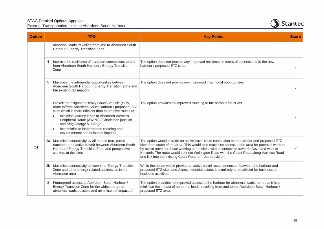
STAG Detailed Options Appraisal
External Transportation Links to Aberdeen South Harbour
55
Option TPO Key Points Score
abnormal loads travelling from and to Aberdeen South Harbour / Energy Transition Zone
4 Improve the resilience of transport connections to and from Aberdeen South Harbour / Energy Transition Zone
The option does not provide any improved resilience in terms of connections to the new harbour / proposed ETZ sites.
-
5 Maximise the intermodal opportunities between Aberdeen South Harbour / Energy Transition Zone and the existing rail network
The option does not provide any increased intermodal opportunities.
-
C4
1 Provide a designated Heavy Goods Vehicle (HGV) route to/from Aberdeen South Harbour / proposed ETZ sites which is more efficient than alternative routes to:
• minimise journey times to Aberdeen Western Peripheral Route (AWPR) / Charleston junction and King George VI Bridge
• help minimise inappropriate routeing and environmental and nuisance impacts
The option provides no improved routeing to the harbour for HGVs.
-
2a Maximise connectivity by all modes (car, public transport, and active travel) between Aberdeen South Harbour / Energy Transition Zone and prospective workers at the sites
The option would provide an active travel route connection to the harbour and proposed ETZ sites from south of the area. This would help maximise access to the area for potential workers by active travel for those working at the sites, with a connection towards Cove and west to Kincorth. The route would connect Wellington Road with the Coast Road along Harness Road and link into the existing Coast Road off-road provision.
2b Maximise connectivity between the Energy Transition Zone and other energy-related businesses in the Aberdeen area
While the option would provide an active travel route connection between the harbour and proposed ETZ sites and Altens industrial estate, it is unlikely to be utilised for business to business activities.
-
3 Futureproof access to Aberdeen South Harbour / Energy Transition Zone for the widest range of abnormal loads possible and minimise the impact of
The option provides no improved access to the harbour for abnormal loads, nor does it help minimise the impact of abnormal loads travelling from and to the Aberdeen South Harbour / proposed ETZ area.
-
STAG Detailed Options Appraisal
External Transportation Links to Aberdeen South Harbour
56
Option TPO Key Points Score
abnormal loads travelling from and to Aberdeen South Harbour / Energy Transition Zone
4 Improve the resilience of transport connections to and from Aberdeen South Harbour / Energy Transition Zone
The option does not provide any improved resilience in terms of connections to the new harbour / proposed ETZ area.
-
5 Maximise the intermodal opportunities between Aberdeen South Harbour / Energy Transition Zone and the existing rail network
The option does not provide any increased intermodal rail opportunities. -
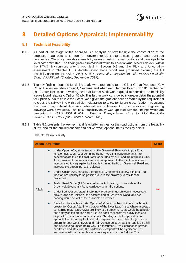
STAG Detailed Options Appraisal
External Transportation Links to Aberdeen South Harbour
57
8 Detailed Options Appraisal: Implementability
8.1 Technical Feasibility
8.1.1 As part of this stage of the appraisal, an analysis of how feasible the construction of the proposed road options is from an environmental, topographical, ground, and transport perspective. The study provides a feasibility assessment of the road options and develops high-level cost estimates. The findings are summarised within this section and, where relevant, within the STAG Environment criteria appraisal in Section 9.2 and the Risk and Uncertainty assessment in Chapter 11. A detailed stand-alone report was produced covering the full feasibility assessment, 45816_2001_R_001 - External Transportation Links to ASH Feasibility Study_DRAFT.pdf, (Stantec, September 2019).
8.1.2 The key findings from the feasibility study were presented to the Client Group (Aberdeen City Council, Aberdeenshire Council, Nestrans and Aberdeen Harbour Board) on 18th September 2019. After discussion it was agreed that further work was required to consider the feasibility issues found relating to Option A3a/b. This further work considered in greater detail the potential for Option A3a/b to tie into the Coast Road given the gradient issues created by the requirement to cross the railway line with sufficient clearance to allow for future electrification. To assess this, new topographical data was collected, and subsequent to this, additional engineering drawings were developed. The initial feasibility study was updated with the findings which are presented in 45816_2001_R_001 - External Transportation Links to ASH Feasibility Study_DRAFT - Rev 1.pdf, (Stantec, March 2020)
8.1.3 Table 8:1 presents the key technical feasibility findings for the road options from the feasibility study, and for the public transport and active travel options, notes the key points.
Table 8:1: Technical Feasibility
Option Key Points Score
A2a/b
Under Option A2a, signalisation of the Greenwell Road/Wellington Road junction has been required (in the traffic modelling work undertaken) to accommodate the additional traffic generated by ASH and the proposed ETZ. An extension of the two-lane section on approach to the junction has been incorporated to segregate right and left turning traffic on Greenwell Road and increase the throughput at the signals.
Under Option A2b, capacity upgrades at Greenbank Road/Wellington Road junction are unlikely to be possible due to the proximity to residential properties.
Traffic Road Order (TRO) needed to control parking on one side of the Greenwell/Greenbank Road carriageway for the options.
Under both Option A2a and A2b, new road construction would necessitate private land acquisition at the eastern end of Greenwell Road, and car parking would be lost at the associated premises.
Based on the available data, Option A2a/b encroaches (with encroachment greater for Option A2a) into a portion of the Ness Landfill site where asbestos containing materials (ACMs) are likely to be present. ACMs would be a health and safety consideration and introduce additional costs for excavation and disposal of these hazardous materials. The diagram below provides an appreciation of the required land take required by the earthworks (shown in green) for both Options A2a and A2b. As can be seen, as the road is on a hill and needs to go under the railway line (assumed 7.5m clearance to provide headroom and structure) the earthworks footprint will be significant. The earthworks will be unusable space as they are on a 1 in 3 slope. The
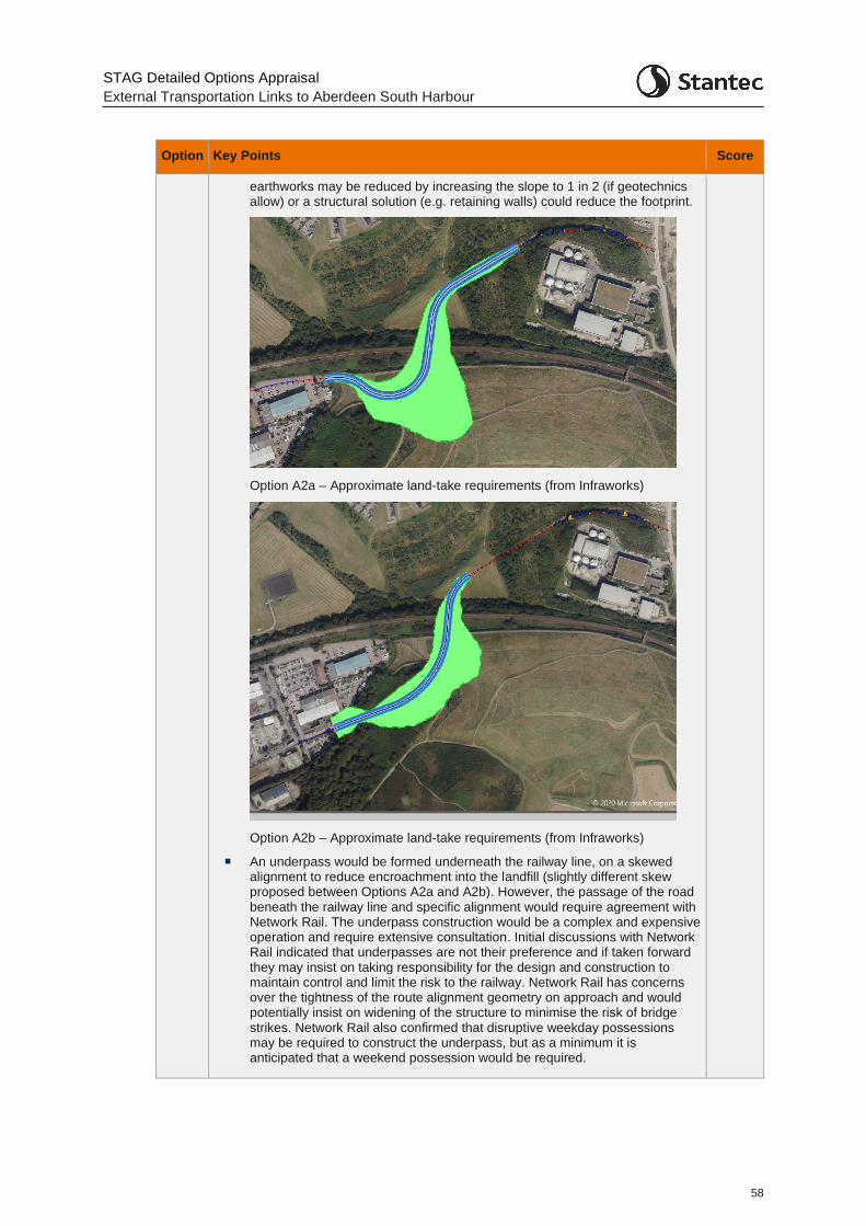
STAG Detailed Options Appraisal
External Transportation Links to Aberdeen South Harbour
58
Option Key Points Score
earthworks may be reduced by increasing the slope to 1 in 2 (if geotechnics allow) or a structural solution (e.g. retaining walls) could reduce the footprint.
Option A2a – Approximate land-take requirements (from Infraworks)
Option A2b – Approximate land-take requirements (from Infraworks)
An underpass would be formed underneath the railway line, on a skewed alignment to reduce encroachment into the landfill (slightly different skew proposed between Options A2a and A2b). However, the passage of the road beneath the railway line and specific alignment would require agreement with Network Rail. The underpass construction would be a complex and expensive operation and require extensive consultation. Initial discussions with Network Rail indicated that underpasses are not their preference and if taken forward they may insist on taking responsibility for the design and construction to maintain control and limit the risk to the railway. Network Rail has concerns over the tightness of the route alignment geometry on approach and would potentially insist on widening of the structure to minimise the risk of bridge strikes. Network Rail also confirmed that disruptive weekday possessions may be required to construct the underpass, but as a minimum it is anticipated that a weekend possession would be required.
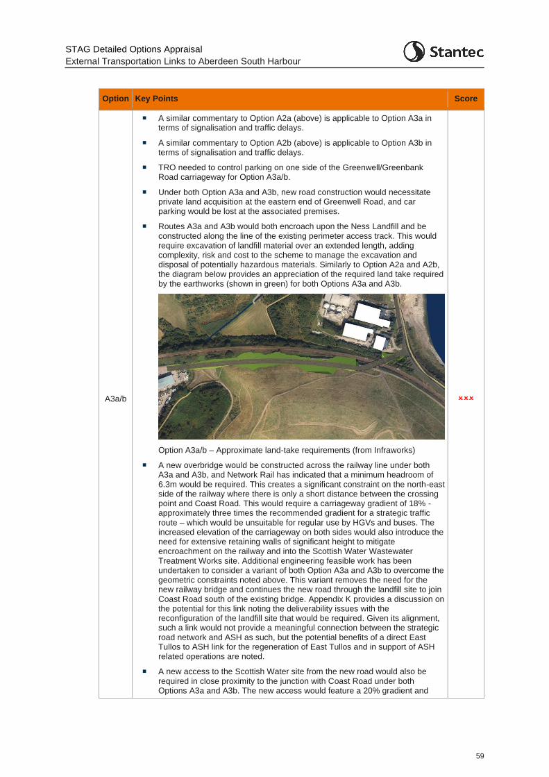
STAG Detailed Options Appraisal
External Transportation Links to Aberdeen South Harbour
59
Option Key Points Score
A3a/b
A similar commentary to Option A2a (above) is applicable to Option A3a in terms of signalisation and traffic delays.
A similar commentary to Option A2b (above) is applicable to Option A3b in terms of signalisation and traffic delays.
TRO needed to control parking on one side of the Greenwell/Greenbank Road carriageway for Option A3a/b.
Under both Option A3a and A3b, new road construction would necessitate private land acquisition at the eastern end of Greenwell Road, and car parking would be lost at the associated premises.
Routes A3a and A3b would both encroach upon the Ness Landfill and be constructed along the line of the existing perimeter access track. This would require excavation of landfill material over an extended length, adding complexity, risk and cost to the scheme to manage the excavation and disposal of potentially hazardous materials. Similarly to Option A2a and A2b, the diagram below provides an appreciation of the required land take required by the earthworks (shown in green) for both Options A3a and A3b.
Option A3a/b – Approximate land-take requirements (from Infraworks)
A new overbridge would be constructed across the railway line under both A3a and A3b, and Network Rail has indicated that a minimum headroom of 6.3m would be required. This creates a significant constraint on the north-east side of the railway where there is only a short distance between the crossing point and Coast Road. This would require a carriageway gradient of 18% - approximately three times the recommended gradient for a strategic traffic route – which would be unsuitable for regular use by HGVs and buses. The increased elevation of the carriageway on both sides would also introduce the need for extensive retaining walls of significant height to mitigate encroachment on the railway and into the Scottish Water Wastewater Treatment Works site. Additional engineering feasible work has been undertaken to consider a variant of both Option A3a and A3b to overcome the geometric constraints noted above. This variant removes the need for the new railway bridge and continues the new road through the landfill site to join Coast Road south of the existing bridge. Appendix K provides a discussion on the potential for this link noting the deliverability issues with the reconfiguration of the landfill site that would be required. Given its alignment, such a link would not provide a meaningful connection between the strategic road network and ASH as such, but the potential benefits of a direct East Tullos to ASH link for the regeneration of East Tullos and in support of ASH related operations are noted.
A new access to the Scottish Water site from the new road would also be required in close proximity to the junction with Coast Road under both Options A3a and A3b. The new access would feature a 20% gradient and
STAG Detailed Options Appraisal
External Transportation Links to Aberdeen South Harbour
60
Option Key Points Score
may be unacceptable to the road authority on account of tight junction spacing.
A4
A traffic regulation order would be required to control parking on Hareness Road.
Hareness Road meets Coast Road at a priority junction. While this junction was expected to be sufficient to accommodate ASH traffic, further modelling may be necessary to ensure it can also accommodate traffic associated with the proposed ETZ and identify whether signalisation is required. Consideration could also be given to reconfiguring the junction priority.
Third party land take may be required to accommodate the widening of Coast Road, but this could potentially be avoided if the Road Authority were to accept narrow verges in constrained sections.
A new railway overbridge would replace the existing structure and be constructed in such a way that continuity of access is maintained; however, this crossing would require realignment of Coast Road and the Coastal Path, and construction of a new access to the Ness Landfill site. These works are not considered onerous.
An historical registered landfill site (Taylor’s Industrial Landfill) is situated immediately east of the railway line adjacent to the proposed railway crossing point in Option A4. Therefore, the option may encroach upon this feature after crossing the railway line. This would require excavation of landfill material adding complexity, risk and cost to the scheme to manage the excavation and disposal of potentially hazardous materials.
As with Options A2a/b and Option A3a/b, the new bridge over the railway line and specific alignment would require agreement with Network Rail who may wish to take ownership of the design process.
A5
A traffic regulation order would be required to control parking on Souter Head Road.
A new road link would be constructed between Souter Head Road and Coast Road via existing industrial premises. This will require the demolition of one building and may compromise access to another.
Beyond the industrial yard the new carriageway would have a gradient of 5% (max recommended for an industrial road). A section of the existing Coast Road would be realigned to tie into the new road to maintain Burnbanks Village’s connection to the road network. This may be a steep connection due to the profile of the new road coming down from Souter Head Road but would be of less concern as it is a residential access road. In addition, a second junction onto the new road would be required to reconnect the eastern end of Langdykes Road to the network. The potential network changes are shown below.
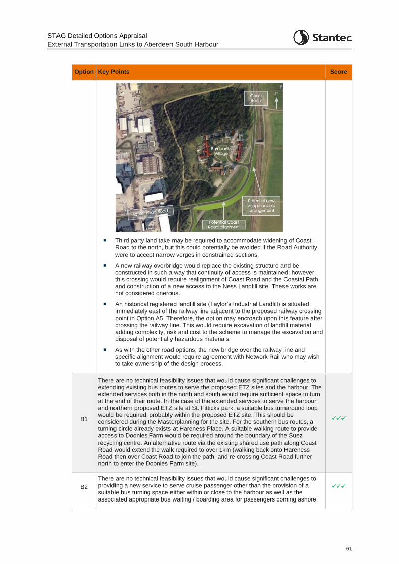
STAG Detailed Options Appraisal
External Transportation Links to Aberdeen South Harbour
61
Option Key Points Score
Third party land take may be required to accommodate widening of Coast Road to the north, but this could potentially be avoided if the Road Authority were to accept narrow verges in constrained sections.
A new railway overbridge would replace the existing structure and be constructed in such a way that continuity of access is maintained; however, this crossing would require realignment of Coast Road and the Coastal Path, and construction of a new access to the Ness Landfill site. These works are not considered onerous.
An historical registered landfill site (Taylor’s Industrial Landfill) is situated immediately east of the railway line adjacent to the proposed railway crossing point in Option A5. Therefore, the option may encroach upon this feature after crossing the railway line. This would require excavation of landfill material adding complexity, risk and cost to the scheme to manage the excavation and disposal of potentially hazardous materials.
As with the other road options, the new bridge over the railway line and specific alignment would require agreement with Network Rail who may wish to take ownership of the design process.
B1
There are no technical feasibility issues that would cause significant challenges to extending existing bus routes to serve the proposed ETZ sites and the harbour. The extended services both in the north and south would require sufficient space to turn at the end of their route. In the case of the extended services to serve the harbour and northern proposed ETZ site at St. Fitticks park, a suitable bus turnaround loop would be required, probably within the proposed ETZ site. This should be considered during the Masterplanning for the site. For the southern bus routes, a turning circle already exists at Hareness Place. A suitable walking route to provide access to Doonies Farm would be required around the boundary of the Suez recycling centre. An alternative route via the existing shared use path along Coast Road would extend the walk required to over 1km (walking back onto Hareness Road then over Coast Road to join the path, and re-crossing Coast Road further north to enter the Doonies Farm site).
B2
There are no technical feasibility issues that would cause significant challenges to providing a new service to serve cruise passenger other than the provision of a suitable bus turning space either within or close to the harbour as well as the associated appropriate bus waiting / boarding area for passengers coming ashore.
STAG Detailed Options Appraisal
External Transportation Links to Aberdeen South Harbour
62
Option Key Points Score
B4
There are no technical feasibility issues that would cause significant challenges to provide a new service to serve the proposed ETZ sites and the harbour. Such a service would require sufficient space to turn at the end of the route (at Doonies Farm) and should be taken into account during the Masterplanning stage for the proposed ETZ sites. Provision for new bus stops would be required at the harbour and proposed ETZ sites themselves.
B5
Option B5 (the inner loop service) requires Option A2a/b to be in place to provide the linkage between the St. Fitticks proposed ETZ site and East Tullos industrial estate. The technical feasibility issues relating to the provision of this new link are discussed above in this table for Option A2a/b. Height clearance in terms of the underpass would be required to accommodate a bus vehicle on the route and should be taken into account at the detailed design stage.
For the bus service itself, there are no technical feasibility issues (other than the potential clearance required at the underpass, which could be accommodated if single decker buses were utilised) that would cause significant challenges to provide the new service given existing bus infrastructure. Although provision for bus stops would be required on Greenwells Road / Greenbank Road as currently no buses route within the East Tullos industrial estate.
C1
The proposed route would provide a new shared use path linking through St. Fitticks Park from Kirkhill Place to the Coast Road.
The route should be considered and included in any proposed ETZ Masterplanning for the site. Within the park, the route splits into two sections, providing a link through the park to the new harbour entrance, and also south of the Waste Water treatment works, providing linkage through to the existing Coast Road off-road shared use path. This then provides onward connectivity to the proposed ETZ site at Doonies Farm.
If Option A2a/b were implemented, it is assumed that the route would connect with the new road link with associated active travel crossings and provision through the proposed ETZ site.
There is currently a network of informal tracks across the park which would be formalised and upgraded to provide an active travel route suitable for commuting. The route would require appropriate lighting to improve user security through the parkland and a new widened bridge over the Burn would be required.
There is sufficient space to provide appropriate provision of the route and there are no major technical challenges to provision.
C4
Two proposed route variations have been costed (as detailed in Section 10.4).
The first assumes no major change to Hareness Road other than on-road cycle way marking to delineate space for cyclists in both directions. The second requires more significant works to provide a tiered cycleway alongside a segregated footway. This second option would require realignment of existing drainage and would present a greater degree of technical challenge. However, the option would be technically feasible.
8.2 Operational Feasibility
8.2.1 The operational feasibility of the roads options has been reviewed through visualisation of the traffic model for both the Do Minimum and options scenarios for the future years (as discussed in Appendix C ) and through consideration of traffic flow changes on key routes within the traffic models.
8.2.2 The assessment of operational feasibility for the public transport options has been undertaken through consultation with the two main bus operators in the region, First and Stagecoach. Initial consultation took place in July 2019. With the emergence of the proposed ETZ and the revisions

STAG Detailed Options Appraisal
External Transportation Links to Aberdeen South Harbour
63
made to the public transport options, further discussions were had with the operators in July 2020. The key issues are noted against the relevant options in the operational feasibility.
8.2.3 The two active travel options do not present any obvious operational feasibility issues.
8.2.4 The appraisal of the operational feasibility of the road and public transport options is presented in Table 8:2.
Table 8:2: Operational Feasibility
Option Key Points Score
A2a/b
Options A2a/b provide a new link to the harbour / proposed ETZ area and direct traffic further north on Wellington Road to either Greenwell Road (Option A2a) or Greenbank Road (Option A2b). As such, a greater volume of traffic is predicted to route on Wellington Road (between Hareness roundabout and Greenwell Road / Greenbank Road junctions). This has an impact on network performance in this area.
Option A2a includes an additional set of signals on Wellington Road along an already busy stretch of carriageway with several existing signals. The cycle time for the new signals has been set to optimise the signals and balance the traffic flow on both Wellington Road and Greenwell Road. It should be noted that the inclusion of these signals creates queuing back on Wellington Road and causes difficulties and delays to traffic trying to join Wellington Road from the side arms further south (Abbotswell Road, Craigshaw Drive etc.) which are blocked by mainline traffic. In addition, queuing on Greenwell Road can delay vehicles in East Tullos industrial estate from exiting the area.
The signals on Greenwell Road do however, overall, provide a significant benefit to harbour / proposed ETZ development traffic by allowing vehicles out onto Wellington Road (with a queue reduction of around 400m compared to the Do Minimum situation (where the congestion on Wellington Road significantly reduces capacity on Greenwell Road as it is a priority junction). In the scenarios with higher growth, (the 10% background growth and high development traffic scenarios) the options provide the greatest benefits to harbour / proposed ETZ traffic by enabling egress onto Wellington Road – which is difficult in the Do Minimum priority junction situation due to congestion in the network.
There are significant impacts on through traffic journey times on Wellington Road due to the new set of signals and additionally some further network wide impacts as a result of the extra vehicles released from Greenwell Road (which results in additional traffic on Wellington Road). In particular, this has a knock-on effect on any give way minor arms along Wellington Road with traffic then struggling to find gaps in the mainline traffic (the impact reduces as the distance from Greenwell Road increases and vehicles disperse within the model).
Unlike Option A2a, Option A2b does not involve any additional traffic signals on Wellington Road and as such does not impact as greatly on existing traffic within the Wellington Road corridor.
Traffic volumes within the modelled network in the AM, IP and PM periods are presented in Appendix C.6 (for the highest demand scenario – 2041 High scenario with 10% background growth). The tables show, as expected, an increase in traffic on Wellington Road (between Hareness Road and Greenwell Rd / Greenbank Road) and also a minor increase in traffic on Souter Head Road (westbound in the AM and eastbound in the IP and PM periods) and Langdykes Road south / westbound – highlighting that some traffic (light goods vehicles only) are seeking alternative routes to avoid congestion on Wellington Road. Naturally, there is a large increase in traffic on Greenwell Road in Option A2a and on Greenbank Road in Option A2b. St. Fitticks Road also sees a decrease in traffic southbound in the AM and IP periods and northbound in the PM period in both Options A2a and A2b.
(A2a)
(A2b)
STAG Detailed Options Appraisal
External Transportation Links to Aberdeen South Harbour
64
Option Key Points Score
Overall, the journey time benefits to harbour / proposed ETZ traffic come with a significant disbenefit to existing traffic.
Option A2a/b requires an underpass under the railway line which may present height clearance issues for abnormally high loads wishing to access the harbour / proposed ETZ area. In addition, the alignment of the underpass may present HGV ‘swept path’ clearance issues for abnormally long loads, although there will be a similar issue at the junction of Greenbank Rd / Greenwells Road for traffic routeing to the harbour / proposed ETZ area from further afield due to the tight geometry at the junctions.
A3a/b
Options A3a/b provide a new link to the harbour / proposed ETZ area and directs traffic further north on Wellington Road to either Greenwell Road (Option A3a) or Greenbank Road (Option A3b). As such, a greater volume of traffic is predicted to route on Wellington Road (between Hareness roundabout and Greenwell Road / Greenbank Road junctions). This has an impact on network performance in this area.
Similar to Option A2a, Option A3a includes an additional set of signals on Wellington Road and causes the same traffic operational issues as noted above for Option A2a. Unlike Option A3a, Option A3b (similar to Option A2b) does not introduce any additional traffic signals on Wellington Road and as such does not impact as much on existing traffic within the Wellington Road corridor.
Traffic volumes within the modelled network in the AM, IP and PM periods are presented in Appendix C.6 (for the highest demand scenario – 2041 High scenario with 10% background growth). The tables show similar traffic patterns and changes to that seen for Options A2a/b as noted above.
Like Options A2a/b, overall, the journey time benefits to harbour / proposed ETZ traffic come with a significant disbenefit to existing traffic.
(A3a)
(A3b)
A4
Option A4 does not make any change from the Do Minimum in terms of the designated route to the harbour / proposed ETZ area, which remains as Hareness Road. This results in no major operational impact on existing traffic volumes or patterns on the road network. Coast Road traffic experiences a benefit due to the removal of the signals with a new bridge over the railway line, creating a straighter road alignment.
Traffic volumes within the modelled network in the AM, IP and PM periods are presented in Appendix C.6 (for the highest demand scenario – 2041 High scenario with 10% background growth). The tables show, as expected given the smaller scale of the option compared to others, no significant changes in traffic flow on any of the routes in all three modelled periods.
A5
Option A5 routes harbour / proposed ETZ bound traffic from Wellington Road further south (at Souter Head roundabout) as opposed to at the Hareness Road junction as in the Do Minimum. This benefits Wellington Road traffic.
There is some disbenefit to northbound traffic at Souter Head Roundabout (more pronounced in the AM period) as there is now a greater volume of traffic turning right at the roundabout onto Souter Head Road – which requires larger gaps to be found in the circulating traffic. Similarly, in the PM period, there are issues on Wellington Road Southbound and Souter Head Road. These arms oppose each other at the Souter Head roundabout. Adjusting the signals to help minimise any additional queueing only serves to move the congestion between the roundabout arms. The queueing on Wellington Road doesn’t impact any other junctions so doesn’t cause further network issues upstream. The Souter Head Road queue reaches the roundabout with Crawpeel Road and traffic can be seen to queue up Crawpeel Road (reaching Hareness Road in the highest demand scenario). Note though that queuing back from the Souter Head roundabout to the Souter Head Road / Crawpeel Road roundabout is noted in the observed traffic counts i.e. the option does not result in a significantly worse situation than the existing.
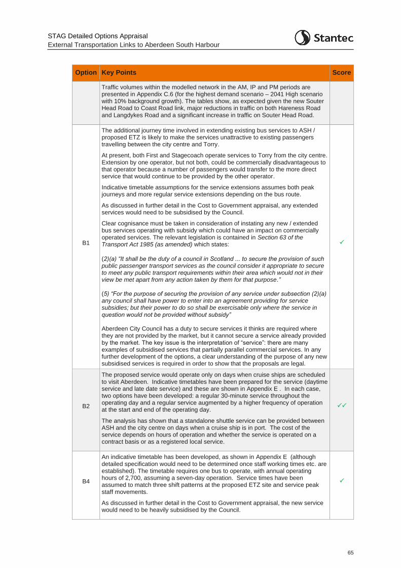
STAG Detailed Options Appraisal
External Transportation Links to Aberdeen South Harbour
65
Option Key Points Score
Traffic volumes within the modelled network in the AM, IP and PM periods are presented in Appendix C.6 (for the highest demand scenario – 2041 High scenario with 10% background growth). The tables show, as expected given the new Souter Head Road to Coast Road link, major reductions in traffic on both Hareness Road and Langdykes Road and a significant increase in traffic on Souter Head Road.
B1
The additional journey time involved in extending existing bus services to ASH / proposed ETZ is likely to make the services unattractive to existing passengers travelling between the city centre and Torry.
At present, both First and Stagecoach operate services to Torry from the city centre. Extension by one operator, but not both, could be commercially disadvantageous to that operator because a number of passengers would transfer to the more direct service that would continue to be provided by the other operator.
Indicative timetable assumptions for the service extensions assumes both peak journeys and more regular service extensions depending on the bus route.
As discussed in further detail in the Cost to Government appraisal, any extended services would need to be subsidised by the Council.
Clear cognisance must be taken in consideration of instating any new / extended bus services operating with subsidy which could have an impact on commercially operated services. The relevant legislation is contained in Section 63 of the Transport Act 1985 (as amended) which states:
(2)(a) “It shall be the duty of a council in Scotland ... to secure the provision of such public passenger transport services as the council consider it appropriate to secure to meet any public transport requirements within their area which would not in their view be met apart from any action taken by them for that purpose.” (5) “For the purpose of securing the provision of any service under subsection (2)(a) any council shall have power to enter into an agreement providing for service subsidies; but their power to do so shall be exercisable only where the service in question would not be provided without subsidy” Aberdeen City Council has a duty to secure services it thinks are required where they are not provided by the market, but it cannot secure a service already provided by the market. The key issue is the interpretation of “service”: there are many examples of subsidised services that partially parallel commercial services. In any further development of the options, a clear understanding of the purpose of any new subsidised services is required in order to show that the proposals are legal.
B2
The proposed service would operate only on days when cruise ships are scheduled to visit Aberdeen. Indicative timetables have been prepared for the service (daytime service and late date service) and these are shown in Appendix E . In each case, two options have been developed: a regular 30-minute service throughout the operating day and a regular service augmented by a higher frequency of operation at the start and end of the operating day.
The analysis has shown that a standalone shuttle service can be provided between ASH and the city centre on days when a cruise ship is in port. The cost of the service depends on hours of operation and whether the service is operated on a contract basis or as a registered local service.
B4
An indicative timetable has been developed, as shown in Appendix E (although detailed specification would need to be determined once staff working times etc. are established). The timetable requires one bus to operate, with annual operating hours of 2,700, assuming a seven-day operation. Service times have been assumed to match three shift patterns at the proposed ETZ site and service peak staff movements.
As discussed in further detail in the Cost to Government appraisal, the new service would need to be heavily subsidised by the Council.
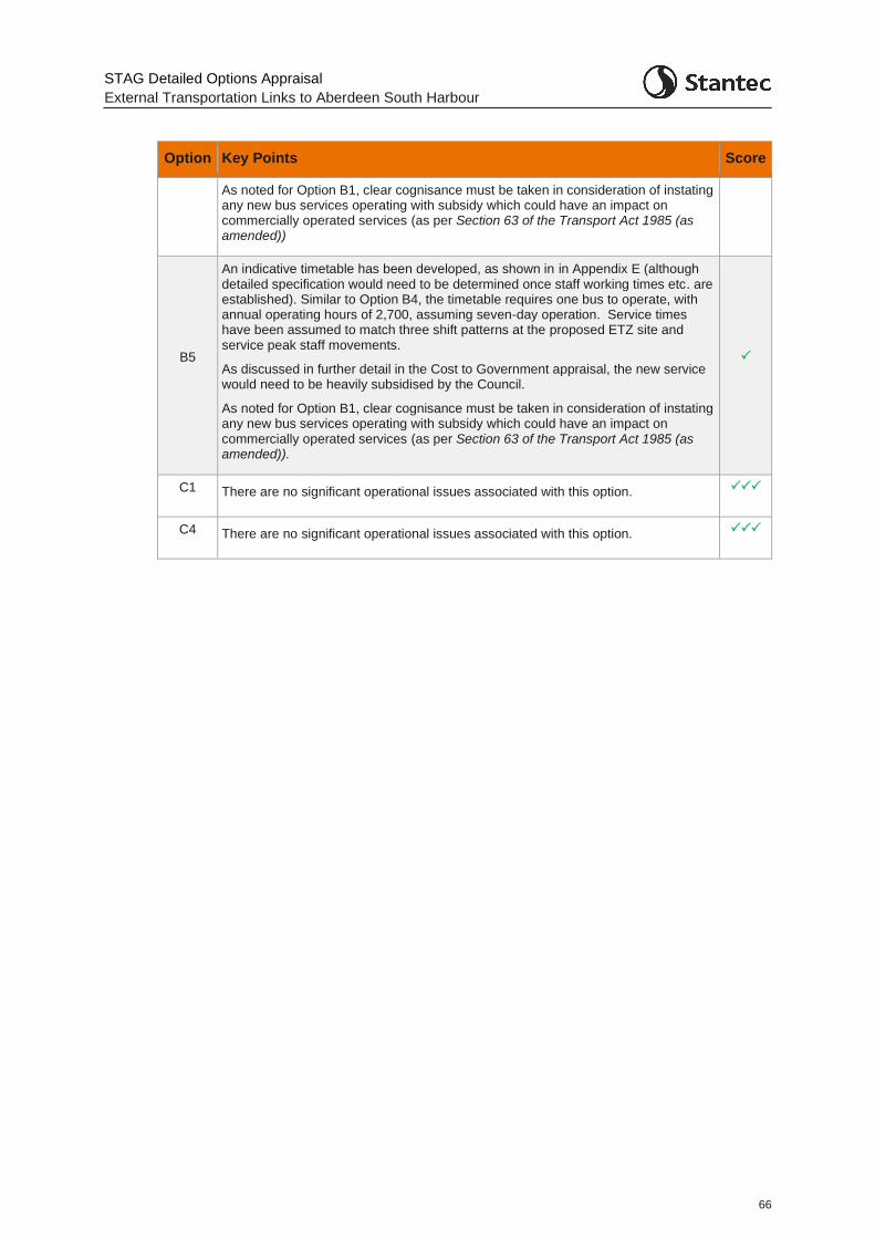
STAG Detailed Options Appraisal
External Transportation Links to Aberdeen South Harbour
66
Option Key Points Score
As noted for Option B1, clear cognisance must be taken in consideration of instating any new bus services operating with subsidy which could have an impact on commercially operated services (as per Section 63 of the Transport Act 1985 (as amended))
B5
An indicative timetable has been developed, as shown in in Appendix E (although detailed specification would need to be determined once staff working times etc. are established). Similar to Option B4, the timetable requires one bus to operate, with annual operating hours of 2,700, assuming seven-day operation. Service times have been assumed to match three shift patterns at the proposed ETZ site and service peak staff movements.
As discussed in further detail in the Cost to Government appraisal, the new service would need to be heavily subsidised by the Council.
As noted for Option B1, clear cognisance must be taken in consideration of instating any new bus services operating with subsidy which could have an impact on commercially operated services (as per Section 63 of the Transport Act 1985 (as amended)).
C1 There are no significant operational issues associated with this option.
C4 There are no significant operational issues associated with this option.
STAG Detailed Options Appraisal
External Transportation Links to Aberdeen South Harbour
67
9 Detailed Options Appraisal: STAG Criteria
9.1 Introduction
9.1.1 This section sets out the approach taken and key points in relation for appraisal of the options against the STAG criteria. The summarised outcome of the appraisal, against the STAG criteria, TPOs and other criteria, is presented in Chapter 13.
9.2 Environment Appraisal
Appraisal Criteria
9.2.1 The environmental appraisal at the Detailed Options Appraisal stage considers:
Noise and Vibration: avoidance of unacceptable adverse impacts on residential amenity;
Global Air Quality: carbon dioxide (CO2): ability to accommodate public transport to support sustainable modal shifts;
Local Air Quality: particulates (PM10) and nitrogen dioxide (NO2); avoid unacceptable adverse impacts on sensitive residential and community receptors, including by tackling or avoiding congestion and other sources of poor air quality;
Water Quality, Drainage and Flood Defence: avoid increased flood risk (to new infrastructure and surrounding area) and unacceptable adverse water quality impacts;
Biodiversity and Habitats: avoidance of unacceptable adverse impacts on important ecological features (designated sites, protected species, valued habitats, etc);
Landscape and Visual Amenity: avoidance of unacceptable adverse impacts on landscape/townscape character, key views, and visual amenity; and,
Cultural Heritage: avoidance of unacceptable adverse impacts on the integrity, understanding and setting of heritage assets and the wider historic environment; and
Geology, Agriculture and Soils: avoid unacceptable adverse geo-technical or geo-environmental (e.g. contamination, human health, etc) risks.
Consenting Requirements
9.2.2 The road options would necessitate varying extents of new and realigned road construction outwith existing carriageways, meaning that it would be necessary for Aberdeen City Council as the scheme promoter to obtain planning permission for relevant development activities. As all options are likely to involve a total site area (including working areas) exceeding 1 hectare, the project is likely to fall within the scope of paragraph 10(f) of Schedule 2 to the Town and Country Planning Environmental Impact Assessment (Scotland) Regulations 2017 (the EIA Regulations). This means it would be necessary to screen the preferred route for the potential need to undertake a statutory Environmental Impact Assessment (EIA), taking account of the nature of the route, its location and whether significant environmental effects are likely to occur. In the event of a statutory EIA not being required, these factors would also influence the range of technical studies and supporting information that may be required to support a planning application for the project.
9.2.3 As all potential road options would be substantially less than 8km in length, the project would be classed as a ‘local’ development under the Town and Country Planning (Hierarchy of
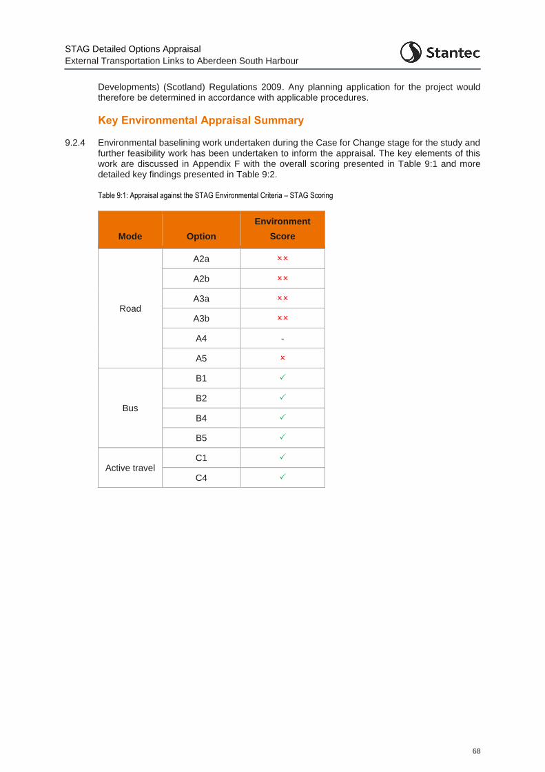
STAG Detailed Options Appraisal
External Transportation Links to Aberdeen South Harbour
68
Developments) (Scotland) Regulations 2009. Any planning application for the project would therefore be determined in accordance with applicable procedures.
Key Environmental Appraisal Summary
9.2.4 Environmental baselining work undertaken during the Case for Change stage for the study and further feasibility work has been undertaken to inform the appraisal. The key elements of this work are discussed in Appendix F with the overall scoring presented in Table 9:1 and more detailed key findings presented in Table 9:2.
Table 9:1: Appraisal against the STAG Environmental Criteria – STAG Scoring
Mode Option
Environment
Score
Road
A2a
A2b
A3a
A3b
A4 -
A5
Bus
B1
B2
B4
B5
Active travel C1
C4
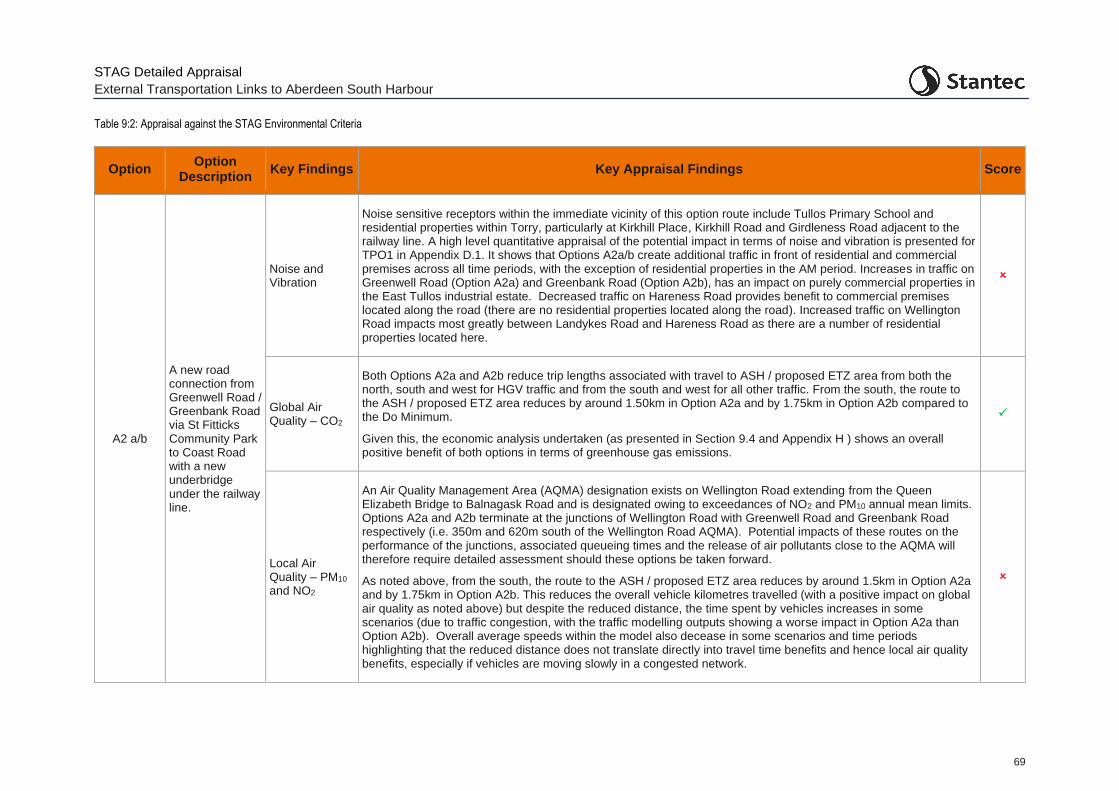
STAG Detailed Appraisal
External Transportation Links to Aberdeen South Harbour
69
Table 9:2: Appraisal against the STAG Environmental Criteria
Option Option
Description Key Findings Key Appraisal Findings Score
A2 a/b
A new road connection from Greenwell Road / Greenbank Road via St Fitticks Community Park to Coast Road with a new underbridge under the railway line.
Noise and Vibration
Noise sensitive receptors within the immediate vicinity of this option route include Tullos Primary School and residential properties within Torry, particularly at Kirkhill Place, Kirkhill Road and Girdleness Road adjacent to the railway line. A high level quantitative appraisal of the potential impact in terms of noise and vibration is presented for TPO1 in Appendix D.1. It shows that Options A2a/b create additional traffic in front of residential and commercial premises across all time periods, with the exception of residential properties in the AM period. Increases in traffic on Greenwell Road (Option A2a) and Greenbank Road (Option A2b), has an impact on purely commercial properties in the East Tullos industrial estate. Decreased traffic on Hareness Road provides benefit to commercial premises located along the road (there are no residential properties located along the road). Increased traffic on Wellington Road impacts most greatly between Landykes Road and Hareness Road as there are a number of residential properties located here.
Global Air Quality – CO2
Both Options A2a and A2b reduce trip lengths associated with travel to ASH / proposed ETZ area from both the north, south and west for HGV traffic and from the south and west for all other traffic. From the south, the route to the ASH / proposed ETZ area reduces by around 1.50km in Option A2a and by 1.75km in Option A2b compared to the Do Minimum.
Given this, the economic analysis undertaken (as presented in Section 9.4 and Appendix H ) shows an overall positive benefit of both options in terms of greenhouse gas emissions.
Local Air Quality – PM10 and NO2
An Air Quality Management Area (AQMA) designation exists on Wellington Road extending from the Queen Elizabeth Bridge to Balnagask Road and is designated owing to exceedances of NO2 and PM10 annual mean limits. Options A2a and A2b terminate at the junctions of Wellington Road with Greenwell Road and Greenbank Road respectively (i.e. 350m and 620m south of the Wellington Road AQMA). Potential impacts of these routes on the performance of the junctions, associated queueing times and the release of air pollutants close to the AQMA will therefore require detailed assessment should these options be taken forward.
As noted above, from the south, the route to the ASH / proposed ETZ area reduces by around 1.5km in Option A2a and by 1.75km in Option A2b. This reduces the overall vehicle kilometres travelled (with a positive impact on global air quality as noted above) but despite the reduced distance, the time spent by vehicles increases in some scenarios (due to traffic congestion, with the traffic modelling outputs showing a worse impact in Option A2a than Option A2b). Overall average speeds within the model also decease in some scenarios and time periods highlighting that the reduced distance does not translate directly into travel time benefits and hence local air quality benefits, especially if vehicles are moving slowly in a congested network.
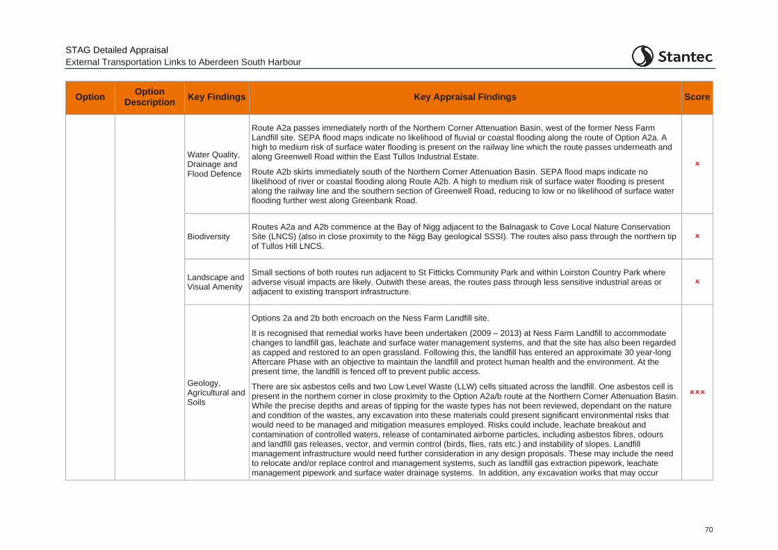
STAG Detailed Appraisal
External Transportation Links to Aberdeen South Harbour
70
Option Option
Description Key Findings Key Appraisal Findings Score
Water Quality, Drainage and Flood Defence
Route A2a passes immediately north of the Northern Corner Attenuation Basin, west of the former Ness Farm Landfill site. SEPA flood maps indicate no likelihood of fluvial or coastal flooding along the route of Option A2a. A high to medium risk of surface water flooding is present on the railway line which the route passes underneath and along Greenwell Road within the East Tullos Industrial Estate.
Route A2b skirts immediately south of the Northern Corner Attenuation Basin. SEPA flood maps indicate no likelihood of river or coastal flooding along Route A2b. A high to medium risk of surface water flooding is present along the railway line and the southern section of Greenwell Road, reducing to low or no likelihood of surface water flooding further west along Greenbank Road.
Biodiversity Routes A2a and A2b commence at the Bay of Nigg adjacent to the Balnagask to Cove Local Nature Conservation Site (LNCS) (also in close proximity to the Nigg Bay geological SSSI). The routes also pass through the northern tip of Tullos Hill LNCS.
Landscape and Visual Amenity
Small sections of both routes run adjacent to St Fitticks Community Park and within Loirston Country Park where adverse visual impacts are likely. Outwith these areas, the routes pass through less sensitive industrial areas or adjacent to existing transport infrastructure.
Geology, Agricultural and Soils
Options 2a and 2b both encroach on the Ness Farm Landfill site.
It is recognised that remedial works have been undertaken (2009 – 2013) at Ness Farm Landfill to accommodate changes to landfill gas, leachate and surface water management systems, and that the site has also been regarded as capped and restored to an open grassland. Following this, the landfill has entered an approximate 30 year-long Aftercare Phase with an objective to maintain the landfill and protect human health and the environment. At the present time, the landfill is fenced off to prevent public access.
There are six asbestos cells and two Low Level Waste (LLW) cells situated across the landfill. One asbestos cell is present in the northern corner in close proximity to the Option A2a/b route at the Northern Corner Attenuation Basin. While the precise depths and areas of tipping for the waste types has not been reviewed, dependant on the nature and condition of the wastes, any excavation into these materials could present significant environmental risks that would need to be managed and mitigation measures employed. Risks could include, leachate breakout and contamination of controlled waters, release of contaminated airborne particles, including asbestos fibres, odours and landfill gas releases, vector, and vermin control (birds, flies, rats etc.) and instability of slopes. Landfill management infrastructure would need further consideration in any design proposals. These may include the need to relocate and/or replace control and management systems, such as landfill gas extraction pipework, leachate management pipework and surface water drainage systems. In addition, any excavation works that may occur
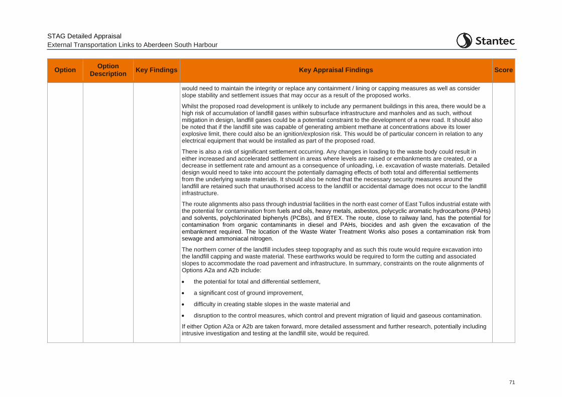
STAG Detailed Appraisal
External Transportation Links to Aberdeen South Harbour
71
Option Option
Description Key Findings Key Appraisal Findings Score
would need to maintain the integrity or replace any containment / lining or capping measures as well as consider slope stability and settlement issues that may occur as a result of the proposed works.
Whilst the proposed road development is unlikely to include any permanent buildings in this area, there would be a high risk of accumulation of landfill gases within subsurface infrastructure and manholes and as such, without mitigation in design, landfill gases could be a potential constraint to the development of a new road. It should also be noted that if the landfill site was capable of generating ambient methane at concentrations above its lower explosive limit, there could also be an ignition/explosion risk. This would be of particular concern in relation to any electrical equipment that would be installed as part of the proposed road.
There is also a risk of significant settlement occurring. Any changes in loading to the waste body could result in either increased and accelerated settlement in areas where levels are raised or embankments are created, or a decrease in settlement rate and amount as a consequence of unloading, i.e. excavation of waste materials. Detailed design would need to take into account the potentially damaging effects of both total and differential settlements from the underlying waste materials. It should also be noted that the necessary security measures around the landfill are retained such that unauthorised access to the landfill or accidental damage does not occur to the landfill infrastructure.
The route alignments also pass through industrial facilities in the north east corner of East Tullos industrial estate with the potential for contamination from fuels and oils, heavy metals, asbestos, polycyclic aromatic hydrocarbons (PAHs) and solvents, polychlorinated biphenyls (PCBs), and BTEX. The route, close to railway land, has the potential for contamination from organic contaminants in diesel and PAHs, biocides and ash given the excavation of the embankment required. The location of the Waste Water Treatment Works also poses a contamination risk from sewage and ammoniacal nitrogen.
The northern corner of the landfill includes steep topography and as such this route would require excavation into the landfill capping and waste material. These earthworks would be required to form the cutting and associated slopes to accommodate the road pavement and infrastructure. In summary, constraints on the route alignments of Options A2a and A2b include:
• the potential for total and differential settlement,
• a significant cost of ground improvement,
• difficulty in creating stable slopes in the waste material and
• disruption to the control measures, which control and prevent migration of liquid and gaseous contamination.
If either Option A2a or A2b are taken forward, more detailed assessment and further research, potentially including intrusive investigation and testing at the landfill site, would be required.

STAG Detailed Appraisal
External Transportation Links to Aberdeen South Harbour
72
Option Option
Description Key Findings Key Appraisal Findings Score
Cultural Heritage
Options A2a and A2b do not interact with any Conservation Areas but are located close to three listed buildings (north of the route above the railway line at Grampian Road, Tullos School and the junction of Girdleness Road and Gregness Gardens).
Two scheduled monuments lie to the north of both routes at North Balnagask Road and St Fitticks Community Park.
Three Scheduled monuments lie to the south of both routes within Loirston Country Park. The closest scheduled monument to both routes is Tullos Cairn, which is located approximately 350m from Option A2a and 250m from Option A2b at its closest point.
-
Physical Fitness
Option A2a intersects with two Core Paths, one running through St Fitticks Community Park and the second crossing the railway line from Ladywell Place onto Greenwell Road. The route also dissects a playing field south west of St Fitticks Community Park and encroaches into Loirston Country Park.
Core Paths intersect Option A2b on three occasions, one running through St Fitticks Community Park, the second crossing the railway line from Ladywell Place onto Greenwell Road and the third along Greenback Crescent. Option A2b also dissects a playing field south west of St Fitticks Community Park and encroaches into Loirston Country Park to greater extent than Option A2a.
Both options therefore sever existing active travel links and would have an impact on their potential use for physical fitness. It will be important to accommodate these existing routes into any new road design with appropriate safe and well-designed crossing points. It is also assumed that any new route through St. Fitticks Park would include a parallel active travel route adjacent to the road.
A3 a/b
A new road connection from Greenwell Road / Greenbank Road via the former Ness Landfill site and a new bridge over the railway.
Noise and Vibration
By virtue of being located further south than Options A2a and A2b, Options A3a and A3b avoid noise sensitive receptors including Tullos Primary School and residential properties within Torry.
A high level quantitative appraisal of the potential option impact in terms of noise and vibration is presented for TPO1 in Appendix D.1. Similar to Option A2a/b, it shows that Option A3a/b create additional traffic in front of residential and commercial premises across all time periods, with the exception of residential properties in the AM period. Increased traffic on Greenwell Road (Option A3a) and Greenbank Road (Option A3b), has an impact on purely commercial properties in the East Tullos industrial estate. Decreased traffic on Hareness Road provides benefit to commercial premises located along the road (there are no residential properties located along the road). Increased traffic on Wellington Road impacts most greatly between Langdykes Road and Hareness Road as there are a number of residential properties located here.
Global Air Quality – CO2
Both Options A3a and A3b reduce the trip length associated with travel to the ASH / proposed ETZ area from both the north, south and west for HGV traffic and from the south and west for all traffic. From the south, the route to the ASH / proposed ETZ area reduces by around 0.9km in Option A3a and by 1.1km in Option A3b.
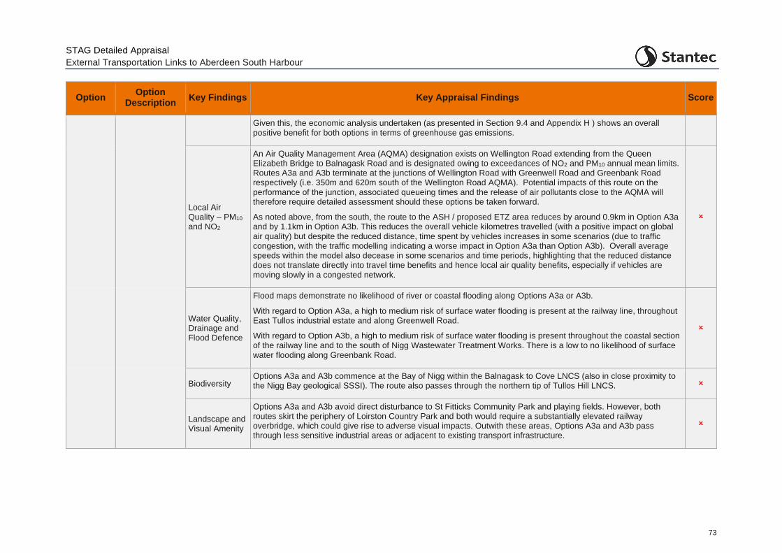
STAG Detailed Appraisal
External Transportation Links to Aberdeen South Harbour
73
Option Option
Description Key Findings Key Appraisal Findings Score
Given this, the economic analysis undertaken (as presented in Section 9.4 and Appendix H ) shows an overall positive benefit for both options in terms of greenhouse gas emissions.
Local Air Quality – PM10 and NO2
An Air Quality Management Area (AQMA) designation exists on Wellington Road extending from the Queen Elizabeth Bridge to Balnagask Road and is designated owing to exceedances of NO2 and PM10 annual mean limits. Routes A3a and A3b terminate at the junctions of Wellington Road with Greenwell Road and Greenbank Road respectively (i.e. 350m and 620m south of the Wellington Road AQMA). Potential impacts of this route on the performance of the junction, associated queueing times and the release of air pollutants close to the AQMA will therefore require detailed assessment should these options be taken forward.
As noted above, from the south, the route to the ASH / proposed ETZ area reduces by around 0.9km in Option A3a and by 1.1km in Option A3b. This reduces the overall vehicle kilometres travelled (with a positive impact on global air quality) but despite the reduced distance, time spent by vehicles increases in some scenarios (due to traffic congestion, with the traffic modelling indicating a worse impact in Option A3a than Option A3b). Overall average speeds within the model also decease in some scenarios and time periods, highlighting that the reduced distance does not translate directly into travel time benefits and hence local air quality benefits, especially if vehicles are moving slowly in a congested network.
Water Quality, Drainage and Flood Defence
Flood maps demonstrate no likelihood of river or coastal flooding along Options A3a or A3b.
With regard to Option A3a, a high to medium risk of surface water flooding is present at the railway line, throughout East Tullos industrial estate and along Greenwell Road.
With regard to Option A3b, a high to medium risk of surface water flooding is present throughout the coastal section of the railway line and to the south of Nigg Wastewater Treatment Works. There is a low to no likelihood of surface water flooding along Greenbank Road.
Biodiversity Options A3a and A3b commence at the Bay of Nigg within the Balnagask to Cove LNCS (also in close proximity to the Nigg Bay geological SSSI). The route also passes through the northern tip of Tullos Hill LNCS.
Landscape and Visual Amenity
Options A3a and A3b avoid direct disturbance to St Fitticks Community Park and playing fields. However, both routes skirt the periphery of Loirston Country Park and both would require a substantially elevated railway overbridge, which could give rise to adverse visual impacts. Outwith these areas, Options A3a and A3b pass through less sensitive industrial areas or adjacent to existing transport infrastructure.
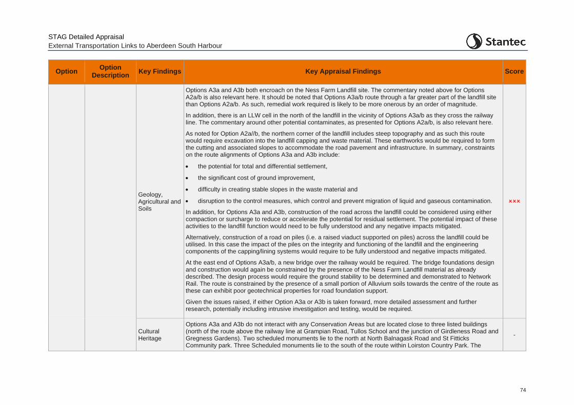
STAG Detailed Appraisal
External Transportation Links to Aberdeen South Harbour
74
Option Option
Description Key Findings Key Appraisal Findings Score
Geology, Agricultural and Soils
Options A3a and A3b both encroach on the Ness Farm Landfill site. The commentary noted above for Options A2a/b is also relevant here. It should be noted that Options A3a/b route through a far greater part of the landfill site than Options A2a/b. As such, remedial work required is likely to be more onerous by an order of magnitude.
In addition, there is an LLW cell in the north of the landfill in the vicinity of Options A3a/b as they cross the railway line. The commentary around other potential contaminates, as presented for Options A2a/b, is also relevant here.
As noted for Option A2a//b, the northern corner of the landfill includes steep topography and as such this route would require excavation into the landfill capping and waste material. These earthworks would be required to form the cutting and associated slopes to accommodate the road pavement and infrastructure. In summary, constraints on the route alignments of Options A3a and A3b include:
• the potential for total and differential settlement,
• the significant cost of ground improvement,
• difficulty in creating stable slopes in the waste material and
• disruption to the control measures, which control and prevent migration of liquid and gaseous contamination.
In addition, for Options A3a and A3b, construction of the road across the landfill could be considered using either compaction or surcharge to reduce or accelerate the potential for residual settlement. The potential impact of these activities to the landfill function would need to be fully understood and any negative impacts mitigated.
Alternatively, construction of a road on piles (i.e. a raised viaduct supported on piles) across the landfill could be utilised. In this case the impact of the piles on the integrity and functioning of the landfill and the engineering components of the capping/lining systems would require to be fully understood and negative impacts mitigated.
At the east end of Options A3a/b, a new bridge over the railway would be required. The bridge foundations design and construction would again be constrained by the presence of the Ness Farm Landfill material as already described. The design process would require the ground stability to be determined and demonstrated to Network Rail. The route is constrained by the presence of a small portion of Alluvium soils towards the centre of the route as these can exhibit poor geotechnical properties for road foundation support.
Given the issues raised, if either Option A3a or A3b is taken forward, more detailed assessment and further research, potentially including intrusive investigation and testing, would be required.
Cultural Heritage
Options A3a and A3b do not interact with any Conservation Areas but are located close to three listed buildings (north of the route above the railway line at Grampian Road, Tullos School and the junction of Girdleness Road and Gregness Gardens). Two scheduled monuments lie to the north at North Balnagask Road and St Fitticks Community park. Three Scheduled monuments lie to the south of the route within Loirston Country Park. The
-
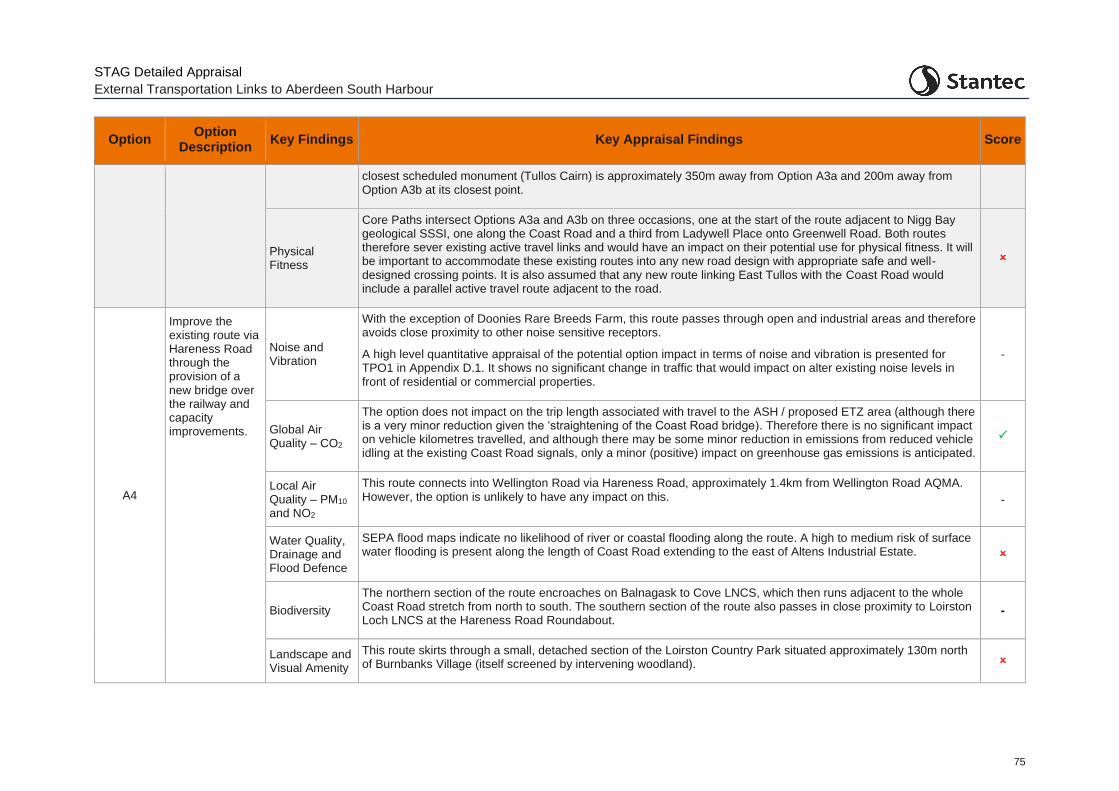
STAG Detailed Appraisal
External Transportation Links to Aberdeen South Harbour
75
Option Option
Description Key Findings Key Appraisal Findings Score
closest scheduled monument (Tullos Cairn) is approximately 350m away from Option A3a and 200m away from Option A3b at its closest point.
Physical Fitness
Core Paths intersect Options A3a and A3b on three occasions, one at the start of the route adjacent to Nigg Bay geological SSSI, one along the Coast Road and a third from Ladywell Place onto Greenwell Road. Both routes therefore sever existing active travel links and would have an impact on their potential use for physical fitness. It will be important to accommodate these existing routes into any new road design with appropriate safe and well-designed crossing points. It is also assumed that any new route linking East Tullos with the Coast Road would include a parallel active travel route adjacent to the road.
A4
Improve the existing route via Hareness Road through the provision of a new bridge over the railway and capacity improvements.
Noise and Vibration
With the exception of Doonies Rare Breeds Farm, this route passes through open and industrial areas and therefore avoids close proximity to other noise sensitive receptors.
A high level quantitative appraisal of the potential option impact in terms of noise and vibration is presented for TPO1 in Appendix D.1. It shows no significant change in traffic that would impact on alter existing noise levels in front of residential or commercial properties.
-
Global Air Quality – CO2
The option does not impact on the trip length associated with travel to the ASH / proposed ETZ area (although there is a very minor reduction given the ‘straightening of the Coast Road bridge). Therefore there is no significant impact on vehicle kilometres travelled, and although there may be some minor reduction in emissions from reduced vehicle idling at the existing Coast Road signals, only a minor (positive) impact on greenhouse gas emissions is anticipated.
Local Air Quality – PM10 and NO2
This route connects into Wellington Road via Hareness Road, approximately 1.4km from Wellington Road AQMA. However, the option is unlikely to have any impact on this. -
Water Quality, Drainage and Flood Defence
SEPA flood maps indicate no likelihood of river or coastal flooding along the route. A high to medium risk of surface water flooding is present along the length of Coast Road extending to the east of Altens Industrial Estate.
Biodiversity
The northern section of the route encroaches on Balnagask to Cove LNCS, which then runs adjacent to the whole Coast Road stretch from north to south. The southern section of the route also passes in close proximity to Loirston Loch LNCS at the Hareness Road Roundabout.
-
Landscape and Visual Amenity
This route skirts through a small, detached section of the Loirston Country Park situated approximately 130m north of Burnbanks Village (itself screened by intervening woodland).
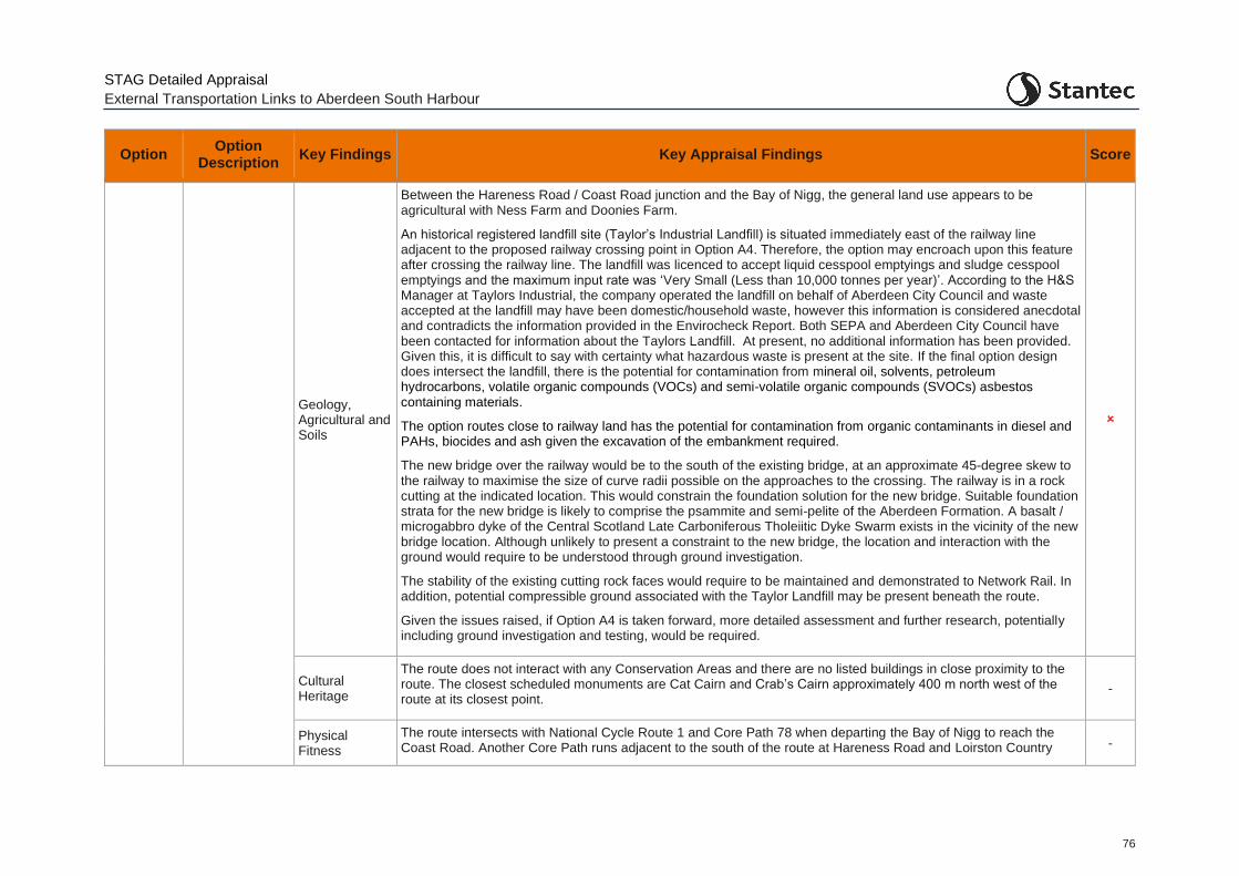
STAG Detailed Appraisal
External Transportation Links to Aberdeen South Harbour
76
Option Option
Description Key Findings Key Appraisal Findings Score
Geology, Agricultural and Soils
Between the Hareness Road / Coast Road junction and the Bay of Nigg, the general land use appears to be agricultural with Ness Farm and Doonies Farm.
An historical registered landfill site (Taylor’s Industrial Landfill) is situated immediately east of the railway line adjacent to the proposed railway crossing point in Option A4. Therefore, the option may encroach upon this feature after crossing the railway line. The landfill was licenced to accept liquid cesspool emptyings and sludge cesspool emptyings and the maximum input rate was ‘Very Small (Less than 10,000 tonnes per year)’. According to the H&S Manager at Taylors Industrial, the company operated the landfill on behalf of Aberdeen City Council and waste accepted at the landfill may have been domestic/household waste, however this information is considered anecdotal and contradicts the information provided in the Envirocheck Report. Both SEPA and Aberdeen City Council have been contacted for information about the Taylors Landfill. At present, no additional information has been provided. Given this, it is difficult to say with certainty what hazardous waste is present at the site. If the final option design does intersect the landfill, there is the potential for contamination from mineral oil, solvents, petroleum hydrocarbons, volatile organic compounds (VOCs) and semi-volatile organic compounds (SVOCs) asbestos containing materials.
The option routes close to railway land has the potential for contamination from organic contaminants in diesel and PAHs, biocides and ash given the excavation of the embankment required.
The new bridge over the railway would be to the south of the existing bridge, at an approximate 45-degree skew to the railway to maximise the size of curve radii possible on the approaches to the crossing. The railway is in a rock cutting at the indicated location. This would constrain the foundation solution for the new bridge. Suitable foundation strata for the new bridge is likely to comprise the psammite and semi-pelite of the Aberdeen Formation. A basalt / microgabbro dyke of the Central Scotland Late Carboniferous Tholeiitic Dyke Swarm exists in the vicinity of the new bridge location. Although unlikely to present a constraint to the new bridge, the location and interaction with the ground would require to be understood through ground investigation.
The stability of the existing cutting rock faces would require to be maintained and demonstrated to Network Rail. In addition, potential compressible ground associated with the Taylor Landfill may be present beneath the route.
Given the issues raised, if Option A4 is taken forward, more detailed assessment and further research, potentially including ground investigation and testing, would be required.
Cultural Heritage
The route does not interact with any Conservation Areas and there are no listed buildings in close proximity to the route. The closest scheduled monuments are Cat Cairn and Crab’s Cairn approximately 400 m north west of the route at its closest point.
-
Physical Fitness
The route intersects with National Cycle Route 1 and Core Path 78 when departing the Bay of Nigg to reach the Coast Road. Another Core Path runs adjacent to the south of the route at Hareness Road and Loirston Country -
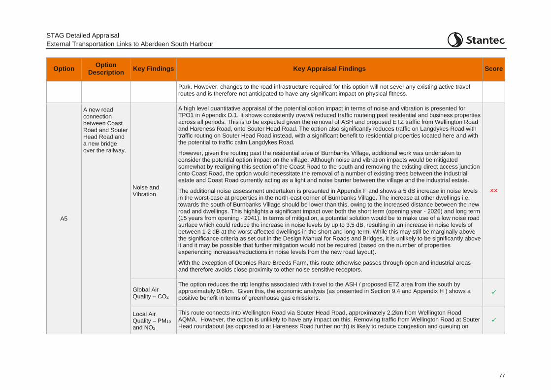
STAG Detailed Appraisal
External Transportation Links to Aberdeen South Harbour
77
Option Option
Description Key Findings Key Appraisal Findings Score
Park. However, changes to the road infrastructure required for this option will not sever any existing active travel routes and is therefore not anticipated to have any significant impact on physical fitness.
A5
A new road connection between Coast Road and Souter Head Road and a new bridge over the railway.
Noise and Vibration
A high level quantitative appraisal of the potential option impact in terms of noise and vibration is presented for TPO1 in Appendix D.1. It shows consistently overall reduced traffic routeing past residential and business properties across all periods. This is to be expected given the removal of ASH and proposed ETZ traffic from Wellington Road and Hareness Road, onto Souter Head Road. The option also significantly reduces traffic on Langdykes Road with traffic routing on Souter Head Road instead, with a significant benefit to residential properties located here and with the potential to traffic calm Langdykes Road.
However, given the routing past the residential area of Burnbanks Village, additional work was undertaken to consider the potential option impact on the village. Although noise and vibration impacts would be mitigated somewhat by realigning this section of the Coast Road to the south and removing the existing direct access junction onto Coast Road, the option would necessitate the removal of a number of existing trees between the industrial estate and Coast Road currently acting as a light and noise barrier between the village and the industrial estate.
The additional noise assessment undertaken is presented in Appendix F and shows a 5 dB increase in noise levels in the worst-case at properties in the north-east corner of Burnbanks Village. The increase at other dwellings i.e. towards the south of Burnbanks Village should be lower than this, owing to the increased distance between the new road and dwellings. This highlights a significant impact over both the short term (opening year - 2026) and long term (15 years from opening - 2041). In terms of mitigation, a potential solution would be to make use of a low noise road surface which could reduce the increase in noise levels by up to 3.5 dB, resulting in an increase in noise levels of between 1-2 dB at the worst-affected dwellings in the short and long-term. While this may still be marginally above the significance criteria as set out in the Design Manual for Roads and Bridges, it is unlikely to be significantly above it and it may be possible that further mitigation would not be required (based on the number of properties experiencing increases/reductions in noise levels from the new road layout).
With the exception of Doonies Rare Breeds Farm, this route otherwise passes through open and industrial areas and therefore avoids close proximity to other noise sensitive receptors.
Global Air Quality – CO2
The option reduces the trip lengths associated with travel to the ASH / proposed ETZ area from the south by approximately 0.6km. Given this, the economic analysis (as presented in Section 9.4 and Appendix H ) shows a positive benefit in terms of greenhouse gas emissions.
Local Air Quality – PM10 and NO2
This route connects into Wellington Road via Souter Head Road, approximately 2.2km from Wellington Road AQMA. However, the option is unlikely to have any impact on this. Removing traffic from Wellington Road at Souter Head roundabout (as opposed to at Hareness Road further north) is likely to reduce congestion and queuing on
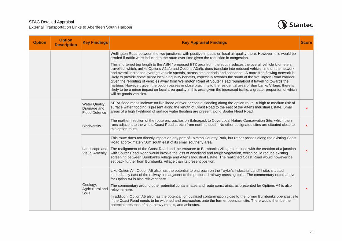
STAG Detailed Appraisal
External Transportation Links to Aberdeen South Harbour
78
Option Option
Description Key Findings Key Appraisal Findings Score
Wellington Road between the two junctions, with positive impacts on local air quality there. However, this would be eroded if traffic were induced to the route over time given the reduction in congestion.
This shortened trip length to the ASH / proposed ETZ area from the south reduces the overall vehicle kilometers travelled, which, unlike Options A2a/b and Options A3a/b, does translate into reduced vehicle time on the network and overall increased average vehicle speeds, across time periods and scenarios. A more free flowing network is likely to provide some minor local air quality benefits, especially towards the south of the Wellington Road corridor given the rerouting of vehicles away from Wellington Road at Souter Head roundabout if travelling towards the harbour. However, given the option passes in close proximity to the residential area of Burnbanks Village, there is likely to be a minor impact on local area quality in this area given the increased traffic, a greater proportion of which will be goods vehicles.
Water Quality, Drainage and Flood Defence
SEPA flood maps indicate no likelihood of river or coastal flooding along the option route. A high to medium risk of surface water flooding is present along the length of Coast Road to the east of the Altens Industrial Estate. Small areas of a high likelihood of surface water flooding are present along Souter Head Road.
Biodiversity
The northern section of the route encroaches on Balnagask to Cove Local Nature Conservation Site, which then runs adjacent to the whole Coast Road stretch from north to south. No other designated sites are situated close to this option route.
Landscape and Visual Amenity
This route does not directly impact on any part of Loirston Country Park, but rather passes along the existing Coast Road approximately 50m south east of its small southerly area.
The realignment of the Coast Road and the entrance to Burnbanks Village combined with the creation of a junction with Souter Head Road would involve the loss of woodland and rough vegetation, which could reduce existing screening between Burnbanks Village and Altens Industrial Estate. The realigned Coast Road would however be set back further from Burnbanks Village than its present position.
Geology, Agricultural and Soils
Like Option A4, Option A5 also has the potential to encroach on the Taylor’s Industrial Landfill site, situated immediately east of the railway line adjacent to the proposed railway crossing point. The commentary noted above for Option A4 is also relevant here.
The commentary around other potential contaminates and route constraints, as presented for Options A4 is also relevant here.
In addition, Option A5 also has the potential for localised contamination close to the former Burnbanks opencast site if the Coast Road needs to be widened and encroaches onto the former opencast site. There would then be the potential presence of ash, heavy metals, and asbestos.
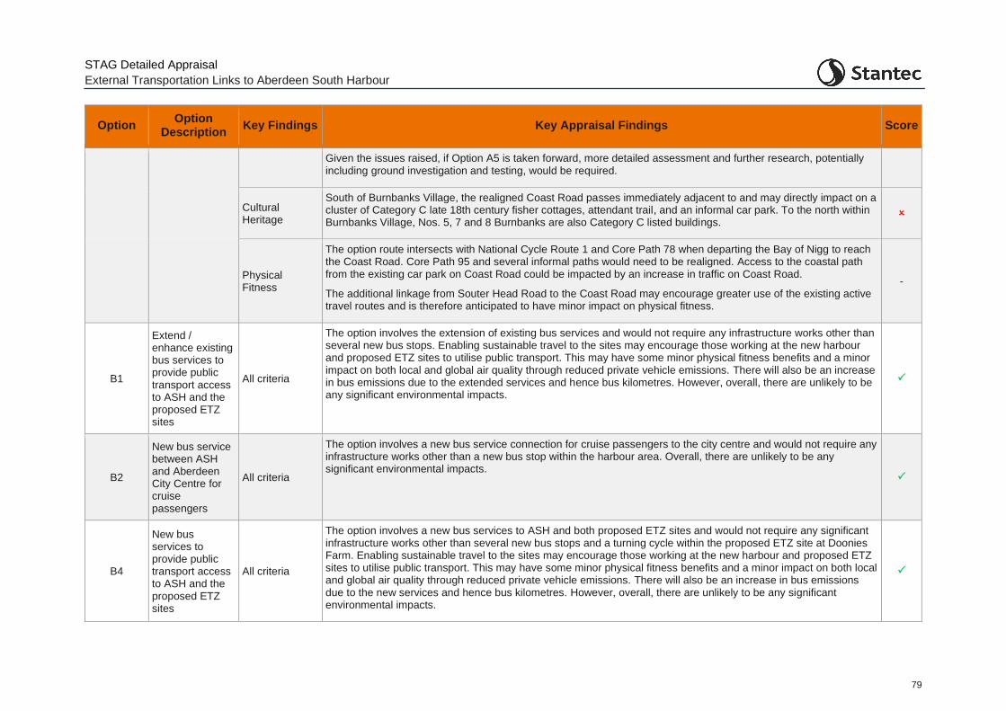
STAG Detailed Appraisal
External Transportation Links to Aberdeen South Harbour
79
Option Option
Description Key Findings Key Appraisal Findings Score
Given the issues raised, if Option A5 is taken forward, more detailed assessment and further research, potentially including ground investigation and testing, would be required.
Cultural Heritage
South of Burnbanks Village, the realigned Coast Road passes immediately adjacent to and may directly impact on a cluster of Category C late 18th century fisher cottages, attendant trail, and an informal car park. To the north within Burnbanks Village, Nos. 5, 7 and 8 Burnbanks are also Category C listed buildings.
Physical Fitness
The option route intersects with National Cycle Route 1 and Core Path 78 when departing the Bay of Nigg to reach the Coast Road. Core Path 95 and several informal paths would need to be realigned. Access to the coastal path from the existing car park on Coast Road could be impacted by an increase in traffic on Coast Road.
The additional linkage from Souter Head Road to the Coast Road may encourage greater use of the existing active travel routes and is therefore anticipated to have minor impact on physical fitness.
-
B1
Extend / enhance existing bus services to provide public transport access to ASH and the proposed ETZ sites
All criteria
The option involves the extension of existing bus services and would not require any infrastructure works other than several new bus stops. Enabling sustainable travel to the sites may encourage those working at the new harbour and proposed ETZ sites to utilise public transport. This may have some minor physical fitness benefits and a minor impact on both local and global air quality through reduced private vehicle emissions. There will also be an increase in bus emissions due to the extended services and hence bus kilometres. However, overall, there are unlikely to be any significant environmental impacts.
B2
New bus service between ASH and Aberdeen City Centre for cruise passengers
All criteria
The option involves a new bus service connection for cruise passengers to the city centre and would not require any infrastructure works other than a new bus stop within the harbour area. Overall, there are unlikely to be any significant environmental impacts.
B4
New bus services to provide public transport access to ASH and the proposed ETZ sites
All criteria
The option involves a new bus services to ASH and both proposed ETZ sites and would not require any significant infrastructure works other than several new bus stops and a turning cycle within the proposed ETZ site at Doonies Farm. Enabling sustainable travel to the sites may encourage those working at the new harbour and proposed ETZ sites to utilise public transport. This may have some minor physical fitness benefits and a minor impact on both local and global air quality through reduced private vehicle emissions. There will also be an increase in bus emissions due to the new services and hence bus kilometres. However, overall, there are unlikely to be any significant environmental impacts.
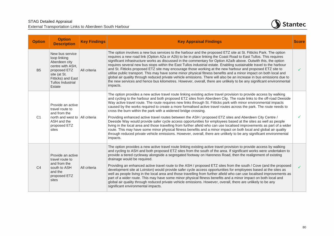
STAG Detailed Appraisal
External Transportation Links to Aberdeen South Harbour
80
Option Option
Description Key Findings Key Appraisal Findings Score
B5
New bus service loop linking Aberdeen city centre with ASH, proposed ETZ site (at St. Fitticks) and East Tullos Industrial Estate
All criteria
The option involves a new bus services to the harbour and the proposed ETZ site at St. Fitticks Park. The option requires a new road link (Option A2a or A2b) to be in place linking the Coast Road to East Tullos. This requires significant infrastructure works as discussed in the commentary for Option A2a/b above. Outwith this, the option requires several new bus stops within the East Tullos industrial estate. Enabling sustainable travel to the harbour and St. Fitticks proposed ETZ site may encourage those working at the new harbour and proposed ETZ site to utilise public transport. This may have some minor physical fitness benefits and a minor impact on both local and global air quality through reduced private vehicle emissions. There will also be an increase in bus emissions due to the new services and hence bus kilometres. However, overall, there are unlikely to be any significant environmental impacts.
C1
Provide an active travel route to and from the north and west to ASH and the proposed ETZ sites
All criteria
The option provides a new active travel route linking existing active travel provision to provide access by walking and cycling to the harbour and both proposed ETZ sites from Aberdeen City. The route links to the off-road Deeside Way active travel route. The route requires new links through St. Fitticks park with minor environmental impacts caused by the works required to create a more formalised active travel routes across the park. The route needs to cross the burn within the park with a widened bridge crossing.
Providing enhanced active travel routes between the ASH / proposed ETZ sites and Aberdeen City Centre / Deeside Way would provide safer cycle access opportunities for employees based at the sites as well as people living in the local area and those travelling from further afield who can use localised improvements as part of a wider route. This may have some minor physical fitness benefits and a minor impact on both local and global air quality through reduced private vehicle emissions. However, overall, there are unlikely to be any significant environmental impacts.
C4
Provide an active travel route to and from the south to ASH and the proposed ETZ sites
All criteria
The option provides a new active travel route linking existing active travel provision to provide access by walking and cycling to ASH and both proposed ETZ sites from the south of the area. If significant works were undertaken to provide a tiered cycleway alongside a segregated footway on Hareness Road, then the realignment of existing drainage would be required.
Providing an enhanced active travel route to the ASH / proposed ETZ sites from the south / Cove (and the proposed development site at Loirston) would provide safer cycle access opportunities for employees based at the sites as well as people living in the local area and those travelling from further afield who can use localised improvements as part of a wider route. This may have some minor physical fitness benefits and a minor impact on both local and global air quality through reduced private vehicle emissions. However, overall, there are unlikely to be any significant environmental impacts.
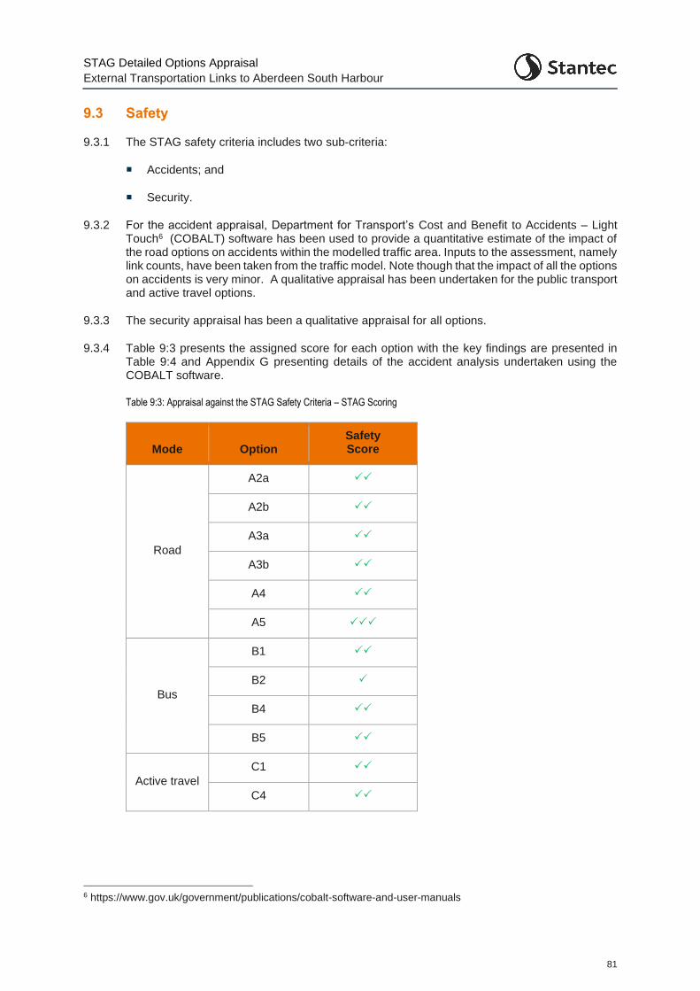
STAG Detailed Options Appraisal
External Transportation Links to Aberdeen South Harbour
81
9.3 Safety
9.3.1 The STAG safety criteria includes two sub-criteria:
Accidents; and
Security.
9.3.2 For the accident appraisal, Department for Transport’s Cost and Benefit to Accidents – Light Touch6 (COBALT) software has been used to provide a quantitative estimate of the impact of the road options on accidents within the modelled traffic area. Inputs to the assessment, namely link counts, have been taken from the traffic model. Note though that the impact of all the options on accidents is very minor. A qualitative appraisal has been undertaken for the public transport and active travel options.
9.3.3 The security appraisal has been a qualitative appraisal for all options.
9.3.4 Table 9:3 presents the assigned score for each option with the key findings are presented in Table 9:4 and Appendix G presenting details of the accident analysis undertaken using the COBALT software.
Table 9:3: Appraisal against the STAG Safety Criteria – STAG Scoring
Mode Option Safety Score
Road
A2a
A2b
A3a
A3b
A4
A5
Bus
B1
B2
B4
B5
Active travel
C1
C4
6 https://www.gov.uk/government/publications/cobalt-software-and-user-manuals
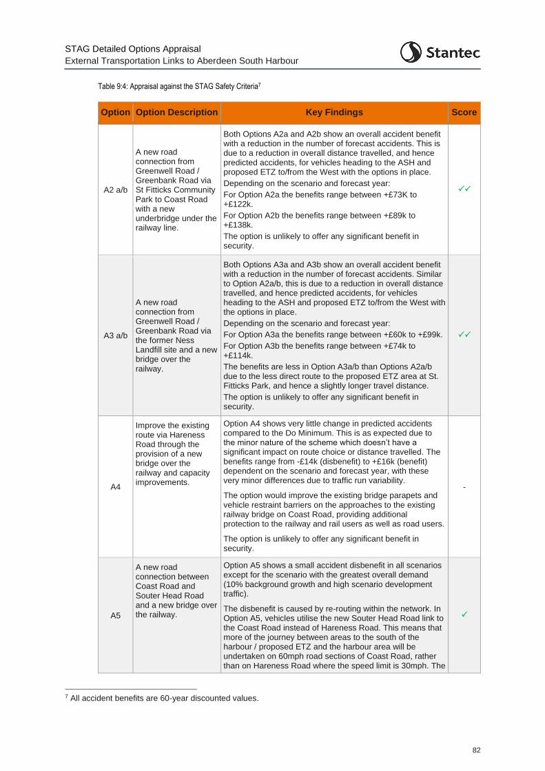
STAG Detailed Options Appraisal
External Transportation Links to Aberdeen South Harbour
82
Table 9:4: Appraisal against the STAG Safety Criteria7
Option Option Description Key Findings Score
A2 a/b
A new road connection from Greenwell Road / Greenbank Road via St Fitticks Community Park to Coast Road with a new underbridge under the railway line.
Both Options A2a and A2b show an overall accident benefit with a reduction in the number of forecast accidents. This is due to a reduction in overall distance travelled, and hence predicted accidents, for vehicles heading to the ASH and proposed ETZ to/from the West with the options in place.
Depending on the scenario and forecast year:
For Option A2a the benefits range between +£73K to +£122k.
For Option A2b the benefits range between +£89k to +£138k.
The option is unlikely to offer any significant benefit in security.
A3 a/b
A new road connection from Greenwell Road / Greenbank Road via the former Ness Landfill site and a new bridge over the railway.
Both Options A3a and A3b show an overall accident benefit with a reduction in the number of forecast accidents. Similar to Option A2a/b, this is due to a reduction in overall distance travelled, and hence predicted accidents, for vehicles heading to the ASH and proposed ETZ to/from the West with the options in place.
Depending on the scenario and forecast year:
For Option A3a the benefits range between +£60k to +£99k.
For Option A3b the benefits range between +£74k to +£114k.
The benefits are less in Option A3a/b than Options A2a/b due to the less direct route to the proposed ETZ area at St. Fitticks Park, and hence a slightly longer travel distance.
The option is unlikely to offer any significant benefit in security.
A4
Improve the existing route via Hareness Road through the provision of a new bridge over the railway and capacity improvements.
Option A4 shows very little change in predicted accidents compared to the Do Minimum. This is as expected due to the minor nature of the scheme which doesn’t have a significant impact on route choice or distance travelled. The benefits range from -£14k (disbenefit) to +£16k (benefit) dependent on the scenario and forecast year, with these very minor differences due to traffic run variability.
The option would improve the existing bridge parapets and vehicle restraint barriers on the approaches to the existing railway bridge on Coast Road, providing additional protection to the railway and rail users as well as road users.
The option is unlikely to offer any significant benefit in security.
-
A5
A new road connection between Coast Road and Souter Head Road and a new bridge over the railway.
Option A5 shows a small accident disbenefit in all scenarios except for the scenario with the greatest overall demand (10% background growth and high scenario development traffic).
The disbenefit is caused by re-routing within the network. In Option A5, vehicles utilise the new Souter Head Road link to the Coast Road instead of Hareness Road. This means that more of the journey between areas to the south of the harbour / proposed ETZ and the harbour area will be undertaken on 60mph road sections of Coast Road, rather than on Hareness Road where the speed limit is 30mph. The
7 All accident benefits are 60-year discounted values.
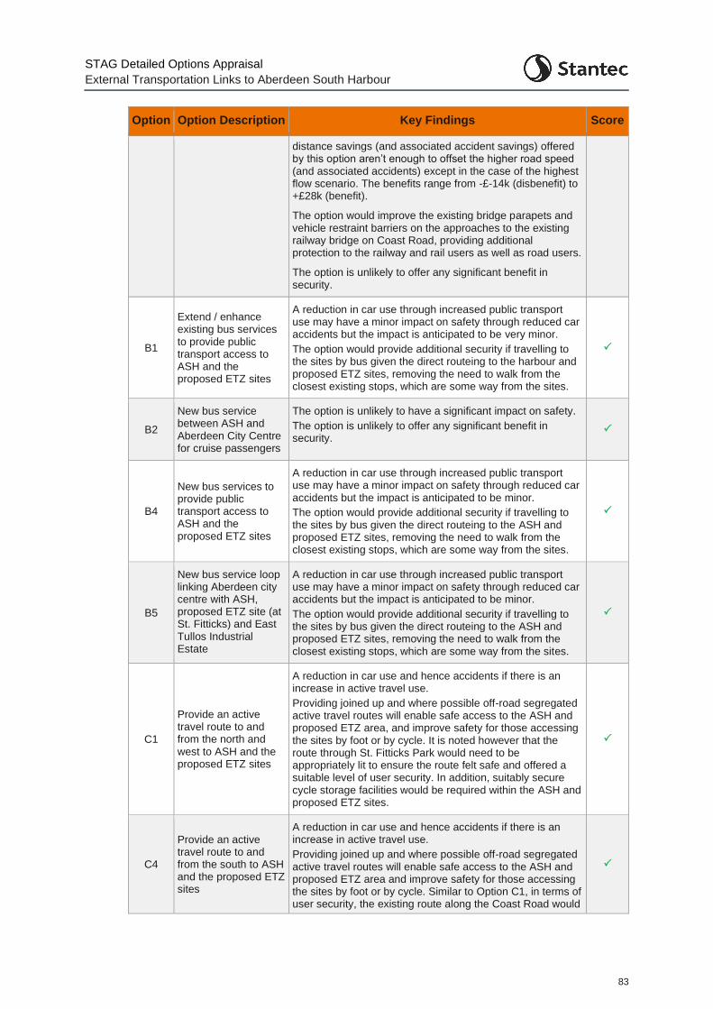
STAG Detailed Options Appraisal
External Transportation Links to Aberdeen South Harbour
83
Option Option Description Key Findings Score
distance savings (and associated accident savings) offered by this option aren’t enough to offset the higher road speed (and associated accidents) except in the case of the highest flow scenario. The benefits range from -£-14k (disbenefit) to +£28k (benefit).
The option would improve the existing bridge parapets and vehicle restraint barriers on the approaches to the existing railway bridge on Coast Road, providing additional protection to the railway and rail users as well as road users.
The option is unlikely to offer any significant benefit in security.
B1
Extend / enhance existing bus services to provide public transport access to ASH and the proposed ETZ sites
A reduction in car use through increased public transport use may have a minor impact on safety through reduced car accidents but the impact is anticipated to be very minor.
The option would provide additional security if travelling to the sites by bus given the direct routeing to the harbour and proposed ETZ sites, removing the need to walk from the closest existing stops, which are some way from the sites.
B2
New bus service between ASH and Aberdeen City Centre for cruise passengers
The option is unlikely to have a significant impact on safety.
The option is unlikely to offer any significant benefit in security.
B4
New bus services to provide public transport access to ASH and the proposed ETZ sites
A reduction in car use through increased public transport use may have a minor impact on safety through reduced car accidents but the impact is anticipated to be minor.
The option would provide additional security if travelling to the sites by bus given the direct routeing to the ASH and proposed ETZ sites, removing the need to walk from the closest existing stops, which are some way from the sites.
B5
New bus service loop linking Aberdeen city centre with ASH, proposed ETZ site (at St. Fitticks) and East Tullos Industrial Estate
A reduction in car use through increased public transport use may have a minor impact on safety through reduced car accidents but the impact is anticipated to be minor.
The option would provide additional security if travelling to the sites by bus given the direct routeing to the ASH and proposed ETZ sites, removing the need to walk from the closest existing stops, which are some way from the sites.
C1
Provide an active travel route to and from the north and west to ASH and the proposed ETZ sites
A reduction in car use and hence accidents if there is an increase in active travel use.
Providing joined up and where possible off-road segregated active travel routes will enable safe access to the ASH and proposed ETZ area, and improve safety for those accessing the sites by foot or by cycle. It is noted however that the route through St. Fitticks Park would need to be appropriately lit to ensure the route felt safe and offered a suitable level of user security. In addition, suitably secure cycle storage facilities would be required within the ASH and proposed ETZ sites.
C4
Provide an active travel route to and from the south to ASH and the proposed ETZ sites
A reduction in car use and hence accidents if there is an increase in active travel use.
Providing joined up and where possible off-road segregated active travel routes will enable safe access to the ASH and proposed ETZ area and improve safety for those accessing the sites by foot or by cycle. Similar to Option C1, in terms of user security, the existing route along the Coast Road would
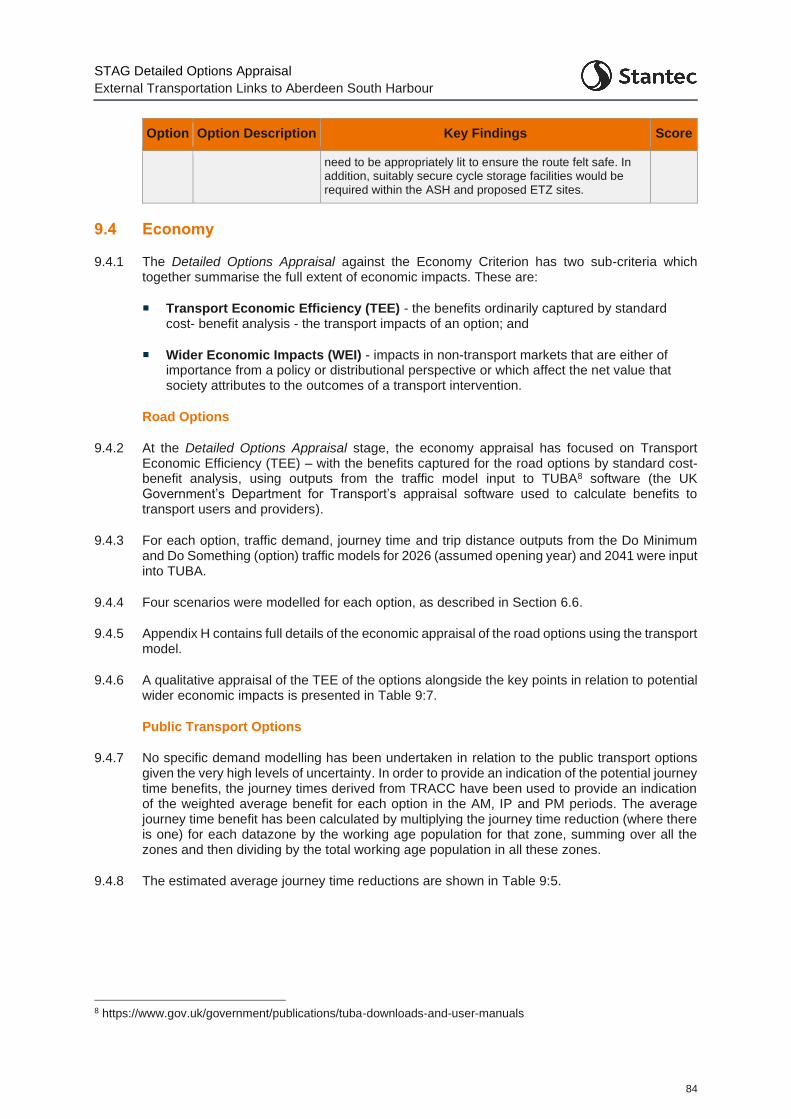
STAG Detailed Options Appraisal
External Transportation Links to Aberdeen South Harbour
84
Option Option Description Key Findings Score
need to be appropriately lit to ensure the route felt safe. In addition, suitably secure cycle storage facilities would be required within the ASH and proposed ETZ sites.
9.4 Economy
9.4.1 The Detailed Options Appraisal against the Economy Criterion has two sub-criteria which together summarise the full extent of economic impacts. These are:
Transport Economic Efficiency (TEE) - the benefits ordinarily captured by standard cost- benefit analysis - the transport impacts of an option; and
Wider Economic Impacts (WEI) - impacts in non-transport markets that are either of importance from a policy or distributional perspective or which affect the net value that society attributes to the outcomes of a transport intervention.
Road Options
9.4.2 At the Detailed Options Appraisal stage, the economy appraisal has focused on Transport Economic Efficiency (TEE) – with the benefits captured for the road options by standard cost- benefit analysis, using outputs from the traffic model input to TUBA8 software (the UK Government’s Department for Transport’s appraisal software used to calculate benefits to transport users and providers).
9.4.3 For each option, traffic demand, journey time and trip distance outputs from the Do Minimum and Do Something (option) traffic models for 2026 (assumed opening year) and 2041 were input into TUBA.
9.4.4 Four scenarios were modelled for each option, as described in Section 6.6.
9.4.5 Appendix H contains full details of the economic appraisal of the road options using the transport model.
9.4.6 A qualitative appraisal of the TEE of the options alongside the key points in relation to potential wider economic impacts is presented in Table 9:7.
Public Transport Options
9.4.7 No specific demand modelling has been undertaken in relation to the public transport options given the very high levels of uncertainty. In order to provide an indication of the potential journey time benefits, the journey times derived from TRACC have been used to provide an indication of the weighted average benefit for each option in the AM, IP and PM periods. The average journey time benefit has been calculated by multiplying the journey time reduction (where there is one) for each datazone by the working age population for that zone, summing over all the zones and then dividing by the total working age population in all these zones.
9.4.8 The estimated average journey time reductions are shown in Table 9:5.
8 https://www.gov.uk/government/publications/tuba-downloads-and-user-manuals
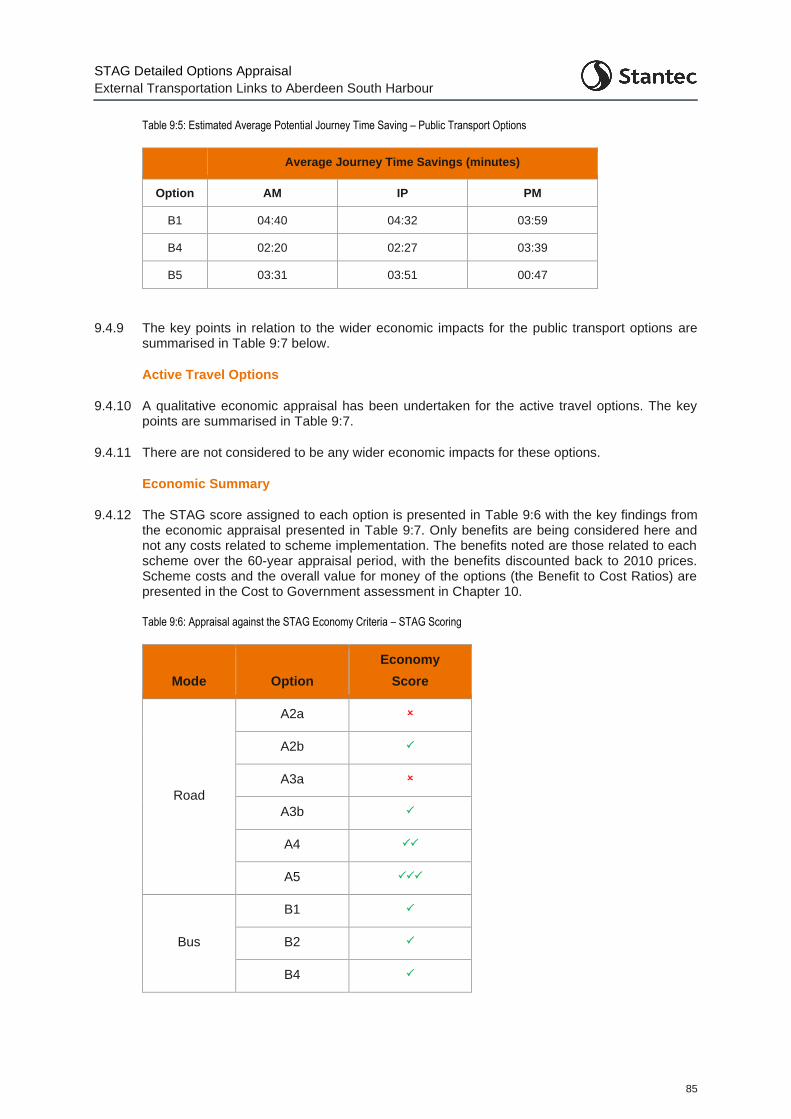
STAG Detailed Options Appraisal
External Transportation Links to Aberdeen South Harbour
85
Table 9:5: Estimated Average Potential Journey Time Saving – Public Transport Options
Average Journey Time Savings (minutes)
Option AM IP PM
B1 04:40 04:32 03:59
B4 02:20 02:27 03:39
B5 03:31 03:51 00:47
9.4.9 The key points in relation to the wider economic impacts for the public transport options are summarised in Table 9:7 below.
Active Travel Options
9.4.10 A qualitative economic appraisal has been undertaken for the active travel options. The key points are summarised in Table 9:7.
9.4.11 There are not considered to be any wider economic impacts for these options.
Economic Summary
9.4.12 The STAG score assigned to each option is presented in Table 9:6 with the key findings from the economic appraisal presented in Table 9:7. Only benefits are being considered here and not any costs related to scheme implementation. The benefits noted are those related to each scheme over the 60-year appraisal period, with the benefits discounted back to 2010 prices. Scheme costs and the overall value for money of the options (the Benefit to Cost Ratios) are presented in the Cost to Government assessment in Chapter 10.
Table 9:6: Appraisal against the STAG Economy Criteria – STAG Scoring
Mode Option
Economy
Score
Road
A2a
A2b
A3a
A3b
A4
A5
Bus
B1
B2
B4
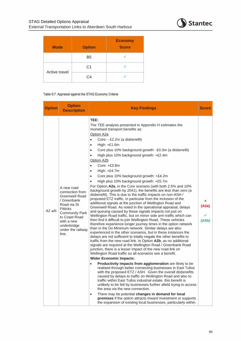
STAG Detailed Options Appraisal
External Transportation Links to Aberdeen South Harbour
86
Mode Option
Economy
Score
B5
Active travel
C1
C4
Table 9:7: Appraisal against the STAG Economy Criteria
Option Option
Description Key Findings Score
A2 a/b
A new road connection from Greenwell Road / Greenbank Road via St Fitticks Community Park to Coast Road with a new underbridge under the railway line.
TEE:
The TEE analysis presented in Appendix H estimates the monetised transport benefits as:
Option A2a
• Core: - £2.2m (a disbenefit)
• High: +£1.6m
• Core plus 10% background growth: -£0.3m (a disbenefit)
• High plus 10% background growth: +£2.4m
Option A2b
• Core: +£3.8m
• High: +£4.7m
• Core plus 10% background growth: +£4.2m
• High plus 10% background growth: +£5.7m
For Option A2a, in the Core scenario (with both 2.5% and 10% background growth by 2041), the benefits are less than zero (a disbenefit). This is due to the traffic impacts on non-ASH / proposed ETZ traffic, in particular from the inclusion of the additional signals at the junction of Wellington Road and Greenwell Road. As noted in the operational appraisal, delays and queuing caused by these signals impacts not just on Wellington Road traffic, but on minor side arm traffic which can then find it difficult to join Wellington Road. These vehicles therefore experience longer journey times in the option network than in the Do Minimum network. Similar delays are also experienced in the other scenarios, but in these instances the delays are not sufficient to totally negate the other benefits to traffic from the new road link. In Option A2b, as no additional signals are required at the Wellington Road / Greenbank Road junction, there is a lesser impact of the new road link on Wellington Road traffic so all scenarios see a benefit.
Wider Economic Impacts:
• Productivity impacts from agglomeration are likely to be realised through better connecting businesses in East Tullos with the proposed ETZ / ASH. Given the overall disbenefits caused by delays to traffic on Wellington Road and also to traffic within East Tullos industrial estate, this benefit is unlikely to be felt by businesses further afield trying to access the area via the new connection.
• There may be potential changes in demand for local premises if the option attracts inward investment or supports the expansion of existing local businesses, particularly within
(A2a)
(A2b)
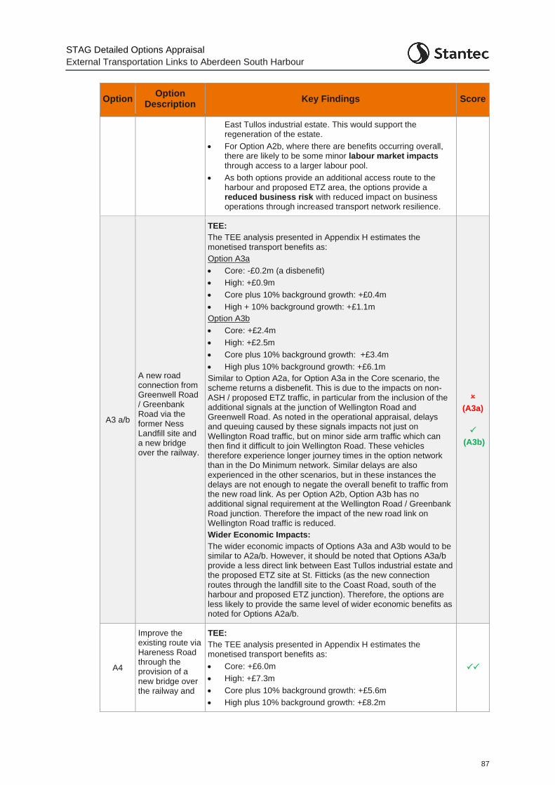
STAG Detailed Options Appraisal
External Transportation Links to Aberdeen South Harbour
87
Option Option
Description Key Findings Score
East Tullos industrial estate. This would support the regeneration of the estate.
• For Option A2b, where there are benefits occurring overall, there are likely to be some minor labour market impacts through access to a larger labour pool.
• As both options provide an additional access route to the harbour and proposed ETZ area, the options provide a reduced business risk with reduced impact on business operations through increased transport network resilience.
A3 a/b
A new road connection from Greenwell Road / Greenbank Road via the former Ness Landfill site and a new bridge over the railway.
TEE:
The TEE analysis presented in Appendix H estimates the monetised transport benefits as:
Option A3a
• Core: -£0.2m (a disbenefit)
• High: +£0.9m
• Core plus 10% background growth: +£0.4m
• High + 10% background growth: +£1.1m
Option A3b
• Core: +£2.4m
• High: +£2.5m
• Core plus 10% background growth: +£3.4m
• High plus 10% background growth: +£6.1m
Similar to Option A2a, for Option A3a in the Core scenario, the scheme returns a disbenefit. This is due to the impacts on non-ASH / proposed ETZ traffic, in particular from the inclusion of the additional signals at the junction of Wellington Road and Greenwell Road. As noted in the operational appraisal, delays and queuing caused by these signals impacts not just on Wellington Road traffic, but on minor side arm traffic which can then find it difficult to join Wellington Road. These vehicles therefore experience longer journey times in the option network than in the Do Minimum network. Similar delays are also experienced in the other scenarios, but in these instances the delays are not enough to negate the overall benefit to traffic from the new road link. As per Option A2b, Option A3b has no additional signal requirement at the Wellington Road / Greenbank Road junction. Therefore the impact of the new road link on Wellington Road traffic is reduced.
Wider Economic Impacts:
The wider economic impacts of Options A3a and A3b would to be similar to A2a/b. However, it should be noted that Options A3a/b provide a less direct link between East Tullos industrial estate and the proposed ETZ site at St. Fitticks (as the new connection routes through the landfill site to the Coast Road, south of the harbour and proposed ETZ junction). Therefore, the options are less likely to provide the same level of wider economic benefits as noted for Options A2a/b.
(A3a)
(A3b)
A4
Improve the existing route via Hareness Road through the provision of a new bridge over the railway and
TEE:
The TEE analysis presented in Appendix H estimates the monetised transport benefits as:
• Core: +£6.0m
• High: +£7.3m
• Core plus 10% background growth: +£5.6m
• High plus 10% background growth: +£8.2m
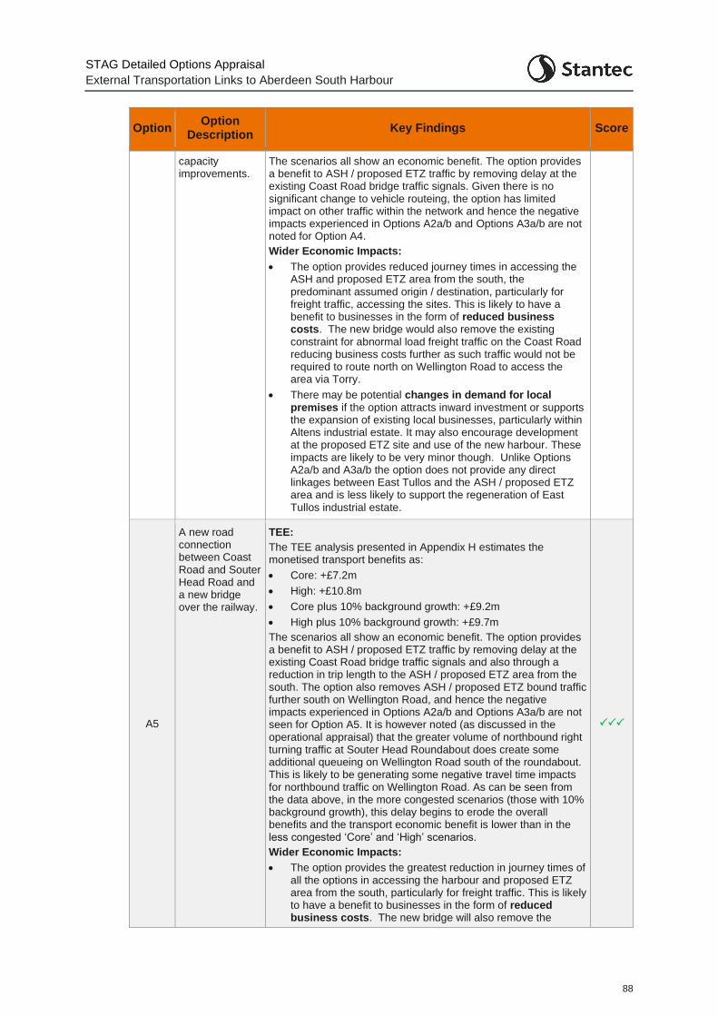
STAG Detailed Options Appraisal
External Transportation Links to Aberdeen South Harbour
88
Option Option
Description Key Findings Score
capacity improvements.
The scenarios all show an economic benefit. The option provides a benefit to ASH / proposed ETZ traffic by removing delay at the existing Coast Road bridge traffic signals. Given there is no significant change to vehicle routeing, the option has limited impact on other traffic within the network and hence the negative impacts experienced in Options A2a/b and Options A3a/b are not noted for Option A4.
Wider Economic Impacts:
• The option provides reduced journey times in accessing the ASH and proposed ETZ area from the south, the predominant assumed origin / destination, particularly for freight traffic, accessing the sites. This is likely to have a benefit to businesses in the form of reduced business costs. The new bridge would also remove the existing constraint for abnormal load freight traffic on the Coast Road reducing business costs further as such traffic would not be required to route north on Wellington Road to access the area via Torry.
• There may be potential changes in demand for local premises if the option attracts inward investment or supports the expansion of existing local businesses, particularly within Altens industrial estate. It may also encourage development at the proposed ETZ site and use of the new harbour. These impacts are likely to be very minor though. Unlike Options A2a/b and A3a/b the option does not provide any direct linkages between East Tullos and the ASH / proposed ETZ area and is less likely to support the regeneration of East Tullos industrial estate.
A5
A new road connection between Coast Road and Souter Head Road and a new bridge over the railway.
TEE:
The TEE analysis presented in Appendix H estimates the monetised transport benefits as:
• Core: +£7.2m
• High: +£10.8m
• Core plus 10% background growth: +£9.2m
• High plus 10% background growth: +£9.7m
The scenarios all show an economic benefit. The option provides a benefit to ASH / proposed ETZ traffic by removing delay at the existing Coast Road bridge traffic signals and also through a reduction in trip length to the ASH / proposed ETZ area from the south. The option also removes ASH / proposed ETZ bound traffic further south on Wellington Road, and hence the negative impacts experienced in Options A2a/b and Options A3a/b are not seen for Option A5. It is however noted (as discussed in the operational appraisal) that the greater volume of northbound right turning traffic at Souter Head Roundabout does create some additional queueing on Wellington Road south of the roundabout. This is likely to be generating some negative travel time impacts for northbound traffic on Wellington Road. As can be seen from the data above, in the more congested scenarios (those with 10% background growth), this delay begins to erode the overall benefits and the transport economic benefit is lower than in the less congested ‘Core’ and ‘High’ scenarios.
Wider Economic Impacts:
• The option provides the greatest reduction in journey times of all the options in accessing the harbour and proposed ETZ area from the south, particularly for freight traffic. This is likely to have a benefit to businesses in the form of reduced business costs. The new bridge will also remove the
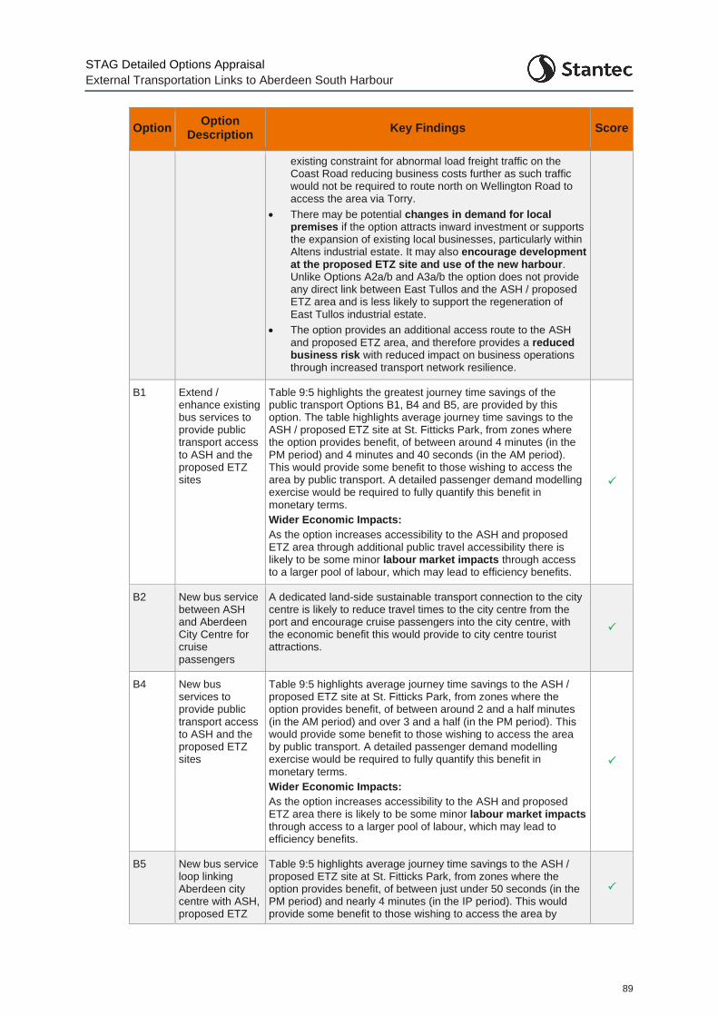
STAG Detailed Options Appraisal
External Transportation Links to Aberdeen South Harbour
89
Option Option
Description Key Findings Score
existing constraint for abnormal load freight traffic on the Coast Road reducing business costs further as such traffic would not be required to route north on Wellington Road to access the area via Torry.
• There may be potential changes in demand for local premises if the option attracts inward investment or supports the expansion of existing local businesses, particularly within Altens industrial estate. It may also encourage development at the proposed ETZ site and use of the new harbour. Unlike Options A2a/b and A3a/b the option does not provide any direct link between East Tullos and the ASH / proposed ETZ area and is less likely to support the regeneration of East Tullos industrial estate.
• The option provides an additional access route to the ASH and proposed ETZ area, and therefore provides a reduced business risk with reduced impact on business operations through increased transport network resilience.
B1 Extend / enhance existing bus services to provide public transport access to ASH and the proposed ETZ sites
Table 9:5 highlights the greatest journey time savings of the public transport Options B1, B4 and B5, are provided by this option. The table highlights average journey time savings to the ASH / proposed ETZ site at St. Fitticks Park, from zones where the option provides benefit, of between around 4 minutes (in the PM period) and 4 minutes and 40 seconds (in the AM period). This would provide some benefit to those wishing to access the area by public transport. A detailed passenger demand modelling exercise would be required to fully quantify this benefit in monetary terms.
Wider Economic Impacts:
As the option increases accessibility to the ASH and proposed ETZ area through additional public travel accessibility there is likely to be some minor labour market impacts through access to a larger pool of labour, which may lead to efficiency benefits.
B2 New bus service between ASH and Aberdeen City Centre for cruise passengers
A dedicated land-side sustainable transport connection to the city centre is likely to reduce travel times to the city centre from the port and encourage cruise passengers into the city centre, with the economic benefit this would provide to city centre tourist attractions.
B4 New bus services to provide public transport access to ASH and the proposed ETZ sites
Table 9:5 highlights average journey time savings to the ASH / proposed ETZ site at St. Fitticks Park, from zones where the option provides benefit, of between around 2 and a half minutes (in the AM period) and over 3 and a half (in the PM period). This would provide some benefit to those wishing to access the area by public transport. A detailed passenger demand modelling exercise would be required to fully quantify this benefit in monetary terms.
Wider Economic Impacts:
As the option increases accessibility to the ASH and proposed ETZ area there is likely to be some minor labour market impacts through access to a larger pool of labour, which may lead to efficiency benefits.
B5 New bus service loop linking Aberdeen city centre with ASH, proposed ETZ
Table 9:5 highlights average journey time savings to the ASH / proposed ETZ site at St. Fitticks Park, from zones where the option provides benefit, of between just under 50 seconds (in the PM period) and nearly 4 minutes (in the IP period). This would provide some benefit to those wishing to access the area by
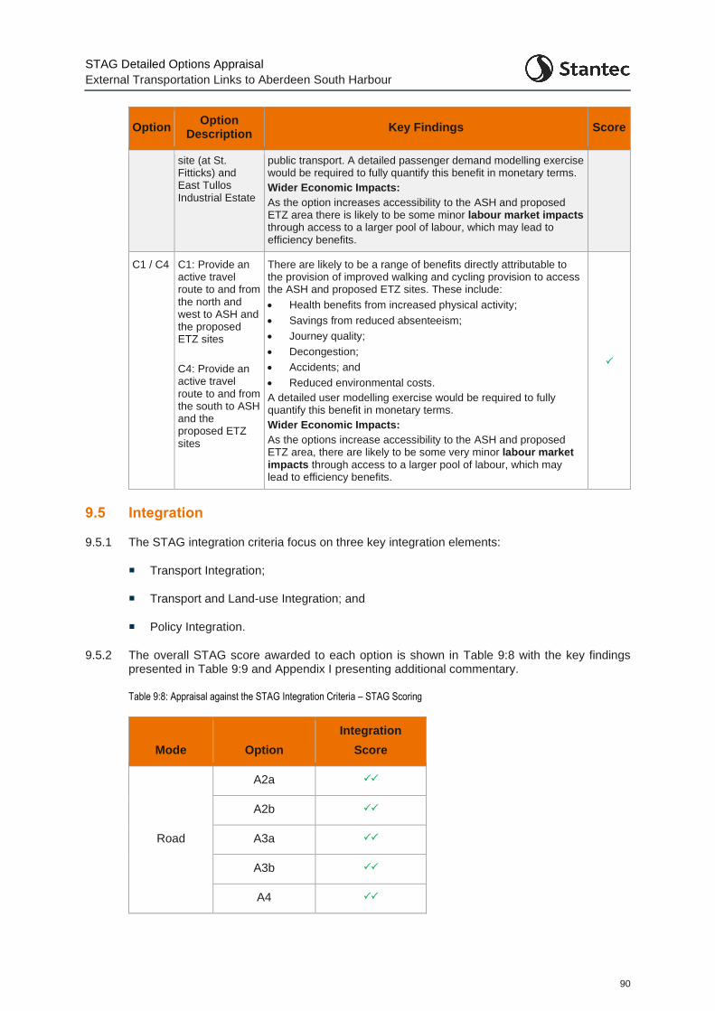
STAG Detailed Options Appraisal
External Transportation Links to Aberdeen South Harbour
90
Option Option
Description Key Findings Score
site (at St. Fitticks) and East Tullos Industrial Estate
public transport. A detailed passenger demand modelling exercise would be required to fully quantify this benefit in monetary terms.
Wider Economic Impacts:
As the option increases accessibility to the ASH and proposed ETZ area there is likely to be some minor labour market impacts through access to a larger pool of labour, which may lead to efficiency benefits.
C1 / C4 C1: Provide an active travel route to and from the north and west to ASH and the proposed ETZ sites
C4: Provide an active travel route to and from the south to ASH and the proposed ETZ sites
There are likely to be a range of benefits directly attributable to the provision of improved walking and cycling provision to access the ASH and proposed ETZ sites. These include:
• Health benefits from increased physical activity;
• Savings from reduced absenteeism;
• Journey quality;
• Decongestion;
• Accidents; and
• Reduced environmental costs.
A detailed user modelling exercise would be required to fully quantify this benefit in monetary terms.
Wider Economic Impacts:
As the options increase accessibility to the ASH and proposed ETZ area, there are likely to be some very minor labour market impacts through access to a larger pool of labour, which may lead to efficiency benefits.
9.5 Integration
9.5.1 The STAG integration criteria focus on three key integration elements:
Transport Integration;
Transport and Land-use Integration; and
Policy Integration.
9.5.2 The overall STAG score awarded to each option is shown in Table 9:8 with the key findings presented in Table 9:9 and Appendix I presenting additional commentary.
Table 9:8: Appraisal against the STAG Integration Criteria – STAG Scoring
Mode Option
Integration
Score
Road
A2a
A2b
A3a
A3b
A4
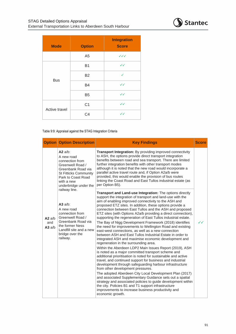
STAG Detailed Options Appraisal
External Transportation Links to Aberdeen South Harbour
91
Mode Option
Integration
Score
A5
Bus
B1
B2
B4
B5
Active travel
C1
C4
Table 9:9: Appraisal against the STAG Integration Criteria
Option Option Description Key Findings Score
A2 a/b and
A3 a/b
A2 a/b:
A new road connection from Greenwell Road / Greenbank Road via St Fitticks Community Park to Coast Road with a new underbridge under the railway line.
A3 a/b:
A new road connection from Greenwell Road / Greenbank Road via the former Ness Landfill site and a new bridge over the railway.
Transport Integration: By providing improved connectivity to ASH, the options provide direct transport integration benefits between road and sea transport. There are limited further integration benefits with other transport modes although it is noted that the new road would incorporate a parallel active travel route and, if Option A2a/b were provided, this would enable the provision of bus routes linking the Coast Road and East Tullos industrial estate (as per Option B5).
Transport and Land-use Integration: The options directly support the integration of transport and land-use with the aim of enabling improved connectivity to the ASH and proposed ETZ sites. In addition, these options provide a connection between East Tullos and the ASH and proposed ETZ sites (with Options A2a/b providing a direct connection), supporting the regeneration of East Tullos industrial estate.
The Bay of Nigg Development Framework (2018) identifies the need for improvements to Wellington Road and existing east-west connections, as well as a new connection between ASH and East Tullos Industrial Estate in order to integrated ASH and maximise economic development and regeneration in the surrounding area.
Within the Aberdeen LDP2 Main Issues Report (2019), ASH is noted as a major committed transport scheme and additional prioritisation is noted for sustainable and active travel, and continued support for business and industrial development through safeguarding harbour infrastructure from other development pressures.
The adopted Aberdeen City Local Development Plan (2017) and associated Supplementary Guidance sets out a spatial strategy and associated policies to guide development within the city. Policies B1 and T1 support infrastructure improvements to increase business productivity and economic growth.
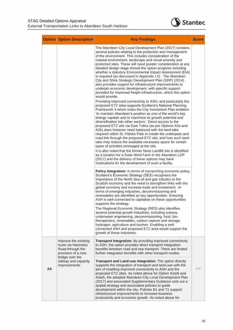
STAG Detailed Options Appraisal
External Transportation Links to Aberdeen South Harbour
92
Option Option Description Key Findings Score
The Aberdeen City Local Development Plan (2017) contains several policies relating to the protection and management of the environment. This includes consideration of the coastal environment, landscape and visual amenity and protected sites. These will need greater consideration at any detailed design stage should the option progress including whether a statutory Environmental Impact Assessment (EIA) is required (as discussed in Appendix I.2). The Aberdeen City and Shire Strategic Development Plan (SDP) (2014) also provides support for infrastructure improvements to underpin economic development, with specific support provided for improved freight infrastructure, which this option would provide.
Providing improved connectivity to ASH, and particularly the proposed ETZ sites supports Scotland’s National Planning Framework 3 which notes the City Investment Plan ambition ‘to maintain Aberdeen’s position as one of the world’s key energy capitals and to maximise its growth potential and diversification into other sectors’. Direct access to the proposed ETZ site via East Tullos (as per Options A2a and A2b) does however need balanced with the land-take required within St. Fitticks Park to create the underpass and road link through the proposed ETZ site, and how such land-take may reduce the available necessary space for certain types of activities envisaged at the site.
It is also noted that the former Ness Landfill site is identified as a location for a Solar Wind Farm in the Aberdeen LDP (2017) and the delivery of these options may have implications for the development of such a facility.
Policy Integration: In terms of overarching economic policy, Scotland’s Economic Strategy (SES) recognises the importance of the North Sea oil and gas industry to the Scottish economy and the need to strengthen links with the global economy and increase trade and investment. In terms of emerging industries, decommissioning and renewables are identified as key opportunities. Ensuring ASH is well connected to capitalise on these opportunities supports the strategy.
The Regional Economic Strategy (RES) also identifies several potential growth industries, including subsea, underwater engineering, decommissioning, food, bio-therapeutics, renewables, carbon capture and storage, hydrogen, agriculture and tourism. Enabling a well-connected ASH and proposed ETZ area would support the growth of these industries.
A4
Improve the existing route via Hareness Road through the provision of a new bridge over the railway and capacity improvements.
Transport Integration: By providing improved connectivity to ASH, the option provides direct transport integration benefits between road and sea transport. There are limited further integration benefits with other transport modes.
Transport and Land-use Integration: The option directly supports the integration of transport and land-use with the aim of enabling improved connectivity to ASH and the proposed ETZ sites. As noted above for Option A2a/b and A3a/b, the adopted Aberdeen City Local Development Plan (2017) and associated Supplementary Guidance sets out a spatial strategy and associated policies to guide development within the city. Policies B1 and T1 support infrastructure improvements to increase business productivity and economic growth. As noted above for
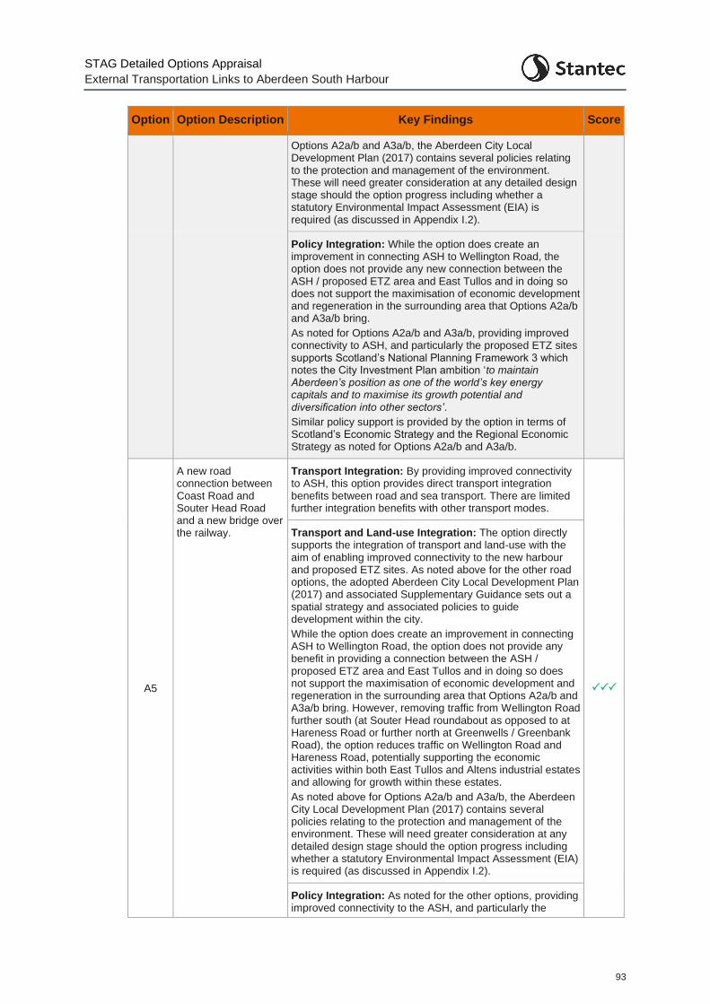
STAG Detailed Options Appraisal
External Transportation Links to Aberdeen South Harbour
93
Option Option Description Key Findings Score
Options A2a/b and A3a/b, the Aberdeen City Local Development Plan (2017) contains several policies relating to the protection and management of the environment. These will need greater consideration at any detailed design stage should the option progress including whether a statutory Environmental Impact Assessment (EIA) is required (as discussed in Appendix I.2).
Policy Integration: While the option does create an improvement in connecting ASH to Wellington Road, the option does not provide any new connection between the ASH / proposed ETZ area and East Tullos and in doing so does not support the maximisation of economic development and regeneration in the surrounding area that Options A2a/b and A3a/b bring.
As noted for Options A2a/b and A3a/b, providing improved connectivity to ASH, and particularly the proposed ETZ sites supports Scotland’s National Planning Framework 3 which notes the City Investment Plan ambition ‘to maintain Aberdeen’s position as one of the world’s key energy capitals and to maximise its growth potential and diversification into other sectors’.
Similar policy support is provided by the option in terms of Scotland’s Economic Strategy and the Regional Economic Strategy as noted for Options A2a/b and A3a/b.
A5
A new road connection between Coast Road and Souter Head Road and a new bridge over the railway.
Transport Integration: By providing improved connectivity to ASH, this option provides direct transport integration benefits between road and sea transport. There are limited further integration benefits with other transport modes.
Transport and Land-use Integration: The option directly supports the integration of transport and land-use with the aim of enabling improved connectivity to the new harbour and proposed ETZ sites. As noted above for the other road options, the adopted Aberdeen City Local Development Plan (2017) and associated Supplementary Guidance sets out a spatial strategy and associated policies to guide development within the city.
While the option does create an improvement in connecting ASH to Wellington Road, the option does not provide any benefit in providing a connection between the ASH / proposed ETZ area and East Tullos and in doing so does not support the maximisation of economic development and regeneration in the surrounding area that Options A2a/b and A3a/b bring. However, removing traffic from Wellington Road further south (at Souter Head roundabout as opposed to at Hareness Road or further north at Greenwells / Greenbank Road), the option reduces traffic on Wellington Road and Hareness Road, potentially supporting the economic activities within both East Tullos and Altens industrial estates and allowing for growth within these estates.
As noted above for Options A2a/b and A3a/b, the Aberdeen City Local Development Plan (2017) contains several policies relating to the protection and management of the environment. These will need greater consideration at any detailed design stage should the option progress including whether a statutory Environmental Impact Assessment (EIA) is required (as discussed in Appendix I.2).
Policy Integration: As noted for the other options, providing improved connectivity to the ASH, and particularly the
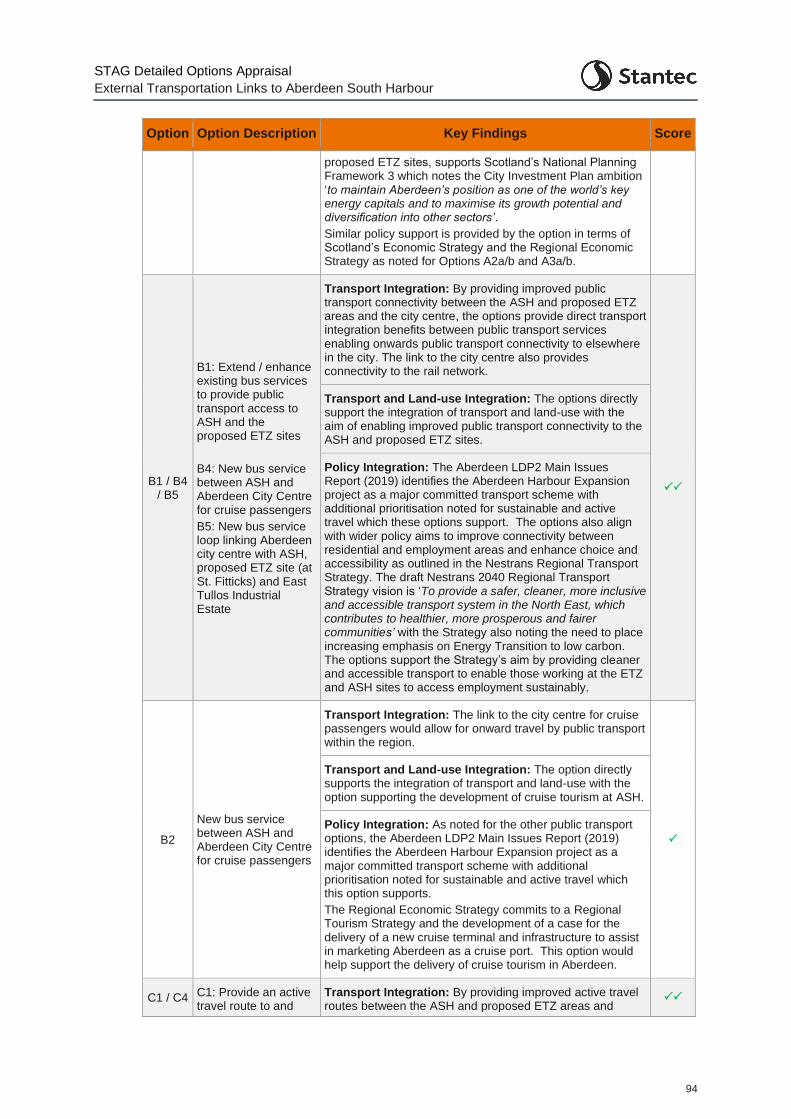
STAG Detailed Options Appraisal
External Transportation Links to Aberdeen South Harbour
94
Option Option Description Key Findings Score
proposed ETZ sites, supports Scotland’s National Planning Framework 3 which notes the City Investment Plan ambition ‘to maintain Aberdeen’s position as one of the world’s key energy capitals and to maximise its growth potential and diversification into other sectors’.
Similar policy support is provided by the option in terms of Scotland’s Economic Strategy and the Regional Economic Strategy as noted for Options A2a/b and A3a/b.
B1 / B4 / B5
B1: Extend / enhance existing bus services to provide public transport access to ASH and the proposed ETZ sites
B4: New bus service between ASH and Aberdeen City Centre for cruise passengers
B5: New bus service loop linking Aberdeen city centre with ASH, proposed ETZ site (at St. Fitticks) and East Tullos Industrial Estate
Transport Integration: By providing improved public transport connectivity between the ASH and proposed ETZ areas and the city centre, the options provide direct transport integration benefits between public transport services enabling onwards public transport connectivity to elsewhere in the city. The link to the city centre also provides connectivity to the rail network.
Transport and Land-use Integration: The options directly support the integration of transport and land-use with the aim of enabling improved public transport connectivity to the ASH and proposed ETZ sites.
Policy Integration: The Aberdeen LDP2 Main Issues Report (2019) identifies the Aberdeen Harbour Expansion project as a major committed transport scheme with additional prioritisation noted for sustainable and active travel which these options support. The options also align with wider policy aims to improve connectivity between residential and employment areas and enhance choice and accessibility as outlined in the Nestrans Regional Transport Strategy. The draft Nestrans 2040 Regional Transport Strategy vision is ‘To provide a safer, cleaner, more inclusive and accessible transport system in the North East, which contributes to healthier, more prosperous and fairer communities’ with the Strategy also noting the need to place increasing emphasis on Energy Transition to low carbon. The options support the Strategy’s aim by providing cleaner and accessible transport to enable those working at the ETZ and ASH sites to access employment sustainably.
B2
New bus service between ASH and Aberdeen City Centre for cruise passengers
Transport Integration: The link to the city centre for cruise passengers would allow for onward travel by public transport within the region.
Transport and Land-use Integration: The option directly supports the integration of transport and land-use with the option supporting the development of cruise tourism at ASH.
Policy Integration: As noted for the other public transport options, the Aberdeen LDP2 Main Issues Report (2019) identifies the Aberdeen Harbour Expansion project as a major committed transport scheme with additional prioritisation noted for sustainable and active travel which this option supports.
The Regional Economic Strategy commits to a Regional Tourism Strategy and the development of a case for the delivery of a new cruise terminal and infrastructure to assist in marketing Aberdeen as a cruise port. This option would help support the delivery of cruise tourism in Aberdeen.
C1 / C4 C1: Provide an active travel route to and
Transport Integration: By providing improved active travel routes between the ASH and proposed ETZ areas and
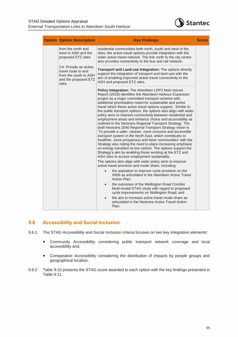
STAG Detailed Options Appraisal
External Transportation Links to Aberdeen South Harbour
95
Option Option Description Key Findings Score
from the north and west to ASH and the proposed ETZ sites
C4: Provide an active travel route to and from the south to ASH and the proposed ETZ sites
residential communities both north, south and west of the sites, the active travel options provide integration with the wider active travel network. The link north to the city centre also provides connectivity to the bus and rail network.
Transport and Land-use Integration: The options directly support the integration of transport and land-use with the aim of enabling improved active travel connectivity to the ASH and proposed ETZ sites.
Policy Integration: The Aberdeen LDP2 Main Issues Report (2019) identifies the Aberdeen Harbour Expansion project as a major committed transport scheme with additional prioritisation noted for sustainable and active travel which these active travel options support. Similar to the public transport options, the options also align with wider policy aims to improve connectivity between residential and employment areas and enhance choice and accessibility as outlined in the Nestrans Regional Transport Strategy. The draft Nestrans 2040 Regional Transport Strategy vision is ‘To provide a safer, cleaner, more inclusive and accessible transport system in the North East, which contributes to healthier, more prosperous and fairer communities’ with the Strategy also noting the need to place increasing emphasis on energy transition to low carbon. The options support the Strategy’s aim by enabling those working at the ETZ and ASH sites to access employment sustainably.
The options also align with wider policy aims to improve active travel provision and mode share, including:
• the aspiration to improve cycle provision on the A956 as articulated in the Aberdeen Active Travel Action Plan;
• the outcomes of the Wellington Road Corridor Multi-modal STAG study with regard to proposed cycle improvements on Wellington Road; and
• the aim to increase active travel mode share as articulated in the Nestrans Active Travel Action Plan.
9.6 Accessibility and Social Inclusion
9.6.1 The STAG Accessibility and Social Inclusion criteria focuses on two key integration elements:
Community Accessibility considering public transport network coverage and local accessibility and;
Comparative Accessibility considering the distribution of impacts by people groups and geographical location.
9.6.2 Table 9:10 presents the STAG score awarded to each option with the key findings presented in Table 9:11.
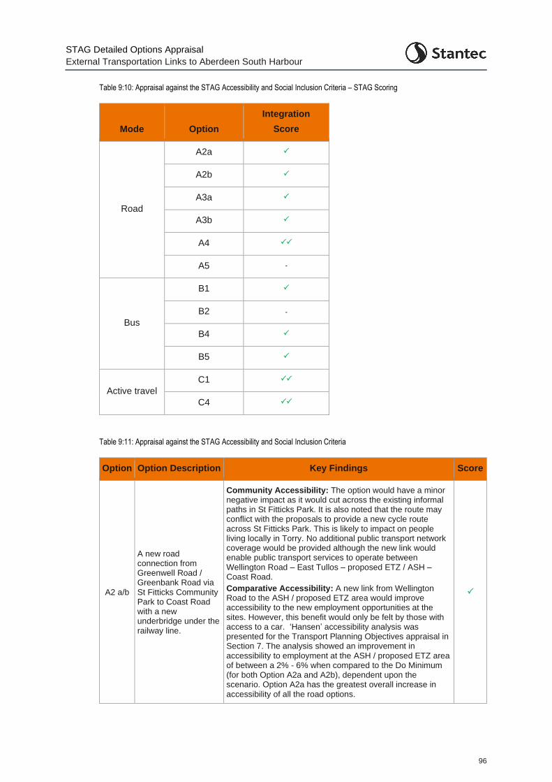
STAG Detailed Options Appraisal
External Transportation Links to Aberdeen South Harbour
96
Table 9:10: Appraisal against the STAG Accessibility and Social Inclusion Criteria – STAG Scoring
Mode Option
Integration
Score
Road
A2a
A2b
A3a
A3b
A4
A5 -
Bus
B1
B2 -
B4
B5
Active travel
C1
C4
Table 9:11: Appraisal against the STAG Accessibility and Social Inclusion Criteria
Option Option Description Key Findings Score
A2 a/b
A new road connection from Greenwell Road / Greenbank Road via St Fitticks Community Park to Coast Road with a new underbridge under the railway line.
Community Accessibility: The option would have a minor negative impact as it would cut across the existing informal paths in St Fitticks Park. It is also noted that the route may conflict with the proposals to provide a new cycle route across St Fitticks Park. This is likely to impact on people living locally in Torry. No additional public transport network coverage would be provided although the new link would enable public transport services to operate between Wellington Road – East Tullos – proposed ETZ / ASH – Coast Road.
Comparative Accessibility: A new link from Wellington Road to the ASH / proposed ETZ area would improve accessibility to the new employment opportunities at the sites. However, this benefit would only be felt by those with access to a car. ‘Hansen’ accessibility analysis was presented for the Transport Planning Objectives appraisal in Section 7. The analysis showed an improvement in accessibility to employment at the ASH / proposed ETZ area of between a 2% - 6% when compared to the Do Minimum (for both Option A2a and A2b), dependent upon the scenario. Option A2a has the greatest overall increase in accessibility of all the road options.

STAG Detailed Options Appraisal
External Transportation Links to Aberdeen South Harbour
97
Option Option Description Key Findings Score
As well as the ASH and proposed ETZ sites, businesses in East Tullos would benefit from the improved road infrastructure through the industrial estate and the direct accessibility offered to proposed ETZ site and ASH. However, this may be offset by additional traffic in the area caused by the new link and the additional delay to vehicles on Wellington Road due to the new set of signals (Option A2a).
Over the wider area, a new link between Wellington Road and the ASH / proposed ETZ sites could benefit businesses access to goods and services. The Hansen accessibility analysis undertaken showed an improvement in business to business accessibility (between the ASH / proposed ETZ area and similar businesses in the Aberdeen region) of 5% with Option A2a in place and between 2-3% for Option A2b.
A3 a/b
A new road connection from Greenwell Road / Greenbank Road via the former Ness Landfill site and a new bridge over the railway.
Community Accessibility: The option would have a minor negative impact as it would cut across the existing informal path between the Waste Water Treatment Works and the railway line – linking St Fitticks Park to the Coast Road where there is an off-road segregated cycle path provided (part of National Cycle Network Route 1).
Comparative Accessibility: A similar commentary to that noted for Option A2a/b applies. Although note that the Option A3a/b routes do not directly link through from East Tullos to the proposed ETZ site at St. Fitticks and as such would not provide the same level of accessibility between the industrial estate and the proposed ETZ site. Hansen accessibility analysis was presented for the Transport Planning Objectives appraisal in Section 7. The analysis showed an improvement in accessibility to employment at the ASH / proposed ETZ area of between 0-3% with the Option A3a in place and 1-3% with the Option A3b in place. In addition, the analysis showed an improvement in business to business accessibility (between the ASH / proposed ETZ area and similar businesses in the Aberdeen region) of 2-3% with Option A3a in place. No change was noted for Option A3b.
A4
Improve the existing route via Hareness Road through the provision of a new bridge over the railway and capacity improvements.
Community Accessibility: The option could potentially have a minor negative impact as the new bridge could impinge on the Aberdeen Coastal Path and the existing segregated cycle path (part of National Cycle Network Route 1) on the eastern side of the existing Coast Bridge. Any bridge design would need to ensure these active travel routes were maintained.
Comparative Accessibility: The new bridge would benefit the freight industry through providing increased accessibility to the ASH / proposed ETZ area for abnormal loads and freight traffic in general.
Hansen accessibility analysis was presented for the Transport Planning Objectives appraisal in Section 7. The analysis showed an improvement in accessibility to employment at the ASH / proposed ETZ area of 0-2%. In addition, the analysis showed an improvement in business to business accessibility (between the ASH / proposed ETZ area and similar businesses in the Aberdeen region) of 1%.
A5
A new road connection between Coast Road and Souter Head Road
Community Accessibility: The option could potentially have a minor negative impact as the new bridge could impinge on the Aberdeenshire Coastal Path and the existing segregated cycle path (part of National Cycle Network Route
-
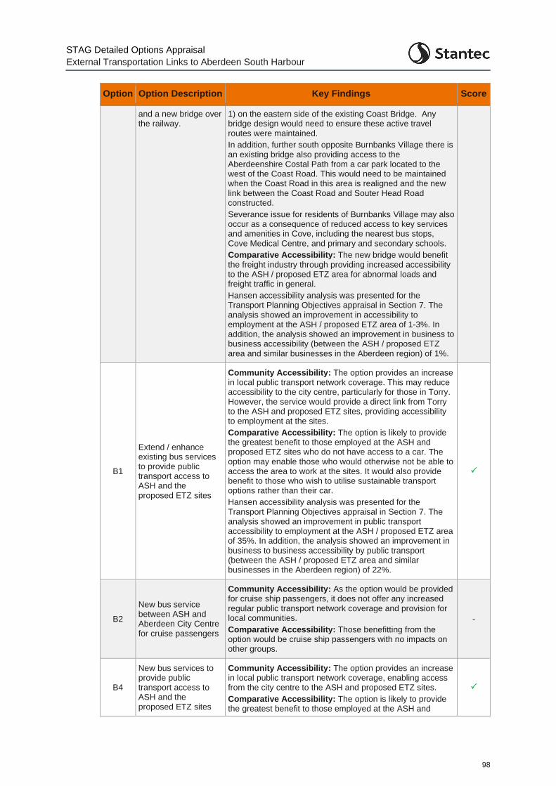
STAG Detailed Options Appraisal
External Transportation Links to Aberdeen South Harbour
98
Option Option Description Key Findings Score
and a new bridge over the railway.
1) on the eastern side of the existing Coast Bridge. Any bridge design would need to ensure these active travel routes were maintained.
In addition, further south opposite Burnbanks Village there is an existing bridge also providing access to the Aberdeenshire Costal Path from a car park located to the west of the Coast Road. This would need to be maintained when the Coast Road in this area is realigned and the new link between the Coast Road and Souter Head Road constructed.
Severance issue for residents of Burnbanks Village may also occur as a consequence of reduced access to key services and amenities in Cove, including the nearest bus stops, Cove Medical Centre, and primary and secondary schools.
Comparative Accessibility: The new bridge would benefit the freight industry through providing increased accessibility to the ASH / proposed ETZ area for abnormal loads and freight traffic in general.
Hansen accessibility analysis was presented for the Transport Planning Objectives appraisal in Section 7. The analysis showed an improvement in accessibility to employment at the ASH / proposed ETZ area of 1-3%. In addition, the analysis showed an improvement in business to business accessibility (between the ASH / proposed ETZ area and similar businesses in the Aberdeen region) of 1%.
B1
Extend / enhance existing bus services to provide public transport access to ASH and the proposed ETZ sites
Community Accessibility: The option provides an increase in local public transport network coverage. This may reduce accessibility to the city centre, particularly for those in Torry. However, the service would provide a direct link from Torry to the ASH and proposed ETZ sites, providing accessibility to employment at the sites.
Comparative Accessibility: The option is likely to provide the greatest benefit to those employed at the ASH and proposed ETZ sites who do not have access to a car. The option may enable those who would otherwise not be able to access the area to work at the sites. It would also provide benefit to those who wish to utilise sustainable transport options rather than their car.
Hansen accessibility analysis was presented for the Transport Planning Objectives appraisal in Section 7. The analysis showed an improvement in public transport accessibility to employment at the ASH / proposed ETZ area of 35%. In addition, the analysis showed an improvement in business to business accessibility by public transport (between the ASH / proposed ETZ area and similar businesses in the Aberdeen region) of 22%.
B2
New bus service between ASH and Aberdeen City Centre for cruise passengers
Community Accessibility: As the option would be provided for cruise ship passengers, it does not offer any increased regular public transport network coverage and provision for local communities.
Comparative Accessibility: Those benefitting from the option would be cruise ship passengers with no impacts on other groups.
-
B4
New bus services to provide public transport access to ASH and the proposed ETZ sites
Community Accessibility: The option provides an increase in local public transport network coverage, enabling access from the city centre to the ASH and proposed ETZ sites.
Comparative Accessibility: The option is likely to provide the greatest benefit to those employed at the ASH and
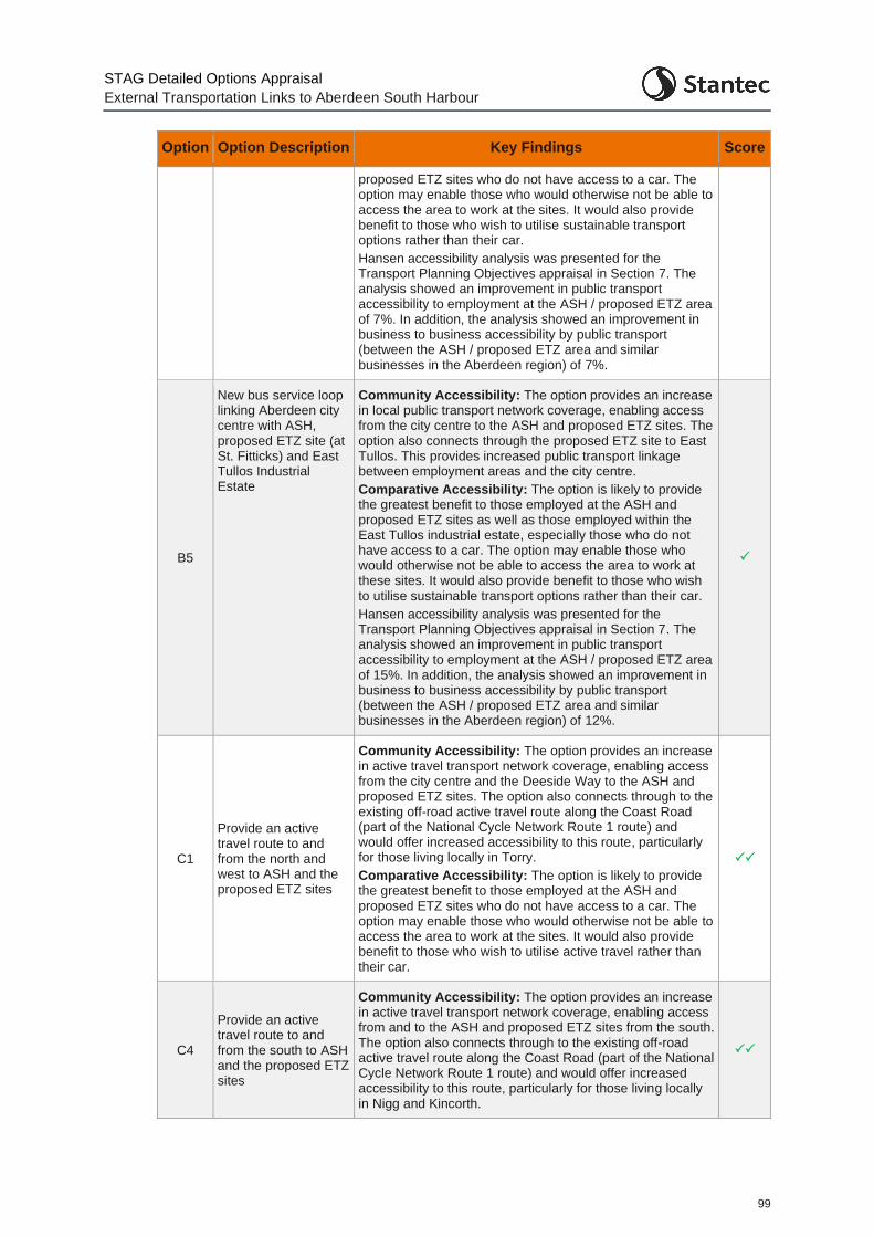
STAG Detailed Options Appraisal
External Transportation Links to Aberdeen South Harbour
99
Option Option Description Key Findings Score
proposed ETZ sites who do not have access to a car. The option may enable those who would otherwise not be able to access the area to work at the sites. It would also provide benefit to those who wish to utilise sustainable transport options rather than their car.
Hansen accessibility analysis was presented for the Transport Planning Objectives appraisal in Section 7. The analysis showed an improvement in public transport accessibility to employment at the ASH / proposed ETZ area of 7%. In addition, the analysis showed an improvement in business to business accessibility by public transport (between the ASH / proposed ETZ area and similar businesses in the Aberdeen region) of 7%.
B5
New bus service loop linking Aberdeen city centre with ASH, proposed ETZ site (at St. Fitticks) and East Tullos Industrial Estate
Community Accessibility: The option provides an increase in local public transport network coverage, enabling access from the city centre to the ASH and proposed ETZ sites. The option also connects through the proposed ETZ site to East Tullos. This provides increased public transport linkage between employment areas and the city centre.
Comparative Accessibility: The option is likely to provide the greatest benefit to those employed at the ASH and proposed ETZ sites as well as those employed within the East Tullos industrial estate, especially those who do not have access to a car. The option may enable those who would otherwise not be able to access the area to work at these sites. It would also provide benefit to those who wish to utilise sustainable transport options rather than their car.
Hansen accessibility analysis was presented for the Transport Planning Objectives appraisal in Section 7. The analysis showed an improvement in public transport accessibility to employment at the ASH / proposed ETZ area of 15%. In addition, the analysis showed an improvement in business to business accessibility by public transport (between the ASH / proposed ETZ area and similar businesses in the Aberdeen region) of 12%.
C1
Provide an active travel route to and from the north and west to ASH and the proposed ETZ sites
Community Accessibility: The option provides an increase in active travel transport network coverage, enabling access from the city centre and the Deeside Way to the ASH and proposed ETZ sites. The option also connects through to the existing off-road active travel route along the Coast Road (part of the National Cycle Network Route 1 route) and would offer increased accessibility to this route, particularly for those living locally in Torry.
Comparative Accessibility: The option is likely to provide the greatest benefit to those employed at the ASH and proposed ETZ sites who do not have access to a car. The option may enable those who would otherwise not be able to access the area to work at the sites. It would also provide benefit to those who wish to utilise active travel rather than their car.
C4
Provide an active travel route to and from the south to ASH and the proposed ETZ sites
Community Accessibility: The option provides an increase in active travel transport network coverage, enabling access from and to the ASH and proposed ETZ sites from the south. The option also connects through to the existing off-road active travel route along the Coast Road (part of the National Cycle Network Route 1 route) and would offer increased accessibility to this route, particularly for those living locally in Nigg and Kincorth.

STAG Detailed Options Appraisal
External Transportation Links to Aberdeen South Harbour
100
Option Option Description Key Findings Score
Comparative Accessibility: The option is likely to provide the greatest benefit to those employed at the ASH and proposed ETZ sites, as well as within Altens Industrial Estate who do not have access to a car. The option may enable those who would otherwise not be able to access the area to work at the sites. It would also provide benefit to those who wish to utilise active travel rather than their car.
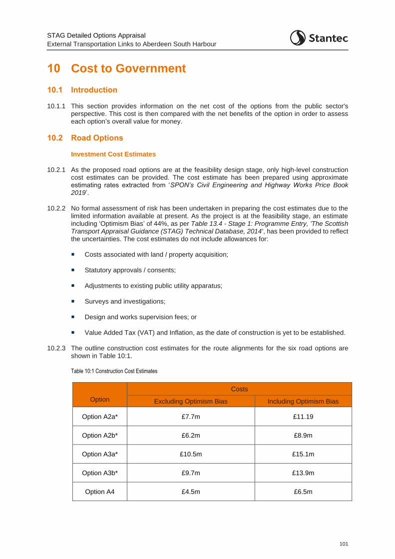
STAG Detailed Options Appraisal
External Transportation Links to Aberdeen South Harbour
101
10 Cost to Government
10.1 Introduction
10.1.1 This section provides information on the net cost of the options from the public sector's perspective. This cost is then compared with the net benefits of the option in order to assess each option’s overall value for money.
10.2 Road Options
Investment Cost Estimates
10.2.1 As the proposed road options are at the feasibility design stage, only high-level construction cost estimates can be provided. The cost estimate has been prepared using approximate estimating rates extracted from ‘SPON’s Civil Engineering and Highway Works Price Book 2019’.
10.2.2 No formal assessment of risk has been undertaken in preparing the cost estimates due to the limited information available at present. As the project is at the feasibility stage, an estimate including ‘Optimism Bias’ of 44%, as per Table 13.4 - Stage 1: Programme Entry, 'The Scottish Transport Appraisal Guidance (STAG) Technical Database, 2014', has been provided to reflect the uncertainties. The cost estimates do not include allowances for:
Costs associated with land / property acquisition;
Statutory approvals / consents;
Adjustments to existing public utility apparatus;
Surveys and investigations;
Design and works supervision fees; or
Value Added Tax (VAT) and Inflation, as the date of construction is yet to be established.
10.2.3 The outline construction cost estimates for the route alignments for the six road options are shown in Table 10:1.
Table 10:1 Construction Cost Estimates
Option
Costs
Excluding Optimism Bias Including Optimism Bias
Option A2a* £7.7m £11.19
Option A2b* £6.2m £8.9m
Option A3a* £10.5m £15.1m
Option A3b* £9.7m £13.9m
Option A4 £4.5m £6.5m
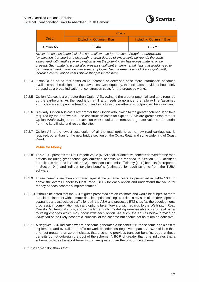
STAG Detailed Options Appraisal
External Transportation Links to Aberdeen South Harbour
102
Option
Costs
Excluding Optimism Bias Including Optimism Bias
Option A5 £5.4m £7.7m
*while the cost estimate includes some allowance for the cost of required earthworks (excavation, transport and disposal), a great degree of uncertainty surrounds the costs associated with landfill site excavation given the potential for hazardous material to be present. Such material would also present significant environmental risks that would need to be managed and mitigation measures employed. Such elements would likely significantly increase overall option costs above that presented here.
10.2.4 It should be noted that costs could increase or decrease once more information becomes available and the design process advances. Consequently, the estimates provided should only be used as a broad indication of construction costs for the proposed works.
10.2.5 Option A2a costs are greater than Option A2b, owing to the greater potential land take required by the earthworks. As the road is on a hill and needs to go under the railway line (assumed 7.5m clearance to provide headroom and structure) the earthworks footprint will be significant.
10.2.6 Similarly, Option A3a costs are greater than Option A3b, owing to the greater potential land take required by the earthworks. The construction costs for Option A3a/b are greater than that for Option A2a/b owing to the excavation work required to remove a greater volume of material from the landfill site and reseal the site.
10.2.7 Option A4 is the lowest cost option of all the road options as no new road carriageway is required, other than for the new bridge section on the Coast Road and some widening of Coast Road.
Value for Money
10.2.8 Table 10:2 presents the Net Present Value (NPV) of all quantitative benefits derived for the road options including greenhouse gas emission benefits (as reported in Section 9.2), accident benefits (as reported in Section 9.3), Transport Economic Efficiency (TEE) benefits (as reported in Section 9.4) and indirect taxation benefits (estimated for each scheme from the TUBA software).
10.2.9 These benefits are then compared against the scheme costs as presented in Table 10:1, to derive the overall Benefit to Cost Ratio (BCR) for each option and understand the value for money of each scheme’s implementation.
10.2.10 It should be noted that the BCR figures presented are an estimate and would be subject to more detailed refinement with: a more detailed option costing exercise; a revision of the development scenarios and associated traffic for both the ASH and proposed ETZ sites (as the developments progress); in combination with any options taken forward with regards to the Wellington Road Corridor Multi-modal study; and with a larger traffic modelling exercise able to capture all wider routeing changes which may occur with each option. As such, the figures below provide an indication of the likely economic ‘success’ of the scheme but should not be taken as definitive.
10.2.11 A negative BCR indicates where a scheme generates a disbenefit i.e. the scheme has a cost to implement, and overall, the traffic network experiences negative impacts. A BCR of less than one, but greater than zero, indicates that a scheme provides transport benefits, but that these benefits do not outweigh the cost of the scheme. A BCR of greater than one indicates that a scheme provides transport benefits that are greater than the cost of the scheme.
10.2.12 Table 10:2 shows that:
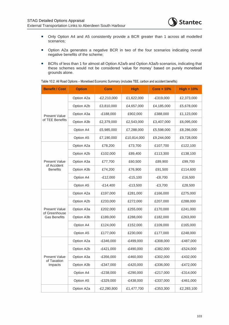
STAG Detailed Options Appraisal
External Transportation Links to Aberdeen South Harbour
103
Only Option A4 and A5 consistently provide a BCR greater than 1 across all modelled scenarios;
Option A2a generates a negative BCR in two of the four scenarios indicating overall negative benefits of the scheme;
BCRs of less than 1 for almost all Option A2a/b and Option A3a/b scenarios, indicating that these schemes would not be considered ‘value for money’ based on purely monetised grounds alone.
Table 10:2: All Road Options – Monetised Economic Summary (includes TEE, carbon and accident benefits)
Benefit / Cost Option Core High Core + 10% High + 10%
Present Value of TEE Benefits
Option A2a -£2,210,000 £1,622,000 -£319,000 £2,373,000
Option A2b £3,810,000 £4,657,000 £4,185,000 £5,678,000
Option A3a -£188,000 £902,000 £388,000 £1,123,000
Option A3b £2,379,000 £2,543,000 £3,407,000 £6,095,000
Option A4 £5,985,000 £7,288,000 £5,598,000 £8,286,000
Option A5 £7,190,000 £10,814,000 £9,244,000 £9,728,000
Present Value of Accident
Benefits
Option A2a £78,200 £73,700 £107,700 £122,100
Option A2b £102,000 £89,400 £113,300 £138,100
Option A3a £77,700 £60,500 £89,900 £99,700
Option A3b £74,200 £76,900 £91,500 £114,600
Option A4 -£12,000 -£15,100 -£8,700 £16,500
Option A5 -£14,400 -£13,500 -£3,700 £28,500
Present Value of Greenhouse Gas Benefits
Option A2a £197,000 £281,000 £166,000 £275,000
Option A2b £233,000 £272,000 £207,000 £288,000
Option A3a £202,000 £255,000 £170,000 £241,000
Option A3b £189,000 £288,000 £182,000 £263,000
Option A4 £124,000 £152,000 £109,000 £165,000
Option A5 £177,000 £230,000 £177,000 £248,000
Present Value of Taxation
Impacts
Option A2a -£346,000 -£499,000 -£308,000 -£487,000
Option A2b -£421,000 -£490,000 -£382,000 -£524,000
Option A3a -£356,000 -£460,000 -£302,000 -£432,000
Option A3b -£347,000 -£420,000 -£336,000 -£472,000
Option A4 -£238,000 -£290,000 -£217,000 -£314,000
Option A5 -£329,000 -£438,000 -£337,000 -£461,000
Option A2a -£2,280,800 £1,477,700 -£353,300 £2,283,100
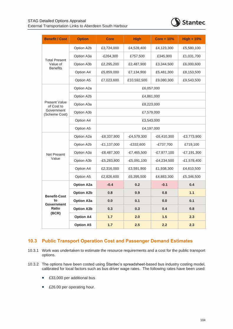
STAG Detailed Options Appraisal
External Transportation Links to Aberdeen South Harbour
104
Benefit / Cost Option Core High Core + 10% High + 10%
Total Present Value of Benefits
Option A2b £3,724,000 £4,528,400 £4,123,300 £5,580,100
Option A3a -£264,300 £757,500 £345,900 £1,031,700
Option A3b £2,295,200 £2,487,900 £3,344,500 £6,000,600
Option A4 £5,859,000 £7,134,900 £5,481,300 £8,153,500
Option A5 £7,023,600 £10,592,500 £9,080,300 £9,543,500
Present Value of Cost to
Government (Scheme Cost)
Option A2a £6,057,000
Option A2b £4,861,000
Option A3a £8,223,000
Option A3b £7,579,000
Option A4 £3,543,000
Option A5 £4,197,000
Net Present Value
Option A2a -£8,337,800 -£4,579,300 -£6,410,300 -£3,773,900
Option A2b -£1,137,000 -£332,600 -£737,700 £719,100
Option A3a -£8,487,300 -£7,465,500 -£7,877,100 -£7,191,300
Option A3b -£5,283,800 -£5,091,100 -£4,234,500 -£1,578,400
Option A4 £2,316,000 £3,591,900 £1,938,300 £4,610,500
Option A5 £2,826,600 £6,395,500 £4,883,300 £5,346,500
Benefit-Cost to
Government Ratio
(BCR)
Option A2a -0.4 0.2 -0.1 0.4
Option A2b 0.8 0.9 0.8 1.1
Option A3a 0.0 0.1 0.0 0.1
Option A3b 0.3 0.3 0.4 0.8
Option A4 1.7 2.0 1.5 2.3
Option A5 1.7 2.5 2.2 2.3
10.3 Public Transport Operation Cost and Passenger Demand Estimates
10.3.1 Work was undertaken to estimate the resource requirements and a cost for the public transport options.
10.3.2 The options have been costed using Stantec’s spreadsheet-based bus industry costing model, calibrated for local factors such as bus driver wage rates. The following rates have been used:
£33,000 per additional bus
£26.00 per operating hour.
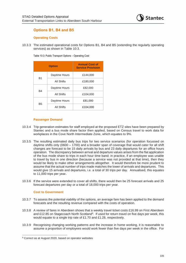
STAG Detailed Options Appraisal
External Transportation Links to Aberdeen South Harbour
105
Options B1, B4 and B5
Operating Costs
10.3.3 The estimated operational costs for Options B1, B4 and B5 (extending the regularly operating services) as shown in Table 10:3.
Table 10:3: Public Transport Options – Operating Cost
Option Annual Cost of
Service Provision
B1 Daytime Hours £144,000
All Shifts £180,000
B4 Daytime Hours £82,000
All Shifts £104,000
B5 Daytime Hours £81,000
All Shifts £104,000
Passenger Demand
10.3.4 Trip generation estimates for staff employed at the proposed ETZ sites have been prepared by Stantec and a bus mode share factor then applied, based on Census travel to work data for workplaces in the Cove North Intermediate Zone, which equates to 9%.
10.3.5 The resulting estimated daily bus trips for two service scenarios (for operation focussed on daytime shifts only (0600 – 1700) and a broader span of coverage that would cater for all shift changes are forecast to be 15 daily arrivals by bus and 23 daily departures for an office hours operation. The discrepancy between arrival and departure values arises from the flat application of the bus mode share to trips in each hour time band; in practice, if an employee was unable to travel by bus in one direction (because a service was not provided at that time), then they would be likely to make other arrangements altogether. It would therefore be more prudent to assume that the actual number of trips made matches the lower of arrivals and departures. This would give 15 arrivals and departures, i.e. a total of 30 trips per day. Annualised, this equates to 11,000 trips per year.
10.3.6 If the service were extended to cover all shifts, there would then be 25 forecast arrivals and 25 forecast departures per day or a total of 18,000 trips per year.
Cost to Government
10.3.7 To assess the potential viability of the options, an average fare has been applied to the demand forecasts and the resulting revenue compared with the costs of operation.
10.3.8 A review of fares in Aberdeen shows that a weekly travel ticket costs £16.99 on First Aberdeen and £12.85 on Stagecoach North Scotland9. If used for return travel on five days per week, this would equate to a single trip rate of £1.70 and £1.28, respectively.
10.3.9 Recognising changing working patterns and the increase in home working, it is reasonable to assume a proportion of employees would work fewer than five days per week in the office. For
9 Correct as at August 2020, based on operator websites
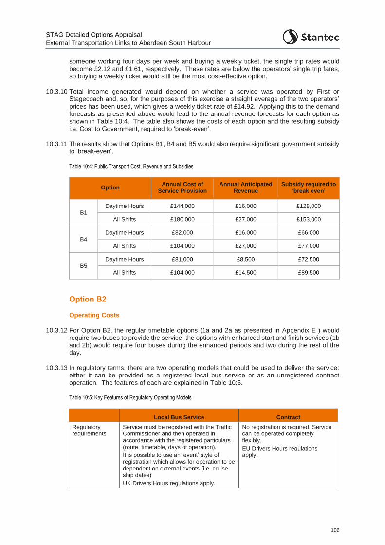
STAG Detailed Options Appraisal
External Transportation Links to Aberdeen South Harbour
106
someone working four days per week and buying a weekly ticket, the single trip rates would become £2.12 and £1.61, respectively. These rates are below the operators’ single trip fares, so buying a weekly ticket would still be the most cost-effective option.
10.3.10 Total income generated would depend on whether a service was operated by First or Stagecoach and, so, for the purposes of this exercise a straight average of the two operators’ prices has been used, which gives a weekly ticket rate of £14.92. Applying this to the demand forecasts as presented above would lead to the annual revenue forecasts for each option as shown in Table 10:4. The table also shows the costs of each option and the resulting subsidy i.e. Cost to Government, required to ‘break-even’.
10.3.11 The results show that Options B1, B4 and B5 would also require significant government subsidy to ‘break-even’.
Table 10:4: Public Transport Cost, Revenue and Subsidies
Option Annual Cost of
Service Provision Annual Anticipated
Revenue Subsidy required to
‘break even’
B1 Daytime Hours £144,000 £16,000 £128,000
All Shifts £180,000 £27,000 £153,000
B4 Daytime Hours £82,000 £16,000 £66,000
All Shifts £104,000 £27,000 £77,000
B5 Daytime Hours £81,000 £8,500 £72,500
All Shifts £104,000 £14,500 £89,500
Option B2
Operating Costs
10.3.12 For Option B2, the regular timetable options (1a and 2a as presented in Appendix E ) would require two buses to provide the service; the options with enhanced start and finish services (1b and 2b) would require four buses during the enhanced periods and two during the rest of the day.
10.3.13 In regulatory terms, there are two operating models that could be used to deliver the service: either it can be provided as a registered local bus service or as an unregistered contract operation. The features of each are explained in Table 10:5.
Table 10:5: Key Features of Regulatory Operating Models
Local Bus Service Contract
Regulatory requirements
Service must be registered with the Traffic Commissioner and then operated in accordance with the registered particulars (route, timetable, days of operation).
It is possible to use an ‘event’ style of registration which allows for operation to be dependent on external events (i.e. cruise ship dates)
UK Drivers Hours regulations apply.
No registration is required. Service can be operated completely flexibly.
EU Drivers Hours regulations apply.
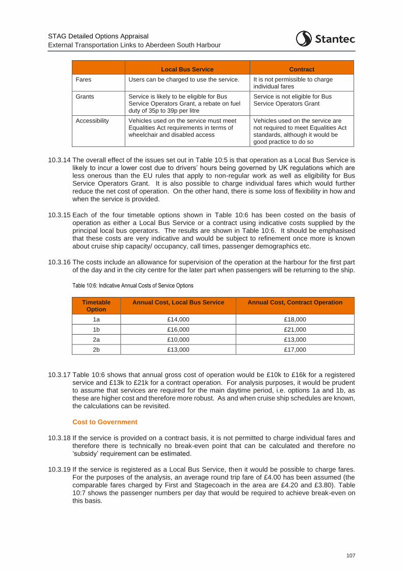
STAG Detailed Options Appraisal
External Transportation Links to Aberdeen South Harbour
107
Local Bus Service Contract
Fares Users can be charged to use the service. It is not permissible to charge individual fares
Grants Service is likely to be eligible for Bus Service Operators Grant, a rebate on fuel duty of 35p to 39p per litre
Service is not eligible for Bus Service Operators Grant
Accessibility Vehicles used on the service must meet Equalities Act requirements in terms of wheelchair and disabled access
Vehicles used on the service are not required to meet Equalities Act standards, although it would be good practice to do so
10.3.14 The overall effect of the issues set out in Table 10:5 is that operation as a Local Bus Service is
likely to incur a lower cost due to drivers’ hours being governed by UK regulations which are less onerous than the EU rules that apply to non-regular work as well as eligibility for Bus Service Operators Grant. It is also possible to charge individual fares which would further reduce the net cost of operation. On the other hand, there is some loss of flexibility in how and when the service is provided.
10.3.15 Each of the four timetable options shown in Table 10:6 has been costed on the basis of operation as either a Local Bus Service or a contract using indicative costs supplied by the principal local bus operators. The results are shown in Table 10:6. It should be emphasised that these costs are very indicative and would be subject to refinement once more is known about cruise ship capacity/ occupancy, call times, passenger demographics etc.
10.3.16 The costs include an allowance for supervision of the operation at the harbour for the first part of the day and in the city centre for the later part when passengers will be returning to the ship.
Table 10:6: Indicative Annual Costs of Service Options
Timetable Option
Annual Cost, Local Bus Service Annual Cost, Contract Operation
1a £14,000 £18,000
1b £16,000 £21,000
2a £10,000 £13,000
2b £13,000 £17,000
10.3.17 Table 10:6 shows that annual gross cost of operation would be £10k to £16k for a registered service and £13k to £21k for a contract operation. For analysis purposes, it would be prudent to assume that services are required for the main daytime period, i.e. options 1a and 1b, as these are higher cost and therefore more robust. As and when cruise ship schedules are known, the calculations can be revisited.
Cost to Government
10.3.18 If the service is provided on a contract basis, it is not permitted to charge individual fares and therefore there is technically no break-even point that can be calculated and therefore no ‘subsidy’ requirement can be estimated.
10.3.19 If the service is registered as a Local Bus Service, then it would be possible to charge fares. For the purposes of the analysis, an average round trip fare of £4.00 has been assumed (the comparable fares charged by First and Stagecoach in the area are £4.20 and £3.80). Table 10:7 shows the passenger numbers per day that would be required to achieve break-even on this basis.
STAG Detailed Options Appraisal
External Transportation Links to Aberdeen South Harbour
108
Table 10:7: Break-even Analysis (Assumes Service is Registered as a Local Bus Service)
Option Daily Passengers
1a 310
1b 370
2a 230
2b 288
10.3.20 This analysis has shown that a standalone shuttle service can be provided between ASH and the city centre on days when a cruise ship is in port. The cost of the service depends on hours of operation and whether the service is operated on a contract basis or as a registered local service.
10.3.21 Based on schedules at other North Scotland ports, cruise ships typically spend 10 to 12 hours in port. A service operating every 30 minutes during this period would require two buses and cost £14k if registered as a Local Bus Service or £18k on a contract basis.
10.3.22 If the service were enhanced to every 15 minutes for the first and last hours of operation, when demand is likely to be highest, the respective costs would be £16k and £21k.
10.3.23 It is possible that some cruise schedules would see the ship arriving around midday and staying until late evening; in this scenario, the shuttle bus would not be required in the evening when cruise passengers are back on board. This would reduce the cost of operation to £10k (registered service) or £13k (contract) for the 30-minute option and to £13k (registered service) or £17k (contract) for the enhanced start and finish timetable.
10.3.24 For appraisal purposes it is suggested that the costs of the daytime option with enhanced start and finish (option 1b) are used. As these are the higher costs, this will add robustness to the analysis. It is also the case that the majority of ships currently visiting North Scotland ports do so for the main daytime period. As noted above, these costs are £16k (registered service) or £21k (contract).
Summary
10.3.25 The analysis presented above shows that Option B1, B4 and B5 would be loss-making and would require considerable public funding support, which may make the options undeliverable.
10.3.26 Option B2, the standalone shuttle service, could be provided between ASH and the city centre on days when a cruise ship is in port. The cost of the service depends on hours of operation and whether the service is operated on a contract basis or as a registered local service.
10.4 Active Travel Cost Estimates
Option C1
10.4.1 For Option C1, an estimate of the cost of providing a new shared use path linking through St. Fitticks Park from Kirkhill Place to the Coast Road, as shown in Figure 10:1, has been developed. Within the park, the route splits into two sections, providing a link through the park to the new harbour entrance, and also south of the Waste Water Treatment Works site, providing linkage through to the existing Coast Road off-road shared use path which then provides onward connectivity to the proposed ETZ site at Doonies Farm.
10.4.2 It is assumed that the route would be incorporated / revised into any Masterplanning for the proposed ETZ site at St. Fitticks Park.
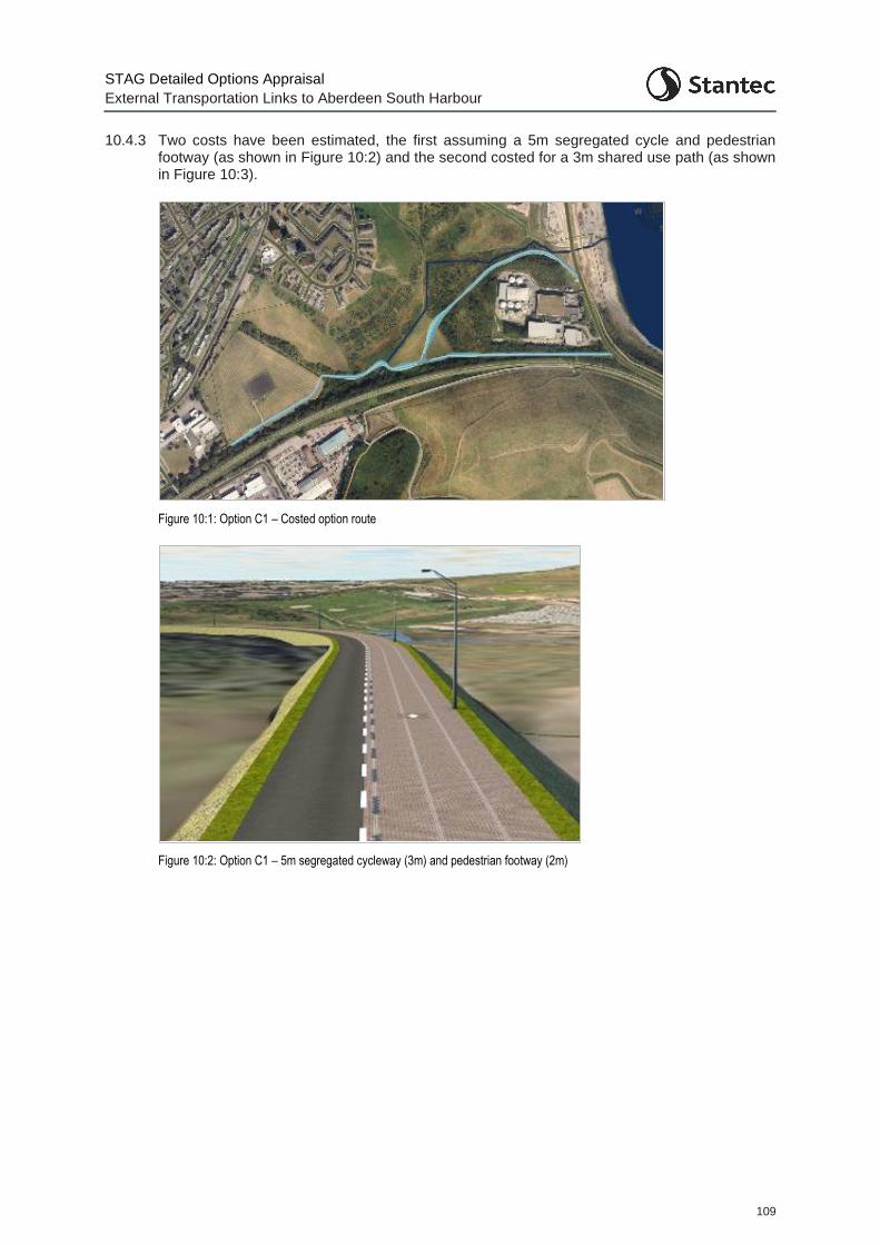
STAG Detailed Options Appraisal
External Transportation Links to Aberdeen South Harbour
109
10.4.3 Two costs have been estimated, the first assuming a 5m segregated cycle and pedestrian footway (as shown in Figure 10:2) and the second costed for a 3m shared use path (as shown in Figure 10:3).
Figure 10:1: Option C1 – Costed option route
Figure 10:2: Option C1 – 5m segregated cycleway (3m) and pedestrian footway (2m)
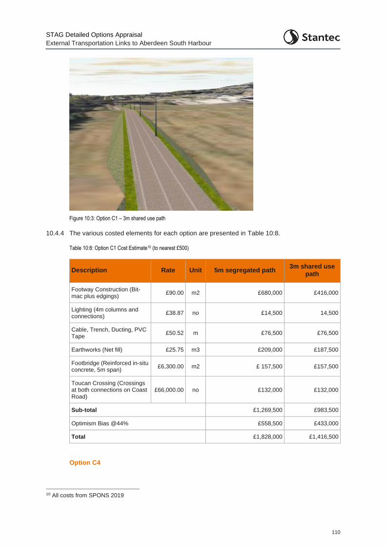
STAG Detailed Options Appraisal
External Transportation Links to Aberdeen South Harbour
110
Figure 10:3: Option C1 – 3m shared use path
10.4.4 The various costed elements for each option are presented in Table 10:8.
Table 10:8: Option C1 Cost Estimate10 (to nearest £500)
Description Rate Unit 5m segregated path 3m shared use
path
Footway Construction (Bit-mac plus edgings)
£90.00 m2 £680,000 £416,000
Lighting (4m columns and connections)
£38.87 no £14,500 14,500
Cable, Trench, Ducting, PVC Tape
£50.52 m £76,500 £76,500
Earthworks (Net fill) £25.75 m3 £209,000 £187,500
Footbridge (Reinforced in-situ concrete, 5m span)
£6,300.00 m2 £ 157,500 £157,500
Toucan Crossing (Crossings at both connections on Coast Road)
£66,000.00 no £132,000 £132,000
Sub-total £1,269,500 £983,500
Optimism Bias @44% £558,500 £433,000
Total £1,828,000 £1,416,500
Option C4
10 All costs from SPONS 2019
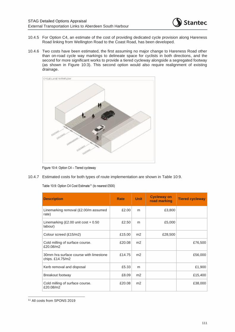
STAG Detailed Options Appraisal
External Transportation Links to Aberdeen South Harbour
111
10.4.5 For Option C4, an estimate of the cost of providing dedicated cycle provision along Hareness Road linking from Wellington Road to the Coast Road, has been developed.
10.4.6 Two costs have been estimated, the first assuming no major change to Hareness Road other than on-road cycle way markings to delineate space for cyclists in both directions, and the second for more significant works to provide a tiered cycleway alongside a segregated footway (as shown in Figure 10:3). This second option would also require realignment of existing drainage.
Figure 10:4: Option C4 – Tiered cycleway
10.4.7 Estimated costs for both types of route implementation are shown in Table 10:9.
Table 10:9: Option C4 Cost Estimate11 (to nearest £500)
Description Rate Unit Cycleway on road marking
Tiered cycleway
Linemarking removal (£2.00/m assumed rate)
£2.00 m £3,800
Linemarking (£2.00 unit cost + 0.50 labour)
£2.50 m £5,000
Colour screed (£15/m2) £15.00 m2 £28,500
Cold milling of surface course. £20.08/m2
£20.08 m2 £76,500
30mm hra surface course with limestone chips. £14.75/m2
£14.75 m2 £56,000
Kerb removal and disposal £5.33 m £1,900
Breakout footway £8.09 m2 £15,400
Cold milling of surface course. £20.08/m2
£20.08 m2 £38,000
11 All costs from SPONS 2019
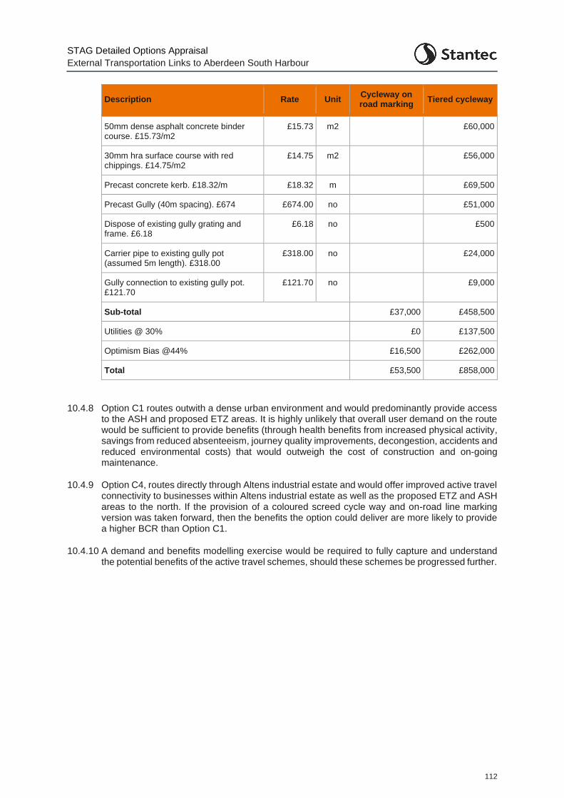
STAG Detailed Options Appraisal
External Transportation Links to Aberdeen South Harbour
112
Description Rate Unit Cycleway on road marking
Tiered cycleway
50mm dense asphalt concrete binder course. £15.73/m2
£15.73 m2 £60,000
30mm hra surface course with red chippings. £14.75/m2
£14.75 m2 £56,000
Precast concrete kerb. £18.32/m £18.32 m £69,500
Precast Gully (40m spacing). £674 £674.00 no £51,000
Dispose of existing gully grating and frame. £6.18
£6.18 no £500
Carrier pipe to existing gully pot (assumed 5m length). £318.00
£318.00 no £24,000
Gully connection to existing gully pot. £121.70
£121.70 no £9,000
Sub-total £37,000 £458,500
Utilities @ 30% £0 £137,500
Optimism Bias @44% £16,500 £262,000
Total £53,500 £858,000
10.4.8 Option C1 routes outwith a dense urban environment and would predominantly provide access to the ASH and proposed ETZ areas. It is highly unlikely that overall user demand on the route would be sufficient to provide benefits (through health benefits from increased physical activity, savings from reduced absenteeism, journey quality improvements, decongestion, accidents and reduced environmental costs) that would outweigh the cost of construction and on-going maintenance.
10.4.9 Option C4, routes directly through Altens industrial estate and would offer improved active travel connectivity to businesses within Altens industrial estate as well as the proposed ETZ and ASH areas to the north. If the provision of a coloured screed cycle way and on-road line marking version was taken forward, then the benefits the option could deliver are more likely to provide a higher BCR than Option C1.
10.4.10 A demand and benefits modelling exercise would be required to fully capture and understand the potential benefits of the active travel schemes, should these schemes be progressed further.
STAG Detailed Options Appraisal
External Transportation Links to Aberdeen South Harbour
113
11 Engagement
11.1 Overview
11.1.1 To inform the public acceptability appraisal of the options, a public engagement exercise was undertaken between 19th November and 16th December 2020. Due to the COVID-19 pandemic, it was not possible to offer face-to-face public events. As such, all engagement activity was online.
11.1.2 During this engagement period, an information pack (External Transportation Links to Aberdeen South Harbour, Detailed Options Appraisal: Public Engagement Information Pack) was made available on Aberdeen City Council’s Consultation Hub
(https://consultation.aberdeencity.gov.uk),. To provide a coherent and understandable narrative
between both this study and the Wellington Road Corridor Multi-modal transport study, the engagement was undertaken in tandem, with the material for both studies presented together and a single feedback questionnaire covering both provided.
11.1.3 The survey was promoted by Aberdeen City Council both on the Council website and through various social media platforms. Direct contact was made with key stakeholders to ensure they were aware of the engagement opportunity. This included contacting the Community Councils directly impacted by the proposals (Torry, Cove etc.) as well as the residents of Burnbanks Village. In addition, letters were sent out to businesses within both Altens and East Tullos Industrial estate. A study email address was also provided to which specific responses, outwith the feedback survey, could be sent.
11.1.4 In total, responses were provided by 126 members of the public as well as from 19 organisations. In addition, at the request of a business located in the Altens industrial estate, a one-to-one discussion was held between the business and the study team, to discuss the option appraisal in greater detail.
11.1.5 A summary of the engagement responses received is provided here. Note that this summary only considers the responses to those feedback questions relating to this study. It does consider or analyse those relating to the Wellington Road Corridor study.
11.1.6 Each option has been analysed in terms of the split of responses as to whether those responding agreed or not with the option proposed. In addition, a summary of the key points raised by the respondents in relation to each option has been summarised. Appendix J presents the full details of the comments provided.
11.2 All Option Overview
11.2.1 Figure 11:1 shows the spread of responses in terms of how respondents agreed and disagreed with the various proposed options. Note that not all responses sum to 100% due to a number of respondents noting they ‘Didn’t Know’. For ease of viewing, these responses have been excluded from the graph.
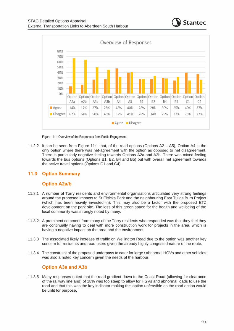
STAG Detailed Options Appraisal
External Transportation Links to Aberdeen South Harbour
114
Figure 11:1: Overview of the Responses from Public Engagement
11.2.2 It can be seen from Figure 11:1 that, of the road options (Options A2 – A5), Option A4 is the only option where there was net-agreement with the option as opposed to net disagreement. There is particularly negative feeling towards Options A2a and A2b. There was mixed feeling towards the bus options (Options B1, B2, B4 and B5) but with overall net agreement towards the active travel options (Options C1 and C4).
11.3 Option Summary
Option A2a/b
11.3.1 A number of Torry residents and environmental organisations articulated very strong feelings around the proposed impacts to St Fitticks Park and the neighbouring East Tullos Burn Project (which has been heavily invested in). This may also be a factor with the proposed ETZ development on the park site. The loss of this green space for the health and wellbeing of the local community was strongly noted by many.
11.3.2 A prominent comment from many of the Torry residents who responded was that they feel they are continually having to deal with more construction work for projects in the area, which is having a negative impact on the area and the environment.
11.3.3 The associated likely increase of traffic on Wellington Road due to the option was another key concern for residents and road users given the already highly congested nature of the route.
11.3.4 The constraint of the proposed underpass to cater for large / abnormal HGVs and other vehicles was also a noted key concern given the needs of the harbour.
Option A3a and A3b
11.3.5 Many responses noted that the road gradient down to the Coast Road (allowing for clearance of the railway line and) of 18% was too steep to allow for HGVs and abnormal loads to use the road and that this was the key indicator making this option unfeasible as the road option would be unfit for purpose.
STAG Detailed Options Appraisal
External Transportation Links to Aberdeen South Harbour
115
11.3.6 Many respondents noted concern over the potential impacts from excavating the Ness landfill site and the potential exposure to hazardous materials.
11.3.7 However, there were many individuals and some organisations which felt Option A3a/b were better options compared to Option A2a and A2b as there would be less of an impact on the local environment, particularly as St Fitticks Park is not affected by any construction.
11.3.8 Some residents noted concern over the increase in traffic in the area and the potential for vehicles to stray from the designated route and travel into residential areas.
Option A4
11.3.9 Many responses noted this option to be the best option under consideration as it has very minimal impact on the environment and does not impact on St. Fitticks Park.
11.3.10 Residents of Torry, Burnbanks Village and Cove support this option as it keeps HGVs away from residential areas, minimising noise and air pollution for local residents.
11.3.11 Many individuals also highlighted that the BCR ratio is higher than other options and it meets most of the transport planning objectives.
Option A5
11.3.12 The residents of Burnbanks Village noted particular concern about the increase in traffic in the area and past the village. Local residents highlighted that the close proximity of the road to their houses will result in an increase in noise and vibrations due to the HGV traffic.
11.3.13 It was noted by many that compared to Option A4, there is a greater environmental impact and this is not supported.
11.3.14 The one-to-one discussion with the business located at the eastern end of Souter Head Road (and whose premises would be most affected by the proposals) highlighted that:
The occupier has a long-term lease of the site and have invested significantly in its capabilities recently
On-going investment decisions are being made in relation to the site and the outcomes of this study could significantly impact on these. Therefore, there is a need to keep the occupier fully up to date on the progression of the options and the project
There is some potential acquisition of some of the site in future, due to the way that the potential road option would interact with the facility i.e. it might not be necessary for the whole business to be acquired and relocated
Option B1
11.3.15 Many residents emphasised that there is currently no demand for a bus service in the area, so the option is thought not to be financially viable.
11.3.16 There was general consensus that there needs to be a shift to more sustainable modes of transport, but to do this there needs to be an improvement in journey times.
Option B2
11.3.17 Many local residents highlighted that the water treatment works located near to the Aberdeen South Harbour are unpleasant to look at and smell, suggesting this was a deterrent in encouraging passengers to disembark from the cruise ships.
STAG Detailed Options Appraisal
External Transportation Links to Aberdeen South Harbour
116
11.3.18 Due to the COVID-19 pandemic and its potential longer-term impact on cruise tourism, numerous individuals suggested there will be no cruise passengers which the bus service is proposed to cater for.
11.3.19 Multiple local residents suggested that the cruise company themselves will have pre-booked buses and coach tours for their passengers, so there is no need for a separate dedicated bus service.
11.3.20 A few individuals commented that this option provides the most direct route to the harbour and was therefore the best public transport option.
Option B4
11.3.21 Numerous respondents highlight that there is no demand for a service in the area so the buses would run at a loss and would not be financially viable.
11.3.22 Some locals believe that this would be beneficial for the industrial estates as it would increase their accessibility.
Option B5
11.3.23 Many Torry residents highlight that this route would heavily impact on St Fitticks Park which is considered to be the heart of the community.
11.3.24 Again, it is believed by locals that the lack of demand for a service indicates that it is unnecessary.
11.3.25 Some residents noted their concern that this option would lead to an increase in traffic in residential areas due to the addition of a bus service on the road network.
Option C1
11.3.26 Many local residents noted that were happy that an active travel route was being considered as they believe that there is little work being done to improve active travel infrastructure in the area.
11.3.27 Some residents and the Aberdeen Cycle Forum highlighted that any cycle lanes must be segregated from other road users for cyclist safety.
11.3.28 A few Torry residents noted that the route as proposed is very convoluted and involves going through St. Fitticks Park. This was not supported as it would involve construction within green space.
Option C4
11.3.29 Many individuals noted that this route allows for great connectivity between various communities and the ASH.
11.3.30 Some respondents felt that there is no need to serve ASH with active travel routes as it will be predominantly accessed by commercial vehicles.
11.3.31 Many local residents noted concern about the resultant increase in congestion due changes to the road network and being unable to overtake cyclists.
STAG Detailed Options Appraisal
External Transportation Links to Aberdeen South Harbour
117
12 Risk Register
12.1.1 The risk and uncertainty inherent in the implementation of the options has been considered and is shown in Table 12:1.
12.1.2 Note that the uncertainty surrounding the COVID-19 pandemic has not been individually noted for each option. However, there is the potential for medium-term, structural impacts of the COVID-19 pandemic to materially alter societal behaviour with respect to work and travel. The aftermath of the pandemic has the potential to impact on the way we work, live and travel. Given the national need for working from home, employers and employees have had to adapt accordingly, implementing working strategies and technological solutions to enable this. The outcome may be a new working reality where staff choose to work more often from home. There are also significant short to medium term restrictions on public transport capacities due to the requirements of social distancing. This evolving working and travel environment may have implications, especially for the public transport and also active travel schemes at the planning stages, as these may need to be revisited to explore whether they are still appropriate, or whether different types of schemes may now be considered more relevant. However, given the nature of the activities at ASH and proposed ETZ, there is perhaps less scope for home working associated with these sites. This should be considered further as the options progress.
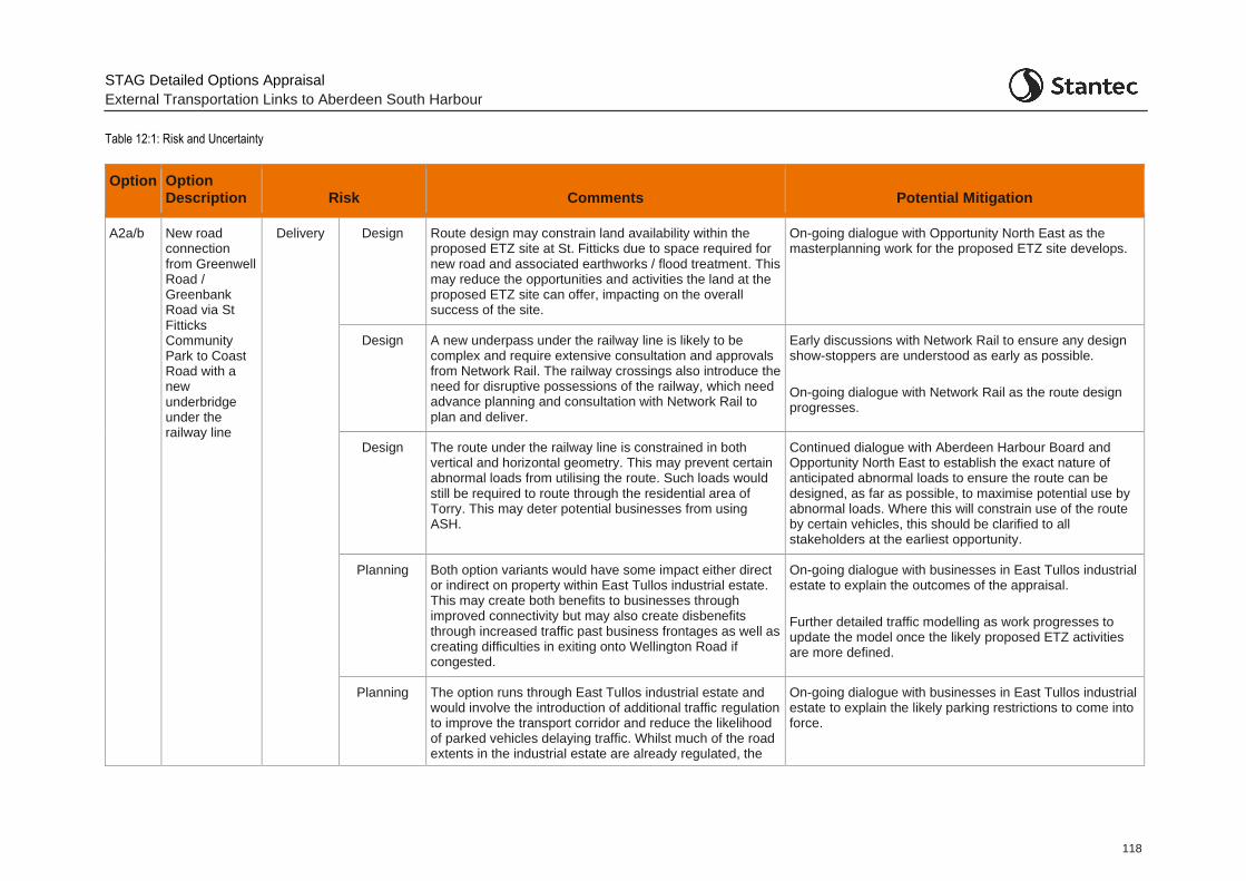
STAG Detailed Options Appraisal
External Transportation Links to Aberdeen South Harbour
118
Table 12:1: Risk and Uncertainty
Option Option Description Risk Comments Potential Mitigation
A2a/b New road connection from Greenwell Road / Greenbank Road via St Fitticks Community Park to Coast Road with a new underbridge under the railway line
Delivery Design Route design may constrain land availability within the proposed ETZ site at St. Fitticks due to space required for new road and associated earthworks / flood treatment. This may reduce the opportunities and activities the land at the proposed ETZ site can offer, impacting on the overall success of the site.
On-going dialogue with Opportunity North East as the masterplanning work for the proposed ETZ site develops.
Design A new underpass under the railway line is likely to be complex and require extensive consultation and approvals from Network Rail. The railway crossings also introduce the need for disruptive possessions of the railway, which need advance planning and consultation with Network Rail to plan and deliver.
Early discussions with Network Rail to ensure any design show-stoppers are understood as early as possible.
On-going dialogue with Network Rail as the route design progresses.
Design The route under the railway line is constrained in both vertical and horizontal geometry. This may prevent certain abnormal loads from utilising the route. Such loads would still be required to route through the residential area of Torry. This may deter potential businesses from using ASH.
Continued dialogue with Aberdeen Harbour Board and Opportunity North East to establish the exact nature of anticipated abnormal loads to ensure the route can be designed, as far as possible, to maximise potential use by abnormal loads. Where this will constrain use of the route by certain vehicles, this should be clarified to all stakeholders at the earliest opportunity.
Planning Both option variants would have some impact either direct or indirect on property within East Tullos industrial estate. This may create both benefits to businesses through improved connectivity but may also create disbenefits through increased traffic past business frontages as well as creating difficulties in exiting onto Wellington Road if congested.
On-going dialogue with businesses in East Tullos industrial estate to explain the outcomes of the appraisal.
Further detailed traffic modelling as work progresses to update the model once the likely proposed ETZ activities are more defined.
Planning The option runs through East Tullos industrial estate and would involve the introduction of additional traffic regulation to improve the transport corridor and reduce the likelihood of parked vehicles delaying traffic. Whilst much of the road extents in the industrial estate are already regulated, the
On-going dialogue with businesses in East Tullos industrial estate to explain the likely parking restrictions to come into force.
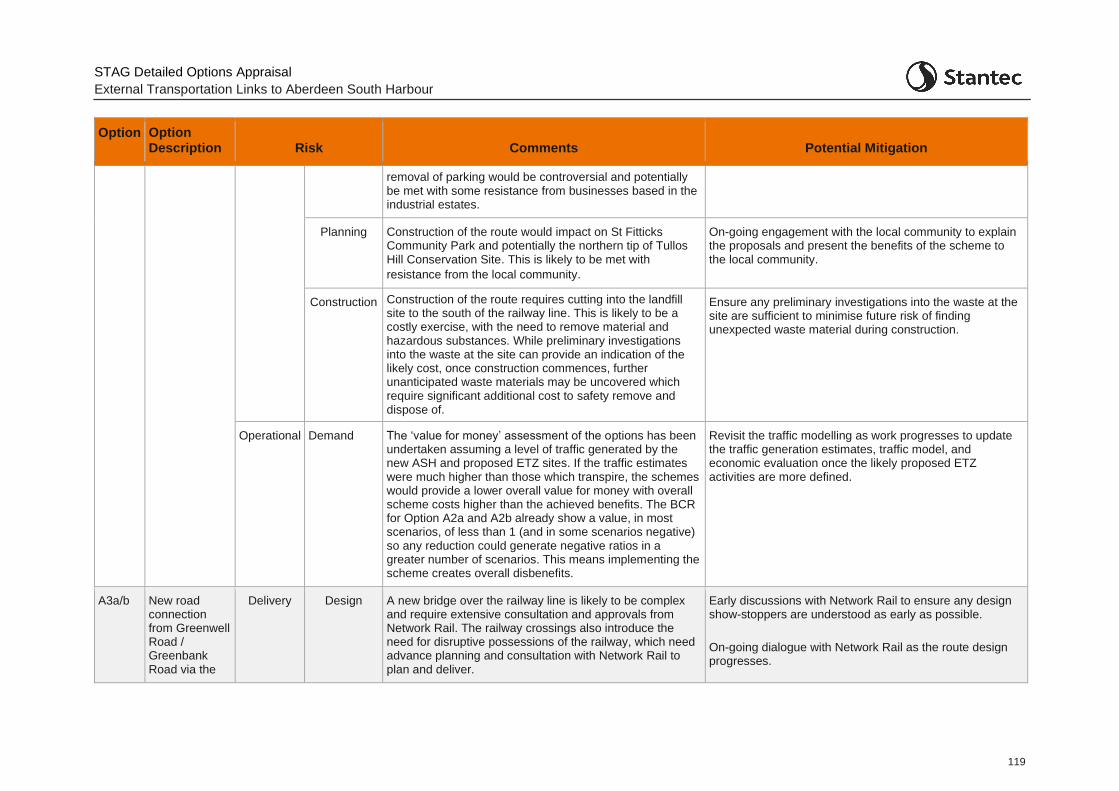
STAG Detailed Options Appraisal
External Transportation Links to Aberdeen South Harbour
119
Option Option Description Risk Comments Potential Mitigation
removal of parking would be controversial and potentially be met with some resistance from businesses based in the industrial estates.
Planning Construction of the route would impact on St Fitticks Community Park and potentially the northern tip of Tullos Hill Conservation Site. This is likely to be met with
resistance from the local community.
On-going engagement with the local community to explain the proposals and present the benefits of the scheme to the local community.
Construction Construction of the route requires cutting into the landfill site to the south of the railway line. This is likely to be a costly exercise, with the need to remove material and hazardous substances. While preliminary investigations into the waste at the site can provide an indication of the likely cost, once construction commences, further unanticipated waste materials may be uncovered which require significant additional cost to safety remove and dispose of.
Ensure any preliminary investigations into the waste at the site are sufficient to minimise future risk of finding unexpected waste material during construction.
Operational Demand The ‘value for money’ assessment of the options has been undertaken assuming a level of traffic generated by the new ASH and proposed ETZ sites. If the traffic estimates were much higher than those which transpire, the schemes would provide a lower overall value for money with overall scheme costs higher than the achieved benefits. The BCR for Option A2a and A2b already show a value, in most scenarios, of less than 1 (and in some scenarios negative) so any reduction could generate negative ratios in a greater number of scenarios. This means implementing the scheme creates overall disbenefits.
Revisit the traffic modelling as work progresses to update the traffic generation estimates, traffic model, and economic evaluation once the likely proposed ETZ activities are more defined.
A3a/b New road connection from Greenwell Road / Greenbank Road via the
Delivery Design A new bridge over the railway line is likely to be complex and require extensive consultation and approvals from Network Rail. The railway crossings also introduce the need for disruptive possessions of the railway, which need advance planning and consultation with Network Rail to plan and deliver.
Early discussions with Network Rail to ensure any design show-stoppers are understood as early as possible.
On-going dialogue with Network Rail as the route design progresses.
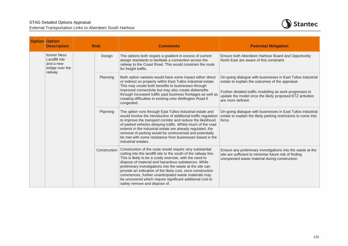
STAG Detailed Options Appraisal
External Transportation Links to Aberdeen South Harbour
120
Option Option Description Risk Comments Potential Mitigation
former Ness Landfill site and a new bridge over the railway
Design The options both require a gradient in excess of current design standards to facilitate a connection across the railway to the Coast Road. This would constrain the route for freight traffic.
Ensure both Aberdeen Harbour Board and Opportunity North East are aware of this constraint.
Planning Both option variants would have some impact either direct or indirect on property within East Tullos industrial estate. This may create both benefits to businesses through improved connectivity but may also create disbenefits through increased traffic past business frontages as well as creating difficulties in existing onto Wellington Road if congested.
On-going dialogue with businesses in East Tullos industrial estate to explain the outcomes of the appraisal.
Further detailed traffic modelling as work progresses to update the model once the likely proposed ETZ activities are more defined.
Planning The option runs through East Tullos industrial estate and would involve the introduction of additional traffic regulation to improve the transport corridor and reduce the likelihood of parked vehicles delaying traffic. Whilst much of the road extents in the industrial estate are already regulated, the removal of parking would be controversial and potentially be met with some resistance from businesses based in the industrial estates.
On-going dialogue with businesses in East Tullos industrial estate to explain the likely parking restrictions to come into force.
Construction Construction of the route would require very substantial cutting into the landfill site to the south of the railway line. This is likely to be a costly exercise, with the need to dispose of material and hazardous substances. While preliminary investigations into the waste at the site can provide an indication of the likely cost, once construction commences, further unanticipated waste materials may be uncovered which require significant additional cost to
safety remove and dispose of.
Ensure any preliminary investigations into the waste at the site are sufficient to minimise future risk of finding unexpected waste material during construction.
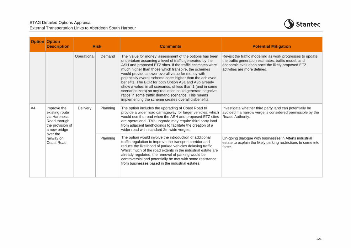
STAG Detailed Options Appraisal
External Transportation Links to Aberdeen South Harbour
121
Option Option Description Risk Comments Potential Mitigation
Operational Demand The ‘value for money’ assessment of the options has been undertaken assuming a level of traffic generated by the ASH and proposed ETZ sites. If the traffic estimates were much higher than those which transpire, the schemes would provide a lower overall value for money with potentially overall scheme costs higher than the achieved benefits. The BCR for both Option A3a and A3b already show a value, in all scenarios, of less than 1 (and in some scenarios zero) so any reduction could generate negative ratios in some traffic demand scenarios. This means implementing the scheme creates overall disbenefits.
Revisit the traffic modelling as work progresses to update the traffic generation estimates, traffic model, and economic evaluation once the likely proposed ETZ activities are more defined.
A4 Improve the existing route via Hareness Road through the provision of a new bridge over the railway on Coast Road
Delivery Planning The option includes the upgrading of Coast Road to provide a wider road carriageway for larger vehicles, which would use the road when the ASH and proposed ETZ sites are operational. This upgrade may require third party land from adjacent landholdings to facilitate the creation of a wider road with standard 2m wide verges.
Investigate whether third party land can potentially be avoided if a narrow verge is considered permissible by the Roads Authority.
Planning The option would involve the introduction of additional traffic regulation to improve the transport corridor and reduce the likelihood of parked vehicles delaying traffic. Whilst much of the road extents in the industrial estate are already regulated, the removal of parking would be controversial and potentially be met with some resistance from businesses based in the industrial estates.
On-going dialogue with businesses in Altens industrial estate to explain the likely parking restrictions to come into force.
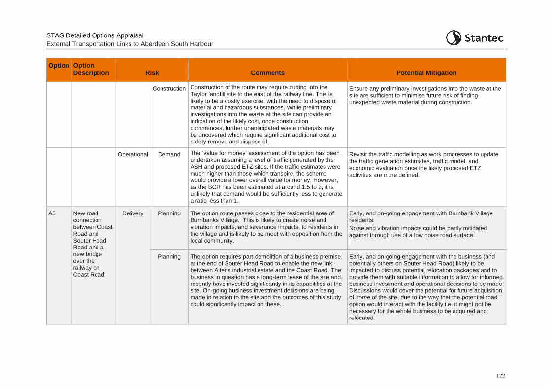
STAG Detailed Options Appraisal
External Transportation Links to Aberdeen South Harbour
122
Option Option Description Risk Comments Potential Mitigation
Construction Construction of the route may require cutting into the Taylor landfill site to the east of the railway line. This is likely to be a costly exercise, with the need to dispose of material and hazardous substances. While preliminary investigations into the waste at the site can provide an indication of the likely cost, once construction commences, further unanticipated waste materials may be uncovered which require significant additional cost to safety remove and dispose of.
Ensure any preliminary investigations into the waste at the site are sufficient to minimise future risk of finding unexpected waste material during construction.
Operational Demand The ‘value for money’ assessment of the option has been undertaken assuming a level of traffic generated by the ASH and proposed ETZ sites. If the traffic estimates were much higher than those which transpire, the scheme would provide a lower overall value for money. However, as the BCR has been estimated at around 1.5 to 2, it is unlikely that demand would be sufficiently less to generate a ratio less than 1.
Revisit the traffic modelling as work progresses to update the traffic generation estimates, traffic model, and economic evaluation once the likely proposed ETZ activities are more defined.
A5 New road connection between Coast Road and Souter Head Road and a new bridge over the railway on Coast Road.
Delivery Planning The option route passes close to the residential area of Burnbanks Village. This is likely to create noise and vibration impacts, and severance impacts, to residents in the village and is likely to be meet with opposition from the local community.
Early, and on-going engagement with Burnbank Village residents.
Noise and vibration impacts could be partly mitigated against through use of a low noise road surface.
Planning The option requires part-demolition of a business premise at the end of Souter Head Road to enable the new link between Altens industrial estate and the Coast Road. The business in question has a long-term lease of the site and recently have invested significantly in its capabilities at the site. On-going business investment decisions are being made in relation to the site and the outcomes of this study could significantly impact on these.
Early, and on-going engagement with the business (and potentially others on Souter Head Road) likely to be impacted to discuss potential relocation packages and to provide them with suitable information to allow for informed business investment and operational decisions to be made. Discussions would cover the potential for future acquisition of some of the site, due to the way that the potential road option would interact with the facility i.e. it might not be necessary for the whole business to be acquired and relocated.

STAG Detailed Options Appraisal
External Transportation Links to Aberdeen South Harbour
123
Option Option Description Risk Comments Potential Mitigation
Planning The option would have some impact either direct or indirect on property within Altens industrial estate. This may create both benefits to businesses through improved connectivity but may also create disbenefits through increased traffic past business frontages as well as creating increased queuing on exiting the estate at Souter Head roundabout.
On-going dialogue with businesses in Altens industrial estate to explain the outcomes of the appraisal.
Further traffic modelling as work progresses to update the model once the likely proposed ETZ activities are more defined.
Planning The option would generate a higher volume of traffic through Altens industrial estate and involve the introduction of additional traffic regulation to improve Souter Head Road and reduce the likelihood of parked vehicles delaying traffic. Any removal of parking would be controversial and potentially be met with some resistance from businesses based in the industrial estates.
On-going dialogue with businesses in Altens industrial estate to explain the likely parking restrictions to come into force.
Planning The option includes the upgrading of Coast Road to provide a wider road carriageway for larger vehicles, which would use the road when the ASH and proposed ETZ sites are operational. This upgrade may require third party land from adjacent landholdings to facilitate the creation of a wider road with standard 2m wide verges.
Investigate whether third party land can potentially be avoided if a narrow verge is considered permissible by the Roads Authority.
Construction Construction of the route may require cutting into the Taylor landfill site to the east of the railway line. This is likely to be a costly exercise, with the need to dispose of material and hazardous substances. While preliminary investigations into the waste at the site can provide an indication of the likely cost, once construction commences, further unanticipated waste materials may be uncovered which require significant additional cost to safety remove and dispose of.
Ensure any preliminary investigations into the waste at the site are sufficient to minimise future risk of finding unexpected waste material during construction.
Operational Demand The ‘value for money’ assessment of the option has been undertaken assuming a level of traffic generated by the new harbour and proposed ETZ sites. If the traffic estimates were much higher than those which transpire, the scheme would provide a lower overall value for
Revisit the traffic modelling as work progresses to update the traffic generation estimates, traffic model, and economic evaluation once the likely proposed ETZ activities are more defined.
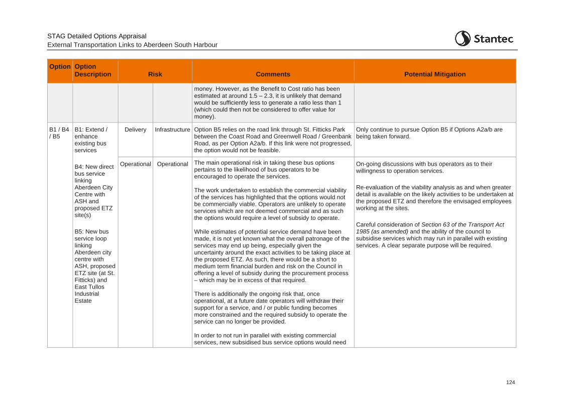
STAG Detailed Options Appraisal
External Transportation Links to Aberdeen South Harbour
124
Option Option Description Risk Comments Potential Mitigation
money. However, as the Benefit to Cost ratio has been estimated at around 1.5 – 2.3, it is unlikely that demand would be sufficiently less to generate a ratio less than 1 (which could then not be considered to offer value for money).
B1 / B4 / B5
B1: Extend / enhance existing bus services
B4: New direct bus service linking Aberdeen City Centre with ASH and proposed ETZ site(s)
B5: New bus service loop linking Aberdeen city centre with ASH, proposed ETZ site (at St. Fitticks) and East Tullos Industrial Estate
Delivery Infrastructure Option B5 relies on the road link through St. Fitticks Park between the Coast Road and Greenwell Road / Greenbank Road, as per Option A2a/b. If this link were not progressed, the option would not be feasible.
Only continue to pursue Option B5 if Options A2a/b are being taken forward.
Operational Operational The main operational risk in taking these bus options pertains to the likelihood of bus operators to be encouraged to operate the services. The work undertaken to establish the commercial viability of the services has highlighted that the options would not be commercially viable. Operators are unlikely to operate services which are not deemed commercial and as such the options would require a level of subsidy to operate. While estimates of potential service demand have been made, it is not yet known what the overall patronage of the services may end up being, especially given the uncertainty around the exact activities to be taking place at the proposed ETZ. As such, there would be a short to medium term financial burden and risk on the Council in offering a level of subsidy during the procurement process – which may be in excess of that required. There is additionally the ongoing risk that, once operational, at a future date operators will withdraw their support for a service, and / or public funding becomes more constrained and the required subsidy to operate the service can no longer be provided. In order to not run in parallel with existing commercial services, new subsidised bus service options would need
On-going discussions with bus operators as to their willingness to operation services.
Re-evaluation of the viability analysis as and when greater detail is available on the likely activities to be undertaken at the proposed ETZ and therefore the envisaged employees working at the sites.
Careful consideration of Section 63 of the Transport Act 1985 (as amended) and the ability of the council to subsidise services which may run in parallel with existing services. A clear separate purpose will be required.
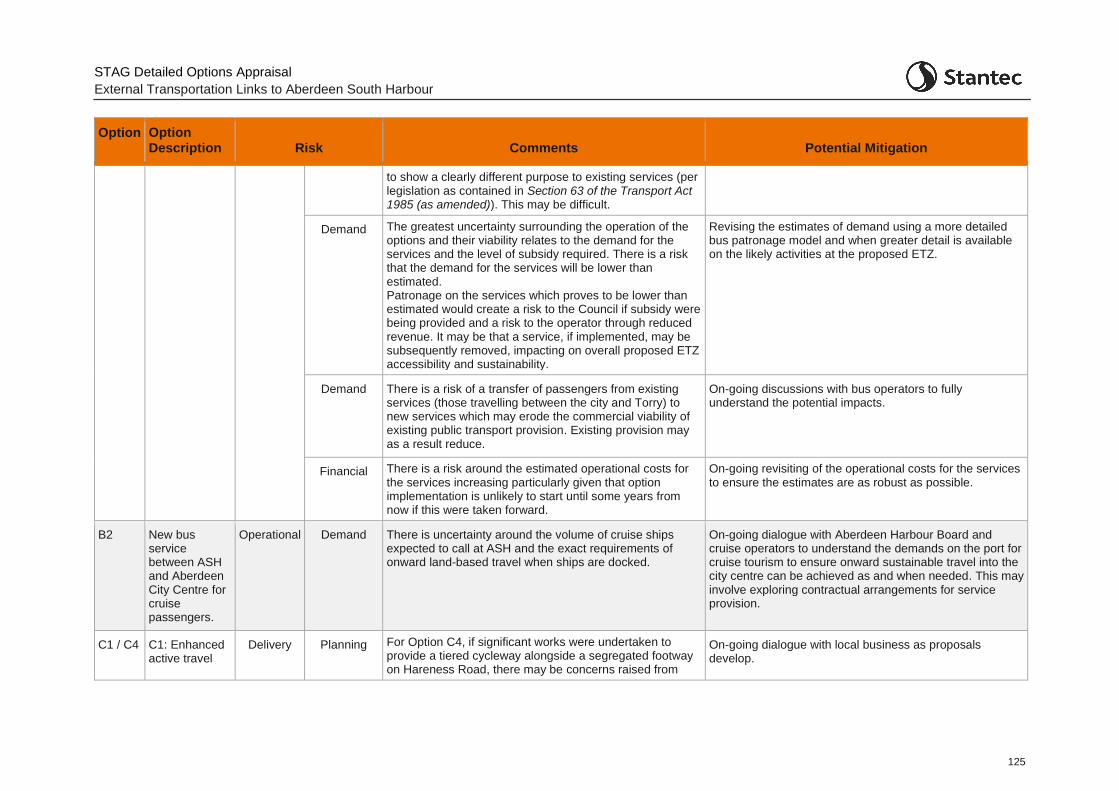
STAG Detailed Options Appraisal
External Transportation Links to Aberdeen South Harbour
125
Option Option Description Risk Comments Potential Mitigation
to show a clearly different purpose to existing services (per legislation as contained in Section 63 of the Transport Act 1985 (as amended)). This may be difficult.
Demand The greatest uncertainty surrounding the operation of the options and their viability relates to the demand for the services and the level of subsidy required. There is a risk that the demand for the services will be lower than estimated. Patronage on the services which proves to be lower than estimated would create a risk to the Council if subsidy were being provided and a risk to the operator through reduced revenue. It may be that a service, if implemented, may be subsequently removed, impacting on overall proposed ETZ accessibility and sustainability.
Revising the estimates of demand using a more detailed bus patronage model and when greater detail is available on the likely activities at the proposed ETZ.
Demand There is a risk of a transfer of passengers from existing services (those travelling between the city and Torry) to new services which may erode the commercial viability of existing public transport provision. Existing provision may as a result reduce.
On-going discussions with bus operators to fully understand the potential impacts.
Financial There is a risk around the estimated operational costs for the services increasing particularly given that option implementation is unlikely to start until some years from now if this were taken forward.
On-going revisiting of the operational costs for the services to ensure the estimates are as robust as possible.
B2 New bus service between ASH and Aberdeen City Centre for cruise passengers.
Operational Demand There is uncertainty around the volume of cruise ships expected to call at ASH and the exact requirements of onward land-based travel when ships are docked.
On-going dialogue with Aberdeen Harbour Board and cruise operators to understand the demands on the port for cruise tourism to ensure onward sustainable travel into the city centre can be achieved as and when needed. This may involve exploring contractual arrangements for service provision.
C1 / C4
C1: Enhanced active travel
Delivery Planning For Option C4, if significant works were undertaken to provide a tiered cycleway alongside a segregated footway on Hareness Road, there may be concerns raised from
On-going dialogue with local business as proposals develop.
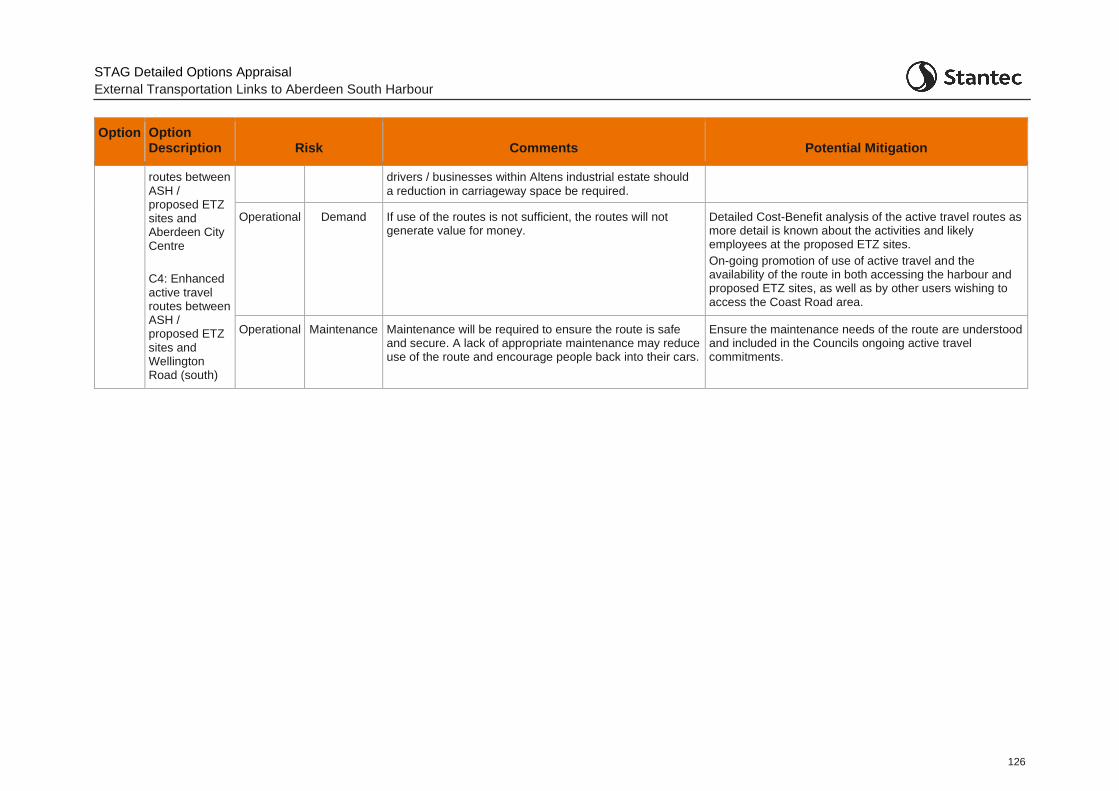
STAG Detailed Options Appraisal
External Transportation Links to Aberdeen South Harbour
126
Option Option Description Risk Comments Potential Mitigation
routes between ASH / proposed ETZ sites and Aberdeen City Centre
C4: Enhanced active travel routes between ASH / proposed ETZ sites and Wellington Road (south)
drivers / businesses within Altens industrial estate should
a reduction in carriageway space be required.
Operational Demand If use of the routes is not sufficient, the routes will not generate value for money.
Detailed Cost-Benefit analysis of the active travel routes as more detail is known about the activities and likely employees at the proposed ETZ sites.
On-going promotion of use of active travel and the availability of the route in both accessing the harbour and proposed ETZ sites, as well as by other users wishing to access the Coast Road area.
Operational Maintenance Maintenance will be required to ensure the route is safe and secure. A lack of appropriate maintenance may reduce use of the route and encourage people back into their cars.
Ensure the maintenance needs of the route are understood and included in the Councils ongoing active travel commitments.
STAG Detailed Appraisal
External Transportation Links to Aberdeen South Harbour
127
13 Summary
13.1.1 The options have been appraised against the Transport Planning Objectives, the STAG criteria (Environment, Safety, Economy, Integration, and Social Accessibility and Inclusion), Implementability criteria (Technical and Operational Feasibility and Public Acceptability) and finally Cost to Government.
13.1.2 The overall scoring of each of the various elements of the appraisal is provided in Table 13:1 for all options.
13.1.3 The table indicates whether, based on the appraisal work undertaken, an option could be considered worthy of further detailed design and business case development. The rationale for potential selection or rejection of each option at this stage is discussed in the subsequent table, Table 13:2.
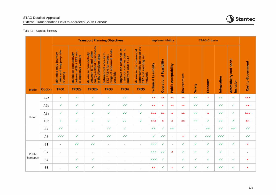
STAG Detailed Appraisal
External Transportation Links to Aberdeen South Harbour
128
Table 13:1: Appraisal Summary
Mode Option
Transport Planning Objectives Implementibility STAG Criteria
Co
st t
o G
ove
rnm
en
t
Min
imis
e H
GV
jo
urn
ey
tim
es
an
d i
na
pp
rop
ria
te
rou
tein
g
Ma
xim
ise
co
nn
ec
tiv
ity
be
twe
en
AS
H /
ET
Z a
nd
pro
sp
ec
tiv
e w
ork
ers
Ma
xim
ise
co
nn
ec
tiv
ity
be
twe
en
ET
Z a
nd
oth
er
en
erg
y-r
ela
ted
bu
sin
es
ses
in t
he
Ab
erd
ee
n a
rea
(Bu
sin
ess
to
Bu
sin
ess
) F
utu
rep
roo
f ac
ces
s t
o
ET
Z /
AS
H f
or
wid
es
t
ran
ge
of
ab
no
rma
l lo
ad
s
po
ss
ible
Imp
rov
e t
he
re
sil
ien
ce
of
tran
sp
ort
co
nn
ec
tio
ns
to
an
d f
rom
AS
H /
ET
Z
Ma
xim
ise
th
e i
nte
rmo
da
l
op
po
rtu
nit
ies
betw
ee
n t
he
ET
Z a
nd
ex
isti
ng
rail
ne
two
rk
Tech
nic
al F
eas
ibili
ty
Op
era
tio
nal
Fe
asib
ility
Pu
blic
Acc
ep
tab
ility
Envi
ron
me
nt
Safe
ty
Eco
no
my
Inte
grat
ion
Acc
ess
ibili
ty a
nd
So
cial
Incl
usi
on
TPO1 TPO2a TPO2b TPO3 TPO4 TPO5
Road
A2a
A2b
A3a
A3b
A4 - - - - -
A5 - - -
Public Transport
B1 - - - - -
B2 - - - - - - - -
B4 - - - - -
B5 - - - -
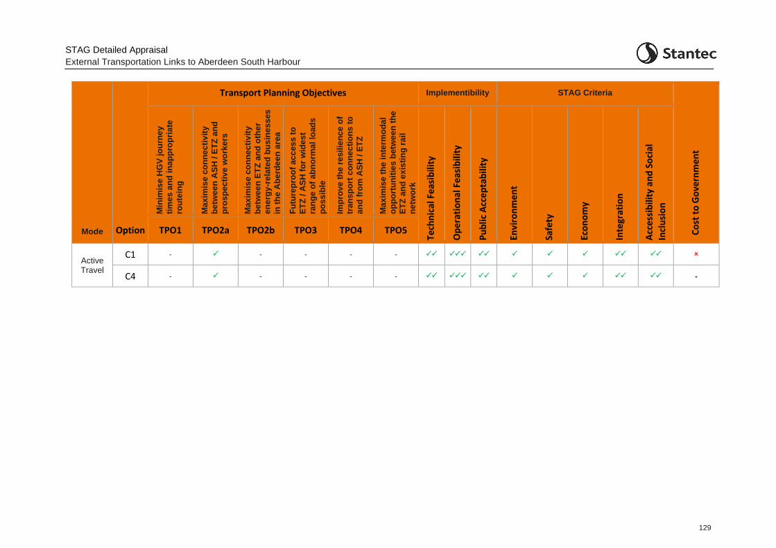
STAG Detailed Appraisal
External Transportation Links to Aberdeen South Harbour
129
Mode Option
Transport Planning Objectives Implementibility STAG Criteria
Co
st t
o G
ove
rnm
en
t
Min
imis
e H
GV
jo
urn
ey
tim
es
an
d i
na
pp
rop
ria
te
rou
tein
g
Ma
xim
ise
co
nn
ec
tiv
ity
be
twe
en
AS
H /
ET
Z a
nd
pro
sp
ec
tiv
e w
ork
ers
Ma
xim
ise
co
nn
ec
tiv
ity
be
twe
en
ET
Z a
nd
oth
er
en
erg
y-r
ela
ted
bu
sin
es
ses
in t
he
Ab
erd
ee
n a
rea
(Bu
sin
ess
to
Bu
sin
ess
) F
utu
rep
roo
f ac
ces
s t
o
ET
Z /
AS
H f
or
wid
es
t
ran
ge
of
ab
no
rma
l lo
ad
s
po
ss
ible
Imp
rov
e t
he
re
sil
ien
ce
of
tran
sp
ort
co
nn
ec
tio
ns
to
an
d f
rom
AS
H /
ET
Z
Ma
xim
ise
th
e i
nte
rmo
da
l
op
po
rtu
nit
ies
betw
ee
n t
he
ET
Z a
nd
ex
isti
ng
rail
ne
two
rk
Tech
nic
al F
eas
ibili
ty
Op
era
tio
nal
Fe
asib
ility
Pu
blic
Acc
ep
tab
ility
Envi
ron
me
nt
Safe
ty
Eco
no
my
Inte
grat
ion
Acc
ess
ibili
ty a
nd
So
cial
Incl
usi
on
TPO1 TPO2a TPO2b TPO3 TPO4 TPO5
Active Travel
C1 - - - - -
C4 - - - - - -
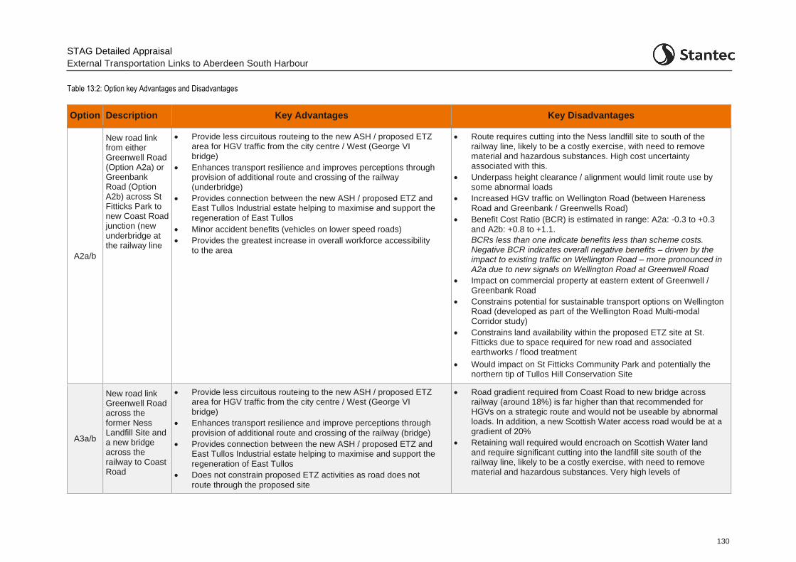
STAG Detailed Appraisal
External Transportation Links to Aberdeen South Harbour
130
Table 13:2: Option key Advantages and Disadvantages
Option Description Key Advantages Key Disadvantages
A2a/b
New road link from either Greenwell Road (Option A2a) or Greenbank Road (Option A2b) across St Fitticks Park to new Coast Road junction (new underbridge at the railway line
• Provide less circuitous routeing to the new ASH / proposed ETZ area for HGV traffic from the city centre / West (George VI bridge)
• Enhances transport resilience and improves perceptions through provision of additional route and crossing of the railway (underbridge)
• Provides connection between the new ASH / proposed ETZ and East Tullos Industrial estate helping to maximise and support the regeneration of East Tullos
• Minor accident benefits (vehicles on lower speed roads)
• Provides the greatest increase in overall workforce accessibility to the area
• Route requires cutting into the Ness landfill site to south of the railway line, likely to be a costly exercise, with need to remove material and hazardous substances. High cost uncertainty associated with this.
• Underpass height clearance / alignment would limit route use by some abnormal loads
• Increased HGV traffic on Wellington Road (between Hareness Road and Greenbank / Greenwells Road)
• Benefit Cost Ratio (BCR) is estimated in range: A2a: -0.3 to +0.3 and A2b: +0.8 to +1.1.
BCRs less than one indicate benefits less than scheme costs. Negative BCR indicates overall negative benefits – driven by the impact to existing traffic on Wellington Road – more pronounced in A2a due to new signals on Wellington Road at Greenwell Road
• Impact on commercial property at eastern extent of Greenwell / Greenbank Road
• Constrains potential for sustainable transport options on Wellington Road (developed as part of the Wellington Road Multi-modal Corridor study)
• Constrains land availability within the proposed ETZ site at St. Fitticks due to space required for new road and associated earthworks / flood treatment
• Would impact on St Fitticks Community Park and potentially the northern tip of Tullos Hill Conservation Site
A3a/b
New road link Greenwell Road across the former Ness Landfill Site and a new bridge across the railway to Coast Road
• Provide less circuitous routeing to the new ASH / proposed ETZ area for HGV traffic from the city centre / West (George VI
bridge)
• Enhances transport resilience and improve perceptions through
provision of additional route and crossing of the railway (bridge)
• Provides connection between the new ASH / proposed ETZ and East Tullos Industrial estate helping to maximise and support the
regeneration of East Tullos
• Does not constrain proposed ETZ activities as road does not
route through the proposed site
• Road gradient required from Coast Road to new bridge across railway (around 18%) is far higher than that recommended for HGVs on a strategic route and would not be useable by abnormal loads. In addition, a new Scottish Water access road would be at a gradient of 20%
• Retaining wall required would encroach on Scottish Water land and require significant cutting into the landfill site south of the railway line, likely to be a costly exercise, with need to remove material and hazardous substances. Very high levels of
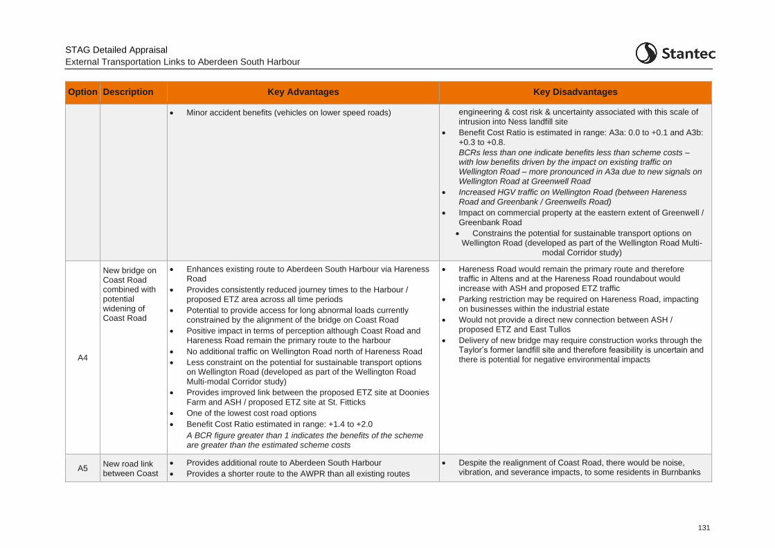
STAG Detailed Appraisal
External Transportation Links to Aberdeen South Harbour
131
Option Description Key Advantages Key Disadvantages
• Minor accident benefits (vehicles on lower speed roads)
engineering & cost risk & uncertainty associated with this scale of
intrusion into Ness landfill site
• Benefit Cost Ratio is estimated in range: A3a: 0.0 to +0.1 and A3b:
+0.3 to +0.8.
BCRs less than one indicate benefits less than scheme costs – with low benefits driven by the impact on existing traffic on Wellington Road – more pronounced in A3a due to new signals on Wellington Road at Greenwell Road
• Increased HGV traffic on Wellington Road (between Hareness
Road and Greenbank / Greenwells Road)
• Impact on commercial property at the eastern extent of Greenwell /
Greenbank Road
• Constrains the potential for sustainable transport options on Wellington Road (developed as part of the Wellington Road Multi-
modal Corridor study)
A4
New bridge on Coast Road combined with potential widening of Coast Road
• Enhances existing route to Aberdeen South Harbour via Hareness Road
• Provides consistently reduced journey times to the Harbour / proposed ETZ area across all time periods
• Potential to provide access for long abnormal loads currently constrained by the alignment of the bridge on Coast Road
• Positive impact in terms of perception although Coast Road and Hareness Road remain the primary route to the harbour
• No additional traffic on Wellington Road north of Hareness Road
• Less constraint on the potential for sustainable transport options on Wellington Road (developed as part of the Wellington Road
Multi-modal Corridor study)
• Provides improved link between the proposed ETZ site at Doonies
Farm and ASH / proposed ETZ site at St. Fitticks
• One of the lowest cost road options
• Benefit Cost Ratio estimated in range: +1.4 to +2.0
A BCR figure greater than 1 indicates the benefits of the scheme are greater than the estimated scheme costs
• Hareness Road would remain the primary route and therefore traffic in Altens and at the Hareness Road roundabout would
increase with ASH and proposed ETZ traffic
• Parking restriction may be required on Hareness Road, impacting on businesses within the industrial estate
• Would not provide a direct new connection between ASH / proposed ETZ and East Tullos
• Delivery of new bridge may require construction works through the Taylor’s former landfill site and therefore feasibility is uncertain and there is potential for negative environmental impacts
A5 New road link between Coast
• Provides additional route to Aberdeen South Harbour
• Provides a shorter route to the AWPR than all existing routes
• Despite the realignment of Coast Road, there would be noise, vibration, and severance impacts, to some residents in Burnbanks
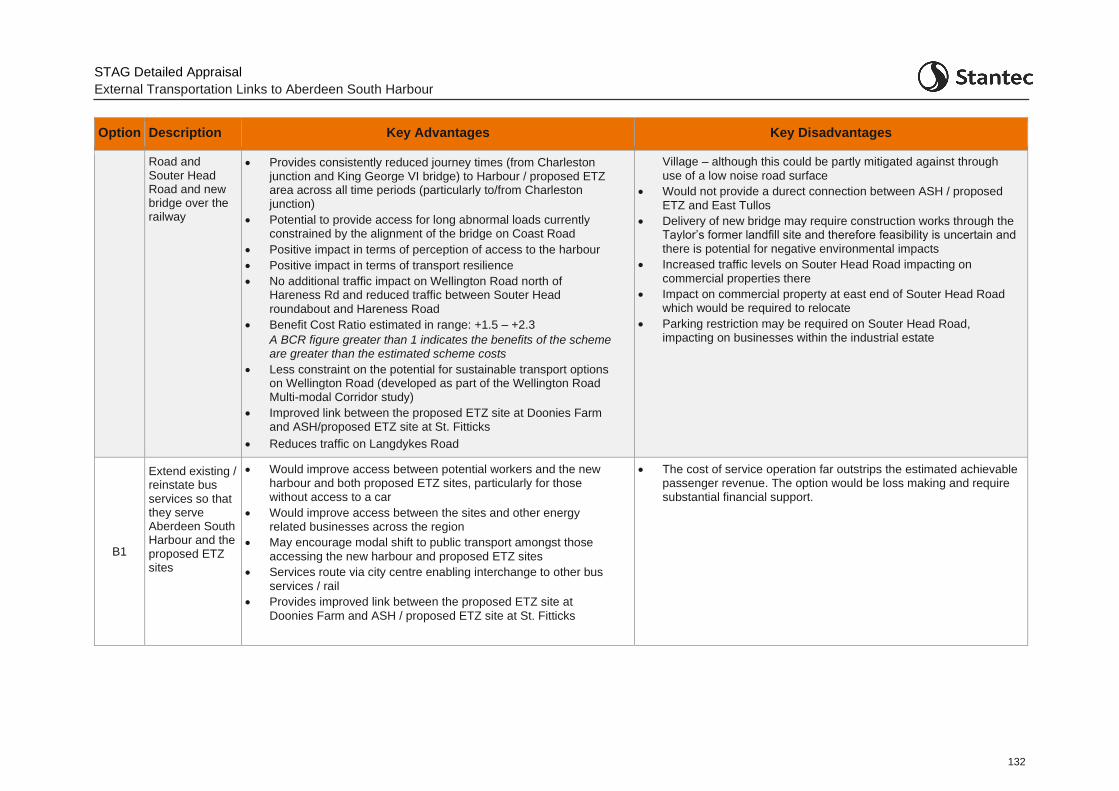
STAG Detailed Appraisal
External Transportation Links to Aberdeen South Harbour
132
Option Description Key Advantages Key Disadvantages
Road and Souter Head Road and new bridge over the railway
• Provides consistently reduced journey times (from Charleston junction and King George VI bridge) to Harbour / proposed ETZ area across all time periods (particularly to/from Charleston junction)
• Potential to provide access for long abnormal loads currently constrained by the alignment of the bridge on Coast Road
• Positive impact in terms of perception of access to the harbour
• Positive impact in terms of transport resilience
• No additional traffic impact on Wellington Road north of Hareness Rd and reduced traffic between Souter Head
roundabout and Hareness Road
• Benefit Cost Ratio estimated in range: +1.5 – +2.3
A BCR figure greater than 1 indicates the benefits of the scheme are greater than the estimated scheme costs
• Less constraint on the potential for sustainable transport options on Wellington Road (developed as part of the Wellington Road Multi-modal Corridor study)
• Improved link between the proposed ETZ site at Doonies Farm and ASH/proposed ETZ site at St. Fitticks
• Reduces traffic on Langdykes Road
Village – although this could be partly mitigated against through
use of a low noise road surface
• Would not provide a durect connection between ASH / proposed
ETZ and East Tullos
• Delivery of new bridge may require construction works through the Taylor’s former landfill site and therefore feasibility is uncertain and
there is potential for negative environmental impacts
• Increased traffic levels on Souter Head Road impacting on
commercial properties there
• Impact on commercial property at east end of Souter Head Road which would be required to relocate
• Parking restriction may be required on Souter Head Road, impacting on businesses within the industrial estate
B1
Extend existing / reinstate bus services so that they serve Aberdeen South Harbour and the proposed ETZ sites
• Would improve access between potential workers and the new harbour and both proposed ETZ sites, particularly for those without access to a car
• Would improve access between the sites and other energy related businesses across the region
• May encourage modal shift to public transport amongst those
accessing the new harbour and proposed ETZ sites
• Services route via city centre enabling interchange to other bus
services / rail
• Provides improved link between the proposed ETZ site at
Doonies Farm and ASH / proposed ETZ site at St. Fitticks
• The cost of service operation far outstrips the estimated achievable passenger revenue. The option would be loss making and require substantial financial support.
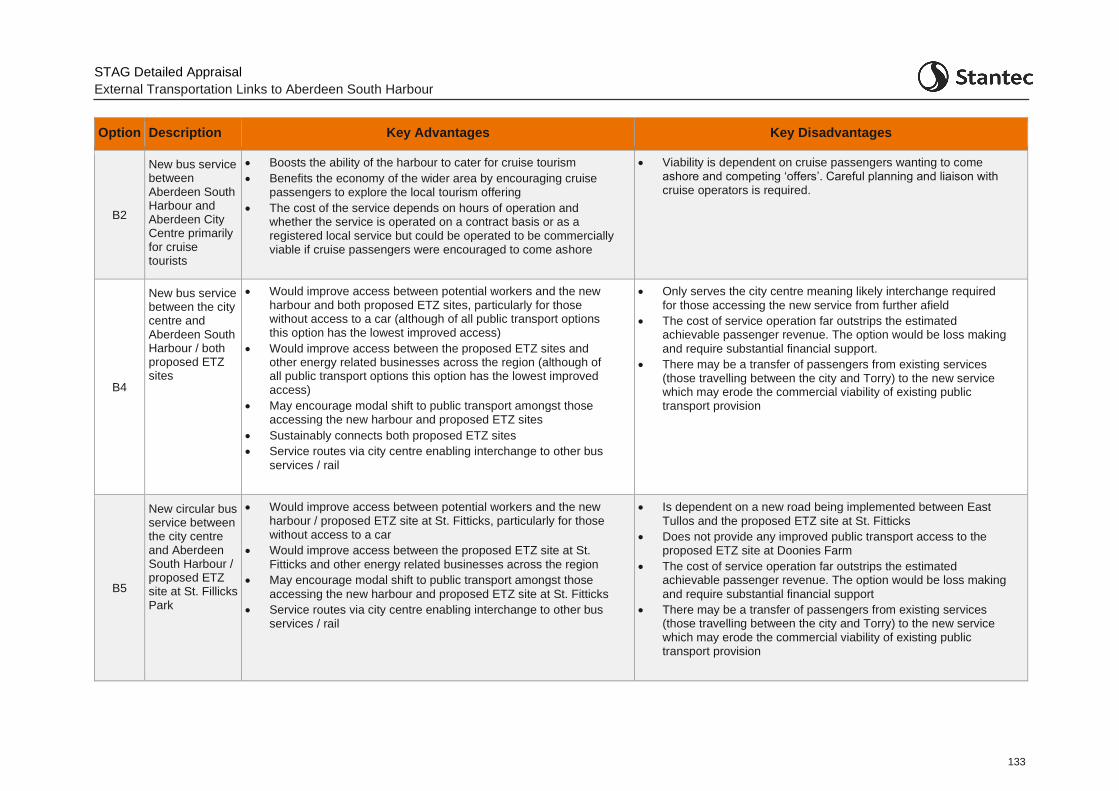
STAG Detailed Appraisal
External Transportation Links to Aberdeen South Harbour
133
Option Description Key Advantages Key Disadvantages
B2
New bus service between Aberdeen South Harbour and Aberdeen City Centre primarily for cruise tourists
• Boosts the ability of the harbour to cater for cruise tourism
• Benefits the economy of the wider area by encouraging cruise passengers to explore the local tourism offering
• The cost of the service depends on hours of operation and whether the service is operated on a contract basis or as a registered local service but could be operated to be commercially viable if cruise passengers were encouraged to come ashore
• Viability is dependent on cruise passengers wanting to come ashore and competing ‘offers’. Careful planning and liaison with cruise operators is required.
B4
New bus service between the city centre and Aberdeen South Harbour / both proposed ETZ sites
• Would improve access between potential workers and the new harbour and both proposed ETZ sites, particularly for those without access to a car (although of all public transport options this option has the lowest improved access)
• Would improve access between the proposed ETZ sites and other energy related businesses across the region (although of all public transport options this option has the lowest improved access)
• May encourage modal shift to public transport amongst those accessing the new harbour and proposed ETZ sites
• Sustainably connects both proposed ETZ sites
• Service routes via city centre enabling interchange to other bus
services / rail
• Only serves the city centre meaning likely interchange required
for those accessing the new service from further afield
• The cost of service operation far outstrips the estimated achievable passenger revenue. The option would be loss making
and require substantial financial support.
• There may be a transfer of passengers from existing services (those travelling between the city and Torry) to the new service which may erode the commercial viability of existing public transport provision
B5
New circular bus service between the city centre and Aberdeen South Harbour / proposed ETZ site at St. Fillicks Park
• Would improve access between potential workers and the new harbour / proposed ETZ site at St. Fitticks, particularly for those without access to a car
• Would improve access between the proposed ETZ site at St.
Fitticks and other energy related businesses across the region
• May encourage modal shift to public transport amongst those
accessing the new harbour and proposed ETZ site at St. Fitticks
• Service routes via city centre enabling interchange to other bus services / rail
• Is dependent on a new road being implemented between East
Tullos and the proposed ETZ site at St. Fitticks
• Does not provide any improved public transport access to the proposed ETZ site at Doonies Farm
• The cost of service operation far outstrips the estimated achievable passenger revenue. The option would be loss making
and require substantial financial support
• There may be a transfer of passengers from existing services (those travelling between the city and Torry) to the new service which may erode the commercial viability of existing public transport provision
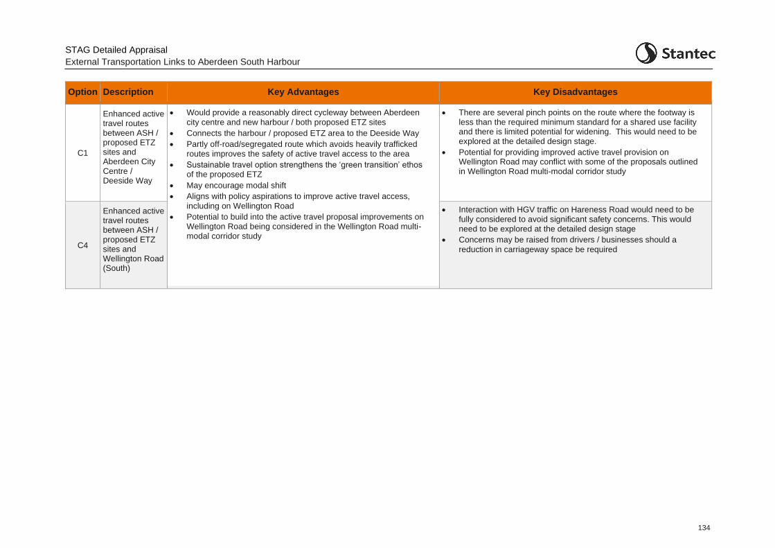
STAG Detailed Appraisal
External Transportation Links to Aberdeen South Harbour
134
Option Description Key Advantages Key Disadvantages
C1
Enhanced active travel routes between ASH / proposed ETZ sites and Aberdeen City Centre / Deeside Way
• Would provide a reasonably direct cycleway between Aberdeen
city centre and new harbour / both proposed ETZ sites
• Connects the harbour / proposed ETZ area to the Deeside Way
• Partly off-road/segregated route which avoids heavily trafficked routes improves the safety of active travel access to the area
• Sustainable travel option strengthens the ‘green transition’ ethos of the proposed ETZ
• May encourage modal shift
• Aligns with policy aspirations to improve active travel access,
including on Wellington Road
• Potential to build into the active travel proposal improvements on Wellington Road being considered in the Wellington Road multi-modal corridor study
• There are several pinch points on the route where the footway is less than the required minimum standard for a shared use facility and there is limited potential for widening. This would need to be explored at the detailed design stage.
• Potential for providing improved active travel provision on Wellington Road may conflict with some of the proposals outlined in Wellington Road multi-modal corridor study
C4
Enhanced active travel routes between ASH / proposed ETZ sites and Wellington Road (South)
• Interaction with HGV traffic on Hareness Road would need to be fully considered to avoid significant safety concerns. This would need to be explored at the detailed design stage
• Concerns may be raised from drivers / businesses should a
reduction in carriageway space be required

STAG Detailed Options Appraisal
External Transportation Links to Aberdeen South Harbour
135
Appendix A Final Road Options for Detailed Options Appraisal
A.1.1 This appendix contains more detailed engineering drawings relating to the final road options for appraisal.
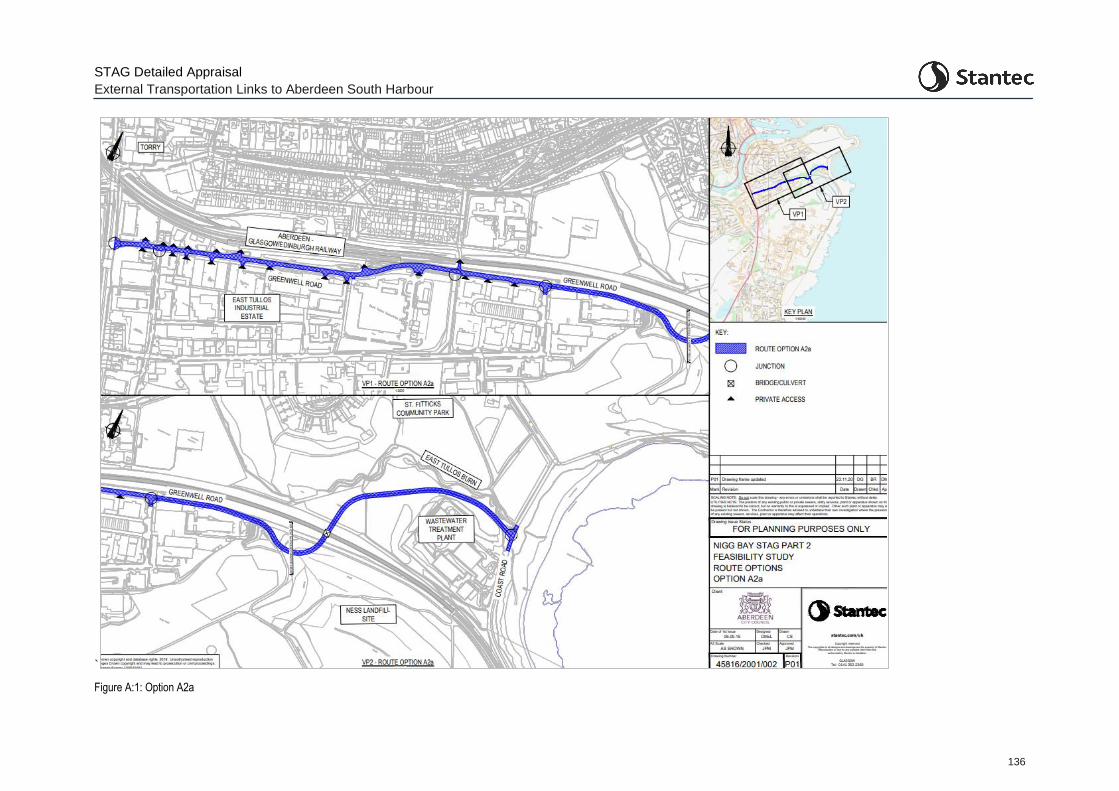
STAG Detailed Appraisal
External Transportation Links to Aberdeen South Harbour
136
`
Figure A:1: Option A2a
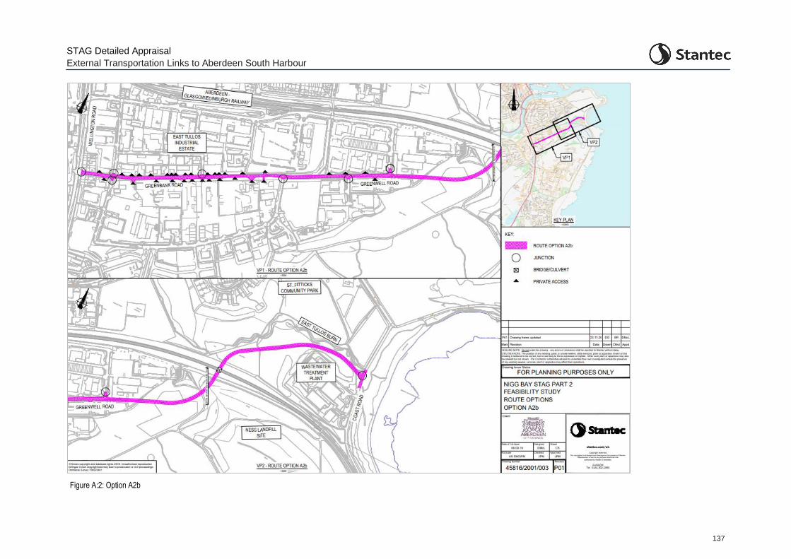
STAG Detailed Appraisal
External Transportation Links to Aberdeen South Harbour
137
Figure A:2: Option A2b
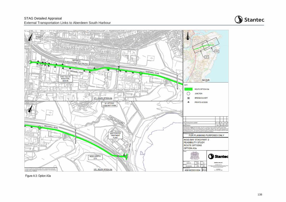
STAG Detailed Appraisal
External Transportation Links to Aberdeen South Harbour
138
Figure A:3: Option A3a
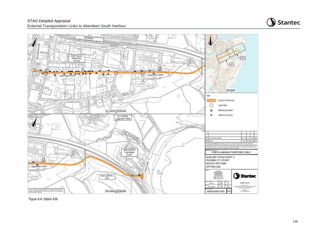
STAG Detailed Appraisal
External Transportation Links to Aberdeen South Harbour
139
Figure A:4: Option A3b
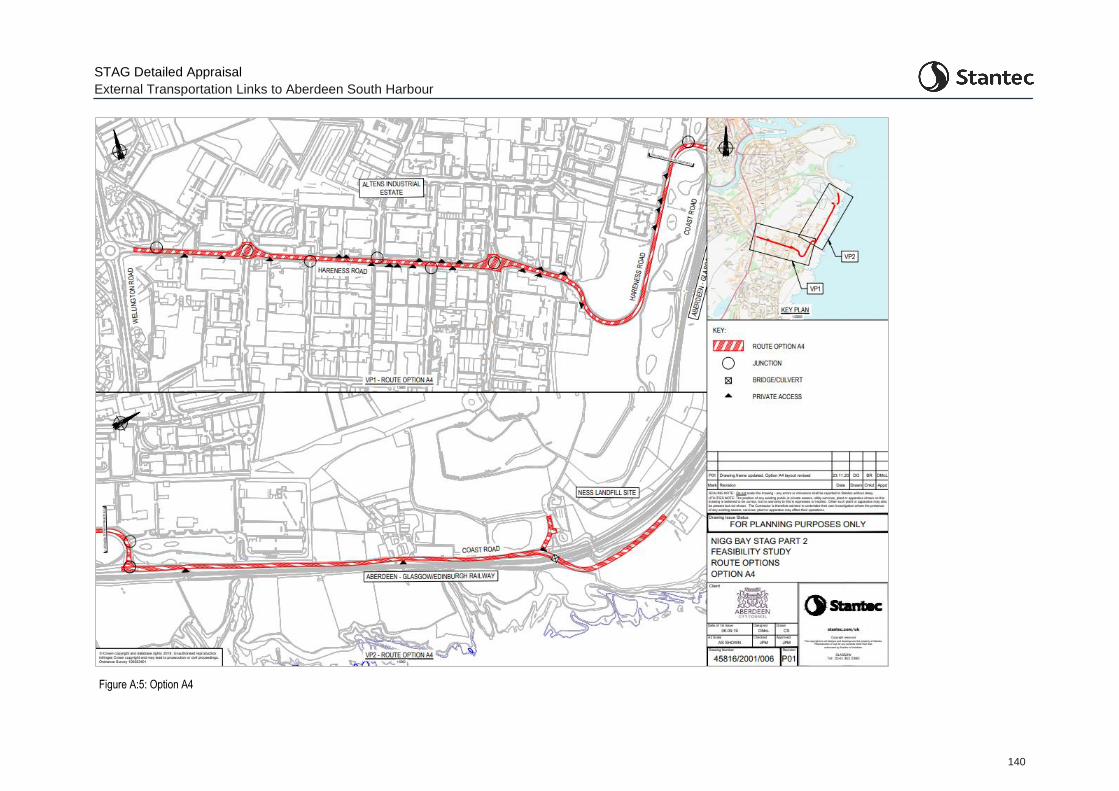
STAG Detailed Appraisal
External Transportation Links to Aberdeen South Harbour
140
Figure A:5: Option A4
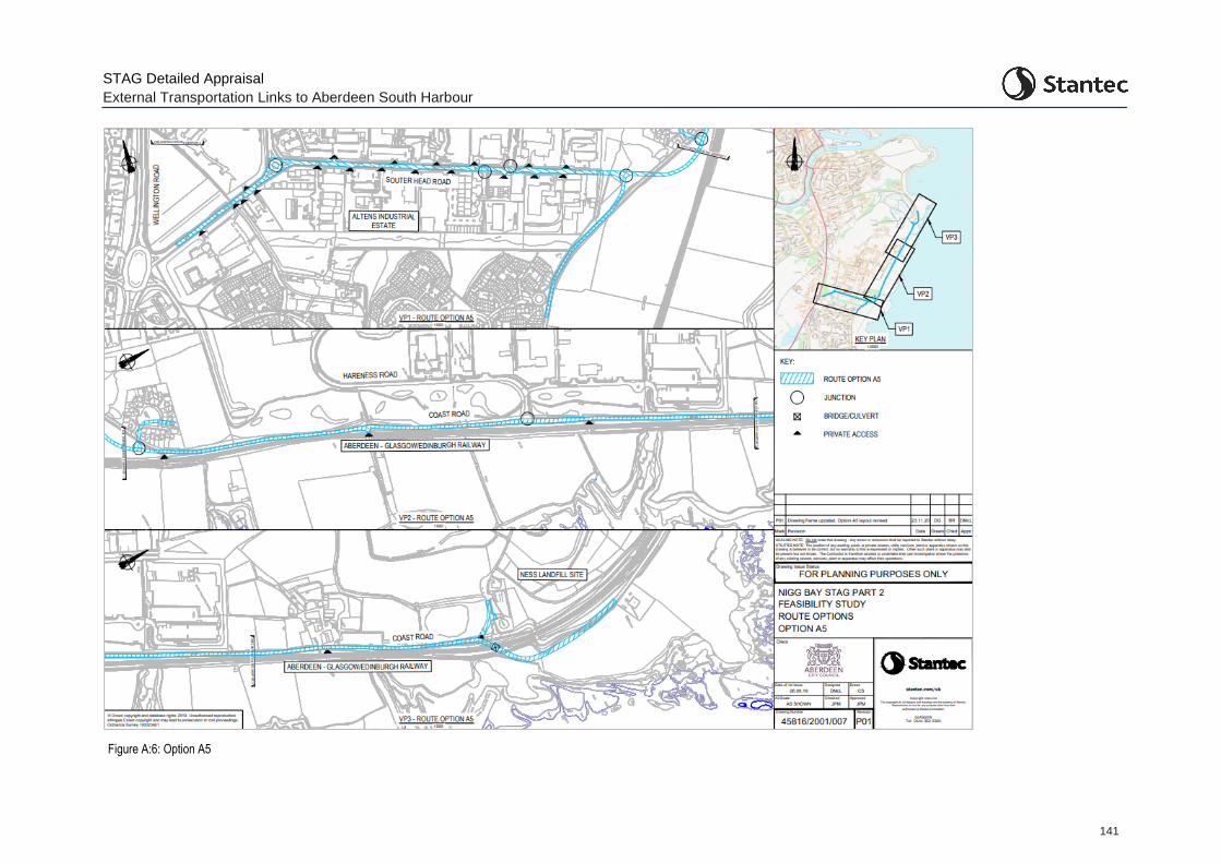
STAG Detailed Appraisal
External Transportation Links to Aberdeen South Harbour
141
Figure A:6: Option A5
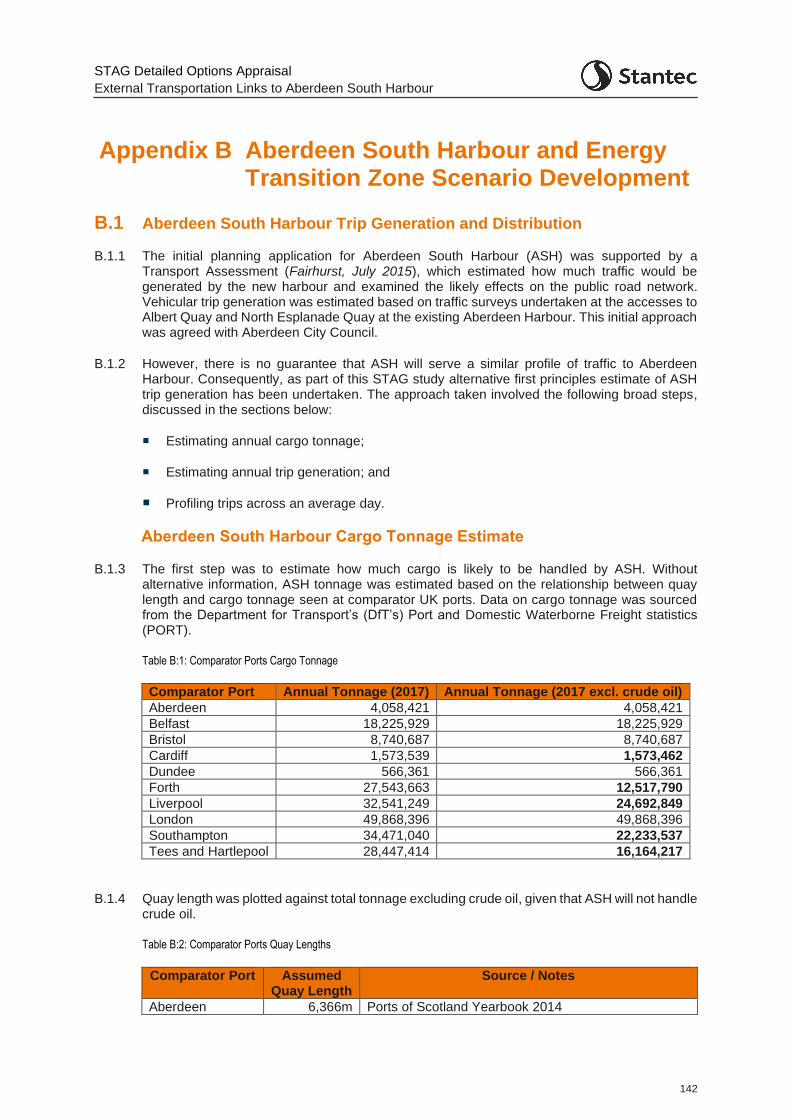
STAG Detailed Options Appraisal
External Transportation Links to Aberdeen South Harbour
142
Appendix B Aberdeen South Harbour and Energy Transition Zone Scenario Development
B.1 Aberdeen South Harbour Trip Generation and Distribution
B.1.1 The initial planning application for Aberdeen South Harbour (ASH) was supported by a Transport Assessment (Fairhurst, July 2015), which estimated how much traffic would be generated by the new harbour and examined the likely effects on the public road network. Vehicular trip generation was estimated based on traffic surveys undertaken at the accesses to Albert Quay and North Esplanade Quay at the existing Aberdeen Harbour. This initial approach was agreed with Aberdeen City Council.
B.1.2 However, there is no guarantee that ASH will serve a similar profile of traffic to Aberdeen Harbour. Consequently, as part of this STAG study alternative first principles estimate of ASH trip generation has been undertaken. The approach taken involved the following broad steps, discussed in the sections below:
Estimating annual cargo tonnage;
Estimating annual trip generation; and
Profiling trips across an average day.
Aberdeen South Harbour Cargo Tonnage Estimate
B.1.3 The first step was to estimate how much cargo is likely to be handled by ASH. Without alternative information, ASH tonnage was estimated based on the relationship between quay length and cargo tonnage seen at comparator UK ports. Data on cargo tonnage was sourced from the Department for Transport’s (DfT’s) Port and Domestic Waterborne Freight statistics (PORT).
Table B:1: Comparator Ports Cargo Tonnage
Comparator Port Annual Tonnage (2017) Annual Tonnage (2017 excl. crude oil)
Aberdeen 4,058,421 4,058,421
Belfast 18,225,929 18,225,929
Bristol 8,740,687 8,740,687
Cardiff 1,573,539 1,573,462
Dundee 566,361 566,361
Forth 27,543,663 12,517,790
Liverpool 32,541,249 24,692,849
London 49,868,396 49,868,396
Southampton 34,471,040 22,233,537
Tees and Hartlepool 28,447,414 16,164,217
B.1.4 Quay length was plotted against total tonnage excluding crude oil, given that ASH will not handle crude oil.
Table B:2: Comparator Ports Quay Lengths
Comparator Port Assumed Quay Length
Source / Notes
Aberdeen 6,366m Ports of Scotland Yearbook 2014
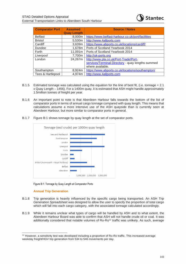
STAG Detailed Options Appraisal
External Transportation Links to Aberdeen South Harbour
143
Comparator Port Assumed Quay Length
Source / Notes
Belfast 8,000m https://www.belfast-harbour.co.uk/port/facilities
Bristol 5,530m http://www.4allports.com
Cardiff 3,639m https://www.abports.co.uk/locations/cardiff/
Dundee 1,678m Ports of Scotland Yearbook 2014
Forth 11,091m Ports of Scotland Yearbook 2014
Liverpool 7,700m http://uk-ports.org
London 24,267m http://www.pla.co.uk/Port-Trade/Port-services/Terminal-Directory - quay lengths summed where available.
Southampton 8,924m https://www.abports.co.uk/locations/southampton/
Tees & Hartlepool 4,974m http://www.4allports.com
B.1.5 Estimated tonnage was calculated using the equation for the line of best fit, (i.e. tonnage = 2.1 x Quay Length – 1456). For a 1400m quay, it is estimated that ASH might handle approximately 1.5million tonnes of freight per year.
B.1.6 An important point to note is that Aberdeen Harbour falls towards the bottom of the list of comparator ports in terms of annual cargo tonnage compared with quay length. This means that calculations assume a more intensive use of the ASH quayside than is currently seen at Aberdeen Harbour, but more similar to comparator ports in general.
B.1.7 Figure B:1 shows tonnage by quay length at the set of comparator ports.
Figure B:1: Tonnage by Quay Length at Comparator Ports
Annual Trip Generation
B.1.8 Trip generation is heavily influenced by the specific cargo being transported. An ASH Trip Generation Spreadsheet was designed to allow the user to specify the proportion of total cargo which will fall into each cargo category, with the associated tonnage calculated accordingly.
B.1.9 While it remains unclear what types of cargo will be handled by ASH and to what extent, the Aberdeen Harbour Board was able to confirm that ASH will not handle crude oil or coal. It was additionally considered that notable volumes of Ro-Ro12 traffic was unlikely. As such, average
12 However, a sensitivity test was developed including a proportion of Ro-Ro traffic. This increased average weekday freight/HGV trip generation from 534 to 546 movements per day.
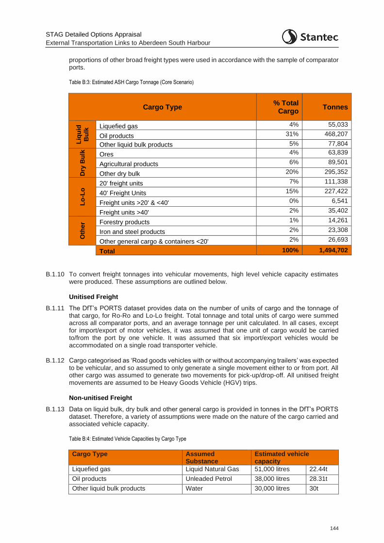
STAG Detailed Options Appraisal
External Transportation Links to Aberdeen South Harbour
144
proportions of other broad freight types were used in accordance with the sample of comparator ports.
Table B:3: Estimated ASH Cargo Tonnage (Core Scenario)
Cargo Type % Total
Cargo Tonnes
Liq
uid
Bu
lk Liquefied gas 4% 55,033
Oil products 31% 468,207
Other liquid bulk products 5% 77,804
Dry
Bu
lk
Ores 4% 63,839
Agricultural products 6% 89,501
Other dry bulk 20% 295,352
Lo
-Lo
20' freight units 7% 111,338
40' Freight Units 15% 227,422
Freight units >20' & <40' 0% 6,541
Freight units >40' 2% 35,402
Oth
er Forestry products 1% 14,261
Iron and steel products 2% 23,308
Other general cargo & containers <20' 2% 26,693
Total 100% 1,494,702
B.1.10 To convert freight tonnages into vehicular movements, high level vehicle capacity estimates were produced. These assumptions are outlined below.
Unitised Freight
B.1.11 The DfT’s PORTS dataset provides data on the number of units of cargo and the tonnage of that cargo, for Ro-Ro and Lo-Lo freight. Total tonnage and total units of cargo were summed across all comparator ports, and an average tonnage per unit calculated. In all cases, except for import/export of motor vehicles, it was assumed that one unit of cargo would be carried to/from the port by one vehicle. It was assumed that six import/export vehicles would be accommodated on a single road transporter vehicle.
B.1.12 Cargo categorised as ‘Road goods vehicles with or without accompanying trailers’ was expected to be vehicular, and so assumed to only generate a single movement either to or from port. All other cargo was assumed to generate two movements for pick-up/drop-off. All unitised freight movements are assumed to be Heavy Goods Vehicle (HGV) trips.
Non-unitised Freight
B.1.13 Data on liquid bulk, dry bulk and other general cargo is provided in tonnes in the DfT’s PORTS dataset. Therefore, a variety of assumptions were made on the nature of the cargo carried and associated vehicle capacity.
Table B:4: Estimated Vehicle Capacities by Cargo Type
Cargo Type Assumed Substance
Estimated vehicle capacity
Liquefied gas Liquid Natural Gas 51,000 litres 22.44t
Oil products Unleaded Petrol 38,000 litres 28.31t
Other liquid bulk products Water 30,000 litres 30t
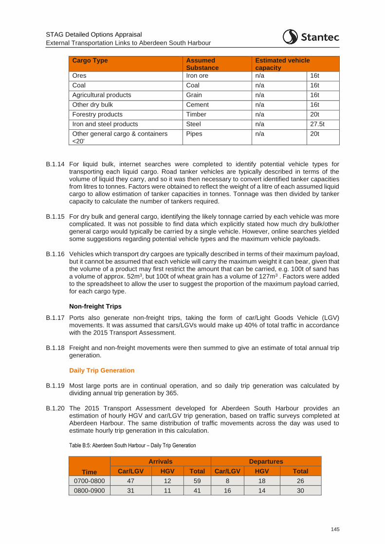
STAG Detailed Options Appraisal
External Transportation Links to Aberdeen South Harbour
145
Cargo Type Assumed Substance
Estimated vehicle capacity
Ores Iron ore n/a 16t
Coal Coal n/a 16t
Agricultural products Grain n/a 16t
Other dry bulk Cement n/a 16t
Forestry products Timber n/a 20t
Iron and steel products Steel n/a 27.5t
Other general cargo & containers <20'
Pipes n/a 20t
B.1.14 For liquid bulk, internet searches were completed to identify potential vehicle types for transporting each liquid cargo. Road tanker vehicles are typically described in terms of the volume of liquid they carry, and so it was then necessary to convert identified tanker capacities from litres to tonnes. Factors were obtained to reflect the weight of a litre of each assumed liquid cargo to allow estimation of tanker capacities in tonnes. Tonnage was then divided by tanker capacity to calculate the number of tankers required.
B.1.15 For dry bulk and general cargo, identifying the likely tonnage carried by each vehicle was more complicated. It was not possible to find data which explicitly stated how much dry bulk/other general cargo would typically be carried by a single vehicle. However, online searches yielded some suggestions regarding potential vehicle types and the maximum vehicle payloads.
B.1.16 Vehicles which transport dry cargoes are typically described in terms of their maximum payload, but it cannot be assumed that each vehicle will carry the maximum weight it can bear, given that the volume of a product may first restrict the amount that can be carried, e.g. 100t of sand has a volume of approx. 52m3, but 100t of wheat grain has a volume of 127m3 . Factors were added to the spreadsheet to allow the user to suggest the proportion of the maximum payload carried, for each cargo type.
Non-freight Trips
B.1.17 Ports also generate non-freight trips, taking the form of car/Light Goods Vehicle (LGV) movements. It was assumed that cars/LGVs would make up 40% of total traffic in accordance with the 2015 Transport Assessment.
B.1.18 Freight and non-freight movements were then summed to give an estimate of total annual trip generation.
Daily Trip Generation
B.1.19 Most large ports are in continual operation, and so daily trip generation was calculated by dividing annual trip generation by 365.
B.1.20 The 2015 Transport Assessment developed for Aberdeen South Harbour provides an estimation of hourly HGV and car/LGV trip generation, based on traffic surveys completed at Aberdeen Harbour. The same distribution of traffic movements across the day was used to estimate hourly trip generation in this calculation.
Table B:5: Aberdeen South Harbour – Daily Trip Generation
Time
Arrivals Departures
Car/LGV HGV Total Car/LGV HGV Total
0700-0800 47 12 59 8 18 26
0800-0900 31 11 41 16 14 30
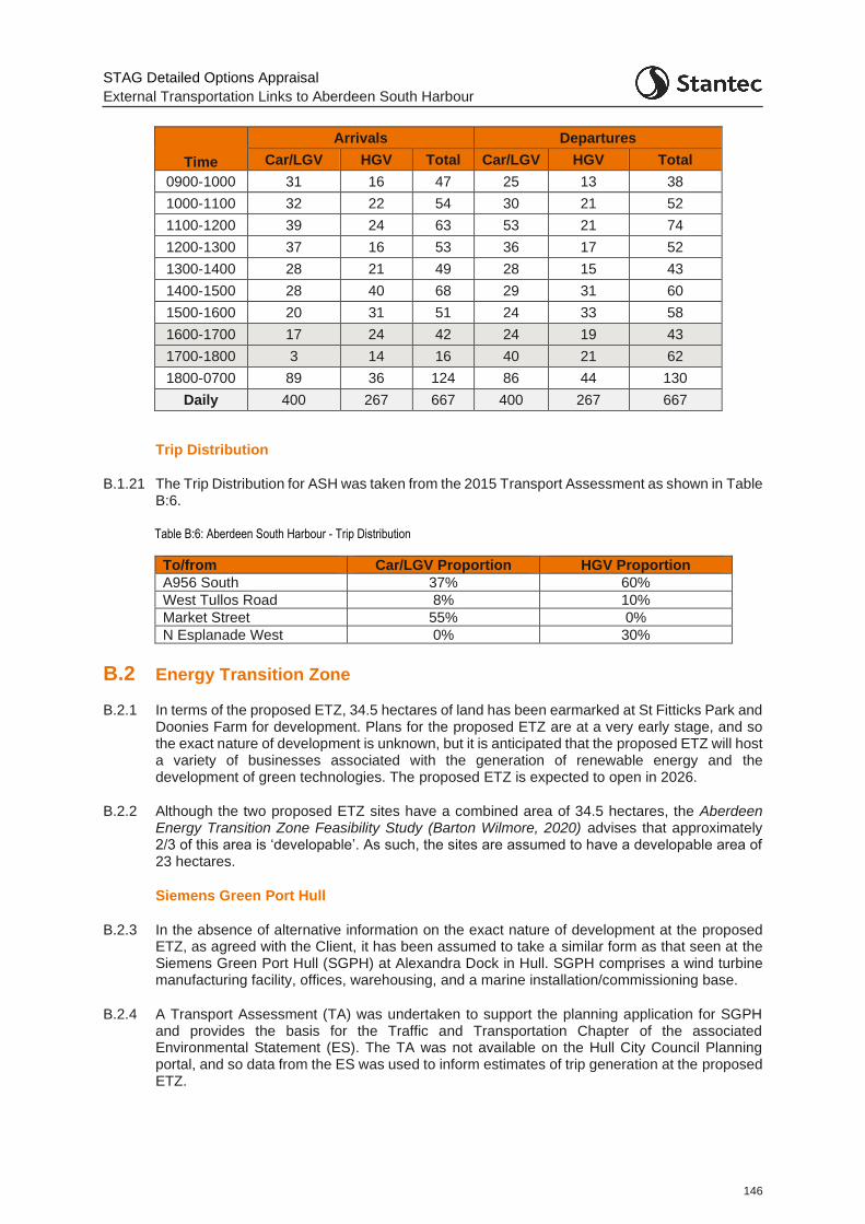
STAG Detailed Options Appraisal
External Transportation Links to Aberdeen South Harbour
146
Time
Arrivals Departures
Car/LGV HGV Total Car/LGV HGV Total
0900-1000 31 16 47 25 13 38
1000-1100 32 22 54 30 21 52
1100-1200 39 24 63 53 21 74
1200-1300 37 16 53 36 17 52
1300-1400 28 21 49 28 15 43
1400-1500 28 40 68 29 31 60
1500-1600 20 31 51 24 33 58
1600-1700 17 24 42 24 19 43
1700-1800 3 14 16 40 21 62
1800-0700 89 36 124 86 44 130
Daily 400 267 667 400 267 667
Trip Distribution
B.1.21 The Trip Distribution for ASH was taken from the 2015 Transport Assessment as shown in Table B:6.
Table B:6: Aberdeen South Harbour - Trip Distribution
To/from Car/LGV Proportion HGV Proportion
A956 South 37% 60%
West Tullos Road 8% 10%
Market Street 55% 0%
N Esplanade West 0% 30%
B.2 Energy Transition Zone
B.2.1 In terms of the proposed ETZ, 34.5 hectares of land has been earmarked at St Fitticks Park and Doonies Farm for development. Plans for the proposed ETZ are at a very early stage, and so the exact nature of development is unknown, but it is anticipated that the proposed ETZ will host a variety of businesses associated with the generation of renewable energy and the development of green technologies. The proposed ETZ is expected to open in 2026.
B.2.2 Although the two proposed ETZ sites have a combined area of 34.5 hectares, the Aberdeen Energy Transition Zone Feasibility Study (Barton Wilmore, 2020) advises that approximately 2/3 of this area is ‘developable’. As such, the sites are assumed to have a developable area of 23 hectares.
Siemens Green Port Hull
B.2.3 In the absence of alternative information on the exact nature of development at the proposed ETZ, as agreed with the Client, it has been assumed to take a similar form as that seen at the Siemens Green Port Hull (SGPH) at Alexandra Dock in Hull. SGPH comprises a wind turbine manufacturing facility, offices, warehousing, and a marine installation/commissioning base.
B.2.4 A Transport Assessment (TA) was undertaken to support the planning application for SGPH and provides the basis for the Traffic and Transportation Chapter of the associated Environmental Statement (ES). The TA was not available on the Hull City Council Planning portal, and so data from the ES was used to inform estimates of trip generation at the proposed ETZ.
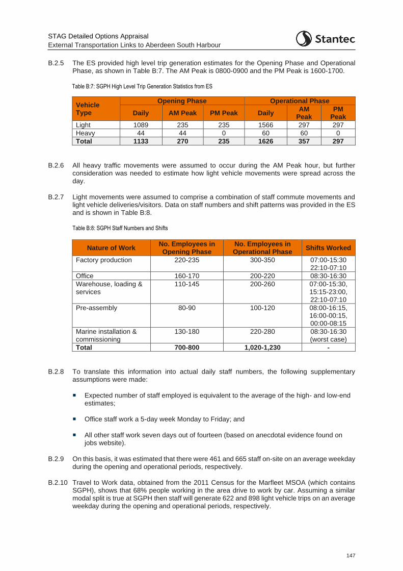
STAG Detailed Options Appraisal
External Transportation Links to Aberdeen South Harbour
147
B.2.5 The ES provided high level trip generation estimates for the Opening Phase and Operational Phase, as shown in Table B:7. The AM Peak is 0800-0900 and the PM Peak is 1600-1700.
Table B:7: SGPH High Level Trip Generation Statistics from ES
Vehicle Type
Opening Phase Operational Phase
Daily AM Peak PM Peak Daily AM
Peak PM
Peak
Light 1089 235 235 1566 297 297
Heavy 44 44 0 60 60 0
Total 1133 270 235 1626 357 297
B.2.6 All heavy traffic movements were assumed to occur during the AM Peak hour, but further consideration was needed to estimate how light vehicle movements were spread across the day.
B.2.7 Light movements were assumed to comprise a combination of staff commute movements and light vehicle deliveries/visitors. Data on staff numbers and shift patterns was provided in the ES and is shown in Table B:8.
Table B:8: SGPH Staff Numbers and Shifts
Nature of Work No. Employees in Opening Phase
No. Employees in Operational Phase
Shifts Worked
Factory production 220-235 300-350 07:00-15:30 22:10-07:10
Office 160-170 200-220 08:30-16:30
Warehouse, loading & services
110-145 200-260 07:00-15:30, 15:15-23:00, 22:10-07:10
Pre-assembly 80-90 100-120 08:00-16:15, 16:00-00:15, 00:00-08:15
Marine installation & commissioning
130-180 220-280 08:30-16:30 (worst case)
Total 700-800 1,020-1,230 -
B.2.8 To translate this information into actual daily staff numbers, the following supplementary assumptions were made:
Expected number of staff employed is equivalent to the average of the high- and low-end estimates;
Office staff work a 5-day week Monday to Friday; and
All other staff work seven days out of fourteen (based on anecdotal evidence found on jobs website).
B.2.9 On this basis, it was estimated that there were 461 and 665 staff on-site on an average weekday during the opening and operational periods, respectively.
B.2.10 Travel to Work data, obtained from the 2011 Census for the Marfleet MSOA (which contains SGPH), shows that 68% people working in the area drive to work by car. Assuming a similar modal split is true at SGPH then staff will generate 622 and 898 light vehicle trips on an average weekday during the opening and operational periods, respectively.
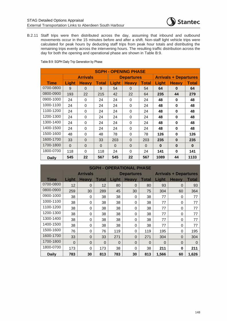
STAG Detailed Options Appraisal
External Transportation Links to Aberdeen South Harbour
148
B.2.11 Staff trips were then distributed across the day, assuming that inbound and outbound movements occur in the 15 minutes before and after a shift. Non-staff light vehicle trips were calculated for peak hours by deducting staff trips from peak hour totals and distributing the remaining trips evenly across the intervening hours. The resulting traffic distribution across the day for both the opening and operational phase are shown in Table B:9.
Table B:9: SGPH Daily Trip Generation by Phase
SGPH - OPENING PHASE
Time
Arrivals Departures Arrivals + Departures
Light Heavy Total Light Heavy Total Light Heavy Total 0700-0800 9 0 9 54 0 54 64 0 64
0800-0900 193 22 215 42 22 64 235 44 279
0900-1000 24 0 24 24 0 24 48 0 48
1000-1100 24 0 24 24 0 24 48 0 48
1100-1200 24 0 24 24 0 24 48 0 48
1200-1300 24 0 24 24 0 24 48 0 48
1300-1400 24 0 24 24 0 24 48 0 48
1400-1500 24 0 24 24 0 24 48 0 48
1500-1600 48 0 48 78 0 78 126 0 126
1600-1700 33 0 33 203 0 203 235 0 235
1700-1800 0 0 0 0 0 0 0 0 0
1800-0700 118 0 118 24 0 24 141 0 141
Daily 545 22 567 545 22 567 1089 44 1133
SGPH - OPERATIONAL PHASE
Time
Arrivals Departures Arrivals + Departures
Light Heavy Total Light Heavy Total Light Heavy Total 0700-0800 12 0 12 80 0 80 93 0 93
0800-0900 259 30 289 45 30 75 304 60 364
0900-1000 38 0 38 38 0 38 77 0 77
1000-1100 38 0 38 38 0 38 77 0 77
1100-1200 38 0 38 38 0 38 77 0 77
1200-1300 38 0 38 38 0 38 77 0 77
1300-1400 38 0 38 38 0 38 77 0 77
1400-1500 38 0 38 38 0 38 77 0 77
1500-1600 76 0 76 119 0 119 195 0 195
1600-1700 33 0 33 271 0 271 304 0 304
1700-1800 0 0 0 0 0 0 0 0 0
1800-0700 173 0 173 38 0 38 211 0 211
Daily 783 30 813 783 30 813 1,566 60 1,626
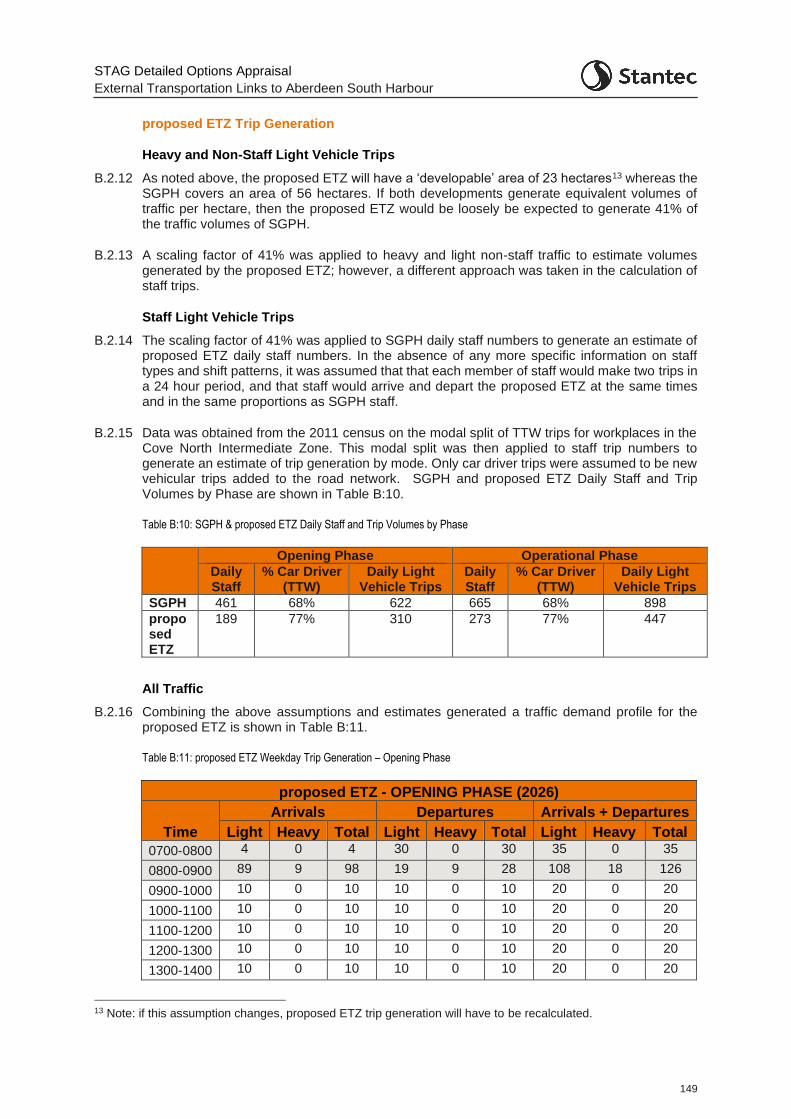
STAG Detailed Options Appraisal
External Transportation Links to Aberdeen South Harbour
149
proposed ETZ Trip Generation
Heavy and Non-Staff Light Vehicle Trips
B.2.12 As noted above, the proposed ETZ will have a ‘developable’ area of 23 hectares13 whereas the SGPH covers an area of 56 hectares. If both developments generate equivalent volumes of traffic per hectare, then the proposed ETZ would be loosely be expected to generate 41% of the traffic volumes of SGPH.
B.2.13 A scaling factor of 41% was applied to heavy and light non-staff traffic to estimate volumes generated by the proposed ETZ; however, a different approach was taken in the calculation of staff trips.
Staff Light Vehicle Trips
B.2.14 The scaling factor of 41% was applied to SGPH daily staff numbers to generate an estimate of proposed ETZ daily staff numbers. In the absence of any more specific information on staff types and shift patterns, it was assumed that that each member of staff would make two trips in a 24 hour period, and that staff would arrive and depart the proposed ETZ at the same times and in the same proportions as SGPH staff.
B.2.15 Data was obtained from the 2011 census on the modal split of TTW trips for workplaces in the Cove North Intermediate Zone. This modal split was then applied to staff trip numbers to generate an estimate of trip generation by mode. Only car driver trips were assumed to be new vehicular trips added to the road network. SGPH and proposed ETZ Daily Staff and Trip Volumes by Phase are shown in Table B:10.
Table B:10: SGPH & proposed ETZ Daily Staff and Trip Volumes by Phase
Opening Phase Operational Phase
Daily Staff
% Car Driver (TTW)
Daily Light Vehicle Trips
Daily Staff
% Car Driver (TTW)
Daily Light Vehicle Trips
SGPH 461 68% 622 665 68% 898
proposed ETZ
189 77% 310 273 77% 447
All Traffic
B.2.16 Combining the above assumptions and estimates generated a traffic demand profile for the proposed ETZ is shown in Table B:11.
Table B:11: proposed ETZ Weekday Trip Generation – Opening Phase
proposed ETZ - OPENING PHASE (2026)
Time
Arrivals Departures Arrivals + Departures
Light Heavy Total Light Heavy Total Light Heavy Total
0700-0800 4 0 4 30 0 30 35 0 35
0800-0900 89 9 98 19 9 28 108 18 126
0900-1000 10 0 10 10 0 10 20 0 20
1000-1100 10 0 10 10 0 10 20 0 20
1100-1200 10 0 10 10 0 10 20 0 20
1200-1300 10 0 10 10 0 10 20 0 20
1300-1400 10 0 10 10 0 10 20 0 20
13 Note: if this assumption changes, proposed ETZ trip generation will have to be recalculated.
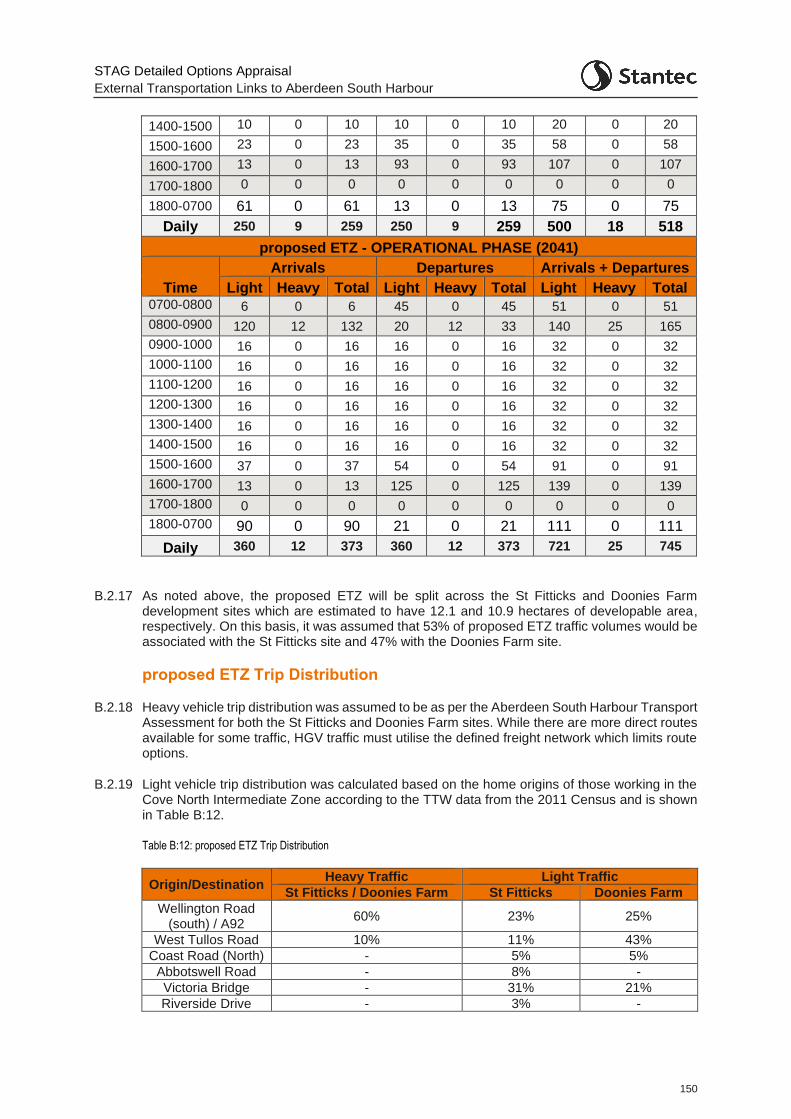
STAG Detailed Options Appraisal
External Transportation Links to Aberdeen South Harbour
150
1400-1500 10 0 10 10 0 10 20 0 20
1500-1600 23 0 23 35 0 35 58 0 58
1600-1700 13 0 13 93 0 93 107 0 107
1700-1800 0 0 0 0 0 0 0 0 0
1800-0700 61 0 61 13 0 13 75 0 75
Daily 250 9 259 250 9 259 500 18 518
proposed ETZ - OPERATIONAL PHASE (2041)
Time
Arrivals Departures Arrivals + Departures
Light Heavy Total Light Heavy Total Light Heavy Total 0700-0800 6 0 6 45 0 45 51 0 51
0800-0900 120 12 132 20 12 33 140 25 165
0900-1000 16 0 16 16 0 16 32 0 32
1000-1100 16 0 16 16 0 16 32 0 32
1100-1200 16 0 16 16 0 16 32 0 32
1200-1300 16 0 16 16 0 16 32 0 32
1300-1400 16 0 16 16 0 16 32 0 32
1400-1500 16 0 16 16 0 16 32 0 32
1500-1600 37 0 37 54 0 54 91 0 91
1600-1700 13 0 13 125 0 125 139 0 139
1700-1800 0 0 0 0 0 0 0 0 0
1800-0700 90 0 90 21 0 21 111 0 111
Daily 360 12 373 360 12 373 721 25 745
B.2.17 As noted above, the proposed ETZ will be split across the St Fitticks and Doonies Farm development sites which are estimated to have 12.1 and 10.9 hectares of developable area, respectively. On this basis, it was assumed that 53% of proposed ETZ traffic volumes would be associated with the St Fitticks site and 47% with the Doonies Farm site.
proposed ETZ Trip Distribution
B.2.18 Heavy vehicle trip distribution was assumed to be as per the Aberdeen South Harbour Transport Assessment for both the St Fitticks and Doonies Farm sites. While there are more direct routes available for some traffic, HGV traffic must utilise the defined freight network which limits route options.
B.2.19 Light vehicle trip distribution was calculated based on the home origins of those working in the Cove North Intermediate Zone according to the TTW data from the 2011 Census and is shown in Table B:12.
Table B:12: proposed ETZ Trip Distribution
Origin/Destination Heavy Traffic Light Traffic
St Fitticks / Doonies Farm St Fitticks Doonies Farm
Wellington Road (south) / A92
60% 23% 25%
West Tullos Road 10% 11% 43%
Coast Road (North) - 5% 5%
Abbotswell Road - 8% -
Victoria Bridge - 31% 21%
Riverside Drive - 3% -

STAG Detailed Options Appraisal
External Transportation Links to Aberdeen South Harbour
151
Origin/Destination Heavy Traffic Light Traffic
St Fitticks / Doonies Farm St Fitticks Doonies Farm
North Esplanade Way
30% - -
South College Street
- 12% -
Cove - 6% 6%
STAG Detailed Options Appraisal
External Transportation Links to Aberdeen South Harbour
152
Appendix C Traffic Modelling
C.1 Introduction
C.1.1 In order to enable an economic assessment of the road options, it was agreed with the client group that the Wellington Road microsimulation model (at the time being developed by AECOM and being used in the Wellington Road Multi-modal Corridor Study), would be utilised to provide estimates of journey time changes and road network traffic operation. In agreement with the client, AECOM extended the Wellington Road model such that it was suitable to be used for this purpose.
C.1.2 A traffic microsimulation model simulates the behaviour of individual vehicles within a predefined road network and is used to predict the likely impact of changes in traffic patterns resulting from changes to traffic flow or from changes to transport infrastructure.
C.1.3 It was agreed that Stantec would audit the model. Stantec would then, independent of AECOM, develop appropriate future year matrices in line with the opening year for the harbour, 2026, and a further future design year, 2041.
C.1.4 As well as providing information on the operational performance of the options, traffic demand and journey time data from the model for both 2026 and 2041 were used in the economic assessment of the schemes using TUBA.
C.1.5 The microsimulation traffic model was developed in Paramics Discovery software.
C.2 Base Model Audit
C.2.1 The Base model audit was completed in June 2020 with comments passed back to the Auditor. The required model changes were subsequently made by AECOM with the model achieving final auditor sign off in June 2020. Details of the model audit can be found in A956 Wellington Road Audit Report_Final, Stantec, June 2020.
C.2.2 The Base Model consists of an AM period (07:00 – 09:00) and a PM period (16:00 – 18:00).
C.3 Inter-Peak Model Development
C.3.1 As noted above, the Wellington Road model consists of AM and PM periods. However, to undertake a more robust economic assessment of the options for this study, a model covering a wider time period was beneficial. This would allow journey time benefits to traffic across the day to be more robustly attributed – rather than potentially deriving a free flow travel time benefit to be applied to a level of traffic demand attributable to just specific harbour and proposed ETZ traffic.
C.3.2 During the Base Model development, observed traffic data was collected covering a 07:00 – 19:00 period. Therefore, while this data was not utilised in the development of the Base Model, it was available for developing a rudimentary IP period for inclusion in the model.
C.3.3 The following steps were agreed with the client and undertaken to derive an IP period (09:00 – 16:00) for inclusion in the model:
Comparisons were undertaken of the observed traffic data on Wellington Road, Greenbank Road, Greenwell Road, Harness Road and Langdykes to compare IP traffic levels to AM and PM levels.
50% of both AM and PM zone to zone traffic demand was taken and combined and then factored to the IP levels to create an IP matrix which reflected the trip distribution patterns
STAG Detailed Options Appraisal
External Transportation Links to Aberdeen South Harbour
153
of both the AM and PM traffic. This was done at the model wide level and not the individual zone level. Essentially this was the type of exercise which might be undertaken to develop a prior matrix for use in the demand matrix estimation. However, no further matrix refinement or model estimation process or calibration / validation was undertaken. The matrix created was assigned to the model. While this does not provide a fully refined and validated IP period, it does provide a reasonably robust platform to allow for the estimation of benefits for zone to zone movements across the modelled area in the IP period.
In terms of the network, AM signal timings were taken from the model and assigned to the IP period, but no detailed consideration of the signal SCOOT timings for the IP period was undertaken. The exception to this is the Langdykes Road approach to Souter Head Roundabout. This arm operates with part time signals that only run during the AM peak. These timings have therefore not been extended to the interpeak.
Bus route assignment was taken from the AM period as per timetables and routes for regularly scheduled services. For non-regular services, timetable information was used to determine what times services run during the interpeak period and this has been coded in the model.
A combined vehicle type proportion split was derived from the AM and PM periods by matrix i.e. Car, and Lights for Matrix 1 and OGV1 and OGV2 for Matrix 2.
Similar traffic profiles to the AM period were assigned to IP traffic at the individual zone level.
C.3.4 On completion, once the IP periods was included, the Base Model covered the period from 07:00 – 18:00 for use in the economic assessment of the road options.
C.4 Do Minimum Model (2026 and 2041)
C.4.1 The Do Minimum model comprises both future assumptions around background traffic growth (including those relating to committed development in the area) and committed infrastructure.
C.4.2 Two future years are to be used for the purposes of undertaking the economic assessment of the proposed road options: 2026 and 2041.
Committed Infrastructure
C.4.3 Aberdeen City Council provided details of a committed infrastructure scheme to be included in the Do Minimum model – the linking up of Palmerston Road to North Esplanade West at the northern extent of the model. This new infrastructure enables vehicles travelling between North Esplanade Westand South College Street to route via Palmerston Place instead of the roundabout of North Esplanade West/ South College Street / Wellington Road / Riverside Drive. As Palmerston Place is just outside the model extent, as agreed with the Client, for modelling purposes the trips between the two route zones have simply been removed from all matrices in the Do Minimum model. This provides an improvement to the roundabout as there is a reduction in the number of right turn movements from North Esplanade Way. This reduces queueing on North Esplanade Westand Wellington Road due to the reduction in opposing vehicle movements.
C.4.4 This has been included in both the 2026 and 2041 Do Minimum models.
C.4.5 In addition, on harbour opening, if no intervention were implemented, Hareness Road will become the designated route to the new harbour. Given this, in the modelled network, to reflect on-street signage and route designation, Langdykes Road, Blackness Road and Crawpeel Road (within Altens industrial estate) have HGV restrictions in place for harbour (and proposed ETZ) traffic. This means all HGV traffic to the new harbour / proposed ETZ area will be constrained to use Hareness Road. This constraint remains in the option models.
STAG Detailed Options Appraisal
External Transportation Links to Aberdeen South Harbour
154
Traffic Growth
C.4.6 In terms of future year traffic growth, as an initial test to observe the future year networks, initial assumptions were made on annual traffic growth up to 2041. The estimates were derived from TEMPRO for 2019-26 (opening year) and 2019-41 (appraisal year) for all time periods, all purposes and car driver mode. These growth factors were developed as both an Aberdeen wide factor to apply to model ‘through’ trips and a more localised factor (for Nigg, Altens, Tullos and Kincorth) applied to those traffic movements which originate or terminate in the modelled area.
C.4.7 It was quickly clear that the future year network, even in 2026, could not accommodate the level of growth derived. The greatest problem encountered was that a small increase in through traffic on Wellington Road made it almost impossible for traffic turning right from the many minor side arm junctions (often crossing four lanes of traffic) which was unable to do so given the lower prevalence of sufficient gaps in the traffic on Wellington Road.
C.4.8 The most significant issues were in the PM peak at the junctions of Wellington Road with Girdleness Road, Abbotswell Road and Greenback Road. Girdleness Road and Greenbank Road have significant capacity issues as these roads have to give-way to the traffic on Wellington Road (i.e. these junctions are not signalised). Increased traffic on Wellington Road has therefore lowered the effective capacity of the side-arms. This interaction is made even more complex due to the proximity of the Abbotswell Road junction (approx. 30m from Girdleness Road). Traffic heading southbound on Wellington Road seeking to turn right into Abbotswell Road queues back past Girdleness Road and further reduces the capacity on that road. Traffic heading northbound on Wellington Road and turning into Girdleness Road must also wait for a gap in the traffic to turn right. This results in queues reaching back to the Wellington Road junction with Greenwell Road, further reducing the available capacity there.
C.4.9 The large queues forming on many of the local roads, indicated that the network was already close to ‘tipping point’ in the Base model. Minor mitigation, including signal optimisation and banning right turns from those side roads, where an alternative route using a signalised junction were possible, was investigated. While some minor benefit was derived, the 2041 network, and to a lesser extent, the 2026 network still did not operate within what would be considered acceptable operating conditions (in the 2041 network there were many unreleased vehicles in the modelled traffic zones at the end of the PM period in particular). This is particularly problematic when utilising model outputs in an economic assessment as it does provide a realistic representation of the future (given traffic simply would not queue for such lengths of time and would potentially use alternative routes – outwith the modelled area).
C.4.10 After discussion with Aberdeen City Council the following traffic growth methodology was agreed:
Applying low or nil growth associated with ‘local’ zones where no future development is allocated;
Applying specific future local development traffic to the appropriate zones as allocated; and
Applying two levels of growth for ‘through’ traffic (up to 2.5% in 2041, and up to 10% in 2041 (pro-rated in 2026). This was based on the knowledge that the network cannot handle much additional traffic and also the impact of the Aberdeen City Centre Masterplan and Sustainable Urban Mobility Plan which is seeking to reduce traffic in the city centre.
C.4.11 Some minor demand adjustments were made in the model to account for re-routeing that would be assumed to occur in the model given the congestion, but which could not be represented in the model due to the network coverage. This included adjustments to move all right turn demand from Girdleness Road to Balnagask and to move 60% of the demand from Craigshaw Road to Craigshaw Drive. Without these adjustments, highly unrealistic queueing was present.
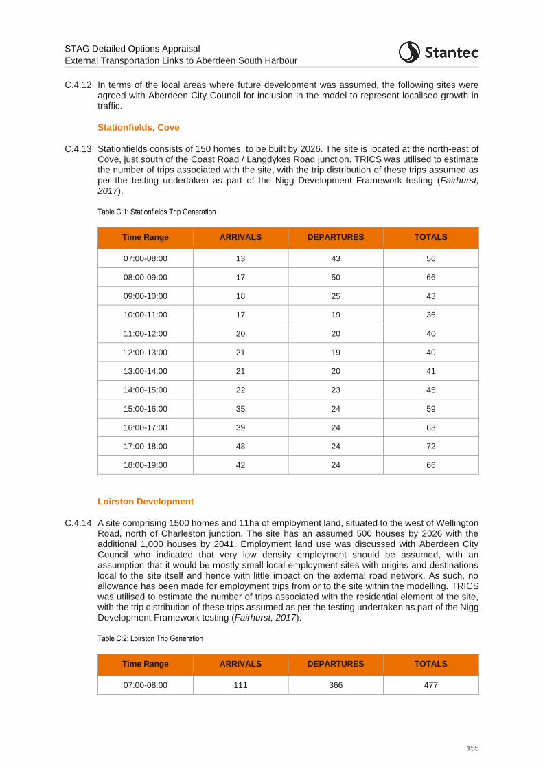
STAG Detailed Options Appraisal
External Transportation Links to Aberdeen South Harbour
155
C.4.12 In terms of the local areas where future development was assumed, the following sites were agreed with Aberdeen City Council for inclusion in the model to represent localised growth in traffic.
Stationfields, Cove
C.4.13 Stationfields consists of 150 homes, to be built by 2026. The site is located at the north-east of Cove, just south of the Coast Road / Langdykes Road junction. TRICS was utilised to estimate the number of trips associated with the site, with the trip distribution of these trips assumed as per the testing undertaken as part of the Nigg Development Framework testing (Fairhurst, 2017).
Table C:1: Stationfields Trip Generation
Time Range ARRIVALS DEPARTURES TOTALS
07:00-08:00 13 43 56
08:00-09:00 17 50 66
09:00-10:00 18 25 43
10:00-11:00 17 19 36
11:00-12:00 20 20 40
12:00-13:00 21 19 40
13:00-14:00 21 20 41
14:00-15:00 22 23 45
15:00-16:00 35 24 59
16:00-17:00 39 24 63
17:00-18:00 48 24 72
18:00-19:00 42 24 66
Loirston Development
C.4.14 A site comprising 1500 homes and 11ha of employment land, situated to the west of Wellington Road, north of Charleston junction. The site has an assumed 500 houses by 2026 with the additional 1,000 houses by 2041. Employment land use was discussed with Aberdeen City Council who indicated that very low density employment should be assumed, with an assumption that it would be mostly small local employment sites with origins and destinations local to the site itself and hence with little impact on the external road network. As such, no allowance has been made for employment trips from or to the site within the modelling. TRICS was utilised to estimate the number of trips associated with the residential element of the site, with the trip distribution of these trips assumed as per the testing undertaken as part of the Nigg Development Framework testing (Fairhurst, 2017).
Table C:2: Loirston Trip Generation
Time Range ARRIVALS DEPARTURES TOTALS
07:00-08:00 111 366 477

STAG Detailed Options Appraisal
External Transportation Links to Aberdeen South Harbour
156
Time Range ARRIVALS DEPARTURES TOTALS
08:00-09:00 105 311 416
09:00-10:00 141 193 334
10:00-11:00 139 157 295
11:00-12:00 158 162 320
12:00-13:00 166 153 320
13:00-14:00 170 165 335
14:00-15:00 161 174 335
15:00-16:00 214 148 362
16:00-17:00 312 195 507
17:00-18:00 400 205 605
18:00-19:00 348 200 548
Altens East and Peterseat
C.4.15 Altens East and Peterseat are largely built out sites with large office developments in place. Altens East is accessed at the east end of Hareness Road near the Coast Road. The Peterseat site is accessed via either Minto Avenue or Minto Road onto Hareness Road.
C.4.16 While there is limited land available for additional development at either site, it was agreed with Aberdeen City Council that additional build out of the sites would be assumed by 2026 with:
2,500sqm Class 5 and 2,500sqm Class 6 assumed at each site.
C.4.17 TRICS was utilised to estimate the number of trips associated with each site with a trip distribution pattern applied similar to the surrounding industrial estate zones.
Table C:3: Altens East and Peterseat Trip Generation
Time Range
ARRIVALS DEPARTURES TOTALS
Lights Heavies Lights Heavies Lights Heavies
07:00-08:00 10 2 3 2 13 3
08:00-09:00 12 2 6 2 18 4
09:00-10:00 9 2 6 2 15 4
10:00-11:00 7 2 7 2 14 4
11:00-12:00 8 1 8 1 15 3
12:00-13:00 8 2 8 1 16 3
13:00-14:00 8 2 8 1 16 3
14:00-15:00 8 1 8 1 16 2
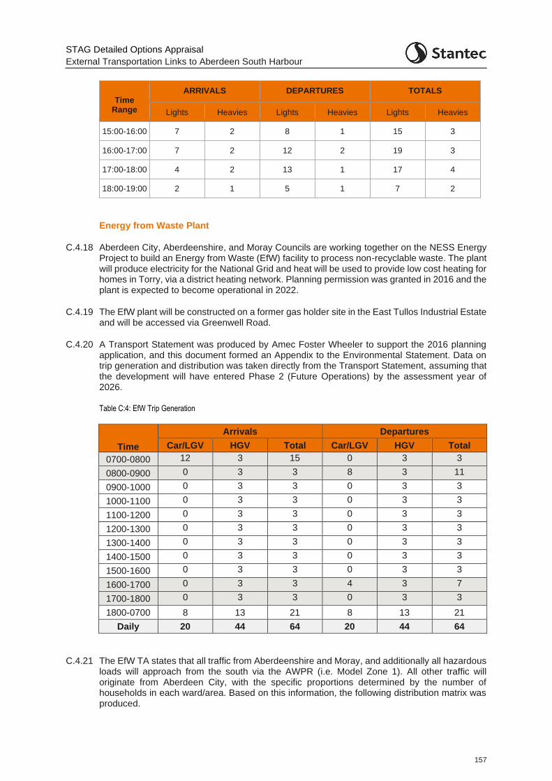
STAG Detailed Options Appraisal
External Transportation Links to Aberdeen South Harbour
157
Time Range
ARRIVALS DEPARTURES TOTALS
Lights Heavies Lights Heavies Lights Heavies
15:00-16:00 7 2 8 1 15 3
16:00-17:00 7 2 12 2 19 3
17:00-18:00 4 2 13 1 17 4
18:00-19:00 2 1 5 1 7 2
Energy from Waste Plant
C.4.18 Aberdeen City, Aberdeenshire, and Moray Councils are working together on the NESS Energy Project to build an Energy from Waste (EfW) facility to process non-recyclable waste. The plant will produce electricity for the National Grid and heat will be used to provide low cost heating for homes in Torry, via a district heating network. Planning permission was granted in 2016 and the plant is expected to become operational in 2022.
C.4.19 The EfW plant will be constructed on a former gas holder site in the East Tullos Industrial Estate and will be accessed via Greenwell Road.
C.4.20 A Transport Statement was produced by Amec Foster Wheeler to support the 2016 planning application, and this document formed an Appendix to the Environmental Statement. Data on trip generation and distribution was taken directly from the Transport Statement, assuming that the development will have entered Phase 2 (Future Operations) by the assessment year of 2026.
Table C:4: EfW Trip Generation
Time
Arrivals Departures
Car/LGV HGV Total Car/LGV HGV Total
0700-0800 12 3 15 0 3 3
0800-0900 0 3 3 8 3 11
0900-1000 0 3 3 0 3 3
1000-1100 0 3 3 0 3 3
1100-1200 0 3 3 0 3 3
1200-1300 0 3 3 0 3 3
1300-1400 0 3 3 0 3 3
1400-1500 0 3 3 0 3 3
1500-1600 0 3 3 0 3 3
1600-1700 0 3 3 4 3 7
1700-1800 0 3 3 0 3 3
1800-0700 8 13 21 8 13 21
Daily 20 44 64 20 44 64
C.4.21 The EfW TA states that all traffic from Aberdeenshire and Moray, and additionally all hazardous loads will approach from the south via the AWPR (i.e. Model Zone 1). All other traffic will originate from Aberdeen City, with the specific proportions determined by the number of households in each ward/area. Based on this information, the following distribution matrix was produced.
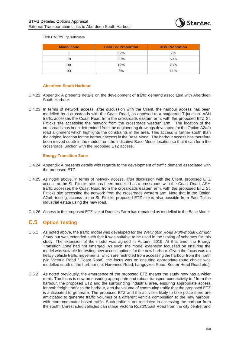
STAG Detailed Options Appraisal
External Transportation Links to Aberdeen South Harbour
158
Table C:5: EfW Trip Distribution
Model Zone Car/LGV Proportion HGV Proportion
1 52% 7%
19 30% 59%
30 12% 23%
33 6% 11%
Aberdeen South Harbour
C.4.22 Appendix A presents details on the development of traffic demand associated with Aberdeen South Harbour.
C.4.23 In terms of network access, after discussion with the Client, the harbour access has been modelled as a crossroads with the Coast Road, as opposed to a staggered T-junction. ASH traffic accesses the Coast Road from the crossroads eastern arm, with the proposed ETZ St. Fitticks site accessing the network from the crossroads western arm. The location of the crossroads has been determined from the engineering drawings developed for the Option A2a/b road alignment which highlights the constraints in the area. This access is further south than the original location for the harbour access in the Base Model. The harbour access has therefore been moved south in the model from the indicative Base Model location so that it can form the crossroads junction with the proposed ETZ access.
Energy Transition Zone
C.4.24 Appendix A presents details with regards to the development of traffic demand associated with the proposed ETZ.
C.4.25 As noted above, in terms of network access, after discussion with the Client, proposed ETZ access at the St. Fitticks site has been modelled as a crossroads with the Coast Road. ASH traffic accesses the Coast Road from the crossroads eastern arm, with the proposed ETZ St. Fitticks site accessing the network from the crossroads western arm. Note that in the Option A2a/b testing, access to the St. Fitticks proposed ETZ site is also possible from East Tullos industrial estate using the new road.
C.4.26 Access to the proposed ETZ site at Doonies Farm has remained as modelled in the Base Model.
C.5 Option Testing
C.5.1 As noted above, the traffic model was developed for the Wellington Road Multi-modal Corridor Study but was extended such that it was suitable to be used in the testing of schemes for this study. The extension of the model was agreed in Autumn 2019. At that time, the Energy Transition Zone had not emerged. As such, the model extension focussed on ensuring the model was suitable for testing new access options for the new harbour. Given the focus was on heavy vehicle traffic movements, which are restricted from accessing the harbour from the north (via Victoria Road / Coast Road), the focus was on ensuring appropriate route choice was modelled south of the harbour (i.e. Hareness Road, Langdykes Road, Souter Head Road etc.).
C.5.2 As noted previously, the emergence of the proposed ETZ means the study now has a wider remit. The focus is now on ensuring appropriate and robust transport connectivity to / from the harbour, the proposed ETZ and the surrounding industrial area, ensuring appropriate access for both freight traffic to the harbour, and the volume of commuting traffic that the proposed ETZ is anticipated to generate. The proposed ETZ and the activities likely to take place there are anticipated to generate traffic volumes of a different vehicle composition to the new harbour, with more commuter-based traffic. Such traffic is not restricted in accessing the harbour from the south. Unrestricted vehicles can utilise Victoria Road/Coast Road from the city centre, and
STAG Detailed Options Appraisal
External Transportation Links to Aberdeen South Harbour
159
Balnagask Road and Girdleness Road if accessing the area from Wellington Road / west of Wellington Road, as well as the routes from the south (Hareness Road, Langdykes Road, Souter Head Road etc.). As such, the route choice available for non-HGV traffic to the harbour/ proposed ETZ area is far greater. It would also be anticipated that a large proportion of commuting traffic to the site would be coming from the urban Aberdeen area i.e. from the north / west of the site.
C.5.3 The potential route choice options from the north are not represented in the model. Given this, a methodology was required to enable access to and from the harbour and proposed ETZ site area to be robustly considered such that traffic journey times, and hence economic benefits, of the road options could be appropriately estimated using the transport model.
C.5.4 At present, the area around the proposed ETZ sites and harbour are not major ‘destinations’. No existing base traffic in the traffic model has an origin or destination at the new harbour or St. Fitticks park zones. Options A2a/b and A3a/b are those likely to generate routeing changes due to the linking of Wellington Road via East Tullos industrial area through to the Coast Road. For ‘Base’ traffic, this link is unlikely to cause any significant re-routeing of traffic to use the new link given the lack of any significant existing origins/destinations in the harbour / proposed ETZ sites area. It is, therefore, development traffic associated with the harbour and proposed ETZ sites that will gain the significant benefits to be derived by the new infrastructure.
C.5.5 To enable the capture of these benefits derived through use of the new road, it is therefore considered appropriate, given the minor benefit that may be gained for existing traffic, to assume that the benefits attributable to the new road will come almost entirely from traffic generated by the new harbour and proposed ETZ sites themselves. As such, in order to understand how this development traffic may route in the model, particularly with regards to the traffic heading to and from the harbour / proposed ETZ from the north and west of the modelled area, ‘ghost links’ were added to the model to enable route choice.
C.5.6 These ‘ghost links’ included:
St. Fitticks Road – to join up the route between Victoria Road and the Coast Road
Balngask Road – to join up Wellington Road with St. Fitticks Road
Girdleness Road - to join up Wellington Road with Balnagask Road / St. Fitticks Road
C.5.7 The ghost links were constrained to allow only light vehicle traffic associated with the new harbour and proposed ETZ sites to use them. In this way, base traffic was maintained as is and HGV traffic associated with the harbour / proposed ETZ sites was still required to route via the defined Aberdeen freight routes.
C.5.8 The ‘ghost links’ are shown on the model network in Figure C:1.
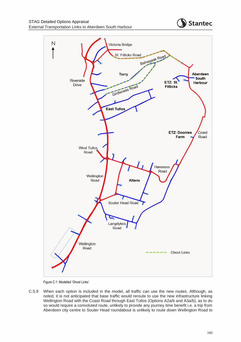
STAG Detailed Options Appraisal
External Transportation Links to Aberdeen South Harbour
160
Figure C:1: Modelled ‘Ghost Links’
C.5.9 When each option is included in the model, all traffic can use the new routes. Although, as noted, it is not anticipated that base traffic would reroute to use the new infrastructure linking Wellington Road with the Coast Road through East Tullos (Options A2a/b and A3a/b), as to do so would require a convoluted route, unlikely to provide any journey time benefit i.e. a trip from Aberdeen city centre to Souter Head roundabout is unlikely to route down Wellington Road to
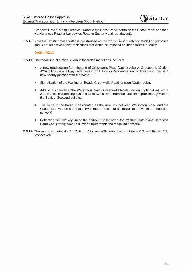
STAG Detailed Options Appraisal
External Transportation Links to Aberdeen South Harbour
161
Greenwell Road, along Greenwell Road to the Coast Road, south on the Coast Road, and then via Hareness Road or Langdykes Road to Souter Head roundabout).
C.5.10 Note that existing base traffic is constrained on the ‘ghost links’ purely for modelling purposes and is not reflective of any restrictions that would be imposed on these routes in reality.
Option A2a/b
C.5.11 The modelling of Option A2a/b in the traffic model has included:
A new road section from the end of Greenwells Road (Option A2a) or Greenbank (Option A2b) to link via a railway underpass into St. Fitticks Park and linking to the Coast Road at a new priority junction with the harbour.
Signalisation of the Wellington Road / Greenwells Road junction (Option A2a).
Additional capacity at the Wellington Road / Greenwells Road junction (Option A2a) with a 2-lane section extending back on Greenwells Road from the junction approximately 60m to the Bank of Scotland building.
The route to the harbour designated as the new link between Wellington Road and the Coast Road via the underpass (with the route coded as ‘major’ route within the modelled network)
Reflecting the new key link to the harbour further north, the existing route along Hareness Road was ‘downgraded to a ‘minor’ route within the modelled network.
C.5.12 The modelled networks for Options A2a and A2b are shown in Figure C:2 and Figure C:3, respectively.
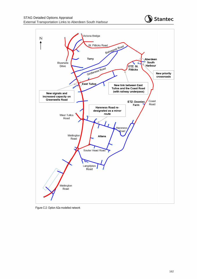
STAG Detailed Options Appraisal
External Transportation Links to Aberdeen South Harbour
162
Figure C:2: Option A2a modelled network
STAG Detailed Options Appraisal
External Transportation Links to Aberdeen South Harbour
163
Figure C:3: Option A2b modelled network
Option A3a/b
C.5.13 The modelling of Option A3a/b in the traffic model has included:
A new road section from the end of Greenwells Road (Option A3a) or Greenbank (Option A3b) across the landfill site with a new bridge over the railway, to link to the Coast Road at a new priority junction.
Signalisation of the Wellington Road / Greenwells Road junction (Option A3a)

STAG Detailed Options Appraisal
External Transportation Links to Aberdeen South Harbour
164
Additional capacity at the Wellington Road / Greenwells Road junction (Option A3a) with a 2-lane section extending back on Greenwells Road from the junction approximately 60m to the Bank of Scotland building.
The route to the harbour designated as the new link between Wellington Road and the Coast Road via the new rail bridge (with the route coded as ‘major’ route within the modelled network).
Reflecting the new key link to the harbour further north, the existing route along Hareness Road ‘downgraded to a ‘minor’ route (shown as blue) within the modelled network.
C.5.14 The modelled networks for options A3a and A3b are shown in Figure C:4 and Figure C:5, respectively.
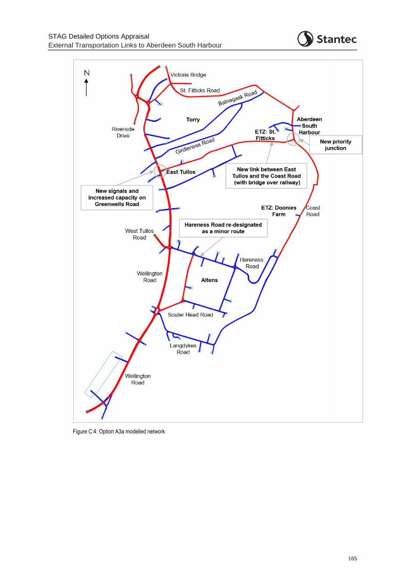
STAG Detailed Options Appraisal
External Transportation Links to Aberdeen South Harbour
165
Figure C:4: Option A3a modelled network
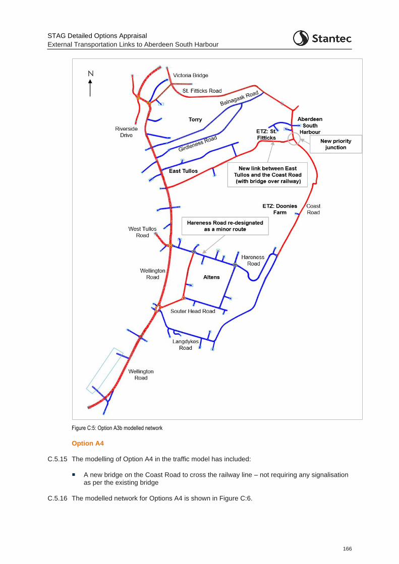
STAG Detailed Options Appraisal
External Transportation Links to Aberdeen South Harbour
166
Figure C:5: Option A3b modelled network
Option A4
C.5.15 The modelling of Option A4 in the traffic model has included:
A new bridge on the Coast Road to cross the railway line – not requiring any signalisation as per the existing bridge
C.5.16 The modelled network for Options A4 is shown in Figure C:6.
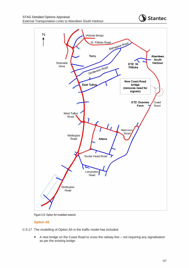
STAG Detailed Options Appraisal
External Transportation Links to Aberdeen South Harbour
167
Figure C:6: Option A4 modelled network
Option A5
C.5.17 The modelling of Option A5 in the traffic model has included:
A new bridge on the Coast Road to cross the railway line – not requiring any signalisation as per the existing bridge

STAG Detailed Options Appraisal
External Transportation Links to Aberdeen South Harbour
168
A new link between the Coast Road and Souter Head Road
The route to the harbour designated to be along Souter Head Road and the Coast Road using the new bridge (with the route coded as ‘major’ route within the modelled network)
Reflecting the new key link to the harbour further south, the existing route along Hareness Road ‘downgraded to a ‘minor’ route (shown as blue) within the modelled network.
C.5.18 The modelled network for Options A5 is shown in Figure C:7.
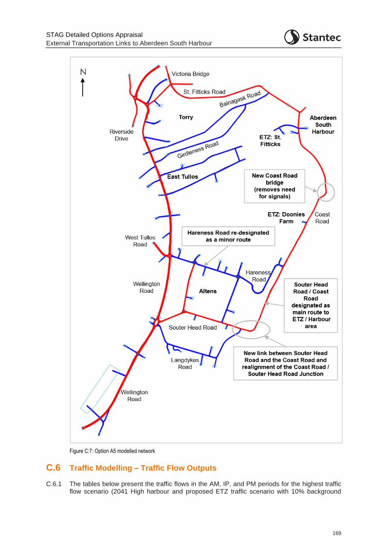
STAG Detailed Options Appraisal
External Transportation Links to Aberdeen South Harbour
169
Figure C:7: Option A5 modelled network
C.6 Traffic Modelling – Traffic Flow Outputs
C.6.1 The tables below present the traffic flows in the AM, IP, and PM periods for the highest traffic flow scenario (2041 High harbour and proposed ETZ traffic scenario with 10% background

STAG Detailed Options Appraisal
External Transportation Links to Aberdeen South Harbour
170
growth). The figures therefore represent the most significant differences between the options and the Do Minimum model.
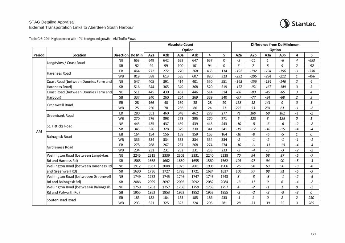
STAG Detailed Appraisal
External Transportation Links to Aberdeen South Harbour
171
Table C:6: 2041 High scenario with 10% background growth – AM Traffic Flows
A2a A2b A3a A3b 4 5 A2a A2b A3a A3b 4 5
NB 653 649 642 653 647 657 0 -3 -11 1 -6 4 -653
SB 92 99 99 100 101 94 0 6 7 8 9 2 -92
EB 464 272 272 270 268 463 134 -192 -192 -194 -196 -1 -330
WB 819 588 613 585 607 820 323 -231 -206 -234 -212 1 -496
NB 547 405 391 414 401 550 551 -143 -156 -134 -146 2 4
SB 516 344 365 349 368 520 519 -172 -151 -167 -149 3 3
NB 511 445 430 462 446 514 514 -66 -80 -49 -65 3 4
SB 337 240 260 254 269 339 340 -97 -77 -84 -68 2 3
EB 28 166 40 169 38 28 29 138 12 141 9 0 1
WB 25 250 78 256 86 24 23 225 53 231 61 -1 -2
EB 280 351 460 348 462 279 277 71 180 68 182 -1 -2
WB 270 276 398 273 395 270 271 6 128 3 125 0 1
NB 445 435 437 439 439 443 443 -10 -8 -6 -6 -2 -2
SB 345 326 328 329 330 341 341 -19 -17 -16 -15 -4 -4
EB 164 154 156 158 159 165 164 -10 -8 -6 -5 1 0
WB 336 334 334 333 334 334 334 -2 -1 -2 -1 -1 -1
EB 278 268 267 267 268 274 274 -10 -11 -11 -10 -4 -4
WB 234 231 231 232 231 233 233 -3 -4 -3 -3 -2 -2
NB 2245 2315 2339 2302 2331 2240 2238 70 94 58 87 -5 -7
SB 1565 1668 1662 1659 1655 1560 1562 103 97 94 90 -5 -3
NB 1912 1987 2008 1975 2001 1908 1906 76 96 63 90 -3 -6
SB 1630 1736 1727 1728 1721 1624 1627 106 97 98 91 -5 -3
NB 1749 1752 1745 1746 1747 1746 1743 3 -3 -3 -1 -2 -5
SB 2086 2099 2097 2095 2092 2082 2084 13 11 9 6 -4 -2
NB 1759 1762 1757 1758 1759 1759 1757 4 -2 -1 1 0 -2
SB 1955 1952 1953 1952 1952 1952 1955 -3 -2 -3 -3 -3 0
EB 183 182 184 183 185 186 433 -1 1 0 2 2 250
WB 293 321 325 323 324 296 581 28 33 30 32 3 289
Period Location Direction
Option Option
Do Min
Greenwell Road
Hareness Road
Difference from Do MinimumAbsolute Count
Langdykes / Coast Road
Coast Road (between Doonies Farm and
Hareness Road)
Balnagask Road
Girdleness Road
Greenbank Road
St. Fitticks Road
Coast Road (between Doonies Farm and
Harbour)
Wellington Road (betweeen Greenwell
Rd and Balnagask Rd)
Wellington Road (betweeen Balnagask
Rd and Polwarth Rd)
Wellington Road (between Langdykes
Rd and Harness Rd)
Wellington Road (between Hareness Rd
and Greenwell Rd)
AM
Souter Head Road
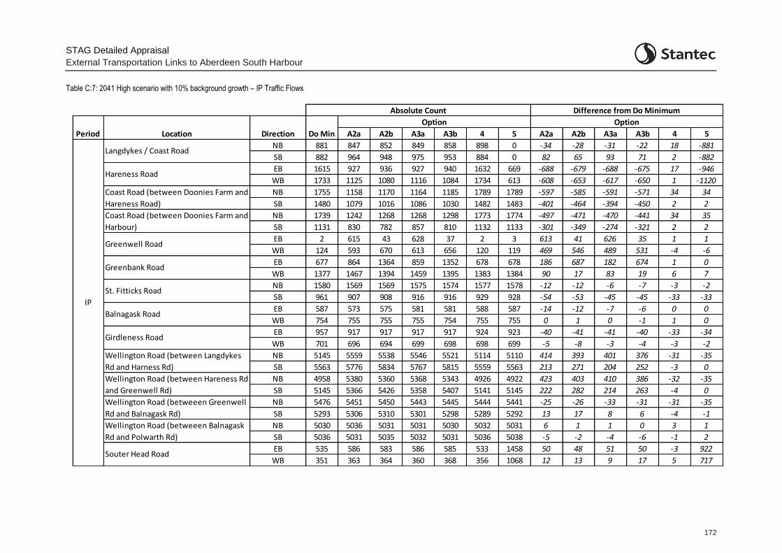
STAG Detailed Appraisal
External Transportation Links to Aberdeen South Harbour
172
Table C:7: 2041 High scenario with 10% background growth – IP Traffic Flows
A2a A2b A3a A3b 4 5 A2a A2b A3a A3b 4 5
NB 881 847 852 849 858 898 0 -34 -28 -31 -22 18 -881
SB 882 964 948 975 953 884 0 82 65 93 71 2 -882
EB 1615 927 936 927 940 1632 669 -688 -679 -688 -675 17 -946
WB 1733 1125 1080 1116 1084 1734 613 -608 -653 -617 -650 1 -1120
NB 1755 1158 1170 1164 1185 1789 1789 -597 -585 -591 -571 34 34
SB 1480 1079 1016 1086 1030 1482 1483 -401 -464 -394 -450 2 2
NB 1739 1242 1268 1268 1298 1773 1774 -497 -471 -470 -441 34 35
SB 1131 830 782 857 810 1132 1133 -301 -349 -274 -321 2 2
EB 2 615 43 628 37 2 3 613 41 626 35 1 1
WB 124 593 670 613 656 120 119 469 546 489 531 -4 -6
EB 677 864 1364 859 1352 678 678 186 687 182 674 1 0
WB 1377 1467 1394 1459 1395 1383 1384 90 17 83 19 6 7
NB 1580 1569 1569 1575 1574 1577 1578 -12 -12 -6 -7 -3 -2
SB 961 907 908 916 916 929 928 -54 -53 -45 -45 -33 -33
EB 587 573 575 581 581 588 587 -14 -12 -7 -6 0 0
WB 754 755 755 755 754 755 755 0 1 0 -1 1 0
EB 957 917 917 917 917 924 923 -40 -41 -41 -40 -33 -34
WB 701 696 694 699 698 698 699 -5 -8 -3 -4 -3 -2
NB 5145 5559 5538 5546 5521 5114 5110 414 393 401 376 -31 -35
SB 5563 5776 5834 5767 5815 5559 5563 213 271 204 252 -3 0
NB 4958 5380 5360 5368 5343 4926 4922 423 403 410 386 -32 -35
SB 5145 5366 5426 5358 5407 5141 5145 222 282 214 263 -4 0
NB 5476 5451 5450 5443 5445 5444 5441 -25 -26 -33 -31 -31 -35
SB 5293 5306 5310 5301 5298 5289 5292 13 17 8 6 -4 -1
NB 5030 5036 5031 5031 5030 5032 5031 6 1 1 0 3 1
SB 5036 5031 5035 5032 5031 5036 5038 -5 -2 -4 -6 -1 2
EB 535 586 583 586 585 533 1458 50 48 51 50 -3 922
WB 351 363 364 360 368 356 1068 12 13 9 17 5 717
Period Location Direction
Option Option
Do Min
Greenwell Road
Hareness Road
Absolute Count Difference from Do Minimum
Langdykes / Coast Road
Coast Road (between Doonies Farm and
Hareness Road)
Balnagask Road
Girdleness Road
Greenbank Road
St. Fitticks Road
Coast Road (between Doonies Farm and
Harbour)
Wellington Road (betweeen Greenwell
Rd and Balnagask Rd)
Wellington Road (betweeen Balnagask
Rd and Polwarth Rd)
Wellington Road (between Langdykes
Rd and Harness Rd)
Wellington Road (between Hareness Rd
and Greenwell Rd)
IP
Souter Head Road
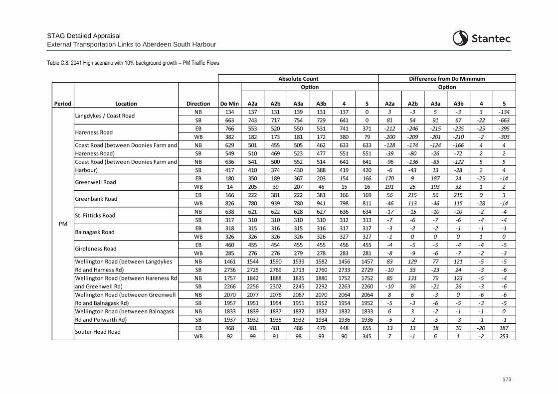
STAG Detailed Appraisal
External Transportation Links to Aberdeen South Harbour
173
Table C:8: 2041 High scenario with 10% background growth – PM Traffic Flows
A2a A2b A3a A3b 4 5 A2a A2b A3a A3b 4 5
NB 134 137 131 139 131 137 0 3 -3 5 -3 3 -134
SB 663 743 717 754 729 641 0 81 54 91 67 -22 -663
EB 766 553 520 550 531 741 371 -212 -246 -215 -235 -25 -395
WB 382 182 173 181 172 380 79 -200 -209 -201 -210 -2 -303
NB 629 501 455 505 462 633 633 -128 -174 -124 -166 4 4
SB 549 510 469 523 477 551 551 -39 -80 -26 -72 2 2
NB 636 541 500 552 514 641 641 -96 -136 -85 -122 5 5
SB 417 410 374 430 388 419 420 -6 -43 13 -28 2 4
EB 180 350 189 367 203 154 166 170 9 187 24 -25 -14
WB 14 205 39 207 46 15 16 191 25 193 32 1 2
EB 166 222 381 222 381 166 169 56 215 56 215 0 3
WB 826 780 939 780 941 798 811 -46 113 -46 115 -28 -14
NB 638 621 622 628 627 636 634 -17 -15 -10 -10 -2 -4
SB 317 310 310 310 310 312 313 -7 -6 -7 -6 -4 -4
EB 318 315 316 315 316 317 317 -3 -2 -2 -1 -1 -1
WB 326 326 326 326 326 327 327 -1 0 0 0 1 0
EB 460 455 454 455 455 456 455 -4 -5 -5 -4 -4 -5
WB 285 276 276 279 278 283 281 -8 -9 -6 -7 -2 -3
NB 1461 1544 1590 1539 1582 1456 1457 83 129 77 121 -5 -5
SB 2736 2725 2769 2713 2760 2733 2729 -10 33 -23 24 -3 -6
NB 1757 1842 1888 1835 1880 1752 1752 85 131 79 123 -5 -4
SB 2266 2256 2302 2245 2292 2263 2260 -10 36 -21 26 -3 -6
NB 2070 2077 2076 2067 2070 2064 2064 8 6 -3 0 -6 -6
SB 1957 1951 1954 1951 1952 1954 1952 -5 -3 -6 -5 -3 -5
NB 1833 1839 1837 1832 1832 1832 1833 6 3 -2 -1 -1 0
SB 1937 1932 1935 1932 1934 1936 1936 -5 -2 -5 -3 -1 -1
EB 468 481 481 486 479 448 655 13 13 18 10 -20 187
WB 92 99 91 98 93 90 345 7 -1 6 1 -2 253
Period Location Direction
Option Option
Do Min
Greenwell Road
Hareness Road
Absolute Count Difference from Do Minimum
Langdykes / Coast Road
Coast Road (between Doonies Farm and
Hareness Road)
Balnagask Road
Girdleness Road
Greenbank Road
St. Fitticks Road
Coast Road (between Doonies Farm and
Harbour)
Wellington Road (betweeen Greenwell
Rd and Balnagask Rd)
Wellington Road (betweeen Balnagask
Rd and Polwarth Rd)
Wellington Road (between Langdykes
Rd and Harness Rd)
Wellington Road (between Hareness Rd
and Greenwell Rd)
PM
Souter Head Road
STAG Detailed Options Appraisal
External Transportation Links to Aberdeen South Harbour
174
Appendix D Transport Planning Objectives Appraisal
D.1 TPO1
TPO1: Provide a designated Heavy Goods Vehicle (HGV) route to/from ASH / proposed ETZ sites which is more efficient than alternative routes:
minimise journey times to Aberdeen Western Peripheral Route (AWPR) / Charleston junction and King George VI Bridge; and
help minimise inappropriate routeing and environmental and nuisance impacts
Minimising Journey Times
D.1.1 Appraisal against TPO1 has been undertaken through the comparison of HGV journey times to and from the Aberdeen South Harbour / proposed ETZ access point on the Coast Road, to Charleston Junction and to King George VI bridge.
D.1.2 HGV journey times for the Do Minimum and Do Something (option) scenarios have been derived in part from the traffic model (up to the model extents) and then using Network Analyst software to derive journey times for the part of the route outwith the modelled area.
D.1.3 Results are presented in the tables below showing the absolute journey times for each option within the AM, IP, and PM periods for 2026 and 2041 as well as the difference from the Do Minimum scenario for:
Core scenario (core harbour traffic and core proposed ETZ traffic)
High scenario (high harbour traffic and high proposed ETZ traffic (+25% for each))
High scenario (high harbour traffic and high proposed ETZ traffic (+25% for each)) with high background growth (10% by 2041)
D.1.4 From the tables, analysis comparing the Do Minimum journey time from the south (Charleston junction) and the north (King George VI bridge) to and from the ASH / proposed ETZ area shows:
For Option A2a (and comparisons with Option A2b):
Between Charleston junction and the ASH / proposed ETZ access junction:
o Overall, Option A2a shows increases in journey time for travel from the harbour area to Charleston junction in the AM and IP periods.
o Journey time reductions from Charleston junction to the harbour / proposed ETZ in the AM period (1 minute), IP period (1 minute) and PM period (2 minutes) in 2026, with these reductions reducing by 2041 as the network becomes more congested.
o Limited journey time change from the harbour / proposed ETZ area to Charleston junction in the AM period in 2026 but with some minor journey time increases by 2041 as the network becomes more congested.
o Journey time increases in the IP period (around 1 minute) from the harbour / proposed ETZ area to Charleston junction.
STAG Detailed Options Appraisal
External Transportation Links to Aberdeen South Harbour
175
o Unlike the AM and IP periods, a reduction in journey time from the harbour / proposed ETZ area to Charleston junction in the PM period of 50 seconds in 2026 increasing to around 2 minutes by 2041 – although this reduces to around 80 seconds in the 2041 scenario where 10% background growth is assumed.
o For travel to the harbour area from Charleston junction, Option A2a shows a greater journey time reduction than A2b in the interpeak period, but when the network is congested in the AM and PM periods, Options A2b yields greater journey time reductions. Similar to Option A2a, Option A2b shows increases in journey time for travel from the harbour area to Charleston junction in the AM and IP periods.
o Option A2a (as well as Option A2b) does not provide the consistency of journey time reductions across all periods and future years as noted for Option A4 and A5.
Between George VI Bridge and the ASH / proposed ETZ area:
o Journey time reductions from George VI Bridge to the harbour / proposed ETZ area in the AM period (1 minute), IP period (over 1 minute) and PM period (over 2 minutes) in 2026, with these reductions reducing by 2041 as the network becomes more congested.
o Limited journey time change from the harbour / proposed ETZ area to George VI Bridge in the AM period in 2026 but with some minor journey time increases by 2041 as the network becomes more congested.
o Journey time increases in the IP period (around 1 minute) from the harbour / proposed ETZ area to George VI Bridge.
o Unlike the AM and IP periods, a reduction in journey time from the harbour / proposed ETZ area to George VI Bridge in the PM period of 45 seconds in 2026 increasing to a reduction of nearly a minute and a half by 2041 – although this reduced to around 45 seconds again in the 2041 scenario where 10% background growth is assumed.
o Overall, Option A2a shows increases in journey time for travel from the harbour area to George VI Bridge in the AM and IP periods.
o Compared to Option A2a, Option A2b provides larger reductions in travel time from the harbour / proposed ETZ area to the bridge in the PM period (over 4 minutes in the 2041 high scenario with additional assumed background growth).
o Option A2a (as well as Option A2b) does not provide the consistency of journey time reduction across all periods and future years, as noted for Option A4 and A5.
For Option A3a (and comparisons with Option A3b):
Between Charleston junction and the ASH / proposed ETZ area:
o Overall, Option A3a shows increases in journey time for travel from the harbour area to Charleston junction in the IP periods but a reduction in the AM and PM.
o Journey time reductions from Charleston junction to the harbour / proposed ETZ in the AM period (1 minute), IP period (1 minute) and PM period (2 minutes) in 2026, with these reductions reducing by 2041 as the network becomes more congested.
o Limited journey time change from the harbour / proposed ETZ area to Charleston junction in the AM period in 2026 but with some minor journey time increases by 2041 as the network becomes more congested.

STAG Detailed Options Appraisal
External Transportation Links to Aberdeen South Harbour
176
o Journey time increases in the IP period (around 1 minute) from the harbour / proposed ETZ area to Charleston junction.
o A small reduction in journey time in the PM peak from the harbour / proposed ETZ to the Charleston junction of around 30 seconds in 2026 increasing to around 90 seconds by 2041 – although this reduced to around 60 seconds in the 2041 scenario where 10% background growth is assumed.
o For travel to the harbour area from Charleston junction, Option A3a shows a greater journey time reduction than A3b in the interpeak period, but when the network is congested in the AM and PM periods, Options A3b yields greater journey time reductions. Similar to option A3a, Option A3b shows increases in journey time for travel from the harbour area to Charleston junction in the AM and IP periods.
o Option A3a (as well as Option A3b) does not provide the consistency of journey time reductions across all periods and future years as noted for Option A4 and A5.
Between George VI Bridge and the ASH / proposed ETZ area:
o Journey time reductions from George VI Bridge to the harbour / proposed ETZ area in the AM (40 seconds), IP (1 minute) and PM (100 seconds) periods in 2026, with these reductions reducing by 2041 as the network becomes more congested.
o Small journey time increase (up to 30 seconds) from the harbour / proposed ETZ area to George VI Bridge in the AM period in 2026 but with some minor journey time increases by 2041 (up to 45 seconds longer than the Do Min) as the network becomes more congested.
o Journey time increases in the IP period (around 1 minute) from the harbour / proposed ETZ area to George VI Bridge in 2026, increasing to around 90 seconds in 2041.
o Unlike the AM and IP periods, a reduction in journey time from the harbour / proposed ETZ area to George VI Bridge in the PM period of 30 seconds (2 minutes in option A3b) in 2026 increasing to a reduction of 1 minute by 2041 (3 minutes in option A3b) – although this reduced by around 30 seconds again in the 2041 scenario where increased background growth is assumed.
o Overall, Options A3a/b shows increases in journey time for travel from the harbour area to George VI Bridge in the AM and IP periods.
o Compared to Option A3a, Option A3b provides larger reductions in travel time from the harbour / proposed ETZ area to the bridge in the PM period (over 4 minutes in the 2041 high scenario with additional assumed background growth).
o Option A3a (as well as Option A2b) does not provide the consistency of journey time reductions across all periods and future years as noted for Option A4 and A5
For Option A4:
Between Charleston junction and the ASH / proposed ETZ area:
o Overall, Option A4 shows a reduction in journey time for travel from the harbour area to Charleston junction in all periods.
o The journey time reduction from the harbour area is around 30 seconds in 2026, rising to around 45 seconds in 2041. These results are similar in the scenarios with increased background growth and increased development traffic.
STAG Detailed Options Appraisal
External Transportation Links to Aberdeen South Harbour
177
o The option also provides a reduction in journey time from the Charleston junction to the harbour in all time periods.
o The journey time reduction from the Charleston junction is around 1 minute in the AM and IP periods and around 100 seconds in the PM peak. The results are similar in the scenarios with increased background growth and increased development traffic.
Between George VI Bridge and the ASH / proposed ETZ area:
o Overall, Option A4 shows a reduction in journey time for travel from the harbour area to the George VI Bridge in all periods.
o The journey time reduction from the harbour area is around 30 seconds in the AM and IP periods and around 1 minute in the PM period in 2026. In 2041 the journey time reduction is around 45 seconds in the AM, 30 seconds in the IP and 90 seconds in the PM peak.
o The journey time savings increase by a further 15 seconds in the scenarios with 10% background growth.
o The option also provides a reduction in journey time from the George VI Bridge to the harbour in all time periods.
o The journey time reduction from the George VI Bridge is around 1 minute in the AM and IP periods and around 2 minutes in the PM period in 2026. The journey time savings are similar in 2041 and in the scenario with 10% background growth.
For Option A5:
Between Charleston junction and the ASH / proposed ETZ area:
o Overall, Option A5 shows a reduction in journey time for travel from the harbour area to Charleston junction in all periods.
o In 2026, the option provides journey time savings of around 3 minutes in the AM and IP periods and over 4 minutes in the PM period. In 2041 the results for the AM and IP periods are similar (to 2026) but there is a saving over 6 minutes in the PM period.
o The results are similar in the scenario with 10% background growth as well as the scenario with high development traffic.
o The option also provides a reduction in journey time from the Charleston junction to the harbour in all time periods.
o In 2026, the journey time savings are around 2 minutes in the AM and IP periods and 3 minutes in the PM period. In 2041 the journey time savings are around 90 seconds in the AM period, 2 minutes in the IP period and 3 minutes in the PM period.
o The results are similar in the scenario with 10% background growth as well as the scenario with high development traffic.
Between George VI Bridge and the ASH / proposed ETZ area:
o Overall, Option A5 shows a reduction in journey time for travel from the harbour area to the George VI Bridge in all periods.
o The journey time reduction is around 45 seconds in the AM period, 20 seconds in the IP and 60 seconds in the PM period in 2026 (increasing to 100 seconds in the scenario
STAG Detailed Options Appraisal
External Transportation Links to Aberdeen South Harbour
178
with 10% background growth). In 2041, the results are similar (to 2026) apart from the PM period which has a reduction of around 150 seconds.
o The option also provides a reduction in journey time from the George VI Bridge to the harbour in all time periods.
o The journey time reduction from the George VI Bridge is around 15 seconds in the AM and IP periods and around 45 seconds in the PM period in 2026. In 2041, the journey time reduction is around 45 seconds in the AM and PM periods and around 15 seconds in the IP.
o The journey time savings are similar in the scenario with 10% background growth but with increased time savings in the PM which shows a reduction of around 2 minutes.
D.1.5 In summary, across all options, the tables show:
For travel between Charleston junction and the harbour / proposed ETZ area:
o Option A4 and Option A5 consistently show journey time benefits across all periods, future years, and scenarios.
o Option A5 shows the overall greatest level of journey time reduction compared to the Do Minimum (over 4 minutes) with Option A4 reductions generally around or under 1 minute.
o For travel to the harbour / proposed ETZ area, Option A2a and A3a show a greater journey time reduction than A2b and A3b in the IP period, but when the network is congested in the AM and PM periods, Options A2b and A3b yield greater journey time reductions.
o Options A2a/b and A3a/b all show increases in journey time for travel from the harbour area to Charleston junction in the AM and IP periods.
o All options show a significant reduction in journey time in the PM period for travel from the harbour / proposed ETZ area to Charleston junction when compared to the Do Minimum.
For travel between King George VI Bridge and the harbour / proposed ETZ area:
o There are reductions in travel time from the bridge to the harbour / proposed ETZ area in all scenarios.
o Option A4 and Option A5 consistently show journey time benefits across all periods, future years, and scenarios – with Option A4 providing greater benefits than Option 5 in travel to and from King George VI bridge specifically.
o Option A2b shows the overall greatest level of journey time reduction compared to the Do Minimum (around 2 and a half minutes in the PM period for travel from the harbour to the bridge in 2026 and over 3 minutes in 2041). This is however not replicated across all periods which show increases in journey time for travel from the harbour area to the bridge in the AM and IP periods.
o Option A2b and A3b show large reductions in travel time from the harbour / proposed ETZ area to the bridge in the PM period (over 4 minutes in the 2041 high scenario with 10% background growth).
o As well as Option A2b, Options A2a and A3a/b all show increases in journey time for travel from the harbour area to the bridge in the AM and IP periods.
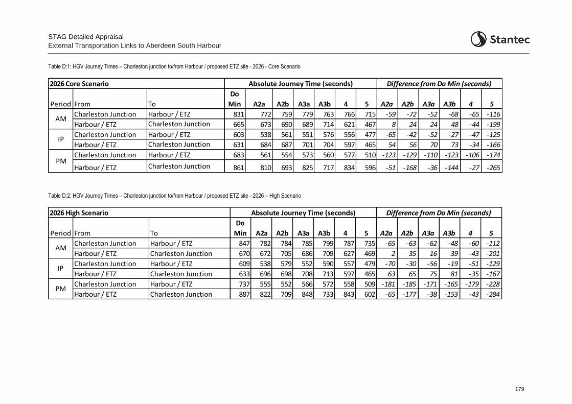
STAG Detailed Appraisal
External Transportation Links to Aberdeen South Harbour
179
Table D:1: HGV Journey Times – Charleston junction to/from Harbour / proposed ETZ site - 2026 - Core Scenario
Period From To
Do
Min A2a A2b A3a A3b 4 5 A2a A2b A3a A3b 4 5
Harbour / ETZ 831 772 759 779 763 766 715 -59 -72 -52 -68 -65 -116
Harbour / ETZ 665 673 690 689 714 621 467 8 24 24 48 -44 -199
Harbour / ETZ 603 538 561 551 576 556 477 -65 -42 -52 -27 -47 -125
Harbour / ETZ 631 684 687 701 704 597 465 54 56 70 73 -34 -166
Harbour / ETZ 683 561 554 573 560 577 510 -123 -129 -110 -123 -106 -174
Harbour / ETZ Charleston Junction 861 810 693 825 717 834 596 -51 -168 -36 -144 -27 -265
IPCharleston Junction
Charleston Junction
Absolute Journey Time (seconds) Difference from Do Min (seconds)
AMCharleston Junction
Charleston Junction
2026 Core Scenario
Charleston JunctionPM
Table D:2: HGV Journey Times – Charleston junction to/from Harbour / proposed ETZ site - 2026 – High Scenario
Period From To
Do
Min A2a A2b A3a A3b 4 5 A2a A2b A3a A3b 4 5
Harbour / ETZ 847 782 784 785 799 787 735 -65 -63 -62 -48 -60 -112
Harbour / ETZ 670 672 705 686 709 627 469 2 35 16 39 -43 -201
Harbour / ETZ 609 538 579 552 590 557 479 -70 -30 -56 -19 -51 -129
Harbour / ETZ 633 696 698 708 713 597 465 63 65 75 81 -35 -167
Harbour / ETZ 737 555 552 566 572 558 509 -181 -185 -171 -165 -179 -228
Harbour / ETZ Charleston Junction 887 822 709 848 733 843 602 -65 -177 -38 -153 -43 -284
2026 High Scenario Absolute Journey Time (seconds) Difference from Do Min (seconds)
AMCharleston Junction
Charleston Junction
IPCharleston Junction
Charleston Junction
Charleston JunctionPM
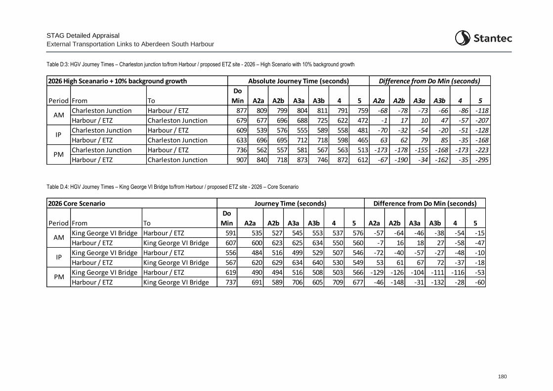
STAG Detailed Appraisal
External Transportation Links to Aberdeen South Harbour
180
Table D:3: HGV Journey Times – Charleston junction to/from Harbour / proposed ETZ site - 2026 – High Scenario with 10% background growth
Period From To
Do
Min A2a A2b A3a A3b 4 5 A2a A2b A3a A3b 4 5
Harbour / ETZ 877 809 799 804 811 791 759 -68 -78 -73 -66 -86 -118
Harbour / ETZ 679 677 696 688 725 622 472 -1 17 10 47 -57 -207
Harbour / ETZ 609 539 576 555 589 558 481 -70 -32 -54 -20 -51 -128
Harbour / ETZ 633 696 695 712 718 598 465 63 62 79 85 -35 -168
Harbour / ETZ 736 562 557 581 567 563 513 -173 -178 -155 -168 -173 -223
Harbour / ETZ Charleston Junction 907 840 718 873 746 872 612 -67 -190 -34 -162 -35 -295
IPCharleston Junction
Charleston Junction
Charleston JunctionPM
Absolute Journey Time (seconds) Difference from Do Min (seconds)
AMCharleston Junction
Charleston Junction
2026 High Sceanario + 10% background growth
Table D.4: HGV Journey Times – King George VI Bridge to/from Harbour / proposed ETZ site - 2026 – Core Scenario
Period From To
Do
Min A2a A2b A3a A3b 4 5 A2a A2b A3a A3b 4 5
Harbour / ETZ 591 535 527 545 553 537 576 -57 -64 -46 -38 -54 -15
Harbour / ETZ 607 600 623 625 634 550 560 -7 16 18 27 -58 -47
Harbour / ETZ 556 484 516 499 529 507 546 -72 -40 -57 -27 -48 -10
Harbour / ETZ 567 620 629 634 640 530 549 53 61 67 72 -37 -18
Harbour / ETZ 619 490 494 516 508 503 566 -129 -126 -104 -111 -116 -53
Harbour / ETZ King George VI Bridge 737 691 589 706 605 709 677 -46 -148 -31 -132 -28 -60
Journey Time (seconds) Difference from Do Min (seconds)2026 Core Scenario
AMKing George VI Bridge
King George VI Bridge
IPKing George VI Bridge
King George VI Bridge
King George VI BridgePM
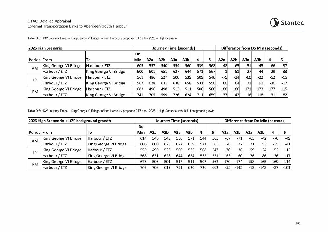
STAG Detailed Appraisal
External Transportation Links to Aberdeen South Harbour
181
Table D:5: HGV Journey Times – King George VI Bridge to/from Harbour / proposed ETZ site - 2026 – High Scenario
Period From To
Do
Min A2a A2b A3a A3b 4 5 A2a A2b A3a A3b 4 5
Harbour / ETZ 605 557 540 554 560 539 568 -48 -65 -51 -45 -66 -37
Harbour / ETZ 600 601 651 627 644 571 567 1 51 27 44 -29 -33
Harbour / ETZ 561 486 527 500 539 509 546 -75 -34 -60 -22 -52 -15
Harbour / ETZ 567 628 631 638 658 531 550 60 64 71 91 -36 -17
Harbour / ETZ 683 496 498 513 511 506 568 -188 -186 -171 -173 -177 -115
Harbour / ETZ King George VI Bridge 741 705 599 726 624 711 659 -37 -142 -16 -118 -31 -82
2026 High Scenario
PM
Journey Time (seconds) Difference from Do Min (seconds)
King George VI Bridge
AMKing George VI Bridge
King George VI Bridge
IPKing George VI Bridge
King George VI Bridge
Table D:6: HGV Journey Times – King George VI Bridge to/from Harbour / proposed ETZ site - 2026 – High Scenario with 10% background growth
Period From To
Do
Min A2a A2b A3a A3b 4 5 A2a A2b A3a A3b 4 5
Harbour / ETZ 614 546 543 550 571 544 565 -67 -71 -63 -42 -70 -49
Harbour / ETZ 606 600 628 627 659 571 565 -6 22 21 53 -35 -41
Harbour / ETZ 559 490 523 500 535 508 547 -70 -36 -59 -24 -52 -12
Harbour / ETZ 568 631 628 644 654 532 551 63 60 76 86 -36 -17
Harbour / ETZ 676 506 501 517 511 507 562 -170 -174 -158 -165 -169 -114
Harbour / ETZ King George VI Bridge 763 708 619 751 620 726 662 -55 -145 -12 -143 -37 -101PM
King George VI Bridge
King George VI BridgeIP
King George VI Bridge
Journey Time (seconds) Difference from Do Min (seconds)
AMKing George VI Bridge
King George VI Bridge
2026 High Sceanario + 10% background growth
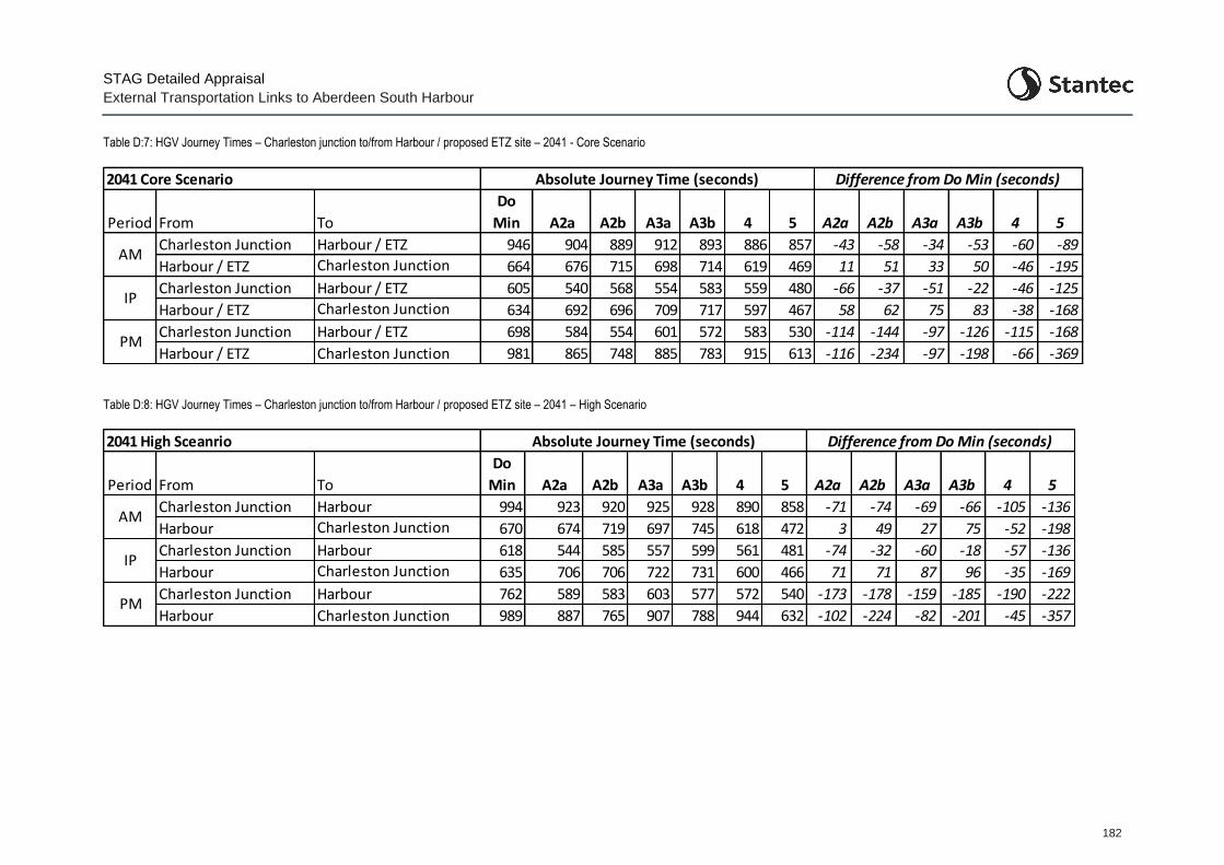
STAG Detailed Appraisal
External Transportation Links to Aberdeen South Harbour
182
Table D:7: HGV Journey Times – Charleston junction to/from Harbour / proposed ETZ site – 2041 - Core Scenario
Period From To
Do
Min A2a A2b A3a A3b 4 5 A2a A2b A3a A3b 4 5
Harbour / ETZ 946 904 889 912 893 886 857 -43 -58 -34 -53 -60 -89
Harbour / ETZ 664 676 715 698 714 619 469 11 51 33 50 -46 -195
Harbour / ETZ 605 540 568 554 583 559 480 -66 -37 -51 -22 -46 -125
Harbour / ETZ 634 692 696 709 717 597 467 58 62 75 83 -38 -168
Harbour / ETZ 698 584 554 601 572 583 530 -114 -144 -97 -126 -115 -168
Harbour / ETZ Charleston Junction 981 865 748 885 783 915 613 -116 -234 -97 -198 -66 -369
Charleston JunctionPM
IPCharleston Junction
Charleston Junction
Absolute Journey Time (seconds) Difference from Do Min (seconds)
AMCharleston Junction
Charleston Junction
2041 Core Scenario
Table D:8: HGV Journey Times – Charleston junction to/from Harbour / proposed ETZ site – 2041 – High Scenario
Period From To
Do
Min A2a A2b A3a A3b 4 5 A2a A2b A3a A3b 4 5
Harbour 994 923 920 925 928 890 858 -71 -74 -69 -66 -105 -136
Harbour 670 674 719 697 745 618 472 3 49 27 75 -52 -198
Harbour 618 544 585 557 599 561 481 -74 -32 -60 -18 -57 -136
Harbour 635 706 706 722 731 600 466 71 71 87 96 -35 -169
Harbour 762 589 583 603 577 572 540 -173 -178 -159 -185 -190 -222
Harbour Charleston Junction 989 887 765 907 788 944 632 -102 -224 -82 -201 -45 -357
IPCharleston Junction
Charleston Junction
Charleston JunctionPM
Absolute Journey Time (seconds) Difference from Do Min (seconds)
AMCharleston Junction
Charleston Junction
2041 High Sceanrio
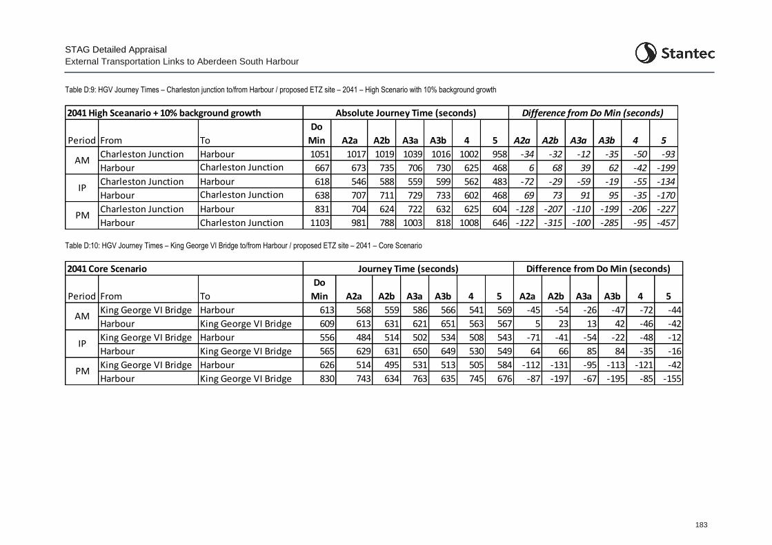
STAG Detailed Appraisal
External Transportation Links to Aberdeen South Harbour
183
Table D:9: HGV Journey Times – Charleston junction to/from Harbour / proposed ETZ site – 2041 – High Scenario with 10% background growth
Period From To
Do
Min A2a A2b A3a A3b 4 5 A2a A2b A3a A3b 4 5
Harbour 1051 1017 1019 1039 1016 1002 958 -34 -32 -12 -35 -50 -93
Harbour 667 673 735 706 730 625 468 6 68 39 62 -42 -199
Harbour 618 546 588 559 599 562 483 -72 -29 -59 -19 -55 -134
Harbour 638 707 711 729 733 602 468 69 73 91 95 -35 -170
Harbour 831 704 624 722 632 625 604 -128 -207 -110 -199 -206 -227
Harbour Charleston Junction 1103 981 788 1003 818 1008 646 -122 -315 -100 -285 -95 -457
Absolute Journey Time (seconds) Difference from Do Min (seconds)
AMCharleston Junction
Charleston Junction
2041 High Sceanario + 10% background growth
IPCharleston Junction
Charleston Junction
Charleston JunctionPM
Table D:10: HGV Journey Times – King George VI Bridge to/from Harbour / proposed ETZ site – 2041 – Core Scenario
Period From To
Do
Min A2a A2b A3a A3b 4 5 A2a A2b A3a A3b 4 5
Harbour 613 568 559 586 566 541 569 -45 -54 -26 -47 -72 -44
Harbour 609 613 631 621 651 563 567 5 23 13 42 -46 -42
Harbour 556 484 514 502 534 508 543 -71 -41 -54 -22 -48 -12
Harbour 565 629 631 650 649 530 549 64 66 85 84 -35 -16
Harbour 626 514 495 531 513 505 584 -112 -131 -95 -113 -121 -42
Harbour King George VI Bridge 830 743 634 763 635 745 676 -87 -197 -67 -195 -85 -155
King George VI BridgePM
King George VI BridgeIP
King George VI Bridge
AMKing George VI Bridge
King George VI Bridge
2041 Core Scenario Journey Time (seconds) Difference from Do Min (seconds)
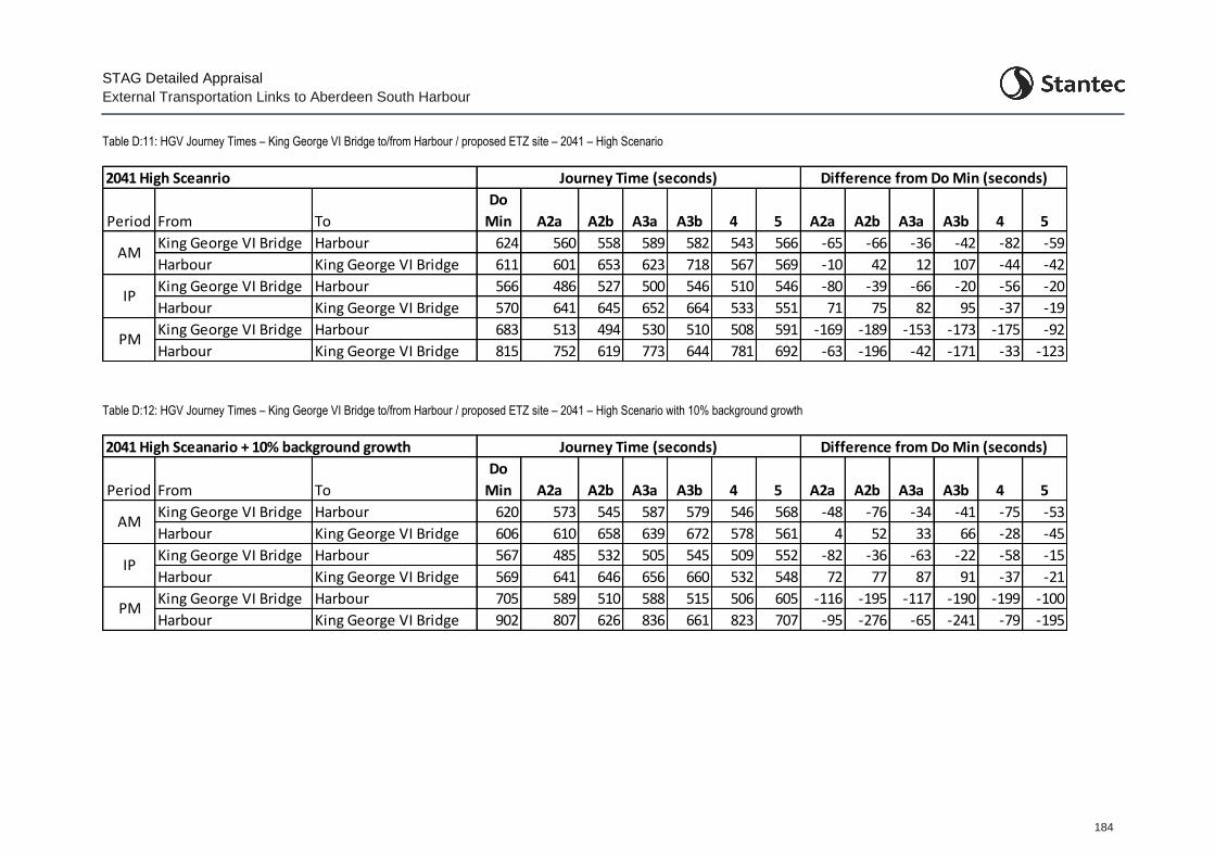
STAG Detailed Appraisal
External Transportation Links to Aberdeen South Harbour
184
Table D:11: HGV Journey Times – King George VI Bridge to/from Harbour / proposed ETZ site – 2041 – High Scenario
Period From To
Do
Min A2a A2b A3a A3b 4 5 A2a A2b A3a A3b 4 5
Harbour 624 560 558 589 582 543 566 -65 -66 -36 -42 -82 -59
Harbour 611 601 653 623 718 567 569 -10 42 12 107 -44 -42
Harbour 566 486 527 500 546 510 546 -80 -39 -66 -20 -56 -20
Harbour 570 641 645 652 664 533 551 71 75 82 95 -37 -19
Harbour 683 513 494 530 510 508 591 -169 -189 -153 -173 -175 -92
Harbour King George VI Bridge 815 752 619 773 644 781 692 -63 -196 -42 -171 -33 -123PM
King George VI Bridge
King George VI BridgeIP
King George VI Bridge
Journey Time (seconds) Difference from Do Min (seconds)
AMKing George VI Bridge
King George VI Bridge
2041 High Sceanrio
Table D:12: HGV Journey Times – King George VI Bridge to/from Harbour / proposed ETZ site – 2041 – High Scenario with 10% background growth
Period From To
Do
Min A2a A2b A3a A3b 4 5 A2a A2b A3a A3b 4 5
Harbour 620 573 545 587 579 546 568 -48 -76 -34 -41 -75 -53
Harbour 606 610 658 639 672 578 561 4 52 33 66 -28 -45
Harbour 567 485 532 505 545 509 552 -82 -36 -63 -22 -58 -15
Harbour 569 641 646 656 660 532 548 72 77 87 91 -37 -21
Harbour 705 589 510 588 515 506 605 -116 -195 -117 -190 -199 -100
Harbour King George VI Bridge 902 807 626 836 661 823 707 -95 -276 -65 -241 -79 -195
King George VI Bridge
King George VI Bridge
AMKing George VI Bridge
King George VI Bridge
2041 High Sceanario + 10% background growth
PM
Journey Time (seconds) Difference from Do Min (seconds)
King George VI Bridge
IP
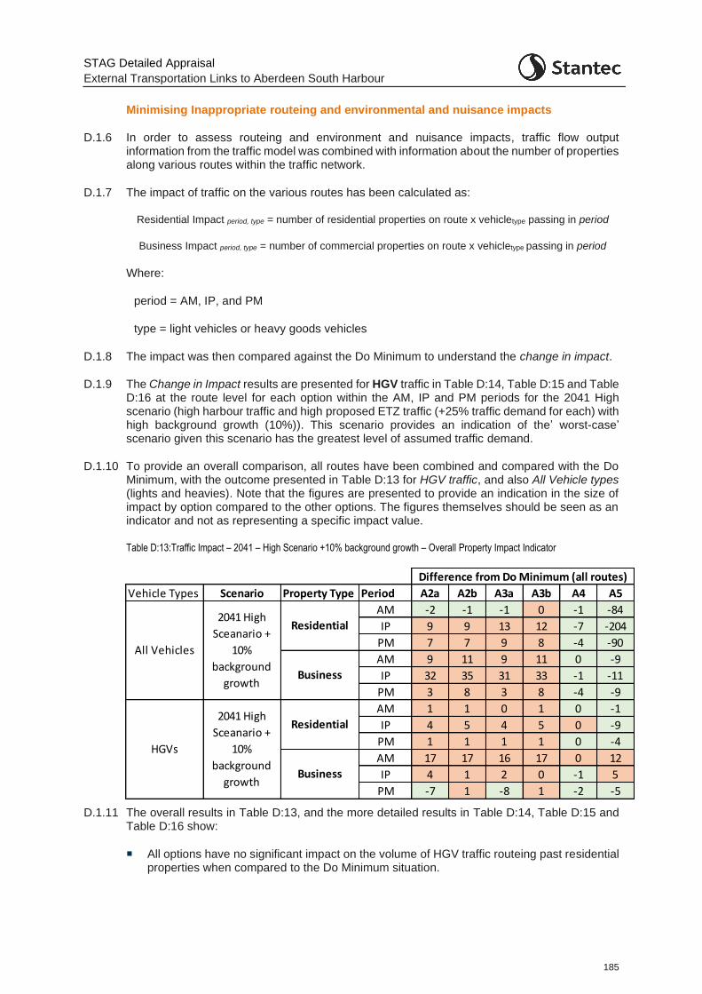
STAG Detailed Appraisal
External Transportation Links to Aberdeen South Harbour
185
Minimising Inappropriate routeing and environmental and nuisance impacts
D.1.6 In order to assess routeing and environment and nuisance impacts, traffic flow output information from the traffic model was combined with information about the number of properties along various routes within the traffic network.
D.1.7 The impact of traffic on the various routes has been calculated as:
Residential Impact period, type = number of residential properties on route x vehicletype passing in period
Business Impact period, type = number of commercial properties on route x vehicletype passing in period
Where:
period = AM, IP, and PM
type = light vehicles or heavy goods vehicles
D.1.8 The impact was then compared against the Do Minimum to understand the change in impact.
D.1.9 The Change in Impact results are presented for HGV traffic in Table D:14, Table D:15 and Table D:16 at the route level for each option within the AM, IP and PM periods for the 2041 High scenario (high harbour traffic and high proposed ETZ traffic (+25% traffic demand for each) with high background growth (10%)). This scenario provides an indication of the’ worst-case’ scenario given this scenario has the greatest level of assumed traffic demand.
D.1.10 To provide an overall comparison, all routes have been combined and compared with the Do Minimum, with the outcome presented in Table D:13 for HGV traffic, and also All Vehicle types (lights and heavies). Note that the figures are presented to provide an indication in the size of impact by option compared to the other options. The figures themselves should be seen as an indicator and not as representing a specific impact value.
Table D:13:Traffic Impact – 2041 – High Scenario +10% background growth – Overall Property Impact Indicator
D.1.11 The overall results in Table D:13, and the more detailed results in Table D:14, Table D:15 and Table D:16 show:
All options have no significant impact on the volume of HGV traffic routeing past residential properties when compared to the Do Minimum situation.
Vehicle Types Scenario Property Type Period A2a A2b A3a A3b A4 A5
AM -2 -1 -1 0 -1 -84
IP 9 9 13 12 -7 -204
PM 7 7 9 8 -4 -90
AM 9 11 9 11 0 -9
IP 32 35 31 33 -1 -11
PM 3 8 3 8 -4 -9
AM 1 1 0 1 0 -1
IP 4 5 4 5 0 -9
PM 1 1 1 1 0 -4
AM 17 17 16 17 0 12
IP 4 1 2 0 -1 5
PM -7 1 -8 1 -2 -5
2041 High
Sceanario +
10%
background
growth
Residential
Business
All Vehicles
HGVs
Difference from Do Minimum (all routes)
2041 High
Sceanario +
10%
background
growth
Residential
Business
STAG Detailed Appraisal
External Transportation Links to Aberdeen South Harbour
186
A reduction in HGV traffic routeing past commercial premises on Hareness Road in all scenarios except, as would be expected, Option A4 (where there is no routeing change for HGV traffic in accessing the harbour / proposed ETZ area).
Increases in HGV traffic routeing past commercial premises on Greenwell Road (Options A2a and A3a) and on Greenbank Road (Options A2b and A3b) as would be expected given the new link to the Coast Road through the East Tullos industrial estate. Correspondingly, there is also increased HGV traffic on Wellington Road (both north and southbound) between Hareness Road and Greenwell Rd / Greenbank Road. This stretch of carriageway is predominantly fronted by commercial premises but there are some residential properties.
Increased HGV traffic routeing past commercial premises on Souter Head road in Option A5, again, as would be expected.
D.1.12 Although for the sake of brevity the detailed tables relating to All Vehicles are not provided here, the results show:
Option A2a/b and Option A3a/b create additional traffic in front of residential and commercial premises across all time periods with the exception of residential properties in the AM period.
Option A2a/b, and Option A3a/b, as expected, show large increases in traffic on Greenwell Road and Greenbank Road, as well as on Wellington Road, with decreases in traffic on Hareness Road and Coast Road. Increased traffic on Greenwell and Greenbank Road has an impact on purely commercial properties in East Tullos industrial estate. Decreased traffic on Hareness Road provides benefit to commercial premises located along the route with no residential properties located along the road. Increased traffic on Wellington Road impacts most greatly between Landykes Road and Hareness Road as there are a number of residential properties located here.
For Option A2a/b and Option A3a/b there are also some minor decreases in traffic on St. Fitticks Road, Balnagask Road and Girdleness Road and therefore some benefit to mainly residential properties on these routes in terms of reduced noise and vibration from traffic in what is predominantly a residential area.
Option A5 consistently shows overall reduced traffic routeing past residential and business properties across all periods. This is to be expected given the removal of new harbour and proposed ETZ traffic from Wellington Road and Hareness Road, onto Souter Head Road. The option also significantly reduces traffic on Langdykes Road with traffic favouring Souter Head Road instead, with a significant benefit to residential properties located here.
As expected, given the smaller size of the intervention, Option A4 provides minor benefits. These changes are not considered to be significant.
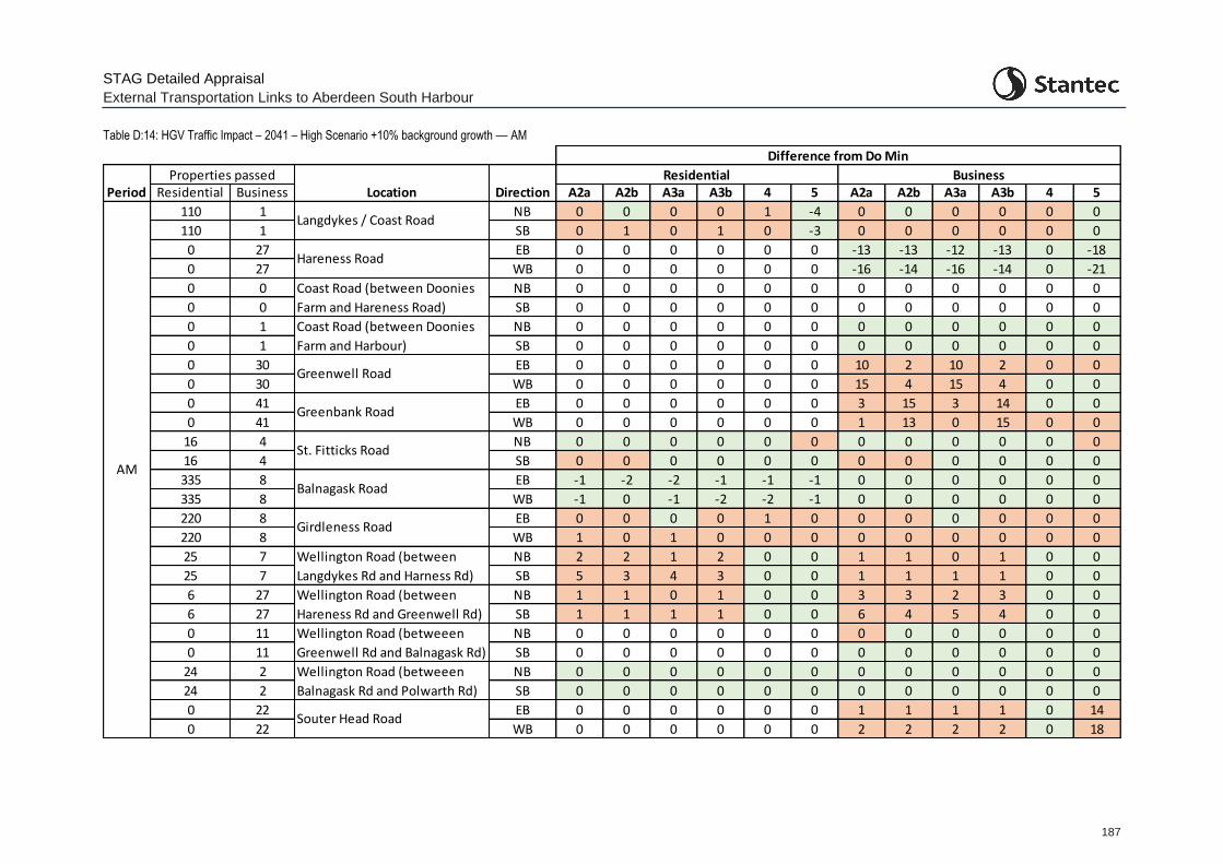
STAG Detailed Appraisal
External Transportation Links to Aberdeen South Harbour
187
Table D:14: HGV Traffic Impact – 2041 – High Scenario +10% background growth –– AM
Residential Business A2a A2b A3a A3b 4 5 A2a A2b A3a A3b 4 5
110 1 NB 0 0 0 0 1 -4 0 0 0 0 0 0
110 1 SB 0 1 0 1 0 -3 0 0 0 0 0 0
0 27 EB 0 0 0 0 0 0 -13 -13 -12 -13 0 -18
0 27 WB 0 0 0 0 0 0 -16 -14 -16 -14 0 -21
0 0 NB 0 0 0 0 0 0 0 0 0 0 0 0
0 0 SB 0 0 0 0 0 0 0 0 0 0 0 0
0 1 NB 0 0 0 0 0 0 0 0 0 0 0 0
0 1 SB 0 0 0 0 0 0 0 0 0 0 0 0
0 30 EB 0 0 0 0 0 0 10 2 10 2 0 0
0 30 WB 0 0 0 0 0 0 15 4 15 4 0 0
0 41 EB 0 0 0 0 0 0 3 15 3 14 0 0
0 41 WB 0 0 0 0 0 0 1 13 0 15 0 0
16 4 NB 0 0 0 0 0 0 0 0 0 0 0 0
16 4 SB 0 0 0 0 0 0 0 0 0 0 0 0
335 8 EB -1 -2 -2 -1 -1 -1 0 0 0 0 0 0
335 8 WB -1 0 -1 -2 -2 -1 0 0 0 0 0 0
220 8 EB 0 0 0 0 1 0 0 0 0 0 0 0
220 8 WB 1 0 1 0 0 0 0 0 0 0 0 0
25 7 NB 2 2 1 2 0 0 1 1 0 1 0 0
25 7 SB 5 3 4 3 0 0 1 1 1 1 0 0
6 27 NB 1 1 0 1 0 0 3 3 2 3 0 0
6 27 SB 1 1 1 1 0 0 6 4 5 4 0 0
0 11 NB 0 0 0 0 0 0 0 0 0 0 0 0
0 11 SB 0 0 0 0 0 0 0 0 0 0 0 0
24 2 NB 0 0 0 0 0 0 0 0 0 0 0 0
24 2 SB 0 0 0 0 0 0 0 0 0 0 0 0
0 22 EB 0 0 0 0 0 0 1 1 1 1 0 14
0 22 WB 0 0 0 0 0 0 2 2 2 2 0 18
Difference from Do Min
Location DirectionResidential Business
Coast Road (between Doonies
Farm and Harbour)
Greenwell Road
Hareness Road
Langdykes / Coast Road
Period
Girdleness Road
Greenbank Road
St. Fitticks Road
Wellington Road (betweeen
Greenwell Rd and Balnagask Rd)
Wellington Road (betweeen
Balnagask Rd and Polwarth Rd)
Wellington Road (between
Langdykes Rd and Harness Rd)
Wellington Road (between
Hareness Rd and Greenwell Rd)
Coast Road (between Doonies
Farm and Hareness Road)
Souter Head Road
AM
Properties passed
Balnagask Road
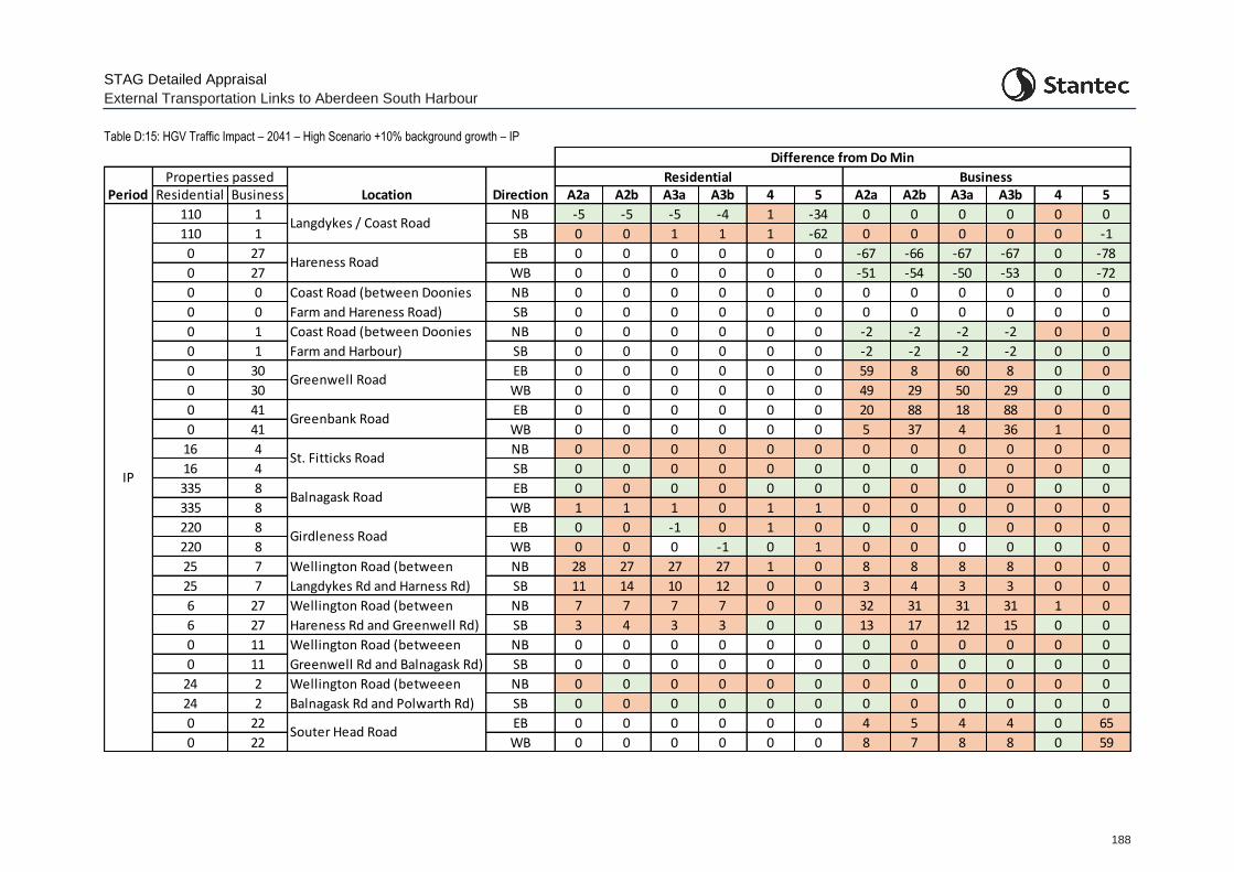
STAG Detailed Appraisal
External Transportation Links to Aberdeen South Harbour
188
Table D:15: HGV Traffic Impact – 2041 – High Scenario +10% background growth – IP
Residential Business A2a A2b A3a A3b 4 5 A2a A2b A3a A3b 4 5
110 1 NB -5 -5 -5 -4 1 -34 0 0 0 0 0 0
110 1 SB 0 0 1 1 1 -62 0 0 0 0 0 -1
0 27 EB 0 0 0 0 0 0 -67 -66 -67 -67 0 -78
0 27 WB 0 0 0 0 0 0 -51 -54 -50 -53 0 -72
0 0 NB 0 0 0 0 0 0 0 0 0 0 0 0
0 0 SB 0 0 0 0 0 0 0 0 0 0 0 0
0 1 NB 0 0 0 0 0 0 -2 -2 -2 -2 0 0
0 1 SB 0 0 0 0 0 0 -2 -2 -2 -2 0 0
0 30 EB 0 0 0 0 0 0 59 8 60 8 0 0
0 30 WB 0 0 0 0 0 0 49 29 50 29 0 0
0 41 EB 0 0 0 0 0 0 20 88 18 88 0 0
0 41 WB 0 0 0 0 0 0 5 37 4 36 1 0
16 4 NB 0 0 0 0 0 0 0 0 0 0 0 0
16 4 SB 0 0 0 0 0 0 0 0 0 0 0 0
335 8 EB 0 0 0 0 0 0 0 0 0 0 0 0
335 8 WB 1 1 1 0 1 1 0 0 0 0 0 0
220 8 EB 0 0 -1 0 1 0 0 0 0 0 0 0
220 8 WB 0 0 0 -1 0 1 0 0 0 0 0 0
25 7 NB 28 27 27 27 1 0 8 8 8 8 0 0
25 7 SB 11 14 10 12 0 0 3 4 3 3 0 0
6 27 NB 7 7 7 7 0 0 32 31 31 31 1 0
6 27 SB 3 4 3 3 0 0 13 17 12 15 0 0
0 11 NB 0 0 0 0 0 0 0 0 0 0 0 0
0 11 SB 0 0 0 0 0 0 0 0 0 0 0 0
24 2 NB 0 0 0 0 0 0 0 0 0 0 0 0
24 2 SB 0 0 0 0 0 0 0 0 0 0 0 0
0 22 EB 0 0 0 0 0 0 4 5 4 4 0 65
0 22 WB 0 0 0 0 0 0 8 7 8 8 0 59
Difference from Do Min
Location DirectionResidential Business
Coast Road (between Doonies
Farm and Harbour)
Greenwell Road
Hareness Road
Langdykes / Coast Road
Period
Balnagask Road
Girdleness Road
Greenbank Road
St. Fitticks Road
Wellington Road (betweeen
Greenwell Rd and Balnagask Rd)
Wellington Road (betweeen
Balnagask Rd and Polwarth Rd)
Wellington Road (between
Langdykes Rd and Harness Rd)
Wellington Road (between
Hareness Rd and Greenwell Rd)
Coast Road (between Doonies
Farm and Hareness Road)
Souter Head Road
IP
Properties passed
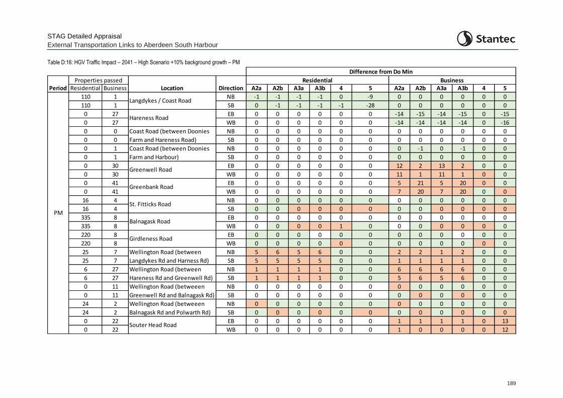
STAG Detailed Appraisal
External Transportation Links to Aberdeen South Harbour
189
Table D:16: HGV Traffic Impact – 2041 – High Scenario +10% background growth – PM
Residential Business A2a A2b A3a A3b 4 5 A2a A2b A3a A3b 4 5
110 1 NB -1 -1 -1 -1 0 -9 0 0 0 0 0 0
110 1 SB 0 -1 -1 -1 -1 -28 0 0 0 0 0 0
0 27 EB 0 0 0 0 0 0 -14 -15 -14 -15 0 -15
0 27 WB 0 0 0 0 0 0 -14 -14 -14 -14 0 -16
0 0 NB 0 0 0 0 0 0 0 0 0 0 0 0
0 0 SB 0 0 0 0 0 0 0 0 0 0 0 0
0 1 NB 0 0 0 0 0 0 0 -1 0 -1 0 0
0 1 SB 0 0 0 0 0 0 0 0 0 0 0 0
0 30 EB 0 0 0 0 0 0 12 2 13 2 0 0
0 30 WB 0 0 0 0 0 0 11 1 11 1 0 0
0 41 EB 0 0 0 0 0 0 5 21 5 20 0 0
0 41 WB 0 0 0 0 0 0 7 20 7 20 0 0
16 4 NB 0 0 0 0 0 0 0 0 0 0 0 0
16 4 SB 0 0 0 0 0 0 0 0 0 0 0 0
335 8 EB 0 0 0 0 0 0 0 0 0 0 0 0
335 8 WB 0 0 0 0 1 0 0 0 0 0 0 0
220 8 EB 0 0 0 0 0 0 0 0 0 0 0 0
220 8 WB 0 0 0 0 0 0 0 0 0 0 0 0
25 7 NB 5 6 5 6 0 0 2 2 1 2 0 0
25 7 SB 5 5 5 5 0 0 1 1 1 1 0 0
6 27 NB 1 1 1 1 0 0 6 6 6 6 0 0
6 27 SB 1 1 1 1 0 0 5 6 5 6 0 0
0 11 NB 0 0 0 0 0 0 0 0 0 0 0 0
0 11 SB 0 0 0 0 0 0 0 0 0 0 0 0
24 2 NB 0 0 0 0 0 0 0 0 0 0 0 0
24 2 SB 0 0 0 0 0 0 0 0 0 0 0 0
0 22 EB 0 0 0 0 0 0 1 1 1 1 0 13
0 22 WB 0 0 0 0 0 0 1 0 0 0 0 12
Difference from Do Min
Location DirectionResidential Business
Coast Road (between Doonies
Farm and Harbour)
Greenwell Road
Hareness Road
Langdykes / Coast Road
Period
Balnagask Road
Girdleness Road
Greenbank Road
St. Fitticks Road
Wellington Road (betweeen
Greenwell Rd and Balnagask Rd)
Wellington Road (betweeen
Balnagask Rd and Polwarth Rd)
Wellington Road (between
Langdykes Rd and Harness Rd)
Wellington Road (between
Hareness Rd and Greenwell Rd)
Coast Road (between Doonies
Farm and Hareness Road)
Souter Head Road
PM
Properties passed
STAG Detailed Appraisal
External Transportation Links to Aberdeen South Harbour
190
D.2 TPO2
2a: Maximise connectivity between ASH / proposed ETZ and prospective workers at the site
2b: Maximise connectivity between proposed ETZ and other energy-related businesses in the Aberdeen area (Business to Business)
D.2.1 To provide an indication of connectivity to the harbour and proposed ETZ sites for prospective workers, journey times by car and public transport from datazones within the region were compared between the Do Minimum and Do Something (option) scenarios. From this, Hansen connectivity indicators were developed through considering the population within each datazone (TOP2a).
D.2.2 In a similar manner, a Hansen connectivity indicator between the proposed ETZ and other energy-related businesses was developed but by consideration of the number of jobs within relevant BRES sectors within each datazone (TPO2b).
D.2.3 Car travel times were developed in a similar way to those for TPO1, with the journey time from the relevant section within the model, added to the journey time from the model extent to the datazone to establish the full journey time from each datazone to the Harbour / proposed ETZ site.
D.2.4 Public transport travel times, for both the Do Minimum and Do Something (option) situations were estimated from TRACC software, with each of the public transport options coded into TRACC.
D.2.5 A Hansen indicator value was developed for each option for the AM, IP and PM periods for the roads and public transport options for the future year of 2041 (Core scenario, High scenario, and High scenario + 10% background growth).
D.2.6 The AM and PM indicator figures were averaged to represent an ‘Access to Workforce’ indicator. The IP indicator was used as a representation of accessibility during business hours and therefore as the ‘Access between businesses’ indicator.
D.2.7 Table D:17 and Table D:18 below present the information for the Hansen Indicators for both Car and Public Transport accessibility for the relevant options (roads options for car and bus options for public transport) and present the absolute change in the indicator and the percentage change in the indicator compared to the Do Minimum scenario. Note that no indicator has been developed for Option B2 as this relates to the ad-hoc provision of bus services to enable cruise ship passengers to access Aberdeen City direct from the new harbour.
D.2.8 Table D:17 and Table D:18 show:
All road options providing minor improvement in access to the workforce, with Option A2a/b providing the greatest accessibility improvement, with a 6% increase in the 2026 High scenario with the high background growth.
Road Option A4 providing the smallest improvement in accessibility. This is likely due to the new Coast Road bridge offering improved benefit to a more limited number of workers accessing the site from the south (as compared to from the north / west i.e. Aberdeen City itself).
All public transport options provide improved accessibility to the harbour / proposed ETZ sites with Option B1 providing the greatest improvement in accessibility for both access to jobs and between the harbour / proposed ETZ site and other businesses. This option covers

STAG Detailed Appraisal
External Transportation Links to Aberdeen South Harbour
191
extending existing services to enable public transport access to the harbour and both proposed ETZ sites with regular services to the sites.
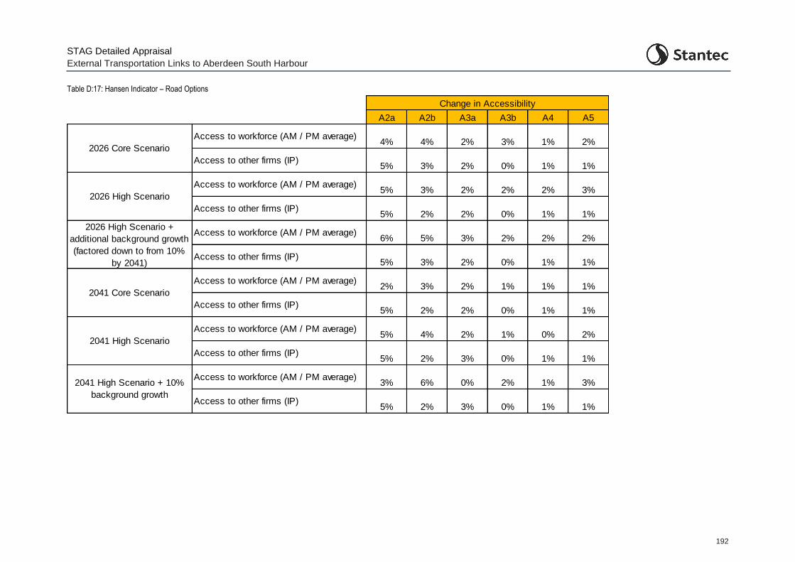
STAG Detailed Appraisal
External Transportation Links to Aberdeen South Harbour
192
Table D:17: Hansen Indicator – Road Options
A2a A2b A3a A3b A4 A5
Access to workforce (AM / PM average)4% 4% 2% 3% 1% 2%
Access to other firms (IP)5% 3% 2% 0% 1% 1%
Access to workforce (AM / PM average)5% 3% 2% 2% 2% 3%
Access to other firms (IP)5% 2% 2% 0% 1% 1%
Access to workforce (AM / PM average)6% 5% 3% 2% 2% 2%
Access to other firms (IP)5% 3% 2% 0% 1% 1%
Access to workforce (AM / PM average)2% 3% 2% 1% 1% 1%
Access to other firms (IP)5% 2% 2% 0% 1% 1%
Access to workforce (AM / PM average)5% 4% 2% 1% 0% 2%
Access to other firms (IP)5% 2% 3% 0% 1% 1%
Access to workforce (AM / PM average)3% 6% 0% 2% 1% 3%
Access to other firms (IP)5% 2% 3% 0% 1% 1%
2041 Core Scenario
2041 High Scenario
2041 High Scenario + 10%
background growth
2026 High Scenario +
additional background growth
(factored down to from 10%
by 2041)
Change in Accessibility
2026 Core Scenario
2026 High Scenario

STAG Detailed Appraisal
External Transportation Links to Aberdeen South Harbour
193
Table D:18: Hansen Indicator – Public Transport Options
Do Min B1 B4 B5
Access to workforce
(AM / PM average) 88 119 94 101
Access to other firms (IP) 58 71 62 65
Access to workforce
(AM / PM average) - 35% 7% 15%
Access to other firms (IP) - 22% 7% 12%
Option
Hansen Value
Change in Accessibility
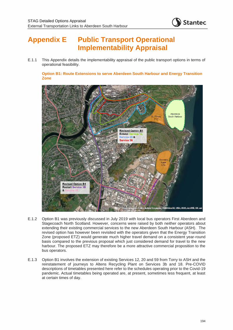
STAG Detailed Options Appraisal
External Transportation Links to Aberdeen South Harbour
194
Appendix E Public Transport Operational Implementability Appraisal
E.1.1 This Appendix details the implementability appraisal of the public transport options in terms of operational feasibility.
Option B1: Route Extensions to serve Aberdeen South Harbour and Energy Transition Zone
E.1.2 Option B1 was previously discussed in July 2019 with local bus operators First Aberdeen and Stagecoach North Scotland. However, concerns were raised by both neither operators about extending their existing commercial services to the new Aberdeen South Harbour (ASH). The revised option has however been revisited with the operators given that the Energy Transition Zone (proposed ETZ) would generate much higher travel demand on a consistent year-round basis compared to the previous proposal which just considered demand for travel to the new harbour. The proposed ETZ may therefore be a more attractive commercial proposition to the bus operators.
E.1.3 Option B1 involves the extension of existing Services 12, 20 and 59 from Torry to ASH and the reinstatement of journeys to Altens Recycling Plant on Services 3b and 18. Pre-COVID descriptions of timetables presented here refer to the schedules operating prior to the Covid-19 pandemic. Actual timetables being operated are, at present, sometimes less frequent, at least at certain times of day.
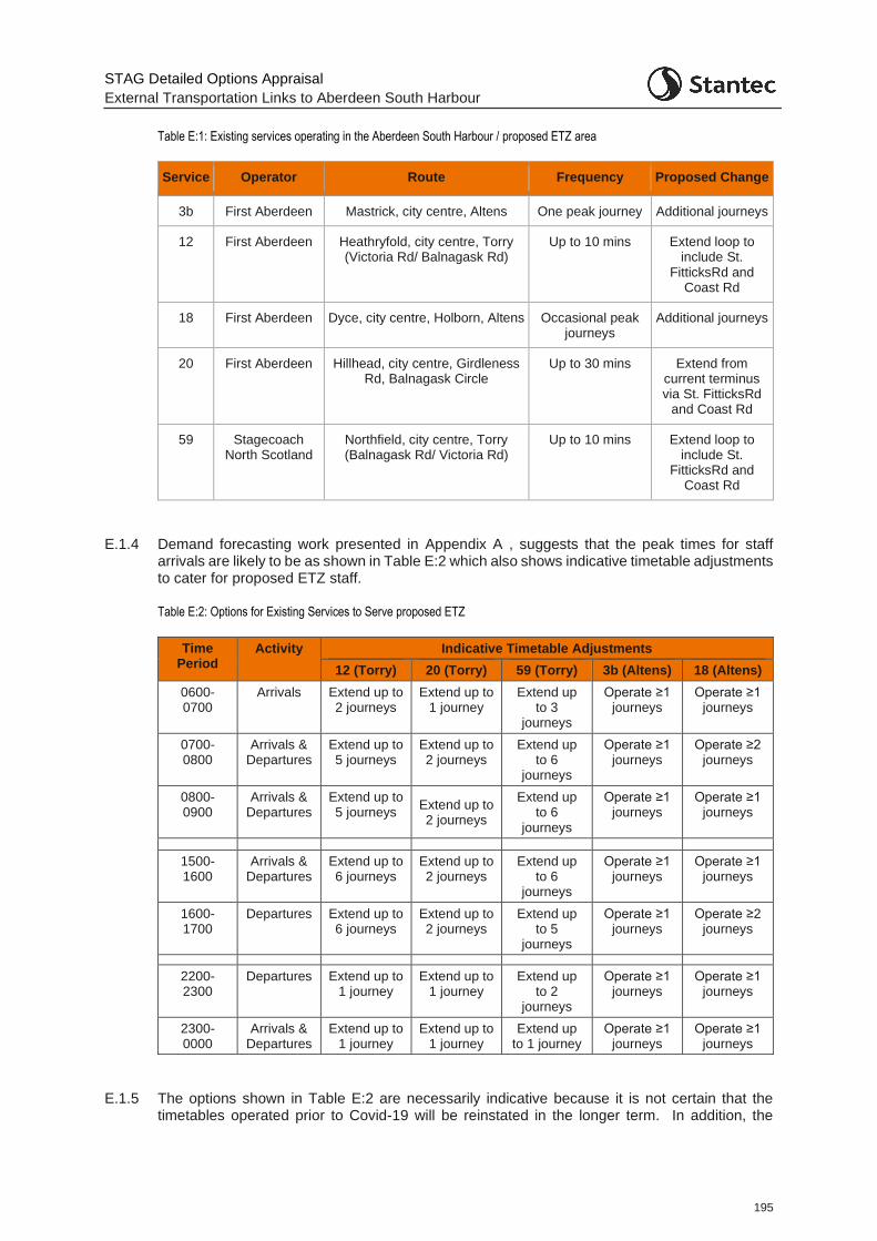
STAG Detailed Options Appraisal
External Transportation Links to Aberdeen South Harbour
195
Table E:1: Existing services operating in the Aberdeen South Harbour / proposed ETZ area
Service Operator Route Frequency Proposed Change
3b First Aberdeen Mastrick, city centre, Altens One peak journey Additional journeys
12 First Aberdeen Heathryfold, city centre, Torry (Victoria Rd/ Balnagask Rd)
Up to 10 mins Extend loop to include St.
FitticksRd and Coast Rd
18 First Aberdeen Dyce, city centre, Holborn, Altens Occasional peak journeys
Additional journeys
20 First Aberdeen Hillhead, city centre, Girdleness Rd, Balnagask Circle
Up to 30 mins Extend from current terminus via St. FitticksRd
and Coast Rd
59 Stagecoach North Scotland
Northfield, city centre, Torry (Balnagask Rd/ Victoria Rd)
Up to 10 mins Extend loop to include St.
FitticksRd and Coast Rd
E.1.4 Demand forecasting work presented in Appendix A , suggests that the peak times for staff arrivals are likely to be as shown in Table E:2 which also shows indicative timetable adjustments to cater for proposed ETZ staff.
Table E:2: Options for Existing Services to Serve proposed ETZ
Time Period
Activity Indicative Timetable Adjustments
12 (Torry) 20 (Torry) 59 (Torry) 3b (Altens) 18 (Altens)
0600-0700
Arrivals Extend up to 2 journeys
Extend up to 1 journey
Extend up to 3
journeys
Operate ≥1 journeys
Operate ≥1 journeys
0700-0800
Arrivals & Departures
Extend up to 5 journeys
Extend up to 2 journeys
Extend up to 6
journeys
Operate ≥1 journeys
Operate ≥2 journeys
0800-0900
Arrivals & Departures
Extend up to 5 journeys
Extend up to 2 journeys
Extend up to 6
journeys
Operate ≥1 journeys
Operate ≥1 journeys
1500-1600
Arrivals & Departures
Extend up to 6 journeys
Extend up to 2 journeys
Extend up to 6
journeys
Operate ≥1 journeys
Operate ≥1 journeys
1600-1700
Departures Extend up to 6 journeys
Extend up to 2 journeys
Extend up to 5
journeys
Operate ≥1 journeys
Operate ≥2 journeys
2200-2300
Departures Extend up to 1 journey
Extend up to 1 journey
Extend up to 2
journeys
Operate ≥1 journeys
Operate ≥1 journeys
2300-0000
Arrivals & Departures
Extend up to 1 journey
Extend up to 1 journey
Extend up to 1 journey
Operate ≥1 journeys
Operate ≥1 journeys
E.1.5 The options shown in Table E:2 are necessarily indicative because it is not certain that the timetables operated prior to Covid-19 will be reinstated in the longer term. In addition, the
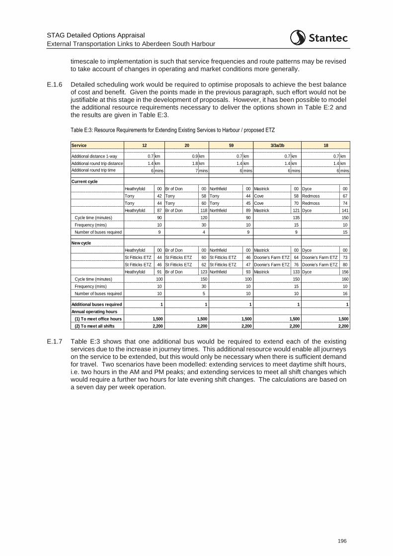
STAG Detailed Options Appraisal
External Transportation Links to Aberdeen South Harbour
196
timescale to implementation is such that service frequencies and route patterns may be revised to take account of changes in operating and market conditions more generally.
E.1.6 Detailed scheduling work would be required to optimise proposals to achieve the best balance of cost and benefit. Given the points made in the previous paragraph, such effort would not be justifiable at this stage in the development of proposals. However, it has been possible to model the additional resource requirements necessary to deliver the options shown in Table E:2 and the results are given in Table E:3.
Table E:3: Resource Requirements for Extending Existing Services to Harbour / proposed ETZ
E.1.7 Table E:3 shows that one additional bus would be required to extend each of the existing services due to the increase in journey times. This additional resource would enable all journeys on the service to be extended, but this would only be necessary when there is sufficient demand for travel. Two scenarios have been modelled: extending services to meet daytime shift hours, i.e. two hours in the AM and PM peaks; and extending services to meet all shift changes which would require a further two hours for late evening shift changes. The calculations are based on a seven day per week operation.
Service
Additional distance 1-way 0.7 km 0.9 km 0.7 km 0.7 km 0.7 km
Additional round trip distance 1.4 km 1.8 km 1.4 km 1.4 km 1.4 km
Additional round trip time 6 mins 7 mins 6 mins 6 mins 6 mins
Current cycle
Heathryfold 00 Br of Don 00 Northfield 00 Mastrick 00 Dyce 00
Torry 42 Torry 58 Torry 44 Cove 58 Redmoss 67
Torry 44 Torry 60 Torry 45 Cove 70 Redmoss 74
Heathryfold 87 Br of Don 118 Northfield 89 Mastrick 121 Dyce 141
Cycle time (minutes) 90 120 90 135 150
Frequency (mins) 10 30 10 15 10
Number of buses required 9 4 9 9 15
New cycle
Heathryfold 00 Br of Don 00 Northfield 00 Mastrick 00 Dyce 00
St Fitticks ETZ 44 St Fitticks ETZ 60 St Fitticks ETZ 46 Doonie's Farm ETZ 64 Doonie's Farm ETZ 73
St Fitticks ETZ 46 St Fitticks ETZ 62 St Fitticks ETZ 47 Doonie's Farm ETZ 76 Doonie's Farm ETZ 80
Heathryfold 91 Br of Don 123 Northfield 93 Mastrick 133 Dyce 156
Cycle time (minutes) 100 150 100 150 160
Frequency (mins) 10 30 10 15 10
Number of buses required 10 5 10 10 16
Additional buses required
Annual operating hours
(1) To meet office hours
(2) To meet all shifts
20 3/3a/3b5912
2,200
18
2,200
1
2,200
1,500 1,500 1,500 1,500
2,200
1 1 1
1,500
1
2,200
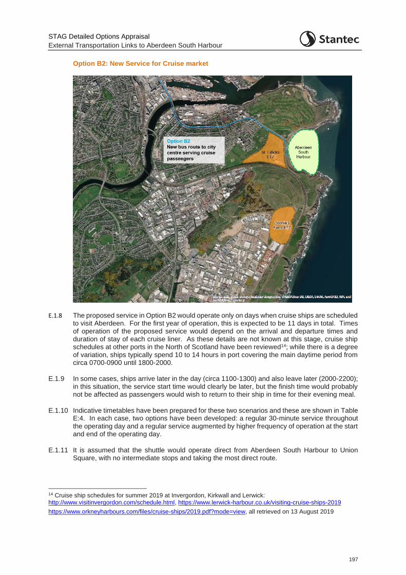
STAG Detailed Options Appraisal
External Transportation Links to Aberdeen South Harbour
197
Option B2: New Service for Cruise market
E.1.8 The proposed service in Option B2 would operate only on days when cruise ships are scheduled to visit Aberdeen. For the first year of operation, this is expected to be 11 days in total. Times of operation of the proposed service would depend on the arrival and departure times and duration of stay of each cruise liner. As these details are not known at this stage, cruise ship schedules at other ports in the North of Scotland have been reviewed14; while there is a degree of variation, ships typically spend 10 to 14 hours in port covering the main daytime period from circa 0700-0900 until 1800-2000.
E.1.9 In some cases, ships arrive later in the day (circa 1100-1300) and also leave later (2000-2200); in this situation, the service start time would clearly be later, but the finish time would probably not be affected as passengers would wish to return to their ship in time for their evening meal.
E.1.10 Indicative timetables have been prepared for these two scenarios and these are shown in Table E:4. In each case, two options have been developed: a regular 30-minute service throughout the operating day and a regular service augmented by higher frequency of operation at the start and end of the operating day.
E.1.11 It is assumed that the shuttle would operate direct from Aberdeen South Harbour to Union Square, with no intermediate stops and taking the most direct route.
14 Cruise ship schedules for summer 2019 at Invergordon, Kirkwall and Lerwick: http://www.visitinvergordon.com/schedule.html, https://www.lerwick-harbour.co.uk/visiting-cruise-ships-2019
https://www.orkneyharbours.com/files/cruise-ships/2019.pdf?mode=view, all retrieved on 13 August 2019
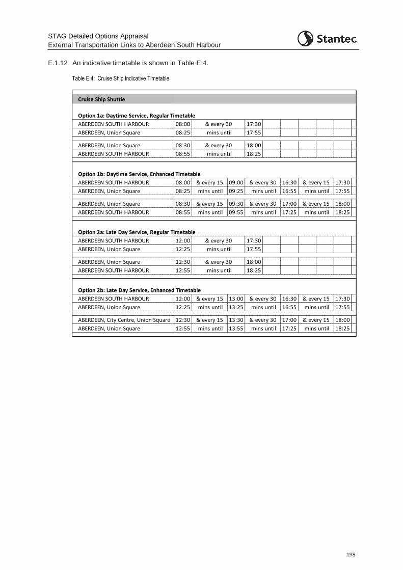
STAG Detailed Options Appraisal
External Transportation Links to Aberdeen South Harbour
198
E.1.12 An indicative timetable is shown in Table E:4.
Table E:4: Cruise Ship Indicative Timetable
Cruise Ship Shuttle
Option 1a: Daytime Service, Regular Timetable
ABERDEEN SOUTH HARBOUR 08:00 17:30
ABERDEEN, Union Square 08:25 17:55
ABERDEEN, Union Square 08:30 18:00
ABERDEEN SOUTH HARBOUR 08:55 18:25
Option 1b: Daytime Service, Enhanced Timetable
ABERDEEN SOUTH HARBOUR 08:00 09:00 16:30 17:30
ABERDEEN, Union Square 08:25 09:25 16:55 17:55
ABERDEEN, Union Square 08:30 09:30 17:00 18:00
ABERDEEN SOUTH HARBOUR 08:55 09:55 17:25 18:25
Option 2a: Late Day Service, Regular Timetable
ABERDEEN SOUTH HARBOUR 12:00 17:30
ABERDEEN, Union Square 12:25 17:55
ABERDEEN, Union Square 12:30 18:00
ABERDEEN SOUTH HARBOUR 12:55 18:25
Option 2b: Late Day Service, Enhanced Timetable
ABERDEEN SOUTH HARBOUR 12:00 13:00 16:30 17:30
ABERDEEN, Union Square 12:25 13:25 16:55 17:55
ABERDEEN, City Centre, Union Square 12:30 13:30 17:00 18:00
ABERDEEN, Union Square 12:55 13:55 17:25 18:25
& every 30
mins until
& every 30
mins until
& every 30
mins until
& every 15
mins until
& every 15
mins until
& every 15
mins until
& every 15
mins until
& every 30
mins until
mins until
& every 15
mins until
& every 15
mins until
& every 15
mins until
& every 30
mins until
& every 30
mins until
& every 15
& every 30
mins until
& every 30
mins until
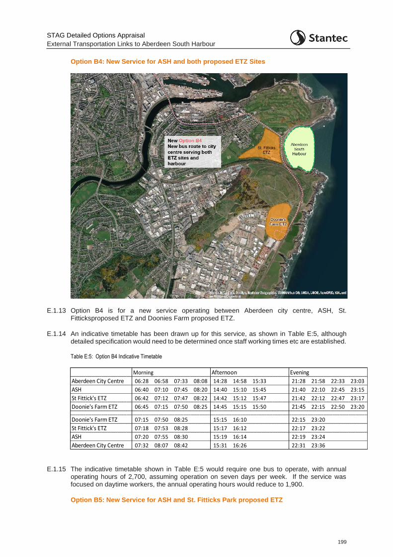
STAG Detailed Options Appraisal
External Transportation Links to Aberdeen South Harbour
199
Option B4: New Service for ASH and both proposed ETZ Sites
E.1.13 Option B4 is for a new service operating between Aberdeen city centre, ASH, St. Fitticksproposed ETZ and Doonies Farm proposed ETZ.
E.1.14 An indicative timetable has been drawn up for this service, as shown in Table E:5, although detailed specification would need to be determined once staff working times etc are established.
Table E:5: Option B4 Indicative Timetable
E.1.15 The indicative timetable shown in Table E:5 would require one bus to operate, with annual operating hours of 2,700, assuming operation on seven days per week. If the service was focused on daytime workers, the annual operating hours would reduce to 1,900.
Option B5: New Service for ASH and St. Fitticks Park proposed ETZ
Morning Afternoon Evening
Aberdeen City Centre 06:28 06:58 07:33 08:08 14:28 14:58 15:33 21:28 21:58 22:33 23:03
ASH 06:40 07:10 07:45 08:20 14:40 15:10 15:45 21:40 22:10 22:45 23:15
St Fittick's ETZ 06:42 07:12 07:47 08:22 14:42 15:12 15:47 21:42 22:12 22:47 23:17
Doonie's Farm ETZ 06:45 07:15 07:50 08:25 14:45 15:15 15:50 21:45 22:15 22:50 23:20
Doonie's Farm ETZ 07:15 07:50 08:25 15:15 16:10 22:15 23:20
St Fittick's ETZ 07:18 07:53 08:28 15:17 16:12 22:17 23:22
ASH 07:20 07:55 08:30 15:19 16:14 22:19 23:24
Aberdeen City Centre 07:32 08:07 08:42 15:31 16:26 22:31 23:36
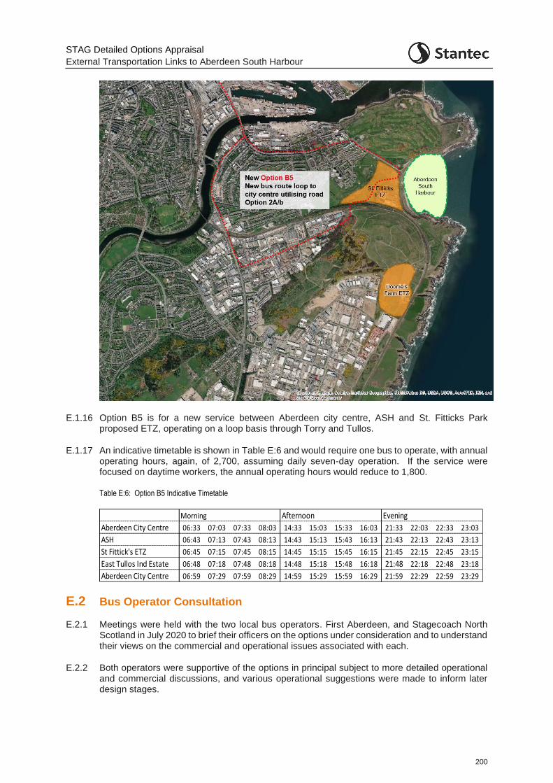
STAG Detailed Options Appraisal
External Transportation Links to Aberdeen South Harbour
200
E.1.16 Option B5 is for a new service between Aberdeen city centre, ASH and St. Fitticks Park proposed ETZ, operating on a loop basis through Torry and Tullos.
E.1.17 An indicative timetable is shown in Table E:6 and would require one bus to operate, with annual operating hours, again, of 2,700, assuming daily seven-day operation. If the service were focused on daytime workers, the annual operating hours would reduce to 1,800.
Table E:6: Option B5 Indicative Timetable
E.2 Bus Operator Consultation
E.2.1 Meetings were held with the two local bus operators. First Aberdeen, and Stagecoach North Scotland in July 2020 to brief their officers on the options under consideration and to understand their views on the commercial and operational issues associated with each.
E.2.2 Both operators were supportive of the options in principal subject to more detailed operational and commercial discussions, and various operational suggestions were made to inform later design stages.
Morning Afternoon Evening
Aberdeen City Centre 06:33 07:03 07:33 08:03 14:33 15:03 15:33 16:03 21:33 22:03 22:33 23:03
ASH 06:43 07:13 07:43 08:13 14:43 15:13 15:43 16:13 21:43 22:13 22:43 23:13
St Fittick's ETZ 06:45 07:15 07:45 08:15 14:45 15:15 15:45 16:15 21:45 22:15 22:45 23:15
East Tullos Ind Estate 06:48 07:18 07:48 08:18 14:48 15:18 15:48 16:18 21:48 22:18 22:48 23:18
Aberdeen City Centre 06:59 07:29 07:59 08:29 14:59 15:29 15:59 16:29 21:59 22:29 22:59 23:29
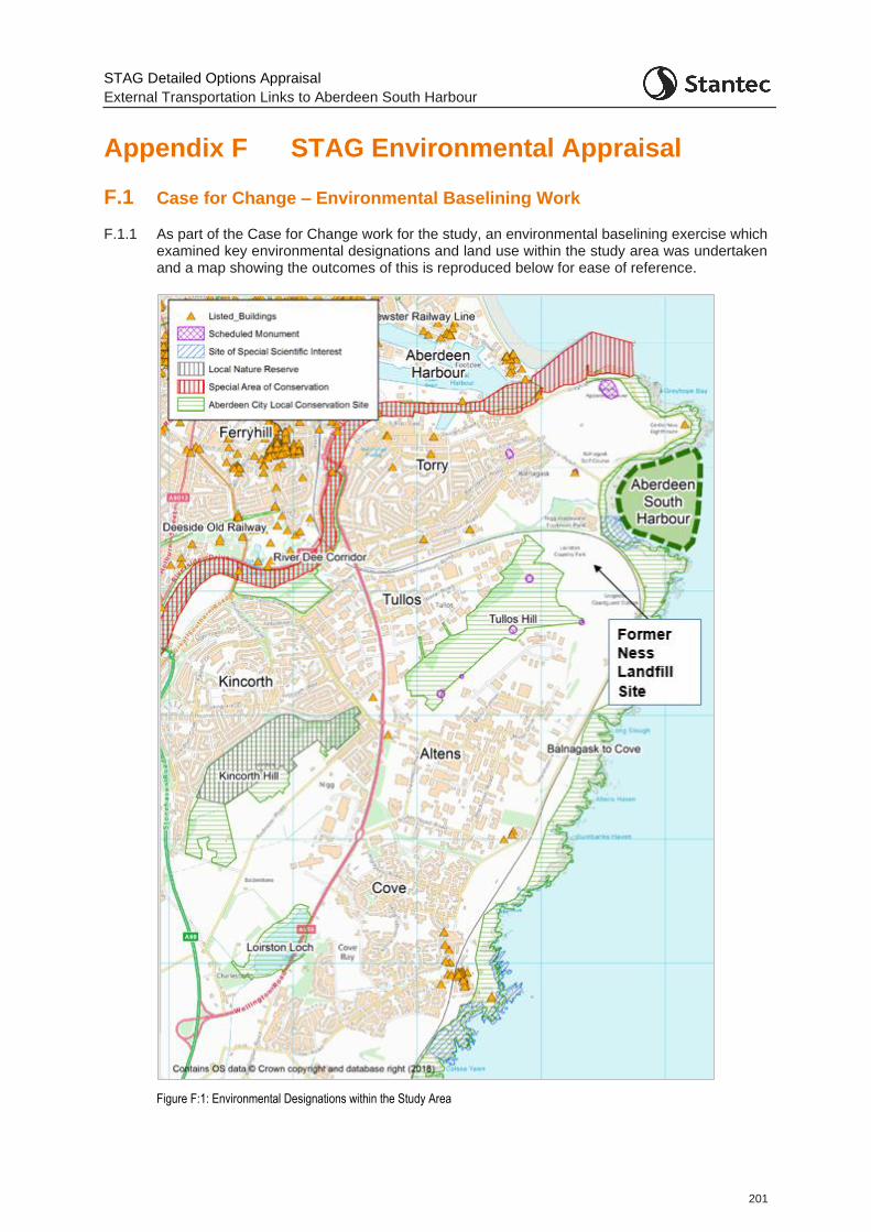
STAG Detailed Options Appraisal
External Transportation Links to Aberdeen South Harbour
201
Appendix F STAG Environmental Appraisal
F.1 Case for Change – Environmental Baselining Work
F.1.1 As part of the Case for Change work for the study, an environmental baselining exercise which examined key environmental designations and land use within the study area was undertaken and a map showing the outcomes of this is reproduced below for ease of reference.
Figure F:1: Environmental Designations within the Study Area
STAG Detailed Options Appraisal
External Transportation Links to Aberdeen South Harbour
202
F.1.2 As shown, the site of the former Ness Landfill is located to the south-west of the ASH site and several of the options involve providing routes through this area. To develop an understanding as to the feasibility of delivering these routes, a more detailed review of the former landfill site was therefore completed. This considered:
The extent of the landfill area;
The site history, including the period during which the landfill was active, the type of waste disposed at the site, and the rate of deposition and closing dates;
Details of the landfill construction cap, drainage infrastructure, monitoring points and hazardous waste cells within the site.
F.1.3 The landfill site was licensed for the disposal of household, industrial, commercial, fragmented, and stabilised drilling muds, asbestos, low level radioactive materials, silt dredging and inert wastes and is known to comprise 90% commercial/industrial waste and 10% domestic waste, with much of the latter pre-treated.
F.1.4 The site appears to extend to the boundary with the railway line and there are several constraints, which may impact the feasibility and cost of construction works, including:
asbestos cells located at various points across the site, including in the north-west corner near Greenwell Road and towards the south-east of the site to the north of the existing railway bridge on Coast Road. In addition, bagged asbestos was also found in two locations outside of the landfill cells during 2010.
two cells containing low radioactive waste which extend across the centre of the site.
several attenuation ponds, including in the north-west corner near Greenwell Road and in the south-east of the site to the north of the existing railway bridge.
F.1.5 Given these challenges, consideration around the issues with the landfill site are detailed in the main body of the report. It was noted that, in general, building on landfill sites is challenging as there is no bearing capacity necessitating the construction of piles. However, the latter create pathways for contamination and therefore significant mitigation would be required. Furthermore, detailed assessment would be required to determine the feasibility and cost implications of building on the landfill site and it is recommended that this be explored further at the detailed design stage should the relevant options progress.
F.2 Environmental Feasibility
F.2.1 In order to facilitate a robust environmental appraisal, a high-level desk-based review of constraints has been undertaken to identify the key environmental considerations and to inform the appraisal and design of the potential route options.
F.2.2 Key environmental constraints were identified with reference to publicly available datasets, Ordnance Survey (OS) mapping, relevant planning policy documents and other available publications. These included:
Development Plan Documents: Aberdeen City and Shire Strategic Development Plan (SDP) (2014), Aberdeen Local Development Plan (LDP) (2017), Aberdeen LDP2 Main Issues Report and associated Interim Environmental Report (2019); Draft Bay of Nigg Development Framework (2018);
Local plans and policies: Aberdeen Core Paths Plan (2009), Aberdeen Local Transport Strategy 2016 – 2021;
STAG Detailed Options Appraisal
External Transportation Links to Aberdeen South Harbour
203
National planning policy, advice and associated information: Scottish Planning Policy (2014), SEPA Flood Map, National Cycle Network in Scotland (Sustrans);
Aberdeen Harbour Project Environmental Statement (2015); and
Envirocheck Report.
F.2.3 Full details are contained in the separate Options Feasibility Study Report, 45816_2001_R_001 - External Transportation Links to ASH Feasibility Study Rev 1, Stantec, March 2020. This review of relevant environmental datasets indicates that several key environmental sensitivities are present within the Study Area and in some cases overlap with potential route options. Any potential route option should address these environmental issues and be sited and designed to minimise environmental impacts. These key environmental sensitivities are discussed below and related in the appraisal in the main body of this report.
Noise and Vibration
F.2.4 The construction and operation of any vehicular route to connect the new harbour with the strategic road network is likely to give rise to localised construction and operational phase noise and vibration impacts on nearby sensitive receptors.
F.2.5 The general study area lies to the east of the residential area of Torry, Balnagask Golf Course and St Fitticks Community Park, extending south to the residential areas of Burnbanks Village and Cove. There are also six primary schools (Walker Road School, Tullos School, Abbotswell Primary School, Kirkhill Primary School, Loirston School and Charleston School) and one secondary school (Lochside Academy) within the Study Area.
Burnbank Village – Noise Assessment
F.2.6 Option A5 creates a new link from Souter Head Road to the Coast Road. Given the routing past Burnbanks Village, additional appraisal was undertaken for this option to consider the potential option impact in terms of noise and vibration on the village community specifically.
F.2.7 Traffic data, disaggregated into light and heavy vehicle types, relating to the route past Burnbanks Village was extracted and compared between the Do Minimum and Option A5 traffic models for all four scenarios (Core, High, Core with 10% background growth by 2026, High + 10% background growth by 2026) and future years (2026 and 2041). Traffic flow data is presented in Table F:1 alongside details of the percentage of all traffic which is HGVs.
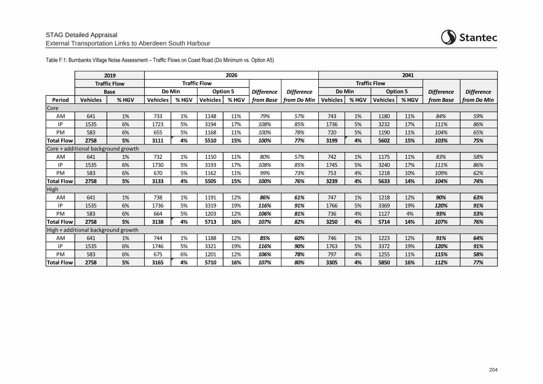
STAG Detailed Appraisal
External Transportation Links to Aberdeen South Harbour
204
Table F:1: Burnbanks Village Noise Assessment – Traffic Flows on Coast Road (Do Minimum vs. Option A5)
Period Vehicles % HGV Vehicles % HGV Vehicles % HGV Vehicles % HGV Vehicles % HGV
Core
AM 641 1% 733 1% 1148 11% 79% 57% 743 1% 1180 11% 84% 59%
IP 1535 6% 1723 5% 3194 17% 108% 85% 1736 5% 3232 17% 111% 86%
PM 583 6% 655 5% 1168 11% 100% 78% 720 5% 1190 11% 104% 65%
Total Flow 2758 5% 3111 4% 5510 15% 100% 77% 3199 4% 5602 15% 103% 75%
AM 641 1% 732 1% 1150 11% 80% 57% 742 1% 1175 11% 83% 58%
IP 1535 6% 1730 5% 3193 17% 108% 85% 1745 5% 3240 17% 111% 86%
PM 583 6% 670 5% 1162 11% 99% 73% 753 4% 1218 10% 109% 62%
Total Flow 2758 5% 3133 4% 5505 15% 100% 76% 3239 4% 5633 14% 104% 74%
AM 641 1% 738 1% 1191 12% 86% 61% 747 1% 1218 12% 90% 63%
IP 1535 6% 1736 5% 3319 19% 116% 91% 1766 5% 3369 19% 120% 91%
PM 583 6% 664 5% 1203 12% 106% 81% 736 4% 1127 4% 93% 53%
Total Flow 2758 5% 3138 4% 5713 16% 107% 82% 3250 4% 5714 14% 107% 76%
AM 641 1% 744 1% 1188 12% 85% 60% 746 1% 1223 12% 91% 64%
IP 1535 6% 1746 5% 3321 19% 116% 90% 1763 5% 3372 19% 120% 91%
PM 583 6% 675 6% 1201 12% 106% 78% 797 4% 1255 11% 115% 58%
Total Flow 2758 5% 3165 4% 5710 16% 107% 80% 3305 4% 5850 16% 112% 77%
High + additional background growth
2019
Traffic Flow
Core + additional background growth
High
Base Do Min Option 5 Do Min Option 5
2026 2041
Traffic Flow
Difference
from Base
Difference
from Do Min
Traffic Flow
Difference
from Base
Difference
from Do Min
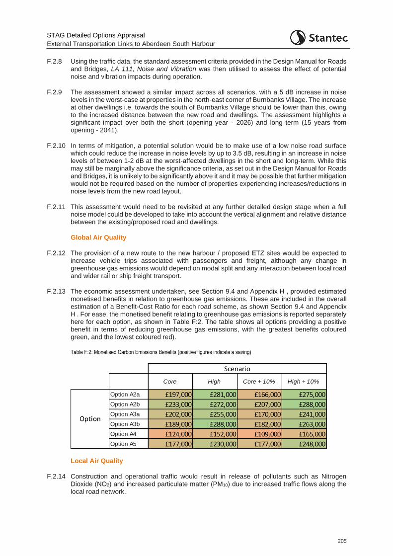
STAG Detailed Options Appraisal
External Transportation Links to Aberdeen South Harbour
205
F.2.8 Using the traffic data, the standard assessment criteria provided in the Design Manual for Roads and Bridges, LA 111, Noise and Vibration was then utilised to assess the effect of potential noise and vibration impacts during operation.
F.2.9 The assessment showed a similar impact across all scenarios, with a 5 dB increase in noise levels in the worst-case at properties in the north-east corner of Burnbanks Village. The increase at other dwellings i.e. towards the south of Burnbanks Village should be lower than this, owing to the increased distance between the new road and dwellings. The assessment highlights a significant impact over both the short (opening year - 2026) and long term (15 years from opening - 2041).
F.2.10 In terms of mitigation, a potential solution would be to make use of a low noise road surface which could reduce the increase in noise levels by up to 3.5 dB, resulting in an increase in noise levels of between 1-2 dB at the worst-affected dwellings in the short and long-term. While this may still be marginally above the significance criteria, as set out in the Design Manual for Roads and Bridges, it is unlikely to be significantly above it and it may be possible that further mitigation would not be required based on the number of properties experiencing increases/reductions in noise levels from the new road layout.
F.2.11 This assessment would need to be revisited at any further detailed design stage when a full noise model could be developed to take into account the vertical alignment and relative distance between the existing/proposed road and dwellings.
Global Air Quality
F.2.12 The provision of a new route to the new harbour / proposed ETZ sites would be expected to increase vehicle trips associated with passengers and freight, although any change in greenhouse gas emissions would depend on modal split and any interaction between local road and wider rail or ship freight transport.
F.2.13 The economic assessment undertaken, see Section 9.4 and Appendix H , provided estimated monetised benefits in relation to greenhouse gas emissions. These are included in the overall estimation of a Benefit-Cost Ratio for each road scheme, as shown Section 9.4 and Appendix H . For ease, the monetised benefit relating to greenhouse gas emissions is reported separately here for each option, as shown in Table F:2. The table shows all options providing a positive benefit in terms of reducing greenhouse gas emissions, with the greatest benefits coloured green, and the lowest coloured red).
Table F:2: Monetised Carbon Emissions Benefits (positive figures indicate a saving)
Local Air Quality
F.2.14 Construction and operational traffic would result in release of pollutants such as Nitrogen Dioxide (NO2) and increased particulate matter (PM10) due to increased traffic flows along the local road network.
Core High Core + 10% High + 10%
Option A2a £197,000 £281,000 £166,000 £275,000
Option A2b £233,000 £272,000 £207,000 £288,000
Option A3a £202,000 £255,000 £170,000 £241,000
Option A3b £189,000 £288,000 £182,000 £263,000
Option A4 £124,000 £152,000 £109,000 £165,000
Option A5 £177,000 £230,000 £177,000 £248,000
Scenario
Option
STAG Detailed Options Appraisal
External Transportation Links to Aberdeen South Harbour
206
F.2.15 Of the three Air Quality Management Areas (AQMA) designated within the Aberdeen City Council area, one is located within the Study Area on the northern section of Wellington Road. The Wellington Road AQMA extends from the Queen Elizabeth Bridge to Balnagask Road and is designated owing to exceedances of NO2 and PM10 annual mean limits.
Water Quality, Drainage and Flood Defence
F.2.16 The key water environment features within the Study Area are:
The Bay of Nigg - open tidal bay which encompasses the marine, intertidal, and terrestrial environments.
East Tullos and Ness Farm Landfill Burns, both of which discharge to the North Sea at the Bay of Nigg. East Tullos Burn runs between Calder Park in the south and St Fitticks Park in the north and is culverted under the East Tullos Industrial Estate.
River Dee - runs throughout Aberdeen and discharges to the North Sea at the existing Aberdeen Harbour. The river is not hydrologically connected to the East Tullos Burn.
F.2.17 The SEPA flood map identifies a high to medium risk of river flooding surrounding the River Dee throughout Aberdeen, with variable levels of surface water flooding. The Study Area is not generally affected by coastal flooding owing to its elevated topography. Envirocheck data indicates the potential for surface groundwater flooding in northern and south eastern areas.
Biodiversity and Habitats
F.2.18 International - the River Dee is designated as a Special Area of Conservation (SAC). This flows through the city and discharges at the existing harbour. It is designated for the presence of Atlantic Salmon, European Otter and Freshwater Pearl Mussel.
F.2.19 National - a single biological Site of Special Scientific Interest (SSSI) is located at Cove Bay at the southern tip of the Study Area. There are several areas of woodland throughout the study area, with one area of Ancient Woodland at Tullos Hill.
F.2.20 Local - Loirston Country Park and Kincorth Hill Local Nature Reserve are located within the centre of the Study Area, adjacent to the former Ness Farm Landfill site. The Study Area encompasses five locally designated Local Nature Conservation Sites (LNCS):
The River Dee is designated as a LNCS in order to protect semi-natural grassland, water margin vegetation, willow and alder tree habitats and associated species;
Tullos Hill LNCS sits within the study area covering the Loirston Country Park and Tullos Wood. Tullos Hill LNCS offers protection for broadleaved woodland, rank neutral grassland, dry heath, wet heath, and lowland birch woodland. It also supports populations of larger mammals such as fox and roe deer. It also incorporates Ancient Woodland;
The Balganask to Cove LNCS covers the entirety of the coastal area in the study area from Battery in the North to Cove in the South. It offers protection to the entirety of the coastal area including shingle beaches, dry heath, coastal health and gorse scrub, mini saltmarsh habitats. and its coastal plants and insects. It also offers protection to coastal birds and cetaceans;
The Kincorth Hill LNCS forms part of ‘the Gramps’ and is an area of semi-natural vegetation. It is dominated by gorse//broom and willow scrub with dry heathland on higher ground. It also includes trees, neutral grassland, and small patches of wet heathland. The majority of Kincorth Hill is also classified as a Local Nature Reserve; and,
STAG Detailed Options Appraisal
External Transportation Links to Aberdeen South Harbour
207
Loirston Loch LNCS is divided in two by the A956 with a small portion on the east side of the road. The loch has a range of grassland and damp habitats, heath, mixed and wet woodland, a Scots pine plantation and areas of gorse scrub. It hosts aquatic and marginal flora, aquatic plant species, birds including wildfowl and rare plant species such as the autumnal water starwort.
Landscape & Visual
F.2.21 The Study Area comprises elevated headlands around the Bay of Nigg, with the land itself generally undulating except steeper slopes located at Doonies Hill and Tullos Hill. Land along the Coast Road is predominantly undeveloped, with residential properties concentrated in Torry to the north and industrial uses clustered in the East Tullos and Altens industrial estates to the west and south west.
F.2.22 The elevated position and topography of the Study Area means that the eastern coastal edge is relatively exposed, whereas further inland, screening is provided by built form. However, the introduction of ASH will itself change the local landscape character around the Bay of Nigg, resulting in a more urbanised setting.
F.2.23 The Study Area is not covered by any Special Landscape Areas (SLA) and does not include any Inventory Garden & Designed Landscapes. St Fitticks Community Park, Walker Park and Loirston Country Park (inc. Kincorth Hill) cover the south west, central and north east parts of the Study Area.
F.2.24 A number of Core Paths, National Cycle Route 1 and other designated routes are present in the Study Area, providing both localised access and forming part of a wider recreational network.
Cultural Heritage
F.2.25 Conservation Areas - there are no Conservation Areas within the Study Area, with the closest being located in Cove to the south and Aberdeen City Centre on the opposite side of the River Dee to the North.
F.2.26 Listed buildings - there are a number of listed buildings throughout the Study Area. Five of these in the north of the Torry residential area (Sinclair Road, Menzies Road, Victoria Road, Walker Road and Grampian Road). Two are in Girdleness Road, with another adjacent to the River Dee at Wellington Road. Another lies at the junction of West Tullos Road and Wellington Road and three are adjacent to Coast Road.
F.2.27 Scheduled Monuments - five scheduled monuments are located within and surrounding Loirston Country Park (cairn and dyke 220m NE of Cat Cairn, Crab's Cairn, Tullos Cairn, Cat Cairn and Barons Cairn). A further four scheduled monuments are located within the Study Area including Pitfoddels Castle, motte 30m E of Norwood, St Fittick's Church, Balnagask motte, Baxter Place and Torry Battery, battery 130m ESE of Old South Breakwater.
Geology
Due to the importance of understanding the challenges with building on a landfill site, detailed commentary around the issue is presented in full in the main body of this report.
STAG Detailed Options Appraisal
External Transportation Links to Aberdeen South Harbour
208
Appendix G STAG Safety Appraisal
G.1 Accident Appraisal
G.1.1 A quantitative appraisal of the impact of the road options on accidents has been undertaken using the Department for Transport’s (DfT’s) COBALT (Cost and Benefit to Accidents – Light Touch) program. The software was developed to undertake the analysis of the impact of accidents as part of the economic appraisal for road schemes. COBALT carries out the economic appraisal in accordance with the DfT’s Transport Analysis Guidance, WebTAG.
G.1.2 COBALT assesses the safety aspects of road schemes using detailed inputs of either (a) separate road links and road junctions that would be impacted by the scheme; or (b) combined links and junctions. The assessment is based on a comparison of accidents by severity and associated costs across an identified network in ‘Without-Scheme’ and ‘With-Scheme’ forecasts, using details of link and junction characteristics, relevant accident rates and costs and forecast traffic volumes by link and junction. For this assessment the combined links and junctions assessment was used.
G.1.3 The most up to date, July 2020, economic parameter file was used in the assessment.
G.1.4 The COBALT model was developed using the traffic model as a base and assigning each link an appropriate COBALT link category. This includes information regarding link length and speed limit. Information regarding the link flows (for both 2026 and 2041) from the traffic model outputs was also input into COBALT for both the Do Minimum and each option test.
G.1.5 Any links that are modified between the Do Minimum and the option to be tested are included twice within COBALT. One of the links is input with the road characteristics and flows from the Do Minimum and then another link is added with the relevant flow and link information from the option test.
G.1.6 The resulting analysis from COBALT is shown in Table G:1.
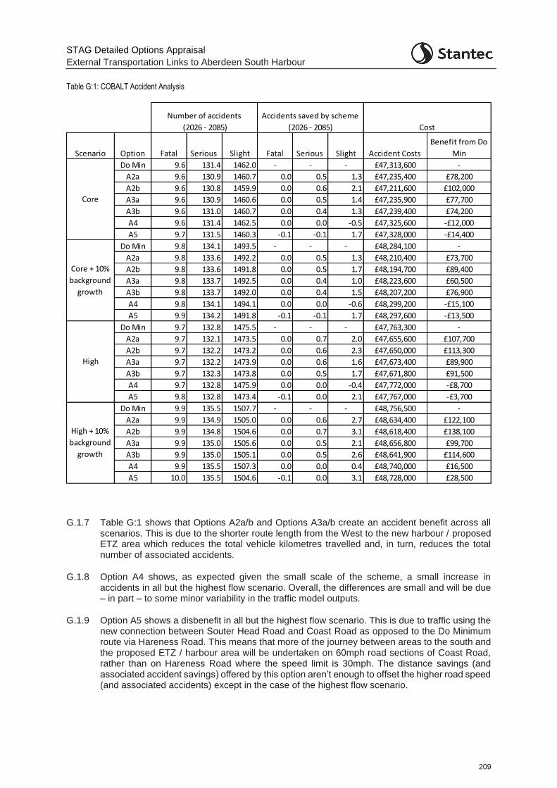
STAG Detailed Options Appraisal
External Transportation Links to Aberdeen South Harbour
209
Table G:1: COBALT Accident Analysis
G.1.7 Table G:1 shows that Options A2a/b and Options A3a/b create an accident benefit across all scenarios. This is due to the shorter route length from the West to the new harbour / proposed ETZ area which reduces the total vehicle kilometres travelled and, in turn, reduces the total number of associated accidents.
G.1.8 Option A4 shows, as expected given the small scale of the scheme, a small increase in accidents in all but the highest flow scenario. Overall, the differences are small and will be due – in part – to some minor variability in the traffic model outputs.
G.1.9 Option A5 shows a disbenefit in all but the highest flow scenario. This is due to traffic using the new connection between Souter Head Road and Coast Road as opposed to the Do Minimum route via Hareness Road. This means that more of the journey between areas to the south and the proposed ETZ / harbour area will be undertaken on 60mph road sections of Coast Road, rather than on Hareness Road where the speed limit is 30mph. The distance savings (and associated accident savings) offered by this option aren’t enough to offset the higher road speed (and associated accidents) except in the case of the highest flow scenario.
Scenario Option Fatal Serious Slight Fatal Serious Slight Accident Costs
Benefit from Do
Min
Do Min 9.6 131.4 1462.0 - - - £47,313,600 -
A2a 9.6 130.9 1460.7 0.0 0.5 1.3 £47,235,400 £78,200
A2b 9.6 130.8 1459.9 0.0 0.6 2.1 £47,211,600 £102,000
A3a 9.6 130.9 1460.6 0.0 0.5 1.4 £47,235,900 £77,700
A3b 9.6 131.0 1460.7 0.0 0.4 1.3 £47,239,400 £74,200
A4 9.6 131.4 1462.5 0.0 0.0 -0.5 £47,325,600 -£12,000
A5 9.7 131.5 1460.3 -0.1 -0.1 1.7 £47,328,000 -£14,400
Do Min 9.8 134.1 1493.5 - - - £48,284,100 -
A2a 9.8 133.6 1492.2 0.0 0.5 1.3 £48,210,400 £73,700
A2b 9.8 133.6 1491.8 0.0 0.5 1.7 £48,194,700 £89,400
A3a 9.8 133.7 1492.5 0.0 0.4 1.0 £48,223,600 £60,500
A3b 9.8 133.7 1492.0 0.0 0.4 1.5 £48,207,200 £76,900
A4 9.8 134.1 1494.1 0.0 0.0 -0.6 £48,299,200 -£15,100
A5 9.9 134.2 1491.8 -0.1 -0.1 1.7 £48,297,600 -£13,500
Do Min 9.7 132.8 1475.5 - - - £47,763,300 -
A2a 9.7 132.1 1473.5 0.0 0.7 2.0 £47,655,600 £107,700
A2b 9.7 132.2 1473.2 0.0 0.6 2.3 £47,650,000 £113,300
A3a 9.7 132.2 1473.9 0.0 0.6 1.6 £47,673,400 £89,900
A3b 9.7 132.3 1473.8 0.0 0.5 1.7 £47,671,800 £91,500
A4 9.7 132.8 1475.9 0.0 0.0 -0.4 £47,772,000 -£8,700
A5 9.8 132.8 1473.4 -0.1 0.0 2.1 £47,767,000 -£3,700
Do Min 9.9 135.5 1507.7 - - - £48,756,500 -
A2a 9.9 134.9 1505.0 0.0 0.6 2.7 £48,634,400 £122,100
A2b 9.9 134.8 1504.6 0.0 0.7 3.1 £48,618,400 £138,100
A3a 9.9 135.0 1505.6 0.0 0.5 2.1 £48,656,800 £99,700
A3b 9.9 135.0 1505.1 0.0 0.5 2.6 £48,641,900 £114,600
A4 9.9 135.5 1507.3 0.0 0.0 0.4 £48,740,000 £16,500
A5 10.0 135.5 1504.6 -0.1 0.0 3.1 £48,728,000 £28,500
Cost
Core + 10%
background
growth
High
High + 10%
background
growth
Accidents saved by scheme
(2026 - 2085)
Number of accidents
(2026 - 2085)
Core
STAG Detailed Options Appraisal
External Transportation Links to Aberdeen South Harbour
210
Appendix H STAG Economy Appraisal
H.1 Methodology
H.1.1 The Detailed Options Appraisal against the Economy Criterion has two sub-criteria which together summarise the full extent of economic impacts. These are:
Transport Economic Efficiency (TEE) - the benefits ordinarily captured by standard cost-benefit analysis - the transport impacts of an option; and
Wider Economic Impacts (WEI) - impacts in non-transport markets that are either of importance from a policy or distributional perspective or which affect the net value that society attributes to the outcomes of a transport intervention.
H.1.2 The TEE analysis captures the main impacts of an option in terms of economic welfare, as represented by the main costs and benefits of users and operators of the transport system. These impacts are expressed in terms of monetary values, by Cost-Benefit Analysis (CBA), which are added together and discounted to produce a Net Present Value (NPV). Costs to the public sector are itemised separately but the input of this is used to generate an overall Benefit to Cost Ratio (BCR) for the option (as discussed and presented in Chapter 10.
H.2 Road Options Economic Appraisal
H.2.1 The TEE for the road options has been estimated using journey time and distance information output from the Do Minimum and Do Something (option) traffic models for the future years of 2026 (assumed scheme opening year) and 2041 (15 years post scheme opening). This information, along with origin-destination traffic demand information has been utilised within the Department for Transport’s TUBA software to generate a BCR for each scheme.
Use of the traffic model
H.2.2 As discussed in Appendix B the microsimulation transport model being utilised for this study was developed by AECOM for Aberdeen City Council for the Wellington Road Multi-modal Corridor Study. In agreement with the client, AECOM extended the Wellington Road model such that it was suitable to be used for this purpose. However, at that time, the Energy Transition Zone had not emerged. As such, when the model was extended and finalised for use in this study, the focus was on ensuring the appropriate routing choices were present in the model for access to the harbour for predominantly heavy goods vehicle traffic. As such, the focus was on ensuring the appropriate route options were available to the south of the model, given little heavy goods vehicle traffic was anticipated from the north given the current routeing restrictions on this type of vehicle.
H.2.3 The proposed ETZ however is anticipated to generate a far higher volume of commuter-based traffic and, as such, draw light (car and light goods vehicle) traffic from Aberdeen city. Unlike heavy goods vehicles, light vehicle traffic accessing the area is not restricted to designated routes. This traffic is able to access the area via a range of routes and generates a greater volume of traffic accessing the area from the north and west of the modelled area (i.e. commuters accessing the site from the Aberdeen urban area). However, some of the route choices available to access the proposed ETZ / harbour area are not ‘joined up’ in the model (given the proposed ETZ had not emerged when decisions on extending the model were made). As such, a number of connections which would be expected to carry traffic bound for ASH and in particular, the proposed ETZ are missing in the model, as discussed in Appendix B.5. This means that if the model were utilised without intervention, development traffic (that associated with ASH and the proposed ETZ) would take unrealistic routes through the model. For example, if a vehicle were travelling from the city centre to the proposed ETZ at St. Fitticks Park, it would, in reality, be expected to take a route via Victoria Road or Sinclair Road to the Coast Road with
STAG Detailed Options Appraisal
External Transportation Links to Aberdeen South Harbour
211
a total route length of approximately 2.5km. However, if restricted to the modelled road network, this vehicle would have to travel via Hareness Road, extending the distance to 10km.
H.2.4 As discussed in Appendix C.5, ‘ghost links’ were included in the model to enable appropriate demand and journey time matrices to be developed and utilised within the model and allow for robust economic assessment.
TUBA Assessment
H.2.5 For each origin-destination pair within the traffic model, demand, journey time and distance travelled inputs and outputs from 30 averaged model simulations were input into TUBA. As noted above, the Do Minimum and the six Do Something (option) traffic models for the future years of 2026 (assumed scheme opening year) and 2041 (15 years post scheme opening) were used in the assessment. This included the modelled scenarios for the: ‘Core’ scenario, ‘High’ scenario, and ‘Core + 10% background growth by 2041’ scenario as described in Chapter 6.
H.2.6 AS noted above, all the models were run to generate 30 simulations, with the resultant outputs averaged for each model before being inputted into TUBA. This was considered sufficient to remove any inherent model ‘noise’ between different simulations.
H.2.7 TUBA software undertakes the economic appraisal of transport schemes in accordance with the Department for Transport’s cost-benefit analysis guidance (TAG Unit A1). While the transport model used in this assessment has light vehicles split by cars and LGVs, and heavy vehicles split by OGV1 and OGV2, no trip purpose information by vehicle type is known. As such, TUBA’s default trip purpose splits were applied to the assessment.
H.2.8 The results from the TUBA assessment in terms of Transport Economic Efficiency are presented in for each individual option in Table H:1 to Table H:6. The results show the overall positive monetised transport efficiency benefits for all options and all scenarios with the exception of Option A2a (Core scenario and Core + 10% background growth by 2041 scenario) and Option A3a (Core scenario).
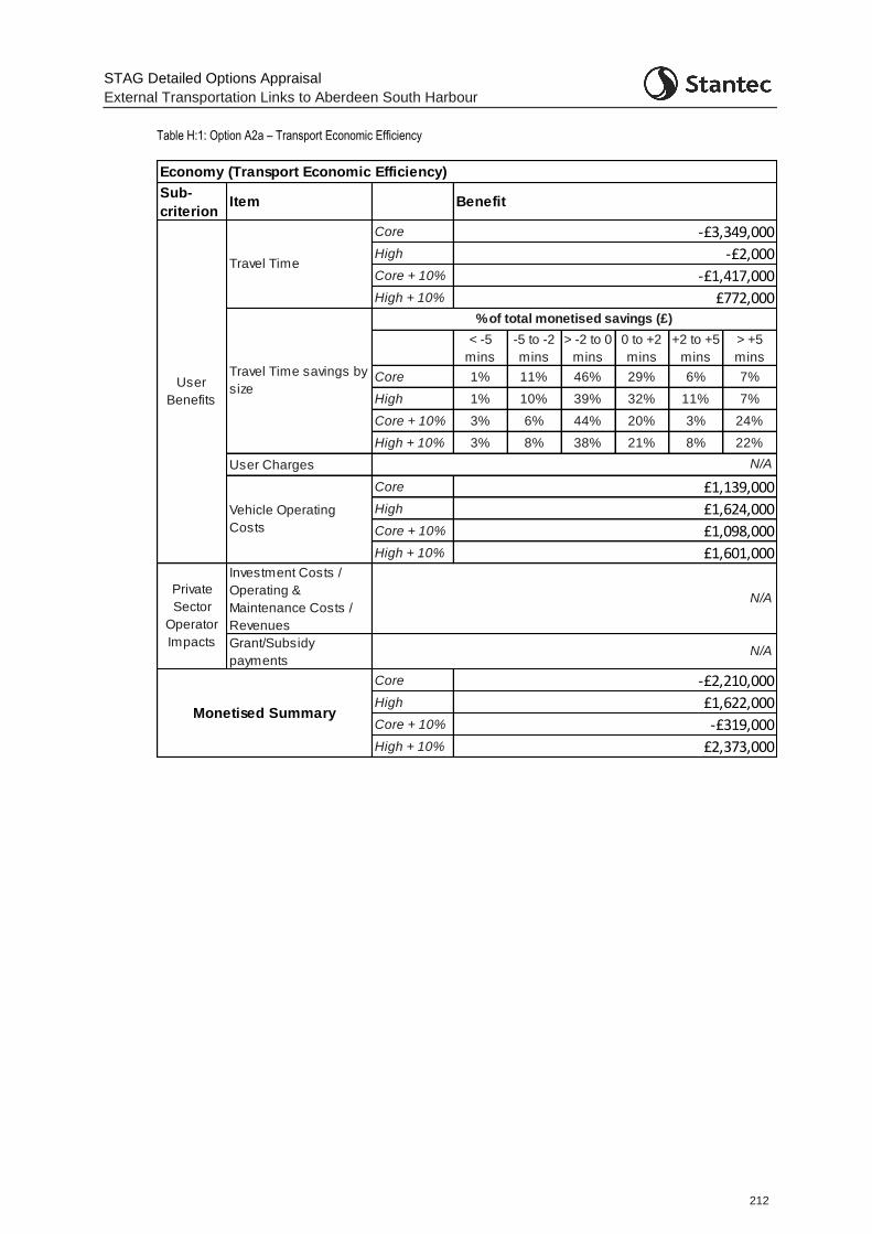
STAG Detailed Options Appraisal
External Transportation Links to Aberdeen South Harbour
212
Table H:1: Option A2a – Transport Economic Efficiency
Sub-
criterionItem
Core
High
Core + 10%
High + 10%
< -5
mins
-5 to -2
mins
> -2 to 0
mins
0 to +2
mins
+2 to +5
mins
> +5
mins
Core 1% 11% 46% 29% 6% 7%
High 1% 10% 39% 32% 11% 7%
Core + 10% 3% 6% 44% 20% 3% 24%
High + 10% 3% 8% 38% 21% 8% 22%
User Charges
Core
High
Core + 10%
High + 10%
Investment Costs /
Operating &
Maintenance Costs /
Revenues
Grant/Subsidy
payments
Core
High
Core + 10%
High + 10%
Monetised Summary
Private
Sector
Operator
Impacts
% of total monetised savings (£)
N/A
Economy (Transport Economic Efficiency)
Benefit
-£3,349,000
£1,139,000
Travel Time
£1,624,000
£1,098,000
£1,601,000
N/A
£2,373,000
N/A
Vehicle Operating
Costs
User
Benefits
-£2,210,000
£1,622,000
-£319,000
-£2,000
-£1,417,000
£772,000
Travel Time savings by
size
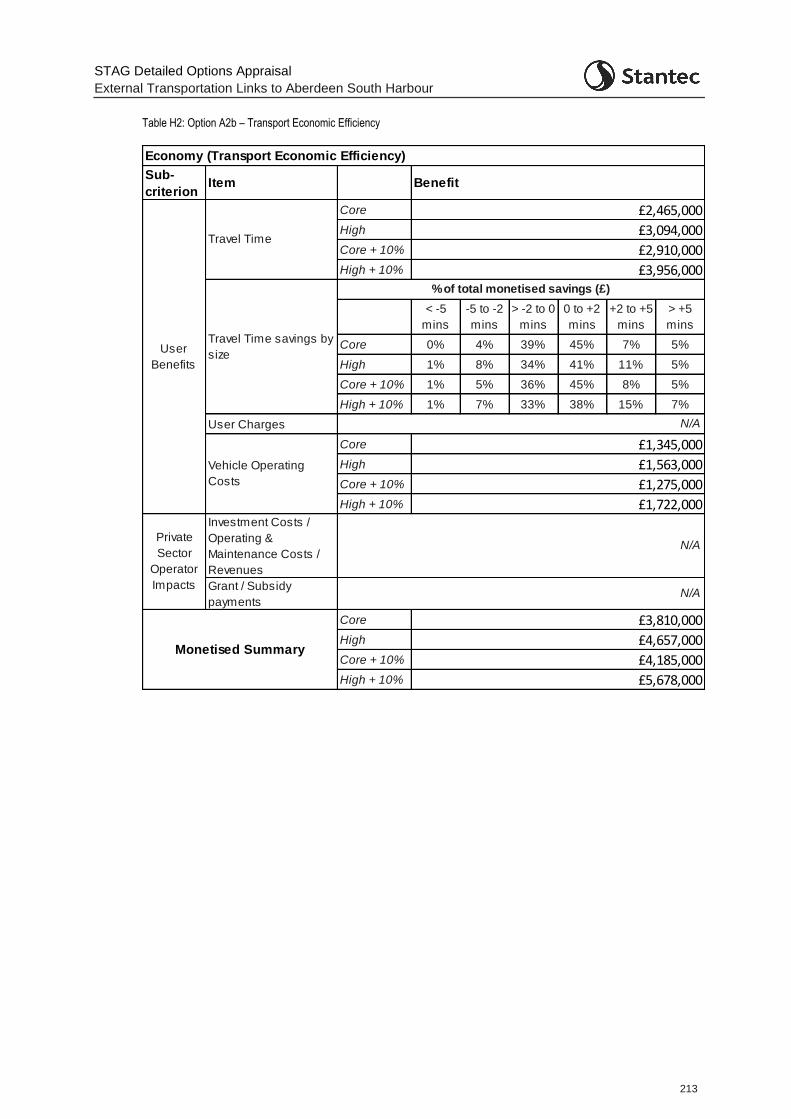
STAG Detailed Options Appraisal
External Transportation Links to Aberdeen South Harbour
213
Table H2: Option A2b – Transport Economic Efficiency
Sub-
criterionItem
Core
High
Core + 10%
High + 10%
< -5
mins
-5 to -2
mins
> -2 to 0
mins
0 to +2
mins
+2 to +5
mins
> +5
mins
Core 0% 4% 39% 45% 7% 5%
High 1% 8% 34% 41% 11% 5%
Core + 10% 1% 5% 36% 45% 8% 5%
High + 10% 1% 7% 33% 38% 15% 7%
User Charges
Core
High
Core + 10%
High + 10%
Investment Costs /
Operating &
Maintenance Costs /
Revenues
Grant / Subsidy
payments
Core
High
Core + 10%
High + 10%
Economy (Transport Economic Efficiency)
Benefit
User
Benefits
Travel Time
£2,465,000
£3,094,000
£2,910,000
£3,956,000
Travel Time savings by
size
% of total monetised savings (£)
N/A
Vehicle Operating
Costs
£1,345,000
£1,563,000
£1,275,000
£1,722,000
N/A
£3,810,000
£4,657,000
£4,185,000
£5,678,000
Private
Sector
Operator
ImpactsN/A
Monetised Summary
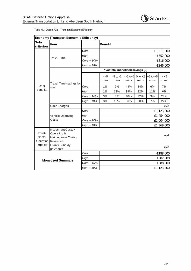
STAG Detailed Options Appraisal
External Transportation Links to Aberdeen South Harbour
214
Table H:3: Option A3a – Transport Economic Efficiency
Sub-
criterionItem
Core
High
Core + 10%
High + 10%
< -5
mins
-5 to -2
mins
> -2 to 0
mins
0 to +2
mins
+2 to +5
mins
> +5
mins
Core 1% 9% 44% 34% 6% 7%
High 1% 12% 39% 32% 11% 6%
Core + 10% 3% 8% 40% 22% 3% 24%
High + 10% 3% 12% 36% 20% 7% 22%
User Charges
Core
High
Core + 10%
High + 10%
Investment Costs /
Operating &
Maintenance Costs /
Revenues
Grant / Subsidy
payments
Core
High
Core + 10%
High + 10%
Economy (Transport Economic Efficiency)
Benefit
User
Benefits
Travel Time
-£1,311,000
-£552,000
-£616,000
-£246,000
Travel Time savings by
size
% of total monetised savings (£)
N/A
Vehicle Operating
Costs
£1,123,000
£1,454,000
£1,004,000
£1,369,000
N/A
-£188,000
£902,000
£388,000
£1,123,000
N/A
Private
Sector
Operator
Impacts
Monetised Summary
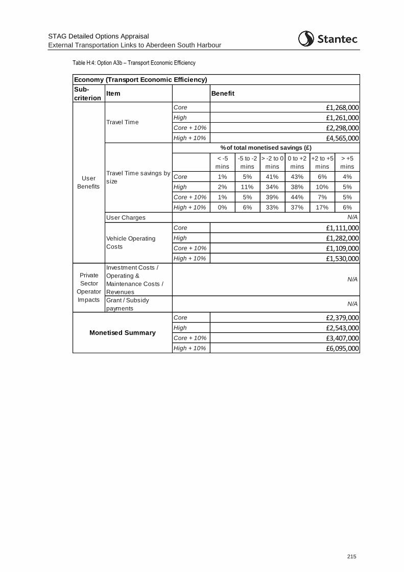
STAG Detailed Options Appraisal
External Transportation Links to Aberdeen South Harbour
215
Table H:4: Option A3b – Transport Economic Efficiency
Sub-
criterionItem
Core
High
Core + 10%
High + 10%
< -5
mins
-5 to -2
mins
> -2 to 0
mins
0 to +2
mins
+2 to +5
mins
> +5
mins
Core 1% 5% 41% 43% 6% 4%
High 2% 11% 34% 38% 10% 5%
Core + 10% 1% 5% 39% 44% 7% 5%
High + 10% 0% 6% 33% 37% 17% 6%
User Charges
Core
High
Core + 10%
High + 10%
Investment Costs /
Operating &
Maintenance Costs /
Revenues
Grant / Subsidy
payments
Core
High
Core + 10%
High + 10%
Economy (Transport Economic Efficiency)
Benefit
User
Benefits
Travel Time
£1,268,000
£1,261,000
£2,298,000
£4,565,000
Travel Time savings by
size
% of total monetised savings (£)
N/A
Vehicle Operating
Costs
£1,111,000
£1,282,000
£1,109,000
£1,530,000
N/A
£2,379,000
£2,543,000
£3,407,000
£6,095,000
N/A
Private
Sector
Operator
Impacts
Monetised Summary
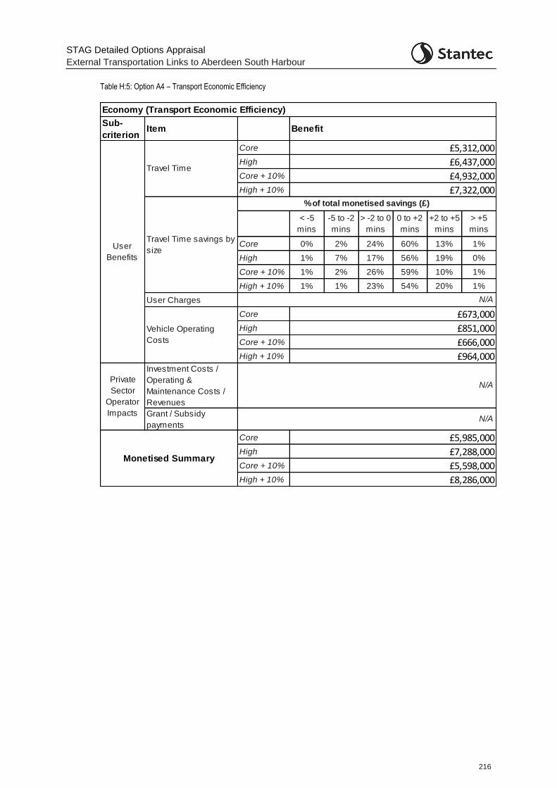
STAG Detailed Options Appraisal
External Transportation Links to Aberdeen South Harbour
216
Table H:5: Option A4 – Transport Economic Efficiency
Sub-
criterionItem
Core
High
Core + 10%
High + 10%
< -5
mins
-5 to -2
mins
> -2 to 0
mins
0 to +2
mins
+2 to +5
mins
> +5
mins
Core 0% 2% 24% 60% 13% 1%
High 1% 7% 17% 56% 19% 0%
Core + 10% 1% 2% 26% 59% 10% 1%
High + 10% 1% 1% 23% 54% 20% 1%
User Charges
Core
High
Core + 10%
High + 10%
Investment Costs /
Operating &
Maintenance Costs /
Revenues
Grant / Subsidy
payments
Core
High
Core + 10%
High + 10%
Economy (Transport Economic Efficiency)
Benefit
User
Benefits
Travel Time
£5,312,000
£6,437,000
£4,932,000
£7,322,000
Travel Time savings by
size
% of total monetised savings (£)
N/A
Vehicle Operating
Costs
£673,000
£851,000
£666,000
£964,000
N/A
£5,985,000
£7,288,000
£5,598,000
£8,286,000
N/A
Private
Sector
Operator
Impacts
Monetised Summary
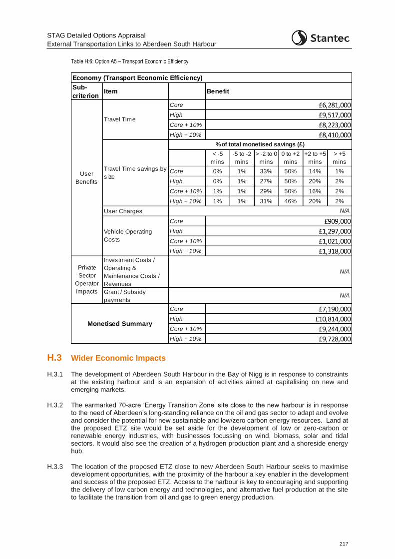
STAG Detailed Options Appraisal
External Transportation Links to Aberdeen South Harbour
217
Table H:6: Option A5 – Transport Economic Efficiency
H.3 Wider Economic Impacts
H.3.1 The development of Aberdeen South Harbour in the Bay of Nigg is in response to constraints at the existing harbour and is an expansion of activities aimed at capitalising on new and emerging markets.
H.3.2 The earmarked 70-acre ‘Energy Transition Zone’ site close to the new harbour is in response to the need of Aberdeen’s long-standing reliance on the oil and gas sector to adapt and evolve and consider the potential for new sustainable and low/zero carbon energy resources. Land at the proposed ETZ site would be set aside for the development of low or zero-carbon or renewable energy industries, with businesses focussing on wind, biomass, solar and tidal sectors. It would also see the creation of a hydrogen production plant and a shoreside energy hub.
H.3.3 The location of the proposed ETZ close to new Aberdeen South Harbour seeks to maximise development opportunities, with the proximity of the harbour a key enabler in the development and success of the proposed ETZ. Access to the harbour is key to encouraging and supporting the delivery of low carbon energy and technologies, and alternative fuel production at the site to facilitate the transition from oil and gas to green energy production.
Sub-
criterionItem
Core
High
Core + 10%
High + 10%
< -5
mins
-5 to -2
mins
> -2 to 0
mins
0 to +2
mins
+2 to +5
mins
> +5
mins
Core 0% 1% 33% 50% 14% 1%
High 0% 1% 27% 50% 20% 2%
Core + 10% 1% 1% 29% 50% 16% 2%
High + 10% 1% 1% 31% 46% 20% 2%
User Charges
Core
High
Core + 10%
High + 10%
Investment Costs /
Operating &
Maintenance Costs /
Revenues
Grant / Subsidy
payments
Core
High
Core + 10%
High + 10%
Economy (Transport Economic Efficiency)
Benefit
User
Benefits
Travel Time
£6,281,000
£9,517,000
£8,223,000
£8,410,000
Travel Time savings by
size
% of total monetised savings (£)
N/A
Vehicle Operating
Costs
£909,000
£1,297,000
£1,021,000
£1,318,000
N/A
£7,190,000
£10,814,000
£9,244,000
£9,728,000
N/A
Private
Sector
Operator
Impacts
Monetised Summary
STAG Detailed Options Appraisal
External Transportation Links to Aberdeen South Harbour
218
H.3.4 Ensuring the harbour and proposed ETZ area is well connected will impact on the real and perceived accessibility of the harbour area and encourage inward growth in the area. This is likely to have wider reaching consequences in terms of the wider economic benefits this could bring to the region, and suppliers of materials and components for the proposed ETZ are likely to benefit from being located close by. The impact is most likely to be felt by those in similar types of industries to the activities envisaged to be undertaken at the proposed ETZ and the use of the harbour. There are therefore likely to be productivity impacts from agglomeration.
H.3.5 There may be potential changes in demand for local premises if an option attracts inward investment or supports the expansion of existing local businesses. This is likely to be mostly felt within East Tullos and Altens industrial estate although may be more widely felt across the region within key employment areas i.e. at Westhill, Bridge of Don etc.
H.3.6 Options which increase accessibility to the area, either through reduced journey times or additional public travel or active travel accessibility, are likely to produce labour market impacts through access to a larger pool of labour, which may lead to efficiency benefits.
H.3.7 Any road option providing reduced freight journey times to and from the harbour and proposed ETZ are likely to be provide reduced business costs. The options providing an additional route to the area (Options A2a/b, A3a/b and A5) also provide a reduced business risk in access to the area and provide resilience and continuity in business operations should an accident, incident or necessary roadworks mean that the existing route (Hareness Road) would be shut. With an alternative route in place, such a closure would not cause such a negative impact on other road users through additional freight traffic on Wellington Road and through Torry.
STAG Detailed Options Appraisal
External Transportation Links to Aberdeen South Harbour
219
Appendix I STAG Integration Appraisal
I.1 Policy Integration – Key Policy Issues
I.1.1 Key planning constraints were identified with reference to publicly available datasets, Ordnance Survey (OS) mapping, relevant planning policy documents and other available publications. These included:
Development Plan Documents: Aberdeen City and Shire Strategic Development Plan (SDP) (2014), Aberdeen Local Development Plan (LDP) (2017), Aberdeen LDP2 Main Issues Report and associated Interim Environmental Report (2019); Draft Bay of Nigg Development Framework (2018);
Local plans and policies: Aberdeen Core Paths Plan (2009), Aberdeen Local Transport Strategy 2016 – 2021; and
National planning policy, advice and associated information: Scottish Planning Policy (2014), SEPA Flood Map, National Cycle Network in Scotland (Sustrans).
I.1.2 Any planning application for a new vehicular route would be determined in accordance with the statutory applicable Development Plan unless material considerations indicate otherwise. More widely, the provision of a new route should align with and support the delivery of policy objectives at local, regional, and national levels.
I.1.3 At the local level, the adopted Aberdeen City Local Development Plan (2017) and associated Supplementary Guidance sets out a spatial strategy and associated policies to guide development within the city. The key policy issues emanating from the adopted LDP of relevance to a new vehicular route to serve ASH are:
Support for infrastructure improvements to increase business productivity and economic growth (Policies B1 and T1 refer). In particular, the Draft Bay of Nigg Development Framework (2018) considers how ASH can be integrated with and maximise economic development and regeneration in the surrounding area. The document explicitly identifies the need for improvements to Wellington Road and existing east west connections, as well as a new connection between ASH and East Tullos Industrial Estate;
Protection and management of coastal environments to protect against erosion or flood risks, protect environmental (including water) quality, and maintain or enhance public access (Policy NE7 refers);
Protection of landscape/townscape character and visual amenity (Policies D2 and SPG on Landscape refer); and,
Requirements to protect designated sites and habitats from unacceptable impacts (Policy NE8 refers).
I.1.4 These key policy issues are also reflected within the Aberdeen LDP2 Main Issues Report (2019), which identifies the Aberdeen Harbour Expansion project as a major committed transport scheme. Additional prioritisation is noted for sustainable and active travel and continued support for business and industrial development through safeguarding harbour infrastructure from other development pressures.
I.1.5 At the regional level, the approved Aberdeen City and Shire Strategic Development Plan (SDP) (2014) requires all development to improve the quality of the environment (built, natural and cultural assets) and to protect the vulnerability of biodiversity and landscapes. In accordance with the Water Framework Directive, the SDP supports the achievement of ‘good ecological status’ in all waterbodies. The SDP also provides support for infrastructure improvements to
STAG Detailed Options Appraisal
External Transportation Links to Aberdeen South Harbour
220
underpin economic development, with specific support provided for improved freight infrastructure.
I.1.6 National planning policy is contained within both the National Planning Framework 3 (NPF3, 2014) and the Scottish Planning Policy (SPP, 2014). Provisions within the SPP (2014) are of some relevance, in particular the protections afforded to designated sites and environmental quality under the Valuing the Natural Environment Subject Policy, although the document does not provide additional relevant criteria beyond the requirements of applicable policies within the adopted and emerging LDPs and SDP.
I.2 Consenting Requirements
I.2.1 The six identified route options would necessitate varying extents of new and realigned road construction outwith existing carriageways, meaning that it would be necessary for Aberdeen City Council, as the scheme promoter, to obtain planning permission for relevant development activities. As all options are likely to involve a total site area (including working areas) exceeding 1 hectare, the project is likely to fall within the scope of paragraph 10(f) of Schedule 2 to the Town and Country Planning Environmental Impact Assessment (Scotland) Regulations 2017 (the EIA Regulations). This means it would be necessary to screen the preferred route for the potential need to undertake a statutory Environmental Impact Assessment (EIA), taking account of the nature of the route, its location and whether significant environmental effects are likely to occur. In the event of a statutory EIA not being required, these factors would also influence the range of technical studies and supporting information that may be required to support a planning application for the project.
I.2.2 As all potential route options would be substantially less than 8km in length, the project would be classed as a ‘local’ development under the Town and Country Planning (Hierarchy of Developments) (Scotland) Regulations 2009. Any planning application for the project would therefore be determined in accordance with applicable procedures.
STAG Detailed Options Appraisal
External Transportation Links to Aberdeen South Harbour
221
Appendix J Engagement
J.1 Introduction
J.1.1 This Appendix sets out detail on engagement activity, both with stakeholder and the public, that has been undertaken during the study.
J.2 Stakeholder Engagement
Various additional stakeholder engagement has taken place during the Detailed Options Appraisal. This has included:
Re-engagement with the bus operators First and Stagecoach to allow for additional discussions on the revised bus options
A workshop with the Energy Transition Zone Working Group to ensure both studies are fully cognisant of the work being undertaken in the other study
Further discussion with Aberdeen Harbour Board on the proposals
Contact (via post) with all potentially impacted businesses - undertaken in tandem with the Public Engagement exercise (discussed below and in Section 11).
J.3 Public Engagement
J.3.1 As noted in Section 11 of this report, responses to the public engagement exercise were received form 126 members of the public and 19 organisations. The organisations who provided a response include:
Muehlhan Industrial Service Ltd
Aberdeen Cycle Forum
NatureScot
North East Scotland Biodiversity Partnership
Dyce Carriers Ltd
ASCO UK
Burnbanks Village Residents Association
Pelagia (UK) Limited
SEPA
Torry Community Group
Stagecoach Bluebird
Car Clinic
Transform Scotland
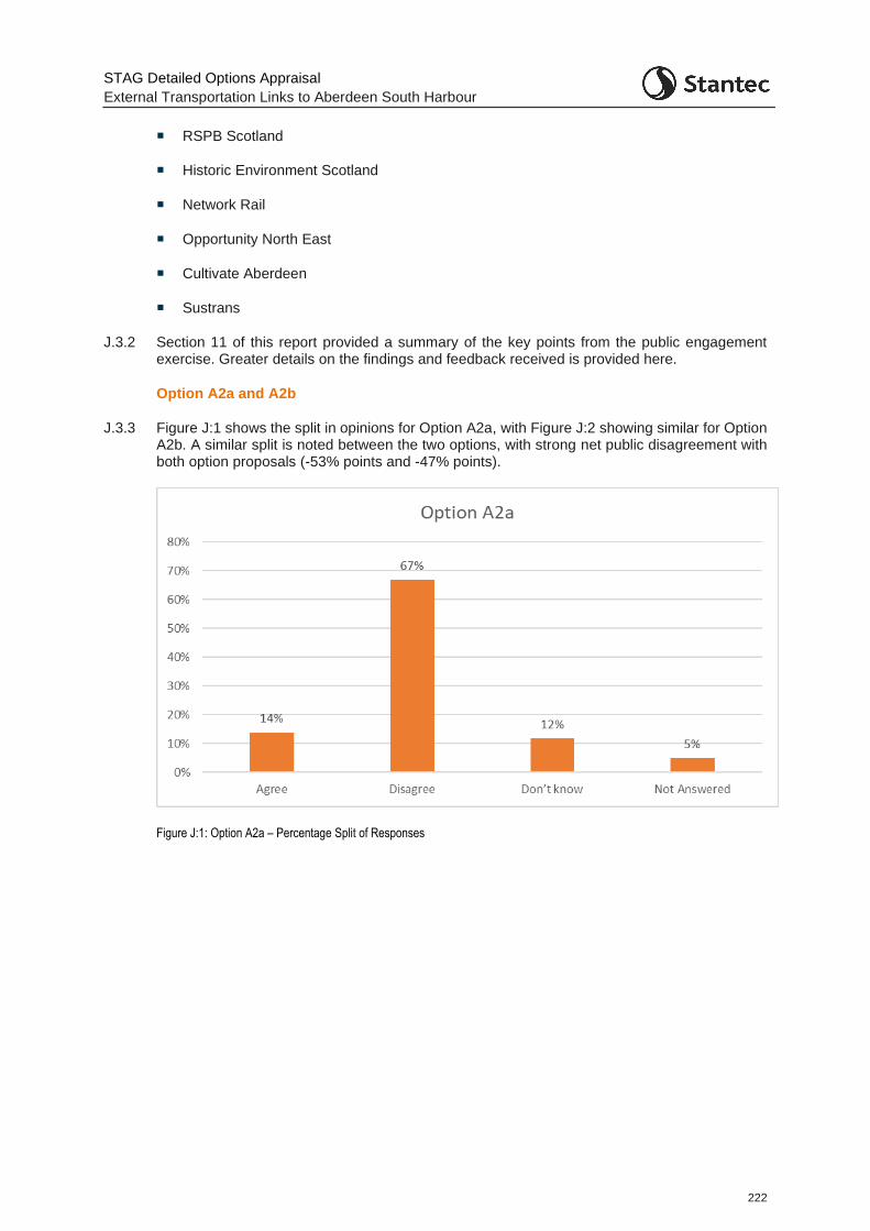
STAG Detailed Options Appraisal
External Transportation Links to Aberdeen South Harbour
222
RSPB Scotland
Historic Environment Scotland
Network Rail
Opportunity North East
Cultivate Aberdeen
Sustrans
J.3.2 Section 11 of this report provided a summary of the key points from the public engagement exercise. Greater details on the findings and feedback received is provided here.
Option A2a and A2b
J.3.3 Figure J:1 shows the split in opinions for Option A2a, with Figure J:2 showing similar for Option A2b. A similar split is noted between the two options, with strong net public disagreement with both option proposals (-53% points and -47% points).
Figure J:1: Option A2a – Percentage Split of Responses
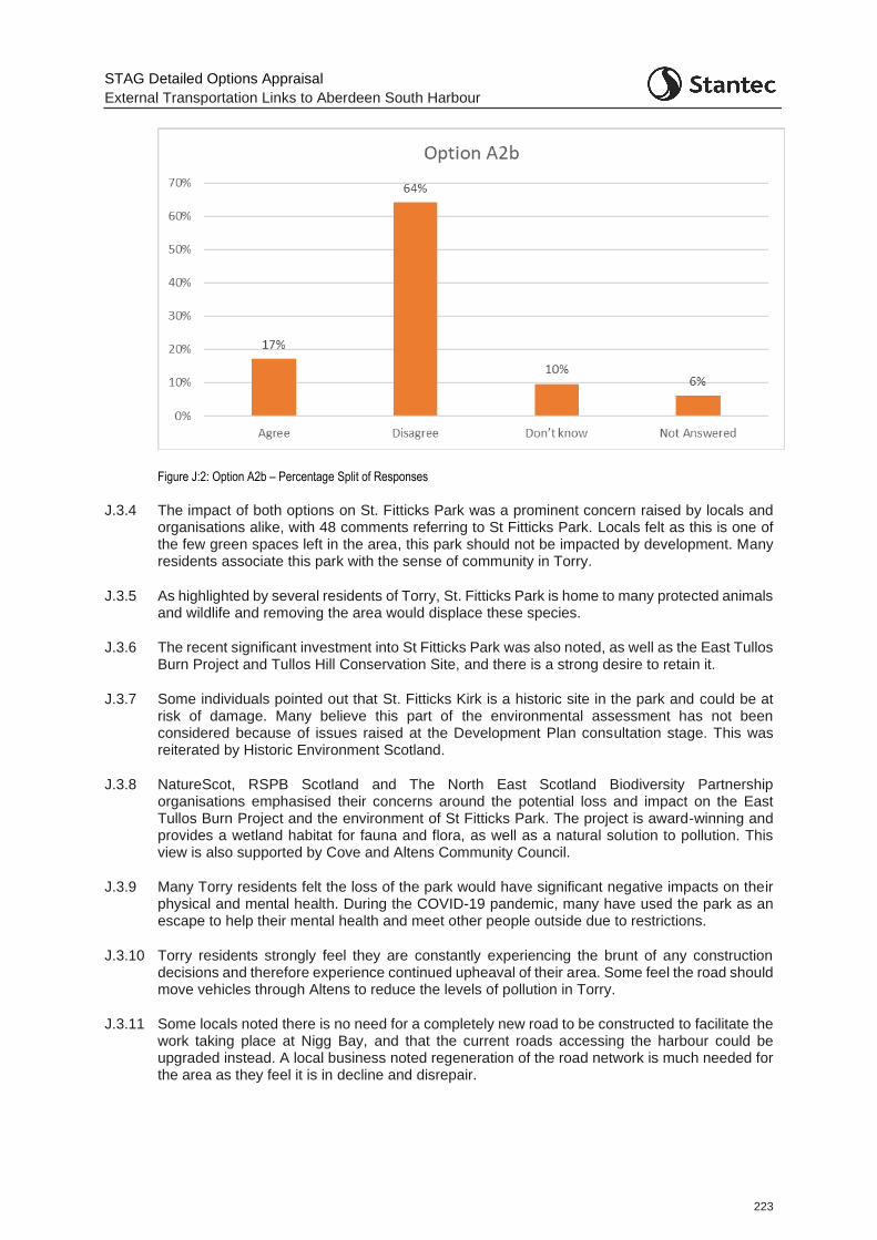
STAG Detailed Options Appraisal
External Transportation Links to Aberdeen South Harbour
223
Figure J:2: Option A2b – Percentage Split of Responses
J.3.4 The impact of both options on St. Fitticks Park was a prominent concern raised by locals and organisations alike, with 48 comments referring to St Fitticks Park. Locals felt as this is one of the few green spaces left in the area, this park should not be impacted by development. Many residents associate this park with the sense of community in Torry.
J.3.5 As highlighted by several residents of Torry, St. Fitticks Park is home to many protected animals and wildlife and removing the area would displace these species.
J.3.6 The recent significant investment into St Fitticks Park was also noted, as well as the East Tullos Burn Project and Tullos Hill Conservation Site, and there is a strong desire to retain it.
J.3.7 Some individuals pointed out that St. Fitticks Kirk is a historic site in the park and could be at risk of damage. Many believe this part of the environmental assessment has not been considered because of issues raised at the Development Plan consultation stage. This was reiterated by Historic Environment Scotland.
J.3.8 NatureScot, RSPB Scotland and The North East Scotland Biodiversity Partnership organisations emphasised their concerns around the potential loss and impact on the East Tullos Burn Project and the environment of St Fitticks Park. The project is award-winning and provides a wetland habitat for fauna and flora, as well as a natural solution to pollution. This view is also supported by Cove and Altens Community Council.
J.3.9 Many Torry residents felt the loss of the park would have significant negative impacts on their physical and mental health. During the COVID-19 pandemic, many have used the park as an escape to help their mental health and meet other people outside due to restrictions.
J.3.10 Torry residents strongly feel they are constantly experiencing the brunt of any construction decisions and therefore experience continued upheaval of their area. Some feel the road should move vehicles through Altens to reduce the levels of pollution in Torry.
J.3.11 Some locals noted there is no need for a completely new road to be constructed to facilitate the work taking place at Nigg Bay, and that the current roads accessing the harbour could be upgraded instead. A local business noted regeneration of the road network is much needed for the area as they feel it is in decline and disrepair.
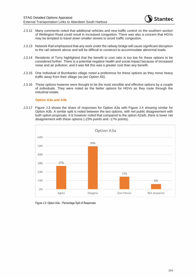
STAG Detailed Options Appraisal
External Transportation Links to Aberdeen South Harbour
224
J.3.12 Many comments noted that additional vehicles and new traffic control on the southern section of Wellington Road could result in increased congestion. There was also a concern that HGVs may be tempted to travel down smaller streets to avoid traffic congestion.
J.3.13 Network Rail emphasised that any work under the railway bridge will cause significant disruption to the rail network above and will be difficult to construct to accommodate abnormal loads.
J.3.14 Residents of Torry highlighted that the benefit to cost ratio is too low for these options to be considered further. There is a potential negative health and social impact because of increased noise and air pollution, and it was felt this was a greater cost than any benefit.
J.3.15 One individual of Burnbanks village noted a preference for these options as they move heavy traffic away from their village (as per Option A5).
J.3.16 These options however were thought to be the most sensible and effective options by a couple of individuals. They were noted as the better options for HGVs as they route through the industrial estate.
Option A3a and A3b
J.3.17 Figure J:3 shows the share of responses for Option A3a with Figure J:4 showing similar for Option A3b. A similar split is noted between the two options, with net public disagreement with both option proposals. It is however noted that compared to the option A2a/b, there is lower net disagreement with these options (-23% points and -17% points).
Figure J:3: Option A3a – Percentage Split of Responses
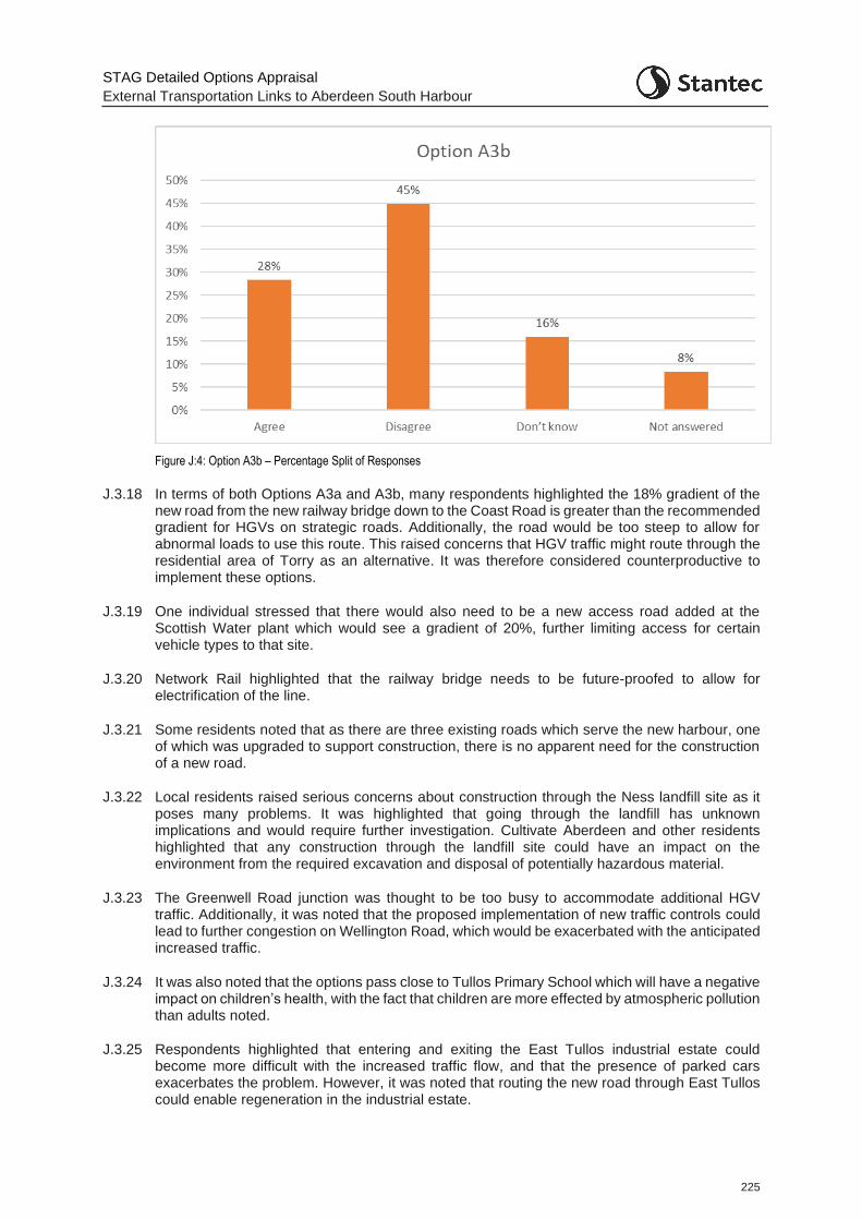
STAG Detailed Options Appraisal
External Transportation Links to Aberdeen South Harbour
225
Figure J:4: Option A3b – Percentage Split of Responses
J.3.18 In terms of both Options A3a and A3b, many respondents highlighted the 18% gradient of the new road from the new railway bridge down to the Coast Road is greater than the recommended gradient for HGVs on strategic roads. Additionally, the road would be too steep to allow for abnormal loads to use this route. This raised concerns that HGV traffic might route through the residential area of Torry as an alternative. It was therefore considered counterproductive to implement these options.
J.3.19 One individual stressed that there would also need to be a new access road added at the Scottish Water plant which would see a gradient of 20%, further limiting access for certain vehicle types to that site.
J.3.20 Network Rail highlighted that the railway bridge needs to be future-proofed to allow for electrification of the line.
J.3.21 Some residents noted that as there are three existing roads which serve the new harbour, one of which was upgraded to support construction, there is no apparent need for the construction of a new road.
J.3.22 Local residents raised serious concerns about construction through the Ness landfill site as it poses many problems. It was highlighted that going through the landfill has unknown implications and would require further investigation. Cultivate Aberdeen and other residents highlighted that any construction through the landfill site could have an impact on the environment from the required excavation and disposal of potentially hazardous material.
J.3.23 The Greenwell Road junction was thought to be too busy to accommodate additional HGV traffic. Additionally, it was noted that the proposed implementation of new traffic controls could lead to further congestion on Wellington Road, which would be exacerbated with the anticipated increased traffic.
J.3.24 It was also noted that the options pass close to Tullos Primary School which will have a negative impact on children’s health, with the fact that children are more effected by atmospheric pollution than adults noted.
J.3.25 Respondents highlighted that entering and exiting the East Tullos industrial estate could become more difficult with the increased traffic flow, and that the presence of parked cars exacerbates the problem. However, it was noted that routing the new road through East Tullos could enable regeneration in the industrial estate.
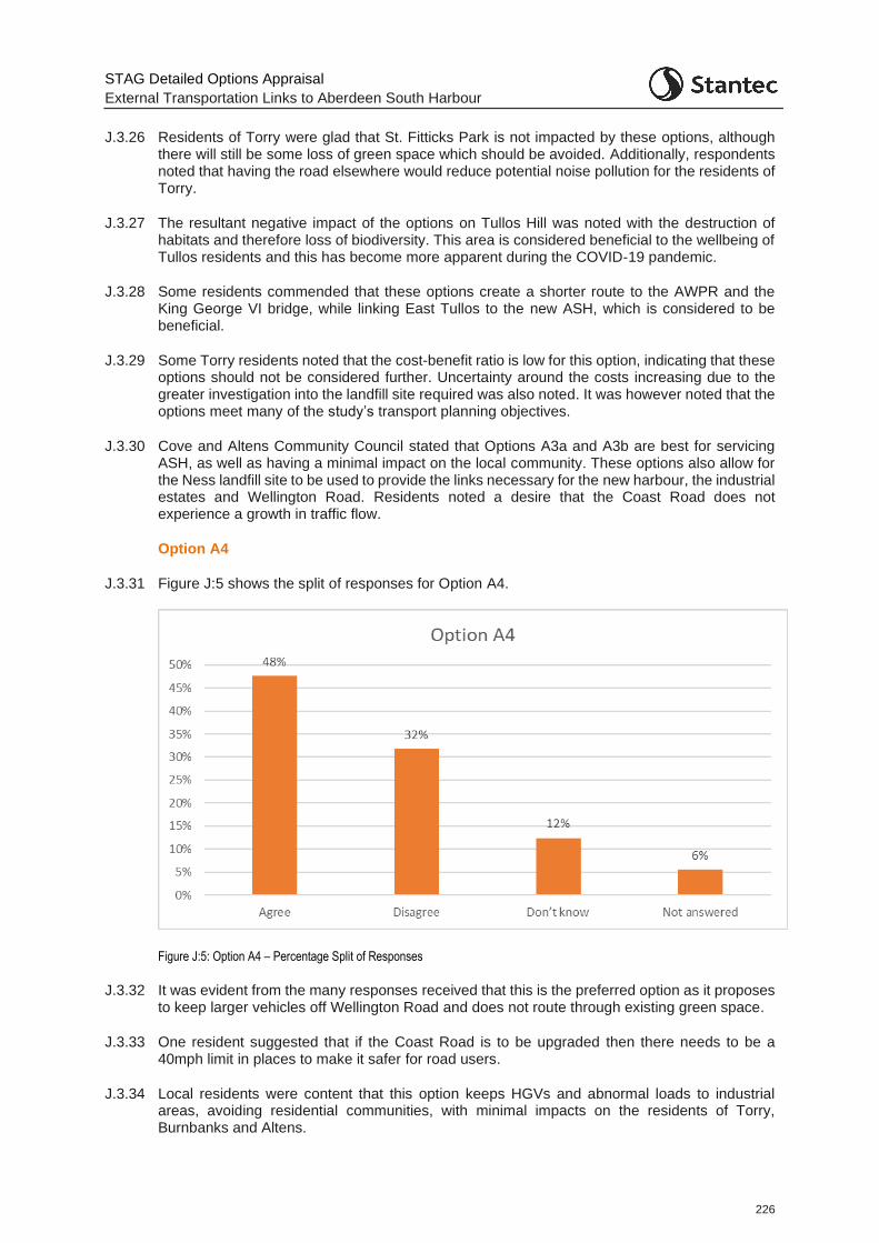
STAG Detailed Options Appraisal
External Transportation Links to Aberdeen South Harbour
226
J.3.26 Residents of Torry were glad that St. Fitticks Park is not impacted by these options, although there will still be some loss of green space which should be avoided. Additionally, respondents noted that having the road elsewhere would reduce potential noise pollution for the residents of Torry.
J.3.27 The resultant negative impact of the options on Tullos Hill was noted with the destruction of habitats and therefore loss of biodiversity. This area is considered beneficial to the wellbeing of Tullos residents and this has become more apparent during the COVID-19 pandemic.
J.3.28 Some residents commended that these options create a shorter route to the AWPR and the King George VI bridge, while linking East Tullos to the new ASH, which is considered to be beneficial.
J.3.29 Some Torry residents noted that the cost-benefit ratio is low for this option, indicating that these options should not be considered further. Uncertainty around the costs increasing due to the greater investigation into the landfill site required was also noted. It was however noted that the options meet many of the study’s transport planning objectives.
J.3.30 Cove and Altens Community Council stated that Options A3a and A3b are best for servicing ASH, as well as having a minimal impact on the local community. These options also allow for the Ness landfill site to be used to provide the links necessary for the new harbour, the industrial estates and Wellington Road. Residents noted a desire that the Coast Road does not experience a growth in traffic flow.
Option A4
J.3.31 Figure J:5 shows the split of responses for Option A4.
Figure J:5: Option A4 – Percentage Split of Responses
J.3.32 It was evident from the many responses received that this is the preferred option as it proposes to keep larger vehicles off Wellington Road and does not route through existing green space.
J.3.33 One resident suggested that if the Coast Road is to be upgraded then there needs to be a 40mph limit in places to make it safer for road users.
J.3.34 Local residents were content that this option keeps HGVs and abnormal loads to industrial areas, avoiding residential communities, with minimal impacts on the residents of Torry, Burnbanks and Altens.
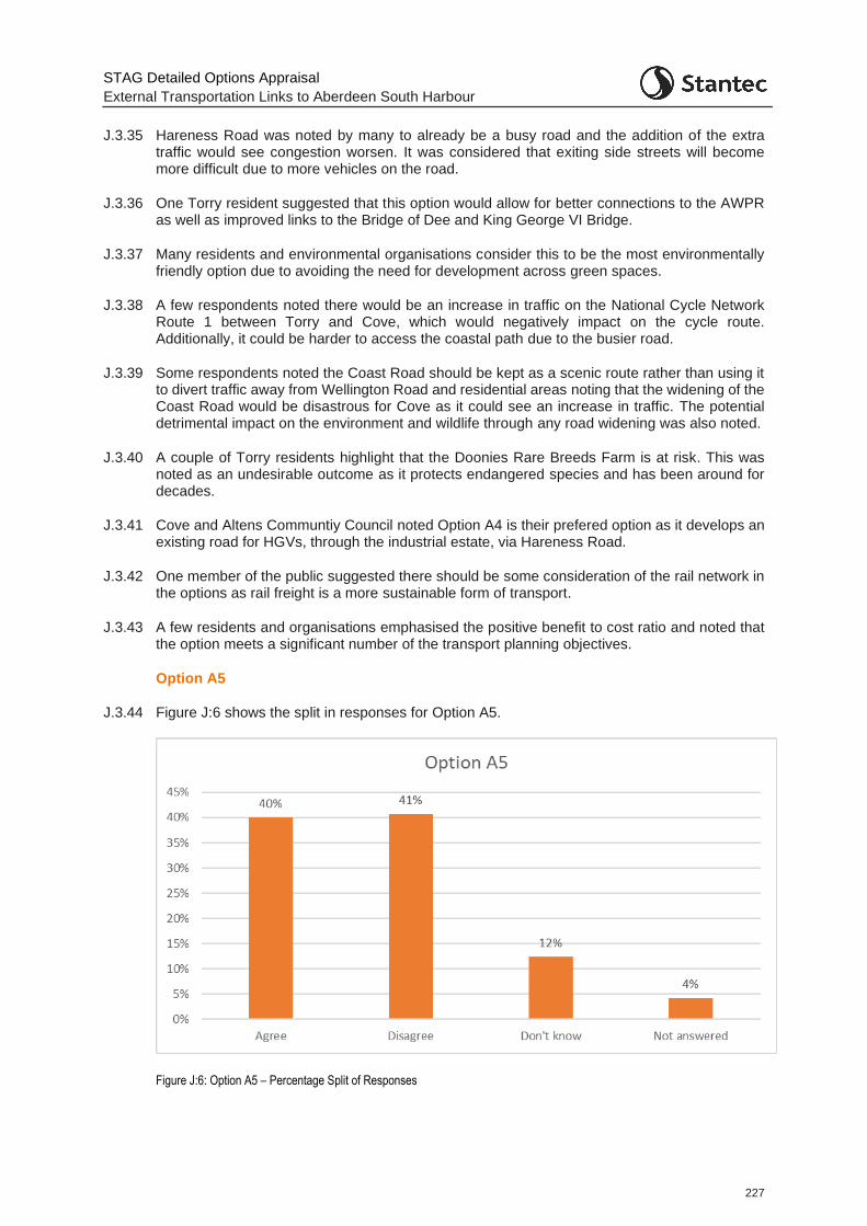
STAG Detailed Options Appraisal
External Transportation Links to Aberdeen South Harbour
227
J.3.35 Hareness Road was noted by many to already be a busy road and the addition of the extra traffic would see congestion worsen. It was considered that exiting side streets will become more difficult due to more vehicles on the road.
J.3.36 One Torry resident suggested that this option would allow for better connections to the AWPR as well as improved links to the Bridge of Dee and King George VI Bridge.
J.3.37 Many residents and environmental organisations consider this to be the most environmentally friendly option due to avoiding the need for development across green spaces.
J.3.38 A few respondents noted there would be an increase in traffic on the National Cycle Network Route 1 between Torry and Cove, which would negatively impact on the cycle route. Additionally, it could be harder to access the coastal path due to the busier road.
J.3.39 Some respondents noted the Coast Road should be kept as a scenic route rather than using it to divert traffic away from Wellington Road and residential areas noting that the widening of the Coast Road would be disastrous for Cove as it could see an increase in traffic. The potential detrimental impact on the environment and wildlife through any road widening was also noted.
J.3.40 A couple of Torry residents highlight that the Doonies Rare Breeds Farm is at risk. This was noted as an undesirable outcome as it protects endangered species and has been around for decades.
J.3.41 Cove and Altens Communtiy Council noted Option A4 is their prefered option as it develops an existing road for HGVs, through the industrial estate, via Hareness Road.
J.3.42 One member of the public suggested there should be some consideration of the rail network in the options as rail freight is a more sustainable form of transport.
J.3.43 A few residents and organisations emphasised the positive benefit to cost ratio and noted that the option meets a significant number of the transport planning objectives.
Option A5
J.3.44 Figure J:6 shows the split in responses for Option A5.
Figure J:6: Option A5 – Percentage Split of Responses

STAG Detailed Options Appraisal
External Transportation Links to Aberdeen South Harbour
228
J.3.45 Many residents of Burnbanks village in particular highlighted that there would be a substantial impact to the Burnbanks community if this option went ahead. This was deemed unacceptable. The route through Souterhead Road to the Coast Road was considered to have significant negative impacts on both the Burnbanks Village and Altens communities. It was noted that the option would result in reduced access from these communities to Cove Bay by foot. This would isolate those who live in Burnbanks Village from Cove Bay where the local primary school, doctors and shops are located.
J.3.46 Cove and Altens Community Council noted Option A5 as the worst option due to the negative health and quality of life impacts on the residents of Burnbanks village. This included the noise and air pollution generated from the close proximity of houses to HGVs traffic on the road.
J.3.47 Network Rail emphasised that a new railway bridge is subject to asset protection and would have to enable future electrification of the line.
J.3.48 Some respondents noted that Option A5 successfully improves links between the ETZ and ASH, although there is little connectivity between ASH and East Tullos which is a potential issue.
J.3.49 Respondents highlighted that the option provides an improved connection to the AWPR which is beneficial for all the residents of this area and that the option will also reduce congestion on Wellington Road, north of Souterhead junction.
J.3.50 Many respondents also noted that the construction of a new road is unnecessary when there is already pre-existing infrastructure present.
J.3.51 Many respondents noted that Option A5 has a greater negative environmental impact compared to Option A4. With Doonies Rare Breed Farm being a valued part of the wider community, many felt it would be a disaster if this were lost.
J.3.52 Local residents emphasised that the noise and vibrations from the south end of the Coast Road would be disruptive to the nearby residential area.
J.3.53 The occupier of the site at the east end of Souterhead Road whose premises would be significantly impacted by this option noted that since 2014, the company has made significant investment at the site in refurbishing and constructing buildings, as well as upgrading facilities. In addition, on-going investment decisions are being made in relation to the site and the outcomes of this study could significantly impact on these. Therefore, there is a need to keep the occupier fully up to date on the progression of the options and the project.
J.3.54 The company holds a SEPA PPC permit for a blast and paint facility at the site and a SEPA permit is also in place for the non-destructive testing and hydro testing facility. Such facilities are far more difficult to relocate compared to other buildings on the site. Another suitable site would need to be found where permits associated with them could be re-applied for. The blast and paint facility, in particular, was highlighted as the most difficult to relocate and ideally would remain at the current site. Given this, it was noted that it may be possible for future acquisition of some of the site, due to the way that the potential road option would interact with the facility i.e. it might not be necessary for the whole business to be acquired and relocated. It is noted that other companies which also occupy land here have been contacted as part of the engagement but have not responded.
J.3.55 Some respondents noted that this option has fewer obvious advantages compared to Option A4 and is more expensive.
J.3.56 Again, a few individuals suggested that rail options should be explored as this mode could be used to lessen the congestion experienced on the road network.
Option B1
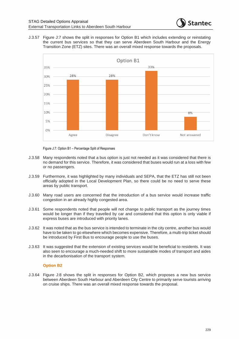
STAG Detailed Options Appraisal
External Transportation Links to Aberdeen South Harbour
229
J.3.57 Figure J:7 shows the split in responses for Option B1 which includes extending or reinstating the current bus services so that they can serve Aberdeen South Harbour and the Energy Transition Zone (ETZ) sites. There was an overall mixed response towards the proposals.
Figure J:7: Option B1 – Percentage Split of Responses
J.3.58 Many respondents noted that a bus option is just not needed as it was considered that there is no demand for this service. Therefore, it was considered that buses would run at a loss with few or no passengers.
J.3.59 Furthermore, it was highlighted by many individuals and SEPA, that the ETZ has still not been officially adopted in the Local Development Plan, so there could be no need to serve these areas by public transport.
J.3.60 Many road users are concerned that the introduction of a bus service would increase traffic congestion in an already highly congested area.
J.3.61 Some respondents noted that people will not change to public transport as the journey times would be longer than if they travelled by car and considered that this option is only viable if express buses are introduced with priority lanes.
J.3.62 It was noted that as the bus service is intended to terminate in the city centre, another bus would have to be taken to go elsewhere which becomes expensive. Therefore, a multi-trip ticket should be introduced by First Bus to encourage people to use the buses.
J.3.63 It was suggested that the extension of existing services would be beneficial to residents. It was also seen to encourage a much-needed shift to more sustainable modes of transport and aides in the decarbonisation of the transport system.
Option B2
J.3.64 Figure J:8 shows the split in responses for Option B2, which proposes a new bus service between Aberdeen South Harbour and Aberdeen City Centre to primarily serve tourists arriving on cruise ships. There was an overall mixed response towards the proposal.
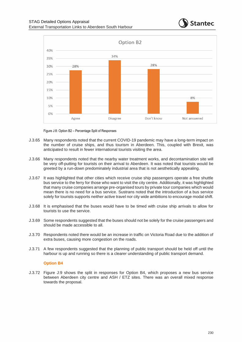
STAG Detailed Options Appraisal
External Transportation Links to Aberdeen South Harbour
230
Figure J:8: Option B2 – Percentage Split of Responses
J.3.65 Many respondents noted that the current COVID-19 pandemic may have a long-term impact on the number of cruise ships, and thus tourism in Aberdeen. This, coupled with Brexit, was anticipated to result in fewer international tourists visiting the area.
J.3.66 Many respondents noted that the nearby water treatment works, and decontamination site will be very off-putting for tourists on their arrival to Aberdeen. It was noted that tourists would be greeted by a run-down predominately industrial area that is not aesthetically appealing.
J.3.67 It was highlighted that other cities which receive cruise ship passengers operate a free shuttle bus service to the ferry for those who want to visit the city centre. Additionally, it was highlighted that many cruise companies arrange pre-organised tours by private tour companies which would mean there is no need for a bus service. Sustrans noted that the introduction of a bus service solely for tourists supports neither active travel nor city wide ambitions to encourage modal shift.
J.3.68 It is emphasised that the buses would have to be timed with cruise ship arrivals to allow for tourists to use the service.
J.3.69 Some respondents suggested that the buses should not be solely for the cruise passengers and should be made accessible to all.
J.3.70 Respondents noted there would be an increase in traffic on Victoria Road due to the addition of extra buses, causing more congestion on the roads.
J.3.71 A few respondents suggested that the planning of public transport should be held off until the harbour is up and running so there is a clearer understanding of public transport demand.
Option B4
J.3.72 Figure J:9 shows the split in responses for Option B4, which proposes a new bus service between Aberdeen city centre and ASH / ETZ sites. There was an overall mixed response towards the proposal.
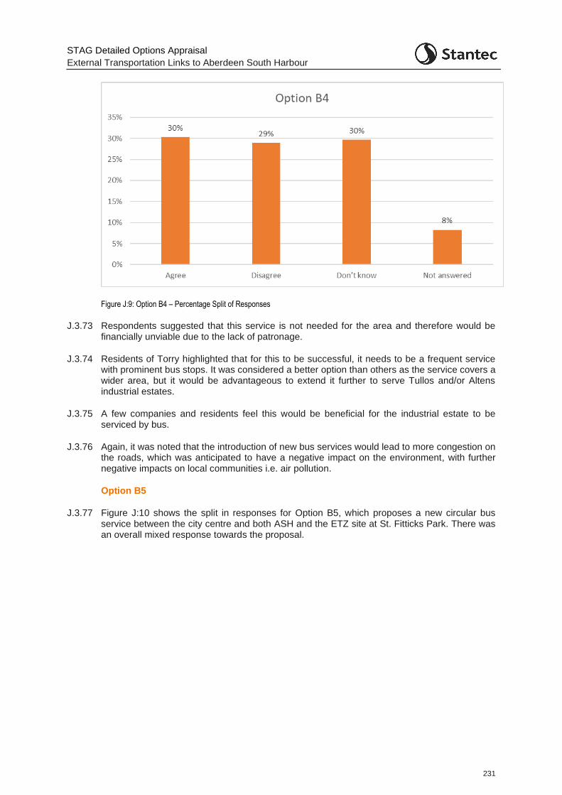
STAG Detailed Options Appraisal
External Transportation Links to Aberdeen South Harbour
231
Figure J:9: Option B4 – Percentage Split of Responses
J.3.73 Respondents suggested that this service is not needed for the area and therefore would be financially unviable due to the lack of patronage.
J.3.74 Residents of Torry highlighted that for this to be successful, it needs to be a frequent service with prominent bus stops. It was considered a better option than others as the service covers a wider area, but it would be advantageous to extend it further to serve Tullos and/or Altens industrial estates.
J.3.75 A few companies and residents feel this would be beneficial for the industrial estate to be serviced by bus.
J.3.76 Again, it was noted that the introduction of new bus services would lead to more congestion on the roads, which was anticipated to have a negative impact on the environment, with further negative impacts on local communities i.e. air pollution.
Option B5
J.3.77 Figure J:10 shows the split in responses for Option B5, which proposes a new circular bus service between the city centre and both ASH and the ETZ site at St. Fitticks Park. There was an overall mixed response towards the proposal.
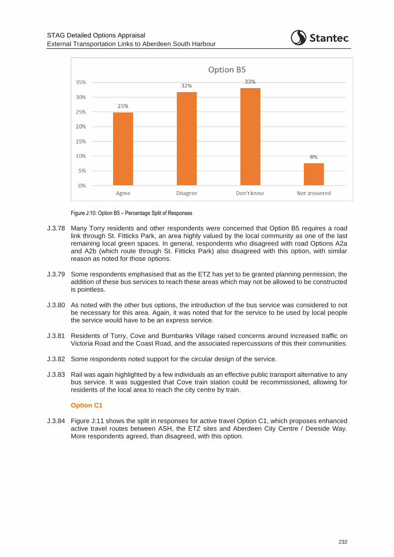
STAG Detailed Options Appraisal
External Transportation Links to Aberdeen South Harbour
232
Figure J:10: Option B5 – Percentage Split of Responses
J.3.78 Many Torry residents and other respondents were concerned that Option B5 requires a road link through St. Fitticks Park, an area highly valued by the local community as one of the last remaining local green spaces. In general, respondents who disagreed with road Options A2a and A2b (which route through St. Fitticks Park) also disagreed with this option, with similar reason as noted for those options.
J.3.79 Some respondents emphasised that as the ETZ has yet to be granted planning permission, the addition of these bus services to reach these areas which may not be allowed to be constructed is pointless.
J.3.80 As noted with the other bus options, the introduction of the bus service was considered to not be necessary for this area. Again, it was noted that for the service to be used by local people the service would have to be an express service.
J.3.81 Residents of Torry, Cove and Burnbanks Village raised concerns around increased traffic on Victoria Road and the Coast Road, and the associated repercussions of this their communities.
J.3.82 Some respondents noted support for the circular design of the service.
J.3.83 Rail was again highlighted by a few individuals as an effective public transport alternative to any bus service. It was suggested that Cove train station could be recommissioned, allowing for residents of the local area to reach the city centre by train.
Option C1
J.3.84 Figure J:11 shows the split in responses for active travel Option C1, which proposes enhanced active travel routes between ASH, the ETZ sites and Aberdeen City Centre / Deeside Way. More respondents agreed, than disagreed, with this option.
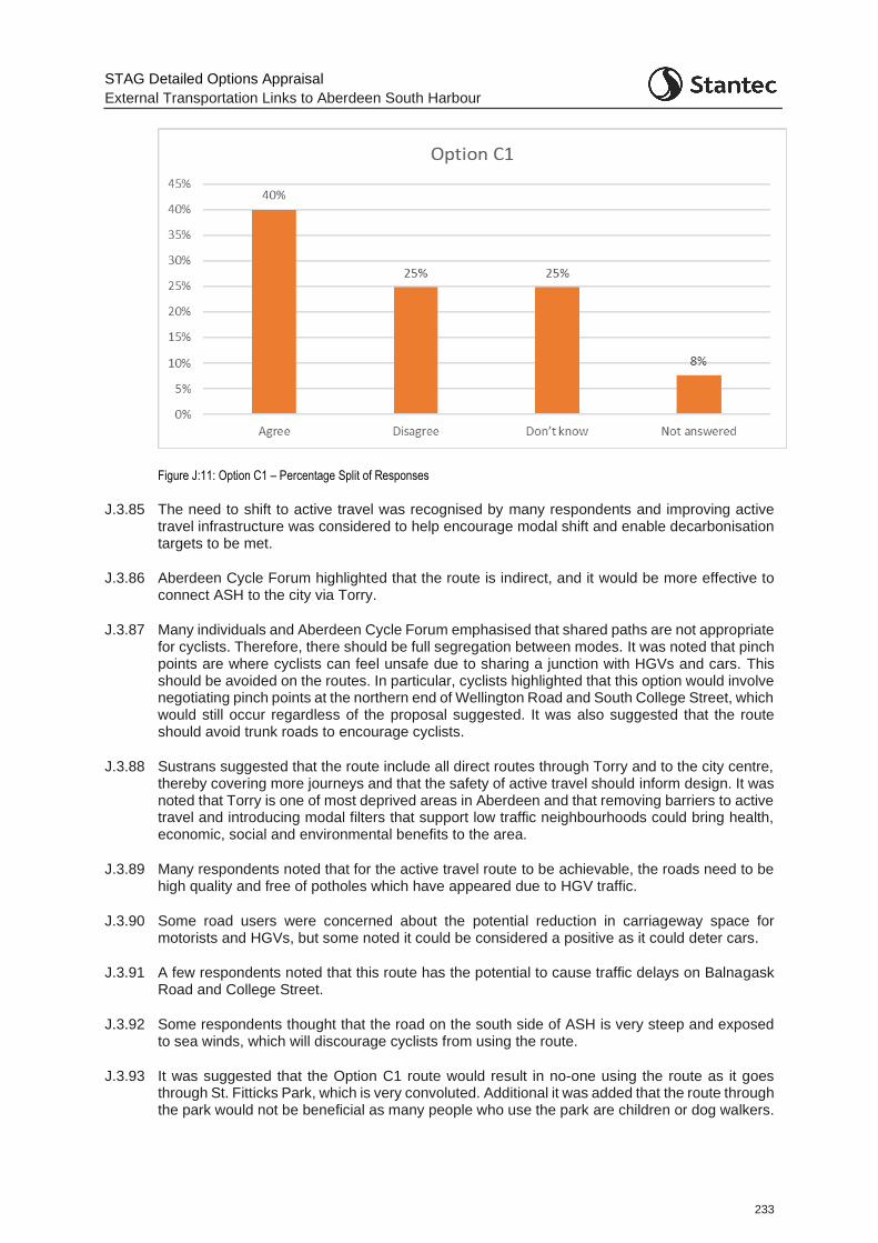
STAG Detailed Options Appraisal
External Transportation Links to Aberdeen South Harbour
233
Figure J:11: Option C1 – Percentage Split of Responses
J.3.85 The need to shift to active travel was recognised by many respondents and improving active travel infrastructure was considered to help encourage modal shift and enable decarbonisation targets to be met.
J.3.86 Aberdeen Cycle Forum highlighted that the route is indirect, and it would be more effective to connect ASH to the city via Torry.
J.3.87 Many individuals and Aberdeen Cycle Forum emphasised that shared paths are not appropriate for cyclists. Therefore, there should be full segregation between modes. It was noted that pinch points are where cyclists can feel unsafe due to sharing a junction with HGVs and cars. This should be avoided on the routes. In particular, cyclists highlighted that this option would involve negotiating pinch points at the northern end of Wellington Road and South College Street, which would still occur regardless of the proposal suggested. It was also suggested that the route should avoid trunk roads to encourage cyclists.
J.3.88 Sustrans suggested that the route include all direct routes through Torry and to the city centre, thereby covering more journeys and that the safety of active travel should inform design. It was noted that Torry is one of most deprived areas in Aberdeen and that removing barriers to active travel and introducing modal filters that support low traffic neighbourhoods could bring health, economic, social and environmental benefits to the area.
J.3.89 Many respondents noted that for the active travel route to be achievable, the roads need to be high quality and free of potholes which have appeared due to HGV traffic.
J.3.90 Some road users were concerned about the potential reduction in carriageway space for motorists and HGVs, but some noted it could be considered a positive as it could deter cars.
J.3.91 A few respondents noted that this route has the potential to cause traffic delays on Balnagask Road and College Street.
J.3.92 Some respondents thought that the road on the south side of ASH is very steep and exposed to sea winds, which will discourage cyclists from using the route.
J.3.93 It was suggested that the Option C1 route would result in no-one using the route as it goes through St. Fitticks Park, which is very convoluted. Additional it was added that the route through the park would not be beneficial as many people who use the park are children or dog walkers.
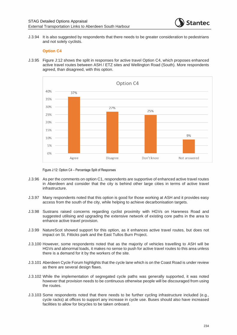
STAG Detailed Options Appraisal
External Transportation Links to Aberdeen South Harbour
234
J.3.94 It is also suggested by respondents that there needs to be greater consideration to pedestrians and not solely cyclists.
Option C4
J.3.95 Figure J:12 shows the split in responses for active travel Option C4, which proposes enhanced active travel routes between ASH / ETZ sites and Wellington Road (South). More respondents agreed, than disagreed, with this option.
Figure J:12: Option C4 – Percentage Split of Responses
J.3.96 As per the comments on option C1, respondents are supportive of enhanced active travel routes in Aberdeen and consider that the city is behind other large cities in terms of active travel infrastructure.
J.3.97 Many respondents noted that this option is good for those working at ASH and it provides easy access from the south of the city, while helping to achieve decarbonisation targets.
J.3.98 Sustrans raised concerns regarding cyclist proximity with HGVs on Hareness Road and suggested utilising and upgrading the extensive network of existing core paths in the area to enhance active travel provision.
J.3.99 NatureScot showed support for this option, as it enhances active travel routes, but does not impact on St. Fitticks park and the East Tullos Burn Project.
J.3.100 However, some respondents noted that as the majority of vehicles travelling to ASH will be HGVs and abnormal loads, it makes no sense to push for active travel routes to this area unless there is a demand for it by the workers of the site.
J.3.101 Aberdeen Cycle Forum highlights that the cycle lane which is on the Coast Road is under review as there are several design flaws.
J.3.102 While the implementation of segregated cycle paths was generally supported, it was noted however that provision needs to be continuous otherwise people will be discouraged from using the routes.
J.3.103 Some respondents noted that there needs to be further cycling infrastructure included (e.g., cycle racks) at offices to support any increase in cycle use. Buses should also have increased facilities to allow for bicycles to be taken onboard.
STAG Detailed Options Appraisal
External Transportation Links to Aberdeen South Harbour
235
J.3.104 Some respondents noted that the addition of cycle lanes on Hareness Road would make congestion and traffic flow worse on the road as the traffic lanes would be narrowed and cyclists would slow down traffic. Hareness roundabout is considered to be difficult to negotiate for cyclists.
J.3.105 One member of the public highlighted that the number of disadvantages for Option C4 outweighs the advantages and that there were more drawbacks for this option compared to Option C1.
J.3.106 One individual suggested that a segregated cycle path along the beach should be considered to enhance the active travel capabilities for the area.
J.3.107 It was also suggested that a dedicated cycle route on Coast Road should be continued along to Cove or have a separate route on the east side of the railway line.
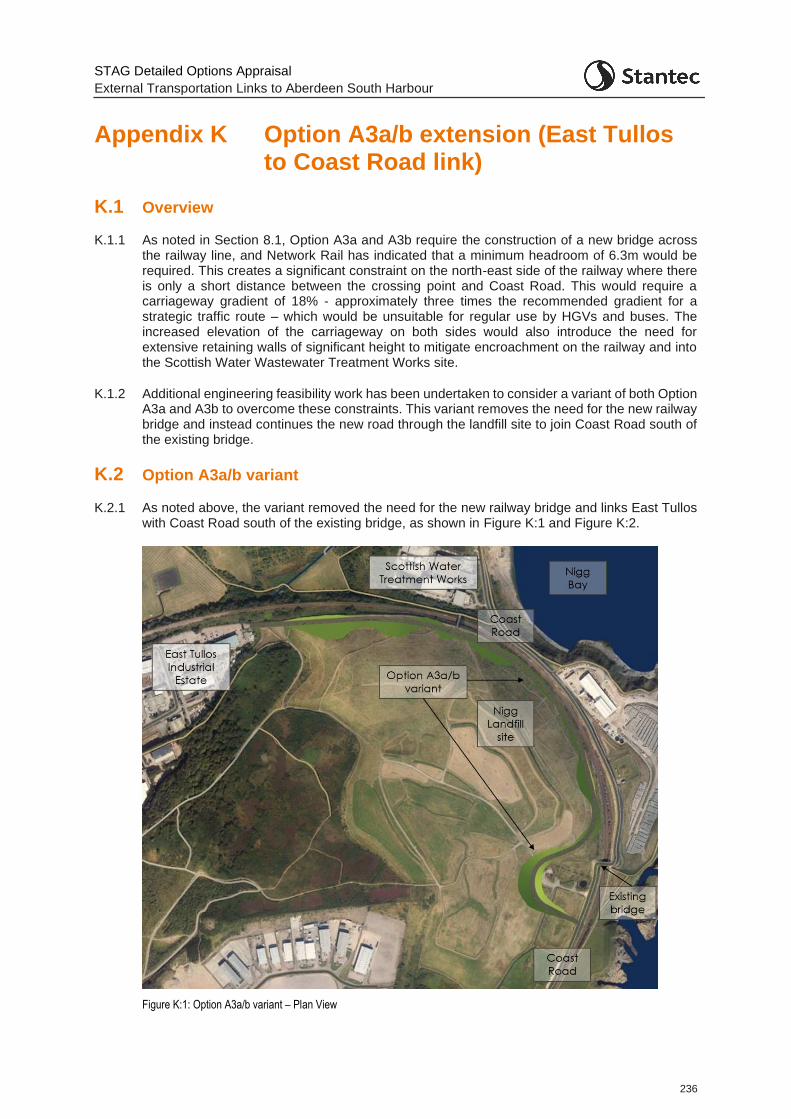
STAG Detailed Options Appraisal
External Transportation Links to Aberdeen South Harbour
236
Appendix K Option A3a/b extension (East Tullos to Coast Road link)
K.1 Overview
K.1.1 As noted in Section 8.1, Option A3a and A3b require the construction of a new bridge across the railway line, and Network Rail has indicated that a minimum headroom of 6.3m would be required. This creates a significant constraint on the north-east side of the railway where there is only a short distance between the crossing point and Coast Road. This would require a carriageway gradient of 18% - approximately three times the recommended gradient for a strategic traffic route – which would be unsuitable for regular use by HGVs and buses. The increased elevation of the carriageway on both sides would also introduce the need for extensive retaining walls of significant height to mitigate encroachment on the railway and into the Scottish Water Wastewater Treatment Works site.
K.1.2 Additional engineering feasibility work has been undertaken to consider a variant of both Option A3a and A3b to overcome these constraints. This variant removes the need for the new railway bridge and instead continues the new road through the landfill site to join Coast Road south of the existing bridge.
K.2 Option A3a/b variant
K.2.1 As noted above, the variant removed the need for the new railway bridge and links East Tullos with Coast Road south of the existing bridge, as shown in Figure K:1 and Figure K:2.
Figure K:1: Option A3a/b variant – Plan View
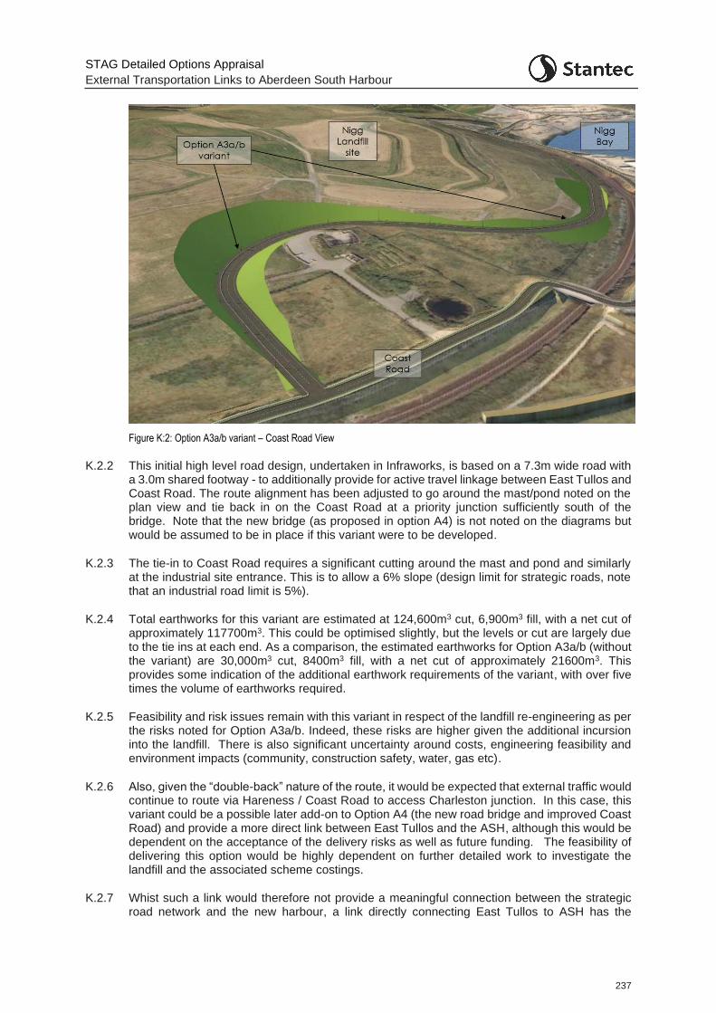
STAG Detailed Options Appraisal
External Transportation Links to Aberdeen South Harbour
237
Figure K:2: Option A3a/b variant – Coast Road View
K.2.2 This initial high level road design, undertaken in Infraworks, is based on a 7.3m wide road with a 3.0m shared footway - to additionally provide for active travel linkage between East Tullos and Coast Road. The route alignment has been adjusted to go around the mast/pond noted on the plan view and tie back in on the Coast Road at a priority junction sufficiently south of the bridge. Note that the new bridge (as proposed in option A4) is not noted on the diagrams but would be assumed to be in place if this variant were to be developed.
K.2.3 The tie-in to Coast Road requires a significant cutting around the mast and pond and similarly at the industrial site entrance. This is to allow a 6% slope (design limit for strategic roads, note that an industrial road limit is 5%).
K.2.4 Total earthworks for this variant are estimated at 124,600m3 cut, 6,900m3 fill, with a net cut of approximately 117700m3. This could be optimised slightly, but the levels or cut are largely due to the tie ins at each end. As a comparison, the estimated earthworks for Option A3a/b (without the variant) are 30,000m3 cut, 8400m3 fill, with a net cut of approximately 21600m3. This provides some indication of the additional earthwork requirements of the variant, with over five times the volume of earthworks required.
K.2.5 Feasibility and risk issues remain with this variant in respect of the landfill re-engineering as per the risks noted for Option A3a/b. Indeed, these risks are higher given the additional incursion into the landfill. There is also significant uncertainty around costs, engineering feasibility and environment impacts (community, construction safety, water, gas etc).
K.2.6 Also, given the “double-back” nature of the route, it would be expected that external traffic would continue to route via Hareness / Coast Road to access Charleston junction. In this case, this variant could be a possible later add-on to Option A4 (the new road bridge and improved Coast Road) and provide a more direct link between East Tullos and the ASH, although this would be dependent on the acceptance of the delivery risks as well as future funding. The feasibility of delivering this option would be highly dependent on further detailed work to investigate the landfill and the associated scheme costings.
K.2.7 Whist such a link would therefore not provide a meaningful connection between the strategic road network and the new harbour, a link directly connecting East Tullos to ASH has the

STAG Detailed Options Appraisal
External Transportation Links to Aberdeen South Harbour
238
potential to support the regeneration of East Tullos and ASH related activities. East Tullos industrial estate represents a large area of land close to the harbour that has been specified for redevelopment as the building stock is ageing. Improved connectivity between the industrial estate and the new harbour has the potential to support future harbour activities, the regeneration aspirations for the estate, and unlock inward investment in the area.