Embed Size (px)
Citation preview
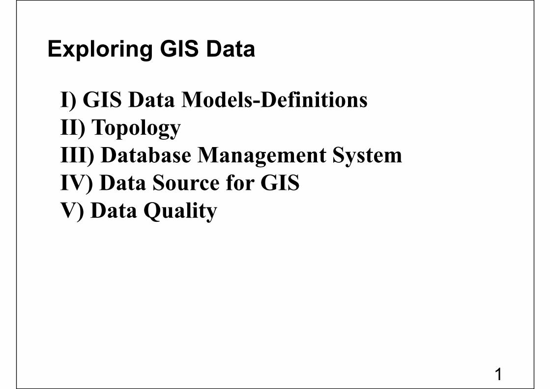
Exploring GIS Data
I) GIS Data Models-DefinitionsII) TopologyIII) Database Management SystemIV) Data Source for GISV) Data Quality
1
Data : A collection of related facts usually arranged in aparticular format and gathered for a particular purpose.(as temperature,..)
Information: Data which serves a purpose (as averageof temperature,..)
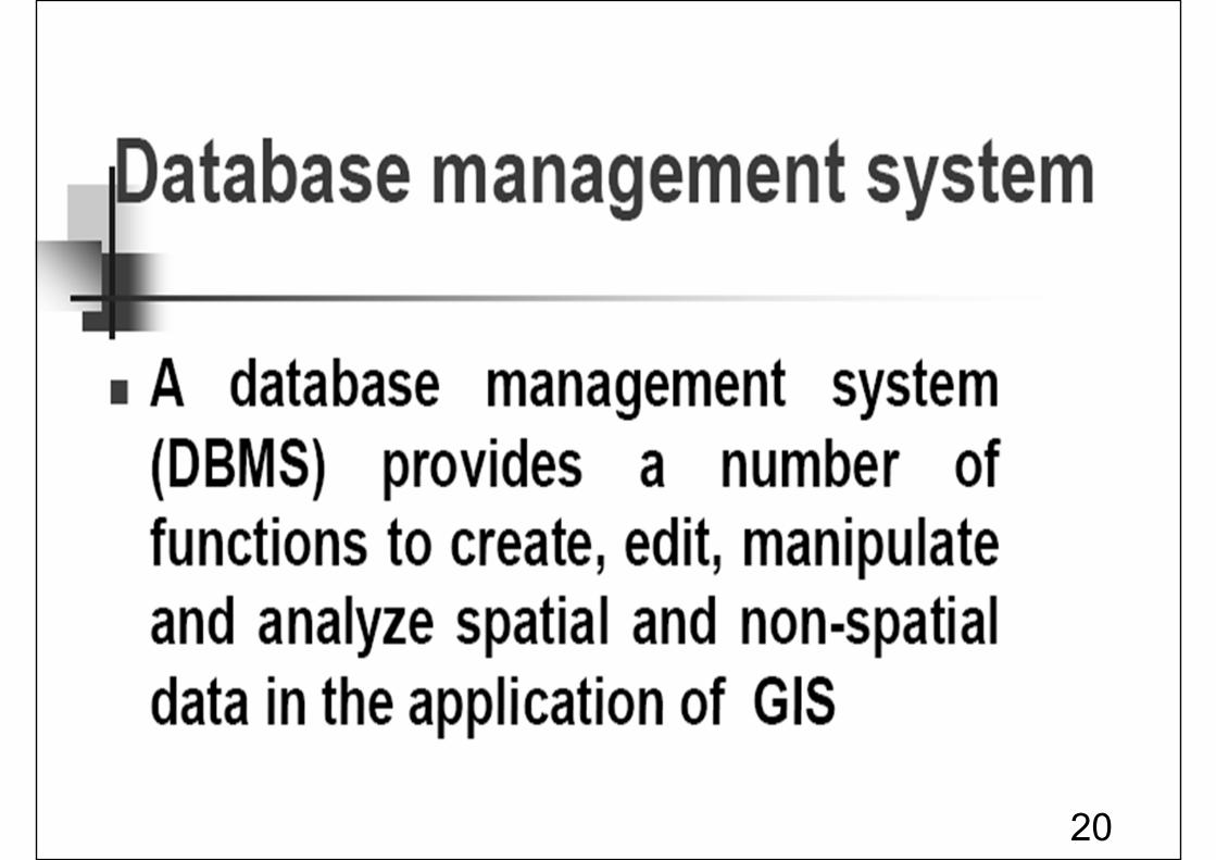
Database:A collection of related files organized for efficient retrievalof information.
Dataset or Layer:Any geographic data such as a shape file, coverageGeodatabase, or raster.
Geographic data Model –Defintions:
*
2
Geodatabase: A geographic database that is hostedinside a relational database management system thatprovides services for managing geographic data. Theseservices include validation rules, relationships, andtopological associations.
Feature: A representation of a real-world object in alayer on a map.
Field: A column in a table. Each field contains the valuesfor a single attribute.
3
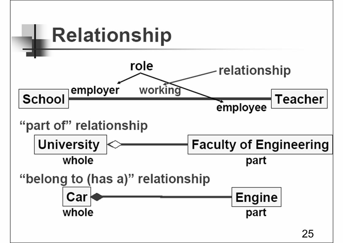
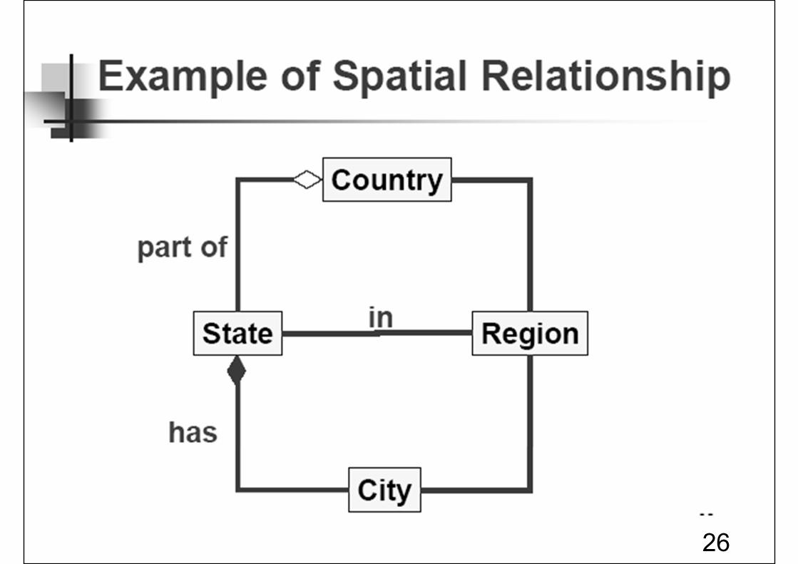
What is Topology
• Topology is the science and mathematics of relationship used to validate the geometry of vector entities, and for operations such as network tracing and test of polygon adjacency .
• Advantages and uses of topology:– Maintain correct data spatial relationship (Find
errors)– Efficient data storage (quickly process large data
sets)– Facilitate spatial analysis (Network analysis,
Adjacent area analysis, overlay analysis) 4
5
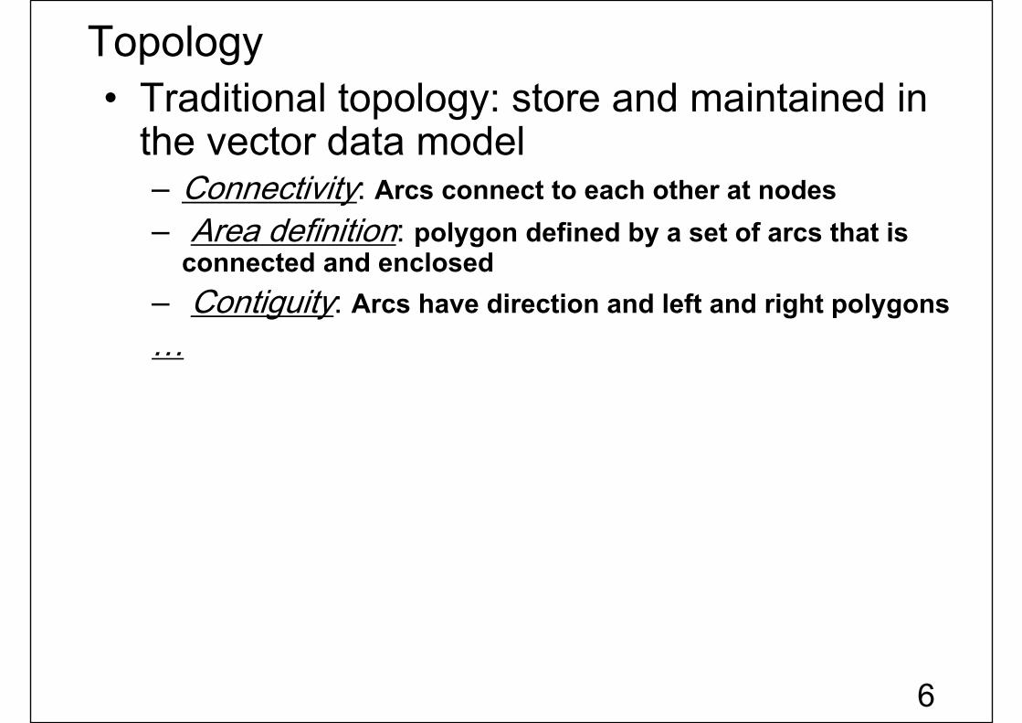
Topology• Traditional topology: store and maintained in
the vector data model– Connectivity: Arcs connect to each other at nodes– Area definition: polygon defined by a set of arcs that is
connected and enclosed– Contiguity: Arcs have direction and left and right polygons…
6
Topology
7

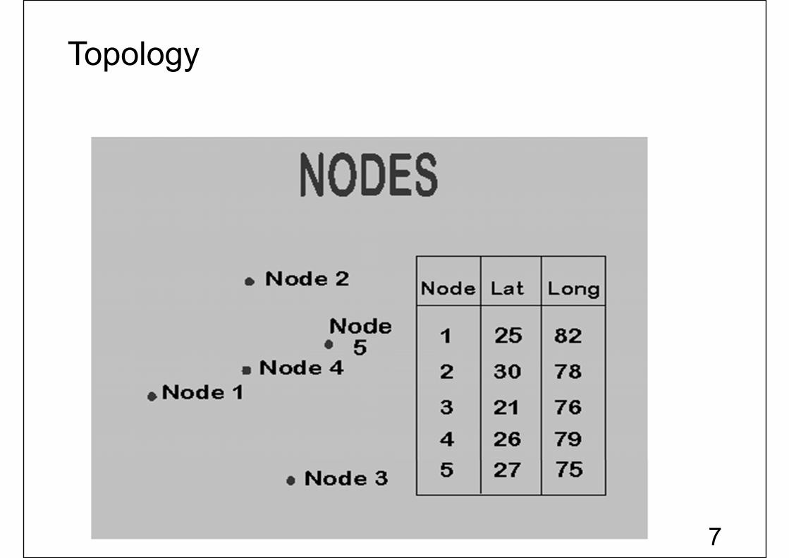
Topological data structure [Node]
8
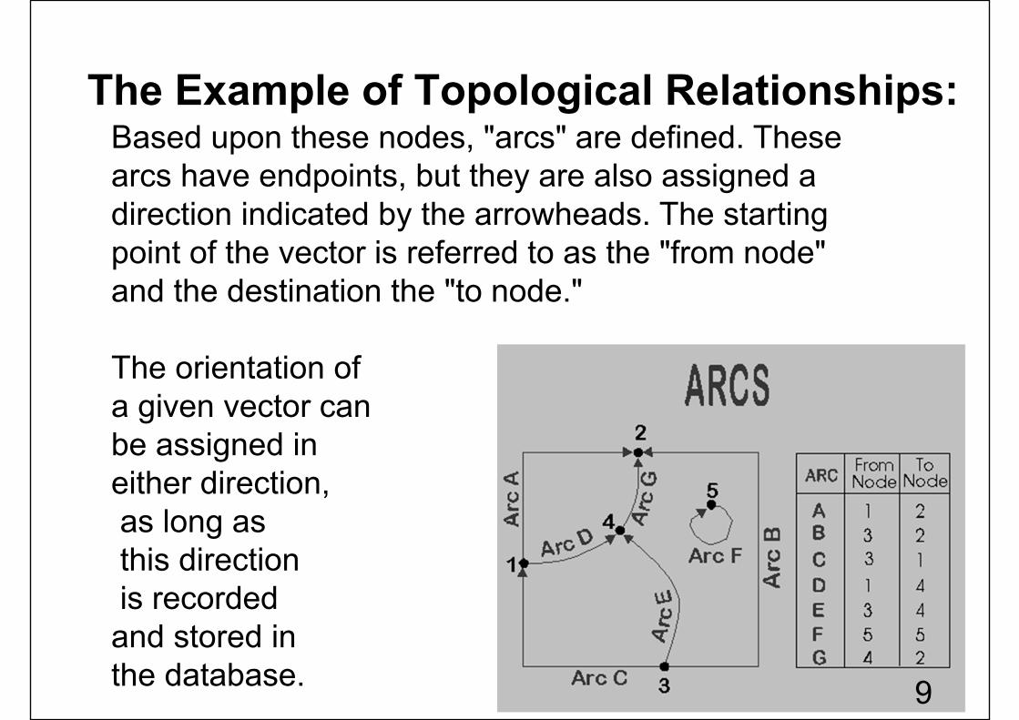
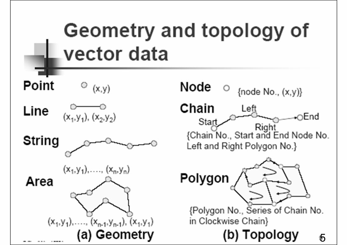
Based upon these nodes, "arcs" are defined. These arcs have endpoints, but they are also assigned a direction indicated by the arrowheads. The starting point of the vector is referred to as the "from node" and the destination the "to node."
The orientation of a given vector can be assigned in either direction,as long asthis directionis recorded and stored in the database.
The Example of Topological Relationships:
9
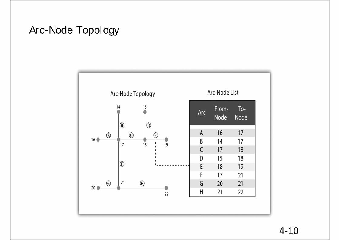
Arc-Node Topology
4‐10
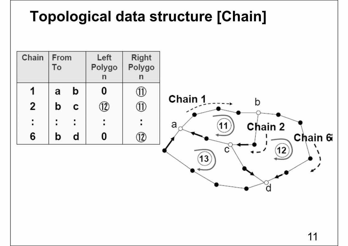
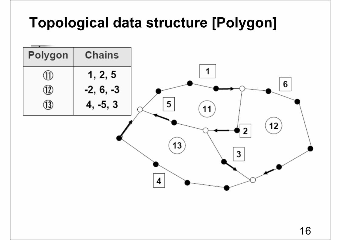
Topological data structure [Chain]
11
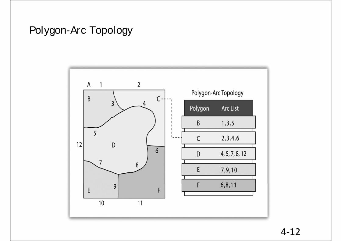
Polygon-Arc Topology
4‐12
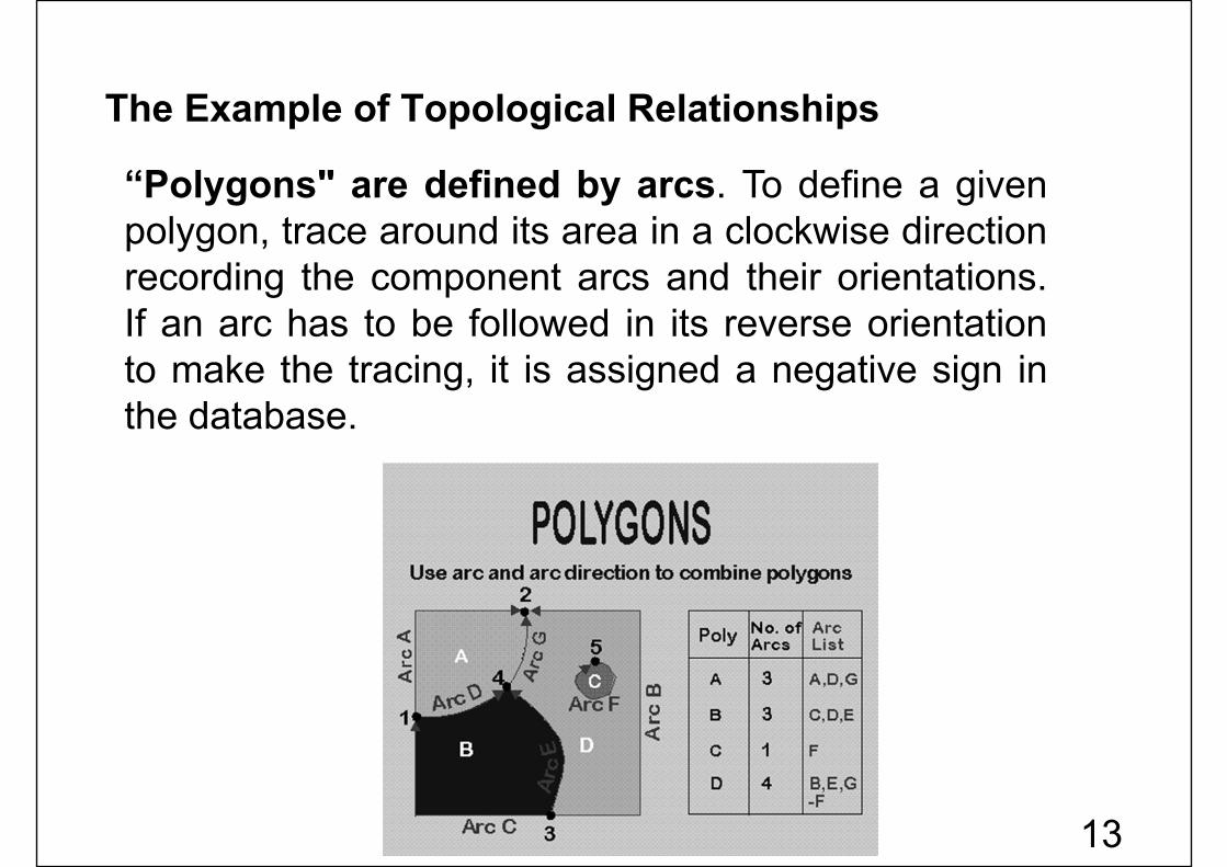
“Polygons" are defined by arcs. To define a givenpolygon, trace around its area in a clockwise directionrecording the component arcs and their orientations.If an arc has to be followed in its reverse orientationto make the tracing, it is assigned a negative sign inthe database.
The Example of Topological Relationships
13

Polygon Topology
4‐14
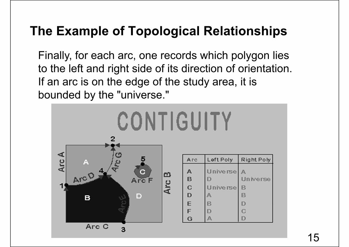
Finally, for each arc, one records which polygon lies to the left and right side of its direction of orientation. If an arc is on the edge of the study area, it is bounded by the "universe."
The Example of Topological Relationships
15
Topological data structure [Polygon]
16
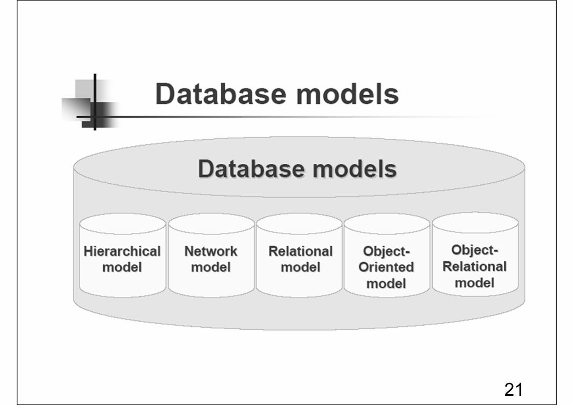
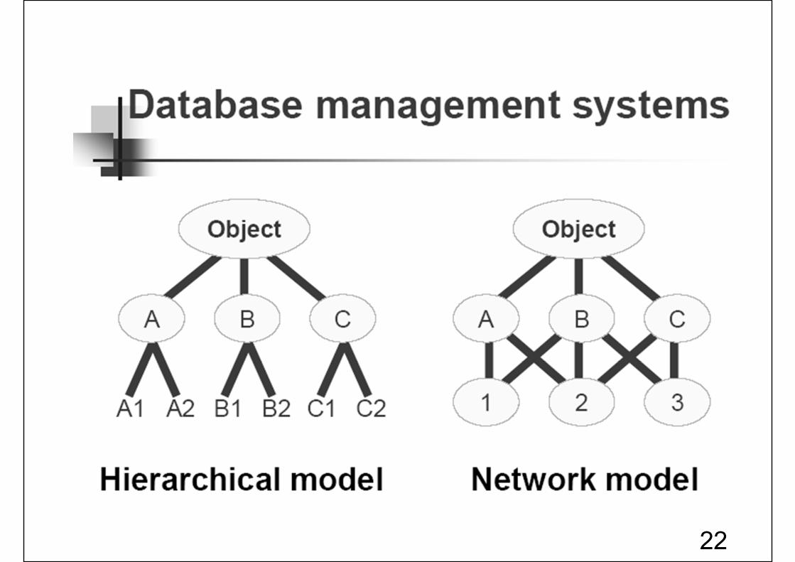
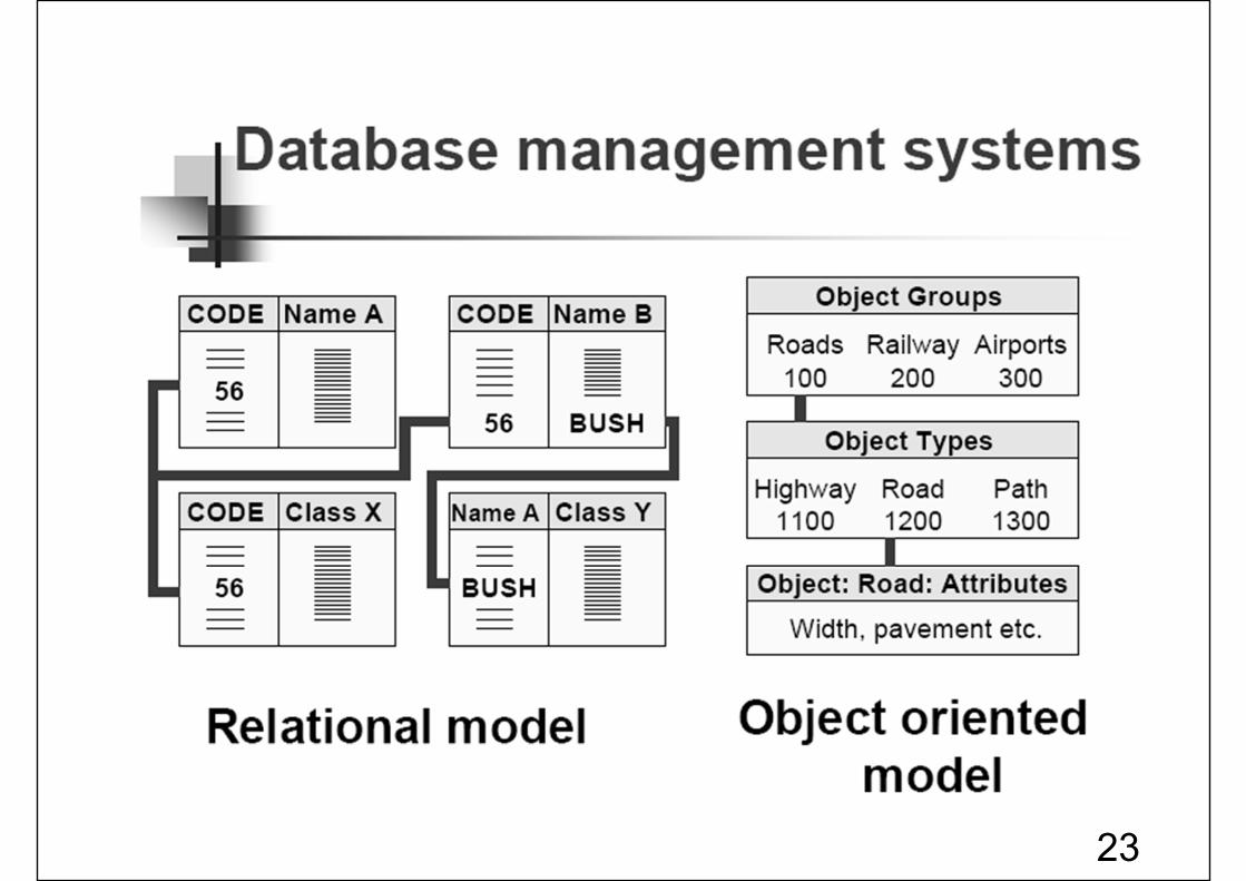
III) Database Management System
17
18
19
20
21
22
23
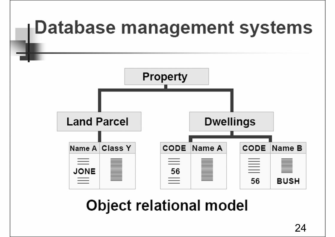
24
25
26
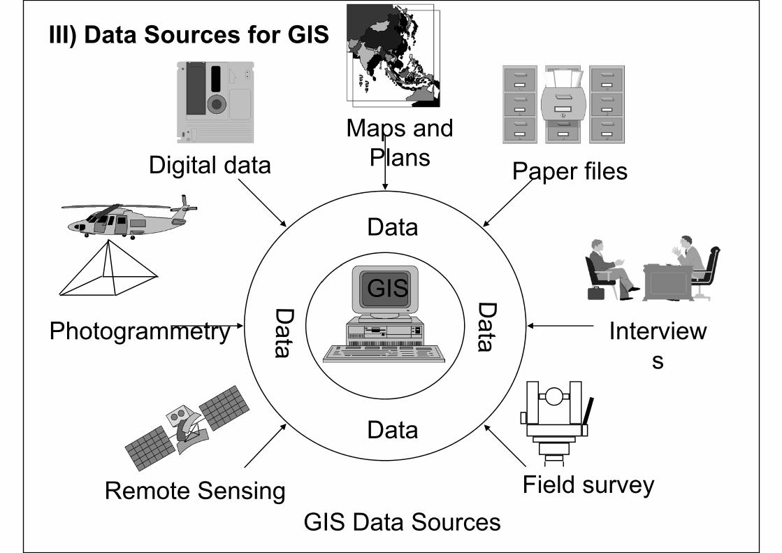
Digital dataMaps and
Plans Paper files
Photogrammetry
Remote Sensing Field survey
Interviews
GIS Data Sources
Data
Data
GIS
III) Data Sources for GIS
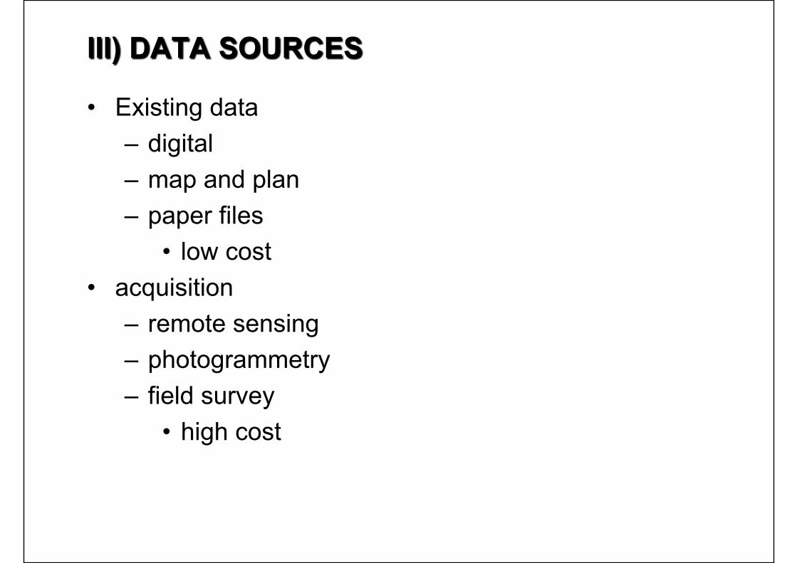
III) DATA SOURCES
• Existing data– digital– map and plan– paper files
• low cost• acquisition
– remote sensing– photogrammetry– field survey
• high cost
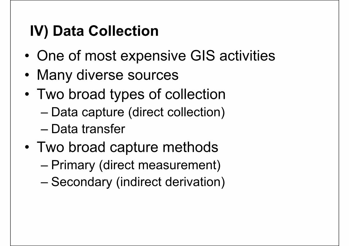
IV) Data Collection• One of most expensive GIS activities• Many diverse sources• Two broad types of collection
– Data capture (direct collection)– Data transfer
• Two broad capture methods– Primary (direct measurement)– Secondary (indirect derivation)

IV) Data Collection Techniques
Raster Vector
Primary Digital remote sensing images
GPS measurements
Digital aerial photographs
Survey measurements
Secondary Scanned maps Topographic surveys
DEMs from maps Toponymy data sets from atlases
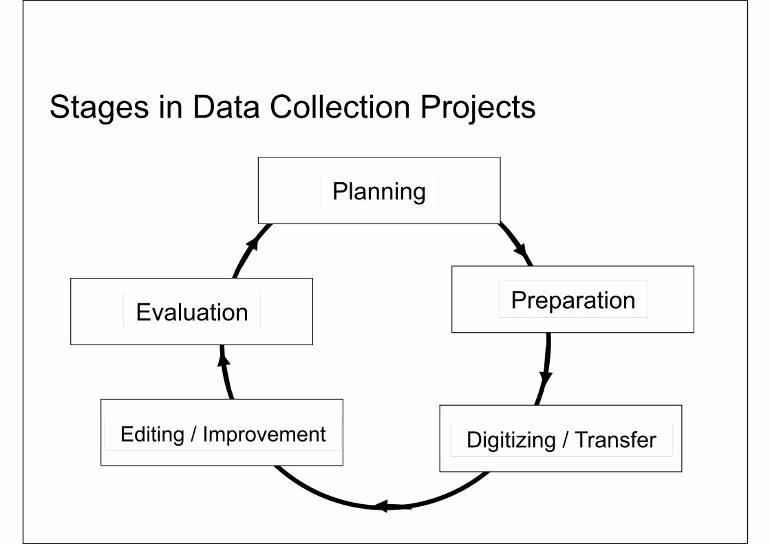
Stages in Data Collection Projects
Planning
Preparation
Digitizing / TransferEditing / Improvement
Evaluation
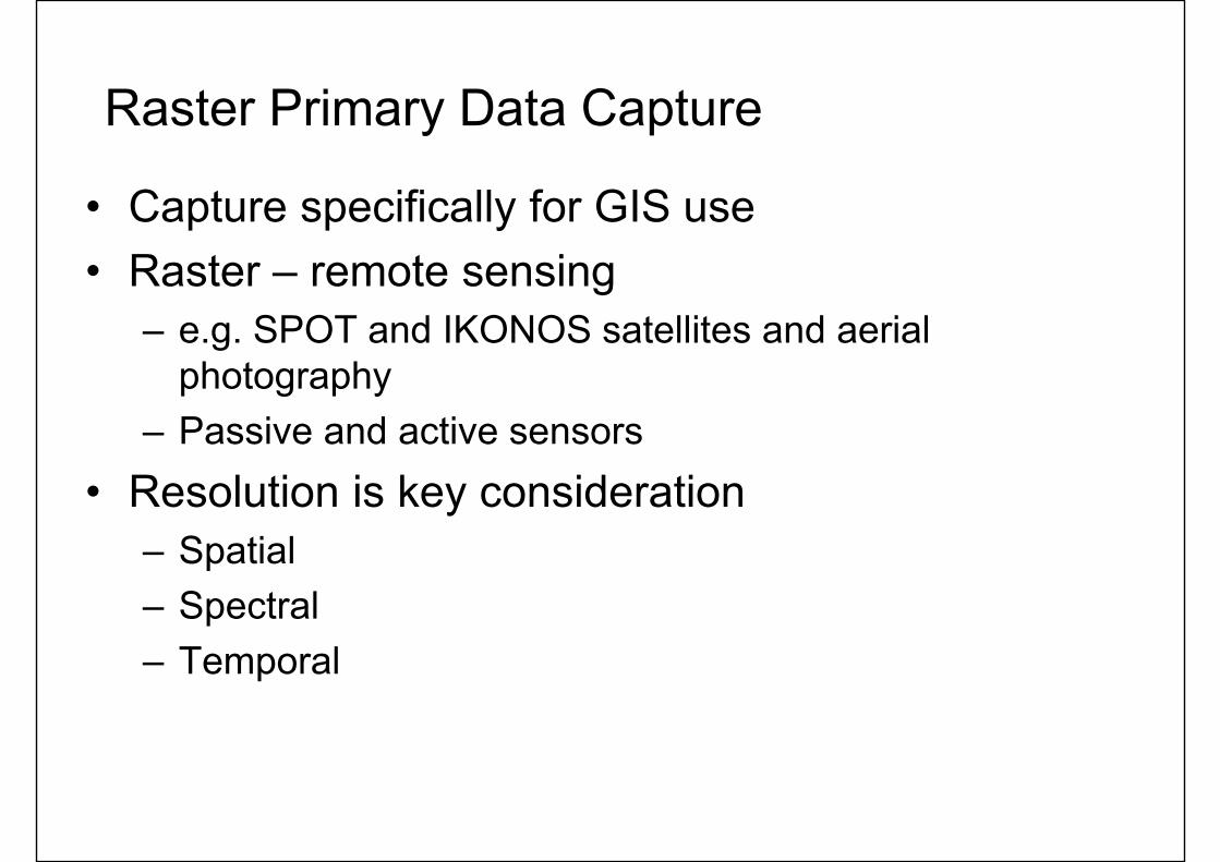
Raster Primary Data Capture
• Capture specifically for GIS use• Raster – remote sensing
– e.g. SPOT and IKONOS satellites and aerial photography
– Passive and active sensors• Resolution is key consideration
– Spatial– Spectral– Temporal
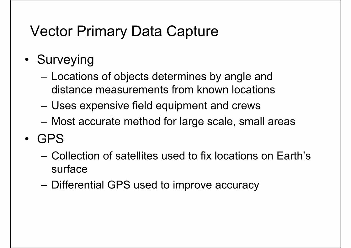
Vector Primary Data Capture
• Surveying– Locations of objects determines by angle and
distance measurements from known locations– Uses expensive field equipment and crews– Most accurate method for large scale, small areas
• GPS– Collection of satellites used to fix locations on Earth’s
surface– Differential GPS used to improve accuracy
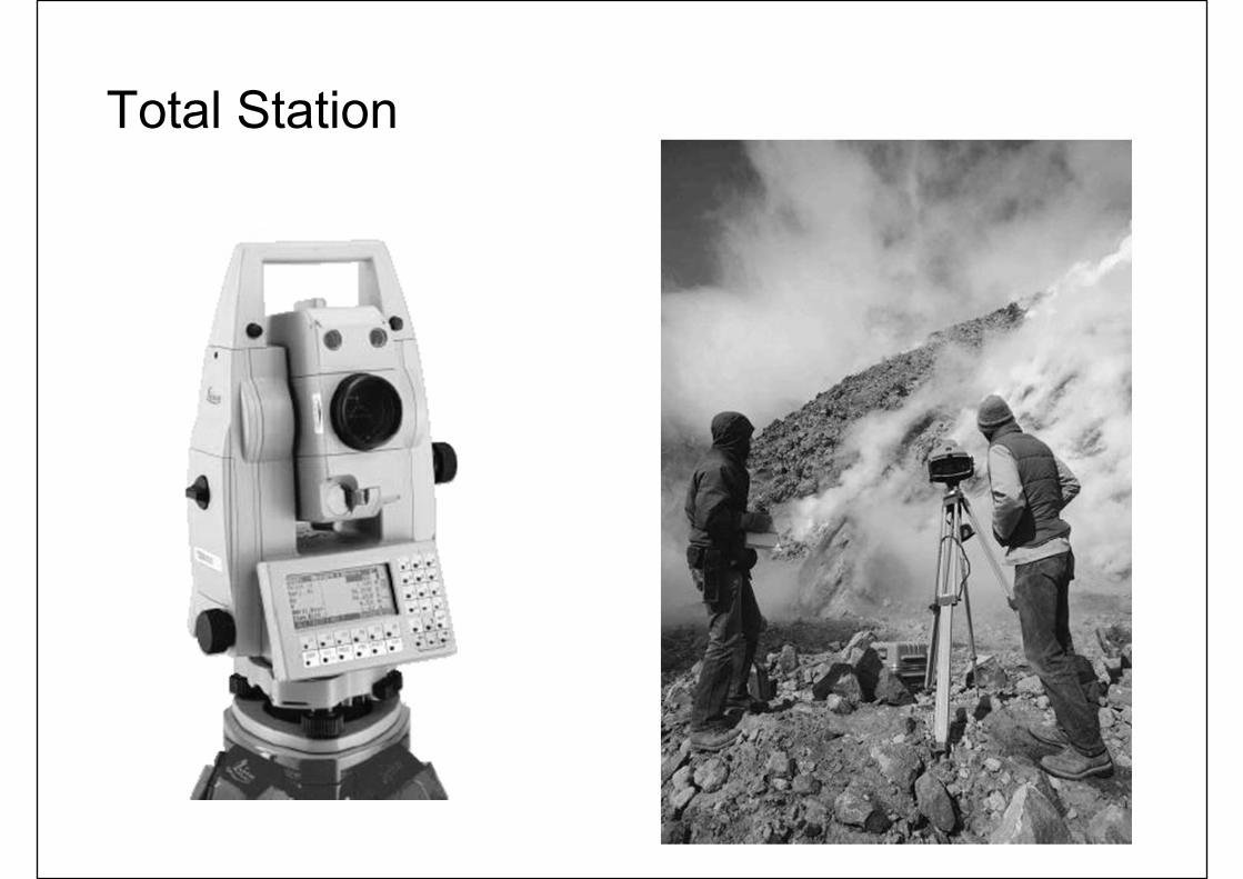
Total Station
Raster Secondary Data Capture
• Data collected for other purposes can be converted for use in GIS
• Raster conversion– Scanning of maps, aerial photographs,
documents, etc– Important scanning parameters are spatial
and spectral (bit depth) resolution
Vector Secondary Data Capture• Collection of vector objects from maps,
photographs, plans, etc.• Digitizing
– Manual (table) – Heads-up and vectorization
• COGO – Coordinate Geometry
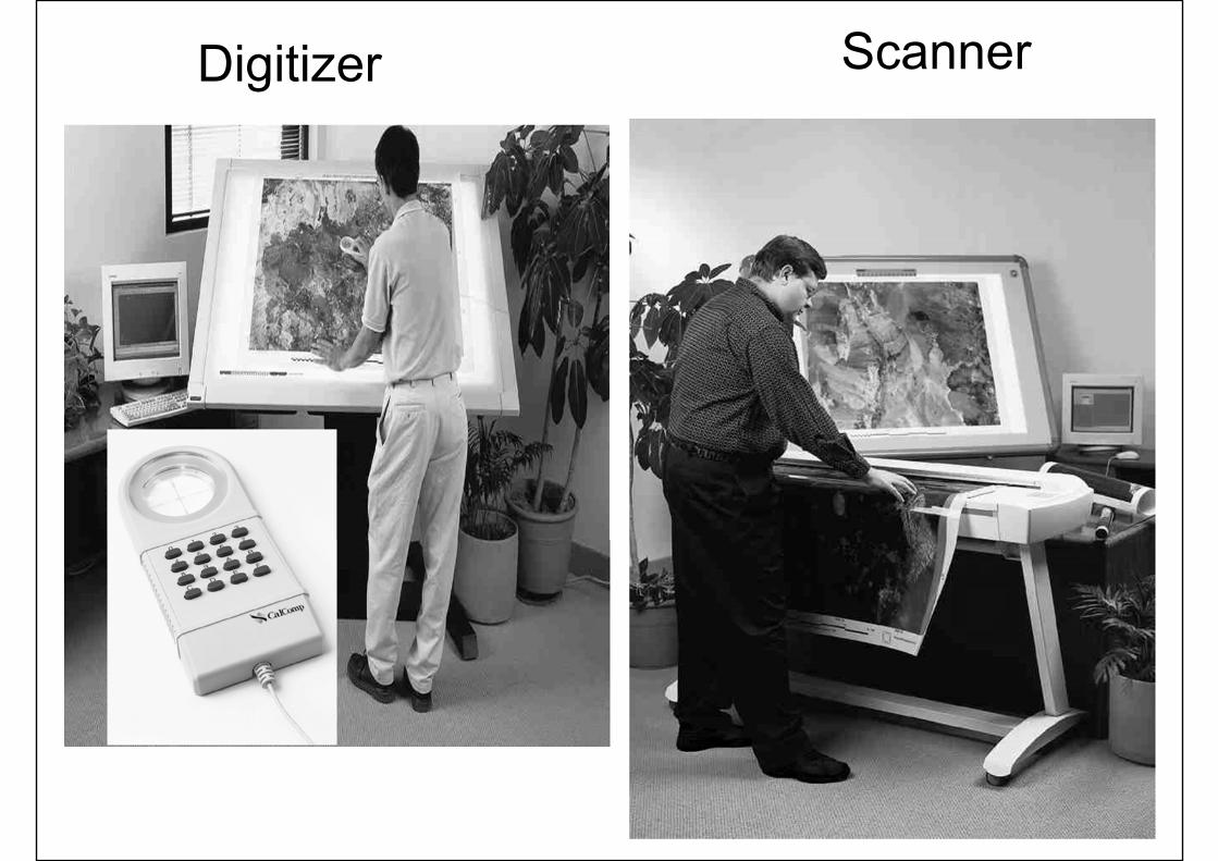
ScannerDigitizer
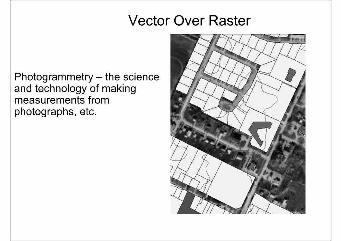
Vector Over Raster
Photogrammetry – the science and technology of making measurements from photographs, etc.
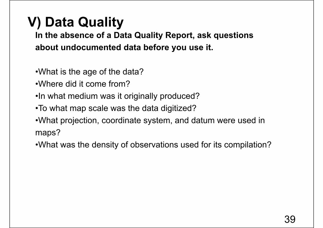
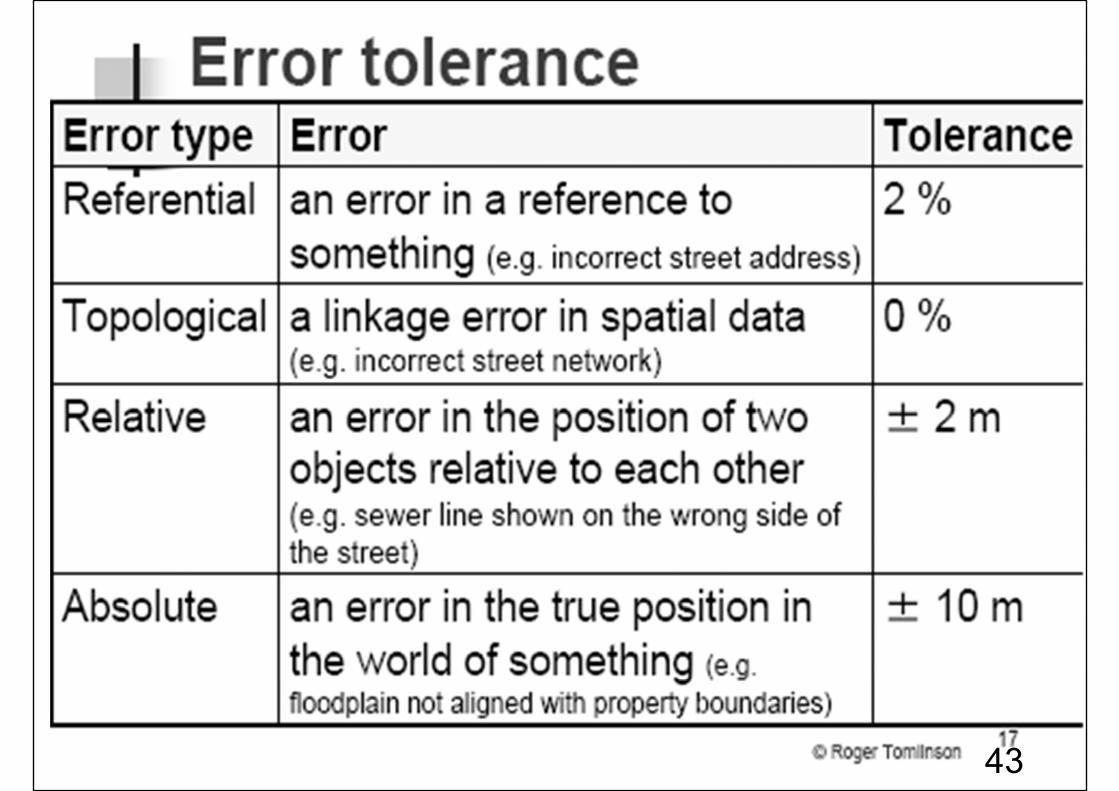
In the absence of a Data Quality Report, ask questions about undocumented data before you use it.
•What is the age of the data? •Where did it come from? •In what medium was it originally produced? •To what map scale was the data digitized? •What projection, coordinate system, and datum were used in maps? •What was the density of observations used for its compilation?
V) Data Quality
39
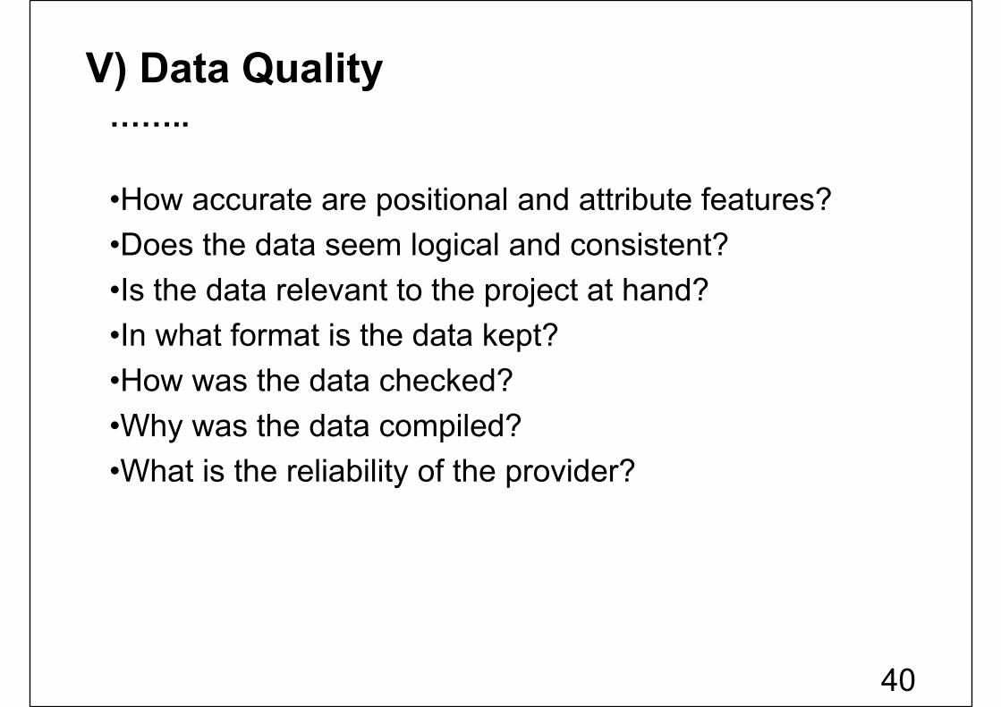
……..
•How accurate are positional and attribute features? •Does the data seem logical and consistent? •Is the data relevant to the project at hand? •In what format is the data kept? •How was the data checked? •Why was the data compiled? •What is the reliability of the provider?
V) Data Quality
40
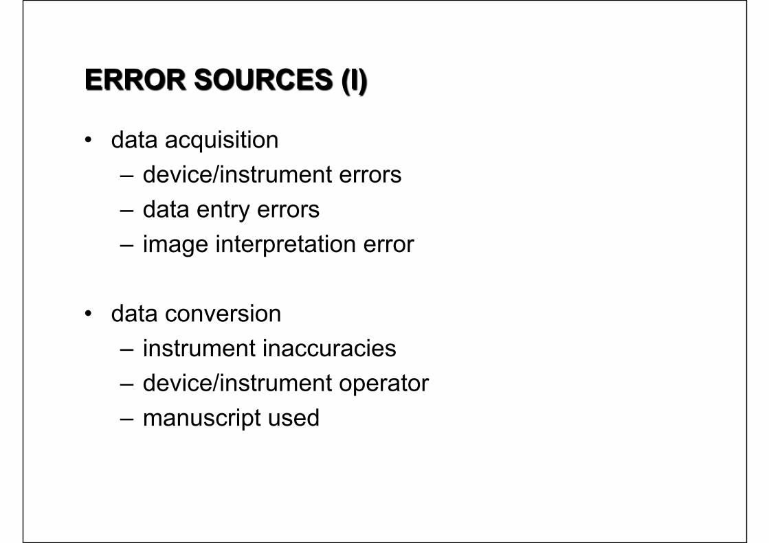
ERROR SOURCES (I)
• data acquisition– device/instrument errors– data entry errors– image interpretation error
• data conversion– instrument inaccuracies– device/instrument operator– manuscript used

ERROR SOURCES (II)
• data storage– digital representation limits– disk storage limits
• used by huge raster formats
• data processing– rounding off error
• digital representation – error propagation law
• information derived by mathematical operations no more accurate than original information
43
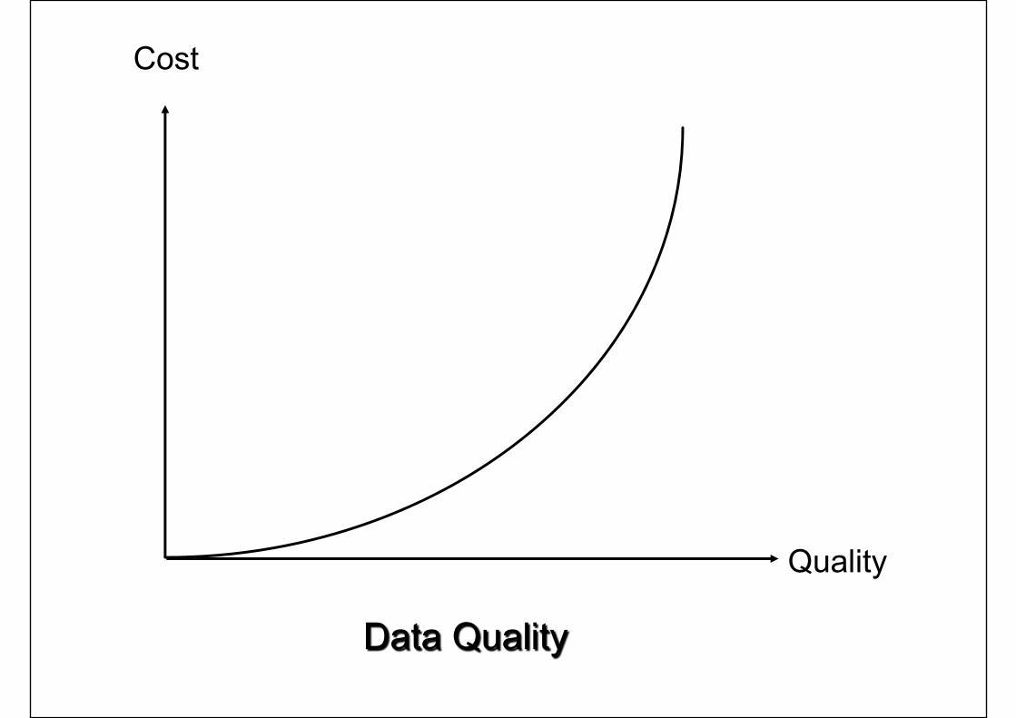
Cost
Quality
Data Quality
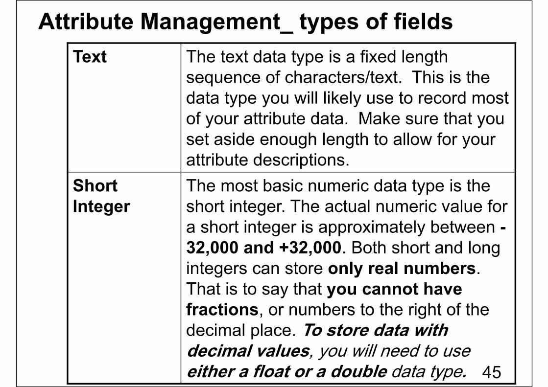
Text The text data type is a fixed length sequence of characters/text. This is the data type you will likely use to record most of your attribute data. Make sure that you set aside enough length to allow for your attribute descriptions.
Short Integer
The most basic numeric data type is the short integer. The actual numeric value for a short integer is approximately between -32,000 and +32,000. Both short and long integers can store only real numbers. That is to say that you cannot have fractions, or numbers to the right of the decimal place. To store data with decimal values, you will need to use either a float or a double data type.
Attribute Management_ types of fields
45
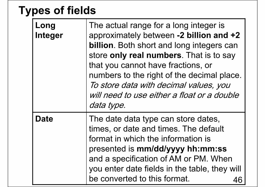
Long Integer
The actual range for a long integer is approximately between -2 billion and +2 billion. Both short and long integers can store only real numbers. That is to say that you cannot have fractions, or numbers to the right of the decimal place. To store data with decimal values, you will need to use either a float or a double data type.
Date The date data type can store dates, times, or date and times. The default format in which the information is presented is mm/dd/yyyy hh:mm:ssand a specification of AM or PM. When you enter date fields in the table, they will be converted to this format.
Types of fields
46
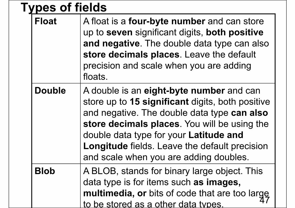
Float A float is a four-byte number and can store up to seven significant digits, both positive and negative. The double data type can also store decimals places. Leave the default precision and scale when you are adding floats.
Double A double is an eight-byte number and can store up to 15 significant digits, both positive and negative. The double data type can also store decimals places. You will be using the double data type for your Latitude and Longitude fields. Leave the default precision and scale when you are adding doubles.
Blob A BLOB, stands for binary large object. This data type is for items such as images, multimedia, or bits of code that are too large to be stored as a other data types.
Types of fields
47
Summary
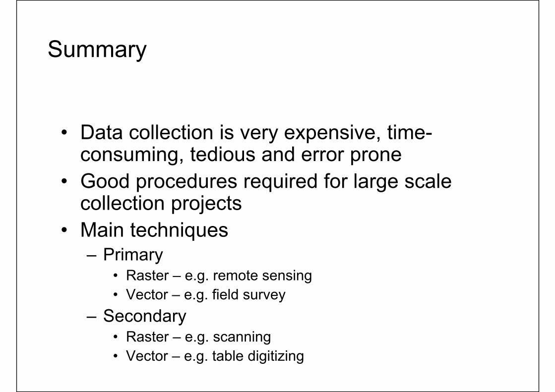
• Data collection is very expensive, time-consuming, tedious and error prone
• Good procedures required for large scale collection projects
• Main techniques– Primary
• Raster – e.g. remote sensing• Vector – e.g. field survey
– Secondary• Raster – e.g. scanning• Vector – e.g. table digitizing

Thank You
49