Embed Size (px)
Citation preview

1
Expanding Partnerships for Improved Data Quality
Addresses, Features, and Boundaries
Michigan GIS Users Group June 5, 2014
Gail A. Krmenec U.S. Census Bureau Geography Division

Today’s Discussion Topics
Geographic Support System Initiative
(GSS-I)
Boundary and Annexation Survey
(BAS)
2

Census Geographic Support Major Initiatives
3
2020 Census – GSS Initiative
2010 Census – MAF/TIGER Enhancement Program
including MAF/TIGER Realignment (7.6 meter min. accuracy)
2000 Census – Master Address File Introduced
1990 Census – TIGER Introduced
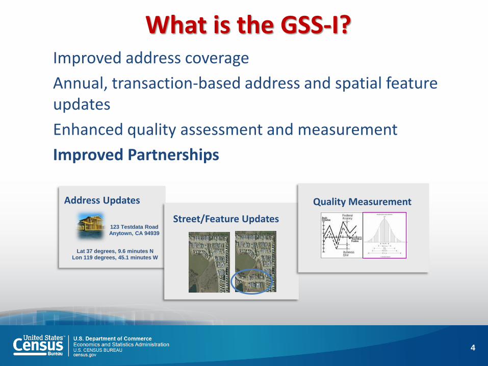
What is the GSS-I? Improved address coverage
Annual, transaction-based address and spatial feature updates
Enhanced quality assessment and measurement
Improved Partnerships
4
Address Updates
123 Testdata Road Anytown, CA 94939
Lat 37 degrees, 9.6 minutes N Lon 119 degrees, 45.1 minutes W
Street/Feature Updates
Quality Measurement

Why the GSS-I?
5
Recommendations of our stakeholder and oversight communities (GAO, OIG, NAS): Lack of a comprehensive geographic update program between censuses Associated negative impact on ongoing programs such as the American Community Survey, other current surveys, and small areas estimates programs
Supports a targeted Address Canvassing for 2020 Census

6
Full Address Canvassing is VERY expensive:
• Addresses to be verified: 145 million
• Census workers hired: 140,000
• Hand-held computers: 151,000
• Local Census Offices managing operations: 151
• Operational Dates: March 30 - July 2009

Why “Targeted” Address Canvassing? Target only areas with uncertainty
Quality of Addresses
Currency of Addresses
Hinges on establishing an acceptable address list for
each level of government
7
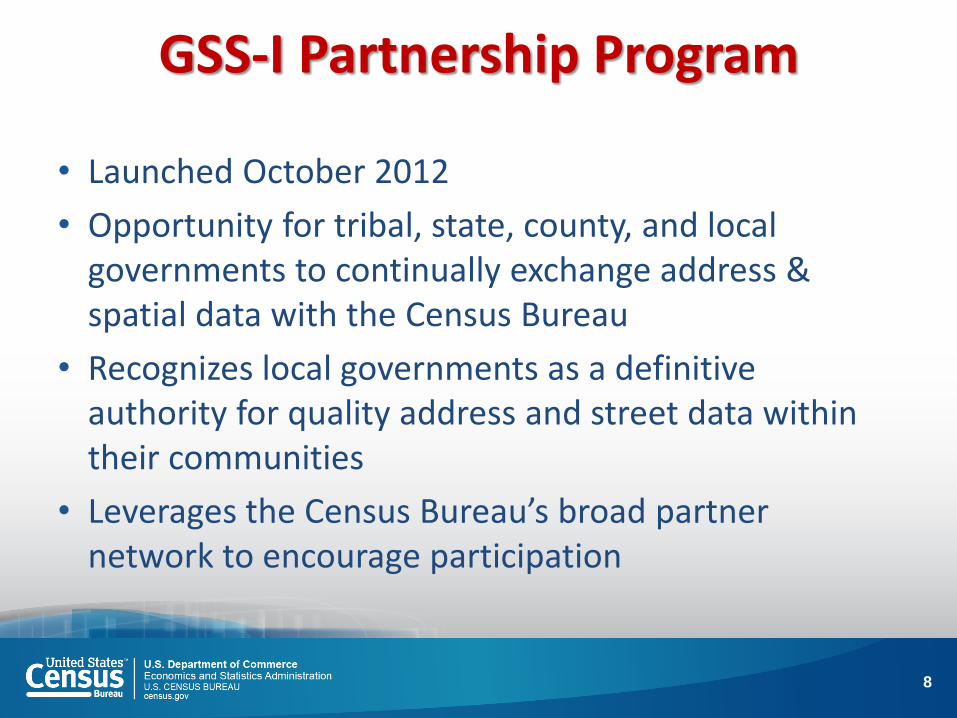
GSS-I Partnership Program
• Launched October 2012
• Opportunity for tribal, state, county, and local governments to continually exchange address & spatial data with the Census Bureau
• Recognizes local governments as a definitive authority for quality address and street data within their communities
• Leverages the Census Bureau’s broad partner network to encourage participation
8
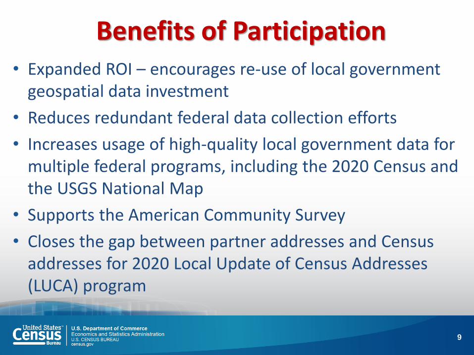
Benefits of Participation • Expanded ROI – encourages re-use of local government
geospatial data investment
• Reduces redundant federal data collection efforts
• Increases usage of high-quality local government data for multiple federal programs, including the 2020 Census and the USGS National Map
• Supports the American Community Survey
• Closes the gap between partner addresses and Census addresses for 2020 Local Update of Census Addresses (LUCA) program
9

What’s in it for you?
Improved address and feature coverage (local govts are authoritative source)
support current survey samples, including the American
Community Survey
More current data and improved process
flows should minimize the impact of programs like LUCA
Accurate 2020 Census
Our evaluations & feedback may help you
improve your data
10

High Level GSS-I Process
11
Determine available partner sources
Acquire datasets: Street Centerlines Address Point File Parcels Boundaries
Perform Content
Verification
Crosswalk, standardize, match, and geocode address and structure points using the MAF
Match street Centerline data to identify differences Calculate spatial accuracy (CE95 method) using GPS control points
New Addresses Added to the MAF New streets added to TIGER Address and spatial inconsistencies resolved
ACQUISITION PROCESSING RESULTS (Ideal) FEEDBACK
Summary Report Detailed Report
Partnership Shapefile

Data Content Guidelines
The Census Bureau has released Data Content Guidelines to describe the minimal and optimal information required for Addresses (including structure points), Street Centerlines, and Metadata provided by partners for the GSS-I
http://www.census.gov/geo/www/gss/gdlns/addgdln.html
12

Partner Data Acquisition and Content Verification
13

Partner Data Acquisition Status
14
* Some counties provided multiple partial-coverage street centerline datasets (i.e., cities vs. balance of county) ** Includes feature and address files processed through the MAF/TIGER system update process
Data as of May 5, 2014
Partners Contacted
Partners Providing Files
Address List
Acquired
Structure Coordinates
Acquired
Street Centerlines
Acquired
Partner Files Processed
TOTAL 482 313 177 622 691* 859**

15

File Content Verification Observations
Incomplete metadata Projection, datum, data dictionaries, etc.
Coverage gaps Some counties excluded data for incorporated cities within their legal jurisdiction
Call-backs for explanations and missing data Missing Interstate Highway layer, cryptic building use codes, etc.
Failure to meet minimum Street Feature Guidelines Limits the uses for partner-provided data (i.e., street matching, attribute harvesting, coordinate enhancement)
16

Partner Address: Matching, Geocoding, MAF Update
17

Minimum Address Guidelines - MATCHING To successfully match to the MAF, a partner address must include:
• Complete Address Number • Complete Street Name
and AT LEAST ONE OF THE FOLLOWING:
• Address Coordinate (latitude, longitude) • ZIP Code • Postal City and State • Census 2010 Tabulation State, County, Tract and Block Code
This minimum information allows the Census Bureau to update the source data for an existing MAF address record, adding to our confidence that the address is valid.
18

Minimum Address Guidelines - GEOCODING
To GEOCODE an existing MAF address, the partner address must meet the MATCHING requirements above, and provide one of the following:
Address Coordinate (latitude/longitude) OR
Census 2010 Tabulation State, County, Tract and Block Code
19

Minimum Address Guidelines – ADDS
To ADD a new partner address to the MAF, the partner address must:
• meet the MATCH requirements above, and
• include an address type indicator identifying the address as residential, commercial, utility, etc., and
• not already exist in the MAF
Minimum Address Guidelines – WITHIN UNIT IDENTIFIERS For residential addresses with multiple units (i.e., apartments, condos, etc.), the partner address data should provide:
• a unique Within Structure Identifier (apartment #, unit #, etc.) to distinguish each unit from other units at the same Basic Street Address (BSA).
or, if a Within Unit Identifier is not available or does not exist:
• The number of units at the BSA (i.e. “123 Main Street - 25 Units”)
and
• A flag indicating which addresses are multi-unit structures
20

Minimum Address Guidelines – GROUP QUARTERS For Group Quarters addresses (i.e., dormitories, prisons, residential medical facilities, etc.), the Census Bureau requests the following information in addition to the address information required for MATCHING and GEOCODING: • NAME (i.e. Shady Acres Retirement Home) of the Group Quarters, and • TYPE (i.e., Hospital, Prison, College Dormitory) of Group Quarters
Minimum Address Guidelines – NON CITY-STYLE ADDRESSES
Census Bureau currently does not attempt to match or add any address records that contain only Non-City-Style Addresses, such as: • Rural Route Addresses (i.e. RR 3 Box 725 Anytown, ST 12345) • Post Office Box Addresses (i.e. P.O. Box 12374 Anytown, ST 12345) • Highway Contract Addresses (i.e. HC 3 Box 330 Anytown, ST 12345) • General Delivery (i.e. General Delivery Anytown, ST 12345) • Location Descriptions (i.e. Brick House at intersection of 1st and Main Streets) • Address Coordinates ONLY
21

Total Partner Addresses Received (2/20/14) 28,673,572
Duplicates Addresses Identified within Partner Datasets (multi-unit addresses missing unit
identifiers)
1,148,866 4%
Total Unduplicated Partner Addresses 27,526,810 96 %
Total Partner Addresses Matched to Master Address File (MAF)
24,336,743 88% of Total
Addresses in Same Block as MAF 22,526,027 93% of Matched
Addresses in Different Block than MAF 1,410,562 6% of Matched
New Geocode Attained 140,427 1% of Matched
Addresses w/ Same Address Class as MAF (residential, etc.)
12,397,201 51% of Matched
Addresses w/ Different Address Class than MAF
494,185 2% of Matched
Addresses w/ No Address Class Identified
11,445,357 47% of Matched
Total Partner Addresses Unmatched to MAF 3,190,067 12% of Total
Unmatched Class Residential 952,003 30% of Unmatched
Unmatched Commercial/Other/ Unspecified
2,238,064 70% of Unmatched

Street Centerline Evaluation and Update
23

Interactive Review and Update
24
• Digitizers interactively review the potential new and misaligned streets using the partner data and current imagery
• GREEN lines indicate street
updates made by the Census Bureau based on the partner data
• The Census Bureau added 39
miles of new streets and modified 115 miles of misaligned streets based on this partner’s street centerline data

Street Centerline Updates
25
• 3,105 Miles of new roads added
• 8,887 Miles of updated roads
• 11,992 total miles of feature updates

Partner Feedback
26

SUMMARY
ADDRESS FEEDBACK REPORT
Column 1. Address Data Submitted to the Census Bureau Total
F Total Addresses 34,695
G Total Residential Addresses 0
H Total Nonresidential Addresses 0
I Total Other 34,695
2. Address Actions taken by the Census Bureau
J Total Matched 32,035
K Total Added 0
L Total Coordinates Used 30,156
M Total Not Accepted 2,638
N Total Not Accepted Duplicate 323
O Total Not Accepted Incomplete 41
P Total Not Accepted Other 2,274
Q Residential Currently in MAF 40,612
27

DETAILED
ADDRESS FEEDBACK REPORT
28
Partner Addresses Provided
Partner Addresses
Matched OR Added to MAF
Records Not
Accepted
Nu
mb
er R
eco
rds
Cu
rren
tly
in M
AF

Feature Feedback
29
Adding a date of last update field to the partnership shapefiles:

What Can You Do?
30
Use ‘Address Type Indicators’ (residential, commercial, utility, etc.) Required to add new addresses to the MAF
Establish ‘Within Structure Identifiers’ for residential addresses with multiple units (apartments, condos, etc.)
Apartment #, unit #, etc. to distinguish each unit from other units at the same Basic Street Address
Provide your data to the State (MI) to provide to the Census Bureau

For more information, visit:
http://www.census.gov/geo/www/gss/
31

Better Boundary Quality:
Consolidating the Boundary & Annexation
Survey
32

The Boundary & Annexation Survey (BAS)
Background Consolidation Why Participate? Consolidation Status How Do I Participate?
33

BAS Background
Census collects boundaries as of January 1 each year annexations, de-annexations, incorporations, mergers
Survey counties, MCDs (townships) & places (cities, towns,
villages) and AIAs: Michigan: 275 Cities Nation: 19,519 Incorporated Places
258 Villages
1573 Townships (MCDs) 16,360 Townships
83 Counties 3,031 Counties
34

BAS Background (Con’t)
2 “parts” to BAS:
1) provide geospatial changes (change polygons
in BAS TIGER file, not just submitting your file)
2) provide legal documentation for changes
Can also provide boundary corrections, not just the legal
changes (more on this shortly)
35

BAS Background (Con’t)
May participate digitally, although significant number of
governments, especially smaller ones, participate on paper
Paper = Relative accuracy?
Many do not participate at all (no annexations = no
boundary review? Remember MTAIP from the Major
Initiatives Slide???
36

Paper BAS Map
37

Inaccuracies:
Visible vs. Non-Visible Boundaries
38

HOW CAN WE
(the Collective “WE”)
IMPROVE THE BOUNDARIES
IN TIGER?
State Consolidated BAS
County Consolidated BAS
39

What is a State Consolidated
Boundary & Annexation Survey?
State responds to BAS for all governments within
the state.
• This is appropriate where state law dictates that all
governments within the state must provide legal changes
to a state office
• Census Bureau and State enter into a Memorandum of
Understanding for consolidation
40

State Boundary and Annexation Survey
MOU
The state has options for enacting a State-Level
BAS:
• Provide the Census Bureau a list of governments in the
State that enacted legal changes in the BAS year;
• Provide the Bureau the geospatial changes for the legal
changes (transaction file) and the legal documentation.
41

Consolidated BAS Benefits
• State can participate digitally (boundary accuracy!)
• If the state is responding, this provides an incentive to
governments to ensure that the state receives their legal
changes, on a timely basis
• State is providing a service to the gov’ts in the state
• Provides continuity of BAS contact and response at the
state level (as opposed the numerous gov’ts within the state,
especially as administrations, staff change in local governments
• State level BAS contact(s) know BAS program,
requirements, what to do and when!
42

Consolidated BAS Benefits (con’t)
• Reduces duplication of effort (with no C-BAS agreement in
place, Bureau still surveys all entities, must rectify discrepancies,
follow up with non-responders)
• Saves $$$ (i.e., taxpayer $) because Bureau has to
engage fewer entities
• Provides “Roll-Up” of boundaries to State and then to
Federal Government
• Contributes to more accurate NSDI (Under OMB Circular A-
16, Census Bureau is boundary steward for the Nation)
• Can reduce inaccuracies (you can make boundary
corrections), which should impact REDISTRICTING
43

Inaccuracies: BAS TIGER Place Boundary
Compared to Local Parcel Data
Light Purple: Census Boundary Green: City Boundaries Pink: Parcel Census clearly leaves out parcels that include Housing Units: Housing Units=pop
44
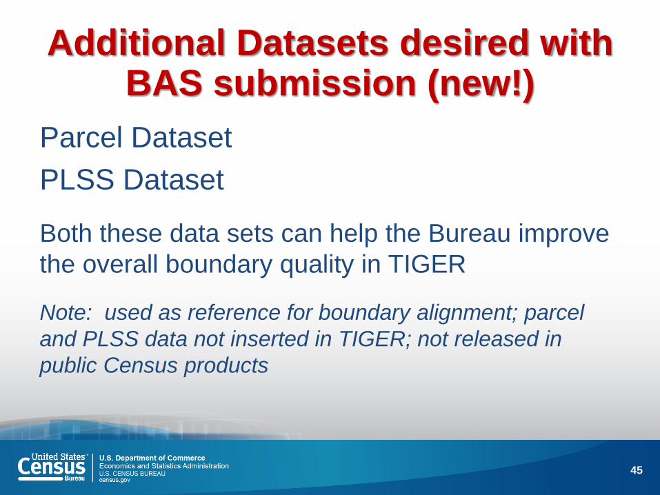
Additional Datasets desired with BAS submission (new!)
Parcel Dataset
PLSS Dataset
Both these data sets can help the Bureau improve
the overall boundary quality in TIGER
Note: used as reference for boundary alignment; parcel
and PLSS data not inserted in TIGER; not released in
public Census products
45

County Consolidated BAS
What if the State can’t engage in CBAS?
COUNTY Consolidated BAS
Implementation is different than State
Consolidation (entities in county must agree to consolidation,
county solicits their participation)
46
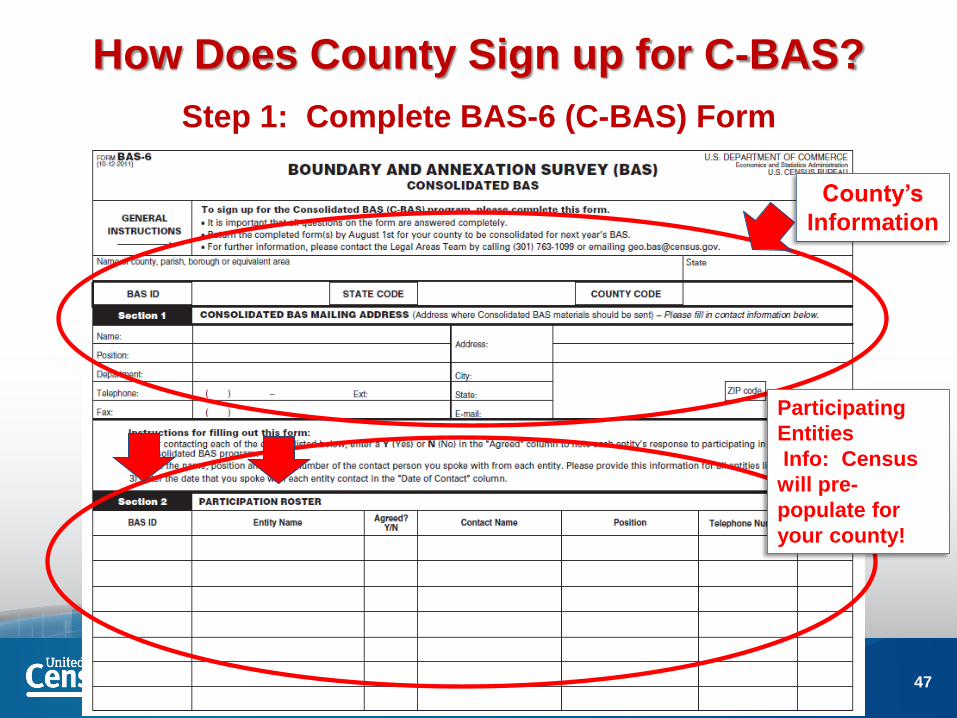
How Does County Sign up for C-BAS?
Step 1: Complete BAS-6 (C-BAS) Form
County’s
Information
Participating
Entities
Info: Census
will pre-
populate for
your county!
47

How Does County Sign up for C-BAS?
Step 2: Contact entities for participation agreement
Participating
Entities
Info
Agree? Y/N
Date of
Contact
48

County Consolidated BAS Step 2: Contact entities for participation agreement (con’t)
TIPS and TRICKS
• We will provide text county can use in email or letter to
solicit participation
• Blast email or .pdf letter sent via email to constituents has
been successful in other states
• County BAS “consolidator” has requested presentation
time at county-wide municipal clerks’ meeting, made the
pitch and signed on entities at the meeting conclusion
49
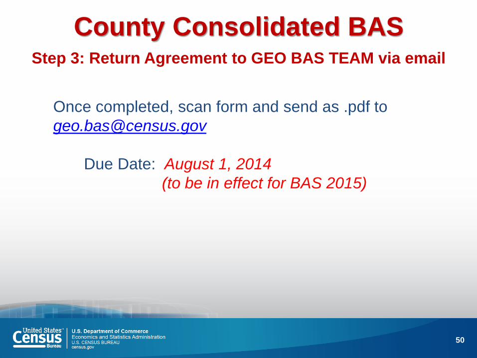
County Consolidated BAS Step 3: Return Agreement to GEO BAS TEAM via email
Once completed, scan form and send as .pdf to
Due Date: August 1, 2014
(to be in effect for BAS 2015)
50

County Consolidated BAS
What happens next?
Entities within the county participating in County
Consolidated BAS will receive a postcard for the (2015)
BAS, indicating that their governmental unit has elected to
have the county respond for them (important because staff/elected officials change)
The counties in C-BAS will receive instructions for
completing the BAS
51

Consolidated BAS More Benefits?
Redistricting Data Program (State level participation)
Starts FY 2015? with Block Boundary Suggestion Program
Geographic Support System Initiative (GSS-I)
(collecting address point data, features, and other data
layers from locals, ongoing effort)
LUCA (Local Update of Census Addresses)
Targeted Address Canvassing? Decision by 2015
52

National C-BAS Participation
State and County Level
State C-BAS (7)
County C-BAS
Cover
(Alaska is State Participant, too)
53

Questions? Ready to Get Started?
Gail A. Krmenec
U.S. Census Bureau
Geography Division
(630) 288-9258
54

FAQs
What if a place is located in 2 or more counties? Does that
place have to get both counties to respond for county C-
BAS? Yes and No.
As a COUNTY participating in C-BAS, can we rescind a
Consolidated BAS agreement?
Yes. We will then survey all the entities in the county.
As a PLACE participating in County C-BAS, can we drop out
of the county agreement?
YES, notify the BAS team (and the participating county).
55

FAQs
If I provide the parcel dataset to the Census Bureau as part
of BAS (or the GSS-I), will these data be released in public
TIGER products?
No, the Bureau uses parcels for reference. Parcel data may
be used to update the Master Address File, but Title 13 of
the U.S. Code restricts the Bureau from sharing individual
addresses with the public.
If PLSS data are provided, will these data be included in
public TIGER products?
No, PLSS data will be used for reference. But if boundaries
follow PLSS lines, edges in TIGER will be flagged &
“locked”.
56