Embed Size (px)
Citation preview
EVERGLADES NATIONAL PARK
GEOLOGIC RESOURCE MANAGEMENT ISSUES
SCOPING SUMMARY
Trista L. Thornberry- Ehrlich Colorado State University – Geologic Resource Evaluation
February 4, 2005
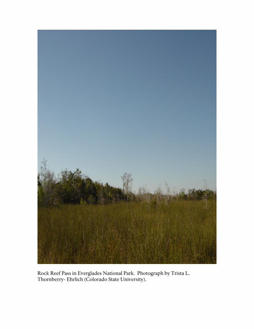
Rock Reef Pass in Everglades National Park. Photograph by Trista L. Thornberry- Ehrlich (Colorado State University).
Table of Contents Table of Contents.................................................................................................................3 Executive Summary ............................................................................................................ 4 Introduction .........................................................................................................................5 Physiography ....................................................................................................................... 6 Geologic History of South Florida ....................................................................................7 Stratigraphy.......................................................................................................................... 9 Significant Geologic Resource Management Issues in Everglades National Park... 10 Scoping Meeting Participants .......................................................................................... 17 References........................................................................................................................... 18 Maps of Everglades National Park ................................................................................. 20
Executive Summary A Geologic Resources Evaluation scoping meeting took place in Homestead, Florida on January 24, 2005. The meeting was followed by a field trip on January 25, 2005. The scoping meeting participants identified the following list of geologic resource management issues. These topics are discussed in detail on pages 10 - 16. 1. The Florida Bay mud banks elevation and stability 2. Mangrove zone topography and buttonwood ridge height 3. Whitewater Bay and Gulf Coast estuaries 4. Solution holes 5. Aquifer characteristics and groundwater flow dynamics 6. Recreation and other use demands 7. Earthen and failed dams, canals, and sheet piling 8. Sediment transport and resuspension at Lake Ingraham 9. Sinkholes and karst features 10. Paleoclimates 11. Sea level rise 12. Geologic changes due to storms and hurricanes 13. Atmospheric deposition of African dust 14. “Lake Belt” management 15. Tree islands and hardwood hammacks 16. Archaeological sites
Introduction The National Park Service held a Geologic Resource Evaluation scoping meeting for Everglades National Park at the Krome Center in Homestead, Florida on Monday, January 24, 2005, followed by a field trip the next day. The purpose of the meeting was to discuss the status of geologic mapping in the park, the associated bibliography, and the geologic issues in the park. The products to be derived from the scoping meeting are: (1) Digitized geologic maps covering the park; (2) An updated and verified bibliography; (3) Scoping summary (this report); and (4) A Geologic Resource Evaluation Report which brings together all of these products. Everglades National Park was established under Harry S. Truman’s administration on December 6, 1947. On October 26, 1976, the park was designated as an International Biosphere Reserve. The park attained its Wilderness Designation on November 10, 1978. It was made a world heritage site on October 24, 1979, and was named a Wetland of International Importance on June 4, 1987. Everglades covers 1,508,537 acres spanning the southern tip of the Florida peninsula and most of Florida Bay between the peninsula and the Florida Keys. The Everglades is the only subtropical preserve in North America. The environments at the park vary from mangrove and cypress swamps, marine and estuarine environments, pinelands and hardwood hammocks, sawgrass prairies and rock ridges. The area covers a large portion of the Florida Bay, a large carbonate mud bank. The park contains some of the most pristine and unique marshland habitat in the continental United States. Everglades National Park identified 385 quadrangles of interest. The Florida State Geologic Survey (FGS) has digitized a geologic map covering the state from individual county maps at a small scale (~ 1:750,000). This map only displays 4 separate geologic units (Holocene sediments, Key Largo Limestone, Miami Limestone, Tamiami Formation) for inside the boundaries of the park. Located within the quadrangles of interest are 11 additional geologic map units. Other geologic maps covering portions of the park itself include the FGS MS6/22 (1:24,000, 2000), the benthic habitat map published by NOAA CSC (1:48,000, 1999), Geological Society of America (GSA) Memoir 147 (1:79,000, 1977), the FGS OFMS 83/01- 07 (1:100,000, 1996), 83/08- 12 (1:100,000, 1995), 67 (1:26,720, Dade County), 66/01 (1:26,720, Monroe County), 63 and Series 120 (1:26,720, Collier County), USGS OF 97- 526 (1:120,000, 1997) and 86- 4126 (1:136,000, 1986). Additional mapping at a smaller scale will be more helpful for park management.
Physiography South Florida in the area of the Everglades is divided into 5 physiographic provinces. The Everglades province forms a south dipping, spoon- shaped low-lying area between the Atlantic Coastal Ridge to the east, the Big Cypress Swamp to the west, and the Sandy Flatlands area to the north. The basin has very low relief. The elevation change is only 3.6 to 4.3 m (12- 14 ft) from the maximum near Lake Okeechobee to sea level. Prior to anthropogenic alteration, this drainage system flowed slowly from north to south. Bounding the Everglades province on the east is the Atlantic Coastal Ridge. It is comprised of Pleistocene marine limestones covered by thin quartz sand sheets. The province ranges in elevation from 1.5 to 6 m (5 to 20 ft) in the southernmost portions. The width of the ridge ranges from 16 km (10 miles) in southern Miami- Dade County and narrows to 5 to 8 km (3 – 5 miles) further north. Periodically breaching the southern portions of the ridge are sloughs (transverse glades) oriented perpendicular to the trend of the ridge. The southern reaches of the Everglades and Big Cypress Swamp provinces transition into the Coastal Marshes and Mangrove Swamp physiographic province. The province covers an area from the northeastern part of Florida Bay, around the southern Florida peninsula, and west, into the Gulf of Mexico up to the Ten Thousand Island region never Everglades City. Bands of swamps and brackish marshes sitting just above sea level characterize this province. Freshwater runoff and tidal fluxes cause the salinity to change dramatically. This is why the mangrove, capable of enduring such salinity changes, thrives in this area. The Big Cypress Swamp province defines the western boundary of the Everglades. This area is slightly higher in elevation than the Everglades basin because it is underlain primarily by the coral- rich limestones of the Pliocene Tamiami Formation (3- 4 Ma). This formation is exposed in large areas of Big Cypress. Drainage in the province is primarily to the south and southwest.
Geologic History of South Florida Sediment cores indicate that South Florida has been predominantly an area of carbonate accumulation since the Mesozoic. Late Paleozoic Era – During the Mississippian, the landmass that would underlie the grand carbonate platform of Florida today was not attached to the North American Craton. It is speculated that it was attached to the northwest portion of the African continent (Condie and Sloan, 1998). However, marine carbonates were being deposited over large portions of the area atop a Paleozoic age crystalline basement high, the Peninsular Arch (Pollastro et al., 2000). In the Pennsylvanian, a collision event, known as the Ouachita orogeny sutured the Florida landmass to the continent as Gondwanaland and North America collided eventually forming the supercontinent Pangaea. The land was still submerged and south Florida was located at the junction of the North American, South American, and African plates. Through the Permian, Pangaea remained intact (Condie and Sloan, 1998). Early Mesozoic Era – No sooner had Pangaea formed than it began to break up. During the late Triassic, South and Central America and Africa began to rift away from North America. This established the long- standing passive margin of the eastern seaboard that persists today. The Florida and Cuba blocks detached from northwest Africa and the Gulf of Mexico opened (Condie and Sloan, 1998). Accompanying the rifting of Pangaea was the widespread extrusion of volcanic rocks consistent with mantle plume upwelling due to crustal tension (Heatherington and Mueller, 1991). This continental rifting also opened the Atlantic Ocean basin. Middle Mesozoic Era - Underlying the south Florida basin are igneous rhyolitic - basaltic rocks (Thomas et al., 1989). These rocks were subaerially exposed and eroded during the late Triassic to middle Jurassic. This caused the formation of redbeds locally. As the Atlantic Ocean continued to develop, deltaic and shallow marine sediments were deposited in the late Jurassic. Restriction of marine circulation at this time resulted in periodic accumulations of evaporites and marine carbonates (Cunningham, 2005). Deposition of Jurassic and Cretaceous sediments was controlled by the south- southeast plunging axis of the Peninsular Arch. Basal sediments onlap and pinch out against the arch (Pollastro et al., 2000). Late Mesozoic Era – As marine transgression proceeded during the early Cretaceous, the Florida Platform was the site of more widespread deposition of marine limestones and reefs. Further transgression and global warming during
the Late Cretaceous established an open marine accumulation of carbonates over the entire Florida Peninsula. Cenozoic Era – Cenozoic development of the Florida Platform included additional deposition of marine carbonates and deposition of siliciclastics (grains of silicate minerals such as quartz in lieu of carbonates) from northwestern highlands sources and long shore oceanic currents. Tertiary faulting occurred south of Florida as the Cuban block collided with the Antilles arc and carbonate accumulation continued in Florida (Condie and Sloan, 1998). In southern Florida, the open marine setting continued during the Paleocene as more restricted flow to the north resulted in deposits of mixed carbonates and evaporites. Eocene and Oligocene deposition is marked by shallow water carbonates. Intermittent with this deposition were subaerial exposures associated with local oceanic regressions. Deposition in south Florida during the Miocene changed with the introduction of more widespread siliciclastics from a fluvio- deltaic system prograding down the peninsula. Phosphates and the carbonate ramp of the Arcadia Formation were deposited during the Miocene in south Florida. A Pliocene lowstand caused many of the previous deposits to be reworked and/or eroded. The Everglades area was the deposition area of a thick pile of sand that was being transported south to eventually form the Long Key Formation (Guertin et al., 1999; Cunningham, 2005). The Pleistocene era resulted in the conversion from siliciclastic deposition mixed with carbonate accumulation to more widespread carbonate sedimentation (Cunningham, 2005). Global sea- level changes during the intermittent ice ages of the Pleistocene controlled the rate and distribution of carbonate units. At 120 Ka, the last major sea level fall occurred as the mixed carbonate- siliciclastic sediments formed the Fort Thompson Formation. This unit interfingers with the surficial geologic units, the Miami and Key Largo Limestones, and the Anastasia Formation (~130 Ka) (Cunningham, 2005). At 15- 16 Ka sea level began to rise rapidly and flood southern Florida around 7 or 6 Ka (Shinn et al., 1997). Sea level has continued to rise. Holocene geologic activity in the Everglades area consists of the dissolution of carbonate units, the accumulation of carbonate muds, marine and freshwater marls, sand and swamp deposits.
Stratigraphy Cores such as the deep, continuous core near the Everglades National Park Research Center (W- 17232), those of the South Florida Drilling Project (Florida Geological Survey, University of Miami, Florida Department of Transportation), and the USGS help constrain the stratigraphy underlying the park. The lowest unit penetrated by the core in the park is the Arcadia Formation (top surface at 147 m, 482 ft). This formation consists of ramp setting carbonates with scant quartz contents increasing northward (~20% quartz grains at W- 17232) (Cunningham, 2005). A major disconformity marks the boundary between the Arcadia Formation and the overlying Peace River Formation. The Peace River Formation is absent south of the Everglades. It contains two distinct units: a lower diatomaceous mudstone, and an upper fine- grained quartz muddy sandstone (Cunningham et al., 1998). The top of the Peace River Formation is 98.8 m (324 ft) below the surface at W- 17232 (McNeill et al., 1996). Cunningham et al. (1998) proposed a new unit, the Long Key Formation, for subsurface siliciclastics underlying the southernmost reaches Florida (from core W- 17156 on Long Key). This unit is coeval with the Stock Island Formation of the lower Florida Keys (Guertin et al., 1999). The top of the Long Key Formation in the park is 17.4 m (57 ft) below the surface. The siliciclastics of the unit were deposited in at least three pulses (late Miocene, early Pliocene, and latest Pliocene/earliest Pleistocene). They are present in a channelized morphology of coarse- grained sands (>1mm) (Warzeski et al., 1996). Shallow water limestone of the Fort Thompson Formation comprises the uppermost 17 m of cored section in the Everglades. This limestone is probably combined with the capping unit of the Miami Limestone. The Fort Thompson is mostly lagoonal facies carbonate with abundant bivalve fossils and some quartz sand. The Miami Limestone is ~125 – 130 Ka and represented deposition during an interglacial period. Two facies, the oolitic facies and the bryozoan facies are more or less combined in most of the outcrops at Everglades National Park (Hoffmeister et al., 1974; Cunningham, 2005). Overlying the Miami Limestone bedrock are surficial units of freshwater peat and organic muck, freshwater and marine marls, and cyanobacteria mats. The peat and muck typically occurs in low- lying sloughs and solution holes and are dark and fine- grained. During the standing water phase of the wet season, extracellular precipitation of calcium carbonate by cyanobacteria forms fresh and marine limestone marls. The marine marls (Flamingo Marl) are dominated by aragonitic mud, and shell deposits that form a sort of coastal levee around the southern rim of the park (Cunningham, 2005).
Significant Geologic Resource Management Issues in Everglades National Park 1. The Florida Bay mud banks elevation and stability The Florida Bay is covered by an extensive system of supra- and subtidal carbonate mud banks, coastal marl ridges, coastal carbonate mud ridges, mangrove peat deposits, and mollusk deposits. There is a strong resource management need to understand how water moves around the bay and what buttressing effect, if any, the mud and marl ridges have on the flow of water. Another concern is gaining an understanding of the nature of landscape evolution during late Holocene sea level rise (23 cm, 9 inches rise in sea level in 70 years). Many of the freshwater marshes behind the ridges are changing to super saline marine lagoons. The features in the bay are strongly related to minute changes in elevation. Environments can change within centimeters of topographic relief. Given the coverage of mapping at the park, normal surficial maps are not sufficient for complex management decisions at the Everglades. An interdisciplinary approach to mapping is critical to producing a useful product for resource management. Anthropogenic, supratidal, intertidal, subtidal, and coastal features would all be helpful. This holistic ecosystem approach integrates biological, physical, cultural, and oceanographic variables. LIDAR surveys in addition to satellite imagery, multibeam mapping, bathymetry data, water quality and circulation, shoreline change data, pre/post storm comparisons, oceanographic data (waves, tides, currents, turbidity, temperature salinity, sediment transport patterns, coral larvae and other species distributions), etc. are essential for resource management at Everglades National Park. Research and monitoring questions and suggestions include: What is the relationship between coastal marl and carbonate mud ridges and the buttonwood distribution? What is the minimum mapping unit relevant to resource management? What are the flow dynamics (especially related to salinity) in the bay? What controls the distribution of the mud banks? Is there any remediation possible for the hypersaline environment in the central portion of the bay? Why does the basin and bank character of the Florida Bay resemble hexagonal mudcracks? 2. Mangrove zone topography and buttonwood ridge height The mangroves thrive in oscillating fresh- saline water conditions. In a sense, they define the water level. A baseline needs to be established regarding sea level
rise to determine its effect on the mangrove areas. Detailed topography would help manage this resource. The scale of inches is important for the low banks and ridges where the tides and wind expose the entire western basins. 3. Whitewater Bay and Gulf Coast estuaries Whitewater Bay sits behind Cape Sable and is fed by the Shark, Broad, and Harney Rivers. It is bound by a buttonwood embankment growing as a natural berm on a storm beach made of mud. Research and monitoring questions and suggestions include: What is the relationship between the diversion of water through canals and the buttonwood distribution? What is the nature of the Shark Slough- Taylor Slough divide? 4. Solution holes Solution holes are an element of the karst topography at the park. They provide essential habitat for fish and other wildlife during the dry winter months at the Everglades. Solution holes occur throughout the park (especially in the eastern half) and need to be systematically located, mapped, and described for resource management. Research and monitoring questions and suggestions include: How are solution holes and other karst features affecting water quality at the Everglades? Are solution holes sources of phosphorus input? How do solution holes affect the hydrogeologic regime including retention time, hydraulic head, and water storage? 5. Aquifer characteristics and groundwater flow dynamics The interaction between groundwater flow and the overall fresh water and marine ecological quality must be quantitatively determined at the Everglades. Visitor uses and surrounding development are increasing the levels of certain substances in the water at the park. Nutrients from waste are causing algal blooms. Salinity levels are dependent on seasonal freshwater input and tidal circulation in the Florida Bay. Research and monitoring questions and suggestions include: How many wells are necessary to model the hydrogeologic system at the park? Model the porosity and permeability of the Fort Thompson layer. Examine the salt wedge characteristics versus the surface water. Is increasing the hydraulic head at the Everglades a good idea? How would an increase in hydraulic head affect the local spring activity?
6. Recreation and other use demands In 2003, Everglades National Park hosted 1,031,888 recreation visits. These in are placing increasing demands on the limited resources and fragile ecosystem of the park. Motorized boat access and fishing motors are restricted in the wilderness areas of the park. Research and monitoring questions and suggestions: Are visitors affecting sediment transport and the hydrologic system at the park? 7. Earthen and failed dams, canals, and sheet piling Dams and other earth works in the park pose a serious threat to the safety of visitors and park resources. During the 1930’s a series of canals and levees were constructed (including East Cape canal, Homestead canal, Slegel’s ditch, Houseman’s ditch, and Middle Cape canal) to divert the water away from the “prime” real estate around Cape Sable. The real estate venture failed and the land was later included in the park boundaries. The remediation of the canals and earth works is a park responsibility. Canals throughout south Florida divert water away from the natural flow between Lake Okeechobee and the Everglades. Locally, near Cape Sable and Lake Ingraham, the flow is disrupted and sediment transport patterns have changed. Fresh water marshes behind the cape are being salinated due to the overall lack of fresh water input. 8. Sediment transport and resuspension at Cape Sable and Lake Ingraham The very nature of the landscape at the Everglades is one of change. Shifting muds and sands continually alter the shape and profile of the shoreline. Sand and mud erode from one beach and are deposited elsewhere in the course of a single storm event. Focus also needs to be on understanding the sediment transport dynamics at the park. The hydrogeologic system in the area around Lake Ingraham was altered with the construction of canals, roads, and levees. As a result, sediments scouring through the canals are being deposited in the lake basin (6- 30 cm/year, 2.4- 11.8 inches/year) and the lake levels are very low and are often exposed at low tide. The delta emanating from the Middle Cape Canal is expanding and increasing the sediment influx for the Florida Bay. Salinity is increasing as 80 high tides a year are cresting the low marl ridges. Higher salinity waters are encroaching on the fresh water areas. This leads to a decline in marsh, mangrove, and prairie areas. Research and monitoring questions and suggestions: Are declines in mangrove, marsh, and prairie areas due to the canal system or sea level rise around Lake
Ingraham? USGS survey points are too far apart for proper monitoring of landscape response to sea level rise (~400 m, 1,312 ft apart). Can the number of these points be increased? Should fill dams be destroyed or reestablished? What remediation can be done on the eroded canal openings (erosion rate is 0.6- 1.2 m/year, 2- 4 ft/year)? What is the rate of change in sediment transport around Cape Sable? How much sediment is being lost through canal scouring? What would be the effects of replugging the Middle Cape Canal? 9. Sinkholes and karst features The Fort Thompson limestone is a very permeable unit. Borrow pits and canals intersect this unit in many locations of the park. This is affecting water flow. Approximately 50 sinkholes have been located in the park. These serve as vital habitat during the dry season. However, their distribution, characteristics, depths, and interconnectedness need to be systematically mapped and described. Research and monitoring questions and suggestions: What steps should be taken to model water flow in the park regarding karst features? Could aerial photography be used to map sinkholes? What is the relationship, if any, between solution holes and other karst features and the distribution of hardwood hammacks and tree islands at the park? 10. Paleoclimates Cores in Florida and Biscayne Bays, and numerous sloughs in the park show peat and pollen as indicators of past climates. The spatial coverage for the cores is not at an adequate resolution to determine the temporal relationships and make interpolations between points. Bioturbation and other ground disturbances (railroad infill effects) distort the subsurface features. Research and monitoring questions and suggestions: Perform more coring operations to increase coverage at the park. Identify pollen species and correlate with paleoclimate. 11. Sea level rise Sea level rise is affecting all of South Florida. While slowing the rate of sea level rise is beyond the resources of the park, monitoring sea level change and evaluating/predicting impacts on the park’s landscape is a valid management issue. The fresh water marshes and brackish estuaries are under constant threat of inundation by the sea. Given the low relief of the park, this rise will destroy much of the marsh landscape protected at the park. Sea level rise is also causing beach erosion near Cape Sable and Lake Ingraham. Increases in turbidity with
rising seas are causing large seagrass dieoffs and increased carbonate material suspension. Research and monitoring questions and suggestions include: Is there any way to save the subaerial habitat from rising seas? What is the local rate of sea level rise? Looking at the affects of storm surges, how will the buttonwood/mangrove zones respond to the rising water? What direction should future planning proceed in light of the current restoration effort? Monitor and measure the relationship between water level flux and elevations to determine an exposure/submergence index (i.e. 100% of the time exposed versus 0% of the time exposed). Quantitatively define the terms subtidal, intertidal, and supratidal to use for future predictions and relate these to the local elevations and annual regime of water fluctuations. 12. Geologic changes due to storms and hurricanes Storm events and hurricanes have a pronounced and often catastrophic effect on the landscape of south Florida. Baseline conditions must be determined and studied for the resource management to predict the environmental response. Hurricane Donna in 1960 evacuated water from the bay by about 1 m (3 ft), then the water rushed back in to a depth of 2.1 m (7 ft). This resulted in mud deposition on the south side of the mud ridges and a high- energy shell layer deposit on the north side. Hurricane Andrew blew the highland beach area near the Ross River away. Geochemical changes resulting from the influx of storm water went unmeasured in the panic and cleanup by local agencies. Research and monitoring questions and suggestions include: Develop a response protocol in cooperation with other local agencies to determine the geochemical effects of storm surges. What are the recovery rates of mangroves after large storm events? Establish baselines for comparison and prediction of future events. 13. Atmospheric deposition of African dust Dust has been blowing across the Atlantic Ocean and depositing in south Florida for thousands of years. Paleosols and reddish (oxidized) layers atop the Miami Limestone attest to these airborne inputs. The process continues today, but modern development has introduced nutrients, elements, microbes, pesticides, soot, organics, bacteria, viruses, and other contaminants to the dust. The dust diminishes air water visibility. A peak of dust fall in the 1980s coincided with a sea urchin disease and other benthic system killoffs. Lead, arsenic, phosphate, copper, iron, and mercury concentrations in the surface sediments in the middle of Florida Bay are highest in low tidal flux areas.
Research and monitoring questions and suggestions include: There are 9.1 m (30 ft) monitoring wells in the bay; these could be expanded and utilized (contact Gene Shinn). Did the combination of dust and hypersalinity kill sea grass and cause algal blooms in Florida Bay? Monitor dust levels and attempt to correlate with environmental responses. Are dieoffs caused by African dust or by the transport of sediments, nutrients, and organics transported out during rising seas and storms? 14. “Lake Belt” management The term “Lake Belt” refers to a series of quarries near the park. These features are supposed to supply water to the park as part of a restoration effort. There is some concern about how these features are affecting groundwater movement. Some USGS monitoring wells are located near levees, but more wells would increase the understanding of the local hydrogeologic system. Local agriculture introduces sulphates, phosphorus, and other contaminants into the groundwater near these lakes that, given the permeable, conduit- rich bedrock, would easily contaminate the water in the quarries and affect the ecosystem of the park. 15. Tree islands and hardwood hammacks Tree islands and hardwood hammacks are prevalent features at the Everglades. They dot the sawgrass prairies throughout the park. They appear to be oriented in linear trends. There is discussion as to whether the islands and hammacks are located in bedrock highs or lows. They could be located in peat depressions, or perhaps on a laminated duracrust formed by phosphorus from evaporites pulled up by the trees in the groundwater. Rock ridges, such as that at Rock Reef Pass, are subtle, enigmatic linear features on the landscape at the Everglades. There are approximately 20 rock ridges in south Florida. The amount of relief associated with these ridges is small, approximately 0.9 to 1.5 m (3- 5 ft), but the vegetation changes across them and makes them appear more pronounced. Many theories abound as to why these features exist. Are they paleoshores, results of Pleistocene wrench faulting, developed fractures, concentrations of shells in oolite, paleo mudbanks, or the result of differential compaction and fracturing? Research and monitoring questions and suggestions include: There are numerous theories as to why these features exist. Can hydrogeochemistry determine if the bedrock is a source of phosphorous for these trees? How did the tree islands and hardwood hammacks form? What is the geologic control on their distribution? Are their linear trends related to elongated paleoflows? Obtain more cores in a transect through a rock ridge to help determine why they exist. Core tree islands
to bedrock to determine the nature of their formation. Install a monitoring well into the tree islands to look at differences in local groundwater chemistry. 16. Archaeological sites There are several sites, approximately 12,000 years old, along ancient coastlines that contain artifacts from the local indigenous populations. Mapping and/or reconstructing these sites would add to the cultural value of the park and help reconstruct the paleoshoreline in the 10,000 lakes, and Cape Sable areas especially.
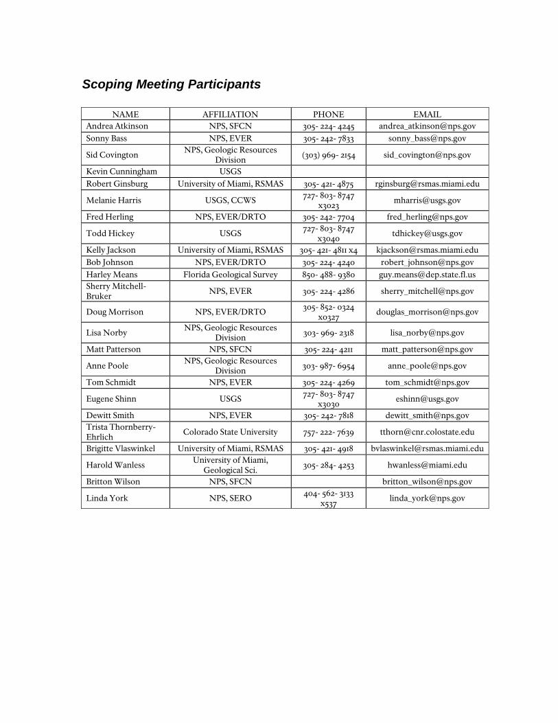
Scoping Meeting Participants
NAME AFFILIATION PHONE EMAIL Andrea Atkinson NPS, SFCN 305- 224- 4245 [email protected] Sonny Bass NPS, EVER 305- 242- 7833 [email protected]
Sid Covington NPS, Geologic Resources Division
(303) 969- 2154 [email protected]
Kevin Cunningham USGS Robert Ginsburg University of Miami, RSMAS 305- 421- 4875 [email protected]
Melanie Harris USGS, CCWS 727- 803- 8747 x3023
Fred Herling NPS, EVER/DRTO 305- 242- 7704 [email protected]
Todd Hickey USGS 727- 803- 8747 x3040
Kelly Jackson University of Miami, RSMAS 305- 421- 4811 x4 [email protected] Bob Johnson NPS, EVER/DRTO 305- 224- 4240 [email protected] Harley Means Florida Geological Survey 850- 488- 9380 [email protected] Sherry Mitchell-Bruker
NPS, EVER 305- 224- 4286 [email protected]
Doug Morrison NPS, EVER/DRTO 305- 852- 0324 x0327
Lisa Norby NPS, Geologic Resources Division
303- 969- 2318 [email protected]
Matt Patterson NPS, SFCN 305- 224- 4211 [email protected]
Anne Poole NPS, Geologic Resources Division
303- 987- 6954 [email protected]
Tom Schmidt NPS, EVER 305- 224- 4269 [email protected]
Eugene Shinn USGS 727- 803- 8747 x3030
Dewitt Smith NPS, EVER 305- 242- 7818 [email protected] Trista Thornberry-Ehrlich
Colorado State University 757- 222- 7639 [email protected]
Brigitte Vlaswinkel University of Miami, RSMAS 305- 421- 4918 [email protected]
Harold Wanless University of Miami, Geological Sci.
305- 284- 4253 [email protected]
Britton Wilson NPS, SFCN [email protected]
Linda York NPS, SERO 404- 562- 3133 x537
References Condie, K.C., Sloan, R.E., 1998, Origin and Evolution of the Earth, Principles of
Historical Geology. Prentice- Hall, Inc., 498 p. Cunningham, K.J., 2005, Hydrogeologic Fieldtrip Everglades National Park,
Southeastern Florida, unpublished. Cunningham, K.J., McNeill, D.F., Guertin, L.A., Ciesielski, P.F., Scott, T.M., de
Verteuil, L., 1998, New Tertiary Stratigraphy for the Florida Keys and Southern Peninsula of Florida. Geological Society of America Bulletin, vol. 110, pp. 231-258.
Guertin, L.A., McNeill, D.F., Lidz, B.H., Cunningham, K.J., 1999, Chronology and
Transgressive/Regressive Signatures in the Late Neogene Siliciclastic Foundation (Long Key Formation) of the Florida Keys. Journal of Sedimentary Research, vol. 69, pp. 653- 666.
Heatherington, A.L., Mueller, P.A., 1991, Geochemical evidence for Triassic
rifting in southwestern Florida. Tectonophysics, vol. 188, pp. 291- 302. Hoffmeister, J.E., Stockman, K.W., Multer, H.G., 1967, Miami Limestone of
Florida and its recent Bahamian counterpart. Geological Society of America Bulletin, vol. 78, pp. 175- 190.
McNeill, D.F., Cunningham, K.J., Guertin, L.A., Melim, L.A., Warzeski, E.R.,
Anselmetti, F.S., Ginsburg, R.N., Eberli, G.P., Swart, P.K., 1996, Data Report: Tertiary- Quaternary cores from the Florida Keys and Everglades. Miami Geological Society, South Miami, Florida, 98 p.
Pollastro, R.M., Schenk, C.J., Charpenter, R.R., 2000, Undiscovered Oil and Gas
in the Big Cypress National Preserve—A Total Petroleum System Assessment of the South Florida Basin, Florida. U.S. Geological Survey, Open File Report 00-317.
Shinn, E.A., Lidz, B.H., Halley, R.B., 1997, IGC Field Guide T176: A Field Guide:
Reefs of Florida and the Dry Tortugas. In: Geological Environments of Florida Bay and the Florida Keys Reef Tract. Compiled by: Tihansky, A., Prager, E., Shinn, G.
Thomas, W.A., Chowns, T.M., Daniels, D.L., Neatherly, T,L., Glover, L.,
Gleason, R.J., 1989, The subsurface Appalachians beneath the Atlantic and Gulf

coastal plains. The Geology of North America, vol. F- 2, Geological Society of America.
Warzeski, E.R., Cunningham, K.J., Ginsburg, R.N., Anderson, J.B., Ding, Z.D.,
1996, Neogene Mixed Siliciclastic and Carbonate Foundation for the Quaternary Carbonate Shelf, Florida Keys. Journal of Sedimentary Research, vol. 66, pp. 788- 800.
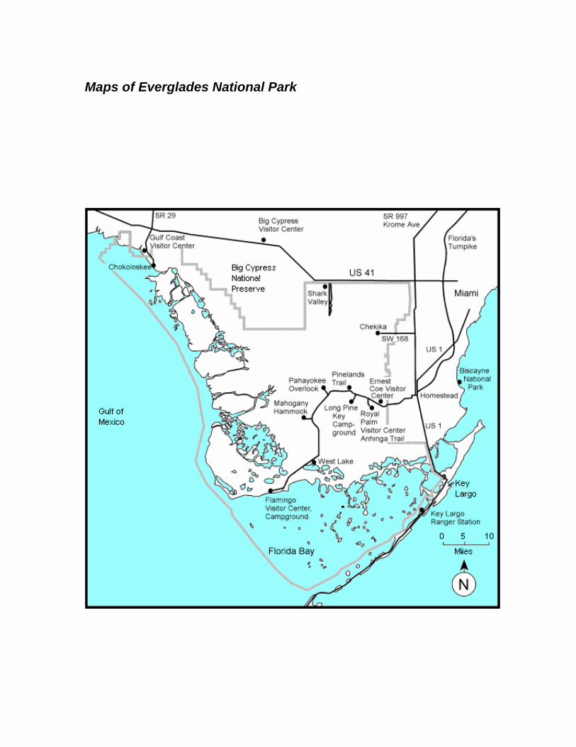
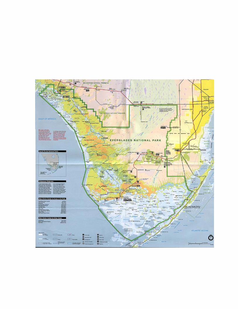
Maps of Everglades National Park