Embed Size (px)
Citation preview
1 European Environment Agency
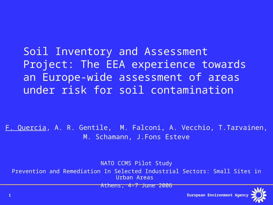
Soil Inventory and Assessment Project: The EEA experience towards an Europe-wide assessment of areasunder risk for soil contamination
F. Quercia, A. R. Gentile, M. Falconi, A. Vecchio, T.Tarvainen, M. Schamann, J.Fons Esteve
NATO CCMS Pilot StudyPrevention and Remediation In Selected Industrial Sectors: Small Sites in Urban Areas
Athens, 4-7 June 2006
2 European Environment Agency
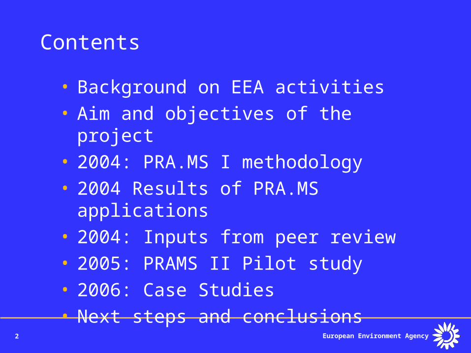
Contents
• Background on EEA activities• Aim and objectives of the project• 2004: PRA.MS I methodology• 2004 Results of PRA.MS
applications• 2004: Inputs from peer review• 2005: PRAMS II Pilot study• 2006: Case Studies• Next steps and conclusions

4 European Environment Agency
EEA main tasks
• Making environmental information accessible
• Networking – Implement and coordinate the EIONET (European Environmental Observation and Information Network)
• Reporting – Prepare regular reports on the state and trends of the environment
• Annual budget of approx. 30 Meuro, about 150 staff, 5 topic centres
5 European Environment Agency
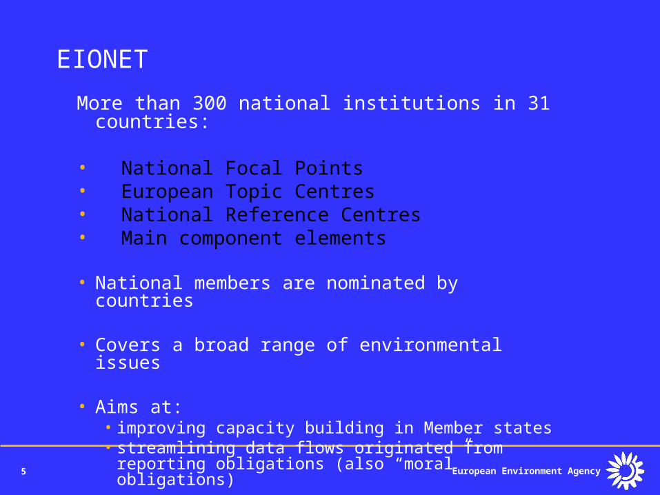
EIONET
More than 300 national institutions in 31 countries:
• National Focal Points• European Topic Centres• National Reference Centres• Main component elements
• National members are nominated by countries
• Covers a broad range of environmental issues
• Aims at: • improving capacity building in Member states• streamlining data flows originated from reporting
obligations (also “moral” obligations)
6 European Environment Agency
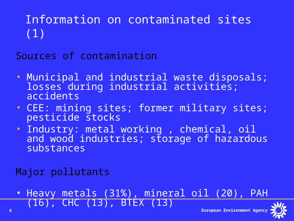
Information on contaminated sites (1)
Sources of contamination
• Municipal and industrial waste disposals; losses during industrial activities; accidents
• CEE: mining sites; former military sites; pesticide stocks
• Industry: metal working , chemical, oil and wood industries; storage of hazardous substances
Major pollutants
• Heavy metals (31%), mineral oil (20), PAH (16), CHC (13), BTEX (13)
7 European Environment Agency
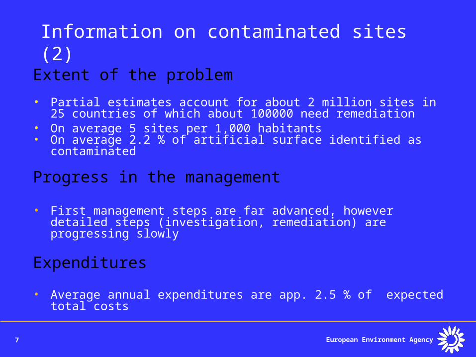
Information on contaminated sites (2)
Extent of the problem
• Partial estimates account for about 2 million sites in 25 countries of which about 100000 need remediation
• On average 5 sites per 1,000 habitants• On average 2.2 % of artificial surface identified as contaminated
Progress in the management
• First management steps are far advanced, however detailed steps (investigation, remediation) are progressing slowly
Expenditures
• Average annual expenditures are app. 2.5 % of expected total costs
8 European Environment Agency
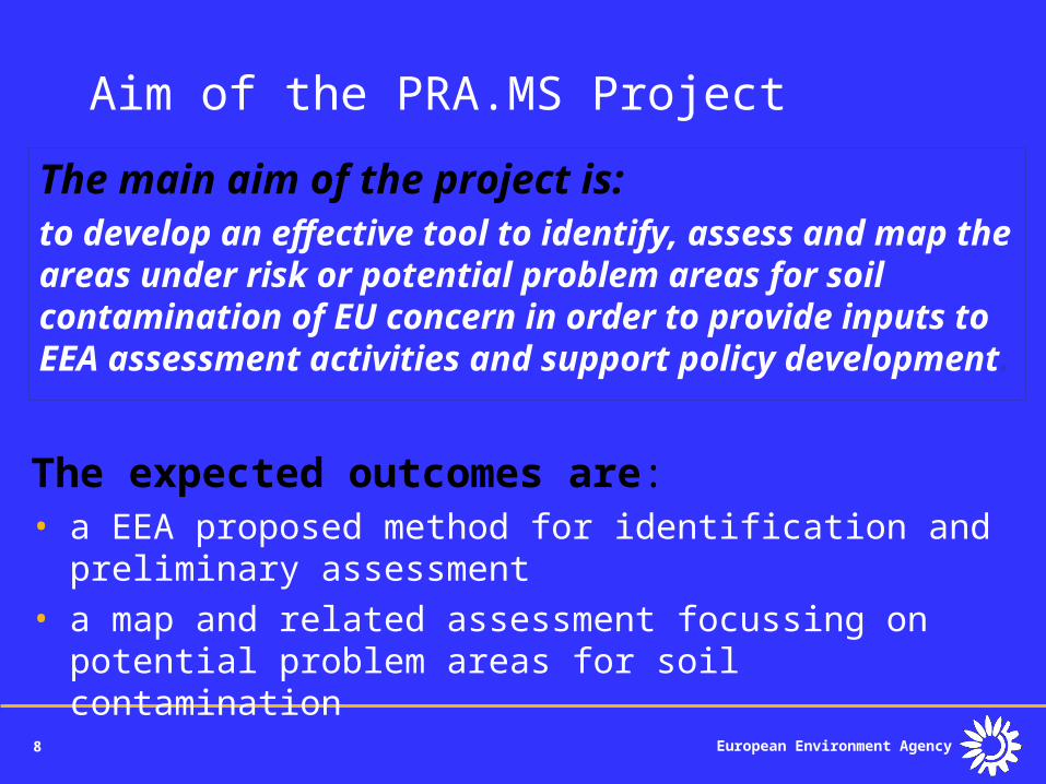
Aim of the PRA.MS Project
The expected outcomes are: • a EEA proposed method for identification and
preliminary assessment • a map and related assessment focussing on
potential problem areas for soil contamination
The main aim of the project is:to develop an effective tool to identify, assess and map the areas under risk or potential problem areas for soil contamination of EU concern in order to provide inputs to EEA assessment activities and support policy development.
9 European Environment Agency
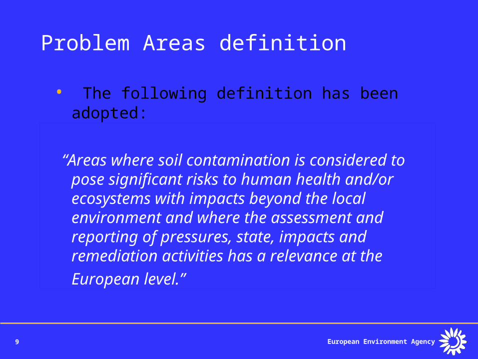
Problem Areas definition
• The following definition has been adopted:
“Areas where soil contamination is considered to pose significant risks to human health and/or ecosystems with impacts beyond the local environment and where the assessment and reporting of pressures, state, impacts and remediation activities has a relevance at the European level.”
10 European Environment Agency
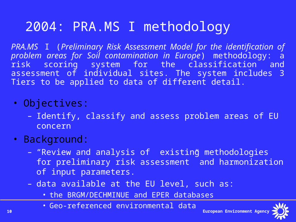
2004: PRA.MS I methodologyPRA.MS I (Preliminary Risk Assessment Model for the identification of problem areas for Soil contamination in Europe) methodology: a risk scoring system for the classification and assessment of individual sites. The system includes 3 Tiers to be applied to data of different detail.
• Objectives:– Identify, classify and assess problem areas of EU concern
• Background:– “Review and analysis of existing methodologies for preliminary risk
assessment” and harmonization of input parameters. – data available at the EU level, such as:
• the BRGM/DECHMINUE and EPER databases
• Geo-referenced environmental data
11 European Environment Agency
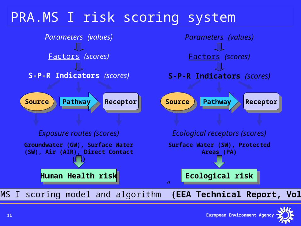
PRA.MS I risk scoring systemParameters (values)
Factors (scores)
S-P-R Indicators (scores)
SourceSource PathwayPathway ReceptorReceptor
Exposure routes (scores)
Groundwater (GW), Surface Water (SW), Air (AIR), Direct Contact (DC)
Human Health riskHuman Health risk
Parameters (values)
Factors (scores)
S-P-R Indicators (scores)
SourceSource PathwayPathway ReceptorReceptor
Ecological receptors (scores)
Surface Water (SW), Protected Areas (PA)
Ecological riskEcological risk
•“PRA.MS I scoring model and algorithm” (EEA Technical Report, Volume 3)
12 European Environment Agency
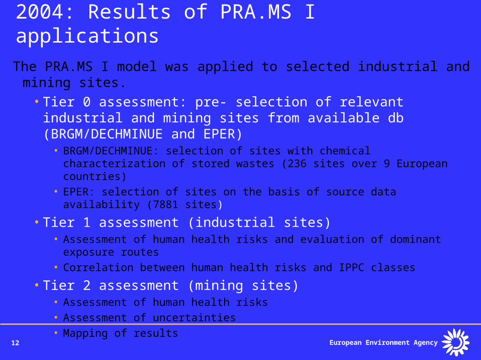
2004: Results of PRA.MS I applications
The PRA.MS I model was applied to selected industrial and mining sites.
•Tier 0 assessment: pre- selection of relevant industrial and mining sites from available db (BRGM/DECHMINUE and EPER)
• BRGM/DECHMINUE: selection of sites with chemical characterization of stored wastes (236 sites over 9 European countries)
• EPER: selection of sites on the basis of source data availability (7881 sites)
•Tier 1 assessment (industrial sites)• Assessment of human health risks and evaluation of dominant exposure
routes• Correlation between human health risks and IPPC classes
•Tier 2 assessment (mining sites)• Assessment of human health risks• Assessment of uncertainties• Mapping of results
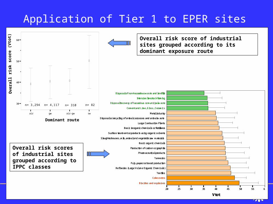
13 European Environment Agency
Application of Tier 1 to EPER sites
air gw air-gw sw
Dominant route
30
40
50
60
Ove
rall
risk
sco
re (
Vto
t)
n= 3,294
n= 310
n= 4,117
n= 82
Disposal or recycling of animal carcasses and animal w aste
Biocides and explosives
Coke ovens
Textiles
Refineries (Large Volume Organic Chemicals)
Pulp, paper or board production
Tanneries
Pharmaceutical products
Production of carbon or graphite
Basic organic chemicals
Slaughterhouses, milk, animal and vegetable raw materials
Surface treatment or products using organic solvents
Basic inorganic chemicals or fertilisers
Large Combustion Plants
Metal industry
Cement and Lime, Glass, Ceramics
Disposal/recovery of hazardous or municipal w aste
Intensive livestock farming
Disposal of non-hazardous waste and landfills
20 25 30 35 40 45 50 55 60
Vtot
Overall risk score of industrial sites grouped according to its dominant exposure route
Overall risk scores of industrial sites grouped according to IPPC classes
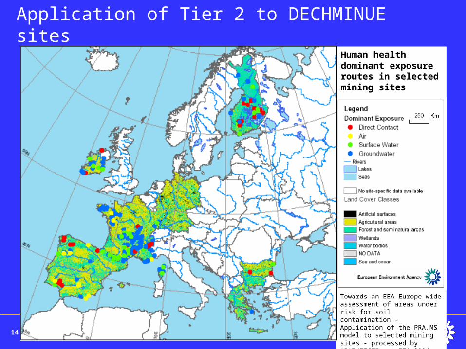
14 European Environment Agency
Application of Tier 2 to DECHMINUE sites
Towards an EEA Europe-wide assessment of areas under risk for soil contamination - Application of the PRA.MS model to selected mining sites - processed by APAT/ETCTE - © EEA 2004
Human health dominant exposure routes in selected mining sites
15 European Environment Agency
2004 Project outcomes
• ACCESS © database of existing methodologies for preliminary risk assessment
• ACCESS © based PRA.MS I model• Technical reports:
• Background and outcomes of the project
• Review and analysis of existing methodologies for preliminary risk assessment
• PRA.MS scoring model and algorithm
• Application of PRA.MS to selected industrial and mining sites
16 European Environment Agency
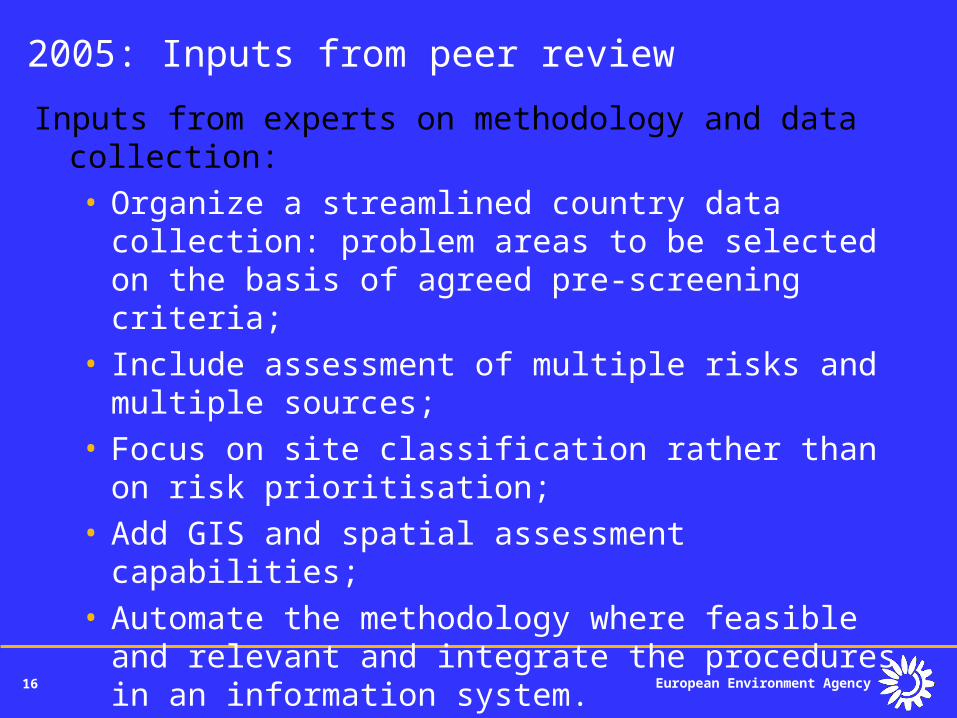
2005: Inputs from peer review
Inputs from experts on methodology and data collection:• Organize a streamlined country data collection:
problem areas to be selected on the basis of agreed pre-screening criteria;
• Include assessment of multiple risks and multiple sources;
• Focus on site classification rather than on risk prioritisation;
• Add GIS and spatial assessment capabilities;• Automate the methodology where feasible and
relevant and integrate the procedures in an information system.
17 European Environment Agency
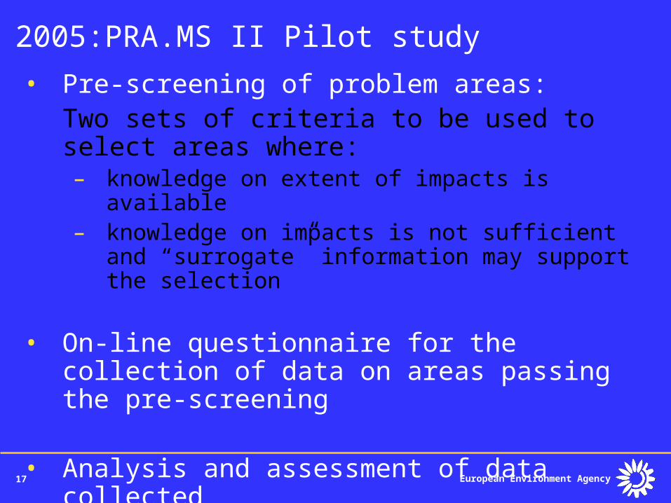
2005:PRA.MS II Pilot study
• Pre-screening of problem areas:Two sets of criteria to be used to select areas where:– knowledge on extent of impacts is available– knowledge on impacts is not sufficient and
“surrogate” information may support the selection
• On-line questionnaire for the collection of data on areas passing the pre-screening
• Analysis and assessment of data collected
18 European Environment Agency
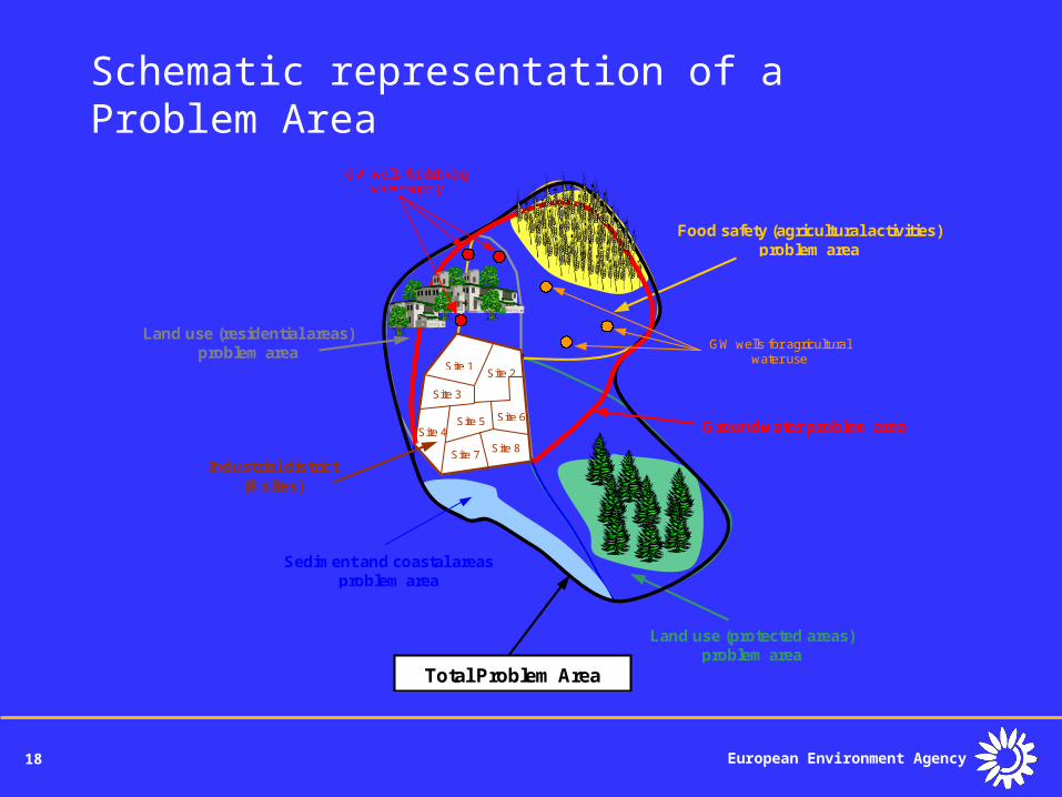
Schematic representation of a Problem Area
Food safety (agricultural activities) problem area
Land use (protected areas) problem area
Sediment and coastal areas problem area
Total Problem Area
Land use (residential areas) problem area
Industrial district (8 sites)
Site 1 Site 2
Site 3
Site 5 Site 4
Site 6
Site 7 Site 8
Groundwater problem area
GW wells for agricultural water use
GW wells for drinking water supply
19 European Environment Agency
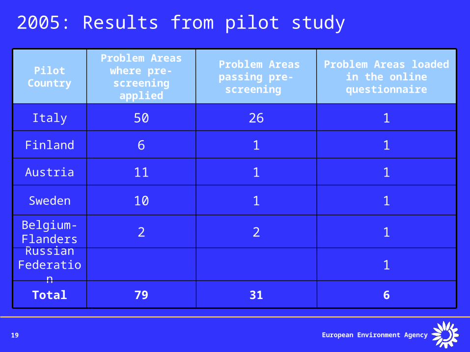
2005: Results from pilot study
1Russian Federation
122Belgium- Flanders
6
1
1
1
1
Problem Areas loaded in the online
questionnaire
3179Total
110Sweden
111Austria
16Finland
2650Italy
Problem Areas passing pre-screening
Problem Areas where pre-screening applied
Pilot Country
20 European Environment Agency
EIONET members were consulted on a number of questions:
• General data availability and accessibility (local vs. central inventories);
• Application of proposed pre-screening criteria;
• Relevance and availability of proposed parameters for the classification and characterisation of Problem Areas.
2005: EIONET consultation
European Environment Agency
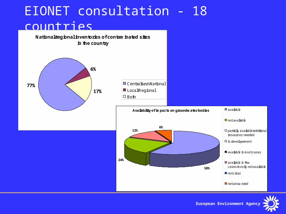
EIONET consultation - 18 countriesNational/regional inventories of contaminated sites
in the country
77%17%
6%
Centralised/National
Local/Regional
Both
Availability of impacts on groundwater bodies
24%
12%6%
58%
available
not avaliable
partially available/additionalresources needed
in developement
available in most cases
available in fewcases/mostly not available
not clear
not answ ered
22 European Environment Agency
2006: Conclusions and next steps 1• The EIONET consultation confirmed the
feasibility of continuing the project on an operational basis. However:• Some elements (i.e. pre-screening criteria)
need further clarification and simplification• Data collection and reporting is an effort
that requires dedicated resources at the national level
• Information on impacts on receptors is not always readily available
• The implementation of the forthcoming Soil Framework Directive would result in data more readily available and comparable
23 European Environment Agency
2006: Conclusions and next steps 2
1. Extend data collection to all Member countries
2. Data collected will be used to classify Problem Areas in relation to:• Source complexity (number of sites/ownerships,
categories of activities/contaminants);• Size (source size, Problem Area size);• Receptor complexity (number/types of receptors
impacted/threatened within the Problem Area);• Progress in management
• Case studies1. Results will be used in EEA reports
European Environment Agency
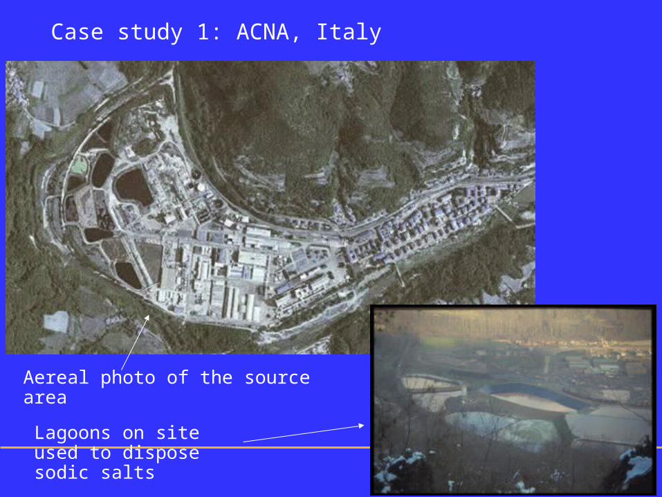
Case study 1: ACNA, Italy
Aereal photo of the source area
Lagoons on site used to dispose sodic salts
European Environment Agency
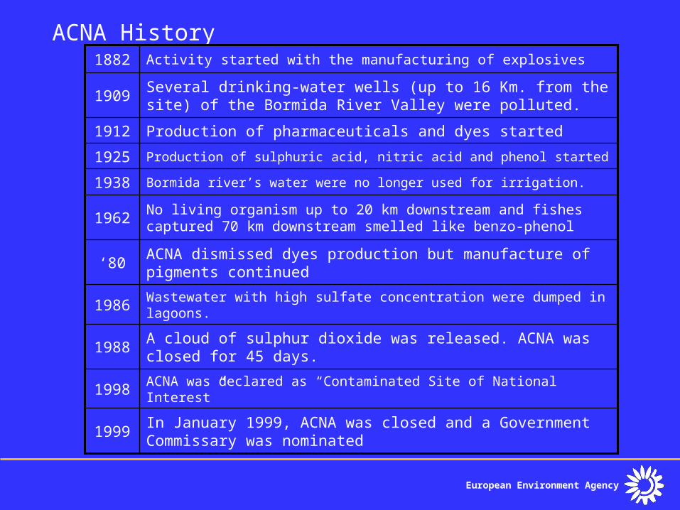
ACNA History
In January 1999, ACNA was closed and a Government Commissary was nominated
1999
ACNA was declared as “Contaminated Site of National Interest” 1998
A cloud of sulphur dioxide was released. ACNA was closed for 45 days.
1988
Wastewater with high sulfate concentration were dumped in lagoons.
1986
ACNA dismissed dyes production but manufacture of pigments continued
‘80
No living organism up to 20 km downstream and fishes captured 70 km downstream smelled like benzo-phenol
1962
Bormida river’s water were no longer used for irrigation.1938
Production of sulphuric acid, nitric acid and phenol started1925
Production of pharmaceuticals and dyes started1912
Several drinking-water wells (up to 16 Km. from the site) of the Bormida River Valley were polluted.
1909
Activity started with the manufacturing of explosives1882
European Environment Agency
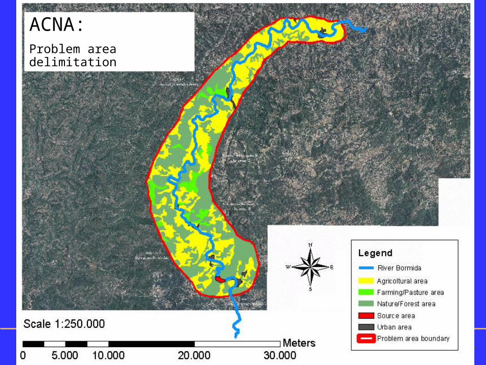
ACNA Impacted areaACNA:Problem area delimitation
European Environment Agency
ACNA ManagementDelimitation of the problem area (22,200 ha)• It was divided into 3 zones: zone A, high risk, including
the chemical plant, a landfill; zone B, medium risk, including the river and flooding areas; zone C, low risk.
Characterization• Soil and groundwater on site are polluted with 214
different compounds. Soil off site is contaminated to a depth of 2-3 meters.
Risk reduction measures• An area will be entombed because it is not possible to
remove the source (2 M m3 of waste and cont’d soil). • 140,000 tons of lagooned sodic salts are being
dewatered, packed and transported to Germany. • A leachate and drainage waters collection system has
been completed.• Estimated costs for remediation and safety measures
are 190 M euro which include government funds
European Environment Agency
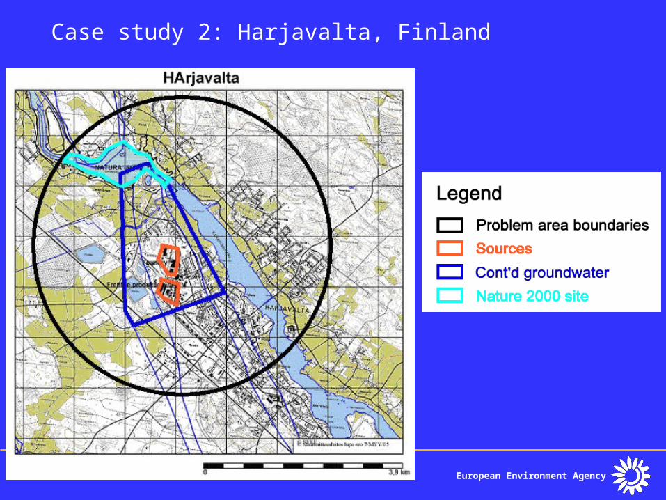
Case study 2: Harjavalta, Finland
European Environment Agency
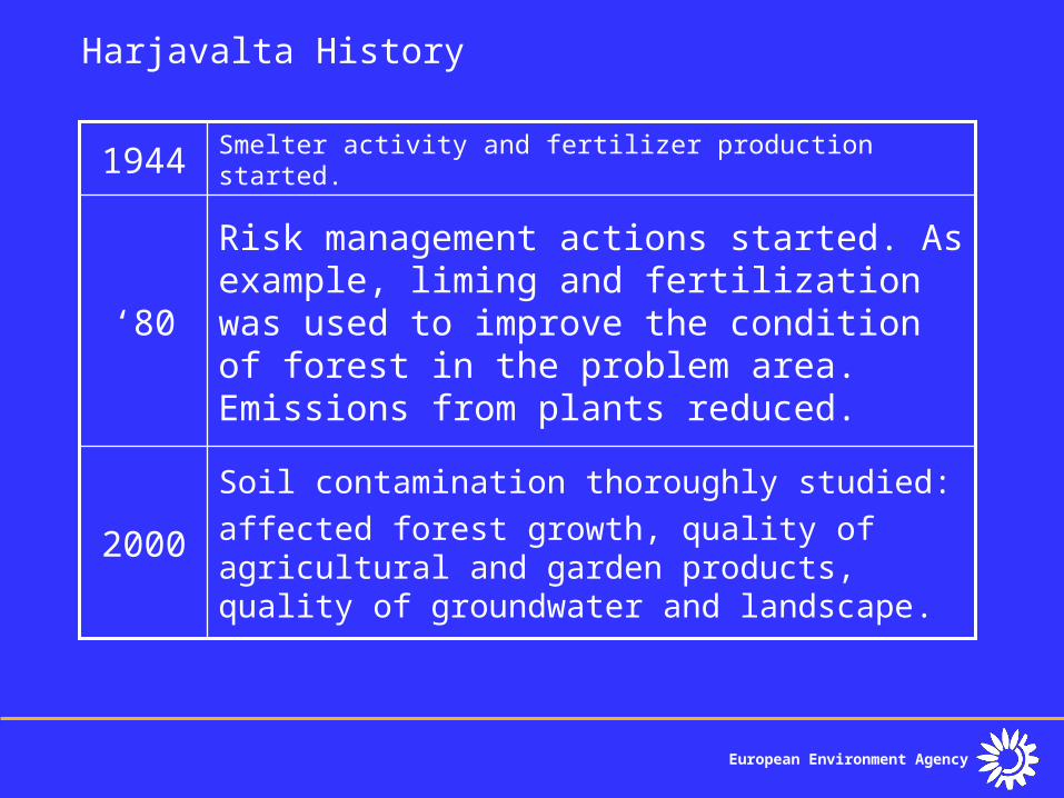
Harjavalta History
Soil contamination thoroughly studied:affected forest growth, quality of agricultural and garden products, quality of groundwater and landscape.
2000
Risk management actions started. As example, liming and fertilization was used to improve the condition of forest in the problem area. Emissions from plants reduced.
‘80
Smelter activity and fertilizer production started.1944
European Environment Agency
Harjavalta Management
Delimitation of the problem area• The location of Harjavalta town is by the river Kokemäenjoki.
Foundry (metals) and fertilizer production are located near the center of the town. Natura2000 site is located in the left upper corner, downstream from the Harjavalta site. The problem area includes an important groundwater reservoir called Järilänvuori groundwater area. The quality of the groundwater is good except in the area between the smelter and the river.
Characterization• Heavy metals (Cu, Ni, Zn, Pb, As, Cd)• Sulphur dioxide• NH4+
Risk reduction measures• Limitation on Groundwater use• Limitation on Agricoltural production• Liming and fertilization of forest
European Environment Agency
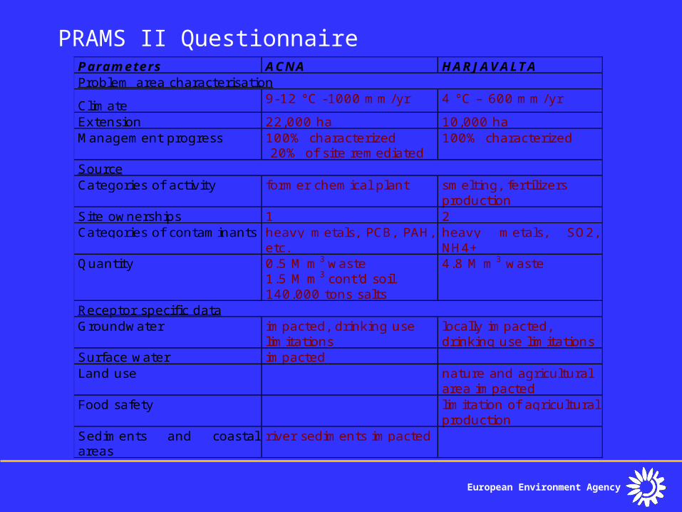
PRAMS II QuestionnaireParameters ACNA HARJAVALTAProblem area characterisation
Climate 9-12 °C -1000 mm/yr 4 °C – 600 mm/yr
Extension 22,000 ha 10,000 haManagement progress 100% characterized
20% of site remediated100% characterized
SourceCategories of activity former chemical plant smelting, fertilizers
productionSite ownerships 1 2Categories of contaminants heavy metals, PCB, PAH,
etc.heavy metals, SO2,NH4+
Quantity 0.5 M m3 waste1.5 M m3 cont’d soil140.000 tons salts
4.8 M m3 waste
Receptor specific dataGroundwater impacted, drinking use
limitationslocally impacted,drinking use limitations
Surface water impactedLand use nature and agricultural
area impactedFood safety limitation of agricultural
productionSediments and coastalareas
river sediments impacted
European Environment Agency
EEAEuropean Environment Agency
http://www.eea.eu.int
Thank you !