Embed Size (px)
Citation preview

Page 1 of 21
Esso Exploration & Production Chad Inc.
Village Impact Quarterly Report
Land Use Mitigation Action Plan
First Quarter 2013
Prepared by the EMP Department
June 2013

Page 2 of 21
Table of Contents
Page
Executive Summary 4
1.0. Village Classification 6
1.1. Land Use Criteria and Trends 7
1.2. Compensated and Returned Land by Land Use Type 9
1.3. Socio-Economic Criteria 10
2.0. Socio-Economic Monitoring
2.1. Surveys: Status Update 12
3.0. Milestones of Q1-2013
3.1. Basic Business school:
In class training program completed for 2013 14
3.2. An auditor invests in an adapted irrigation technology 15
3.3. From cloth dyeing to vegetable production 16
Conclusion 17
Annex 1: OFDA Village Map
Annex 2: Village Classification Criteria’s
Page 3 of 21
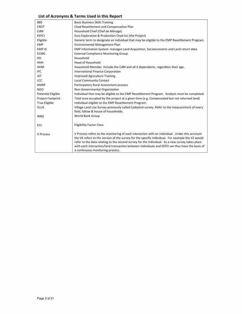
List of Acronyms & Terms Used in this Report
BBS
CRCP
CdM
EEPCI
Eligible
EMP
EMP-IS
ECMG
HH
HHH
HHM
IFC
IAT
LCC
MARP
NGO
Potential Eligible
Project Footprint
True Eligible
VLUS
WBG
EFC
V Process
Basic Business Skills Training
Chad Resettlement and Compensation Plan
Household Chief (Chef de Ménage)
Esso Exploration & Production Chad Inc (the Project)
Generic term to designate an individual that may be eligible to the EMP Resettlement Program.
Environmental Management Plan
EMP Information System: manages Land Acquisition, Socioeconomic and Land return data.
External Compliance Monitoring Group
Household
Head of Household
Household Member. Include the CdM and all it dependents, regardless their age.
International Finance Corporation
Improved Agriculture Training
Local Community Contact
Participatory Rural Assessment process
Non-Governmental Organization
Individual that may be eligible to the EMP Resettlement Program. Analysis must be completed.
Total area occupied by the project at a given time (e.g. Compensated but not returned land)
Individual eligible to the EMP Resettlement Program.
Village Land Use Survey previously called Cadastral survey. Refer to the measurement of every
field, fallow & house of households.
World Bank Group
Eligibility Factor Class
V Process refers to the monitoring of each interaction with an individual. Under this acronym
the VX refers to the version of the survey for the specific individual. For example the V2 would
refer to the data relating to the second survey for the individual. As a new survey takes place
with each interaction/land transaction between individuals and EEPCI we thus have the basis of
a continuous monitoring process.

Page 4 of 21
Executive Summary
The Quarterly Village Report provides information to Esso Exploration & Production Chad Inc (EEPCI)
management and the International Finance Corporation (IFC) on the progress made in calculating,
analyzing and reducing the Project’s land use impact on villages and households.
Tracking and analysis of land use impact is the purpose of Village Impact Classification and the
“Watch List”. The classification follows the movement of a village from one category to another in
order to judge the effectiveness of Environmental Management Plan (EMP) Chad Resettlement and
Compensation Plan’s (CRCP) implementing procedures (e.g. the Land Management Manual) and the
system improvements made through the Land Use Mitigation Action Plan (LUMAP) or to signal when
ongoing Project land take requires the Project to review the situation and adjust plans as per the
Environmental Management Plan (EMP) principles.
The village impact classification (high, approaching high, medium and low) is also used to:
• Improve the targeting of mitigation activities by more clearly defining an OFDA village’s
specific problems.
• Determine eligibility (actual versus estimated land acquisition) for Supplemental Community
Compensation.
The First Quarter 2013 (1Q13), Village Impact summary:
• 2 High impact villages (Missimadji & Poutouguem)
• 7 approaching high villages
• 5 moderate impact villages
• 12 low impact villages
One Village changed classification during this quarter. Ndoheuri moved up from a moderate to a
approaching high impact situation. Seven villages saw an increase in the Project’s footprint while 11
saw a reduction (table 2). The village which saw the biggest net increase was Ndoheuri with an
increase of 11.8 ha. During this period the village of Bero, the village with the higher increase in Q4-
2012, saw a reduction of the project’s footprint of more than 69 ha. It must be noted that the
Project’s overall footprint was reduced by slightly more than 119 ha during the 1Q13 (Table 3).
The primary accomplishments of 1Q13 are:
EMP and EMP-IS
• Continued implementation of a strategy to accelerate the return of flow-lines through a
bundling process. Over this quarter 159.5 ha of land associated with flow lines and other
underground facilities was returned to communities.
• Continue the follow up of households impacted by the project, using improved impact
survey process.
• Started preparation of Land Return Survey process for parcels returned in 2012 and early
2013. Process to be implemented between June and October 2013.
• Launched Village cadastral survey in three villages of the Nya Moundouli field.
• Contributed to preparation of Semi-Annual Project Update Report (second semester 2012)
Resettlement Program
• 29 eligibles (2012 promotion) completed the dry season portion (optional portion) of their
training program and received the grant equipment related to their training option.
• 21 eligibles of the 2013 promotion completed the literacy training program (BBS)

Page 5 of 21
• All 90 eligibles of the 2011 promotion completed the second year of the Improved
Agricultural Training Program.
• 2012 Reinforcement program completed for 18 eligibles. Final evaluation completed.
• 2013 Reinforcement program implemented for 29 individuals.
• Interview process completed for further 15 individuals who could potentially be reinforced
in 2013.
• Monitoring process launched with 46 previously trained eligibles.
• Organized and held workshop regarding lessons learned from the 2012 IAT training
initiatives, as part of continuous improvement process.
Community Compensation and Supplemental Community Compensation Program
• Drafted Site Specific Plan for Naikam
• Construction of Ndoheuri’s Supplemental Community Compensation, a one-room school,
ongoing.
• Bero III’s Supplemental Community Compensation Project, 15 ha rice field, completed and
turned over to community.
• Dokaidilti’s Supplemental Community Compensation Project, 15 ha rice field, completed and
turned over to community.
Interaction with World Bank
• Completed Q4-2012 Village Impact report and Posted onto ESSO-CHAD website..
• Completed 2012 – Annual Individual Livelihood Restoration Report and Posted onto ESSO-
CHAD website.
• Reviewed and commented on report from ECMG/IFC’s last site visit.
Work Plan for Second Quarter 2013(2Q13)
• Launch and complete post-literacy program with 21 eligibles of 2013 promotion.
• Launch IAT for 21 eligible of 2013 promotion
• Launch second year of IAT training for 29 eligibles of 2012 promotion.
• Continue implementation of reinforcement process with 29 identified eligibles.
• Launch implementation of reinforcement process with up to 15 other identified eligibles
• Complete Q1-2013 Village Impact report and Post onto ESSO-CHAD website.
• Launch technical support portion of Bero III’s Supplemental Community Compensation (Rice
field).
• Complete establishment of Ndoheuri’s Supplemental Community Compensation (School).
• Complete accelerated land return process (Flow Line Project).
• Continue cadastral surveys in three villages of the Nya Moundouli field.

Page 6 of 21
1.0 Village Classification
The village classification is calculated using land use (area of temporary and permanent take) and
two socioeconomic criteria (see annex 2 for details). Each criterion classifies a village into one of
four categories: High, Approaching High, Moderate and Low. It should be noted that the socio-
economic criterion made possible by investigation using the Village Land Use Survey (VLUS)
methodology provides a more direct measure of impact, and that this information is continuously
upgraded using the data collected through the Impact and Land return Surveys. This process
measures land holdings per capita and the number of currently non-viable individuals among the
total population of the village. For villages where the survey is not completed or is not being
implemented, we have had to rely on declarative data collected during land compensation in past
years; therefore the criterion becomes individuals made non-viable by Project compared to the
population of the village.
Table 1 : Village Classification Last Quarter
Categories Villages – 1Q13 Villages - 4Q12
High
• Poutouguem
• Missimadji
• Poutouguem
• Missimadji
Approaching High (Watch
List)
• Danmadja
• Bero
• Dokaïdilti
• Ngalaba
• Dildo-Bayande
• Ndoheuri
• Bela
• Danmadja
• Bero
• Dokaïdilti
• Ngalaba
• Dildo-Bayande
• Bela
Moderate
• Maïkéri
• Madjo
• Mbanga
• Maïnani
• Madana Nadpeur
• Begada
• Maïkéri
• Madjo
• Mbanga
• Maïnani
• Madana Nadpeur
• Begada
• Ndoheuri
Low
• Bendo
• Mouarom
• Meurmeouel
• Kome
• Ndolobe
• Miandoum
• Kaïrati
• Morkete
• Naïkam
• Maïmbaye
• Koutou Nya
• Bendo
• Mouarom
• Meurmeouel
• Kome
• Ndolobe
• Miandoum
• Kaïrati
• Morkete
• Naïkam
• Maïmbaye
• Koutou Nya
Low (Declared low through
other processes)*
• Bedara*
• Bekia 2
• Bekia 3
• Bedara*
• Bekia 2
• Bekia 3
Villages in bold have a Site Specific Plan (SSP).
* Villages added to the list may have received Community Compensation but may not have lost land to
the Project. When the resident of a village is impacted by the Project even if impacted field is located
in another village the village of residence is automatically classified as being in the low impact category
and receives the corresponding Community Compensation.
It should be noted that one Village changed classification during this quarter. Ndoheuri moved up
from a moderate to an approaching high impact situation. This is the consequence of some
additional land take which has resulted in a significant increase in the area of the village occupied by

Page 7 of 21
the project and in the proportion of the population which is made up of non-viable project affected
individuals. A Site Specific Plan (SSP) was completed in late 2012 and is presently being implemented
for the village of Ndoheuri which is, as we will see below, the village that saw the largest footprint
increase by the project over the last three quarters.
A Site Specific Plan (SSP) was drafted for the village of Naikam during the first quarter of 2013. It
concludes that while this community has been affected by repetitive small land takes it has not been
affected in a significant fashion and as such should not be targeted for Supplemental Community
Compensation. The factors that support this decision are that:
• Following subsequent land returns, the Project’s footprint has never exceeded the original
land take. It presently stands at about 12 ha.
• Villagers have access to a significant land base. On average this community has the highest
eligibility factor of all of the OFDA’s villages.
• No non-viable households are to be found in this community.
As per the LUMAP, the Site Specific Plan (SSP) was developed to monitor the state of the most
impacted villages (17 villages). Villages for which an SSP was prepared are presented in bold in Table
1 (page 6). In all villages where SSPs were completed and fully implemented (14/17 villages), only
low residual impacts remain.
Site specific plans (SSPs) have been fully implemented in all but three (3) communities. For two of
the villages concerned with this process (Dokaidilti and Bero 3) the construction of the selected
community compensation item (rice fields) has started in 2012 and was completed in the first
quarter of 2013. Some further activities associated with Improved Rice Production Training are
slated to take place during the latter part of 2013. The village of Ndoheuri selected a one-room
school which is presently being construction.
1.1 Land Use Criteria and Trends
From a land use perspective the criterion
is the area of the village affected by the
project, note that some villages can pass
from High to Moderate or Moderate to
Low as temporary land is returned, or
move up as land is acquired.
As shown in figure 1, the footprint of
permanently and still temporarily
occupied land (in the six fields of the
OFDA) was reduced by almost 120 ha, or 5 %, during the Q1-2013. The footprint as it stood on
March 31st
2013 was the lowest it has been in 8 years, (Q4-2004).
The land returned is not the only factor that counterbalances the new land take. The second factor is
due to the fact that many of the new facilities being established are in areas previously occupied by
the project. An area already compensated for an initial facility is simply reused for the new well, if it
has not yet been returned, without requiring much additional land acquisition. Using the fault block
approach in reclaiming land i.e. postponing reclamation until the work in the fault block has been
completed, reduces the risk of wasting top soil by re-acquiring newly reclaimed land. Top soil in
certain parts of the OFDA and elsewhere in southern Chad is a scarce resource.

Page 8 of 21
The calculation of additional land acquired is not straightforward as new facilities are now
overlapping old facilities. Simple addition or subtraction would compute the same area twice to
determine how much land has been acquired or returned (delta column) compared to the previous
quarter.
When we consider the information presented in Table 2 we can easily note that the actual reduction
in the area occupied by the Project is not only limited to the case of villages located in the three
original fields (Kome, Bolobo and Miandoum) but is also a reflection of the situation of villages
located in the newer development areas of the OFDA (Maikeri, Timbre and Nya oil fields).
During the first quarter of 2013, 11 villages saw an actual reduction in the Project’s footprint on their
territory, 7 saw no change and 7 villages were affected by an increase of the Project’s footprint.
The village which saw the biggest net increase was Ndoheuri with an increase of 11.8 ha while the
village of Béro saw a net reduction of almost 70 ha of the Project’s footprint.
Table 2: Land Use by Village in OFDA.
As the Impact and Land-Return Survey processes became fully operational, identification of the
impacted land users can be calculated when or shortly after the impact has taken place (real time).
Since January 2012, the Impact Survey (both land take and land return) data has been fully
integrated into the system, the Project is thus able to make full use of this information at present.

Page 9 of 21
If we consider the maximum land use of the Project for each village (see column 3 of table 2), 23 of
the 25 villages on which such data is presented above have known a reduction of their footprint in
relation to their land maximum use.
As the integration of impact survey data was completed, all impacted individuals who are deemed to
have been made non-viable by the Project or who were already non-viable before being impacted by
the Project, before November 1st
2012 (21 individuals in total), have been integrated into the roster
of the 2013 Resettlement Promotion, presently completing the literacy training program (BBS).
As we forged ahead to complete the integration of the tools and processes developed under the
LUMAP into the daily routine of the EMP’s Socioeconomics, we have also completed an exhaustive
review of the processes leading to and including the Five Steps of Reflection. This revised process
was used in the later portion of 2012. It has contributed to further integrate all of the EMP team
members involved in the process. In doing so our goal is and continues to be to further enhance the
interconnection between the various players and ultimately improve relations with the communities
and eligible individuals to seamlessly deliver the Five Steps of Reflection and the Resettlement
processes over time.
1.2 Compensated and Returned Land by Land Use Type
This section presents the compensated and returned areas. Table 3 shows the current portion of
each Land Use Type out of the total Compensated Land. The “Returned” column shows the number
of hectares returned (on the left) and the percentage of returned area out of the total compensated
area (on the right), for each land use type. It should be noted that this data covers all of the land
requirements in Kome, Bolobo, Miandoum, Maikeri, Nya and Timbre oil fields.
Table 3: Compensated and Returned Land by Land Use and Facility Type
• The column “total areas in hectares: compensated” shows the total area compensated since the project started up to the end of the quarter covered in this report.
• “Total areas in hectares: returned” shows the total area returned since the project started up to the end of the quarter covered in this report.
• “1Q2013: Compensated” shows the total hectares compensated during the quarter covered in this report.
• “1Q2013: Returned” shows the total hectares returned during the quarter covered in this report.
• 6 fields = Kome, Bolobo, Miandoum, Maïkeri, Nya and Timbre
Total area (hectares) 1Q13 (hectares)
Land use type Compensated Returned Compensated Returned
Sub-Total - Permanent with public access-
736.0 61.7 8 % 12.3 2.3
Sub-Total – Permanent with no Public access
1023.3 114.5 11 % 15.4 3.5
Sub-Total Permanent 1759.3 176.2 10 % 27.7 5.8
Borrow Pit 566.3 459.9 81% 8.3 11.4
Others 33.2 19.8 60% 4.1 -1.6
Sub-Total – Temporary returned without restriction
599.5 479.7 80% 12.4 9.8
Underground facility 1031.2 921.3 89% 9.4 159.5
OHL 325.8 76.8 24% -3.1 -3.5
Well Pad 569.2 511.8 90% 16.6 10.7
Sub-Total – Temporary returned with restriction
1926.2 1509.9 78% 22.9 166.7
Sub-Total Temporary 2525.7 1989.6 79% 35.3 176.5
Grand Total 4285.0 2165.8 51% 63.0 182.3

Page 10 of 21
• Negative numbers indicate corrections to the data.
As was presented in Table 2 (page 8) the data presented above (Table 3 on page 9) confirms that
land returned more than compensated for new land take with a net footprint decrease over the
quarter. During the last quarter 63 ha of land was compensated for, by the Project, while 182.3 ha
were returned to the communities. Overall, this resulted in 119.3 ha of net land return during this
period.
Although 11 villages were affected by new land take during the first quarter of 2013 the emphasis on
land return resulted in only 7 villages seeing an increase in the project’s footprint.
This new process (flow line return) resulted in the return of 159.5 ha in addition to the return of 22.8
ha through normal processes or a grand total of 182.3 ha of land being returned during the quarter.
Most (56%) of the land compensated during the first quarter was for temporary use and has already
started to be returned. It must be noted that land returned in the temporary category (176.5 ha)
exceeded new temporary land take (35.3), by five folds. The Project actually had a net reduction in
its temporary land use of 141.2 ha during the quarter. An initiative started during the third quarter
of 2012 in order to accelerate the return of land associated with underground facilities (mainly flow
lines) was maintained and resulted in most of the net gain made. As almost 90% of the areas
associated with flow lines and other underground facilities have now been returned it is to be
expected that this initiative in its present form should conclude during the second quarter of 2013.
The return of such facilities would then be dealt with on an ongoing basis.
As 416.3 ha are still to be returned in the temporary category, returning but a portion of this area
would have a significant impact on the project’s net footprint.
1.3 Socio-economic Criteria
Village level impact depends both on absolute amounts of land taken or returned and the way in
which land resources are allocated within the village. In some villages, people depend mainly on
farming for their livelihood. In others, a portion of the inhabitants depend on fishing as well as
farming; fishing families in these villages often have (and need) less farmland than in inland villages
and may already be below the general threshold of agricultural viability (2/3 cordes per HHM).
Others are recently established households who will progressively gain access to land from their
family land trust. These households may appear to be non-viable or marginal while in reality they
are simply in a transitional phase.
Attributing all non-viable household to Project land acquisition in these villages would overstate the
Project’s impact.
To distinguish between these two types of situations, the social criteria using compensation
database information were initially set according to:
1. The number of people already non-viable before they were impacted by the project and
2. Those that were made non-viable when they lost land to the project.
Completed village land surveys have demonstrated that the declarative data used to calculate non-
viability often overstated the number of people dependent on the household’s land and understated
the amount of land available. Therefore the number of non-viable households found through a
village survey presents a more accurate picture of Project impact.

Page 11 of 21
Such data was not available
when the Land Use Impact list
was first calculated but now,
as measured data has become
available for most villages, the
pre-Project non-viability
criterion has been dropped.
When the survey is complete
and the village is open to
reclassification only the
current but accurate criterion
of currently non-viable HH
(compensated and not
compensated) has been used.
While no better tool, than the
declarative surveys, is available for the villages
presented in Table 4, it must be noted that
excessive reliance on this data could lead the
reader to some interpretation errors. Please note
that the villages in this table are those where no
Village Land Use Survey (VLUS) has been
performed.
The number of non-viable households below 2/3
cordes of land per HHM is much more reliable in
villages with complete VLUS data given the higher
level of accuracy and the fact that the whole village
is surveyed versus only Project affected
households.
Table 5, presents the data originating from the
VLUS and now incorporates the information from
the impact and land return surveys. One major
change has occurred over the last quarterly report.
First we must note that incorporation of the impact
studies performed in Ndoheuri over Q1-2013
confirms that this village now falls in the
approaching high risk level category. Similarly the
proportion of Madjo’s, Bero’s and Ngalaba’s
populations made up of non-viable project affected
individuals went up during the fourth quarter. This
change was not sufficient to justify a downgrade of
the risk level category.
While changes that occur may sometimes appear to be fairly significant they often result from an
interaction between the Project and one or a limited number household made non-viable through
land take or made viable through the return of some land. This reflects the ability to monitor the
status of project affected household in the OFDA in real time. It must be noted that while returned
land is removed from the Project’s footprint immediately upon signing of the Quitus, it is only added
Total non-viable
individuals today Value Now
Made non-viable by
project Value Now
Kaïrati 17.2 Maïmbaye 2.1
Madana Nadpeur 16.3 Madana Nadpeur 1.4
Koutou Nya 13.9 Merméouel 1.0
Miandoum 7.3 Miandoum 0.6
Bendo 4.1 Kaïrati 0.0
Merméouel 2.7 Koutou Nya 0.0
Benguirakol 2.6 Bendo 0.0
Maïmbaye 2.1 Benguirakol 0.0
Morkété N/A Morkété N/A
Table 5: Percentage of Individuals Made Non-
viable by Project Land Take
According to the VLUS and Impact Databases
Village Non-Viable project
affected individuals
Poutouguem 17.0 %
Madjo 13.6 %
Dokaïdilti 13.5 %
Danmadja 11.9 %
Ndoheuri 11.3 %
Béro 10.8 %
Missimadji 10.3 %
Ngalaba 8.5 %
Dildo-Bayande 5.0 %
Mouarom 4.1 %
Béla 3.9 %
Bégada 2.8 %
Mbanga 2.7 %
Maïkéri 2.6 %
Komé Ndolobe 2.2 %
Maïnani 0.9 %
Naïkam 0.0 %
Table 4: Percentage of Individuals Made Non-viable by Project Land Take
According to the Declarative Database

Page 12 of 21
to a household’s land basket during the following production season. This ensures that the land has
effectively been put back into production and who has profited from the land return. As Land Return
Surveys can only be performed during the ensuing cropping season, a village may remain in a higher
risk category for 1, 2 or even 3 quarters after land has been returned to its population. It is only
after the completion and integration of the Land Return surveys that the full impact of the returned
land on the community will be reflected on its classification.
2. Socioeconomic monitoring
2.1. Village Surveys
Table 6: Total Number of HH Survey by Village
The objective is to use the data generated by these various surveys and investigations to track each
community and household over time. Ensuring that the specific impact, whether they be a land take
or a land return, are accounted for and that the Resettlement option selected achieved its livelihood
restoration goal. Integrating all of this information will allow tracking the communities over time
ensuring that each community and individual HHH receives the kind of support which is best suited
to his/her situation as well as process and performance indicators regarding the effectiveness of the
Chad Resettlement and Compensation Plan (CRCP) implementing procedures.
Impact surveys: The Project is now surveying impacted HHs and integrating this information into the
EMP IS on a real time basis. 76 new impact surveys were completed and integrated during this
quarter. Most of these surveys were related to the villages of Bero, Madjo and Ndoheuri. In the case
of Mouarom and Poutouguem there appears to be a discrepancy between the fact that new land
Page 13 of 21
was taken (net land take of 8.7 ha for each village) while only few surveys were completed. Such
discrepancies, which are not uncommon, arise because of the following phenomenon:
• Although the project is now operating in real time, surveying impacted individuals shortly
after the land take, there may still be situations were up to three weeks may elapse between
the land take and the survey. In the case of these two communities most of the land take
took place in late March, too late for surveys to be completed within the first quarter.
• Furthermore the land return process presently being implemented results in the quantities
of land being returned simply exceeding the amount of land taken. As explained earlier out
of 11 villages where land was taken only 7 actually saw an increase in the project’s footprint.
In this way a village facing a significant reduction of the Project’s footprint may still have a
significant number of new Impact (land take) surveys. For example, during the first quarter
Bero was targeted for the completion of 14 Impact survey while the Project’s footprint was
reduced by 69.8 ha.
Monitoring: During the 1st
quarter of 2013, 21 new monitoring surveys were completed. These
surveys were targeting the 21 eligibles of the 2013 promotion that will start the IAT program in May
2013. The objective of this initiative was to establish a base line or reference point to which we will
compare the results of surveys to be completed once they complete their IAT training program, in
this way being able to have a clear evaluation of their progression.
.

Page 14 of 21
3.0 Milestones of Q1-2013
3.1. Basic Business school: In class training program completed for 2013
The construction of a number of new facilities in this
community over the last two years has led to the
identification of a number of eligibles. This resulted
in the establishment of a training literacy training
center in this community. It must be noted that
although the Basic Business School or the functional
literacy program has been available in much of the
OFDA for the last five years, 2013 was the first time
that it was offered in Ndoheuri, a fairly new
production area.
With only four eligibles who were entitled to take
part as per their resettlement package, the Project
was initially anticipating a relatively small number of
participants. This was not to be the case, in fact 39
people registered for this program among which the
four eligibles but also 5 spouses and 30 auditors.
Among these auditors were present the village chief
(Daniel Ndouba) and the local clergymen who was
more than happy to offer his church to hold these
sessions.
When asked why he participated the chief explained
that he did not have the opportunity of a formal
education. When this opportunity presented itself, he grabbed it as he saw the possibility of
growing as a person and of improving his life, that of his family and of his constituents. By learning
to read and write Ngambay, and some basic management skills he will be able to better serve, guide
and represent his fellow villagers. It must be noted that he encouraged his wife to also participate in
order to ensure that his family would fully benefit from this experience.
As a chief and a leader he was happy to note such a large participation for his village. For him, skills
learnt during this program go beyond reading and writing, it can and probably has already had some
significant impacts in terms of public health. As many families have learnt the importance of
personal hygiene, the risk of
outbreaks and propagation of certain
diseases will be reduced, with both
the financial and emotional hardship
that accompany such outbreaks.
But most of all, he feels that the
management skills shared with his
community will help bolster the
wealth of villagers who will utilize
these skills in practice. If many
people do so it is the village as a
whole that will become wealthier
with all the benefits that this entails.
Daniel Nouba, village chief Ndoheuri
BBS training session in the village off Ndoheuri

Page 15 of 21
3.2 An auditor invests in an adapted irrigation technology
Jasson Mbairamadji audited the Improved
Agriculture Training program a number of years ago,
his wife was actually the eligible. Over the years they
have grown and diversified their enterprise in many
areas of agricultural production such as cereals,
cattle, goats, sheep, a flock of fowls and honey.
Last fall he was present during a training session
organized by AfriCare, with the financial support of
the Exxon Mobil foundation. One of the objectives of
this session was to promote the establishment of
market garden plots by women’s groups.
During this session he was particularly interested by
the demonstration of a foot powered irrigation
pump, being produced in Kenya. Jasson feels that
this technology is well adapted to the reality of small
scale vegetable producers in Chad as it is a low input
and mainly low maintenance technology.
This session was the incentive he needed to decide to
start a vegetable operation of his own. After having
gained access to ½ an hectare of low lying land from
his brother he started to fence in and prepare the soil
to plant corn, watermelons, lettuce and a number of
other vegetable crops. He also contacted AfriCare in
order to purchase two pumps to irrigate is new vegetable operation. As he was not eligible for a
donation, he was nonetheless able to buy two of the pumps at a price of 90 000 XFA each.
As we can see from the picture presented above, with Jasson standing in the middle of his corn crop,
this new initiative was a success. But a question remained, why venture in vegetable production
normally relegated to women and which requires different skills from his other activities. To this
question he had the following answers:
*As the composted dung produced by is now extensive livestock operation makes an ideal fertilizer
for such demanding crops, this was a natural step of diversification.
* As a farmer his assets must be used 12 months out of 12.
* As his family has needs all year round, he must strive to produce income and food every month in
order to meet them.
* It is only by ignorance that some
men may choose to relegate
vegetable production to women, as
it is an interesting and profitable
activity.
* Once he completes his harvest he
will bring additional value to this
piece of low lying land by growing a
rice crop.
* His own analysis leads him to
believe that the profit generated by
this activity will be sufficient to pay
for his pumps in two cropping
Jasson Mbairamadji
Foot pump for crop irrigation

Page 16 of 21
seasons.
3.3 From cloth dyeing to vegetable production
In 2006 Denise Tarassoum became eligible for the
resettlement program following a land take in the
community of Bero. After completing the five steps of
reflection process, she chose one of the off-farm
training options available to her at that time: knitting.
She is one of the eligibles who have persevered in her
learnt trade from which she generates a
complementary income to help feed, educate and care
for her 4 children. She produces a number of small
items such as children’s clothes and bonnets that she
sale to merchants who retail them to a regional client
base. The advantage of working with such
intermediaries is that she works from set orders with
limited customization. She is paid cash on delivery
limiting her business risk.
As this business is only reliable during the colder
months (October to January) she found that she had to
develop additional sources of income. After much
reflection she chose to start a vegetable market garden
along the Nya River. Two years ago, her maternal uncles lent her a patch of land that she
proceeded to fence in order to avoid predation by meandering livestock. Goats and cattle can cause
significant damages to an unprotected vegetable plot mainly during the dry season when they are
more than happy to consume a fresh head of lettuce or cabbage.
While she had little knowledge regarding gardening and vegetable production, she picked up what
skills she needed by observing her neighbors and auditing some Improved Agriculture classes offered
by the Project. Project staff who drop in once in a while have also been a good source of
information regarding crop rotation practices and seed production.
Using part of her income, she hired one of her neighbors to dig a well where she draws the water
necessary for irrigation. While she is only 20 meters from the river she finds that this investment
was more that warranted if she considers the thousands of steps she would have had to make if she
was drawing her water from the river.
Already this year she has generate over 60 000 XFA from her market garden, in addition to the direct
contribution it has made to the dietary needs of her family.
Part of her income was used to pay
the tuitions of her two eldest children
who are in high school. For her and
her husband this is a priority to which
they both contribute. The rest of the
income she generates helps to meet
the basic needs of her family and buy
some additional grain to compensate
for the poor yield they had during the
last grain harvest, producing only
three bags of grain from 1 ½ ha of
land. Her perseverance has paid off
Denise Tarassoum
Denise’s vegetable patch

Page 17 of 21
and will continue to, if she keeps on the present path.
Conclusion
A number of activities were ongoing during the first quarter of 2013 such as the 2013 literacy
training program, the underground facilities (flow line, underground cable etc.) return strategy and
regular monitoring activities. While these activities have started to have significant positive impacts,
on villagers and their communities, only time will allow us to measure their level of performance.
From this report we can make the following conclusions:
1. Project’s footprint reduced by 119.3 ha following the return of 159.5 ha of flow lines and
underground facilities. While not changing category many villages saw a reduction in
Project’s footprint as a result of the emphasis put on land return, by the Project during the
last three quarters.
2. One Village changed classification during this quarter. Ndoheuri moved from a moderate to
an approaching high impact situation. While some land return took place in Ndoheuri, the
change in classification is the result of the establishment of a number of new facilities over
the last three months.
3. Site Specific Plan prepared for Naikam
4. Construction of Supplemental compensation Projects completed and transferred to
communities in Bero III and Ndoheuri.
5. Construction of Supplemental compensation Projects launched in Ndoheuri and should be
completed by second quarter.
6. 21 eligibles (2013 promotion) completed the formal training portion of the BBS.
7. 90 eligibles (2011 promotion) completed the post training portion of the IAT.
8. 29 eligibles (2012 promotion) completed the dry season (optional program) portion of the
IAT and received the associated grant equipment.
9. 29 eligibles started the reinforcement process.
10. Cadastral surveys were conducted in three villages of the Nya Moundouli oil field area and
should be completed in the third quarter.
11. Implement Land Return Survey, with the advent of the rainy season and the new cropping
season.
The project continues to have important positive effects on communities and many individuals
whether they are Project affected and eligible for resettlement or not.

Annex 1
OFDA Village Impact Map

Annex 2: Village Classification Criteria’s
Land Use Criteria
The criteria concerning Land Use impact represents the percentage of village area used by the project within each village. The boundaries of the village used to set the village area are not official and are computed based on a global survey of the village limits. The thresholds between levels of impact represent “natural breaks” or large numerical gaps in between villages.
Calculation of Land Use Impact
The final percentage used to classify the village’s level of impact is computed by adding the “temporary” land not yet returned to the land permanently used by the project:
Thresholds
High ≥11%
Approaching High 7% - 10.9%
Moderate 3% - 6.9%
Low 0% - 2.9%
Initial Classification with Compensation Data
Criterion 1: % all non-viable individuals/all individuals in the village
Description: Percentage of all project-affected individuals in the village currently below the resettlement factor of 2/3.
Rule:
Σ (All individuals below 2/3 cordes after land take)
Village Population
Σ Permanent Not Returned + Temporary Not Returned
Σ Village Area

Threshold:
Threshold Criteria 1
Min Max
High 50.1% 100%
Approaching High 30.1% 50%
Moderate 20.1% 30%
Low 0% 20%
This criterion includes people who were already non-viable before the Project.
Criterion 2: % individuals in the village made non-viable by project land take/all individuals in village
Description: Percentage of the number of individuals that were economically viable before surrendering land/feeling any project impact (the resettlement factor > 2/3) but who became agriculturally non-viable upon surrendering land/ after project impact (the resettlement factor < 2/3 cordes).
Rule:
Σ (All individuals that were not eligible before land take & are eligible after Land take)
Village Population
Threshold:
Threshold Criteria 2
High 20.1% 100.00%
Approaching High 15.1% 20.00%
Moderate 9.1% 15.00%
Low 0% 9%
This criterion cannot be calculated with village land survey results and is no longer applied when a change in village impact classification is calculated.

Criterion 3: Reclassification with Village Survey data
Description: When a village reclassification is calculated and village survey data is available, a single criterion is used. This criterion represents all the members of the non-viable compensated households compared to the population of the village:
Rule:
Σ All members of non-viable compensated Households
Village Population
*This statistic excludes non-viable households with resettlement options
Threshold:
Threshold Criteria 3
High 15.1% 100.00%
Approaching High 10.1% 15.0%
Moderate 5.1% 10.0%
Low 0% 5.0%