Embed Size (px)
Citation preview

1
ESRI UC 2015Making Tomorrow Possible Today
2
ESRI UC 2015Mel ChristopherSenior DirectorGas System Operations
Mehmet “DJ” KutsalSenior Project ManagerIT Gas Business Technology
Making Tomorrow Possible Today

3
GIS Technology at PG&E
§ About PG&E
§ Our Customer Number is 3 digits J
§ We have several major GIS initiatives overall.
§ About Gas System Operations
§ TAMI project kicked off May 2013.
§ Operational August 2013.
§ Continuous improvements since then with monthly releases.
§ Supported by 4 environments (Development/Test/QA/Production).
§ 28 servers in total, 99.999% availability, runs simultaneously at 2 data centers.
§ ArcGIS Server, SDE, and Geoevent server extension based.
§ Scripts and SDKs
§ HTML5 User Interface
§ ORACLE and MS SQL Server databases

4
PG&E Background§ Serves approximately 15 million
people throughout a 70,000-square-mile service area
§ Operates approximately 6,750 miles of gas transmission pipeline~ 42,000 miles of gas distribution pipeline
§ 4.3 million natural gas customer accounts.
§ Deliver 970 BCF/year
§ Approximately 105 BCF of gas storage
§ Approximately 203,000 HP of compression
§ Gas System Operations – Safe and Reliable Operations of Transmission and Distribution 24X7

5
Vision: The Leading Utility in the United StatesStrategy:
Deliver safe, reliable, and affordable electricity and natural gas• Customer Focus• Operational Excellence
Our Vision
PG&E Enterprise
Vision: The Safest, Most Reliable Gas Company in the United StatesStrategy:
We will deliver gas safety excellence by:• Putting safety and people at the heart of everything• Investing in the reliability and integrity of our gas system• Continuously improving the effectiveness and affordability of
our processes
Vision: The Front Line for Public and Employee Safety and System Reliability
Strategy:Transform data into intelligence to operate predictively and proactively in order to identify and mitigate risks in real time.
Gas Operations
Gas Control

6
Leveraging Technology to Reduce and Mitigate Operational Risk

7
Transmission, Distribution, and Dispatch are colocated

8
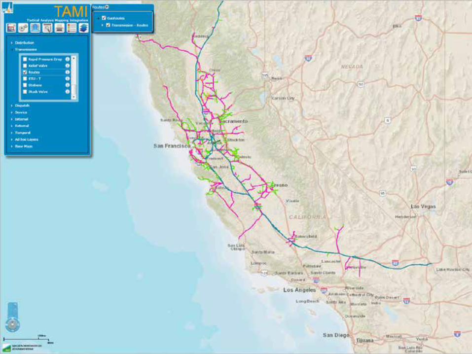
TAMI - Tactical Analysis Mapping Integration
TAMI is a system that provides intelligent use of geospatial and temporal data for managing operational risk.

9
Napa Earthquake 2014
• 6.0 Magnitude earthquake• 6km NW of American Canyon• 0320 on August 24, 2014

10
Napa Earthquake 2014

11
Napa Earthquake 2014

12
Napa Earthquake 2014

13
Napa Earthquake 2014

14
Napa Earthquake 2014

15
Napa Earthquake 2014

16
Napa Earthquake 2014

17
Napa Earthquake 2014
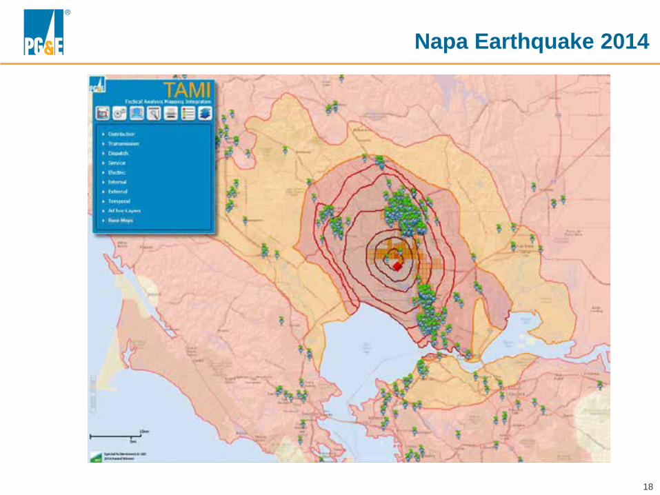
18
Napa Earthquake 2014
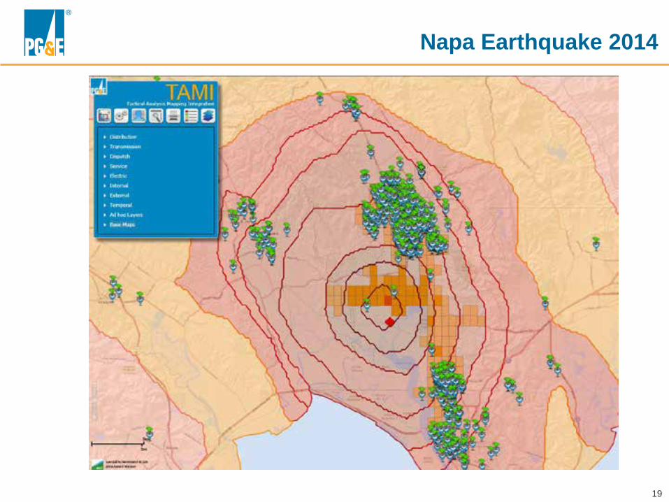
19
Napa Earthquake 2014

20
Other Ways We Use TAMI

21
Damage Prevention
22

23

24

25
Risk: Weather & Outside Forces, Land Movement
Automatically correlate seismic activity, weather events
(rain/flood), and areas of landslide potential with pipeline location
and notify GOC of increased risk.

26
Risk: Incorrect Operations
Automatically correlate pressure alarms with work clearances and
valve operations within a geographic area and
notify GOC of increasing risk

27
Risk: Equipment Related
Real time correlation of alarms with
integrated system operations.

28
Intelligent Operations

29
Questions?