Embed Size (px)
Citation preview
Erwin Raisz‘ Atlases – an early multi-method approach to cartographic communication
(Eric Losang)
ICC-Preconference-Workshop:AtlasesandInfographicsTokyo,2019/07/13
Outline
• ErwinRaisz–biographyandopus• TheconceptbehindRaisz‘work• ThreeAtlases
• AtlasofGlobalGeography• AtlasofCuba• AtlasofFlorida
• PossibleImportanceofthethreeAtlases• Communication• Storytelling
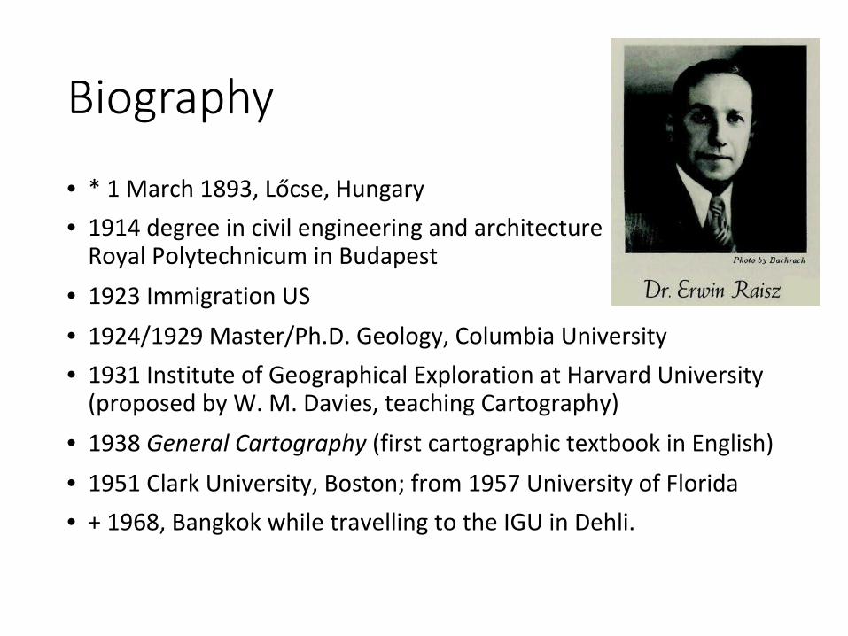
Biography
• *1March1893,Lőcse,Hungary• 1914degreeincivilengineeringandarchitectureRoyalPolytechnicuminBudapest
• 1923ImmigrationUS• 1924/1929Master/Ph.D.Geology,ColumbiaUniversity• 1931InstituteofGeographicalExplorationatHarvardUniversity(proposedbyW.M.Davies,teachingCartography)
• 1938GeneralCartography(firstcartographictextbookinEnglish)• 1951ClarkUniversity,Boston;from1957UniversityofFlorida• +1968,BangkokwhiletravellingtotheIGUinDehli.
Landform (physiographic) Maps
• InfluencedbyW.M.Davies,I.BowmanandN.Fenneman(physiographicprovinces)
• Goal:explainingterritorywithinitsphysiographicinsteadof(manmade)countyborders
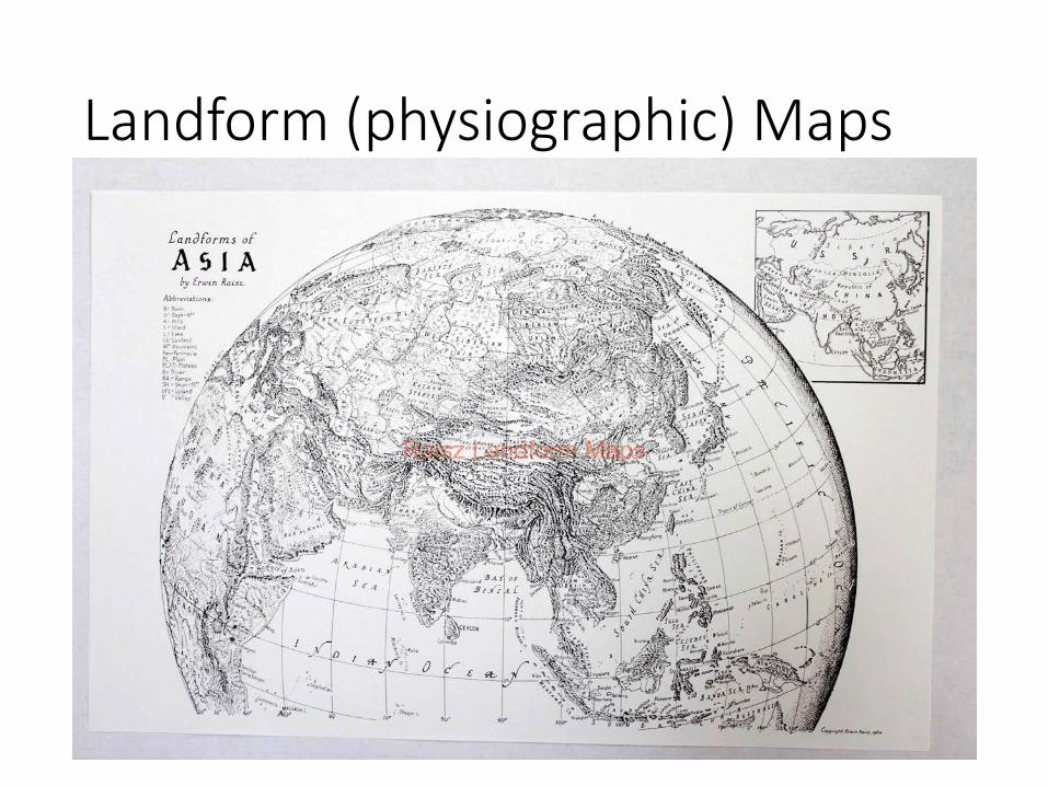
Landform (physiographic) Maps
Landform (physiographic) Maps
• InfluencedbyW.M.Davies,I.BowmanandN.Fenneman(physiographicprovinces)
• Goal:explainingterritorywithinitsphysiographicinsteadof(manmade)countyborders
• Geodeterministicanswertoaprevaillingstatisticalapproachtogeography(H.Gannett)
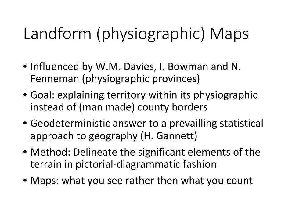
Landform (physiographic) Maps
• InfluencedbyW.M.Davies,I.BowmanandN.Fenneman(physiographicprovinces)
• Goal:explainingterritorywithinitsphysiographicinsteadof(manmade)countyborders
• Geodeterministicanswertoaprevaillingstatisticalapproachtogeography(H.Gannett)
• Method:Delineatethesignificantelementsoftheterraininpictorial-diagrammaticfashion
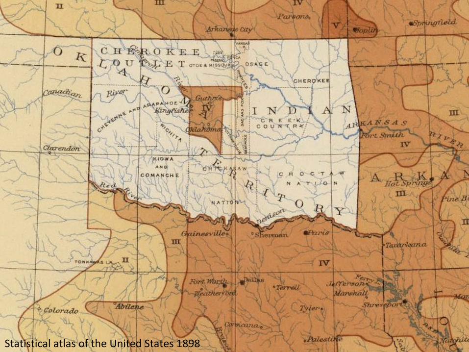
StatisticalatlasoftheUnitedStates1898
Landform (physiographic) Maps
• InfluencedbyW.M.Davies,I.BowmanandN.Fenneman(physiographicprovinces)
• Goal:explainingterritorywithinitsphysiographicinsteadof(manmade)countyborders
• Geodeterministicanswertoaprevaillingstatisticalapproachtogeography(H.Gannett)
• Method:Delineatethesignificantelementsoftheterraininpictorial-diagrammaticfashion
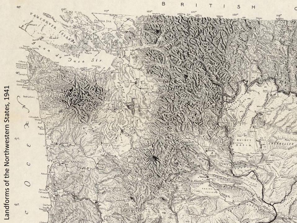
Land
form
softhe
NorthwesternStates,194
1
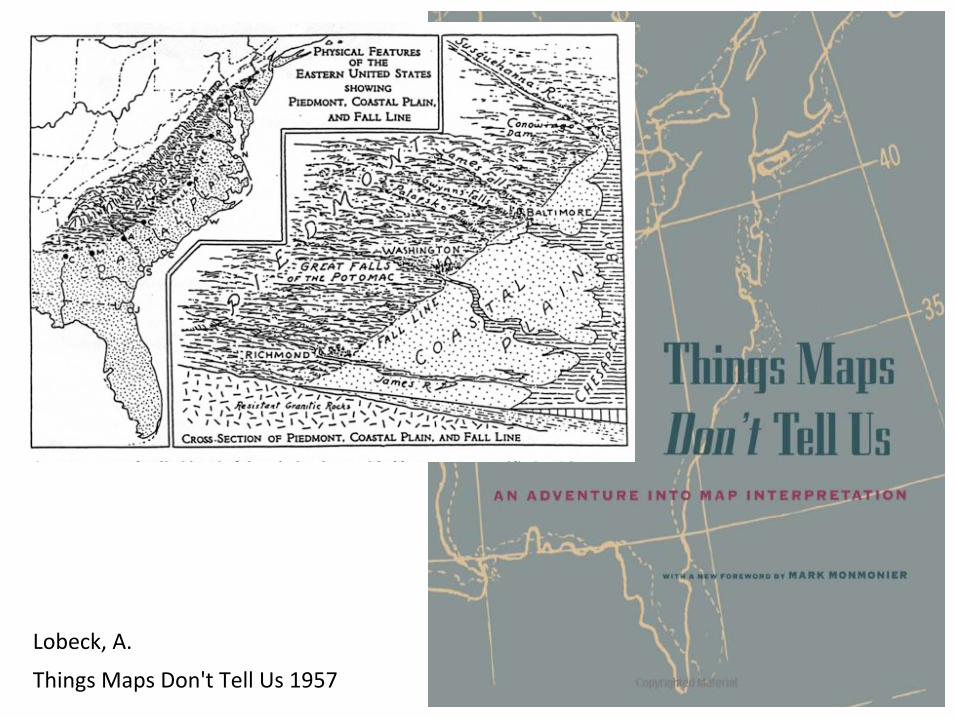
Landform (physiographic) Maps
• InfluencedbyW.M.Davies,I.BowmanandN.Fenneman(physiographicprovinces)
• Goal:explainingterritorywithinitsphysiographicinsteadof(manmade)countyborders
• Geodeterministicanswertoaprevaillingstatisticalapproachtogeography(H.Gannett)
• Method:Delineatethesignificantelementsoftheterraininpictorial-diagrammaticfashion
• Maps:whatyouseeratherthenwhatyoucount
Landform (physiographic) Maps
Lobeck,A.
ThingsMapsDon'tTellUs1957
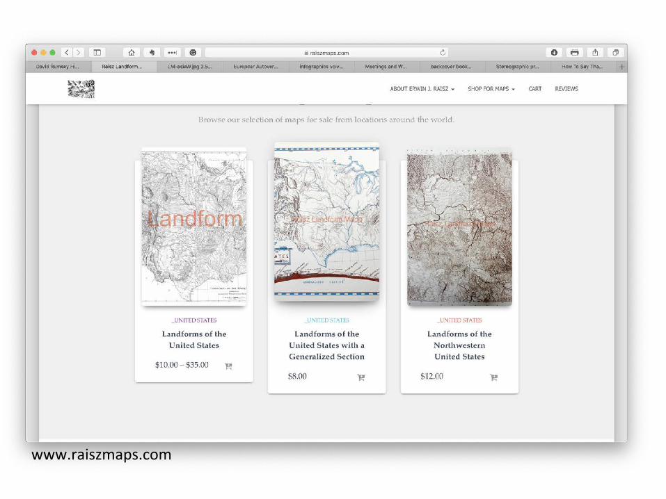
www.raiszmaps.com
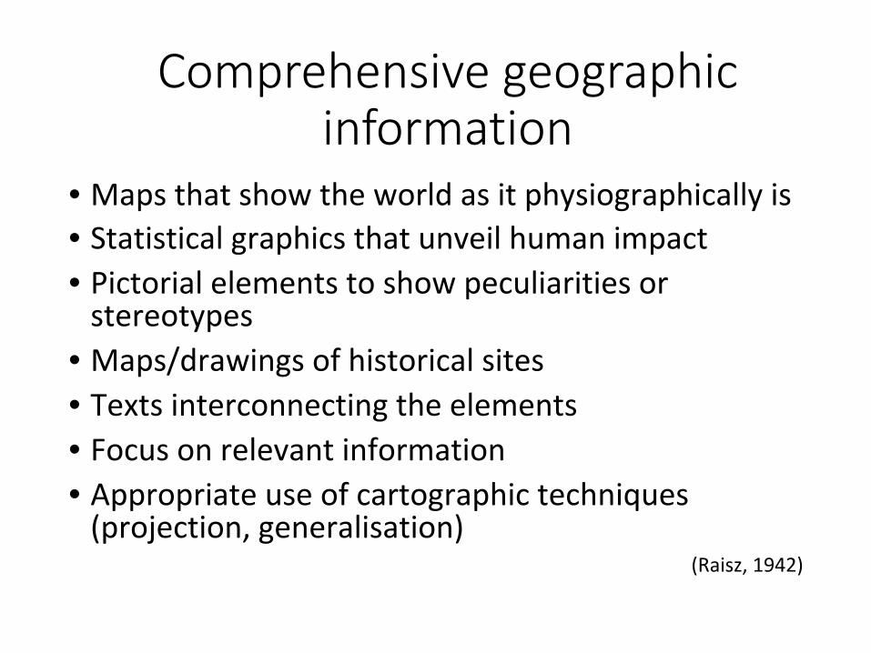
Comprehensive geographic information
• Mapsthatshowtheworldasitphysiographicallyis• Statisticalgraphicsthatunveilhumanimpact• Pictorialelementstoshowpeculiaritiesorstereotypes
• Maps/drawingsofhistoricalsites• Textsinterconnectingtheelements• Focusonrelevantinformation• Appropriateuseofcartographictechniques(projection,generalisation)
(Raisz,1942)
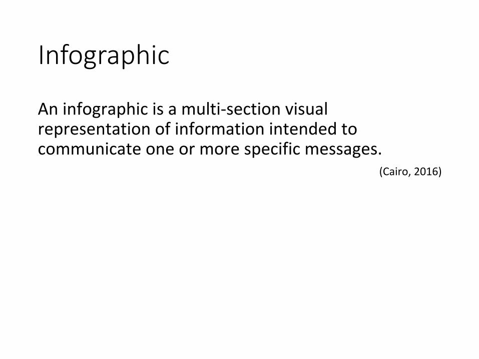
Infographic
Aninfographicisamulti-sectionvisualrepresentationofinformationintendedtocommunicateoneormorespecificmessages.
(Cairo,2016)
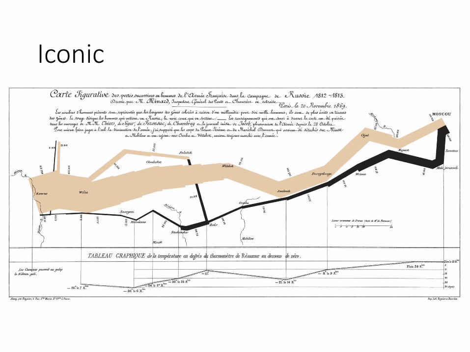
Iconic
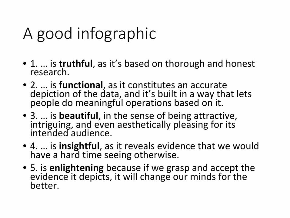
A good infographic
• 1.…istruthful,asit’sbasedonthoroughandhonestresearch.
• 2.…isfunctional,asitconstitutesanaccuratedepictionofthedata,andit’sbuiltinawaythatletspeopledomeaningfuloperationsbasedonit.
• 3.…isbeautiful,inthesenseofbeingattractive,intriguing,andevenaestheticallypleasingforitsintendedaudience.
• 4.…isinsightful,asitrevealsevidencethatwewouldhaveahardtimeseeingotherwise.
• 5.isenlighteningbecauseifwegraspandaccepttheevidenceitdepicts,itwillchangeourmindsforthebetter.
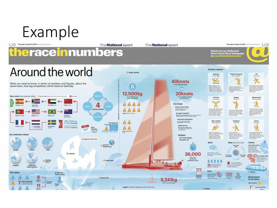
Example
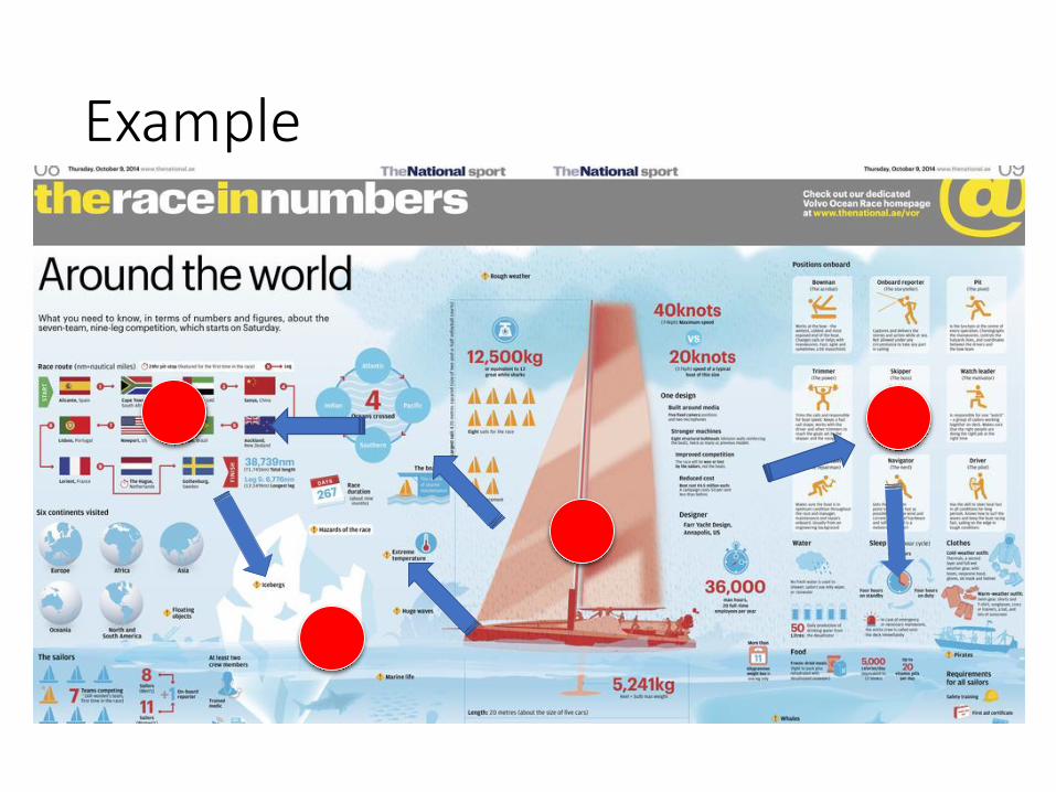
Example
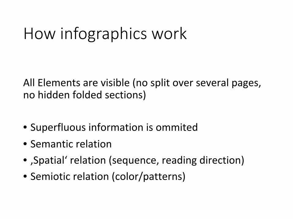
How infographics work
AllElementsarevisible(nosplitoverseveralpages,nohiddenfoldedsections)• Superfluousinformationisommited• Semanticrelation• ‚Spatial‘relation(sequence,readingdirection)• Semioticrelation(color/patterns)

Comprehensive geographic information
• Mapsthatshowtheworldasitphysiographicallyis• Statisticalgraphicsthatunveilhumanimpact• Pictorialelementstoshowpeculiaritiesorstereotypes
• Maps/drawingsofhistoricalsites• Textsinterconnectingtheelements• Focusonrelevantinformation• Appropriateuseofcartographictechniques(projection,generalisation)
(Raisz,1942)
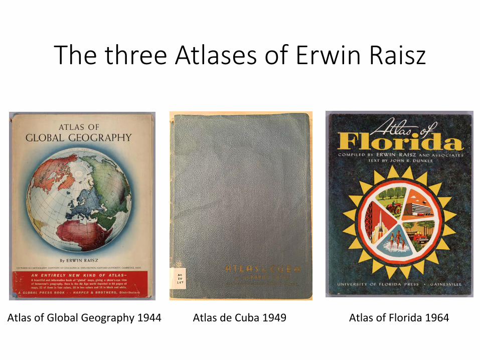
The three Atlases of Erwin Raisz
AtlasofGlobalGeography1944 AtlasofFlorida1964AtlasdeCuba1949
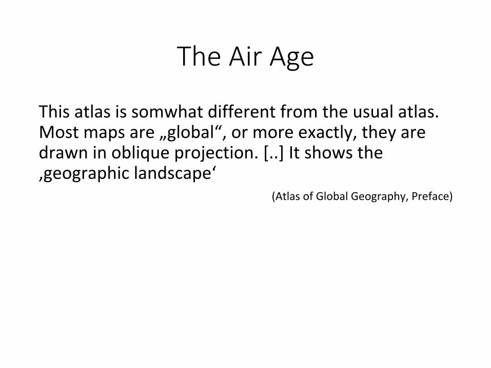
The Air Age
Thisatlasissomwhatdifferentfromtheusualatlas.Mostmapsare„global“,ormoreexactly,theyaredrawninobliqueprojection.[..]Itshowsthe‚geographiclandscape‘
(AtlasofGlobalGeography,Preface)
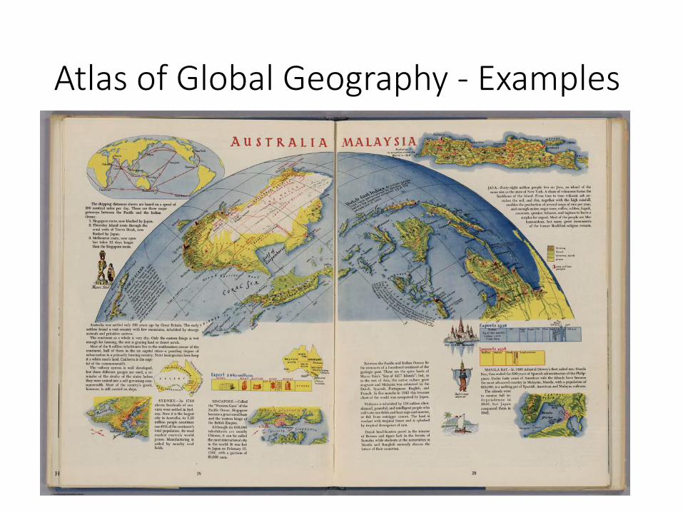
Atlas of Global Geography - Examples
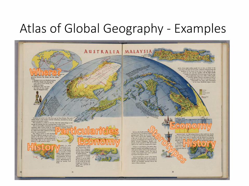
Atlas of Global Geography - Examples
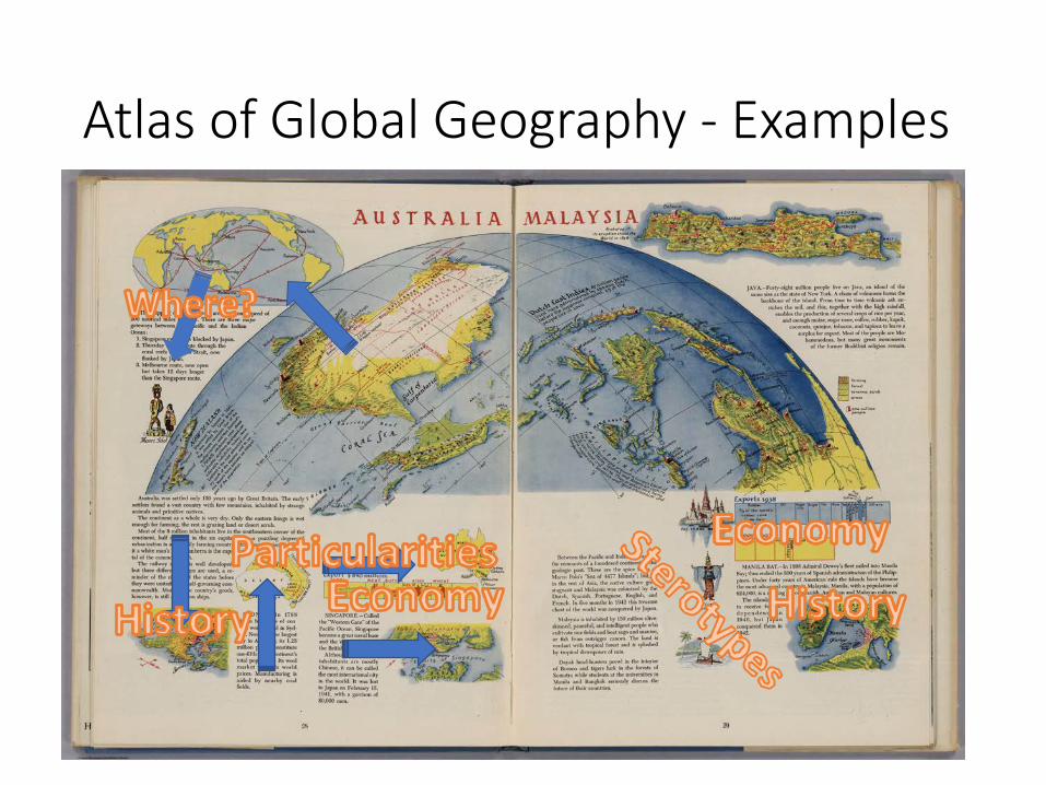
Atlas of Global Geography - Examples
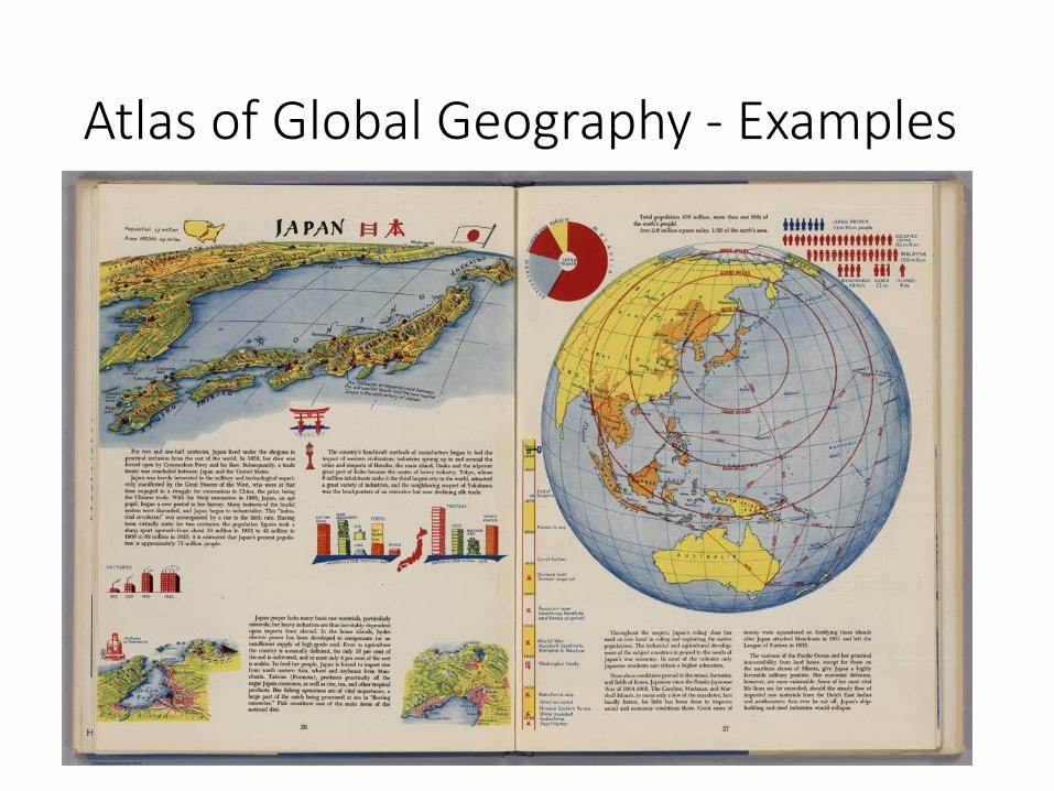
Atlas of Global Geography - Examples
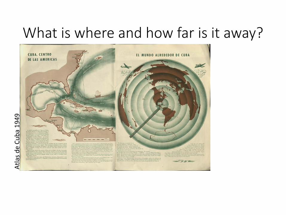
What is where and how far is it away? Atlasd
eCu
ba194
9
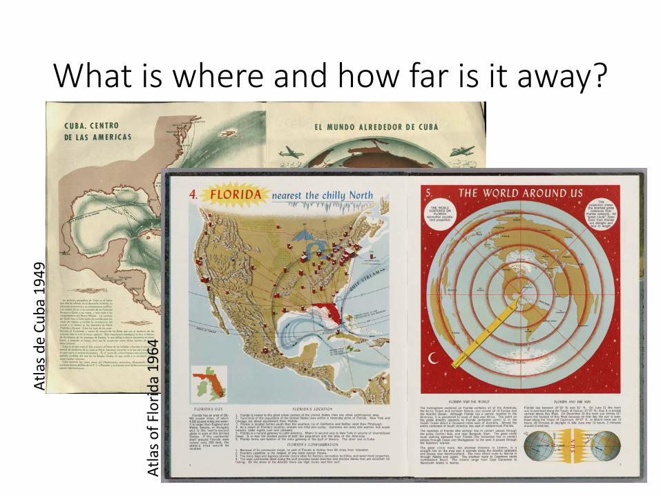
What is where and how far is it away? Atlasd
eCu
ba194
9
Atlaso
fFlorid
a19
64
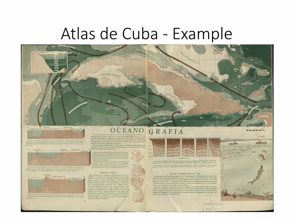
Atlas de Cuba - Example
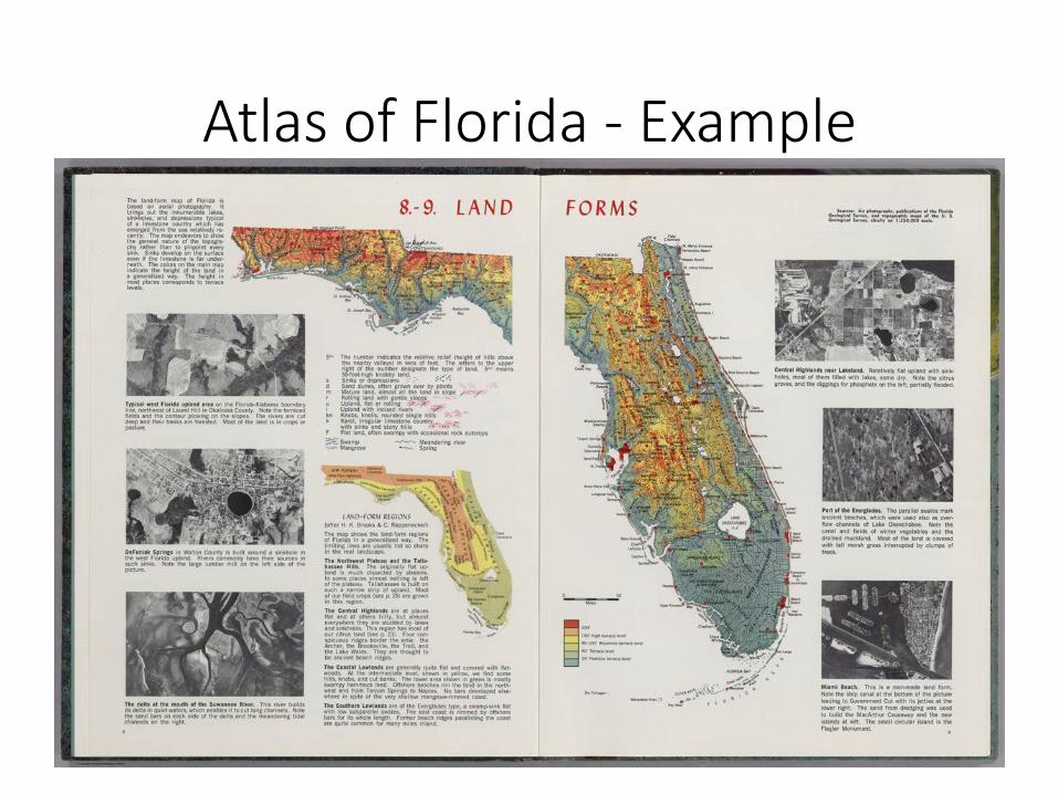
Atlas of Florida - Example
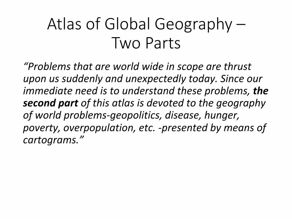
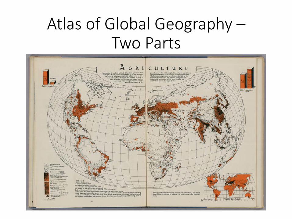
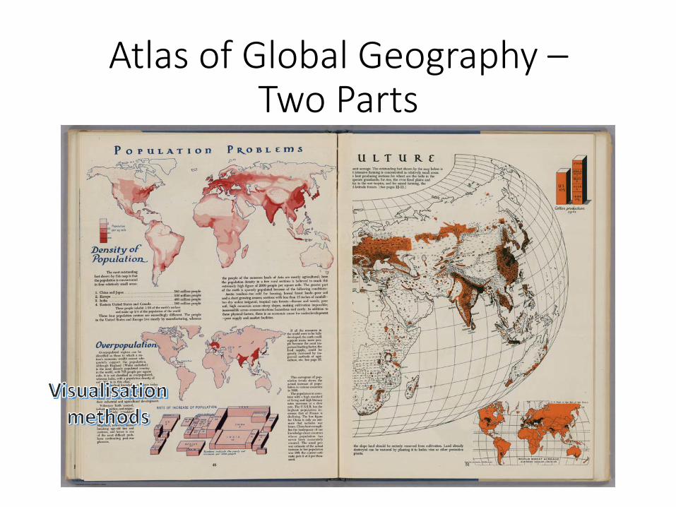
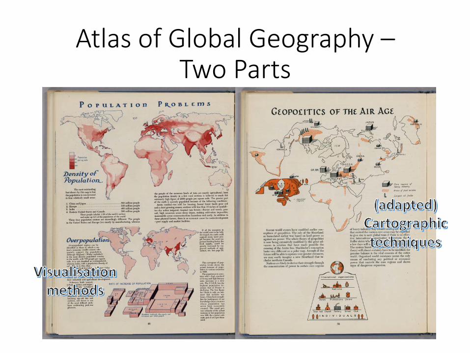
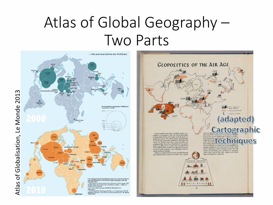
Atlas of Global Geography – Two Parts
“Problemsthatareworldwideinscopearethrustuponussuddenlyandunexpectedlytoday.Sinceourimmediateneedistounderstandtheseproblems,thesecondpartofthisatlasisdevotedtothegeographyofworldproblems-geopolitics,disease,hunger,poverty,overpopulation,etc.-presentedbymeansofcartograms.”
Atlas of Global Geography – Two Parts
Atlas of Global Geography – Two Parts
Atlas of Global Geography – Two Parts
Atlas of Global Geography – Two Parts
Atlaso
fGlobalisation,LeMon
de201
3
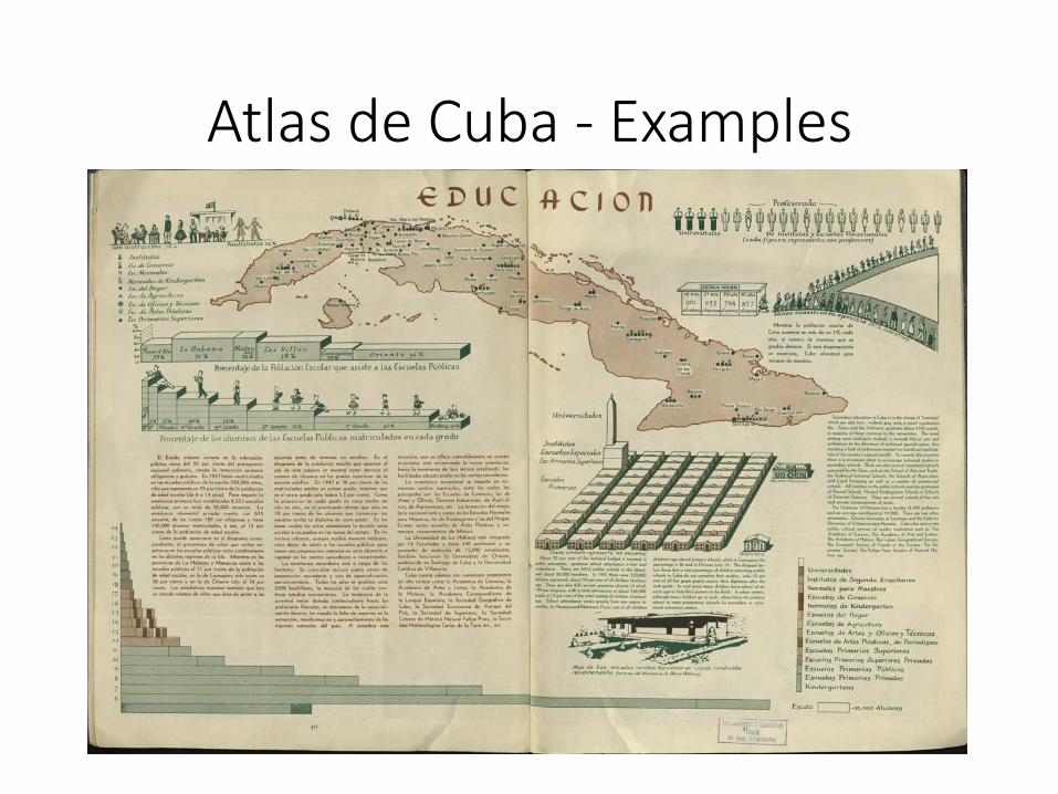
Atlas de Cuba - Examples
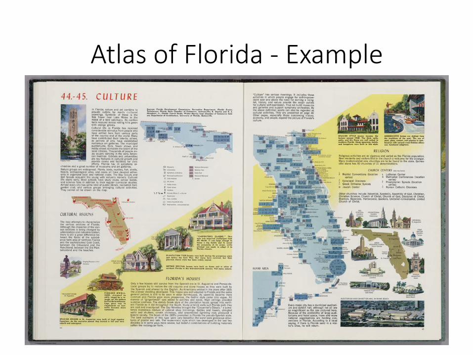
Atlas of Florida - Example
Important development
• Breakinguptheprevailingstructuraldivisionofatlases(maps/texts/graphics-parts)
• Inclusionoflatelyachieved/revivedvisualisationmethods
• Integrationofbothstereotypes(recognitioneffect)andexplanatorydrawings
• Positionofseveralentrypointsfortheusertounveilcomplexinformation
• Enablingstorytelling
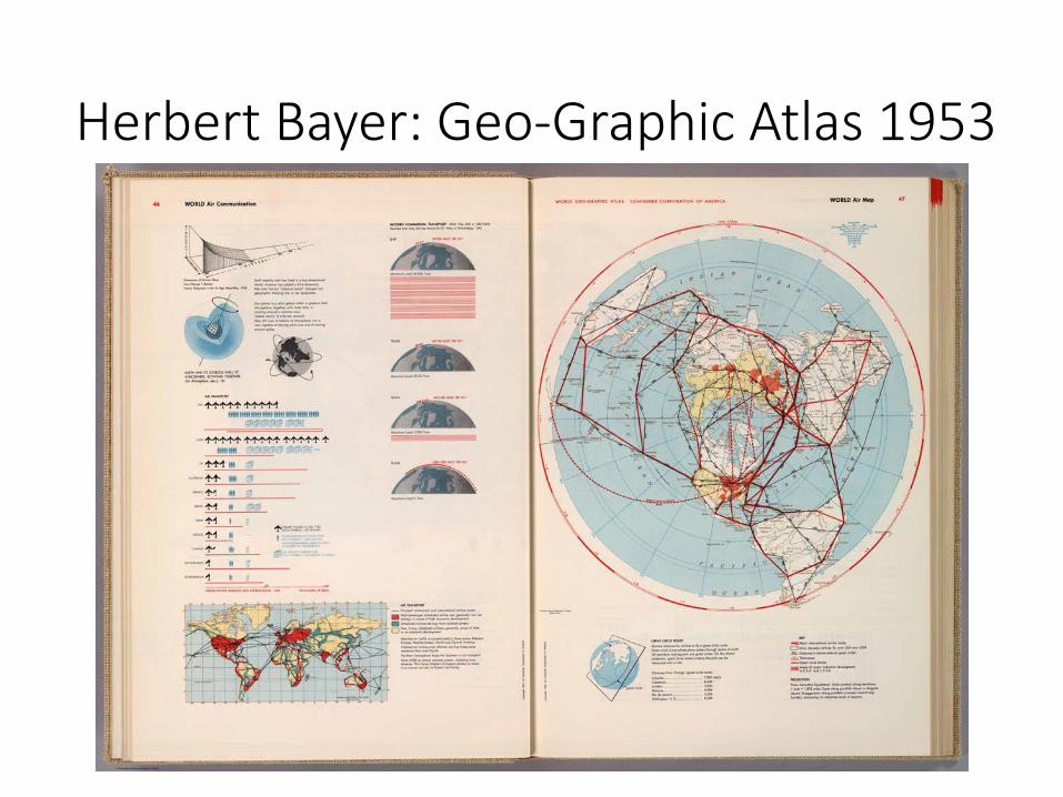
Herbert Bayer: Geo-Graphic Atlas 1953
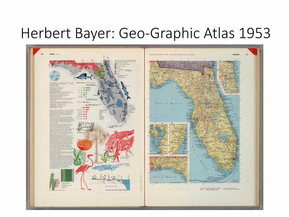
Herbert Bayer: Geo-Graphic Atlas 1953
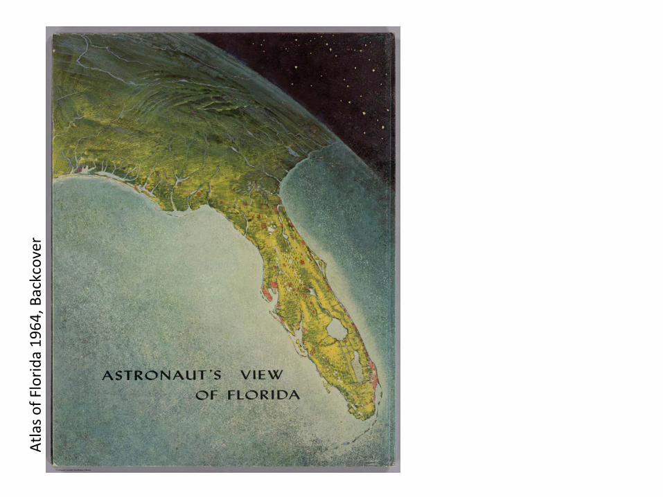
Atlaso
fFlorid
a19
64,B
ackcover
Doumo arigatou gozaimasu!
Thank you!
EricH.Losang-LeibnizInstituteforRegionalGeography,Leipzig,Germany,[email protected]