Embed Size (px)
Citation preview
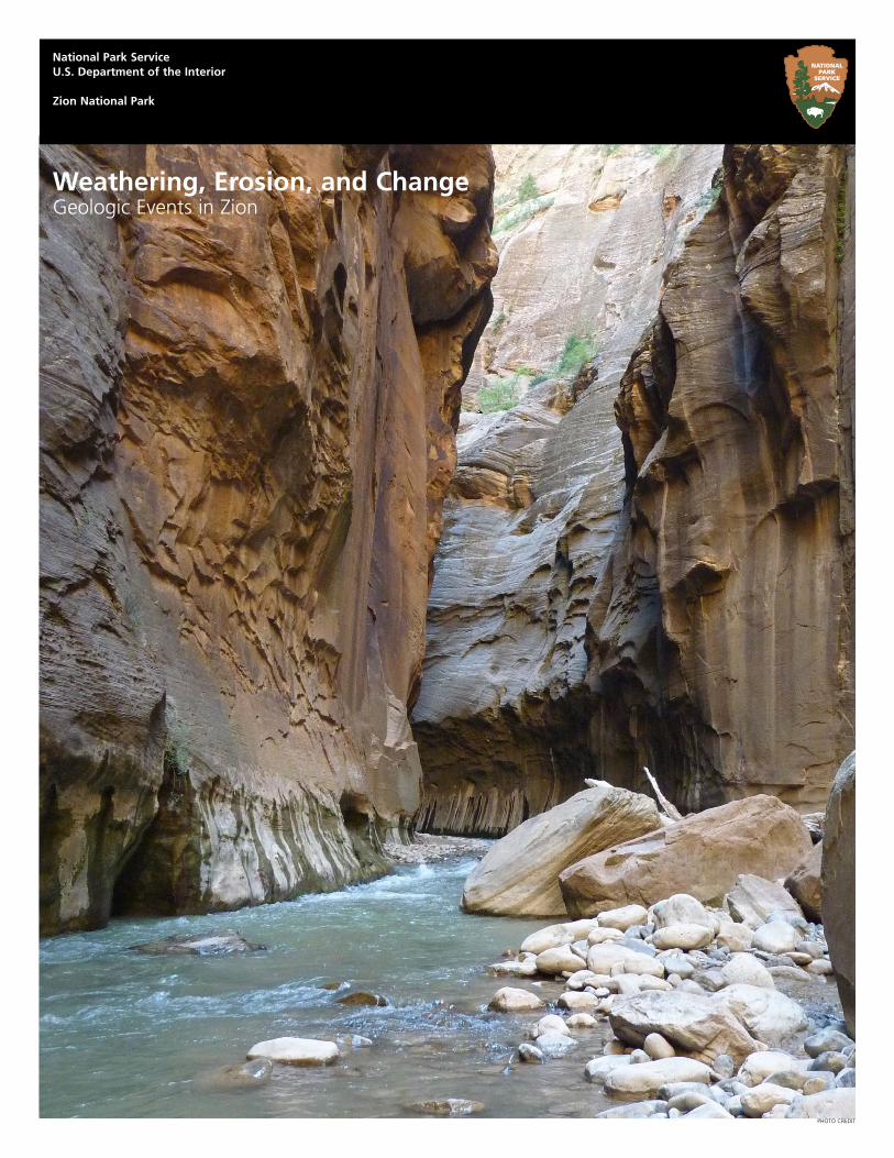
Weathering, Erosion, and ChangeGeologic Events in Zion
PHOTO CREDIT
National Park ServiceU.S. Department of the Interior
Zion National Park
Contents
Introduction 2
Core Connections 2
Background 2
ActivitiesEarth’s Power Punches 4
Rock On, Zion 5
It Happened Here! 6
Glossary 8
References 9
Zion National Park, 2015 Erosion, Weathering, and Change 2
ThemeThe Earth’s surface is a dynamic system that is constantly changing due to weathering, erosion, floods, earthquakes, volcanoes, and other geologic events.
FocusThe activities focus on relationship between geologic processes such as weathering and erosion and changes on the Earth’s surface.
ActivitiesEarth’s Power PunchesStudents view a presentation of digital im-ages showing the forces that shape the Earth’s surface. Then students view images from Zion and determine which geologic forces have contributed to the landscapes shown.
Rock On, ZionStudents will learn how Zion was formed and evaluate how weathering and erosion contrib-uted to the formation of the rock layers and subsequent carving of the canyon.
It Happened Here!Students draw on the knowledge they have gained about geologic events to invent a spe-cific event and imagine themselves in it.
Background
Zion National Park is located along the edge of a region called the Colorado Plateau. Uplift, tilting, and the erosion of rock layers formed a feature called the Grand Staircase, a series of colorful cliffs stretching between Bryce Canyon, Zion, and the Grand Canyon.
Zion has spectacular geology. The arid climate and sparse vegetation expose bare rock and reveal the park’s geologic history. Evidence
Introduction
This guide contains background information about how weathering, erosion, and other geologic processes such as volcanoes continually shape the landscape, and directions for three activities that will help students better understand how these processes are at work in Utah. This guide is specifically designed for fifth grade classrooms, but the activities can be modified for students at other levels.
of deposition (sedimentation), lithification, uplift, weathering, erosion, tectonics, and volcanic activity make the park a showcase for changing landscapes.
Deposition (Sedimentation)Zion National Park was a relatively flat basin near sea level 275 million years ago, near the coast of Pangaea, the land area believed to have once connected nearly all of the earth’s landmasses together. As sands, gravels, and muds eroded from surrounding mountains, streams carried these materials into the basin and deposited them in layers. The sheer weight of these accumulated layers caused the basin to sink, so that the top surface always remained near sea level. As the land rose and fell and as the climate changed, the depositional environment fluctuated from shallow seas to coastal plains to a massive desert of windblown sand. This process of sedimentation continued until over 10,000 feet of material accumulated.
LithificationMineral-laden waters slowly filtered through the compacted sediments. Iron oxide, calcium carbonate, and silica acted as cementing agents, and with pressure from overlying layers over long periods of time, transformed the deposits into stone. Ancient seabeds became limestone; mud and clay became mudstones and shale; and river sand and sand dunes became sandstone. Each layer originated from a distinct source and so differs in thickness, mineral content, color, and eroded appearance.
Tectonics and UpliftIn an area from Zion to the Rocky Mountains, tectonic forces deep within the Earth pushed the surface up creating the Colorado Plateau. This was not chaotic uplift, but
Core Connections
Utah Core Curriculum Fifth Grade Science
Standard 2: Students will understand that volcanoes, earthquakes, uplift, weathering, and erosion reshape Earth’s surface.
Objective 1: Describe how weathering and erosion change Earth’s surface.
Objective 2: Explain how volcanoes, earthquakes, and uplift affect Earth’s surface.
Objective 3: Relate the building up and breaking down of Earth’s surface over time to the various physical land features.
NPS
NPS/CAITLIN CECI
NPS/MARC NEIDIG
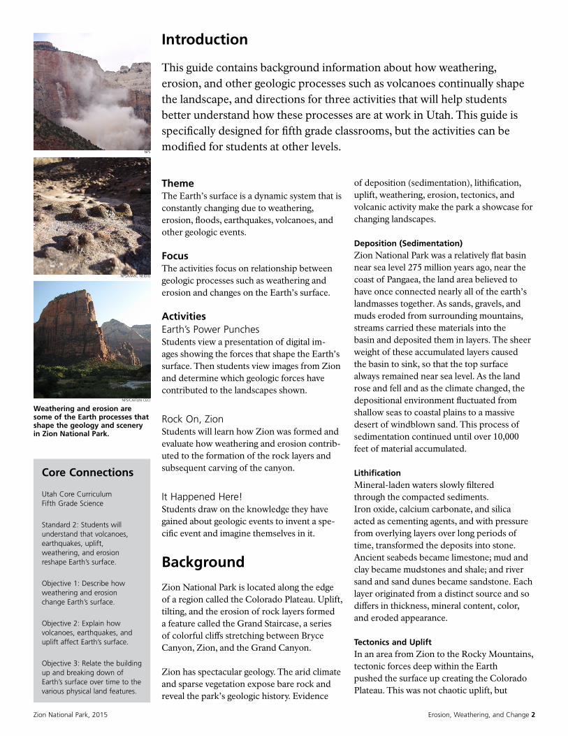
Weathering and erosion are some of the Earth processes that shape the geology and scenery in Zion National Park.
Zion National Park, 2015 Erosion, Weathering, and Change 3
slow vertical hoisting of huge blocks of the crust. Zion’s elevation rose from near sea level to as high as 10,000 feet above sea level. Uplift is still occurring.
For many millions of years, portions of the Pacific Plate (oceanic crust) subducted beneath the thicker, more buoyant North American Plate (continental crust). This subduction formed mountains and volcanoes along the west coast, and led to the formation of the Rocky Mountains. Later, changes in plate geometry led to the end of subduction along much of the West Coast (although subduction continues today in the Pacific Northwest). Instead of being pushed together, the plates began to slide sideways (lateral motion), as is seen today in California’s San Andreas Fault. This lateral motion stretched portions of western North America; creating a region called the Basin and Range. Westernmost Utah is part of the eastern edge of the Basin and Range province, where stretching continues today along active faults like the Hurricane and Wasatch Faults. Despite the mountain building and stretching that occurred in the surrounding areas, the Colorado Plateau rose to its high elevation with little deformation.
Erosion The uplift of the Colorado Plateau gave the streams greater cutting force in their descent to the sea. The park’s location on the western edge of this uplift caused the streams to tumble off the plateau, flowing rapidly down a steep gradient. These streams began eroding and cutting into the rock layers, forming deep and narrow canyons.
Grain by grain, the Virgin River has carried away several thousand feet of rock that once lay above the highest layers visible today. On average, the Virgin River transports one million tons of sediment per year. The rate varies dramatically with the flow of the river, with the vast majority of sediment transport occurring during floods. When the river is low and clear, very little sediment is moving, and much of the transport involves minerals dissolved in the water.
The Virgin River is still excavating. Upstream from the Temple of Sinawava, in The Narrows, the river cuts through Navajo Sandstone, creating a slot canyon. At the Temple of Sinawava, the river has reached the softer Kayenta Formation below. Water erodes the shale, undermining the overlaying sandstone and causing it to collapse, widening the canyon. As the plateaus continue to rise, the basins drop, and the river cuts, Zion Canyon is expanding upstream at a rate of about 10 miles of lateral movement every million years.
Volcanic Activity Volcanic vents, created as a result of the weakening of the Earth’s crust during tectonic events, allowed lava flows and cinder cones to form. Cinder was piled several hundred feet high in classic cone shapes and lava flowed into valleys. Cinder cones and black basalt flows are visible west of Rockville and on the Kolob Terrace.
Fractures and Faults Fractures and their control of canyon erosion are one of the most striking features of the canyons of the Virgin River. The fractures (not faults because there is no displacement) exert a strong influence on the erosion of smaller canyons in the Navajo Sandstone.
These fractures are believed to have formed due to tectonic compression and extension forces. The fractures form perpendicular to the direction of the compression and extension. The dominant fracture direction in Zion is roughly north-south. There are also fracture sets that are east-west (Kolob Canyons) and northeast–southwest (Kolob Terrace and Hop Valley).
While the straight north-south canyons on either side of Checkerboard Mesa are controlled by large fractures, the criss-cross fractures on its surface are of a more recent origin. The horizontal banding is the result of differential weathering of the crossbedded sandstone, while the vertical cracks are thought to be the result of freeze/thaw cycles at the surface of the rock.
Zion National Park, 2015 Erosion, Weathering, and Change 4
Earth’s Power Punches
Duration1 hour
LocationIndoors
Key Vocabularyblind arch, butte, cinder cone, erosion, earthquake, geologic processes, mesa, rock layers, uplift, volcanoes, weathering
ObjectivesBy the end of the activity, students will be able to a) name three Earth processes that shape the landscape, b) name two Earth processes that have helped to change the landscape at Zion, c) name which Earth processes have occurred quickly and which have occurred slowly.
MethodStudents view a presentation showing geologic processes that contribute to changing landscapes. Applying their knowledge to Zion, students view images and identify evidence of geologic forces such as weathering, erosion, earthquakes, volcanoes, and uplift.
BackgroundThe Earth’s surface constantly changes due to weathering, erosion, earthquakes, volcanoes, and uplift. At Zion National Park evidence of these processes is observed in the water and wind carved rocks, uplifted geologic layers, volcanic flows, cinder cones, mesas, blind arches, and other landforms.
Materials• Utah State Geological Survey presentation
of Landscapes located at http://geology.utah.gov/teacher/ppt/utah_landforms.ppt
• Earth’s Power Punches images
Suggested Procedures 1. Show the Utah State Geological Survey
Landscapes presentation and use accompanying notes for each slide to introduce students to the variety of geologic processes that occur to shape the Earth.
2. Show each of the Zion landscape images and ask the students to name which Earth process they think was at work to create the landscape in each image. Have the students write down a list of Earth changing processes for two or three of the images.
3. Ask the students to determine which processes can occur quickly (minutes/hours) and which occur over a long period of time (years to millions of years). Have students discuss their results with the class and describe the processes they investigated. Ask the students to describe how they came up with their determination of the time it took for each process to occur.
Zion National Park, 2015 Erosion, Weathering, and Change 5
Rock On, Zion
Duration1 hour
LocationIndoors
Key Vocabularychemical weathering, deposition, erosion, lithification, mass wasting, mechanical weathering, plateau, rock cycle, uplift
ObjectivesBy the end of the activity, students will be able to a) explain the difference between erosion and weathering, b) explain how weathering and erosion has contributed to the formation of the rock layers and c) describe how the Virgin River carved Zion Canyon.
MethodAfter viewing images of landforms in Zion National Park and discussing the rock cycle images, students will evaluate how weathering and erosion have contributed to the formation of the rock layers and subsequent carving of the canyon.
BackgroundEvidence of weathering and erosion can be observed at the park. Weathering and erosion are often confused.
Weathering involves two processes that often work together to decompose or break down rocks. Chemical weathering involves a chemical change in at least some of the minerals within a rock. Mechanical weathering involves physically breaking rocks into fragments without changing the chemical make-up of the minerals within it. Weathering is a surface or near-surface process. No movement is involved in weathering.
Erosion occurs as soon as a rock particle (loosened by one of the two weathering processes) moves. Mass wasting is simply movement down slope due to gravity. Rock falls, slumps, and debris flows are all examples of mass wasting.
Materials• Rock On, Zion images
Suggested Procedures 1. Write the word “weathering” on the board,
then write the word “erosion” on the board. Ask the students to think of some of the things that might make weathering happen such as water and ice, wind, and chemicals. Then ask the students to think of some things such as water, wind, and glaciers that erode (move) the weathered materials. Ask the students to think about which of these processes might have carved Zion.
2. Show the rock cycle image and have the students explain how they think the cycle works. Ask them if the park was always a canyon or if it has changed over time. How have the processes shown in the rock cycle impacted Zion?
3. Go through the images of four steps of the rock cycle that have helped to shape Zion. Explain that over several million years, the Virgin River weathered and eroded the rock layers and made it possible for us to see them. The river once flowed at the top of a flat plateau but has carved through the rock layers to its current level.
4. Break the class into five groups, and assign each group one of the steps in Zion’s geologic process (sedimentation/deposition, lithification, uplift, weathering, and erosion). Print out a set of the numbered photos in the Rock On, Zion images or display on board. Have each group determine which images show their step in the geologic process. Finally, have students draw one or more new images showing their step. Have each group share their findings.
5. Ask the students how the canyon is likely to change as the Virgin River continues to weather and erode the sedimentary rock layers.
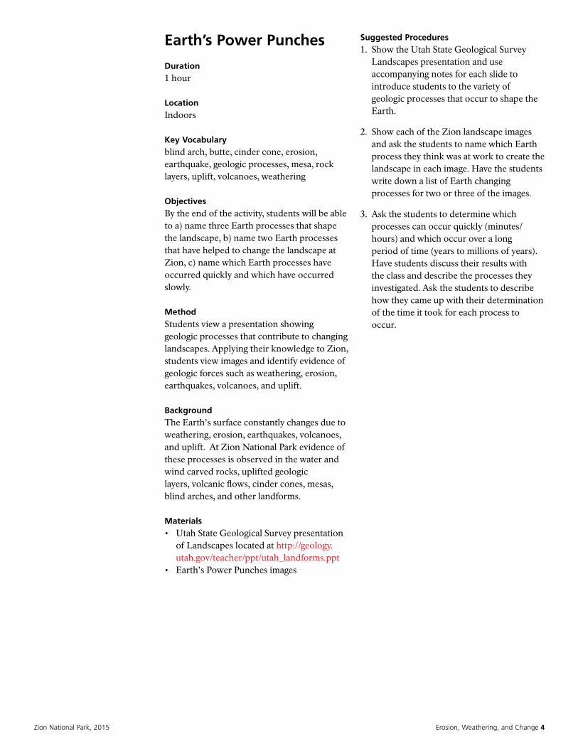
NPS/ADRIENNE FITZGERALD
NPS/MARC NEIDIG
NPS/RENDALL SEELY
Weathering and erosion have created much of the dramatic scenery in Zion National Park.
Zion National Park, 2015 Erosion, Weathering, and Change 6
It Happened Here!
Duration1 to 2 hours
LocationIndoors
Key Vocabularyerosion, eyewitness, Hurricane Fault, landslide, scientist
ObjectivesAfter this activity, students will be able to: a) describe a single event from three perspectives, b) name two geological features, and c) describe map features that were created through landscape changes.
MethodStudents draw on the knowledge they have gained about geologic events to invent a specific event and explore the event from different the different perspectives of a news reporter, scientist, and eyewitness.
Materials• It Happened Here! images• writing paper and pens• student copies of writing guide (three
types)• classroom computers
Suggested Procedure1. Show the images to review the kind of
landscape changes that can be caused by weathering and erosion, landslides, rock falls, floods, and earthquakes.
2. Tell students that they are going to draw on the knowledge they already have about the geologic events to invent a specific event and imagine themselves in it. Distribute copies of the writing guides and ask each student to note the date and time of their changing landscape event, the location, how much damage it caused, and other basic information at the top of the writing guide.
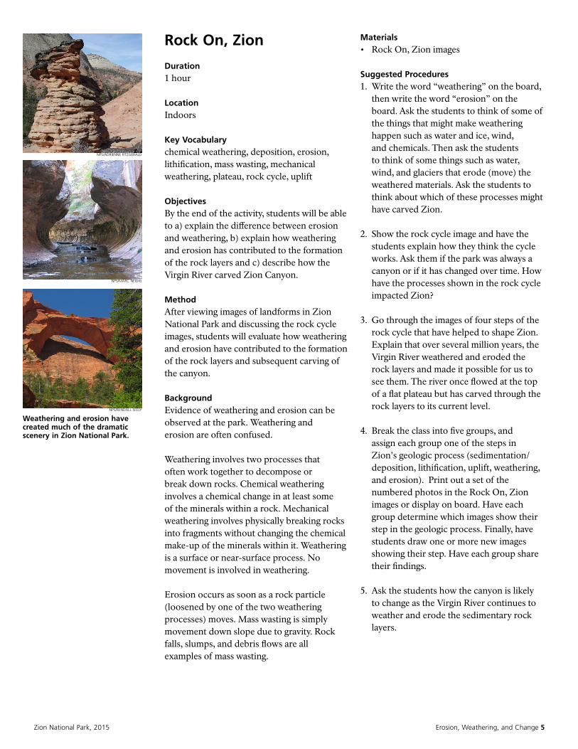
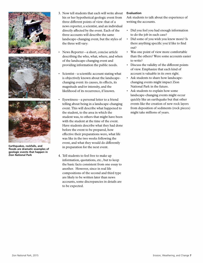
Over millions of years, erosion, weathering, rockfalls, floods, earthquakes, volcanoes, and
other geologic events have shaped the landscape that is
today Zion National Park. NPS
Zion National Park, 2015 Erosion, Weathering, and Change 7
3. Now tell students that each will write about his or her hypothetical geologic event from three different points of view: that of a news reporter, a scientist, and an individual directly affected by the event. Each of the three accounts will describe the same landscape-changing event, but the styles of the three will vary:
• News Reporter—a short, concise article describing the who, what, where, and when of the landscape-changing event and providing information the public needs.
• Scientist—a scientific account stating what is objectively known about the landscape-changing event: its causes, its effects, its magnitude and/or intensity, and the likelihood of its recurrence, if known.
• Eyewitness—a personal letter to a friend telling about being in a landscape-changing event. This will describe what happened to the student, to the area in which the student was, to others that might have been with the student at the time of the event. Have students describe what they had done before the event to be prepared, how effective their preparations were, what life was like in the two weeks following the event, and what they would do differently in preparation for the next event.
4. Tell students to feel free to make up information, quotations, etc., but to keep the basic facts consistent from one essay to another. However, since in real life compositions of the second and third type are likely to be written later than news accounts, some discrepancies in details are to be expected.
EvaluationAsk students to talk about the experience of writing the accounts.
• Did you feel you had enough information to do the job in each case?
• Did some of you wish you knew more? Is there anything specific you’d like to find out?
• Was one point of view more comfortable than the others? Were some accounts easier to write?
• Discuss the validity of the different points of view. Emphasize that each kind of account is valuable in its own right.
• Ask students to share how landscape-changing events might impact Zion National Park in the future.
• Ask students to explain how some landscape-changing events might occur quickly like an earthquake but that other events like the creation of new rock layers from deposition of sediments (rock pieces) might take millions of years.
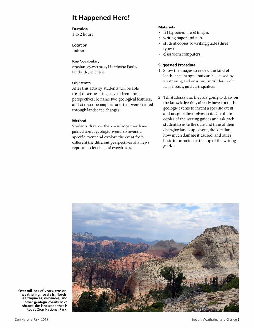
NPS
Earthquakes, rockfalls, and floods are dramatic examples of geologic events that happen in Zion National Park
NPS
NPS/BARB GRAVES
Zion National Park, 2015 Erosion, Weathering, and Change 8
Glossary
Basin and Range: type of topography that is characterized by a series of tilted fault blocks forming ridges or mountains and broad, intervening basins or valleys.
blind arch: a curved structure created by natural geological forces causing rock to fall away, with a rock face behind so there is no window through the arch.
butte: a steep-sided hill with a flat top, often standing alone in an otherwise flat area. A butte is smaller than a mesa.
cementation: the process in which the spaces between loose particles are filled with a hardening or bonding agent. This is one form of lithification.
Colorado Plateau: a large uplifted plateau roughly centered on the four corners region (Utah, Arizona, Colorado, and New Mexico) of the southwestern United States.
compaction: the process by which overlying rock layers or sediments compress the spaces between underlying particles. This is one form of lithification.
crater: a pit or hole in the ground created by an explosion such as a volcanic eruption, or from the impact of a meteorite.
deposition: the geological process by which material is added to a landform or land mass.
earthquake: the result of a sudden release of energy in the Earth’s crust that creates seismic waves.
erosion: the movement of weathered materials by natural processes.
extrusive rock: rock produced by molten lava that flows onto the surface of the Earth (also called volcanic rock).
eyewitness: someone who has knowledge about a dramatic event through seeing it firsthand.
fault: the boundary between two rock sections that have been displaced relative to each other.
fold: a bend in a layer of rock.
fossil: the mineralized or otherwise preserved remains or traces (such as footprints) of animals, plants, and other organisms.
geology: the science and study of the solid earth and the processes by which it is shaped and changed.
geologic processes: a scientific term used to describe the internal and external forces that shape the physical makeup of the Earth.
geologic time scale: used by geologists and other scientists to describe the timing and relationships between events that have occurred during the history of Earth.
igneous rock: rock produced by the cooling and solidification of magma, either on or below the Earth’s surface.
intrusive rock: rock produced by the cooling of magma deep beneath the Earth’s surface (also called plutonic rock).
landslide: the downslope movement, under gravity, of masses of soil and rock material; includes a wide range of ground movement, such as rockfall, slump, and debris slide.
lava: magma that emerges onto the surface of the Earth.
lithification: the processes in which sediments become solid rock.
lithospheric plates: a massive, irregularly shaped slab of solid rock, generally composed of both continental and oceanic lithosphere (also called tectonic plates); part of plate tectonics.
magma: molten rock deep within the Earth.
Zion National Park, 2015 Erosion, Weathering, and Change 9
mesa: (Spanish and Portuguese for “table”) an elevated area of land with a flat top and sides that are usually steep cliffs. It takes its name from its characteristic table-top shape and is larger than a butte.
metamorphic rock: rock that has undergone change as a result of intense heat and pressure.
normal fault: a break in the Earth where tension pulls rocks apart and one block slides down relative to the other block.
paleoenvironment: the past environment of an area during a given period of its history.
plate tectonics: theory of geology that has been developed to explain the observed evidence for large scale motions of the Earth’s lithosphere.
plateau: also called a high plain or tableland, is an area of high elevation land, usually consisting of relatively flat terrain.
relative age: the age of a rock in comparison to other rocks.
rock cycle: interrelated sequence of events by which rocks are initially formed, altered, destroyed, and reformed as a result of magmatism, erosion, sedimentation (or deposition), lithification, and metamorphism.
scientist: in a broad sense is one engaging in a systematic activity to acquire knowledge. In a more restricted sense, a scientist is an individual who uses the scientific method.
sedimentary rock: rock produced from particles deposited by wind, water, ice, or chemical reactions.
sediment: finely divided solid material, ex: sand, gravel, mud.
subduction: a geologic process in which one edge of a crustal plate descends below another.
thrust fault: occur in a compressional environment, where rocks are squeezed together and one block is forced upward (and possibly over) relative to another.
uplift: a geological process most often caused by plate tectonics which increases elevation.
volcano: an opening, or rupture, in a planet’s surface or crust, which allows hot, molten rock, ash and gases to escape from below the surface.
weathering: decomposition of rocks, soils, and their minerals by chemical or physical processes. Chemical weathering involves a chemical change in at least some of the minerals within a rock. Mechanical weathering involves physically breaking rocks into fragments without changing the chemical make-up of the minerals within it.
References
Colorado Plateau Geosystems, Inc. Reconstructing the Ancient Earth, http://cpgeosystems.com/gallery.html. Last modified 2010.
Federal Emergency Management Agency. Seismic Sleuths: A teacher’s package for grades 7-12, 2nd Edition. Washington D.C.: American Geophysical Union, 1995
Hislop, Teresa, and Kirstin Reed. Topographic maps, http://www.uen.org/Lessonplan/preview?LPid=2209. Last modified 2002.
National Geographic. How was the Grand Canyon formed? http://www.nationalgeographic.com/expeditions/lessons/07/g35/canyon35.html. Last modified 2011.
U.S. Geological Survey. What’s the difference between weathering and erosion? http://geomaps.wr.usgs.gov/parks/misc/gweaero.html. Last modified 2014.


![FRW holography from uplifted AdS/CFT - · PDF fileFRW holography from uplifted AdS/CFT Gonzalo Torroba SLAC, Stanford University Based on arXiv: 1108.5732 [DHMST], 1005.5403 [DHST]](https://img.pdfslide.us/doc/110x75/5a822f967f8b9ada388dae1c/frw-holography-from-uplifted-adscft-holography-from-uplifted-adscft-gonzalo.jpg)

![FRW holography from uplifted AdS/CFT · FRW holography from uplifted AdS/CFT Gonzalo Torroba SLAC, Stanford University Based on arXiv: 1108.5732 [DHMST], 1005.5403 [DHST] with X](https://img.pdfslide.us/doc/110x75/5b8405757f8b9a934f8e80df/frw-holography-from-uplifted-ads-frw-holography-from-uplifted-adscft-gonzalo.jpg)