Embed Size (px)
Citation preview

EPA Releases First Ever National Wetland Condition Assessment
Webcast sponsored by EPA’s Watershed Academy
Thursday, June 16, 2016 1:00pm – 3:00pm Eastern
Instructors:
1
• Sarah Lehmann, Team Leader for National Aquatic Resource Surveys, Monitoring Branch, U.S. Environmental Protection Agency, Office of Water
• Gregg Serenbetz, Environmental Protection Specialist, Wetlands Division, U.S. Environmental Protection Agency, Office of Water
Webcast Logistics
• To Ask a Question – Type your question in the “Questions” tool box on the right side of your screen and click “Send.”
• To Report any Technical Issues (such as audio problems) – Type your issue in the “Questions” tool box on the right side of your screen and click “Send” and we will respond by posting an answer in the “Questions” box.
2
1

3
Overview of Today’s Webcast
• Overview of the National Aquatic ResourSurvey (NARS).
• Results of the National Wetland ConditioAssessment (NWCA).
ce
n
National Wetland Condition Assessment Overview and Key Findings Implications and Future Directions
4
The National Aquatic Resource Surveys – An Ov erview
2

Presentation Outline
• Background
• NARS Approach
• Accomplishments
• Current and Upcoming Milestones
5
What is NARS?
Coastal Streams and Rivers Wetlands Lakes
• Series of surveys implemented by EPA and our state and tribal partners addressing 4 waterbody types
• Assess all surface waters within the 48 conterminous states
• Cost effective, nationally consistent, regionally relevant means of tracking status and trends
• Builds from almost 20 years of research and pilots 6
3

Purpose of the National Aquatic Resource Surveys
• Assess biological and recreational conditionand change over time
• Document associations between indicators of condition and indicators of stress
• Build/enhance state monitoring andassessment capacity
7
Why is NARS important?
Provides national
assessments
• Address gaps in information about the condition of the nation’s waters with statistical confidence.
• Reports used as water quality outcome measures of progress tracking protection and restoration nationally.
Supports national priorities
• Results support continued nutrient pollution reduction and habitat protection for lakes, rivers and streams, estuaries and wetlands.
• Critical data set for identifying and responding to concerns about HABs, defining baseline conditions for Gulf of Mexico.
Complements state and local monitoring
• Reports extent of degradation and risk key stressors pose to water quality at national and regional scales.
• State and local monitoring are key to informing local priorities for site specific restoration actions and watershed protection.
8
4

National Consistency: NARS Approach
• Randomized design to report on condition of eachresource nationally and regionally– 1,000 sites in lower 48
• Standard field and lab protocols
• National QA and data management
• Nationally consistent and regionally relevant datainterpretation and peer‐reviewed reports
9
Types of Survey Indicators and Measures
Biological indicators such as:
• Benthic macroinvertebrates
• Plants
• Fish community
Public health indicators such as
• Fish tissue
• Pathogens (e.g., enterococci)
• Microcystins and other algal toxins
Occurrence and extent of key stressors such as:
• High levels of nutrients
• Excess sediment
• Physical habitat characteristics (e.g. riparian cover)
May include pertinent research indicators such as:
• Sediment enzymes
• Contaminants of emerging concern 10
5

11
Accomplishments
12
First ever, nationally consistent assessments of coastal waters, lakes and reservoirs, rivers and streams, and wetlands.
Assessments address ecological and human‐health indicators; stressors; and changes over time
Expanded/strengthened state, tribal and interagency partnerships 2015: More than 12,000 sites sampled
2015: Comprehensive, consistent, and statistically‐valid assessments
Results: Increased ability to
report on the condition of our waters
Coastal: >35,000 square miles a 40% increase from 2004
Lakes: >110,000 lakes which substantially increases the assessed acres since 2004
Rivers/streams: >1.2 million miles more than doubling the assessed miles since 2004
Wetlands: >60,000,000 acres resulting in a 30 fold increase since 2004
6

Questions?
Current and Upcoming Milestones
Reporting • NRSA 2008/09 – Final re leased March 2016• NCCA 2010 – Final report released January 2016• NWCA 2011 – Final re leased May 2016• NLA 2012 – Release in 2016
New • NRSA 2013/14 – Data ar e in final stages of QC; analysis beginning• NCCA 2015 – Finished field season; samples being processed by labs• NWCA 2016 – Crews ar e in the field collecting data• NLA 2017 – Planning and preparations have already begun. Design completed and indicators selected
13
Data Collection
Questions?
Coastal Waters
Wetlands
Lakes
Streams
Rivers 14
7

National Wetland Condition Assessment 2011
Watershed Academy Webcast Gregg Serenbetz
US EPA Wetlands Division
NWCA11‐R013LickC reek‐CacheR iver Watershed,Illin oisPhotob y Mick Micacchion, MBI
15
Presentation Outline
• Overview of NWCA – Background and objectives
– Planning and implementation
• Findings from NWCA 2011 – National
– Regional
• Implications and future directions – Application of 2011 data
– NWCA 2016
16
8

Acknowledgements
• State and Tribal partners • Federal partners
– Fish and Wildlife Service – NRCS Soil Survey – U.S. Geological Survey – USDA PLANTS team – National Park Service – U.S. Forest Service, Army
Corps of Engineers, NOAA • Academic Institutions • EPA Office of Research
and Development andRegions
17
Objectives of the NWCA
• Produce a national report describing – ecologic condition of the nation’s
wetlands – stressors most commonly associated
with poor condition
• Collaborate with states and tribes in developing – complementary wetland monitoring
tools – analytical approaches – data management technologies
• Advance the science of wetland monitoring and assessment to supportwetland management and policy needs
Goal: Information on wetland quality that leads to more effective protection and restoration of wetlands 18
9

Planning and Implementation
2006
2011
Indicator development and selection
Survey design Manuals, forms, and database development
19 Field training and sampling
Protocol development and pilot testing
Summary of NWCA field data collection and analysis activities
A. Select and Sample Sites Representing Population
B. Collect Standard Field and Lab Data
D. Set thresholds for Condition/Stress
E. Derive Estimates of Condition/Stress for Population
20
categories (i.e., “good”, “fair”, “poor”)
10

Selection of Sites • Site selection made using a probability‐based survey design
(GRTS) – Every element in population has known probability of selection – Ensures results reflect full range of wetlands in target population
• FWS Status and Trends sample frame used as a base map toselect wetland sites meeting NWCA target population
• All sites were screened to ensure they met established criteriafor inclusion in survey
NWCA Target Population • Tidal and non‐tidal wetlands of the conterminous U.S., including certain farmed
wetlands not currently in crop production. • The wetlands have rooted vegetation and, when present, open water <1 m deep. • NWCA uses a definition for wetlands described by Cowardin that is broader than
the definition used in the Clean Water Act. • A wetland’s jurisdictional status under state or federal regulatory programs did
not factor into the NWCA definition of target. 21
22
11

Field Sampling: Standard Site Layout
LEGEND Sampling Point
Assessment Area
Buffer Area
Vegetation Plot Soil Pit Buffer Plot Water (≥ 15cm deep)
At each site crews collected data within
23
Field Sampling: Standard Site Layout
LEGEND Sampling Point
Assessment Area
Buffer Area
Vegetation Plot Soil Pit Buffer Plot Water (≥ 15cm deep)
40m
0.5 hectare area (1.24 acres)
At each site crews collected data within
A Core Assessment Area (AA) • Represented by 40 meter radius
circle around the sampling point (0.5 hectares)
24
12

Field Sampling: Typical Site Layout
LEGEND Sampling Point
Assessment Area
Buffer Area
Vegetation Plot Soil Pit Buffer Plot Water (≥ 15cm deep)
100m
At each site crews collected data within
A Core Assessment Area (AA) • Represented by 40 meter radius
circle around the sampling point (0.5 hectares)
The Surrounding “Buffer” • 100 meter area outside the core
Assessment Area
25
Field Sampling: Standard Site Layout
LEGEND Sampling Point
Assessment Area
Buffer Area
Vegetation Plot Soil Pit Buffer Plot Water (≥ 15cm deep)
Within AA crews collected data on
VEGETATION • Species identity, presence, and
abundance • Within five 100m2 plots
26
13

Field Sampling: Typical Site Layout
Sampling Point
Assessment Area
Buffer Area
Vegetation Plot Soil Pit Buffer Plot Water (≥ 15cm deep)
LEGEND
Within AA crews collected data on
HYDROLOGY • Presence of water sources, evidence
of hydrologic alterations, indicators of hydrology
28
Field Sampling: Standard Site Layout
LEGEND Sampling Point
Assessment Area
Buffer Area
Vegetation Plot Soil Pit Buffer Plot Water (≥ 15cm deep)
Within AA crews collected data on
VEGETATION • Species identity, presence, and
abundance • Within five 100m2 plots
SOILS • Soil morphology (color, texture,
saturation) • Samples for analysis of physical and
chemical properties • Four soil pits described (samples
collected at representative pit)
27
14

Field Sampling: Typical Site Layout
LEGEND Sampling Point
Assessment Area
Buffer Area
Vegetation Plot Soil Pit Buffer Plot Water (≥ 15cm deep)
Surface water greater than 15 cm deep
Within AA crews collected data on
HYDROLOGY • Presence of water sources, evidence
of hydrologic alterations, indicators of hydrology
WATER CHEMISTRY • Sample collected at sites with
surface water ≥ 15cm deep and analyzed for WQ parameters
29
Field Sampling: Typical Site Layout
LEGEND Sampling Point
Assessment Area
Buffer Area
Vegetation Plot Soil Pit Buffer Plot Water (≥ 15cm deep)
Surface water greater than 15 cm deep
Within AA crews collected data on
HYDROLOGY • Presence of water sources, evidence
of hydrologic alterations, indicators of hydrology
WATER CHEMISTRY • Sample collected at sites with
surface water ≥ 15cm deep and analyzed for WQ parameters
ALGAE • Sample collected for algae species ID • Samples collected for chlorophyll‐a
and microcystin analysis at sites with surface water ≥ 15cm deep
30
15

Field Sampling: Typical Site Layout
LEGEND Sampling Point
Assessment Area
Buffer Area
Vegetation Plot Soil Pit Buffer Plot Water (≥ 15cm deep)
100m
Within Buffer crews collected data on
NATURAL COVER • Vegetation and ground cover in
twelve 100m2 plots arrayed along cardinal directions from point
DISTURBANCE • Presence of stressors in twelve
100m2 plots arrayed along cardinal directions from point
TARGETED INVASIVE SPECIES • Presence of 22 targeted invasive
plant species in twelve 100m2 plots arrayed along cardinal directions from point
31
Field Sampling: Typical Site Layout
LEGEND Sampling Point
Assessment Area
Buffer Area
Vegetation Plot Soil Pit Buffer Plot Water (≥ 15cm deep)
100m
Crews also collected data in both the AA and buffer for pilot rapid assessment method
USARAM • Physical and Biological structure
within AA • Presence of stressors within AA • Presence of stressors within Buffer
32
16

Development of Metrics/Indicators
• Process and QA field and lab data (lots of it!)
• Determine reporting groups
• Characterize reference condition – Categorize sites along a disturbance gradient
• Detailed information provided in NWCA 2011 Technical Report
33
NWCA 2011 Reporting Groups
• General rule followed by EPA in NARS is to have ≥ 50 sites per reporting group to achieve statistically valid estimates
• NWCA grouped ecoregions
9 NARS Ecoregions 4 NWCA Ecoregions
• NWCA grouped wetland types (based on Cowardin) emergent pond (PUB)
(EM)
farmed (Pf)
34
17
herbaceous scrub‐shrub (SS) forested (FO) woody

Ten NWCA reporting groups
35
Characterizing Reference Condition
• Similar to well‐established approach used in other NARS studies
• Four categories of stressor data used from field/lab data
– Buffer – Hydrology – Soil chemistry – Nonnative plant cover
• Each site screened to see if exceeded threshold or not
• Thresholds could be – Observed presence – Chemical concentration (based on
literature & lab data) – BPJ (nonnative plant cover)
• Identified least/most disturbed for each reporting group
– 20‐30% of sites per class target
36
18

Setting Condition/Stressor Thresholds
• Distribution‐based threshold approach
• NARS conventions used to set • vegetation MMI thresholds for
each reporting group • Soil phosphorus stressor
indicator
• Fixed threshold approach • Used to set thresholds for other
stressors • Accepted values from peer‐
reviewed, published literature that are well established or widely used by agencies
• E.g. microcystin thresholds based on WHO values
• Best professional judgement • E.g. nonnative plant stressor
37
NWCA 2011 Indicators Category Indicator Description
Biological Condition Vegetation MMI Index comprised of 4 metrics related to plant abundance, native status, and tolerance to disturbance
Physical Stress – Vegetation Alteration
Vegetation Removal Field (e.g., mowing / shrub cutting, herbicide use, highly grazed grasses, recently burned forest)
observations related to loss, removal, or damage of vegetation
Vegetation Replacement Field observations of a change in the plant species present due to anthropogenic activities (e.g., tree plantation, golf course, lawn/park, row crops, pasture/hay, rangeland)
Physical Hydrological Alteration
Stress – Damming Field from or within the site (e.g., dikes, dams, berms, railroad beds)
observations related to impounding or impeding water flow
Ditching Field observations related to draining water within the site (e.g., ditches, corrugated pipe, excavation‐dredging)
Hardening Field observations related to soil compaction, including activities and infrastructure that primarily result in soil hardening (e.g., roads, suburban residential development, pavement)
Filling/Erosion Field observations related to soil erosion or deposition (e.g., soil loss/root exposure, fill/spoil banks, freshly deposited sediment)
Chemical Stress Heavy Metal Index Index comprised of 12 different heavy metals closely associated withanthropogenic activities measured in soil sample
Soil Phosphorus Concentration of phosphorus in soil sample
Microcystin Concentration of the algal toxin microcystin in composite water, sediment, and surface vegetation sample
Biological Stress Nonnative Plant Stressor Index
Index comprised of 3 metrics related to presence and abundance of nonnative plants
38
19

Deriving Estimates of Condition/Stress for Population
1. Each NWCA probability site is assigned to a condition or stress‐level category based on the indicator value (e.g. VMMI, Heavy Metal Index, etc) for the site and the threshold appropriate to the site (e.g., reporting group) – Biologic condition (good, fair, poor) – Levels of stress (high, moderate, low)
2. Site weights from the probability design, e reflecting the number of acres each sit
represents across the total population of specific NWCA target wetland types, are summed for each class to estimate total area in that class (i.e. good, fair, poor)
39
NWCA11‐R013Lick Creek‐Cache River Watershed, IllinoisPhoto by Mick Micacchion, MBI
40
Questions?
20

NWCA 2011 Findings
• Results from data analysis presented in NWCA 2011 report – Nationally – Regionally by major ecoregion and broad wetland type
• Estimates for different reporting groups by condition/stress category – Example on next slide
41
D. Confidence Interval displays level of certainty or confidence in the estimate
F. Assessed wetland area, in acres, nationally or within an ecoregion in each of the condition or stress level categories
E. Proportion of wetland area nationally or within an ecoregion in each of the condition or stress level categories
B. Condition classes or stress levels are indicated by colors: Green = Good Condition or Low Stress Yellow = Fair Condition or Moderate Stress Red = Poor Condition or High Stress Dark Red = Very High Stress (nonnative plant stressor only) Gray = Unassessed (area that could not be sampled)
A. National estimates of condition or stress level are shown by the first group of bars, followed by estimates for each of the NWCA Aggregated Ecoregions
C. Number shows the value of the estimate represented by the bar (e.g., 48% of wetland area nationally is in Good condition)
Reporting of NWCA 2011 Results
42
21

Key NWCA 2011 Findings
• Less than half of wetland area – 48% ‐ is in good condition based on plant community characteristics
• Physical disturbances to wetlands and surrounding habitat such as soil compaction, ditching, and plant removal are most widespread stressors – Wetlands with high levels of stress from soil
compaction are twice as likely to have plant communities in poor condition
• Nonnative plants are a problem, particularly in the interior plains and west
• West is in poorer condition and has higher levels of stressors than other regions
43
National Findings: Biological Indicators
Plants integrate different wetland processes and respond to physical, chemical, and biological disturbances.
44
22
Indicator of condition – NWCA developed vegetation multi‐metric
index (VMMI) • Field‐based observances of plant species
presence and abundance • Species trait information (e.g., C‐value reflecting
sensitivity to human disturbance)
– Reference‐based approach used to set regionally specific thresholds
– 48% of wetland area in good condition, 20% in fair, and 32% in poor
Indicator of stress – Nonnative Plant Stressor Index based on
species composition and traits – Fixed threshold used nationally – 19% of wetland area has high or very high
levels of stress from nonnative plants

National Findings: Physical Indicators of Stress
• Based on field‐observed disturbances to wetlands and surrounding habitat
• Disturbances classified by whether they resulted primarily in alterations to – vegetation (removal, replacement) – hydrology (damming, ditching, hardening,
filling/erosion) • Fixed thresholds used nationally • Hardening (soil compaction) and plant
removal (grazing, cutting, mowing, herbicides) at high stress levels for 27% of wetland area
• Ditching at high stress levels for 23% of wetland area
Removal Replacement
Ditching Hardening
Physical changes to the plant community and hydrology in wetlands and their surrounding habitat alter natural wetland processes, impacting plant ‐productivity, nutrient and carbon cycling.
45
National Findings: Chemical Indicators of Stress
• Based on laboratory analysis of soil and water samples collected at field site
• Soil indicators – Heavy Metal Index
• Concentrations of 12 metals compared to literature values for background and natural breaks in NWCA data
• 2% of wetland area at high stress levels
– Soil phosphorus • Concentrations compared to reference‐ based
thresholds • 6% of wetland area at high stress levels
• Microcystin – Toxin produced by cyanobacteria – Detected in 12% of wetland area; less than
1% at moderate or high levels of risk for recreational exposure (WHO thresholds)
Chemical stressors to wetlands can disrupt nutrient cycles, affect plant and animal growth, and be detrimental to human health.
46
23

National Findings: Relationships between Stressor/Condition Data
• Quantitative approach to explore relationship between high stressor levels and poor condition
• Relative Risk ratio of 1.9 indicates that sites in high stress category are nearly twice as likely to be in poor condition
47
Regional Findings: West
• Findings for West worse than other ecoregions
• 61% of wetland area in poor condition (21% good condition)
• Greater percentage of wetland area at high levels of stress – Ditching 76% – Nonnative plants 72% (high or very high) – Hardening 70% – Vegetation removal 61%
• Heavy metals at moderate stressor levels for 47% of wetland area
48
24

Regional Findings: Interior Plains
• 44% of wetland area in goodcondition (19% in poor condition)
• Vegetation removal (44%), hardening (35%), and ditching (28%) are predominant stressors at high levels – All physical stressors except
filling/erosion above 20% • Nonnative plants at high or very high
stressor levels for 46% of wetland area – Only 4% inland herbaceous wetland area
at low stressor levels
49
Regional Findings: Coastal Plains
• Half of assessed wetland area nationallyoccurs in ecoregion
• 50% of wetland area in good condition(29% in poor condition)
• Vegetation removal (25%), hardening (23%), and ditching (21%) are predominant stressors at high levels
• Inland herbaceous wetlands far worse than inland woody wetlands – 59% of wetland area in poor condition – Vegetation removal 61% – Hardening 57% – Ditching 52%
50
25

Regional Findings: Eastern Mountains and Upper Midwest
• 52% of wetland area in goodcondition (37% in poor condition)
• Hardening (22%), vegetation removal (17%), ditching (15%) are predominant stressors at high levels
• Larger percentage of wetland areawith high stress levels for soil phosphorus (13%) than other ecoregions – 35% for inland herbaceous
• Heavy metals at moderate stressor levels for 31% of wetland area
51
Regional Findings: Estuarine
• Estuarine wetlands are reported nationally bywetland type (herbaceous or woody) – Estuarine herbaceous wetland area comprises 90% of
total • Estuarine herbaceous wetlands
– 58% of wetland area in good condition (26% in poor) – Ditching (18%), hardening (11%), and damming
(10%) were predominant stressors at high levels – Nonnative plants at high and very high levels for 24%
of wetland area • Estuarine woody wetlands
– 59% of wetland area in good condition (22% in poor) – Ditching (18%), hardening (13%), and soil
phosphorus (9%) were predominant stressors at high levels
52
26

Accessing NWCA report and data
• 2011 reports and data available for download at:
• https://www.epa.gov/ national‐aquatic‐resource‐surveys/nwca
Implications & Follow‐Up Actions
• Working to further understand data
53
results for West – Survey design changes to add more sites
and enable reporting of Xeric and WesternMountains independently
– Target additional candidate reference sites – Panel Session at SWS Pacific NW Workshop
• Engagement with stakeholders onimplications, applications, and use ofNWCA data – Special Issue on NWCA in scientific journal – NWCA Campus Challenge – ASWM communications assistance
54
27

Applications/Uses of NWCA Data
• Wetland program management – Compensatory mitigation & voluntary
restoration – Wetlands role in mitigating climate change – National and site‐specific data to inform
development of water quality standards • Data for national databases
– Species occurrence data for USDA PLANTS – National Wetland Inventory maps – NRCS hydric soils – Reference site networks
• Verification and assessment of wetland field indicators – Plant, hydrology, and hydric soil indicators
55
Innovations for Wetland Science
• Development of national indicators ofbiological condition and stress – Robust multimetric index of biological
condition (VMMI) to evaluate condition acrossvarying wetland types and ecoregions
– Physical, chemical and biological indicators ofstress based on readily collected field and labdata
• Wealth of data to pursue research intodevelopment of other wetland assessmentprotocols and indicators – Soil indicators of stress and health – Rapid Assessment Methods (RAMs) – Water chemistry – Algae species
56
28

NWCA 2016 Survey
• Field sampling for NWCA 2016survey began April 17th in Georgia
• Same core indicators – Vegetation – Soil – Hydrology – Water samples (nutrients, chlorophyll‐a,
microcystin) – Stressors
• Expanded design – Greater number of sites in west
• Separate reporting groups for xeric and western mountains
– Improved distribution in other areas
57
Speaker Contact Information
Sarah Lehmann Lead, National Aquatic Resource Surveys U.S. EPA’s Office of Wetlands, Oceans, and Watersheds [email protected]
Gregg Serenbetz Environmental Protection Specialist U.S. EPA’s Office of Wetlands, Oceans, and Watersheds [email protected]
http://www.epa.gov/national‐aquatic‐resource‐surveys/nwca 58
29
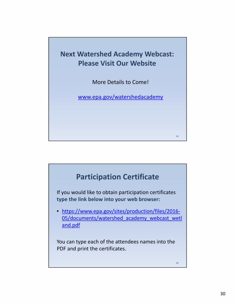
Next Watershed Academy Webcast:Please Visit Our Website
More Details to Come!
www.epa.gov/watershedacademy
59
Participation Certificate
If you would like to obtain participation certificates type the link below into your web browser:
• https://www.epa.gov/sites/production/files/2016‐05/documents/watershed_academy_webcast_wetland.pdf
You can type each of the attendees names into the PDF and print the certificates.
60
30

NWCA11‐R013Lick Creek‐Cache River Watershed, IllinoisPhoto by Mick Micacchion, MBI
61
Questions?
31