Embed Size (px)
Citation preview
EPA Drinking Water Mapping Application (DWMA)
Authors:
James Sinnott, RTI International (presenter)
Jay Rineer, RTI International
William Cooter, RTI International
Roger Anzzolin, US EPA, Office of Ground Water and Drinking Water
AWRA 2004 Spring Specialty Conference
GIS and Water Resources III
May 19, 2004
The work described in this presentation was funded by the U.S. Environmental Protection Agency under Contract 68-C-01-001 with Research Triangle Institute (RTI). RTI gratefully acknowledges this support.
Disclaimer: Although the research described has been funded wholly or in part by the U.S. Environmental Protection Agency Contract 68-C-01-001 to Research Triangle Institute, it has not been subject to the Agency's review and therefore does not necessarily reflect the views of the Agency, and no official endorsement should be inferred. Mention of trade names or commercial products does not constitute endorsement or recommendation for use.
Disclaimer: In the interest of protecting certain types of information, and in accordance with EPA protocol, the GIS data displayed in the following images were rendered for display purposes only and do not accurately represent actual data from EPA’s spatial databases.
Acknowledgements
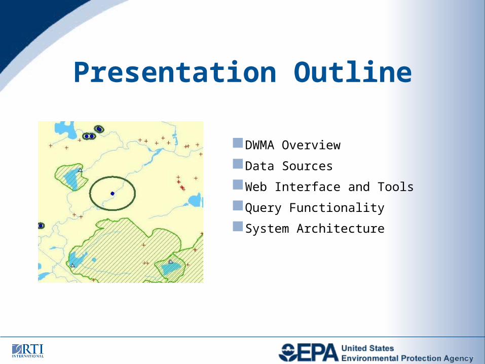
DWMA Overview
Data Sources
Web Interface and Tools
Query Functionality
System Architecture
Presentation Outline
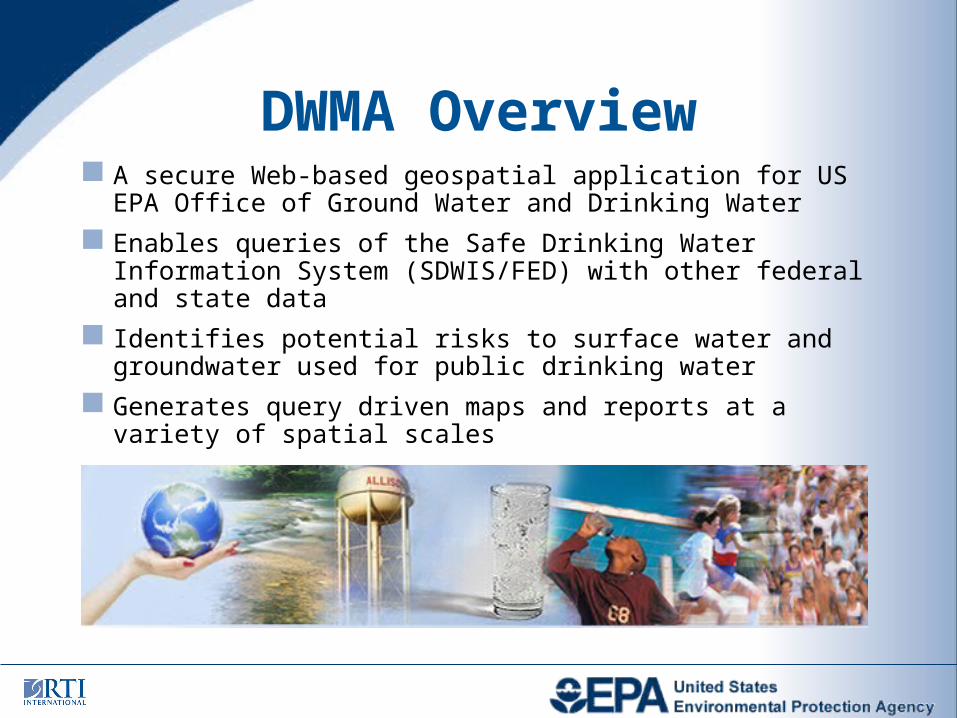
A secure Web-based geospatial application for US EPA Office of Ground Water and Drinking Water
Enables queries of the Safe Drinking Water Information System (SDWIS/FED) with other federal and state data
Identifies potential risks to surface water and groundwater used for public drinking water
Generates query driven maps and reports at a variety of spatial scales
DWMA Overview
Drinking water sources (intakes and wells) from SDWIS/FED
Source water (protection) areas from states (SWAs)
Point sources of contamination including dischargers, hazardous waste sites, Superfund sites, and state sources
Non-point sources of contamination including USGS nitrogen fertilizer use, herbicide use, and USDA animal waste
Surface waters represented by the NHD in the RAD
Groundwater represented by USGS groundwater regions, principal aquifers, and groundwater atlas
A variety of other layers from EPA IGD and RAD and USGS
Data Sources
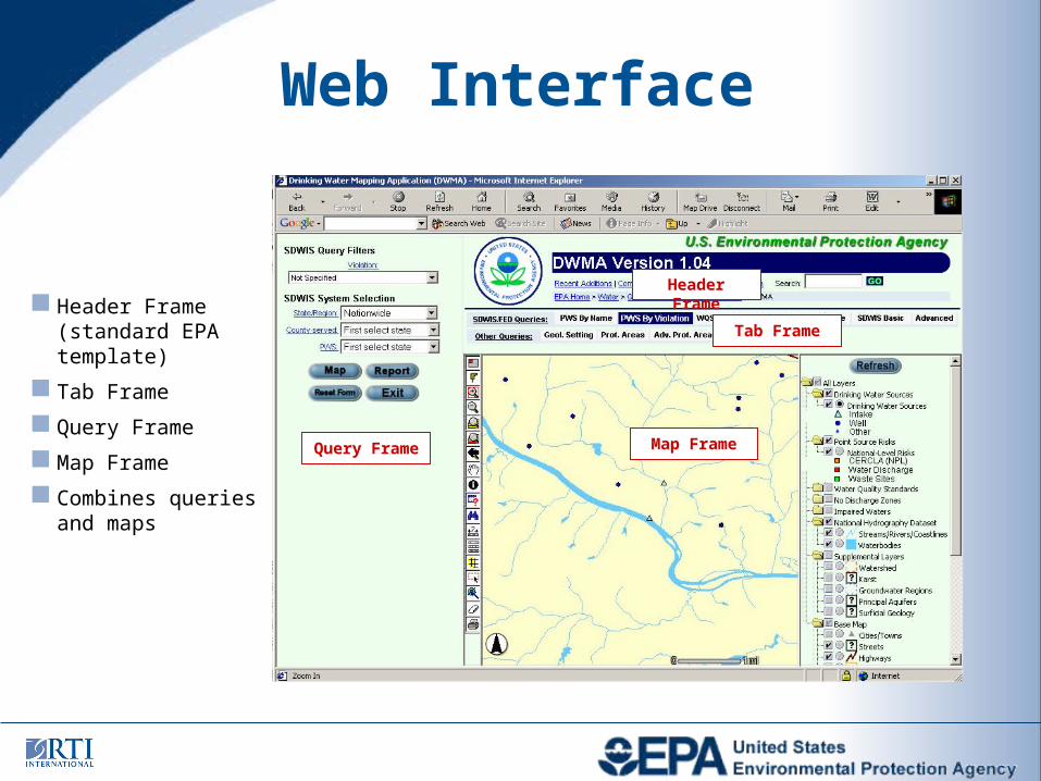
Web Interface
Header Frame (standard EPA template)
Tab Frame
Query Frame
Map Frame
Combines queries and maps
Header Frame
Tab Frame
Map FrameQuery Frame
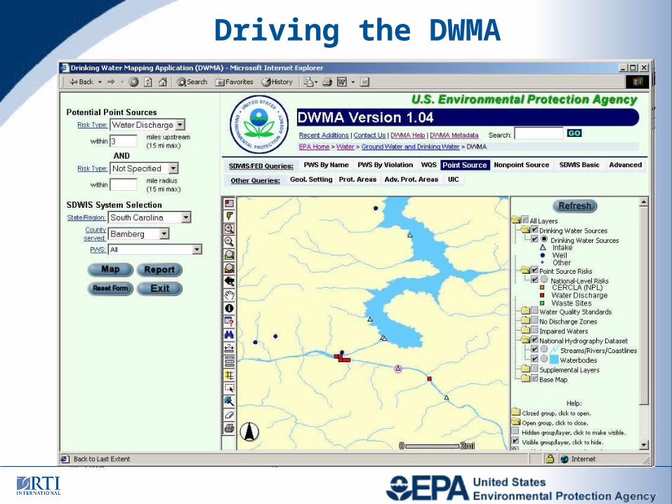
Driving the DWMA
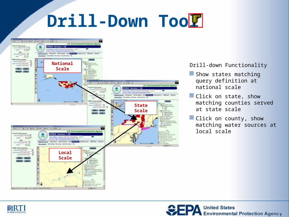
Drill-Down Tool
Drill-down Functionality
Show states matching query definition at national scale
Click on state, show matching counties served at state scale
Click on county, show matching water sources at local scale
National Scale
State Scale
Local Scale
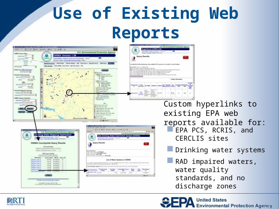
Use of Existing Web Reports
Custom hyperlinks to existing EPA web reports available for:
EPA PCS, RCRIS, and CERCLIS sites
Drinking water systems
RAD impaired waters, water quality standards, and no discharge zones
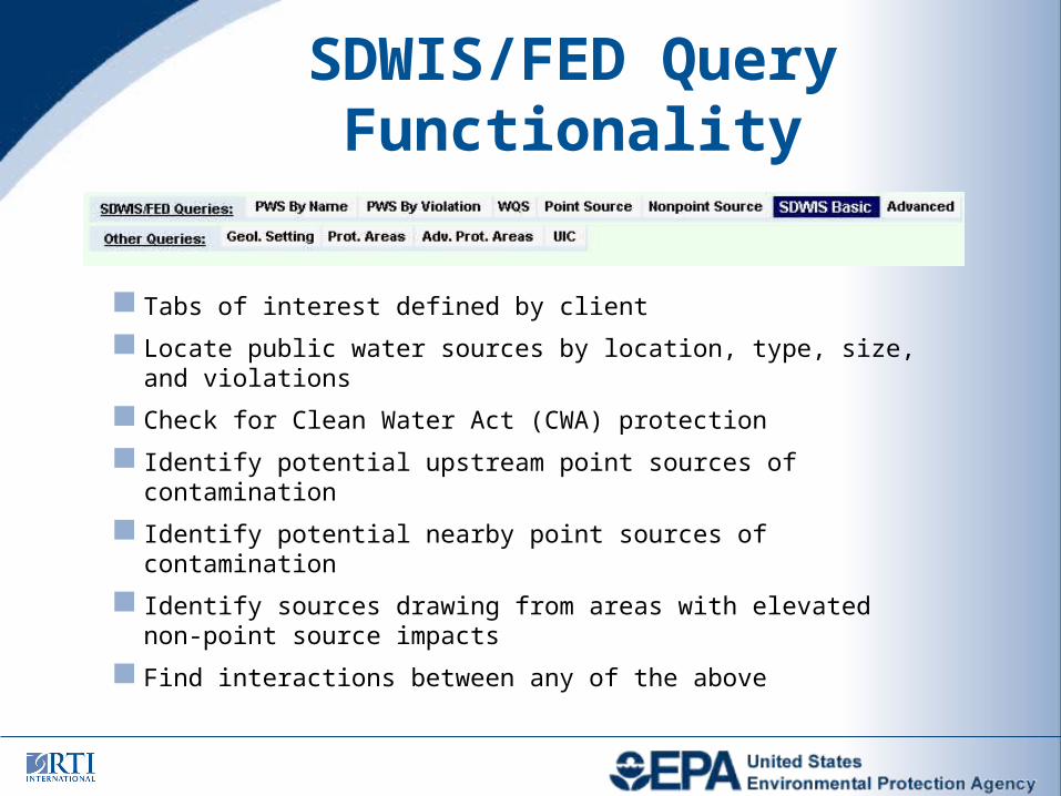
SDWIS/FED Query Functionality
Tabs of interest defined by client
Locate public water sources by location, type, size, and violations
Check for Clean Water Act (CWA) protection
Identify potential upstream point sources of contamination
Identify potential nearby point sources of contamination
Identify sources drawing from areas with elevated non-point source impacts
Find interactions between any of the above
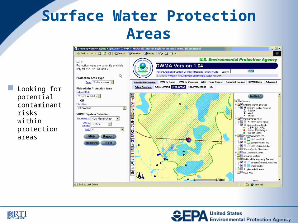
Surface Water Protection Areas
Looking for potential contaminant risks within protection areas
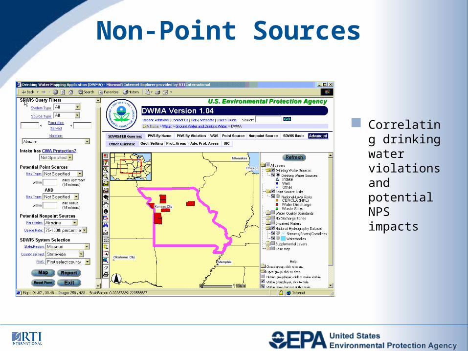
Non-Point Sources
Correlating drinking water violations and potential NPS impacts
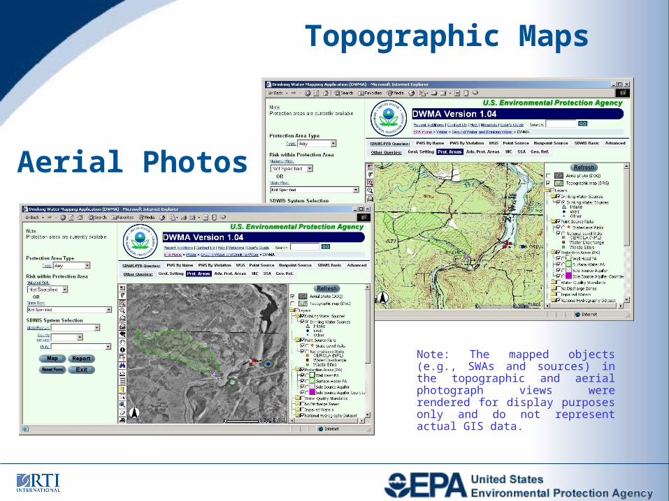
Topographic Maps
Aerial Photos
Note: The mapped objects (e.g., SWAs and sources) in the topographic and aerial photograph views were rendered for display purposes only and do not represent actual GIS data.
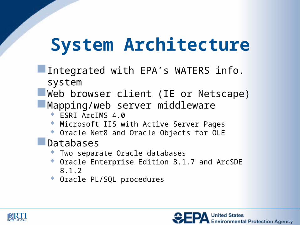
System ArchitectureIntegrated with EPA’s WATERS info. systemWeb browser client (IE or Netscape)Mapping/web server middleware
ESRI ArcIMS 4.0 Microsoft IIS with Active Server Pages Oracle Net8 and Oracle Objects for OLE
Databases Two separate Oracle databases Oracle Enterprise Edition 8.1.7 and ArcSDE 8.1.2 Oracle PL/SQL procedures
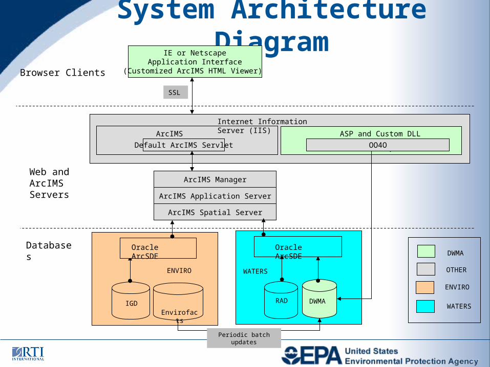
System Architecture Diagram
DWMA
Oracle ArcSDE
IE or NetscapeApplication Interface
(Customized ArcIMS HTML Viewer)
ArcIMS Spatial Server
WATERS
Browser Clients
Web and ArcIMS Servers
SSL
Databases
ASP and Custom DLL
OO4O
ArcIMS Connector
Internet Information Server (IIS)
ArcIMS Manager
Default ArcIMS Servlet
ArcIMS Application Server
Envirofacts
Periodic batch updates
RADIGD
Oracle ArcSDE
ENVIRO
DWMA
WATERS
ENVIRO
OTHER
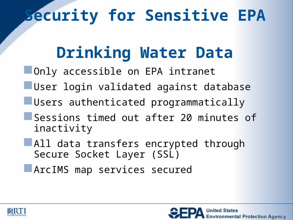
Only accessible on EPA intranet
User login validated against database
Users authenticated programmatically
Sessions timed out after 20 minutes of inactivity
All data transfers encrypted through Secure Socket Layer (SSL)
ArcIMS map services secured
Security for Sensitive EPA Drinking Water Data
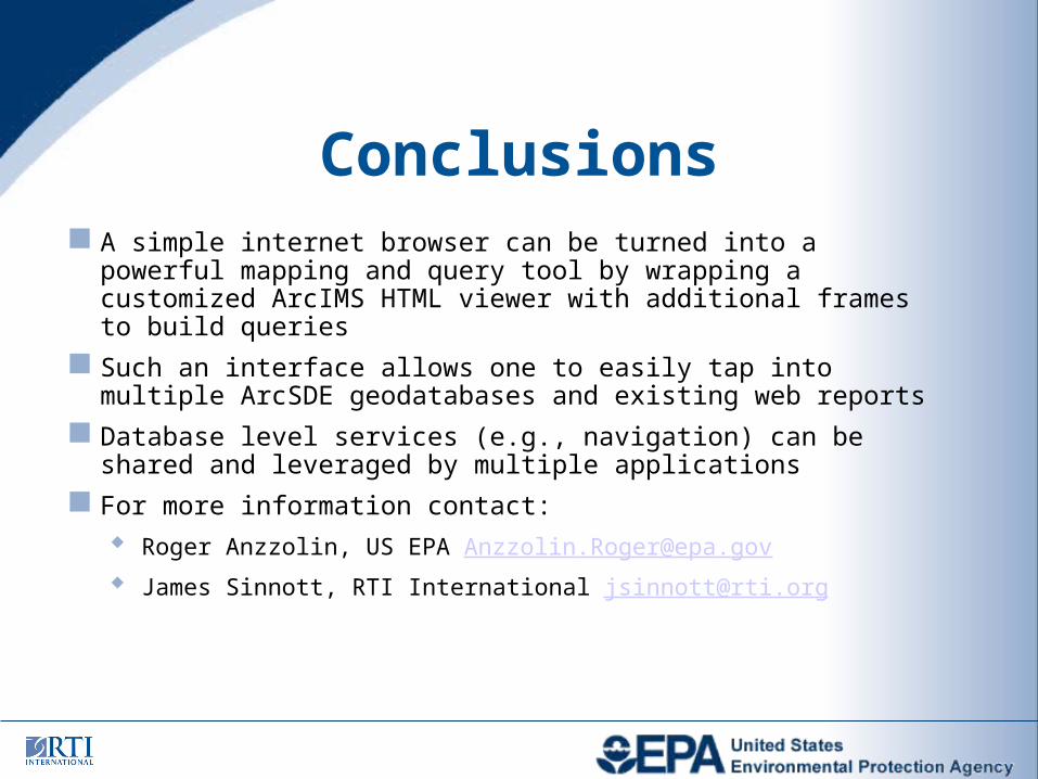
A simple internet browser can be turned into a powerful mapping and query tool by wrapping a customized ArcIMS HTML viewer with additional frames to build queries
Such an interface allows one to easily tap into multiple ArcSDE geodatabases and existing web reports
Database level services (e.g., navigation) can be shared and leveraged by multiple applications
For more information contact: Roger Anzzolin, US EPA [email protected]
James Sinnott, RTI International [email protected]
Conclusions


![Music History 220: History of Western Music IIwriting.umn.edu/tww/discipline/music/Mus220syll.pdf · Stolba score anthology [DWMA] ... DWMA 120, D. Scarlatti, Sonata in D major, K](https://img.pdfslide.us/doc/110x75/5b50dfb27f8b9a7b648b4e74/music-history-220-history-of-western-music-stolba-score-anthology-dwma-.jpg)