Embed Size (px)
Citation preview

Environmentally Sustainable River Restoration
Techniques
Italy, USA and Canada
Julie Tuck
Winston Churchill Fellow 2008

Contents: Introduction Aims Destination Travel Venice, Italy USA and Canada Lessons Learnt Appendix A: Itinerary Appendix B: Press Releases

Introduction: Freshwater science and management has been my career focus since leaving University and through this I have developed a keen interest in the physical management of rivers. I’ve seen many examples over the years of what not to do in a river, be it due to poor planning, inappropriate materials or having little understanding of the river system. I also think it is fair to say good examples of what engineering methods can be employed in a river either for habitat enhancement, flood defence or even small scale bank protection, are sometimes limited. It was with this in mind that I chose to go abroad to investigate the different practices that can be put to use on rivers. The Fellowship Aims The aims of my fellowship were to:
- investigate river restoration practices on varying river types subject to varying pressures in the North West USA
- to focus on environmentally sustainable or “soft” engineering techniques where possible
- and most importantly to see the work on the ground Instream and bankside engineering employed in river restoration projects generally aims to be environmentally sustainable, given the nature and driver for the work. So I focussed my efforts on visiting site specific restoration projects to see techniques employed, as I was keen to see alternatives to the more historic hard engineering practices or practices carried out on rivers that are inappropriate to the river type. This site specific approach was instead of taking a more holistic approach and looking at whole catchment scale projects. By way of explanation, when using the term hard engineering I mean the use of hard materials like concrete, gabions and sheet piling or highly degrading practices like dredging, channel realignment and culverts. These materials and practices are often associated with flood defence schemes, urban development and agricultural or forestry drainage. By activities inappropriate to the river type, which obviously includes the use of hard engineering, I also mean the management of a river in a way that is not considering the form, function or power of that river e.g. the input of croys or excavation of pools at a reach that, due to the physical attributes of that reach, are not appropriate in that location. Such activities can end up causing more harm than good. I was keen to see the good, the bad and the ugly during my trip! By visiting a range of projects I also aimed to learn what can be achieved realistically and where failures may occur. The Destination - The Pacific North West, USA & Canada; Venice, Italy.

I chose to visit the Pacific North West for a number of reasons. In the field of river management and restoration it is an area that is known for having numerous well funded projects on the ground. So there are plenty projects to chose from at varying scales of completion. It is also an area not dissimilar to the UK and particularly Scotland. The states of Washington and Oregon and British Columbia in Canada are hugely affected by the Pacific Ocean weather systems in the same way as we in the UK are affected by the Atlantic. There are numerous watersheds of varying river type in scale and form, some of which are similar to those of the UK. This meant I could try and relate the practices employed over there to here and hopefully draw relevant conclusions. The area also has a variety of anthropogenic pressures impacting on its watercourses from urban sprawl to deforestation to agriculture to large scale damming for water supply. At points in California I did venture inland however and although the climate was hugely different the issues and practices on the whole remained the same. Last but by no means least it is also an area I had visited, in part, before and had a handful of contacts there which made a very good starting point for the practicalities of trip organisation! The Travel I began my fellowship by travelling to Venice to attend the European Centre for River Restoration International Conference on River Restoration in June 2008. I followed this with a month long trip to Canada and the west coast of the USA. The itinerary of the trip can be found in Appendix A. San Servolo, Venice, 4th European Centre for River Restoration Conference on River Restoration 16th to 21st June
River restoration has become an important issue for Water Authorities, Agencies and river managers in Europe, especially with the arrival of the Water Framework Directive and other directives, such as the Habitats Directive and the future Floods Directive. In the last decade river restoration projects, aimed at enhancing degraded river habitats and improving the wider river landscape, have increased. These projects have improved the knowledge and understanding amongst practitioners in the field whether it is from a planning, hydrological, engineering or ecological perspective.
The ECRR wished to collaborate with other organisations and individuals operating in river restoration related sectors and share experiences, hoping to expand the opportunities for river restoration at a global scale. It was with this aim that the conference took place in June
The Conference themes covered restoration project planning, implementation and appraisal for different types of river systems including upland, lowland and urban rivers. Topic areas addressed during the event included hydrology, geomorphology, ecology and economics. This again was highlighting the fact that to be successful, restoration of freshwater ecosystems must incorporate all of these subjects within a holistic framework.

As the conference ran parallel work sessions I was able to move between themed sessions and sat in on many of the physical process themed talks. However for information and rather than append it to the report the full agenda and proceedings from the conference can be found at:
http://www.ecrr.org/conf08/programme.htm
I have been to a number of UK River Restoration Conferences in the past but this was my first European. From my perspective the trip, the first part of my fellowship, was not only the chance to attend a full and highly relevant conference but it also enabled me to renew contact with delegates from the UK and make contact with a number of American delegates, who proved very helpful in planning my North American trip. Delegates from all over Europe attended but there were also delegates from Asia, Australasia and North America. I even met a past Fellow, who just happened to be the only other delegate from Scotland! Quite a number of the presenters were from the west coast US, again highlighting the extent of restoration work and the level of expertise that exists in this area of the world.
Venice itself, which is actually under flood water as I type this in December was stunning and despite the full agenda I was able to tour the city for an afternoon. Staying less than a minute from St Marks Square however also insured I saw the sites daily whilst making my way by water bus to the conference on San Servolo Island, an island in the lagoon. I was glad all the student accommodation had been taken and I had to stay in the city itself as I think it gave a very different feeling to the trip….and a room to yourself is never such a bad thing!
North West USA, August 25th to September 24th 2008
I travelled down the North West Coast of the USA and Canada over a month, going from Seattle via Vancouver to follow a mainly coastal route to San Francisco and then Tahoe in California. I visited many rivers and projects along the way and I’ve detailed the who, what and where as I’ve gone along, although not in huge detail as I don’t think I’ve enough page allowance! I’ve used a lot of images in the hope that these explain things better than maybe technical text will but much of what I talk about is easily found nowadays via the internet should this interest anyone further.
Washington State
I landed in Washington State in Seattle and based myself there for the first few days of the trip. I arrived to pouring rain and thunderstorms, so felt quite at home….although after 3 days of it I was happy to be moving north of the bad weather. Id arranged a meet with contacts based in Seattle the day after I arrived and despite the jet lag it turned out to be the fullest day of the whole trip.

In and around Seattle
Hosts: King County Department of Water and Land Division and the Northwest Fisheries Science Centre, part of National Oceanic and Atmospheric Administration (NOAA).
Rivers: Raging River, Snoqualmie River, Green River, Ham Creek, Ravenna Creek
Methods: levee removal, boulder clusters, bank reinforcement / protection, vegetation management, large wood placements, day-lighting, channel creation (pool/riffle/meander)
The Raging River is a small, for the area, river about an hours drive from Seattle which was my first stop of the trip. Historically it was a very dynamic river but in reaches it has been contained by levees to protect housing and infrastructure. The river is now the home of a number of levee removal projects led by King County. One such project was a levee removal near a section of the Preston-Fall City road. It was not constructed to protect the road but to protect a single household opposite the road. The levee constricted the river into a fixed alignment and much narrower channel than would have been there naturally. The project removed the levee, input small scale bank protection on the toe slope near the road and carried out invasive plant control with replanting of native species.
The work was undertaken by Kings County in 2006, so we visited a couple of years after completion. Native plants were re-establishing well. In fact when standing on the site of the old levee it was thought that if the invasives are managed / controlled the need to plant may not be necessary as a native seed bank will allow regeneration when the conditions enable it to. A number of large floods had also acted to introduce large woody debris to the site, create side channels and generally move sediments around the reach unconfined. The toe reinforcement methods were overgrown and not very visible but I was shown a diagram of how clusters of boulders had been placed along the toe of the bank nearest the road. This was to act as a deflector to the flow and take some of the erosive energy out of the river. The lack of channel confinement also took the pressure of an eroding bank next to the single household.
The project is continually monitored and, as well as successful vegetation regeneration, both Chinook and Coho Salmon have been observed at the reach, with Chinook spawning there. It’s a fairly passive example of engineering, whereby removing a structure allows the river to re-establish itself and has meant active management is minimal.
The Snoqualmie River site visit was brief as the work had not been undertaken yet and is still under negotiation due to landowner issues, a common problem when it comes to restoration projects. The site was at a reach called Chinook Bend, a name that speaks for itself in terms of the wildlife importance. Chinook Bend Natural Area is 2 miles north of the City of Carnation and sits in the floodplain of the Snoqualmie River. The area will be the site of another levee removal project with further planting and large woody debris

placement. The removal of the levee will allow a currently drained and degraded wetland to re-establish. Although no work had been carried out what was noted was that on first sight the area in question did not actually look that degraded. However it is a site that historically would look very different and have larger fish numbers utilising the area than currently do. So the levee will be removed and again with minimal management hopefully more natural processes will re-establish within the reach.
Green River Log Jam Upstream warning signs on Green River
A number of sites were visited along the Green River. The Green River is located in southern King County and is one of the largest rivers in the county, flowing for 93 miles from the Cascade Mountains to Elliot Bay. Again we initially went to an area that hadn’t actually had work done on it yet but it was to be the site of another levee removal with wetland creation. It was the location of one of the largest log jams I had ever seen however. It isn’t all plain sailing for the County however, leaving log jams of this scale can still be seen as a hazard and signage is in place upstream to warn water users of the jam. The natural recruitment and deposition of wood in Washington rivers is in stark contrast to what we see over here in the UK. Our riparian zones are very limited, so recruitment of wood in many rivers is low. We have also historically removed wood from the channel, viewing it as an obstruction or flood hazard.
Nearby we did find an older project upstream of the jam which involved the creation of an artificial side channel. These side channels are seen as important habitat for spawning and rearing fish. At the time of the visit though the side channel created seemed to have been left high and dry due to a build up of woody debris at the mouth of the channel. This had been deposited from upstream but in part trapped by the log and root structures placed in the mouth of the new side channel, which as can be seen from the photo to the right were extensive. The best laid plans….!
The use of these large logs and root wads create
diversity within the channel, providing flow variation, enabling localised scour and deposition, as well as providing cover for juvenile fish. Logs and root wads (the base of trees with root networks intact) are either placed along the bank and secured there or driven into the bank. It was evident through out my trip that there is no necessarily right or wrong way to utilise wood but there were definitely differences in opinion in how to use it, particularly in how to secure wood in the channel. On this site on the green river there were logs driven into the bank, logs along the toe and logs secured by chains on the levee.
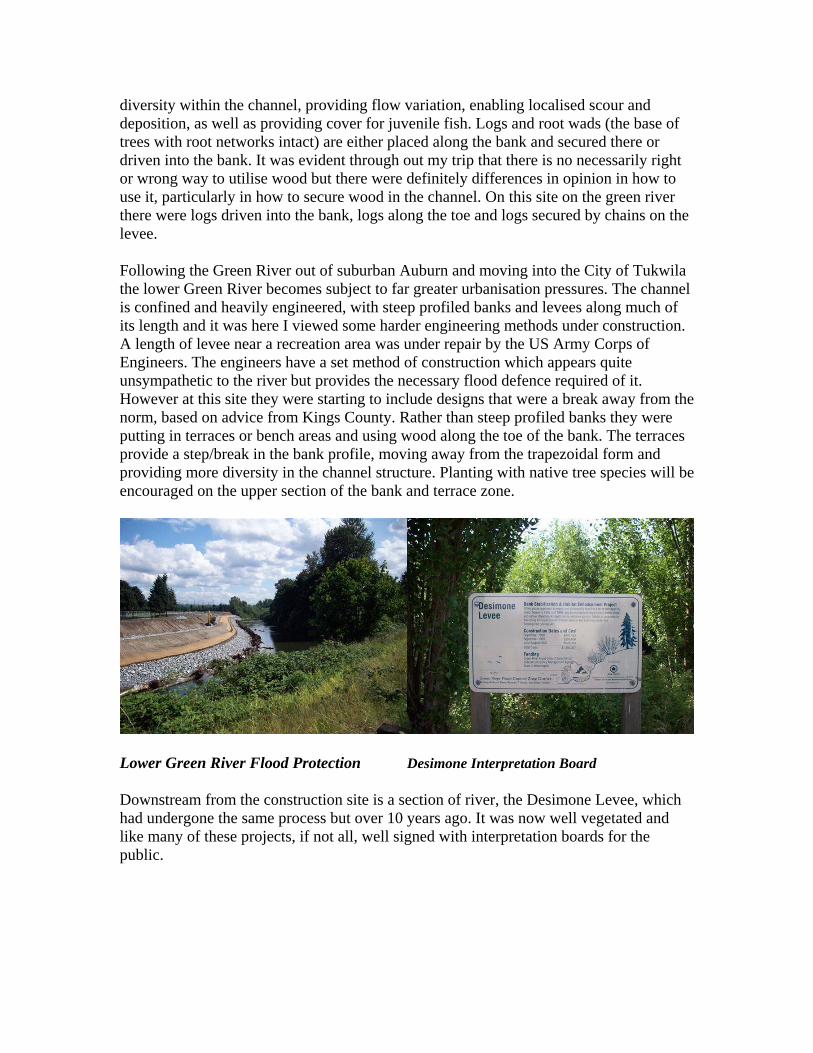
Following the Green River out of suburban Auburn and moving into the City of Tukwila the lower Green River becomes subject to far greater urbanisation pressures. The channel is confined and heavily engineered, with steep profiled banks and levees along much of its length and it was here I viewed some harder engineering methods under construction. A length of levee near a recreation area was under repair by the US Army Corps of Engineers. The engineers have a set method of construction which appears quite unsympathetic to the river but provides the necessary flood defence required of it. However at this site they were starting to include designs that were a break away from the norm, based on advice from Kings County. Rather than steep profiled banks they were putting in terraces or bench areas and using wood along the toe of the bank. The terraces provide a step/break in the bank profile, moving away from the trapezoidal form and providing more diversity in the channel structure. Planting with native tree species will be encouraged on the upper section of the bank and terrace zone.
Lower Green River Flood Protection Desimone Interpretation Board
Downstream from the construction site is a section of river, the Desimone Levee, which had undergone the same process but over 10 years ago. It was now well vegetated and like many of these projects, if not all, well signed with interpretation boards for the public.

Whilst in and around Seattle, I visited two projects to daylight streams, Ham Creek and Ravenna Creek. These separate projects took two streams out of culverts or pipes into reconstructed engineered channels and wetlands. The engineered channels aim to mimic, as best they can, the likely former path and structure of the stream. The route of the stream to be engineered is normally interpreted via historic maps and aerial photographs or sometimes even local knowledge. In Ravenna Creek, above, they recreated meanders and weirs using boulder and wood placements. Both projects had a successful re-vegetation programme associated with the works, particularly in the case of Ravenna Park, as can be seen in the previous photo. The vegetation, along with the wood and boulders, diversifies flow in the stream leading to increased instream habitat diversity. Good instream cover and flow diversity also improves conditions for instream fauna. The work not only aimed to restore the channel to improve the habitat and biodiversity of the creek but it also improved the drainage and increased the aesthetics of the sites.
Maintaining and restoring the health of rivers in Washington is a well funded and fairly public affair. Not only was there interpretation at many of the sites I visited but even when I was out and about site seeing, I noticed the interpretation boards at ferry terminals explaining the importance of the Puget Sound and its biodiversity or images of whales on drains to warn of the pollution risks, like the one to the left on a road drain on Bainbridge Island. It all seems far more ‘high profile’ than in the UK and there definitely seems to be greater public
engagement in the process of environmental protection.
Northern Washington – Skagit River Catchment
Hosts: Skagit River System Cooperative
Rivers: Swinomish Channel, Fornsby Slough, Wiley Slough
Methods: estuarine restoration, input of self regulation tide gate, vegetation management, removal of sea dikes, drainage maintenance
I organised to meet up with the Skagit River System Cooperative (SRSC) whilst travelling north from Seattle to Vancouver. The SRCS provide natural resource

management services for two tribal groups in the area, the Sauk-Suiattle Indian Tribe and the Swinomish Indian Community. The Co-op’s primary aim is to improve fisheries management within the tribes fishing areas, the Skagit and Samish River Basins. They aim to do this by protecting existing functioning ecosystems and by restoring degraded systems that no longer function within their expected natural range. The Skagit River is approximately 150 miles long and runs from southern British Columbia in Canada through north west Washington to drain into the Puget Sound. The Samish River Basin is much smaller, the river length is approximately 25 miles and it drains from the hills south of Bellingham, Washington to empty into the Puget.
My visit to the Skagit Coop coincided with some construction work they were undertaking on a couple of estuarine restoration projects. Although estuarine restoration is not a process I was aiming to look at, I was very interested to see what was going on having never seen anything like it in Scotland.
Approximately 70% of estuarine wetlands in the Puget Sound have been lost in the past 150 years, much of which has been reclaimed for agriculture. These lost habitats were highly important for fish and other wildlife, in fact their restoration is seen as vital for the recovery of wild Chinook populations in the area. Of all the Pacific species, Chinook are the most dependant on estuarine zones. The Skagit River is home to 6 of the 22 populations of wild Chinook salmon in the Puget Sound that are listed as threatened under the Endangered Species Act. I was very aware through out my trip that it is this piece of legislation that is driving much of the river restoration work in the North West. Some rivers or reaches in the North West appear to be engineered to designs most suitable to support salmon populations or to support a specific species of salmon. My impression was this may not always be in keeping with what would naturally be occurring on the river and that maybe the funding driver has in some instances dictated
the restoration methods.
However, the first of the two projects I visited with the Skagit Coop was on the North Fornsby Floodplain. It was a work in progress when I arrived as they were putting in a self regulating tide gate (SRT). This gate will replace an old failing conventional flap gate which had become blocked over the years, resulting in a barrier to migrating fish. The new tide gate will improve fish access and extend the fresh-salt water mixing zone. Basically it
will reopen an estuarine-riparian channel to fish and improve the associated aquatic habitat that lies behind the tide gate.
We visited another estuarine site that has been a while in the planning due to some contentious issues with regards local bird hunters and the Skagit Watershed Council.

Wiley Slough is a much bigger project than North Fornsby; it even has its own website: http://www.wileyslough.org.
The aim at Wiley Slough is to remove 6500 feet of sea dykes, construct a new improved tide gate and re-develop the existing drainage ditches. The result of this work should hopefully be the restoration of about 157 acres of ground to tidal and riverine floodplain.
The driver behind this project is to reinstate the natural processes of the Slough to a more self sustaining state.
This in turn should provide the conditions to support natural flora and fauna typical of the area, particularly Chinook. By focussing on restoring the natural processes of the system it is likely the project will require less human intervention and management long term, therefore it is a more sustainable environmental option.
To put the scale of this project in perspective, a 2005 report on the proposed work at Wiley Slough estimated a preliminary cost to construct the project at $2,806,545. In Scotland SEPA announced this year that a fund for restoring aquatic ecosystems has been established. This fund may reach one million next year and it will be the main source of funding for all restoration work in Scotland.
Canada – Vancouver, British Columbia
British Columbia is only the 5th largest of Canada’s provinces and territories but still covers a substantial area, 944,735km2 in comparison to the UK, 244,820km2. It’s an area famed for its natural beauty and numerous rivers, some of which have basin area’s larger than the whole of the UK. However despite the scale being beyond anything in the UK, the river types and the anthropogenic activities impacting on these rivers are still, as said, comparable.
Host: Dr Mark Johannes, Golder Associates / University of Victoria, BC
Rivers: Spanish Bank Creek, Capilano River, Musqueam Creek and storm-water run off channels Crown St
Methods: daylighting, channel creation (pool / riffle / meander input), bank reinforcement, vegetation management, hatchery, storm water management
I headed north from the Skagit River into Canada and based myself in Vancouver for a couple of days to meet up with a lecturer from the University of Victoria but based in Vancouver. I visited a number of small projects in and around Vancouver as well as travelling up the Capilano River to see the hatchery. The following day was set aside for

some sight seeing and I followed up my visit to the Capilano with a journey across the Capilano Swing bridge……not for the faint hearted! I couldn’t actually say I saw much of the river gorge though as was too focussed on hanging on and reaching the other side.
Spanish Bank Creek was my first site visit in Vancouver. The creek is part of a small low lying suburban catchment located in West Vancouver and flows through the Pacific Spirit Regional Park into English Bay at Spanish Banks Beach. Prior to this area being developed the creek supported salmon and their disappearance was again the driver to restoring the system. An impassable culvert was removed from the lower reaches of the creek and the channel was recreated incorporating log and rock placements, brush piles and riparian vegetation planting. The log and rock placements were used to create channel diversity. Logs were placed in the channel as well as being secured into the bank to act as flow deflectors. Rock was used to armour the banks along the beach reach. Gravel was also input, aiming to create suitable spawning habitat. The restoration of this channel continued across the beach to the bay where a beach meadow was created by planting up with dunegrass.
Work was undertaken between 1994 and 1999 on this site so it had over 10 years to establish by the time I visited. It was actually difficult to see what had been done at this site due to the success of the vegetation establishment, the channel was very overgrown and despite our best efforts to plough through it we didn’t get very far! Bar the visible reinforcement as the channel moves through the beach section it was hard to pick out what had been done but it would seem that the instream habitat creation has been a success for fish numbers at least with Coho and Chum that had been released into the stream returning to spawn.
Salmon were again drivers for the work going on at Musqueam Creek. At this creek I saw a site that had an undersized concrete culvert removed and replaced with a much larger natural bed arched bridge. These old culverts often restrict flow and sediment transport in a channel as well a limiting the mitigation of salmonids upstream. This site was downstream of the Crown St Sustainable Street project.
The Crown St project aims to improve the quality and quantity of storm water run of from an area of road in Southlands Community in Vancouver. As well as stormwater management the work aimed to tackle the aesthetics of urban drainage, the maintenance
requirements and traffic calming in the area. What made this different from the normal SUDs (Sustainable Urban Drainage) schemes we have in the UK is the level of unique design techniques that were applied in the drainage and profiling of the roadside swales and detention ponds. Innovative technologies and recycled materials were encouraged in the process. These included structural grass (a plastic honeycomb grid containing grass) and structural soil (mix of aggregate and sand/soil), both of which act to improve structural stability of

the verges whilst also allowing for effective drainage. Recycled concrete sidewalks were used to recreate crazy paving and granite curbs were used as weir drops along the swales. These swales were designed to cope with a one in ten year flood, allowing water to infiltrate the ground whilst being filtered by natural vegetation. The swales and detention ponds on the street were planted with numerous different species of native plant, as can be seen in the photo previous. Not only does this scheme provide obvious environmental benefit to the water quality and sediment influx to the Creeks nearby but I was informed that house prices in the street may also have improved due to the aesthetic appeal of the scheme.
As well as the hatchery on the Capilano I visited a stream that was a first for me, it was completely engineered. The stream was created within Stanley Park to mimic all that would be typical of a salmon stream in the Pacific North West condensed into one small stream in an urban park. It gave me a chance to see many of the techniques employed on rivers up close and easily accessible but not necessarily all however functioning as they would do in a natural river. The initiative was funded by BC Hydro to educate the public on the need for salmon restoration in the area.

Stanley Park Engineered Stream
Victoria – Vancouver Island
Following a couple of packed days in Vancouver, including a visit to Grouse Mountain and the grizzlies, I caught the ferry across to Vancouver Island and drove down to Victoria, the Capital of BC.
Hosts: Peter McCully, Fisheries Consultant; Steve Hocquard, Environmental Consultant
Rivers: Millstream; Goldstream River; Douglas Creek
Methods: fish ladder, side channel creation, log and rock jams (Newbury Weirs), log reinforcements, log placements (A frame), gravel augmentation
I spent a couple of days on Vancouver Island and one of those days was spent with Peter McCully, a local fisheries consultant working with Goldstream Hatchery and Salmonid Enhancement Association. Although I visited the hatchery I was most keen to see the work done on the ground to enhance/restore rivers in the area. The enhancement project is driven by the need to improve the declining salmon populations in the area and as well as the instream work a number of the rivers in the area are also subject to stocking of predominantly Coho but also Chum and Chinook from the hatchery. The fish numbers are then part of the ongoing monitoring that the instream projects are subject to, gauging the success of returning fish and using the data, in part, as an indicator of the success of the restoration projects.
Native design salmon sculpture – native artwork of Salmon was a common sight throughout the Pacific North West but particularly so in BC
The Millstream is a river near Victoria that’s part of an ongoing enhancement programme, including removing barriers to upstream migration of fish and habitat creation. Millstream Creek flows from the Gowlland Tod Range in the Highlands,

through View Royal, Colwood and Langford, into Esquimalt Harbour. CRD Parks, in partnership with the District of Langford, the Goldstream Volunteer Salmon Enhancement Association and Fisheries and Oceans Canada, constructed “fishways” in Millstream Creek to enable spawning salmon to travel up the stream. I visited with Peter and also a reporter from the Goldstream Gazette, who was very interested to hear of the “international” attention the work on the Millstream was receiving, one such fishway. The article that resulted from our visit is appended to the end of the report.
The ladder itself comprised rock steps excavated out of the rock face climbing up the side of an impassable waterfall. It looked more in keeping with the surroundings than many of the fish ladders I’ve seen before which are often concrete made block steps built next to the river. I’m afraid there are no photographs of this site visit though as a couple of days later I lost my camera to some snake infested grass at the side of a river on the Olympic Peninsula! Despite spending half the day retracing my steps (all 10m worth of them!), in 80 plus degrees and trying not to think of the wee snakes that slithered out of view ahead of me (not easy for someone from Scotland where the worst thing that can bite you is a midge) I lost my camera and three days of photos, including a whale watching trip, to the undergrowth. I think I learnt my lesson there to download my images every night!
I spent the day with the Goldstream and as well as the fishways and hatchery I visited a gauging site and a section of river where a side channel had been created to increase salmon rearing habitat as well as having a tour of the hatchery with Peter.
The next day I drove to the site of a project on the Douglas Creek. This was a brief visit but made quite an impression as they had done so much instream work over a fairly short length of river. I met with Steve Hocquard, a local consultant working on the project. The photographs of the site are also courtesy of Steve.
The Douglas Creek is located along the eastern edge of Mount Douglas Park. Its watershed is approximately 5.5km2 and much of it lies within Victoria. Its location means it has suffered extensively from urbanisation with over 30% of the catchment covered by impervious services and much of the creek now running through storm drains. Less than 1km actually remains above ground in the park and it is this 1km reach that I visited. The local salmon, coho and chum, disappeared from the creek over 60 years ago, in part due to poor ocean survival but also because of freshwater habitat degradation. There are obvious issues with water quality in the creek from polluted run off but generally it was believed the creek, with the necessary habitat improvements could support a viable salmon population.
With this in mind the Mount Douglas Park project focused their instream works on the habitat requirements of Chum, which are not so dependant on rearing habitat in stream. The creek was void of instream diversity, there was little substrate and much of the large woody debris (LWD) had been removed some time ago. Since 1996 there have been numerous restoration activities on the creek including salmon fry release, salmon carcass transplants, riparian zone revegetation and instream habitat improvements. The latter, the instream works, were the focus of my visit.

Lack of good spawning habitat was identified by Steve and his colleagues as a primary limiting factor to the success of salmon in the creek and it is this that drove much of the instream engineering design. A spawning gravel platform was constructed with a supporting riffle structure and this was followed by large woody debris and boulder structures, along with log and boulder weirs at various points along the steep sided creek. The spawning platform was achieved by constructing a weir of rock (known as a Newbury weir because of its design) with a riffle constructed downstream made up of various grades of substrate. The platform is then recreated upstream of the weir by depositing a volume of appropriate sized gravels. This was all constructed and designed after extensive studies of the stream and its flows to ensure that the placing, scale, substrate size etc were all appropriate to the nature of the system. Much of the work was done by hand in this instance but machinery was taken in for the large woody debris work downstream. The Douglas is however a very spatey stream due to the majority of it being urban and after completing the platform a 30 year storm occurred and washed much of the gravels out. I suppose you can only plan and design for so much in a project!
I was able to get a reasonable idea of the construction methods at this site as the river was very low and there were so many examples, some of which can seen below. The structures were put in based on generic guidance that is available for such features e.g. placements should extend into a percentage of the channel at given intervals based on the width of the channel. The preferred method in the use of wood here was to secure it to very large boulders with cables and /or drive the trunks into the bank. Steve was also able to explain some of the logistics of working in such a challenging location, the machinery utilised (a spider excavator) and the costs involved.

USA – Olympic Peninsula, Washington
After my visit to Douglas Creek and an afternoon whale watching, I headed back across to the US, arriving on the Olympic Peninsula that evening and driving to Port Townsend. The following day I was due to meet with Peter Bahls of the Northwest Watershed Institute and visit the Tarboo Creek, a creek undergoing restoration in a bid to improve not only the creek but also the bay it drains into. However this day happened to be my one day where everything went wrong! I arrived at the wrong location and was subsequently an hour late meeting Peter, then within 10 minutes of arriving on site with Peter I lost my camera and spent the rest of day looking for it. So that visit was pretty much written of. Although I did make it to the river I spent more time in it looking for my camera than anything else!
However the next day, after a night of good food and a bottle or two of wine to drown my sorrows, I was out on a more successful site visit on the peninsula.
Hosts: North Olympic Salmon Coalition (NOSC)
Rivers: Salmon Creek, Snow Creek, Chimacum Creek
Methods: contaminated land remediation, replant salt marsh, create tidal channels, riparian vegetation planting

The NOSC is a non-profit community based salmon recovery organisation. It provides funding, guidance, technical assistance and support for salmon habitat restoration and enhancement. It is one of fourteen regional fisheries enhancement groups located throughout Washington State. Again, although focussed on salmon the methods they use instream and bankside were of interest and I met with the NOSC on site at another estuary restoration project under construction.
The work they were involved in during my visit was on Salmon Creek Estuary but we also visited Snow Creek and Chimacum Creek. Salmon Creek and Snow Creek drain into Discovery Bay on the Olympic Peninsula. Salmon creek and its estuary have been prioritised by NOSC as part of a large project for restoration work to improve the instream and estuarine habitat. Chinook use the estuary for rearing, and coho salmon, steelhead and cutthroat spawn in both Salmon and Snow Creeks, hence the focus of the work.
A big part of restoring the estuarine zone was removing contaminated land from a woodwaste site that had been located on the edge of the estuary and leaking contaminants into the bay. The presence of a lumber mill on this site from the 50’s also resulted in blocked tidal flow and a depletion of the salt marsh as well as degraded water quality. The work was ongoing when I was on site, both the clean up and the creation of tidal channels. These channels will help provide a network of watercourses through the planted marshes. Whilst there, we also took a look at a completed phase of work upstream of the construction work on the estuary. A section of channel here, no more than 5m wide, was created and the creek was diverted out of the existing agricultural ditch it flowed through. It was here they had also placed a temporary fish trap, which had caught an impressive Chum Salmon in it when we got there. However you’ll just have to take my word for it as it never showed itself well enough or long enough for me to get a good photo!
Four miles south of Port Townsend is Chimacum Watershed, an area that is the subject of an extensive riparian planting project by NOSC. The river which drains 37km2 of land through 29.5 miles of low gradient streams is similar in size and scale to many in the UK, with forestry pressure in its uplands and urban pressures in the low lying areas. It flows out near a town called Irondale and as the name suggests it was an area subject to iron working, which also impacted on the watercourse. I visited some of the work done near the mouth of the river, where native trees had been planted along the bank face and top. This activity has been repeated at points through out the watershed. There is an element of trial and error with some of the planting though as not all the trees have taken but in the main the site and species selection is successful. The planting of vegetation along banksides is a very effective and sustainable method of bank stabilisation and by using native, locally sourced species it also enhances the native biodiversity of an area. The knock on effect of tree planting in a riparian zone is that it increases the input of leaf litter and woody debris to the riverine system, beneficial for instream fauna and habitat creation. The trees also provide instream cover through shading and this offers a variation in temperatures across the channel, again increasing its diversity.

Both these projects are part of a salmon stocking programme. Hatcheries are sometimes viewed as a contentious fish restoration method given they may not be the most sustainable long term method of conservation. However they have a definite economic value and where in combination with instream enhancement and a drive to restore natural processes, they could improve wild stocks by removing some of the fishing pressure.
Portland, North Oregon
From the Olympic Peninsula I made my way down the west coast of the Puget Sound, through southern Washington, across the Columbia River and into northern Oregon to Portland. I based myself here for the weekend and combined a couple of site visits with some site seeing, as the first 2 weeks of my trip were pretty hectic. The next two weeks of the trip were at a more laid back pace as I had been advised that the Oregon Coast and Northern California were something worth taking time to travel down so I didn’t want to rush.
Hosts: US Fish and Wildlife Services
Rivers: Lewis and Clark River, Columbia River
Methods: bank reinforcement / protection, riparian vegetation management, large wood placements, dam removal, boulder weirs, gravel augmentation, fish pass
I went out with a group to visit sites on the Oregon coast, including officers from the US Fisheries and Wildlife Service, who had worked on the projects and Robin Jenkinson from the Bonneville Environmental Foundation. I met Robin in Venice and she had been very helpful in putting me in touch with various people and groups in the area.
The first site visited was on the Lewis and Clark River, a tributary of the Columbia approximately 20 miles long. A local landowner had steadily lost land to the river and was concerned for a building near the river. Bank stabilisation was carried out on a meander bend of the river but the work was designed in a way as to also add instream habitat complexity. The toe of the bank was reinforced using rock and then wood and live stakes were put into the bank further up. The work was done 4 years ago and the live stakes had taken well, so the bank was now reasonably well vegetated and no longer eroding at the same rate towards the buildings. Flooding and bank erosion are a problem for many land owners in this area, which is subject to quite large floods but the landowner at the site was happy to try alternatives to traditional hard engineering and was pleased with the result. He was definitely of the opinion that the live stakes were the solution. Vegetated banks act to dissipate the energy of a river much more than bare banks or concrete lined smooth walls. The root networks of the stakes / trees once they developed acted very effectively to stabilise the banks and give them structure.
After viewing another site similar to the Lewis and Clark we drove on to South Fork Klaskinine River. This site was more complex, as it was the subject of a dam removal project which hadn’t gone exactly to plan. The dam was used by a local hatchery as an

off-take but also acted as a barrier to upstream migration of fish. A plan was designed for the reach of river upstream from the dam to improve the channel diversity, which included a number of rock weirs, gravel augmentation, log toe reinforcement with root wads mid bank and live alder stakes planted along the bank face. A number of things happened that I think had an impact on the outcome of the works; one being when the dam was taken out the channel incised by at least 5ft and the other was a large flood that occurred after the dam removal. The flood broke through the weirs, moving much of the large centre rocks forming the weirs and the channel incision left the root wads and trees high and dry.
As a lot of the bank work was visible I was able to get a good view of the design of the works, in particular what methods had been used to stabilise the log and root structures used. Previously I’d seen chains, boulders and cables used but here they attached logs to other logs using large metal rods driven threw. They believed this offered better stability and less risk should they move or be washed downstream e.g. cables can become wrapped round bridge piers. I was very interested in how they dealt with the
associated risk of this work (e.g. using wood rather than harder materials, creating weirs, inputting gravel) and how they measured that risk. It’s obviously impossible to remove risk completely and softer materials are not apt in all circumstances but hard materials also carry their own risk of failure. I’ve seen many examples of exacerbated bank erosion around gabion baskets for example. River engineering, particularly in more complex projects, will always have an associated risk of not performing exactly as “predicted” and it was pointed out that maybe testing designs or methods in more rural, less populated, areas to start with is the best way to progress. The problem in the UK though is being able to test out methods without fear of impacting on someone or something, even our rural areas are more populated than those in the Pacific North West. Plus the issues we’d often like to address in rivers are by their nature associated with more densely populated areas. However, it was good to know that there’s still not a necessarily right or wrong method or material to use in a given river, it’s as it is in the UK, very site specific.
Now half way through my trip I was impressed by the extent to which wood was utilised in restoration project construction. The selection of wood as a material seemed more commonplace that I would have thought, despite the fact that issues concerning longevity and maintenance may be viewed as more pressing in comparison to harder materials. The longevity of wood in river has been studied though. Logs of different tree species have an associated lifespan and will degrade at different rates. These studies could give a good indication of the potential maintenance associated with work dependant on what species of tree is used in which river type.

Before leaving Portland I managed to travel up the scenic Columbia River Gorge and visit the famous Bonneville Dam and its fish pass. The viewing windows allowed me the chance to see some of the different species of salmon up close, not that I saw many of them out with the confines of a fish pass or hatchery but I at least now had some idea about the physical variations of the species! Not such an issue at home where we only have the Atlantic.
Coos Bay, South Oregon
From Portland I travelled down the scenic Oregon coast heading for Coos Bay. I managed to get in a visit to the sand dunes national park on route and stayed in a motel on the mouth of the Siuslaw River, which provided some stunning views over the River to Florence and the Pacific. The next day I drove to Coos Bay to meet up with Jon Souder the Director of The Coos Watershed Association.
Oregon Sand Dunes Recreational Park
Hosts: Coos Watershed Association
Rivers: Larson Creek, Palouse Creek, Elk Creek
Methods: tidal gates, willow wattling bank stabilisation (woven willow stem walls), riparian vegetation management, large wood debris, culvert replacement, boulder placement
The Coos Watershed Association is a local non-profit organization formed in 1993. It’s a forum for people with a wide range of interests to get together along with individual landowners to decide how best to manage and restore the watershed’s natural systems. It aims to provide a framework to coordinate and implement proven management practices as well as testing new management practices. The watershed has an extensive restoration programme working on riparian zones, road (forest) related erosion control, fish passage and instream habitat structure.
The first two sites I visited with Jon were tidal gates with much the same issues as previous sites Id seen, although there is quite a bit of on-going research into the impact on fish movements on the Larson and Palouse Creeks as a result of these

gates. We next went upstream on the Larson to see some riparian planting and an area of bioengineered bank stabilisation. It was what we would refer to as willow wattling here, where willow stems are woven into a fence along the bank to provide erosion control and it can be seen in the photo above. It’s a practice that seems more suited to lower energy streams however and examples I’ve seen of it in the UK would maybe not be suitable for higher energy spatey rivers.
The majority of the day at the coos bay watershed was however taken up by a visit to a forest creek. It took a good hour’s drive up some of the most hair raising forest tracks I’ve been on before. Thankfully Jon is well used to the roads and negotiated the hairpin bends, rubble strewn tracks, pot holes and threats of on-coming logging trucks expertly in his truck! I doubt the hire car would have made it round the first bend.
Work on forest tracks here aims to minimise the sediment run of from the eroding tracks, which are subject to heavy traffic, high rain fall and poor drainage. Forest tracks have been identified as a major source of sediment input in many catchments; the high volume of fine sediment input to a river can have a significant impact on the system by, for example, smothering gravels and reducing the habitat available for spawning. The upgrade of drainage systems in the forests involves removing the small pipes that exist in many of the tracks and installing larger culverts. This upgrade of these tracks and improving the drainage associated with them is tackling the problem at source, rather than once the sediment is in the river. We visited a couple of sites in Elliot State Forest, one where they were about to install a larger culvert and another where the culvert was already in and they were now inputting woody debris. As you can see from the previous photo the culvert pipes being installed are substantial, the existing pipes are a fraction of the size. These oversized pipes will be part buried in the bed of the river and will allow greater flow and substrate movement through the system, along with improving fish access to upstream reaches.
As well as sediment run of from the tracks this watershed has been subject, like many, to the historic removal of wood from rivers. Wood was, and still is, viewed as a risk to be managed. However perceptions are changing and although debris dams still pose a flood risk, the value of wood in rivers is also recognised. Part of the enhancement plan for this system included the input of and here again they were following a different method than I had seen elsewhere. Woody brash and logs were dragged or rolled down the steep hill sides, into the upstream reaches and the river was allowed to move the wood downstream naturally. In a few instances they had secured logs but only by wedging them between existing trees or among exposed root systems. No boulders, cables, chains or other methods of securing the wood in place were used. As this is a harvested forest the deliberate input of wood is an aim to mimic what would be naturally occurring. The association are happy with results so far. The larger culverts and freer movement of

water, sediment and debris in the system allows the river to function as it should, which works towards the projects aim of improving the watershed habitat quality and diversity.
Logs awaiting input to Elk Creek
Northern California
After leaving Coos Bay I travelled down the coast and into Northern California with its Redwood dominated coastline and numerous State Parks. The area is totally stunning and well worth taking time in. I visited a few of the state parks down the coast and spent some time getting out and hiking about a bit. The visitor’s centre provided a wealth of information on the area, including pamphlets on work undertaken in the parks on watershed restoration and the protection of endangered species.
Weaverville, Trinity River Valley, Northern California
I spent a night and day on the coast and then headed inland to Weaverville. This road journey took me by surprise as I was yet again caught out by the distance on a map versus distance in reality….resulting in an evening driving up and down and round and round mountains! I got there eventually though and loved Weaverville. It was the most un-commercial and probably smallest of the towns stayed in during the trip and was well worth the drive. The Trinity River Valley itself is very scenic and, unless you know the area, probably not somewhere the average tourist would visit. It was also the start of temperature hike during my trip, hitting 80 or 90 degrees, compared to the barely 60 degree thunderstorms of Seattle.
Hosts: Dave Gaurman - Trinity River Restoration Programme

Rivers: Trinity River, Lewiston River
Methods: gravel augmentation, gravel bar creation, side channel creation, removal of berms, riparian planting, input of woody debris
I met with Dave Gaurman, a fluvio-geomorphologist with the Trinity River Restoration Programme in Weaverville. The Programme exists on the back of the Trinity River Flow Evaluation Study, an amalgam of studies into the impact of land use and damming on the Trinity and the resultant habitat alteration and salmon decline. It aims to rehabilitate the river and restore natural spawning levels of salmon and steelhead to pre-dam levels. Prior to damming the Trinity had an impressive run of wild salmon and steelhead, now the runs are predominantly hatchery based. For socio-economic reasons the Trinity was dammed in 1964 and between 75 – 90% of the inflow to the reservoir can be diverted to the Sacramento River, northern California. In less than 10 years the impacts on the wildlife in the river were evident. Dams are not the only problem in the watershed though, historically the area was extensively mined and the river dredged for gold from the 1840’s onward, with hydraulic mining continuing into the 1950’s. Its then industrial logging also increased. Both activities had a huge impact on the sediment dynamics of the river, with dredging in particular significantly altering the channels form and function.
I went with Dave to a few sites on the Lewiston and the Trinity, the first being downstream from a dam and the site of a significant gravel input project. I didn’t actually see the work in action and there was no visible evidence left at the site that the gravel augmentation had occurred but having seen the images below (courtesy of Dave) I was very impressed at the volume of gravel that the river had since moved but then again seeing the flow present I maybe shouldn’t have been so surprised! By inputting sediment in to the river in this way the programme hope to counteract the impact of the dam starving the downstream reaches of sediment. I’ve never come across the use of a conveyor belt to deposit gravel into the river though! This was on a whole other scale to what I’ve seen in Scotland.

Gravel augmentation downstream of dam on Lewiston (photo courtesy of D. Gaurman)
Gravel augmentation is often targeted to specific reaches and input to re-create specific features such as riffles or side bars. Here though the gravel was just deposited into the river at a time when extremely high flows had been released from the dam, with the aim that the river would move it downstream in its own time and deposit it out, which it did. There was however no specific tracking of this and no way of ensuring it will result in exactly what they would want in terms of fish habitat.
The Programme is also involved in an extensive project to flatten out old berms made up of the tailings from old mining works. The berms restricted the natural migration of the channel and were targeted as a priority in the restoration programme. In some cases they’ve removed the berm completely, in others they’ve broken up the edges and created notches in the berms to allow the river to break through. In one instance an artificial side channel was created of the main stem by breaking through a berm at points and dredging out a channel form.
In a similar fashion to the gravel, the Programme also input wood to the system by depositing brash and logs and allowing the river to move it and it to settle out naturally. This hasn’t always gone down well with locals who see it as a flood risk and would rather take it out. Likewise with planting vegetation along the banks, although they are planting along sections of the river there seems to be an aversion to it with a high percentage of “willow phobes”. Again as with many things it’s about slowly changing mind sets.
The Trinity has an extensive monitoring programme following fish populations but also the sediment dynamics of the river and the impact of the restoration work, so in time it will be very interesting to see the results.

Sonoma, California
I travelled down from the Trinity Valley to Sonoma on the lovely I-5, an interstate best avoided if you can but time was against me. I had initially made contact and hoped to meet up with a number of different groups around San Francisco including NOAA, UC Berkeley and a number of consultants but unfortunately for one reason or another, these meets were not possible. I did have a meeting set with The Sonoma Ecology Centre, an organisation actively involved in numerous projects in and around the Sonoma Valley.
Hosts: Sonoma Ecology Centre
River: Nathanson Creek
Methods: Invasive species control
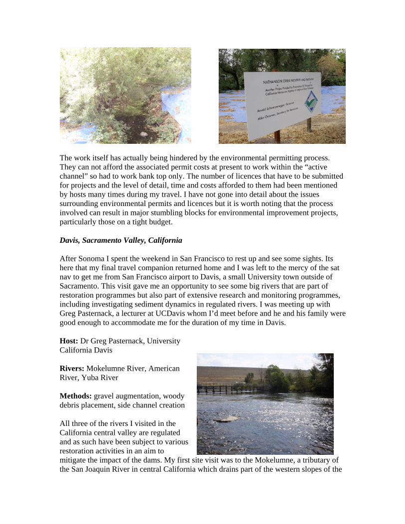
The Ecology Centre is a non profit organisation working towards the sustainable ecological health of the valley through research, restoration and education. Much of the work revolves around monitoring and restoring watersheds in the area and I visited one site in Sonoma City itself.
Nathanson Creek is and urban stream impacted by all the problems normally associated with the urban environment e.g. storm water run of, channelization, culverting. It drains the valley from the north east of Sonoma, eventually merging with Sonoma Creek before it drains into San Pablo Bay. This project, the Nathanson Creek Preserve and Parkway project, differed from many Id seen so far in its setting and that it was not driven by restoring fish habitat, it was specifically aiming to restore the riparian vegetation of the reach by targeting invasive species removal in the riparian zone. It also had significant community input and general awareness raising attached to it, maybe not surprising given the location.
The main aim of the work I viewed on the ground was to control Blackberries. The presence of this species was common through out my site visits along the west coast and there are various methods to control it from smothering to herbicides. As can be seen from the photo’s below the Centre were using large tarps to smother out the cut back blackberries. They then hope to re-plant the bare ground with native riparian species as well as developing an area within the park to be planted with only native Sonoma vegetation.
The work itself has actually being hindered by the environmental permitting process. They can not afford the associated permit costs at present to work within the “active channel” so had to work bank top only. The number of licences that have to be submitted for projects and the level of detail, time and costs afforded to them had been mentioned by hosts many times during my travel. I have not gone into detail about the issues surrounding environmental permits and licences but it is worth noting that the process involved can result in major stumbling blocks for environmental improvement projects, particularly those on a tight budget.
Davis, Sacramento Valley, California
After Sonoma I spent the weekend in San Francisco to rest up and see some sights. Its here that my final travel companion returned home and I was left to the mercy of the sat nav to get me from San Francisco airport to Davis, a small University town outside of Sacramento. This visit gave me an opportunity to see some big rivers that are part of restoration programmes but also part of extensive research and monitoring programmes, including investigating sediment dynamics in regulated rivers. I was meeting up with Greg Pasternack, a lecturer at UCDavis whom I’d meet before and he and his family were good enough to accommodate me for the duration of my time in Davis.
Host: Dr Greg Pasternack, University California Davis
Rivers: Mokelumne River, American River, Yuba River
Methods: gravel augmentation, woody debris placement, side channel creation
All three of the rivers I visited in the California central valley are regulated and as such have been subject to various restoration activities in an aim to mitigate the impact of the dams. My first site visit was to the Mokelumne, a tributary of the San Joaquin River in central California which drains part of the western slopes of the

Sierra Nevada’s. It has four large reservoirs on it and my site visit started at a reach downstream of the Camanche Dam. A gravel rehabilitation project has been ongoing here since 1999 and washed floodplain gravel had been placed in the river over a 1km reach at various dates since then, building up the bed of the river. It was hoped this would improve in-channel flow and habitat diversity, improving the conditions for spawning and rearing. It would have been difficult to see the results of this but I walked the reach instream and definitely noticed when we got to the end of the augmented reach and had to step down to the level of the existing channel bed! The image previous is of the augmented river reach and the embanked area cutting across the back of the image is the dam.
Again wood structures, like the A frame log and boulder structure to the left, debris dams and boulders were also input to this reach. These structures, along with the whole reach, are currently being studied by UC Davis looking at flow and substrate variation and habitat creation, as always linked to suitability for salmon.
Next we moved to the American River, near Sacramento. This river also drains the western slopes of the Sierra Nevada’s, through Sacramento before it joins the Sacramento River, which drains into San Francisco Bay. We stopped at three sites along this river, 2 were to be the subject of future works (gravel augmentation and side channel creation) and the third was a site where a side channel had been created a number of years ago. This side channel (photo below) was simply excavated out of the floodplain, following a route based on historic maps. It is now dry as the river moved its course after it was created. There is always the risk with works such as these that the river will respond in a way that wasn’t predicted at the time and the work will fail. Monitoring of the site pre and post works could provide a warning of such events occurring but often the funding for such long term study is not available. Restoration funding is often available only for the work itself but not the associated monitoring. This means gauging the success of projects and in particular, for me, the success of the different methods used can be quite difficult. However, there is hope to re-instate this side channel but no plans have been drawn up as yet.

The next day we headed up to another major dam on the Yuba. Downstream of it was the site of more gravel augmentation, similar to that done on the Lewiston (Trinity). As far as we could tell much of the gravel had been washed downstream as intended. How sustainable practices such as this are seems up for debate but as long as there are dams there will be rivers starved of sediment and as it is not feasible to remove all dams the next best solution appears to be to manually transport the sediment into the rivers. This method of dumping in large volumes and allowing the river to move it is also less intensive than manually trying to recreate instream features through out the system. However if the intended result of the work is purely to recreate suitable fish habitat then it carries a higher risk of not delivering exactly what some may want to see. I would assume that there is no guarantee the gravels input will form the exact riffle, pool, spawning bed areas that a fishery biologist may be looking for!
There has been quite a bit of research into sediment transport on this river by UC Davis and one of the other sites visited was a study reach downstream from the dam and the gravel input. This site, photo to the right, was looking at the sediment dynamics of the river under varying flows and the resultant spawning incidents. The study in this area is on-going.
I spent my last day in Davis up at the University, reading through papers on some of the research carried out on the three rivers Id visited and preparing for my trip to Tahoe. It wasn’t looking good for meeting my contact and as it turned out the day I made it to Tahoe he cancelled suggesting next week, when I was back home, as an alternative. Luckily I had a back up plan and had a number of sites I could go visit alone.
Lake Tahoe, California
I made it to Tahoe on the last weekend of my trip and I based myself in South Tahoe at the south of the Lake with easy access to the three site visits.
Hosts: None, but site information was thanks to Mitch Swanson, Swanson Hydrology and Geomorphology Consultants and Craig Oehrli, US Forest Service
Rivers: Blackwood Creek, Cookhouse Stream, Trout Creek
Methods: re-meandering channels, gravel augmentation, rock weirs, vegetation management, log jams, rock toe reinforcement

Emerald Bay – Lake Tahoe
Cookhouse Stream and Blackwood Creek Restoration are both projects lead by the Tahoe Basin US Forest Service. The Cookhouse Stream project, as I discovered once I eventually found the site, aimed to restore a reach of channel running through a meadow and was fairly remote……so finding coyote and other unidentifiable animal prints in the river bed meant I didn’t linger to long on my own! The stream is a tributary of the Upper Truckee River and receives most of its annual precipitation in the form of snow. It was dry when I visited but this enabled me to see more clearly the work that had been carried out. Apparently the stream had incised over time as a result of varying factors from over grazing to high flood flows. An incised stream is a stream that in part no longer connects with its floodplain as it would in normal conditions. Which means the meadows flooding regime was altered and that downstream from the site also experienced increased flooding.
The work undertaken on the stream in 2005 and 2006 was to recreate a more natural channel, based on historic data and images. I wasn’t under the impression from what Id seen that they’d actually recreated the whole channel, but the instream work was very evident. They had aimed to recreate a channel that would store and transport sediment and had designed features instream to promote this, mainly through the creation of what appeared to be a step – pool scenario. Gravel was built up behind rock weirs, followed by a drop in elevation in the stream and then a build up of further sediment downstream. This was repeated at varying intervals along the reach length. The plan is to monitor for a further 10 years at this site to gauge its success. Management of the site post construction has been considered in this project and the management will be adapted to the outcomes of the monitoring. This again is something that sometimes is overlooked or under funded in many restoration projects.
Blackwood Creek watershed delivers the largest volume of fine sediment per square mile of any of Lake Tahoes feeder streams. The cause of this has been identified as historic anthropogenic activities, including channelisation, logging and mining. The result of this

is 3-4 miles of main stem channel classed as unstable with excessive bank erosion. The work programmed for this section of main stem focussed on promoting natural processes within the system to reduce the fine sediment input and transport. Work at Blackwood Creek was in its final phase when I visited. I couldn’t get close to the site of the new works but I found a site of a previous phase of works upstream.
The site at Blackwood Creek was downstream from a bridge. The channel at this point was wide and split by an island. The channel was rock lined at the toe and it looked like they were trying to create multiple channel threads. At this reach there was significant use of wood and boulder structures as well. It looked to be one lengthy, slightly disparate log jam. This structure acts to dissipate the flow, moving scour away from bank toe and reducing the erosion force on the banks, as well as creating instream diversity. It also mimics what you would normally find in a forested stream i.e. wood. Although the channel was at very low flow when I was there it is obviously capable of transporting very large flows and the logs in this project were well secured with large boulders and cables.
Blackwood Creek – Wood and Boulder Structures
Finally I visited Trout Creek, another tributary of the Upper Truckee River and the fourth largest tributary to Lake Tahoe. The work on this site was similar to that on Cookhouse but was led by the City of South Lake Tahoe and the California Tahoe Conservancy. Work carried out at his site aimed to restore a stretch of creek that had been realigned along the edge of a meadow in the 1950’s. The project took the channel back to meandering through the meadow mimicking its original path. Much of the work at this site was done in 2001 and the riparian vegetation appeared to have re-established well. It was still

possible to see areas of gravel augmentation and small log jams along the reach, as well as natural bank erosion as the channel moved more freely within the floodplain area and natural recruitment of woody debris was also evident.
Lake Tahoe was the final leg of my trip and it was from here I made my way back to San Francisco and my flight back to the UK. Although tired and I think in need of a holiday at the end! I was very pleased to have successfully made all but one of my site visits and saw everything I hoped to see and more.

Lessons Learnt and Conclusion
I learnt a lot from my fellowship, far more than just what I set out to see and I’ve detailed the key points I think I’ve taken from my visit below.
Key lessons learnt from fellowship:
- softer engineering approaches can form an integral part of river restoration and river engineering designs and can be applied across river types
- wood can be a key material in river engineering with numerous methods available to utilise it
- there will not always be a consensus on the best way to employ various engineering methods.
- risk has to be factored in to any project but still cant always be quantified as precisely as we may like
- approaches employed are very site specific. Designs for one river may not transfer easily across to another but methods can.
- pre and post monitoring is vital to build an understanding of the system and the engineering methods used, as well as to gauge the success of the project
- restoration projects and their design are often restricted by funding availability and licensing
Overall the trip was a great learning experience, not only in terms of what I gained in understanding about rivers but also what I gained from the travel itself. I can now, alone, drive myself out of San Francisco airport, an achievement in itself I think! Also since starting to write this report I have gained a new job as a Restoration Specialist in SEPA and am sure the fellowship played a part in my achieving this new job. I think this is a great conclusion to my fellowship and report and my thanks again go to the Trust for enabling me to undertake what has definitely been a life changing experience.

Appendix A: Itinerary
Date Location / HostSunday 24th August Travel to EdinburghMonday 25th Edinburgh to SeattleTuesday 26th Kings County visits around SeattleWednesday 27th Ravenna Park; Bainbridge Island; SeattleThursday 28th Skagit River Coop; drive to VancouverFriday 29th Vancouver Site visitsSaturday 30th Grouse Mountain; Capilano Bridge; Vancouver Sunday 31st Travel to Vancouver IslandMonday 1st September Goldstream visitsTuesday 2nd Douglas Creek visit; whale watching; travel to Olympic PeninsulaWednesday 3rd Lost camera dayThursday 4th Port Angeles - NOSC; Travel to OregonFriday 5th Portland - Oregon coastal streams visitsSaturday 6th Portland Sunday 7th Columbia River valley and Bonneville DamMonday 8th Travel to Coo's Bay via Oregon Sand DunesTuesday 9th Coos Bay site visitWednesday 10th Travel via Redwoods to Trinity RiverThursday 11th Trinity River visit; Travel to SonomaFriday 12th Sonoma site visitsSaturday 13th San FranciscoSunday 14th San FranciscoMonday 15th Travel to DavisTuesday 16th Mokelumne and American River site visitsWednesday 17th Sacramento and Yuba site visitsThursday 18th UC DavisFriday 19th Travel to Tahoe; Cookhouse Meadow visitSaturday 20th Blackwood Creek and Trout Creek visitSunday 21st Rest and write upMonday 22nd Travel to San FranciscoTuesday 23rd Flight back to UKWednesday 24th Arrive in Edinburgh, drive back to Inverness

Appendix B: Press Releases

Press cutting, Inverness Courier, May 2008

Press cutting, Press and Journal, June 2008

Intranet article, Scottish Water and Scottish Water Solutions Intranet, April 2008

Press cutting, Inverness Courier, January 2009

Goldstream News Gazette, press cutting, September 2008. Image courtesy of Amy Dove, Goldstream Gazette