Embed Size (px)
Citation preview
Environmental Consequences of
Protection Schemes
Environmental Consequences of
Protection SchemesCEE 129: Stanford University
Project on Engineering Responses to Sea Level Rise
Katie Jewett FALL 2010
CEE 129: Stanford University Project on Engineering Responses
to Sea Level RiseKatie Jewett FALL 2010
OverviewOverview
Ecosystem Services Impact Assessment Valuation Techniques Case Studies:
Port of LA/Long Beach*Port of Providence
Ecosystem Services Impact Assessment Valuation Techniques Case Studies:
Port of LA/Long Beach*Port of Providence
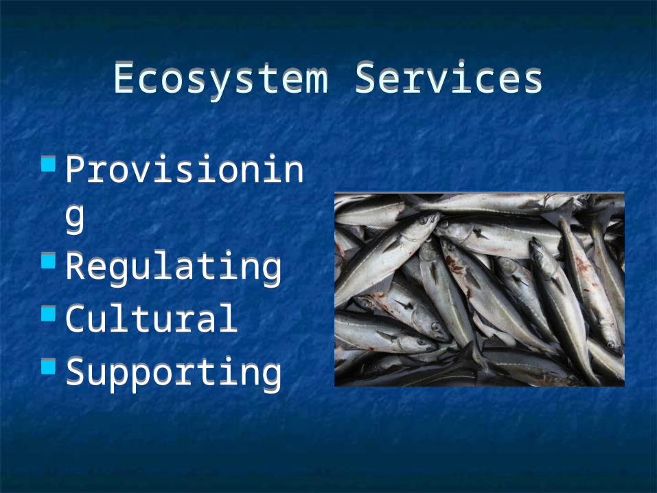
Ecosystem ServicesEcosystem Services
Provisioning Regulating Cultural Supporting
Provisioning Regulating Cultural Supporting
Impact AssessmentImpact Assessment
1. Measurement What are the quantitative metrics by
which this project will impact the surrounding environment?
2. Assessment What are the ramifications of the
proposed construction activities? 3. Valuation
Market and non-market techniques
1. Measurement What are the quantitative metrics by
which this project will impact the surrounding environment?
2. Assessment What are the ramifications of the
proposed construction activities? 3. Valuation
Market and non-market techniques
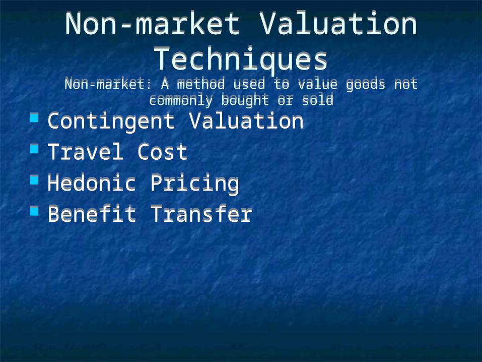
Non-market Valuation Techniques
Non-market: A method used to value goods not commonly bought or sold
Non-market Valuation Techniques
Non-market: A method used to value goods not commonly bought or sold
Contingent Valuation Travel Cost Hedonic Pricing Benefit Transfer
Contingent Valuation Travel Cost Hedonic Pricing Benefit Transfer
Case Study: Port of LA/Long Beach
Case Study: Port of LA/Long Beach
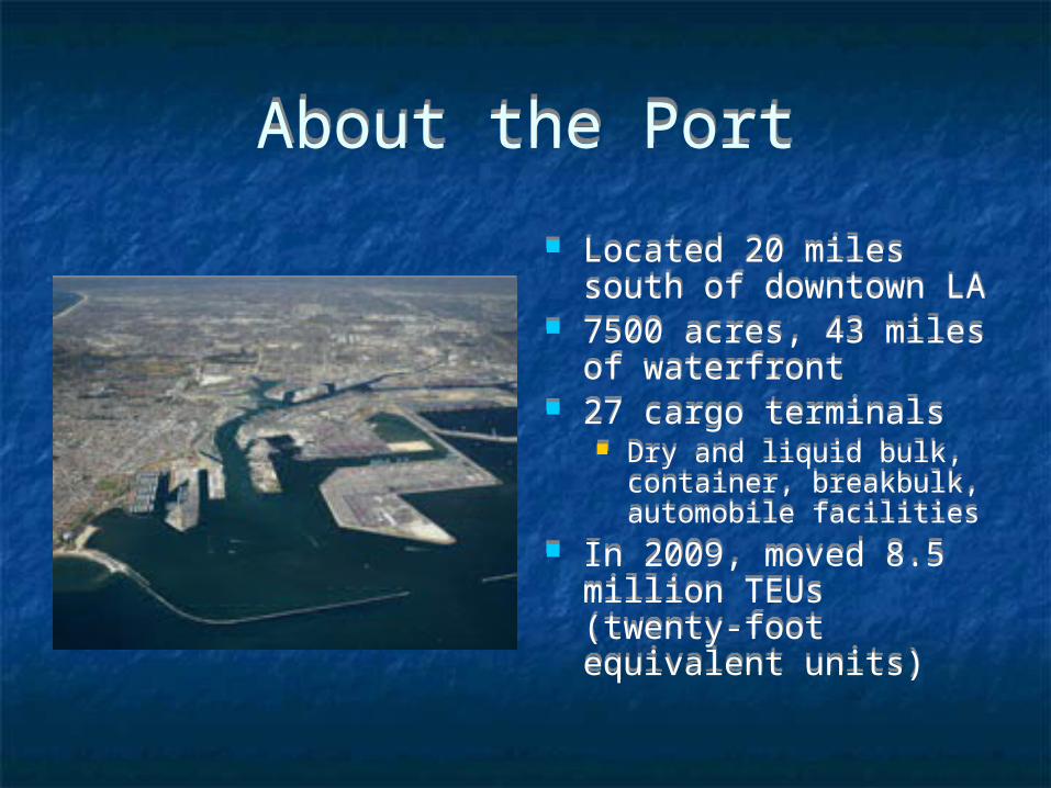
About the PortAbout the Port
Located 20 miles south of downtown LA
7500 acres, 43 miles of waterfront
27 cargo terminals Dry and liquid bulk,
container, breakbulk, automobile facilities
In 2009, moved 8.5 million TEUs (twenty-foot equivalent units)
Located 20 miles south of downtown LA
7500 acres, 43 miles of waterfront
27 cargo terminals Dry and liquid bulk,
container, breakbulk, automobile facilities
In 2009, moved 8.5 million TEUs (twenty-foot equivalent units)
Plans for SLR?Plans for SLR? Dr. Bob Kanter (Managing Director of
Environmental Affairs for Port of Long Beach) Terminals 12-15 ft above mean lower low water
(mllw) Terminals and berthing areas undergo
reconstruction approximately every 20-30 yrs With current uncertainties in the exact predicted
figure for SLR, there are no current plans to guide future development, or re-development, of existing port facilities.
USACE No current plans to update federal breakwaters
protecting POLA/LB
Dr. Bob Kanter (Managing Director of Environmental Affairs for Port of Long Beach)
Terminals 12-15 ft above mean lower low water (mllw)
Terminals and berthing areas undergo reconstruction approximately every 20-30 yrs
With current uncertainties in the exact predicted figure for SLR, there are no current plans to guide future development, or re-development, of existing port facilities.
USACE No current plans to update federal breakwaters
protecting POLA/LB
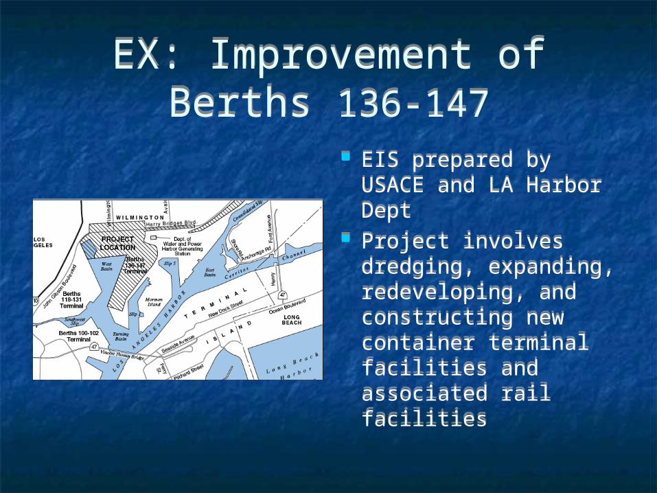
EX: Improvement of Berths 136-147
EX: Improvement of Berths 136-147
EIS prepared by USACE and LA Harbor Dept
Project involves dredging, expanding, redeveloping, and constructing new container terminal facilities and associated rail facilities
EIS prepared by USACE and LA Harbor Dept
Project involves dredging, expanding, redeveloping, and constructing new container terminal facilities and associated rail facilities
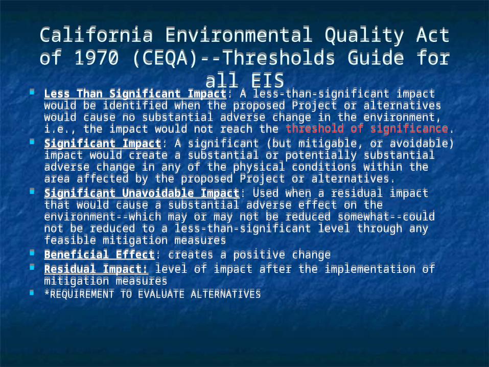
California Environmental Quality Act of 1970 (CEQA)--Thresholds Guide for all EIS
California Environmental Quality Act of 1970 (CEQA)--Thresholds Guide for all EIS
Less Than Significant Impact: A less-than-significant impact would be identified when the proposed Project or alternatives would cause no substantial adverse change in the environment, i.e., the impact would not reach the threshold of significance.
Significant Impact: A significant (but mitigable, or avoidable) impact would create a substantial or potentially substantial adverse change in any of the physical conditions within the area affected by the proposed Project or alternatives.
Significant Unavoidable Impact: Used when a residual impact that would cause a substantial adverse effect on the environment--which may or may not be reduced somewhat--could not be reduced to a less-than-significant level through any feasible mitigation measures
Beneficial Effect: creates a positive change Residual Impact: level of impact after the implementation of
mitigation measures *REQUIREMENT TO EVALUATE ALTERNATIVES
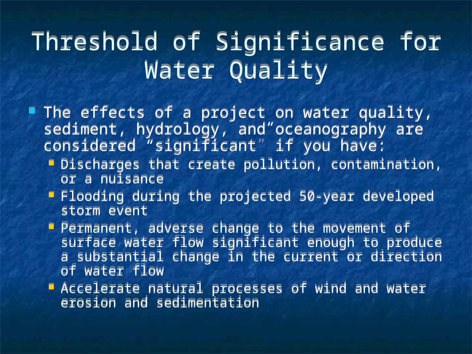
Threshold of Significance for Water Quality
Threshold of Significance for Water Quality
The effects of a project on water quality, sediment, hydrology, and oceanography are considered “significant” if you have: Discharges that create pollution, contamination, or a
nuisance Flooding during the projected 50-year developed
storm event Permanent, adverse change to the movement of
surface water flow significant enough to produce a substantial change in the current or direction of water flow
Accelerate natural processes of wind and water erosion and sedimentation

Example of Construction Impacts on Water Quality for
Berths 136-147
Example of Construction Impacts on Water Quality for
Berths 136-147 The level of significance is determined by applying
the threshold of significance (significance criteria) presented for each resource evaluation area.
“Impact WQ-1b: Runoff from backland development/redevelopment could create pollution and contamination or cause regulatory standards to be violated in harbor waters.”
CEQA Impact Determination Mitigation Measures: No mitigation measures
would be required for impacts of onshore construction to water quality
Residual Impacts: Would be less than significant
The level of significance is determined by applying the threshold of significance (significance criteria) presented for each resource evaluation area.
“Impact WQ-1b: Runoff from backland development/redevelopment could create pollution and contamination or cause regulatory standards to be violated in harbor waters.”
CEQA Impact Determination Mitigation Measures: No mitigation measures
would be required for impacts of onshore construction to water quality
Residual Impacts: Would be less than significant
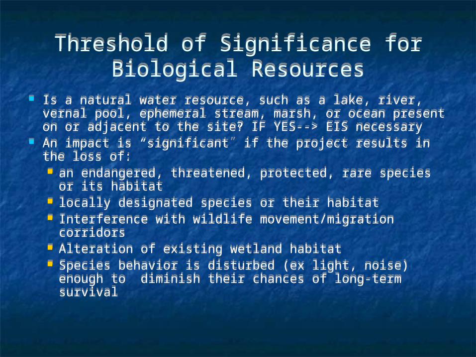
Threshold of Significance for Biological Resources
Threshold of Significance for Biological Resources
Is a natural water resource, such as a lake, river, vernal pool, ephemeral stream, marsh, or ocean present on or adjacent to the site? IF YES--> EIS necessary
An impact is “significant” if the project results in the loss of: an endangered, threatened, protected, rare species or
its habitat locally designated species or their habitat Interference with wildlife movement/migration
corridors Alteration of existing wetland habitat Species behavior is disturbed (ex light, noise) enough
to diminish their chances of long-term survival
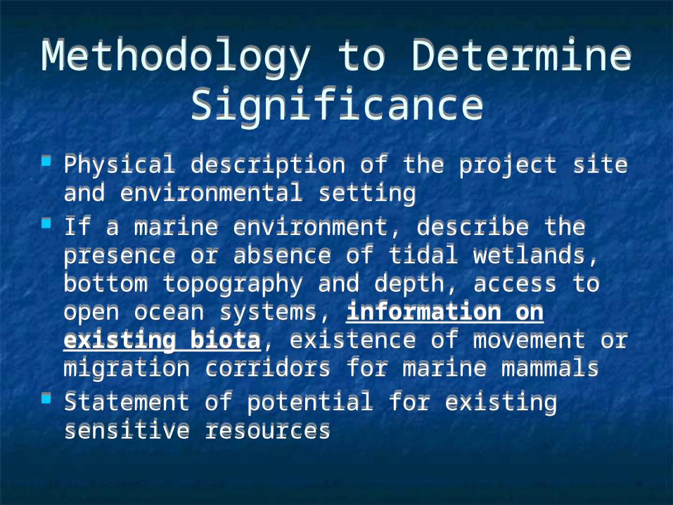
Methodology to Determine Significance
Methodology to Determine Significance
Physical description of the project site and environmental setting
If a marine environment, describe the presence or absence of tidal wetlands, bottom topography and depth, access to open ocean systems, information on existing biota, existence of movement or migration corridors for marine mammals
Statement of potential for existing sensitive resources
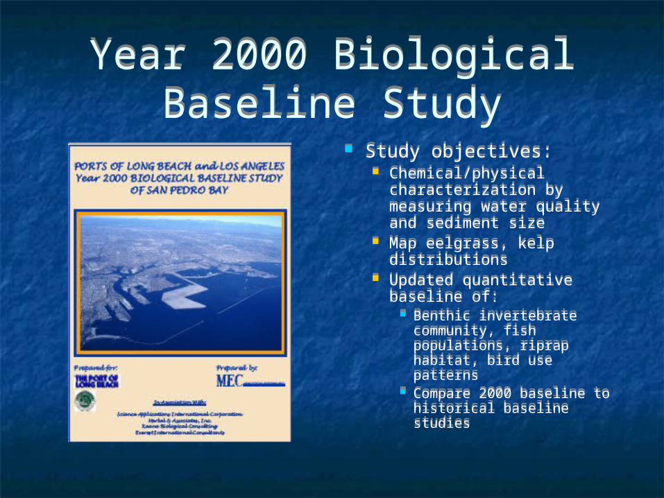
Year 2000 Biological Baseline Study
Year 2000 Biological Baseline Study
Study objectives: Chemical/physical
characterization by measuring water quality and sediment size
Map eelgrass, kelp distributions
Updated quantitative baseline of:
Benthic invertebrate community, fish populations, riprap habitat, bird use patterns
Compare 2000 baseline to historical baseline studies
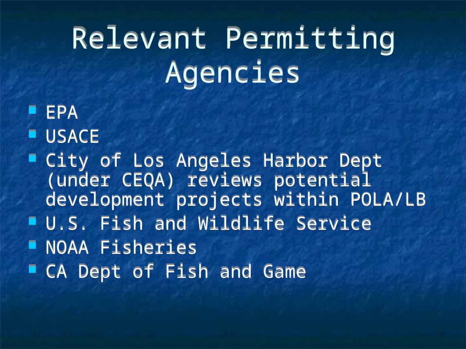
Relevant Permitting Agencies
Relevant Permitting Agencies
EPA USACE City of Los Angeles Harbor Dept (under
CEQA) reviews potential development projects within POLA/LB
U.S. Fish and Wildlife Service NOAA Fisheries CA Dept of Fish and Game
EPA USACE City of Los Angeles Harbor Dept (under
CEQA) reviews potential development projects within POLA/LB
U.S. Fish and Wildlife Service NOAA Fisheries CA Dept of Fish and Game
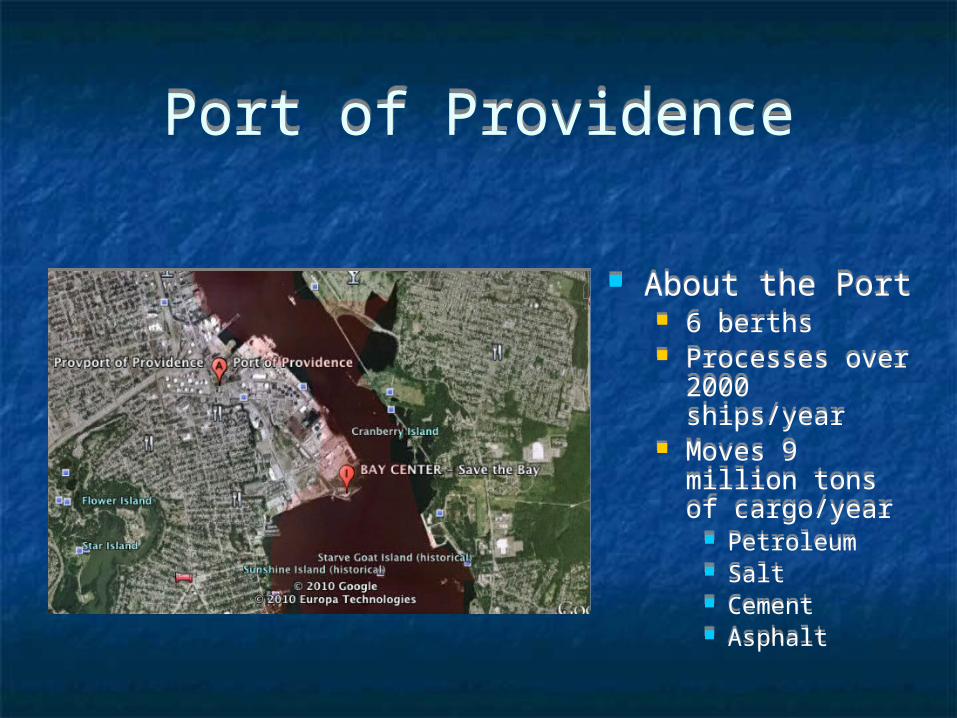
Port of ProvidencePort of Providence
About the Port 6 berths Processes over
2000 ships/year Moves 9 million
tons of cargo/year
Petroleum Salt Cement Asphalt
About the Port 6 berths Processes over
2000 ships/year Moves 9 million
tons of cargo/year
Petroleum Salt Cement Asphalt
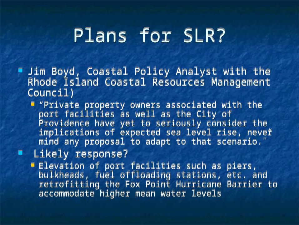
Plans for SLR?Plans for SLR?
Jim Boyd, Coastal Policy Analyst with the Rhode Island Coastal Resources Management Council) “Private property owners associated with the port
facilities as well as the City of Providence have yet to seriously consider the implications of expected sea level rise, never mind any proposal to adapt to that scenario.”
Likely response? Elevation of port facilities such as piers, bulkheads,
fuel offloading stations, etc. and retrofitting the Fox Point Hurricane Barrier to accommodate higher mean water levels
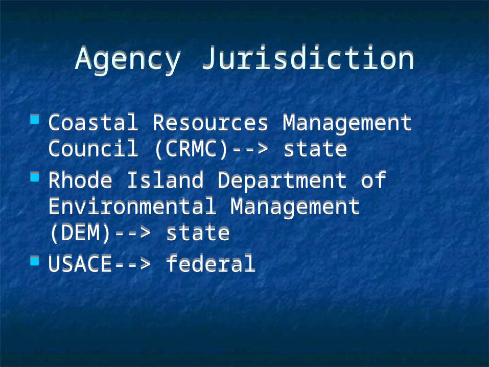
Agency JurisdictionAgency Jurisdiction
Coastal Resources Management Council (CRMC)--> state
Rhode Island Department of Environmental Management (DEM)--> state
USACE--> federal
Coastal Resources Management Council (CRMC)--> state
Rhode Island Department of Environmental Management (DEM)--> state
USACE--> federal
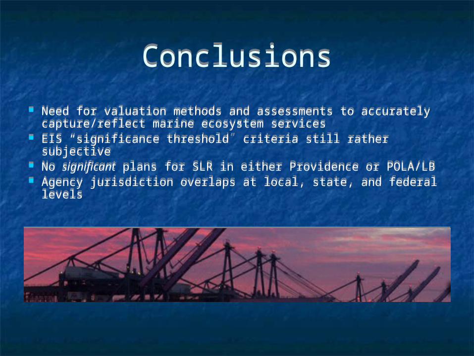
ConclusionsConclusions
Need for valuation methods and assessments to accurately capture/reflect marine ecosystem services
EIS “significance threshold” criteria still rather subjective No significant plans for SLR in either Providence or POLA/LB Agency jurisdiction overlaps at local, state, and federal levels
Need for valuation methods and assessments to accurately capture/reflect marine ecosystem services
EIS “significance threshold” criteria still rather subjective No significant plans for SLR in either Providence or POLA/LB Agency jurisdiction overlaps at local, state, and federal levels