Embed Size (px)
Citation preview

ENV 259
11/03/2012
Lecture 5

Unglaciated Appalachian PlateauHill country
Most Forested in OhioPioneers clearcut for
fuel (iron industry)

Unglaciated Appalachian PlateauHill country
Mining for bituminous coal (strip mining)
Much is reforested – covers 70 % of the region

Rock Layers Middle to late Paleozoic acidic sandstones Shale Coal Limestone, seldom
Knobs predominate along Ohio River & along Appalachian escarpment (lower, rounder hills)
¾ of Hill country streams were once a part of the ancient Teays River system
Dover & Steubenville Rivers actually flowed north
Unglaciated Appalachian Plateau Geology
Unglaciated…yes, Unaffected…no. Profound glacial impact
Redirected river systems (reversed) Filled valleys with water Formation of the continental drainage divide Impacted plant/animal populations by
genetically & physically isolating them Unusual drainage patterns & constituents
Alkaline waters Glacial outwash (sand or gravel carried by
glaciers)
Unglaciated Appalachian Plateau Glacial impact
Variety of microclimates present due to topographic variation Frost pockets in valleys – frequently the coldest
temperatures in the area But presence of a stream can make them
warmer Wind, humidity, evaporation impacted by
direction of slope Sun exposure, surface temperature – southern
face Microclimate (along with varied soil and land
surface types) have encouraged biological diversity in the Hill country
Unglaciated Appalachian Plateau Climate & Weather

Upland Mixed Oak Forests
Mixed Mesophytic Forests
Lowland Forests
Unglaciated Appalachian Plateau Plant/ Animal Communities
Unglaciated Appalachian Plateau Upland Mixed Oak Forests
Widespread in unglaciated Appalachian plateau
Canopy tree communities White Oak is dominant species Oak-Hickory communities Loose, open tree canopy
Flower communities Wood rush, fire pink, dittany Beggar’s ticks, thorny greenbriar

Unglaciated Appalachian Plateau Upland Mixed Oak Forests
Understory tree communities Sassafras
Provide food for promethea silk moth larvae serviceberry
Provide early summer berries consumed by birds, & nesting site
Dogwood Chestnut oaks
Mixed pines interspersed Virginia Pine Yellow Pine, White Pine Both native & Reforested pines

Small Mammals Gray squirrels – remember me Flying squirrels (rarely seen) Hairy-tailed moles Short-tailed shrew Fox shrew Pygmy shrew (rare) – smallest mammal in
Western Hemisphere Eastern wood rat
Unglaciated Appalachian Plateau Upland Mixed Oak Forests

Unglaciated Appalachian Plateau Upland Mixed Oak Forests
Larger Mammals Raccoons Opossums Skunks Woodchucks Weasels Bats Cottontail rabbits Gray foxes – remember me
Other Animals Turkey vultures Swifts (fence lizards) Large-headed skink
Snakes Puff adders
(Hognose) Poisonous
copperhead Timber rattlesnake

Mesophytes: plants growing in area with average water supply
Trees (20-25 spp primarily) White & red oak, tuliptree, sugar maple, beech,
wild black cherry, white ash, blackgum, red maple, shagbark hirckory, bitternute, white basswood, black walnut, cucumber tree (north), yellow buckeye (south)
Less common: hemlockMainly moderate climateMoist, well-drained, moderately acidic
soils
Unglaciated Appalachian Plateau Mixed Mesophytic Forests

Unglaciated Appalachian Plateau Mixed Mesophytic Forests
High tree and plant diversity
1000’s of types of plants, mosses, fungi, lichens
Undercanopy trees Hornbeam (musclewood
or ironwood) Dogwood Redbud pawpaw
Wildflowers Hepaticas Anemones Mayapple Phlox Indian-pipe flower Sullivantia
Non-native flowering plants Bigleaf magnolia Umbrella magnolia Sourwood Flame azalea Great rohododendron

Fauna Deer, gray squirrels, raccoons, skunk, weasels,
bats Black rat snakes, box turtles, wild turkey,
ruffed grouse, great horned owls Zebra swallowtail butterfly (eats pawpaw
leaves) Salamanders (vernal pools) Red-tailed hawk, screech & barred owls,
pileated & downy woodpeckers, chickadees, tufted titmouse (permanent residents)
Unglaciated Appalachian Plateau Mixed Mesophytic Forests
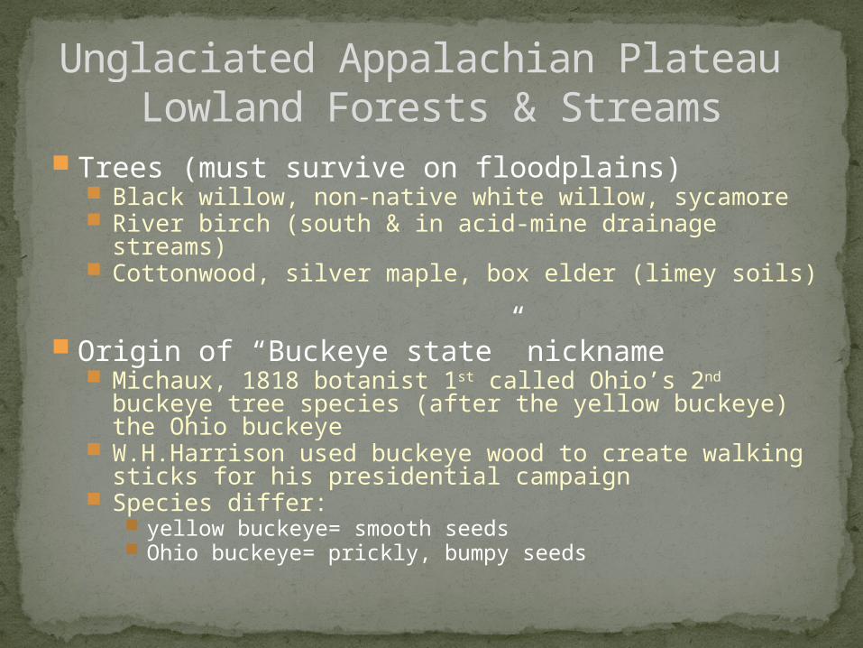
Unglaciated Appalachian Plateau Lowland Forests & Streams
Trees (must survive on floodplains) Black willow, non-native white willow, sycamore River birch (south & in acid-mine drainage streams) Cottonwood, silver maple, box elder (limey soils)
Origin of “Buckeye state” nickname Michaux, 1818 botanist 1st called Ohio’s 2nd buckeye tree
species (after the yellow buckeye) the Ohio buckeye W.H.Harrison used buckeye wood to create walking sticks
for his presidential campaign Species differ:
yellow buckeye= smooth seeds Ohio buckeye= prickly, bumpy seeds

Common animals Mink, muskrats, beaver, rarely river otters
(note water)Birds (waterfowl)
Kingfisher, phoebes, wood ducksAquatic species
Northern water snake, painted turtle, snapping turtle, brown soft-shell turtle, hellbender (salamander)
Muskellunge, fresh-water mussels (important
historic food source)
Unglaciated Appalachian Plateau Lowland Forests & Streams

Unglaciated Appalachian Plateau Mining
Coal & clay mining Why damaging?
Bound with sulfur…causes environmental damage when released during mining
Acid mine drainage – “Yellow Boy”
If abated, waterways may recover (didn’t begin until post-WWII)
Many are not abated due to costs
Small scale strip-mining (pre-WWI) gave way to larger scale mining efforts over time

Rome Beauty 1817 Named 1848
Gallia Beauty From a Rome Beauty seedling Named 1865
Unglaciated Appalachian Plateau Apple Country?

Glaciated Plateau (Allegheny plateau)
Geology
Glacial till weathered into rich agricultural soil
Bedrock (visible in roadcuts) Limestone, shale, sandstone,
conglomerate & coal, Pennsylvanian period e.g. Sharon Sandstone
Shale & Sandstone, Mississipian e.g. Berea Sandstone
Oldest rocks, Devonian e.g. Chagrin Shale

Glaciated Plateau (Allegheny plateau)
Geology
Human utility of materials Quarried bedrock for building
material Clay & shale are also taken for
brick, tile, pottery Lesser presence of coal & gas Rock salt mining
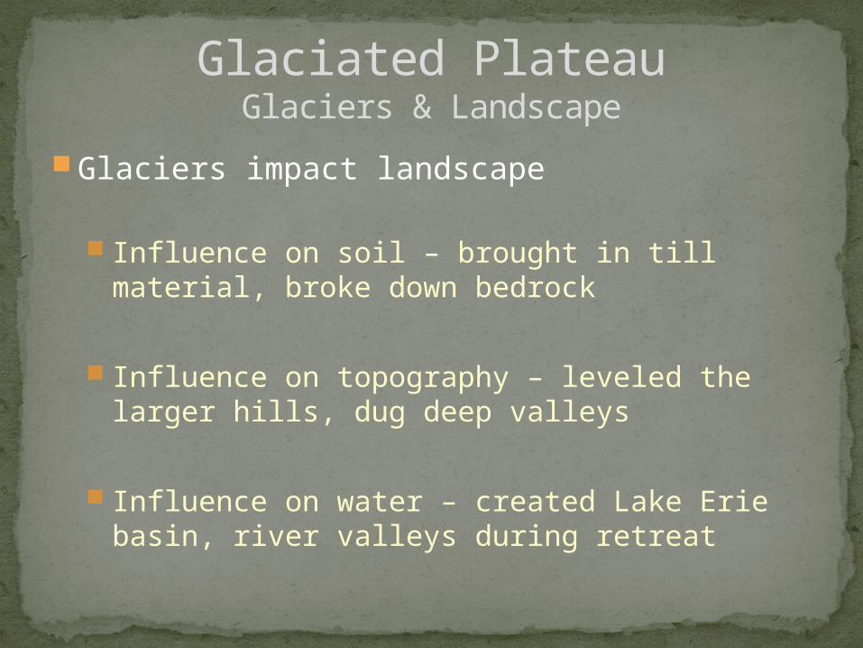
Glaciers impact landscape
Influence on soil – brought in till material, broke down bedrock
Influence on topography – leveled the larger hills, dug deep valleys
Influence on water – created Lake Erie basin, river valleys during retreat
Glaciated PlateauGlaciers & Landscape

Historic meeting point between N. Allegheny & Central Appalachian forests (noted during last 200 yrs) White oak, like Appalachians N. Hemlock forests similar to Allegheny woods in NY and
PA Most forests are secondary, regrown Deep glacial till deposits support widespread
beech-maple forest growth Maple syrup production (Geauga county) Blueberries, clubmoss, pink ladyslipper like the
acidic soils
Glaciated PlateauPlants

Wildflowers Painted trillium (very rare) Purple trillium Spring
Spring beauties, anemones, Dutchman’s breeches, purple cresses
Mayapples Wild phlox
“Signal” Tree Bur Oak N. of Akron off of Peck Road Native Americans used it to designate crossing
(portage) of Cuyahoga-Tuscarawas divide
Glaciated PlateauPlants

Settlers saw vast forests populated with Wolf, elk, bear, mountain lion (mainly predatory)
Today, remaining forests populated with Cottontail , red fox, raccoon, fox squirrel, skunk,
deer, woodchucks, weasel, muskrats (hearty, non-predatory to human species) – “edge species”
Birds, both resident and migratory Robin, wood thrush, warblers, ruffed grouse, red tailed and
coopers hawks, owls, bald eagles, tree swallows, veery…live on forest edges. Why?
Reptiles & amphibians Red-bellied snake, Mountain dusky salamanders
Greater variety of landscape = greater diversity
Glaciated PlateauFauna (Animals)

Till PlainsGeology
Sedimentary bedrock (Ordovician through Devonian) (500 to 350 million years old) Mainly limestone Smaller areas of shale
(youngest rocks present here)
Fossil-rich (particularly Ordovician rocks) Marine invertebrates
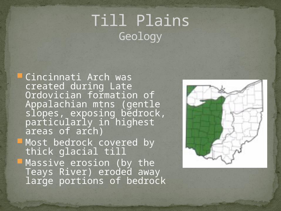
Till PlainsGeology
Cincinnati Arch was created during Late Ordovician formation of Appalachian mtns (gentle slopes, exposing bedrock, particularly in highest areas of arch)
Most bedrock covered by thick glacial till
Massive erosion (by the Teays River) eroded away large portions of bedrock

Wisconsinan was most recent (peaked 20,000 years ago), traveling southward across the region
Advanced & retreated several times, leaving layers of impact (morains)
Created rolling hillsCampbell Hill, Ohio’s highest point, an end
moraineKames & Eskers are extensive in some
areasBoulder belts – large glacial erratics big as
quarries
Till PlainsGlaciation

Miamian soils Loam/Clay loam till (south) Clay rich till (Blount soils) (north)
Both are high-lime & found in Wisconsinan till
Low-lime tills resulting in Alexandrian soils to east
Soils here are formed primarily by parent material & time
Extremely fertile
Till PlainsSoils

Settlers saw woodlands, forests & wet prairies
Today 95% of land is farm or urban Agriculture mainly seen today
Corn, soybeans, wheat 1st growth vegetation almost non-existent Cedar Bog still remains…white cedar wetland
Till PlainsVegetation

Intense farming has led to less diversity
Ag resulted in destruction of valuable habitat
Fish Mad River – cold water Brook trout Big Darby – Scioto Madtom
Amphibians Striped chorus frog, small-mouth & tiger salamanders,
cave salamander Reptiles
Eastern garter snake, Butler’s garter snake blue racer, northern copperbelly, eastern massasauga, painted turtle
Till PlainsFauna

Intense farming has led to less diversity
Birds (attracted to open fields & plains with forest nearby) Kestrels, eastern meadowlark, horned lark, savannah
sparrow, song sparrow, woodcock Region is also a large migratory path for multitudes of
birds
Edge species – Ringneck replaced the Grouse
Till PlainsFauna

Intense farming has led to less diversity
Small Mammals Fox Squirrel replaced the Grey Red Fox replaced the Grey Forest species vs “woodlot” species Neither species existed in Ohio prior to clearing
Till PlainsFauna

2 Weeks left1 More lecturePresentations last class – must be here to
presentField trip next week – Canalway Center
Presentations:A few slides10 minutes topsTell us what your paper was about and a
few interesting findings
Final Class Time