Embed Size (px)
Citation preview
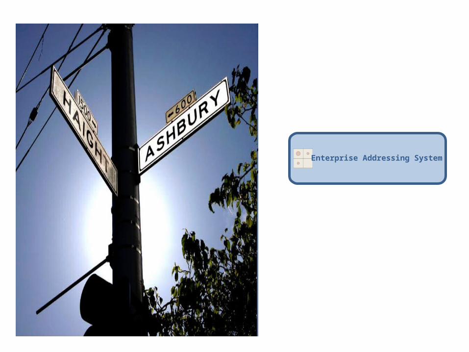
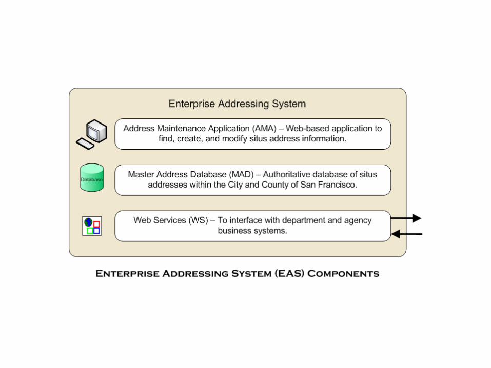
Enterprise Addressing System
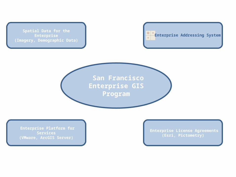
San Francisco Enterprise GIS
Program
Spatial Data for the Enterprise(Imagery, Demographic Data)
Enterprise License Agreements(Esri, Pictometry)
Enterprise Platform for Services
(VMware, ArcGIS Server)
Enterprise Addressing System
Why an Enterprise Addressing System (EAS)?
• Departments are focused on their primary business• Addresses critical but secondary• Current ad hoc situation leads to inefficiencies and
confusion• An enterprise solution
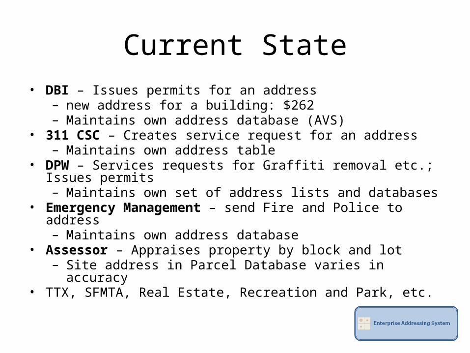
Current State• DBI – Issues permits for an address
– new address for a building: $262– Maintains own address database (AVS)
• 311 CSC – Creates service request for an address– Maintains own address table
• DPW – Services requests for Graffiti removal etc.; Issues permits– Maintains own set of address lists and databases
• Emergency Management – send Fire and Police to address– Maintains own address database
• Assessor – Appraises property by block and lot– Site address in Parcel Database varies in accuracy
• TTX, SFMTA, Real Estate, Recreation and Park, etc.
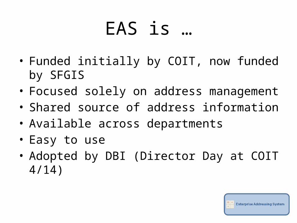
EAS is …
• Funded initially by COIT, now funded by SFGIS• Focused solely on address management• Shared source of address information • Available across departments• Easy to use• Adopted by DBI (Director Day at COIT 4/14)
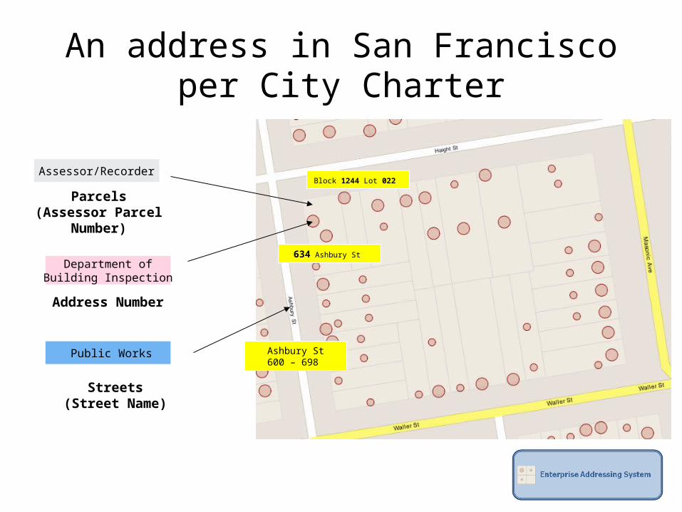
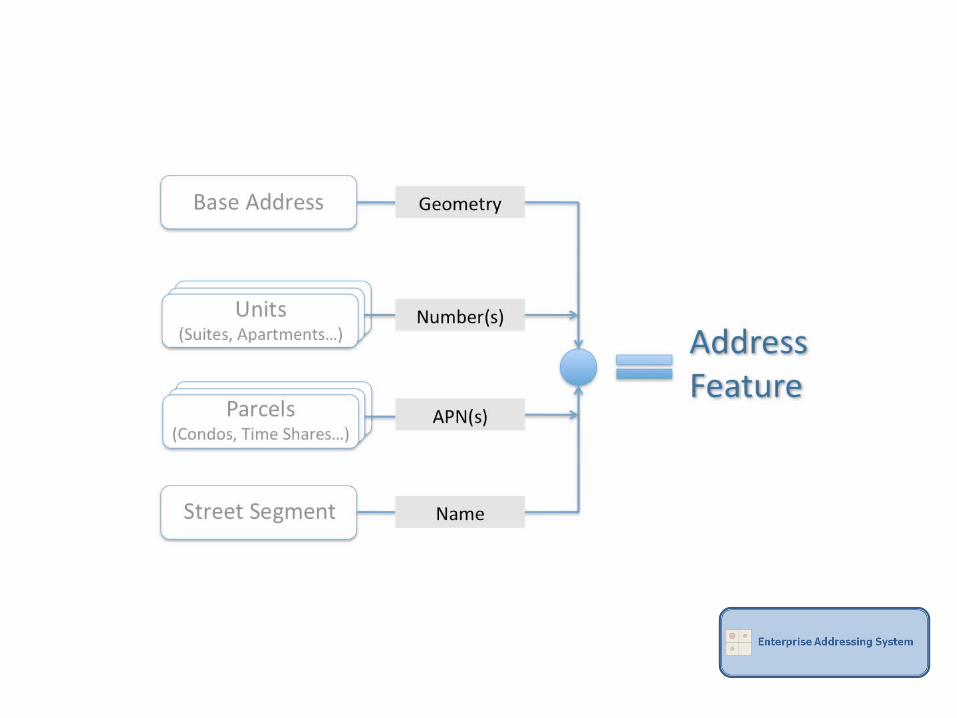
An address in San Francisco
Assessor/Recorder
Public Works
Parcels(Assessor Parcel
Number)
Streets(Street Name)
Department ofBuilding Inspection
Address Number
Block 1244 Lot 022
Ashbury St600 – 698
634 Ashbury St
per City Charter
Demonstration

• EAS 1.0 in production (eas.sfgov.org)– Production environment on VMWare– Regularly scheduled load of DBI’s data into EAS– Nightly load of parcels and streets from DPW into EAS– Active Open Source Project (http://code.google.com/eas)
• EAS 1.1– Real-time integration with DBI’s permitting system– MOU/SLA between DT and DBI
• EAS 1.2 and beyond– Integration with 311 Call Service Center database– Integration with DPW– Integration with other departments – Mail Merge services, etc.– Leverage development work of other municipalities through the EAS Open Source
Project – Civic Commons, Code for America, Sacramento, Bellevue, Virginia Beach, San Mateo
– Add imagery, building footprints
Schedule

Questions?
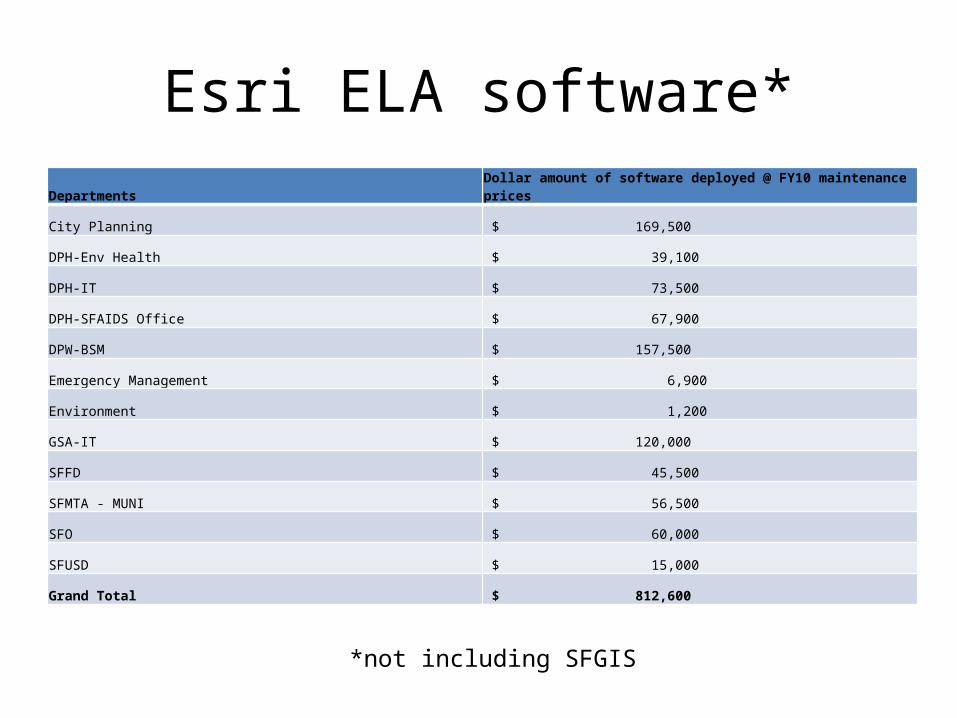
Esri ELA software*Departments
Dollar amount of software deployed @ FY10 maintenance prices
City Planning $ 169,500
DPH-Env Health $ 39,100
DPH-IT $ 73,500
DPH-SFAIDS Office $ 67,900
DPW-BSM $ 157,500
Emergency Management $ 6,900
Environment $ 1,200
GSA-IT $ 120,000
SFFD $ 45,500
SFMTA - MUNI $ 56,500
SFO $ 60,000
SFUSD $ 15,000
Grand Total $ 812,600
*not including SFGIS
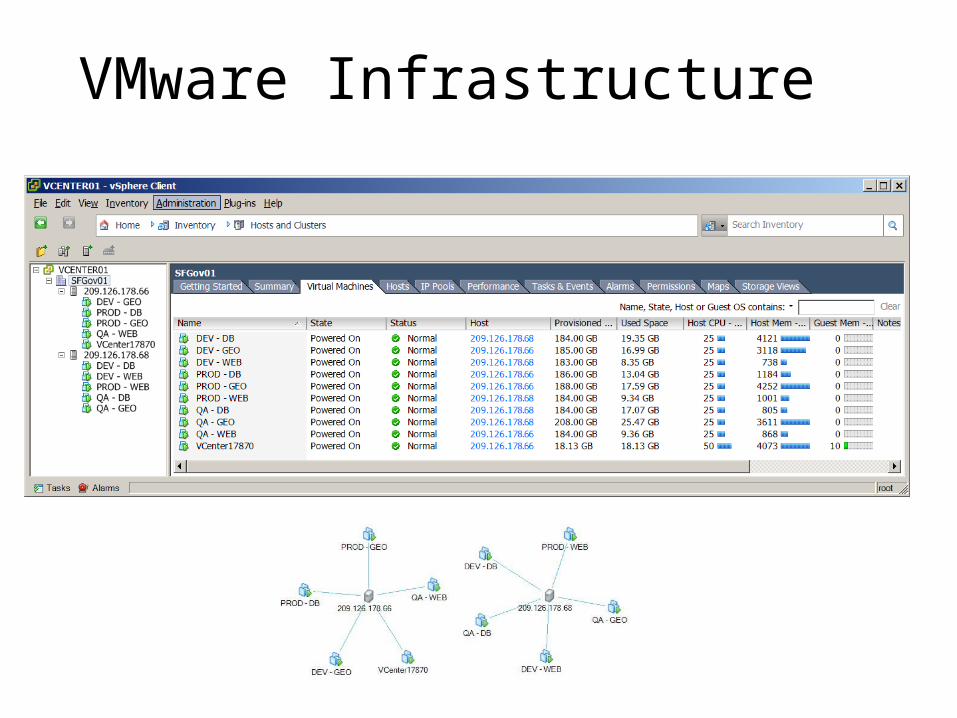
VMware Infrastructure
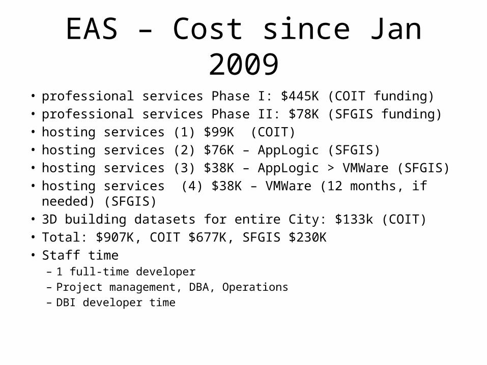
EAS – Cost since Jan 2009• professional services Phase I: $445K (COIT funding)• professional services Phase II: $78K (SFGIS funding)• hosting services (1) $99K (COIT)• hosting services (2) $76K – AppLogic (SFGIS)• hosting services (3) $38K – AppLogic > VMWare (SFGIS)• hosting services (4) $38K – VMWare (12 months, if needed) (SFGIS)• 3D building datasets for entire City: $133k (COIT)• Total: $907K, COIT $677K, SFGIS $230K• Staff time
– 1 full-time developer– Project management, DBA, Operations– DBI developer time
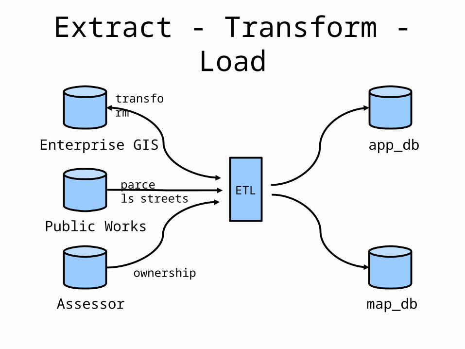
Extract - Transform - Load
ETL
app_db
map_db
Public Works
parcelsstreets
Assessor
ownership
Enterprise GIS
transform
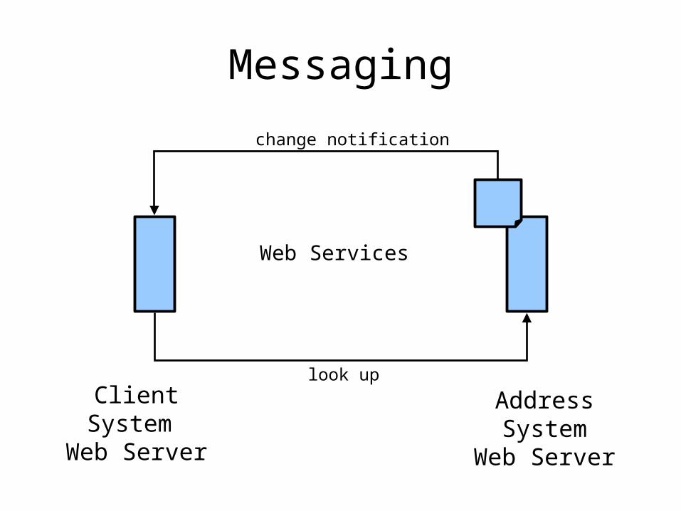
Messaging
Web Services
AddressSystem
Web Server
look up
change notification
ClientSystem
Web Server
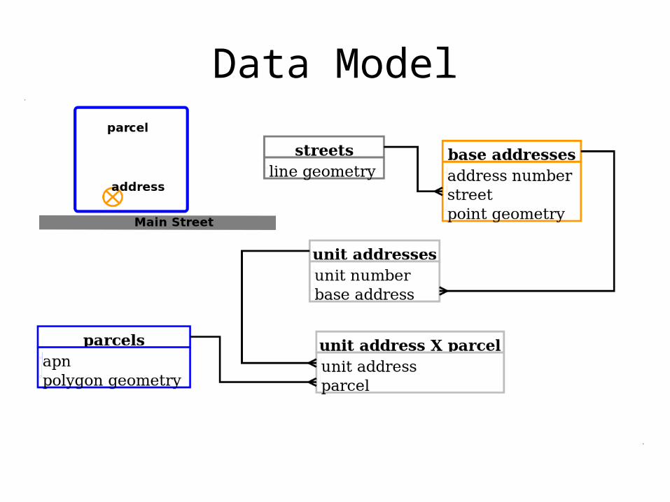
Data Model
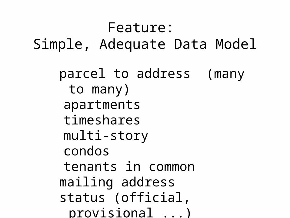
Feature: Simple, Adequate Data Model
parcel to address (many to many)
apartmentstimesharesmulti-storycondostenants in common
mailing addressstatus (official, provisional ...)
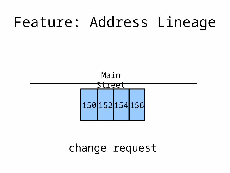
Feature: Address Lineage
Main Street
150150 152 154 156
change request
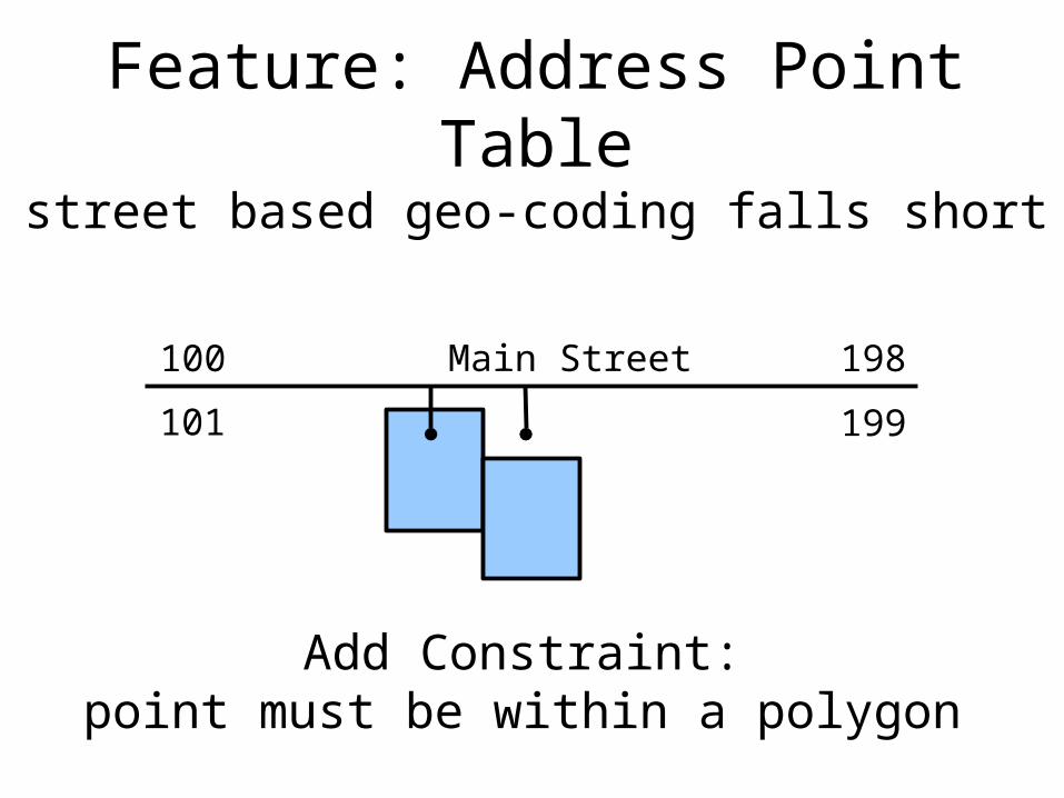
Feature: Address Point Tablestreet based geo-coding falls short
Main Street 198100
101 199
Add Constraint:point must be within a polygon
Why Open Source?
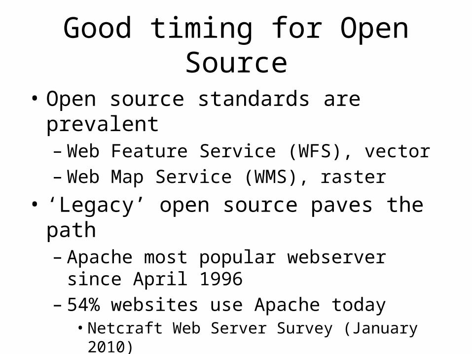
Good timing for Open Source
• Open source standards are prevalent– Web Feature Service (WFS), vector– Web Map Service (WMS), raster
• ‘Legacy’ open source paves the path– Apache most popular webserver since April 1996 – 54% websites use Apache today
• Netcraft Web Server Survey (January 2010)
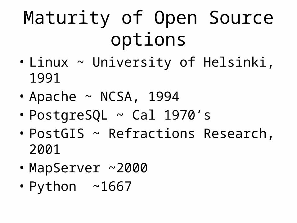
Maturity of Open Source options
• Linux ~ University of Helsinki, 1991• Apache ~ NCSA, 1994• PostgreSQL ~ Cal 1970’s• PostGIS ~ Refractions Research, 2001• MapServer ~2000• Python ~1667
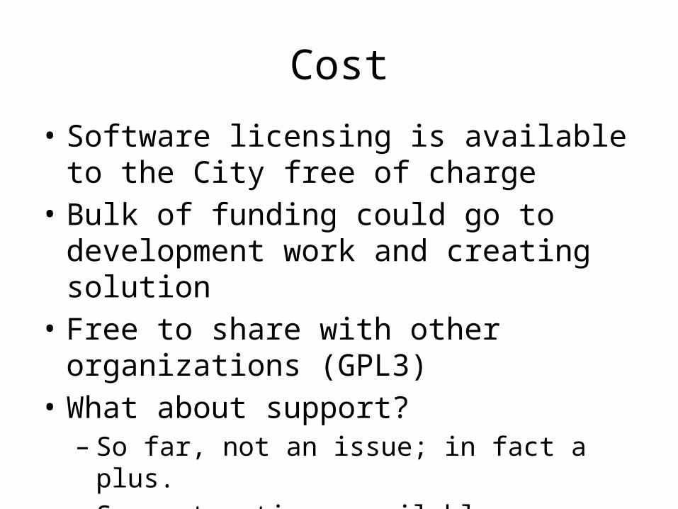
Cost
• Software licensing is available to the City free of charge
• Bulk of funding could go to development work and creating solution
• Free to share with other organizations (GPL3)• What about support?
– So far, not an issue; in fact a plus.– Support options available
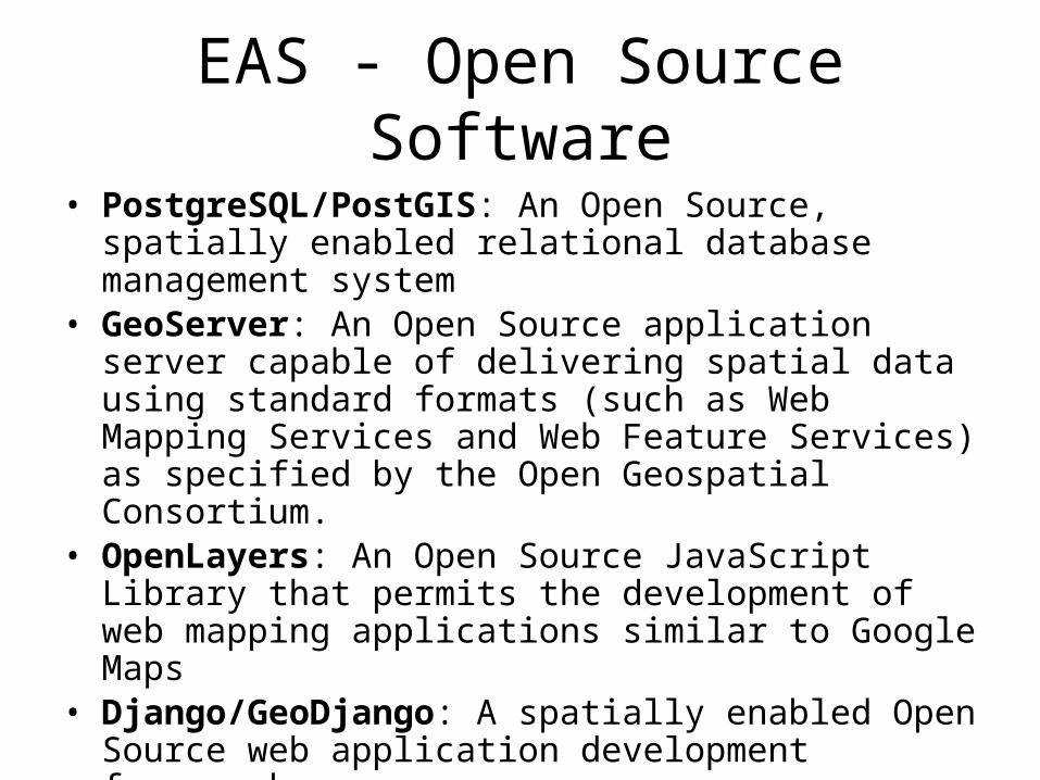
EAS - Open Source Software• PostgreSQL/PostGIS: An Open Source, spatially enabled
relational database management system• GeoServer: An Open Source application server capable of
delivering spatial data using standard formats (such as Web Mapping Services and Web Feature Services) as specified by the Open Geospatial Consortium.
• OpenLayers: An Open Source JavaScript Library that permits the development of web mapping applications similar to Google Maps
• Django/GeoDjango: A spatially enabled Open Source web application development framework
• ExtJS: A modern javascript library (ajax, etc.)
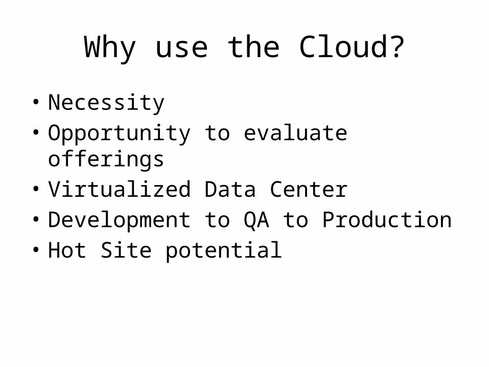
Why use the Cloud?
• Necessity• Opportunity to evaluate offerings• Virtualized Data Center• Development to QA to Production• Hot Site potential