Embed Size (px)
Citation preview
Engineering Geology& Seismology Review
for Public Schools & Hospitals in California
Engineering Geology& Seismology Review
for Public Schools & Hospitals in Californiafor Public Schools & Hospitals in California
Centennial of the Quake ’06Centennial of the Quake ’06April 18, 2006 April 18, 2006 —— San FranciscoSan Francisco
Robert H. Sydnor, Robert H. Sydnor, PG 3267, CHG 6, CEG 968PG 3267, CHG 6, CEG 968Member, SSA, EERI, AEG, ASCE, GSA, ASTMMember, SSA, EERI, AEG, ASCE, GSA, ASTM
Senior Engineering GeologistSenior Engineering GeologistCalifornia Geological SurveyCalifornia Geological Survey
California Geological SurveyCalifornia Geological Survey
Geology & Seismology Review for Schools & Hospitals
StateReviewfor CCRTitle 24,
CaliforniaBuilding
Code
California Geological SurveyCalifornia Geological Survey
The Renaissance Building801 “K” Street, 12th Floor
Sacramentowww.conservation.ca.gov/cgs

3 Types of Ground Failure3 Types of Ground Failure
Liquefaction &Seismic Compression
Landslides
Fault Rupture
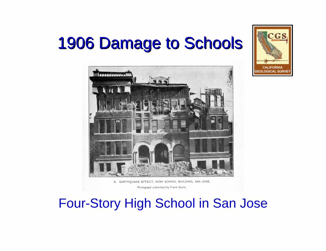
1906 Damage to Schools1906 Damage to Schools
Four-Story High School in San Jose
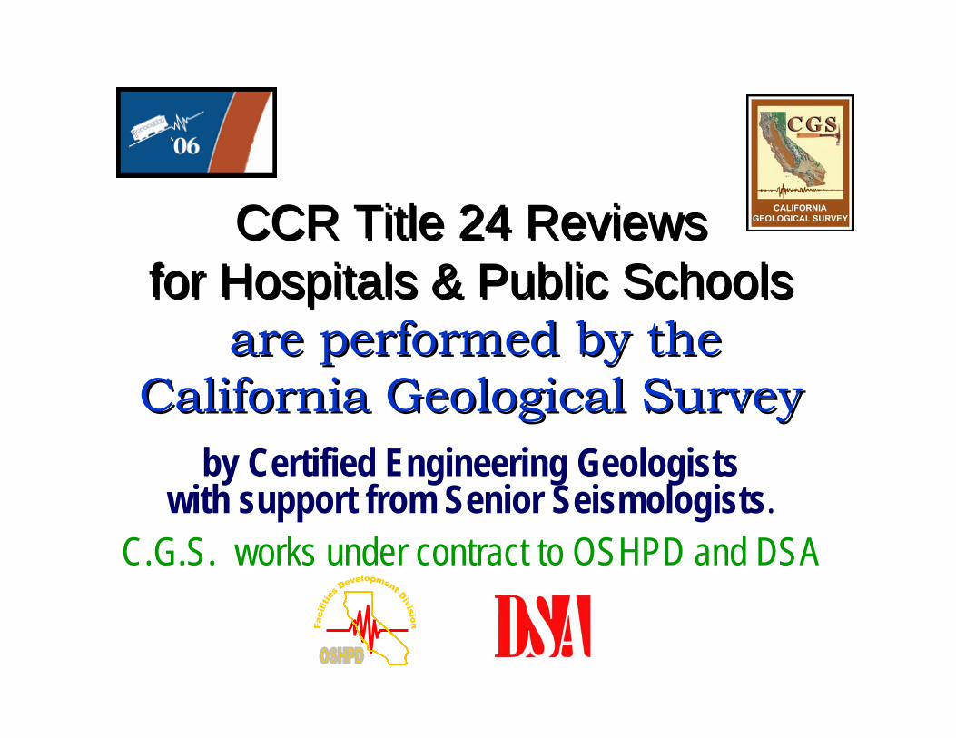
CCR Title 24 Reviewsfor Hospitals & Public Schools
are performed by theCalifornia Geological Survey
CCR Title 24 Reviewsfor Hospitals & Public Schools
are performed by theCalifornia Geological Survey
by Certified Engineering Geologistswith support from Senior Seismologists.
C.G.S. works under contract to OSHPD and DSA
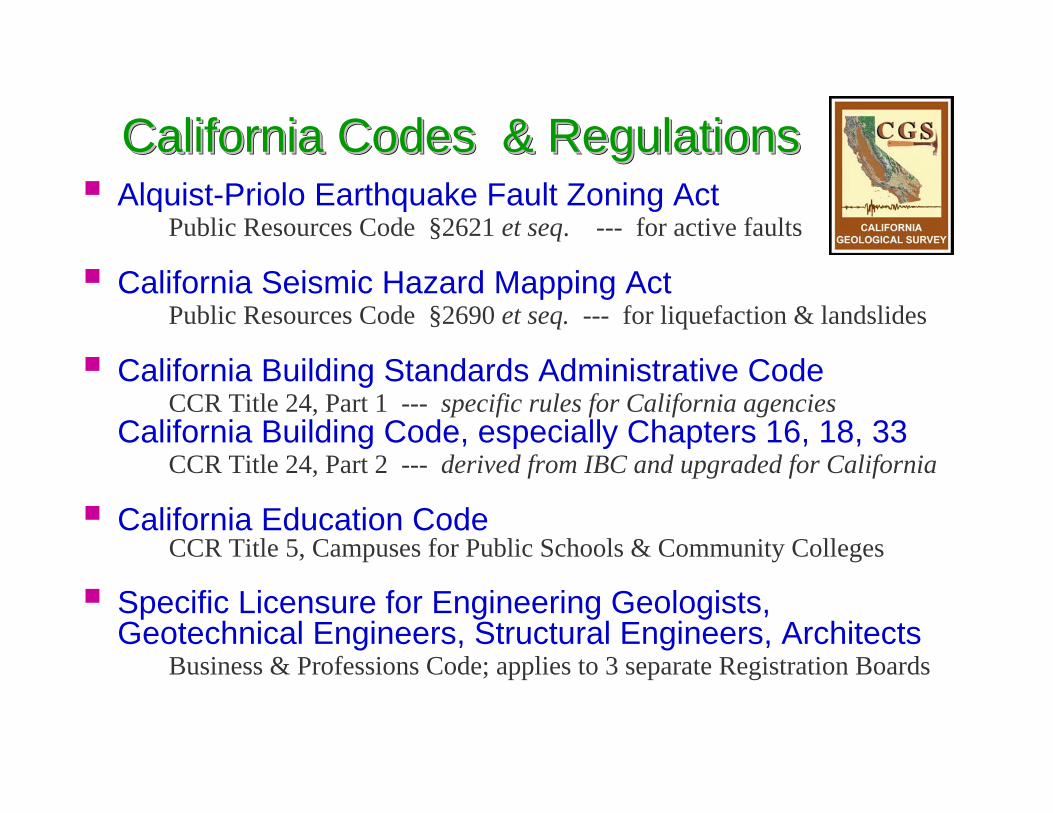
California Codes & RegulationsCalifornia Codes & RegulationsCalifornia Codes & RegulationsAlquist-Priolo Earthquake Fault Zoning Act
Public Resources Code §2621 et seq. --- for active faults
California Seismic Hazard Mapping ActPublic Resources Code §2690 et seq. --- for liquefaction & landslides
California Building Standards Administrative CodeCCR Title 24, Part 1 --- specific rules for California agencies
California Building Code, especially Chapters 16, 18, 33CCR Title 24, Part 2 --- derived from IBC and upgraded for California
California Education CodeCCR Title 5, Campuses for Public Schools & Community Colleges
Specific Licensure for Engineering Geologists,Geotechnical Engineers, Structural Engineers, Architects
Business & Professions Code; applies to 3 separate Registration Boards
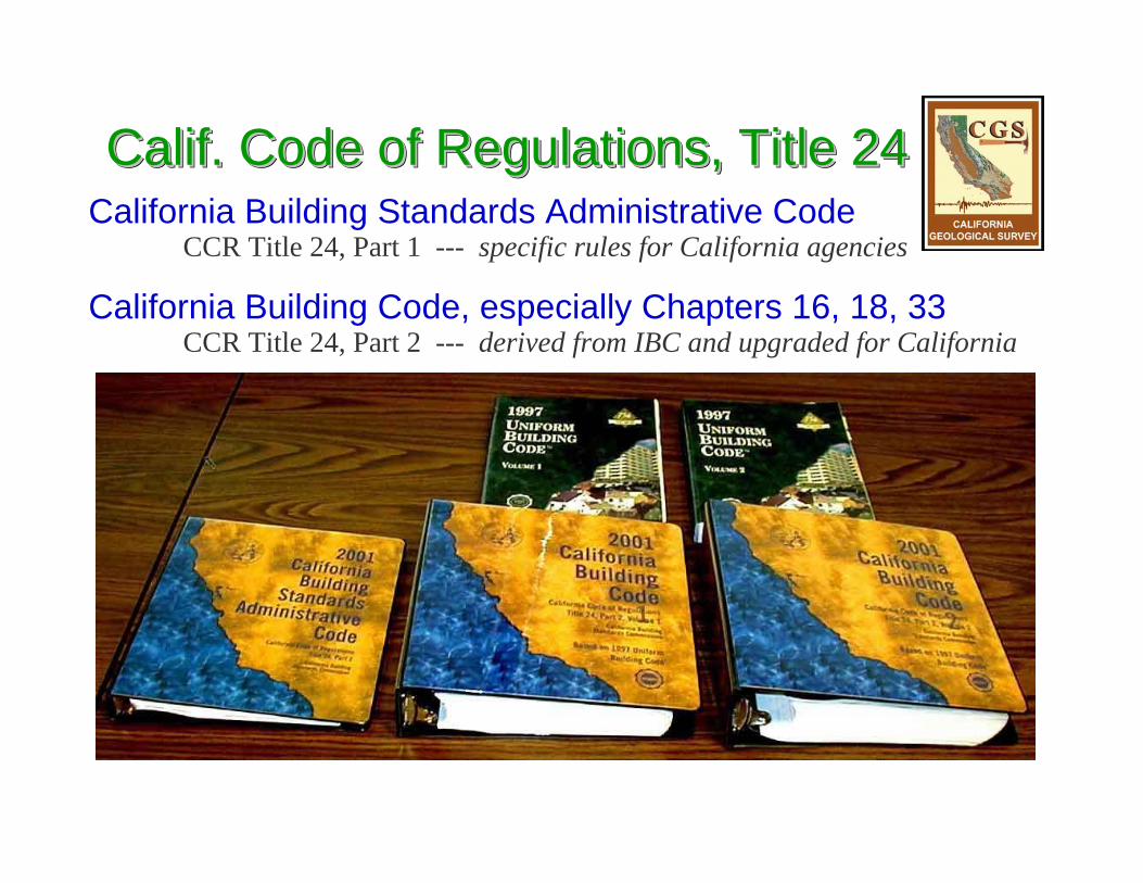
Calif. Code of Regulations, Title 24Calif. Code of Regulations, Title 24Calif. Code of Regulations, Title 24California Building Standards Administrative Code
CCR Title 24, Part 1 --- specific rules for California agencies
California Building Code, especially Chapters 16, 18, 33CCR Title 24, Part 2 --- derived from IBC and upgraded for California
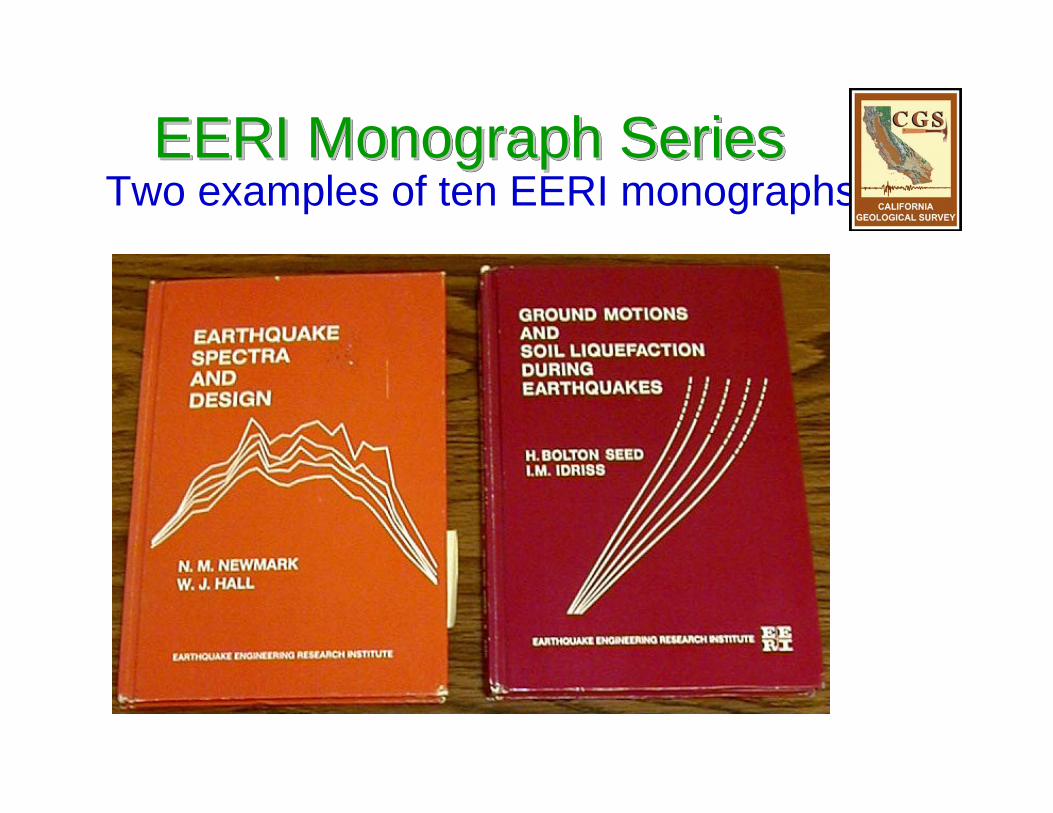
EERI Monograph SeriesEERI Monograph SeriesEERI Monograph SeriesTwo examples of ten EERI monographs.
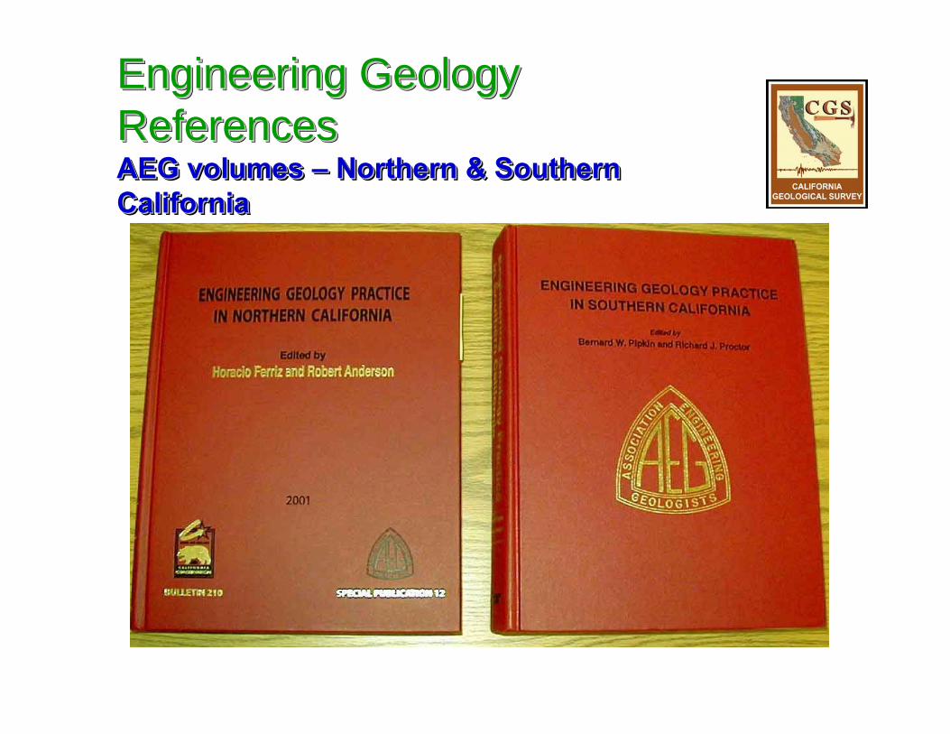
Engineering Geology ReferencesAEG volumes – Northern & Southern California
Engineering Geology Engineering Geology ReferencesReferencesAEG volumes AEG volumes –– Northern & Southern Northern & Southern CaliforniaCalifornia

ASCE Standard 7-05ASCE Standard 7ASCE Standard 7--0505
Minimum Design Loads for Buildings &Other Structureswww.asce.org
2006 IBC and2007 CBC will be cross-linked to sections ofASCE Standard 7-05
New Sources of Geologic Information
New Sources of New Sources of Geologic InformationGeologic Information
Latitude & Longitude = easily looked-upAlquist-Priolo Fault Zone Maps = pdfLiquefaction and Landslide Zone Maps = pdfEarthquake Ground Motion attenuation formulasderived from robust new CSMIP datasetCGS Statewide Fault Model – on-line 2002GeoRef & GeoScience World=find geology refsTraining Sessions by EERI & SSA= like this one!
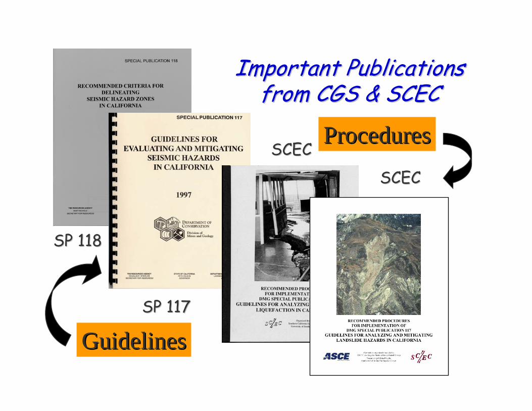
Important PublicationsImportant Publicationsfrom CGS & SCECfrom CGS & SCEC
SP 118SP 118
SP 117SP 117
SCECSCEC
SCECSCEC
GuidelinesGuidelines
ProceduresProcedures
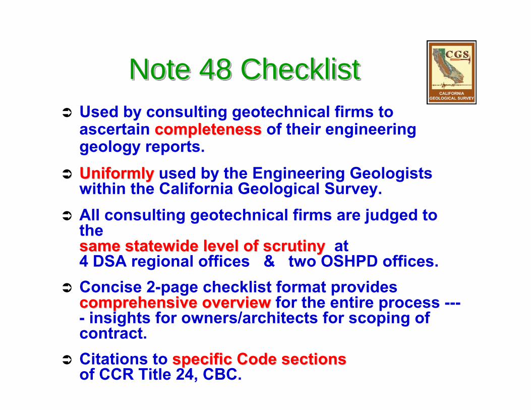
Note 48 ChecklistNote 48 ChecklistNote 48 ChecklistUsed by consulting geotechnical firms to ascertain completenesscompleteness of their engineering geology reports.UniformlyUniformly used by the Engineering Geologistswithin the California Geological Survey.All consulting geotechnical firms are judged to thesame statewide level of scrutinysame statewide level of scrutiny at4 DSA regional offices & two OSHPD offices.Concise 2-page checklist format provides comprehensive overviewcomprehensive overview for the entire process ---- insights for owners/architects for scoping of contract.Citations to specific Code sectionsspecific Code sectionsof CCR Title 24, CBC.

Note 48 ChecklistNote 48 ChecklistNote 48 Checklist
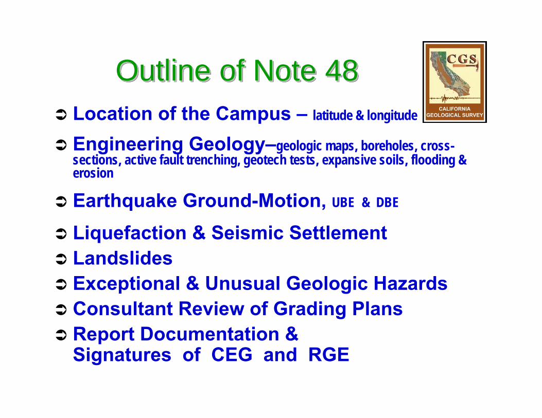
Outline of Note 48Outline of Note 48Outline of Note 48Location of the Campus – latitude & longitude
Engineering Geology–geologic maps, boreholes, cross-sections, active fault trenching, geotech tests, expansive soils, flooding & erosion
Earthquake Ground-Motion, UBE & DBE
Liquefaction & Seismic SettlementLandslidesExceptional & Unusual Geologic HazardsConsultant Review of Grading PlansReport Documentation &Signatures of CEG and RGE
Engineering GeologyNote 48 Checklist
Engineering GeologyEngineering GeologyNote 48 ChecklistNote 48 Checklist
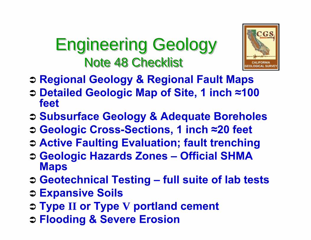
Regional Geology & Regional Fault MapsDetailed Geologic Map of Site, 1 inch ≈100 feetSubsurface Geology & Adequate BoreholesGeologic Cross-Sections, 1 inch ≈20 feetActive Faulting Evaluation; fault trenchingGeologic Hazards Zones – Official SHMA MapsGeotechnical Testing – full suite of lab testsExpansive SoilsType II or Type V portland cementFlooding & Severe Erosion
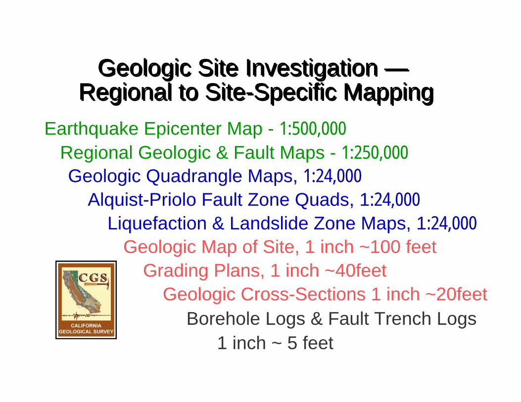
Geologic Site Investigation —Regional to Site-Specific Mapping
Geologic Site Investigation —Regional to Site-Specific Mapping
Regional Geologic & Fault Maps - 1:250,000Earthquake Epicenter Map - 1:500,000
Geologic Quadrangle Maps, 1:24,000Alquist-Priolo Fault Zone Quads, 1:24,000
Liquefaction & Landslide Zone Maps, 1:24,000Geologic Map of Site, 1 inch ~100 feet
Geologic Cross-Sections 1 inch ~20feetBorehole Logs & Fault Trench Logs
1 inch ~ 5 feet
Grading Plans, 1 inch ~40feet
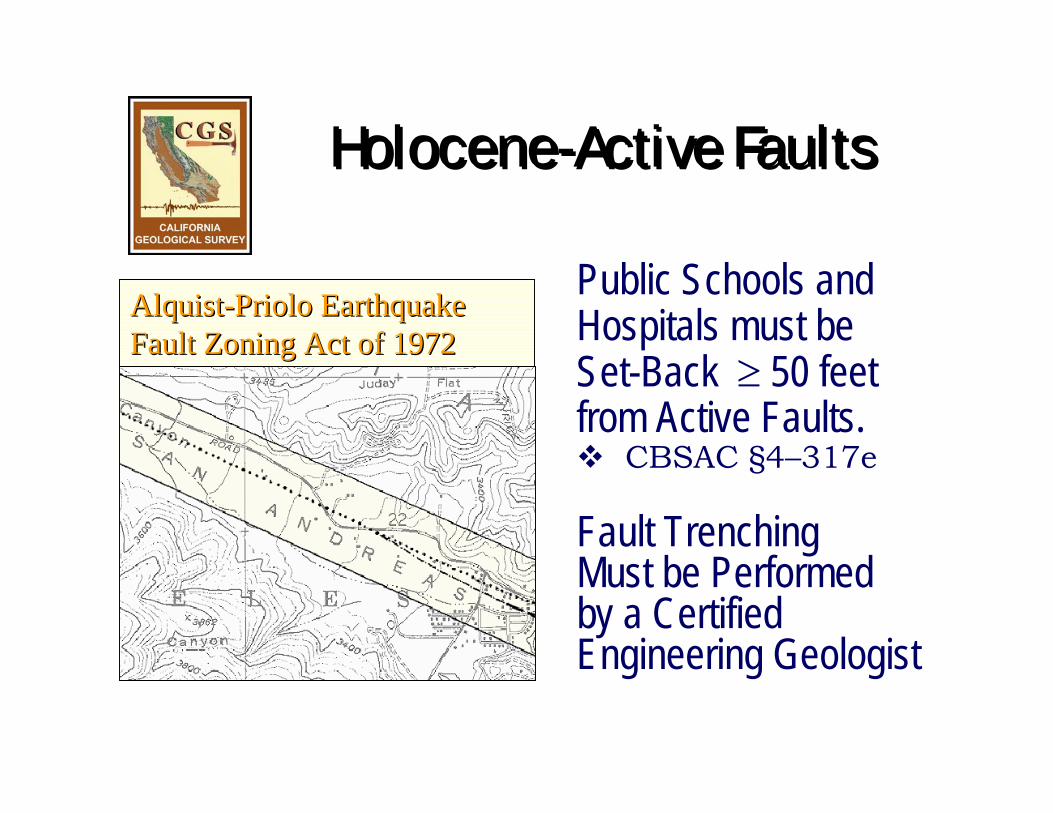
Public Schools and Hospitals must beSet-Back ≥ 50 feetfrom Active Faults.
CBSAC §4–317e
Fault TrenchingMust be Performedby a CertifiedEngineering Geologist
Holocene-Active FaultsHolocene-Active Faults
AlquistAlquist--Priolo Earthquake Priolo Earthquake Fault Zoning Act of 1972Fault Zoning Act of 1972
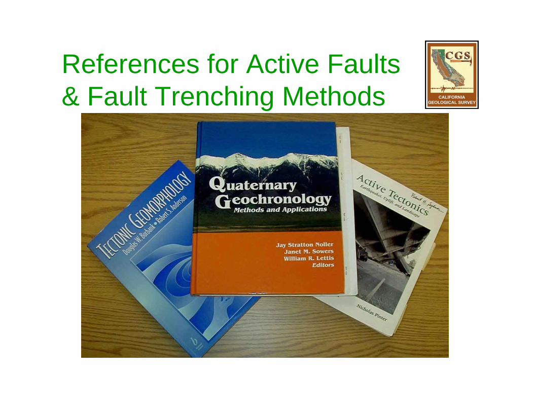
References for Active Faults& Fault Trenching Methods
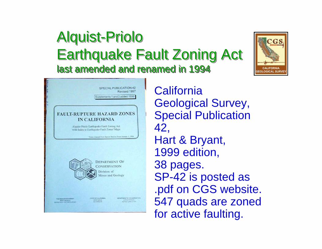
Alquist-PrioloEarthquake Fault Zoning Actlast amended and renamed in 1994
AlquistAlquist--PrioloPrioloEarthquake Fault Zoning ActEarthquake Fault Zoning Actlast amended and renamed in 1994last amended and renamed in 1994
CaliforniaGeological Survey, Special Publication 42,Hart & Bryant,1999 edition,38 pages.SP-42 is posted as.pdf on CGS website.547 quads are zonedfor active faulting.
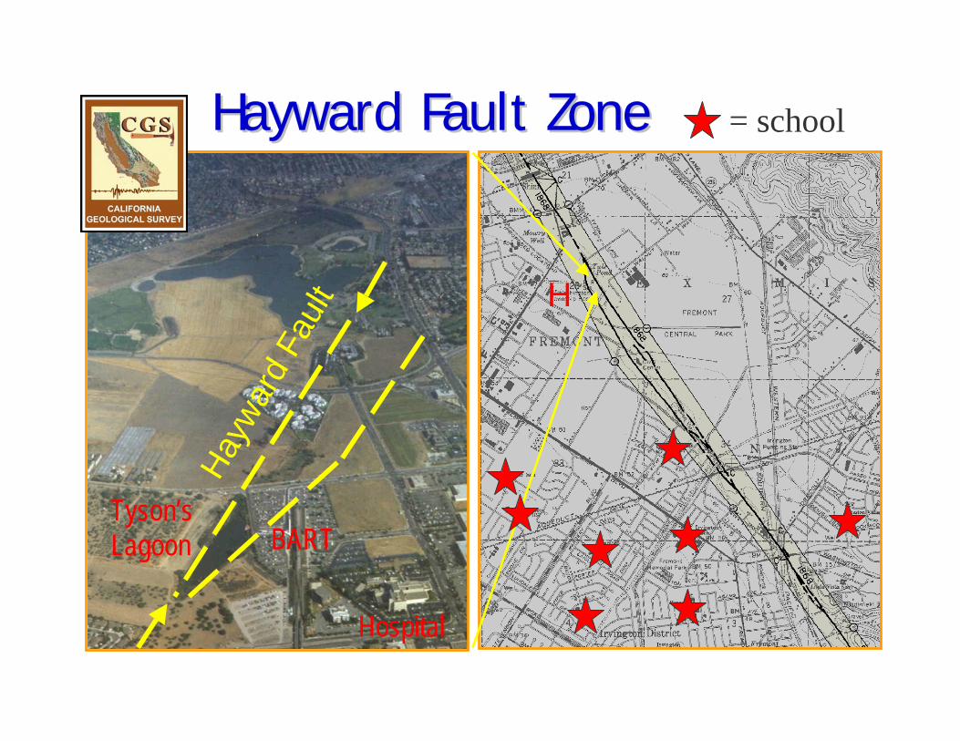
Hayward Fault ZoneHayward Fault Zone
BART
Hospital
H
Tyson’sLagoon
= school
Hayw
ard
Fault
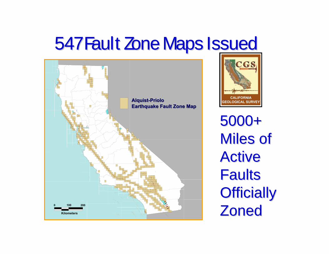
547 Fault Zone Maps Issued547 Fault Zone Maps Issued
Alquist-PrioloAlquist-PrioloEarthquake Fault Zone MapEarthquake Fault Zone Map
200
Kilometers
1000
5000+5000+Miles of Miles of ActiveActiveFaultsFaultsOfficially Officially ZonedZoned

SeismologyNote 48 Checklist
SeismologySeismologyNote 48 ChecklistNote 48 Checklist
Historic Seismicity - simple EQ map, Map Sheet 49Characterize & Classify the Geologic SubgradeCalifornia Seismic Zone 3 or 4Near-Source Coefficients – if applicable, cap @ Ca=0.66g
Probabilistic Seismic Hazard Analysis, UBE & DBENormalized Spectral AccelerationDeaggregated Seismic Source Parameters
– modal magnitude & fault distanceSeismic Retrofit--Senate Bill 1953 & Division VI-RScaled Time-Histories of EQ Ground-Motion
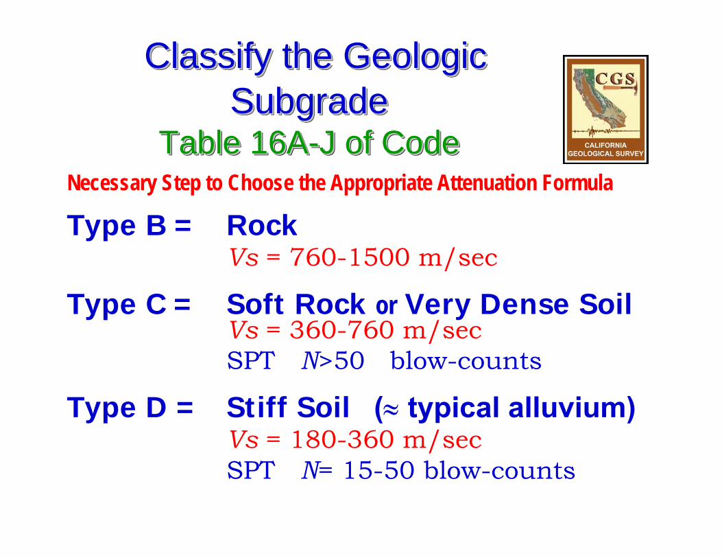
Classify the Geologic Subgrade
Table 16A-J of Code
Classify the Geologic Classify the Geologic SubgradeSubgrade
Table 16ATable 16A--J of CodeJ of CodeNecessary Step to Choose the Appropriate Attenuation Formula
Type B = RockVs = 760-1500 m/sec
Type C = Soft Rock or Very Dense SoilVs = 360-760 m/secSPT N>50 blow-counts
Type D = Stiff Soil (≈ typical alluvium)Vs = 180-360 m/secSPT N= 15-50 blow-counts
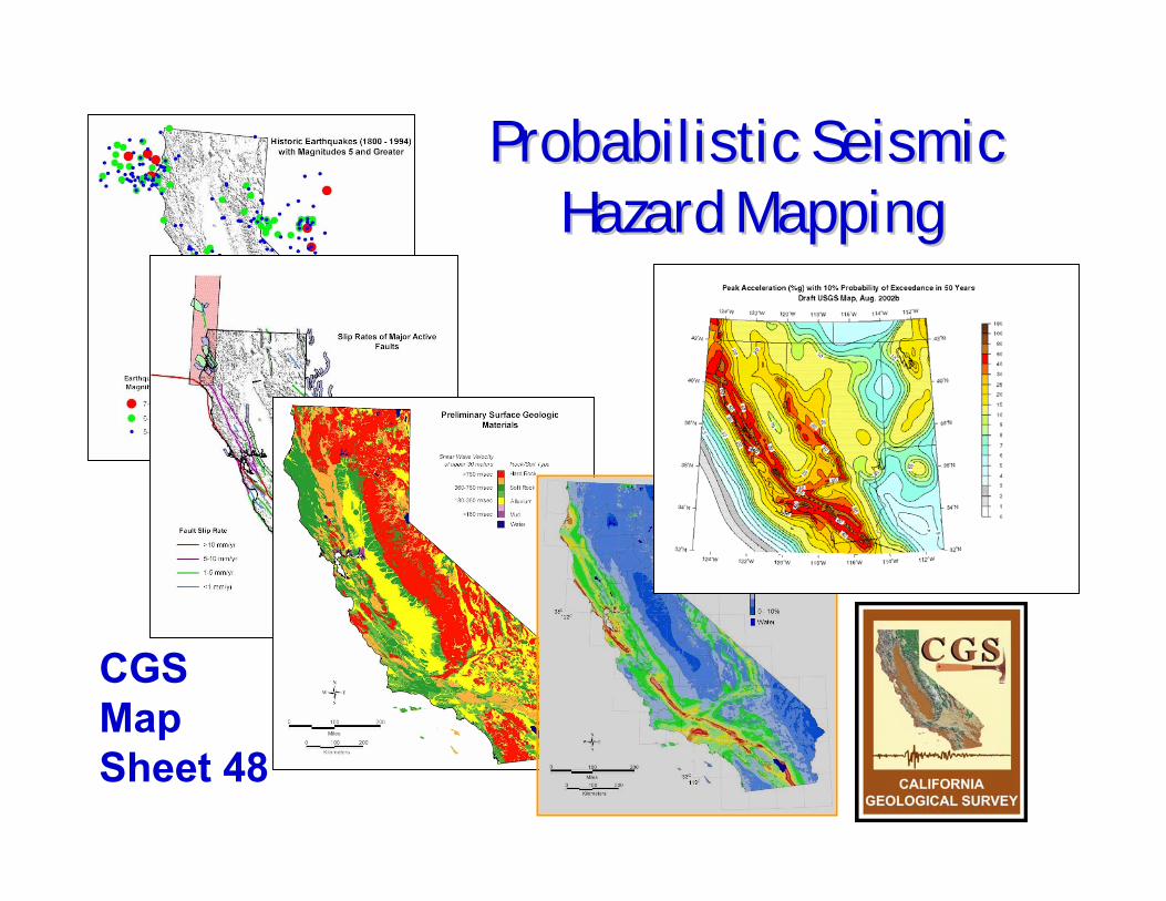
Probabilistic SeismicProbabilistic SeismicHazard MappingHazard Mapping
CGS Map Sheet 48
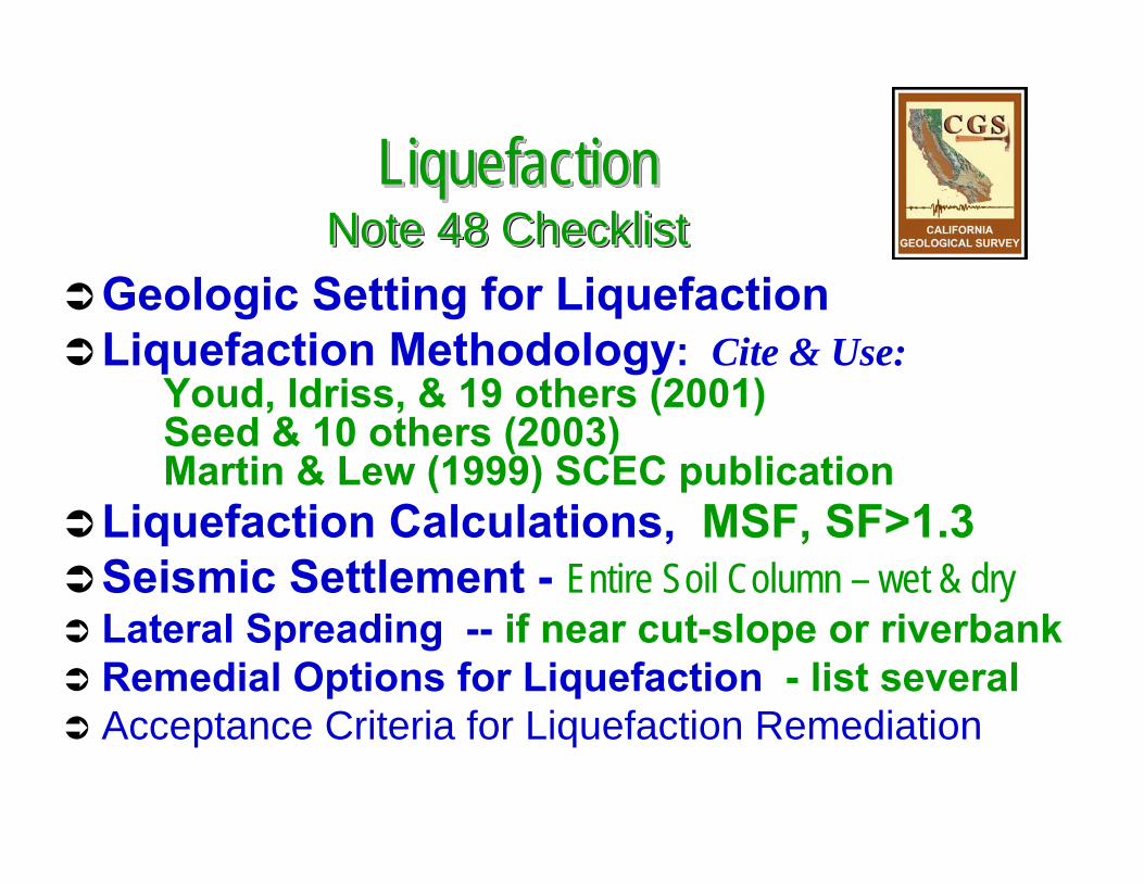
LiquefactionNote 48 Checklist
LiquefactionLiquefactionNote 48 ChecklistNote 48 Checklist
Geologic Setting for LiquefactionLiquefaction Methodology: Cite & Use:
Youd, Idriss, & 19 others (2001)Seed & 10 others (2003)Martin & Lew (1999) SCEC publication
Liquefaction Calculations, MSF, SF>1.3Seismic Settlement - Entire Soil Column – wet & dryLateral Spreading -- if near cut-slope or riverbankRemedial Options for Liquefaction - list severalAcceptance Criteria for Liquefaction Remediation
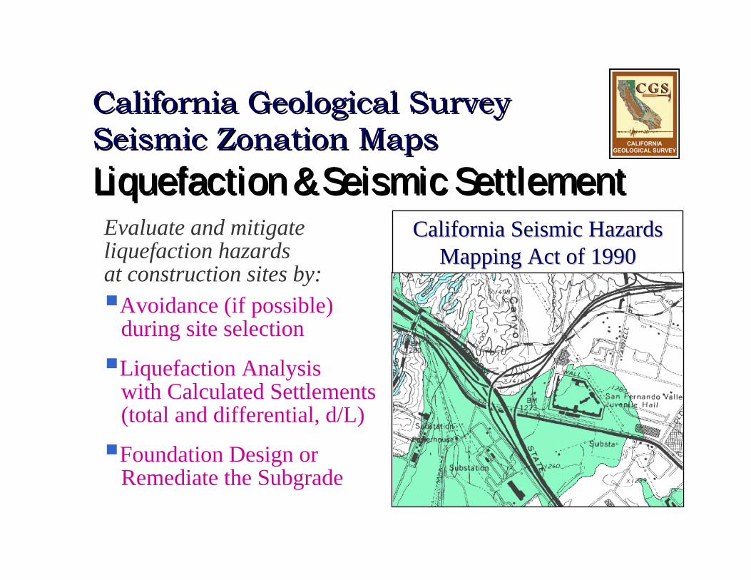
California Seismic Hazards California Seismic Hazards Mapping Act of 1990Mapping Act of 1990
California Geological SurveySeismic Zonation MapsLiquefaction & Seismic Settlement
California Geological SurveySeismic Zonation MapsLiquefaction & Seismic Settlement
Evaluate and mitigateliquefaction hazardsat construction sites by:
Avoidance (if possible)during site selection
Liquefaction Analysiswith Calculated Settlements(total and differential, d/L)
Foundation Design orRemediate the Subgrade
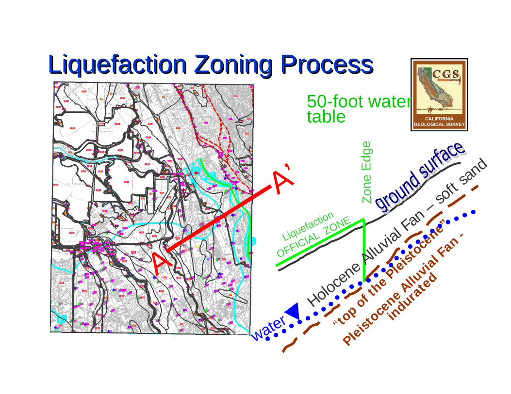
Liquefaction Zoning ProcessLiquefaction Zoning Process
Zone
Edg
e
Liquefaction
OFFICIAL ZONE
Holoce
ne Al
luvial
Fan –
soft s
and
“top of t
he Plei
stoce
ne”
Pleisto
cene A
lluvia
l Fan
-
indura
ted
water
50-foot water table
A
A’
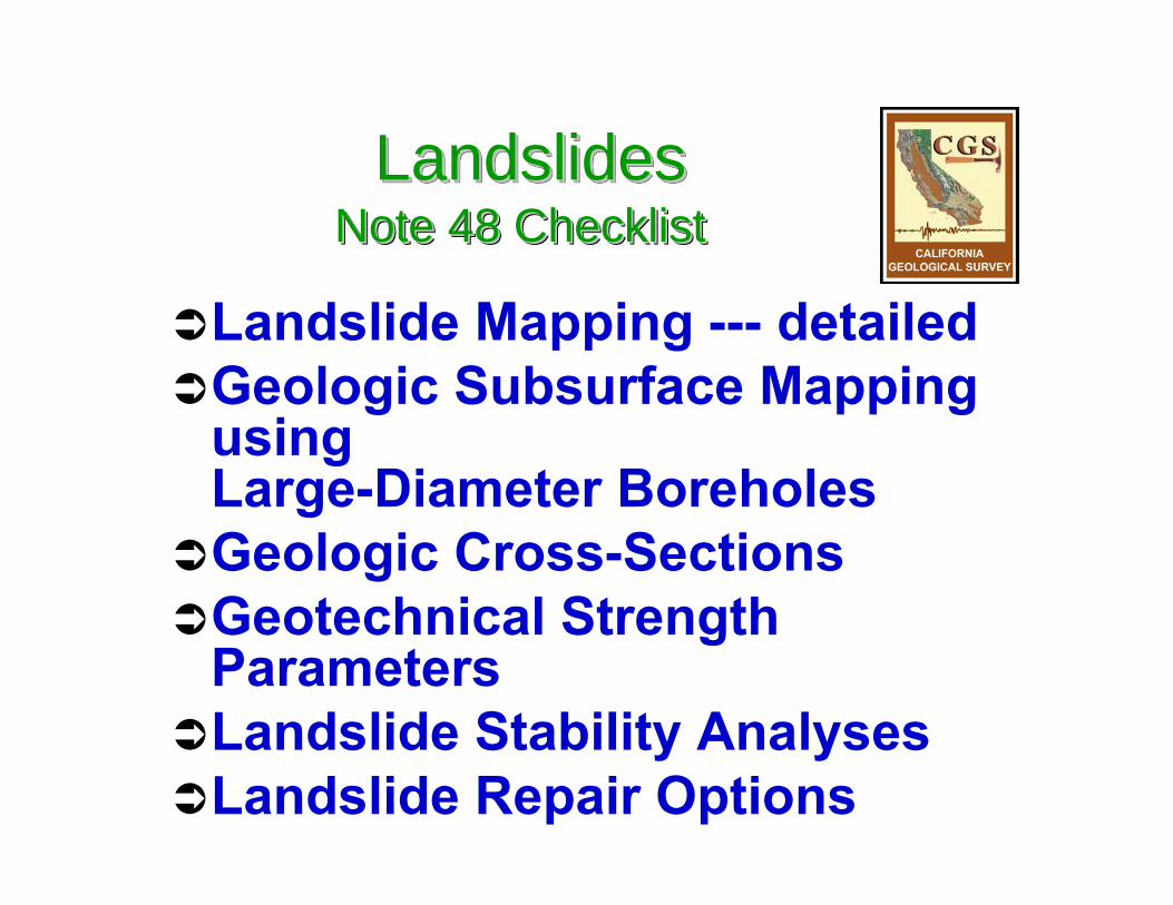
LandslidesNote 48 Checklist
LandslidesLandslidesNote 48 ChecklistNote 48 Checklist
Landslide Mapping --- detailedGeologic Subsurface Mapping usingLarge-Diameter BoreholesGeologic Cross-SectionsGeotechnical Strength ParametersLandslide Stability AnalysesLandslide Repair Options
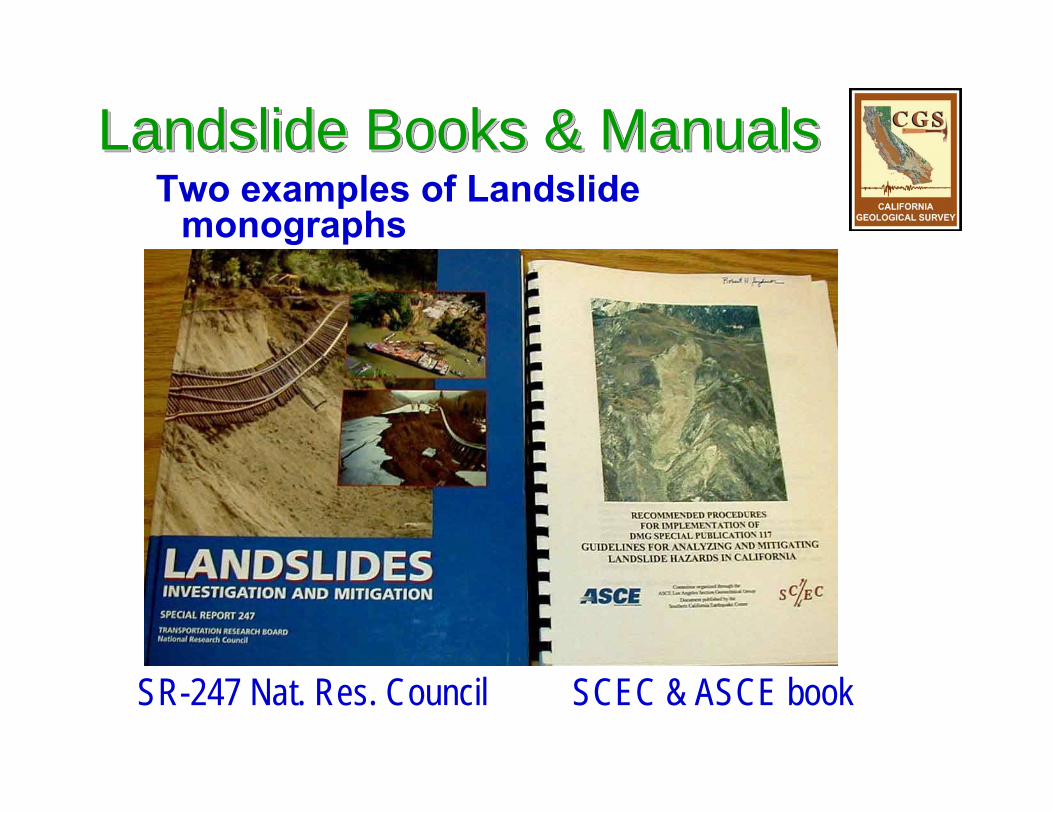
Landslide Books & ManualsLandslide Books & ManualsLandslide Books & ManualsTwo examples of Landslide
monographs
SR-247 Nat. Res. Council SCEC & ASCE book

SLOPE STABILITY ANALYSIS
Static Conditions:FS = R/D = Wcos α tan φ / Wsin α = tan φ / tan α
Dynamic Conditions:ay = (FS - 1)g sin a (Newmark’s Equation)
Wkh(t)W WW
Rs Rd
Ns = W cos α Nd
αDynamicModel
INFINITE SLOPE MODELINFINITE SLOPE MODEL
α
StaticModel

Grading Plan ReviewNote 48 Checklist
Grading Plan ReviewGrading Plan ReviewNote 48 ChecklistNote 48 Checklist
Consulting Geotech Review of PenultimateGrading Plans & Foundation PlansCalled-Inspections for CEG & RGESubdrain Plans & Surface-WaterCut-Fill Prisms & Seismic Compression of FillsDeep Foundations -- piles & caissonsRetaining Walls, Fill Buttresses, Geosynthetics

Report DocumentationNote 48 Checklist
Report DocumentationReport DocumentationNote 48 ChecklistNote 48 Checklist
Geology, Seismology, & Geotechnical References --- concise & pertinent to site
Engineering Geology Reportsigned by Certified Engineering GeologistGeotechnical Engineering Reportsigned by Registered Geotechnical Engineer

Begin with the End in Mind= Subsurface Strategy
Begin with the End in MindBegin with the End in Mind== Subsurface StrategySubsurface Strategy
Work backwards through these Parameters:Ultimate Question: Ultimate Question: What will be the Seismic Settlement?What will be the Seismic Settlement?
Differential Settlement? Total Settlement?Differential Settlement? Total Settlement?Multiple Settlement Calculations — formula of: Tokimatsu & Seed, 1987
Multiple Geologic Cross-Sections — through foundationsAdequate geotechnical lab testing — consolidation tests & void ratiosAdequate subsurface data — frequent sampling in sandsAdequate depth of boreholes �� 50 feet deepAdequate number of boreholes within building footprintVisualize geologic subgrade & anticipate complex
stratigraphy= planning of the drilling program.
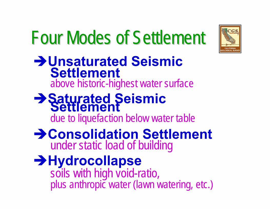
Four Modes of SettlementFour Modes of SettlementFour Modes of SettlementUnsaturated Seismic Settlementabove historic-highest water surfaceSaturated Seismic Settlementdue to liquefaction below water tableConsolidation Settlementunder static load of buildingHydrocollapsesoils with high void-ratio,plus anthropic water (lawn watering, etc.)
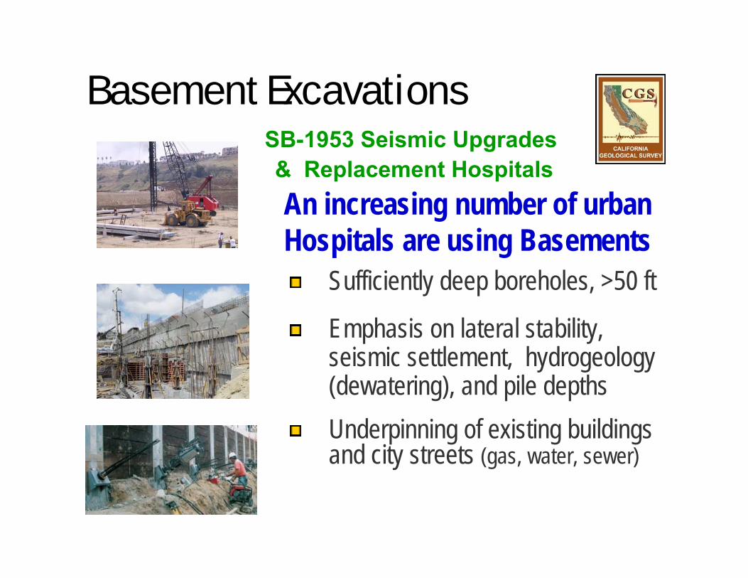
Basement Excavations
An increasing number of urban Hospitals are using Basements
Sufficiently deep boreholes, >50 ft
Emphasis on lateral stability,seismic settlement, hydrogeology (dewatering), and pile depthsUnderpinning of existing buildingsand city streets (gas, water, sewer)
SB-1953 Seismic Upgrades & Replacement Hospitals
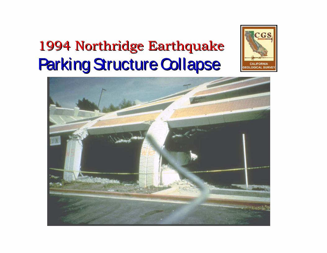
1994 Northridge EarthquakeParking Structure Collapse1994 Northridge EarthquakeParking Structure Collapse

Parking Structures
Sufficiently deep boreholes, ≥50 ft
Emphasis on seismic settlement, particularly differential, ∂ ÷ LDetermine optimum depth tostratigraphic horizon for Pile Tips
3 & 4-Story Reinforced Concrete with Heavy Column Loads
An increasing number ofurban Community Colleges & Hospitalsare planning Parking Structures
Useful Hints to Expedite Your Project
Useful Hints to Expedite Useful Hints to Expedite Your ProjectYour Project
Retain an Engineering Geologist to select a campuswith minimal geologic hazards.minimal geologic hazards.Use longUse long--range planning for adroit site acquisition.range planning for adroit site acquisition.Schools: Do not accept inferior properties from tract Schools: Do not accept inferior properties from tract developers (with: active faults, landslides, developers (with: active faults, landslides, liquefaction).liquefaction).Select aSelect a qualified CEG & RGEqualified CEG & RGE for the design team.Begin geologic field-work in a timely mannertimely manner
(avoid winter drilling & earthwork during rains).(avoid winter drilling & earthwork during rains).Provide preliminary ground-motionto the Structural Engineer in a timely manner.Avoid costly re-design --- one year later.Plan the layout & depth of boreholes commensurate with the subsurface geologic conditions, andcolumn loads and basements.
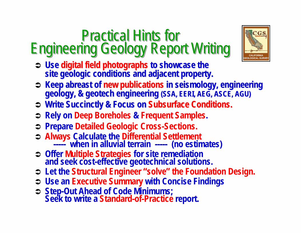
Practical Hints forEngineering Geology Report Writing
Practical Hints forPractical Hints forEngineering Geology Report WritingEngineering Geology Report Writing
Use Use digital field photographsdigital field photographs to showcase theto showcase thesite geologic conditions and adjacent property.site geologic conditions and adjacent property.Keep abreast of Keep abreast of new publicationsnew publications in seismology, engineering in seismology, engineering geology, & geotech engineering geology, & geotech engineering (SSA, EERI, AEG, ASCE, AGU)(SSA, EERI, AEG, ASCE, AGU)Write Succinctly & Focus on Write Succinctly & Focus on Subsurface Conditions.Subsurface Conditions.Rely on Deep Boreholes & Frequent Samples.Prepare Detailed Geologic Cross-Sections.Always Calculate the Differential Settlement
----- when in alluvial terrain ----- (no estimates)Offer Multiple Strategies for site remediationand seek cost-effective geotechnical solutions.Let the Structural Engineer “solve” the Foundation Design.Use an Executive Summary with Concise FindingsStep-Out Ahead of Code Minimums;Seek to write a Standard-of-Practice report.
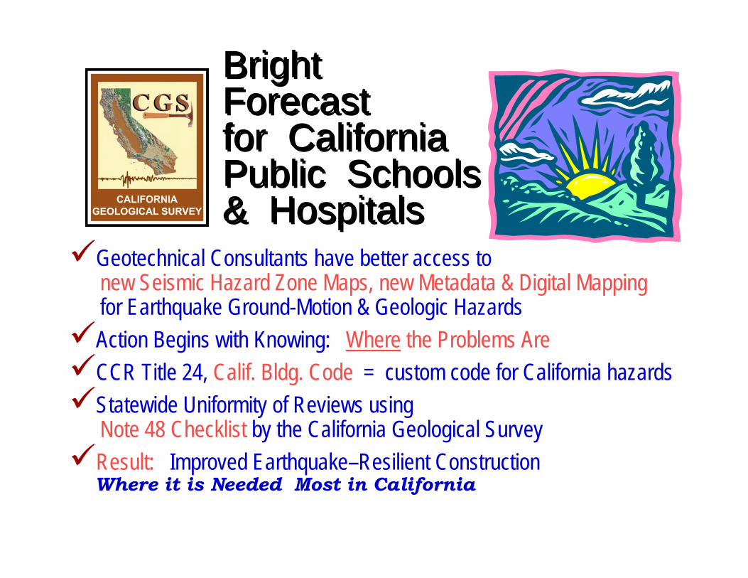
Bright Forecast for CaliforniaPublic Schools& Hospitals
Bright Forecast for CaliforniaPublic Schools& Hospitals
Geotechnical Consultants have better access tonew Seismic Hazard Zone Maps, new Metadata & Digital Mappingfor Earthquake Ground-Motion & Geologic HazardsAction Begins with Knowing: Where the Problems AreCCR Title 24, Calif. Bldg. Code = custom code for California hazardsStatewide Uniformity of Reviews usingNote 48 Checklist by the California Geological SurveyResult: Improved Earthquake–Resilient ConstructionWhere it is Needed Most in California