Embed Size (px)
Citation preview

A04
The moral rights of the author to publish this book have been asserted and all rights are reserved.
No part of this book may be reproduced or utilized in any form or by any means, electronic, me-chanical, or photocopy without the prior permission in writing from the author Dr James Maxlow, except for brief quotes and excerpts in connection with scholarly analysis and di-scussion.
Copyright © 2018 Dr James Maxlow
Photography by Anita and James Maxlow.
Graphics by Anita and James Maxlow.
Permission was granted by the Commission de la Carte Geologique du Monda, Paris to use and digitise the Geological Map of the World at 1:25,000,000 M scale (1990), published by the Commis-sion for the Geological Map of the World and UNESCO © (1990).
Digitising the Geological Map of the World (1990) © was originally carried out by Simon Brown of Geoviz International.
James Maxlow
Beyond plate tectonicsUnsettling settled science
Aracne editrice
Copyright © MMXVIIIGioacchino Onorati editore S.r.l. — unipersonale
via Vittorio Veneto, 2000020 Canterano (RM)
(06) 45551463
isbn 978–88–255–1890–0
No part of this book may be reproduced by print, photoprint, microfilm, microfiche, or any other means,
without publisher’s authorization.
Ist edition: November 2018

And some rin up hill and down dale, Knapping the chunky stanes to pieces wi’ hammers, Like sae many road makers run daft. They say it is to see how the warld was made.
Sir Walter Scott, St. Ronan’s Well, 1824

7
Index
13 About the Author 15 Dedication 17 Preface
Part OneIntroduction, Historical Aspects, and Geological Modelling
23 Introduction
33 Chapter 1 Controversial Ideas
1.1. Conventional Wisdom – 1.2. Alternative Considerations.
51 Chapter 2 New Discoveries
2.1. Geologic Time Scale – 2.2. Magnetic Seafloor Mapping.
63 Chapter 3 Geological Map of the World
3.1. Measuring Seafloor Surface Areas – 3.2. Measuring Potential An-cient Earth Radii.
75 Chapter 4 Modelling Seafloor Crusts
4.1. Assumptions – 4.2. Model Construction – 4.3. Observations.
8 Index
85 Chapter 5 Modern Oceans and Seas
5.1. Arctic Ocean – 5.2. Atlantic Ocean – 5.2.1. North Atlantic Ocean – 5.2.2. South Atlantic Ocean – 5.3. Caribbean Sea –5.4. Indian Ocean – 5.5. Pacific Ocean – 5.6. Mediterranean Sea – 5.7. South East Asian Seas – 5.8. Southwest Pacific Ocean – 5.9. Southern Ocean.
109 Chapter 6 Pre–Jurassic Earth Radii
6.1. Continental Crust – 6.2. Crustal Extension – 6.3. Establishing Po-tential Pre–Jurassic Earth Radii – 6.4. Changing Earth Parameters – 6.5. Mass, Density and Surface Gravity – 6.5.1. Constant Earth Mass Scenario – 6.5.2. Increasing Earth Mass Scenario.
129 Chapter 7 Modelling Continental Crusts
7.1. Assumptions – 7.2. Model Construction – 7.3. Preliminary Observa-tions.
139 Chapter 8 Ancient Supercontinents
8.1. Archaean Supercontinent – 8.2. Rodinia Supercontinent – 8.2.1. Nor-th Atlantic Ocean – 8.2.2. South Atlantic Ocean – 8.3. Gondwana Supercon-tinent – 8.4. Laurentia, Baltica, Laurussia Sub–continents – 8.5. Pangaea Supercontinent.
153 Chapter 9 Modern Continents
9.1. Australia – 9.2. Africa and Arabia – 9.3. Antarctica – 9.4. Europe, Russia and Asia – 9.5. India – 9.6. North America–Greenland–Scandina-via – 9.7. South America – 9.7. The Future.
175 Chapter 10 Modelling Summary

Index 9
Part TwoEmpirical Global Data Modelling
181 Chapter 11 Proposed Causal Mechanism
11.1. Plasma Transfer from the Sun – 11.2. Earth and Solar System – 11.2.1. Effects on the Present–Day Earth – 11.2.2. Effects on the Ancient Earth.
193 Chapter 12 Palaeomagnetics
12.1. Remnant Magnetism – 12.2. Palaeomagnetic Dipole Formula – 12.3. Apparent–Polar–Wander – 12.4. Present–day Palaeomagnetic Po-les, – 12.5. Palaeomagnetics on an Increasing Radius Earth – 12.6. An Alternative Palaeopole Method – 12.7. Ancient Palaeomagnetic Poles – 12.8. Ancient Latitude – 12.9. Palaeoradius Using Palaeomagnetics – 12.10. African Palaeoradius Determinations.
223 Chapter 13 Space Geodetics
13.1. Space Geodetic Data – 13.2. Space Geodetic Limitations – 13.3. Continental Plate Motion.
235 Chapter 14 Geological Implications
14.1. Historical Overview – 14.2. Changing Earth Surface Curvature –14.3. Relief of Surface Curvature – 14.4. Geosynclines – 14.5. Crustal Mechanisms –14.5.1. Crustal Formation – 14.5.2. Primary Crustal Mechani-sms – 14.5.3. Enduring Strength and Super–Elevation – 14.5.4. Relief of Sur-face Curvature (Subduction–Related Features) – 14.5.5. Orogenesis – 14.5.6. Fold–Mountain Belts – 14.6. Proposed Crustal Model.
273 Chapter 15 Palaeogeographic Evidence
15.1. Ancient Shorelines – 15.2. Ancient Continental Sedimentary Basins – 15.3. Rise and Fall in Sea Levels.
10 Index
283 Chapter 16 Palaeoclimate Evidence
16.1. Present–day and Ancient Climate Zones – 16.2. Ancient Coral Re-efs – 16.3. Ice Age – 16.4. Distribution of Ancient Polar Regions – 16.5. Ancient Glacial Record – 16.5.1. Early–Proterozoic Huronian Glaciation – 16.5.2. Late–Proterozoic Cryogenian Glaciation – 16.5.3. Precambrian Glacia-tion – 16.5.4. Early–Palaeozoic Andean–Saharan Glaciation – 16.5.5. Late–Palaeozoic Karoo Glaciation – 16.5.6. Late–Cenozoic Quaternary Glaciation.
307 Chapter 17 Extinction Evidence
17.1. End–Ordovician Extinction Event – 17.2. Late–Devonian Extin-ction Event – 17.3. End–Permian Extinction Event – 17.4. End–Triassic Extinction Event – 17.5. End–Cretaceous Extinction Event.
321 Chapter 18 Palaeobiogeographic Evidence
18.1. Biogeographic Data Modelling – 18.2. Precambrian Life – 18.3. Ear-ly–Palaeozoic Life – 18.4. Mid–Palaeozoic Life – 18.5. Late–Palaeozoic Life – 18.6. Mesozoic Life – 18.7. Cenozoic Life –18.8. Summary of Life on Earth.
359 Chapter 19 Metallogenic Evidence
19.1. Metallogenic Epochs – 19.1.1. Archaean Metallogenesis – 19.1.2. Pro-terozoic Metallogenesis – 19.1.3. Phanerozoic Metallogenesis – 19.2. Metallo-genic Provincial Modelling.
375 Chapter 20 Fossil Fuel Evidence
20.1. Shale Oil–Gas – 20.2. Permo–Carboniferous Coal – 20.3. Cretace-ous Lignite Coal – 20.4. Petroleum and Natural Gas – 20.5. Fossil Fuel Global Distributions.
Index 11
Part ThreeSpeculating on the Geological Rock Record
389 Chapter 21 Continental Example
21.1. Australian Crustal Development – 21.1.1. Archaean Superprovinces – 21.1.2. Archaean to Proterozoic Superprovince – 21.1.3. Tasman Superprovince
399 Chapter 22 Geological Rock Record
22.1. Primitive Atmosphere and Hydrosphere – 22.2. Archaean Crust–Mantle – 22.3. Proterozoic Earth – 22.4. Palaeozoic Earth, – 22.5. Meso-zoic Earth – 22.6. Cenozoic Earth.
423 Chapter 23 A Paradigm Shift in Thinking
433 Glossary of Terms
461 Bibliography
473 Appendix A
Kinematics – Radius, Circumference, Surface Area, Volume – Mass Den-sity and Surface Gravity – Secular Rate of Change.
481 Appendix B
Palaeomagnetic Formulae – Magnetic Dipole Equations – Modified Di-pole Formulae – Secular Rate of Change.

13
About the Author
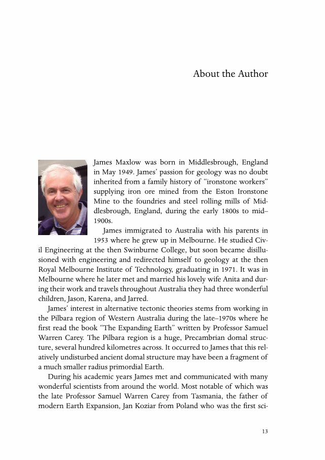
James Maxlow was born in Middlesbrough, England in May 1949. James’ passion for geology was no doubt inherited from a family history of “ironstone workers” supplying iron ore mined from the Eston Ironstone Mine to the foundries and steel rolling mills of Mid-dlesbrough, England, during the early 1800s to mid–1900s.
James immigrated to Australia with his parents in 1953 where he grew up in Melbourne. He studied Civ-
il Engineering at the then Swinburne College, but soon became disillu-sioned with engineering and redirected himself to geology at the then Royal Melbourne Institute of Technology, graduating in 1971. It was in Melbourne where he later met and married his lovely wife Anita and dur-ing their work and travels throughout Australia they had three wonderful children, Jason, Karena, and Jarred.
James’ interest in alternative tectonic theories stems from working in the Pilbara region of Western Australia during the late–1970s where he first read the book “The Expanding Earth” written by Professor Samuel Warren Carey. The Pilbara region is a huge, Precambrian domal struc-ture, several hundred kilometres across. It occurred to James that this rel-atively undisturbed ancient domal structure may have been a fragment of a much smaller radius primordial Earth.
During his academic years James met and communicated with many wonderful scientists from around the world. Most notable of which was the late Professor Samuel Warren Carey from Tasmania, the father of modern Earth Expansion, Jan Koziar from Poland who was the first sci-

14 About the Author
entist to measure and calculate an ancient Earth radius using modern sea-floor mapping, and the late Klaus Vogel from Germany, the father of mod-ern small Earth modelling studies. It was during James’ academic studies that Professor Carey recognized the potential of his research into Global Tectonics. Carey then kindly “passed on his Expanding Earth baton” to James in order to further ongoing research into Expansion Tectonics; an honour that James deeply cherishes.
James gained his Master of Science in geology in 1995, followed by a Doctorate of Philosophy in 2001 at Curtin University of Technology, Perth, Western Australia, including a letter of commendation from the university Chancellor for original thought provoking research into Expan-sion Tectonics. His Master of Science thesis was called: “Global Expansion Tectonics: the Geological Implications of an Expanding Earth”, and his PhD thesis was called: “Quantification of an Archaean to Recent Earth expansion Process Using Global Geological and Geophysical Data Sets.”
15
Dedication
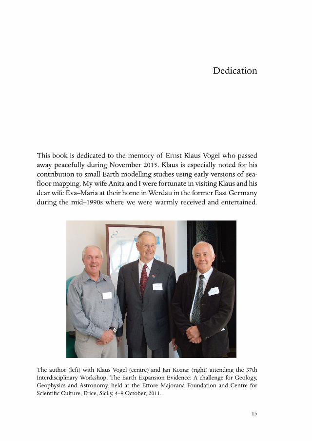
This book is dedicated to the memory of Ernst Klaus Vogel who passed away peacefully during November 2015. Klaus is especially noted for his contribution to small Earth modelling studies using early versions of sea-floor mapping. My wife Anita and I were fortunate in visiting Klaus and his dear wife Eva–Maria at their home in Werdau in the former East Germany during the mid–1990s where we were warmly received and entertained.
The author (left) with Klaus Vogel (centre) and Jan Koziar (right) attending the 37th Interdisciplinary Workshop; The Earth Expansion Evidence: A challenge for Geology, Geophysics and Astronomy, held at the Ettore Majorana Foundation and Centre for Scientific Culture, Erice, Sicily, 4–9 October, 2011.
16 Dedication
Klaus’ small Earth models represent the first time that modern seafloor mapping has been used to both constrain plate assemblage and to accu-rately constrain ancient Earth radius back to the early–Jurassic Period.
17
Preface
With the hindsight of over fifty years of global tectonic data collection and processing by numerous researchers, my primary intent in writing this book is to utilize this modern global observational data in order to investigate what else this data tells us about the formation and subsequent geological history of the Earth. Or, as Zarebski noted, to investigate “new ways of seeing and understanding the physical world”.
Over the past half century modern global tectonic data has primari-ly been investigated from a conventional Continental Drift–based Plate Tectonic perspective. To an observer it may seem that science has adopt-ed Continental Drift as a unique and comprehensive mechanism for our tectonic understanding of the Earth and all is settled in the geosciences. In reality, at no stage over this time period has the scientific community been encouraged, or has seriously deviated from conventional Continen-tal Drift–based plate theory in order to see what else this modern global data may reveal beyond our current Plate Tectonic understanding.
It is emphasized that the research presented here — based exclusively on modern global observational data — is a data modelling exercise focused on modelling this data independently of any present or pre–existing theory. It is important to note this is not a theory modelling exercise. This critical analy-sis allows the data to tell its own story and reveals a new tectonic picture of the Earth that more closely aligns with global empirical observations. It will be systematically shown that the resulting picture overcomes a great num-ber of known limitations and problems still facing Plate Tectonics today and, in particular, the use of Continental Drift as the basis of plate theory.
The research presented here does not directly challenge or discredit Plate Tectonics. It does, however, offer new ways of interpreting and un-
18 Preface
derstanding the vast amount of Plate Tectonic observational data now available today. A concern raised during this research is that, when Plate Tectonics was first introduced during the 1960s, the decision to use Con-tinental Drift as the basis of plate theory may have been premature and ill–advised. Because of this decision, scientists have since failed to utilize this modern global tectonic data in order to further test or quantify this decision.
The work covered in this book represents the results of an intensive re-search study by the author, a retired professional geologist and researcher, over a period of twenty five years. Because no one can know for certain what has happened to our Earth over the four to five billion years of its existence, it is considered that, in order to understand more about what modern global data has to offer, we need to start from the present–day Earth and, step by step, reconstruct global data for increasingly older ge-ological periods, thus working our way back in time. This actualistic–prin-ciple approach, which emphasizes reliance on observed geology, is already the basis for modern understanding of the geological evolution of our Earth: the present is the key to the past.
This book is structured in three main parts. Part 1 will introduce his-torical aspects relating to the origins and development of global tecton-ics. Focus then shifts to presenting modern geological mapping evidence from the continents and oceans which will be displayed on purpose–built spherical scale models of the Earth. This geological mapping is then used exclusively to accurately constrain crustal plate assemblages back to the early Archaean — the beginning of geological time — an unprecedented outcome. From this spherical modelling study the origins of not only the continents and oceans but also the origins of the more ancient supercon-tinents and primitive seas will be discussed at length.
Part 2 extends on these geological modelling studies by introducing additional global tectonic observational data from a wide range of more specialized fields of Earth science. These fields include geology, palaeo-geography, palaeoclimate, biogeography, palaeomagnetics, natural metal-lic and fossil–fuel based resources, and space geodetics. The opportunity will also be taken to speculate on a proposed causal mechanism for the observations raised.
Part 3 introduces even more detailed and specialized geology in order to compare and contrast the different viewpoints raised by this new shift

Preface 19
in thinking. The implications raised by the modelling study will also be used in an attempt to further promote original thought and to create new opportunities for on–going research within the sciences.
The approach taken here is considered necessary in order to promote increased objectivity in the modelling and interpretation of all global tec-tonic observational data. If conventional Continental Drift–based plate theory is truly consistent with the modern data, then there is no problem and the data modelling will highlight this. If it is not, then there exists a problem that demands to be taken seriously and in the Earth sciences must be fully addressed by the scientific community as a whole.
The data used throughout this book is sourced from well–renowned international datasets including the International Global Palaeomagnetic Databases of McElhinny & Lock (1996) and Pisarevsky (2004), the dis-tributions of ancient shorelines based on the published data of Scotese (1994) and Smith et al. (1994), and palaeobiogeographic data sourced from the Paleobiology Database (PaleoBioDB) (2015). The distribution of met-als is sourced from the USGS Mineral Resource Data Set (MRDS) (2015) and oil and gas resources sourced from various publications.
The contents of this book are written in an informative style and are designed to appeal to a wide audience — in particular those with an in-nate exposure to the natural sciences — and to persons with prior expo-sure and qualifications in the various Earth sciences.
Much of the first part of this book is based on geological research orig-inally carried out as part of the requirement for the award of the Doc-tor of Philosophy of Curtin University of Technology in Perth, Western Australia, completed in 2001 with some extracts from my earlier Master of Science award of Curtin University of Technology completed in 1995. The book is also a completely revised and updated extension of earlier books, including: Terra non Firma Earth, first published in 1995, and On the Origin of Continents and Oceans: A Paradigm Shift in Understanding, first published in 2014, along with the introduction of an extensive range of new modern data and modelling studies.
Acknowledgements and special thanks go to my wife Anita Maxlow of Terrella Press for her support, encouragement, and assistance in editing, and for her patient involvement in graphical display and publication of this book. Sincere thanks must also go to Philippe Bouysse of the Commission de la Carte Geologique du Monde, Paris, for granting permission to use
20 Preface
and digitize the Geological Map of the World at 1:25,000,000 M scale (1990), published by the Commission for the Geological Map of the World and UNESCO©. Simon Brown of Geoviz International, Perth, Western Aus-tralia, who originally digitized the Geological Map of the World which was then used as a base map in my research. Also thanks are due to Profes-sor Cliff Ollier, Dr Errol Stock, John B. Eichler, Jan Koziar, Bill Erickson, and Stephen Hurrell, amongst many others, who have provided invalu-able assistance with editing of early versions of this text and providing constructive assistance on content and structure, stimulating discussion on mountains, causal mechanisms, crustal processes, dinosaurs, as well as ongoing encouragement towards completion of this book.
Dr James MaxlowPerth, Western Australia, 2018.


![5602 Traveller - [A04] Leviathan](https://img.pdfslide.us/doc/110x75/577c80d51a28abe054aa5951/5602-traveller-a04-leviathan.jpg)