Embed Size (px)
Citation preview
Develop, communicate, and
apply practical and credible science in responding to risks and mitigating the
consequences from spills and other hazards
threatening coastal environments and
communities.
Emergency Response DivisionAccomplishments 2012
NOAA Office of Response and Restoration
Contents
The Emergency Response Division 3
Responding to Environmental Threats 4
Staying Prepared 8
Building Better Capabilities 11
Achieving Excellence 15
Every year, natural disasters and maritime accidents result in oil spills and chemical releases that threaten America’s coasts.The role of the Emergency Response Division of NOAA’s Office of Response and Restoration (OR&R) is to ensure that the nation’s responders have the science and experience they need to guide tough decisions during these crises. This role requires significant investment in preparedness, training, and research and development. To meet these needs, OR&R’s Emergency Response Division (ERD) maintains partnerships with other agencies, academia, and private industry, as well as a staff of approximately 50 talented scientists, programmers, and support personnel.
Following the Deepwater Horizon/BP oil spill in 2010, opportunities have emerged for new research and development, new partners, and even new ways of employing science during an emergency. BP dedicated $500 million over 10 years to oil spill research. The RESTORE Act will ensure 80 percent of the settlement funds from Clean Water Act penalties will be directed toward restoring the Gulf of Mexico’s ecosystems and economy. On both the national and international scales, private companies are pooling their talents and financial resources to research important scientific questions related to oil spill response.
There has never been a better time to advance the science and technology related to oil spills. With this opportunity comes the responsibility to help transition—when appropriate—public and private research from experimental to operational use. Taking full advantage of and contributing to these activities is challenging with today’s broader scopes of work and increasingly constrained budgets. However, as ERD faces this reality over the next several years, the responsibility remains to build better tools for real-world response decisions. I believe ERD already has risen to this challenge in fiscal year 2012 and will continue to do so over the next several years.
The list of ERD’s 2012 accomplishments is long. The following report highlights some of these accomplishments and provides examples of how ERD is moving forward strategically in the wake of new opportunities.
The success of the division comes from a small but dedicated staff with support from NOAA and federal, state, and local partners. I am proud of what we have accomplished in 2012 and am excited to see what we can accomplish in 2013 and beyond.
Debbie Payton, Emergency Response Division Chief
3
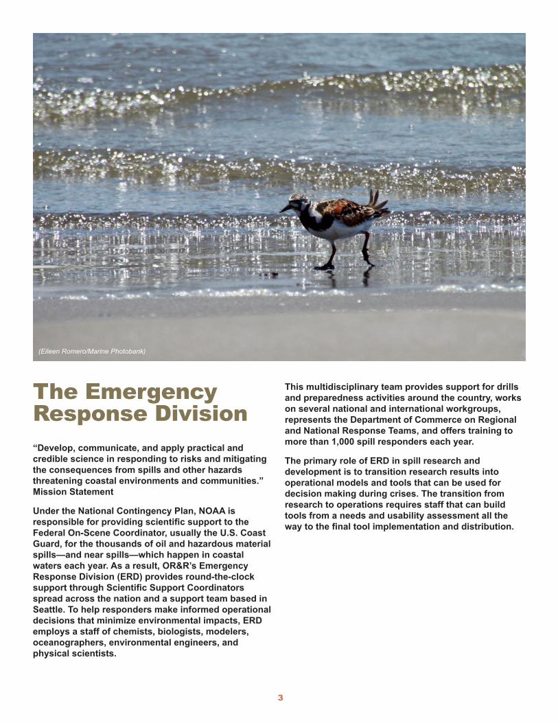
The Emergency Response Division“Develop, communicate, and apply practical and credible science in responding to risks and mitigating the consequences from spills and other hazards threatening coastal environments and communities.” Mission Statement
Under the National Contingency Plan, NOAA is responsible for providing scientific support to the Federal On-Scene Coordinator, usually the U.S. Coast Guard, for the thousands of oil and hazardous material spills—and near spills—which happen in coastal waters each year. As a result, OR&R’s Emergency Response Division (ERD) provides round-the-clock support through Scientific Support Coordinators spread across the nation and a support team based in Seattle. To help responders make informed operational decisions that minimize environmental impacts, ERD employs a staff of chemists, biologists, modelers, oceanographers, environmental engineers, and physical scientists.
This multidisciplinary team provides support for drills and preparedness activities around the country, works on several national and international workgroups, represents the Department of Commerce on Regional and National Response Teams, and offers training to more than 1,000 spill responders each year.
The primary role of ERD in spill research and development is to transition research results into operational models and tools that can be used for decision making during crises. The transition from research to operations requires staff that can build tools from a needs and usability assessment all the way to the final tool implementation and distribution.
(Eileen Romero/Marine Photobank)

4
2002 2003 2004 2005 2006 2007 2008 2009 2010 2011 2012
200
150
100
50
0
Other
Chemical
Oil
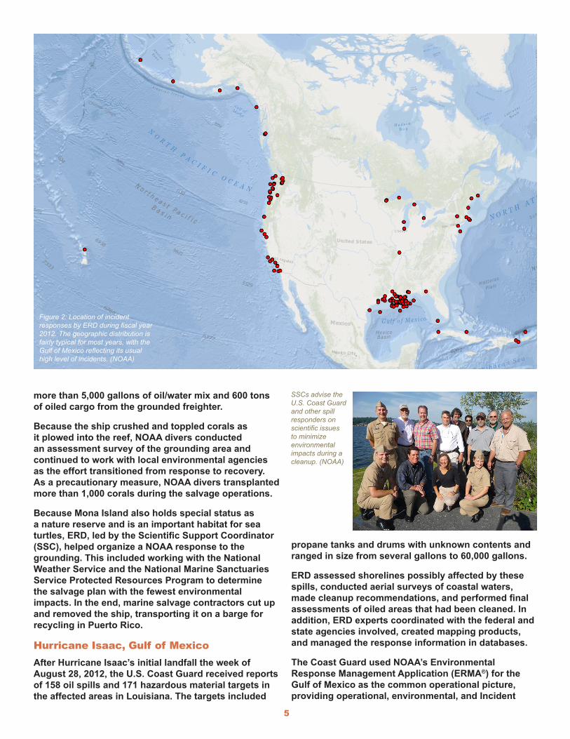
Responding to Environmental ThreatsFrom October 2011 to September 2012, the Office of Response and Restoration’s Emergency Response Division (ERD) responded to 131 oil spills, chemical accidents, and various other threats to coastal environments and communities. As in previous years, the majority of this work supported U.S. Coast Guard operations. As shown in Figure 1, the annual number of incidents that ERD responds to has returned to the 10-year average after a peak in 2009. However, some incidents result in only a few hours or days of work, while others require considerably more time and effort. For example, some ERD staff was still working on the response in Louisiana in early 2013, several years after the 2010 Deepwater Horizon/BP oil spill. The map in Figure 2 shows the locations of incidents around the U.S. in which ERD provided response support during fiscal year 2012.
The following are three notable examples of maritime responses that ERD supported during fiscal year 2012.
Figure 1: Number of annual incident responses by ERD from 2002 to 2012, showing oil, chemical, and other (e.g., log booms, shipping containers, etc.) incidents.
Oil washed up on the beaches of Grand Isle, La., from the Deepwater Horizon/BP oil spill. (Eileen Romero/Marine Photobank)
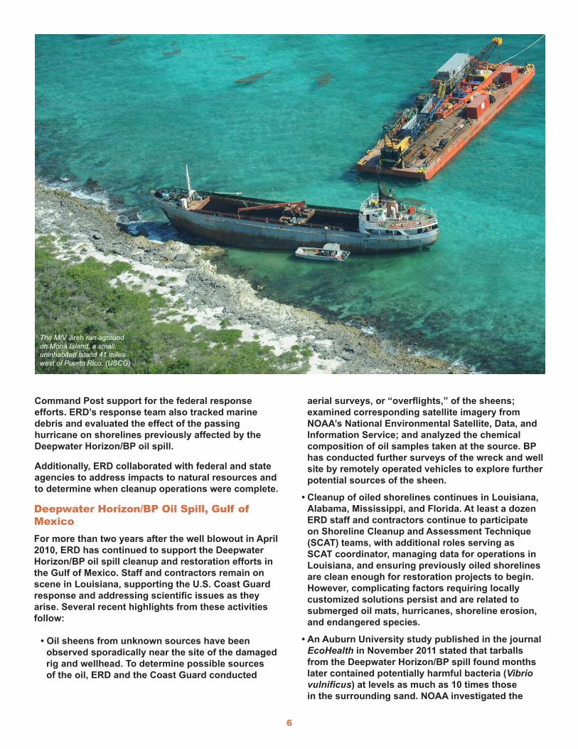
M/V Jireh, Mona Island, Puerto Rico On June 21, 2012, the 202-foot M/V Jireh ran aground on Mona Island, a small, uninhabited island 41 miles west of Puerto Rico. NOAA, U.S. Coast Guard, U.S. Fish and Wildlife Service, and the Commonwealth of Puerto Rico focused on recovering the approximately 2,000 gallons of fuel oil on board the freighter to minimize the environmental impact, particularly to corals. During the initial stages of the response, contractors removed
5
propane tanks and drums with unknown contents and ranged in size from several gallons to 60,000 gallons.
ERD assessed shorelines possibly affected by these spills, conducted aerial surveys of coastal waters, made cleanup recommendations, and performed final assessments of oiled areas that had been cleaned. In addition, ERD experts coordinated with the federal and state agencies involved, created mapping products, and managed the response information in databases.
The Coast Guard used NOAA’s Environmental Response Management Application (ERMA®) for the Gulf of Mexico as the common operational picture, providing operational, environmental, and Incident
more than 5,000 gallons of oil/water mix and 600 tons of oiled cargo from the grounded freighter.
Because the ship crushed and toppled corals as it plowed into the reef, NOAA divers conducted an assessment survey of the grounding area and continued to work with local environmental agencies as the effort transitioned from response to recovery. As a precautionary measure, NOAA divers transplanted more than 1,000 corals during the salvage operations.
Because Mona Island also holds special status as a nature reserve and is an important habitat for sea turtles, ERD, led by the Scientific Support Coordinator (SSC), helped organize a NOAA response to the grounding. This included working with the National Weather Service and the National Marine Sanctuaries Service Protected Resources Program to determine the salvage plan with the fewest environmental impacts. In the end, marine salvage contractors cut up and removed the ship, transporting it on a barge for recycling in Puerto Rico.
Hurricane Isaac, Gulf of MexicoAfter Hurricane Isaac’s initial landfall the week of August 28, 2012, the U.S. Coast Guard received reports of 158 oil spills and 171 hazardous material targets in the affected areas in Louisiana. The targets included
SSCs advise the U.S. Coast Guard and other spill responders on scientific issues to minimize environmental impacts during a cleanup. (NOAA)
Figure 2: Location of incident responses by ERD during fiscal year 2012. The geographic distribution is fairly typical for most years, with the Gulf of Mexico reflecting its usual high level of incidents. (NOAA)
6
Deepwater Horizon/BP Oil Spill, Gulf of MexicoFor more than two years after the well blowout in April 2010, ERD has continued to support the Deepwater Horizon/BP oil spill cleanup and restoration efforts in the Gulf of Mexico. Staff and contractors remain on scene in Louisiana, supporting the U.S. Coast Guard response and addressing scientific issues as they arise. Several recent highlights from these activities follow:
• Oil sheens from unknown sources have been observed sporadically near the site of the damaged rig and wellhead. To determine possible sources of the oil, ERD and the Coast Guard conducted
aerial surveys, or “overflights,” of the sheens; examined corresponding satellite imagery from NOAA’s National Environmental Satellite, Data, and Information Service; and analyzed the chemical composition of oil samples taken at the source. BP has conducted further surveys of the wreck and well site by remotely operated vehicles to explore further potential sources of the sheen.
• Cleanup of oiled shorelines continues in Louisiana, Alabama, Mississippi, and Florida. At least a dozen ERD staff and contractors continue to participate on Shoreline Cleanup and Assessment Technique (SCAT) teams, with additional roles serving as SCAT coordinator, managing data for operations in Louisiana, and ensuring previously oiled shorelines are clean enough for restoration projects to begin. However, complicating factors requiring locally customized solutions persist and are related to submerged oil mats, hurricanes, shoreline erosion, and endangered species.
• An Auburn University study published in the journal EcoHealth in November 2011 stated that tarballs from the Deepwater Horizon/BP spill found months later contained potentially harmful bacteria (Vibrio vulnificus) at levels as much as 10 times those in the surrounding sand. NOAA investigated the
Command Post support for the federal response efforts. ERD’s response team also tracked marine debris and evaluated the effect of the passing hurricane on shorelines previously affected by the Deepwater Horizon/BP oil spill.
Additionally, ERD collaborated with federal and state agencies to address impacts to natural resources and to determine when cleanup operations were complete.
The M/V Jireh ran aground on Mona Island, a small, uninhabited island 41 miles west of Puerto Rico. (USCG)
7
study’s findings and potential health threats to response workers and the public. The levels of the bacteria in the tarballs were consistent with the levels found normally and did not pose a health risk. An ERD Scientific Support Coordinator worked with NOAA’s Center for Coastal Environmental Health and Biomolecular Research to review previously published studies, examine the virulence of these and related bacteria, and provide guidance to the Incident Command.
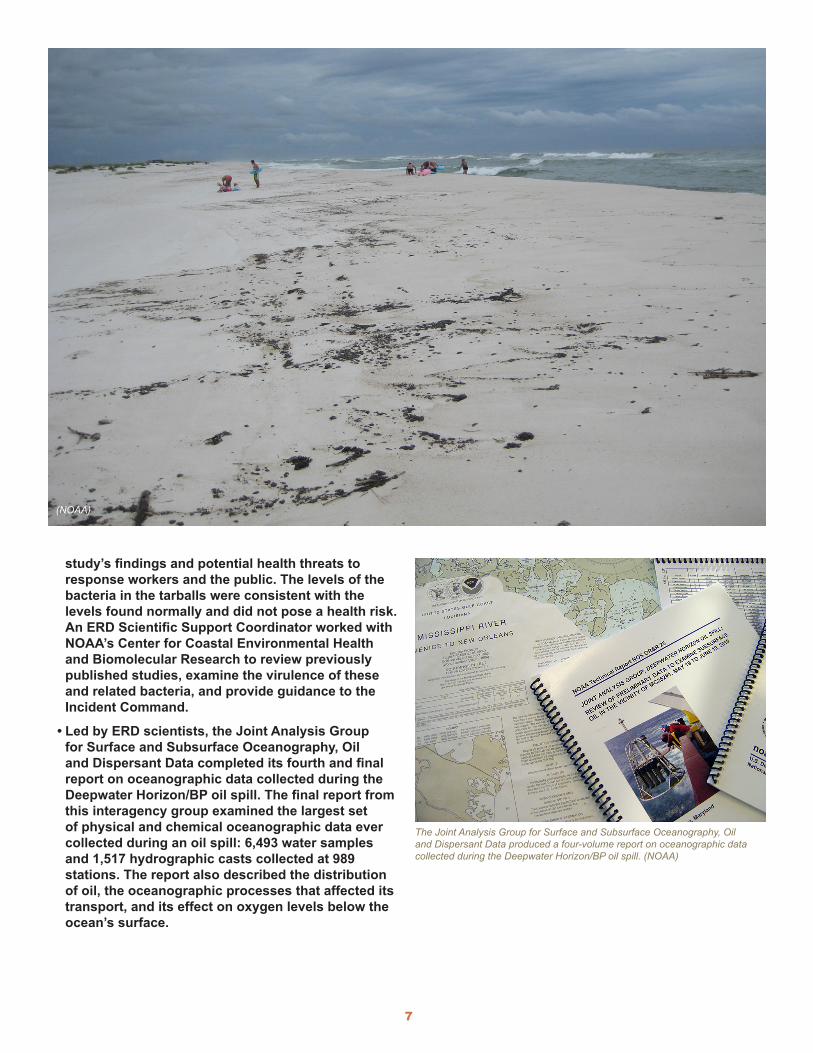
• Led by ERD scientists, the Joint Analysis Group for Surface and Subsurface Oceanography, Oil and Dispersant Data completed its fourth and final report on oceanographic data collected during the Deepwater Horizon/BP oil spill. The final report from this interagency group examined the largest set of physical and chemical oceanographic data ever collected during an oil spill: 6,493 water samples and 1,517 hydrographic casts collected at 989 stations. The report also described the distribution of oil, the oceanographic processes that affected its transport, and its effect on oxygen levels below the ocean’s surface.
The Joint Analysis Group for Surface and Subsurface Oceanography, Oil and Dispersant Data produced a four-volume report on oceanographic data collected during the Deepwater Horizon/BP oil spill. (NOAA)
(NOAA)
8
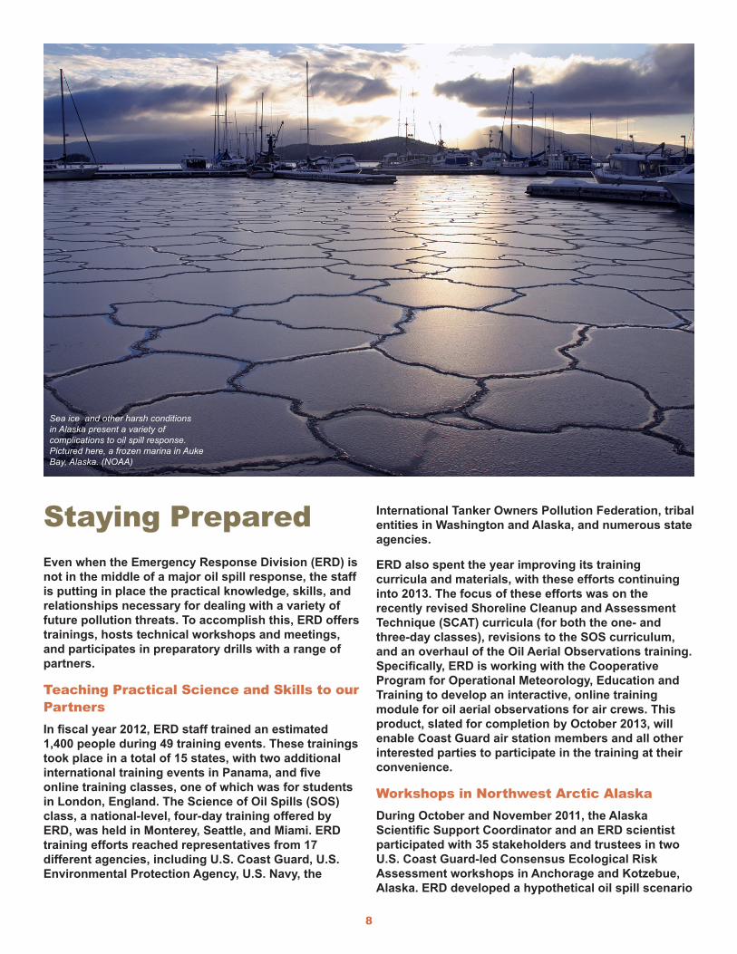
Staying PreparedEven when the Emergency Response Division (ERD) is not in the middle of a major oil spill response, the staff is putting in place the practical knowledge, skills, and relationships necessary for dealing with a variety of future pollution threats. To accomplish this, ERD offers trainings, hosts technical workshops and meetings, and participates in preparatory drills with a range of partners.
Teaching Practical Science and Skills to our PartnersIn fiscal year 2012, ERD staff trained an estimated 1,400 people during 49 training events. These trainings took place in a total of 15 states, with two additional international training events in Panama, and five online training classes, one of which was for students in London, England. The Science of Oil Spills (SOS) class, a national-level, four-day training offered by ERD, was held in Monterey, Seattle, and Miami. ERD training efforts reached representatives from 17 different agencies, including U.S. Coast Guard, U.S. Environmental Protection Agency, U.S. Navy, the
International Tanker Owners Pollution Federation, tribal entities in Washington and Alaska, and numerous state agencies.
ERD also spent the year improving its training curricula and materials, with these efforts continuing into 2013. The focus of these efforts was on the recently revised Shoreline Cleanup and Assessment Technique (SCAT) curricula (for both the one- and three-day classes), revisions to the SOS curriculum, and an overhaul of the Oil Aerial Observations training. Specifically, ERD is working with the Cooperative Program for Operational Meteorology, Education and Training to develop an interactive, online training module for oil aerial observations for air crews. This product, slated for completion by October 2013, will enable Coast Guard air station members and all other interested parties to participate in the training at their convenience.
Workshops in Northwest Arctic Alaska During October and November 2011, the Alaska Scientific Support Coordinator and an ERD scientist participated with 35 stakeholders and trustees in two U.S. Coast Guard-led Consensus Ecological Risk Assessment workshops in Anchorage and Kotzebue, Alaska. ERD developed a hypothetical oil spill scenario
Sea ice and other harsh conditions in Alaska present a variety of complications to oil spill response. Pictured here, a frozen marina in Auke Bay, Alaska. (NOAA)
9
in which 400,000 gallons of intermediate fuel oil spilled in the Bering Strait, and workshop
participants then evaluated the benefits and drawbacks of response options for this scenario. These options included mechanical methods, chemical dispersants, and shoreline protection and cleanup. None of the response options and opportunities were completely effective in preventing injury to ecological and cultural resources and values. This was the first workshop of its kind to be conducted in an Arctic environment.
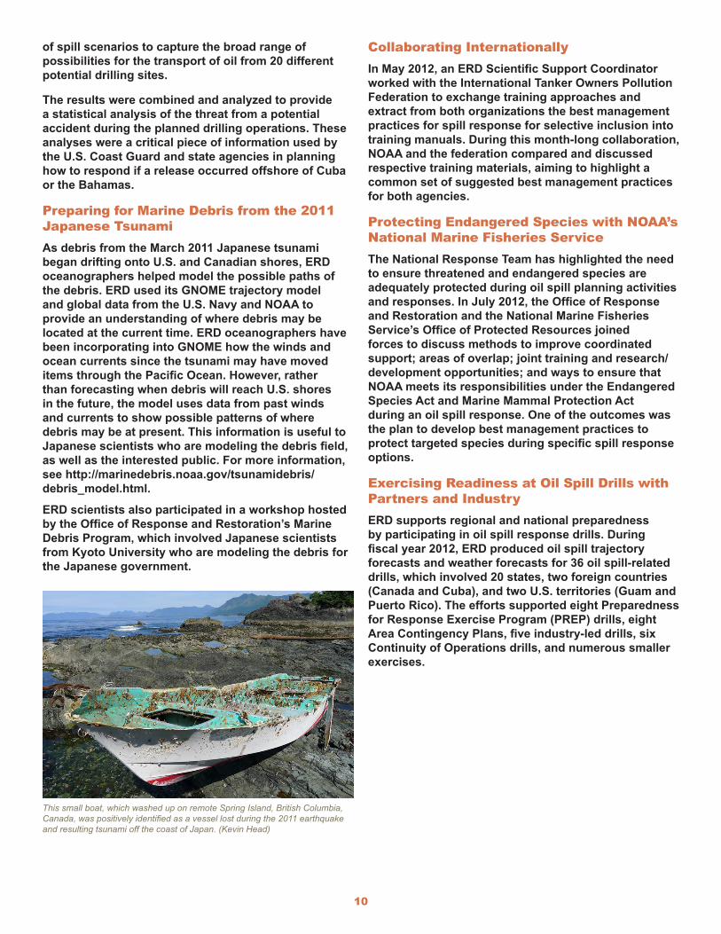
Preparing for Response in the Florida StraitsScientific Support Coordinator Brad Benggio, accepting a commendation from U.S. Coast Guard Rear Admiral Baumgartner. (NOAA)
In spring 2011, potential offshore drilling activities
in Cuba and the Bahamas prompted U.S. efforts to examine resulting threats to the nearby Florida coastline. The 2010 Deepwater Horizon/BP well blowout in the Gulf of Mexico highlighted the potential for offshore drilling accidents and their at-times dire consequences. As a result, the U.S. Coast Guard and U.S. state governments began planning for potential responses to an incident from drilling operations in the Caribbean, and NOAA analyzed the potential threats from a major oil release.
Working with the Department of the Interior’s Bureau of Ocean Energy Management, ERD collected model results and wind hindcasts to develop a Trajectory Analysis Planner model for the region. ERD’s spill trajectory model, GNOME (a software modeling tool used to predict the possible route pollutants might follow in a body of water) was run for thousands
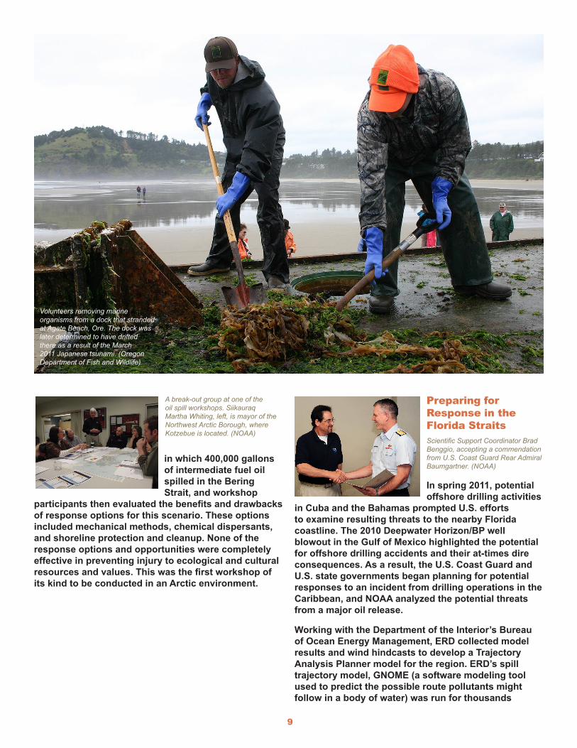
Volunteers removing marine organisms from a dock that stranded at Agate Beach, Ore. The dock was later determined to have drifted there as a result of the March 2011 Japanese tsunami. (Oregon Department of Fish and Wildlife)
A break-out group at one of the oil spill workshops. Siikauraq Martha Whiting, left, is mayor of the Northwest Arctic Borough, where Kotzebue is located. (NOAA)
10
of spill scenarios to capture the broad range of possibilities for the transport of oil from 20 different potential drilling sites.
The results were combined and analyzed to provide a statistical analysis of the threat from a potential accident during the planned drilling operations. These analyses were a critical piece of information used by the U.S. Coast Guard and state agencies in planning how to respond if a release occurred offshore of Cuba or the Bahamas.
Preparing for Marine Debris from the 2011 Japanese TsunamiAs debris from the March 2011 Japanese tsunami began drifting onto U.S. and Canadian shores, ERD oceanographers helped model the possible paths of the debris. ERD used its GNOME trajectory model and global data from the U.S. Navy and NOAA to provide an understanding of where debris may be located at the current time. ERD oceanographers have been incorporating into GNOME how the winds and ocean currents since the tsunami may have moved items through the Pacific Ocean. However, rather than forecasting when debris will reach U.S. shores in the future, the model uses data from past winds and currents to show possible patterns of where debris may be at present. This information is useful to Japanese scientists who are modeling the debris field, as well as the interested public. For more information, see http://marinedebris.noaa.gov/tsunamidebris/debris_model.html.
ERD scientists also participated in a workshop hosted by the Office of Response and Restoration’s Marine Debris Program, which involved Japanese scientists from Kyoto University who are modeling the debris for the Japanese government.
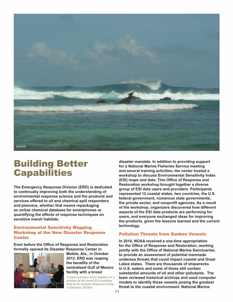
This small boat, which washed up on remote Spring Island, British Columbia, Canada, was positively identified as a vessel lost during the 2011 earthquake and resulting tsunami off the coast of Japan. (Kevin Head)
Collaborating InternationallyIn May 2012, an ERD Scientific Support Coordinator worked with the International Tanker Owners Pollution Federation to exchange training approaches and extract from both organizations the best management practices for spill response for selective inclusion into training manuals. During this month-long collaboration, NOAA and the federation compared and discussed respective training materials, aiming to highlight a common set of suggested best management practices for both agencies.
Protecting Endangered Species with NOAA’s National Marine Fisheries ServiceThe National Response Team has highlighted the need to ensure threatened and endangered species are adequately protected during oil spill planning activities and responses. In July 2012, the Office of Response and Restoration and the National Marine Fisheries Service’s Office of Protected Resources joined forces to discuss methods to improve coordinated support; areas of overlap; joint training and research/development opportunities; and ways to ensure that NOAA meets its responsibilities under the Endangered Species Act and Marine Mammal Protection Act during an oil spill response. One of the outcomes was the plan to develop best management practices to protect targeted species during specific spill response options.
Exercising Readiness at Oil Spill Drills with Partners and IndustryERD supports regional and national preparedness by participating in oil spill response drills. During fiscal year 2012, ERD produced oil spill trajectory forecasts and weather forecasts for 36 oil spill-related drills, which involved 20 states, two foreign countries (Canada and Cuba), and two U.S. territories (Guam and Puerto Rico). The efforts supported eight Preparedness for Response Exercise Program (PREP) drills, eight Area Contingency Plans, five industry-led drills, six Continuity of Operations drills, and numerous smaller exercises.
11
Building Better CapabilitiesThe Emergency Response Division (ERD) is dedicated to continually improving both the understanding of environmental response science and the products and services offered to oil and chemical spill responders and planners, whether that means repackaging an online chemical database for smartphones or quantifying the effects of response techniques on sensitive marsh habitats.
Environmental Sensitivity Mapping Workshop at the New Disaster Response CenterEven before the Office of Response and Restoration formally opened its Disaster Response Center in
Mobile, Ala., in October 2012, ERD was reaping the benefits of the centralized Gulf of Mexico facility with a broad
disaster mandate. In addition to providing support for a National Marine Fisheries Service meeting and several training activities, the center hosted a workshop to discuss Environmental Sensitivity Index (ESI) maps and data. This Office of Response and Restoration workshop brought together a diverse group of ESI data users and providers. Participants represented 12 coastal states, two countries, the U.S. federal government, numerous state governments, the private sector, and nonprofit agencies. As a result of the workshop, organizers discovered how different aspects of the ESI data products are performing for users, and everyone exchanged ideas for improving the products, given the lessons learned and the current technology.
Pollution Threats from Sunken VesselsIn 2010, NOAA received a one-time appropriation for the Office of Response and Restoration, working jointly with the Office of National Marine Sanctuaries, to provide an assessment of potential manmade undersea threats that could impact coastal and Great Lakes states. There are thousands of shipwrecks in U.S. waters and some of these still contain substantial amounts of oil and other pollutants. The team reviewed historical archives and used computer models to identify those vessels posing the greatest threat to the coastal environment. National Marine
A break-out team works together on a problem at the recent ESI workshop held at the Disaster Response Center in Alabama. (NOAA)
(NOAA)
12
Sanctuaries has continued the effort with additional historical and outreach activities. The final report will be released in fiscal year 2013.
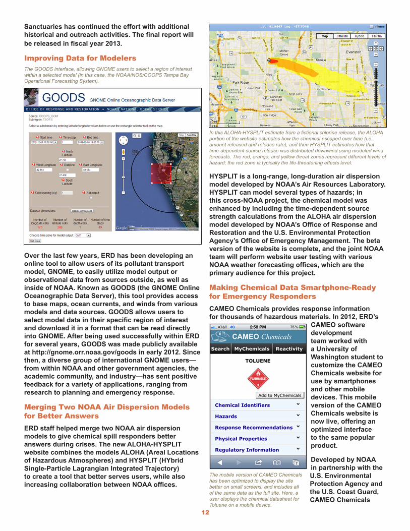
Improving Data for ModelersThe GOODS interface, allowing GNOME users to select a region of interest within a selected model (in this case, the NOAA/NOS/COOPS Tampa Bay Operational Forecasting System).
Over the last few years, ERD has been developing an online tool to allow users of its pollutant transport model, GNOME, to easily utilize model output or observational data from sources outside, as well as inside of NOAA. Known as GOODS (the GNOME Online Oceanographic Data Server), this tool provides access to base maps, ocean currents, and winds from various models and data sources. GOODS allows users to select model data in their specific region of interest and download it in a format that can be read directly into GNOME. After being used successfully within ERD for several years, GOODS was made publicly available at http://gnome.orr.noaa.gov/goods in early 2012. Since then, a diverse group of international GNOME users—from within NOAA and other government agencies, the academic community, and industry—has sent positive feedback for a variety of applications, ranging from research to planning and emergency response.
Merging Two NOAA Air Dispersion Models for Better AnswersERD staff helped merge two NOAA air dispersion models to give chemical spill responders better answers during crises. The new ALOHA-HYSPLIT website combines the models ALOHA (Areal Locations of Hazardous Atmospheres) and HYSPLIT (HYbrid Single-Particle Lagrangian Integrated Trajectory) to create a tool that better serves users, while also increasing collaboration between NOAA offices.
In this ALOHA-HYSPLIT estimate from a fictional chlorine release, the ALOHA portion of the website estimates how the chemical escaped over time (i.e., amount released and release rate), and then HYSPLIT estimates how that time-dependent source release was distributed downwind using modeled wind forecasts. The red, orange, and yellow threat zones represent different levels of hazard; the red zone is typically the life-threatening effects level.
HYSPLIT is a long-range, long-duration air dispersion model developed by NOAA’s Air Resources Laboratory. HYSPLIT can model several types of hazards; in this cross-NOAA project, the chemical model was enhanced by including the time-dependent source strength calculations from the ALOHA air dispersion model developed by NOAA’s Office of Response and Restoration and the U.S. Environmental Protection Agency’s Office of Emergency Management. The beta version of the website is complete, and the joint NOAA team will perform website user testing with various NOAA weather forecasting offices, which are the primary audience for this project.
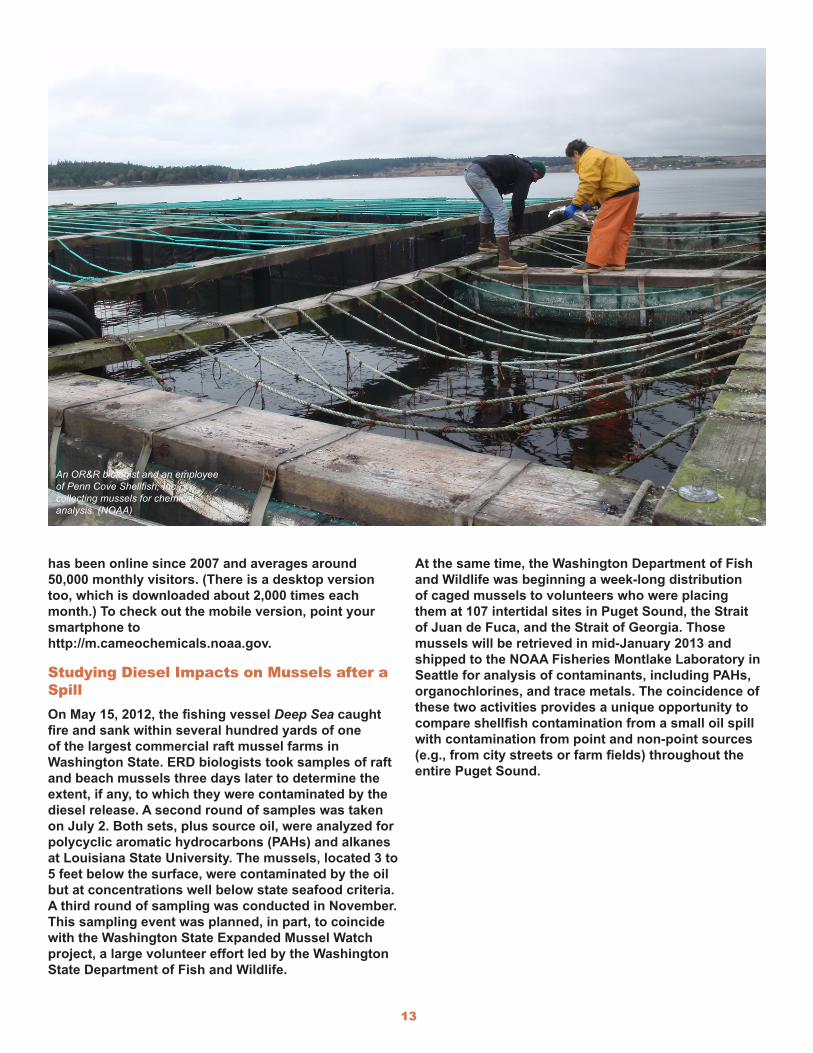
Making Chemical Data Smartphone-Ready for Emergency RespondersCAMEO Chemicals provides response information for thousands of hazardous materials. In 2012, ERD’s
CAMEO software development team worked with a University of Washington student to customize the CAMEO Chemicals website for use by smartphones and other mobile devices. This mobile version of the CAMEO Chemicals website is now live, offering an optimized interface to the same popular product.
Developed by NOAA in partnership with the U.S. Environmental Protection Agency and the U.S. Coast Guard, CAMEO Chemicals
The mobile version of CAMEO Chemicals has been optimized to display the site better on small screens, and includes all of the same data as the full site. Here, a user displays the chemical datasheet for Toluene on a mobile device.
13
has been online since 2007 and averages around 50,000 monthly visitors. (There is a desktop version too, which is downloaded about 2,000 times each month.) To check out the mobile version, point your smartphone to http://m.cameochemicals.noaa.gov.
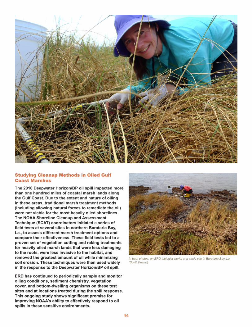
Studying Diesel Impacts on Mussels after a Spill On May 15, 2012, the fishing vessel Deep Sea caught fire and sank within several hundred yards of one of the largest commercial raft mussel farms in Washington State. ERD biologists took samples of raft and beach mussels three days later to determine the extent, if any, to which they were contaminated by the diesel release. A second round of samples was taken on July 2. Both sets, plus source oil, were analyzed for polycyclic aromatic hydrocarbons (PAHs) and alkanes at Louisiana State University. The mussels, located 3 to 5 feet below the surface, were contaminated by the oil but at concentrations well below state seafood criteria. A third round of sampling was conducted in November. This sampling event was planned, in part, to coincide with the Washington State Expanded Mussel Watch project, a large volunteer effort led by the Washington State Department of Fish and Wildlife.
At the same time, the Washington Department of Fish and Wildlife was beginning a week-long distribution of caged mussels to volunteers who were placing them at 107 intertidal sites in Puget Sound, the Strait of Juan de Fuca, and the Strait of Georgia. Those mussels will be retrieved in mid-January 2013 and shipped to the NOAA Fisheries Montlake Laboratory in Seattle for analysis of contaminants, including PAHs, organochlorines, and trace metals. The coincidence of these two activities provides a unique opportunity to compare shellfish contamination from a small oil spill with contamination from point and non-point sources (e.g., from city streets or farm fields) throughout the entire Puget Sound.
An OR&R biologist and an employee of Penn Cove Shellfish, Inc., collecting mussels for chemical analysis. (NOAA)
14
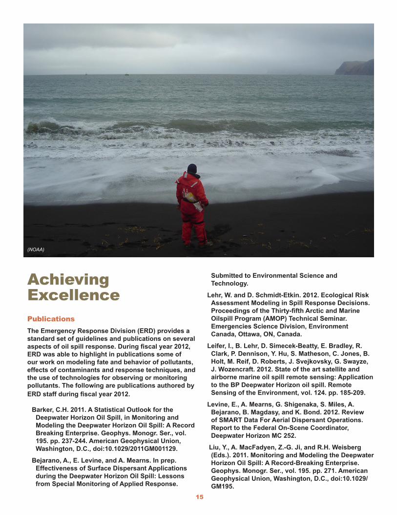
Studying Cleanup Methods in Oiled Gulf Coast MarshesThe 2010 Deepwater Horizon/BP oil spill impacted more than one hundred miles of coastal marsh lands along the Gulf Coast. Due to the extent and nature of oiling in these areas, traditional marsh treatment methods (including allowing natural forces to remediate the oil) were not viable for the most heavily oiled shorelines. The NOAA Shoreline Cleanup and Assessment Technique (SCAT) coordinators initiated a series of field tests at several sites in northern Barataria Bay, La., to assess different marsh treatment options and compare their effectiveness. These field tests led to a proven set of vegetation cutting and raking treatments for heavily oiled marsh lands that were less damaging to the roots, were less invasive to the habitat, and removed the greatest amount of oil while minimizing soil erosion. These techniques were then used widely in the response to the Deepwater Horizon/BP oil spill.
ERD has continued to periodically sample and monitor oiling conditions, sediment chemistry, vegetation cover, and bottom-dwelling organisms on these test sites and at locations treated during the spill response. This ongoing study shows significant promise for improving NOAA’s ability to effectively respond to oil spills in these sensitive environments.
In both photos, an ERD biologist works at a study site in Barataria Bay, La. (Scott Zengel)
15
Achieving ExcellencePublicationsThe Emergency Response Division (ERD) provides a standard set of guidelines and publications on several aspects of oil spill response. During fiscal year 2012, ERD was able to highlight in publications some of our work on modeling fate and behavior of pollutants, effects of contaminants and response techniques, and the use of technologies for observing or monitoring pollutants. The following are publications authored by ERD staff during fiscal year 2012.
Barker, C.H. 2011. A Statistical Outlook for the Deepwater Horizon Oil Spill, in Monitoring and Modeling the Deepwater Horizon Oil Spill: A Record Breaking Enterprise. Geophys. Monogr. Ser., vol. 195. pp. 237-244. American Geophysical Union, Washington, D.C., doi:10.1029/2011GM001129.
Bejarano, A., E. Levine, and A. Mearns. In prep. Effectiveness of Surface Dispersant Applications during the Deepwater Horizon Oil Spill: Lessons from Special Monitoring of Applied Response.
Submitted to Environmental Science and Technology.
Lehr, W. and D. Schmidt-Etkin. 2012. Ecological Risk Assessment Modeling in Spill Response Decisions. Proceedings of the Thirty-fifth Arctic and Marine Oilspill Program (AMOP) Technical Seminar. Emergencies Science Division, Environment Canada, Ottawa, ON, Canada.
Leifer, I., B. Lehr, D. Simecek-Beatty, E. Bradley, R. Clark, P. Dennison, Y. Hu, S. Matheson, C. Jones, B. Holt, M. Reif, D. Roberts, J. Svejkovsky, G. Swayze, J. Wozencraft. 2012. State of the art satellite and airborne marine oil spill remote sensing: Application to the BP Deepwater Horizon oil spill. Remote Sensing of the Environment, vol. 124. pp. 185-209.
Levine, E., A. Mearns, G. Shigenaka, S. Miles, A. Bejarano, B. Magdasy, and K. Bond. 2012. Review of SMART Data For Aerial Dispersant Operations. Report to the Federal On-Scene Coordinator, Deepwater Horizon MC 252.
Liu, Y., A. MacFadyen, Z.-G. Ji, and R.H. Weisberg (Eds.). 2011. Monitoring and Modeling the Deepwater Horizon Oil Spill: A Record-Breaking Enterprise. Geophys. Monogr. Ser., vol. 195. pp. 271. American Geophysical Union, Washington, D.C., doi:10.1029/GM195.
(NOAA)
16
MacFadyen, A., G.Y. Watabayashi, C.H. Barker, and C.J. Beegle-Krause. 2011. Tactical modeling of surface oil transport during the Deepwater Horizon spill response, in Monitoring and Modeling the Deepwater Horizon Oil Spill: A Record-Breaking Enterprise. Geophys. Monogr. Ser., vol. 195, pp. 167–178. American Geophysical Union, Washington, D.C., doi:10.1029/2011GM001128.
Mearns, A.J., D.J. Reish, P.S. Oshida, T. Ginn, M.A. Remple-Hester, and C. Arthur. 2012. Effects of Pollution on Marine Life. Water Environment Research. vol. 84(10). pp. 1737-1823.
Mearns, A.J, M. Lindeberg, D. Janka, J. Whitney and G. Shigenaka. 2012. Twenty-three Year Update of Shoreline Biological Observations in Prince William Sound. Poster presented at Alaska Marine Science Symposium, Anchorage, Alaska. January 2012.
Svejkovsky, J., W. Lehr, J. Muskat, G. Graettinger, and J. Mullin. 2012. Operational Utilization of Aerial Multispectral Remote Sensing during Oil Spill, in Spill Response: Lessons Learned During the Deepwater Horizon (MC-252) Spill. Photogrammetric Engineering & Remote Sensing. vol. 78(10). pp. 1089-1102.
RecognitionThe Emergency Response Division has a long history of hard work and dedication, which has been reflected not only in its achievements in the field during a spill, but also in the many awards its staff has received in recognition for this work. This year was no exception.
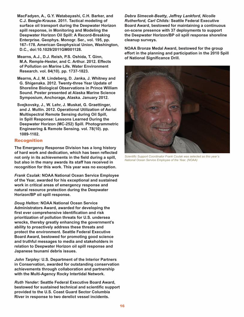
Frank Csulak: NOAA National Ocean Service Employee of the Year, awarded for his exceptional and sustained work in critical areas of emergency response and natural resource protection during the Deepwater Horizon/BP oil spill response.
Doug Helton: NOAA National Ocean Service Administrators Award, awarded for developing the first ever comprehensive identification and risk prioritization of pollution threats for U.S. undersea wrecks, thereby greatly enhancing the government’s ability to proactively address these threats and protect the environment. Seattle Federal Executive Board Award, bestowed for promoting good science and truthful messages to media and stakeholders in relation to Deepwater Horizon oil spill response and Japanese tsunami debris issues.
John Tarpley: U.S. Department of the Interior Partners in Conservation, awarded for outstanding conservation achievements through collaboration and partnership with the Multi-Agency Rocky Intertidal Network.
Ruth Yender: Seattle Federal Executive Board Award, bestowed for sustained technical and scientific support provided to the U.S. Coast Guard Sector Columbia River in response to two derelict vessel incidents.
Debra Simecek-Beatty, Jeffrey Lankford, Nicolle Rutherford, Carl Childs: Seattle Federal Executive Board Award, bestowed for maintaining a continuous on-scene presence with 37 deployments to support the Deepwater Horizon/BP oil spill response shoreline cleanup surveys.
NOAA Bronze Medal Award, bestowed for the group effort in the planning and participation in the 2010 Spill of National Significance Drill.
Scientific Support Coordinator Frank Csulak was selected as this year’s National Ocean Service Employee of the Year. (NOAA)

NOAA Office of Response and Restoration
1305 East-West Highway
Silver Spring, Maryland 20910
Phone: 301.713.4248
response.restoration.noaa.gov
U.S. Department of Commerce • National Oceanic and Atmospheric Administration
(NOAA)
January 2013